
FEDERAL COURT OF AUSTRALIA
Braun on behalf of the Jirrbal People #4 v State of Queensland (No 2) [2024] FCA 1018
ORDERS
DATE OF ORDER: |
THE COURT NOTES THAT:
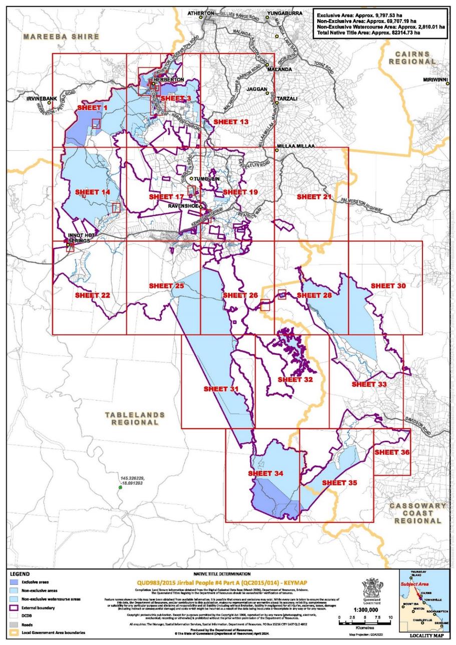
A. Having regard to the need to balance the limited availability of public resources with the competing need to resolve applications for a determination of native title in an efficient, cost effective and timely manner, the parties agree that the question of whether s 47C of the Native Title Act 1993 (Cth) (NTA) would apply to any park areas (within the meaning given in s 47C(3) of the NTA) within the External Boundary will be addressed after the matter has proceeded to determination.
B. The Jirrbal People (being the proposed native title holders described in Schedule 1 of the determination) and the State of Queensland have indicated a desire to enter into negotiations in relation to whether s 47C of the NTA would have application to any park areas within the External Boundary.
C. Subject to recital D below, the Applicant and the State of Queensland agree that, if agreement is reached in accordance with s 47C(1)(b) of the NTA that s 47C is applicable in respect of any park areas within the External Boundary, the State of Queensland would not oppose:
i. an application being brought on behalf of the Jirrbal People pursuant to ss 13(1)(a) and 61(1) of the NTA for a determination that native title exists in relation to any such park area which is excluded from the Determination Area; and
ii. an application being brought by the registered native title body corporate pursuant to ss 13(1)(b) and 13(5)(c) of the NTA to vary the determination in relation to any park area which is included in the Determination Area.
D. The agreement of the State of Queensland in recital C above not to oppose an application for a determination that native title exists or an application to vary the determination in relation to any park area is subject to the Applicant and the State of Queensland having reached agreement on the nature and extent of the native title rights and interests that would be determined to exist in relation to each such park area.
BEING SATISFIED that an order in the terms set out below is within the power of the Court, and it appearing appropriate to the Court to do so, pursuant to s 87A of the NTA.
BY CONSENT THE COURT ORDERS THAT:
1. There be a determination of native title in the terms set out below (the determination).
2. Each party to the proceedings is to bear its own costs.
BY CONSENT THE COURT DETERMINES THAT:
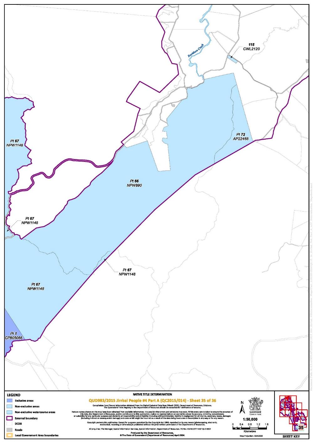
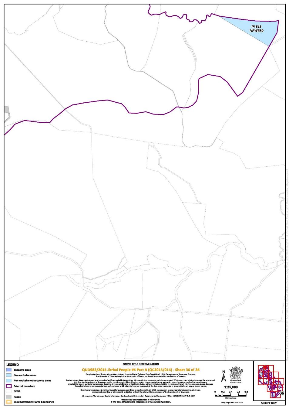
3. The determination area is the land and waters described in Schedule 4 and depicted in the map attached to Schedule 6 to the extent those areas are within the External Boundary and not otherwise excluded by the terms of Schedule 5 (the Determination Area). To the extent of any inconsistency between the written description and the map, the written description prevails.
4. Native title exists in the Determination Area.
5. The native title is held by the Jirrbal People described in Schedule 1 (the Native Title Holders).
6. Subject to orders 8, 9 and 10 below the nature and extent of the native title rights and interests in relation to the land and waters described in Part 1 of Schedule 4 are:
(a) other than in relation to Water, the right to possession, occupation, use and enjoyment of the area to the exclusion of all others; and
(b) in relation to Water, the non-exclusive rights to:
(i) take the Natural Resources of the Water in the area; and
(ii) take the Water of the area for personal, domestic and non-commercial communal purposes.
7. Subject to orders 8, 9 and 10 below the nature and extent of the native title rights and interests in relation to the land and waters described in Part 2 of Schedule 4 are the non-exclusive rights to:
(a) access, be present on, move about on and travel over the area;
(b) live and camp on the area, and, for those purposes, erect shelters and other structures on the area;
(c) protect places, areas, and things of traditional significance;
(d) take Natural Resources from the area;
(e) light fires on the area for domestic purposes including cooking, but not for the purposes of hunting or clearing vegetation;
(f) conduct ceremonies on the area;
(g) bury Native Title Holders in the area; and
(h) take the Water of the area for personal, domestic and non-commercial communal purposes.
8. The native title rights and interests are subject to and exercisable in accordance with:
(a) the Laws of the State and the Commonwealth; and
(b) the traditional laws acknowledged and traditional customs observed by the Native Title Holders.
9. The native title rights and interests referred to in orders 6(b) and 7 do not confer possession, occupation, use or enjoyment to the exclusion of all others.
10. There are no native title rights in or in relation to minerals as defined by the Mineral Resources Act 1989 (Qld) and petroleum as defined by the Petroleum Act 1923 (Qld) and the Petroleum and Gas (Production and Safety) Act 2004 (Qld).
11. The nature and extent of any other interests in relation to the Determination Area (or respective parts thereof) are set out in Schedule 2.
12. The relationship between the native title rights and interests described in orders 6 and 7 and the other interests described in Schedule 2 (the Other Interests) is that:
(a) the Other Interests continue to have effect, and the rights conferred by or held under the Other Interests may be exercised notwithstanding the existence of the native title rights and interests;
(b) to the extent the Other Interests are inconsistent with the continued existence, enjoyment or exercise of the native title rights and interests in relation to the land and waters of the Determination Area, the native title continues to exist in its entirety but the native title rights and interests have no effect in relation to the Other Interests to the extent of the inconsistency for so long as the Other Interests exist; and
(c) the Other Interests and any activity that is required or permitted by or under, and done in accordance with, the Other Interests, or any activity that is associated with or incidental to such an activity, prevail over the native title rights and interests and any exercise of the native title rights and interests.
DEFINITIONS AND INTERPRETATION
13. In this determination, unless the contrary intention appears:
“Animal” means any member of the animal kingdom (other than human), whether alive or dead;
“External Boundary” means the area described in Schedule 3;
“land” and “waters”, respectively, have the same meanings as in the NTA;
“Laws of the State and the Commonwealth” means the common law and the laws of the State of Queensland and the Commonwealth of Australia, and includes legislation, regulations, statutory instruments, local planning instruments and local laws;
“Local Government” has the meaning given in the Local Government Act 2009 (Qld);
“Local Government Act” has the meaning given in the Local Government Act 2009 (Qld);
“Local Government Area” has the meaning given in the Local Government Act 2009 (Qld);
“Natural Resources” means:
(a) an Animal, a Plant, or any other non-human life form found on or in the land and waters of the Determination Area; and
(b) inorganic material;
(c) but does not include:
i. Animals that are the private personal property of another;
ii. crops that are the private personal property of another;
iii. minerals as defined in the Mineral Resources Act 1989 (Qld); or
iv. petroleum as defined in the Petroleum Act 1923 (Qld) and the Petroleum and Gas (Production and Safety) Act 2004 (Qld).
“Plant” means any member of the plant or fungus kingdoms, whether alive or dead, and standing or fallen;
“Reserve” means a reserve dedicated or taken to be a reserve under the Land Act 1994 (Qld);
“Water” means:
(a) water which flows, whether permanently or intermittently, within a river, creek or stream;
(b) any natural collection of water, whether permanent or intermittent;
(c) water from an underground water source; and
(d) tidal water;
“Works” has the same meaning as in the Electricity Act 1994 (Qld).
Other words and expressions used in this determination have the same meanings as they have in Part 15 of the NTA.
THE COURT DETERMINES THAT:
14. The native title is not held in trust.
15. The Wabubadda Aboriginal Corporation RNTBC (ICN: 7117), incorporated under the Corporations (Aboriginal and Torres Strait Islander) Act 2006 (Cth), is to:
(a) be the prescribed body corporate for the purpose of s 57(2) of the NTA; and
(b) perform the functions mentioned in s 57(3) of the NTA after becoming the registered native title body corporate in relation to the Determination Area.
Note: Entry of orders is dealt with in Rule 39.32 of the Federal Court Rules 2011.
SCHEDULE 1
NATIVE TITLE HOLDERS
The native title holders are the Jirrbal People. The Jirrbal People are those Aboriginal persons who:
(a) are descended by birth or by adoption in accordance with the traditional laws acknowledged and the traditional customs observed by the Jirrbal People, from one or more of the following apical ancestors (listed alphabetically):
1. Betty (aka Biddy) Gordon
2. Bonnel Logan and Jinnie
3. Bulbulyarraman Willie Mango or his wives Nellie and Calida
4. Charlie (Jurabagle) Woods
5. Chloe McKenzie/Cameron
6. Dubula Lorna Lawrence (nee Robinson)
7. Ethel Perrott
8. Harry Maloon
9. Jack (Deinjo) Watson/Major
10. Jack Robinson
11. Jerry Linedale or Maggie
12. Jimmy Darcy or his wives Polly and Lassie Darcy
13. Jimmy Murray (aka Jimmy Minegan) or his wives Jinnie (aka Jay Minigan) and Misashay (aka Maryanne)
14. Joe Robinson or Eva Robinson
15. Katie Cameron
16. King Jimmy Robertson/Robinson (aka Jimmy King) or his wives Kitty Robertson or Polly Malone
17. King Sandy Maynard or his wife Annie Thomas
18. Linda Duffin (aka Linda McGuire)
19. Lizzie Palmer, Maggie Cross or Mary Todd
20. Lucy Gordon/Lifu
21. Minnie Silent
22. Murrigami (aka Jim Clarke)
23. Murriguemie
24. Nellie Deagon
25. Nellie Googoonburra
26. Nellie Keough/James, Merti/Bertie or Peter
27. Nellie Williams
28. Polly Hull
29. Polly Robinson (1) (aka Polly Ingham) or her husband Mick Robinson
30. Polly Robson
31. Romeo Robson (aka Robinson) or his wife Topsy
32. Rosie Congoo
33. Sam Boyd
34. Toby and Polly
35. Tommy Gardiner (aka Tommy Anderson)
36. Tommy Herberton’s siblings
37. Tommy Toombs or his wife Polly
38. Una Woodleigh
39. Wanmal and Yugibidjal
40. Youall Biddy-Robinson or her husband Tommy Herberton
41. Youall Biddy-Robinson’s siblings, and
(b) identify themselves as Jirrbal; and
(c) are accepted as Jirrbal by other Jirrbal People in accordance with the traditional laws acknowledged and the traditional customs observed by the Jirrbal People.
SCHEDULE 2
OTHER INTERESTS IN THE DETERMINATION AREA
The nature and extent of the other interests in relation to the Determination Area are the following as they exist as at the date of the determination:
1. The rights and interests of the parties under the following agreements registered on the Register of Indigenous Land Use Agreements:
(a) QI2007/041 - Joint Bar-Barrum Jirrbal Herberton Project ILUA;
(b) QI2007/040 - Bar-Barrum Herberton Project ILUA;
(c) QI2011/012 - Herberton Tin Fields ILUA;
(d) QI2012/056 - Bar Barrum #2-#7 and Tablelands Regional Council ILUA;
(e) QI2010/029 - Jirrbal People and Tablelands Regional Council ILUA;
(f) QI2007/039 - Jirrbal Herberton Project ILUA;
(g) QI2010/031 - Jirrbal People and Ergon Energy ILUA;
(h) QI2010/033 - Jirrbal People Protected Areas ILUA;
(i) QI2022/013 - Chalumbin Wind Farm Area ILUA; and
(j) QI2010/030 - Jirrbal People and QLACCA ILUA.
2. The rights and interests of the holders of the following water allocations granted pursuant to the Water Act 2000 (Qld):
(a) 36279K;
(b) 48242K; and
(c) 58722K.
3. The rights and interests of the holders of the following interests granted pursuant to the Land Act 1962 (Qld) or Land Act 1994 (Qld):
(a) permit to occupy No. PO 0/233421 over Lot 2 and 3 on Plan AP5947;
(b) permit to occupy No. PO 0/234055 over Lot 2 on Plan AP12192;
(c) occupation licence OL 22/211 over Lot 1 on Plan AP17369;
(d) occupation licence OL 22/183 over Lot 183 on Plan OL443;
(e) occupation licence OL 22/150 over Lot 150 on Plan OL444;
(f) occupation licence OL 22/145 over Lot 145 on Plan OL186;
(g) occupation licence OL 22/216 over Lot 216 on Plan OL204;
(h) occupation licence OL 22/206 over Lot 206 on Plan AP23116; and
(i) occupation licence OL 22/136 over Lot 136 on Plan OL452.
4. The rights and interests of the holders of the following tenements granted pursuant to the Mineral Resources Act 1989 (Qld):
(a) Exploration permit for minerals no 14185 (EPM 14185);
(b) Exploration permit for minerals no 26536 (EPM 26536);
(c) Mineral development licence no 381 (MDL 381); and
(d) Mining lease no 201140 (ML 20140).
5. The rights and interests of Telstra Corporation Limited ACN 051 775 556 and any of its successors in title:
(a) as the owners or operators of telecommunications facilities within the Determination Area;
(b) created pursuant to the Post and Telegraph Act 1901 (Cth), the Telecommunications Act 1975 (Cth), the Australian Telecommunications Corporation Act 1989 (Cth), the Telecommunications Act 1991 (Cth) and the Telecommunications Act 1997 (Cth), including rights:
(i) to inspect land;
(ii) to install, occupy and operate telecommunication facilities; and
(iii) to alter, remove, replace, maintain, repair and ensure the proper functioning of its telecommunications facilities;
(c) for its employees, agents or contractors to access its telecommunication facilities in and in the vicinity of the Determination Area in the performance of its duties; and
(d) under any lease, licence, access agreement, permit or easement relating to its telecommunications facilities in the Determination Area.
6. The rights and interests of CleanCo Queensland Limited (ABN 85 628 008 159):
(a) as the owner and operator of any Works in the Determination Area;
(b) as an electricity entity under the Electricity Act 1994 (Qld), including:
(i) as the holder of a generation authority;
(ii) to access, inspect, operate, manage, maintain, repair, replace, upgrade or otherwise deal with any Works in the Determination Area; and
(iii) rights to enter the Determination Area by its employees, agents or contractors to exercise any of the rights and interests referred to in this paragraph;
(c) pursuant to the Water Licences 613512, 613513 and 51227P granted under the Water Act 2000 (Qld); and
(d) as the holder of Occupation Permit PID2021 under the Forestry Act 1959 (Qld), which relates to Lot 1 on AP14613.
7. The rights and interests of Ergon Energy Corporation Limited ACN 087 646 062:
(a) as the owner and operator of any Works within the Determination Area;
(b) as an electricity entity under the Electricity Act 1994 (Qld), including but not limited to:
(i) as the holder of a distribution authority;
(ii) to inspect, maintain and manage any Works in the Determination Area;
(iii) in relation to any agreement relating to the Determination Area existing or entered into before the date on which these orders are made; and
(c) to enter the Determination Area by its employees, agents or contractors to exercise any of the rights and interests referred to in this paragraph.
8. The rights and interests of Cassowary Coast Regional Council and Tablelands Regional Council (Councils):
(a) under their local government jurisdiction and functions under the Local Government Act 2009 (Qld), under the Stock Route Management Act 2002 (Qld), under any other Local Government Act, or under any other legislation, for that part of the Determination Area within the area declared to be their Local Government Area;
(b) as the:
(i) lessor under any leases which were validly entered into before the date on which these orders are made and whether separately particularised in these orders or not;
(ii) grantor of any licences or other rights and interests which were validly granted before the date on which these orders were made and whether separately particularised in these orders or not;
(iii) holder of any estate or any other interest in land; and
(iv) trustee of any Reserves or holder of any interest under access agreements or easements;
(c) as the owner and operator of infrastructure, structures, earthworks, access works, and any other facilities and other improvements located in the Determination Area validly constructed or established on or before the date on which these orders are made, including but not limited to:
(i) undedicated but constructed roads except for those not operated by Councils;
(ii) water pipelines and water supply infrastructure;
(iii) drainage facilities;
(iv) watering point facilities;
(v) recreational facilities;
(vi) transport facilities;
(vii) gravel pits operated by Councils;
(viii) cemetery and cemetery-related facilities; and
(ix) community facilities;
(d) to enter the land for the purposes described in paragraphs 8(a), 8(b) or 8(c) above by their employees, agents or contractors to:
(i) exercise any of the rights and interests referred to in this paragraph 8;
(ii) inspect, maintain and repair the infrastructure, facilities and other improvements referred to in paragraph 8(c) above;
(iii) undertake operational activities in their capacity as a Local Government such as feral animal control, weed control, erosion control, waste management and fire management.
9. The rights and interests of the State of Queensland, Tablelands Regional Council and Cassowary Coast Regional Council to access, use, operate, maintain and control the dedicated roads in the Determination Area and the rights and interests of the public to use and access the roads.
10. The rights and interests of the State of Queensland in Reserves, the rights and interests of the trustees of those Reserves and the rights and interests of the persons entitled to access and use those Reserves for the respective purpose for which they are reserved.
11. The rights and interests of the State of Queensland or any other person existing by reason of the force and operation of the laws of the State of Queensland, including those existing by reason of the following legislation or any regulation, statutory instrument, declaration, plan, authority, permit, lease or licence made, granted, issued or entered into under that legislation:
(a) the Fisheries Act 1994 (Qld);
(b) the Land Act 1994 (Qld);
(c) the Nature Conservation Act 1992 (Qld);
(d) the Forestry Act 1959 (Qld);
(e) the Water Act 2000 (Qld);
(f) the Petroleum Act 1923 (Qld) or Petroleum and Gas (Production and Safety) Act 2004 (Qld);
(g) the Mineral Resources Act 1989 (Qld);
(h) the Planning Act 2016 (Qld);
(i) the Transport Infrastructure Act 1994 (Qld);
(j) the Fire and Emergency Services Act 1990 (Qld) or Ambulance Service Act 1991 (Qld); and
(k) the Wet Tropics World Heritage Protection and Management Act 1993 (Qld).
12. The rights and interests of members of the public arising under the common law, including but not limited to the following:
(a) any subsisting public right to fish; and
(b) the public right to navigate.
13. So far as confirmed pursuant to s 212(2) of the NTA and s 18 of the Native Title (Queensland) Act 1993 (Qld) as at the date of this determination, any existing rights of the public to access and enjoy the following places in the Determination Area:
(a) waterways;
(b) beds and banks or foreshores of waterways; or
(c) areas that were public places at the end of 31 December 1993.
14. Any other rights and interests:
(a) held by the State of Queensland or Commonwealth of Australia; or
(b) existing by reason of the force and operation of the Laws of the State and the Commonwealth.
SCHEDULE 3
EXTERNAL BOUNDARY
The area of land and waters commencing:
at the intersection of the Barron, Mitchell and Herbert River drainage basins at approximate Longitude 145.418119° East, Latitude 17.334627° South (also being a point on the eastern boundary of Native Title Determination QUD6031/2001 Bar Barrum People #5 (QCD2016/015)) and extending generally south easterly along the south western boundaries of the Barron River drainage basin and the Johnstone River drainage basin until the intersection with the eastern boundary of Native Title Determination QUD42/2004 Jirrbal People #3 (QCD2010/006) at approximate Longitude 145.631262° East, Latitude 17.635576° South; then generally southerly along the eastern boundary of that determination until the intersection again with the south western boundary of the Johnstone River drainage basin at approximate Longitude 145.643133° East, Latitude 17.702766° South; then generally south easterly, north easterly and south easterly along the southern boundaries of that drainage basin until the intersection with the northern boundary of Native Title Determination QUD308/2014 Gulngay People (QCD2019/003) at approximate Longitude 145.769453° East, Latitude 17.752209° South; then generally south westerly, south easterly, westerly, south westerly and south easterly along the western and southern boundaries of the external boundary of that determination until a point within Jalum Conservation Park at Longitude 145.834526° East; also described as:
south westerly to the headwaters of Jarra Creek at approximate Latitude 17.759195° South; then generally south easterly along the centreline of Jarra Creek until a point on an eastern boundary of Lot 66 on NPW890 (Tully Gorge National Park) at approximate Longitude 145.836969° East, Latitude 17.891940° South; then southerly and generally westerly along the boundaries of that lot until a point at Longitude 145.785836° South; then south westerly in a straight line until the intersection with another corner point of Lot 66 on NPW890 (Tully Gorge National Park) at Longitude 145.750207° East, Latitude 17.909158° South (also the Native Title Determination QUD42/2004 Jirrbal People #3 (QCD2010/006)); then generally southerly, westerly and southerly along the boundaries of that lot and determination until the intersection with the south western corner of Lot 34 on SP152312; then south easterly in a straight line until the intersection with the centreline of Davidson Creek at approximate Longitude 145.741675° East, Latitude 17.970726° South; then generally easterly along the centreline of that creek until the intersection with an unnamed tributary at approximate Longitude 145.784995° East, Latitude 17.967986° South; then generally southerly, westerly, southerly, and south easterly along the centreline of that unnamed tributary, Boar Creek and another unnamed tributary until a point at approximate Longitude 145.819084° East, Latitude 17.990045° South; then easterly following an unnamed watercourse (based on Watercourse Lines topographic data sourced from 2006 Geoscience Australia Geodata Topo 250K) until a point at Longitude 145.834526° East, Latitude 17.991579° South passing through the following coordinate points (along that unnamed watercourse):
Longitude (East) | Latitude (South) |
145.820908 | 17.990607 |
145.825838 | 17.991337 |
145.829268 | 17.991727 |
145.833778 | 17.991797 |
Then generally southerly until the intersection with the southern boundary of the Tully River drainage basin boundary at Longitude 145.825051° East; passing through the following coordinate points:
Longitude (East) | Latitude (South) |
145.834149 | 17.994455 |
145.832521 | 17.997286 |
145.826208 | 18.008267 |
Then generally westerly and south westerly along that drainage basin boundary until the intersection with the external boundary of the Native Title Determination QUD741/2015 Girramay People #2 (QCD2018/003) at approximately Longitude 145.755218° East, Latitude 18.044876° South; then south westerly along the north western external boundary of that determination and along the centreline of Kirrama Creek until the intersection with the centreline of Blencoe Creek; then generally north westerly passing through Longitude 145.591693° East, Latitude 18.141276° South until the eastern external boundary of the Native Title Determination QUD111/2004 Warrungnu (Warrungu) People #2 (QCD2013/004) at Latitude 18.128445° South (also being the eastern boundary of Lot 2 on CWL3600); then generally northerly and south westerly along the eastern and northern boundaries of that determination until Longitude 145.537968° East, also described as:
generally northerly along the eastern boundary of Lot 2 on CWL3600 until a point at Latitude 18.076241° South; then north easterly across an unnamed road corridor to the westernmost corner of Lot 67 on NPW1148 (Kirrama National Park); then generally north easterly along the western boundary of that lot until a point at Latitude 18.073137° South; then generally northerly along the external boundary of the Native Title Determination QUD111/2004 Warrungnu (Warrungu) People #2 (QCD2013/004) until the intersection with the southern bank of Cameron Creek; then generally westerly along the southern bank of Cameron Creek until Longitude 145.537968° East, Latitude 18.022075 ° South;
Then north westerly until the centreline of Blunder Creek at Longitude 145.412483° East, passing through the following coordinate points:
Longitude (East) | Latitude (South) |
145.460497 | 17.864007 |
145.420645 | 17.785325 |
145.416991 | 17.778111 |
145.412751 | 17.769740 |
145.412540 | 17.767754 |
Then generally south westerly and generally north westerly along the centreline of that creek until the centreline of the Herbert River; then generally north westerly and generally south westerly along the centreline of that river until Latitude 17.734387° South; then northerly passing through the following coordinate points:
Longitude (East) | Latitude (South) |
145.211008 | 17.604777 |
145.220008 | 17.571007 |
145.222398 | 17.541127 |
Then northerly in a straight line until the south eastern corner of Native Title Determination QUD6222/1998 Bar-Barrum People (QCD2001/007) at the south eastern corner of Lot 6 on AP21240 at approximate Longitude 145.224235° East, Latitude 17.5285954° South; then generally northerly and generally north easterly along the boundary of that determination, Native Title Determination QUD607/2016 Bar Barrum Rivers Claim (QCD2017/009) and Native Title Determination QUD6031/2001 Bar Barrum People #5 (QCD2016/015) back to the point of commencement, also described as:
then generally north easterly along the eastern and southern boundaries of Lot 6 on AP21240, Lot 35 on AP23119, Lot 1 on USL21432, Lot 3 and 1 on USL21433, Lot 156 on USL21437, Surveyors Creek (as represented in the Cadastre) and Lot 567 on OL57, and northern boundary of the Herbert River drainage basin through Lot 1 on AP19246.
Exclusions:
This determination area excludes all land and waters within:
Lot 228 on OL463;
Lot 230 on AP4557;
Native title determination QUD6001/2003 Jirrbal People #1 (QCD2010/004) as determined by the Federal Court of Australia on 8 October 2010;
Native title determination QUD41/2004 Jirrbal People #2 (QCD2010/005) as determined by the Federal Court of Australia on 8 October 2010;
Native title determination QUD42/2004 Jirrbal People #3 (QCD2010/006) as determined by the Federal Court of Australia on 8 October 2010;
Native title determination QUD6014/2001 Mamu People (QCD2013/005) as determined by the Federal Court of Australia on 1 November 2013;
Native title determination QUD6222/1998 Bar-Barrum People (QCD2001/007) as determined by the Federal Court of Australia on 28 June 2001;
Native title determination QUD111/2004 Warrungnu [Warrungu] People #2 (QCD2013/004) as determined by the Federal Court of Australia on 23 September 2013;
Native title determination QUD6031/2001 Bar Barrum People #5 (QCD2016/015) as determined by the Federal Court of Australia on 5 December 2016;
Native title determination QUD607/2016 Bar Barrum Rivers Claim (QCD2017/009) as determined by the Federal Court of Australia on 12 December 2017;
Native title determination QUD741/2015 Girramay People #2 (QCD2018/003) as determined by the Federal Court of Australia on 1 August 2018; and
Native title determination QUD308/2014 Gulngay People (QCD2019/003) as determined by the Federal Court of Australia on 4 April 2019.
Note
Data Reference and source
Cadastre data sourced from Department of Resources, Qld (published 11/03/2024).
Drainage Basin Sub Areas data sourced from Department of Resources, Qld (published 20/10/2022).
Rivers / Creeks based on cadastral casement data, else Watercourse Lines topographic data sourced from Department of Resources, Qld (published 05/10/2022). As referenced above, one unnamed watercourse is based on Watercourse Lines topographic data sourced from 2006 Geoscience Australia Geodata Topo 250K.
Reference datum
Geographical coordinates are referenced to the Geocentric Datum of Australia 2020 (GDA2020), in decimal degrees and are based on the spatial reference data acquired from the various custodians at the time.
Use of Coordinates
Where coordinates are used within the description to represent cadastral or topographical boundaries or the intersection with such, they are intended as a guide only. As an outcome of the custodians of cadastral and topographic data continuously recalculating the geographic position of their data based on improved survey and data maintenance procedures, it is not possible to accurately define such a position other than by detailed ground survey.
SCHEDULE 4
DESCRIPTION OF DETERMINATION AREA
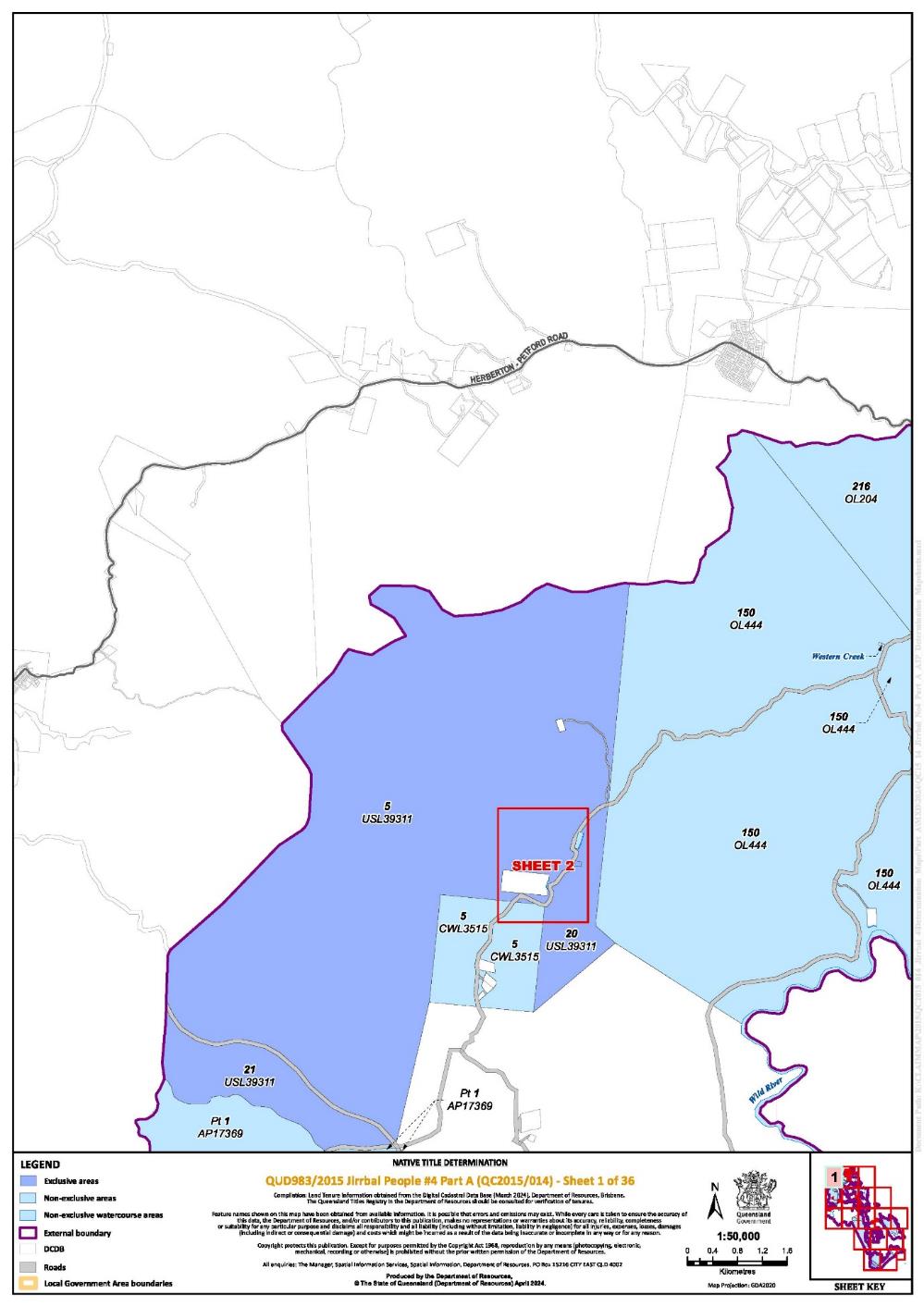
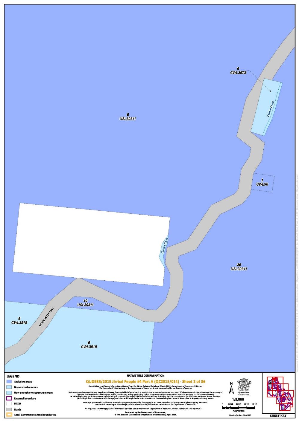
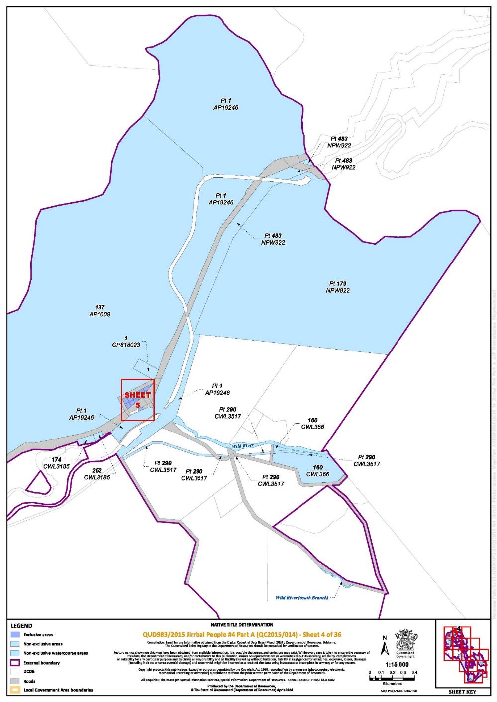
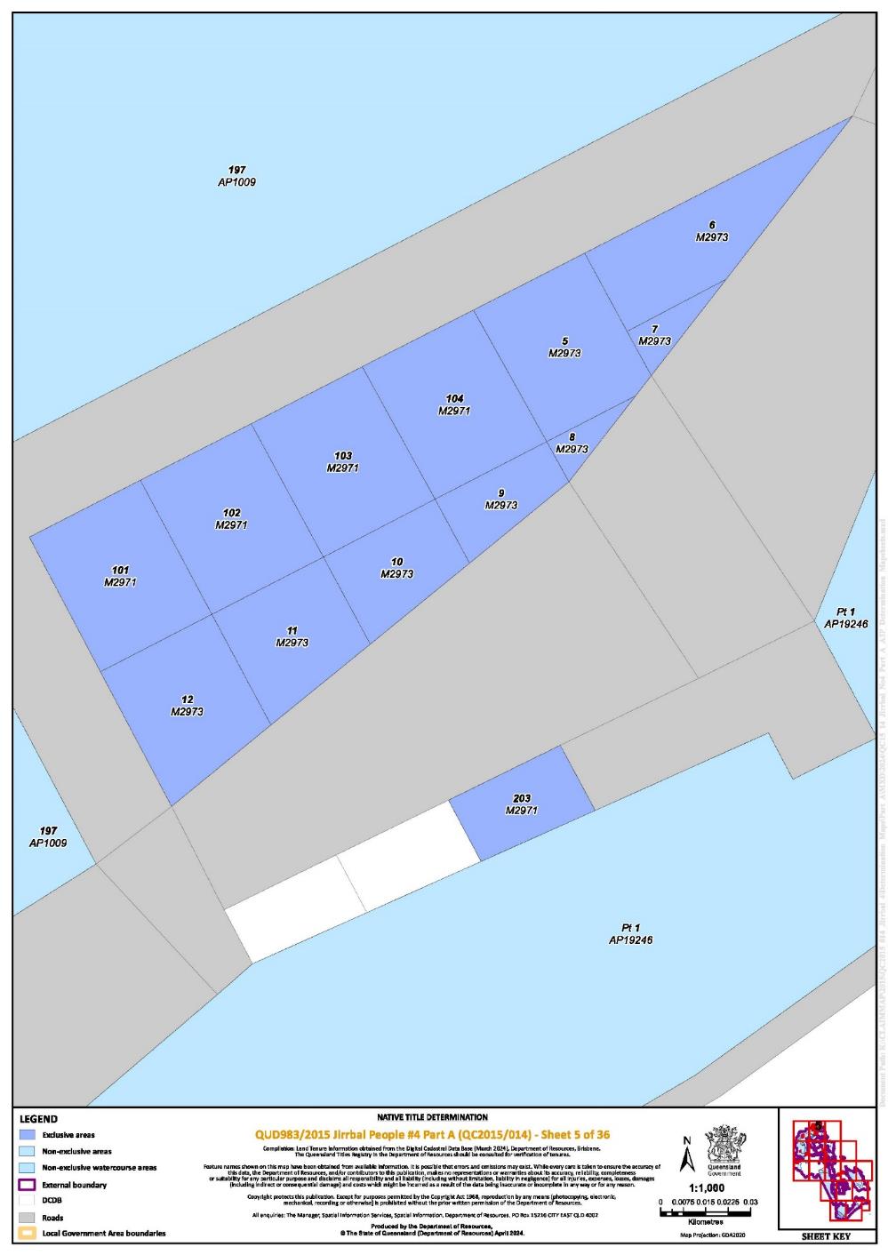
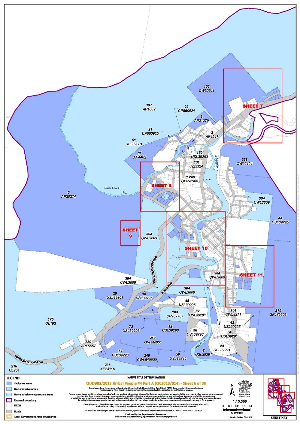
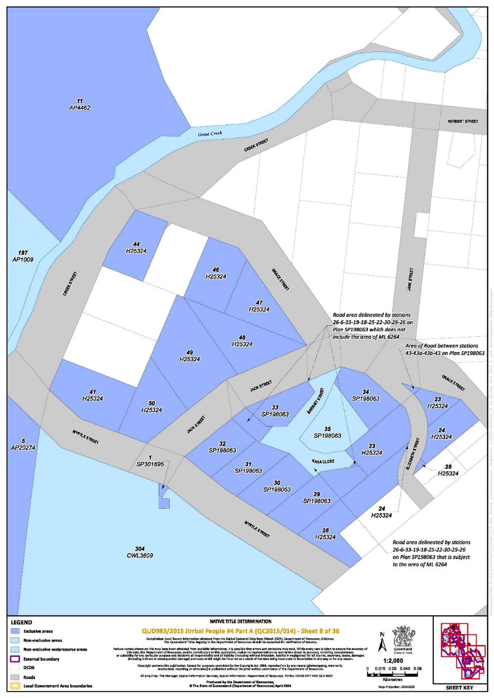
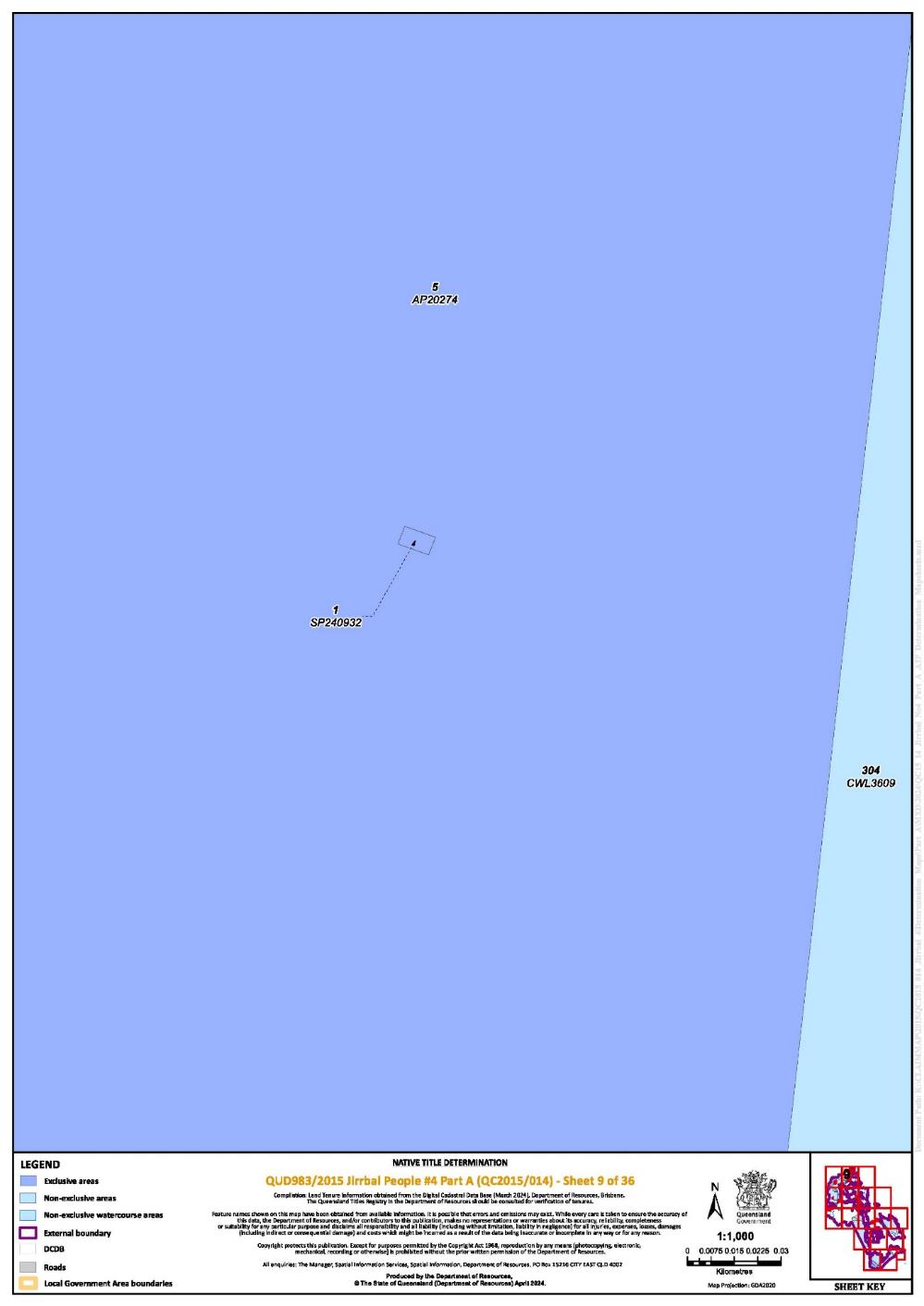
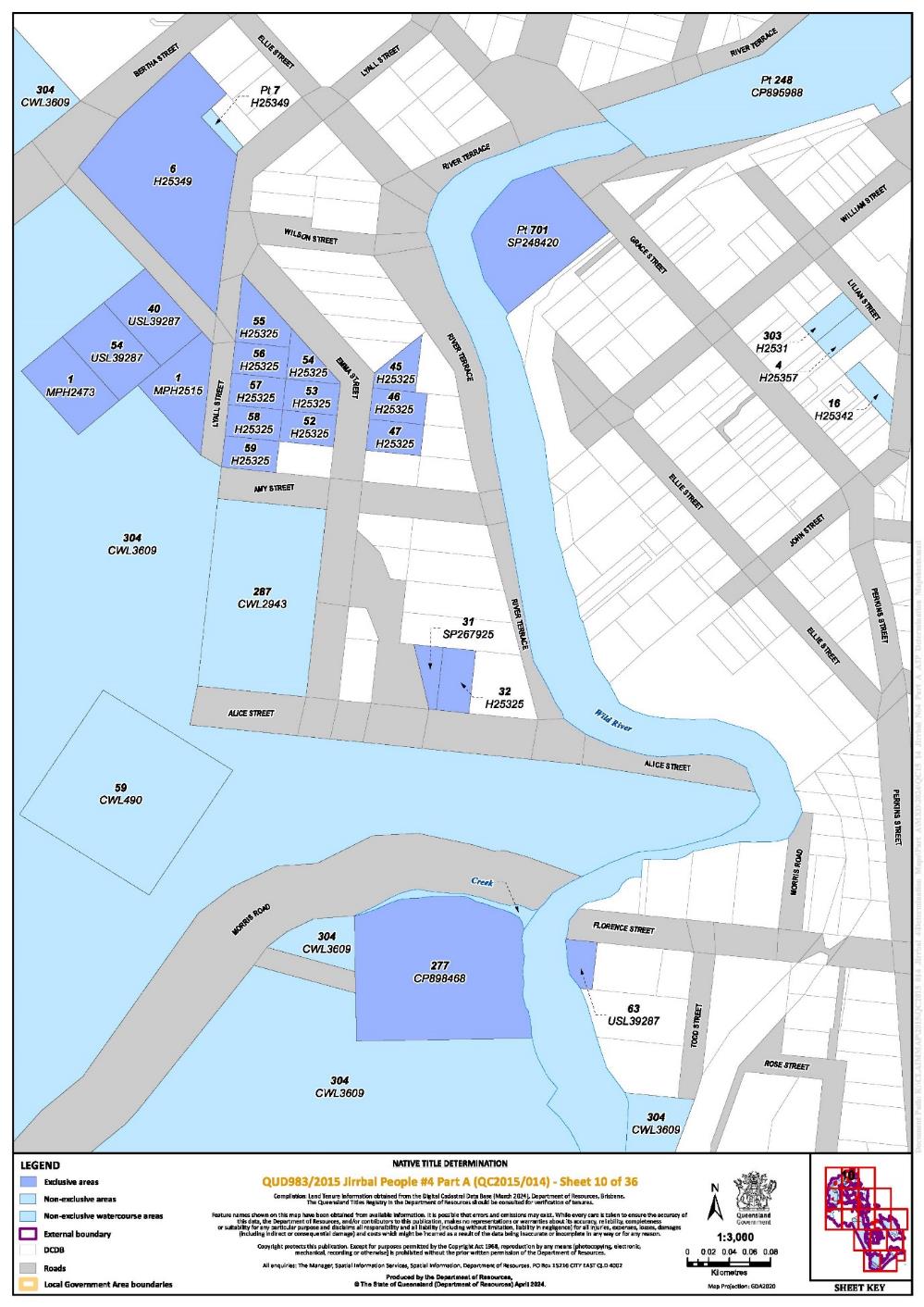
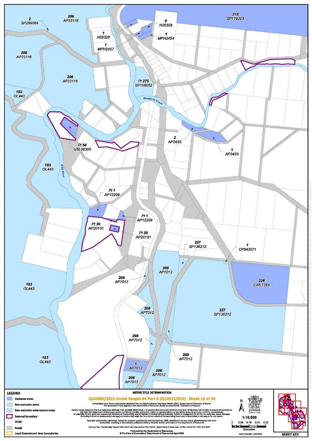
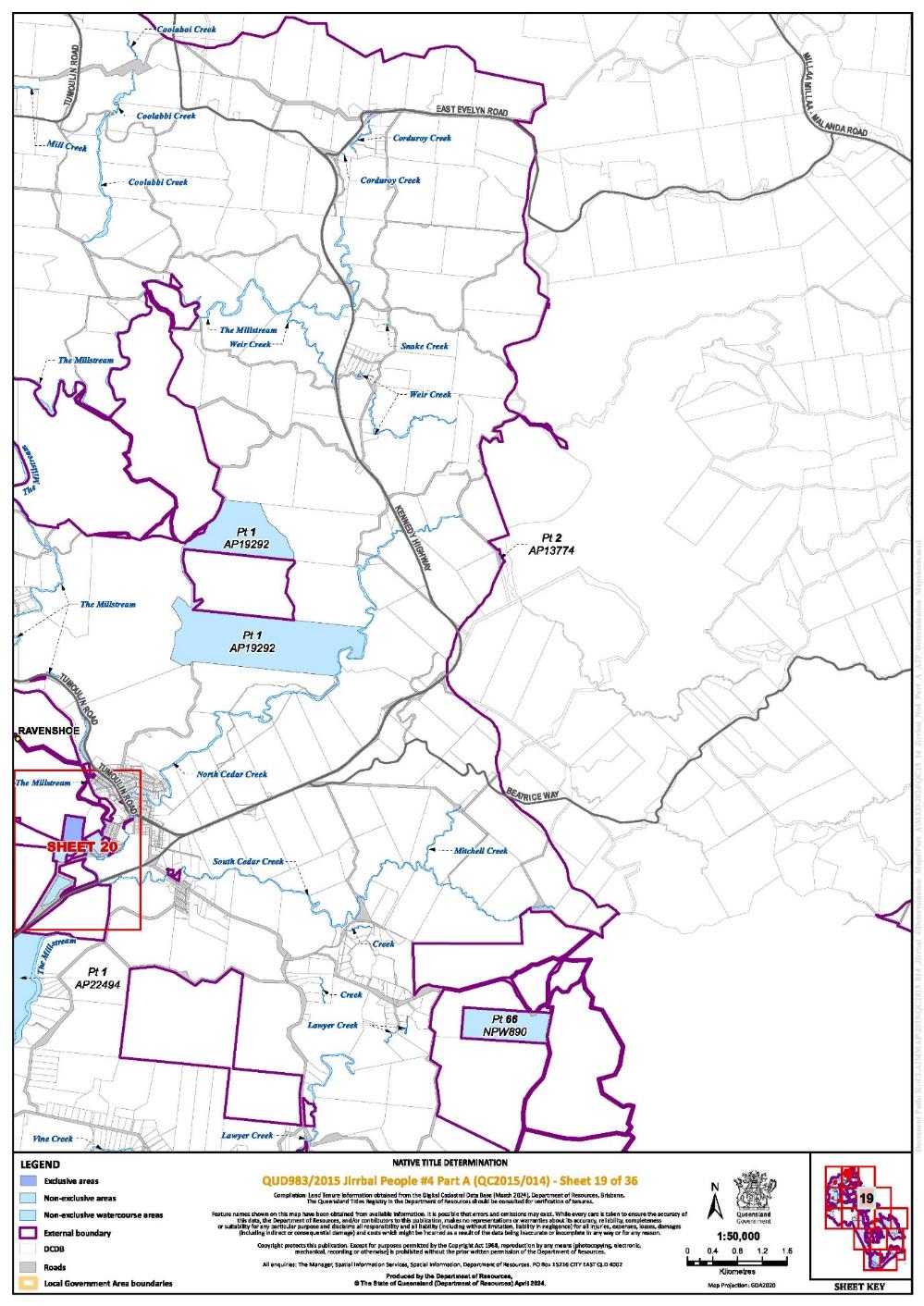
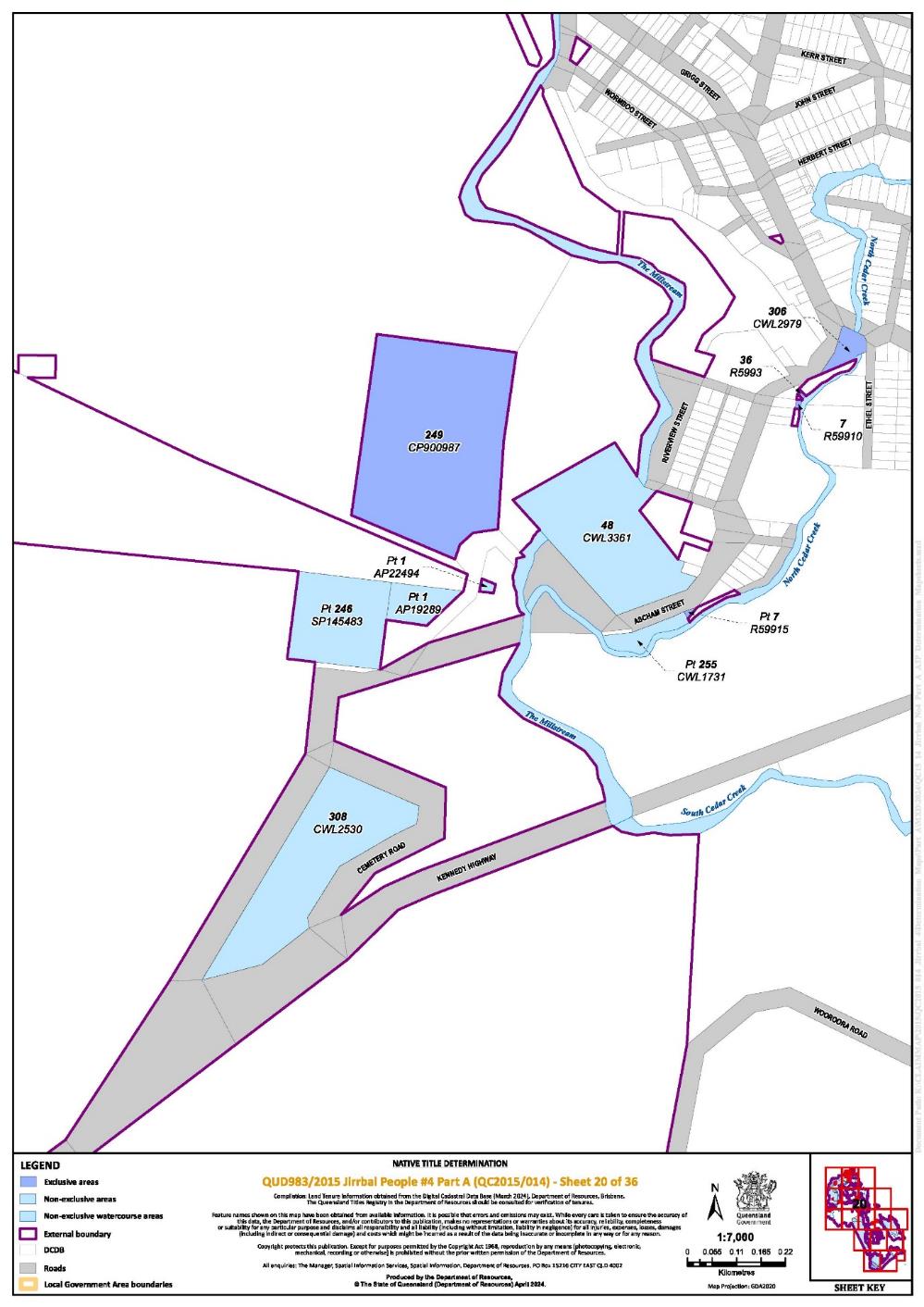
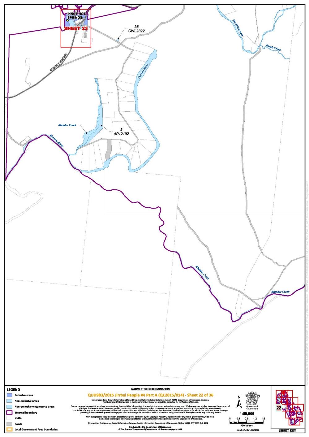
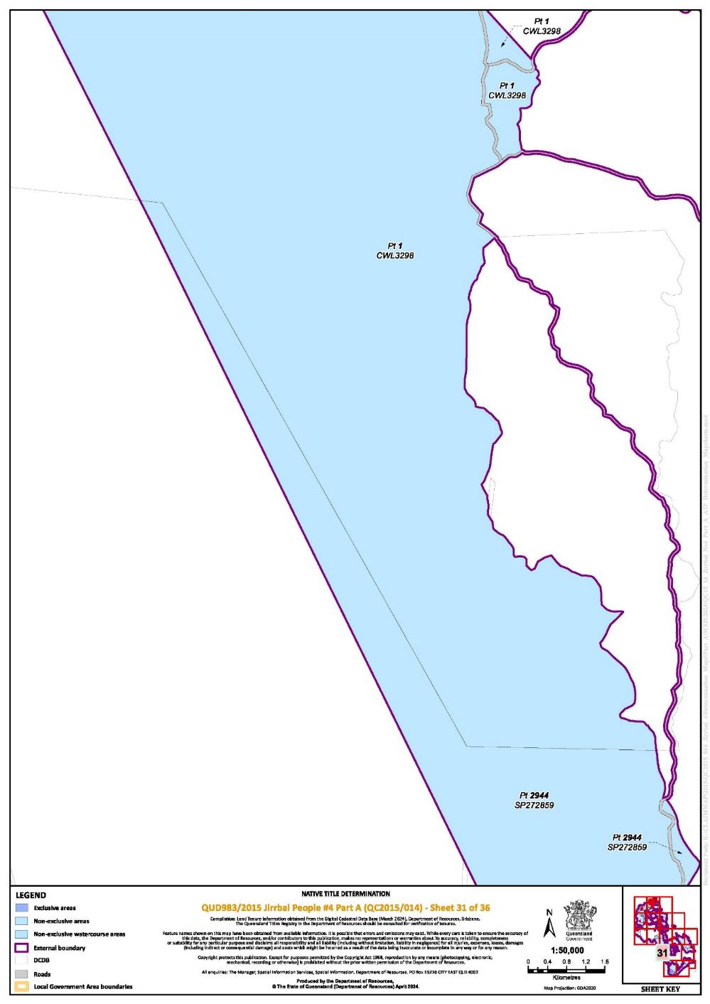
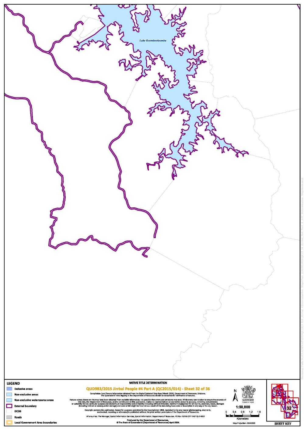
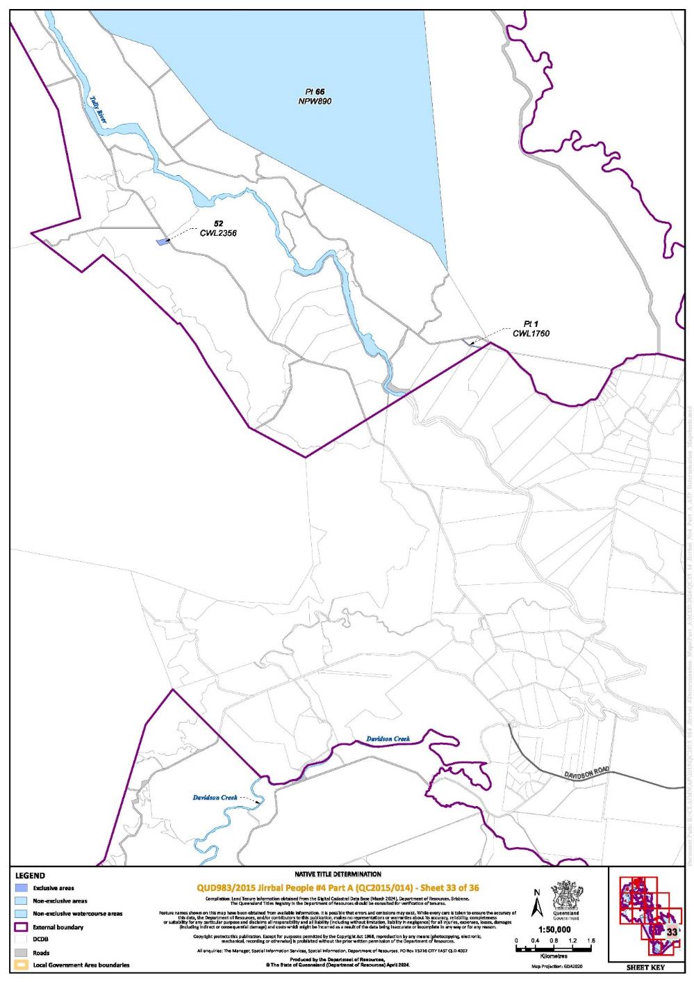
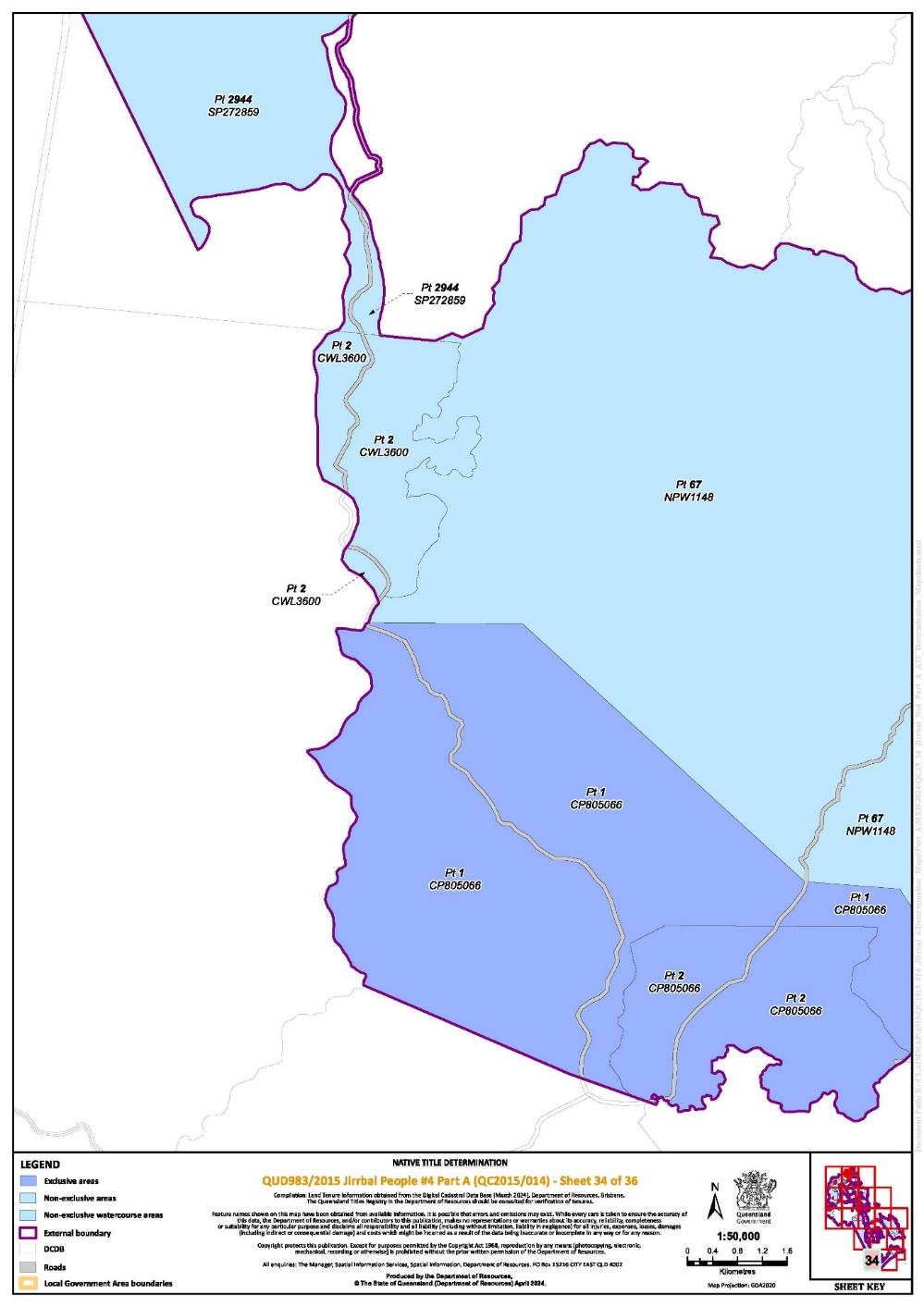
The determination area comprises all of the land and waters described by lots on plan, or relevant parts thereof, and any rivers, streams, creeks or lakes described in the first column of the tables in the Parts immediately below, and depicted in the maps in Schedule 6, to the extent those areas are within the External Boundary and not otherwise excluded by the terms of Schedule 5.
Part 1 — Exclusive Areas
All of the land and waters described in the following table and depicted in dark blue on the determination map contained in Schedule 6:
Area description (at the time of the determination) | Determination Map Sheet Reference | Note |
That part of Lot 1 on AP12209 excluding former MH 1595 on Plan MPH14281 | 12 |
|
Lot 43 on Plan AP13752 | 11 |
|
Lot 380 on Plan AP15657 | 6 |
|
Lot 141 on Plan AP20035 | 17 |
|
Lot 30 on Plan AP20151 | 12 | ~ |
Lot 5 on Plan AP20274 | 6, 8, 9 |
|
Lot 2 on Plan AP21279 | 6 |
|
Lot 78 on Plan AP22748 | 23 | ~ |
Lot 1 on Plan AP3435 | 12 |
|
Lot 2 on Plan AP3435 | 12 |
|
Lot 11 on Plan AP4462 | 6, 8 |
|
Lot 2 on Plan AP4547 | 6 |
|
Lot 1 on Plan AP7012 | 12 |
|
Lot 1 on Plan CP805066 | 34, 35 | ^ |
Lot 2 on Plan CP805066 | 34 | ^ |
Lot 22 on Plan CP860924 | 6 |
|
Lot 21 on Plan CP860925 | 6 |
|
Lot 277 on Plan CP898468 | 10 | ^ |
Lot 249 on Plan CP900987 | 20 | ^ |
Lot 228 on Plan CWL1264 | 12 |
|
Lot 1 on Plan CWL1760 | 33 |
|
Lot 238 on Plan CWL2104 | 6 |
|
Lot 52 on Plan CWL2356 | 33 |
|
Lot 153 on Plan CWL2611 | 6, 7 |
|
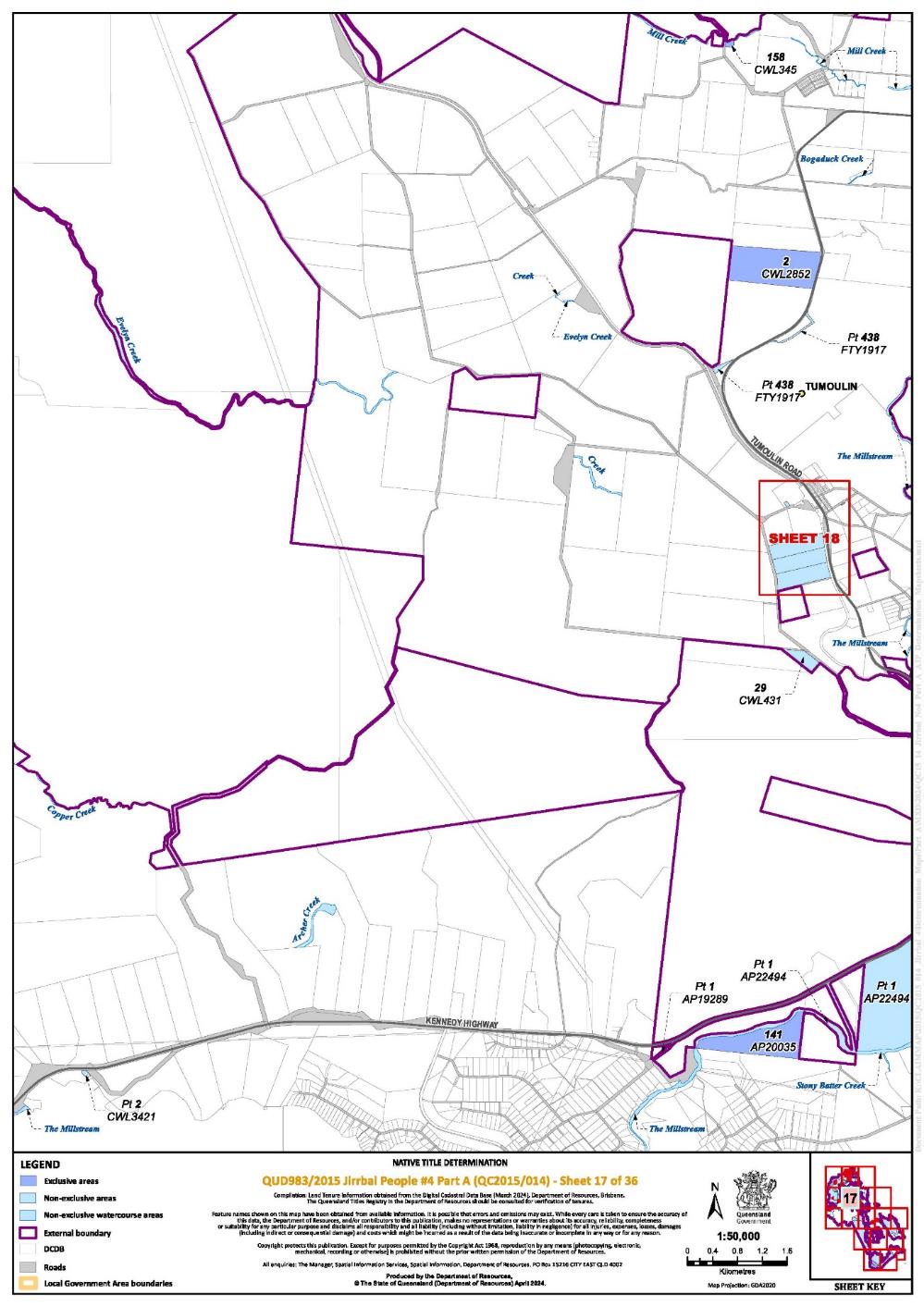
Lot 2 on Plan CWL2852 | 17 | ^ |
Lot 306 on Plan CWL2979 | 20 |
|
Lot 158 on Plan CWL345 | 17 |
|
Lot 13 on Plan CWL3622 | 11 |
|
Lot 37 on Plan CWL3682 | 23 |
|
Lot 312 on Plan CWL430 | 18 |
|
Lot 249 on Plan CWL840900 | 6 |
|
Lot 250 on Plan CWL840900 | 6 |
|
Lot 1 on Plan CWL96 | 2 |
|
Lot 47 on Plan H25320 | 11 | ~ |
Lot 131 on Plan H25324 | 6 |
|
Lot 23 on Plan H25324 | 8 |
|
Lot 24 on Plan H25324 | 8 |
|
Lot 28 on Plan H25324 | 8 |
|
Lot 41 on Plan H25324 | 8 |
|
Lot 44 on Plan H25324 | 8 |
|
Lot 46 on Plan H25324 | 8 |
|
Lot 47 on Plan H25324 | 8 |
|
Lot 48 on Plan H25324 | 8 |
|
Lot 49 on Plan H25324 | 8 |
|
Lot 50 on Plan H25324 | 8 |
|
Lot 32 on Plan H25325 | 10 |
|
Lot 45 on Plan H25325 | 10 |
|
Lot 46 on Plan H25325 | 10 |
|
Lot 47 on Plan H25325 | 10 |
|
Lot 52 on Plan H25325 | 10 |
|
Lot 53 on Plan H25325 | 10 |
|
Lot 54 on Plan H25325 | 10 |
|
Lot 55 on Plan H25325 | 10 |
|
Lot 56 on Plan H25325 | 10 |
|
Lot 57 on Plan H25325 | 10 |
|
Lot 58 on Plan H25325 | 10 |
|
Lot 59 on Plan H25325 | 10 |
|
Lot 43 on Plan H25326 | 11 |
|
Lot 44 on Plan H25326 | 11 |
|
Lot 46 on Plan H25326 | 11 |
|
Lot 47 on Plan H25326 | 11 |
|
Lot 48 on Plan H25326 | 11 |
|
Lot 49 on Plan H25326 | 11 |
|
Lot 50 on Plan H25326 | 11 |
|
Lot 51 on Plan H25326 | 11 |
|
Lot 52 on Plan H25326 | 11 |
|
Lot 53 on Plan H25326 | 11 |
|
Lot 54 on Plan H25326 | 11 |
|
Lot 55 on Plan H25326 | 11 |
|
Lot 56 on Plan H25326 | 11 |
|
Lot 1 on Plan H25328 | 12 |
|
Lot 6 on Plan H25328 | 12 |
|
Lot 6 on Plan H25349 | 10 |
|
Lot 101 on Plan M2971 | 5 |
|
Lot 102 on Plan M2971 | 5 |
|
Lot 103 on Plan M2971 | 5 |
|
Lot 104 on Plan M2971 | 5 |
|
Lot 203 on Plan M2971 | 5 |
|
Lot 10 on Plan M2973 | 5 |
|
Lot 11 on Plan M2973 | 5 |
|
Lot 12 on Plan M2973 | 5 |
|
Lot 5 on Plan M2973 | 5 |
|
Lot 6 on Plan M2973 | 5 |
|
Lot 7 on Plan M2973 | 5 |
|
Lot 8 on Plan M2973 | 5 |
|
Lot 9 on Plan M2973 | 5 |
|
Lot 1 on Plan MPH2454 | 12 |
|
Lot 1 on Plan MPH2457 | 12 |
|
Lot 1 on Plan MPH2473 | 10 |
|
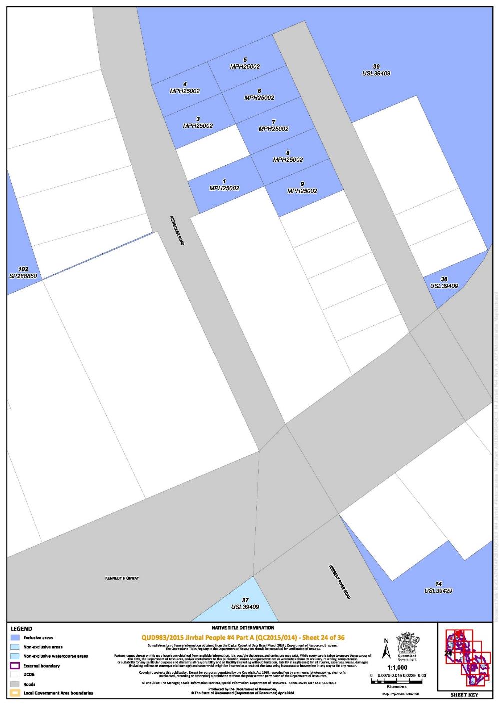
Lot 1 on Plan MPH25002 | 24 |
|
Lot 3 on Plan MPH25002 | 24 |
|
Lot 4 on Plan MPH25002 | 24 |
|
Lot 5 on Plan MPH25002 | 24 |
|
Lot 6 on Plan MPH25002 | 24 |
|
Lot 7 on Plan MPH25002 | 24 |
|
Lot 8 on Plan MPH25002 | 24 |
|
Lot 9 on Plan MPH25002 | 24 |
|
Lot 1 on Plan MPH2515 | 10 |
|
Lot 20 on Plan MPH32725 | 7 |
|
Lot 21 on Plan MPH32725 | 7 |
|
Lot 22 on Plan MPH32725 | 7 |
|
Lot 23 on Plan MPH32725 | 7 |
|
Lot 24 on Plan MPH32725 | 7 |
|
Lot 25 on Plan MPH32725 | 7 |
|
Lot 26 on Plan MPH32725 | 7 |
|
Lot 27 on Plan MPH32725 | 7 |
|
Lot 305 on Plan N25269 | 3 |
|
Lot 7 on Plan R59910 | 20 |
|
That part of Lot 7 on Plan R59915 excluding former Allotment 7 of Section 11 on Plan R59914 | 20 |
|
Lot 36 on Plan R5993 | 20 |
|
Lot 215 on Plan SP179203 | 3, 6, 11, 12 | ~ |
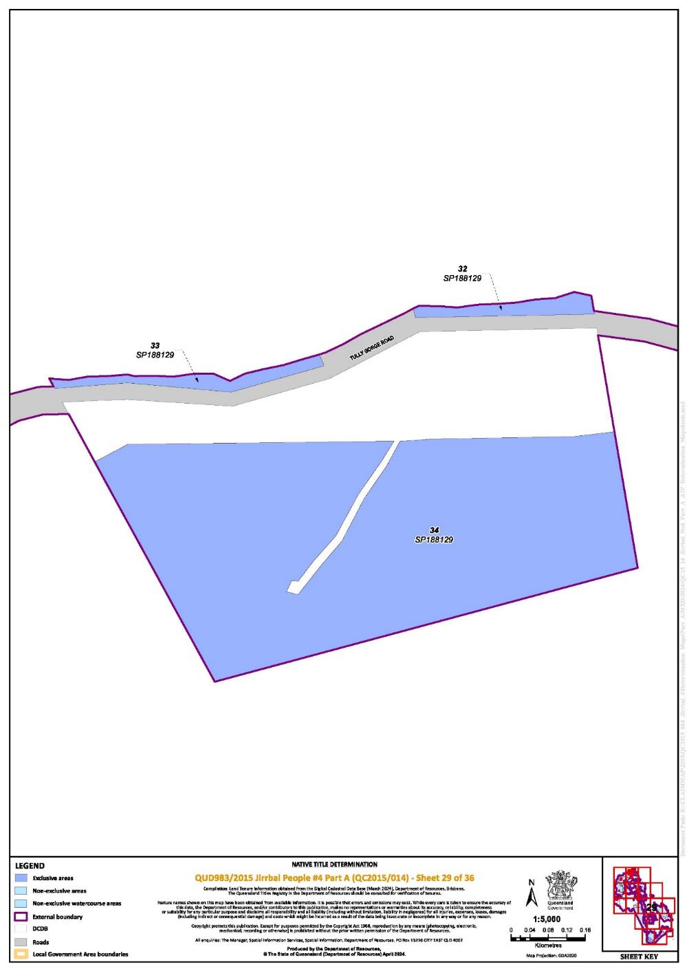
Lot 32 on Plan SP188129 | 29 | ~ |
Lot 33 on Plan SP188129 | 29 | ~ |
Lot 34 on Plan SP188129 | 29 | ~ |
Lot 29 on Plan SP198063 | 8 |
|
Lot 30 on Plan SP198063 | 8 |
|
Lot 31 on Plan SP198063 | 8 |
|
Lot 32 on Plan SP198063 | 8 |
|
Lot 33 on Plan SP198063 | 8 |
|
Lot 34 on Plan SP198063 | 8 |
|
Lot 1 on Plan SP240932 | 9 |
|
That part of Lot 701 on Plan SP248420 excluding former Lot 2 on AP3152 | 10 |
|
Lot 31 on Plan SP267925 | 10 |
|
An area of new road delineated by stations J-K-L-J on Plan SP288860 | 23 | ~* |
Lot 2 on SP288860 | 23 | ~ |
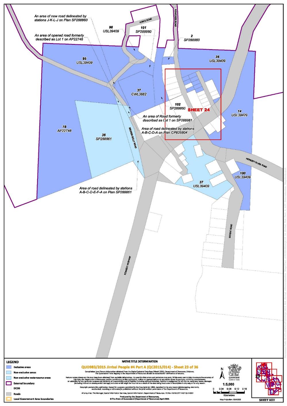
Lot 101 on Plan SP288860 | 23 | ~ |
Lot 102 on Plan SP288860 | 23, 24 | ~ |
Lot 64 on Plan USL36300 | 12 |
|
Lot 150 on Plan USL39283 | 6 |
|
Lot 40 on Plan USL39287 | 10 |
|
Lot 54 on Plan USL39287 | 10 |
|
Lot 63 on Plan USL39287 | 10 |
|
Lot 2 on Plan USL39291 | 6 |
|
Lot 23 on Plan USL39291 | 6 |
|
Lot 32 on Plan USL39291 | 6 |
|
Lot 34 on Plan USL39291 | 6 |
|
Lot 65 on Plan USL39293 | 7 |
|
Lot 80 on Plan USL39293 | 7 |
|
Lot 43 on Plan USL39295 | 6, 11 |
|
Lot 44 on Plan USL39295 | 3, 6 |
|
Lot 12 on Plan USL39296 | 6 |
|
Lot 16 on Plan USL39296 | 6 |
|
Lot 48 on Plan USL39296 | 6 |
|
Lot 58 on Plan USL39296 | 6 |
|
Lot 59 on Plan USL39296 | 6 |
|
Lot 72 on Plan USL39296 | 6 |
|
Lot 73 on Plan USL39296 | 6 |
|
Lot 29 on Plan USL39301 | 6 |
|
Lot 51 on Plan USL39301 | 6 |
|
Lot 10 on Plan USL39311 | 2 |
|
Lot 20 on Plan USL39311 | 1, 2 |
|
Lot 21 on Plan USL39311 | 1 | ~ |
Lot 5 on Plan USL39311 | 1, 2 |
|
Lot 100 on Plan USL39409 | 23 |
|
Lot 36 on Plan USL39409 | 23, 24 |
|
Lot 95 on Plan USL39409 | 23 |
|
Lot 98 on Plan USL39409 | 23 |
|
Lot 14 on Plan USL39429 | 23, 24 |
|
Lot 1 on Plan SP301695 | 8 | ~ |
That part of an area identified as Road and delineated by stations 26-6-33-19-18-25-22-30-29-26 on Plan SP198063 which does not include the area of ML 6264 | 8 | * |
An area identified as Road and delineated by stations 43-43a-43b-43 on Plan SP198063 | 8 | * |
* denotes areas to which s 24KA of the NTA apply
^ denotes areas to which s 47A of the NTA apply
~ denotes areas to which s 47B of the NTA apply
Part 2 — Non-Exclusive Areas
All of the land and waters described in the following table and depicted in light blue on the determination map contained in Schedule 6:
Area description (at the time of the determination) | Determination Map Sheet Reference | Note | ||||||
Lot 197 on Plan AP1009 | 4, 5, 6, 7, 8 |
| ||||||
Lot 149 on Plan AP11724 | 3 |
| ||||||
Lot 2 on Plan AP12192 | 22 |
| ||||||
Lot 2 on Plan AP13774 | 19 |
| ||||||
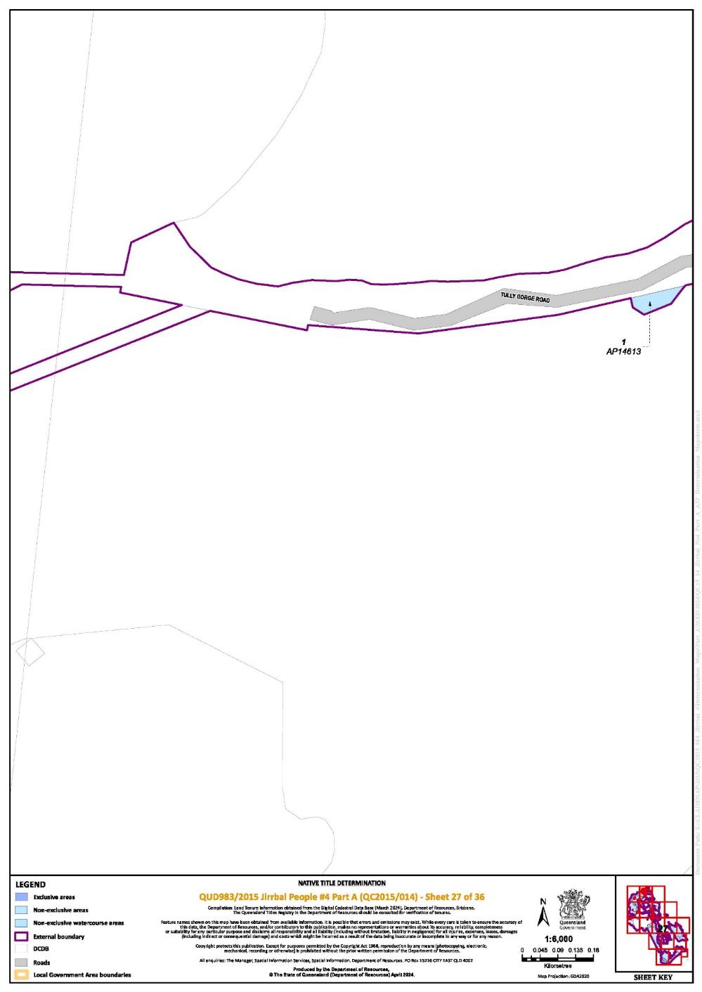
Lot 1 on Plan AP14613 | 27 |
| ||||||
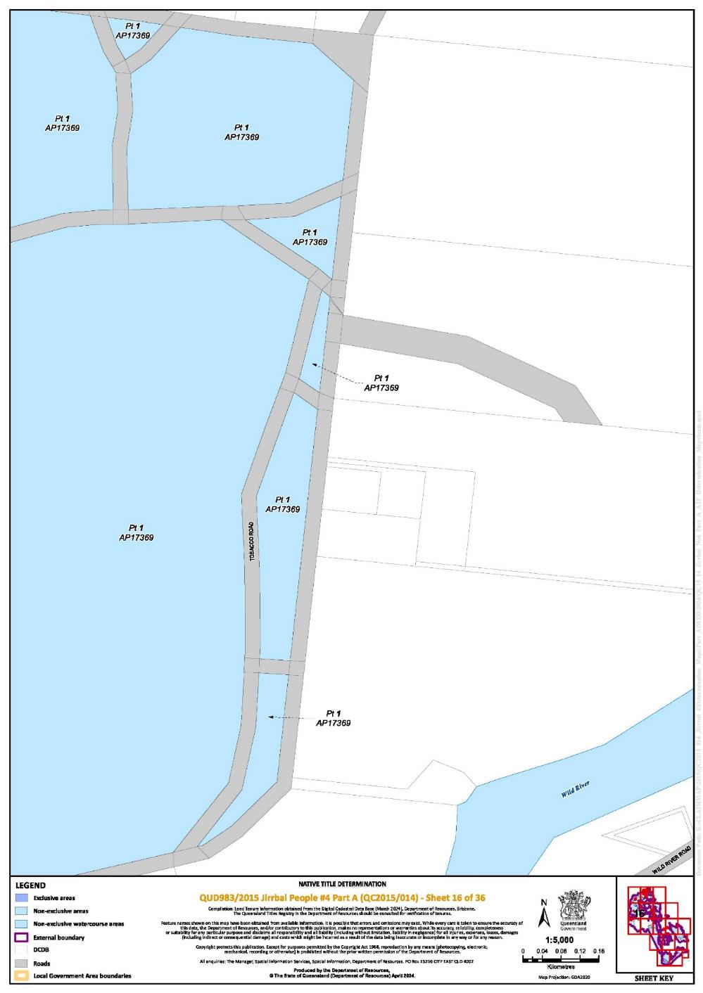
Lot 1 on Plan AP17369 | 1, 14, 15, 16 |
| ||||||
That part of Lot 1 on Plan AP19246 excluding former Portion 212 on Plan CWL342 and Portion 213 on Plan CWL380 | 4, 5 |
| ||||||
Lot 1 on Plan AP19289 | 17, 20 |
| ||||||
That part of Lot 1 on Plan AP19292 excluding former Portion 43 on Plan CWL223, former Portions 238, 240 & 243 on Plan CWL429, former Portions 218 - 219 on Plan CWL543, former Portion 53 on Plan CWL368 and former Portion 62 on Plan CWL215 | 19 |
| ||||||
Lot 72 on Plan AP22468 | 35 |
| ||||||
Lot 1 on Plan AP22494 | 17, 19, 20 |
| ||||||
An area identified as Road and formerly described as Lot 1 on Plan AP22748 | 23 | * | ||||||
Lot 206 on Plan AP23116 | 3, 6, 12 |
| ||||||
Lot 2 on Plan AP5947 | 14 |
| ||||||
Lot 3 on Plan AP5947 | 14 |
| ||||||
Lot 208 on Plan AP7012 | 3, 12 |
| ||||||
Lot 1 on Plan CP818023 | 4 |
| ||||||
An area identified as Road and delineated by stations A-B-C-D-E-F-A on Plan SP288861 | 23 | * | ||||||
An area identified as Road and formerly described as Lot 1 on SP288861 | 23 | * | ||||||
Lot 36 on Plan SP288861 | 23 |
| ||||||
Lot 1 on Plan CP843571 | 12 |
| ||||||
That part of Lot 248 on Plan CP895988 excluding former Lot 245 on Plan CWL2807 | 6, 10 |
| ||||||
Lot 183 on Plan CP902757 | 6 |
| ||||||
That part of Lot 255 on Plan CWL1731 excluding an area of former Road on Plan CWL406 | 20 |
| ||||||
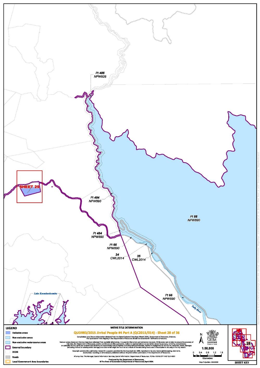
Lot 34 on Plan CWL2014 | 28 |
| ||||||
Lot 35 on Plan CWL2014 | 28 |
| ||||||
Lot 231 on Plan CWL2056 | 11 |
| ||||||
Lot 115 on Plan CWL2120 | 35 |
| ||||||
Lot 35 on Plan CWL2322 | 22 |
| ||||||
Lot 308 on Plan CWL2530 | 20 |
| ||||||
Lot 143 on Plan CWL262 | 3 |
| ||||||
Lot 287 on Plan CWL2943 | 10 |
| ||||||
That part of Lot 309 on Plan CWL2958 described as former Portion 216 on Plan CWL585 | 18 |
| ||||||
Lot 174 on Plan CWL3185 | 4 |
| ||||||
Lot 252 on Plan CWL3185 | 4 |
| ||||||
Lot 254 on Plan CWL3271 | 6 |
| ||||||
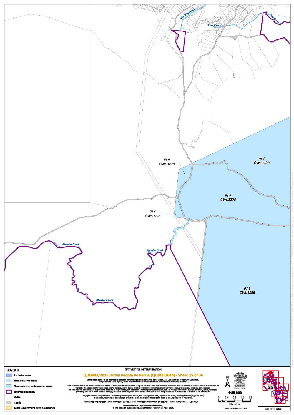
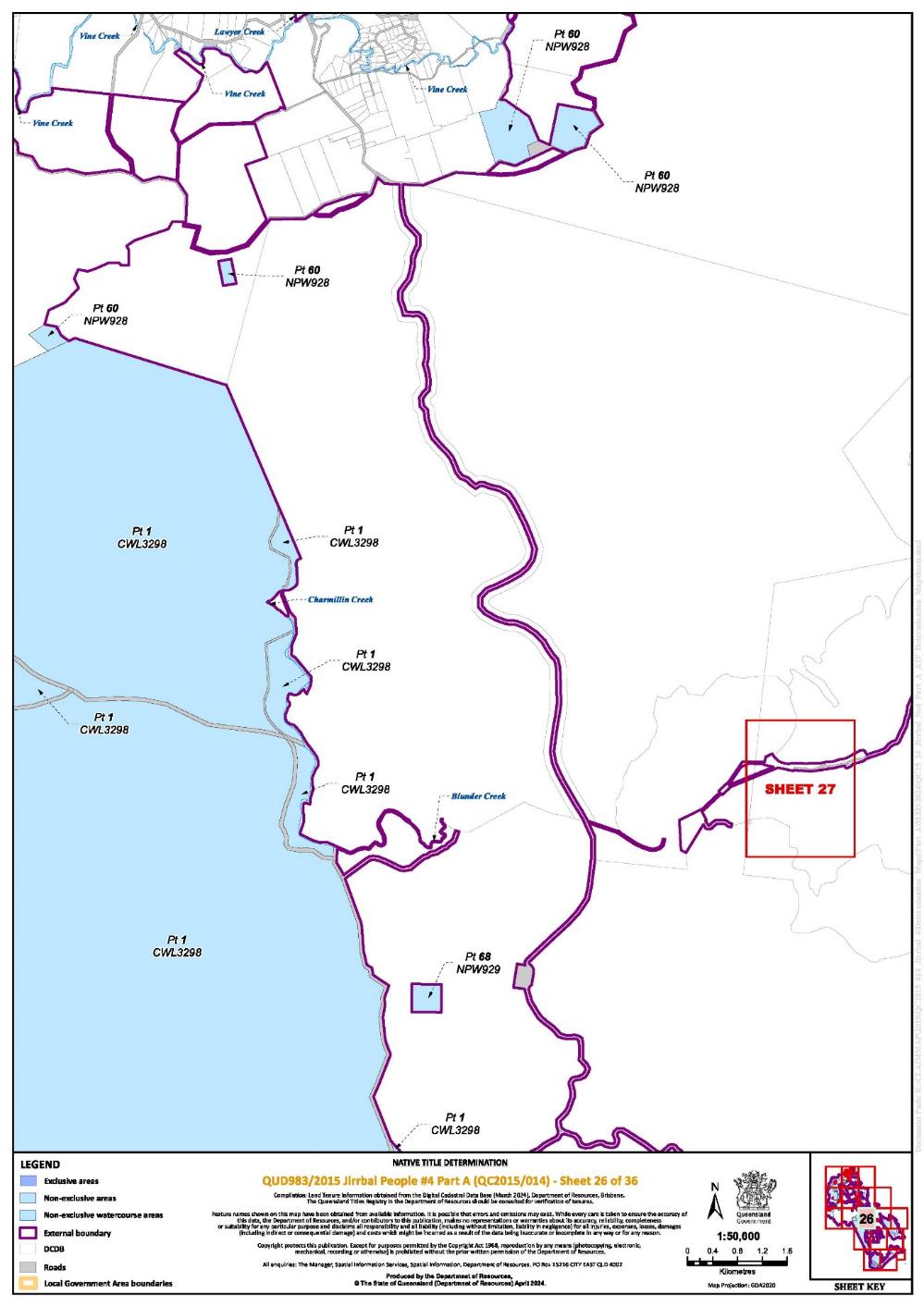
Lot 1 on Plan CWL3298 | 25, 26, 31 |
| ||||||
Lot 48 on Plan CWL3361 | 20 |
| ||||||
That part of Lot 2 on CWL3421 excluding former Portion 30 on Plan CWL3112 | 17 |
| ||||||
Lot 5 on Plan CWL3515 | 1, 2 |
| ||||||
Lot 290 on Plan CWL3517 | 4, 7 |
| ||||||
Lot 2 on Plan CWL3600 | 34 |
| ||||||
Lot 304 on Plan CWL3609 | 6, 8, 9, 10, 11 |
| ||||||
Lot 160 on Plan CWL366 | 4 |
| ||||||
Lot 6 on Plan CWL3673 | 2 |
| ||||||
Lot 29 on Plan CWL431 | 17 |
| ||||||
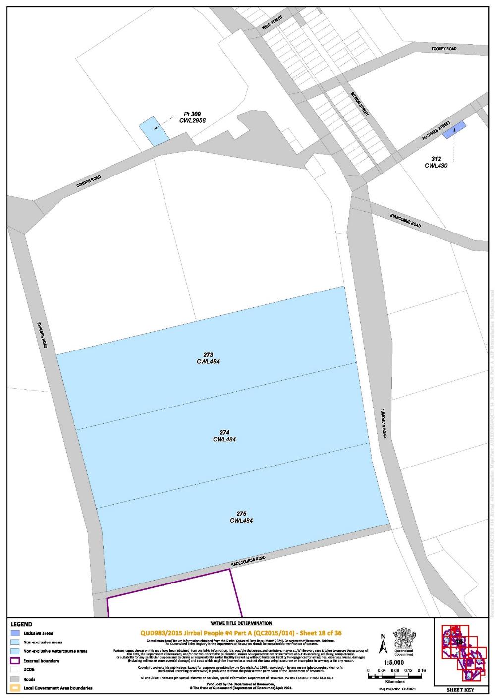
Lot 273 on Plan CWL484 | 18 |
| ||||||
Lot 274 on Plan CWL484 | 18 |
| ||||||
Lot 275 on Plan CWL484 | 18 |
| ||||||
Lot 59 on Plan CWL490 | 10 |
| ||||||
That part of Lot 438 on Plan FTY1917 excluding former Portion 10 on Plan CWL246, Portions 40, 44 & 45 on Plan CWL223, former Portions 218 & 219 on Plan CWL543, former Portions 215 & 238 - 240 on Plan CWL429, former Portion 53 on Plan CWL368, former Portion 62 on Plan CWL215 and former Portion 243 on Plan CWL429 | 17 |
| ||||||
Lot 303 on Plan H2531 | 10 |
| ||||||
Lot 16 on Plan H25342 | 10 |
| ||||||
That part of Lot 7 on H25349 southwest of a line bisecting the following coordinates:
Note Data Reference and source Coordinates are based on Queensland Imagery: Latest State Program (SISP) Image Service, State of Queensland (Department of Resources). Reference datum Geographical coordinates are referenced to the Geocentric Datum of Australia 2020 (GDA2020), in decimal degrees. | 10 | |||||||
Lot 4 on Plan H25357 | 10 |
| ||||||
Lot 67 on Plan NPW1148 | 34, 35 |
| ||||||
Lot 513 on Plan NPW580 | 36 |
| ||||||
Lot 484 on Plan NPW890 | 28 |
| ||||||
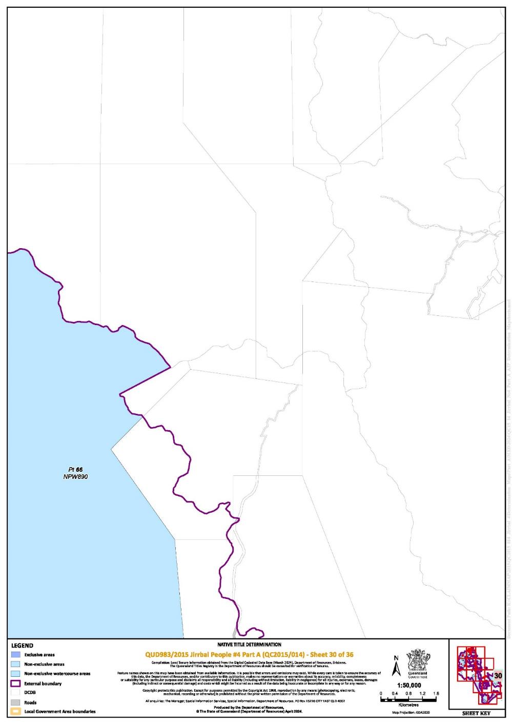
That part of Lot 66 on Plan NPW890 excluding Lot C on Plan CWL3128 and Lot 36 on Plan CWL2542 | 3, 4, 13 |
| ||||||
That part of Lot 179 on Plan NPW922 excluding former Portion 216 on Plan CWL342 | 3, 4, 13 |
| ||||||
Lot 483 on Plan NPW922 | 3, 4, 13 |
| ||||||
Lot 554 on Plan NPW922 | 3 |
| ||||||
Lot 486 on Plan NPW928 | 28 |
| ||||||
Lot 60 on Plan NPW928 | 26 |
| ||||||
Lot 68 on Plan NPW929 | 26 |
| ||||||
Lot 145 on Plan OL186 | 3 |
| ||||||
Lot 175 on Plan OL193 | 3, 6 |
| ||||||
Lot 207 on Plan OL200 | 3 |
| ||||||
Lot 216 on Plan OL204 | 1, 3, 6 |
| ||||||
Lot 183 on Plan OL443 | 3, 12 |
| ||||||
Lot 150 on Plan OL444 | 1, 3 |
| ||||||
Lot 136 on Plan OL452 | 3 |
| ||||||
That part of Lot 275 on Plan SP106052 described as former Portion 275 on Plan H25336 | 12 |
| ||||||
Lot 227 on Plan SP136212 | 12 |
| ||||||
That part of Lot 246 on Plan SP145483 described as former Portion 246 on Plan CWL584 | 20 |
| ||||||
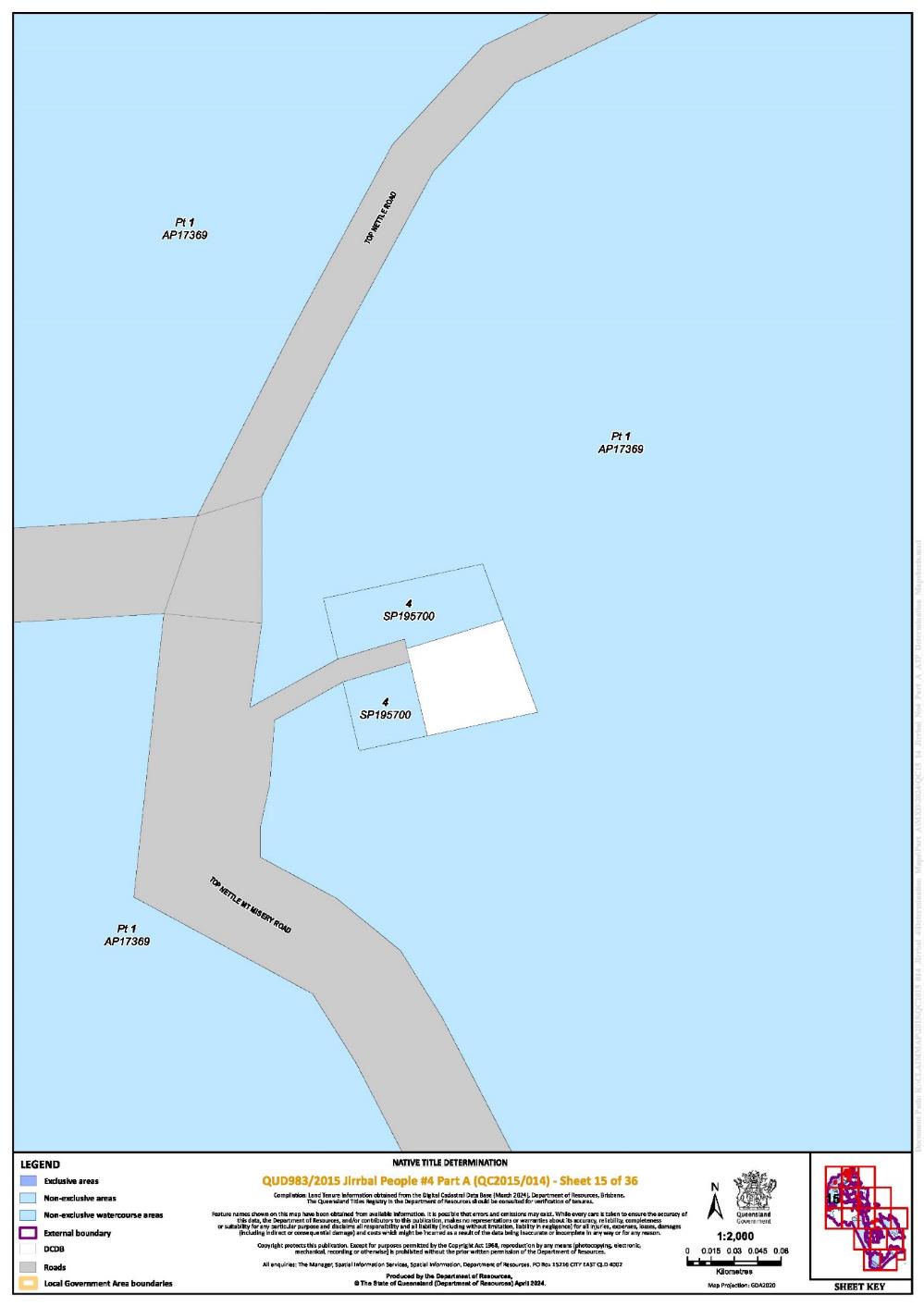
Lot 4 on Plan SP195700 | 15 |
| ||||||
Lot 35 on Plan SP198063 | 8 |
| ||||||
Lot 2944 on Plan SP272859 | 31, 34 |
| ||||||
Lot 2 on Plan SP289084 | 12 |
| ||||||
Lot 2 on Plan SP306250 | 3 |
| ||||||
Lot 37 on Plan USL39409 | 23, 24 |
| ||||||
An area identified as Road and delineated by stations A-B-C-D-A on Plan CP825804 | 23 | * | ||||||
That part of an area identified as Road and delineated by stations 26-6-33-19-16-25-22-30-29-26 on Plan SP198063 that is subject to the area of ML 6264 | 8 | * | ||||||
Save for any waters forming part of a lot on plan, all rivers, creeks, streams and lakes within the External Boundary described in Schedule 3, including but not limited to: (i) Western Creek; (ii) Wild River; (iii) Clotten Creek; (iv) Wondecla Creek; (v) Flaggy Creek; (vi) Sandy Creek; (vii) Spring Creek; (viii) Chunum Creek; (ix) Basalt Creek; (x) Grant Creek; (xi) Evelyn Creek; (xii) Dry River; (xiii) Sailor Gully; (xiv) Cooper Creek; (xv) The Millstream; (xvi) Mill Creek; (xvii) Bogaduck Creek; (xviii) Archer Creek; (xix) Coolabbi Creek; (xx) Corduroy Creek; (xxi) Snake Creek; (xxii) Weir Creek; (xxiii) North Cedar Creek; (xxiv) South Cedar Creek; (xxv) Mitchell Creek; (xxvi) Lawyer Creek; (xxvii) Vine Creek; (xxviii) Herbert River; (xxix) Blunder Creek; (xxx) Charmillin Creek; (xxxi) Tully River; (xxxii) Davidson Creek; and (xxxiii) Lake Koombooloomba. | Various |
* denotes areas to which s 24KA of the NTA apply
SCHEDULE 5
AREAS NOT FORMING PART OF THE DETERMINATION AREA
The following areas of land and waters are excluded from the determination area as described in Part 1 of Schedule 4 and Part 2 of Schedule 4:
Part 1 – Area excluded on the basis of extinguishment
1. Those land and waters within the External Boundary which at the time the native title determination application was made were, or had been, the subject of one or more Previous Exclusive Possession Acts, within the meaning of s 23B of the NTA as they could not be claimed in accordance with s 61A of the NTA.
2. Specifically, and to avoid any doubt, the land and waters described in (1) above includes:
(a) the Previous Exclusive Possession Acts described in ss 23B(2) and 23B(3) of the NTA to which s 20 of the Native Title (Queensland) Act 1993 (Qld) applies, and to which none of ss 47, 47A or 47B of the NTA applied, including but not limited to the whole of the land and waters described as:
(i) Lot 300 on CWL3395;
(ii) Lot 2 on Plan CWL379;
(iii) That part of Lot 309 on Plan CWL2958 not forming the area described as former Portion 216 on Plan CWL585;
(iv) Lot 267 on Plan CWL3206;
(v) Lot 253 on Plan CWL3226;
(vi) Lot 301 on Plan CWL3360;
(vii) That part of Lot 2 on Plan CWL3421 included in former Portion 30 on Plan CWL3112;
(viii) Lot 99 on Plan CWL3456;
(ix) Lot 401 on Plan R5995;
(x) Lot 402 on Plan R5995;
(xi) Lot 694 on Plan RP748643;
(xii) Lot 96 on Plan RP749684;
(xiii) Lot 905 on Plan RP800631;
(xiv) Lot 31 on Plan RP835430;
(xv) Lot 67 on Plan RP835459;
(xvi) Lot 447 on Plan SP106050; and
(xvii) Lot 101 on Plan SP124675.
(b) the land and waters on which any public work, as defined in s 253 of the NTA, is or was constructed, established or situated, and to which ss 23B(7) and 23C(2) of the NTA and to which s 21 of the Native Title (Queensland) Act 1993 (Qld), applies, together with any adjacent land or waters in accordance with s 251D of the NTA, including, but not limited to, the whole of the land and waters described as:
(i) That part of Lot 275 on Plan SP106052 not forming the area described as former Portion 275 on Plan H25336;
(ii) Lot 267 on Plan CWL3206;
(iii) Lot 77 on Plan CWL3479; and
(iv) Lot 13 on Plan H25351.
3. Those land and waters within the External Boundary on which, at the time the native title determination application was made, public works were validly constructed, established or situated after 23 December 1996, where s 24JA of the NTA applies, and which wholly extinguished native title.
4. Those land and waters within the External Boundary which, at the time the native title determination application was made, were the subject of one or more Pre-existing Rights Based Acts, within the meaning of s 24IB of the NTA, which wholly extinguished native title.
Part 2 – Other excluded areas
1. To the extent they are within the External Boundary, those land and waters described as:
(a) That part of Lot 1 on Plan AP19291 described as former Portion 241 on Plan CWL2711;
(b) Lot 23 on Plan CP851463;
(c) Lot 94 on Plan CP865093;
(d) That part of Lot 248 on Plan CP895988 described as former Lot 245 on Plan CWL2807;
(e) Lot 23 on Plan CP902760;
(f) Lot 12 on Plan CP903633;
(g) Lot 257 on Plan CWL146;
(h) Lot 4 on Plan CWL1539;
(i) Lot 307 on Plan CWL2908;
(j) Lot 264 on Plan CWL3023;
(k) Lot 62 on Plan CWL3204;
(a) (l) That part of Lot 47 on Plan CWL3460 excluding former Portion 47V on Plan N25505;
(m) Lot 754 on Plan FTY1925;
(n) Those parts of Lot 66 on Plan NPW890 described as Lot C on Plan CWL3128 and Lot 36 on Plan CWL2542;
(o) That part of Lot 7 on Plan R59915 described as former Allotment 7 of Section 11 on Plan R59914;
(p) Lot 21 on Plan R59916;
(q) Lot 4 on Plan SP104560;
(r) Lot 37 on Plan SP121861;
(s) Lot 242 on Plan SP166985;
(t) Lot 311 on Plan SP181099;
(u) That part of Lot 40 on Plan SP238236 described as former Lot 37 on Plan CWL2850;
(v) Lot 306 on Plan SP257001;
(w) That part of Lot 24 on Plan SP271386 excluding an area of former Road on Plan CWL2982; and
(x) Lot 1 on Plan SP306250.
SCHEDULE 6
MAP OF DETERMINATION AREA


Note: Entry of orders is dealt with in Rule 39.32 of the Federal Court Rules 2011.
RANGIAH J:
1 The applicant seeks a determination of native title pursuant to ss 61 and 225 of the Native Title Act 1993 (Cth) (the Act) on behalf of the Jirrbal People.
2 Three determinations of native title have been previously made in favour of the Jirrbal People: see Cashmere (on behalf of the Jirrbal People #1) v State of Queensland (2010) 283 ALR 610; [2010] FCA 1090 (the Jirrbal Determinations). Each of the Jirrbal Determinations was conditional on the registration of certain Indigenous land use agreements, and took effect on 7 February 2011.
3 On 25 March 2022, the Court made orders for the administrative division of the area covered by the application into two parts, Part A and Part B.
4 The parties have indicated their consent to a determination that the Jirrbal People hold native title rights and interests in a substantial, but not the whole, of Part A.
5 The determination area covers the area set out at Order 3 of the Orders. It encompasses approximately 82,315 ha of land and waters in far north Queensland, in the southern Atherton Tableland, from Herberton south to Koombooloomba National Park.
6 The Court is satisfied, for the reasons below, that it is within the power of the Court to make the orders sought, and that it is appropriate to do so.
The Native Title Act
7 The preamble to the Act recognises, on behalf of all people of Australia, that the Aboriginal peoples of Australia inhabited the country prior to European settlement and that the Aboriginal peoples were progressively dispossessed of their lands. It records that the Constitution was amended, by the overwhelming vote of the people of Australia, to enable laws such as the Act to be passed and to facilitate recognition by our shared legal system of native title rights and interests.
8 Section 87A of the Act provides a mechanism for achieving a key objective of the Act, the resolution of claims for native title by agreement. The agreement of the parties to the terms of the proposed orders is consistent with that objective.
9 Section 61 of the Act provides that an application for a determination of native title may be made by a person or persons authorised by all the persons who, according to their traditional laws and customs, hold the common or group rights and interests comprising the particular native title claimed.
10 Section 223(1) of the Act explains the meaning of “native title”:
Common law rights and interests
(1) The expression native title or native title rights and interests means the communal, group or individual rights and interests of Aboriginal peoples or Torres Strait Islanders in relation to land or waters, where:
(a) the rights and interests are possessed under the traditional laws acknowledged, and the traditional customs observed, by the Aboriginal peoples or Torres Strait Islanders; and
(b) the Aboriginal peoples or Torres Strait Islanders, by those laws and customs, have a connection with the land or waters; and
(c) the rights and interests are recognised by the common law of Australia.
11 Section 225 of the Act describes what is meant by a “determination of native title”:
225 Determination of native title
A determination of native title is a determination whether or not native title exists in relation to a particular area (the determination area) of land or waters and, if it does exist, a determination of:
(a) who the persons, or each group of persons, holding the common or group rights comprising the native title are; and
(b) the nature and extent of the native title rights and interests in relation to the determination area; and
(c) the nature and extent of any other interests in relation to the determination area; and
(d) the relationship between the rights and interests in paragraphs (b) and (c) (taking into account the effect of this Act); and
(e) to the extent that the land or waters in the determination area are not covered by a non-exclusive agricultural lease or a non-exclusive pastoral lease—whether the native title rights and interests confer possession, occupation, use and enjoyment of that land or waters on the native title holders to the exclusion of all others.
…
The application
12 The application for a determination of native title was filed in the Federal Court on 22 October 2015.
13 As has been indicated, the parties propose a consent determination over a substantial, but not the whole of Part A. For the balance of Part A, the parties are considering the need for the determination of a separate question in respect of tenure issues (and associated extinguishment of native title), further research and discussion with a neighbouring native title group, and the negotiation of Indigenous land use agreements to address tenure matters.
14 The persons comprising the applicant are: Angela Braun, Elizabeth Cashmere and Bradley Go-Sam.
15 The respondents to the application are: the State of Queensland, Cassowary Coast Regional Council, Commonwealth of Australia, Tablelands Regional Council, Ergon Energy Corporation Limited, Telstra Corporation Limited, Archer Management Pty Ltd, CleanCo Queensland Limited, EPM 14880 Pty Limited, John Davey Mudge, William John Wieland, Gregory John Barry, Lorraine Cross, Caroline Anne Waddell, Peter Hal Waddell, Sam Waddell, Jelka Grkovic, Shevaun Ynis Grkovic, Yadran Grkovic, Susan Elizabeth Tobler and Brenden Arthur Tobler.
16 All parties to the application have reached agreement that native title exists in the proposed determination area and as to the nature and extent of those native title rights and interests. That agreement, made under s 87A(1)(b) of the Act, was filed in the Federal Court on 24 May 2024.
17 The evidence of connection filed by the applicant primarily includes claimant evidence in the form of affidavits, witness statements and several expert reports prepared by anthropologists including Dr Benjamin Smith, Dr John Burton, Rosalind Glass, Ophelia Rubinich and Sarah Bell.
18 The evidence of members of the native title claim group about their traditional laws and customs and rights and responsibilities in respect to land and waters is of the highest importance: Sampi v Western Australia [2005] FCA 777 at [48]. The claimant evidence of connection is comprised of affidavits and witness statements of the following persons:
Affidavit of Ernest Grant affirmed 9 September 2015
Affidavit of Bradley Go-Sam affirmed 10 September 2015
Affidavit of Elizabeth Cashmere affirmed 22 March 2016
Affidavit of Narelle Miller affirmed 23 March 2016
Witness statement of Margaret Freeman dated 3 August 2022
Witness statement of Elizabeth Cashmere dated 3 August 2022
Witness statement of Bradley Go-Sam dated 3 August 2022
Witness statement of Phyllis Grant dated 4 August 2022
Witness statement of Joyce Bean dated 25 October 2022.
19 The applicant also relies on the following reports of expert anthropologists:
Anthropological Report in support of Jirrbal People Native Title Applications QC03/1 (Q60001/03), QC04/3 (Q41/04), and QC04/4 (Q42/04) by Dr Benjamin Smith and Dr John Burton
Genealogical Report in support of Jirrbal People Native Title Determination Applications QUD 6007/06, QUD 41/04 and QUD 42/02 by Rosalind Glass
Jirrbal People Application Report by Ophelia Rubinich
Expert Opinion regarding whether Wambino should be added as an apical ancestor to the Jirrbal #4 native title claim and other matters by Dr John Burton
Sam Boyd – Ancestor Research Report by Sarah Bell.
20 In their Anthropological Report, Dr Smith and Dr Burton examine Jirrbal laws and customs, their sociocultural system and, “the ways in which this system has continued and developed from that which existed ‘at the threshold of colonisation’ to the present”.
21 Dr Smith and Dr Burton observe that the Jirrbal People have continued to observe customary practices, which have been handed down to the present generation by their forebears, including with respect to totemic and spiritual beliefs, sites, dispute resolution and decision-making.
22 Dr Smith concludes that:
It is apparent… that members of contemporary Jirrbal ‘families’ and their forebears have not only maintained a system of law and custom pertaining to Jirrbal country in the region since early colonial times, and up to the present, without significant interruption in transmission, but that a significant proportion of the members of these families have maintained this system of law and culture, and their Jirrbal traditions, as a cornerstone of their day-to-day lives whilst continuing to live on Jirrbal country across the region.
23 In the Jirrbal People Application Report, Ms Rubinich observes that:
Although with some adaptation, the laws and customs acknowledged and practiced by the contemporary Jirrbal society shows clear continuity with the past. Features apparent in the contemporary Jirrbal group are derived from the beliefs and systems of the society likely to have been present at effective sovereignty.
24 Ms Rubinich concludes that, “a number of these laws and customs have continued from and have a basis in the traditions of the pre-sovereign society”.
25 The native title holders are the Jirrbal People. The Jirrbal People are those Aboriginal persons who:
(1) are descended by birth or by adoption in accordance with the traditional laws acknowledged and the traditional customs observed by the Jirrbal People, from one or more of the following apical ancestors (listed alphabetically):
• Betty (aka Biddy) Gordon
• Bonnel Logan and Jinnie
• Bulbulyarraman Willie Mango or his wives Nellie and Calida
• Charlie (Jurabagle) Woods
• Chloe McKenzie/Cameron
• Dubula Lorna Lawrence (nee Robinson)
• Ethel Perrott
• Harry Maloon
• Jack (Deinjo) Watson/Major
• Jack Robinson
• Jerry Linedale or Maggie
• Jimmy Darcy or his wives Polly and Lassie Darcy
• Jimmy Murray (aka Jimmy Minegan) or his wives Jinnie (aka Jay Minigan) and Misashay (aka Maryanne)
• Joe Robinson or Eva Robinson
• Katie Cameron
• King Jimmy Robertson/Robinson (aka Jimmy King) or his wives Kitty Robertson or Polly Malone
• King Sandy Maynard or his wife Annie Thomas
• Linda Duffin (aka Linda McGuire)
• Lizzie Palmer, Maggie Cross or Mary Todd
• Lucy Gordon/Lifu
• Minnie Silent
• Murrigami (aka Jim Clarke)
• Murriguemie
• Nellie Deagon
• Nellie Googoonburra
• Nellie Keough/James, Merti/Bertie or Peter
• Nellie Williams
• Polly Hull
• Polly Robinson (1) (aka Polly Ingham) or her husband Mick Robinson
• Polly Robson
• Romeo Robson (aka Robinson) or his wife Topsy
• Rosie Congoo
• Sam Boyd
• Toby and Polly
• Tommy Gardiner (aka Tommy Anderson)
• Tommy Herberton’s siblings
• Tommy Toombs or his wife Polly
• Una Woodleigh
• Wanmal and Yugibidjal
• Youall Biddy-Robinson or her husband Tommy Herberton
• Youall Biddy-Robinson’s siblings;
(2) identify themselves as Jirrbal; and
(3) are accepted as Jirrbal by other Jirrbal People in accordance with the traditional laws acknowledged and the traditional customs observed by the Jirrbal People.
26 The evidence filed, including the expert reports and the witness statements and affidavits provided by the claimants, provide cogent evidence of the continuity of the traditional laws and customs of the Jirrbal People extending back to before the time of sovereignty. The evidence supports the claim that the traditional laws acknowledged and the traditional customs observed give the Jirrbal People the rights and interests set out in Orders 6 and 7 of the Orders.
The agreement reached between the parties
27 Section 87A(4) of the Act gives the Court the power to make an order consistent with the terms of a proposed determination of native title agreed between the parties to the proceeding without holding a hearing in relation to the application if the Court considers that:
an order in, or consistent with, the terms of the proposed determination would be within its power; and
it would be appropriate to do so.
28 The conditions under s 87A of the Act that enable the Court to make the determination without a hearing are:
There is a proceeding in relation to an application for a determination of native title: s 87A(1)(a);
At any stage of the proceeding after the end of the period specified in the notice given under s 66 of the Act, agreement is reached on a proposed determination of native title in relation to an area that is part of, but not all of, the area covered by the application: s 87A(1)(b);
Certain persons are parties to the agreement, including “each person who holds an interest in relation to the land or waters in any part of the determination area at the time the agreement is made, and who is a party to the proceeding at the time the agreement is made”: s 87A(1)(c);
The terms of the proposed determination are in writing and signed by or on behalf of those parties: s 87A(1)(d); and
The Court is satisfied that an order in, or consistent with, the terms of the proposed determination, would be within its power and the Court considers it appropriate to make the orders sought: s 87A(4).
29 In considering whether it is appropriate to make the orders sought, the Court’s role is confined to considering the evidence filed for the purpose of determining whether the parties have entered into an agreement that has been freely made on an informed basis: Nangkiriny (on behalf of the Karajarri People) v State of Western Australia (2002) 117 FCR 6 at [14]. The Court is not required to make a judicial determination of the merits of the claim: Button (on behalf of the Koa People) v State of Queensland [2021] FCA 1190 at [5]. In considering the appropriateness of the orders, the Court considers whether the parties to the agreement have acted rationally and in good faith: Munn (for and on behalf of the Gunggari People) v State of Queensland (2001) 115 FCR 109 at [30].
30 The requirements of the Act have been satisfied:
There is a proceeding in relation to an application for a determination of native title: s 87A(1)(a).
The period for notification of the application under s 66 of the Act has ended, and the parties to the proposed determination have recorded their agreement as to the terms of a determination of native title in relation to the proposed determination area: s 87A(1)(b) and (c).
The parties to the proposed determination have recorded their agreement in a signed Minute of Consent: s 87A(1)(d).
An order in terms of the Minute or consistent with the Minute would be within the Court’s power because:
• The application has been made in accordance with s 61 of the Act;
• The application is for a determination of native title in relation to an area for which there are no other approved determinations of native title: s 13(1)(a); and
• the Minute agreed to by the parties complies with ss 94A and 225 of the Act: s 87A(4).
31 It is appropriate for the Court to make the orders sought because:
The parties have freely entered into the agreement on an informed basis, having had the opportunity to consider and assess the evidence relied upon by the applicant.
The parties have agreed as to the nature and extent of rights and interests, and the proposed determination is unambiguous and certain as to the rights and interests declared.
There are no proceedings before the Court relating to native title determination applications that cover any part of the area that is the subject of this application.
32 In addition, it is appropriate for the Court to make the orders sought because:
The parties have freely entered into the agreement on an informed basis, having had the opportunity to consider and assess the evidence relied upon by the applicant.
The parties have agreed as to the nature and extent of rights and interests, and the proposed determination is unambiguous and certain as to the rights and interests declared.
There are no proceedings before the Court relating to native title determination applications that cover any part of the area that is the subject of this application.
33 The terms of the proposed determination also satisfy the requirements of s 225 of the Act.
34 Section 55 of the Act relevantly provides that if the Federal Court proposes to make an approved determination of native title, and the determination is that native title exists at the time of making the determination, the Federal Court must, at the same time or as soon as practicable after it makes the determination, make a determination under ss 56 and 57 of the Act.
35 Section 56(1) of the Act requires that the Court must determine whether the native title is to be held in trust, and if so, by whom. The applicant has consented to orders determining that the native title is to be held in trust. The applicant seeks orders that the Wabubadda Aboriginal Corporation RNTBC (ICN 7117) is to be the prescribed body corporate for the purposes of ss 56(2)(b) and 56(3) of the Act. The applicant relies on an affidavit of Louise Ngahia Keepa which annexes a form signed by Kevin Murphy, an authorised representative of the Jirrbal People common law holders, formally nominating Wabubadda Aboriginal Corporation as the prescribed body corporate in respect of the determination.
36 I am satisfied that the Wabubadda Aboriginal Corporation is a prescribed body corporate within reg 4 of the Native Title (Prescribed Bodies Corporate) Regulations 1999 (Cth).
37 It is appropriate to determine that the Wabubadda Aboriginal Corporation is to be the prescribed body corporate for the purpose of s 57 of the Act and perform the functions prescribed in s 57(3) of the Act.
38 The Court will make orders in accordance with the orders agreed by the parties.
I certify that the preceding thirty-eight (38) numbered paragraphs are a true copy of the Reasons for Judgment of the Honourable Justice Rangiah. |
Associate:
QUD 983 of 2015 | |
TABLELANDS REGIONAL COUNCIL | |
Fifth Respondent: | ERGON ENERGY CORPORATION LIMITED ACN 087 646 062 |
Sixth Respondent: | TELSTRA CORPORATION LIMITED (ABN 33 051 775 556) |
Seventh Respondent: | ARCHER MANAGEMENT PTY LTD ACN 010 320 591 |
Eighth Respondent: | CLEANCO QUEENSLAND LIMITED (ABN 85 628 008 159) |
Ninth Respondent: | EPM 14880 PTY LTD |
Tenth Respondent: | JOHN DAVEY MUDGE |
Eleventh Respondent: | WILLIAM JOHN WIELAND |
Twelfth Respondent: | GREGORY JOHN BARRY |
Thirteenth Respondent: | LORRAINE CROSS |
Fourteenth Respondent: | CAROLINE ANNE WADDELL |
Fifteenth Respondent: | PETER HAL WADDELL |
Sixteenth Respondent: | SAM WADDELL |
Seventeenth Respondent: | JELKA GRKOVIC |
Eighteenth Respondent: | SHEVAUN YNIS GRKOVIC |
Nineteenth Respondent: | YADRAN GRKOVIC |
Twentieth Respondent: | SUSAN ELIZABETH TOBLER |
Twenty-First Respondent: | BRENDEN ARTHUR TOBLER |

