Federal Court of Australia
Kum Sing on behalf of the Mitakoodi and Mayi People #5 v State of Queensland (No 3) [2024] FCA 935
ORDERS
TANYA KUM SING ON BEHALF OF THE MITAKOODI AND MAYI PEOPLE #5 First Applicant | ||
AND: | First Respondent (and others named in the Schedule) | |
DATE OF ORDER: |
THE COURT NOTES THAT:
A. The Applicant in proceedings QUD 556 of 2015 has made a native title determination application (Mitakoodi and Mayi People #5 Application).
B. By Order of the Federal Court made on 25 March 2022 pursuant to s 67(2) of the Native Title Act 1993 (Cth), the Mitakoodi and Mayi People #5 Application was divided into two proceedings to be called Part A and Part B. This Determination relates to the Part A proceeding. The parties have reached an agreement as to the terms of the determination which is to be made in relation to Part A.
C. Part B of the proceeding comprises two parcels, to the extent that they fall within the External Boundary, being Lot 2038 on PH460 and Lot 1 on AL78, where connection issues have not been agreed as between the Applicant and certain pastoral respondents. The parties propose to seek a determination by consent for Part A and to continue negotiations to resolve Part B following Part A being determined.
D. The Applicant and the State of Queensland have entered into a tenure resolution indigenous land use agreement (the Tenure Resolution ILUA) pursuant to which the Applicant has agreed to the surrender of native title over the areas identified in Item 2 of Part 2 of Schedule 5. On that basis, the parties have agreed to exclude those parcels from this determination.
E. Having regard to the need to balance the limited availability of public resources with the competing need to resolve applications for a determination of native title in an efficient, cost effective and timely manner, the parties agree that the question of whether s 47C of the Native Title Act 1993 (Cth) would apply to any park area within the External Boundary will be addressed after the matter has proceeded to determination.
F. Pursuant to s 87A(1) and (2) of the Native Title Act 1993 (Cth) the parties have filed with the Court a Minute of Proposed Consent Determination of Native Title setting out the terms of the agreement reached by the parties in relation to the Part A proceedings.
G. The terms of the agreement involve the making of consent orders for a determination pursuant to s 87A and s 94A of the Native Title Act 1993 (Cth) that native title exists in relation to the land and waters of the Determination Area.
H. The parties acknowledge that the effect of the making of the determination is that the members of the native title claim group, in accordance with the traditional laws acknowledged and the traditional customs observed by them, are recognised as the native title holders for the Determination Area in the manner set out in the determination.
BEING SATISFIED that a determination of native title in the terms set out would be within the power of the Court and it appearing appropriate to the Court to do so, pursuant to s 87A and s 94A of the Native Title Act 1993 (Cth) and by the consent of the parties:
BY CONSENT, THE COURT ORDERS THAT:
1. There be a determination of native title in relation to Part A of the proceedings in the terms set out below (the determination).
2. With respect to the following parcels, which are included in Part 2 of Schedule 4, the determination will take effect upon the agreement referred to in paragraph 1 of Schedule 2 being registered on the Register of Indigenous Land Use Agreements:
(a) Lot 151 on CP911698; and
(b) Lot 51 on SP265801.
3. In the event that the agreement referred to in paragraph 1 of Schedule 2 is not registered on the Register of Indigenous Land Use Agreements within twelve (12) months of the date of this order, the matter is to be listed for a further case management hearing.
4. The native title is held in trust.
5. The Mitakoodi and Mayi People Native Title Aboriginal Corporation (ICN: 10313), incorporated under the Corporations (Aboriginal and Torres Strait Islander) Act 2006 (Cth), is to:
(a) be the prescribed body corporate for the purpose of ss 56(2)(b) and 56(3) of the Native Title Act 1993 (Cth); and
(b) perform the functions mentioned in s 57(1) of the Native Title Act 1993 (Cth) after becoming a registered native title body corporate.
6. There be no order as to costs.
BY CONSENT, THE COURT DETERMINES THAT:
7. The determination area is the land and waters described in Schedule 4 and depicted in the map attached to Schedule 6 to the extent those areas are within the External Boundary and not otherwise excluded by the terms of Schedule 5 (the Determination Area). To the extent of any inconsistency between the written description and the map, the written description prevails.
8. Native title exists in the Determination Area.
9. The native title is held by the Mitakoodi and Mayi People described in Schedule 1 (the Native Title Holders).
10. Subject to orders 12, 13 and 14 below the nature and extent of the native title rights and interests in relation to the land and waters described in Part 1 of Schedule 4 are:
(a) other than in relation to Water, the right to possession, occupation, use and enjoyment of the area to the exclusion of all others; and
(b) in relation to Water, the non-exclusive rights to:
(i) hunt, fish and gather from the Water of the area;
(ii) take the Natural Resources of the Water in the area; and
(iii) take the Water of the area for personal, domestic and non-commercial communal purposes.
11. Subject to orders 12, 13 and 14 below the nature and extent of the native title rights and interests in relation to the land and waters described in Part 2 of Schedule 4 are the non-exclusive rights to:
(a) access, be present on, move about on and travel over the area;
(b) camp, and live temporarily on the area as part of camping, and for that purpose build temporary shelters;
(c) hunt, fish and gather on the land and waters of the area;
(d) take Natural Resources from the land and waters of the area for any purpose;
(e) take the Water of the area for personal, domestic and non-commercial communal purposes;
(f) conduct ceremonies on the area;
(g) bury Native Title Holders within the area;
(h) hold meetings on the area;
(i) teach on the area the physical and spiritual attributes of the area;
(j) light fires on the area for domestic purposes including cooking, but not for the purpose of hunting or clearing vegetation;
(k) maintain places of importance and areas of significance to the Native Title Holders under their traditional laws and customs and protect those places and areas from physical harm; and
(l) be accompanied onto the area by certain non-Native Title Holders, being:
(i) immediate family of Native Title Holders, pursuant to the exercise of traditional laws acknowledged and customs observed by the Native Title Holders; and
(ii) people required under traditional laws acknowledged and traditional customs observed by the Native Title Holders for the performance of, or participation in, ceremonies and dance.
12. The native title rights and interests are subject to and exercisable in accordance with:
(a) the Laws of the State and the Commonwealth; and
(b) the traditional laws acknowledged and traditional customs observed by the Native Title Holders.
13. The native title rights and interests referred to in orders 10(b) and 11 do not confer possession, occupation, use or enjoyment to the exclusion of all others.
14. There are no native title rights in or in relation to minerals as defined by the Mineral Resources Act 1989 (Qld) and petroleum as defined by the Petroleum Act 1923 (Qld) and the Petroleum and Gas (Production and Safety) Act 2004 (Qld).
15. The nature and extent of any other interests in relation to the Determination Area are set out in Schedule 2.
16. The relationship between the native title rights and interests described in orders 10 and 11 and the other interests described in Schedule 2 (the Other Interests) is that:
(a) the Other Interests continue to have effect, and the rights conferred by or held under the Other Interests may be exercised notwithstanding the existence of the native title rights and interests;
(b) to the extent the Other Interests are inconsistent with the continued existence, enjoyment or exercise of the native title rights and interests in relation to the land and waters of the Determination Area, the native title continues to exist in its entirety, but the native title rights and interests have no effect in relation to the Other Interests to the extent of the inconsistency for so long as the Other Interests exist; and
(c) the Other Interests and any activity that is required or permitted by or under, and done in accordance with, the Other Interests, prevail over the native title rights and interests and any exercise of the native title rights and interests but, except as otherwise provided for by law, do not extinguish them.
17. In this determination, unless the contrary intention appears:
‘Animal’ means any member of the animal kingdom (other than human), whether alive or dead;
‘External Boundary’ means the area described in Schedule 3;
‘Land’ and ‘waters’, respectively, have the same meanings as in the Native Title Act 1993 (Cth);
‘Laws of the State and the Commonwealth’ means the common law and valid laws of the State of Queensland and the Commonwealth of Australia, and includes legislation, regulations, statutory instruments, local planning instruments and local laws;
‘Local Government Act’ has the meaning given in the Local Government Act 2009 (Qld);
‘Local Government Area’ has the meaning given in the Local Government Act 2009 (Qld);
‘Native Title Determination Application’ means the amended native title determination application filed in this proceeding (QUD 556 of 2015) on 20 October 2023;
‘Natural Resources’ means:
(a) any Animals and Plants found on or in the lands and waters of the Determination Area; and
(b) any clays, soil, sand, gravel or rock found on or below the surface of the Determination Area,
(c) that have traditionally been taken and used by the Native Title Holders,
(d) but does not include:
(i) Animals that are the private personal property of another;
(ii) crops that are the private personal property of another;
(iii) minerals as defined in the Mineral Resources Act 1989 (Qld); or
(iv) petroleum as defined in the Petroleum Act 1923 (Qld) and the Petroleum and Gas (Production and Safety) Act 2004 (Qld);
‘Plant’ means any member of the plant or fungus kingdom, whether alive or dead and standing or fallen;
‘Reserve’ means a reserve dedicated, or taken to be a reserve, under the Land Act 1994 (Qld);
‘Water’ means:
(a) water which flows, whether permanently or intermittently, within a river, creek or stream;
(b) any natural collection of water, whether permanent or intermittent; and
(c) water from an underground water source,
18. Other words and expressions used in this determination have the same meanings as they have in Part 15 of the Native Title Act 1993 (Cth).
Note: Entry of orders is dealt with in Rule 39.32 of the Federal Court Rules 2011.
Schedule 1 – Native Title Holders
1. The Mitakoodi and Mayi People are Aboriginal people who:
(a) principally identify as Mitakoodi and Mayi People and as belonging to the traditional country of their Mitakoodi and Mayi forebears;
(b) are recognised by other Mitakoodi and Mayi People as the biological descendants of deceased Mitakoodi and Mayi People; and
(c) are the descendants of the following deceased Aboriginal People:
(i) Minnie;
(ii) Thomas ‘Tiger’ Mitchell;
(iii) Dinah;
(iv) Topsy;
(v) Sophie; and
(vi) Billy Chisholm.
Schedule 2 – Other Interests in the Determination Area
The nature and extent of the other interests in relation to the Determination Area are the following as they exist as at the date of the determination:
1. The rights and interests of the parties under the Mitakoodi and Mayi People and State of Queensland Tenure Resolution ILUA authorised on 9 June 2024.
2. The rights and interests of the parties under the Mitakoodi & Mayi People No. 5 Rail Load Out Facility ILUA (QI2017/016) registered on the Register of Indigenous Land Use Agreements on 15 May 2018.
3. The rights and interests of Chinova Resources Cloncurry Mines Pty Ltd under the Land Act 1962 (Qld) as the holder of rolling term lease (PH5364) for pastoral purposes (also known as Starcross) over that part of Lot 5364 on SP278014 that falls within the External Boundary.
4. The rights and interests of Black Rock Minerals Pty Ltd ACN 102 753 417 as the holder of exploration permit EPM15027 granted under the Mineral Resources Act 1989 (Qld).
5. The rights and interests of Mount Margaret Mining Pty Ltd ACN 150 366 224:
(a) as the holder of exploration permits EPM7085, EPM8609 and EPM14201 granted under the Mineral Resources Act 1989 (Qld);
(b) as the holder of mining leases ML90198, and ML90199 granted under the Mineral Resources Act 1989 (Qld);
(c) as the holder of mining leases ML90228 and ML90229 granted under the Mineral Resources Act 1989 (Qld) for infrastructure purposes, in accordance with s 24MD of the Native Title Act 1993 (Cth); and
(d) as the holder of mining lease ML90157 granted under the Mineral Resources Act 1989 (Qld), the current term of which expired on 31 May 2021 but for which an application for renewal has been made, and which is dependent upon the requirements of sections 286, 286A and 286C of Mineral Resources Act 1989 (Qld) being satisfied.
6. The rights and interests of Mount Isa Mines Limited ACN 009 661 447:
(a) as the holder of exploration permits EPM8588, EPM8586, EPM8648, EPM12597, EPM14303, EPM19527, EPM25143 and EPM26977 granted under the Mineral Resources Act 1989 (Qld);
(b) arising under the deed regarding the grant of exploration permit pursuant to s 31 of the Native Title Act 1993 (Cth) for EPM26227 between the State of Queensland, Mount Isa Mines Limited and the applicant at the time for the Mitakoodi and Mayi People #5 (Edward Ah Sam, Pearl Connelly, Kay Douglas, Norman Douglas, Brian Douglas, Tanya Kum Sing and Ronald Major) dated 24 November 2017, and the associated exploration permit consent agreement between Mount Isa Mines Limited and the applicant at the time for the Mitakoodi and Mayi People #5 (Tanya Kum Sing, Brenda Lucas, Gabrielle Biffin, Sharn Fogarty, Emily Patricia Asse, Karl Howard and George Kenny) dated 30 October 2017;
(c) arising under the deed regarding the grant of exploration permit pursuant to s 31 of the Native Title Act 1993 (Cth) for EPM26443 between the State of Queensland, Mount Isa Mines Limited and the applicant at the time for the Mitakoodi and Mayi People #5 (Edward Ah Sam, Pearl Connelly, Kay Douglas, Norman Douglas, Brian Douglas, Tanya Kum Sing and Ronald Major) dated 24 November 2017, and the associated exploration permit consent agreement between Mount Isa Mines Limited and the applicant at the time for the Mitakoodi and Mayi People #5 (Tanya Kum Sing, Brenda Lucas, Gabrielle Biffin, Sharn Fogarty, Emily Patricia Asse, Karl Howard and George Kenny) dated 30 October 2017;
(d) arising under the deed regarding the grant of exploration permit pursuant to s 31 of the Native Title Act 1993 (Cth) for EPM26524 between the State of Queensland, Mount Isa Mines Limited and the applicant at the time for the Mitakoodi and Mayi People #5 (Edward Ah Sam, Pearl Connelly, Kay Douglas, Norman Douglas, Brian Douglas, Tanya Kum Sing and Ronald Major) dated 24 November 2017, and the associated exploration permit consent agreement between Mount Isa Mines Limited and the applicant at the time for the Mitakoodi and Mayi People #5 (Tanya Kum Sing, Brenda Lucas, Gabrielle Biffin, Sharn Fogarty, Emily Patricia Asse, Karl Howard and George Kenny); and
(e) arising under the deed regarding the grant of exploration permit pursuant to s 31 of the Native Title Act 1993 (Cth) for EPM26767 between the State of Queensland, Mount Isa Mines Limited and the applicant at the time for the Mitakoodi and Mayi People #5 (Edward Ah Sam, Pearl Connelly, Kay Douglas, Norman Douglas, Brian Douglas, Tanya Kum Sing and Ronald Major) dated 16 August 2018, and the associated exploration permit consent agreement between Mount Isa Mines Limited and the applicant at the time for the Mitakoodi and Mayi People #5 (Tanya Kum Sing, Edward Ah Sam, Pearl Connelly, Kay Douglas, Norman Douglas, Brian Douglas, and Ronald Major) dated 23 July 2018.
7. The rights and interests of the holder from time to time of Mining Lease No. 90220 granted under the Mineral Resources Act 1989 (Qld), who at the determination date is MMG Dugald River Pty Ltd ABN 19 083 405 556.
8. The rights and interests of North West Queensland Water Pipeline Pty Ltd (ACN 070 999 218) pursuant to:
(a) Lease Z (Trustee Lease No. 714912956) granted over Lot 97 on SP103584 pursuant to the Land Act 1994 (Qld);
(b) that part of Permit to Occupy (PO 0/237008) granted over Lot WA on AP16965 and Lot WC on AP16967 pursuant to the Land Act 1994 (Qld) which falls within the Determination Area; and
(c) Easement L on SP232463 granted over Lot 97 on SP103584.
9. The rights and interests of Aurizon Operations Limited ACN 124 649 967 and Aurizon Property Pty Ltd ACN 145 991 724:
(a) in relation to rail transport infrastructure under the Transport Infrastructure Act 1994 (Qld);
(b) in relation to the railway and loading facilities within Lot 4105 on Survey Plan 279603 and Mining Lease No. 90077; and
(c) under any valid lease, licence, easement, permit or agreement within the Determination Area.
10. The rights and interests of the holders of the following leases granted pursuant to the Land Act 1962 (Qld) or the Land Act 1994 (Qld):
(a) rolling term lease for pastoral purposes PH 13/50 over Lot 50 on SP212806 (also known as Canobie);
(b) rolling term lease for pastoral purposes PH 13/68 over Lot 68 on SP276502 (also known as Dalgonally);
(c) rolling term lease for pastoral purposes PH 13/5223 over Lot 1 on TD1, Lot 1 on TD4, Lot 2 on TD1, and Lot 2 on TD4 (also known as Lyrian);
(d) rolling term lease for pastoral purposes TL 0/235911 over Lot 1 on SP254318 (also known as Broadlands);
(e) rolling term lease for pastoral purposes PPH 13/2463 over Lot 2463 on PH760 (also known as Table Mount);
(f) rolling term lease for pastoral purposes PH 13/2330 over Lot 2 on SW40 (also known as The Gorge);
(g) rolling term lease for pastoral purposes PH 13/4143 over Lot 4143 on SP276147 (also known as Elder Creek);
(h) rolling term lease for pastoral purposes PH 13/4640 over Lot 4640 on SP276146 (also known as Soldiers Cap);
(i) rolling term lease for pastoral purposes PH 13/4641 over Lot 4641 on SP276145 (also known as Nundata);
(j) rolling term lease for pastoral purposes TL 0/236895 over Lot 4893 on SP259551 (also known as Roxmere);
(k) rolling term lease for pastoral purposes PH 13/3111 over Lot 3111 on SP272586 (also known as Charteris);
(l) rolling term lease for pastoral purposes TL 0/233456 over Lot 10 on SP223544 (also known as Corella);
(m) rolling term lease for pastoral purposes TL 0/233089 over Lot 1 on CE2 and Lot 2 on CE3 (also known as Wallanoobie);
(n) rolling term lease for pastoral purposes TL 0/233061 over Lot 4415 on PH629 (also known as Kalmeta);
(o) rolling term lease for pastoral purposes PH 13/47 over Lot 47 on SP271813 (also known as Byrimine);
(p) rolling term lease for pastoral purposes PH 13/3555 over Lot 5 on CE15 (also known as Wallacooloobie);
(q) rolling term lease for pastoral purposes TL 0/233060 over Lot 8 on GR49 (also known as Clonagh);
(r) rolling term lease for pastoral purposes TL 0/235607 over Lot 4910 on SP135396 (also known as Mount Avarice);
(s) rolling term lease for pastoral purposes PPH 13/4082 over Lot 4 on CP884304 (also known as Waltonvale);
(t) rolling term lease for pastoral purposes TL 0/220242 over Lot 5 on EN47;
(u) rolling term lease for pastoral purposes TL 0/220241 over Lot 6 on EN47;
(v) rolling term lease for pastoral purposes PH 13/5157 over Lot 1 on BD55, Lot 1 on BD85, Lot 5 on BD153 and Lot 1 on SP280691 (also known as Cooyal);
(w) rolling term lease for pastoral purposes TL 0/242148 over Lot 3 on SP287775 (also known as Donors Hill South);
(x) rolling term lease for pastoral purposes PH 13/4990 over Lot 4990 on PH200 (also known as Margaret Creek);
(y) rolling term lease for pastoral purposes TL 0/240068 over Lot 80 on SP280693 (also known as Fort Constantine);
(z) rolling term lease for pastoral purposes PH 13/5430 over Lot 3 on LS18 (also known as Boomara);
(aa) rolling term lease for pastoral purposes PPH 13/4774 over Lot 2 on BD104 and Lot 3 on BD105 (also known as Antion);
(ab) rolling term lease for pastoral purposes PH 13/166 over Lot 166 on SP276509 (also known as Wondoola); and
(ac) rolling term lease for pastoral purposes PH13/4492 over Lot 26 on BD814405 (also known as Gladwyne).
11. The right and interests of the parties under the following agreements:
(a) The Mitakoodi & Mayi Pastoral Native Title Agreement between Tanya Kum Sing, Pearl Connelly, Kay Douglas, Norman Douglas, Ronald Major, Sharn Fogarty, Clyde Fogarty and Kristal Chapman and Margaret Eleanor Allison and William Francis Allison (Broadlands) dated 22 April 2024;
(b) The Mitakoodi & Mayi Pastoral Native Title Agreement between Tanya Kum Sing, Pearl Connelly, Kay Douglas, Norman Douglas, Ronald Major, Sharn Fogarty, Clyde Fogarty and Kristal Chapman and North Australian Pastoral Company Pty Ltd (Boomara) dated 24 April 2024;
(c) The Mitakoodi & Mayi Pastoral Native Title Agreements between Tanya Kum Sing, Pearl Connelly, Kay Douglas, Norman Douglas, Ronald Major, Sharn Fogarty, Clyde Fogarty and Kristal Chapman and Colin Clyde Saunders and Judith Rose Saunders (Mount Avarice) dated 4 June 2024; and
(d) The Mitakoodi & Mayi Pastoral Native Title Agreements between Tanya Kum Sing, Pearl Connelly, Kay Douglas, Norman Douglas, Ronald Major, Sharn Fogarty, Clyde Fogarty and Kristal Chapman and Colin Clyde Saunders and Judith Rose Saunders (Waltonvale) dated 4 June 2024.
12. The rights and interests of South32 Cannington Proprietary Ltd ACN 125 530 967:
(a) as the holder of mining lease No. 90077 granted under the Mineral Resources Act 1989 (Qld);
(b) as the holder of exploration permits EPM27514, EPM26847 and EPM26972 granted under the Mineral Resources Act 1989 (Qld);
(c) the rights and interests as holder of the following leases granted under the Land Act 1994 (Qld) and the Land Act 1962 (Qld) respectively:
(i) term lease for pastoral purposes TL 0/220948 over Lot 2482 on SP279603 (also known as Fisher Creek);
(ii) rolling term lease for pastoral purposes PH 13/2628 over that part of Lot 2628 on PH1162 that falls within the Determination Area (also known as Cowie Holding);
(iii) rolling term lease for pastoral purposes PH 13/2831 over Lot 2831 on SP279603 (also known as Kaampa Holding); and
(iv) term lease for pastoral purposes TL 0/2209050 over Lot 4105 on SP279603 (also known as Martindale Holding).
13. The rights and interests of Telstra Corporation Limited (ACN 051 775 556), Amplitel Pty Ltd as trustee of the Towers Business Operating Trust (ABN 75 357 171 746) and any of their successors in title:
(a) as the owner(s) or operator(s) of telecommunications facilities within the Determination Area;
(b) created pursuant to the Post and Telegraph Act 1901 (Cth), the Telecommunications Act 1975 (Cth), the Australian Telecommunications Corporation Act 1989 (Cth), the Telecommunications Act 1991 (Cth) and the Telecommunications Act 1997 (Cth), including rights:
(i) to inspect land;
(ii) to install, occupy and operate telecommunication facilities; and
(iii) to alter, remove, replace, maintain, repair and ensure the proper functioning of their telecommunications facilities;
(c) for their employees, agents or contractors to access their telecommunication facilities in and in the vicinity of the Determination Area in the performance of their duties; and
(d) under any lease, licence, access agreement, permit or easement relating to their telecommunications facilities in the Determination Area.
14. The rights and interests of Ergon Energy Corporation ACN 087 646 062:
(a) as the owner and operator of any “Works” (as that term is defined in the Electricity Act 1994 (Qld)) within the Determination Area;
(b) as an electrical entity under the Electricity Act 1994 (Qld), including but not limited to:
(i) as the holder of a distribution authority;
(ii) to inspect, maintain and manage any Works in the Determination Area;
(iii) in relation to any agreement or consent relating to the Determination Area existing or entered into before the date these orders are made;
(c) to enter the Determination Area by its employees, agents or contractors to exercise any if the rights and interests referred to in this clause;
(d) without limiting paragraphs 14(a)-(c), the right to access, use, inspect, maintain, repair, replace, upgrade and otherwise deal with any Works situated on Lot 7 on CP905412.
15. The rights and interests of Cloncurry Shire Council, Carpentaria Shire Council and McKinlay Shire Council:
(a) under their local government jurisdiction and functions under the Local Government Act 2009 (Qld), under the Stock Route Management Act 2002 (Qld) and under any other legislation, for that part of the Determination Area within the area declared to be within their respective Local Government Area;
(b) as the:
(i) lessor under any leases which were validly entered into before the date on which these orders are made and whether separately particularised in these orders or not;
(ii) grantor of any licences or other rights and interests which were validly granted before the date on which these orders were made and whether separately particularised in these orders or not; and
(iii) holder of any estate or any other interest in land, including as trustee of any Reserves and under any easements that exist in the Determination Area;
(c) as the owner and operator of infrastructure, structures, earthworks, access works and any other facilities and other improvements located in the Determination Area validly constructed or established on or before the date on which these orders are made, including but not limited to:
(i) undedicated but constructed roads except for those not operated by the Councils;
(ii) water pipelines and water supply infrastructure;
(iii) drainage facilities;
(iv) watering point facilities;
(v) recreational facilities;
(vi) transport facilities;
(vii) gravel pits operated by the Councils;
(viii) cemetery and cemetery related facilities; and
(ix) community facilities; and
(d) to enter the land for the purposes described in paragraphs 15(a), (b) and (c) above by their employees, agents or contractors to:
(i) exercise any of the rights and interests referred to in this paragraph 15 and paragraph 16 below;
(ii) use, operate, inspect, maintain, replace, restore and repair the infrastructure, facilities and other improvements referred to in paragraph 15(c) above; and
(iii) undertake operational activities in their capacity as a local government such as feral animal control, erosion control, waste management and fire management.
16. The rights and interests of the State of Queensland, the Cloncurry Shire Council, the Carpentaria Shire Council and the McKinlay Shire Council to access, use, operate, maintain and control the dedicated roads in the Determination Area and the rights and interests of the public to use and access the roads.
17. The rights and interests of the Mitakoodi Juhnjlar Aboriginal Land Trust as the holder of the Deed of Grant in Trust (Title references 50498681 and 50231344) granted under the Aboriginal Land Act 1991 (Qld) comprising Lot 100 on Plan SP139219 and Lot 1 on Plan CP904786.
18. The rights and interests of the Mitakoodi Aboriginal Corporation (ICN: 16) as:
(a) the holder of Deeds of Grant in fee simple granted under the Land Act 1994 (Qld) over the following parcels:
(i) Lot 1 on Plan MPH4489, Lot 1 on Plan RP733205, Lot 1 on Plan RP737916, Lot 1 on Plan RP743006, Lot 1 on Plan RP810458, Lot 1 on Plan RP893073, Lot 1 on Plan RP898043, Lot 1 on Plan SP148244, Lot 117 on Plan RP703327, Lot 124 on Plan RP703327, Lot 130 on Plan BD215, Lot 133 on Plan RP703327, Lot 15 on Plan RP703328, Lot 155 on Plan RP703328, Lot 16 on Plan RP703328, Lot 175 on Plan RP703304, Lot 180 on Plan RP703304, Lot 2 on Plan RP707085, Lot 2 on Plan RP713233, Lot 2 on Plan RP718613, Lot 2 on Plan RP728242, Lot 2 on Plan RP810458, Lot 2 on Plan RP893073, Lot 2 on Plan RP898043, Lot 2 on Plan SP148244, Lot 20 on Plan C19612, Lot 203 on Plan RP703304, Lot 22 on Plan RP703328, Lot 23 on Plan C1961, Lot 24 on Plan C1961, Lot 3 on Plan BD810460, Lot 3 on Plan RP745478, Lot 3 on Plan RP893073, Lot 37 on Plan RP703328, Lot 4 on Plan BD810460, Lot 4 on Plan RP728242, Lot 4 on Plan RP733205, Lot 4 on Plan RP737916, Lot 5 on Plan RP718624, Lot 5 on Plan RP743006, Lot 8 on Plan RP718624, Lot 8 on Plan RP728242; and Lot 98 on Plan C1961;
(b) as the trustee of the Reserves dedicated over Lot 231 on Plan C1961 and Lot 232 on Plan C1961.
19. The rights and interests of the State of Queensland in Reserves, the rights and interests of the trustees of those Reserves and the rights and interests of the persons entitled to access and use those Reserves for the respective purpose for which they are reserved.
20. The rights and interests of the State of Queensland or any other person existing by reason of the force and operation of the Laws of the State and the Commonwealth, including those existing by reason of the following legislation or any valid regulation, statutory instrument, declaration, plan, authority, permit, lease or licence made, granted, issued or entered into under that legislation:
(a) the Aboriginal Land Act 1991 (Qld);
(b) the Land Act 1994 (Qld);
(c) the Forestry Act 1959 (Qld);
(d) the Water Act 2000 (Qld);
(e) the Petroleum Act 1923 (Qld) or Petroleum and Gas (Production and Safety) Act 2004 (Qld);
(f) the Mineral Resources Act 1989 (Qld);
(g) the Planning Act 2016 (Qld);
(h) the Transport Infrastructure Act 1994 (Qld); and
(i) the Fire and Emergency Services Act 1990 (Qld) or Ambulance Service Act 1991 (Qld).
21. The rights and interests of members of the public arising under the common law, including but not limited to the following:
(a) any subsisting public right to fish; and
(b) the public right to navigate.
22. So far as confirmed pursuant to s 212(2) of the Native Title Act 1993 (Cth) and s 18 of the Native Title (Queensland) Act 1993 (Qld) as at the date of this determination, any existing rights of the public to access and enjoy the following places in the Determination Area:
(a) waterways;
(b) beds and banks or foreshores of waterways;
(c) stock routes; or
(d) areas that were public at the end of 31 December 1993.
23. Any other rights and interests:
(a) held by the State of Queensland or Commonwealth of Australia; or
(b) existing by reason of the force and operation of the Laws of the State and the Commonwealth.
Schedule 3 – External Boundary
The area of land and waters commencing at a point on the external boundary of Native Title Determination QUD579/2005 Kalkadoon People #4 (QCD2011/007) at Longitude 140.395031° East, Latitude 19.212076° South, also being a point on the western bank of Dismal Creek; then extending generally north-easterly and generally northerly along the western banks of that creek to its intersection with the western bank of the Cloncurry River at Latitude 18.896540° South; then continuing generally northerly along the western banks of that river to its intersection with the southern boundary of Native Title Determination QUD29/2019 Gkuthaarn and Kukatji People (QCD2020/002) at Latitude 18.750634° South; then generally easterly along the southern boundary of that application to the point of highest elevation approximately midway between the Flinders River and the Saxby River at Longitude 140.833806° East; then generally southerly along the line of highest elevation approximately midway between those rivers, passing through the following coordinate points:
Longitude ° East | Latitude ° South |
140.836586 | 18.777204 |
140.892741 | 18.925682 |
140.944105 | 18.996511 |
140.997438 | 19.078444 |
141.071168 | 19.213518 |
141.099722 | 19.448132 |
141.160160 | 19.620881 |
141.297574 | 19.725280 |
141.333694 | 19.753459 |
Then south-westerly to a point easterly of the Cloncurry River at Longitude 141.212571° East, Latitude 20.017431° South; then generally south-easterly and generally southerly in a line easterly of Gilliat River and Gilliat Creek to a point on a ridgeline at Longitude 141.518147° East, Latitude 21.612858° South, being a point on a boundary of Native Title Determination QUD592/2015 Koa People (QCD2021/004), also being a point on the southern boundary of the Cloncurry River sub-catchment, passing through the following coordinate points:
Longitude ° East | Latitude ° South |
141.246000 | 20.112200 |
141.378010 | 20.240700 |
141.481990 | 20.426300 |
141.542010 | 20.551201 |
141.582000 | 20.640400 |
141.576000 | 20.726299 |
141.564000 | 20.790400 |
141.542010 | 20.875999 |
141.528000 | 20.986700 |
141.539000 | 21.090200 |
141.571000 | 21.218700 |
141.589000 | 21.343599 |
141.585010 | 21.482800 |
141.552990 | 21.575600 |
Then generally southerly, generally westerly, again generally southerly, again generally westerly, generally north-westerly and again generally westerly along the southern boundary of that subcatchment to its intersection with the eastern boundary of Lot 5364 on SP278014 (Starcross Pastoral Holding) at approximate Longitude 140.643438° East; then northerly along the boundary of that lot to its intersection with the external boundary of Native Title Determination QUD579/2005 Kalkadoon People #4 (QCD2011/007) at approximate Latitude 21.570024° South; then generally northerly, westerly, again generally northerly, generally north-easterly, again generally westerly, southerly, again westerly and generally northerly along that external boundary back to the commencement point.
Note
For the avoidance of doubt, the application area does not include any lands or waters subject to or within the external boundaries of:
QUD579/2005 Kalkadoon People #4 (QCD2011/007) as determined by the Federal Court 12 December 2011;
QUD29/2019 Gkuthaarn and Kukatj People (QCD2020/002) as determined by the Federal Court 29 September 2020; and
QUD592/2015 Koa People (QCD2021/004) as determined by the Federal Court 6 October 2021.
Data Reference and source
Application boundary compiled by National Native Title Tribunal based on information or instructions provided by the applicants.
Cadastral data sourced from Department of Natural Resources, Mines and Energy, Qld (August 2018).
Rivers and creeks are 1:250K Topographic vector data © Commonwealth of Australia (Geoscience Australia) 2015.
Drainage basin sub-area data depicts a subdivision of the major drainage basins (catchment) in Queensland, Dataset sourced from supplied by Department of Natural Resources, Mines and Energy, Qld (20 Feb 2009).
Reference datum
Geographical coordinates have been provided by the NNTT Geospatial Services and are referenced to the Geocentric Datum of Australia 1994 (GDA94), in decimal degrees and are based on the spatial reference data acquired from the various custodians at the time.
Use of Coordinates
Where coordinates are used within the description to represent cadastral or topographical boundaries or the intersection with such, they are intended as a guide only. As an outcome of the custodians of cadastral and topographic data continuously recalculating the geographic position of their data based on improved survey and data maintenance procedures, it is not possible to accurately define such a position other than by detailed ground survey.
Schedule 4 – Description of Determination Area
The Determination Area comprises all of the land and waters described by lots on plan, or relevant parts thereof, and any rivers, streams, creeks or lakes described in the first column of the tables in the Parts immediately below, and depicted in the maps in Schedule 6, to the extent those areas are within the External Boundary and not otherwise excluded by the terms of Schedule 5.
Part 1 – Exclusive Areas
All of the land and waters described in the following table and depicted in dark blue on the determination map contained in Schedule 6:
Area description (at the time of the Determination) | Determination Map Sheet Reference | Note |
Lot 5 on Plan AL67 | Sheet 50 | ~ |
Lot 32 on Plan AL75 | Sheet 51 | ~ |
Lot 33 on Plan AL75 | Sheet 51 | ~ |
Lot 34 on Plan AL75 | Sheet 51 | ~ |
Lot 607 on Plan AL75 | Sheet 51 | ~ |
Lot 110 on Plan AL77 | Sheet 51 | ~ |
Lot 1 on Plan AL79 | Sheet 51 | ~ |
Lot 2 on Plan AL79 | Sheet 51 | ~ |
Lot 13 on Plan AL80 | Sheet 51 | ~ |
Lot 14 on Plan AL80 | Sheet 51 | ~ |
Lot 15 on Plan AL80 | Sheet 51 | ~ |
Lot 16 on Plan AL80 | Sheet 51 | ~ |
Lot 17 on Plan AL80 | Sheet 51 | ~ |
Lot 18 on Plan AL80 | Sheet 51 | ~ |
Lot 19 on Plan AL80 | Sheet 51 | ~ |
Lot 20 on Plan AL80 | Sheet 51 | ~ |
Lot 21 on Plan AL80 | Sheet 51 | ~ |
Lot 22 on Plan AL80 | Sheet 51 | ~ |
Lot 23 on Plan AL80 | Sheet 51 | ~ |
Lot 24 on Plan AL80 | Sheet 51 | ~ |
Lot 25 on Plan AL80 | Sheet 51 | ~ |
Lot 27 on Plan AL80 | Sheet 51 | ~ |
Lot 28 on Plan AL80 | Sheet 51 | ~ |
Lot 29 on Plan AL80 | Sheet 51 | ~ |
Lot 30 on Plan AL80 | Sheet 51 | ~ |
Lot 1 on Plan AL82 | Sheet 51 | ~ |
Lot 2 on Plan AL82 | Sheet 51 | ~ |
Lot 3 on Plan AL82 | Sheet 51 | ~ |
Lot 4 on Plan AL82 | Sheet 51 | ~ |
Lot 6 on Plan AL82 | Sheet 51 | ~ |
Lot 7 on Plan AL82 | Sheet 51 | ~ |
Lot 8 on Plan AL82 | Sheet 51 | ~ |
Lot 9 on Plan AL82 | Sheet 51 | ~ |
Lot 10 on Plan AL82 | Sheet 51 | ~ |
Lot 11 on Plan AL82 | Sheet 51 | ~ |
Lot 16 on Plan AL82 | Sheet 51 | ~ |
Lot 17 on Plan AL82 | Sheet 51 | ~ |
Lot 18 on Plan AL82 | Sheet 51 | ~ |
Lot 19 on Plan AL82 | Sheet 51 | ~ |
Lot 1 on Plan AP11620 | Sheet 26 | ~ |
Lot 2 on Plan AP11620 | Sheet 26 | ~ |
Lot 124 on Plan AP13614 | Sheet 25 | ~ |
Lot 7 on Plan AP13616 | Sheets 24 and 35 | ~ |
Lot 9 on Plan AP13616 | Sheets 24 and 36 | ~ |
Lot 18 on Plan AP13693 | Sheet 51 | ~ |
That part of Lot 1 on Plan AP15580 excluding ML90108 | Sheets 24, 36 and 37 | ~ |
Lot 3 on Plan AP15580 | Sheet 36 | ~ |
Lot 1 on Plan AP15586 | Sheet 23 | ~ |
Lot 2 on Plan AP15586 | Sheet 23 | ~ |
Lot 1 on Plan AP15887 | Sheet 34 | ~ |
Lot 10 on Plan AP15888 | Sheet 34 | ~ |
Lot 14 on Plan AP17195 | Sheet 25 | ~ |
Lot 1 on Plan AP22746 | Sheet 42 | ~ |
Lot 2 on Plan AP22746 | Sheet 42 | ~ |
Lot 3 on Plan AP22746 | Sheet 42 | ~ |
Lot 4 on Plan AP22746 | Sheet 42 | ~ |
Lot 5 on Plan AP22746 | Sheet 42 | ~ |
Lot 42 on Plan AP23963 (formerly part of Lot 41 on Plan AP23159) | Sheet 33 | |
Lot 1 on Plan AP2811 | Sheets 50 and 51 | ~ |
Lot 3 on Plan AP5103 | Sheet 27 | ~ |
Lot 39 on Plan AP9325 | Sheet 28 | ~ |
Lot 86 on Plan AP9367 | Sheets 24, 26 and 27 | ~ |
Lot 10 on Plan B15720 | Sheet 42 | |
Lot 20 on Plan B15720 | Sheet 42 | |
That part of Lot 2821 on Plan B15722 excluding ML2506 and ML2551 | Sheet 48 | ~ |
Lot 2822 on Plan B15722 | Sheet 47 | ~ |
That part of Lot 2823 on Plan B15722 excluding ML2506 and ML2550 | Sheets 47 and 48 | ~ |
Lot 2820 on Plan B15724 | Sheet 47 | ~ |
Lot 1169 on Plan B15729 | Sheet 42 | ~ |
Lot 9 on Plan BD139 | Sheet 43 | ~ |
Lot 11 on Plan BD194 | Sheet 43 | ~ |
Lot 117 on Plan BD203 | Sheet 27 | ~ |
Lot 130 on Plan BD215 | Sheet 31 | ^ |
Lot 12 on Plan BD255 | Sheet 26 | ~ |
Lot 14 on Plan BD255 | Sheet 26 | ~ |
Lot 27 on Plan BD255 | Sheet 26 | ~ |
Lot 14 on Plan BD802432 | Sheet 43 | ~ |
Lot 3 on Plan BD810460 | Sheet 26 | ^ |
Lot 4 on Plan BD810460 | Sheet 26 | ^ |
Lot 23 on Plan C1961 | Sheet 29 | ^ |
Lot 24 on Plan C1961 | Sheet 29 | ^ |
Lot 28 on Plan C1961 | Sheet 29 | ~ |
Lot 43 on Plan C1961 | Sheet 29 | ~ |
Lot 98 on Plan C1961 | Sheet 30 | ^ |
Lot 231 on Plan C1961 | Sheet 25 | ^ |
Lot 232 on Plan C1961 | Sheet 25 | ^ |
Lot 307 on Plan C1961 | Sheet 28 | ~ |
Lot 308 on Plan C1961 | Sheet 28 | ~ |
Lot 310 on Plan C1961 | Sheet 28 | ~ |
Lot 20 on Plan C19612 | Sheet 25 | ^ |
Lot 1 on Plan C19621 | Sheet 28 | ~ |
Lot 2 on Plan C19621 | Sheet 28 | ~ |
Lot 3 on Plan C19621 | Sheet 28 | ~ |
Lot 4 on Plan C19621 | Sheet 28 | ~ |
Lot 5 on Plan C19621 | Sheet 28 | ~ |
Lot 6 on Plan C19621 | Sheet 28 | ~ |
Lot 7 on Plan C19621 | Sheet 28 | ~ |
Lot 8 on Plan C19621 | Sheet 28 | ~ |
Lot 9 on Plan C19621 | Sheet 28 | ~ |
Lot 10 on Plan C19621 | Sheet 28 | ~ |
Lot 13 on Plan C19622 | Sheet 26 | ~ |
Lot 14 on Plan C19622 | Sheet 26 | ~ |
Lot 53 on Plan C1964 | Sheet 29 | ~ |
Lot 54 on Plan C1964 | Sheet 29 | ~ |
Lot 56 on Plan C1964 | Sheet 29 | ~ |
Lot 57 on Plan C1964 | Sheet 29 | ~ |
Lot 58 on Plan C1964 | Sheet 29 | ~ |
Lot 59 on Plan C1964 | Sheet 29 | ~ |
Lot 60 on Plan C1964 | Sheet 29 | ~ |
Lot 91 on Plan C1964 | Sheet 29 | ~ |
Lot 92 on Plan C1964 | Sheet 29 | ~ |
Lot 96 on Plan C1964 | Sheet 29 | ~ |
Lot 97 on Plan C1964 | Sheet 29 | ~ |
Lot 98 on Plan C1964 | Sheet 29 | ~ |
Lot 99 on Plan C1964 | Sheet 29 | ~ |
Lot 100 on Plan C1964 | Sheet 29 | ~ |
Lot 171 on Plan C1964 | Sheet 29 | ~ |
Lot 172 on Plan C1964 | Sheet 29 | ~ |
That part of Lot 1 on Plan CP898006 excluding former MHL 773, former MHL 1194, former MHL 1545, former MHL 1546, former MHL 1547, former MHL 1548 and former MHL 1549 on Plan MPH4410, and an area of former Road (100 Links Wide) delineated on the east by stations 5 to 12 on Plan MPH4410 | Sheets 24 and 35 | |
Lot 1 on Plan CP903571 | Sheet 25 | ~ |
Lot 1 on Plan CP904786 | Sheet 28 | ^ |
Lot 83 on Plan CP904802 | Sheet 25 | ~ |
Lot 41 on Plan CP911399 | Sheet 20 | ~ |
Lot 102 on Plan G5131 | Sheet 45 | ~ |
Lot 201 on Plan G5131 | Sheet 45 | ~ |
Lot 202 on Plan G5131 | Sheet 45 | ~ |
Lot 203 on Plan G5131 | Sheet 45 | ~ |
Lot 208 on Plan G5131 | Sheet 45 | ~ |
Lot 302 on Plan G5131 | Sheet 45 | ~ |
Lot 303 on Plan G5131 | Sheet 45 | ~ |
Lot 411 on Plan G5133 | Sheet 46 | ~ |
Lot 415 on Plan G5133 | Sheet 46 | ~ |
Lot 416 on Plan G5133 | Sheet 46 | ~ |
Lot 417 on Plan G5133 | Sheet 46 | ~ |
Lot 418 on Plan G5133 | Sheet 46 | ~ |
Lot 419 on Plan G5133 | Sheet 46 | ~ |
Lot 420 on Plan G5133 | Sheet 46 | ~ |
Lot 506 on Plan G5133 | Sheet 46 | ~ |
Lot 507 on Plan G5133 | Sheet 46 | ~ |
Lot 508 on Plan G5133 | Sheet 46 | ~ |
Lot 509 on Plan G5133 | Sheet 46 | ~ |
Lot 510 on Plan G5133 | Sheet 46 | ~ |
Lot 511 on Plan G5133 | Sheet 46 | ~ |
Lot 512 on Plan G5133 | Sheet 46 | ~ |
Lot 513 on Plan G5133 | Sheet 46 | ~ |
Lot 514 on Plan G5133 | Sheet 46 | ~ |
Lot 515 on Plan G5133 | Sheet 46 | ~ |
Lot 601 on Plan G5133 | Sheet 46 | ~ |
Lot 602 on Plan G5133 | Sheet 46 | ~ |
Lot 603 on Plan G5133 | Sheet 46 | ~ |
Lot 604 on Plan G5133 | Sheet 46 | ~ |
Lot 605 on Plan G5133 | Sheet 46 | ~ |
Lot 606 on Plan G5133 | Sheet 46 | ~ |
Lot 607 on Plan G5133 | Sheet 46 | ~ |
Lot 608 on Plan G5133 | Sheet 46 | ~ |
Lot 609 on Plan G5133 | Sheet 46 | ~ |
Lot 610 on Plan G5133 | Sheet 46 | ~ |
Lot 611 on Plan G5133 | Sheet 46 | ~ |
Lot 612 on Plan G5133 | Sheet 46 | ~ |
Lot 613 on Plan G5133 | Sheet 46 | ~ |
Lot 614 on Plan G5133 | Sheet 46 | ~ |
Lot 615 on Plan G5133 | Sheet 46 | ~ |
Lot 616 on Plan G5133 | Sheet 46 | ~ |
Lot 617 on Plan G5133 | Sheet 46 | ~ |
Lot 618 on Plan G5133 | Sheet 46 | ~ |
Lot 619 on Plan G5133 | Sheet 46 | ~ |
Lot 620 on Plan G5133 | Sheet 46 | ~ |
Lot 701 on Plan G5133 | Sheet 46 | ~ |
Lot 702 on Plan G5133 | Sheet 46 | ~ |
Lot 703 on Plan G5133 | Sheet 46 | ~ |
Lot 704 on Plan G5133 | Sheet 46 | ~ |
Lot 705 on Plan G5133 | Sheet 46 | ~ |
Lot 706 on Plan G5133 | Sheet 46 | ~ |
Lot 707 on Plan G5133 | Sheet 46 | ~ |
Lot 708 on Plan G5133 | Sheet 46 | ~ |
Lot 709 on Plan G5133 | Sheet 46 | ~ |
Lot 710 on Plan G5133 | Sheet 46 | ~ |
Lot 711 on Plan G5133 | Sheet 46 | ~ |
Lot 712 on Plan G5133 | Sheet 46 | ~ |
Lot 713 on Plan G5133 | Sheet 46 | ~ |
Lot 714 on Plan G5133 | Sheet 46 | ~ |
Lot 715 on Plan G5133 | Sheet 46 | ~ |
Lot 716 on Plan G5133 | Sheet 46 | ~ |
Lot 717 on Plan G5133 | Sheet 46 | ~ |
Lot 718 on Plan G5133 | Sheet 46 | ~ |
Lot 719 on Plan G5133 | Sheet 46 | ~ |
Lot 720 on Plan G5133 | Sheet 46 | ~ |
Lot 44 on Plan MPH13978 | Sheet 29 | ~ |
Lot 67 on Plan MPH13978 | Sheet 29 | ~ |
Lot 1 on Plan MPH4489 | Sheet 26 | ^ |
Lot 101 on Plan O7731 | Sheet 43 | ~ |
Lot 102 on Plan O7731 | Sheet 43 | ~ |
Lot 103 on Plan O7731 | Sheet 43 | ~ |
Lot 104 on Plan O7731 | Sheet 43 | ~ |
Lot 105 on Plan O7731 | Sheet 43 | ~ |
Lot 106 on Plan O7731 | Sheet 43 | ~ |
Lot 107 on Plan O7731 | Sheet 43 | ~ |
Lot 108 on Plan O7731 | Sheet 43 | ~ |
Lot 109 on Plan O7731 | Sheet 43 | ~ |
Lot 110 on Plan O7731 | Sheet 43 | ~ |
Lot 201 on Plan O7731 | Sheet 43 | ~ |
Lot 202 on Plan O7731 | Sheet 43 | ~ |
Lot 203 on Plan O7731 | Sheet 43 | ~ |
Lot 204 on Plan O7731 | Sheet 43 | ~ |
Lot 205 on Plan O7731 | Sheet 43 | ~ |
Lot 206 on Plan O7731 | Sheet 43 | ~ |
Lot 207 on Plan O7731 | Sheet 43 | ~ |
Lot 208 on Plan O7731 | Sheet 43 | ~ |
Lot 209 on Plan O7731 | Sheet 43 | ~ |
Lot 175 on Plan RP703304 | Sheet 30 | ^ |
Lot 180 on Plan RP703304 | Sheet 30 | ^ |
Lot 203 on Plan RP703304 | Sheet 30 | ^ |
Lot 117 on Plan RP703327 | Sheet 25 | ^ |
Lot 124 on Plan RP703327 | Sheet 25 | ^ |
Lot 133 on Plan RP703327 | Sheet 25 | ^ |
Lot 15 on Plan RP703328 | Sheet 31 | ^ |
Lot 16 on Plan RP703328 | Sheet 31 | ^ |
Lot 22 on Plan RP703328 | Sheet 31 | ^ |
Lot 37 on Plan RP703328 | Sheet 31 | ^ |
Lot 155 on Plan RP703328 | Sheet 31 | ^ |
Lot 2 on Plan RP707085 | Sheet 25 | ^ |
Lot 2 on Plan RP713233 | Sheet 30 | ^ |
Lot 2 on Plan RP718613 | Sheet 25 | ^ |
Lot 5 on Plan RP718624 | Sheet 25 | ^ |
Lot 8 on Plan RP718624 | Sheet 25 | ^ |
Lot 2 on Plan RP728242 | Sheet 26 | ^ |
Lot 4 on Plan RP728242 | Sheet 26 | ^ |
Lot 8 on Plan RP728242 | Sheet 26 | ^ |
Lot 1 on Plan RP733205 | Sheet 30 | ^ |
Lot 4 on Plan RP733205 | Sheet 30 | ^ |
Lot 1 on Plan RP737916 | Sheet 26 | ^ |
Lot 4 on Plan RP737916 | Sheet 26 | ^ |
Lot 1 on Plan RP743006 | Sheet 32 | ^ |
Lot 5 on Plan RP743006 | Sheet 32 | ^ |
Lot 3 on Plan RP745478 | Sheet 25 | ^ |
Lot 1 on Plan RP810458 | Sheet 26 | ^ |
Lot 2 on Plan RP810458 | Sheet 26 | ^ |
Lot 1 on Plan RP893073 | Sheet 30 | ^ |
Lot 2 on Plan RP893073 | Sheet 30 | ^ |
Lot 3 on Plan RP893073 | Sheet 30 | ^ |
Lot 1 on Plan RP898043 | Sheet 26 | ^ |
Lot 2 on Plan RP898043 | Sheet 26 | ^ |
Lot 100 on Plan SP139219 | Sheets 26, 28 and 29 | ^ |
Lot 134 on Plan SP139544 | Sheet 19 | ~ |
Lot 1 on Plan SP148244 | Sheet 30 | ^ |
Lot 2 on Plan SP148244 | Sheet 30 | ^ |
Lot 121 on Plan SP288854 | Sheet 30 | ~ |
Lot 4 on TD3 | Sheet 3 | ~ |
Lot 80 on Plan USL90 | Sheet 51 | ~ |
Lot 91 on Plan USL904 | Sheet 27 | ~ |
Lot 49 on Plan USL960 | Sheet 23 | ~ |
Lot 50 on Plan USL960 | Sheet 23 | ~ |
Lot 59 on Plan USL960 | Sheet 23 | ~ |
Lot 14 on Plan USL964 | Sheet 16 | ~ |
Lot 58 on Plan USL966 | Sheet 39 | ~ |
Lot 16 on Plan USL967 | Sheets 24 and 36 | ~ |
^ denotes areas to which s 47A of the Native Title Act 1993 (Cth) apply
~ denotes areas to which s 47B of the Native Title Act 1993 (Cth) apply
Part 2 – Non-Exclusive Areas
All of the land and waters described in the following table and depicted in light blue on the determination map contained in Schedule 6:
Area description (at the time of the Determination) | Determination Map Sheet Reference | Note |
Lot 15 on Plan AL10 | Sheet 53 | |
Lot 7 on Plan AL33 | Sheet 50 | |
Lot 8 on Plan AL33 | Sheet 50 | |
Lot 1 on Plan AL34 | Sheets 10 and 53 | |
Lot 13 on Plan AL38 | Sheet 10 | |
Lot 3 on Plan AL44 | Sheets 10 and 53 | |
Lot 1 on Plan AL52 | Sheets 10 and 54 | |
Lot 2 on Plan AL57 | Sheets 10 and 53 | |
Lot 36 on Plan AL64 | Sheet 50 | |
Lot 1 on Plan AL65 | Sheet 59 | |
Lot 3 on Plan AL66 | Sheet 10 | |
Lot 19 on Plan AL68 | Sheet 50 | |
Lot 26 on Plan AL70 | Sheets 10 and 59 | * |
Lot 3 on Plan AL71 | Sheet 10 | |
Lot 20 on Plan AL72 | Sheet 50 | |
That part of Lot 2 on Plan AL73 excluding former Portions 5 and 6 on Plan AL53 | Sheet 10 | |
Lot 21 on Plan AL74 | Sheet 50 | |
Lot 22 on Plan AL74 | Sheet 50 | |
Lot 602 on Plan AL75 | Sheet 51 | |
Lot 606 on Plan AL75 | Sheet 51 | |
Lot 23 on Plan AL76 | Sheets 50 and 51 | |
Lot 301 on Plan AL77 | Sheet 51 | |
Lot 310 on Plan AL77 | Sheet 51 | |
Lot 24 on Plan AL79 | Sheet 51 | |
Lot 3 on Plan AL8 | Sheet 53 | |
That part of Lot 2 on Plan AL81 excluding former Portion 12 on Plan AL54, and areas of former road (3 and 10 Chains Wide) as depicted within Portion 10 on Plan AL40 | Sheets 10, 54, 55 and 57 | |
Lot 15 on Plan AL82 | Sheet 51 | |
Lot 12 on Plan AL84 | Sheets 10, 53 and 54 | |
Lot 4 on Plan AL9 | Sheets 10 and 53 | |
Lot 14 on Plan AL9 | Sheets 10 and 53 | |
Lot 30 on Plan AP13680 | Sheet 27 | |
Lot 31 on Plan AP13680 | Sheet 27 | |
That part of Lot 1 on Plan AP15580 that is subject to ML90108 | Sheet 34 | |
Lot 2 on Plan AP15580 | Sheet 35 | |
Lot 18 on Plan AP22522 | Sheet 26 | |
Lot 6 on Plan AP22746 | Sheet 42 | |
Lot 7 on Plan AP22746 | Sheet 42 | |
Lot 8 on Plan AP22746 | Sheet 42 | |
Lot 1 on Plan AP5103 | Sheet 27 | |
Lot 1 on Plan AP9325 | Sheet 26 | |
Lot 24 on Plan AP9325 | Sheets 26 and 28 | |
Lot 1 on Plan AP9348 | Sheet 27 | |
Lot 1 on Plan B144307 | Sheet 44 | |
Lot 2 on Plan BD104 | Sheets 10 and 15 | |
Lot 3 on Plan BD105 | Sheets 10, 11, 12 and 15 | |
Lot 92 on Plan BD149 | Sheet 19 | |
Lot 5 on Plan BD153 | Sheet 10 | |
Lot 81 on Plan BD154 | Sheet 24 | |
Lot 12 on Plan BD181 | Sheet 43 | |
That part of Lot 101 on Plan BD214 excluding former: • Portion 101 on Plan C19616; • MHL 785 on Plan MPH4241; and • MHPL 4355 on Plan MPH21993 | Sheets 19 and 24 | |
Lot 128 on Plan BD214 | Sheet 24 | |
Lot 129 on Plan BD214 | Sheet 24 | |
That part of Lot 140 on Plan BD226 excluding former MHL 785 on Plan MPH4241 and area of former road as depicted on Plan BD47 west to the Cloncurry River and depicted as cross-hachured on Plan RA2858 | Sheets 19 and 24 | |
That part of Lot 157 on Plan BD238 excluding former MHL 810 and MHL 811 on Plan MPH4250 | Sheets 24 and 26 | |
That part of Lot 15 on Plan BD242 excluding former MHPL 3389 on Plan MPH4905 | Sheet 26 | |
Lot 13 on Plan BD252 | Sheets 10 and 43 | |
Lot 1 on Plan BD4 | Sheet 10 | |
Lot 2 on Plan BD4 | Sheets 10 and 43 | |
Lot 1 on Plan BD55 | Sheet 10 | |
Lot 4 on Plan BD79 | Sheet 10 | |
Lot 149 on Plan BD808595 | Sheet 26 | |
That part of Lot 26 on Plan BD814405 excluding former Portions 5, 6, 7, 8 and 9 on Plan B1577 and areas of road as shown coloured blue on Plan RA1729 | Sheets 16, 18, 19, 22, 23 and 24 | |
Lot 1 on Plan BD85 | Sheet 10 | |
Lot 272 on Plan C1961 | Sheet 30 | |
Lot 273 on Plan C1961 | Sheet 26 | |
Lot 274 on Plan C1961 | Sheet 26 | |
Lot 276 on Plan C1961 | Sheets 29 and 30 | |
That part of Lot 277 on SP336952 excluding the area described as Lot C on Drawing CNS21/003A (Lot C on Drawing CNS21/003A being an area where native title rights and interests have been surrendered pursuant to the Mitakoodi People #5 and John David Senden and Margaret June Senden and the State of Queensland ILUA Registered on 9 September 2022 (QI2022/004)) | Sheets 29 and 30 | |
Lot 5 on Plan C19622 | Sheet 26 | |
Lot 147 on Plan C19622 | Sheet 26 | |
Lot 1 on Plan C19650 | Sheet 25 | |
Lot 7 on Plan C19657 | Sheets 26 and 29 | |
Lot 8 on Plan C19660 | Sheet 26 | |
Lot 1 on Plan C19665 | Sheet 25 | |
Lot 3 on Plan CE13 | Sheet 7 | |
Lot 4 on Plan CE14 | Sheet 6 | |
Lot 5 on Plan CE15 | Sheets 1 and 6 | |
Lot 1 on Plan CE2 | Sheet 1 | |
Lot 2 on Plan CE3 | Sheet 1 | |
Lot 2 on Plan CE7 | Sheet 1 | |
That part of Lot 417 on Plan CP855213 excluding Portion 7 on Plan B1577 | Sheets 16 and 23 | |
Lot 158 on Plan CP867187 | Sheet 19 | |
Lot 159 on Plan CP867187 | Sheet 19 | |
That part of Lot 4 on Plan CP884304 excluding former MHL 345 on Plan BD71 and Portion 23A on Plan BD32 | Sheets 16, 24, 39, 41 and 42 | |
That part of Lot 2 on Plan CP887780 excluding area of former road (3 Chains Wide) as shown on Plan AL41 | Sheets 10 and 59 | |
Lot 3994 on Plan CP889409 | Sheet 10 | |
That part of Lot 4119 on Plan CP893494 excluding area of former road delineated by stations 57-58-59-60-50-51-52-52a-51a-50a-60a-59a-58a-57a-57 on Plan AL29 | Sheet 59 | |
That part of Lot 82 on Plan CP904802 excluding former Portion 82 on Plan BD155 | Sheet 25 | |
That part of Lot 521 on Plan CP905413 excluding former: • Portions 5, 6, 7, 8 and 9 on Plan B1577; • Portion 16 on Plan B1579; • MHL 2203 on Plan MPH4504; and • road delineated by stations 31a-29a-30a-40a-41a-42a-43a-49a-50a-58a-57a-56a-53a-66a-65a-61a-62a-63a-63-62-61-65-66-51a-51-53-56-57b-58-50-49-43-42-41-40-30-29-31-31a on Plan BD33 | Sheets 16, 21, 22, 23 and 40 | * |
Lot 110 on Plan CP906695 | Sheet 24 | |
Lot 44 on Plan CP908316 | Sheet 20 | |
Lot 142 on Plan CP911689 | Sheets 24 and 34 | |
Lot 150 on Plan CP911689 | Sheets 24, 27 and 34 | |
Lot 151 on Plan CP911698 | Sheet 34 | |
Lot 10 on Plan EN100 | Sheet 44 | |
Lot 11 on Plan EN100 | Sheets 44 and 46 | |
Lot 7 on Plan EN122 | Sheet 49 | |
Lot 4 on Plan EN124 | Sheet 10 | |
Lot 5 on Plan EN47 | Sheets 10 and 44 | * |
Lot 6 on Plan EN47 | Sheet 10 | * |
Lot 501 on Plan G5133 | Sheet 46 | |
Lot 502 on Plan G5133 | Sheet 46 | |
Lot 503 on Plan G5133 | Sheet 46 | |
Lot 504 on Plan G5133 | Sheet 46 | |
Lot 505 on Plan G5133 | Sheet 46 | |
Lot 516 on Plan G5133 | Sheet 46 | |
Lot 517 on Plan G5133 | Sheet 46 | |
Lot 518 on Plan G5133 | Sheet 46 | |
Lot 519 on Plan G5133 | Sheet 46 | |
Lot 520 on Plan G5133 | Sheet 46 | |
Lot 8 on Plan GR49 | Sheets 1, 4 and 11 | * |
Lot 3 on Plan GR8 | Sheets 1 and 9 | |
Lot 3 on Plan LS18 | Sheet 1 | * |
Lot 4 on Plan MF30 | Sheet 13 | |
That part of Lot 5 on Plan MF39 excluding former Portion 1 on Plan B144136 | Sheets 12 and 13 | |
Lot 7 on Plan MPH40855 | Sheets 26 and 28 | |
Lot 2628 on Plan PH1162 | Sheets 10, 52 and 59 | * |
Lot 4990 on Plan PH200 | Sheet 10 | |
Lot 3720 on Plan PH222 | Sheet 10 | |
Lot 3030 on Plan PH243 | Sheet 10 | |
Lot 3334 on Plan PH317 | Sheets 10 and 58 | * |
Lot 4676 on Plan PH331 | Sheets 16 and 19 | |
Lot 4196 on Plan PH339 | Sheets 1, 4 and 5 | * |
Lot 4415 on Plan PH629 | Sheets 1, 9, 12 and 13 | |
Lot 2463 on Plan PH760 | Sheets 10, 14, 41 and 42 | |
Lot 97 on Plan SP103584 | Sheets 16, 19, 20 and 41 | |
Lot 32 on Plan SP106211 | Sheet 19 | |
Lot 54 on Plan SP109746 | Sheet 19 | |
Lot 1 on Plan SP116830 | Sheet 20 | |
That part of Lot 34 on Plan SP121871 excluding former: • Portion 10 on Plan B1576; • MHPL 2414 on Plan MPH4526; • MHL 281 on Plan MPH4183; and • MHL 279 on Plan MPH4183 | Sheets 16, 24, 27 and 34 | |
Lot 100 on Plan SP135396 | Sheet 38 | |
That part of Lot 4910 on Plan SP135396 excluding: • former MHL 711 on Plan MPH21879; • former GFH 55 on Plan MPH4168; and • former GFH 54 on Plan MPH4169 | Sheets 16, 24, 36, 37, 38 and 41 | |
That part of Lot 150 on Plan SP169677 excluding former MHPL 2738 on Plan MPH4250 | Sheets 19 and 24 | |
That part of Lot 125 on Plan SP172357 excluding: • that part of Lot 125 on Plan SP172357 shown on Drawing TSV20000825 Vs.1.2 annexed and labelled ‘Attachment A’ to the Cloncurry ILUA (QIA2000/012) registered on the Register of Indigenous Land Use Agreements on 22 June 2001; and • an area of former road west of stations 8-12-7-6 on Plan SP106212 | Sheet 20 | |
Lot 50 on Plan SP212806 | Sheets 1 and 2 | * |
Lot 10 on Plan SP223544 | Sheets 1 and 4 | * |
That part of Lot 11 on Plan SP232323 excluding an area of former road delineated by stations A-B-C-D-A on Plan SP232323 | Sheet 25 | |
Lot 4991 on Plan SP246188 | Sheets 1, 9, 10, 12 and 13 | * |
That part of Lot 4126 on Plan SP247222, excluding an area of former road delineated by stations 4-12a-13a-13-12-4a-4 on Plan BD41 | Sheets 10, 14, 16 and 17 | * |
Lot 1 on Plan SP254318 | Sheets 10, 55 and 57 | |
That part of Lot 4144 on Plan SP256851, excluding an area of former road (20 Chains Wide) as depicted on Plan BD16 | Sheets 16 and 19 | * |
Lot 2123 on Plan SP258120 | Sheet 1 | * |
Lot 4893 on Plan SP259551 | Sheets 10, 16 and 41 | * |
That part of Lot 139 on Plan SP261126 excluding former Portions 3 and 4 on Plan B1576 and an area of former road delineated by stations J-O-N-M-J on Plan SP261126 | Sheets 16, 20, 24, 33 and 41 | |
Lot 131 on Plan SP262316 | Sheet 10 | |
That part of Lot 50 on Plan SP265801 excluding former Lot 51 on Plan CP875535 | Sheets 16 and 19 | |
That part of Lot 51 on SP265801 excluding former Lot 51 on Plan CP857735 | Sheet 19 | |
Lot 4554 on Plan SP271696 | Sheet 10 | * |
Lot 47 on Plan SP271813 | Sheets 1, 9, 11, 12 and 13 | |
Lot 5183 on Plan SP272221 | Sheet 11 | * |
That part of Lot 3111 on Plan SP272586 excluding former: • GFHL 62 on Plan MPH4176; • MHL 652 on Plan MPH4223; and • MHL 700 on Plan MPH4228 | Sheets 16, 23, 24 and 34 | |
Lot 4641 on Plan SP276145 | Sheet 10 | |
Lot 4640 on Plan SP276146 | Sheets 10, 47 and 48 | |
Lot 4143 on Plan SP276147 | Sheets 10, 41, 42, 47 and 48 | |
Lot 68 on Plan SP276502 | Sheets 10, 12, 13 and 15 | * |
Lot 166 on Plan SP276509 | Sheet 1 | * |
Lot 5364 on Plan SP278014 | Sheets 10 and 52 | * |
That part of Lot 2482 on Plan SP279603 excluding former: • Lot 1 on Plan MPH4175; • Lot 1 on Plan MPH4355; • MHL 1420 on Plan MPH4365; • MHL 178 on Plan MPH4172; • GHL 65 on MPH4174; and • MHL 1480 on Plan MPH4395 | Sheets 41 and 42 | |
That part of Lot 2831 on Plan SP279603 excluding former: • Portion 5, Parish of Norna, County of Beaconsfield; • Lot 1 on Plan MPH21883; and • Lot 1 on Plan MPH4396 | Sheets 41 and 42 | |
That part of Lot 4105 on Plan SP279603 excluding former Lot 1 on MPH4173 | Sheets 41 and 42 | |
Lot 1 on Plan SP280691 | Sheet 10 | |
Lot 80 on Plan SP280693 | Sheets 10, 11 and 14 | * |
That part of Lot 2 on Plan SW40 excluding former MH 20A and MH 21 on Plan PH294 | Sheets 16 and 23 | |
Lot 1 on Plan SW41 | Sheet 10 | * |
Lot 7 on Plan SW42 | Sheet 10 | * |
Lot 427 on Plan SW805054 | Sheets 10, 16 and 40 | * |
Lot 1 on Plan TD1 | Sheet 1 | * |
Lot 2 on Plan TD1 | Sheet 1 | * |
Lot 1 on Plan TD4 | Sheet 1 | * |
Lot 2 on Plan TD4 | Sheet 1 | * |
Lot 1 on Plan TD6 | Sheets 1 and 3 | * |
Lot 2 on Plan TD6 | Sheet 1 | * |
Lot 3 on Plan TD6 | Sheets 1 and 8 | * |
Lot 5 on Plan TD6 | Sheets 1 and 3 | |
Lot 2 on Plan TD9 | Sheet 8 | * |
Lot 5 on Plan TO34 | Sheet 56 | * |
Lot 3 on Plan TO49 | Sheets 10 and 58 | * |
Lot 3 on SP287775 (formerly part of Lot 2 on Plan WON4) | Sheet 1 | * |
Road delineated by stations 1-2-OP-3-4-River-5-6-7-8-9-1 as shown on Plan SP106211 | Sheet 19 | # |
Road delineated by stations 9-28-30a-30-28a-9a-9 as shown on Plan SP103584 | Sheet 20 | # |
Road delineated by stations 1-2-3-4-4a-3a-2a-1b-1a-1 shown on Plan CP908316 | Sheet 20 | # |
Road delineated by stations E-D-A-K-F-E as shown on Previous Plan CP896291 | Sheets 36 and 37 | # |
Road delineated by stations 229-230-231-218-219-232-233-92a-112a-192b-192a-190-189-187-140-140a-229 shown on Plan SP280693 | Sheet 14 | #* |
Road delineated by stations 44-44a-212-213-214-221-222-223-139-188-189a-190a-191-192-195-196-44 shown on Plan SP280693 | Sheet 14 | # |
Road delineated by stations 40-40a-209-210-211-43a-43-194-193-192c-112-40 shown on Plan SP280693 | Sheet 14 | #* |
Road delineated by stations 11-10-119-224-225-226-11 shown on Plan SP280693 | Sheet 14 | # |
Road delineated by stations 7-7a-227-228-117-118-186-7 shown on Plan SP280693 | Sheet 14 | # |
Road delineated by stations A-B-C-D-A and E-F-G-H-E shown on former Plan SP112345 | Sheet 14 | # |
Road delineated by stations J-K-L-M-J and N-P-R-S-N shown on former Plan SP112345 | Sheet 14 | # |
Save for any waters forming part of a lot on plan, all rivers, creeks, streams and lakes within the External Boundary described in Schedule 3, including but not limited to: Butcher Creek; Cloncurry River; Coppermine Creek; Dismal Creek; Eastern Creek; Flinders River; Fullarton River; Gilliat River; McKinlay River; Mount Margaret Creek; Snake Creek; and Williams River. |
# denotes areas to which s 24KA of the Native Title Act 1993 (Cth) applies
* denotes areas to which are located partly within the External Boundary
Schedule 5 – Areas Not Forming Part of the Determination Area
Part 1 – Areas to be excluded on the basis of extinguishment
The following areas of land and waters are excluded from the Determination Area as described in Part 1 of Schedule 4 and Part 2 of Schedule 4:
1. Those land and waters within the External Boundary which at the time the Native Title Determination Application was made had been the subject of one or more Previous Exclusive Possession Acts, within the meaning of s 23B of the Native Title Act 1993 (Cth) and to which none of ss 47, 47A or 47B of the Native Title Act 1993 (Cth) applied as they could not be claimed in accordance with s 61A of the Native Title Act 1993 (Cth).
2. Specifically, and to avoid any doubt, the land and waters described in paragraph (1) above includes:
(a) the Previous Exclusive Possession Acts described in ss 23B(2) and 23B(3) of the Native Title Act 1993 (Cth) to which s 20 of the Native Title (Queensland) Act 1993 (Qld) applies, and to which none of ss 47, 47A or 47B of the Native Title Act 1993 (Cth) applied, including, but not limited to the whole of the land and waters described as:
(i) that part of Lot 4105 on Plan SP279603 that is subject to former Lot 1 on MPH4173 being MHL139;
(ii) Lot 2 on Plan RP818179;
(iii) Lot 1 on Plan BD2;
(iv) Lot 2 on Plan BD2;
(v) Lot 6 on Plan BD55;
(vi) Lot 100 on Plan SP108163;
(vii) Lot 101 on Plan SP135875;
(viii) Lot 56 on Plan BD98;
(ix) Lot 57 on Plan BD98;
(x) Lot 58 on Plan BD98;
(xi) Lot 15 on Plan C19646;
(xii) Lot 16 on Plan C19646;
(xiii) Lot 17 on Plan C19646;
(xiv) Lot 18 on Plan C19646;
(xv) Lot 15 on Plan BD15;
(xvi) That part of Lot 51 on Plan SP265801 described as former Lot 51 on Plan CP857735.
(b) the land and waters on which any public work, as defined in s 253 of the Native Title Act 1993 (Cth), is or was constructed, established or situated, and to which ss 23B(7) and 23C(2) of the Native Title Act 1993 (Cth) and to which s 21 of the Native Title (Queensland) Act 1993 (Qld), applies, together with any adjacent land or waters in accordance with s 251D of the Native Title Act 1993 (Cth), including, but not limited to, the whole of the land and waters described as:
(i) Lot 13 on Plan C1961;
(ii) Lot 135 on Plan C1961;
(iii) Lot 136 on Plan C1961;
(iv) Lot 99 on Plan BD168;
(v) Lot 50 on Plan CP893733;
(vi) Lot 8 on Plan BD107;
(vii) Lot 116 on Plan BD211;
(viii) Lot 38 on Plan SP130415; and
(ix) Lot 9 on Plan AL79.
(c) Those land and waters within the External Boundary on which, at the time the native title determination application was made, public works were validly constructed, established or situated after 23 December 1996, where s 24JA of the Native Title Act 1993 (Cth) applies, and which wholly extinguished native title.
(d) Those land and waters within the External Boundary which, at the time the native title determination application was made, were the subject of one or more Pre-existing Rights Based Acts, within the meaning of s 24IB of the Native Title Act 1993 (Cth), which wholly extinguished native title.
Part 2 – Other excluded areas
1. Those parts of Lot 1 on Plan AL78 and Lot 2038 on Plan PH460 that fall within the External Boundary are excluded from the Determination Area on the basis that they comprise the area partitioned as Part B of this proceeding pursuant to the Orders made in this proceeding (QUD 556 of 2015) on 25 March 2022.
2. The following areas are excluded from the Determination Area, to the extent they are not otherwise excluded by the terms of Part 1 of Schedule 5, on the basis that they are proposed to be resolved as part of the Mitakoodi and Mayi People and State of Queensland Tenure Resolution Indigenous Land Use Agreement:
(a) Lot 23 on Plan CP896272;
(b) Lot 33 on Plan BD68;
(c) Lot 43 on Plan AP23963; and
(d) Lot 7 on Plan CP905412.
Schedule 6 – Map of Determination Area
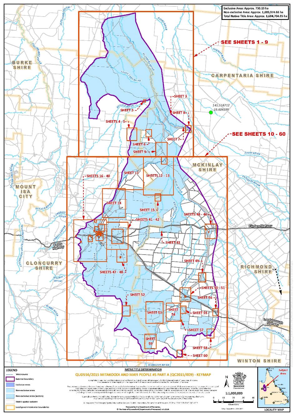
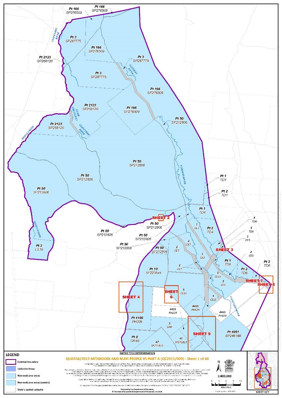
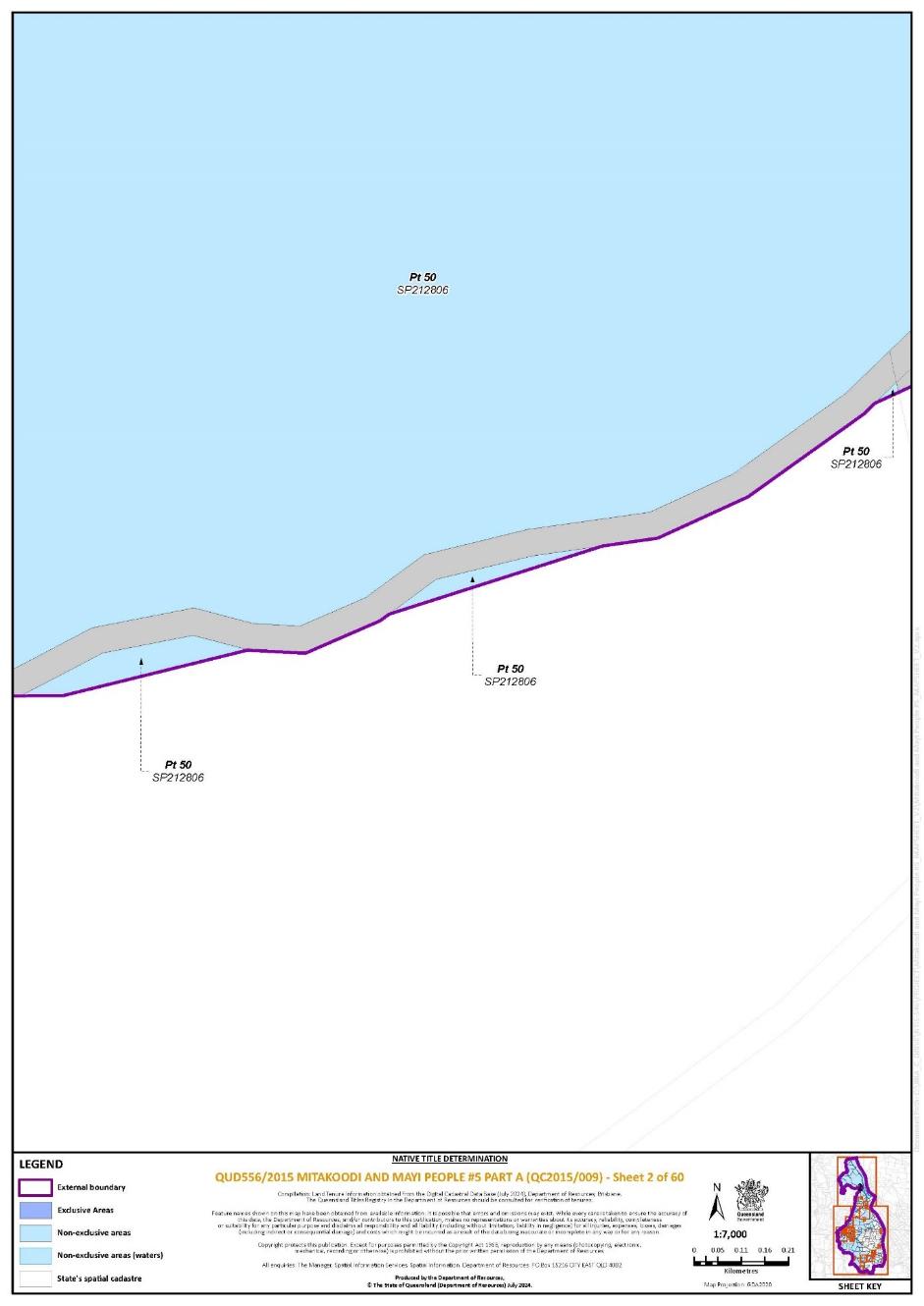
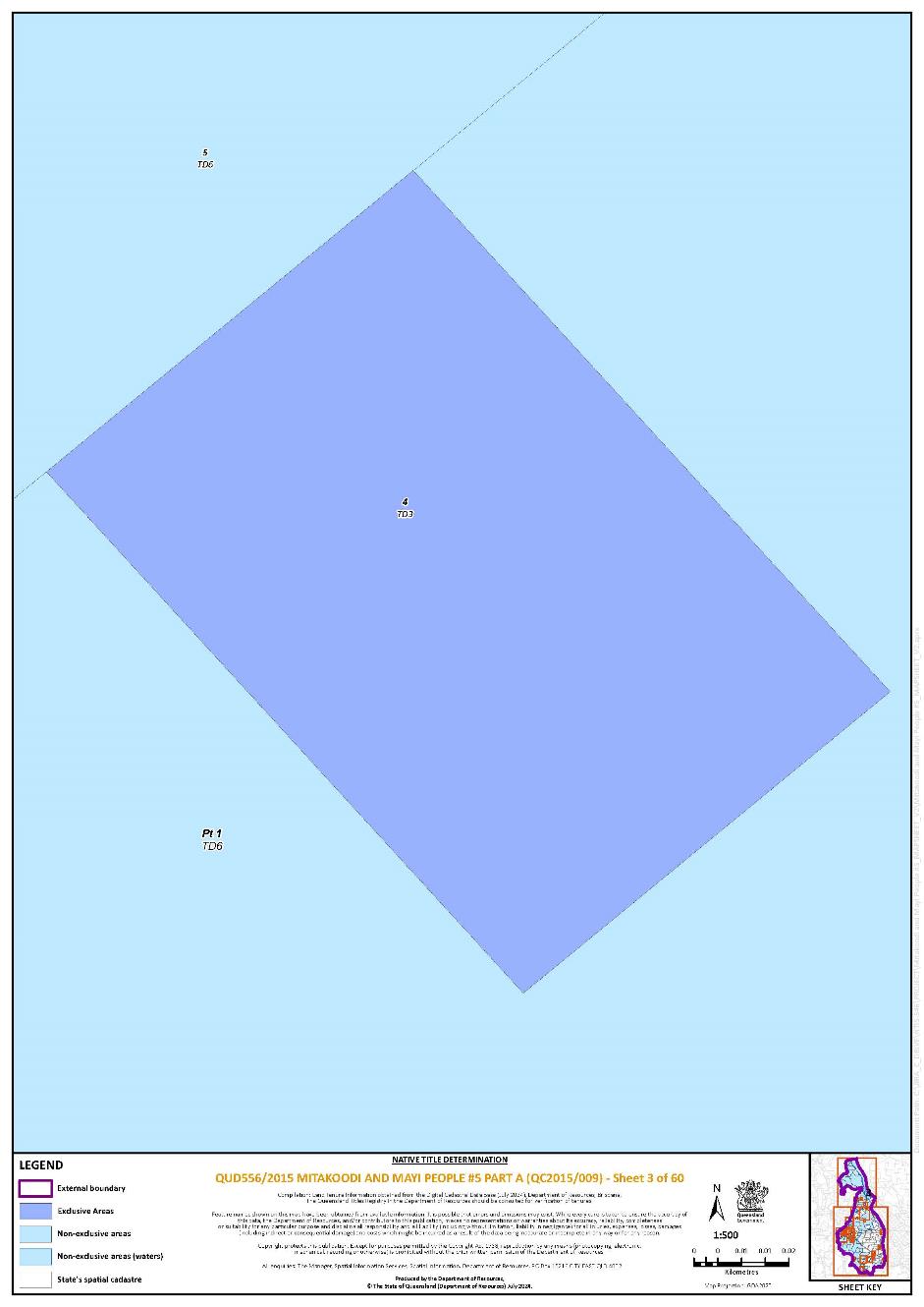
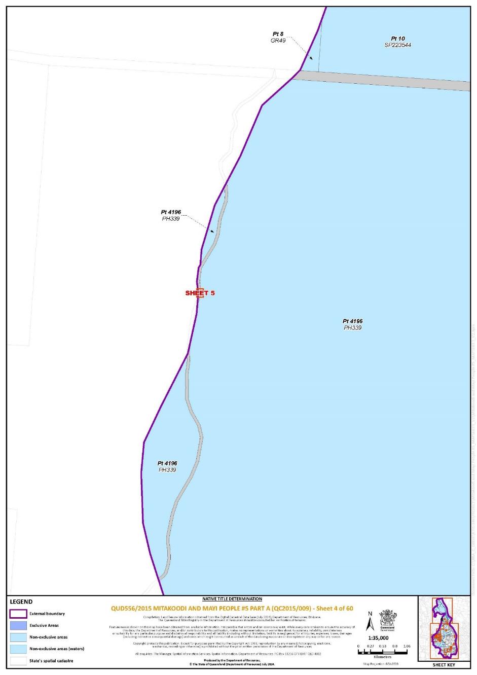
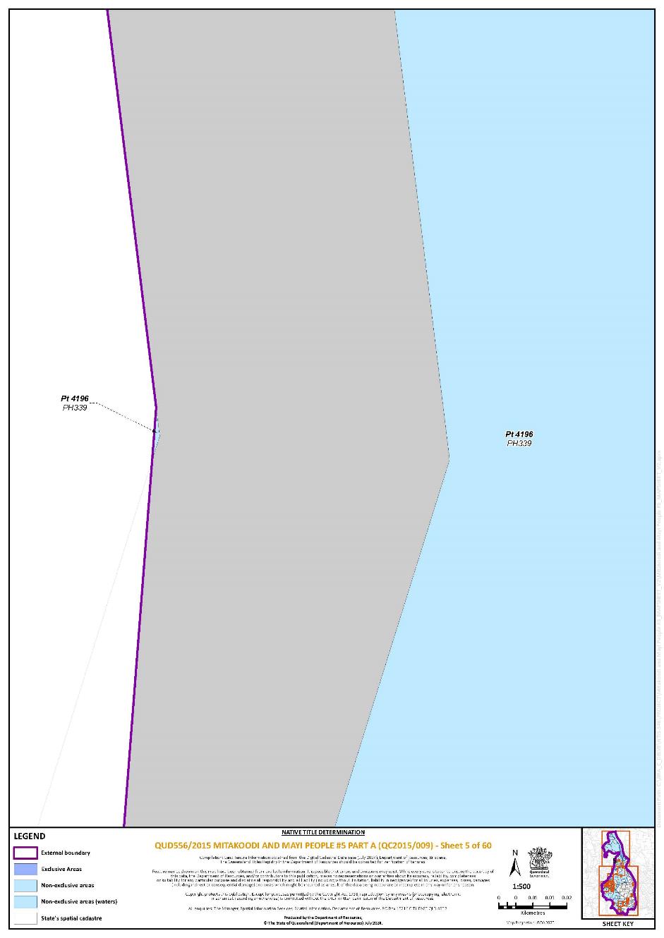
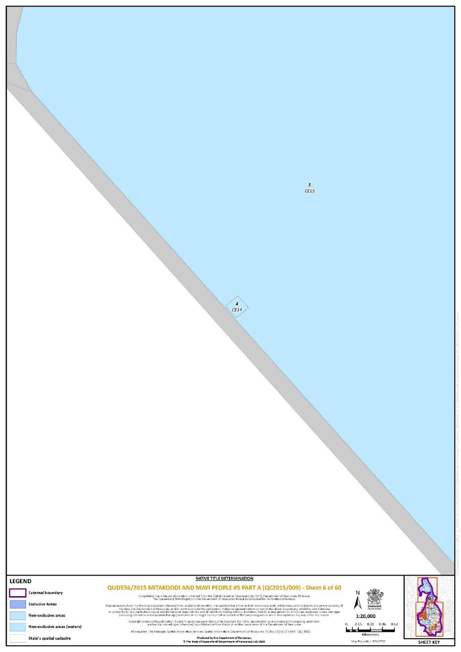
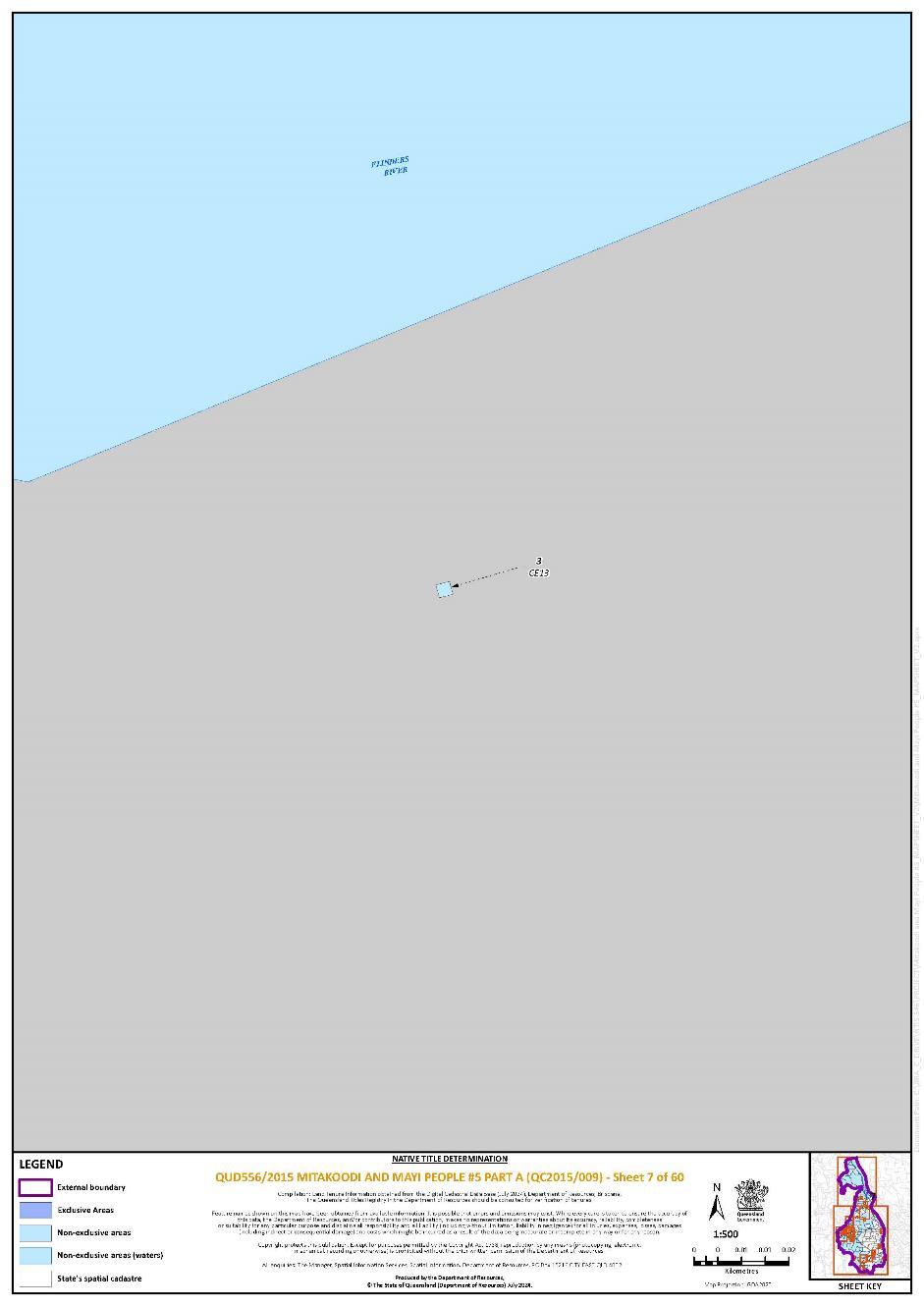
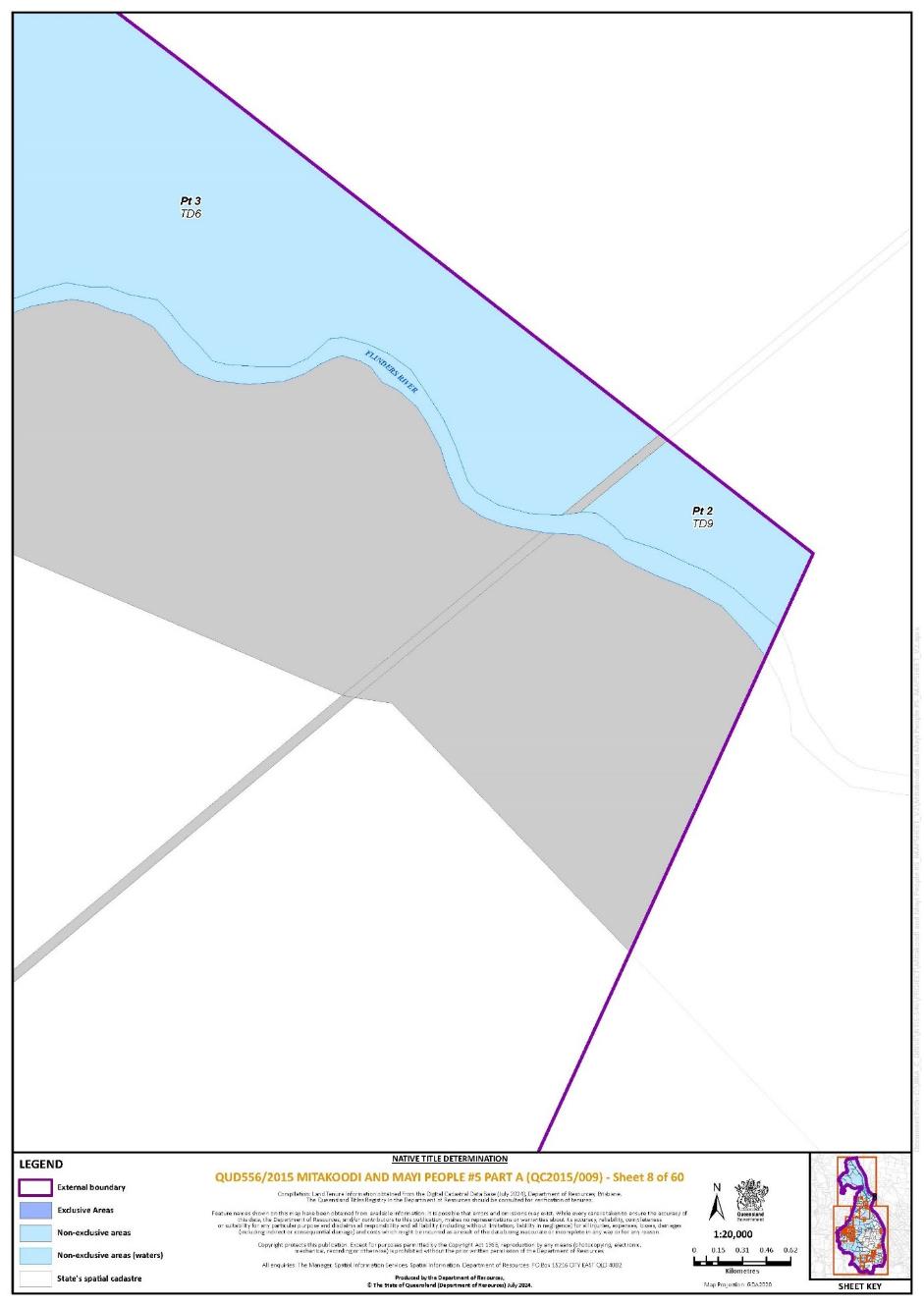
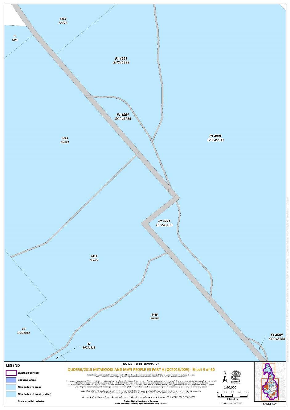
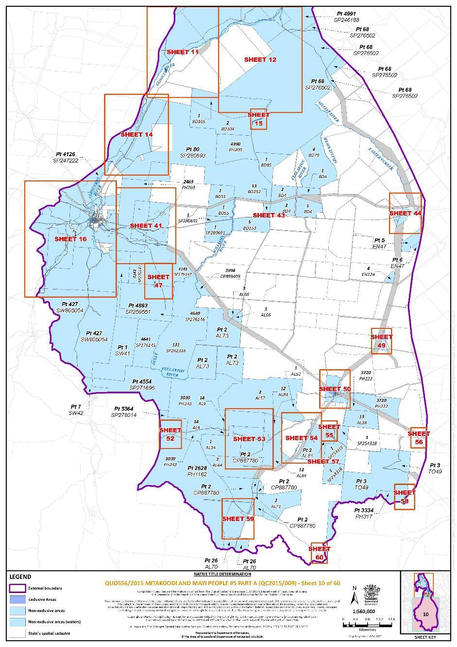
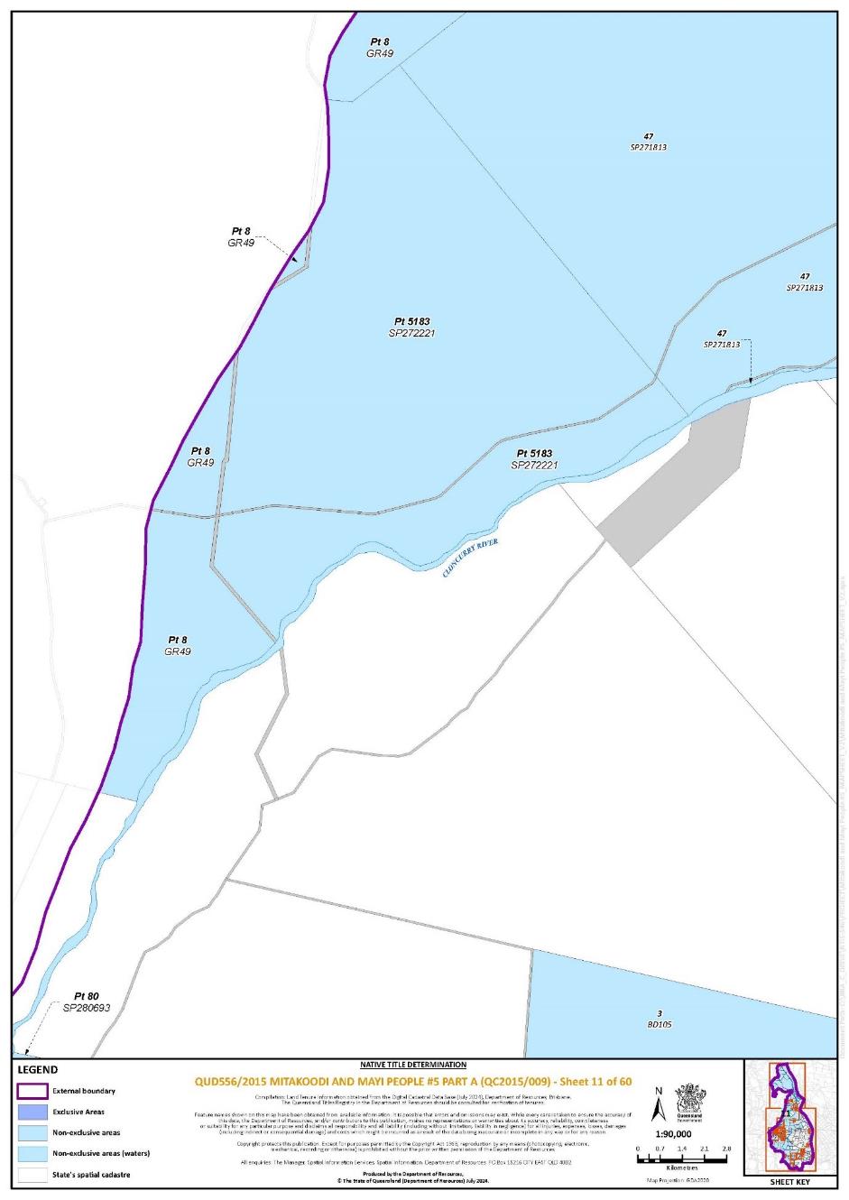
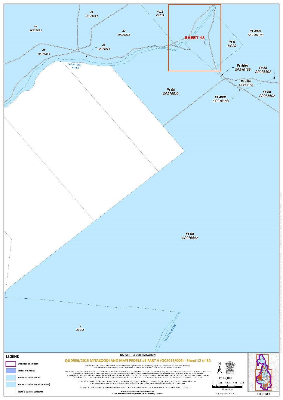
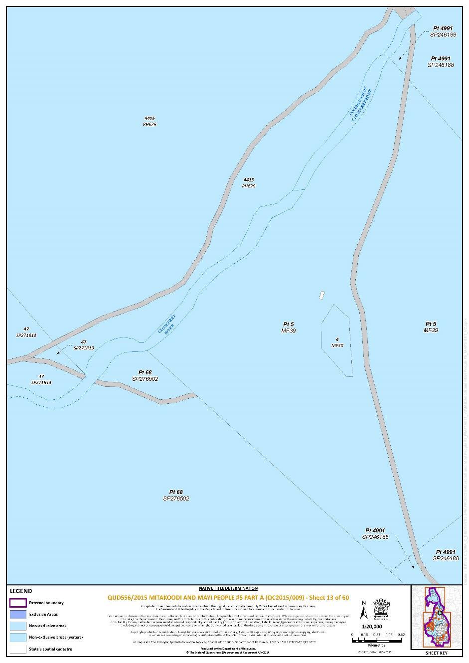
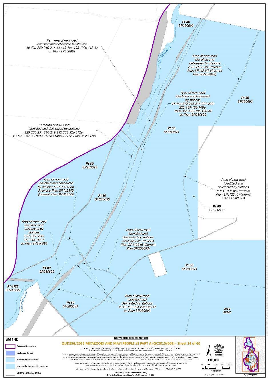
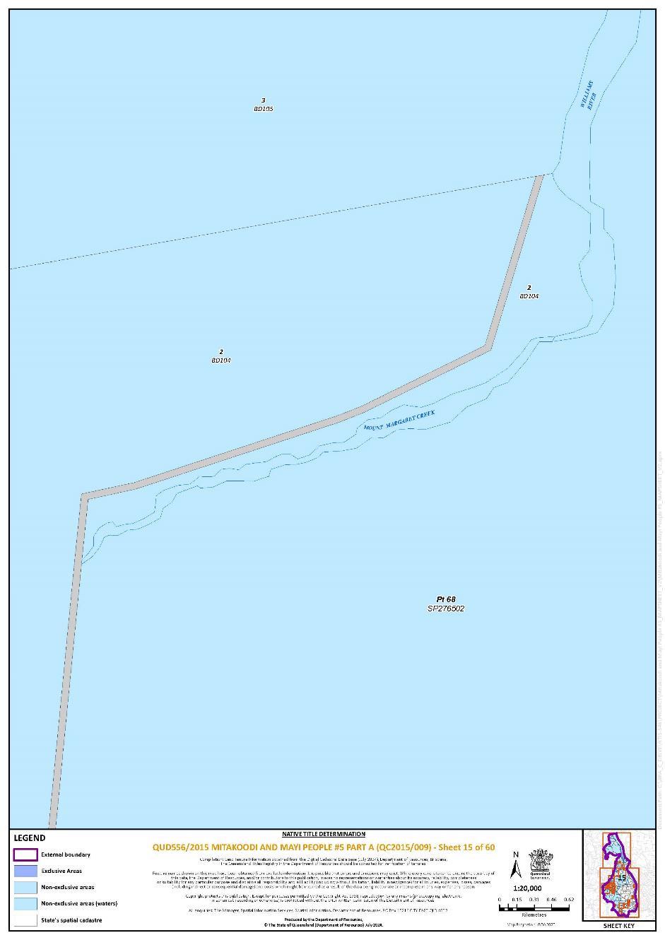
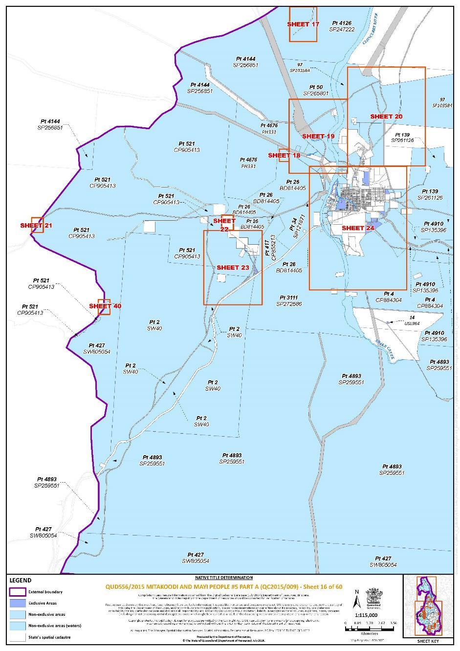
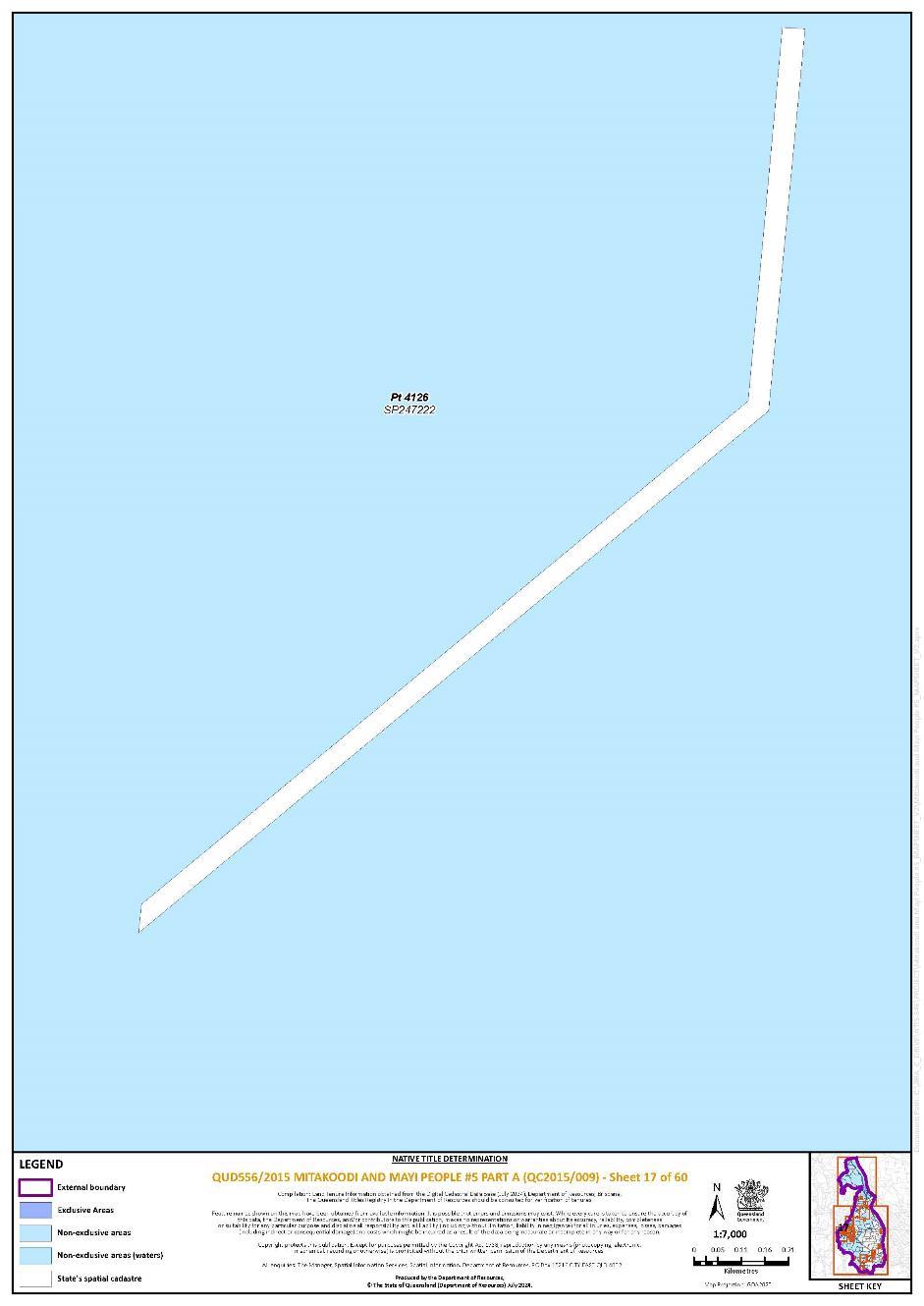
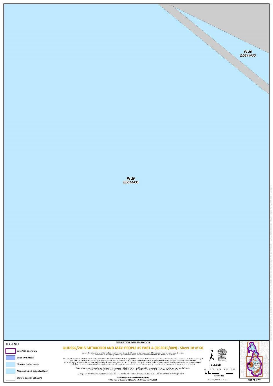
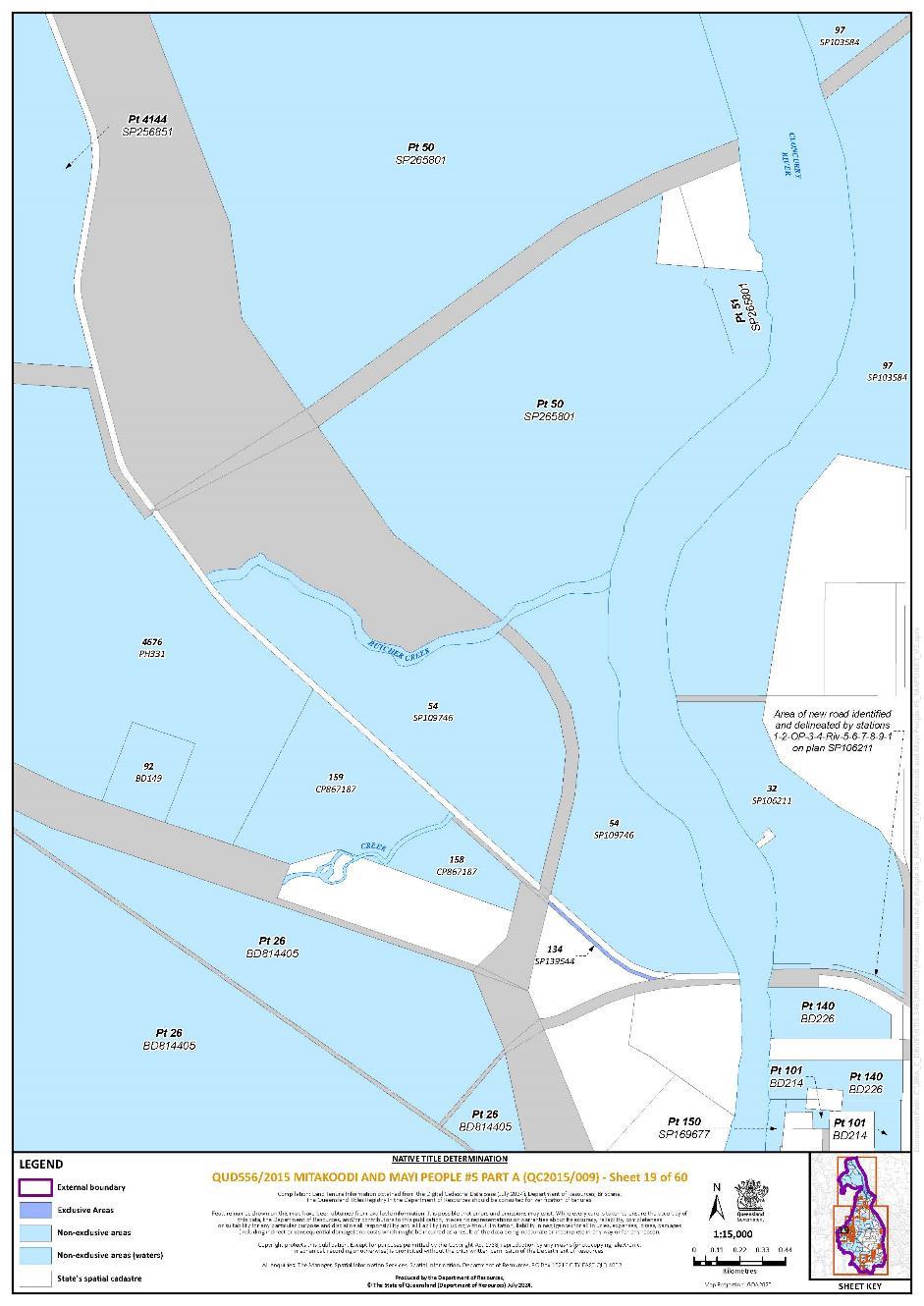
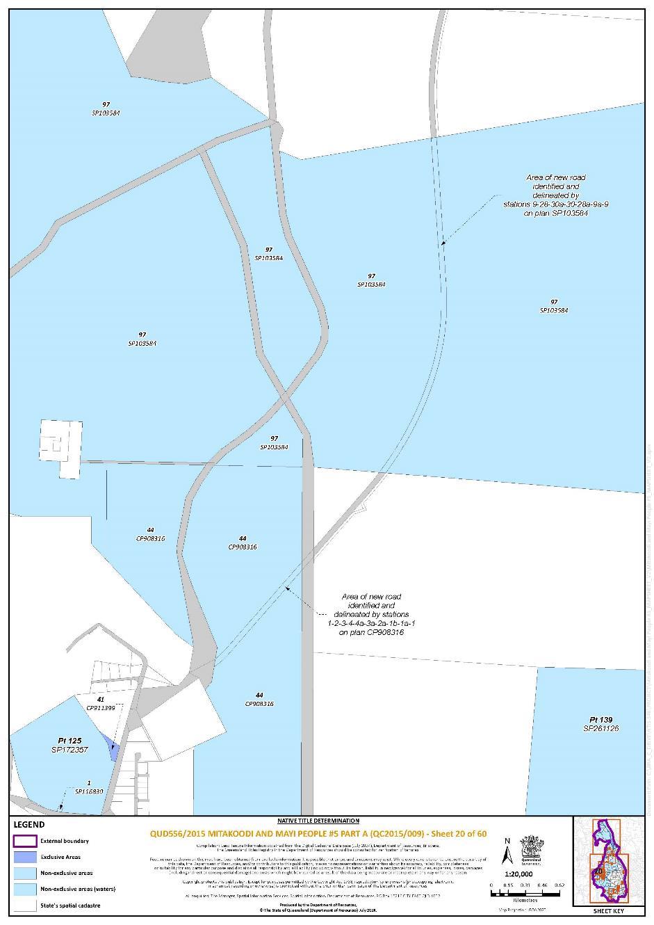
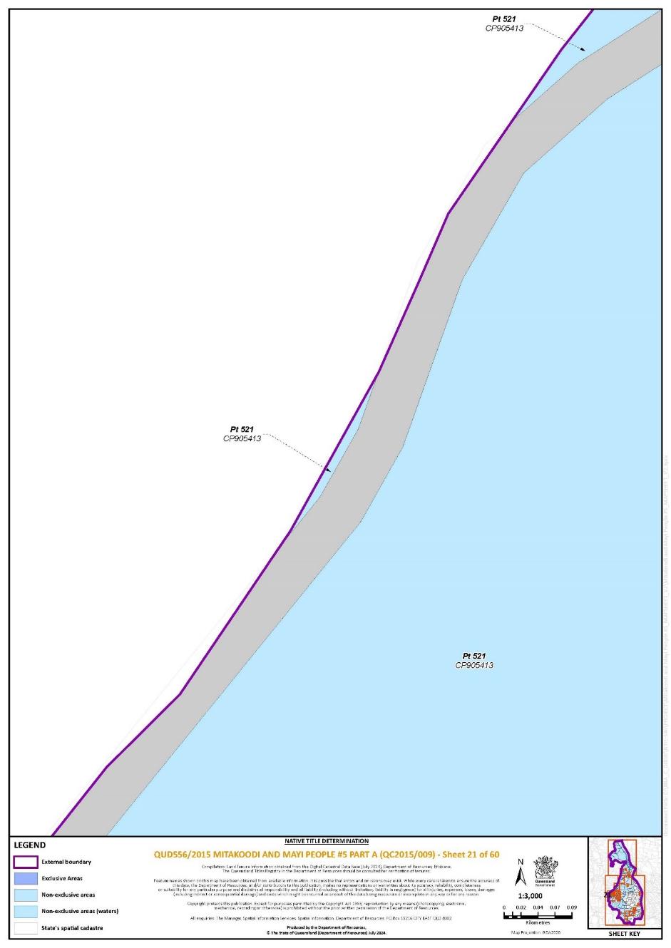
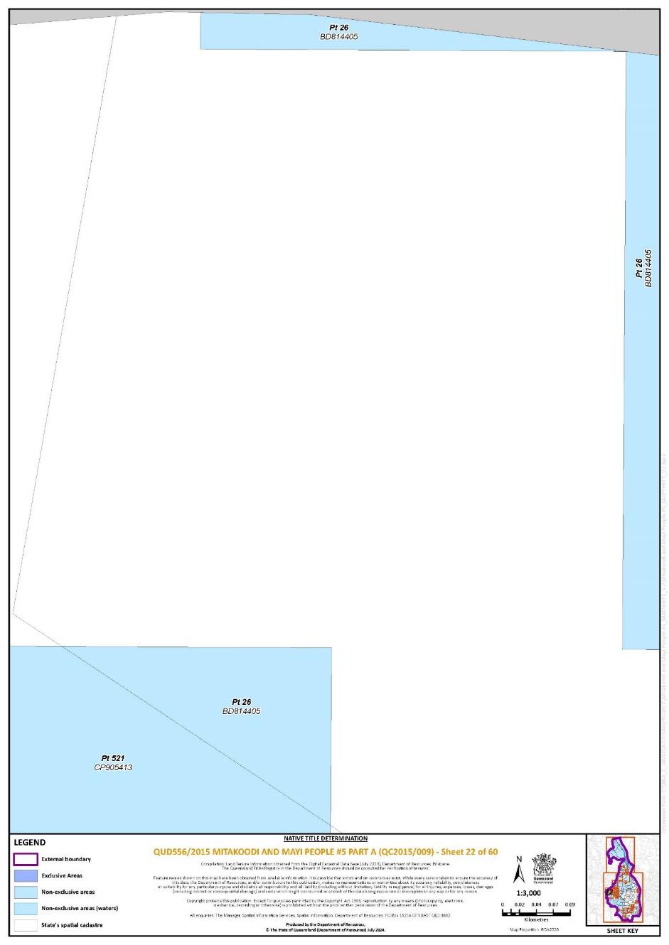
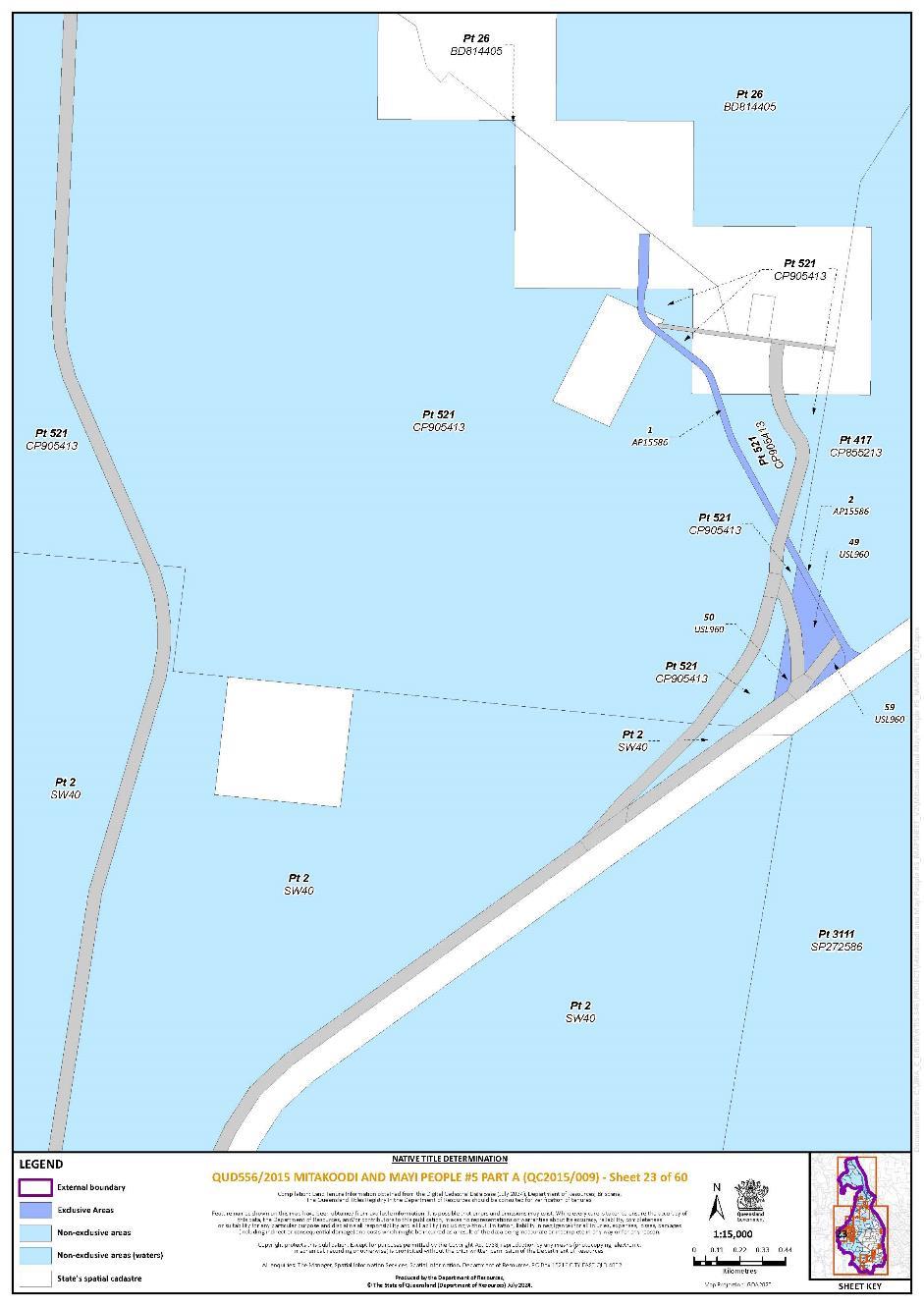
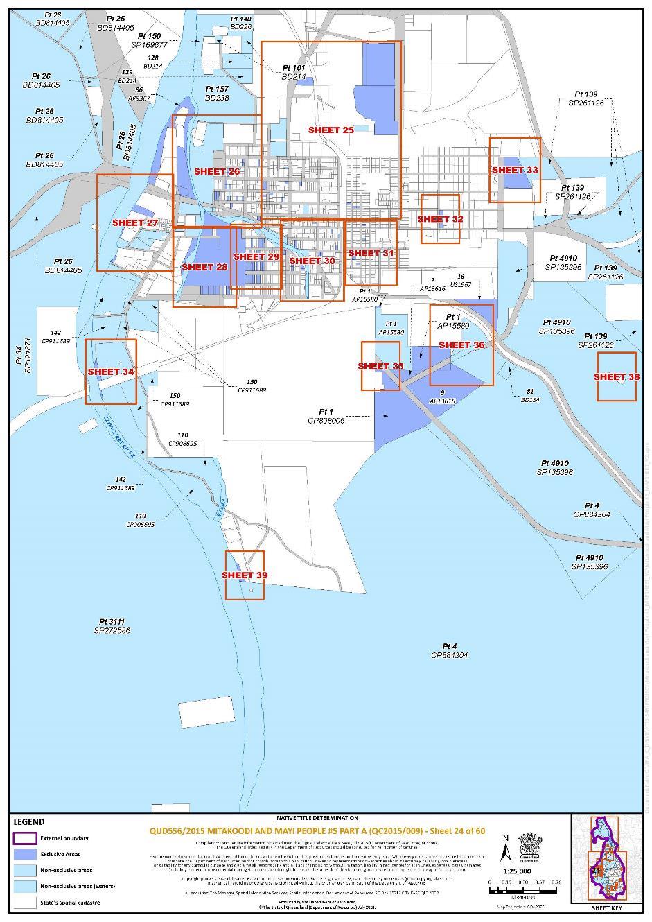
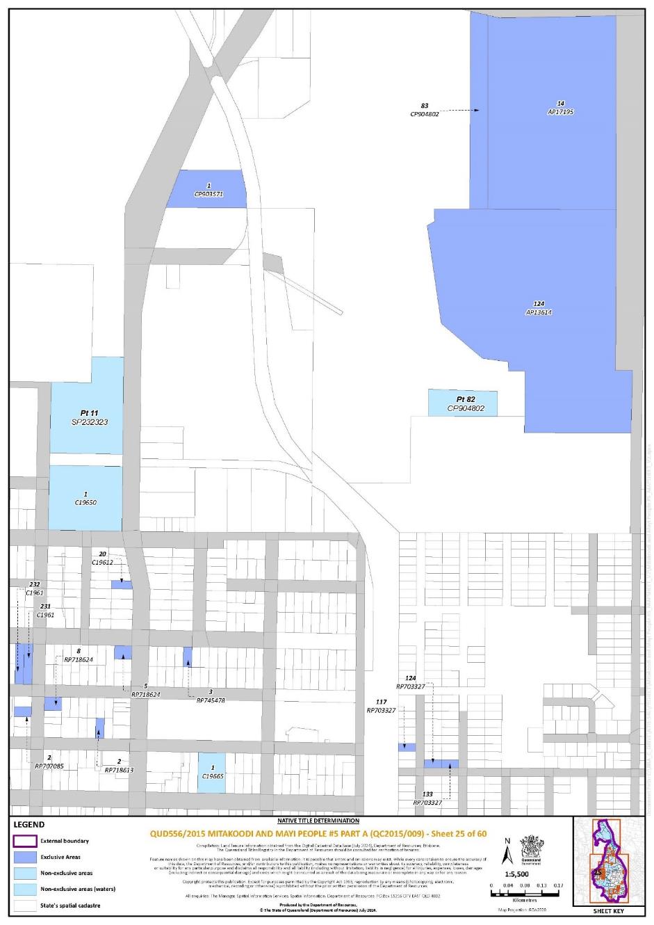
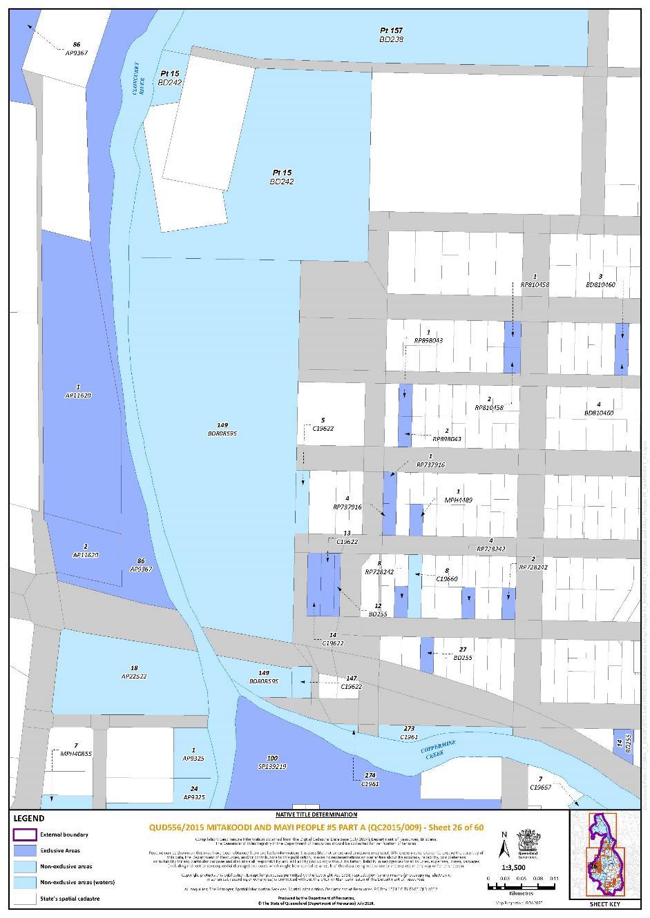
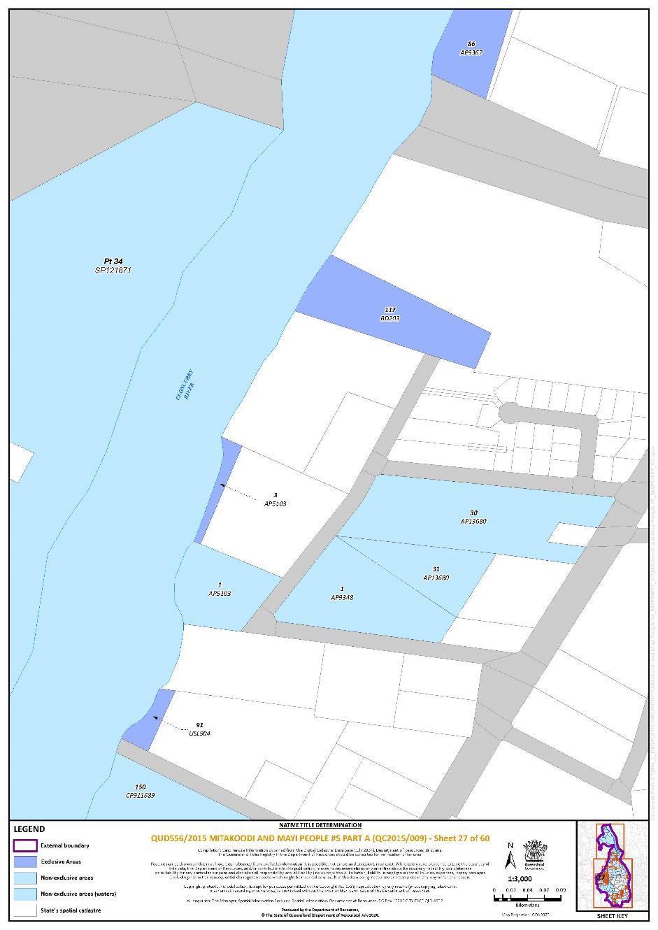
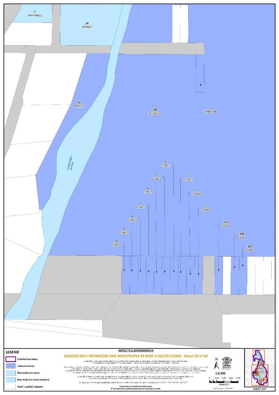
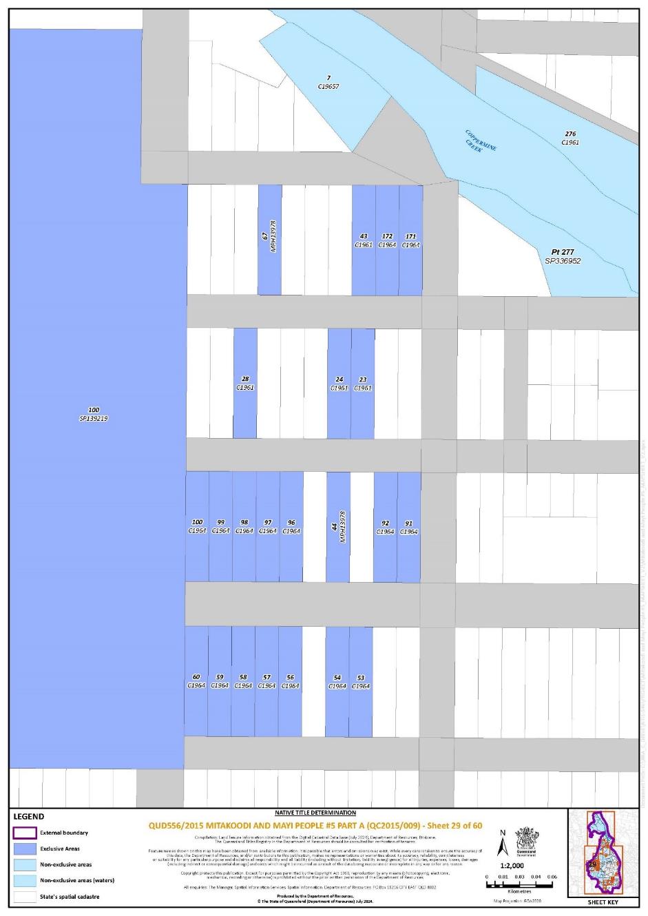
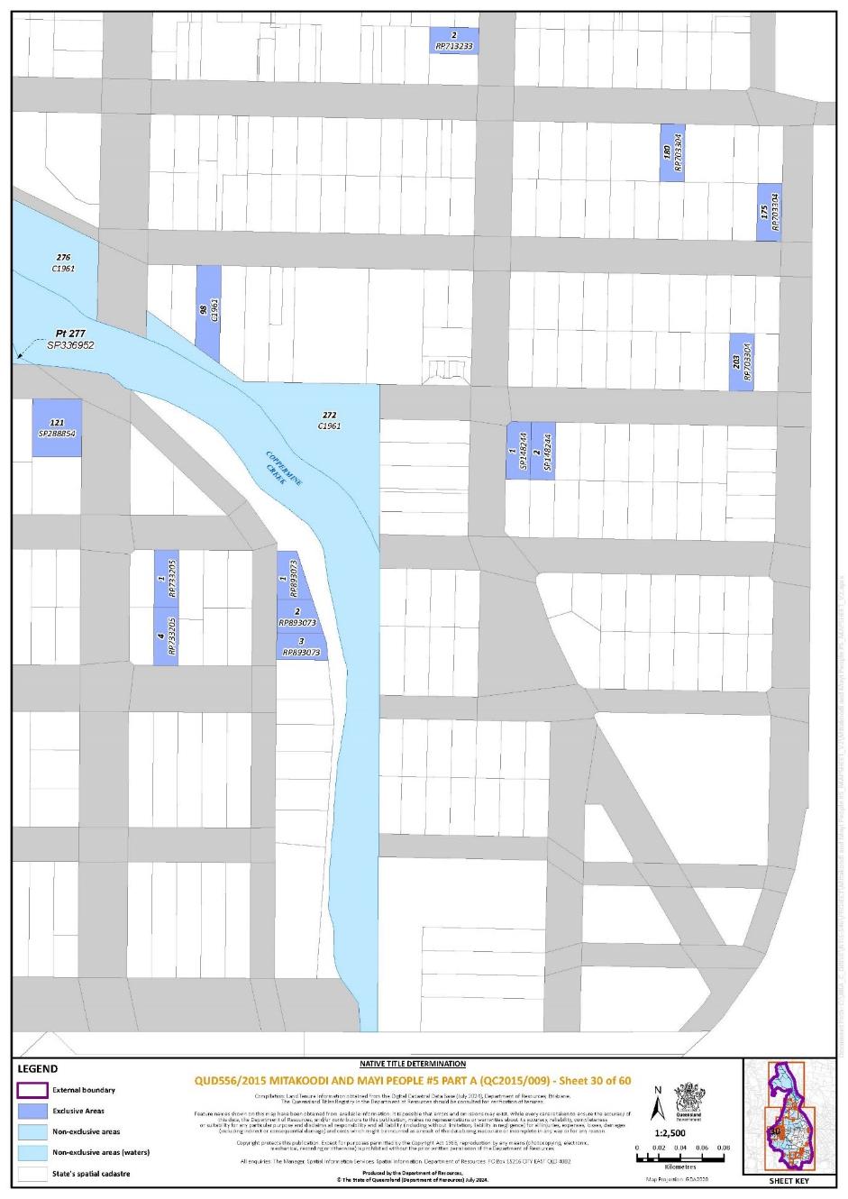
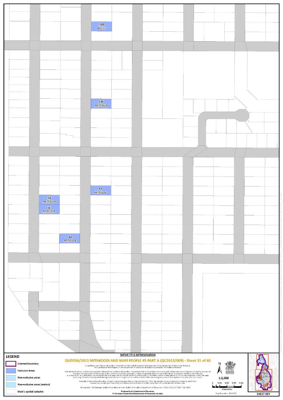
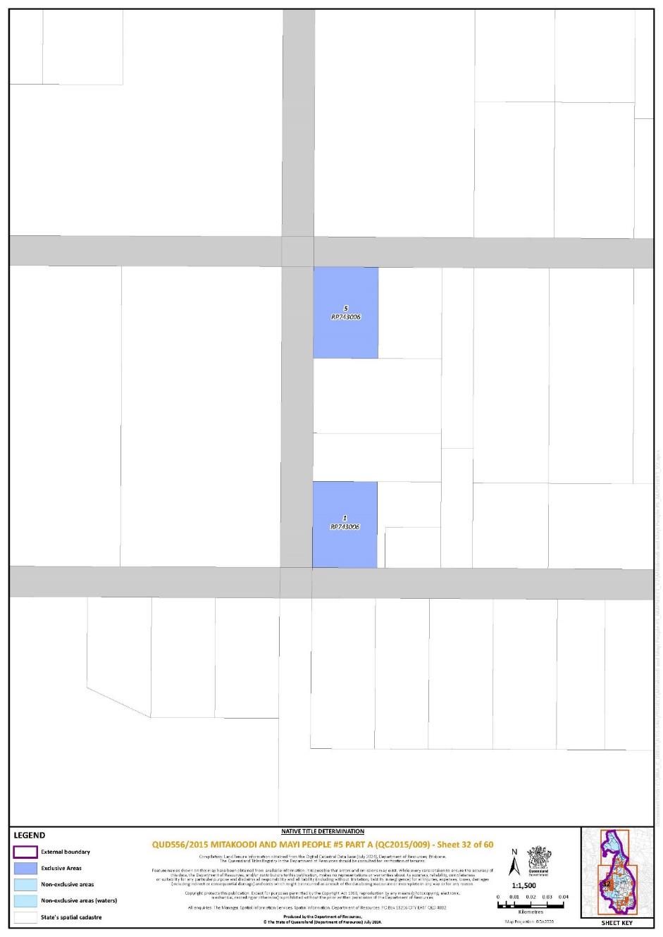
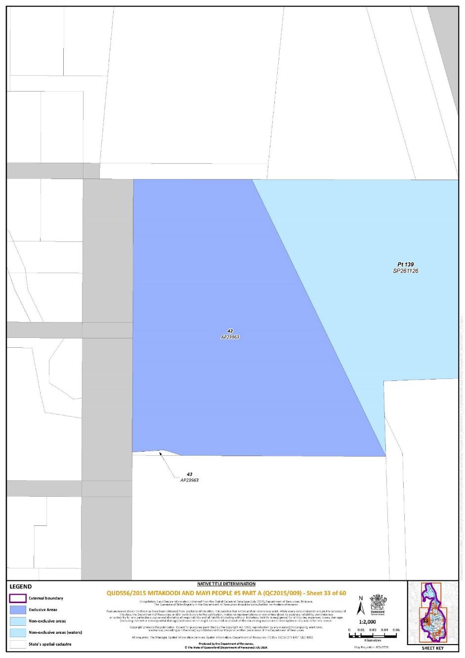
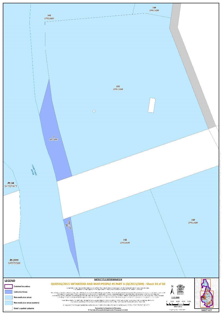
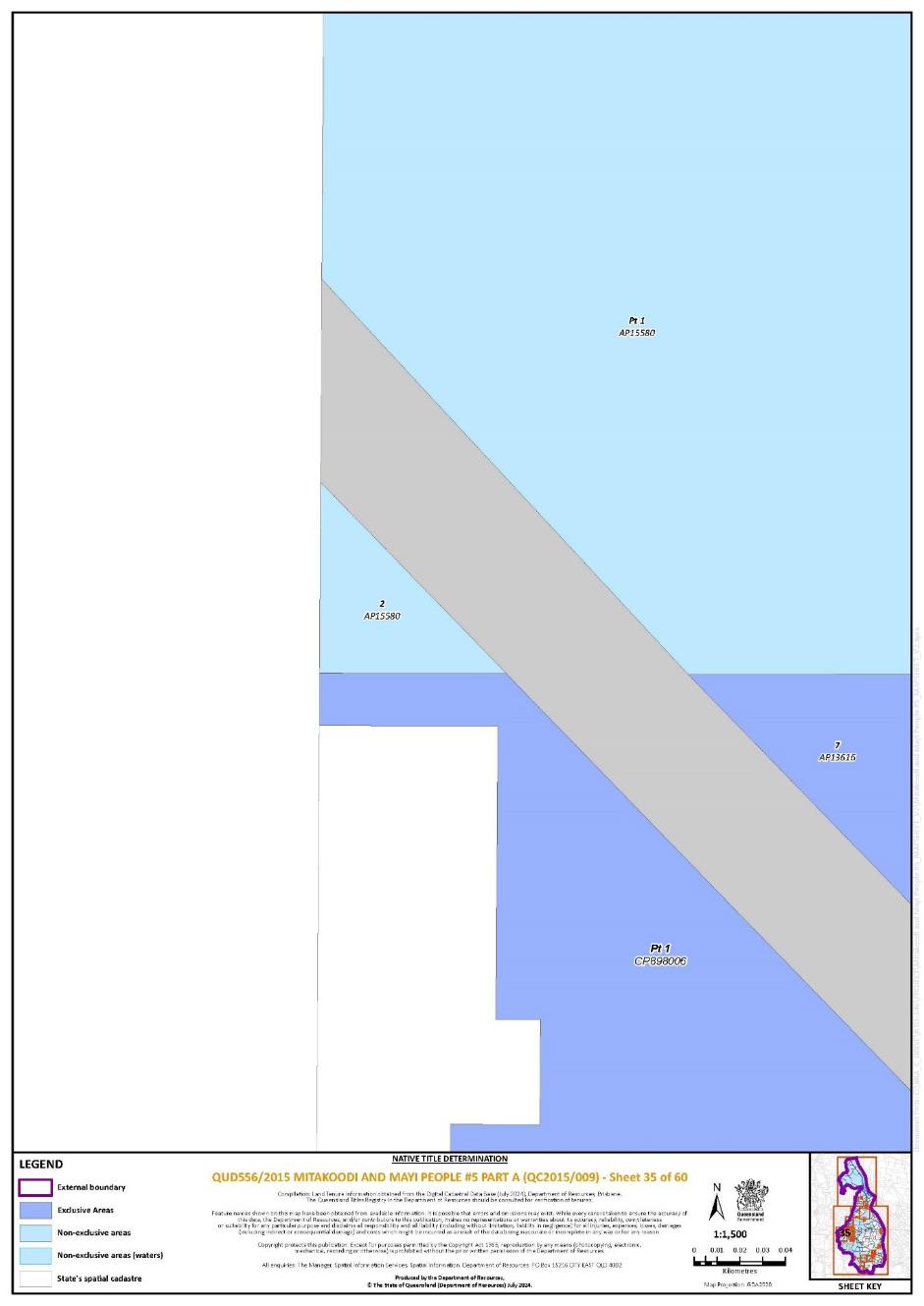
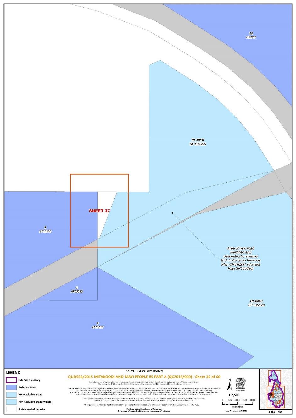
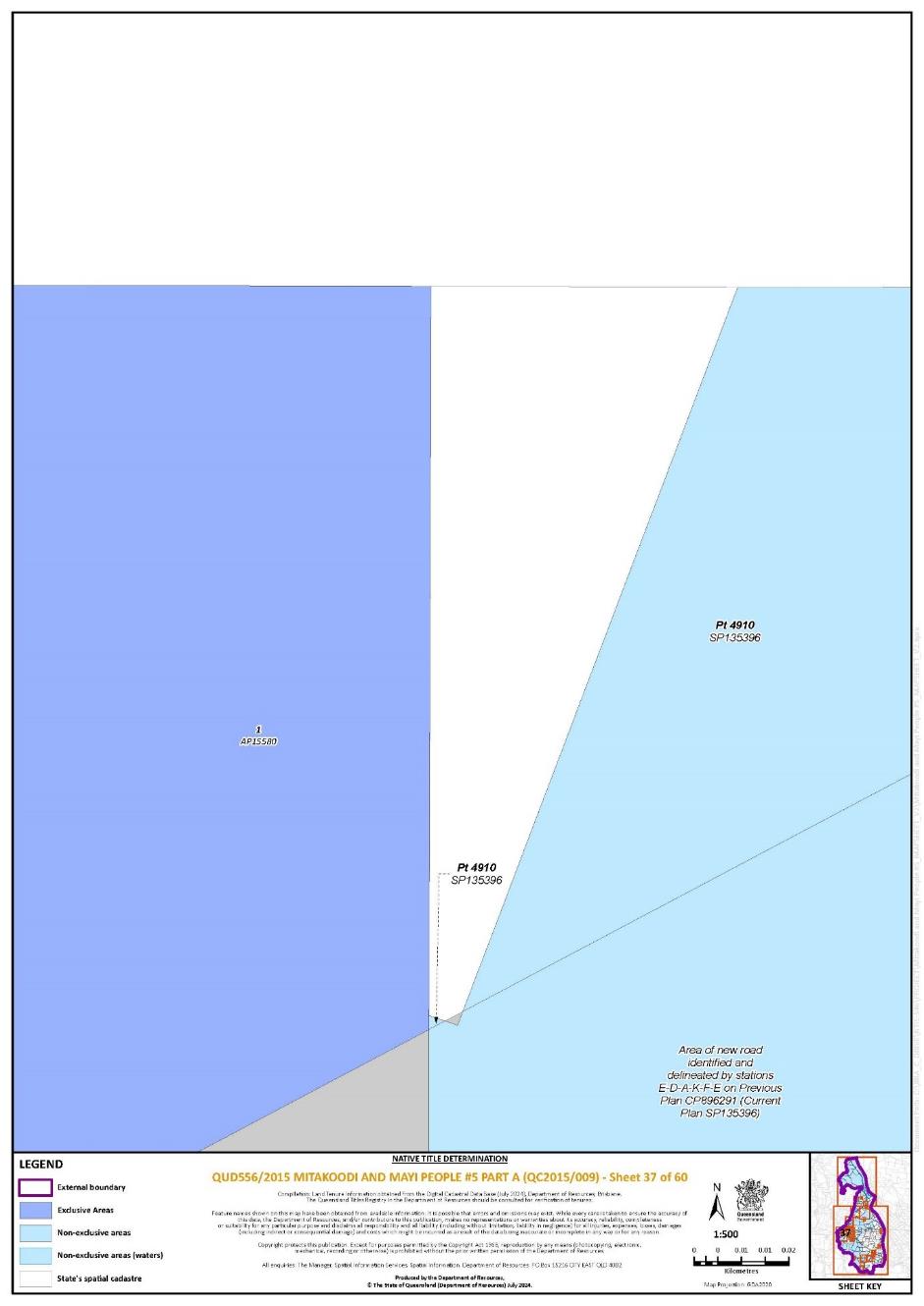
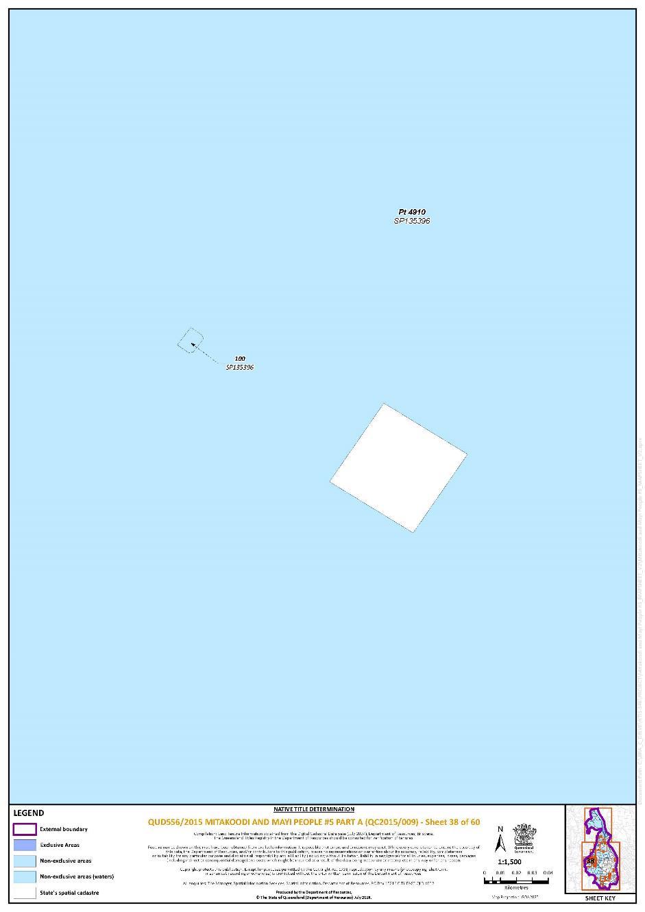
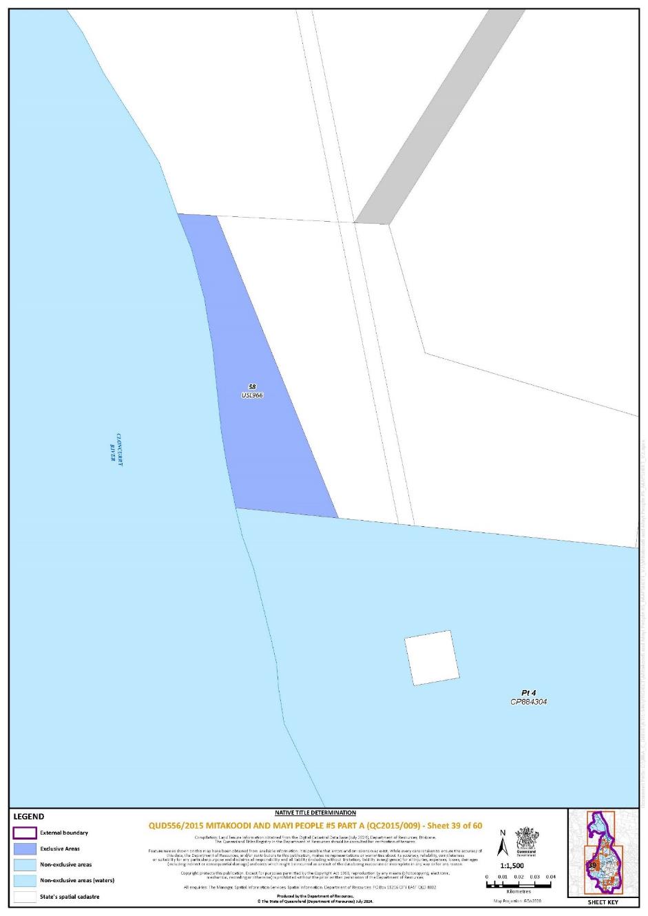
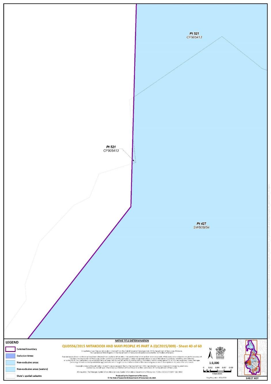
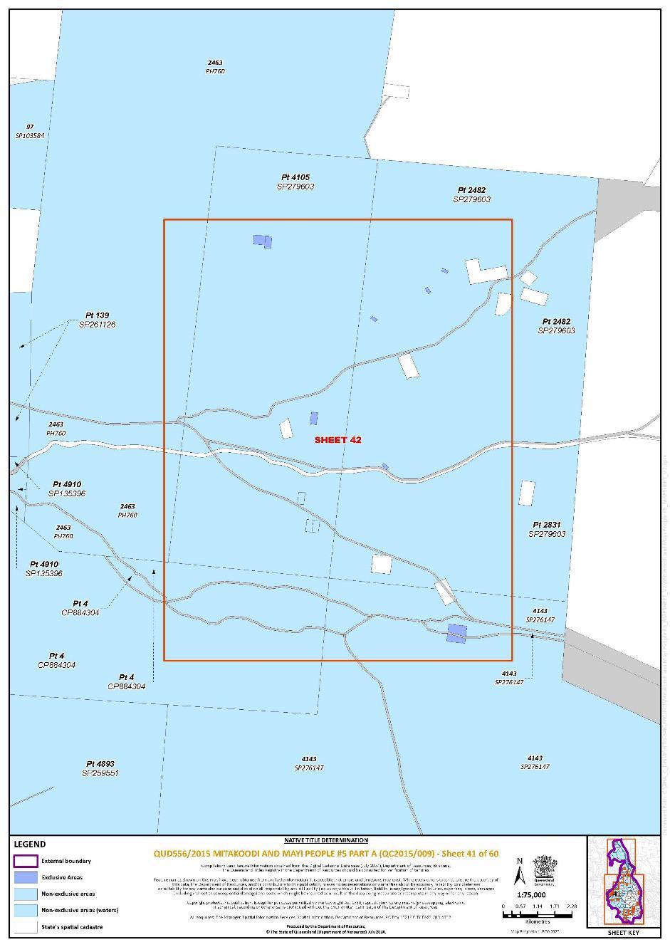
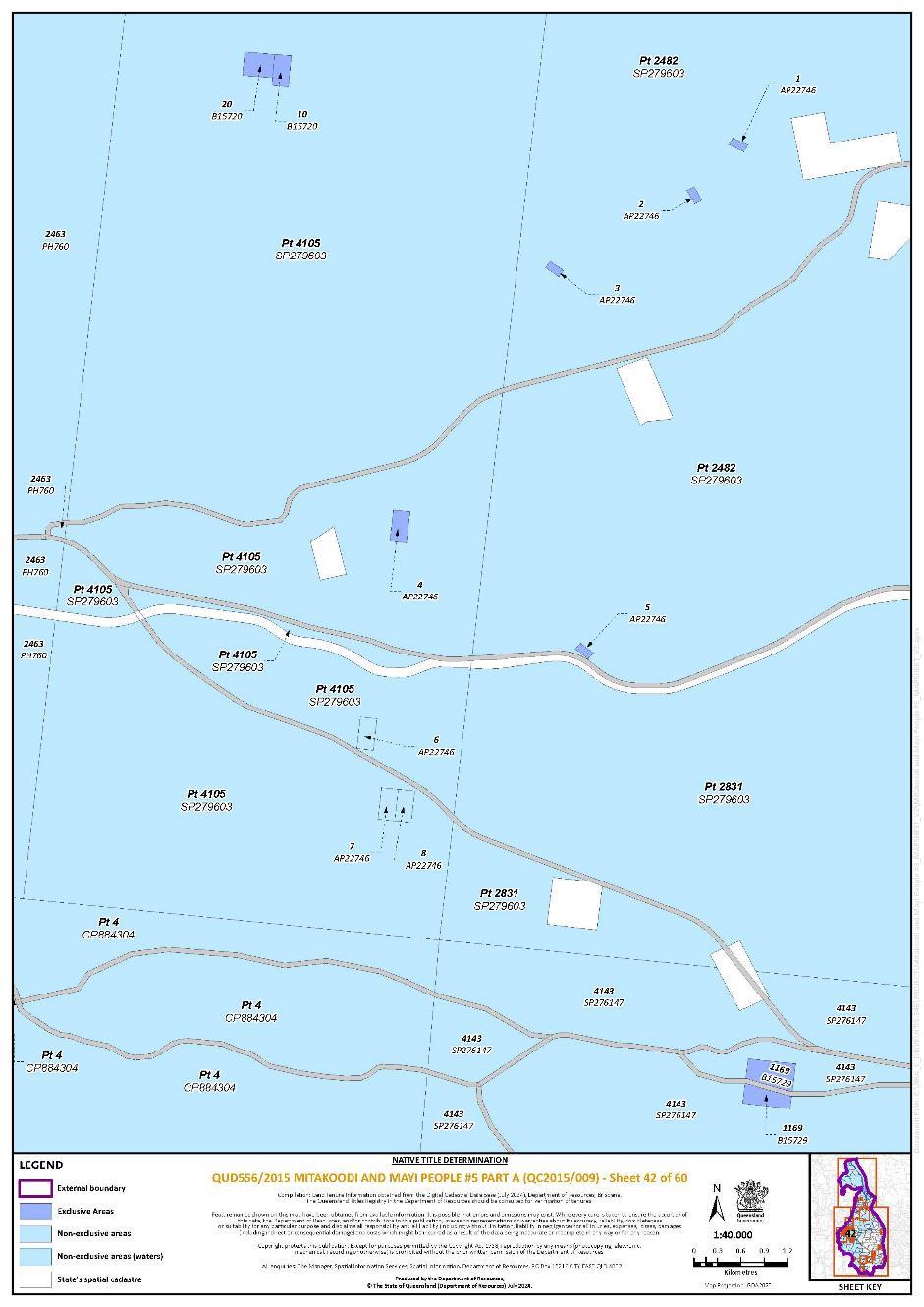
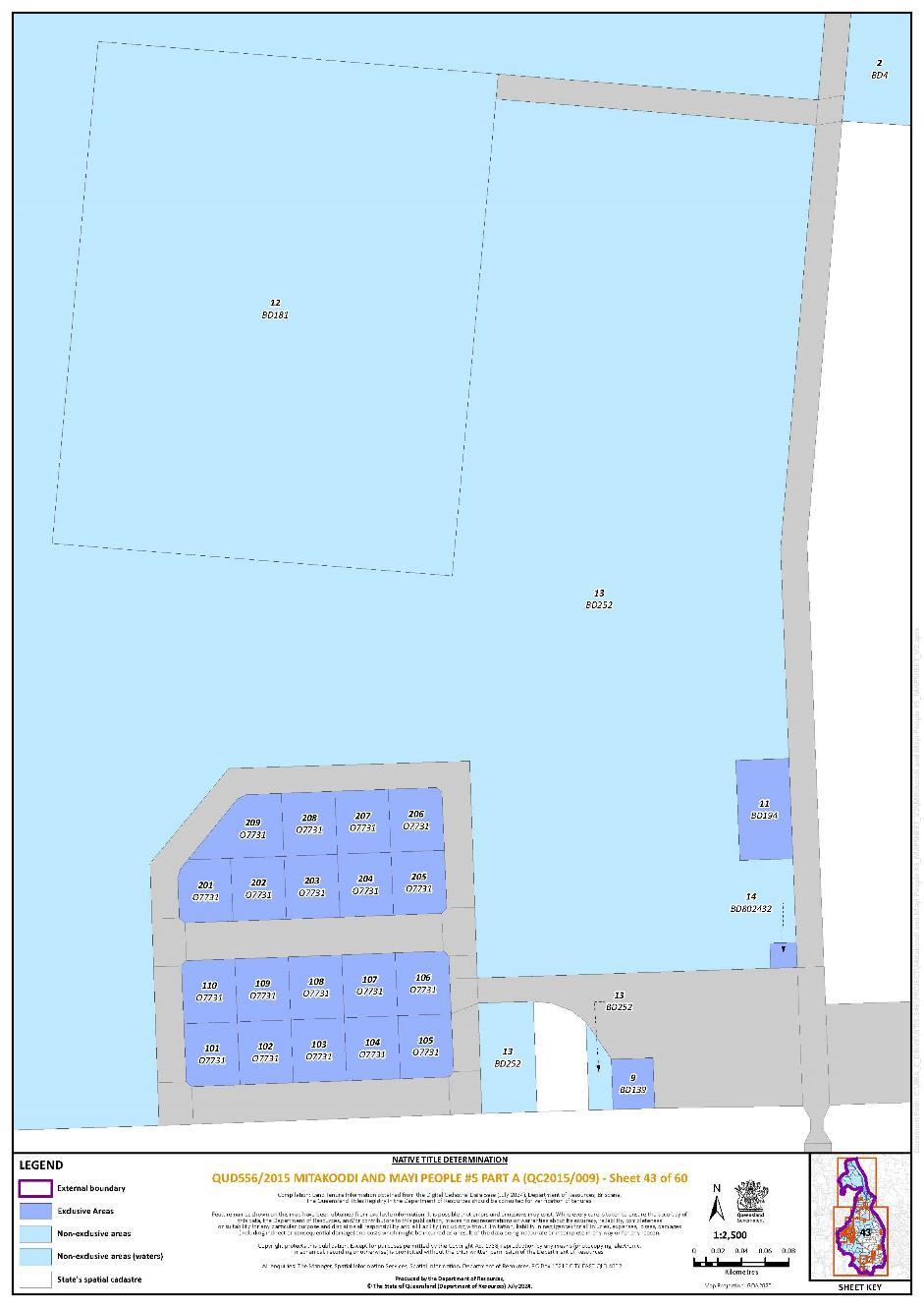
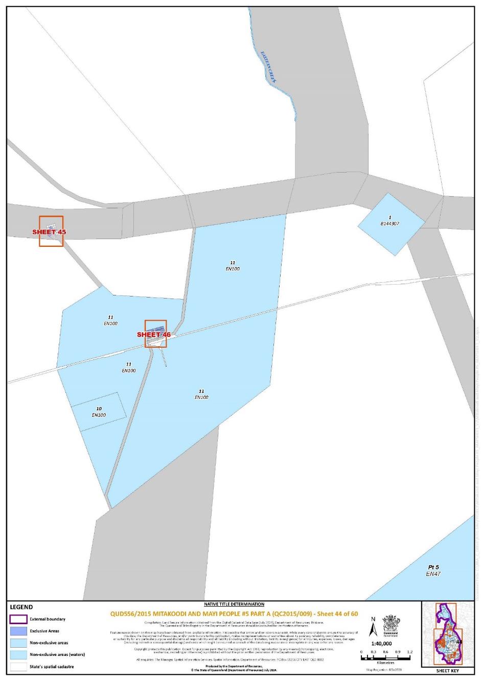
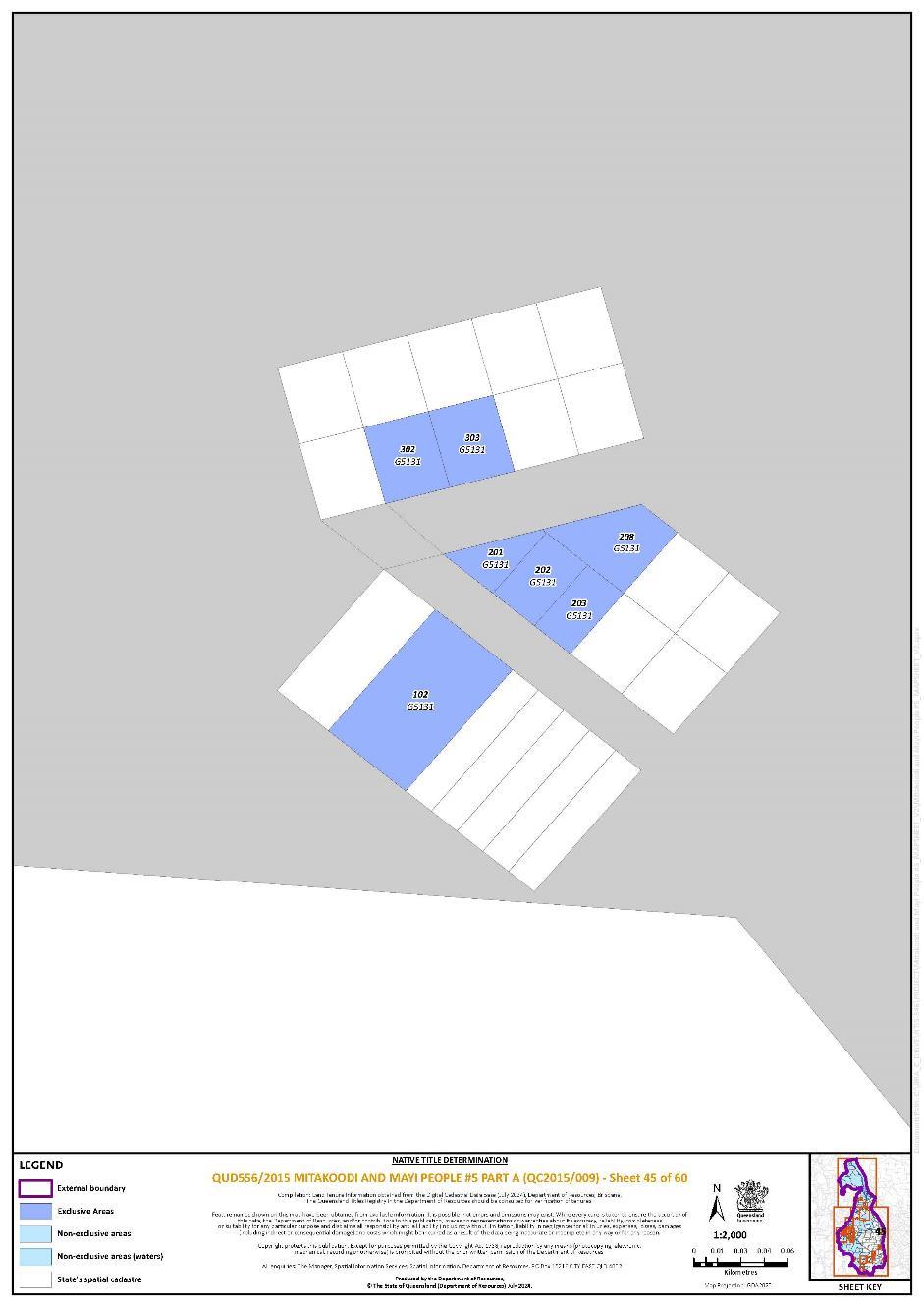
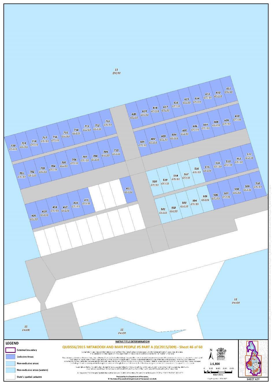
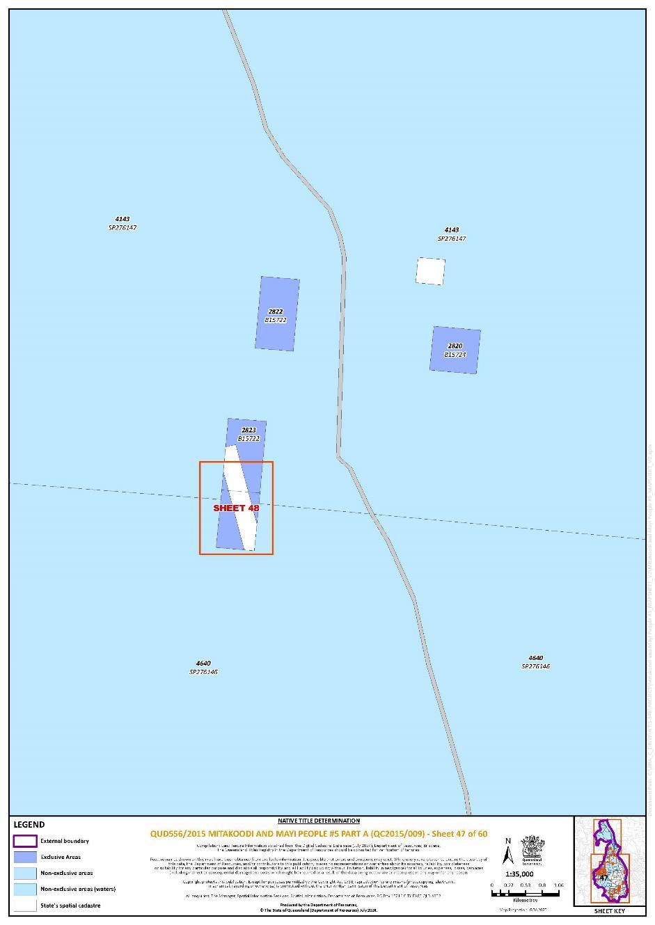
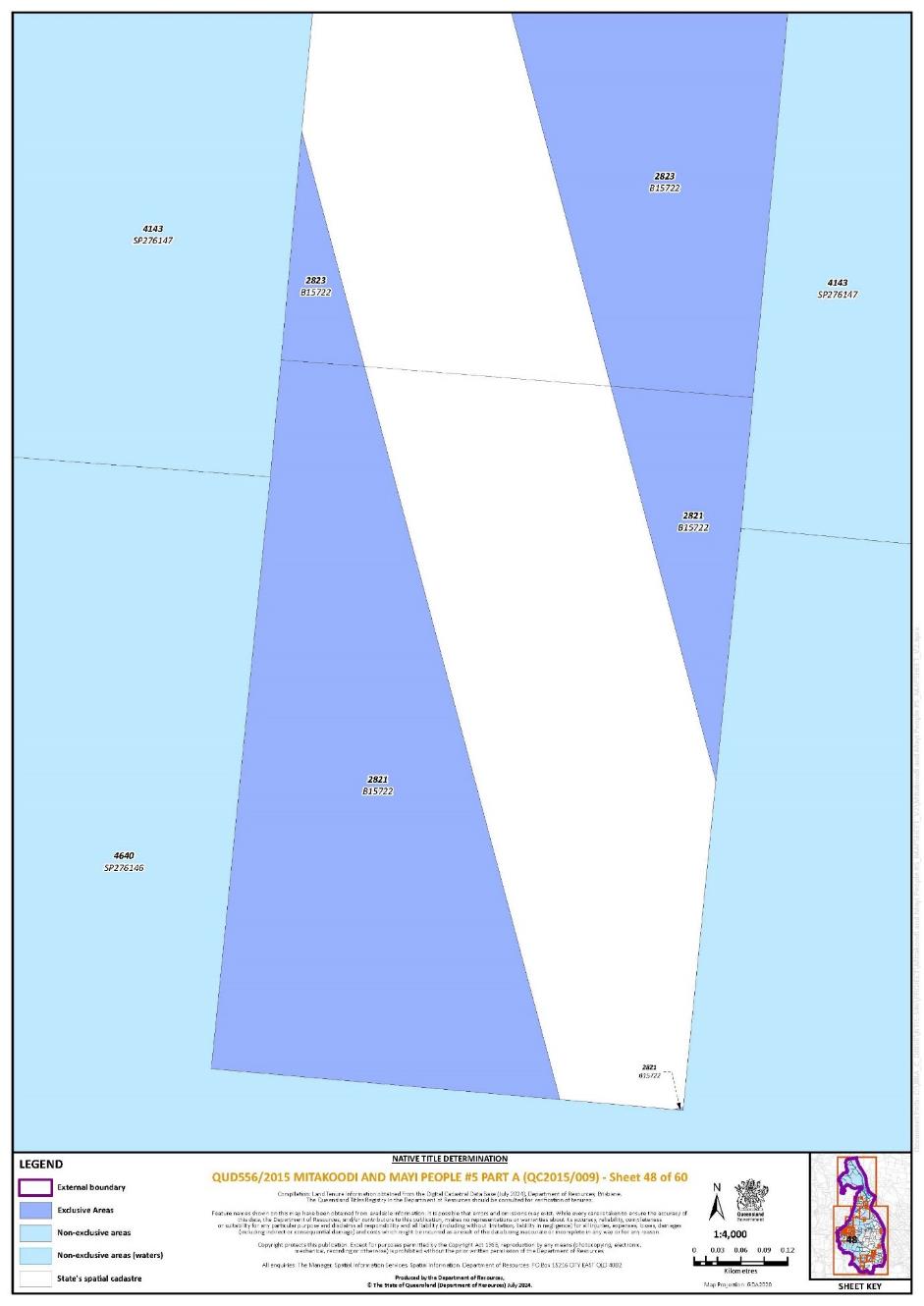
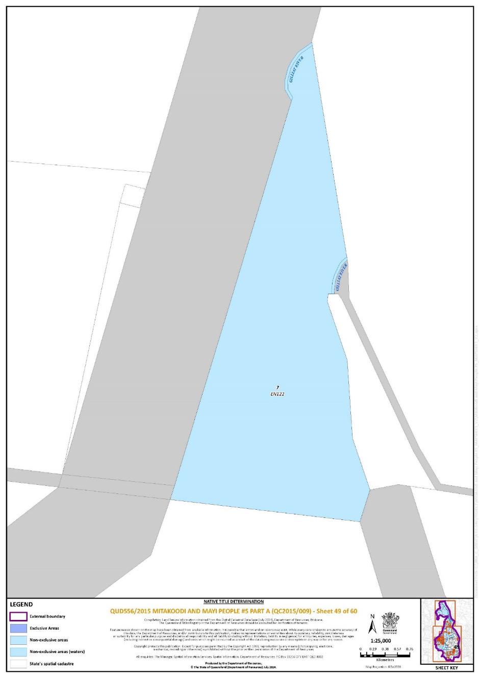
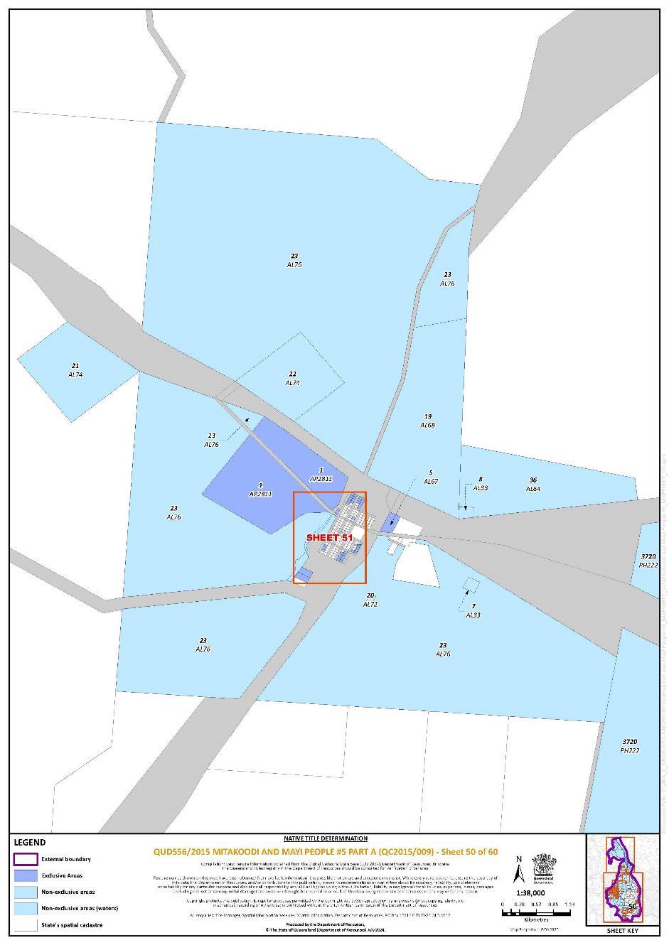
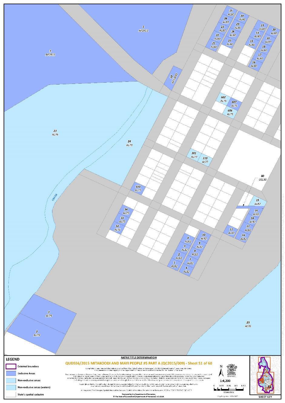
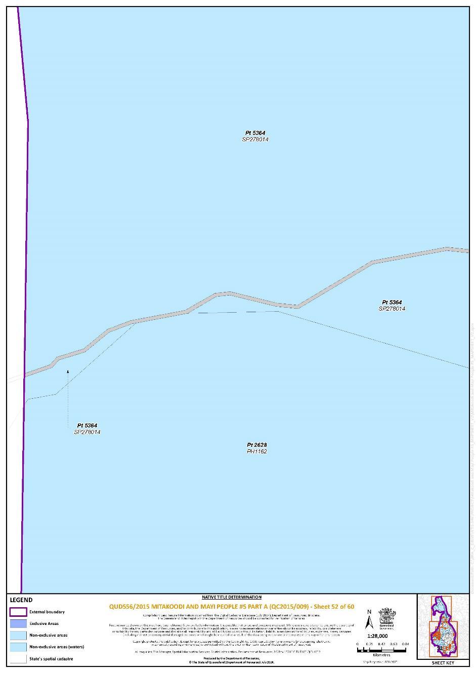
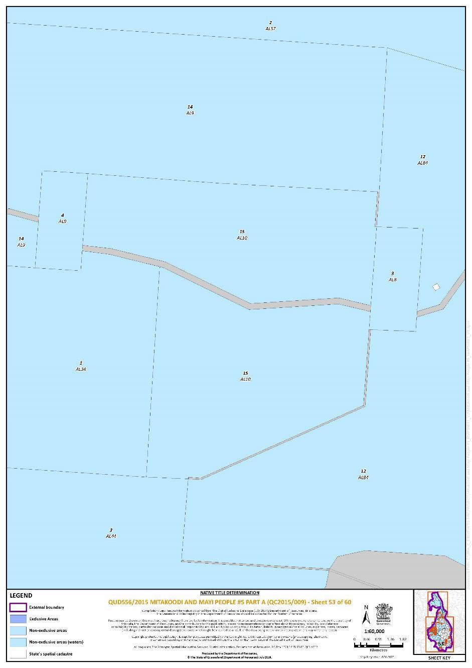
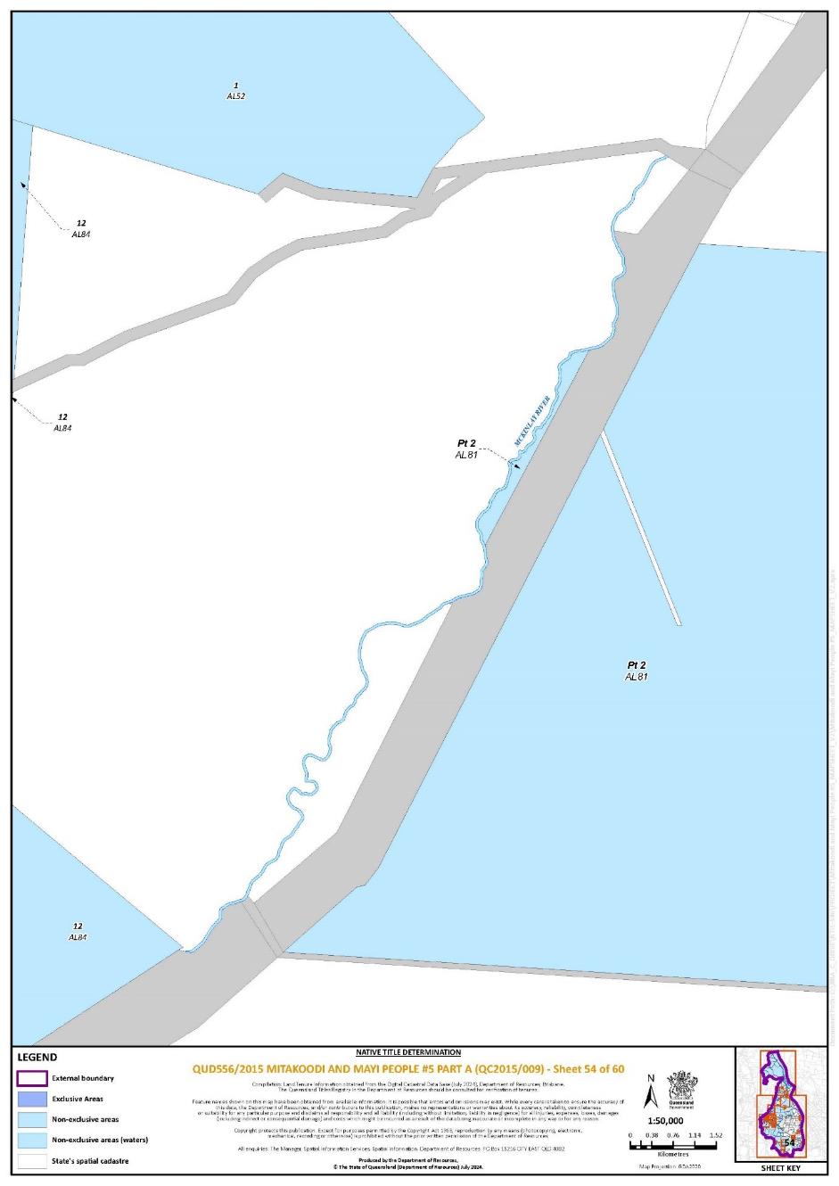
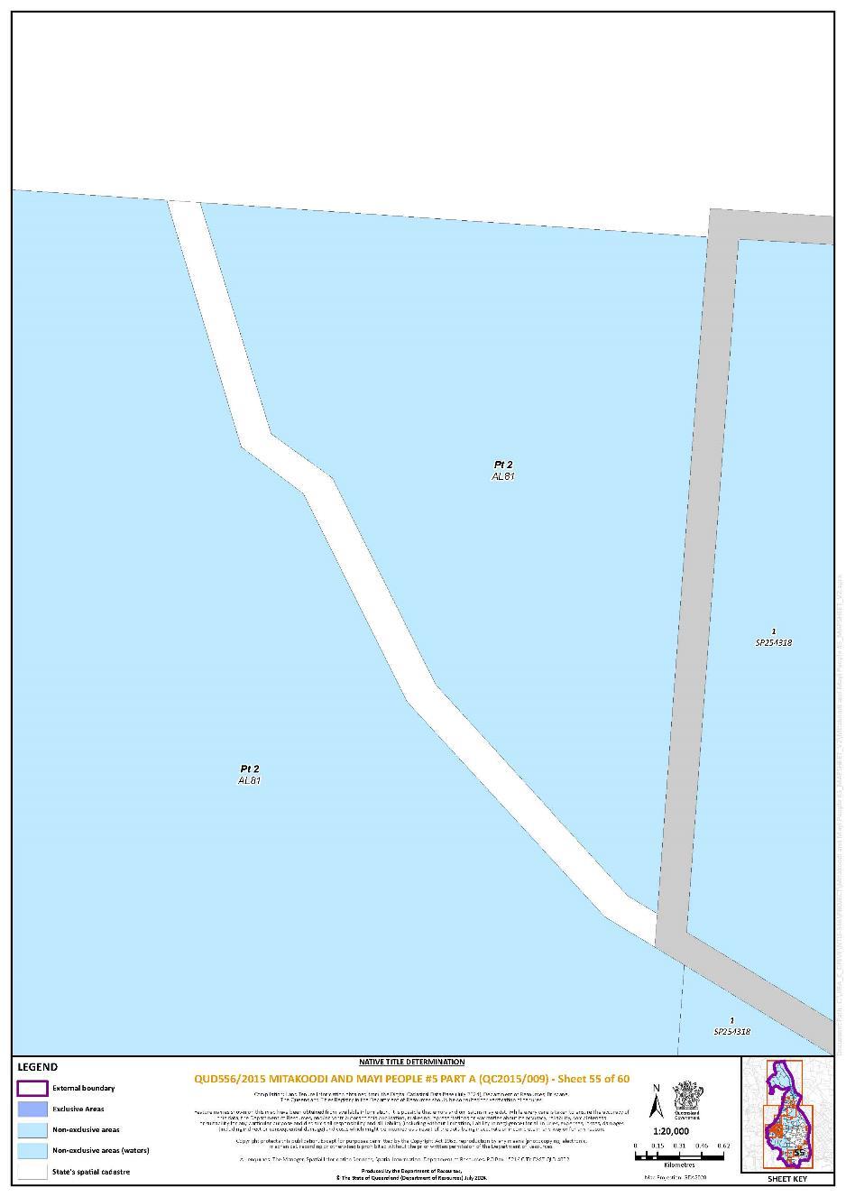
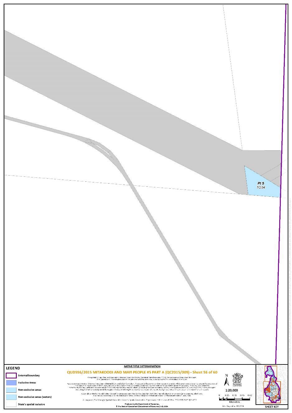
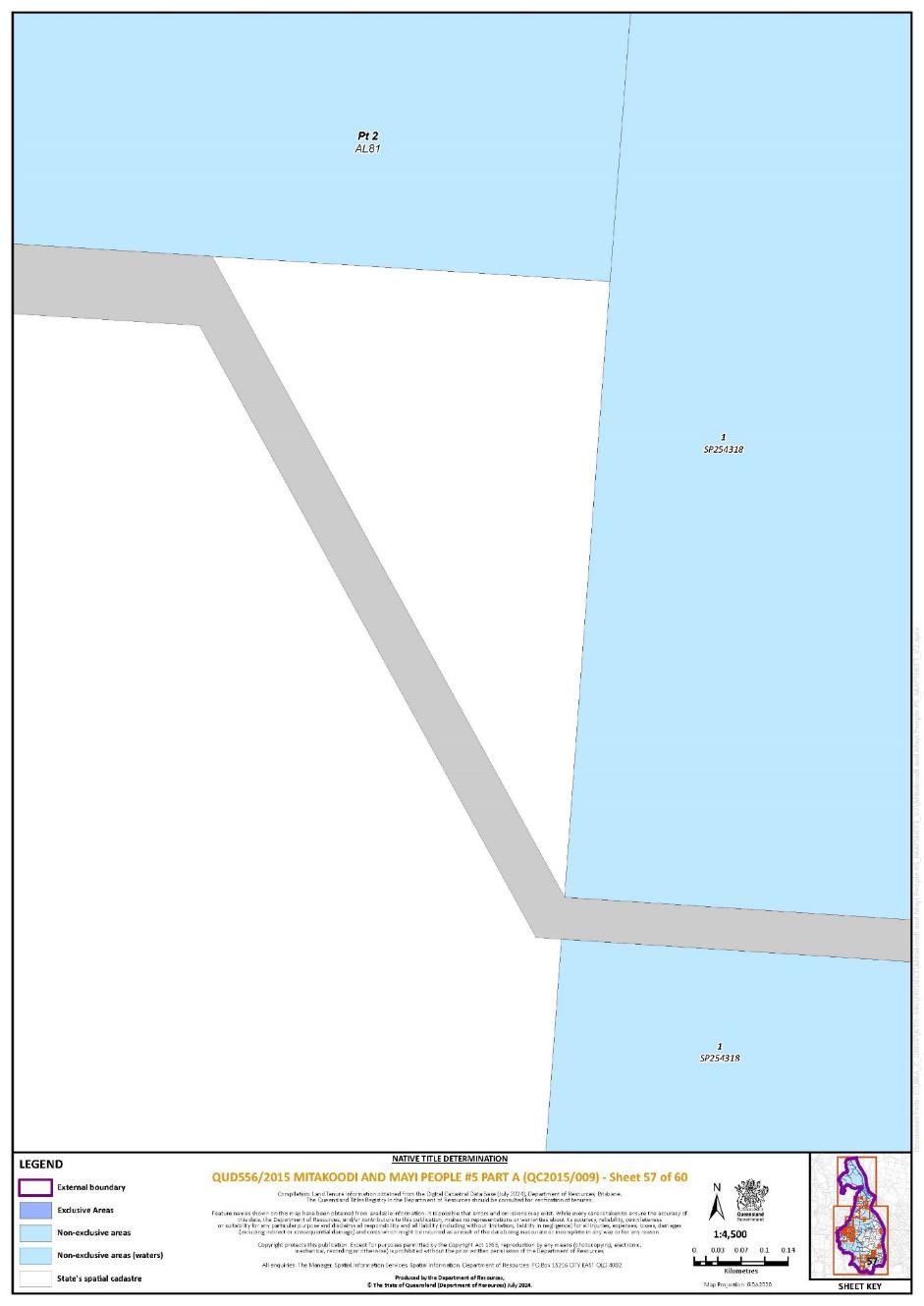
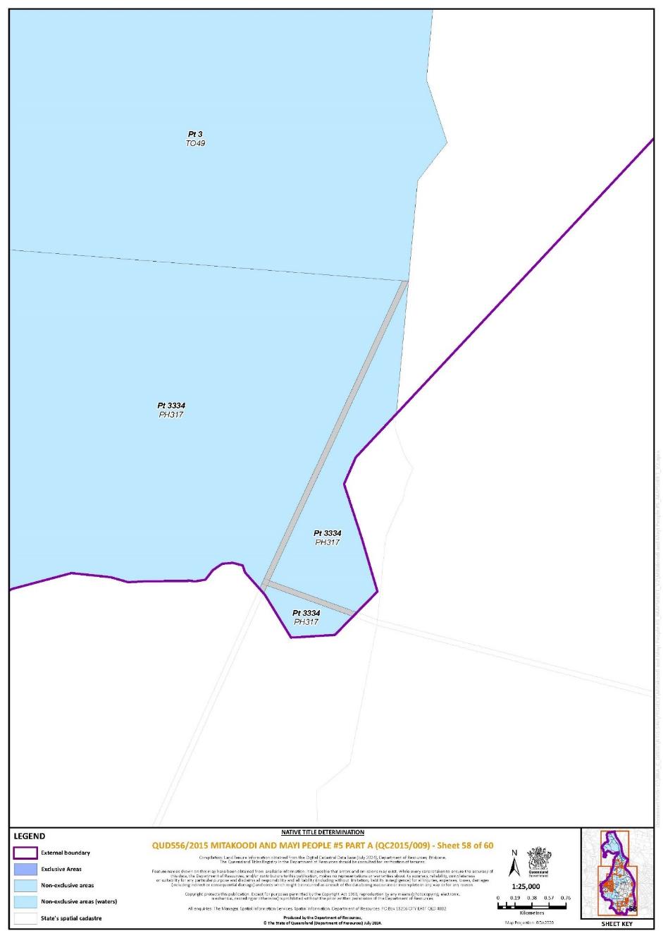
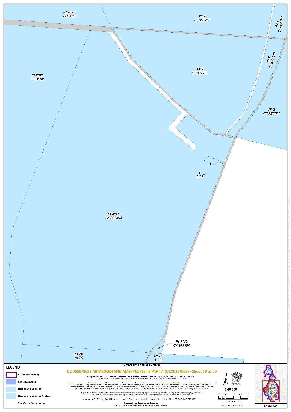
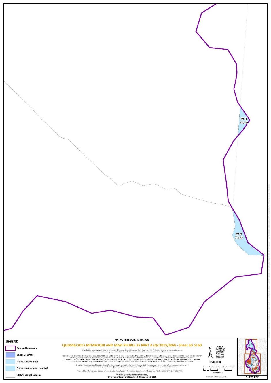
REASONS FOR JUDGMENT
PERRY J:
1. INTRODUCTION
1 In 2015, the Applicant, on behalf of the Mitakoodi and Mayi People, instituted a claimant native title determination application under s 61 of the Native Title Act 1993 (Cth) in the Federal Court of Australia.
2 The first respondent is the State of Queensland. In addition, there are a large number of respondents to the proceeding, including local councils, companies with mining or exploration activities in the application area, pastoralists, and energy and communication suppliers. Over the course of the proceeding, some parties have withdrawn, including the Commonwealth, while others were joined.
3 The parties have reached agreement as to the existence of native title rights and interests with respect to part of the area covered by the application, being Part A of the native title claim area. As a result, they seek a native title determination under s 87A of the Act that native title rights and interests exist over the lands and waters described in Schedule Four (the Determination Area) of the Proposed Determination and the orders which accompany these reasons, and are held by the Mitakoodi and Mayi People. Sections 87 and 87A of the Act provide a mechanism for achieving a key objective of the Act, being to ensure, where possible, that the just and proper recognition of native title rights and interests is achieved by conciliation and agreement. Specifically, these provisions confer power on the Court to make a determination of native title in relation to the whole, or (relevantly) part of, an area covered by a native title determination application (ss 87 and 87A respectively) where the parties reach agreement and a number of criteria are met (a consent determination).
4 The native title rights set out in the Proposed Consent Determination comprise exclusive and non-exclusive rights. The former are described in Part 1 of Schedule 4 (the exclusive areas) and comprise approximately 730 ha. Exclusive rights are areas (excluding waters) where the native title rights and interests confer exclusive possession, occupation, use and enjoyment on the native title holders to the exclusion of all others are described in Part 1 of Schedule 4. The latter comprise approximately 2,683,974 ha. Non-exclusive rights comprise areas of land and water where non-exclusive native title rights and interests are recognised, that is, where the native title rights and interests do not confer any right of possession, occupation, use and enjoyment or to control access.
5 In both cases, the native title must be exercised in accordance with:
(1) the laws of the State of Queensland and of the Commonwealth;
(2) the traditional laws acknowledged, and traditional customs observed, by the native title holders; and
(3) the terms and conditions of any agreement that appears on the Register of Indigenous Land Use Agreements (ILUAs).
6 Importantly, once made, a native title determination operates against the whole world and does not merely bind the parties to the case in which the determination was made: CG (Deceased) on behalf of the Badimia Poeple v Western Australia [2016] FCAFC 67; (2016) 240 FCR 466 at [44] (North, Mansfield, Jagot and Mortimer JJ); McLennan on behalf of the Jangga People #3 v Queensland [2023] FCAFC 191; (2023) 301 FCR 452 at [26] (Perry J). This is so irrespective of whether the determination is made after a contested hearing and proved on the balance of probabilities or, as here, by consent: Jangga People #3 at [30]–[31] (Perry J).
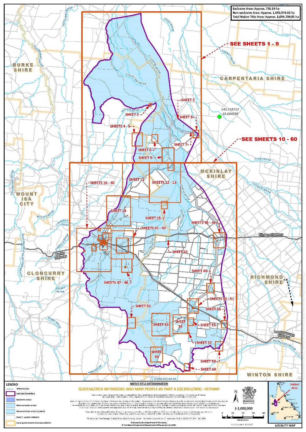
7 The application relates to an area of land and waters covering approximately 25,700 square kilometres in north-west Queensland. It extends northerly from the Selwyn Range along the Cloncurry, McKinlay, Fullarton, Gilliat, Williams and Flingers Rivers. The southern boundary of the claim traces the watershed between the Lake Eyre Basin and the Cloncurry River catchment. The town of Cloncurry lies within the application area. There are also pastoral stations throughout the application area, including Fort Constantine and Canobie with which members of the claim group have long, intergenerational associations.
8 The area subject to the Proposed Determination is reproduced below for convenience from Schedule 6:
2. THE PARTIES AND PROCEDURAL HISTORY
2.1 The application: amendments and registration
9 On 8 July 2015, the Applicant filed a claimant native title determination application under s 61 of the Act in the Federal Court on behalf of the Mitakoodi and Mayi People. The application was entered on the Register of Native Title Claims on 25 September 2015. The application followed a number of earlier claims filed over a similar area by some of the same claimants.
10 An amended application was filed on 24 September 2019 but was removed from the Register on 8 November 2019, after a delegate of the Native Title Registrar found that the amended application did not satisfy all of the conditions imposed by ss 190B and 190C of the Act.
11 A further amended application was filed by the Applicant on 19 December 2019. A second further amended application was filed on 15 January 2020, which was accepted for registration and entered on the Register on 21 February 2020.
12 On 20 October 2023, a third additional further amended application was filed pursuant to leave granted by this Court on 9 October 2023 and was accepted for registration on 15 December 2023. As the third additional further amended application (the current application) did not result in a change to the area of land or waters claimed, there was no requirement on the National Native Title Tribunal to give notice of the amended application: s 66A of the Act. Accordingly, the application has remained on the Register since 21 February 2020.
2.2 The native title claim group
13 The native title claim group comprises Mitakoodi and Mayi People who:
(1) principally identify as Mitakoodi and Mayi People and as belonging to the traditional country of their Mitakoodi and Mayi forebears;
(2) are recognised by other Mitakoodi and Mayi People as the biological descendants of deceased Mitakoodi and Mayi people; and
(3) are the descendants of the following apical ancestors: Minnie; Thomas ‘Tiger’ Mitchell; Dinah; Topsy; Sophie and Billy Chisholm.
14 The members of the Mitakoodi and Mayi People who are authorised to make the application on behalf of the native title claim group, as at the time of the consent determination, and who comprise the Applicant for the purposes of s 61(2) of the Act are:
(1) Tanya Kum Sing;
(2) Pearl Connelly;
(3) Kay Douglas;
(4) Norman Douglas;
(5) Ronald Major;
(6) Sharn Fogarty;
(7) Clyde Fogarty;
(8) Justin Asse; and
(9) Kristal Chapman.
(together, the Applicant).
2.3 Progress of Part A to consent determination
15 In 2021 the State of Queensland wrote to the Applicant confirming that, having assessed the connection material filed by the Applicant, it was satisfied that there was a credible basis for it to enter into substantive negotiations towards a consent determination in this Proceeding. At the same time, the State communicated this to the Court and to the other respondent parties.
16 Most of the other respondents confirmed that they were willing to enter into substantive negotiations towards resolving the proceeding by consent. Four respondent parties (the Daniels respondents) did not agree that connection was established with respect to part of the application area (Part B).
17 Following mediation conducted by a Judicial Registrar of the Court, on 25 March 2022, I ordered by consent that the proceeding be divided into Part A and Part B. Part B comprises two lots in the south of the application area: Lot 1 on AL78 and Lot 2038 on PH460, to the extent that they were within the external boundary of the application. Part A comprises the balance of the application area and is the subject of the Proposed Determination. Part B remains on foot and is to be progressed and determined separately.
18 The parties have negotiated and reached agreement on the native title rights and interests recognised in the Proposed Determination on the basis of the connection evidence provided by the Applicant. The State and Applicant have also conducted a detailed analysis of the tenure of Part A of the application area and have reached agreement as to where native title can be recognised.
19 As part of this tenure assessment, the Applicant provided to the State the following further evidence from members of the claim group for the purposes of ss 47A and 47B of the Act:
(1) Affidavit of Dean Turner, affirmed on 17 October 2023;
(2) Affidavits of Dwayne Turner, affirmed on 17 October 2023 and 28 February 2024;
(3) Affidavit of Ronald Major, affirmed on 17 October 2023;
(4) Affidavit of Pearl Connelly, affirmed on 18 October 2023;
(5) Affidavit of Kay Douglas, affirmed on 19 October 2023;
(6) Affidavit of Gregory Cummins, affirmed on 20 October 2023;
(7) Affidavit of Brian Douglas, affirmed on 20 October 2023;
(8) Affidavit of Tanya Kum Sing, affirmed on 2 February 2024; and
(9) Affidavit of Clyde Fogarty, affirmed on 21 February 2024.
20 I note that the other respondent parties confirmed in accordance with Court timetabling orders that they did not seek to be provided with this evidence.
21 The terms of the agreement reached between the parties includes agreements as to the parcels where exclusive native title rights can be recognised by virtue of the operation of ss 47A and 47B of the Act. These sections provide that for the purposes of the Act, any extinguishment of native title rights and interests in relation to an area claimed in a native title claimant application is to be disregarded in certain circumstances, namely: the area has been granted for the benefit of Aboriginal peoples or is expressly held for their benefit (s 47A); or, when the claimant application is made, the area is vacant Crown land occupied by members of the native title claim group (s 47B).
22 The State and Applicant have reached agreement as to the terms of an Indigenous Land Use Agreement (ILUA) to resolve tenure and validity issues arising in relation to the grants of some tenures within Part A of the application area. Pursuant to this ILUA, the Applicant has agreed to surrender native title over several parcels of land. Accordingly, those parcels have been excluded from the Proposed Determination.
23 In relation to other parcels to which the ILUA applies, namely, Lot 151 on CP911698 and Lot 51 on SP265801, the parties have agreed that the Proposed Determination will take effect in relation to those parcels upon registration of the ILUA under Div 3 of Part 2 of the Act [AS [77]]. The Proposed Determination over the remainder of Part A of the application area is agreed to take effect from 22 August 2024.
24 Between 23 and 30 July 2024, the parties signed the consent determination, as I shortly explain.
3. THE NATIVE TITLE CLAIM GROUP’S CONNECTION TO THE CLAIM AREA
3.1 The evidence relied upon in support of connection.
25 The following lay evidence by members of the claim group was relied upon by the Applicant in its submissions, in support of the proposed determination of native title:
(1) Affidavit of Alan Joseph Kum Sing, affirmed on 12 October 2020;
(2) Affidavit of Dwayne (“Fred”) Turner, affirmed on 12 October 2020;
(3) Affidavit of Pearl Connelly, affirmed on 12 October 2020(subject to confidentiality orders made by Reeves J on 19 November 2020);
(4) Affidavit of Sharn Fogarty, affirmed on 14 April 2020;
(5) Affidavit of Alan Joseph Kum Sing, affirmed on 6 November 2020;
(6) Affidavit of Pearl Connelly, affirmed on 6 November 2020;
(7) Affidavit of Brian Douglas, affirmed on 28 April 2021;
(8) Affidavit of Norman Douglas, affirmed on 28 April 2021; and
(9) Affidavit of Melita Dawn Dolan, affirmed on 21 October 2021.
26 The Applicant also relied upon an expert anthropological report by Dr Kevin Murphy dated 8 November 2020. Among other things, Dr Murphy was awarded a PhD in anthropology, is a fellow of the Australian Anthropological Society, and has extensive experience as an expert in native title proceedings. The Applicant also relied upon a supplementary expert report prepared by Kate Waters dated 7 June 2021, with respect to the genealogies of Sophie (also known as Sophy and Sophie Monkey) and Tospy (also known as Topsy Wilson and Topsy Patterson), who are among the listed apical ancestors for the Mitakoodi and Mayi People. Ms Waters is a professional historian and cultural heritage specialist, with over 20 years’ experience, including in fine-grained historical and genealogical analysis.
27 Additionally, a large number of expert reports have been prepared for the purpose of this application and during the history of former claims over the area by members of the Mitakoodi and Mayi People. These include:
(1) Report of Nicolas Heijm, dated 6 July 1999;
(2) Report of Paul Gorecki, dated April 2000;
(3) Historical Report of Jonathon Richards, dated November 2012;
(4) Reports of Daniel Leo, dated 17 August 2016 and 2 April 2017;
(5) Reports of Dr Fiona Powell, dated 1 May 2019 and 3 July 2019;
(6) Report of Professor David Trigger, dated 12 February 2023;
(7) Supplementary Report of Dr Murphy, dated 3 May 2023; and
(8) Reports of Wendy Asche, dated February and March 2024.
3.2 Connection
28 The date of effective sovereignty for the application area is the early 1860’s.
29 The connection evidence included multiple expert reports, and affidavits and statements from lay witnesses. I particularly acknowledge the valuable evidence given by members of the claim group as to their continuing connection with the land and waters of Part A of the claim area. This includes evidence as to the native title claim group’s deep spiritual association with the land and waters of Part A of the claim area, the particular spiritual significance of the Cloncurry River which runs through the application area, their responsibilities to care for the land and protect sites of significance, their right to speak for country and control access to places, and the importance attached by the native title claim group to ensuring that young people are taught on country about their country and about the laws and customs of their country.
30 Key aspects of Dr Murphy’s conclusions in the executive summary to his report, which is helpful to quote at some length, include that:
The region of the claim area and its Aboriginal inhabitants were impacted by colonial intrusion from 1864.
At that time, the claim area and surrounds to the north, north-west and east was inhabited by people who spoke variants of a language in which the word for language or speech is mayi. People made distinctions between variants of this language by using names, several of which are prefixed with the word mayi. The name Mitakoodi is one spelling of such a name, phonetically spelled Mayi Thakurti; Mayi Yapi is another.
The Aboriginal people who inhabited the region of the claim area had an intricate set of beliefs and practices emanating from an ontology in which the land and the features of the landscape; the flora and fauna of the land and waters; celestial and meteorological phenomena; and the spirits of their own ancestors were all interrelated with each other and themselves, and those relationships were given expression in ritual, dance, song, graphic design, story and a complex social structure by which interpersonal relationships were regulated, and through which human connections with country were structured. In native title terminology, people held rights and interests in the land that derived from a body of laws and customs.
There was some variation in the specifics of the laws and customs of the society of the region of the claim area before sovereignty, but distinctions deriving from variation in any particular social and cultural characteristic do not align with each other to define a multitude of separate and distinct societies (with the meaning of “society” taken as defined in Native Title case law). Instead, the claim area was part of a broad regional society that contained some internal variation but was a single normative system.
Colonial encroachment into the region of the claim area rapidly led to conflict between the Aboriginal inhabitants and the newcomers. In the first few decades after effective sovereignty the Aboriginal inhabitants suffered substantial population decline and disruption of their access to and control of the land and its resources. It quickly became impossible for the Aboriginal inhabitants to continue living autonomously from the settler society, and the surviving Aboriginal population became dependent on the colonial economy…..
…
It is likely that the laws and customs of the people who occupied the claim area before sovereignty provided for rights of primary ownership of land to be vested in individuals on the basis of membership of a clan, to which they were recruited by patrifiliation, probably mediated by a totemic spiritual conception event. It is likely that people also held secondary rights in country with which they had a matrilateral connection.
The normative order was underpinned by a set of rules and expectations about the appropriate forms of interaction between people whose relationships were differentially defined within a universalising kinship system. The kinship system was given simplified expression in a set of four named socio-centric categories known colloquially as ‘skin names.’ Skin names were commonly used as terms of reference and address, and provided for division into complementary groupings in the enactment of ritual.
…
Following physical displacement, depopulation and effective dispossession of their lands, language named ‘tribes’ replaced the smaller clan groups that had previously functioned as foci of land-related group identities, and the former fine-grained distinctions of the clan estate system were dissolved into emergent tribal estates. This occurred in a socio-political context in which Aboriginal people were disempowered in relation to the settler society and the state, and is appropriately apprehended as an adaptation in the face of altered circumstances….
The laws and customs of the Aboriginal society that encompasses the Mitakoodi claim area continued to recognise genealogical descent from ancestors who had owned and occupied the land before colonial intrusion as the fundamental basis on which rights were asserted and accepted. Descent came to be reckoned cognatically rather than patrilineally. Patrilineal descent is structurally exclusive, functioning to limit the extent of land in which any person holds rights. Cognatic descent is structurally inclusive, and without additional mechanisms functions to multiply the areas of land in which a person has rights in land as they trace descent from multiple ancestors from multiple places.
The legal recognition of native title effected a change in the socio-political environment within which the laws and customs subsist, and the changed environment has catalysed further adaptation of the laws and customs. It became structurally necessary for the inclusive mechanism of cognatic descent to be tempered by a cross-cutting mechanism that functions to limit the capacity for individuals to have rights and authority in multiple areas of land. This is commonly described as a requirement that each person must “choose” only one claim group with which they maintain primary identification.
…
The traditional laws and customs of the claimants’ society contain a provision that people acquire rights in country by inheritance from their ancestors, and as a matter of principle the claimants accept that people who have been removed from their country for several generations may still hold rights in the claim area, but more is required in order to be recognised as a claim group member than mere assertion based on a speculative interpretation of archival documents.
The claimants have a keen sense of the presence of their ancestors on the country, and believe that they inherit the country from those ancestors. The claimants and their forebears have maintained continuous physical presence on the claim area since a time before effective sovereignty.
There has been intergenerational transmission of knowledge of stories and places, and of resources and techniques for exploiting them, demonstrating continuity since a time before effective sovereignty.
The claimants collectively assert that they hold rights and interests under their traditional laws and customs throughout the claim area. There is substantial evidence of them exercising those rights in the affidavits that some claim group members have filed.
The claimants hold a committed belief that they have a right to speak for the country, and this includes a responsibility to protect it generally, as well as a particular responsibility to protect sites of special significance.
In my opinion, the rights and interests asserted by the Mitakoodi claimants arise from a body of law and custom which, while it has adapted in response to the forces and events by which the sovereignty of the Crown was imposed, remains traditional in the sense that it derives from the normative system that existed prior to effective sovereignty, and has continuous existence since that time.
(Emphasis added.)
4. THE REQUIREMENTS FOR MAKING A CONSENT DETERMINATION
4.1 General principles
31 Section 213 of the Act provides that a determination of native title must be made in accordance with the procedures in the Act.
32 In Jangga People #3, I summarised the general principles relating to consent determinations as follows (at [27]–[29]):
in furtherance of the legislative preference for the negotiated resolution of native title claims, the NTA confers power on the Court to make a determination of native title that gives effect to the terms of an agreement between the parties (commonly described as a consent determination). That power may be exercised where the jurisdictional conditions in s 87(1) are met and it appears to the Court that it is appropriate to make an order consistent with the agreement between the parties (s 87(1) and (1A) respectively). While the discretion must be exercised judicially, the parties to an agreement are not required to produce evidence as if in a trial: Ward v Western Australia [2006] FCA 1848 at [8] (North J); Hughes v Western Australia [2007] FCA 365 at [8] (Bennett J). Rather, as Rares J held at [6] in McLennan:
The Court has not had a trial to establish the applicant’s claim on its merits. Even so, the Court has an important power to make a determination that native title over land and waters exists under s 87 of the Act once all of the parties have signed a written agreement and provided certain other conditions are met. In these proceedings, the State of Queensland has consented to the making of the determination of native title. Before the Court can make the orders recognising native title, it must be satisfied that the consent determination has been reached after proper consideration by the parties, particularly the State, of all of the matters that the Act requires be established. This consensual process depends upon the executive government of each State and Territory in whose jurisdiction the claim is made taking an active role in the litigation. The government must scrutinise carefully any claim for native title in order to seek to protect the interests of the whole community that it represents: Munn v State of Queensland (2001) 115 FCR 109 at 115 [29] per Emmett J.
In this regard, as Rares J stated, the State has a public responsibility to ensure that any agreement made under s 87 of the NTA is in the interests of the community it represents, bearing in mind that a determination of native title is a determination in rem…
This responsibility is discharged by the State where it is satisfied that there is a credible or cogent basis for concluding that the requirements of s 223 of the NTA are satisfied. Thus Jagot J helpfully explained in Western Bundjalung People v Attorney General (NSW) [2017] FCA 992 at [21]-[22] that:
In reconciling its multiple duties the orthodox position which has emerged and been settled for many years is that the State should not require an applicant to prove to it on the balance of probabilities that each of the requirements of s 223 is satisfied. For the State party to discharge its duties not only to the public at large but also to the claim group and to the Court, and to fulfil its fundamental obligations of fidelity to the objects of the NTA and the requirements of the Court Act, it looks for only a credible or cogent basis to conclude that the requirements of s 223 are satisfied whether or not that basis would constitute admissible evidence in contested litigation or would enable the Court to make findings about s 223 in favour of an applicant on the balance of probabilities…
(Emphasis added.)
33 A determination of native title may be made pursuant to s 87A of the Act, without holding a hearing, where the following conditions are satisfied:
(1) the procedural preconditions in s 87A have been satisfied (subs 87A(1)–(3));
(2) the Court is satisfied that an order in, or consistent with, those terms would be within the power of the Court (s 87A(4)(a)); and
(3) the Court is satisfied that it is appropriate to make the proposed consent determination (s 87A(4)(b)).
34 I address each of these requirements in turn below.
4.2 Are the procedural preconditions for making a consent determination met?
35 The procedural requirements under s 87A were summarised by Murphy J in Paterson on behalf of the Yandruwandha Yawarrawarrka People v State of Queensland [2024] FCA 700 at [31]:
Section 87A of the NTA prescribes the following preconditions before the Court can make a consent determination of native title:
(a) there is a proceeding in relation to an application for determination of native title (subs (1)(a));
(b) the specified notice period under s 66 has ended (subs (1)(b));
(c) agreement is reached as to a proposed determination of native title in relation to an area (the determination area), that is part of, but not all of, the area covered by the native title determination application (subs (1)(b));
(d) the necessary parties are all parties to the agreement (subs 1(c));
(e) the terms of the proposed determination are in writing and signed by or on behalf of all the necessary parties (subs (1)(d));
(f) the requirements regarding a registered native title claimant being a party to the agreement and signing the terms of the proposed determination are satisfied (subs (1A) and (1B));
(g) the proposed determination of native title is filed with the Court (subs (2));
(h) the Chief Executive Officer of the Court has given notice to the other parties to the proceeding that the proposed determination of native title has been filed with the Court (subs (3))…
36 With respect to s 87A(1)(d), s 87A(1A) makes provision for how the native title Applicant enters into the agreement, given that a number of persons may jointly be the “applicant” which is authorised to act on behalf of all of the persons in the native title claim group: see s 61(2) and s 251B of the Act. Those persons, who are jointly the Applicant, also comprise the “registered native title claimant”: see the definition of “registered native title claimant” in s 253. Section 87A(1A) provides that:
The requirements that a registered native title claimant be a party to the agreement and sign the terms of the agreement are satisfied if:
(a) a majority of the persons who comprise the registered native title claimant are parties to the agreement and sign the terms, unless paragraph (b) applies; or
(b) if conditions under section 251BA on the authority of the registered native title claimant provide for the persons who must become a party to the agreement and sign the terms—those persons are parties to the agreement and sign the terms.
37 The Applicant submits that the preconditions of s 87A of the Act are met, given:
(1) the notification period for the application has ended;
(2) there is agreement between the parties about the terms of the Proposed Determination in relation to Part A; and
(3) that agreement is in writing and has been signed by or on behalf of each of the parties.
38 I am satisfied that each of the procedural preconditions arising under s 87A are satisfied for the following reasons.
39 First, I am satisfied that the notification period has ended.
40 Secondly, there is agreement between the parties about the terms of the Proposed Determination in relation to Part A, and the terms of the proposed orders relate to this proceeding, being the current application.
41 Thirdly, with respect to the requirement under s 87A(1)(d) that the agreement be in writing and signed by or on behalf of the parties, I note that s 61(1) of the Act permits the making of a native title determination application by those persons who are:
…authorised by all the persons (the native title claim group) who, according to their traditional laws and customs, hold the common or group rights and interests comprising the particular native title claimed…
42 Section 62A(1) of the Act relevantly provides that in the case of a claimant application, the applicant may deal with all matters arising under the Act in relation to the application. This includes consenting to a determination of native title pursuant to s 87A of the Act. The affidavit of Ms Reid, affirmed on 12 August 2024, records that on 9 June 2024, MPS Law properly notified and convened a Native Title Claim Group Meeting of the Mitakoodi and Mayi People to authorise the Applicant to agree to the proposed consent determination, and that a resolution was passed by the native title claim group using the agreed and adopted decision-making method which provided that authorisation: at [6]–[11].
4.3 Are the orders sought within the Court’s powers?
43 Section 87(4)(a) of the Act permits the Court to make an order consistent with the terms of a proposed determination of native title without holding a hearing if the Court considers that “an order in, or consistent with, the terms of the proposed determination would be within its power”.
44 When making a determination of native title, s 213(1) of the Act requires:
If, for the purpose of any matter or proceeding before the Federal Court, it is necessary to make a determination of native title, that determination must be made in accordance with the procedures in this Act.
45 Those procedures in the Act include:
(1) the application to the Federal Court was made under Part 3 of the Act (s 13(1)); and
(2) the application for a determination of native title is “in relation to an area for which there is no approved determination of native title”, or revokes or varies an approved determination of native title (ss 13(1) and 68).
46 Further, as the Full Court explained in Commonwealth v Clifton [2007] FCAFC 190; (2007) 164 FCR 355 at [44]–[46]:
the rules that govern the making of a native title determination are found in Div 1 of Pt 3 of the Act. That Division prescribes who may make such an application (s 61), proscribes the making of an application in relation to an area for which there is an approved determination of native title (s 61A) and specifies the form of the application and the information that must be included in the application (s 61(3), (4) and (5)) or in an accompanying affidavit (s 62). It requires any application under s 61, and any accompanying affidavit, to be given to the Native Title Registrar (s 63) who must give notice of the application to persons likely to be interested in the application (s 66). The Division proscribes the amendment of an application where the amendment would increase the area claimed beyond that of which the Native Title Registrar will have given notice (s 64).
Part 4 of the Act governs the way in which the Federal Court is to exercise its jurisdiction to hear and determine applications concerning native title. Importantly, unless the Court orders to the contrary after taking into account the matters identified in s 86B(4), every application under s 61 must be referred by the Court to the NNTT for mediation.
As mentioned above, s 67 of the Act recognises that two or more applications may be made to the Court for a determination of native title in respect of the same area. It provides a procedure for dealing with applications concerning the same area. It requires that they be dealt with in the one proceeding.
47 First, I am satisfied that the application before me was made in accordance with the requirements of Part 3 of the Act. I am satisfied that the application was authorised in a manner that was compliant with the requirements under the Act and is a valid application.
48 Secondly, the Proposed Determination area is not the subject of any previous approved determination of native title: s 68 of the Act. There is also no overlap with any other application for determination, which would otherwise require orders to be made under s 67(1) of the Act.
49 Thirdly, I am satisfied that there has been compliance with Part 4 of the Act which (relevantly) sets out the rules for processing native title applications in the Federal Court and making determinations relating to native title.
50 In particular, s 94A requires that “[a]n order in which the Federal Court makes a determination of native title must set out details of the matters mentioned in section 225”. Section 225, in turn, provides:
A determination of native title is a determination whether or not native title exists in relation to a particular area (the determination area) of land or waters and, if it does exist, a determination of:
(a) who the persons, or each group of persons, holding the common or group rights comprising the native title area; and
(b) the nature and extent of the native title rights and interests in relation to the determination area; and
(c) the nature and extent of any other interests in relation to the determination area; and
(d) the relationship between the rights and interests in paragraphs (b) and (c) (taking into account the effect of this Act); and
(e) to the extent that the land or waters in the determination area are not covered by a non‑exclusive agricultural lease or a non‑exclusive pastoral lease—whether the native title rights and interests confer possession, occupation, use and enjoyment of that land or waters on the native title holders to the exclusion of all others.
Note: The determination may deal with the matters in paragraphs (c) and (d) by referring to a particular kind or particular kinds of non‑native title interests.
(Emphasis in original.)
51 I am satisfied that each of these matters are addressed in the Proposed Determination: see cls 7–16 of the Proposed Determination.
52 I am, therefore, satisfied that the proposed consent determination is within power.
4.4 Is it appropriate to make the determination?
53 For the Court to make an order in, or consistent with, the terms of the Section 87A Agreement, the Court must be satisfied that it is appropriate to do so: ss 87A(4)(b). As Mortimer J (as her Honour then was) explained in Freddie v Northern Territory [2017] FCA 867 at [19], “[t]he discretionary evaluation of whether orders are appropriate is a wide one, but the Court must focus on the individual circumstances of each proposed determination”.
54 The principles applicable to determining this question were helpfully summarised by Halley J recently in Madrill on behalf of the members of the Amapete, Apwetyerlaneme, Atnweale and Warrtharre Landholding Groups v Northern Territory of Australia [2024] FCA 529 at [27]–[31] as follows:
The Act is designed to encourage parties to take responsibility for resolving proceedings without the need for litigation. The power in s 87 of the Act must be exercised flexibly and with regard to the purpose for which the section is designed: Lovett on behalf of the Gunditjmara People v State of Victoria [2007] FCA 474 at [36] (North J).
The primary task of the Court is to determine whether there is an agreement between the parties and whether that agreement was freely entered into on an informed basis: Nangkiriny v Western Australia (2002) 117 FCR 6; [2002] FCA 660 at [14] (North J); Ward v State of Western Australia [2006] FCA 1848 at [9] (North J); Hughes (on behalf of the Eastern Guruma People) v State of Western Australia [2007] FCA 365 at [9] (Bennett J).
The Court must be satisfied, however, that the relevant state party has taken steps to satisfy itself that there is a credible basis for an application: Munn v Queensland (2001) 115 FCR 109; [2001] FCA 1229 at [29] (Emmett J). The state has a public responsibility to ensure that its agreement to the order proposed is in the interests of the community it represents and there is a sufficient basis for concluding that the proposed determination is capable of satisfying the requirements of s 225 of the Act: Davey on behalf of the Mayala #2 Native Title Claim Group v State of Western Australia [2019] FCA 1137 at [18] (Bromberg J).
The Court is not required to embark upon an inquiry as to the merits of the claim to satisfy itself that the orders are supported and in accordance with law: Cox on behalf of the Yungngora People v State of Western Australia [2007] FCA 588 at [3] (French J). The Court will, however, consider evidence for the limited purpose of determining whether the state has made a rational decision and is acting in good faith: Munn at [29–[30].
In Jones on behalf of the Yinhawangka People v State of Western Australia [2017] FCA 801, Bromberg J stated at [45]-[46] that in determining whether the requirements in s 87(2) of the Act have been met, the Court would need to have an understanding of the process that led to the agreement and, in particular, how the state or territory went about assessing the underlying evidence as to the existence of native title, which would require the Court to consider whether:
(a) the parties have independent and competent legal representation: Munn at [29]; Lovett at [39] – [40];
(b) the terms of the proposed order are “unambiguous and certain as to the rights declared”: Munn at [32]; and
(c) the agreement has been preceded by a mediation process: Nangkiriny at [6]; Trevor Close on behalf of the Githabul People v Minister for Lands [2007] FCA 1847 at [6] (Branson J); Lovett at [41]-[42].
(Emphasis omitted.)
(See also, eg, Freddie at [21] – [24].)
55 Regarding the interests of the community, which the State represents, Mortimer J (as her Honour then was) explained in Agius v State of South Australia (No 6) [2018] FCA 358 at [72]:
The State comes to an agreement under s 87 or s 87A only after discharging its public responsibilities to ensure the agreement is in the interests of the community it represents. The indigenous people of South Australia are of course part of the community whose interests the State considers. As Jagot J said in Yaegl #2 [v Attorney-General of New South Wales [2017] FCA 993] at [16]:
it would be wrong to conceive of the State’s duty as one of protecting the public interest as if the public interest excluded the legitimate interests of native title claimants; claimants are part of the community for which the State is responsible and to whom it owes its duties and to conceive of the public interest as if it were in opposition to native title rights and interests is contrary to the provisions of the NTA, particularly the stated object in the Preamble.
56 The material relied upon in support of the Proposed Determination satisfies me that:
(a) the parties have had the benefit of legal representation in arriving at agreement about the terms of the determination;
(b) having engaged in an independent assessment of the connection material provided by the Applicant, there was a proper basis for the State’s conclusion that there was a credible basis on which to commence negotiations for an agreement to resolve the proceeding under the Act;
(c) the Application has been subject to Court-annexed mediation, giving the Court oversight of the proceedings, the engagement of the parties, and their consideration of the materials;
(d) the State has conducted searches of land tenure of Part A of the application area which has been subjected to detailed analysis by the State and the Applicant and has resulted an agreement as to where native title exists and where native title has been extinguished; and
(f) the Applicant has entered into the agreement under s 87A of the Act freely and on an informed basis, as is established by the affidavits of Ms Reid affirmed on 31 July 2024 and 12 August 2024.
57 Furthermore, in light of the material relied upon in support of the consent orders sought including the lay evidence of members of the claimant group and the expert evidence of Dr Murphy, I am satisfied that the State, acting on behalf of the broader community, including the Mitakoodi and Mayi People, has been actively involved in the proceeding and has a proper basis for being satisfied that there is a credible basis for the consent determination.
58 Therefore, in all of the circumstances, I am satisfied that the orders sought are appropriate.
5. NOMINATION OF A PRESCRIBED BODY CORPORATE
59 If the Court proposes to make an approved determination of native title, the Court must also make a determination of “whether the native title is to be held in trust, and, if so, by whom” at the same time, or as soon as practicable thereafter: ss 55 and 56(1) of the Act. Section 56(2) relevantly sets out the steps the Court must take in making the determination, including:
(a) first, it must request a representative of the persons it proposes to include in the determination of native title as the native title holders (the common law holders) to indicate whether the common law holders intend to have the native title held in trust by:
(i) nominating, in writing given to the Federal Court within a specified period, a prescribed body corporate to be the trustee of the native title; and
(ii) including with the nomination the written consent of the body corporate; and
(b) secondly, if the common law holders give the nomination within the period, the Federal Court must determine that the prescribed body corporate is to hold the rights and interests from time to time comprising the native title in trust for the common law holders…
(Emphasis in original.)
60 Under s 56(3), on the making of a determination under s 56(2)(b), “the prescribed body corporate holds, in accordance with the regulations, the rights and interests from time to time comprising the native title in trust for the common law holders”.
61 The Applicant has nominated the Mitakoodi and Mayi People Native Title Aboriginal Corporation (ICN 10313) to be the prescribed body corporate to hold the native title of the Mitakoodi and Mayi People in trust.
62 In her affidavit affirmed on 31 July 2024, Ms Reid deposes to the resolution passed by the Mitakoodi and Mayi People #5 claim group meetings on 7–9 June 2024 in the following terms:
Resolution 5 – Nomination of the PBC
The members of the Mitakoodi and Mayi #5 native title claim group present at the meeting:
CONFIRM that is it the Mitakoodi and Mayi Native Title Holders’ intention that their determined native title be held in trust.
NOMINATE the Mitakoodi and Mayi People Native Title Aboriginal Corporation, once it is incorporated, to be the prescribed body corporate for the proposed consent determination and to hold the Mitakoodi and Mayi Naïve Title Holders’ determined native title in trust.
AUTHORISE AND INSTRUCT MPS Law as the legal representatives for the claim group to be the Mitakoodi and Mayi Native Title Holders’ representative for the purpose of doing all things necessary to give effect to this resolution.
AUTHORISE, AGREE AND INSTRUCT the Mitakoodi and Mayi People Native Title Aboriginal Corporation, once it is incorporated and upon request by MPS Law, to provide its written consent to be the native title body corporate for the proposed consent determination.
(Resolution 5)
63 On 19 June 2024, and in accordance with Resolution 5, MPS Law convened an incorporation meeting for the Corporation. This meeting was attended by all of the initial members and initial directors, as nominated at the meeting on 8 June 2024, together with Ms Reid and other solicitors from MPS Law. At the meeting, the initial members passed a resolution authorising the proposed rule book and the application for registration of the corporation. On 2 July 2024, the Office of the Registrar of Indigenous Corporations registered the Corporation.
64 Subsequently, two directors of the Corporation executed a statement which confirmed that, for the purposes of s 56 of the Act, the Corporation:
(1) accepted the nomination to be the prescribed body corporate; and
(2) consented to holding the Mitakoodi and Mayi People’s native title in trust for the native title holders upon a determination of native title being made by the Court in the Mitakoodi and Mayi People #5 Part A native title application.
65 Accordingly, I am required by s 56(2)(b) of the Act to make the orders appointing the Corporation to undertake the roles and perform the functions specified in the determination.
6. CONCLUSION
66 I am satisfied that the requirements of the Act are met. Further, I am satisfied that it is appropriate that the orders and the determination of native title proposed by the parties should be made.
67 The Court warmly congratulates the parties, their legal representatives, the Native Title Registrars, and all who have contributed to the conclusion of the Section 87A Agreement, and acknowledges their hard work over many years to reach this milestone. It is important to emphasise that the rights and interests recognised in the consent determination are not conferred by the Act; nor does the making of this consent determination confer those rights. Rather, the consent determination formally recognises rights and interests of the Mitakoodi and Mayi People which have always existed and which continue to exist today. As such, this determination marks an event of great significance in recognising the native title rights and interests of the Mitakoodi and Mayi People.
I certify that the preceding sixty-seven (67) numbered paragraphs are a true copy of the Reasons for Judgment of the Honourable Justice Perry. |
Associate:
QUD 556 of 2015 | |
PEARL CONNELLY | |
Third Applicant: | KAY DOUGLAS |
Fourth Applicant: | NORMAN DOUGLAS |
Fifth Applicant: | RONALD MAJOR |
Sixth Applicant: | SHARN FOGARTY |
Seventh Applicant: | CLYDE FOGARTY |
Eighth Applicant: | JUSTIN ASSE |
Ninth Applicant: | KRISTAL CHAPMAN |
Second Respondent: | CARPENTARIA SHIRE COUNCIL |
Third Respondent: | CLONCURRY SHIRE COUNCIL |
MCKINLAY SHIRE COUNCIL | |
Fifth Respondent: | AURIZON OPERATIONS LIMITED ACN 124 649 967 |
Sixth Respondent: | AURIZON PROPERTY PTY LTD ACN 145 991 724 |
Seventh Respondent: | TELSTRA CORPORATION LIMITED ACN 051 775 556 |
Eighth Respondent: | BLACK ROCK MINERALS PTY LTD |
Ninth Respondent: | CHINOVA RESOURCES CLONCURRY MINES PTY |
Tenth Respondent: | ERNEST HENRY MINING PTY LTD |
Eleventh Respondent: | EXCO RESOURCES LTD |
Twelfth Respondent: | MMG DUGALD RIVER PTY LTD ABN 19 083 405 556 |
Thirteenth Respondent: | MOUNT ISA MINES LIMITED ACN 009 661 447 |
Fourteenth Respondent: | MOUNT MARGARET MINING PTY LTD ACN 150 366 |
Fifteenth Respondent: | SOUTH32 CANNINGTON PROPRIETARY LIMITED |
Sixteenth Respondent: | A. A. COMPANY PTY LTD ACN 010 317 067 |
Seventeenth Respondent: | MARGARET ELEANOR ALLISON |
Eighteenth Respondent: | WILLIAM FRANCIS ALLISON |
Nineteenth Respondent: | ANDREW WILLIAM JESSE DANIELS |
Twentieth Respondent: | JEFFREY ROBERT JAMES DANIELS |
Twenty First Respondent: | LUKE WILLIAM JESSE DANIELS |
Twenty Second Respondent: | SAMUEL DONALD JAMES DANIELS |
Twenty Third Respondent: | KLAYTON ROMAN JOHN DOUGLAS |
Twenty Fourth Respondent: | SALLY-ANN DOUGLAS |
Twenty Fifth Respondent: | THE NORTH AUSTRALIAN PASTORAL COMPANY PTY LTD ACN 009 591 511 |
Twenty Sixth Respondent: | PARAWAY PASTORAL COMPANY LIMITED ACN 122 572 641 |
Twenty Seventh Respondent: | COLIN CLYDE SAUNDERS |
Twenty Eighth Respondent: | JUDITH ROSE SAUNDERS |
Twenty Ninth Respondent: | SHILLONG PTY LTD ABN 30 050 399 347 |
Thirtieth Respondent: | VENLOCK PTY LTD ACN 010 198 893 |
Thirty First Respondent: | JENNIFER JOAN WINDUS |
Thirty Second Respondent: | WILLIAM GEORGE WINDUS |
Thirty Third Respondent: | WONDOOLA PTY LTD ACN 009 736 805 |
Thirty Fourth Respondent: | MIM RESOURCE DEVELOPMENT PTY LIMITED |
Thirty Fifth Respondent: | NORTH WEST QUEENSLAND WATER PIPELINE PTY LTD ACN 070 999 218 |
Thirty Sixth Respondent: | VIVA ENERGY AUSTRALIA PTY LTD ACN 004 610 459 |
Thirty Seventh Respondent: | AMPLITEL PTY LTD AS TRUSTEE OF THE TOWERS BUSINESS OPERATING TRUST ABN 75 357 171 746 |
Thirty Eighth Respondent: | ERGON ENERGY CORPORATION LIMITED ACN 087 646 062 |


