
FEDERAL COURT OF AUSTRALIA
Douglas on behalf of the Kabi Kabi First Nation Traditional Owners Native Title Claim Group v State of Queensland (No 5) [2024] FCA 645
ORDERS
DATE OF ORDER: |
BEING SATISFIED that an order in the terms set out below is within the power of the Court, and it appearing appropriate to the Court to do so, pursuant to s 87A of the Native Title Act 1993 (Cth);
BY CONSENT THE COURT ORDERS THAT:
1. There be a determination of native title in the terms set out below (the determination).
2. The determination will take effect upon the agreement referred to in paragraph 1(a) of Schedule 2 being registered on the Register of Indigenous Land Use Agreements.
3. In the event that the agreement referred to in order 2 is not registered on the Register of Indigenous Land Use Agreements within seven (7) months of the date of this order or such later time as this Court may order, the matter is to be listed for further directions.
4. Each party to the proceedings is to bear its own costs.
BY CONSENT THE COURT DETERMINES THAT:
5. The determination area is the land and waters described in Schedule 4 and depicted in the map attached to Schedule 6 to the extent those areas are within the External Boundary and not otherwise excluded by the terms of Schedule 5 (the Determination Area). To the extent of any inconsistency between the written description and the map, the written description prevails.
6. Native title exists in the Determination Area.
7. The native title is held by the Kabi Kabi People described in Schedule 1 (the Native Title Holders).
8. Subject to orders 9, 10 and 11 below the nature and extent of the native title rights and interests in relation to the land and waters described in Schedule 4 are the non-exclusive rights to:
(a) access, be present on, move about on and travel over the area;
(b) camp on the area, and for that purpose, erect temporary shelters on the area;
(c) take resources of the area for any purpose;
(d) take and use the Water of the area for personal, domestic and non-commercial communal purposes (including cultural and spiritual purposes);
(e) participate in cultural activities on the area;
(f) be buried and bury Native Title Holders within the area;
(g) maintain places of importance and areas of significance to the Native Title Holders under their laws and customs and protect those places and areas from physical harm;
(h) teach on the area the physical and spiritual attributes of the area;
(i) hold meetings on the area; and
(j) light fires on the area for domestic purposes including cooking, but not for the purpose of hunting or clearing vegetation.
9. The native title rights and interests are subject to and exercisable in accordance with:
(a) the Laws of the State and the Commonwealth; and
(b) the traditional laws acknowledged and traditional customs observed by the Native Title Holders.
10. The native title rights and interests referred to in order 8 do not confer on the Native Title Holders:
(a) possession, occupation, use or enjoyment to the exclusion of all others;
(b) any right to access or take:
(i) minerals as defined in the Mineral Resources Act 1989 (Qld); or
(ii) petroleum as defined in the Petroleum Act 1923 (Qld) and the Petroleum and Gas (Production and Safety) Act 2004 (Qld).
11. There are no native title rights in or in relation to minerals as defined by the Mineral Resources Act 1989 (Qld) and petroleum as defined by the Petroleum Act 1923 (Qld) and the Petroleum and Gas (Production and Safety) Act 2004 (Qld).
12. The nature and extent of any other interests in relation to the Determination Area (or respective parts thereof) are set out in Schedule 2 (the Other Interests).
13. The relationship between the native title rights and interests described in order 8 and the Other Interests described in Schedule 2 is that:
(a) the Other Interests continue to have effect, and the rights conferred by or held under the Other Interests may be exercised notwithstanding the existence of the native title rights and interests;
(b) to the extent the Other Interests are inconsistent with the continued existence, enjoyment or exercise of the native title rights and interests in relation to the land and waters of the Determination Area, the native title continues to exist in its entirety but the native title rights and interests have no effect in relation to the Other Interests to the extent of the inconsistency for so long as the Other Interests exist; and
(c) the Other Interests and any activity that is required or permitted by or under, and done in accordance with, the Other Interests, or any activity that is associated with or incidental to such an activity, prevail over the native title rights and interests and any exercise of the native title rights and interests.
DEFINITIONS AND INTERPRETATION
14. In this determination, unless the contrary intention appears:
“External Boundary” means the area described in Schedule 3; "High Water Mark" means the ordinary high-water mark at spring tides; |
"land" and "waters", respectively, have the same meanings as in the Native Title Act 1993 (Cth); |
"Laws of the State and the Commonwealth" means the common law and the laws of the State of Queensland and the Commonwealth of Australia, and includes legislation, regulations, statutory instruments, local planning instruments and local laws; “Local Government Act” has the meaning given in the Local Government Act 2009 (Qld); “Local Government Area” has the meaning given in the Local Government Act 2009 (Qld); |
“Native Title Determination Application” means the Kabi Kabi People native title determination application accepted for filing on 8 November 2023 in QUD20 of 2019; |
“Reserve” means a reserve dedicated or taken to be a reserve under the Land Act 1994 (Qld); "Water" means: (a) water which flows, whether permanently or intermittently, within a river, creek or stream; (b) any natural collection of water, whether permanent or intermittent; (c) water from an underground water source; and (d) tidal water; “Water Infrastructure” has the same meaning as: (a) that phrase in the South-East Queensland Water (Distribution and Retail Restructuring) Act 2009 (Qld); and (b) “service provider’s infrastructure” in the Water Supply (Safety and Reliability) Act 2008 (Qld); and “Works” has the same meaning as in the Electricity Act 1994 (Qld). Other words and expressions used in this determination have the same meanings as they have in Part 15 of the Native Title Act 1993 (Cth). |
THE COURT DETERMINES THAT:
15. The native title is held in trust.
16. The Kabi Kabi Peoples Aboriginal Corporation (ICN: 8996), incorporated under the Corporations (Aboriginal and Torres Strait Islander) Act 2006 (Cth), is to:
(a) be the prescribed body corporate for the purpose of ss 56(2)(b) and 56(3) of the Native Title Act 1993 (Cth); and
(b) perform the functions mentioned in s 57(1) of the Native Title Act 1993 (Cth) after becoming a registered native title body corporate.
LIST OF SCHEDULES
Schedule 1 – Native Title Holders vi
Schedule 2 – Other Interests in the Determination Area vii
Schedule 3 – External Boundary xiii
Schedule 4 – Description of Determination Area xxv
Schedule 5 – Areas Not Forming Part of the Determination Area xcvii
Schedule 6 – Map of Determination Area cxxv
Schedule 7 – Map of Areas Partly Affected by Public Works cccxliv
Schedule 1 – Native Title Holders
1. The native title holders are the Kabi Kabi People. The Kabi Kabi People are those people who are descendants of the following apical ancestors:
(a) Maggie Cadenti/Cadente/Cantidi: “Maggie”;
(b) George Parson;
(c) Albert Williams;
(d) Ngimburum;
(e) Kaloma-kuta/Galmaguda/Haloma-kuta/Kal-ma-kuta;
(f) Willie Kina;
(g) Susan Andy;
(h) Jacky Ball (or Baul);
(i) Maggie Cain/Caine;
(j) James Crow/Crowe;
(k) Maggie Palmer;
(l) Emma Dunne;
(m) William/Billy Glenbar;
(n) Annie Laurie;
(o) May Burnett;
(p) Tuppernywoe/"King" Tommy of Noosa;
(q) Dundalli;
(r) Sarah Di:naba Moreton;
(s) Marian/Mary Ann Thompson; or
(t) Towcha
and who identify as and are recognised as members of the Kabi Kabi People in accordance with the system of traditional laws and customs.
Schedule 2 – Other Interests in the Determination Area
The nature and extent of the other interests in relation to the Determination Area are the following as they exist as at the date of the determination:
1. The rights and interests of the parties under the following agreements lodged, or to be lodged, for registration on the Register of Indigenous Land Use Agreements:
(a) Kabi Kabi Peoples Tenure Resolution Indigenous Land Use Agreement between Michael Douglas, Helena Gulash, Cecilia Combo, Melissa Bond, Norman Bond, Kerry Jones and Brian Warner on their own behalf and on behalf of the Kabi Kabi People (the Native Title Parties), the Kabi Kabi Peoples Aboriginal Corporation (ICN 8996) (the PBC) and the State of Queensland, authorised on 12 August 2023 and signed by the Native Title Parties and the PBC on 10 May 2024 (Kabi Kabi People’s Tenure Resolution Indigenous Land Use Agreement).
2. The rights and interests of the parties under the following agreements registered on the Register of Indigenous Land Use Agreements:
(a) Traveston Crossing Dam ILUA registered on 14 April 2008;
(b) Wakka Wakka #2 and Tarong ILUA registered on 8 September 2009;
(c) Yurol and Ringtail ILUA registered on 27 August 2021 and;
(d) Cooloola Great Walk Ecotourism Project ILUA registered on 16 May 2023.
3. The rights and interests of the holders of water allocations granted pursuant to the Water Act 2000 (Qld).
4. The rights and interests of the holders of pipeline licence PPL60 granted pursuant to the Petroleum Act 1923 (Qld) and administered under the Petroleum and Gas (Production and Safety) Act 2004 (Qld).
5. The rights and interests of Telstra Corporation Limited ACN 051 775 556, Amplitel Pty Ltd as trustee of the Towers Business Operating Trust (ABN 75 357 171 746) and any of their successors in title:
(a) as the owners or operators of telecommunications facilities within the Determination Area;
(b) created pursuant to the Post and Telegraph Act 1901 (Cth), the Telecommunications Act 1975 (Cth), the Australian Telecommunications Corporation Act 1989 (Cth), the Telecommunications Act 1991 (Cth) and the Telecommunications Act 1997 (Cth), including rights:
(i) to inspect land;
(ii) to install, occupy and operate telecommunication facilities; and
(iii) to alter, remove, replace, maintain, repair and ensure the proper functioning of its telecommunications facilities;
(c) for their employees, agents or contractors to access their telecommunication facilities in and in the vicinity of the Determination Area in the performance of their duties; and
(d) under any lease, licence, access agreement, permit or easement relating to their telecommunications facilities in the Determination Area.
6. The rights and interests of Energex Limited ABN 40 078 849 055:
(a) as the owner and operator of any Works within the Determination Area;
(b) as an electricity entity under the Electricity Act 1994 (Qld), including but not limited to:
(i) as the holder of a distribution authority;
(ii) to inspect, maintain and manage any Works in the Determination Area; and
(iii) in relation to any agreement or consent relating to the Determination Area existing or entered into before the date these orders are made; and
(c) to enter the Determination Area by its employees, agents or contractors to exercise any of the rights and interests referred to in this clause.
7. The rights and interests of Ergon Energy Corporation Limited ACN 087 646 062:
(a) as the owner and operator of any Works within the Determination Area;
(b) as an electricity entity under the Electricity Act 1994 (Qld), including but not limited to:
(i) as the holder of a distribution authority;
(ii) to inspect, maintain or manage any Works in the Determination Area; and
(iii) in relation to any agreement or consent relating to the Determination Area existing or entered into before the date these orders are made; and
(c) to enter the Determination Area by its employees, agents or contractors to exercise any of the rights and interests referred to in this clause.
8. The rights and interests of Moreton Bay Regional Council, Noosa Shire Council, Sunshine Coast Regional Council, Somerset Regional Council, Bundaberg Regional Council, Fraser Coast Regional Council and Gympie Regional Council (Councils):
(a) under their local government jurisdiction and functions under the Local Government Act, under the Stock Route Management Act 2002 (Qld) and under any other legislation, for that part of the Determination Area within the area declared to be their respective Local Government Areas under the Local Government Regulations 2012 (Qld);
(b) as the:
(i) lessor under any leases which were validly entered into before the date on which these orders are made and whether separately particularised in these orders or not;
(ii) grantor of any licences or other rights and interests which were validly granted before the date on which these orders were made and whether separately particularised in these orders or not; and
(iii) holder of any estate or any other interest in land, including as trustee of any Reserves, under access agreements and easements that exist in the Determination Area;
(c) as the owner and operator of infrastructure, structures, earthworks, access works and any other facilities and other improvements located in the Determination Area validly constructed or established on or before the date on which these orders are made, including but not limited to:
(i) undedicated but constructed roads except for those not operated by Councils;
(ii) water pipelines and water supply infrastructure;
(iii) drainage facilities;
(iv) watering point facilities;
(v) recreational facilities;
(vi) transport facilities; and
(vii) community facilities; and
(d) to enter the land for the purposes described in paragraphs 8(a), 8(b) or 8(c) above by their employees, agents or contractors to:
(i) exercise any of the rights and interests referred to in this paragraph or paragraph 9 below;
(ii) use, operate, inspect, maintain, replace, restore and repair the infrastructure, facilities and other improvements referred to in paragraph 8(c) above; and
(iii) undertake operational activities in its capacity as a local government such as feral animal control, weed control, erosion control, waste management and fire management.
9. The rights and interests of the State of Queensland and the Bundaberg Regional Council, Fraser Coast Regional Council, Gympie Regional Council, Moreton Bay Regional Council, Noosa Shire Council, Somerset Regional Council and Sunshine Coast Regional Council to access, use, operate, maintain and control the dedicated roads in the Determination Area and the rights and interests of the public to use and access the roads.
10. The rights and interests of the Australian Maritime Safety Authority as the owner, manager, or operator of aids to navigation pursuant to s 190 of the Navigation Act 2012 (Cth), and in performing the functions of the Authority under s 6(1) of the Australian Maritime Safety Authority Act 1990 (Cth) including to be a national safety regulator, to combat pollution in the marine environment and to provide a search and rescue service.
11. The rights and interests of Australian Gas Networks (Qld) Pty Ltd under Permit to Occupy 0/215701 over Lot 1 on AP4993, Title Reference 40028824.
12. The rights and interests of Northern SEQ Distributor-Retailer Authority trading as Unitywater:
(a) as the:
(i) owner and operator of Water Infrastructure within the Determination Area;
(ii) “Northern SEQ Distributor-Retailer Authority” and “Service Provider” under the South-East Queensland Water (Distribution and Retail Restructuring) Act 2009 (Qld); and
(iii) “Service Provider” under the Water Supply (Safety and Reliability) Act 2008 (Qld);
(b) including rights to inspect, operate, change, maintain, remove, repair, replace or install Water Infrastructure located in the Determination Area;
(c) including rights for its employees, agents or contractors to enter the Determination Area in the performance of their duties; and
(d) under any lease, licence, access agreement, permit or easement relating to its Water Infrastructure in the Determination Area.
(a) under the Water Supply (Safety and Reliability) Act 2008 (Qld) including for access, installation, inspection, operation, maintenance, removal, repair, or replacement of infrastructure within the Determination Area;
(b) under the South East Queensland Water (Restructuring) Act 2007 (Qld) including carrying out, supplying and developing water activities, water services, and ancillary activities within the Determination Area;
(c) as the:
(i) lessor under any leases which were validly entered into before the date on which these orders are made and whether separately particularised in these orders or not;
(ii) grantor of any licences or other rights and interests which were validly granted before the date on which these orders were made and whether separately particularised in these orders or not; and
(iii) holder of any estate or any other interest in land, including as trustee of any Reserves, under access agreements and easements that exist in the Determination Area;
(d) as the owner and operator of infrastructure, structures, earthworks, access works and any other facilities and other improvements located in the Determination Area validly constructed or established on or before the date on which these orders are made, including but not limited to:
(i) dams and dam infrastructure;
(ii) water pipelines and water supply infrastructure;
(iii) water treatment plants;
(iv) water pump stations;
(v) reservoirs;
(vi) irrigation channels;
(vii) weirs; and
(viii) water quality facilities including alert stations and irrigation meters;
(i) exercise any of the rights and interests referred to in this paragraph; and
(ii) use, operate, inspect, maintain, replace, restore and repair the infrastructure, facilities and other improvements referred to in paragraph 13(d) above; and
(f) under the following Permits to Occupy:
(i) Occupation Permit No. 2308 granted in accordance with the Forestry Act 1959 (Qld);
(ii) Occupation Permit No. 2793 granted in accordance with the Forestry Act 1959 (Qld); and
(iii) Occupation Permit No. 3029 granted in accordance with the Forestry Act 1959 (Qld).
14. The rights and interests of the State of Queensland in Reserves, the rights and interests of the trustees of those Reserves and the rights and interests of the persons entitled to access and use those Reserves for the respective purpose for which they are reserved.
15. The rights and interests of the State of Queensland or any other person existing by reason of the force and operation of the laws of the State of Queensland, including those existing by reason of the following legislation or any regulation, statutory instrument, declaration, plan, authority, permit, lease or licence made, granted, issued or entered into under that legislation:
(a) the Fisheries Act 1994 (Qld);
(b) the Land Act 1994 (Qld);
(c) the Nature Conservation Act 1992 (Qld);
(d) the Forestry Act 1959 (Qld);
(e) the Water Act 2000 (Qld);
(f) the Petroleum Act 1923 (Qld) or Petroleum and Gas (Production and Safety) Act 2004 (Qld);
(g) the Mineral Resources Act 1989 (Qld);
(h) the Planning Act 2016 (Qld);
(i) the Transport Infrastructure Act 1994 (Qld);
(j) the Fire and Emergency Services Act 1990 (Qld) or Ambulance Service Act 1991 (Qld); and
(k) the Marine Parks Act 2004 (Qld).
16. The rights and interests of members of the public arising under the common law, including but not limited to the following:
(a) any subsisting public right to fish; and
(b) the public right to navigate.
17. So far as confirmed pursuant to s 212(2) of the Native Title Act 1993 (Cth) and s 18 of the Native Title Act (Queensland) Act 1993 (Qld) as at the date of this Determination, any existing rights of the public to access and enjoy the following places in the Determination Area:
(a) waterways;
(b) beds and banks or foreshores of waterways;
(c) coastal waters;
(d) beaches;
(e) stock routes; and
(f) areas that were public places at the end of 31 December 1993.
18. Any other rights and interests:
(a) held by the State of Queensland or Commonwealth of Australia; or
(b) existing by reason of the force and operation of the Laws of the State and the Commonwealth.
Schedule 3 – External Boundary
The area of land and waters:
commencing at the intersection of the northern boundary of Berries Road and southern bank of Oaky Creek (Edward Creek) and extending generally northerly and generally north-easterly along southern banks of that creek, and southern banks of Isis River to the western bank of the Burrum River; then easterly to the eastern bank of that river at Latitude 25.212232° South; then generally southerly along banks of that river to Latitude 25.221740° South; then south-westerly to the centreline of Cherwell River at its mouth; then generally south-westerly along the centreline of that river (passing to the north of Lot 20 on CK3227) to Latitude 25.235245° South; then generally south-westerly and generally south-easterly passing through the following co-ordinate points:
Longitude ° (East) | Latitude ° (South) |
152.524182 | 25.264640 |
152.507026 | 25.316109 |
152.502329 | 25.332243 |
152.496610 | 25.351442 |
152.493547 | 25.369006 |
152.493138 | 25.377789 |
152.492934 | 25.385754 |
152.496406 | 25.422108 |
152.498857 | 25.435588 |
152.503555 | 25.446412 |
152.511316 | 25.453969 |
152.521732 | 25.459688 |
152.537255 | 25.463568 |
152.547671 | 25.471329 |
152.556453 | 25.476231 |
152.597097 | 25.491957 |
152.627528 | 25.497471 |
152.637127 | 25.500126 |
152.641621 | 25.502985 |
152.647544 | 25.508500 |
152.648987 | 25.510692 |
Then southerly to the southern bank of the Mary River, west of Maryborough, at Longitude 152.648966° East; then generally southerly along banks of that river to the centreline of Gutchy Creek; then northerly to the centreline of the Mary River at Longitude 152.520670° East, Latitude 25.768908° South; then generally westerly and generally southerly along the centreline of that river (passing to the east of Lot 62 on USL43380) to Latitude 26.069738° South, then generally easterly, generally south-easterly, generally north-westerly and generally easterly to a point on the Lowest Astronomical Tide at Latitude 26.016775° South passing through the following coordinate points:
Longitude ° (East) | Latitude ° (South) |
152.540728 | 26.070082 |
152.551252 | 26.068777 |
152.561681 | 26.066420 |
152.572600 | 26.062148 |
152.582951 | 26.058149 |
152.594555 | 26.050710 |
152.605640 | 26.045363 |
152.616250 | 26.040176 |
152.626855 | 26.034072 |
152.637767 | 26.028579 |
152.647344 | 26.025203 |
152.656885 | 26.022781 |
152.670609 | 26.020952 |
152.687551 | 26.022015 |
152.697621 | 26.024310 |
152.710867 | 26.027329 |
152.719390 | 26.029702 |
152.729950 | 26.032643 |
152.739623 | 26.034682 |
152.750286 | 26.039260 |
152.758524 | 26.045058 |
152.768275 | 26.049636 |
152.778490 | 26.056077 |
152.786275 | 26.062148 |
152.795779 | 26.069840 |
152.802408 | 26.075910 |
152.810093 | 26.082594 |
152.816575 | 26.089550 |
152.824509 | 26.097473 |
152.830175 | 26.103132 |
152.839408 | 26.112352 |
152.845302 | 26.118237 |
152.853244 | 26.126168 |
152.859529 | 26.133404 |
152.867091 | 26.142110 |
152.874534 | 26.150111 |
152.880932 | 26.156989 |
152.887975 | 26.164442 |
152.895990 | 26.172924 |
152.902370 | 26.179376 |
152.912186 | 26.189098 |
152.921646 | 26.196117 |
152.931716 | 26.203441 |
152.942072 | 26.207408 |
152.948144 | 26.206187 |
152.952994 | 26.203746 |
152.958738 | 26.197948 |
152.962658 | 26.192150 |
152.964440 | 26.184520 |
152.965296 | 26.174145 |
152.965262 | 26.167736 |
152.963073 | 26.156445 |
152.960303 | 26.150036 |
152.954480 | 26.141186 |
152.947133 | 26.131421 |
152.937967 | 26.122571 |
152.928801 | 26.113721 |
152.917500 | 26.103651 |
152.907731 | 26.095716 |
152.900462 | 26.088024 |
152.892446 | 26.079542 |
152.887240 | 26.072218 |
152.881716 | 26.062453 |
152.881446 | 26.056024 |
152.887709 | 26.046584 |
152.894669 | 26.040786 |
152.904972 | 26.034988 |
152.920140 | 26.029495 |
152.930892 | 26.025591 |
152.942900 | 26.022781 |
152.953825 | 26.019729 |
152.969307 | 26.016067 |
152.981460 | 26.015152 |
152.991310 | 26.014575 |
153.001796 | 26.014048 |
153.012475 | 26.013512 |
153.022496 | 26.012597 |
153.034629 | 26.011184 |
153.047701 | 26.011490 |
153.064120 | 26.012710 |
153.076282 | 26.013321 |
153.089051 | 26.013931 |
153.101821 | 26.014847 |
153.116412 | 26.015152 |
153.127356 | 26.015457 |
153.140429 | 26.016067 |
Then generally southerly along the Lowest Astronomical Tide to Pumicestone Channel; then south westerly across that Channel to the lowest astronomical tide of the northern coastline of Bribie Island; then generally southerly and generally westerly again along that lowest astronomical tide to the southern end of Pumicestone Channel; then north-westerly across that channel to its intersection with the Lowest Astronomical Tide and onwards to the High Water Mark of the mainland at Sandstone Point at Latitude 27.085939° South; then generally north easterly and generally north westerly along the High Water Mark of Pumicestone Channel, across Ningi Creek, to the southern bank of Elimbah Creek; then southerly to a boundary of Elimbah Creek Catchment Area at Longitude 153.084552° East, Latitude 27.030730° South; then generally southerly and generally westerly along boundaries of that catchment to Longitude 152.961443° East; then generally south westerly passing through the following coordinate points:
Longitude ° (East) | Latitude ° (South) |
152.953269 | 27.038824 |
152.948284 | 27.040590 |
152.946461 | 27.041499 |
152.943437 | 27.042164 |
152.940410 | 27.044176 |
152.938143 | 27.044170 |
152.933606 | 27.045504 |
152.928314 | 27.046835 |
152.924535 | 27.047497 |
152.922266 | 27.048163 |
152.919034 | 27.048236 |
Then westerly to a point on the western boundary of Easement A on RP105208 at Latitude 27.048578° South, a point on the eastern external boundary of Native Title Determination QUD6128/98 Jinibara People (QC98/45); then generally northerly, generally south westerly, generally southerly and generally westerly along eastern and northern external boundaries of that native title determination to a point in Lot 7 on AP23765, a point on the northern boundary of former Lot 2 on AP19208 at Longitude 152.476410° East, further described as:
Generally northerly along western boundaries of A on RP105208, B RP105540, A RP105540, B RP169368, A RP104615, A RP104616, A RP104618, A RP104360 A RP104355 and A RP104359 to a southern boundary of Alcock Road; then northerly to the southernmost south-west corner of Lot 15 RP843783, being a northern boundary of Alcock Road; then generally easterly, generally north-easterly, generally northerly and generally north-westerly along boundaries of that road, western boundaries Old Gympie Road, Beerburrum Woodford Road, again Old Gympie Road and Paper Road to the eastern boundary of Mount Mellum Road; then north-easterly to the southern bank of the Mooloolah River at Longitude 152.956365° East; then generally westerly along the southern banks of that river to Longitude 152.918070° East; then generally northerly passing through the following co-ordinate points:
Longitude ° (East) | Latitude ° (South) |
152.918040 | 26.751710 |
152.916245 | 26.748397 |
152.916522 | 26.736780 |
152.916522 | 26.718249 |
152.914171 | 26.705526 |
152.913756 | 26.700409 |
152.913894 | 26.696952 |
152.911405 | 26.686718 |
152.910022 | 26.680356 |
152.905043 | 26.673165 |
152.902277 | 26.664176 |
152.902001 | 26.663485 |
152.899605 | 26.656017 |
152.899512 | 26.650762 |
152.900341 | 26.645783 |
152.903384 | 26.639007 |
152.906288 | 26.635411 |
152.906979 | 26.630156 |
152.908224 | 26.626975 |
152.918596 | 26.617295 |
152.930489 | 26.601806 |
152.934223 | 26.594477 |
152.937542 | 26.587839 |
152.940723 | 26.582030 |
152.941553 | 26.577743 |
152.942244 | 26.572488 |
152.941691 | 26.566403 |
152.939340 | 26.561978 |
152.936989 | 26.557414 |
152.934223 | 26.550776 |
152.933532 | 26.547595 |
152.933670 | 26.546074 |
152.934361 | 26.545106 |
152.935468 | 26.542478 |
152.938233 | 26.539436 |
152.940584 | 26.537915 |
152.945840 | 26.532245 |
Then northerly to the western boundary of Bunya Road at Latitude 26.517695° South; then generally north-westerly and generally southerly along southern boundaries of that road, Gold Creek Road, Browns Creek Road and eastern boundaries of Anderson Road to its southernmost eastern corner; then generally southerly to a point on the northern boundary of Lot 1239 on NPW1105 at Longitude 152.887569° East passing through the following co-ordinate point:
Longitude ° (East) | Latitude ° (South) |
152.887757 | 26.494490 |
Then westerly, generally southerly, again westerly and again generally southerly along northern and western boundaries of Lot 1239 on NPW1105, western boundary of Lot 2 on AP19232, western boundary of Lot 1239 on NPW1106, again northern boundaries of Lot 1239 on NPW1105, northern boundaries of Lot 2 on AP19232 and again Lot 1239 on NPW1105, northern and western boundaries of again Lot 2 on AP19232 to the northern boundary of Buckby Road; then generally south-easterly, generally southerly and generally westerly along southern, western and northern boundaries of again Lot 1239 on NPW1105 and western and northern boundaries of Lot 4 on AP19232 to a corner on the eastern boundary of Naranga Road at Longitude 152.836465° East, Latitude 26.522126° South; then south-westerly to again a corner of Lot 1239 on NPW1105 at Longitude 152.816277° East; then westerly, generally south-westerly, southerly and generally easterly along northern and western boundaries that lot, northern boundaries Lot 1 on AP19232 and western and southern boundaries of again Lot 1239 on NPW1105 to Longitude 152.797163° East; then southerly to a corner of the western boundary of Kidaman Creek Road at Latitude 26.654626° South passing through coordinate point:
Longitude ° (East) | Latitude ° (South) |
152.795978 | 26.621352 |
Then generally southerly along western boundaries of Kidaman Creek Road, Suicide Road, again Kidaman Creek Road and Curramore Road to an intersection with Maleny Kenilworth Road; then generally westerly along northern boundaries of that road to intersect the eastern bank of the Mary River; then generally westerly passing through the following coordinate points:
Longitude ° (East) | Latitude ° (South) |
152.713548 | 26.728587 |
152.660839 | 26.729212 |
152.641728 | 26.730950 |
152.619799 | 26.734666 |
Then westerly to a point in Lot 7 on AP23765, a corner on an eastern boundary of former Lot 102 on NPW746 at Longitude 152.598821° East, Latitude 26.740418° South; then generally south westerly along southern boundaries of that former lot to its intersection with the northern boundary of Mt Kilcoy Road; then westerly along the northern boundary of that road to Longitude 152.566192° East; then generally westerly passing through Lot 7 on AP23765 along the northern boundaries of an unnamed track (Jimna Bellthorpe Road), and northern boundaries of former Lot 2 on AP19208 to Longitude 152.476410° East, being a point on the external boundary of Native Title Determination QUD6128/1998 Jinibara People.
Then northerly to the western boundaries of the Mary River Catchment Area at Latitude 26.719721° South and generally north-westerly along western boundaries of that catchment to Longitude 152.425480° East; then generally westerly and generally north-westerly passing through the following co-ordinate points:
Longitude ° (East) | Latitude ° (South) |
152.417561 | 26.656021 |
152.406348 | 26.656821 |
152.398339 | 26.657222 |
152.389530 | 26.658423 |
152.381121 | 26.658823 |
152.371910 | 26.659624 |
152.366705 | 26.660425 |
152.359096 | 26.660825 |
152.351236 | 26.660930 |
152.343731 | 26.660880 |
152.336235 | 26.659713 |
152.328721 | 26.658535 |
152.323702 | 26.657370 |
152.317424 | 26.656192 |
152.312348 | 26.656117 |
152.308507 | 26.654920 |
152.302093 | 26.653668 |
152.297129 | 26.651410 |
152.292192 | 26.650290 |
152.284698 | 26.647999 |
152.275454 | 26.644307 |
152.274173 | 26.644283 |
152.246122 | 26.624053 |
152.236321 | 26.610710 |
152.226421 | 26.606219 |
152.216577 | 26.599510 |
152.201827 | 26.588338 |
152.194518 | 26.577218 |
152.137699 | 26.539723 |
Then north westerly to a corner on a western boundary of the Somerset Regional Council at Latitude 26.537032° South, then generally northerly and generally easterly along boundaries of that regional council to a corner at Longitude 152.370763° East; then north-easterly to again a point on the boundary of the Mary River Catchment Area at Longitude 152.370974° East, Latitude 26.461615° South and generally north-easterly, generally north-westerly, generally northerly and again generally north-easterly along boundaries of that catchment area to its intersection with the southern boundary of the Fraser Coast Regional Council; then generally northerly, generally westerly, generally north-westerly and generally north-easterly along boundaries of that regional council to its intersection with the southern boundary of the Bundaberg Regional Council; then northerly and generally north-easterly along boundaries of that regional council back to the commencement point.
In addition, the Determination Area includes Mudjimba Island (Part Lot 509 on NPW594):
The determination area does not include any land and waters within the external boundaries subject to:
Native Title Determination QUD6128/1998 Jinibara People as determined by the Federal Court 20 November 2012.
Native Title Determination QUD460/2018 - Butchulla Land & Sea Claim #2 as determined by the Federal Court 13 December 2019.
Native Title Determination QUD276/2019 - Wakka Wakka People #3 (Part A & B) as determined by the Federal Court 12 April 2022.
Native Title Determination QUD277/2019 - Wakka Wakka People #4 (Part A) as determined by the Federal Court 12 April 2022.
Note:
Data Reference and source
• Determination external boundary complied Queensland South Native Title Services, based in part on spatial data sourced from Commonwealth of Australia, NNTT (March 2023).
• Cadastral data sourced from State of Queensland, Department of Natural Resources (March 2023).
• Lowest Astronomical Tide double Island Point to Caloundra Head based on Australian Maritime Boundaries (AMBIS) 2001, sourced from Commonwealth of Australia, Geoscience Australia.
• Lowest Astronomical Tide Caloundra Head to Point Clontarf based in part on data sourced from State of Queensland, Maritime Safety, Department of Transport and Main Roads (September 2018).
• Local Government Authority boundaries sourced from State of Queensland, Department of Natural Resources (March 2023).
• Location of Mount Bauple sourced from Queensland Place Names Gazetteer.
• Oaky Creek (Edward Creek) alignment taken from Watercourse lines - North East Coast drainage division 1:25,000 dataset from State of Queensland, Department of Natural Resources (5 May 2015).
• Unnamed track – Jimna Bellthorpe Road sourced from Queensland Baseline roads and tracks Department of Resources (June 2021).
• Tracks in part as described through Forest Reserve and State Forest and Oaky Creek taken from 1:100,000 scale Geoscience Australia Map Series.
• Roads, Tracks, Rivers and Creeks where possible are based on cadastral data sourced from State of Queensland, Department of Natural Resources (September 2018). Elsewhere, rivers and creeks based 1:250,000 topographic vector data © Commonwealth of Australia (Geoscience Australia) 2008.
• Catchment boundaries sourced from Drainage basin sub areas – Queensland, sourced from State of Queensland, Department of Natural Resources (June 2020).
Reference datum
Geographical coordinates are referenced to the Geocentric Datum of Australia 1994 (GDA94), in decimal degrees and are based on the spatial reference data acquired from the various custodians at the time.
Use of Coordinates
Where coordinates are used within the description to represent cadastral or topographical boundaries or the intersection with such, they are intended as a guide only. As an outcome to the custodians of cadastral and topographic data continuously recalculating the geographic position of their data based on improved survey and data maintenance procedures, it is not possible to accurately define such a position other than by detailed ground survey.
Prepared by Queensland South Native Title Services (September 2023).
Schedule 4 – Description of Determination Area
The determination area comprises all of the land and waters described by lots on plan, or relevant parts thereof, and any rivers, streams, creeks, lakes or tidal waters described in the first column of the table immediately below, and depicted in the maps in Schedule 6, to the extent those areas are within the External Boundary and not otherwise excluded by the terms of Schedule 5.
Non-Exclusive Areas
All of the land and waters described in the following table and depicted in light blue on the determination map contained in Schedule 6:
Area description (current as at 13 March 2023) | Determination Map Sheet Reference | Notes | ||||||||
Lot 1 on Plan AP2739 | 66 | |||||||||
Lot 1 on Plan AP2768 | 73 | |||||||||
Lot 1 on Plan AP3835 | 37 | |||||||||
Lot 1 on Plan AP3844 | 2 | |||||||||
Lot 2 on Plan AP3844 | 2, 3 | |||||||||
Lot 2 on Plan AP4099 | 131 | * | ||||||||
Lot 1 on Plan AP4993 | 2 | |||||||||
Lot 33 on Plan AP6114 | 103 | |||||||||
Lot 1 on Plan AP6562 | 79 | |||||||||
Lot 1 on Plan AP8129 | 144 | * | ||||||||
Lot 1 on Plan AP8130 | 144 | |||||||||
Lot 1 on Plan AP8132 | 142 | |||||||||
Lot 1 on Plan AP8133 | 141, 142 | * | ||||||||
Lot 1 on Plan AP11931 | 66 | |||||||||
That part of Lot 1 on Plan AP14620 excluding former Portion 135v on Plan C311382 | 119 | |||||||||
Lot 2 on Plan AP14620 | 119 | |||||||||
Lot 3 on Plan AP14620 | 119 | |||||||||
Lot 3 on Plan AP14626 | 12 | |||||||||
Lot 59 on Plan AP15500 | 2 | |||||||||
Lot 1 on Plan AP15565 | 152 | |||||||||
Lot 435 on Plan AP15596 | 197 | |||||||||
Lot 452 on Plan AP15708 | 74 | * | ||||||||
Lot 224 on Plan AP15722 | 64, 65 | * | ||||||||
Lot 3 on Plan AP15794 | 35 | * | ||||||||
Lot 12 on Plan AP15866 | 152 | |||||||||
Lot 3 on Plan AP15868 | 207 | |||||||||
Lot 2 on Plan AP15894 | 216 | * | ||||||||
Lot 1 on Plan AP15917 | 2 | |||||||||
Lot 1 on Plan AP15918 | 7 | |||||||||
Lot 2 on Plan AP15918 | 7 | |||||||||
Lot 1 on Plan AP15937 | 116 | |||||||||
Lot 2 on Plan AP15937 | 116 | |||||||||
Lot 7 on Plan AP16213 | 213 | |||||||||
Lot 2 on Plan AP16412 | 56 | |||||||||
Lot 2 on Plan AP16779 | 2 | |||||||||
Lot 42 on Plan AP17184 | 205, 213 | * | ||||||||
Lot 304 on Plan AP17220 | 86 | |||||||||
Lot 305 on Plan AP17220 | 86 | |||||||||
Lot 309 on Plan AP17220 | 86 | |||||||||
Lot 310 on Plan AP17220 | 86 | |||||||||
Lot 311 on Plan AP17220 | 86 | |||||||||
Lot 11 on Plan AP17231 | 174 | |||||||||
Lot 12 on Plan AP17231 | 174 | |||||||||
Lot 13 on Plan AP17231 | 174 | |||||||||
Lot 77 on Plan AP17232 | 216 | * | ||||||||
Lot 150 on Plan AP17916 | 9 | |||||||||
Lot 34 on Plan AP17920 | 34 | |||||||||
Lot 480 on Plan AP17921 | 27 | |||||||||
Lot 1 on Plan AP19201 | 87, 88, 89 | |||||||||
Lot 1 on Plan AP19204 | 96 | |||||||||
Lot 1 on Plan AP19210 | 172 | |||||||||
Lot 1 on Plan AP19217 | 59, 80, 83 | |||||||||
Lot 2 on Plan AP19217 | 80 | |||||||||
Lot 3 on Plan AP19217 | 76 | |||||||||
Lot 2 on Plan AP19219 | 173 | |||||||||
Lot 2 on Plan AP19221 | 201 | |||||||||
Lot 3 on Plan AP19221 | 197 | |||||||||
Lot 1 on Plan AP19296 | 94, 95 | |||||||||
Lot 1 on Plan AP19297 | 94, 96, 102, 103 | |||||||||
Lot 1 on Plan AP19386 | 156 | |||||||||
Lot 792 on Plan AP19386 | 162 | |||||||||
Lot 2 on Plan AP19777 | 66 | |||||||||
Lot 2 on Plan AP21166 | 216 | * | ||||||||
Lot 1 on Plan AP21297 | 12 | |||||||||
Lot 2 on Plan AP22145 | 181 | |||||||||
Lot 39 on Plan AP22145 | 178 | |||||||||
Lot 130 on Plan AP22150 | 46 | |||||||||
Lot 108 on Plan AP22152 | 66 | |||||||||
Lot 4 on Plan AP22153 | 64 | |||||||||
Lot 11 on Plan AP22157 | 2 | |||||||||
Lot 14 on Plan AP22157 | 2 | |||||||||
Lot 26 on Plan AP22157 | 2 | |||||||||
Lot 2 on Plan AP22158 | 2, 3 | |||||||||
Lot 99 on Plan AP22160 | 66 | |||||||||
Lot 1 on Plan AP22457 | 168, 176 | |||||||||
Lot 2 on Plan AP22457 | 190 | |||||||||
That part of Lot 561 on Plan AP22457 excluding former Portion 18 on Plan C31393, former Portion 75 on Plan CG635, former Portions 131 to 133 on Plan CG155, former Portion 270 on Plan CG999 and former Portion 364 on Plan CG887 | 173, 175, 176, 189, 190, 195, 196, 197, 198, 205 | |||||||||
Lot 2 on Plan AP22458 | 176, 189, 190 | |||||||||
Lot 3 on Plan AP22458 | 190 | |||||||||
Lot 4 on Plan AP22458 | 190 | |||||||||
Lot 112 on Plan AP22458 | 176, 184 | |||||||||
Lot 561 on Plan AP22458 | 176, 190 | |||||||||
Lot 632 on Plan AP22460 | 25 | |||||||||
Lot 1 on Plan AP22462 | 176 | |||||||||
Lot 2 on Plan AP22462 | 205 | |||||||||
Lot 3 on Plan AP22462 | 205 | |||||||||
That part of Lot 4 on Plan AP22462 excluding former Portion 17 on Plan CG1285, former Portion 49 on Plan CG2155, former Portion 42 on Plan D13 and former Portion 26 on Plan M115111 | 205, 210, 213, 216 | |||||||||
Lot 10 on Plan AP22462 | 176 | |||||||||
Lot 49 on Plan AP22462 | 205 | |||||||||
That part of Lot 105 on Plan AP22462 excluding former Portion 26 on Plan M115111, former Portion 49 on Plan CG2155, former Portion 49 on Plan CG3485 and areas of former Roads (Esplanades) on Plan CG2155 | 176, 192, 205, 206, 209, 210 | |||||||||
Lot 120 on Plan AP22462 | 205 | |||||||||
Lot 2 on Plan AP22476 | 205 | |||||||||
Lot 24 on Plan AP22476 | 205 | |||||||||
Lot 25 on Plan AP22476 | 205 | |||||||||
Lot 28 on Plan AP22476 | 205 | |||||||||
Lot 128 on Plan AP22476 | 205 | |||||||||
Lot 611 on Plan AP22476 | 205 | |||||||||
That part of Lot 2 on Plan AP22502 excluding an area of former Road delineated by stations 66-51-52-54-56-57-55-53-66 on Plan MCH793 | 80, 119 | |||||||||
That part of Lot 3 on Plan AP22502 excluding former Portions 138v and 139v on Plan M371223 | 80, 119 | |||||||||
That part of Lot 4 on Plan AP22502 excluding an area of former Road delineated by stations 132-131-130-46-43-44-48-42-41-40-39-38-37-30-32-34-18-16-14-12-10-11-13-15-17-36-35-33-31-29-28-27-26-25-49-bounded on the south west by North Coast Railway-132 on Plan MCH792 | 80, 119, 121, 122 | |||||||||
Lot 6 on Plan AP22503 | 85 | |||||||||
Lot 7 on Plan AP22503 | 85 | |||||||||
Lot 8 on Plan AP22503 | 80, 85 | |||||||||
Lot 9 on Plan AP22503 | 80 | |||||||||
Lot 10 on Plan AP22503 | 80 | |||||||||
Lot 11 on Plan AP22503 | 80, 85 | |||||||||
Lot 12 on Plan AP22503 | 85 | |||||||||
Lot 1 on Plan AP22557 | 33 | |||||||||
Lot 27 on Plan AP22929 | 65, 66 | |||||||||
Lot 45 on Plan AP22930 | 65 | |||||||||
Lot 39 on Plan AP22935 | 73 | |||||||||
Lot 80 on Plan AP22936 | 70 | |||||||||
Lot 11 on Plan AP22937 | 66 | |||||||||
Lot 170 on Plan AP22938 | 66 | |||||||||
Lot 38 on Plan AP22939 | 207 | |||||||||
Lot 12 on Plan AP22940 | 66 | |||||||||
Lot 184 on Plan AP22941 | 53 | |||||||||
Lot 185 on Plan AP22941 | 53 | |||||||||
Lot 192 on Plan AP22942 | 59 | |||||||||
Lot 6 on Plan AP22944 | 27 | * | ||||||||
Lot 151 on Plan AP22945 | 31 | |||||||||
Lot 18 on Plan AP22947 | 32 | |||||||||
Lot 63 on Plan AP22949 | 213 | |||||||||
Lot 24 on Plan AP22950 | 213 | * | ||||||||
Lot 16 on Plan AP22951 | 205 | |||||||||
Lot 46 on Plan AP22952 | 213 | * | ||||||||
Lot 134 on Plan AP22953 | 216 | * | ||||||||
Lot 35 on Plan AP22962 | 165 | |||||||||
Lot 21 on Plan AP22963 | 176, 178 | |||||||||
Lot 77 on Plan AP22963 | 178 | |||||||||
Lot 5 on Plan AP22964 | 170 | |||||||||
Lot 21 on Plan AP22965 | 145 | * | ||||||||
Lot 119 on Plan AP23016 | 145 | * | ||||||||
Lot 9 on Plan AP23017 | 142 | * | ||||||||
Lot 98 on Plan AP23018 | 139 | |||||||||
Lot 54 on Plan AP23019 | 83 | |||||||||
Lot 25 on Plan AP23020 | 83 | |||||||||
Lot 35 on Plan AP23020 | 83 | |||||||||
Lot 45 on Plan AP23021 | 82 | |||||||||
Lot 29 on Plan AP23022 | 10 | |||||||||
Lot 220 on Plan AP23023 | 209 | |||||||||
Lot 81 on Plan AP23024 | 59 | |||||||||
Lot 99 on Plan AP23025 | 66 | |||||||||
Lot 1 on Plan AP23628 | 104 | |||||||||
Lot 3 on Plan AP23628 | 104 | |||||||||
Lot 4 on Plan AP23628 | 104, 107 | |||||||||
Lot 5 on Plan AP23628 | 107 | |||||||||
Lot 6 on Plan AP23628 | 110 | |||||||||
Lot 9 on Plan AP23628 | 166 | |||||||||
Lot 10 on Plan AP23628 | 166 | |||||||||
Lot 11 on Plan AP23628 | 166 | |||||||||
Lot 12 on Plan AP23628 | 166 | |||||||||
Lot 13 on Plan AP23628 | 166 | |||||||||
Lot 14 on Plan AP23628 | 166 | |||||||||
Lot 15 on Plan AP23628 | 161 | |||||||||
Lot 16 on Plan AP23628 | 161 | |||||||||
Lot 17 on Plan AP23628 | 166 | |||||||||
Lot 18 on Plan AP23628 | 163 | |||||||||
Lot 19 on Plan AP23628 | 163 | |||||||||
Lot 20 on Plan AP23628 | 163 | |||||||||
Lot 21 on Plan AP23628 | 163 | |||||||||
Lot 22 on Plan AP23628 | 163 | |||||||||
Lot 23 on Plan AP23628 | 163 | |||||||||
Lot 24 on Plan AP23628 | 163 | |||||||||
Lot 25 on Plan AP23628 | 163 | |||||||||
Lot 26 on Plan AP23628 | 163 | |||||||||
Lot 28 on Plan AP23628 | 163 | |||||||||
Lot 33 on Plan AP23628 | 166 | |||||||||
Lot 34 on Plan AP23628 | 166 | |||||||||
Lot 35 on Plan AP23628 | 161 | |||||||||
Lot 1 on Plan AP23630 | 80 | |||||||||
Lot 2 on Plan AP23630 | 80, 119 | |||||||||
That part of Lot 3 on Plan AP23630 excluding former Portion 32 on Plan MCH604, former Portion 36 on Plan MCH468, former Portion 38 on Plan MCH467, former Portion 44 on Plan MCH605, former Portion 107 on Plan MCH692, former Portion 108 on Plan MCH930, former Portion 126 on Plan MCH816, former Portion 167v on Plan M371157, former Portion 1355 on Plan M37682, former Portion 1305 on Plan M37597, an area of former Road as delineated by stations 47-45-43-41-39-37-35-33-31-29-27-25-23-21-19-18-71a-71-70-20-22-24-26-28-30-32-34-36-38-40-42-44-46-73-47 on Plan MCH468, an area of former Road delineated by stations 39-40-42-44-46-48-57-49-47-45-43-41-39 on Plan MCH604, an area of former Road as delineated by stations 1-2-3-4-3b-1b-1 on Plan MCH1437, an area of former Road identified and delineated by stations 32-9-12 on Plan MCH692 then to a point on the northern boundary of former Portion 150 on Plan C311682 then directly east to the western boundary of former Portion 107 on Plan MCH692 then by stations 11-10-7-2-32 on Plan MCH692 and an area of former Road as delineated by stations 8-9-33-25-27-30-31-32-8 on Plan MCH930 | 119, 131 | |||||||||
That part of Lot 1 on Plan AP23631 excluding former Portions 21V and 22V on Plan C311151 and former Portion 49 on Plan CG1070 | 197, 200, 201, 202, 205 | |||||||||
Lot 2 on Plan AP23631 | 197, 201 | |||||||||
That part of Lot 3 on Plan AP23631 excluding former Portion 21V on Plan C311151 | 202 | |||||||||
Lot 24 on Plan AP23631 | 205 | |||||||||
That part of Lot 5 on Plan AP23639 excluding former Portion 64v on Plan M371145, an area of former Road as delineated by stations 35-36-17-15-13-11-10-12-14-16-18-35 on Plan MCH792 and an area of former Road as delineated by stations 11-135-139-138-137-136-98-99-92-147-148-149-150-11 on Plan MCH793 | 121 | |||||||||
That part of Lot 6 on Plan AP23639 excluding former Portion 161 on Plan MCH792 and an area of former Road as delineated by stations 49-25-26-27-28-37-bounded on the south west by North Coast Railway-49 on Plan MCH792 | 122 | |||||||||
That part of Lot 8 on Plan AP23639 excluding former Portion 64v on Plan M371145, former Portion 161 on Plan MCH792 and former Road delineated by stations 66-51-52-54-56-57-55-53-66 and delineated by stations 11-135-139-138-137-136-98-99-92-147-148-149-150-11 on Plan MCH793 and delineated by stations 28-37-30-32-34-18-16-14-12-10-11-13-15-17-36-35-33-31-29-28 on Plan MCH792 | 80, 119, 122 | |||||||||
That part of Lot 9 on Plan AP23639 excluding former Portion 161 on Plan MCH792, former Portion 139v on Plan M371223 and former Road delineated by stations 132-131-130-46-43-44-48-42-41-40-39-38-37-bounded on the south by North Coast Railway-132 on Plan MCH792 | 122 | |||||||||
That part of Lot 10 on Plan AP23639 excluding former Portion 139v on Plan M371223 | 122 | |||||||||
Lot 1 on Plan AP23640 | 80 | |||||||||
Lot 2 on Plan AP23640 | 80 | |||||||||
Lot 3 on Plan AP23640 | 86 | |||||||||
Lot 4 on Plan AP23640 | 80 | |||||||||
Lot 13 on Plan AP23640 | 80, 85 | |||||||||
That part of Lot 1004 on Plan AP23646 excluding former Portion 1079 on Plan M37473 | 41, 80, 90 | |||||||||
Lot 1 on Plan AP23653 | 80, 86 | |||||||||
Lot 2 on Plan AP23653 | 80, 85 | |||||||||
Lot 3 on Plan AP23653 | 80, 85 | |||||||||
Lot 5 on Plan AP23653 | 80, 85 | |||||||||
Lot 1 on Plan AP23654 | 80 | |||||||||
Lot 5 on Plan AP23654 | 80, 119 | |||||||||
Lot 216 on Plan AP23760 | 45 | |||||||||
Lot 217 on Plan AP23760 | 45 | |||||||||
That part of Lot 218 on Plan AP23760 formerly subject to Lot 218 on Plan NPW963 | 45 | |||||||||
Lot 219 on Plan AP23760 | 45 | |||||||||
Lot 220 on Plan AP23760 | 27, 45 | |||||||||
Lot 221 on Plan AP23760 | 27, 45 | |||||||||
Lot 222 on Plan AP23760 | 45 | |||||||||
Lot 223 on Plan AP23760 | 45 | |||||||||
Lot 2 on Plan AP23765 | 104 | |||||||||
Lot 3 on Plan AP23765 | 104 | |||||||||
Lot 4 on Plan AP23765 | 104 | |||||||||
Lot 5 on Plan AP23765 | 108 | |||||||||
Lot 6 on Plan AP23765 | 104 | |||||||||
That part of Lot 7 on Plan AP23765 excluding former Portion 344 on Plan L37245, former Portion 58 on Plan LX1762, former Portion 86 on Plan LX1585 and an area of former Road as coloured black on Plan RA4179 | 104, 108, 110, 118, 156, 161, 162, 163, 164, 166 | |||||||||
Lot 29 on Plan B6581 | 116 | |||||||||
Lot 1 on Plan B44112 | 173 | |||||||||
That part of Lot 1 on Plan B63241 excluding an area of former Road (Webster Street) abutting part of the south-eastern boundary of Portion 24 as coloured blue on Plan RA1636 | 213 | |||||||||
Lot 2 on Plan B63241 | 213 | |||||||||
Lot 301 on Plan C2301 | 86 | |||||||||
Lot 302 on Plan C2301 | 86 | |||||||||
Lot 303 on Plan C2301 | 86 | |||||||||
Lot 312 on Plan C2301 | 86 | |||||||||
Lot 465 on Plan C8157 | 27 | |||||||||
That part of Lot 746 on Plan C8193 excluding the area described in Schedule 5 Clause 2(b)(xlvii) | 170 | |||||||||
That part of Lot 679 on Plan C8221 excluding the area described in Schedule 5 Clause 2(b)(xxxvi) | 119 | |||||||||
That part of Lot 142 on Plan C8249 excluding the area described in Schedule 5 Clause 2(b)(xv) | 80 | |||||||||
Lot 8 on Plan C27635 | 192 | |||||||||
Lot 980 on Plan C31169 | 150 | |||||||||
Lot 766 on Plan C31615 | 176 | |||||||||
Lot 803 on Plan C31966 | 176 | |||||||||
Lot 49 on Plan C56013 | 123 | * | ||||||||
Lot 50 on Plan C56013 | 123 | * | ||||||||
Lot 51 on Plan C56013 | 123 | * | ||||||||
Lot 515 on Plan C56014 | 123 | * | ||||||||
Lot 15 on Plan C56027 | 123 | * | ||||||||
Lot 962 on Plan C311024 | 131 | |||||||||
Lot 804 on Plan C311068 | 176 | |||||||||
Lot 710 on Plan C311411 | 168 | |||||||||
That part of Lot 91 on Plan CG230 excluding the area described in Schedule 5 Clause 2(b)(xii) | 119 | |||||||||
Lot 975 on Plan CG286 | 119 | |||||||||
Lot 5 on Plan CG398 | 169 | * | ||||||||
Lot 999 on Plan CG493 | 131 | |||||||||
Lot 496 on Plan CG685 | 150 | |||||||||
Lot 287 on Plan CG867 | 189 | |||||||||
Lot 132 on Plan CG1160 | 203 | |||||||||
Lot 204 on Plan CG1244 | 201 | |||||||||
Lot 34 on Plan CG1434 | 205 | |||||||||
Lot 428 on Plan CG1434 | 206 | |||||||||
That part of Lot 407 on Plan CG1459 excluding the area described in Schedule 5 Clause 2(b)(xxiii) | 170 | |||||||||
Lot 415 on Plan CG1621 | 170 | |||||||||
Lot 448 on Plan CG2052 | 172 | |||||||||
Lot 114 on Plan CG2094 | 204 | |||||||||
Lot 461 on Plan CG2520 | 177 | |||||||||
Lot 711 on Plan CG2524 | 153 | |||||||||
Lot 422 on Plan CG2728 | 170 | |||||||||
Lot 744 on Plan CG2857 | 173 | |||||||||
Lot 996 on Plan CG2907 | 146 | |||||||||
Lot 71 on Plan CG2930 | 216 | |||||||||
That part of Lot 62 on Plan CG2999 excluding former Allotments 19 and 20 of Section 1 on Plan W7531, former area of Road (Road and Esplanade) abutting south of Allotment 1 and 20 of Section 1, north of Portion 8 and east of stations 1-6 on Plan W7531, former area of Road (Esplanade) to the east of stations 2-7 on Plan W7533 and former area of Road (esplanade) to the east of stations 5-6 on Plan W7538 | 216 | |||||||||
Lot 75 on Plan CG3000 | 216 | |||||||||
Lot 493 on Plan CG3027 | 176 | |||||||||
That part of Lot 716 on Plan CG3065 excluding the area described in Schedule 5 Clause 2(b)(xlii) | 192 | |||||||||
Lot 52 on Plan CG3290 | 216 | |||||||||
That part of Lot 18 on Plan CG3312 excluding the area described in Schedule 5 Clause 2(b)(x) | 201 | |||||||||
Lot 925 on Plan CG3312 | 201 | |||||||||
Lot 390 on Plan CG3429 | 197 | |||||||||
That part of Lot 981 on Plan CG3467 excluding former Portion 457 on Plan CG1098 | 150 | |||||||||
That part of Lot 706 on Plan CG3575 excluding the area described in Schedule 5 Clause 2(b)(xxxviii) | 192 | |||||||||
That part of Lot 431 on Plan CG3579 excluding the area described in Schedule 5 Clause 2(b)(xxv) | 183 | |||||||||
Lot 7 on Plan CG3595 | 199 | |||||||||
Lot 22 on Plan CG3617 | 217 | |||||||||
Lot 210 on Plan CG3617 | 217 | |||||||||
That part of Lot 728 on Plan CG3782 excluding an area of former Road as coloured blue on Plan RA1494 | 181 | |||||||||
Lot 973 on Plan CG3858 | 119 | |||||||||
That part of Lot 708 on Plan CG3862 excluding the area described in Schedule 5 Clause 2(b)(xl), former Portion 359 on Plan C31678 and areas of former Road (Esplanade) abutting Portions 42, 44 and 43 on Plan C31678 | 192 | |||||||||
That part of Lot 707 on Plan CG3863 excluding the area described in Schedule 5 Clause 2(b)(xxxix) | 192 | |||||||||
Lot 200 on Plan CG3867 | 217 | |||||||||
Lot 416 on Plan CG3878 | 197 | |||||||||
Lot 203 on Plan CG4009 | 216 | |||||||||
That part of Lot 713 on Plan CG4027 excluding the area described in Schedule 5 Clause 2(b)(xli) | 186, 187 | |||||||||
That part of Lot 734 on Plan CG4028 excluding the area described in Schedule 5 Clause 2(b)(xliii) | 182 | |||||||||
Lot 165 on Plan CG4043 | 204 | |||||||||
Lot 174 on Plan CG4043 | 204 | |||||||||
That part of Lot 522 on Plan CG4048 excluding the area described in Schedule 5 Clause 2(b)(xxx) | 192 | |||||||||
Lot 551 on Plan CG4048 | 192 | |||||||||
That part of Lot 202 on Plan CG4176 excluding former area of Trustee Lease 602823880 as shown on Drawing No. 4/A4/09-24C attached to the lease document | 213, 215 | |||||||||
That part of Lot 741 on Plan CG4177 excluding the area described in Schedule 5 Clause 2(b)(xliv) | 190 | |||||||||
That part of Lot 742 on Plan CG4224 excluding the area described in Schedule 5 Clause 2(b)(xlv) | 185 | |||||||||
Lot 143 on Plan CG4385 | 208 | |||||||||
Lot 622 on Plan CG4400 | 176 | |||||||||
That part of Lot 471 on Plan CG4426 excluding former Lot 471 on Plan N3811 | 129 | |||||||||
That part of Lot 146 on Plan CG4496 below the High Water Mark | 212 | |||||||||
That part of Lot 640 on Plan CG4509 excluding the area described in Schedule 5 Clause 2(b)(xxxv) | 194 | |||||||||
Lot 657 on Plan CG4652 | 192 | |||||||||
Lot 667 on Plan CG4652 | 192 | |||||||||
That part of Lot 682 on Plan CG4748 excluding the area described in Schedule 5 Clause 2(b)(xxxvii) | 192 | |||||||||
Lot 480 on Plan CG4807 | 176, 192 | * | ||||||||
Lot 86 on Plan CG4976 | 199 | |||||||||
Lot 939 on Plan CG5058 | 201 | |||||||||
Lot 194 on Plan CG5062 | 216 | * | ||||||||
That part of Lot 721 on Plan CG5072 excluding former area of Trustee Lease commencing at a point on the northern boundary of Lot 721 on Plan CG5072, at the intersection of the boundary of Maroochy River Latitude 26.642273 South, Longitude 153.078677 East, and extending easterly along the northern boundary of that lot until a point at Latitude 26.642240 South, Longitude 153.079152 East; then southerly, then westerly, then northerly back to the point of commencement through the following coordinate points:
| 178 | |||||||||
Lot 208 on Plan CG6046 | 207 | |||||||||
Lot 994 on Plan CG6102 | 119 | |||||||||
Lot 21 on Plan CG6154 | 213 | |||||||||
Lot 982 on Plan CG6200 | 150 | |||||||||
Lot 101 on Plan CG6313 | 149 | * | ||||||||
Lot 745 on Plan CG6381 | 192 | |||||||||
Lot 1 on Plan CG6385 | 216 | |||||||||
Lot 10 on Plan CG6393 | 153 | |||||||||
Lot 340 on Plan CG803364 | 176 | * | ||||||||
That part of Lot 7 on Plan CG806762 excluding former Portion 438 on Plan CG2116 | 192 | |||||||||
Lot 7 on Plan CG807403 | 131, 153, 178 | |||||||||
Lot 6 on Plan CG807404 | 178 | |||||||||
Lot 1 on Plan CG807406 | 180 | |||||||||
Lot 2 on Plan CG807406 | 180 | |||||||||
That part of Lot 5 on Plan CG807407 excluding the area described in Schedule 5 Clause 2(b)(vi) | 178 | |||||||||
Lot 23 on Plan CG810537 | 148 | |||||||||
Lot 8 on Plan CG810562 | 126 | |||||||||
That part of Lot 618 on Plan CG812658 excluding the areas described in Schedule 5 Clause 2(b)(xxxiii) & 2(b)(xxxiv) | 187 | |||||||||
Lot 619 on Plan CG812658 | 187 | |||||||||
That part of Lot 525 on Plan CG813466 excluding former Portion 524 on Plan CG3635 | 192 | |||||||||
Lot 5 on Plan CG837191 | 213 | |||||||||
Lot 1 on Plan CG838777 | 170 | |||||||||
Lot 13 on Plan CK801 | 2 | |||||||||
Lot 16 on Plan CK971 | 2 | |||||||||
Lot 18 on Plan CK1438 | 10 | |||||||||
Lot 24 on Plan CK3248 | 2 | |||||||||
Lot 11 on Plan CP818578 | 216 | |||||||||
That part of Lot 159 on Plan CP839188 excluding the area described in Schedule 5 Clause 2(b) (xvii) and former Portion 65 on Plan MCH2650 | 131, 141, 142, 144, 145 | |||||||||
That part of Lot 210 on Plan CP840281 excluding an area of former Road delineated by stations A-B-C-D-A on Plan CP840281 | 86 | |||||||||
That part of Lot 939 on Plan CP845344 excluding the area described in Schedule 5 Clause 2(b)(xlix) | 153 | |||||||||
Lot 940 on Plan CP845344 | 153 | |||||||||
Lot 957 on Plan CP845367 | 149 | * | ||||||||
Lot 2 on Plan CP845406 | 192 | |||||||||
Lot 130 on Plan CP846482 | 141 | |||||||||
That part of Lot 1 on Plan CP847069 excluding an area of former Road delineated by stations 9-9a-5a-8-9 on Plan LX1744 | 8 | |||||||||
Lot 2 on Plan CP847069 | 8 | |||||||||
That Part of Lot 4 on Plan CP847069 excluding an area of former Road delineated by stations 11-22-21-20-19-18-17-16-15-14-13-12-11 on Plan LX2380 | 8 | |||||||||
Lot 100 on Plan CP847069 | 8 | |||||||||
That part of Lot 103 on Plan CP848501 excluding former Portion 984 on Plan M37477 and former Portion 128 on Plan MCH400 | 127 | |||||||||
Lot 167 on Plan CP849516 | 138 | |||||||||
Lot 168 on Plan CP849516 | 138 | |||||||||
Lot 169 on Plan CP849516 | 138 | |||||||||
Lot 4 on Plan CP851820 | 21 | |||||||||
That part of Lot 300 on Plan CP855842 excluding the area described in Schedule 5 Clause 2(b)(xx), an area formerly identified as SL716 on Plan T1631 and an area of former Road (Lane) abutting the southern boundary of SL716 on Plan T1631 | 134 | |||||||||
Lot 8 on Plan CP855953 | 178 | |||||||||
Lot 59 on Plan CP855985 | 131 | * | ||||||||
That part of Lot 516 on Plan CP857226 excluding the area described in Schedule 5 Clause 2(b)(xxviii) | 192 | |||||||||
Lot 978 on Plan CP859585 | 193 | |||||||||
That part of Lot 13 on Plan CP882124 excluding former Portion 197 on Plan LX1588 | 159 | |||||||||
That part of Lot 14 on Plan CP882124 excluding former Portion 197 on Plan LX1588 | 159 | |||||||||
Lot 15 on Plan CP882124 | 159 | * | ||||||||
Lot 275 on Plan CP885479 | 67 | |||||||||
That part of Lot 3 on Plan CP888598 excluding the area described in Schedule 5 Clause 2(b)(v) | 192 | |||||||||
That part of Lot 976 on Plan CP889198 excluding an area of former Road delineated by stations A-B-C-D-E-F-G-H-A on Plan CP889198 | 119 | |||||||||
Lot 11 on Plan CP889209 | 153 | |||||||||
Lot 12 on Plan CP889209 | 153 | |||||||||
Lot 337 on Plan CP890292 | 52 | |||||||||
Lot 62 on Plan CP892763 | 2, 3 | |||||||||
Lot 10 on Plan CP893046 | 2, 3 | |||||||||
Lot 1383 on Plan CP893048 | 2, 3 | |||||||||
Lot 180 on Plan CP894536 | 65 | * | ||||||||
That part of Lot 475 on Plan CP894913 excluding the area described in Schedule 5 Clause 2(b)(xxvii) | 192 | |||||||||
Lot 55 on Plan CP895008 | 205 | |||||||||
Lot 474 on Plan CP896044 | 45 | |||||||||
Lot 70 on Plan CP897897 | 216 | |||||||||
That part of Lot 208 on Plan CP897897 excluding former Portions 8 and 9 on Plan CG734, an area of former Road delineated by stations A-B-C-D-E-F-G-H-A on Plan CP897897 and an area of former Road (Esplanade) on Plan W7531 abutting the eastern boundary of former Portion 8 on Plan CG720 | 216 | |||||||||
Lot 3 on Plan CP898979 | 207 | |||||||||
Lot 155 on Plan CP900479 | 137 | |||||||||
That part of Lot 951 on Plan CP900486 excluding former Portion 65 on Plan MCH2650 and former Portion 65 on Plan MCH5509 | 142 | |||||||||
That part of Lot 950 on Plan CP900487 excluding former Portion 65 on Plan MCH5509 | 142 | |||||||||
That part of Lot 599 on Plan CP901249 excluding the area described in Schedule 5 Clause 2(b)(xxxii) | 131, 153, 178 | |||||||||
Lot 1 on Plan CP901439 | 216 | |||||||||
Lot 99 on Plan CP901439 | 216 | |||||||||
Lot 687 on Plan CP902087 | 176, 192 | |||||||||
Lot 100 on Plan CP902519 | 218 | |||||||||
That part of Lot 17 on Plan CP902705 excluding former Portion 610, Parish of Maroochy, County of Canning | 147 | |||||||||
That part of Lot 18 on Plan CP902705 excluding former Portion 610, Parish of Maroochy, County of Canning | 147 | |||||||||
Lot 121 on Plan CP903033 | 46 | |||||||||
That part of Lot 162 on Plan CP907407 excluding an area of former Road (Esplanade) abutting Noosa River as shown on Plan T16314 | 136 | |||||||||
That part of Lot 163 on Plan CP907408 excluding former Portion 67 on Plan MCH3779 and an area of former Road (Esplanade) abutting Noosa River as shown on Plan T16314 | 136 | |||||||||
That part of Lot 164 on Plan CP907410 excluding an area of former Road (Esplanade) abutting Noosa River as shown on Plan T16314 | 136 | |||||||||
That part of Lot 160 on Plan CP908649 excluding an area of former Road (Esplanade) abutting Noosa River as shown on Plan T1638 | 137 | |||||||||
Lot 34 on Plan CP908656 | 141 | * | ||||||||
Lot 201 on Plan E931 | 11 | |||||||||
Lot 202 on Plan E931 | 11 | |||||||||
Lot 203 on Plan E931 | 11 | |||||||||
Lot 208 on Plan E931 | 11 | |||||||||
Lot 209 on Plan E931 | 11 | |||||||||
Lot 210 on Plan E931 | 11 | |||||||||
Lot 214 on Plan E4311 | 126 | |||||||||
That part of Lot 5 on Plan E4319 excluding former Lot 207 on Plan E4311 | 126 | |||||||||
That part of Lot 6 on Plan E4319 excluding former Lot 207 on Plan E4311 | 126 | |||||||||
That part of Lot 7 on Plan E4319 excluding former Lot 207 on Plan E4311 | 126 | |||||||||
Lot 344 on Plan FTY18 | 96, 155 | |||||||||
Lot 12 on Plan FTY323 | 10 | |||||||||
Lot 572 on Plan FTY346 | 52 | |||||||||
Lot 343 on Plan FTY525 | 155 | |||||||||
Lot 918 on Plan FTY678 | 110, 164 | |||||||||
Lot 124 on Plan FTY773 | 52, 57 | |||||||||
Lot 234 on Plan FTY879 | 119 | |||||||||
Lot 298 on Plan FTY1230 | 96, 97, 98 | |||||||||
Lot 242 on Plan FTY1248 | 52 | |||||||||
Lot 529 on Plan FTY1257 | 21 | |||||||||
Lot 552 on Plan FTY1277 | 21 | |||||||||
Lot 481 on Plan FTY1292 | 57 | |||||||||
Lot 82 on Plan FTY1310 | 33, 52 | |||||||||
Lot 546 on Plan FTY1315 | 96, 97, 98, 104, 106 | |||||||||
Lot 562 on Plan FTY1335 | 12, 24 | |||||||||
Lot 138 on Plan FTY1389 | 45 | |||||||||
Lot 420 on Plan FTY1398 | 27 | |||||||||
Lot 501 on Plan FTY1399 | 22 | |||||||||
That part of Lot 523 on Plan FTY1400 excluding former Lot 107 on Plan LX606 | 21 | |||||||||
Lot 526 on Plan FTY1401 | 10 | |||||||||
Lot 550 on Plan FTY1402 | 5 | |||||||||
Lot 574 on Plan FTY1404 | 12 | |||||||||
Lot 355 on Plan FTY1408 | 25 | |||||||||
Lot 612 on Plan FTY1410 | 43, 45, 47 | |||||||||
Lot 530 on Plan FTY1443 | 21 | |||||||||
Lot 416 on Plan FTY1461 | 45 | |||||||||
That part of Lot 983 on Plan FTY1488 excluding former Portion 410 on Plan M37162, former Portion 452 on Plan M37163 and former Portion 871 on Plan M37406 | 59, 75 | |||||||||
That part of Lot 700 on Plan FTY1491 excluding former Portion 95 on Plan MCH1077 and former Portion 96 on Plan MCH383; then excluding an area of former Road identified and delineated by stations 15-16-17-18-19-20-21-22 on Plan MCH1077 – then by stations L-h-G-P-3-4-5 on Plan MCH940 – then back to the point of commencement being station 15 on Plan MCH1077; and then excluding an area of former Road identified and delineated by stations 1-1a-2-4-6-8-10-12-18-20-29 on Plan MCH383 – then by stations 9-10-11-12-13-14 on Plan MCH1077 – then by stations 14-15-11-9-7-5-3-1 on Plan MCH383 | 33, 36, 37, 38, 39, 60 | |||||||||
That part of Lot 57 on Plan FTY1519 excluding former Portions 93 and 95 on Plan L37399, former Portions 121 and 126 on Plan LX238, former Portions 134 and 135 on Plan LX579, former Portions 137 and 140 on Plan LX733, former Portion 143 on Plan LX885, former Portion 157 on Plan LX969, former area of Road delineated by stations 17a-17-15-13-11-9-10-12a-12-14-16-18-17a on Plan LX579, former area of Road delineated by stations 1-2-4-6-8-10-17-11-9-7-5-3-1 on Plan LX971, former area of Road delineated by stations 12-11-10-9-8-7-6-5-4-1-2-4a-5a-6a-8a-9a-10a-11a-12a-12 on Plan LX733, former area of Road delineated by stations 19-17a-17-18-20-19a-19 on Plan LX578 and former area of Road delineated by stations 1-3-5-7-9-11-25-13-14-12-10-8-6-4-2-1 on Plan LX611 | 10, 17, 21, 24 | |||||||||
Lot 50 on Plan FTY1641 | 17, 21 | |||||||||
Lot 249 on Plan FTY1673 | 119 | |||||||||
Lot 274 on Plan FTY1680 | 118 | |||||||||
That part of Lot 986 on Plan FTY1720 excluding former Portion 1158 on Plan LX1915 | 96, 98, 104, 109, 156 | |||||||||
Lot 504 on Plan FTY1755 | 17 | |||||||||
Lot 932 on Plan FTY1758 | 52 | |||||||||
Lot 589 on Plan FTY1876 | 197, 200, 201 | |||||||||
That part of Lot 207 on Plan FTY1885 excluding the areas described in Schedule 5 Clause 2(b)(xviii), former Portion 197 on Plan CG819, former Portion 197 on Plan LX1588 and an area covering part of former R137 and identified as SL3551 on Plan CG819 | 96, 155, 156, 157, 158, 159, 160, 162 | |||||||||
That part of Lot 1294 on Plan FTY1888 excluding former Portion 11 on Plan CK861, former Portion 21 on Plan L37365, former Portion 28 on Plan LX771 and former Portion 30v on Plan LX356 | 1, 2, 5, 10, 12 | |||||||||
Lot 575 on Plan FTY1892 | 52 | |||||||||
Lot 301 on Plan FTY1894 | 21, 27, 33 | |||||||||
Lot 435 on Plan FTY1895 | 52, 59, 77, 104 | |||||||||
Lot 368 on Plan FTY1901 | 119 | |||||||||
Lot 256 on Plan FTY1910 | 104, 110, 114 | |||||||||
That part of Lot 135 on Plan FTY1911 excluding former Subdivision 1 of Portion 1112 on Plan LX711, former Portion 1112 on Plan L37661, former Portion 781 on Plan L37544, former Lot A on Plan LX2745, former Lease A on Plan LX2676, former Portion 344 on Plan L37245, former Portion 41 on Plan LX1173 and Lot C on Plan LX2746 | 104, 110, 114, 115, 118, 164 | |||||||||
Lot 329 on Plan FTY1912 | 94, 102 | |||||||||
Lot 673 on Plan FTY1931 | 94, 95, 96, 99, 100, 101, 102 | |||||||||
Lot 502 on Plan FTY1954 | 36, 40 | |||||||||
Lot 108 on Plan G2591 | 56 | |||||||||
Lot 404 on Plan G2591 | 56 | |||||||||
Lot 405 on Plan G2591 | 56 | |||||||||
Lot 406 on Plan G2591 | 56 | |||||||||
Lot 4 on Plan G5937 | 199 | |||||||||
Lot 73 on Plan G14797 | 66 | |||||||||
Lot 21 on Plan G147142 | 64 | |||||||||
Lot 16 on Plan G147171 | 66 | |||||||||
Lot 1 on Plan G147174 | 65 | |||||||||
Lot 2 on Plan G147174 | 65 | |||||||||
Lot 18 on Plan G147174 | 65 | |||||||||
Lot 465 on Plan K2942 | 31 | |||||||||
Lot 47 on Plan K2943 | 31 | |||||||||
Lot 48 on Plan K2943 | 31 | |||||||||
Lot 49 on Plan K2943 | 31 | |||||||||
Lot 50 on Plan K2943 | 31 | |||||||||
Lot 51 on Plan K2943 | 31 | |||||||||
Lot 52 on Plan K2943 | 31 | |||||||||
Lot 57 on Plan K2943 | 31 | |||||||||
Lot 58 on Plan K2943 | 31 | |||||||||
Lot 117 on Plan K2943 | 31 | |||||||||
Lot 118 on Plan K2943 | 31 | |||||||||
Lot 123 on Plan K2943 | 31 | |||||||||
Lot 124 on Plan K2943 | 31 | |||||||||
Lot 125 on Plan K2943 | 31 | |||||||||
Lot 126 on Plan K2943 | 31 | |||||||||
Lot 712 on Plan K2943 | 31 | |||||||||
That part of Lot 458 on Plan K2949 excluding former area of Trustee Lease 602824039 as identified on the Sketch attached to the lease document | 31 | |||||||||
Lot 4 on Plan K6575 | 81 | |||||||||
Lot 11 on Plan K29413 | 31 | |||||||||
Lot 1 on Plan K29417 | 31 | |||||||||
Lot 17 on Plan K29417 | 31 | |||||||||
Lot 2 on Plan K29420 | 31 | |||||||||
Lot 3 on Plan K29420 | 31 | |||||||||
Lot 14 on Plan L2589 | 174 | |||||||||
Lot 15 on Plan L2589 | 174 | |||||||||
Lot 16 on Plan L2589 | 174 | |||||||||
Lot 17 on Plan L2589 | 174 | |||||||||
Lot 18 on Plan L2589 | 174 | |||||||||
Lot 19 on Plan L2589 | 174 | |||||||||
Lot 20 on Plan L2589 | 174 | |||||||||
Lot 460 on Plan L3780 | 7 | |||||||||
Lot 201 on Plan L37108 | 7 | |||||||||
Lot 874 on Plan L37108 | 7 | |||||||||
Lot 1111 on Plan L37108 | 7 | |||||||||
Lot 1118 on Plan L37108 | 7 | |||||||||
Lot 1162 on Plan L37108 | 7 | |||||||||
Lot 1932 on Plan L37108 | 7 | |||||||||
Lot 1211 on Plan L37144 | 7 | |||||||||
Lot 204 on Plan L37239 | 7 | |||||||||
Lot 205 on Plan L37239 | 7 | |||||||||
Lot 102 on Plan L37281 | 33 | |||||||||
Lot 220 on Plan L37386 | 21 | |||||||||
Lot 73 on Plan L37508 | 17 | |||||||||
That part of Lot 468 on Plan L37573 excluding an area of former Road delineated by stations 21-20-19-31-21 as shown on Plan L37573 | 25 | |||||||||
Lot 150 on Plan L37611 | 17 | |||||||||
Lot 142 on Plan L37633 | 14 | |||||||||
Lot 2651 on Plan L37634 | 25 | |||||||||
Lot 1726 on Plan L37733 | 104 | |||||||||
Lot 125 on Plan L37783 | 59 | |||||||||
Lot 144 on Plan L37911 | 27 | |||||||||
Lot 57 on Plan L37932 | 5 | |||||||||
Lot 1508 on Plan L37932 | 5 | |||||||||
Lot 33 on Plan L371065 | 52 | |||||||||
Lot 148 on Plan L371068 | 17 | |||||||||
Lot 459 on Plan L371231 | 43 | |||||||||
Lot 469 on Plan L371233 | 43 | |||||||||
Lot 52 on Plan L371274 | 45 | |||||||||
Lot 464 on Plan L371282 | 27 | |||||||||
Lot 177 on Plan L371311 | 16 | |||||||||
Lot 52 on Plan L371352 | 10 | |||||||||
Lot 21 on Plan L371362 | 104 | |||||||||
Lot 114 on Plan L371397 | 14 | |||||||||
Lot 326 on Plan L371407 | 45 | |||||||||
Lot 21 on Plan L371452 | 21 | |||||||||
Lot 174 on Plan LX25 | 8 | |||||||||
Lot 29 on Plan LX54 | 78 | |||||||||
Lot 2 on Plan LX88 | 78 | |||||||||
Lot 80 on Plan LX152 | 59 | |||||||||
Lot 69 on Plan LX160 | 17 | |||||||||
Lot 145 on Plan LX188 | 7 | |||||||||
Lot 144 on Plan LX189 | 17 | |||||||||
Lot 146 on Plan LX189 | 17 | |||||||||
Lot 6 on Plan LX196 | 16, 18 | |||||||||
Lot 37 on Plan LX196 | 16, 18 | |||||||||
Lot 197 on Plan LX196 | 16 | |||||||||
Lot 30 on Plan LX204 | 34 | |||||||||
Lot 147 on Plan LX211 | 20 | |||||||||
Lot 71 on Plan LX290 | 21 | |||||||||
Lot 93 on Plan LX298 | 17 | |||||||||
Lot 11 on Plan LX318 | 29 | |||||||||
Lot 461 on Plan LX320 | 31 | |||||||||
Lot 61 on Plan LX328 | 5 | |||||||||
Lot 70 on Plan LX344 | 31 | |||||||||
Lot 19 on Plan LX351 | 17 | |||||||||
Lot 51 on Plan LX409 | 17 | |||||||||
Lot 330 on Plan LX410 | 5 | |||||||||
Lot 50 on Plan LX430 | 17 | |||||||||
Lot 17 on Plan LX439 | 104 | |||||||||
Lot 85 on Plan LX456 | 17 | |||||||||
Lot 91 on Plan LX478 | 31 | |||||||||
Lot 80 on Plan LX556 | 55 | |||||||||
Lot 103 on Plan LX561 | 57 | |||||||||
Lot 195 on Plan LX591 | 14 | |||||||||
Lot 200 on Plan LX598 | 14 | |||||||||
Lot 68 on Plan LX629 | 17 | |||||||||
Lot 69 on Plan LX629 | 17 | |||||||||
Lot 248 on Plan LX695 | 73 | |||||||||
Lot 98 on Plan LX736 | 31 | |||||||||
Lot 33 on Plan LX850 | 110 | |||||||||
Lot 9 on Plan LX899 | 110 | |||||||||
Lot 121 on Plan LX908 | 27 | |||||||||
Lot 76 on Plan LX1037 | 17 | |||||||||
Lot 169 on Plan LX1056 | 21 | |||||||||
Lot 14 on Plan LX1072 | 55 | |||||||||
Lot 26 on Plan LX1105 | 34 | |||||||||
Lot 84 on Plan LX1108 | 17 | |||||||||
Lot 35 on Plan LX1121 | 35 | * | ||||||||
That part of Lot 245 on Plan LX1163 excluding an area of former Road delineated by stations 10-10a-11a-11-10 on Plan LX1163 | 24 | * | ||||||||
Lot 75 on Plan LX1183 | 66 | |||||||||
Lot 25 on Plan LX1190 | 21 | |||||||||
Lot 31 on Plan LX1277 | 17 | |||||||||
Lot 481 on Plan LX1302 | 43 | |||||||||
Lot 29 on Plan LX1445 | 5 | |||||||||
Lot 55 on Plan LX1465 | 17 | |||||||||
Lot 161 on Plan LX1511 | 9 | |||||||||
Lot 61 on Plan LX1515 | 17 | |||||||||
Lot 140 on Plan LX1521 | 31 | |||||||||
Lot 62 on Plan LX1538 | 27 | * | ||||||||
Lot 332 on Plan LX1563 | 27 | |||||||||
Lot 161 on Plan LX1600 | 17 | |||||||||
Lot 304 on Plan LX1636 | 27 | |||||||||
Lot 40 on Plan LX1697 | 5, 10, 11 | |||||||||
Lot 64 on Plan LX1728 | 17 | |||||||||
Lot 72 on Plan LX1739 | 116 | |||||||||
Lot 74 on Plan LX1739 | 116 | |||||||||
Lot 47 on Plan LX1768 | 10 | |||||||||
Lot 56 on Plan LX1782 | 104 | |||||||||
Lot 340 on Plan LX1806 | 31 | |||||||||
Lot 75 on Plan LX1808 | 52 | |||||||||
Lot 76 on Plan LX1808 | 52 | |||||||||
Lot 23 on Plan LX1912 | 104 | |||||||||
Lot 281 on Plan LX1926 | 31 | |||||||||
Lot 24 on Plan LX1939 | 8 | |||||||||
Lot 70 on Plan LX2045 | 54 | |||||||||
Lot 297 on Plan LX2045 | 54 | |||||||||
Lot 227 on Plan LX2052 | 78 | |||||||||
Lot 40 on Plan LX2230 | 52 | |||||||||
That part of Lot 71 on Plan LX2233 excluding former Portion 29 on Plan LX644 | 27 | |||||||||
Lot 205 on Plan LX2256 | 21 | |||||||||
Lot 245 on Plan LX2270 | 64 | |||||||||
That part of Lot 256 on Plan LX2273 subject to former Reserve delineated by stations 4-2-3-5-4 on Plan W39430 | 13 | |||||||||
That part of Lot 356 on Plan LX2278 excluding former Portion 42 on Plan MPH25086, former Portion 57 on Plan MPH25091 and an area of former Road delineated by stations 8-13-19-16-8 on Plan LX2278 | 31 | |||||||||
Lot 234 on Plan LX2313 | 59 | |||||||||
Lot 63 on Plan LX2314 | 17 | |||||||||
Lot 50 on Plan LX2318 | 13 | |||||||||
Lot 70 on Plan LX2321 | 17, 25 | |||||||||
Lot 171 on Plan LX2323 | 8 | |||||||||
Lot 235 on Plan LX2329 | 73 | |||||||||
Lot 128 on Plan LX2330 | 34 | * | ||||||||
Lot 150 on Plan LX2340 | 5 | |||||||||
Lot 200 on Plan LX2341 | 5 | |||||||||
Lot 343 on Plan LX2361 | 31 | |||||||||
Lot 198 on Plan LX2378 | 15 | |||||||||
Lot 138 on Plan LX2390 | 113 | |||||||||
Lot 139 on Plan LX2390 | 113 | |||||||||
Lot 275 on Plan LX2490 | 30 | |||||||||
Lot 69 on Plan LX2492 | 52 | |||||||||
Lot 42 on Plan LX2494 | 59 | |||||||||
Lot 135 on Plan LX2544 | 110 | |||||||||
Lot 39 on Plan LX2545 | 15 | |||||||||
Lot 40 on Plan LX2545 | 15 | |||||||||
Lot 4 on Plan LX2549 | 9 | |||||||||
Lot 1313 on Plan LX2596 | 5, 17 | |||||||||
Lot 7 on Plan LX2605 | 8 | |||||||||
Lot 395 on Plan LX2628 | 43 | |||||||||
That part of Lot 247 on Plan LX2642 subject to former Pound Reserve delineated by stations 5A-3-3A-4A-5A on Plan W39839 | 31 | |||||||||
Lot 224 on Plan LX2644 | 111 | |||||||||
Lot 89 on Plan LX2659 | 5 | |||||||||
That part of Lot 169 on Plan LX2661 excluding an area of former Road delineated by stations 14-14c-11-10-9-8-5a-9a-12a-12b-13-14 on Plan LX1744 | 8 | |||||||||
Lot 83 on Plan LX2674 | 159 | |||||||||
Lot 202 on Plan LX2680 | 7 | |||||||||
Lot 463 on Plan LX2689 | 46 | |||||||||
Lot 470 on Plan LX2692 | 27 | |||||||||
Lot 257 on Plan LX2696 | 10 | |||||||||
Lot 127 on Plan LX2698 | 22 | |||||||||
Lot 67 on Plan LX2703 | 7 | |||||||||
Lot 73 on Plan LX2704 | 14 | |||||||||
Lot 59 on Plan LX2711 | 13 | |||||||||
Lot 37 on Plan LX2715 | 6 | |||||||||
Lot 149 on Plan LX2730 | 7 | |||||||||
That part of Lot 16 on Plan LX2750 excluding former Portion 32 on Plan LX738 | 115 | |||||||||
Lot 17 on Plan LX2750 | 115 | * | ||||||||
That part of Lot 1 on Plan LX2754 excluding former Portion 12 on Plan LX1925 and former Lot J on Plan CP844383 | 104, 108 | |||||||||
That part of Lot 3 on Plan LX2754 excluding former Portion 1158 on Plan LX1915, former Lot B on Plan LX811647 and former Lot C on Plan LX811648 | 104, 107, 109 | |||||||||
Lot 18 on Plan LX839927 | 55 | |||||||||
Lot 3 on Plan M3309 | 34 | |||||||||
That part of Lot 439 on Plan M5676 excluding the area described in Schedule 5 Clause 2(b)(xxvi) and an area of former Road (Esplanade) abutting Cornmeal Creek as shown on Plan M5676 | 181 | |||||||||
Lot 2 on Plan M33011 | 34 | |||||||||
Lot 3 on Plan M33011 | 34 | |||||||||
Lot 1 on Plan M33021 | 34 | |||||||||
Lot 2 on Plan M33022 | 34 | |||||||||
Lot 27 on Plan M33023 | 34 | |||||||||
Lot 197 on Plan M37174 | 36 | |||||||||
Lot 188 on Plan M37834 | 110 | |||||||||
Lot 65 on Plan M37837 | 110 | |||||||||
Lot 22 on Plan M56712 | 181 | |||||||||
Lot 776 on Plan M331205 | 177 | |||||||||
Lot 4 on Plan M331835 | 183 | |||||||||
That part of Lot 301 on Plan M332061 excluding the area described in Schedule 5 Clause 2(b)(xxi) | 172, 174 | |||||||||
Lot 979 on Plan M332448 | 119 | |||||||||
Lot 163 on Plan MCH103 | 59 | |||||||||
Lot 6 on Plan MCH128 | 59 | |||||||||
Lot 159 on Plan MCH132 | 33 | |||||||||
Lot 162 on Plan MCH132 | 33 | |||||||||
Lot 21 on Plan MCH149 | 119 | |||||||||
Lot 98 on Plan MCH191 | 33 | |||||||||
Lot 33 on Plan MCH200 | 59 | |||||||||
Lot 9 on Plan MCH342 | 71 | |||||||||
Lot 415 on Plan MCH366 | 80 | |||||||||
Lot 12 on Plan MCH574 | 71 | |||||||||
That part of Lot 93 on Plan MCH602 excluding the area described in Schedule 5 Clause 2(b)(xiii) | 117 | |||||||||
Lot 249 on Plan MCH618 | 80 | |||||||||
Lot 60 on Plan MCH771 | 36 | |||||||||
Lot 512 on Plan MCH886 | 80 | |||||||||
Lot 13 on Plan MCH925 | 59 | |||||||||
Lot 171 on Plan MCH944 | 80 | |||||||||
Lot 352 on Plan MCH958 | 131 | * | ||||||||
Lot 348 on Plan MCH974 | 80 | |||||||||
Lot 296 on Plan MCH987 | 90 | |||||||||
Lot 401 on Plan MCH1048 | 80 | |||||||||
Lot 22 on Plan MCH1139 | 72 | |||||||||
Lot 24 on Plan MCH1207 | 71 | |||||||||
Lot 31 on Plan MCH1395 | 66 | |||||||||
Lot 326 on Plan MCH1523 | 124 | |||||||||
Lot 58 on Plan MCH1567 | 62 | |||||||||
Lot 59 on Plan MCH1571 | 66 | |||||||||
Lot 70 on Plan MCH1614 | 60 | |||||||||
Lot 386 on Plan MCH1667 | 135 | |||||||||
Lot 1 on Plan MCH1683 | 119 | |||||||||
Lot 26 on Plan MCH1799 | 38 | |||||||||
Lot 126 on Plan MCH2337 | 64 | |||||||||
Lot 10 on Plan MCH2826 | 42 | |||||||||
Lot 277 on Plan MCH2958 | 80, 82 | |||||||||
Lot 78 on Plan MCH2990 | 139 | |||||||||
Lot 313 on Plan MCH3020 | 80, 82 | |||||||||
Lot 103 on Plan MCH3039 | 83 | |||||||||
Lot 143 on Plan MCH3101 | 66 | |||||||||
Lot 114 on Plan MCH3147 | 66 | |||||||||
Lot 208 on Plan MCH3245 | 65 | |||||||||
Lot 206 on Plan MCH3307 | 66 | |||||||||
Lot 202 on Plan MCH3583 | 64 | |||||||||
That part of Lot 113 on Plan MCH3808 excluding an area of former Road identified on Plan W39959 and commencing at station 4 and bounded by a line bearing 216 degrees 32 minutes and distance of 149.97 metres, then by a line bearing 145 degrees 0 minutes and distance 1.750 metres to station 1, then by a line bearing 39 degrees 34 minutes and distance 125.227 metres, then by a line bearing 62 degrees 18 minutes and distance of 21.726 metres, then by a line bearing 325 degrees back to the point of commencement | 66 | |||||||||
That part of Lot 201 on Plan MCH3808 excluding an area of former Road identified on Plan W39959 and commencing at station 4 and bounded by a line bearing 216 degrees 32 minutes and distance of 149.97 metres, then by a line bearing 145 degrees 0 minutes and distance 1.750 metres to station 1, then by a line bearing 39 degrees 34 minutes and distance 125.227 metres, then by a line bearing 62 degrees 18 minutes and distance of 21.726 metres, then by a line bearing 325 degrees back to the point of commencement | 66 | |||||||||
That part of Lot 372 on Plan MCH3843 excluding former area of Trustee Lease 602825876 as marked ‘Lease A’ on the Plan attached to the lease document | 131 | |||||||||
Lot 223 on Plan MCH3861 | 123 | * | ||||||||
Lot 346 on Plan MCH3970 | 83 | * | ||||||||
That part of Lot 249 on Plan MCH4125 subject to former R509 on Plan MCH3729 | 59 | |||||||||
That part of Lot 250 on Plan MCH4125 excluding former Homestead Selection 69 on Plan MPH14095 | 59 | |||||||||
That part of Lot 515 on Plan MCH4139 excluding former areas of Trustee Leases 602824620 and 602824621 as identified on the Sketch attached to the respective lease document | 65 | |||||||||
Lot 177 on Plan MCH4199 | 81 | |||||||||
Lot 365 on Plan MCH4233 | 80 | |||||||||
Lot 292 on Plan MCH4337 | 82 | |||||||||
Lot 32 on Plan MCH4399 | 93 | |||||||||
That part of Lot 114 on Plan MCH4454 excluding former Portion 4935 on Plan MPH6246 | 64 | |||||||||
Lot 386 on Plan MCH4544 | 53 | |||||||||
Lot 307 on Plan MCH4551 | 131, 135 | |||||||||
Lot 376 on Plan MCH4559 | 132 | |||||||||
Lot 7 on Plan MCH4562 | 90, 93 | |||||||||
Lot 132 on Plan MCH4609 | 33 | |||||||||
That part of Lot 140 on Plan MCH4786 excluding former MHL 5887 on Plan MPH24006 and an area of former Road delineated by stations 5-5a-9-7-5 on Plan MPH40750 | 66 | |||||||||
Lot 35 on Plan MCH4795 | 135 | |||||||||
Lot 143 on Plan MCH4796 | 138 | |||||||||
Lot 144 on Plan MCH4796 | 138 | |||||||||
Lot 145 on Plan MCH4796 | 138 | |||||||||
Lot 146 on Plan MCH4796 | 138 | |||||||||
Lot 147 on Plan MCH4796 | 138 | |||||||||
Lot 148 on Plan MCH4796 | 138 | |||||||||
Lot 2 on Plan MCH4799 | 89 | |||||||||
That part of Lot 439 on Plan MCH4831 excluding former GF Homesteads 252, 253 and 256 on Plan MPH23153 | 66 | |||||||||
Lot 39 on Plan MCH4838 | 80 | |||||||||
Lot 66 on Plan MCH4838 | 80 | |||||||||
Lot 102 on Plan MCH4906 | 64 | |||||||||
Lot 1 on Plan MCH5012 | 69 | |||||||||
That part of Lot 117 on Plan MCH5050 excluding an area of former Road (Railway Road) abutting former Portion 41 on Plan MCH2556 | 83 | |||||||||
Lot 125 on Plan MCH5066 | 75 | |||||||||
Lot 126 on Plan MCH5066 | 75 | |||||||||
Lot 128 on Plan MCH5083 | 59 | |||||||||
Lot 131 on Plan MCH5093 | 33 | |||||||||
Lot 289 on Plan MCH5100 | 110 | |||||||||
Lot 2 on Plan MCH5101 | 119 | |||||||||
That part of Lot 358 on Plan MCH5157 excluding the area described in Schedule 5 Clause 2(b)(xxii) | 89 | |||||||||
Lot 381 on Plan MCH5206 | 120 | |||||||||
Lot 34 on Plan MCH5214 | 90 | |||||||||
Lot 35 on Plan MCH5214 | 90 | |||||||||
That part of Lot 1 on Plan MCH5234 excluding an area of former Railway delineated by stations 2-3-4-X-2 on Plan MCH5234 | 89 | |||||||||
Lot 166 on Plan MCH5254 | 138 | |||||||||
Lot 133 on Plan MCH5350 | 33 | |||||||||
That part of Lot 13 on Plan MCH5443 excluding an area of former Road delineated by stations 5-5a-16-8-5 on Plan MCH5443 | 134 | |||||||||
Lot 900 on Plan MCH5445 | 142 | |||||||||
Lot 768 on Plan MCH5517 | 64 | |||||||||
That part of Lot 5 on Plan MCH801883 excluding former Portion 224 on Plan MCH3628, former Portion 181 on Plan MCH3948 and an area of former Road delineated by stations 2-7-8-B-C-D-A-2 on Plan MCH801883 | 64, 65 | |||||||||
Lot 43 on Plan MCH801883 | 64 | |||||||||
Lot 542 on Plan MCH801883 | 64 | |||||||||
Lot 240 on Plan MCH802648 | 80 | |||||||||
Lot 6 on Plan MCH838760 | 69 | |||||||||
Lot 114 on Plan MCH839107 | 138 | |||||||||
Lot 115 on Plan MCH839107 | 138 | |||||||||
Lot 3 on Plan MCH842013 | 144, 145 | * | ||||||||
Lot 5 on Plan MCH842015 | 144 | |||||||||
Lot 7 on Plan MCH842016 | 144 | * | ||||||||
Lot 9 on Plan MCH842018 | 142 | |||||||||
Lot 10 on Plan MCH842019 | 141 | * | ||||||||
That part of Lot 4 on Plan MCH842781 excluding former Portion 65 on Plan MCH2650 | 144 | |||||||||
Lot 1 on Plan MCH842782 | 131 | |||||||||
Lot 1 on Plan MCH843845 | 80 | |||||||||
Lot 3 on Plan MPH6021 | 71 | |||||||||
Lot 53 on Plan MPH6023 | 66 | |||||||||
Lot 1 on Plan MPH6169 | 59, 61 | |||||||||
Lot 2 on Plan MPH6409 | 66 | |||||||||
Lot 1 on Plan MPH6450 | 40 | |||||||||
Lot 1 on Plan MPH6901 | 64 | |||||||||
Lot 5 on Plan MPH7044 | 29 | |||||||||
Lot 10 on Plan MPH7045 | 29 | |||||||||
Lot 2 on Plan MPH7070 | 65 | |||||||||
Lot 4 on Plan MPH7077 | 65 | |||||||||
Lot 13 on Plan MPH15336 | 31 | |||||||||
Lot 39 on Plan MPH23646 | 71 | |||||||||
Lot 12 on Plan MPH24128 | 64, 66 | |||||||||
Lot 2 on Plan MPH30187 | 66 | |||||||||
Lot 7357 on Plan MPH31811 | 68 | |||||||||
Lot 203 on Plan N10574 | 140 | * | ||||||||
That part of Lot 6 on Plan N21840 excluding former Portion 65 on Plan MCH2650 | 141 | |||||||||
Lot 117 on Plan N21851 | 141 | |||||||||
Lot 14 on Plan N25356 | 34 | |||||||||
Lot 111 on Plan NPW552 | 168 | |||||||||
That part of Lot 509 on Plan NPW594 excluding former Portion 68v on Plan M333232 and former Portion 79v on Plan C311181 | 131, 153, 154, 178, 180, 181 | |||||||||
Lot 135 on Plan NPW672 | 119 | |||||||||
Lot 1010 on Plan NPW686 | 93 | |||||||||
Lot 202 on Plan NPW719 | 59 | |||||||||
That part of Lot 127 on Plan NPW725 excluding the area described in Schedule 5 Clause 2(b)(xiv), former Portion 15V on Plan C311127, former Portion 224 on Plan CG698 and former Portion 80A on Plan C31227 | 168, 173, 197, 200 | |||||||||
Lot 561 on Plan NPW725 | 168, 173, 175, 176, 195, 196, 197 | |||||||||
That part of Lot 589 on Plan NPW725 excluding the area described in Schedule 5 Clause 2(b)(xxxi) | 197, 201 | |||||||||
Lot 50 on Plan NPW734 | 4, 14 | |||||||||
Lot 168 on Plan NPW764 | 25, 26, 27 | |||||||||
Lot 193 on Plan NPW770 | 17, 21, 27, 33 | |||||||||
Lot 214 on Plan NPW771 | 36, 59, 63 | |||||||||
Lot 475 on Plan NPW771 | 36, 59, 63 | |||||||||
Lot 52 on Plan NPW773 | 14, 17, 25, 27 | |||||||||
Lot 205 on Plan NPW774 | 36, 40 | |||||||||
Lot 557 on Plan NPW782 | 52 | |||||||||
Lot 728 on Plan NPW787 | 164 | |||||||||
Lot 736 on Plan NPW787 | 164, 165 | |||||||||
Lot 351 on Plan NPW791 | 119 | |||||||||
Lot 689 on Plan NPW791 | 119, 128 | |||||||||
That part of Lot 559 on Plan NPW814 excluding former Lot C on Plan CG4125 and former Portion 135V on Plan C311382 | 119, 131 | |||||||||
That part of Lot 210 on Plan NPW833 excluding the area described in Schedule 5 Clause 2(b)(xix) | 80, 87, 88, 89, 119 | |||||||||
Lot 69 on Plan NPW841 | 5, 10 | |||||||||
Lot 188 on Plan NPW842 | 17 | |||||||||
Lot 209 on Plan NPW843 | 59, 76, 80, 83 | |||||||||
Lot 155 on Plan NPW845 | 80 | |||||||||
Lot 539 on Plan NPW863 | 131, 152 | |||||||||
That part of Lot 154 on Plan NPW867 excluding former Portion 505 on Plan CG2628, former Portion 93 on Plan M332983, former Portion 218v on Plan C311657, former Portion 171v on Plan C311487 and former Portion 708, Parish of Maroochy, County of Canning as shown on Appendix B of the Development Lease 3 lease document (Title Reference 17549168) | 131, 149 | |||||||||
That part of Lot 147 on Plan NPW889 excluding the area described in Schedule 5 Clause 2(b)(xvi), former Portion 463 on Plan CG612, former Portion 1653 on Plan M37800, former Portion 706 on Plan CG2426, former Lots 65 and 95 on Plan MCH5575, former Portion 65 on Plan MCH2650, former Portion 10v on Plan MCH55, former Portion 610, Parish of Maroochy, County of Canning and an area of former Road (100 Links Wide) as shown on Plan CG2426 | 131, 138, 139, 141, 142, 143, 144, 145, 147 | |||||||||
Lot 1683 on Plan NPW939 | 80 | |||||||||
Lot 1 on Plan NPW1105 | 117 | |||||||||
Lot 368 on Plan NPW1111 | 119 | |||||||||
Lot 291 on Plan NPW1114 | 172 | |||||||||
Lot 453 on Plan NPW1114 | 172 | |||||||||
Lot 454 on Plan NPW1114 | 172 | |||||||||
Lot 211 on Plan NPW1132 | 52 | |||||||||
Lot 1 on Plan NPW1142 | 45, 46, 48, 49, 51, 52, 58, 94, 96, 97, 98, 99, 100, 101, 102, 104, 106, 109 | |||||||||
Lot 1020 on Plan NPW1143 | 45, 48, 49, 50, 51, 52, 58 | |||||||||
That part of Lot 21 on Plan NPW1150 excluding former Portion 135 on Plan MCH386, former Portion 549 on Plan M37301, former Portion 116 on Plan MCH285 and Lots A and B on Plan MCH5358 | 41, 42, 80, 90, 91, 93, 131, 135, 138 | |||||||||
Lot 138 on Plan OL178 | 43 | |||||||||
Lot 325 on Plan OL274 | 2 | |||||||||
Lot 363 on Plan OL280 | 3 | |||||||||
Lot 201 on Plan P4111 | 84 | |||||||||
Lot 210 on Plan P4111 | 84 | |||||||||
Lot 806 on Plan P4458 | 170 | |||||||||
Lot 12 on Plan P5015 | 89 | |||||||||
Lot 4 on Plan P5018 | 89 | |||||||||
That part of Lot 744 on Plan P93127 excluding former Portion 706 on Plan CG2426 | 147 | |||||||||
Lot 116 on Plan P93133 | 145 | * | ||||||||
Lot 221 on Plan PA7263 | 148 | |||||||||
Lot 321 on Plan PA7263 | 148 | |||||||||
Lot 322 on Plan PA7263 | 148 | |||||||||
Lot 1 on Plan PA7266 | 148 | |||||||||
Lot 2 on Plan PA7267 | 148 | |||||||||
Lot 22 on Plan RP25570 | 138 | * | ||||||||
Lot 1 on Plan RP27466 | 35 | |||||||||
Lot 2 on Plan RP104909 | 52 | |||||||||
Lot 3 on Plan RP132579 | 207 | |||||||||
Lot 1 on Plan RP214916 | 46 | |||||||||
Lot 2 on Plan RP214916 | 46 | |||||||||
Lot 1 on Plan RP233895 | 186 | * | ||||||||
That part of Lot 354 on Plan SP103050 excluding former MHPL 6650 on Plan MPH7022, an area of former Road delineated by stations a-b-c-d-a on Plan SP103050 and an area of former Road abutting the western boundary of R1248 as coloured blue on Plan RA2447 | 66 | |||||||||
Lot 107 on Plan SP104215 | 213, 216 | |||||||||
Lot 25 on Plan SP104238 | 216 | |||||||||
That part of Lot 7 on Plan SP104252 excluding former Portion 610, Parish of Maroochy, County of Canning | 147 | |||||||||
Lot 66 on Plan SP104261 | 173 | * | ||||||||
That part of Lot 879 on Plan SP104269 excluding the area described in Schedule 5 Clause 2(b)(xlviii), former Portion 463 on Plan CG612 and an area of former Road (Esplanade) abutting Portions 516 to 522 on Plan CG716 | 131 | |||||||||
Lot 8 on Plan SP104270 | 144 | |||||||||
Lot 26 on Plan SP104277 | 144 | |||||||||
Lot 89 on Plan SP104319 | 31 | |||||||||
That part of Lot 117 on Plan SP108103 excluding an area of former Road delineated by stations 5-6-2-5 on Plan SP108103 | 138 | |||||||||
Lot 94 on Plan SP108291 | 10 | |||||||||
Lot 95 on Plan SP108291 | 10 | |||||||||
Lot 1 on Plan SP115352 | 10 | |||||||||
Lot 3 on Plan SP115352 | 10 | |||||||||
That part of Lot 153 on Plan SP119430 excluding former Portion 984 on Plan M37477 | 127 | |||||||||
That part of Lot 940 on Plan SP127767 excluding the area described in Schedule 5 Clause 2(b)(l), former Portion 489 on Plan CG2126, former Portion 692 on Plan CG3614, former Portions 697 and 698 on Plan CG2326, former area of Trustee Lease 602825846 as shown on Drawing No. 3120 attached to the lease document and former areas of Trustee Leases 602825843, 602825844, 602825845 and 602825847 as shown on Plan SP127767 | 119 | |||||||||
Lot 10 on Plan SP128387 | 206 | * | ||||||||
Lot 96 on Plan SP136741 | 42 | |||||||||
Lot 189 on Plan SP139797 | 211 | * | ||||||||
That part of Lot 276 on Plan SP140491 excluding an area of former Road delineated by stations 16-17-21-22-16 on Plan SP140491 | 82 | |||||||||
That part of Lot 300 on Plan SP140491 excluding an area of former Road delineated by stations 25-33-36-12-37-32-38-10-27-26-25 on Plan SP140491 | 82 | |||||||||
That part of Lot 301 on Plan SP140491 excluding an area of former Road identified on Plan B7063 and further delineated by stations 36-34-15-35-37-12-36 and stations 38-31-30-29-28-10-38 on Plan SP140491 | 82 | |||||||||
Lot 145 on Plan SP141471 | 208 | |||||||||
That part of Lot 98 on Plan SP141512 excluding an area of former Road (Main Road) abutting the western boundary of former Portion 207 on Plan CG698 | 168 | |||||||||
That part of Lot 2 on Plan SP143293 excluding an area east of a line drawn southerly from stations 1 to 8 on that plan and onwards to and along the boundaries of Lot 5 on Plan RP838131, Lot 4 on Plan RP838131 and the southern boundary of Lot 3 on Plan RP838131 | 186 | |||||||||
That part of Lot 85 on Plan SP145795 excluding former ‘Lease A’ on Plan LX2716 | 66 | |||||||||
That part of Lot 158 on Plan SP146043 excluding former Lot 158 on CP901989 | 137 | |||||||||
Lot 1 on Plan SP146044 | 135 | |||||||||
Lot 12 on Plan SP148801 | 80, 90 | * | ||||||||
That part of Lot 2 on Plan SP149921 excluding an area of former Road delineated by stations 8-13-14-9-8 on Plan SP149921 | 173 | |||||||||
That part of Lot 8 on Plan SP151415 excluding the area described in Schedule 5 Clause 2(b)(viii) | 133 | |||||||||
That part of Lot 274 on Plan SP153823 subject to an area delineated by stations I-H-G-F-I on Plan SP153823 | 30 | |||||||||
Lot 58 on Plan SP157920 | 68 | |||||||||
That part of Lot 42 on Plan SP159642 excluding former MHPL 5043 on Plan MPH6290, former MHPL 5459 on Plan MCH3309 and an area of former Road (Lane) abutting Portion 42 on Plan MCH1511 | 64 | |||||||||
Lot 43 on Plan SP159642 | 64 | |||||||||
Lot 21 on Plan SP159827 | 2, 10 | * | ||||||||
That part of Lot 6 on Plan SP160873 excluding former Portion 25 on Plan C31156 | 179 | |||||||||
Lot 1 on Plan SP163570 | 131 | |||||||||
Lot 969 on Plan SP168891 | 186 | * | ||||||||
Lot 971 on Plan SP168891 | 186 | * | ||||||||
Lot 79 on Plan SP169496 | 73 | |||||||||
Lot 277 on Plan SP170309 | 125 | |||||||||
Lot 1 on Plan SP174333 | 217 | |||||||||
Lot 23 on Plan SP174333 | 217 | |||||||||
That part of Lot 224 on Plan SP175079 excluding former Homestead Selections 13, 24 and 73 on Plan MPH19430, former Homestead Selections 192 and 193 on Plan MPH14104, former GF Homestead Selection 207 on Plan MPH23158 and an area of former Road abutting Homestead Selections 24 and 73 on Plan MPH19430 | 64, 70 | |||||||||
Lot 168 on Plan SP177646 | 135 | |||||||||
Lot 2 on Plan SP177807 | 205, 209 | |||||||||
Lot 3 on Plan SP177807 | 209 | |||||||||
Lot 199 on Plan SP181240 | 190 | |||||||||
That part of Lot 600 on Plan SP189442 excluding an area of former Road delineated by stations 1-3-6-29-30-31-28-5-4-2-1 on Plan G14782 and then that part of River Road coloured orange on Plan G14787 | 66 | |||||||||
Lot 100 on Plan SP192435 | 138 | |||||||||
Lot 613 on Plan SP195894 | 190 | |||||||||
That part of Lot 67 on Plan SP199934 excluding former Portion 15 on Plan CG1267 and former area of Trustee Lease 602823703 as shown on Sketch 4/A4/94-25 attached to the lease document | 213 | |||||||||
That part of Lot 500 on Plan SP199934 excluding former Portion 15 on Plan CG1267 | 205, 213, 216 | |||||||||
Lot 1 on Plan SP202953 | 151 | * | ||||||||
Lot 100 on Plan SP208113 | 135 | |||||||||
Lot 18 on Plan SP211621 | 64, 66 | |||||||||
Lot 65 on Plan SP213106 | 88 | |||||||||
Lot 31 on Plan SP215013 | 135 | |||||||||
Lot 32 on Plan SP215013 | 135, 138 | |||||||||
Lot 48 on Plan SP215031 | 93 | |||||||||
Lot 56 on Plan SP215040 | 135 | |||||||||
Lot 57 on Plan SP215040 | 135 | |||||||||
Lot 58 on Plan SP215040 | 135 | |||||||||
Lot 59 on Plan SP215041 | 135 | |||||||||
Lot 60 on Plan SP215041 | 135 | |||||||||
Lot 63 on Plan SP215042 | 135 | |||||||||
Lot 65 on Plan SP215044 | 138 | * | ||||||||
Lot 67 on Plan SP215045 | 93 | |||||||||
Lot 76 on Plan SP215047 | 91 | |||||||||
Lot 78 on Plan SP215048 | 91 | |||||||||
Lot 61 on Plan SP215049 | 93 | |||||||||
That part of Lot 361 on Plan SP216726 excluding former area of Trustee Lease 602825731 as shown on Plan SP216726 | 66 | |||||||||
Lot 79 on Plan SP217586 | 91 | |||||||||
Lot 80 on Plan SP217587 | 90, 91 | |||||||||
Lot 68 on Plan SP217589 | 93 | |||||||||
Lot 130 on Plan SP221466 | 64 | |||||||||
Lot 179 on Plan SP221468 | 64 | |||||||||
Lot 10 on Plan SP223278 | 44 | |||||||||
Lot 12 on Plan SP223278 | 44 | |||||||||
Lot 165 on Plan SP223758 | 135 | |||||||||
Lot 4 on Plan SP223759 | 125 | |||||||||
Lot 5 on Plan SP223759 | 125 | |||||||||
Lot 1 on Plan SP228344 | 216 | |||||||||
Lot 90 on Plan SP228362 | 31 | |||||||||
Lot 91 on Plan SP228362 | 31 | |||||||||
Lot 92 on Plan SP228362 | 31 | |||||||||
Lot 93 on Plan SP228362 | 31 | |||||||||
Lot 94 on Plan SP228362 | 31 | |||||||||
Lot 95 on Plan SP228362 | 31 | |||||||||
Lot 96 on Plan SP228362 | 31 | |||||||||
Lot 97 on Plan SP228362 | 31 | |||||||||
Lot 98 on Plan SP228362 | 31 | |||||||||
Lot 99 on Plan SP228362 | 31 | |||||||||
Lot 100 on Plan SP228362 | 31 | |||||||||
Lot 5 on Plan SP228615 | 201 | |||||||||
That part of Lot 604 on Plan SP233314 excluding former Subdivision 1 of Homestead 327 on Plan MPH4983 and areas of former Road delineated by stations 2-3-3a-11-2 on Plan MCH5273 | 66 | |||||||||
That part of Lot 30 on Plan SP236407 excluding former Portion 16 on Plan B6323 | 213 | |||||||||
Lot 92 on Plan SP236407 | 214 | |||||||||
Lot 144 on Plan SP236422 | 208 | |||||||||
That part of Lot 427 on Plan SP237585 excluding the area described in Schedule 5 Clause 2(b)(xxiv) and the former area of Trustee Lease 602823705 as shown hatched on the Plan attached to the lease document | 188 | |||||||||
Lot 900 on Plan SP239524 | 192 | |||||||||
Lot 169 on Plan SP240678 | 205 | |||||||||
Lot 191 on Plan SP240678 | 205 | |||||||||
Lot 2 on Plan SP240978 | 64 | |||||||||
Lot 110 on Plan SP240979 | 66 | |||||||||
That part of Lot 131 on Plan SP240979 excluding former Portion 131 and an area of Road (Esplanade) on Plan MCH3243 | 66 | |||||||||
Lot 219 on Plan SP240979 | 66 | |||||||||
That part of Lot 215 on Plan SP245265 excluding former Lot 40 on Plan B6321 | 215 | |||||||||
That part of Lot 2 on Plan SP245615 excluding former Allotment 2 of Section 35 on Plan CG2013 and an area of former Road identified on Plan B63252 as commencing at station 14a, then north-westerly to station 14, then north-easterly along the northern boundary of former Allotment 2 of Section 35 to the northern most corner of that Allotment, then south-easterly along the boundary between that Allotment and former Allotment 4 of Section 35 for a distance of 10.188 metres, then back to the point of commencement | 213 | |||||||||
Lot 1 on Plan SP246462 | 52 | |||||||||
Lot 2 on Plan SP251269 | 2 | * | ||||||||
Lot 901 on Plan SP258997 | 175 | |||||||||
Lot 902 on Plan SP258997 | 175 | |||||||||
That part of Lot 903 on Plan SP258997 excluding former Portions 132 and 133 on Plan CG155 | 175 | |||||||||
That part of Lot 161 on Plan SP260155 excluding former Portion 82 on Plan MCH3326 and an area of former Road (Esplanade) abutting Noosa River as shown on Plan T16314 | 136 | |||||||||
Lot 162 on Plan SP260155 | 136 | |||||||||
Lot 2 on Plan SP262587 | 192 | |||||||||
Lot 6 on Plan SP262587 | 192 | |||||||||
That part of Lot 743 on Plan SP262587 excluding the area described in Schedule 5 Clause 2(b)(xlvi) | 192 | |||||||||
Lot 23 on Plan SP262593 | 10 | |||||||||
Lot 365 on Plan SP269087 | 31 | |||||||||
Lot 66 on Plan SP269720 | 26 | |||||||||
Lot 62 on Plan SP269721 | 43, 45 | |||||||||
Lot 77 on Plan SP269722 | 44 | |||||||||
Lot 79 on Plan SP269722 | 44 | |||||||||
Lot 11 on Plan SP269723 | 45 | |||||||||
Lot 1 on Plan SP269725 | 64 | |||||||||
Lot 26 on Plan SP269726 | 110 | |||||||||
Lot 65 on Plan SP269727 | 116 | |||||||||
Lot 8 on Plan SP269728 | 66 | |||||||||
Lot 95 on Plan SP269729 | 66 | |||||||||
Lot 16 on Plan SP269730 | 64 | |||||||||
Lot 90 on Plan SP269731 | 66 | |||||||||
Lot 87 on Plan SP269732 | 68 | |||||||||
Lot 256 on Plan SP269733 | 66 | |||||||||
Lot 43 on Plan SP269737 | 66 | |||||||||
Lot 48 on Plan SP269738 | 66 | |||||||||
Lot 59 on Plan SP269739 | 66 | |||||||||
Lot 31 on Plan SP269741 | 65 | |||||||||
That part of Lot 104 on Plan SP272967 excluding former Portion 532 on Plan CG3803 | 190 | |||||||||
Lot 348 on Plan SP273754 | 31 | * | ||||||||
Lot 46 on Plan SP273758 | 123 | * | ||||||||
Lot 63 on Plan SP273765 | 66 | |||||||||
Lot 34 on Plan SP273768 | 4 | |||||||||
Lot 15 on Plan SP273775 | 3 | |||||||||
Lot 47 on Plan SP273777 | 146 | |||||||||
Lot 219 on Plan SP273778 | 186 | * | ||||||||
Lot 1905 on Plan SP273784 | 25 | |||||||||
Lot 43 on Plan SP277908 | 66 | * | ||||||||
Lot 44 on Plan SP277908 | 66 | |||||||||
Lot 1 on Plan SP278635 | 128 | |||||||||
Lot 2 on Plan SP278635 | 128 | |||||||||
Lot 3 on Plan SP278635 | 128 | |||||||||
Lot 28 on Plan SP279631 | 5 | |||||||||
Lot 13 on Plan SP283826 | 46 | |||||||||
Lot 143 on Plan SP283832 | 17 | |||||||||
That part of Lot 172 on Plan SP284457 excluding former Lot 156 on Plan CP904560 | 137 | |||||||||
Lot 20 on Plan SP284459 | 134 | |||||||||
Lot 490 on Plan SP287419 | 93 | |||||||||
Lot 491 on Plan SP287419 | 93 | |||||||||
Lot 492 on Plan SP287419 | 93 | |||||||||
That part of Lot 67 on Plan SP290338 excluding the area described in Schedule 5 Clause 2(b)(xi) | 192 | |||||||||
Lot 1 on Plan SP290992 | 212 | |||||||||
Lot 50 on Plan SP291584 | 66 | |||||||||
Lot 95 on Plan SP291585 | 66 | |||||||||
That part of Lot 14 on Plan SP295888 excluding former Allotment 10 of Section 17 on Plan T1632, an area of former Road being that part of Toolar Street abutting Allotments 1 to 4 of Section 19 and Allotments 7 to 10 of Section 17 on Plan T1632 and areas of former Road delineated by stations 4-9-10-5-4 and stations 6-11-12-7-6 on Plan SP221092 | 134 | |||||||||
Lot 13 on Plan SP299673 | 71 | |||||||||
Lot 900 on Plan SP299982 | 186 | |||||||||
That part of Lot 518 on Plan SP300406 excluding the area described in Schedule 5 Clause 2(b)(xxix), former area of Trustee Lease 602825768 also identified as ‘Lease Area (No. 602825766)’ on Plan IS142058 and former areas of Trustee Leases 602825765 and 602825767 as delineated in red in the Sketch Plan attached to the respective lease documents | 192 | |||||||||
Lot 31 on Plan SP300415 | 192 | |||||||||
That part of Lot 264 on Plan SP306843 excluding an area of Road delineated by stations B-3-4-C-B on Plan SP306841 | 167 | |||||||||
That part of Lot 3 on Plan SP312324 excluding former Portion 341 on Plan CG2778 | 176 | |||||||||
That part of Lot 75 on Plan SP315347 excluding former Portion 65 on Plan MCH2650 | 145 | |||||||||
That part of Lot 21 on Plan SP316730 excluding former Portion 14 on Plan CG1944, former Portion 17 on Plan CG1285 and an area of former Road delineated by stations 10-11-12-6-7-13-10 on Plan B63249 | 213, 214 | |||||||||
That part of Lot 2 on Plan SP318220 excluding former Selection 309 on Plan MPH4987 and former MHL 4745 on Plan MPH6215 | 64 | |||||||||
Lot 100 on Plan SP326158 | 200 | |||||||||
That part of Lot 1 on Plan SP327620 excluding former Part A of R930 on Plan CG3225 | 205, 213, 216 | |||||||||
That part of Lot 1 on Plan SP327710 excluding the area described in Schedule 5 Clause 2(b)(ii) | 192 | |||||||||
Lot 3 on Plan SP327711 | 192 | |||||||||
Lot 4 on Plan SP327711 | 192 | |||||||||
Lot 5 on Plan SP327711 | 192 | |||||||||
Lot 100 on Plan SP328637 | 201 | |||||||||
Lot 101 on Plan SP328637 | 201 | |||||||||
Lot 102 on Plan SP328637 | 201 | |||||||||
Lot 103 on Plan SP328637 | 201 | |||||||||
Lot 104 on Plan SP328637 | 201 | |||||||||
Lot 101 on Plan SP329108 | 200 | |||||||||
Lot 102 on Plan SP329108 | 200 | |||||||||
Lot 1 on Plan SP329738 | 31 | |||||||||
Lot 2 on Plan T4021 | 19 | |||||||||
Lot 3 on Plan T4021 | 19 | |||||||||
Lot 10 on Plan T4021 | 19 | |||||||||
Lot 31 on Plan T4021 | 19 | |||||||||
Lot 36 on Plan T4021 | 19 | |||||||||
Lot 37 on Plan T4021 | 19 | |||||||||
Lot 38 on Plan T4021 | 19 | |||||||||
Lot 39 on Plan T4021 | 19 | |||||||||
Lot 47 on Plan T4021 | 19 | |||||||||
Lot 48 on Plan T4021 | 19 | |||||||||
Lot 1 on Plan T4041 | 20 | |||||||||
Lot 2 on Plan T4041 | 20 | |||||||||
Lot 3 on Plan T4041 | 20 | |||||||||
Lot 5 on Plan T4041 | 20 | |||||||||
Lot 6 on Plan T4041 | 20 | |||||||||
Lot 25 on Plan T9242 | 91 | |||||||||
Lot 1 on Plan T9243 | 91 | |||||||||
Lot 2 on Plan T9243 | 91 | |||||||||
Lot 3 on Plan T9243 | 91 | |||||||||
Lot 4 on Plan T9243 | 91 | |||||||||
Lot 5 on Plan T9243 | 91 | |||||||||
Lot 6 on Plan T9243 | 91 | |||||||||
Lot 7 on Plan T9243 | 91 | |||||||||
Lot 8 on Plan T9243 | 91 | |||||||||
Lot 9 on Plan T9243 | 91 | |||||||||
Lot 10 on Plan T9243 | 91 | |||||||||
Lot 11 on Plan T9243 | 91 | |||||||||
Lot 12 on Plan T9243 | 91 | |||||||||
Lot 13 on Plan T9243 | 91 | |||||||||
Lot 14 on Plan T9243 | 91 | |||||||||
Lot 15 on Plan T9243 | 91 | |||||||||
Lot 16 on Plan T9243 | 91 | |||||||||
Lot 17 on Plan T9243 | 91 | |||||||||
Lot 18 on Plan T9243 | 91 | |||||||||
Lot 19 on Plan T9243 | 91 | |||||||||
Lot 20 on Plan T9243 | 91 | |||||||||
Lot 21 on Plan T9243 | 91 | |||||||||
Lot 22 on Plan T9243 | 91 | |||||||||
Lot 23 on Plan T9243 | 91 | |||||||||
Lot 24 on Plan T9243 | 91 | |||||||||
Lot 7 on Plan USL14648 | 191 | |||||||||
Lot 2 on Plan USL15262 | 205 | |||||||||
Lot 25 on Plan USL20914 | 130 | |||||||||
Lot 26 on Plan USL20914 | 130 | |||||||||
Lot 27 on Plan USL20914 | 130 | |||||||||
Lot 28 on Plan USL20914 | 130 | |||||||||
Lot 26 on Plan USL26406 | 215 | |||||||||
Lot 43 on Plan USL26406 | 215 | |||||||||
That part of Lot 314 on Plan USL26441 excluding former Portion 26 on Plan M115111 | 210 | |||||||||
Lot 1 on Plan USL26498 | 207 | |||||||||
Lot 51 on Plan USL26498 | 207 | |||||||||
Lot 14 on Plan USL26508 | 205, 207 | |||||||||
Lot 31 on Plan USL26508 | 207 | |||||||||
Lot 1 on Plan USL26509 | 207 | |||||||||
Lot 7 on Plan USL26509 | 207 | |||||||||
Lot 19 on Plan USL26639 | 201 | |||||||||
Lot 21 on Plan USL26639 | 201 | |||||||||
Lot 23 on Plan USL26639 | 201 | |||||||||
Lot 25 on Plan USL26639 | 201 | |||||||||
That part of Lot 28 on Plan USL30824 excluding former Allotment 11 of Section 3 on Plan N21818 | 138 | |||||||||
Lot 29 on Plan USL30906 | 92, 132 | |||||||||
Lot 5 on Plan USL30950 | 135 | |||||||||
Lot 66 on Plan USL31034 | 177 | |||||||||
Lot 12 on Plan USL31140 | 112 | |||||||||
Lot 8 on Plan USL31361 | 143 | |||||||||
Lot 42 on Plan USL31423 | 123 | * | ||||||||
Lot 43 on Plan USL31423 | 123 | * | ||||||||
Lot 44 on Plan USL31423 | 123 | * | ||||||||
Lot 45 on Plan USL31429 | 123 | * | ||||||||
Lot 27 on Plan USL31463 | 107 | * | ||||||||
Lot 170 on Plan USL35342 | 82 | |||||||||
Lot 189 on Plan USL36739 | 192 | |||||||||
Lot 71 on Plan USL37307 | 64 | |||||||||
Lot 128 on Plan USL37342 | 71 | |||||||||
Lot 9 on Plan USL37807 | 38 | |||||||||
Lot 14 on Plan USL38709 | 17 | |||||||||
Lot 14 on Plan USL38837 | 9 | |||||||||
Lot 23 on Plan USL38917 | 17 | |||||||||
Lot 21 on Plan USL39154 | 68 | |||||||||
Lot 16 on Plan USL43357 | 23 | |||||||||
Lot 13 on Plan USL43374 | 27, 33 | |||||||||
Lot 53 on Plan USL43377 | 21 | |||||||||
Lot 70 on Plan USL43377 | 21 | |||||||||
Lot 14 on Plan USL43378 | 24 | |||||||||
Lot 62 on Plan USL43380 | 21 | |||||||||
Lot 44 on Plan USL43389 | 21 | |||||||||
Lot 21 on Plan USL43434 | 28 | |||||||||
Lot 22 on Plan USL43434 | 28 | |||||||||
Lot 23 on Plan USL43434 | 28 | |||||||||
Lot 24 on Plan USL43434 | 28 | |||||||||
Lot 27 on Plan USL43434 | 28 | |||||||||
Lot 132 on Plan USL43469 | 38 | |||||||||
Lot 40 on Plan USL46243 | 56 | |||||||||
Lot 28 on Plan USL46313 | 104, 114 | |||||||||
Lot 50 on Plan USL46317 | 105 | |||||||||
Lot 365 on Plan USL54927 | 138 | |||||||||
Lot 35 on Plan W7533 | 216 | |||||||||
Lot 253 on Plan W37124 | 24 | |||||||||
Lot 58 on Plan W39484 | 10 | |||||||||
Lot 330 on Plan W39796 | 31 | |||||||||
Lot 170 on Plan W39824 | 17 | |||||||||
Lot 199 on Plan W39877 | 14 | |||||||||
Lot 1 on Plan W75326 | 216 | |||||||||
Lot 201 on Plan WP3351 | 209 | |||||||||
Lot 202 on Plan WP3351 | 209 | |||||||||
Lot 203 on Plan WP3351 | 209 | |||||||||
Lot 204 on Plan WP3351 | 209 | |||||||||
Lot 205 on Plan WP3351 | 209 | |||||||||
Lot 206 on Plan WP3351 | 209 | |||||||||
Lot 207 on Plan WP3351 | 209 | |||||||||
Lot 208 on Plan WP3351 | 209 | |||||||||
Lot 209 on Plan WP3351 | 209 | |||||||||
Lot 210 on Plan WP3351 | 209 | |||||||||
Lot 211 on Plan WP3351 | 209 | |||||||||
Lot 212 on Plan WP3351 | 209 | |||||||||
Lot 301 on Plan WP3351 | 209 | |||||||||
Lot 302 on Plan WP3351 | 209 | |||||||||
Lot 303 on Plan WP3351 | 209 | |||||||||
Lot 304 on Plan WP3351 | 209 | |||||||||
Lot 305 on Plan WP3351 | 209 | |||||||||
Lot 306 on Plan WP3351 | 209 | |||||||||
Lot 307 on Plan WP3351 | 209 | |||||||||
Lot 308 on Plan WP3351 | 209 | |||||||||
Lot 309 on Plan WP3351 | 209 | |||||||||
Lot 310 on Plan WP3351 | 209 | |||||||||
Lot 311 on Plan WP3351 | 209 | |||||||||
Lot 312 on Plan WP3351 | 209 | |||||||||
Lot 413 on Plan WP3351 | 209 | |||||||||
Lot 414 on Plan WP3351 | 209 | |||||||||
Lot 415 on Plan WP3351 | 209 | |||||||||
Lot 416 on Plan WP3351 | 209 | |||||||||
Lot 417 on Plan WP3351 | 209 | |||||||||
Lot 418 on Plan WP3351 | 209 | |||||||||
Lot 514 on Plan WP3351 | 209 | |||||||||
Lot 515 on Plan WP3351 | 209 | |||||||||
Lot 516 on Plan WP3351 | 209 | |||||||||
Lot 517 on Plan WP3351 | 209 | |||||||||
Lot 814 on Plan WP3351 | 209 | |||||||||
Lot 815 on Plan WP3351 | 209 | |||||||||
Lot 816 on Plan WP3351 | 209 | |||||||||
Lot 817 on Plan WP3351 | 209 | |||||||||
Lot 924 on Plan WP3351 | 209 | |||||||||
Lot 925 on Plan WP3351 | 209 | |||||||||
Lot 926 on Plan WP3351 | 209 | |||||||||
Lot 14 on Plan Y16410 | 130 | |||||||||
Lot 5 on Plan Y16420 | 130 | |||||||||
An area identified as Road (part of Roys Road) and formerly described as Lot 500 on Plan SP269359 | 195, 196 | # | ||||||||
An area identified as Road (part of Roys Road) and formerly described as Lot 501 on Plan SP269359 | 195 | # | ||||||||
An area identified as Road (part of Roys Road) and formerly described as Lot 502 on Plan SP269359 | 196 | # | ||||||||
An area identified as Road (part of Roys Road and Bruce Highway Intersection) and formerly described as Lot 503 on Plan SP269359 | 196 | # | ||||||||
An area identified as Road (part of Roys Road and Bruce Highway Intersection) and formerly described as Lot 504 on Plan SP269359 | 196 | # | ||||||||
An area identified as Road (part of Bells Creek Road and Bruce Highway Intersection) and formerly described as Lot 505 on Plan SP269359 | 196 | # | ||||||||
An area identified as Road (part of Bells Creek Road and Bruce Highway Intersection) and formerly described as Lot 506 on Plan SP269359 | 196 | # | ||||||||
An area identified as Road (part of Bells Creek Road) and formerly described as Lot 507 on Plan SP269359 | 196 | # | ||||||||
An area identified as Road (part of Roys and Coochin Roads) and formerly described as Lot 508 on Plan SP278713 | 198 | # | ||||||||
An area identified as Road (part of Roys and Coochin Roads) and formerly described as Lot 509 on Plan SP278713 | 196, 198 | # | ||||||||
An area identified as Road (part of East Deep Creek Road) and delineated by stations 2-3-4-5-9-2 on Plan SP299673 | 71 | # | ||||||||
An area identified as Road (part of Gympie Connection Road) and formerly described as Lot 491 on Plan SP268663 | 64 | # | ||||||||
An area identified as Road and formerly described as Lot 57 on Plan SP269736 | 59 | # | ||||||||
An area identified as Road and formerly described as Lot 21 on Plan USL37366 | 59 | # | ||||||||
An area identified as Road (part of Burke Street) and delineated by stations 2-3-4-5-6-7-11-13-14-15-16-2 on Plan SP300406 excluding former area of Trustee Lease 602825765 as delineated in red in the Sketch Plan attached to the lease document | 192 | # | ||||||||
An area identified as New Road and delineated by stations 20-7-6-21-20 on Plan SP306841 | 167 | # | ||||||||
An area identified as New Road (part of Margaret Street) and delineated by stations 1-8-7-1 on Plan SP323200 | 171 | # | ||||||||
An area identified as Road (part of Donnybrook Road and the Bruce Highway Intersection) and formerly described as Lot 100 on Plan SP269532 | 202 | # | ||||||||
An area identified as Road and formerly described as Lot 100 on Plan SP300755 | 39, 60 | # | ||||||||
An area identified as Road (part of Donnybrook Road and the Bruce Highway Intersection) and formerly described as Lot 101 on Plan SP269532 excluding former Portion 21V on Plan C311151 | 202 | # | ||||||||
An area identified as Road and formerly described as Lot 101 on Plan SP300755 | 39, 60 | # | ||||||||
An area identified as Road (part of the Bruce Highway) and formerly described as Lot 102 on Plan SP269532 | 202 | # | ||||||||
An area identified as Road and formerly described as Lot 102 on Plan SP300755 | 36, 38 | # | ||||||||
An area identified as Road (part of Steve Irwin Way and the Bruce Highway Intersection) and formerly described as Lot 103 on Plan SP269532 | 202 | # | ||||||||
An area identified as Road and formerly described as Lot 103 on Plan SP300755 | 36 | # | ||||||||
An area identified as New Road (part of Cotterill Avenue) as shown on Plan SP316730 | 214 | # | ||||||||
An area identified as Road and delineated by stations 13-14-9-10-11-12-13 on Plan SP315347 | 145 | # | ||||||||
All waterways, natural lakes, creeks and rivers within the External Boundary described in Schedule 3: including but not limited to: a) Burrum River; b) Calico Creek; c) Doongul Creek; d) Kandanga Creek; e) Maroochy River; f) That part of Mary River excluding the areas described in Schedule 5 Clause 2(b)(li) and 2b(lii); g) Munna Creek; h) Myrtle Creek; i) Noosa River; j) Obi Obi Creek; k) South Maroochy River; l) Teebar Creek; m) Tinana Creek; and n) That part of Yabba Creek excluding the areas described in Schedule 5 Clause 2(b)(liii), but excluding: a) any areas listed in Schedule 5 of this determination; b) any waters forming part of a lot on plan which is not otherwise included in the lot on plan descriptions contained in the first column of the table above; and c) the areas described, whether by current or former description, as: i. Portion 1 on Plan C311; ii. Portion 21 on Plan C3134; iii. Portion 23 on Plan C3135; iv. Portion 50 on Plan C3164; v. Portion 15 on Plan C31120; vi. Portion 8 on Plan C31129; vii. Portion 25 on Plan C31156; viii. Portion 43 on Plan C31177; ix. Portion 80A on Plan C31227; x. Portion 54 on Plan C31254; xi. Portion 19 on Plan C31394; xii. Portion 71 on Plan C31418; xiii. Portion 13A on Plan C31505; xiv. Portion 27 on Plan C31619; xv. Portion 145 on Plan C31653; xvi. Portion 128 on Plan C31672; xvii. Portion 82 on Plan C31715; xviii. Portion 1132 on Plan C311681; xix. Portion 239 on Plan CG197; xx. Portion 1 on Plan CG318; xxi. Portion 2 on Plan CG318; xxii. Portion 3 on Plan CG318; xxiii. Portion 463 on Plan CG612; xxiv. Portion 326 on Plan CG732; xxv. Portion 10A on Plan CG1113; xxvi. Portion 362 on Plan CG1117; xxvii. Portion 367 on Plan CG1038; xxviii. Portion 489 on Plan CG3007; xxix. Portion 564 on Plan CG3964; xxx. Lot 98 on Plan CG4657; xxxi. Lot 186 on Plan CG4657; xxxii. Lot 158 on Plan CP901989; xxxiii. Portion 610 on Plan L37380; xxxiv. Portion 37 on Plan M3720; xxxv. Portion 332 on Plan M37159; xxxvi. Portion 396 on Plan M37322; xxxvii. Portion 1527 on Plan M37704; xxxviii. Portion 92V on Plan M371038; xxxix. Portion 93V on Plan M371038; xl. Portion 85 on Plan MCH3424; xli. Portion 86 on Plan MCH3424; xlii. Portion 87 on Plan MCH3424; xliii. Portions 462 and 463 Parish of Bribie County of Canning; xliv. Portions 450 to 457 Parish of Mooloolah County of Canning; xlv. Portion 708 Parish of Maroochy County of Canning; xlvi. Portion 709 Parish of Maroochy County of Canning; xlvii. An area of Road as delineated by stations 1-11-10-2-1 on Plan C31715; xlviii. An area of former Road delineated by stations 16-15-14-13-12b-12-11-9a-9-11a-12a-12c-14a-15a-16a-16 on Plan CG1038; xlix. An area of former Road delineated by stations 29-28a-27a-26a-30a-30-26-27-28 on Plan CG1117 – then to station 16 on Plan CG1038 – then back to station 29 on Plan CG1117; l. An area of Road as delineated by stations 13-13a-10a-10-13 on Plan MCH3658; li. An area of Road as delineated by stations 31-32-33-33a-32v-31a-31 on Plan MCH1017; lii. That part of Keys Creek that intersects the road corridor of Main Street in the locality of Kin Kin; and liii. That part of Kin Kin Creek that intersects the road corridor of Old Wahpunga Road in the locality of Kin Kin. |
* denotes areas to which s 47B of the Native Title Act 1993 (Cth) applies
# denotes areas to which s 24KA of the Native Title Act 1993 (Cth) applies
Data reference and source
Cadastral data sourced from Department of Resources, Qld (13 March 2023).
Coordinate references are based on the date of the cadastral data used and may be subject to change with the realignment of the database.
Reference datum
Geographical coordinates are referenced to the Geocentric Datum of Australia 1994 (GDA94), in decimal degrees and are based on the spatial reference data acquired from the various custodians at the time.
Use of coordinates
Where coordinates are used within the description to represent cadastral or topographical boundaries or the intersection with such, they are intended as a guide only. As an outcome to the custodians of cadastral and topographic data continuously recalculating the geographic position of their data based on improved survey and data maintenance procedures, it is not possible to accurately define such a position other than by detailed ground survey.
Prepared by Department of Resources, Qld (13 March 2023).
Schedule 5 – Areas Not Forming Part of the Determination Area
The following areas of land and waters are excluded from the determination area as described in Schedule 4:
1. Those land and waters within the External Boundary which at the time the Native Title Determination Application was made were the subject of one or more Previous Exclusive Possession Acts, within the meaning of s 23B of the Native Title Act 1993 (Cth) as they could not be claimed in accordance with s 61A of the Native Title Act 1993 (Cth).
2. Specifically, and to avoid any doubt, the land and waters described in (1) above includes:
(a) the Previous Exclusive Possession Acts described in ss 23B(2) and 23B(3) of the Native Title Act 1993 (Cth) to which s 20 of the Native Title (Queensland) Act 1993 (Qld) applies, and to which none of ss 47, 47A or 47B of the Native Title Act 1993 (Cth) applied;
(b) the land and waters on which any public work, as defined in s 253 of the Native Title Act 1993 (Cth), is or was constructed, established or situated, and to which ss 23B(7) and 23C(2) of the Native Title Act 1993 (Cth) and to which s 21 of the Native Title (Queensland) Act 1993 (Qld), applies, together with any adjacent land or waters in accordance with s 251D of the Native Title Act 1993 (Cth), including, but not limited to, land and waters described in whole immediately below and those part lots described immediately below and depicted in the maps in Schedule 7 as:
(i) Lot 1 on Plan C27619
(ii) That part of Lot 1 on Plan SP327710 as shown on a map labelled 1SP327710* in Schedule 7 and described as the area to the east of the line defined by coordinate points 1 – 2
(iii) Lot 2 on Plan C27619
(iv) Lot 2 on Plan SP327620
(v) That part of Lot 3 on Plan CP888598 as shown on a map labelled 3CP888598* in Schedule 7 and described as the area to the north east and north west of the line defined by coordinates 1 – 3 and to the south east and south west of the line defined by coordinates 4 – 6
Point No. | Easting | Northing |
1 | 514309.10 | 7035572.60 |
2 | 514319.78 | 7035553.63 |
3 | 514341.22 | 7035581.50 |
4 | 514303.17 | 7035539.87 |
5 | 514323.86 | 7035548.63 |
6 | 514331.42 | 7035507.83 |
(vi) That part of Lot 5 on Plan CG807407 as shown on a map labelled 5CG807407* in Schedule 7 and described as the area in the eastern severance portion, west of the line defined by coordinate points 1 – 2, but excluding the whole of the western severance portion.
Point No. | Easting | Northing |
1 | 509720.28 | 7054498.93 |
2 | 509749.02 | 7054443.52 |
(vii) That part of Lot 5 on Plan CP901604 not covered by former Lot 5 on Plan CG6276 and former Lot 5 on Plan CG837244
(viii) That part of Lot 8 on Plan SP151415 as shown on a map labelled Lot 8 on SP151415* in Schedule 7 and described as the area to the south of the line defined by coordinate points 1 - 17 excluding the area contained within the line defined by coordinate points 18 – 22
Point No. | Easting | Northing |
1 | 502497.452 | 7080704.675 |
2 | 502515.451 | 7080704.514 |
3 | 502513.740 | 7080761.489 |
4 | 502502.193 | 7080757.759 |
5 | 502525.765 | 7080729.239 |
6 | 502535.819 | 7080727.916 |
7 | 502539.550 | 7080735.695 |
8 | 502530.713 | 7080741.516 |
9 | 502533.952 | 7080749.596 |
10 | 502550.303 | 7080745.570 |
11 | 502543.095 | 7080731.369 |
12 | 502577.271 | 7080738.991 |
13 | 502601.241 | 7080733.067 |
14 | 502615.033 | 7080728.335 |
15 | 502611.312 | 7080723.283 |
16 | 502597.028 | 7080653.684 |
17 | 502643.606 | 7080641.603 |
18 | 502516.851 | 7080685.539 |
19 | 502524.524 | 7080689.904 |
20 | 502536.695 | 7080719.472 |
21 | 502541.272 | 7080709.570 |
22 | 502535.623 | 7080680.554 |
(ix) Lot 14 on Plan MCH5443
(x) That part of Lot 18 on Plan CG3312 as shown on a map labelled 18CG3312* in Schedule 7 and described as the area to the south of the line defined by coordinate points 1 - 2
Point No. | Easting | Northing |
1 | 495704.08 | 7018369.10 |
2 | 495645.75 | 7018354.53 |
(xi) That part of Lot 67 on Plan SP290338 as shown on a map labelled 67SP290338* in Schedule 7 and described as the area to the east of the line defined by coordinate points 1 – 18 and to the east of the line defined by coordinate points 19 – 26 and to the west and south of the line defined by coordinate points 27 – 34
Point No. | Easting | Northing |
1 | 512353.88 | 7034993.34 |
2 | 512350.05 | 7034983.38 |
3 | 512348.46 | 7034979.49 |
4 | 512344.25 | 7034974.60 |
5 | 512339.81 | 7034970.75 |
6 | 512336.05 | 7034965.29 |
7 | 512329.34 | 7034958.95 |
8 | 512322.59 | 7034955.12 |
9 | 512315.93 | 7034949.64 |
10 | 512311.08 | 7034941.07 |
11 | 512306.24 | 7034931.75 |
12 | 512303.63 | 7034920.94 |
13 | 512304.00 | 7034912.75 |
14 | 512307.73 | 7034904.17 |
15 | 512312.20 | 7034899.70 |
16 | 512314.44 | 7034895.23 |
17 | 512315.55 | 7034887.78 |
18 | 512320.03 | 7034882.56 |
19 | 512304.00 | 7034808.04 |
20 | 512306.24 | 7034801.33 |
21 | 512303.26 | 7034794.25 |
22 | 512296.92 | 7034779.34 |
23 | 512289.47 | 7034763.69 |
24 | 512281.64 | 7034746.92 |
25 | 512272.33 | 7034729.78 |
26 | 512262.27 | 7034714.13 |
27 | 512357.25 | 7034992.32 |
28 | 512352.75 | 7034978.77 |
29 | 512346.64 | 7034971.95 |
30 | 512360.84 | 7034965.75 |
31 | 512365.49 | 7034957.46 |
32 | 512366.40 | 7034949.40 |
33 | 512371.08 | 7034948.52 |
34 | 512378.53 | 7034948.52 |
(xii) That part of Lot 91 on Plan CG230 as shown on a map labelled 91CG230* in Schedule 7 and described as the area to the east of the line defined by coordinate points 1 - 2
Point No. | Easting | Northing |
1 | 494056.18 | 7069939.26 |
2 | 494007.86 | 7069850.20 |
(xiii) That part of Lot 93 on Plan MCH602 as shown on a map labelled 93MCH602* in Schedule 7 and described as the area to the west and south west of the line defined by coordinate points 1 - 3 and to the north west, north and north east of the line defined by coordinate points 4 - 7
Point No. | Easting | Northing |
1 | 477243.11 | 7063097.75 |
2 | 477249.72 | 7063039.01 |
3 | 477288.87 | 7062983.60 |
4 | 477287.67 | 7062978.82 |
5 | 477237.29 | 7062939.53 |
6 | 477207.65 | 7062944.56 |
7 | 477192.57 | 7063048.80 |
(xiv) That part of Lot 127 on Plan NPW725 as shown on a map labelled Glasshouse Mountains Reservoir 2 Facility* in Schedule 7 and described as the area within the lines defined by coordinate points 1 - 4
Point No. | Easting | Northing |
1 | 493303.84 | 7024408.55 |
2 | 493312.05 | 7024463.49 |
3 | 493371.93 | 7024454.77 |
4 | 493365.21 | 7024402.27 |
(xv) That part of Lot 142 on Plan C8249 as shown on a map labelled Lot 142 on C8249* in Schedule 7 and described as the area to the south west of the line defined by coordinate points 1 – 10
Point No. | Easting | Northing |
1 | 485241.307 | 7086292.240 |
2 | 485396.303 | 7086190.712 |
3 | 485388.683 | 7086175.479 |
4 | 485370.745 | 7086181.353 |
5 | 485363.521 | 7086136.837 |
6 | 485380.190 | 7086131.915 |
7 | 485380.997 | 7086119.890 |
8 | 485370.348 | 7086107.917 |
9 | 485354.216 | 7086107.226 |
10 | 485350.839 | 7086083.071 |
(xvi) That part of Lot 147 on Plan NPW889 as shown on a map labelled Laguna Reservoir 1 Facility* in Schedule 7 and described as the area within the lines defined by coordinates points 1 – 5
Point No. | Easting | Northing |
1 | 509533.66 | 7080974.09 |
2 | 509521.12 | 7080991.60 |
3 | 509522.24 | 7081027.59 |
4 | 509553.15 | 7081027.90 |
5 | 509553.31 | 7080974.18 |
Point No. | Easting | Northing |
1 | 509859.42 | 7072682.07 |
2 | 509897.34 | 7072709.15 |
3 | 509891.37 | 7072715.01 |
4 | 509909.52 | 7072740.42 |
5 | 509947.63 | 7072729.35 |
6 | 509939.26 | 7072691.83 |
7 | 509902.71 | 7072697.88 |
8 | 509866.77 | 7072673.88 |
9 | 509660.82 | 7071187.15 |
10 | 509688.81 | 7071150.86 |
11 | 509783.43 | 7071125.70 |
12 | 509771.26 | 7071064.32 |
13 | 509784.04 | 7071055.42 |
14 | 509759.44 | 7070908.73 |
15 | 509637.94 | 7070918.94 |
(xviii) That part of Lot 207 on Plan FTY1885 identified as Jimna Water Treatment Plant, Jimna Pump Station, Yabba Creek Weir, and associated public works as shown on the map labelled Jimna WTP, Yabba Creek Weir (Jimna) and Jimna Pump Station* in Schedule 7
(xix) That part of Lot 210 on Plan NPW833 as shown on a map labelled Pomona Reservoir Facility* in Schedule 7 and described as the area within the lines defined by coordinate points 1 - 7
Point No. | Easting | Northing |
1 | 484331.97 | 7083645.16 |
2 | 484331.84 | 7083672.96 |
3 | 484357.97 | 7083672.88 |
4 | 484360.38 | 7083666.02 |
5 | 484361.18 | 7083664.02 |
6 | 484359.09 | 7083657.60 |
7 | 484358.91 | 7083645.31 |
(xx) That part of Lot 300 on Plan CP855842 as shown on a map labelled Lot 300 on CP855842* in Schedule 7 and described as the area to the south of the southern boundary of the historical road abutting R508 on Plan T1631, excluding the area west, south west and north of the line defined by coordinate points 1 - 5, the area east, north and north east of the line defined by coordinate points 6 - 10 and the area contained within the line defined by coordinate points 11 - 17
Point No. | Easting | Northing |
1 | 504072.602 | The point defined by the southern boundary of the historical road |
2 | 504070.884 | 7080718.558 |
3 | 504072.551 | 7080712.817 |
4 | 504069.881 | 7080706.106 |
5 | 504060.121 | 7080705.684 |
6 | 504077.589 | The point defined by the southern boundary of the historical road |
7 | 504075.514 | 7080714.854 |
8 | 504078.662 | 7080706.145 |
9 | 504082.367 | 7080703.001 |
10 | 504092.598 | 7080701.888 |
11 | 504071.617 | 7080689.565 |
12 | 504070.688 | 7080691.814 |
13 | 504072.613 | 7080693.650 |
14 | 504073.291 | 7080692.444 |
15 | 504077.922 | 7080692.629 |
16 | 504084.404 | 7080696.148 |
17 | 504085.236 | 7080691.573 |
(xxi) That part of Lot 301 on Plan M332061 as shown on a map labelled 301M332061* in Schedule 7 and described as the area to the south of the line defined by coordinate points 1 - 2 and to the north of the line defined by coordinate points 3 - 5
Point No. | Easting | Northing |
1 | 496728.80 | 7035714.59 |
2 | 496978.27 | 7035794.23 |
3 | 496934.74 | 7035473.76 |
4 | 496896.64 | 7035510.54 |
5 | 496719.36 | 7035514.77 |
(xxii) That part of Lot 358 on Plan MCH5157 as shown on a map labelled Lot 358 on MCH5157* in Schedule 7 and described as the area to the south, south east and east of the line defined by coordinate points 1 - 5 and the area north and north east of the line defined by coordinate points 6 - 9
Point No. | Easting | Northing |
1 | 485372.356 | 7083672.109 |
2 | 485389.138 | 7083671.467 |
3 | 485389.138 | 7083685.226 |
4 | 485424.216 | 7083704.325 |
5 | 485511.447 | 7083699.924 |
6 | 485513.599 | 7083625.955 |
7 | 485400.787 | 7083639.369 |
8 | 485387.814 | 7083657.048 |
9 | 485370.645 | 7083658.417 |
(xxiii) That part of Lot 407 on Plan CG1459 as shown on a map labelled 407CG1459* in Schedule 7 and described as the area to the north of the line defined by coordinate points 1 - 2
Point No. | Easting | Northing |
1 | 497421.97 | 7050040.43 |
2 | 497487.58 | 7050037.78 |
(xxiv) That part of Lot 427 on Plan SP237585 as shown on a map labelled 427SP237585* in Schedule 7 and described as the area to the south west of the line defined by coordinate points 1 – 3 and to the south east of the line defined by coordinate points 4 – 6 but excluding the whole of the south eastern severance portion
Point No. | Easting | Northing |
1 | 504487.38 | 7043220.18 |
2 | 504286.42 | 7043253.25 |
3 | 504342.78 | 7043391.81 |
4 | 504301.97 | 7043397.47 |
5 | 504243.88 | 7043259.26 |
6 | 504052.90 | 7043292.25 |
(xxv) That part of Lot 431 on Plan CG3579 as shown on a map labelled 431CG3579* in Schedule 7 and described as the area to the south of the line defined by the coordinate points 1 – 2 and to the north of the line defined by the coordinate points 3 – 4
Point No. | Easting | Northing |
1 | 505040.85 | 7048496.59 |
2 | 505069.59 | 7048493.28 |
3 | 505036.66 | 7048469.99 |
4 | 505065.40 | 7048466.09 |
(xxvi) That part of Lot 439 on Plan M5676 as shown on a map labelled 439M5676* in Schedule 7 and described as the area to the south of the line defined by the coordinate points 1 – 2
Point No. | Easting | Northing |
1 | 509217.53 | 7051899.23 |
2 | 509266.05 | 7051896.70 |
(xxvii) That part of Lot 475 on Plan CP894913 as shown on a map labelled CWS Reservoir 1, 2 & 3 Facility in Schedule 7 and described as the area within the lines defined by coordinates 1 – 9
Point No. | Easting | Northing |
1 | 511382.90 | 7037310.58 |
2 | 511367.94 | 7037355.12 |
3 | 511401.49 | 7037412.24 |
4 | 511400.36 | 7037486.01 |
5 | 511444.31 | 7037496.82 |
6 | 511482.56 | 7037479.40 |
7 | 511487.99 | 7037328.10 |
8 | 511433.52 | 7037331.47 |
9 | 511400.01 | 7037319.32 |
(xxviii) That part of Lot 516 on Plan CP857226 as shown on a map labelled 516CP857226* in Schedule 7 and described as the area to the east of the line defined by coordinate points 1 - 4 and to the west, north and north east of the line defined by coordinate points 5 - 11
Point No. | Easting | Northing |
1 | 511317.51 | 7035847.59 |
2 | 511305.62 | 7035700.27 |
3 | 511305.62 | 7035595.53 |
4 | 511322.12 | 7035554.10 |
5 | 511365.47 | 7035551.03 |
6 | 511325.57 | 7035671.88 |
7 | 511333.24 | 7035682.24 |
8 | 511343.60 | 7035688.76 |
9 | 511361.25 | 7035691.06 |
10 | 511374.29 | 7035686.08 |
11 | 511488.25 | 7035534.74 |
(xxix) That part of Lot 518 on Plan SP300406 as shown on a map labelled 518CP300406* in Schedule 7 and described as the area to the north of the line defined by coordinates points 1 - 2 and to the south east of the line defined by coordinate points 3 - 5 and the whole of the southern severance portion
Point No. | Easting | Northing |
1 | 511445.71 | 7034932.58 |
2 | 511742.53 | 7034889.76 |
3 | 511706.06 | 7034647.47 |
4 | 511552.07 | 7034656.20 |
5 | 511531.43 | 7034544.28 |
(xxx) That part of Lot 522 on Plan CG4048 as shown on a map labelled 522CG4048* in Schedule 7 and described as the area to the south east and south west of the line defined by coordinate points 1 - 3 and to the north west, north east and south east of the line defined by coordinate points 4 – 8
Point No. | Easting | Northing |
1 | 513373.45 | 7038462.36 |
2 | 513295.81 | 7038385.99 |
3 | 513283.21 | 7038398.68 |
4 | 513253.76 | 7038367.00 |
5 | 513262.20 | 7038367.42 |
6 | 513285.54 | 7038382.61 |
7 | 513288.21 | 7038379.80 |
8 | 513264.02 | 7038355.75 |
(xxxi) That part of Lot 589 on Plan NPW725 as shown on a map labelled Beerburrum Reservoir 1 & 2* in Schedule 7 and described as the area within the lines defined by coordinate points 1 – 4
Point No. | Easting | Northing |
1 | 495510.22 | 7018271.32 |
2 | 495463.96 | 7018283.48 |
3 | 495473.58 | 7018316.05 |
4 | 495519.33 | 7018304.33 |
(xxxii) That part of Lot 599 on Plan CP901249 as shown on a map labelled 599CP901249* in Schedule 7 and described as the area to the east, south and west of the lines defined by coordinate points 1 – 4
Point No. | Easting | Northing |
1 | 509073.77 | 7055398.01 |
2 | 509102.82 | 7055571.37 |
3 | 509242.60 | 7055546.84 |
4 | 509211.17 | 7055373.49 |
(xxxiii) That part of Lot 618 on Plan CG812658 as shown on a map labelled 618CG812658* in Schedule 7 and described as the area to the east, south east, south west and west of the line defined by coordinate points 1 - 49 and to the east of the line defined by coordinate points 50 - 51 and to the south, east, northeast and northwest of the line defined by coordinate points 52 - 77 but excluding the area contained within the line defined by coordinates points 78 - 97
Point No. | Easting | Northing |
1 | 513658.99 | 7048972.69 |
2 | 513664.83 | 7048976.83 |
3 | 513673.50 | 7048982.62 |
4 | 513678.85 | 7048986.27 |
5 | 513690.53 | 7048991.23 |
6 | 513706.34 | 7048989.63 |
7 | 513712.71 | 7048987.40 |
8 | 513718.04 | 7048983.57 |
9 | 513725.21 | 7048981.08 |
10 | 513730.21 | 7048975.60 |
11 | 513735.20 | 7048967.46 |
12 | 513735.86 | 7048960.49 |
13 | 513732.51 | 7048942.75 |
14 | 513735.51 | 7048945.23 |
15 | 513739.36 | 7048951.20 |
16 | 513740.40 | 7048956.96 |
17 | 513740.32 | 7048965.30 |
18 | 513739.57 | 7048998.32 |
19 | 513744.14 | 7049015.16 |
20 | 513754.78 | 7049025.34 |
21 | 513754.79 | 7049031.64 |
22 | 513758.47 | 7049039.11 |
23 | 513760.97 | 7049041.92 |
24 | 513766.98 | 7049045.90 |
25 | 513769.48 | 7049046.39 |
26 | 513778.32 | 7049045.06 |
27 | 513790.32 | 7049038.91 |
28 | 513787.30 | 7049024.31 |
29 | 513782.46 | 7049016.85 |
30 | 513782.27 | 7048999.43 |
31 | 513781.60 | 7048991.80 |
32 | 513778.90 | 7048987.66 |
33 | 513776.06 | 7048985.50 |
34 | 513770.40 | 7048983.53 |
35 | 513768.06 | 7048976.90 |
36 | 513765.72 | 7048974.08 |
37 | 513761.05 | 7048969.11 |
38 | 513756.51 | 7048956.67 |
39 | 513748.35 | 7048949.71 |
40 | 513741.48 | 7048939.28 |
41 | 513731.30 | 7048931.83 |
42 | 513728.45 | 7048930.84 |
43 | 513706.94 | 7048923.39 |
44 | 513689.44 | 7048911.63 |
45 | 513676.08 | 7048893.73 |
46 | 513669.22 | 7048868.52 |
47 | 513662.98 | 7048832.24 |
48 | 513677.32 | 7048827.75 |
49 | 513657.07 | 7048764.07 |
50 | 513621.56 | 7048779.20 |
51 | 513630.77 | 7048807.78 |
52 | 513634.29 | 7048831.92 |
53 | 513650.30 | 7048828.76 |
54 | 513651.64 | 7048839.54 |
55 | 513657.34 | 7048867.90 |
56 | 513665.05 | 7048895.76 |
57 | 513668.39 | 7048902.06 |
58 | 513674.93 | 7048911.95 |
59 | 513685.45 | 7048923.39 |
60 | 513702.31 | 7048931.17 |
61 | 513712.15 | 7048936.63 |
62 | 513725.67 | 7048941.76 |
63 | 513728.34 | 7048945.07 |
64 | 513730.69 | 7048960.67 |
65 | 513730.03 | 7048966.31 |
66 | 513727.20 | 7048970.79 |
67 | 513722.70 | 7048976.27 |
68 | 513718.20 | 7048977.44 |
69 | 513715.54 | 7048978.93 |
70 | 513709.87 | 7048983.25 |
71 | 513704.86 | 7048984.95 |
72 | 513693.25 | 7048985.63 |
73 | 513689.92 | 7048985.32 |
74 | 513687.74 | 7048984.35 |
75 | 513680.77 | 7048980.63 |
76 | 513671.50 | 7048975.00 |
77 | 513660.15 | 7048966.88 |
78 | 513744.53 | 7048958.33 |
79 | 513744.24 | 7048998.81 |
80 | 513747.26 | 7049009.75 |
81 | 513751.27 | 7049015.56 |
82 | 513757.95 | 7049020.86 |
83 | 513760.95 | 7049025.50 |
84 | 513759.62 | 7049029.81 |
85 | 513764.30 | 7049038.27 |
86 | 513766.81 | 7049040.92 |
87 | 513770.81 | 7049041.58 |
88 | 513775.98 | 7049040.75 |
89 | 513781.32 | 7049038.58 |
90 | 513784.48 | 7049033.27 |
91 | 513783.97 | 7049028.63 |
92 | 513777.29 | 7049017.85 |
93 | 513777.10 | 7048997.11 |
94 | 513776.09 | 7048991.14 |
95 | 513765.58 | 7048985.84 |
96 | 513757.41 | 7048986.85 |
97 | 513753.39 | 7048973.58 |
(xxxiv) That part of Lot 618 on Plan CG812658 as shown on a map labelled Point Cartwright Reservoir Facility* in Schedule 7 and described as the area within the lines defined by coordinates 1 – 9
Point No. | Easting | Northing |
1 | 513762.67 | 7048988.70 |
2 | 513750.63 | 7048992.03 |
3 | 513749.36 | 7049006.43 |
4 | 513759.33 | 7049025.69 |
5 | 513779.61 | 7049017.25 |
6 | 513777.40 | 7048994.22 |
7 | 513773.13 | 7048996.88 |
8 | 513768.55 | 7048994.56 |
9 | 513764.07 | 7048994.34 |
(xxxv) That part of Lot 640 on Plan CG4509 as shown on a map labelled 640CG4509* in Schedule 7 and described as the area to the east of the line defined by coordinate points 1 – 2
Point No. | Easting | Northing |
1 | 512232.10 | 7035725.29 |
2 | 512227.10 | 7035692.82 |
(xxxvi) That part of Lot 679 on Plan C8221 as shown on a map labelled 679C8221* in Schedule 7 and described as the area to the south west of the line defined by coordinate points 1 - 3
Point No. | Easting | Northing |
1 | 497075.43 | 7056249.66 |
2 | 497179.29 | 7056211.30 |
3 | 497137.41 | 7056044.32 |
(xxxvii) That part of Lot 682 on Plan CG4748 as shown on a map labelled 682CG4748* in Schedule 7 and as described as the area north east of the line defined by coordinates points 1 – 2
Point No. | Easting | Northing |
1 | 512555.62 | 7037737.25 |
2 | 512643.69 | 7037652.29 |
(xxxviii) That part of Lot 706 on Plan CG3575 as shown on a map labelled 706CG3575* in Schedule 7 and described as the area to the east of the line defined by coordinates 1 - 8 and to the west, north and east of the line defined by coordinate points 9 - 13 and to the west of the line defined by coordinates point 14-15 and to the area east of the line defined by coordinate points 16 - 17 and to the west of the line defined by coordinate points 18 - 19
Point No. | Easting | Northing |
1 | 514494.45 | 7035450.91 |
2 | 514509.37 | 7035443.21 |
3 | 514518.59 | 7035434.66 |
4 | 514522.58 | 7035425.73 |
5 | 514519.25 | 7035423.26 |
6 | 514514.88 | 7035430.29 |
7 | 514507.47 | 7035432.86 |
8 | 514497.68 | 7035419.65 |
9 | 514539.30 | 7035400.74 |
10 | 514531.41 | 7035430.48 |
11 | 514552.31 | 7035426.21 |
12 | 514559.44 | 7035412.90 |
13 | 514574.83 | 7035405.49 |
14 | 514674.77 | 7035427.70 |
15 | 514694.46 | 7035436.19 |
16 | 514809.67 | 7035419.05 |
17 | 514822.86 | 7035405.73 |
18 | 514841.46 | 7035402.43 |
19 | 514854.78 | 7035412.72 |
(xxxix) That part of Lot 707 on Plan CG3863 as shown on a map labelled 707CG3863* in Schedule 7 and described as the area to the west of the line defined by coordinate points 1 - 8 and to the east of the line defined by coordinates points 9 - 13
Point No. | Easting | Northing |
1 | 513271.87 | 7034848.90 |
2 | 513271.87 | 7034798.30 |
3 | 513279.47 | 7034774.49 |
4 | 513297.00 | 7034756.30 |
5 | 513351.57 | 7034761.59 |
6 | 513367.45 | 7034727.20 |
7 | 513348.60 | 7034713.64 |
8 | 513286.75 | 7034707.35 |
9 | 513255.33 | 7034848.24 |
10 | 513252.02 | 7034824.10 |
11 | 513243.09 | 7034821.78 |
12 | 513237.14 | 7034804.92 |
13 | 513254.34 | 7034762.58 |
(xl) That part of Lot 708 on Plan CG3862 as shown on a map labelled 708CG3862* in Schedule 7 and described as the area to the east, south and west of the line defined by coordinate points 1 - 4 and to the east, north and west of the line defined by coordinate points 5 - 8 and to the south and south west of the line defined by coordinate points 9 - 13
Point No. | Easting | Northing |
1 | 513540.98 | 7038633.75 |
2 | 513537.92 | 7038665.86 |
3 | 513544.46 | 7038666.56 |
4 | 513547.79 | 7038632.35 |
5 | 513544.32 | 7038596.20 |
6 | 513550.57 | 7038596.07 |
7 | 513553.77 | 7038569.93 |
8 | 513547.65 | 7038569.09 |
9 | 513628.34 | 7038169.91 |
10 | 513647.10 | 7038175.47 |
11 | 513653.52 | 7038175.71 |
12 | 513663.39 | 7038168.19 |
13 | 513668.57 | 7038153.38 |
(xli) That part of Lot 713 on Plan CG4027 as shown on a map labelled 713CG4027* in Schedule 7 and described as the area to the north west, north, east, and south east of the line defined by coordinate points 1 – 29 and to the west, north west, north and north east of the line defined by coordinate points 30 – 46 and to the south east, south, south west and west of the line defined by coordinate points 50 – 74 but excluding the area contained within the line defined by coordinate points 47 – 49
Point No. | Easting | Northing |
1 | 513438.84 | 7049029.89 |
2 | 513442.83 | 7049026.17 |
3 | 513446.76 | 7049024.94 |
4 | 513456.94 | 7049013.49 |
5 | 513464.24 | 7049010.59 |
6 | 513483.22 | 7049030.99 |
7 | 513492.04 | 7049033.84 |
8 | 513505.46 | 7049033.95 |
9 | 513515.34 | 7049037.33 |
10 | 513525.94 | 7049034.34 |
11 | 513550.28 | 7049033.60 |
12 | 513559.77 | 7049034.88 |
13 | 513576.24 | 7049030.70 |
14 | 513579.97 | 7049026.09 |
15 | 513578.60 | 7049012.24 |
16 | 513584.55 | 7048993.99 |
17 | 513586.10 | 7048984.31 |
18 | 513558.82 | 7048941.87 |
19 | 513561.55 | 7048939.40 |
20 | 513566.36 | 7048942.27 |
21 | 513574.19 | 7048957.55 |
22 | 513576.04 | 7048951.16 |
23 | 513575.61 | 7048938.48 |
24 | 513567.13 | 7048930.84 |
25 | 513560.82 | 7048931.02 |
26 | 513539.86 | 7048936.18 |
27 | 513530.61 | 7048933.89 |
28 | 513523.30 | 7048928.21 |
29 | 513507.89 | 7048907.69 |
30 | 513512.39 | 7048906.88 |
31 | 513526.26 | 7048925.50 |
32 | 513532.34 | 7048930.24 |
33 | 513539.66 | 7048932.13 |
34 | 513560.20 | 7048927.06 |
35 | 513569.21 | 7048927.33 |
36 | 513579.45 | 7048937.02 |
37 | 513580.03 | 7048951.52 |
38 | 513577.03 | 7048962.12 |
39 | 513579.12 | 7048965.49 |
40 | 513593.06 | 7048968.97 |
41 | 513596.05 | 7048966.63 |
42 | 513615.62 | 7048960.46 |
43 | 513628.31 | 7048946.21 |
44 | 513635.46 | 7048943.10 |
45 | 513643.41 | 7048946.63 |
46 | 513661.67 | 7048967.91 |
47 | 513582.15 | 7048970.37 |
48 | 513587.21 | 7048978.51 |
49 | 513590.12 | 7048972.36 |
50 | 513443.23 | 7049032.97 |
51 | 513459.56 | 7049016.53 |
52 | 513463.41 | 7049014.69 |
53 | 513472.29 | 7049026.51 |
54 | 513480.96 | 7049034.33 |
55 | 513491.37 | 7049037.81 |
56 | 513504.77 | 7049037.92 |
57 | 513515.15 | 7049041.37 |
58 | 513526.47 | 7049038.34 |
59 | 513550.26 | 7049037.62 |
60 | 513560.05 | 7049038.90 |
61 | 513577.87 | 7049034.41 |
62 | 513583.85 | 7049027.33 |
63 | 513584.47 | 7049021.31 |
64 | 513582.64 | 7049012.64 |
65 | 513588.40 | 7048995.08 |
66 | 513590.80 | 7048980.27 |
67 | 513594.11 | 7048973.29 |
68 | 513597.73 | 7048970.29 |
69 | 513617.81 | 7048963.91 |
70 | 513630.80 | 7048949.38 |
71 | 513635.36 | 7048947.29 |
72 | 513640.75 | 7048949.69 |
73 | 513659.24 | 7048972.87 |
74 | 513662.87 | 7048975.29 |
(xlii) That part of Lot 716 on Plan CG3065 as shown on a map labelled 716CG3065* in Schedule 7 and described as the area to the east, south and west of the line defined by coordinate points 1 - 4
Point No. | Easting | Northing |
1 | 512963.89 | 7039581.95 |
2 | 512935.32 | 7039506.63 |
3 | 512850.21 | 7039514.86 |
4 | 512843.50 | 7039538.84 |
(xliii) That part of Lot 734 on Plan CG4028 as shown on a map labelled 734CG4028* in Schedule 7 and described as the area to the east and south of the line defined by coordinate points 1 - 3
Point No. | Easting | Northing |
1 | 502038.54 | 7048164.79 |
2 | 502065.03 | 7048230.13 |
3 | 502130.61 | 7048204.37 |
(xliv) That part of Lot 741 on Plan CG4177 as shown on a map labelled 741CG4177* in Schedule 7 and described as the area to the north east of the line defined by coordinate points 1 - 3
Point No. | Easting | Northing |
1 | 503709.72 | 7038521.02 |
2 | 503694.51 | 7038420.15 |
3 | 503813.24 | 7038404.94 |
(xlv) That part of Lot 742 on Plan CG4224 as shown on a map labelled 742CG4224* in Schedule 7 and described as the area to the north of the line defined by coordinate points 1 - 2
Point No. | Easting | Northing |
1 | 509096.74 | 7048906.52 |
2 | 509318.90 | 7048931.40 |
(xlvi) That part of Lot 743 on Plan SP262587 as shown on a map labelled 743SP262587* in Schedule 7 and described as the area to the west of the line defined by coordinate points 1 - 2
Point No. | Easting | Northing |
1 | 511334.27 | 7037240.21 |
2 | 511351.01 | 7037162.62 |
(xlvii) That part of Lot 746 on Plan C8193 as shown on a map labelled 746C8193* in Schedule 7 and described as the area to the south of the line defined by coordinate points 1 - 3 and to the north of the line defined by coordinate points 4 - 5
Point No. | Easting | Northing |
1 | 497341.99 | 7049001.08 |
2 | 497394.96 | 7048993.23 |
3 | 497486.93 | 7048910.57 |
4 | 497479.37 | 7048834.32 |
5 | 497300.38 | 7048868.08 |
(xlviii) That part of Lot 879 on Plan SP104269 as shown on a map labelled 879SP104269* in Schedule 7 and described as the area to south and east of the line defined by coordinates points 1- 15 and to the north and west of the line defined by coordinate points 16 - 33
Point No. | Easting | Northing |
1 | 509022.50 | 7066500.40 |
2 | 509040.36 | 7066499.74 |
3 | 509063.52 | 7066501.72 |
4 | 509097.25 | 7066508.34 |
5 | 509125.03 | 7066514.95 |
6 | 509144.87 | 7066531.49 |
7 | 509160.75 | 7066561.92 |
8 | 509160.75 | 7066587.05 |
9 | 509153.47 | 7066636.66 |
10 | 509149.51 | 7066677.01 |
11 | 509152.15 | 7066712.73 |
12 | 509169.35 | 7066824.51 |
13 | 509179.93 | 7066888.68 |
14 | 509185.22 | 7066904.55 |
15 | 509197.13 | 7066923.73 |
16 | 509221.60 | 7066912.49 |
17 | 509220.28 | 7066906.54 |
18 | 509240.79 | 7066889.34 |
19 | 509252.69 | 7066870.82 |
20 | 509246.74 | 7066848.33 |
21 | 509231.53 | 7066835.10 |
22 | 509216.97 | 7066831.79 |
23 | 509192.50 | 7066833.11 |
24 | 509185.89 | 7066831.13 |
25 | 509165.38 | 7066696.85 |
26 | 509164.06 | 7066670.39 |
27 | 509171.99 | 7066626.08 |
28 | 509176.62 | 7066593.67 |
29 | 509172.66 | 7066557.95 |
30 | 509157.44 | 7066524.87 |
31 | 509133.63 | 7066504.37 |
32 | 509084.68 | 7066491.80 |
33 | 509022.50 | 7066487.83 |
(xlix) That part of Lot 939 on Plan CP845344 as shown on a map labelled 939CP845344* in Schedule 7 and described as the area to the north east of the line defined by coordinate points 1 - 3
Point No. | Easting | Northing |
1 | 509750.22 | 7055902.35 |
2 | 509819.22 | 7055768.58 |
3 | 510017.34 | 7055750.38 |
(l) That part of Lot 940 on Plan SP127767 as shown on a map labelled 940SP127767* in Schedule 7 and described as the area to the west of the line defined by coordinate points 1 - 3 and to the east and south of the line defined by coordinate points 3 - 7 and to the west and south of the line defined by coordinate points 8 - 12 and to the east and north of the line defined by coordinate points 13 - 17
Point No. | Easting | Northing |
1 | 495186.80 | 7062942.24 |
2 | 495175.99 | 7062866.01 |
3 | 495142.42 | 7062831.88 |
4 | 495256.20 | 7062813.11 |
5 | 495283.66 | 7062831.93 |
6 | 495240.88 | 7062838.74 |
7 | 495256.04 | 7062932.36 |
8 | 495493.41 | 7062895.03 |
9 | 495475.21 | 7062793.77 |
10 | 495614.57 | 7062773.29 |
11 | 495609.52 | 7062736.62 |
12 | 495660.81 | 7062727.81 |
13 | 495617.43 | 7062880.17 |
14 | 495607.83 | 7062829.45 |
15 | 495627.48 | 7062826.38 |
16 | 495625.46 | 7062814.18 |
17 | 495675.09 | 7062805.26 |
(li) Gympie Weir and associated public work extent as shown on the map labelled Gympie Weir* in Schedule 7
(lii) Kenilworth Pump Station and associated infrastructure extent as identified on the map labelled Kenilworth Pump Station* in Schedule 7
(liii) Imbil Weir and associated public work extent as identified on the map labelled Imbil Weir* in Schedule 7
*To the extent of any inconsistency between the written description in Schedule 5 and the map in Schedules 6 and 7, the written description prevails.
All Grid coordinates listed in Schedule 5 referenced to the (Universal Transverse Mercator, using the GRS80 ellipsoid): Map Grid of Australia 1994 (MGA94) (Zone 56) Cadastral data confirmed by the Department of Resources, Qld (13 March 2023). Coordinate references are based on the date of the cadastral data used and may be subject to change with the realignment of the database.
3. Those land and waters within the External Boundary which were specifically excluded in Schedule B of the Native Title Determination Application:
(a) any area that is or has been subject to the following:
(i) any Crown to Crown grant of freehold; and
(ii) any post 23 December 1996 grant of freehold;
(b) any area that is subject to the following category of leases:
(i) boat harbour;
(ii) housing lease;
(iii) railway lease;
(iv) freeholding lease;
(v) grazing homestead perpetual lease;
(vi) perpetual lease;
(vii) non-competitive lease; and
(viii) manufacturing, industrial, residential or business; and
(c) any area listed in Attachment B1 to the Form 1 accepted for filing on 8 November 2023.
4. Those land and waters within the External Boundary on which, at the time the Native Title Determination Application was made, public works were validly constructed, established or situated after 23 December 1996, where s 24JA of the Native Title Act 1993 (Cth) applies, and which wholly extinguished native title.
5. Those land and waters within the External Boundary which, at the time the Native Title Determination Application was made, were the subject of one or more Pre-existing Rights Based Acts, within the meaning of s 24IB of the Native Title Act 1993 (Cth), which wholly extinguished native title.
Schedule 6 – Map of Determination Area
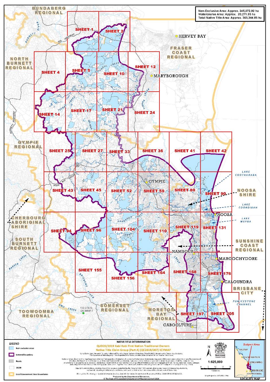
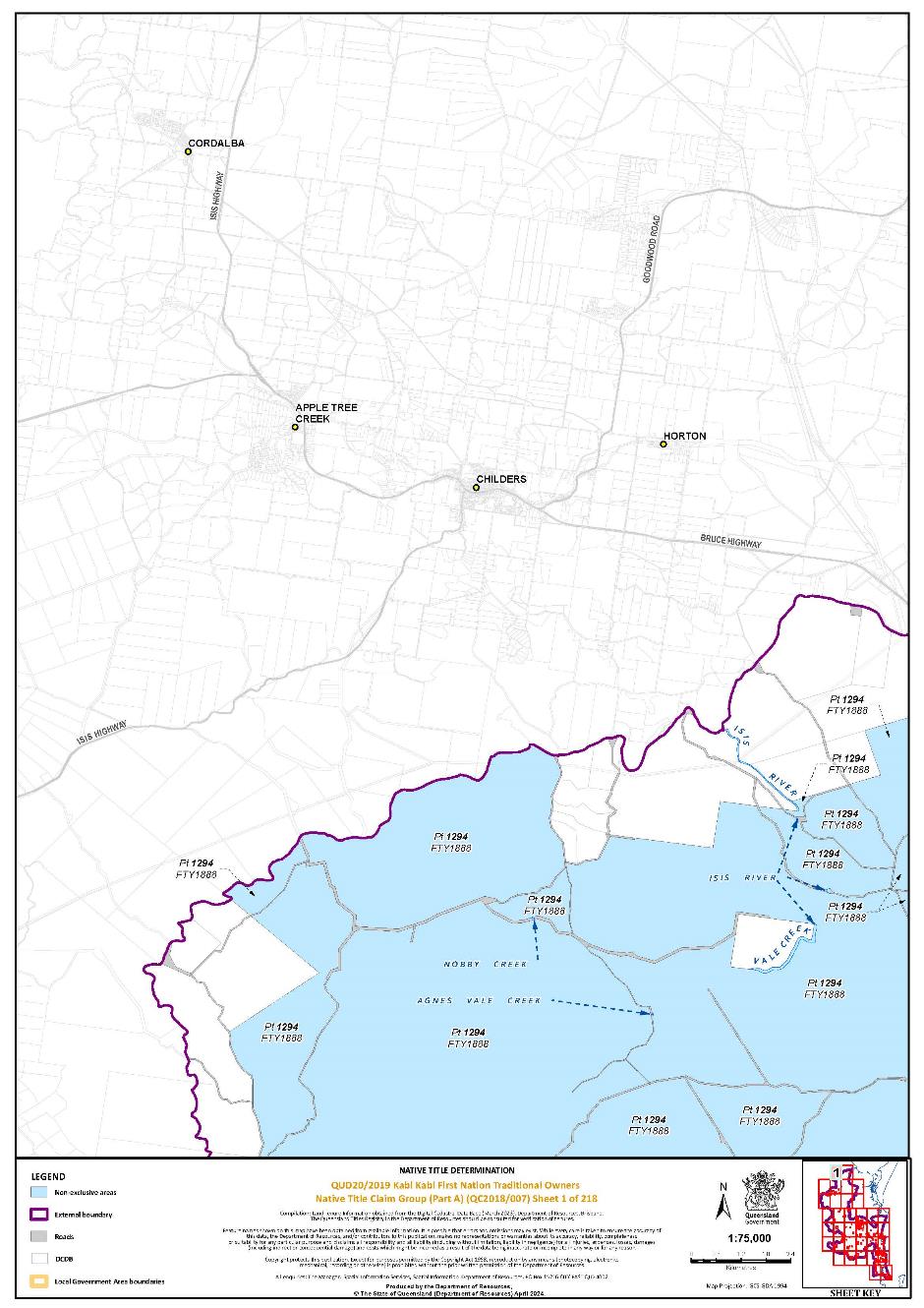
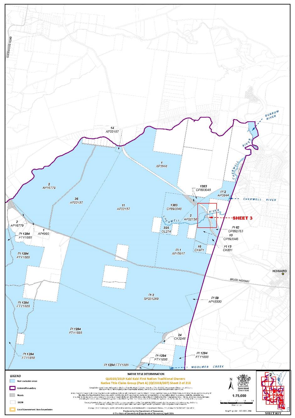
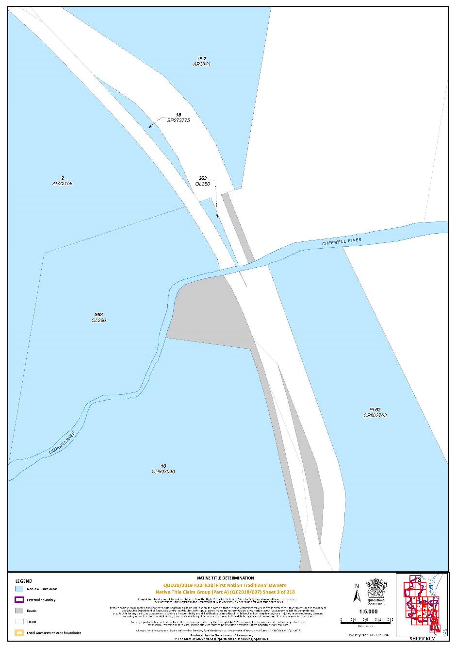
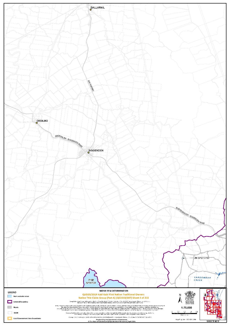
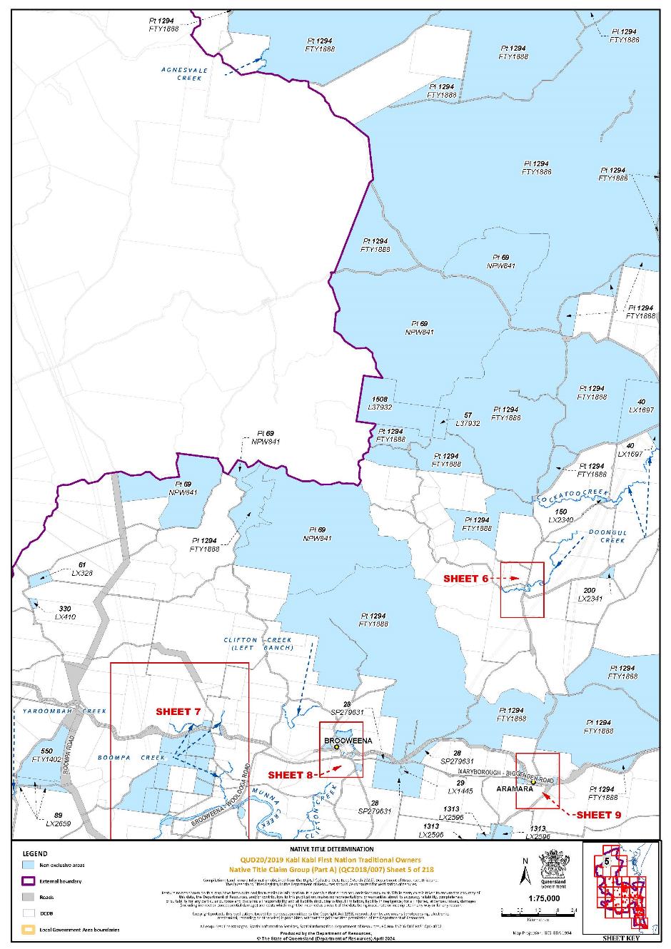
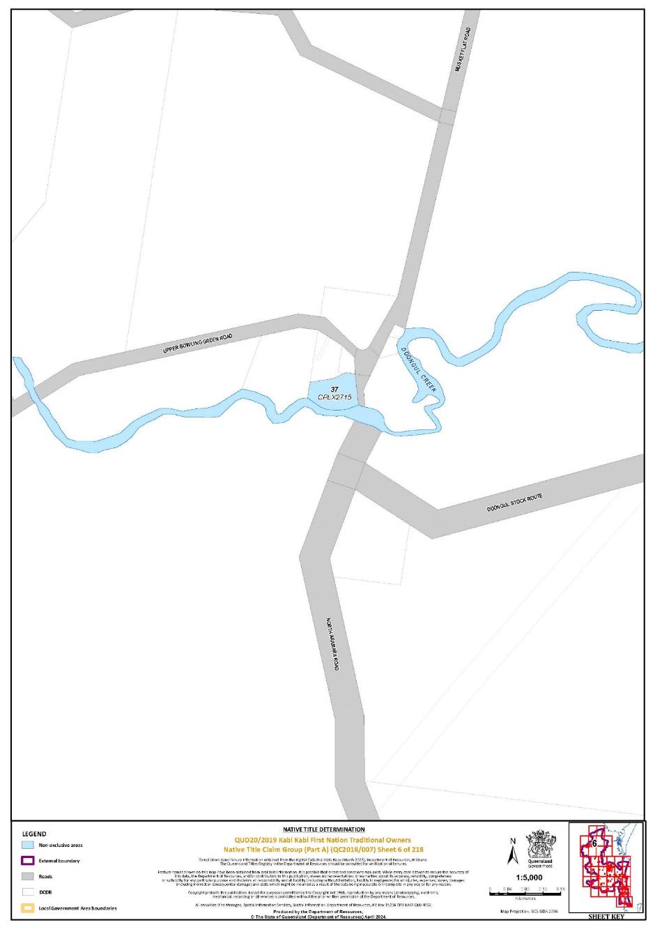
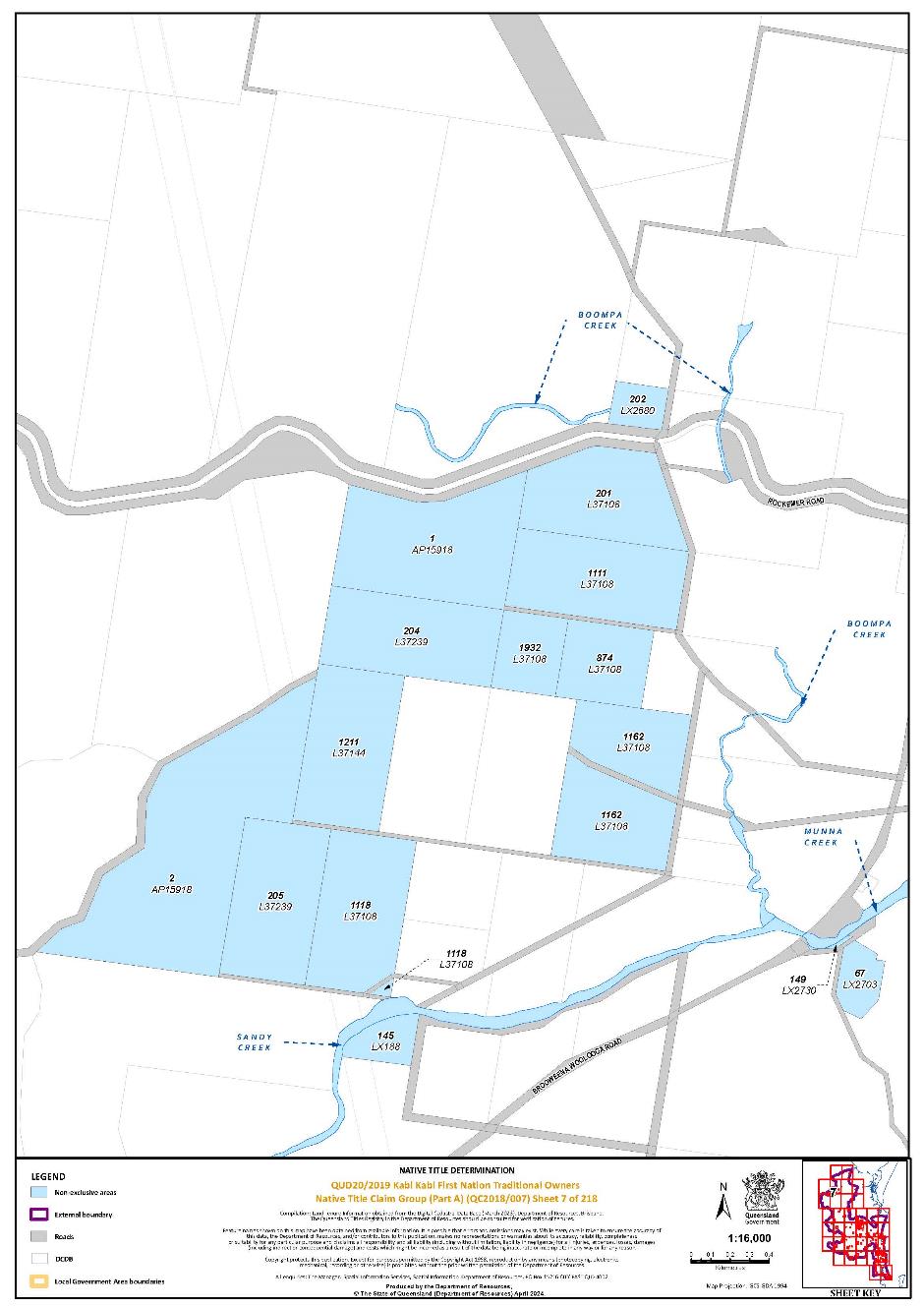
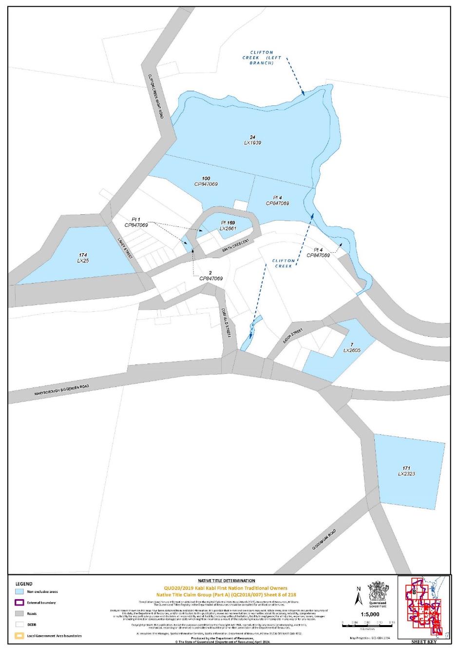
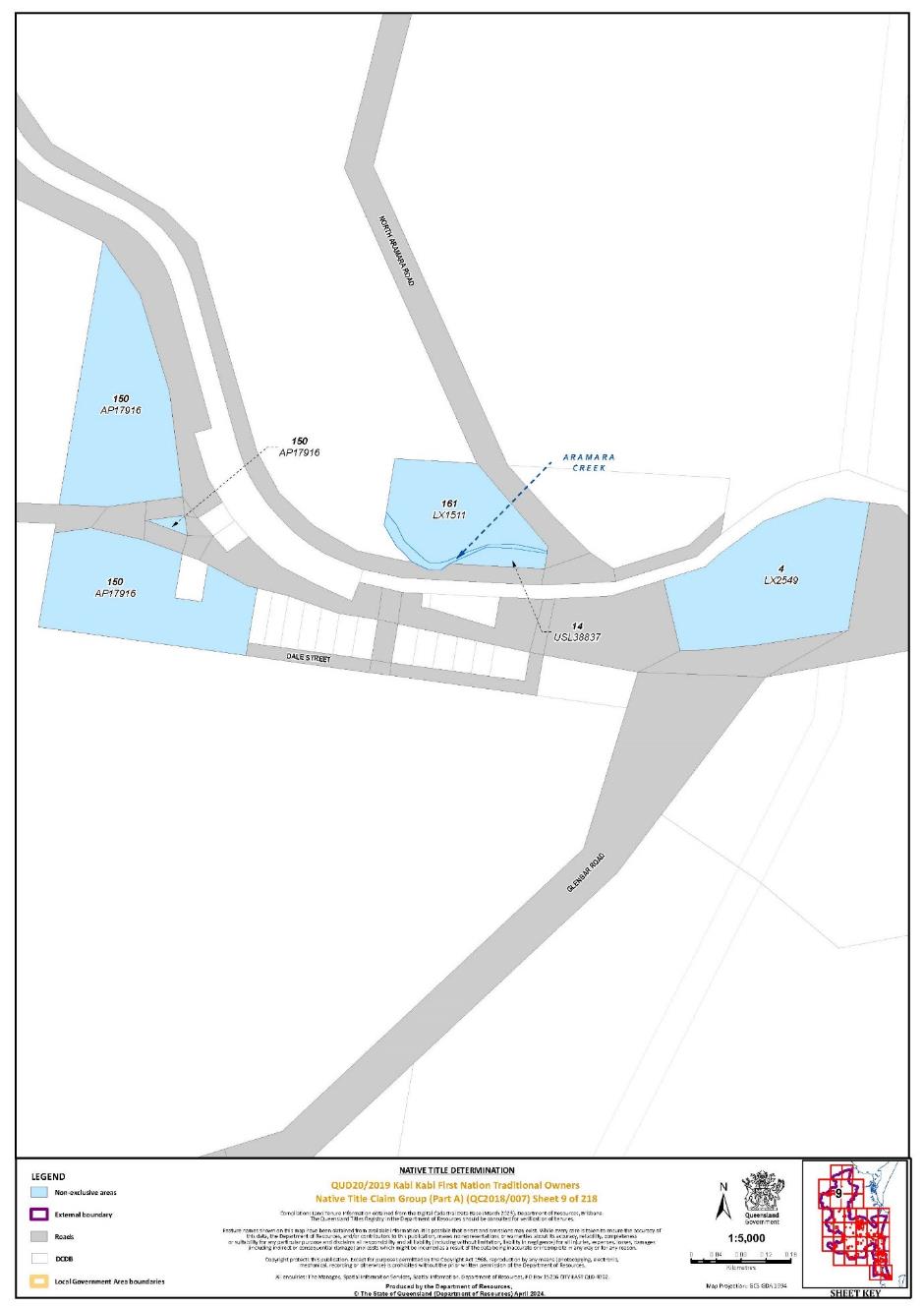
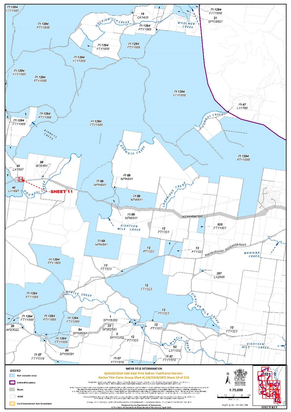
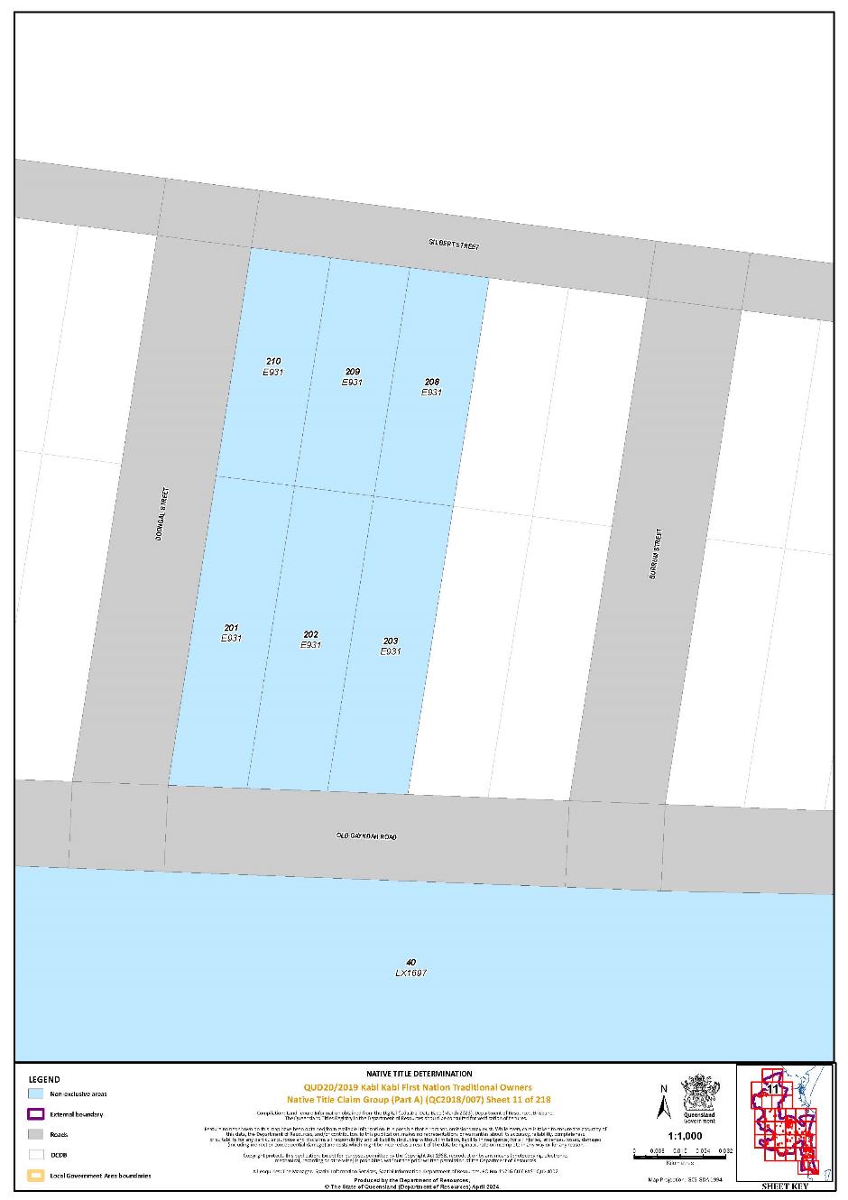
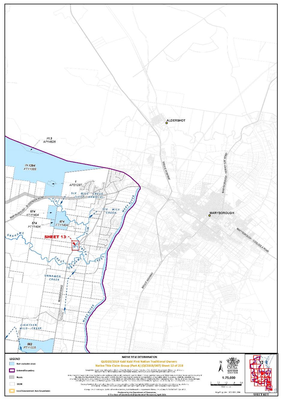
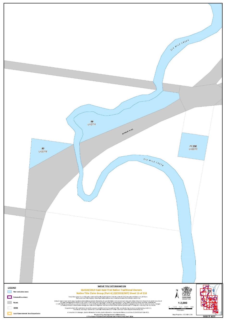
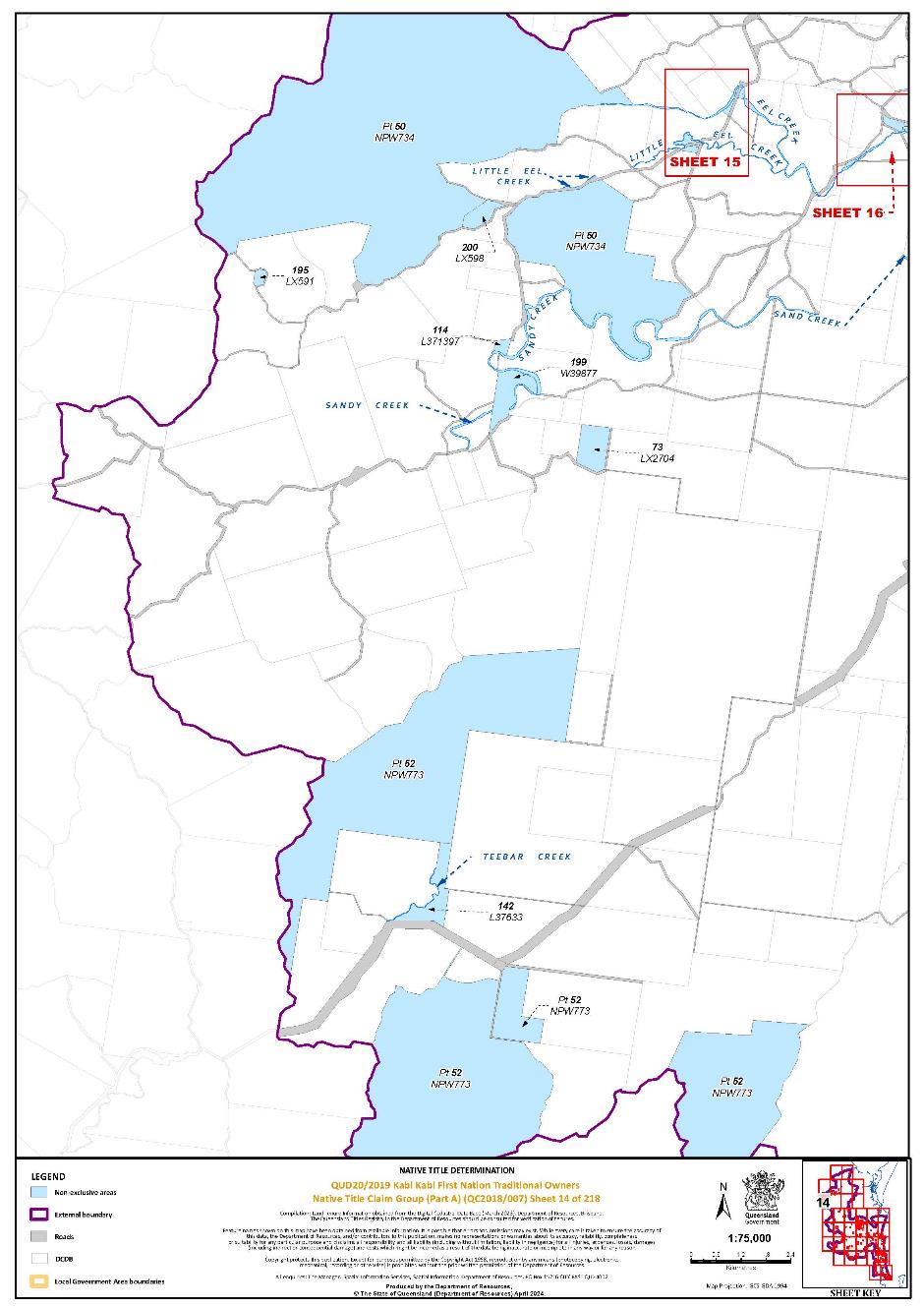
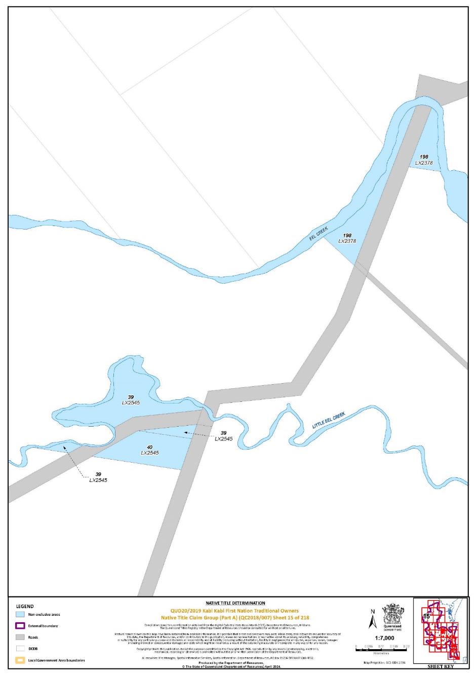
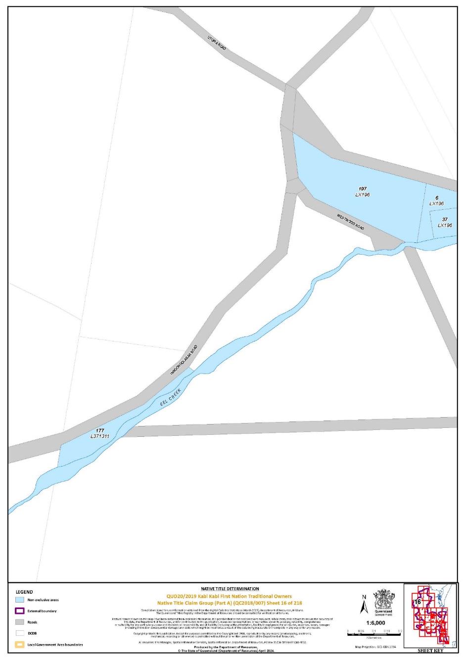
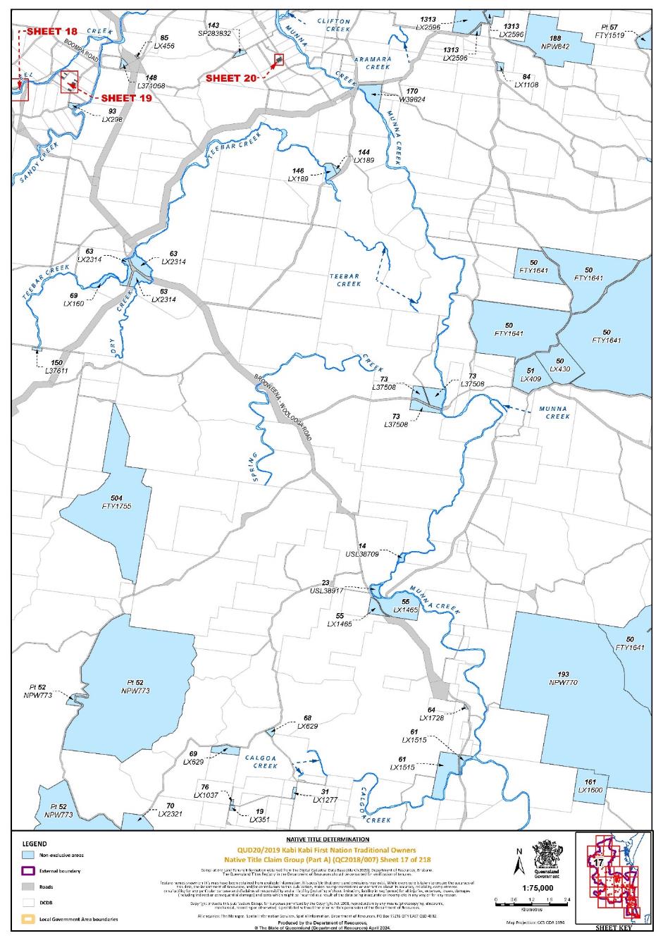
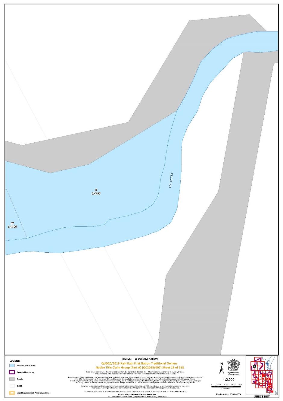
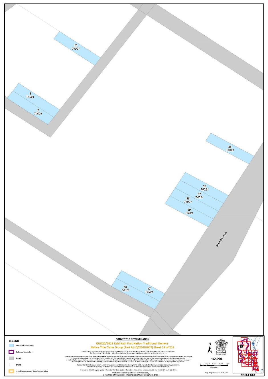
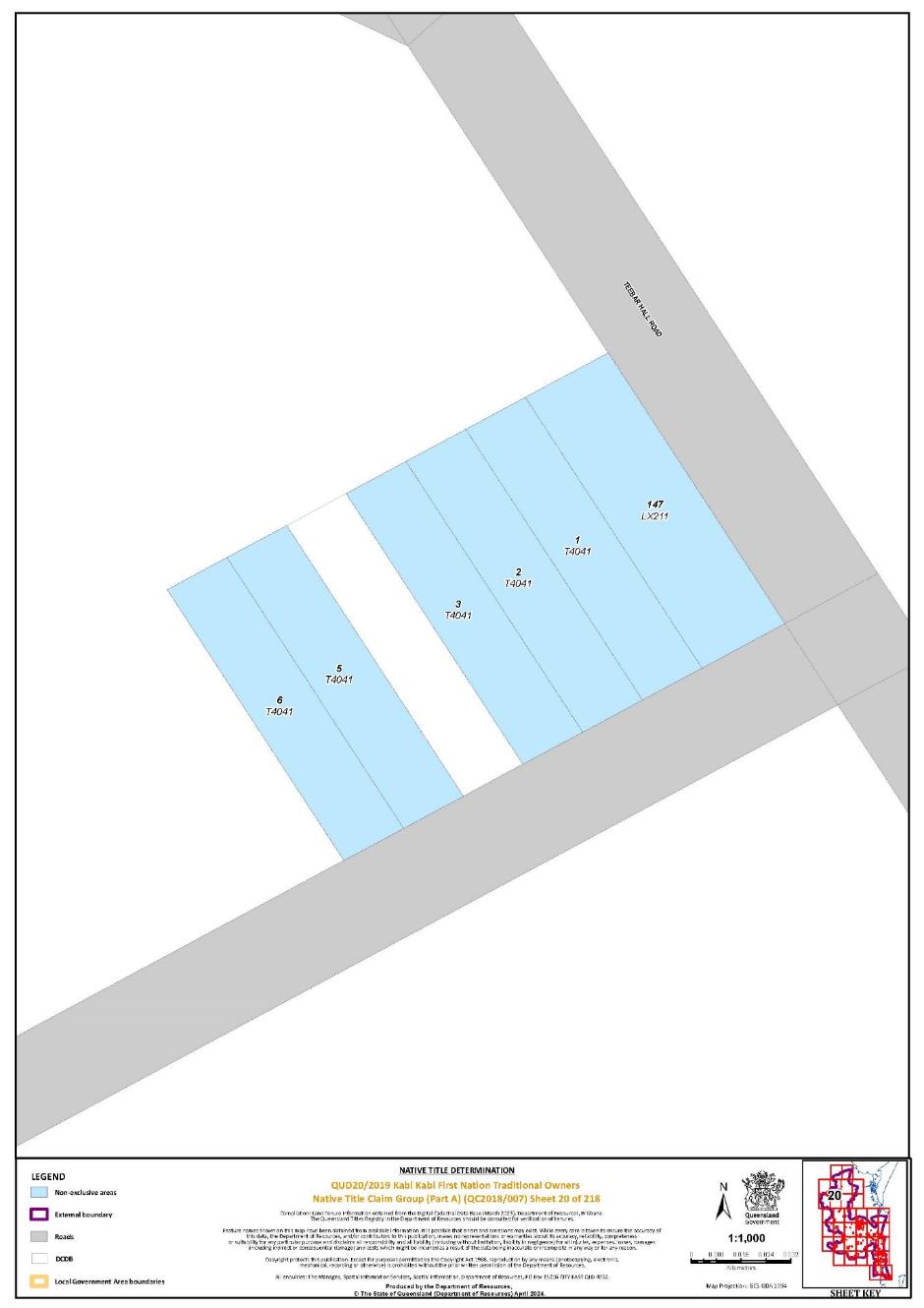
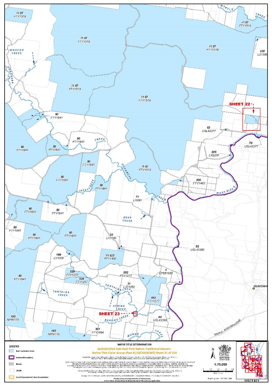
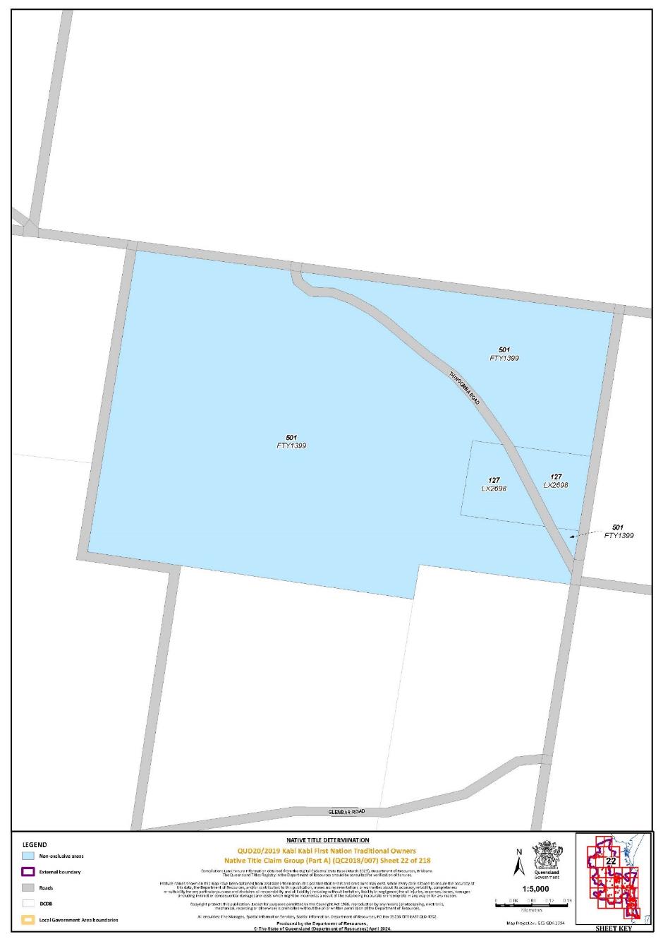
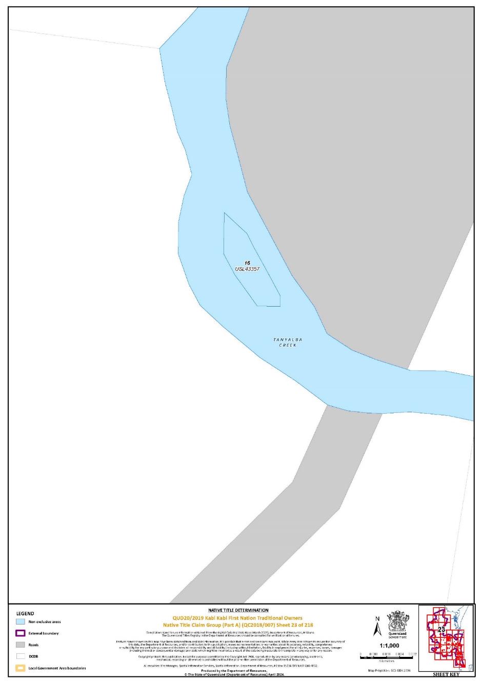
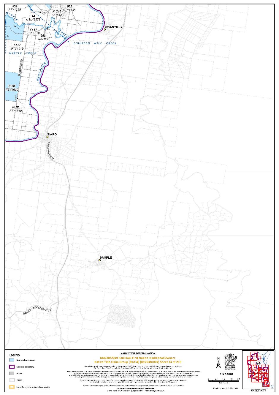
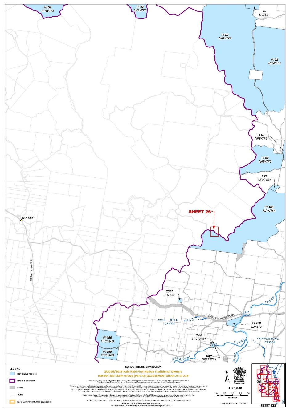
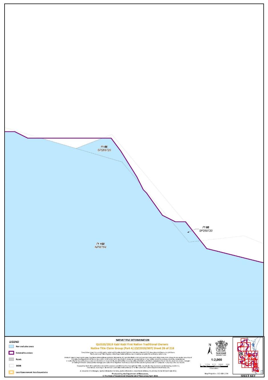
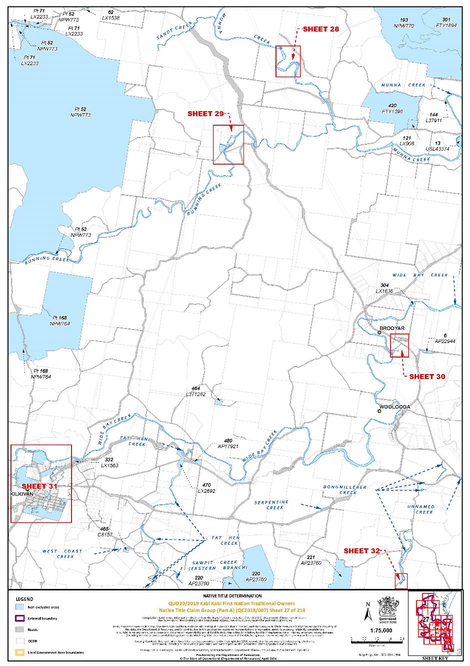
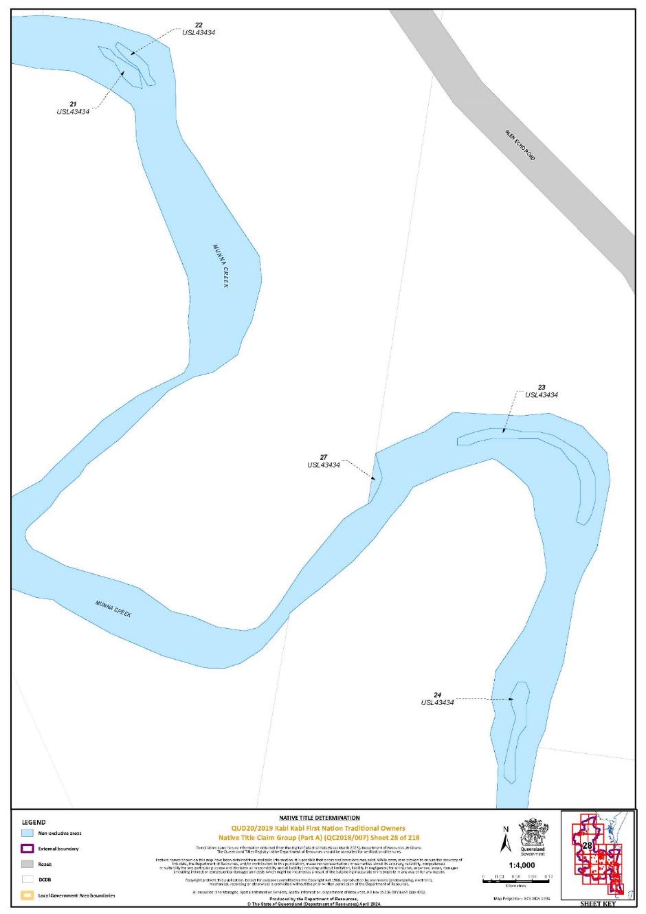
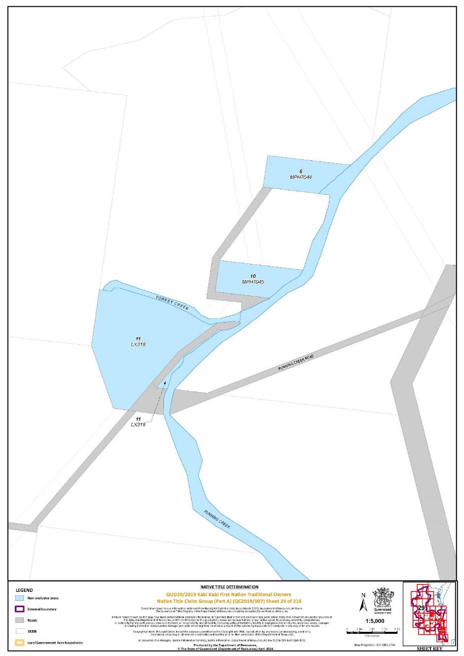
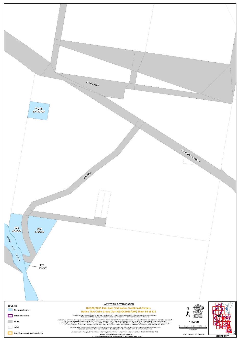
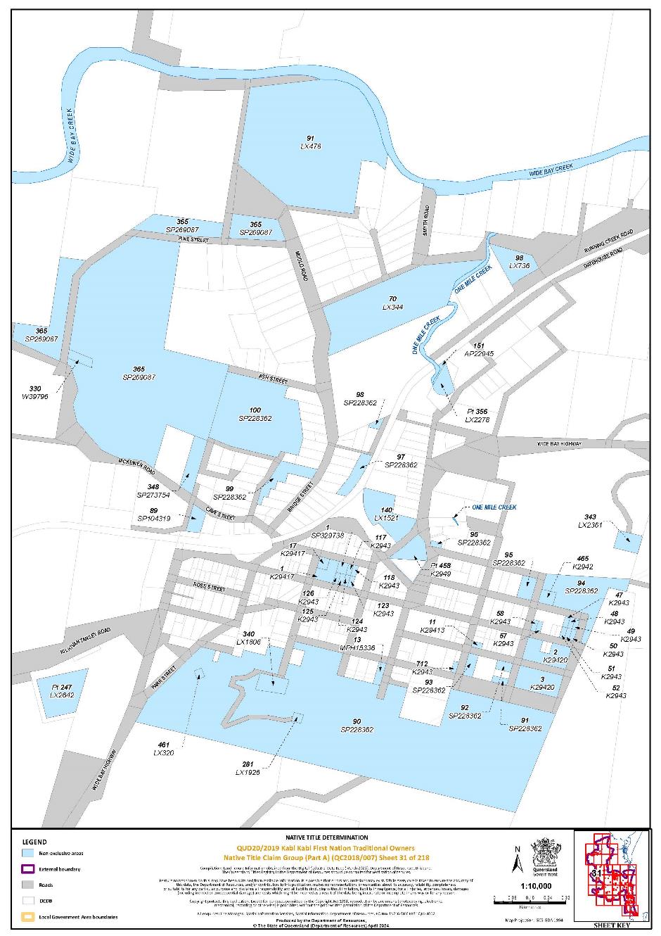
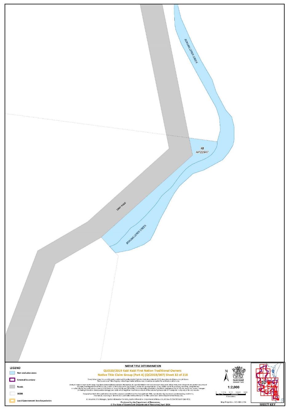
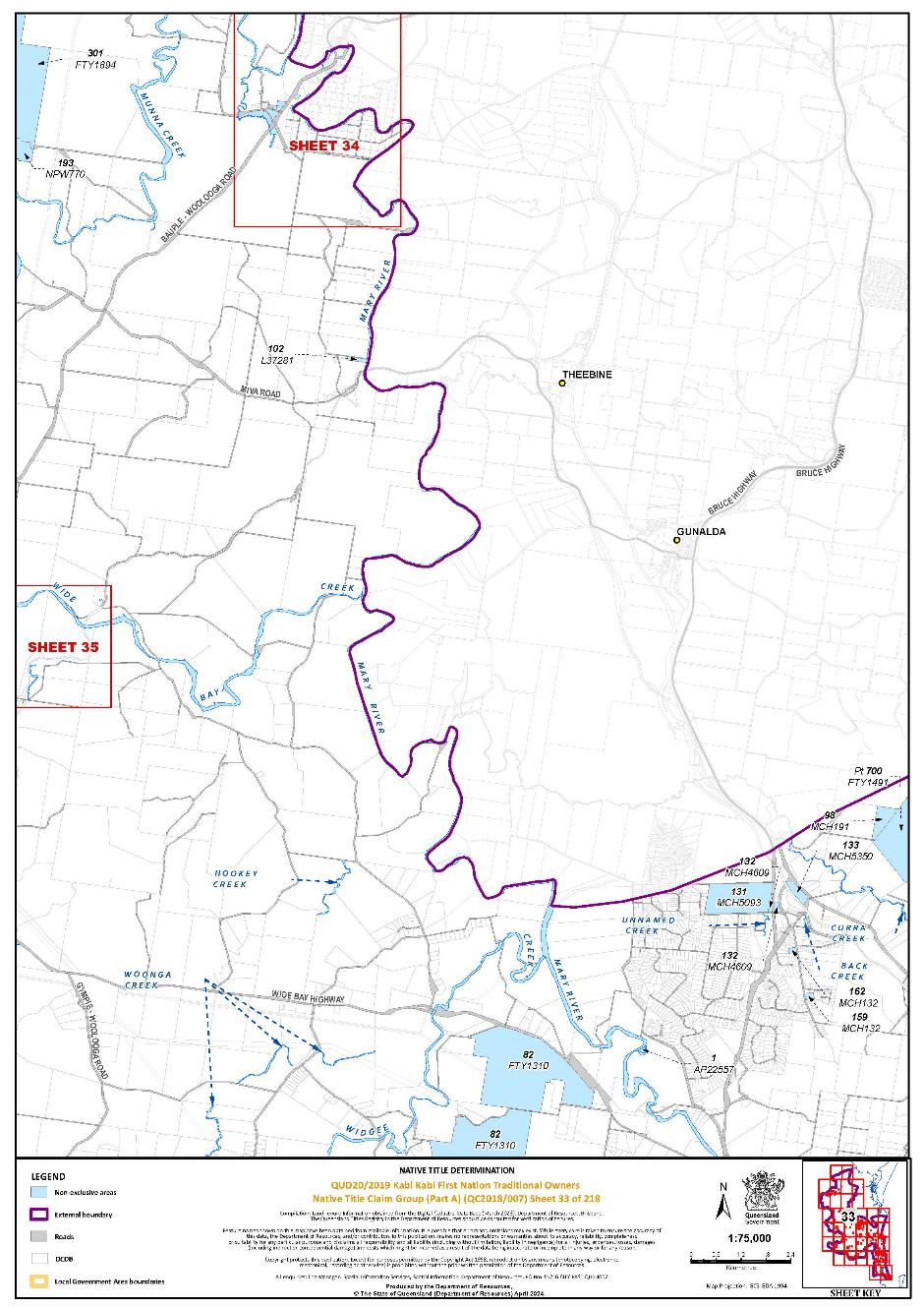
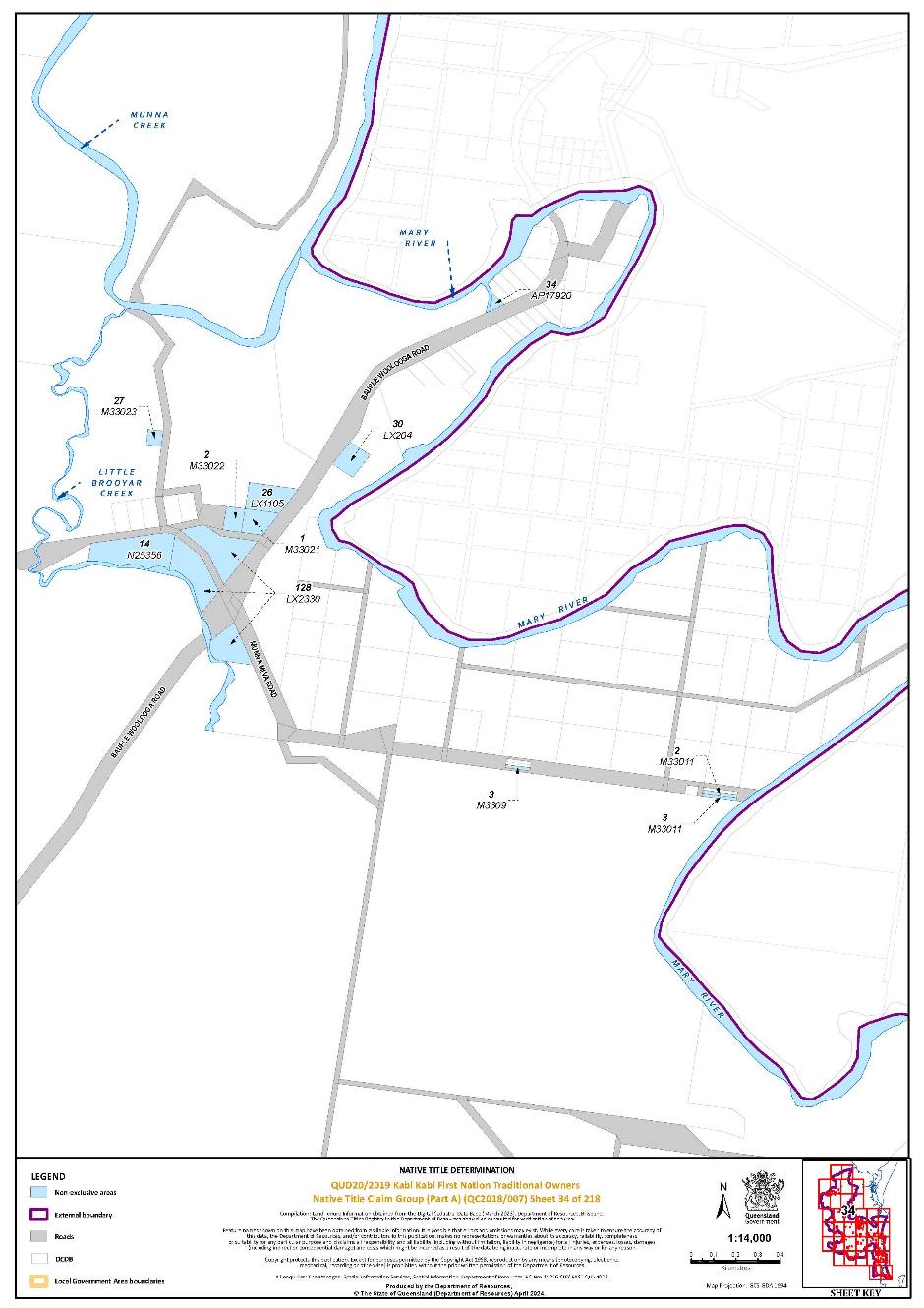
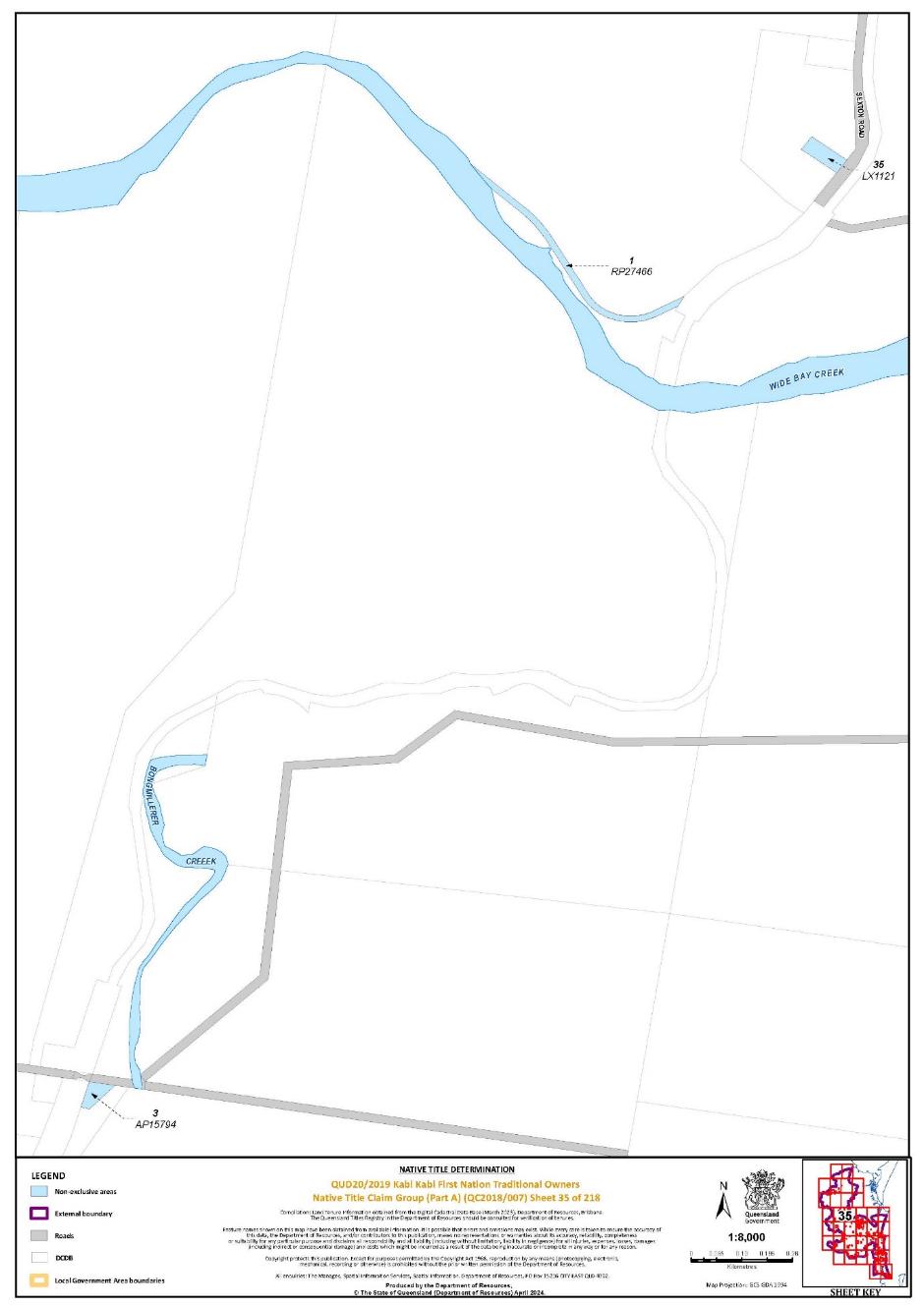
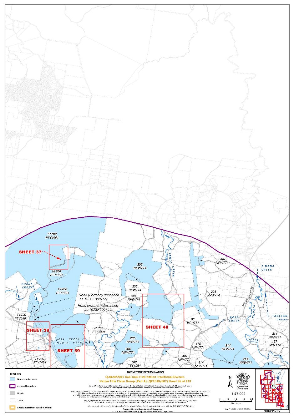
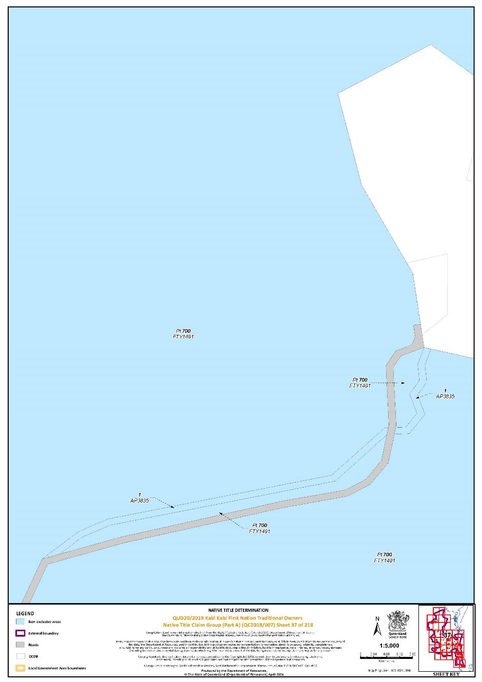
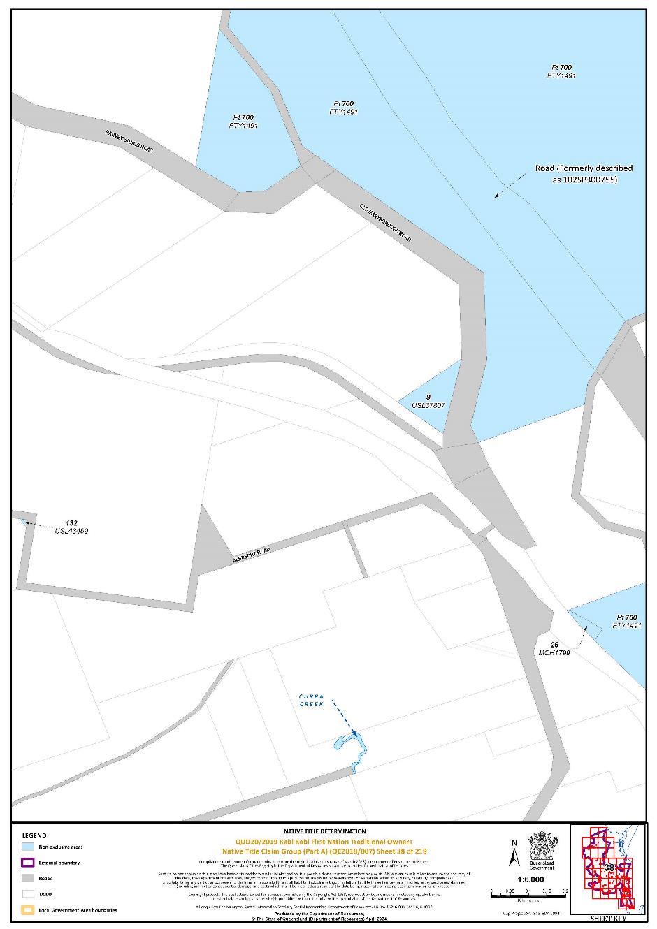
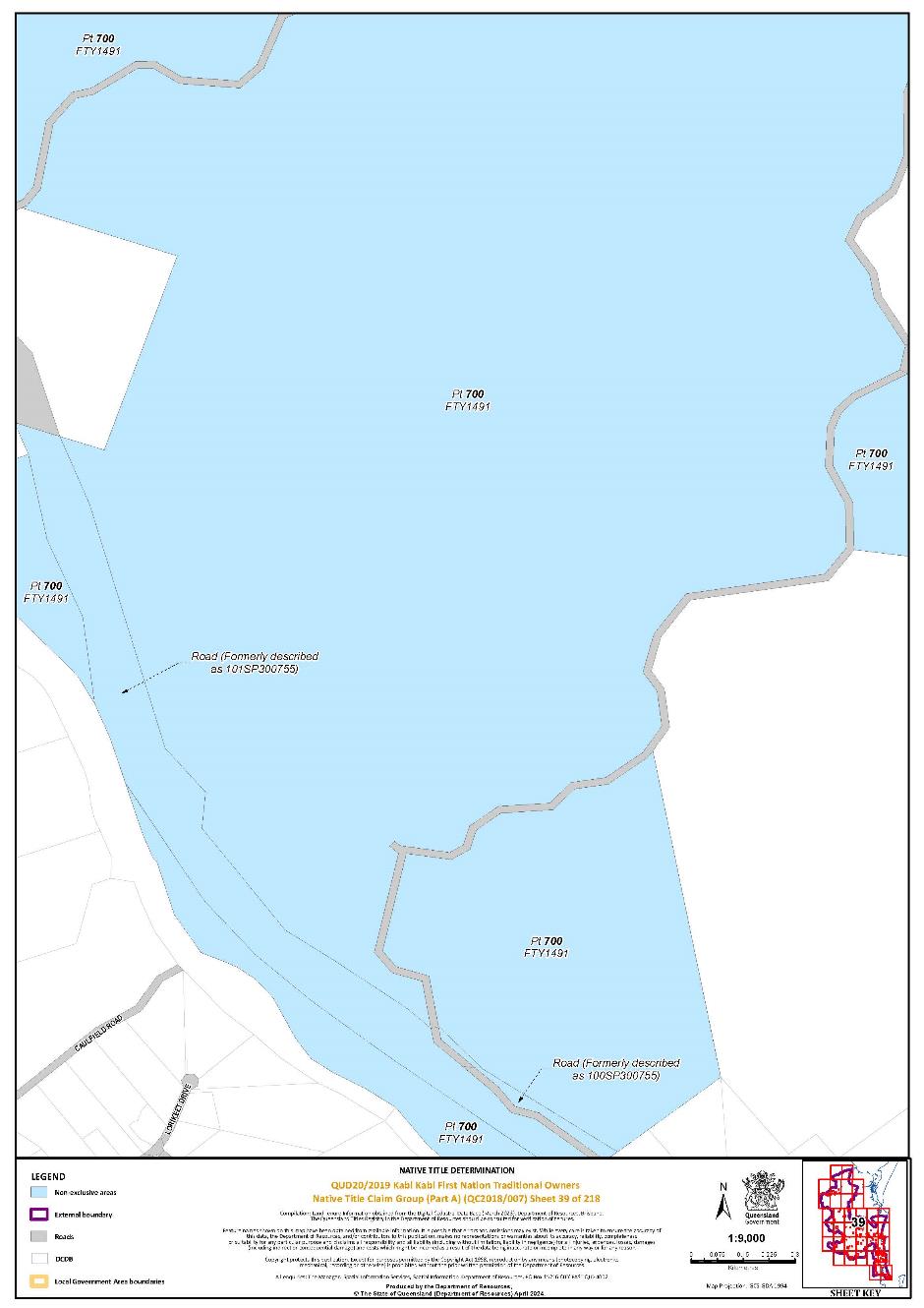
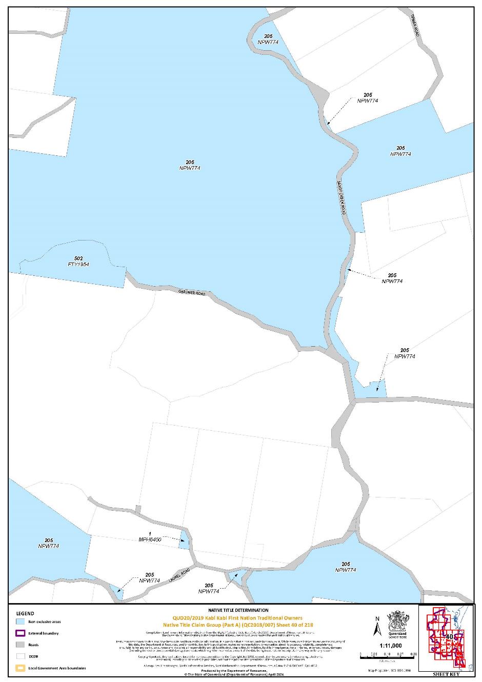
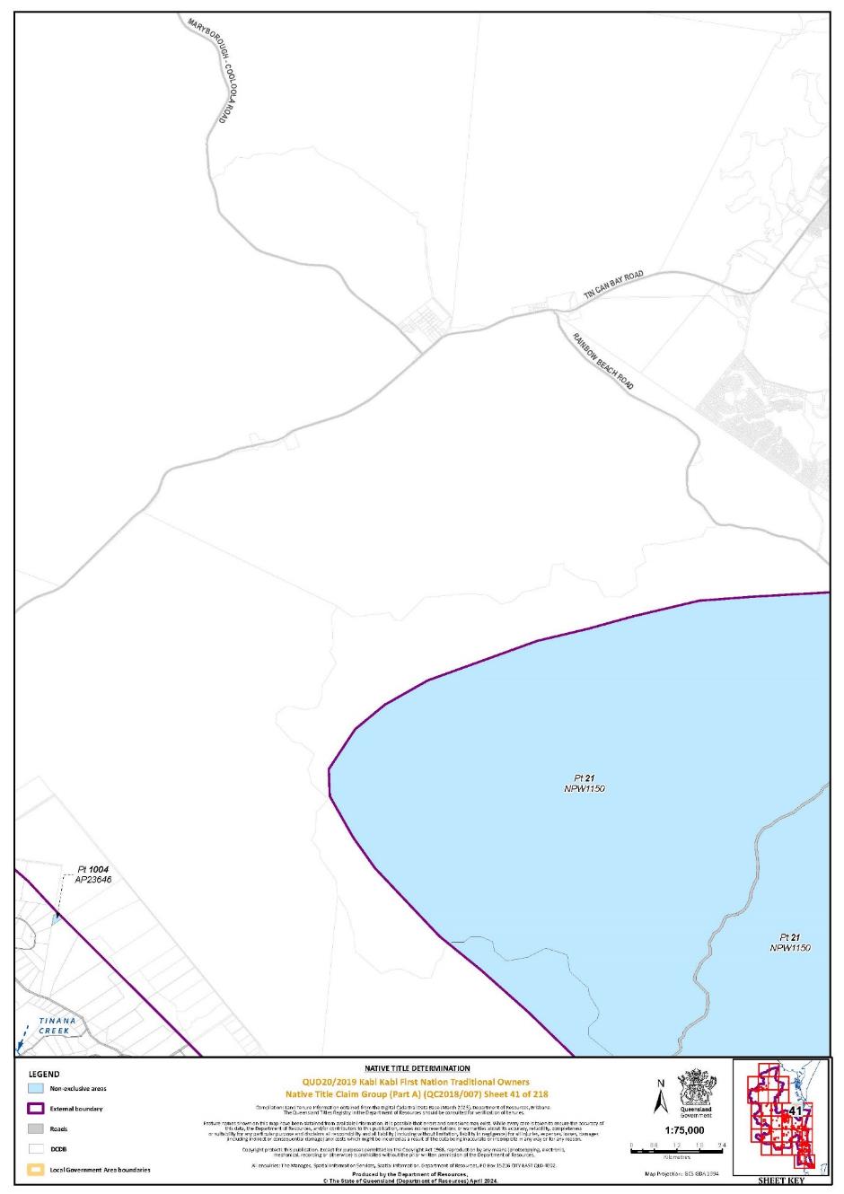
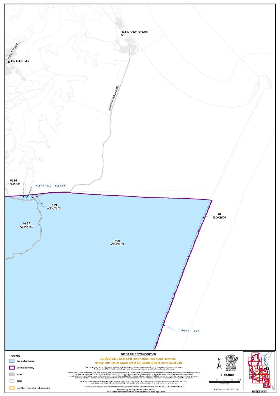
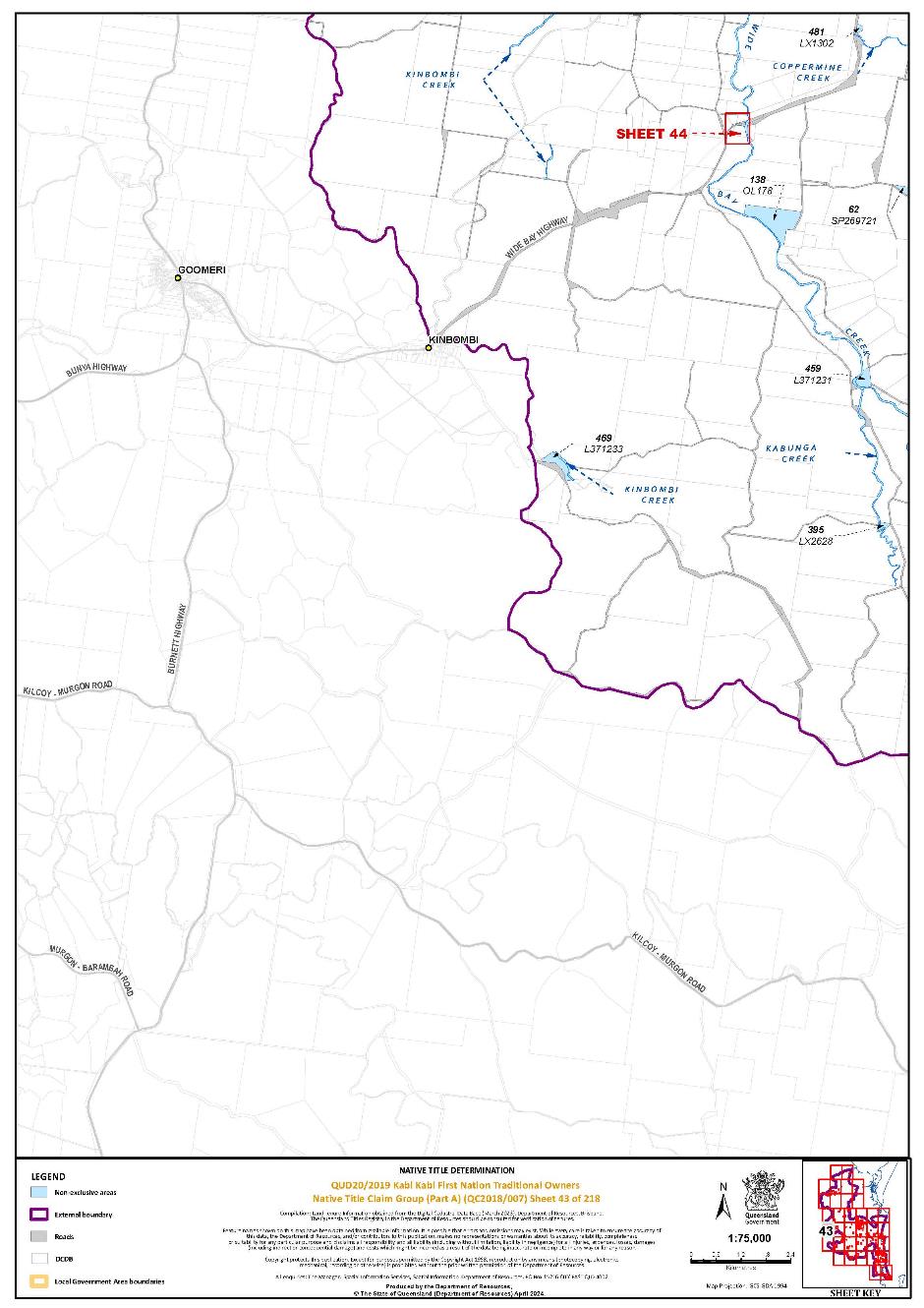
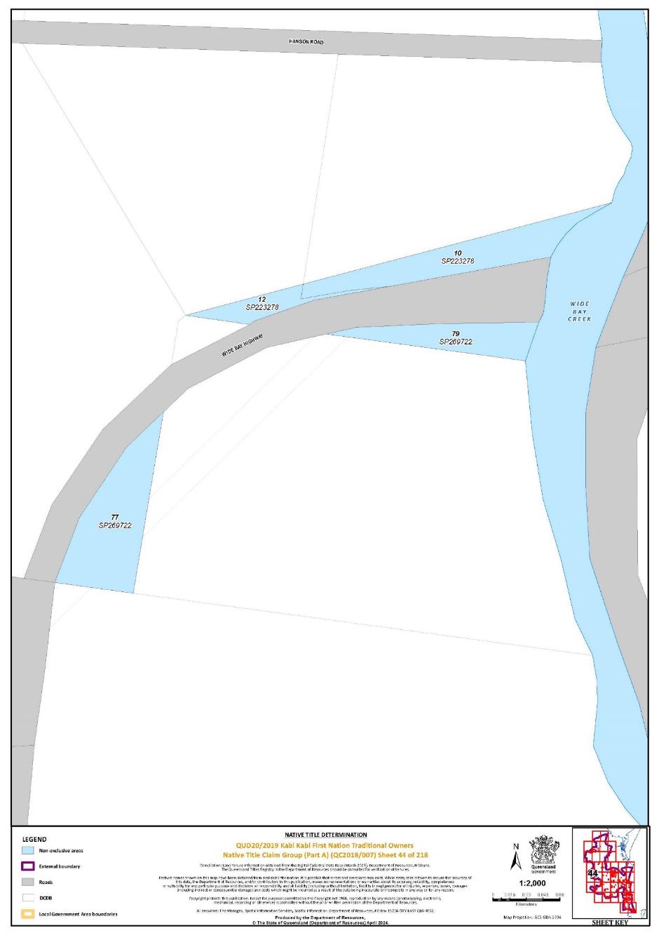
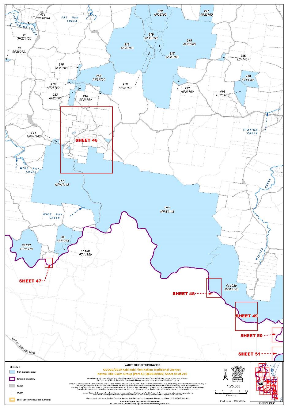
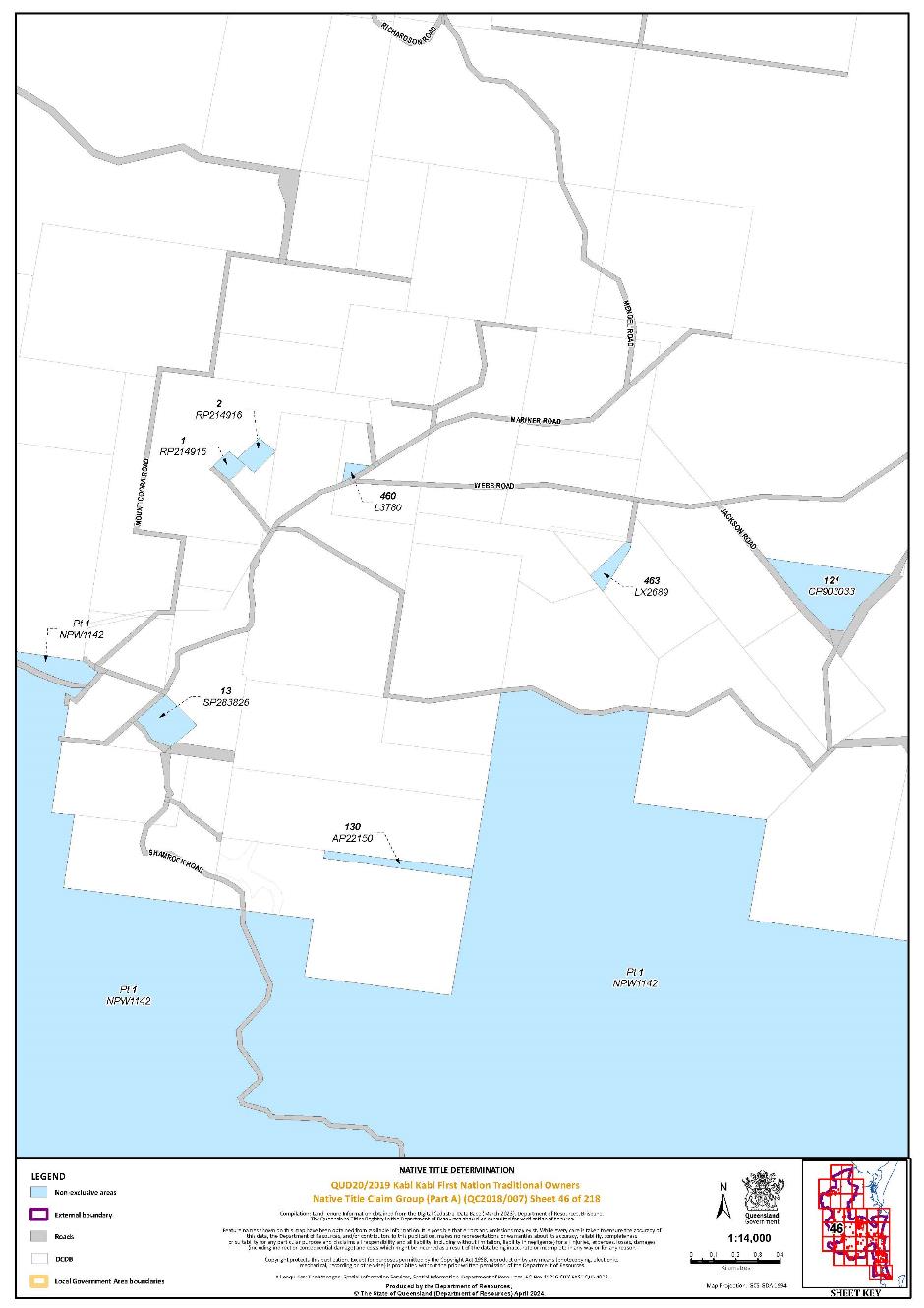
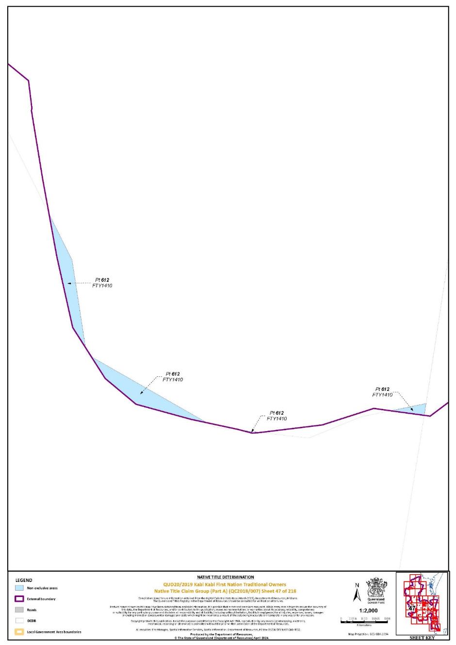
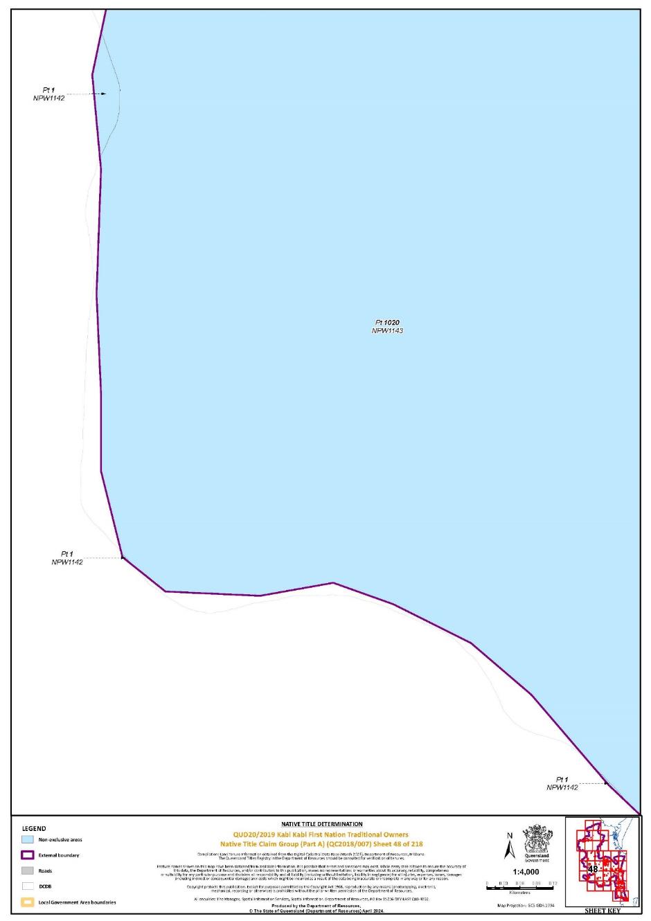
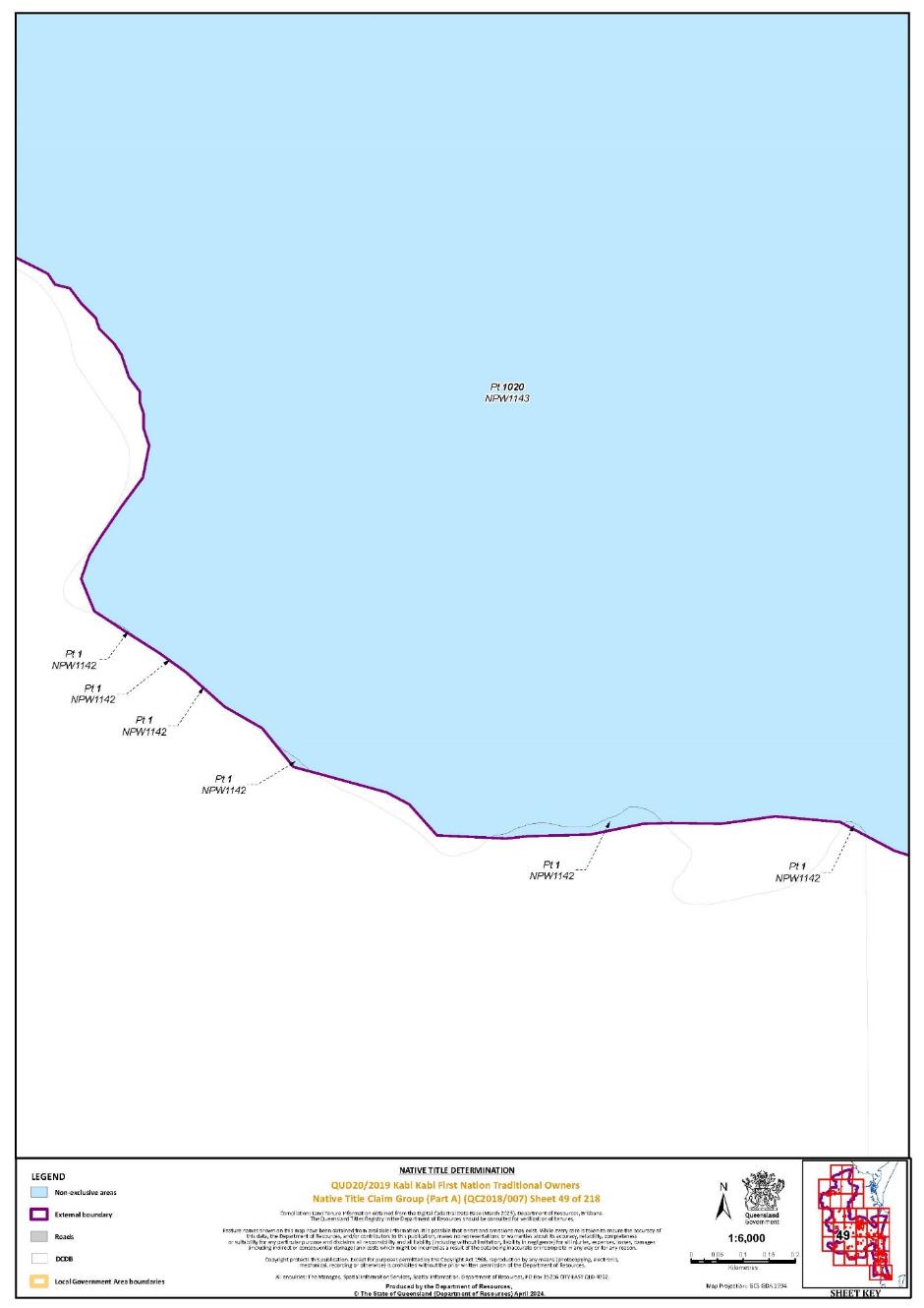
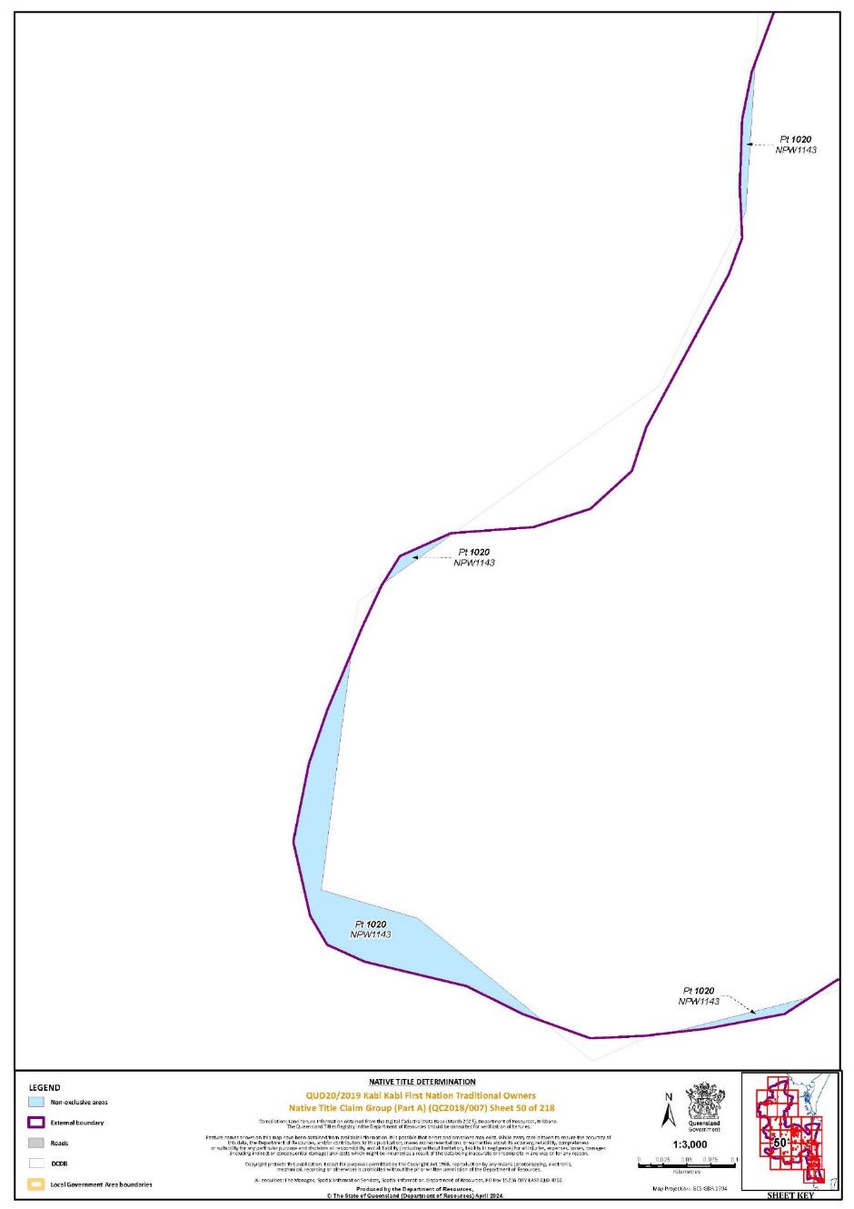
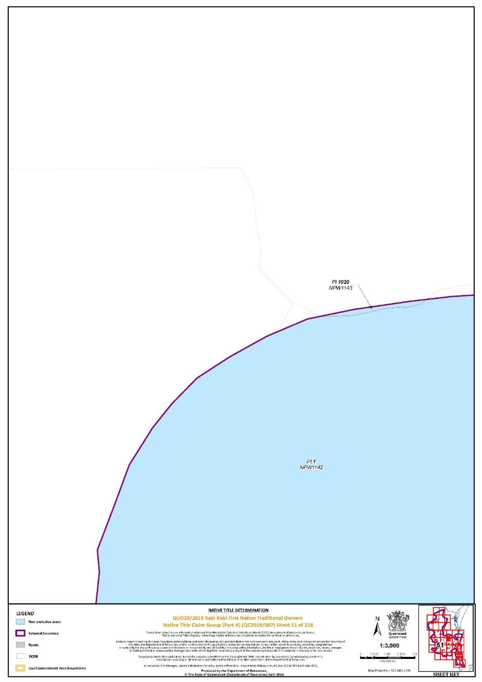
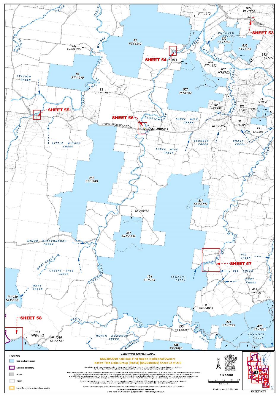
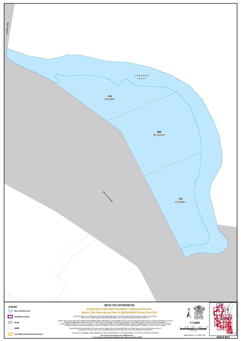
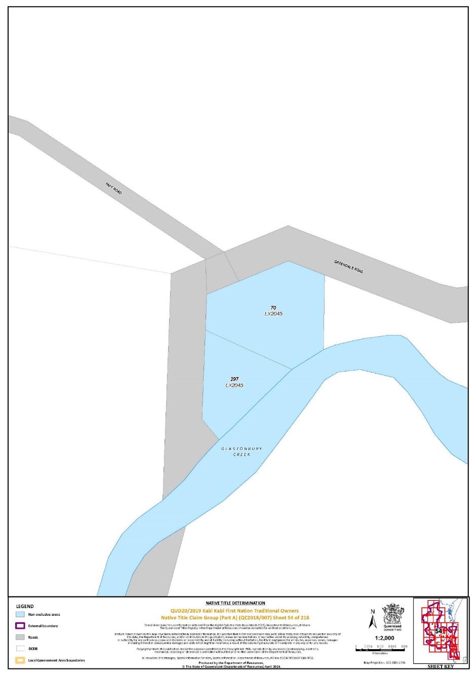
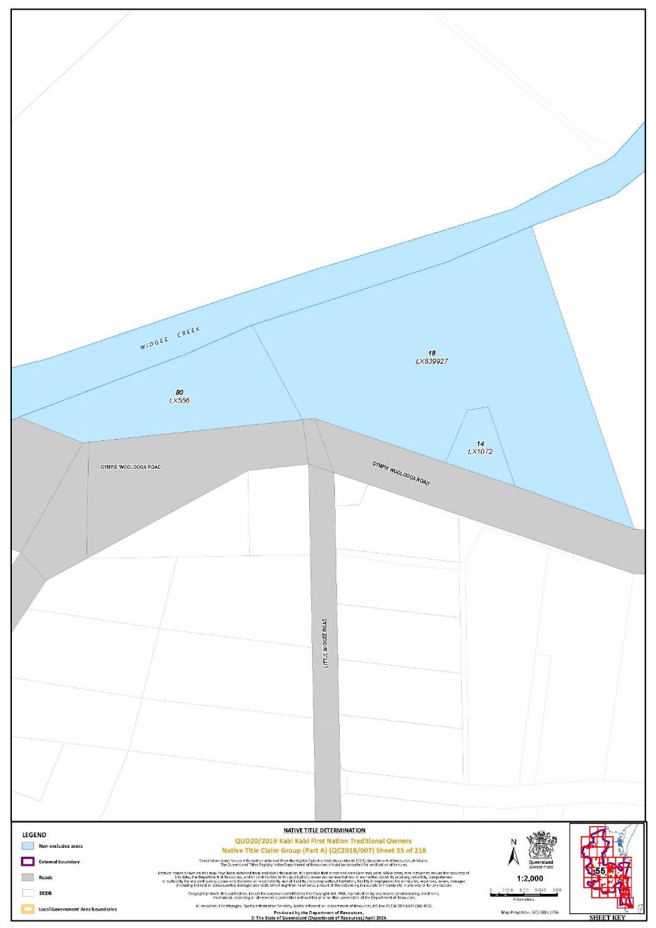
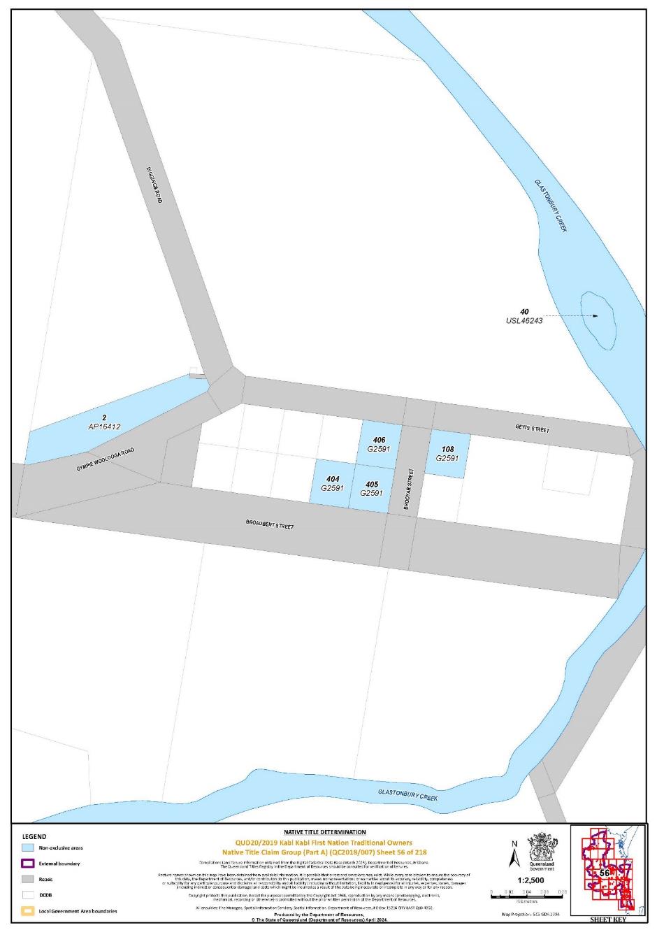
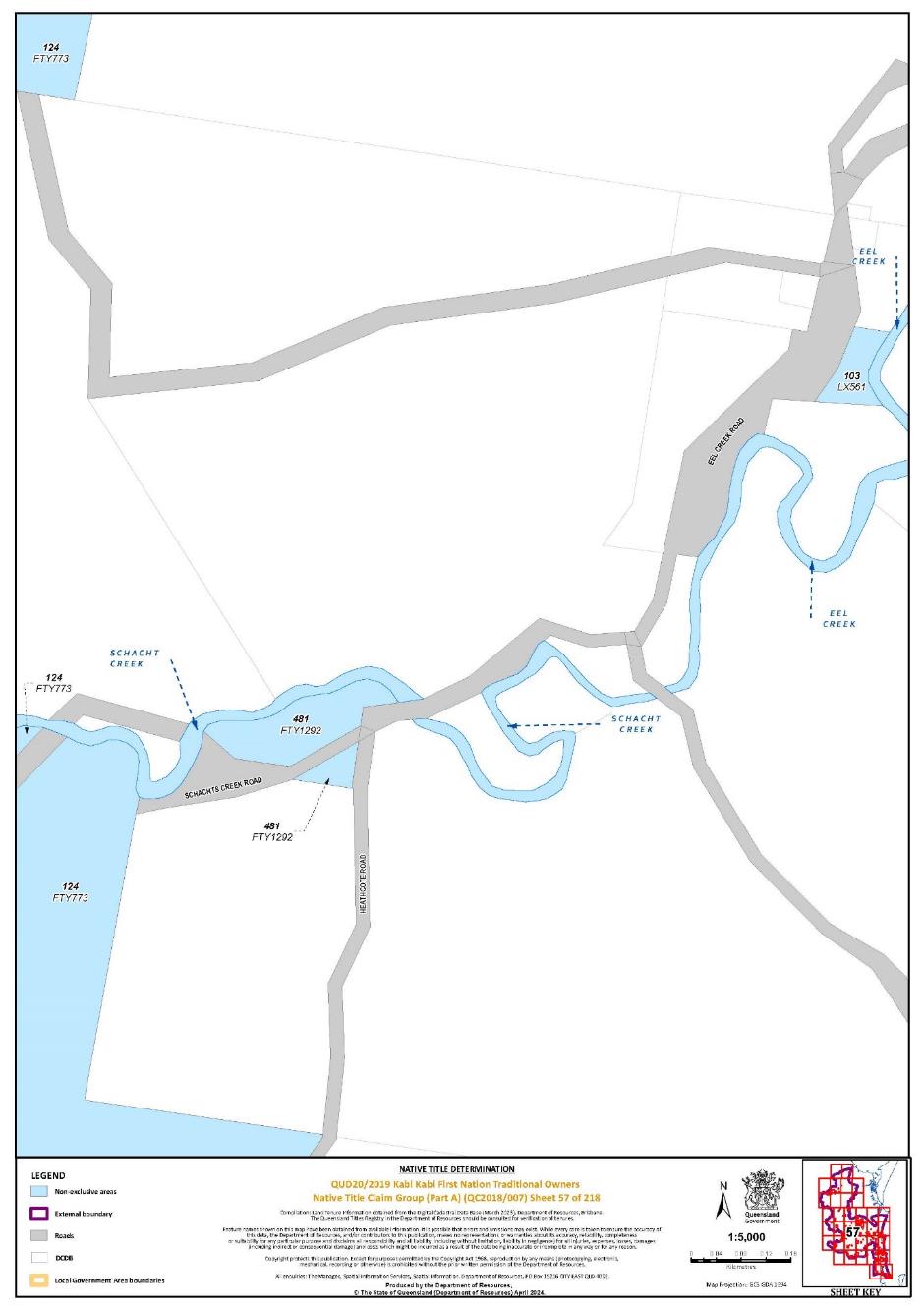
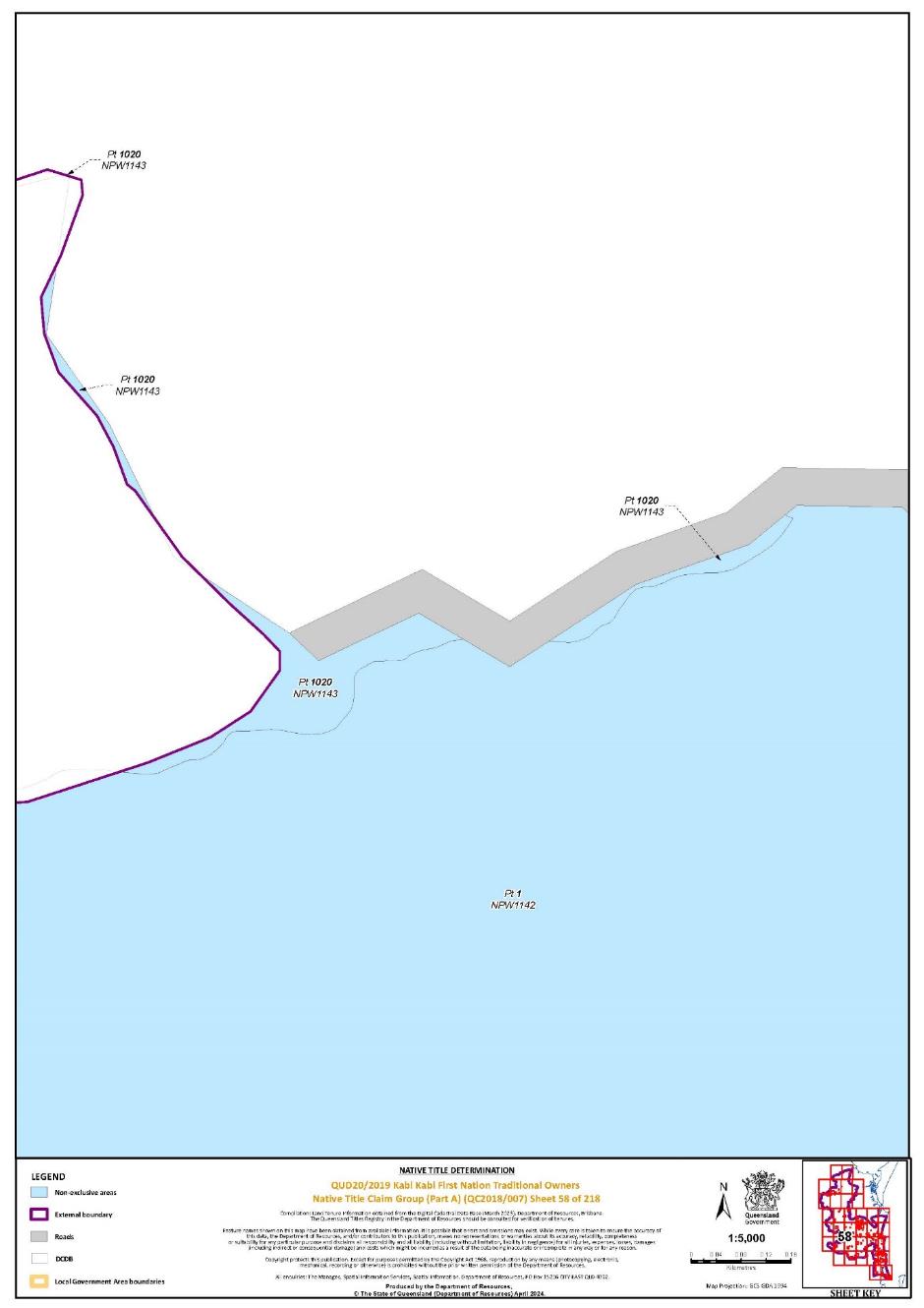

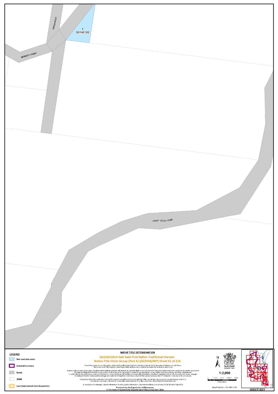
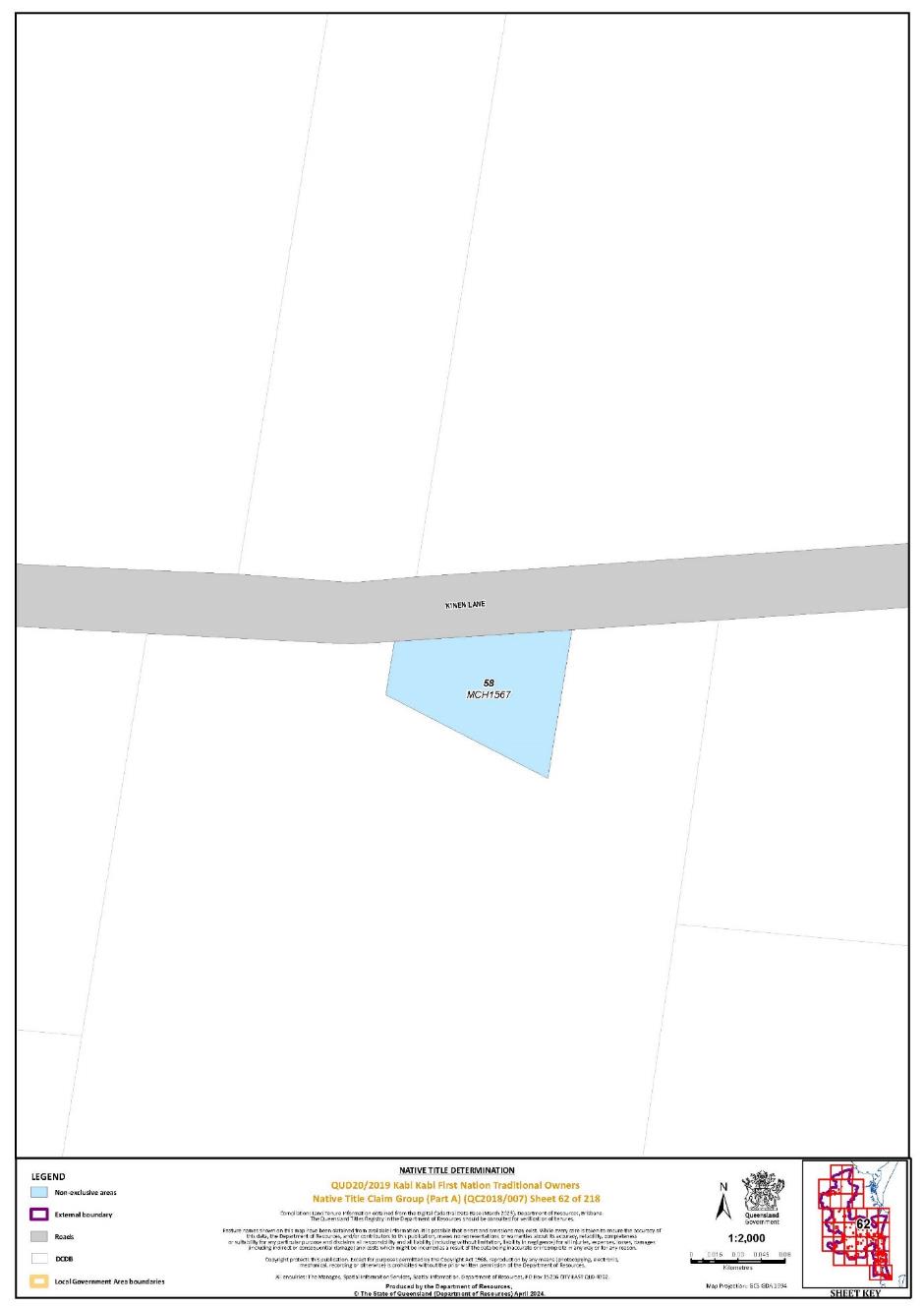
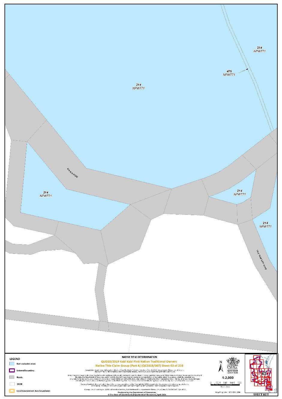
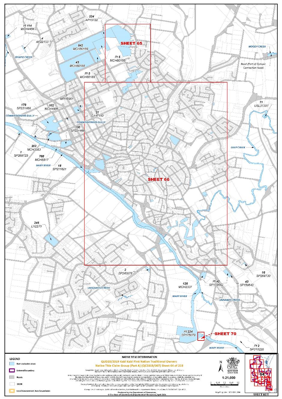

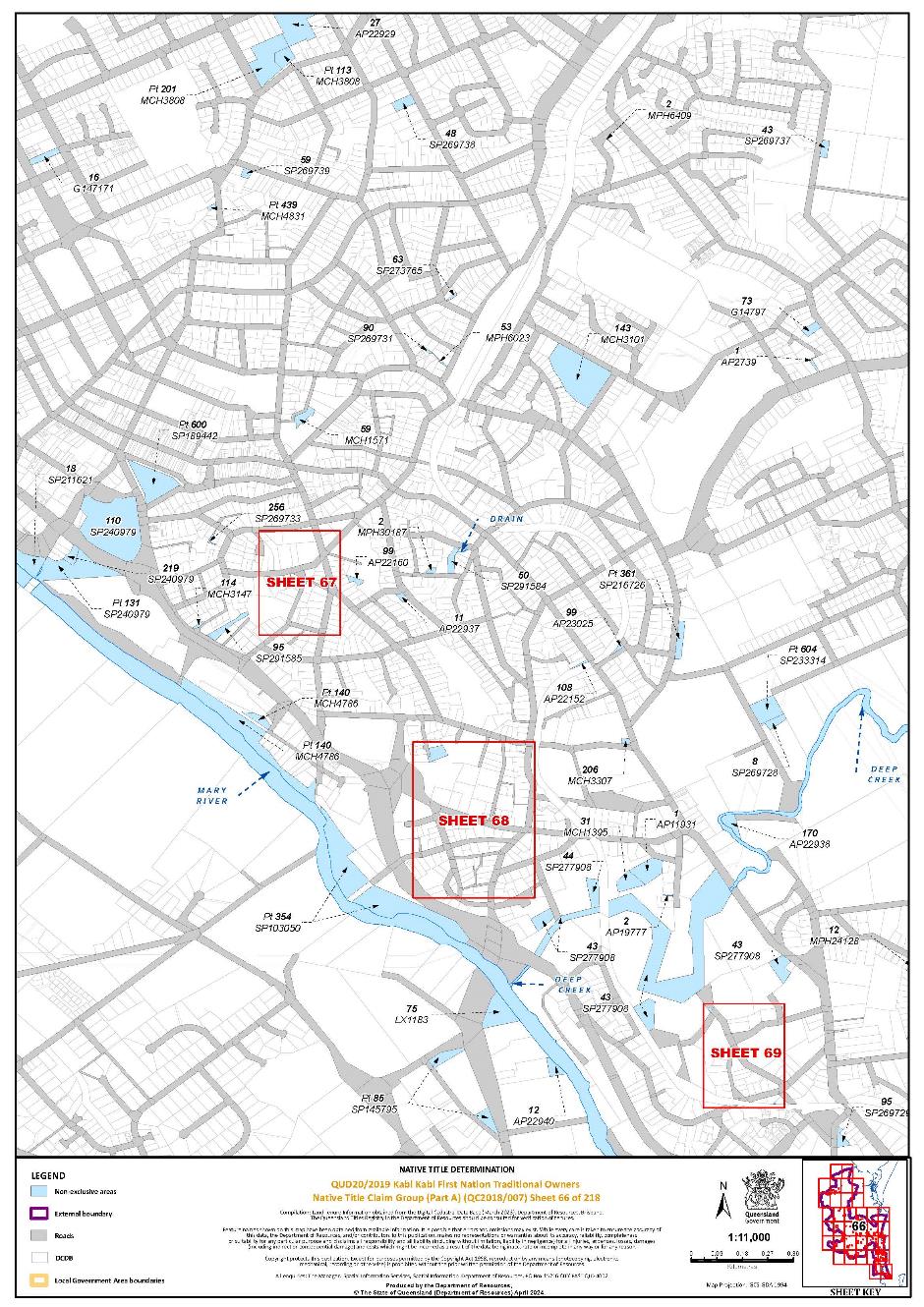
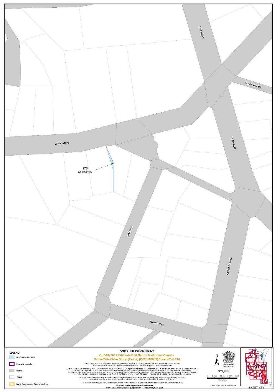
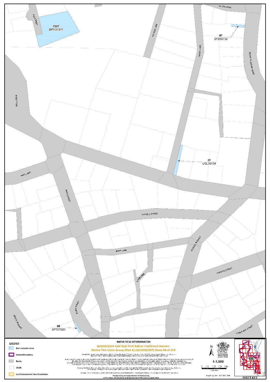
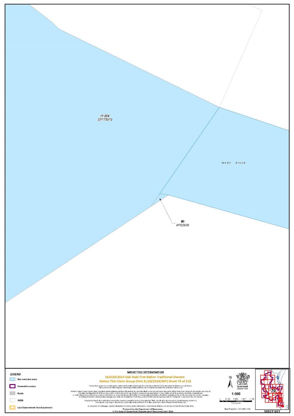
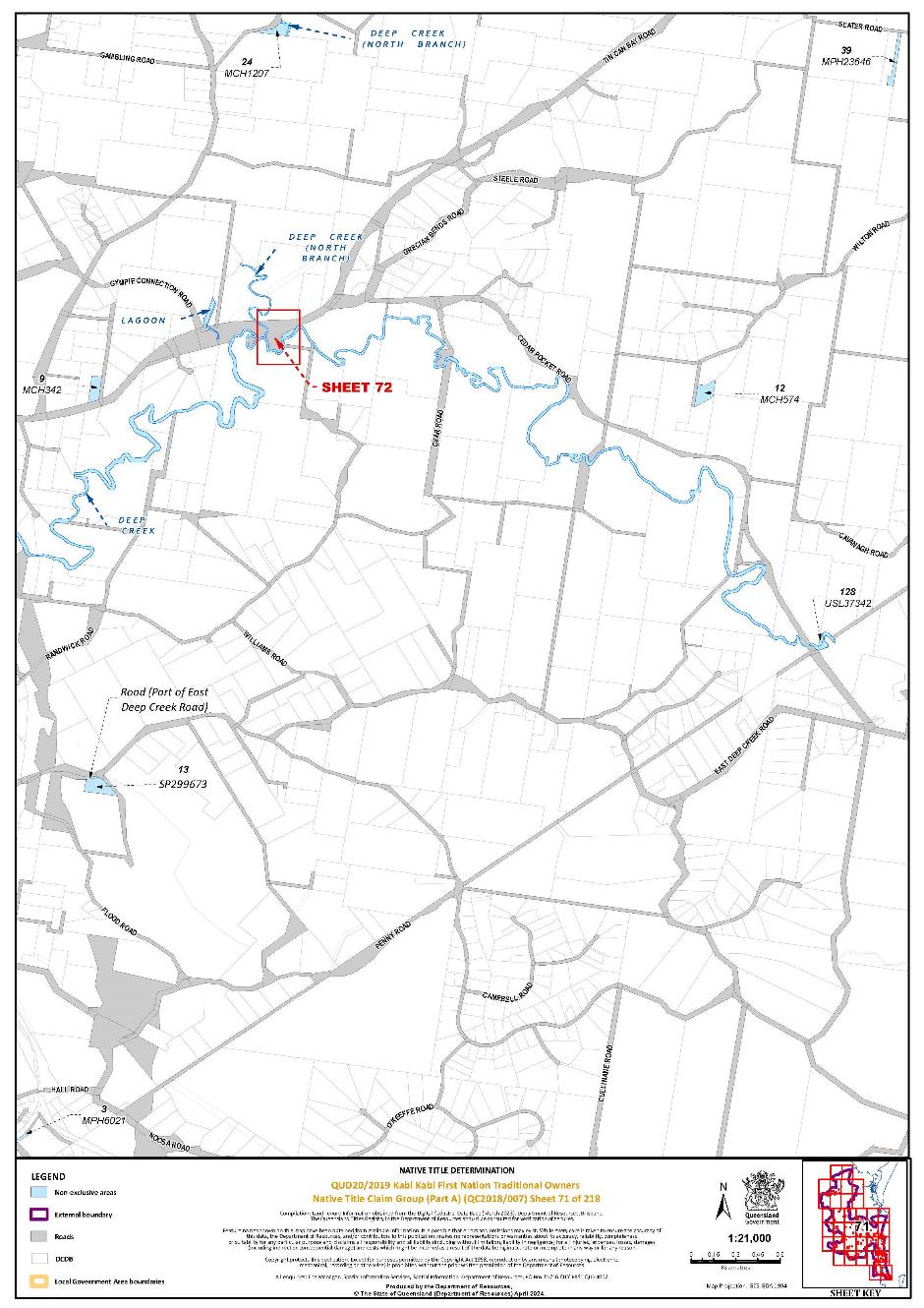
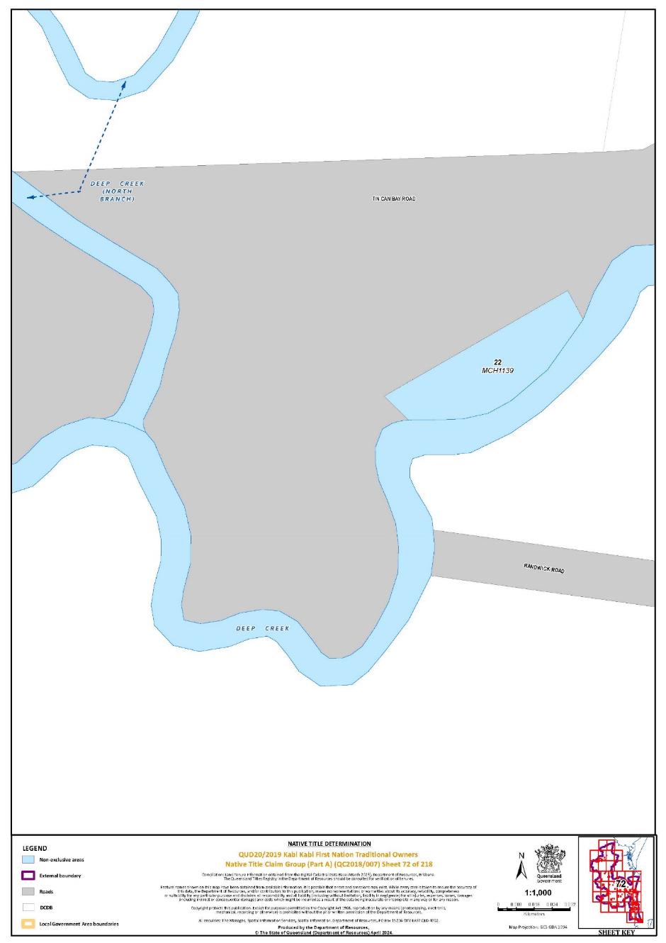
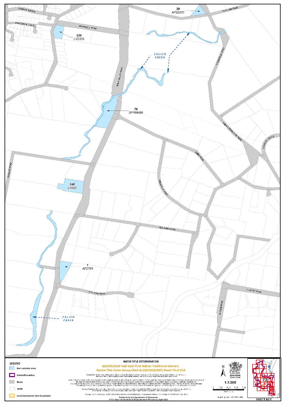
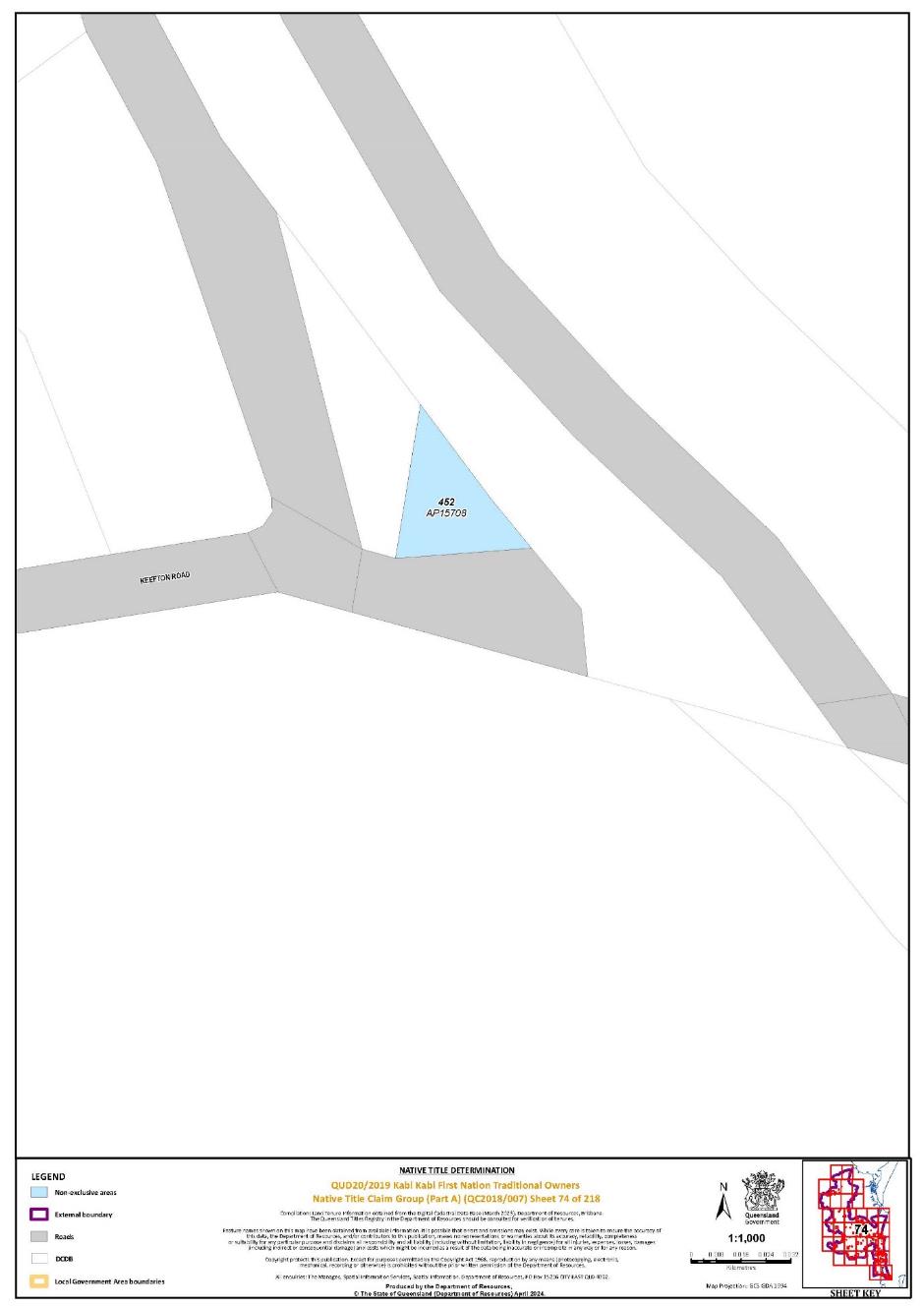
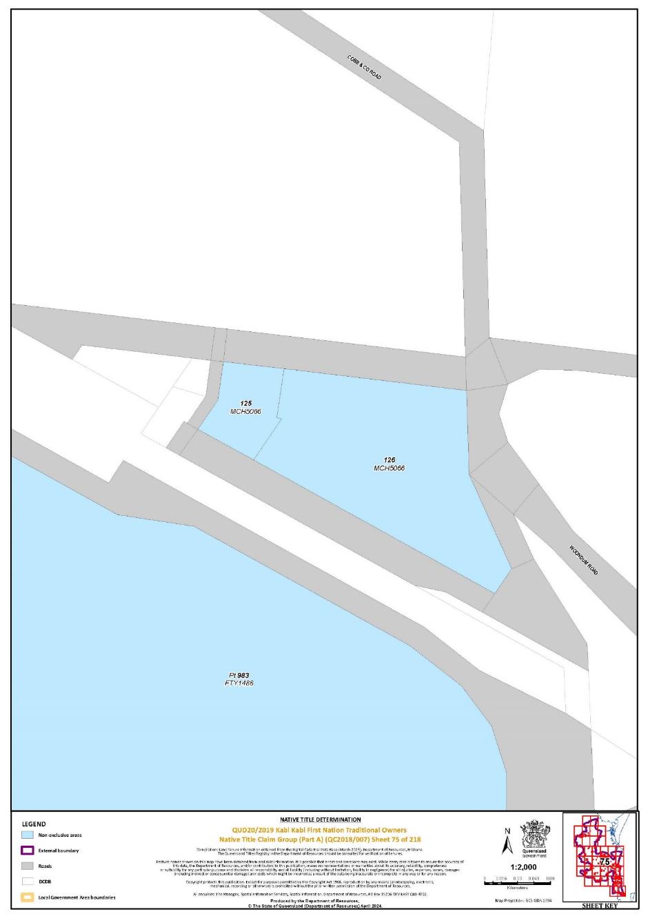
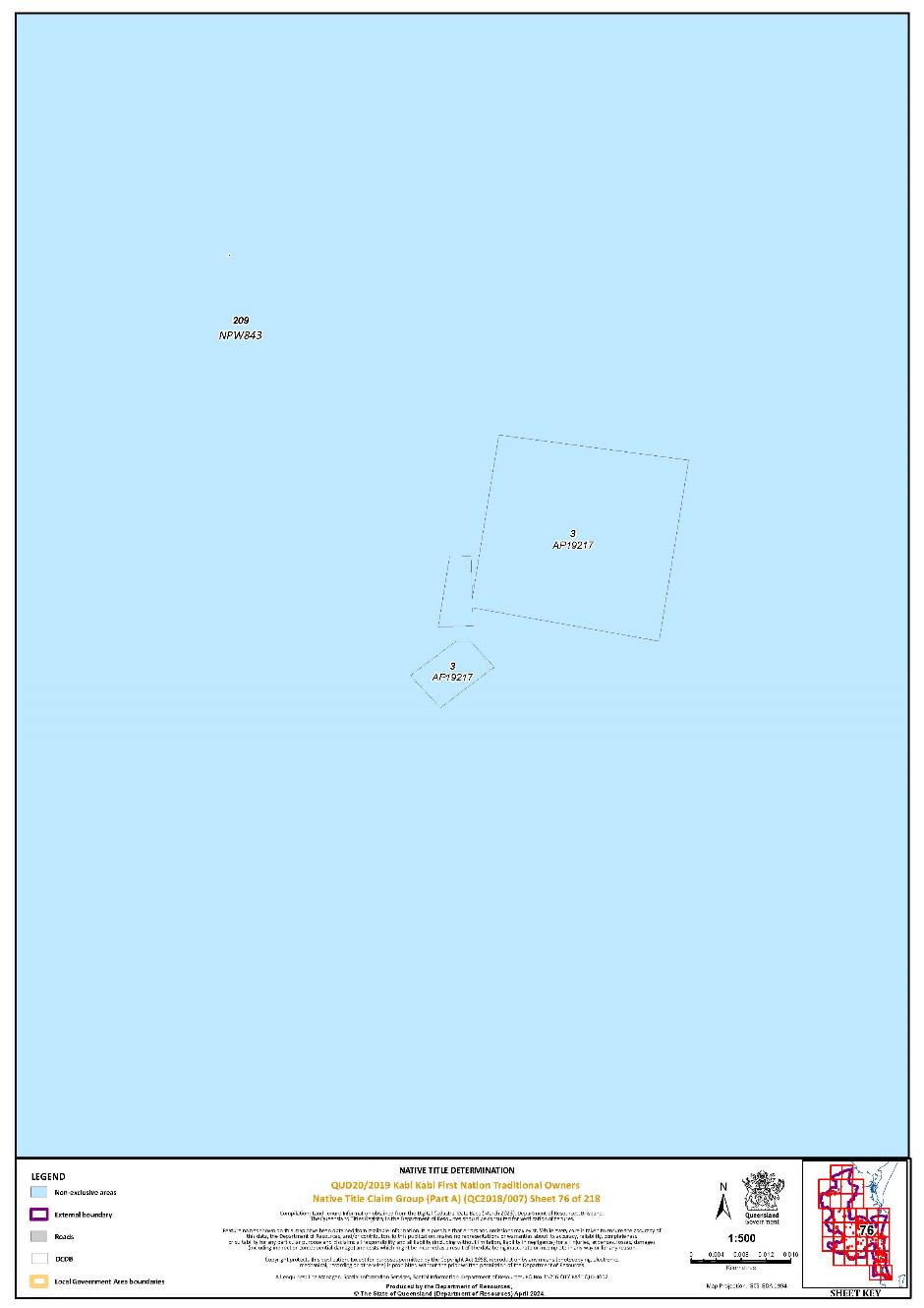
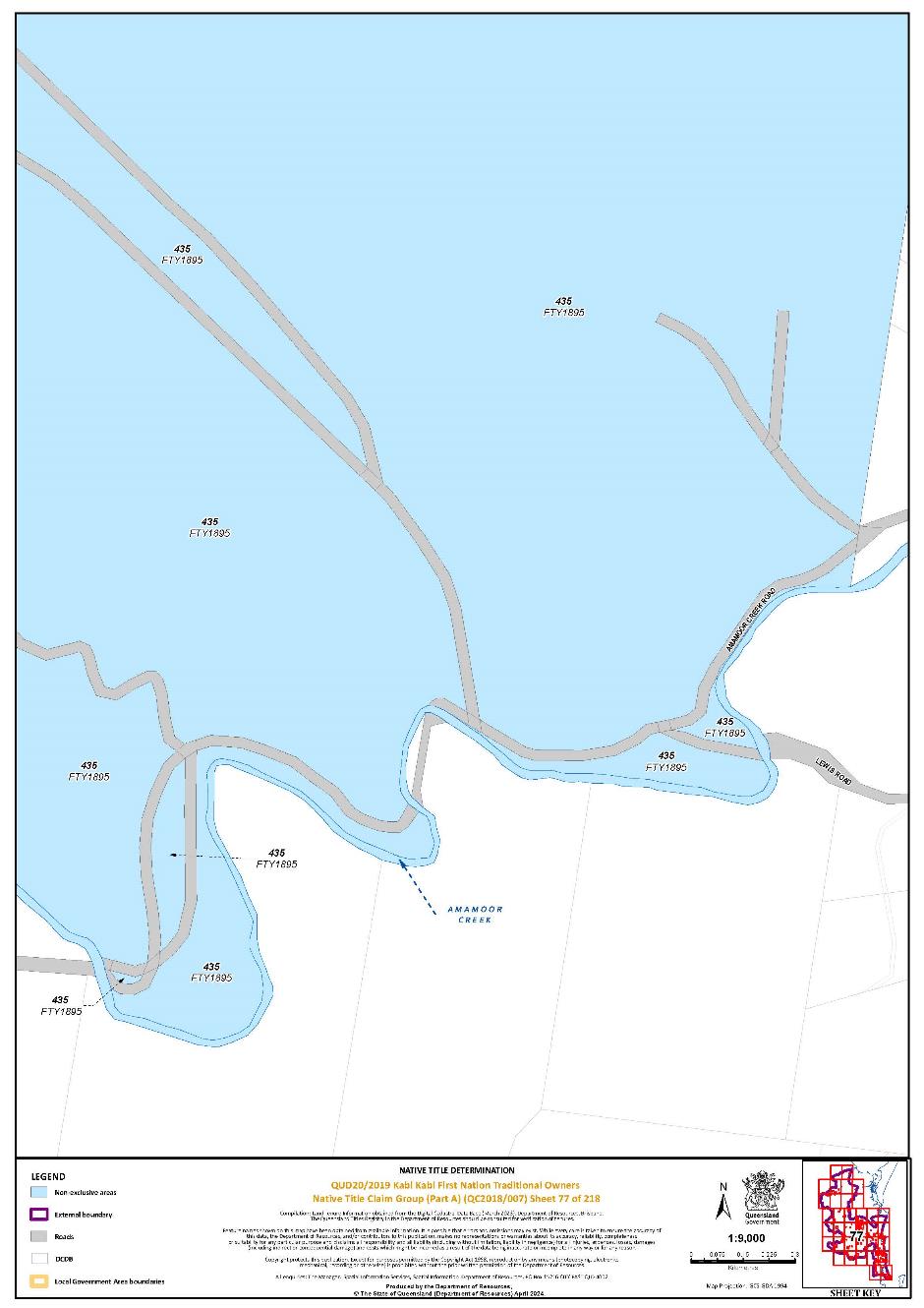
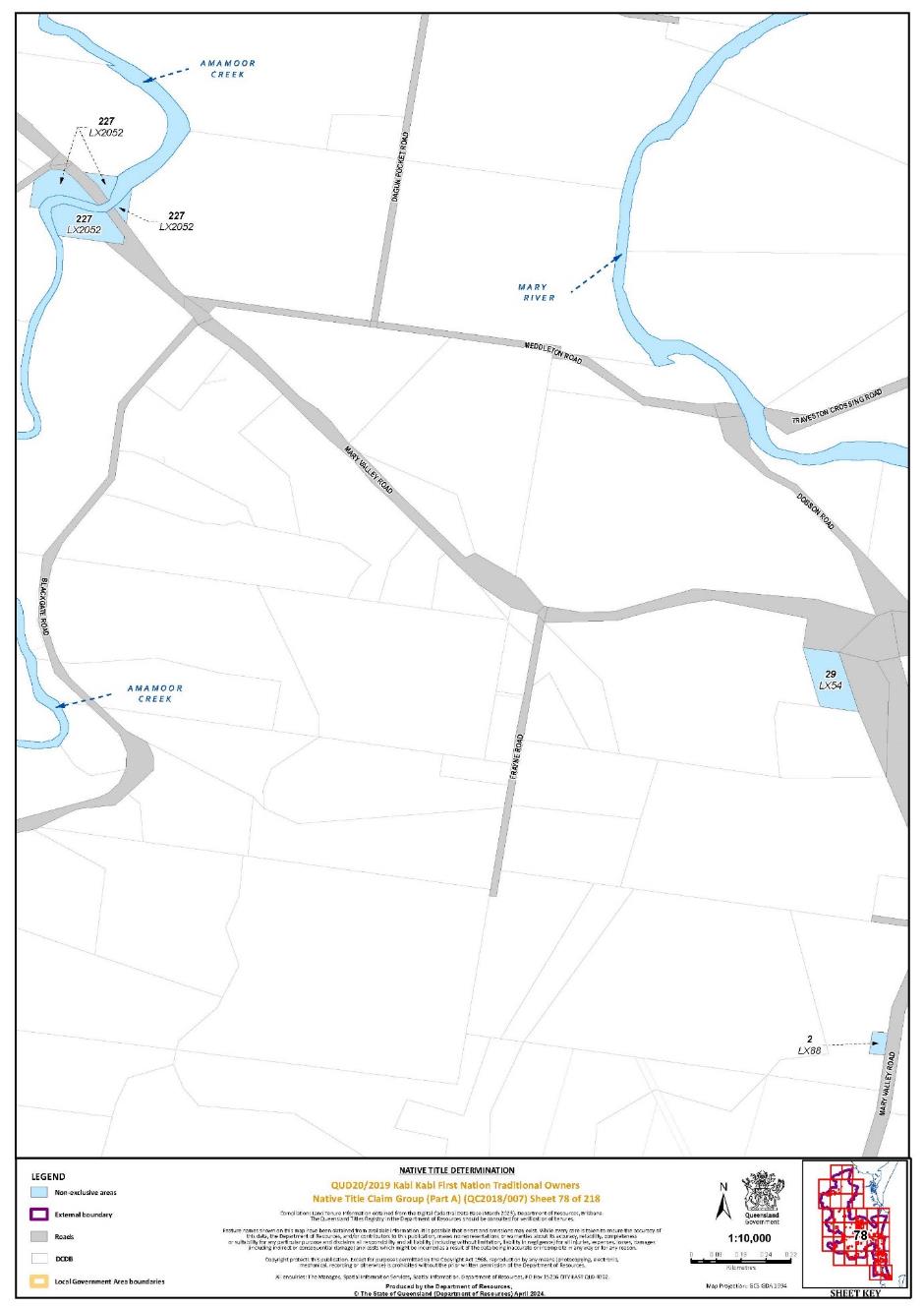
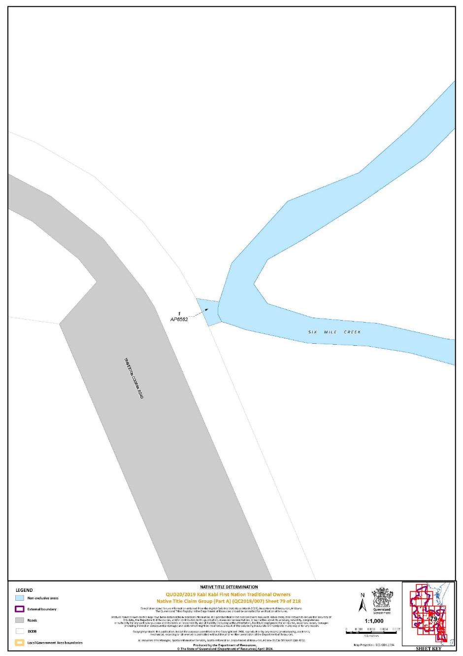
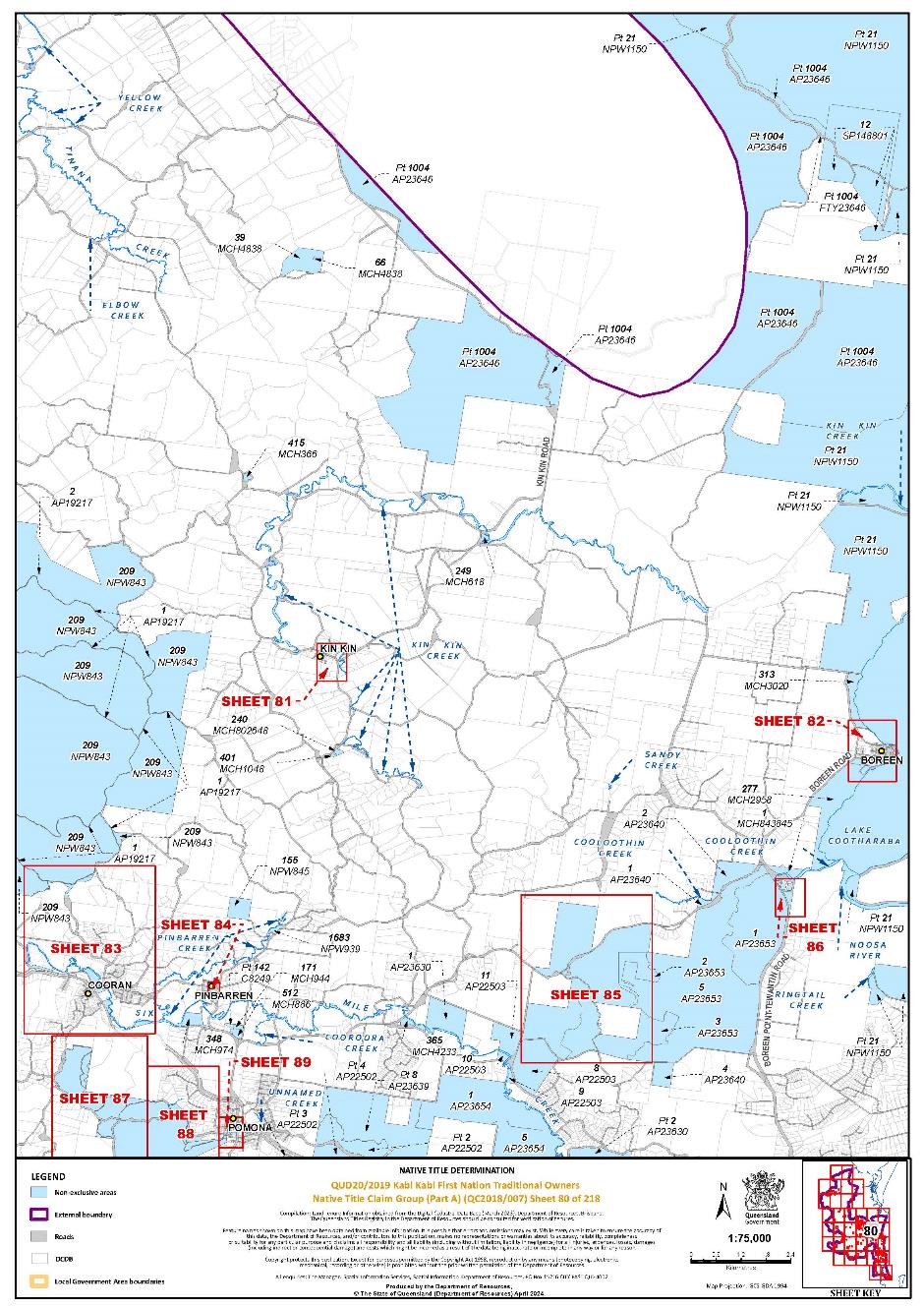
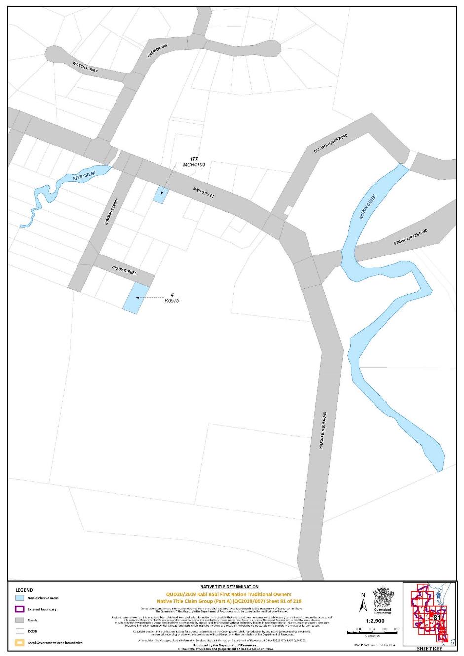
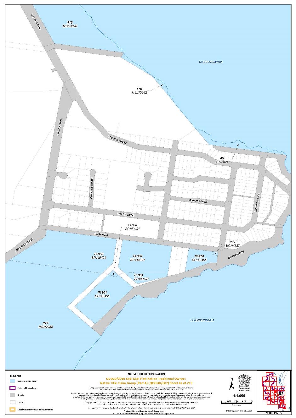
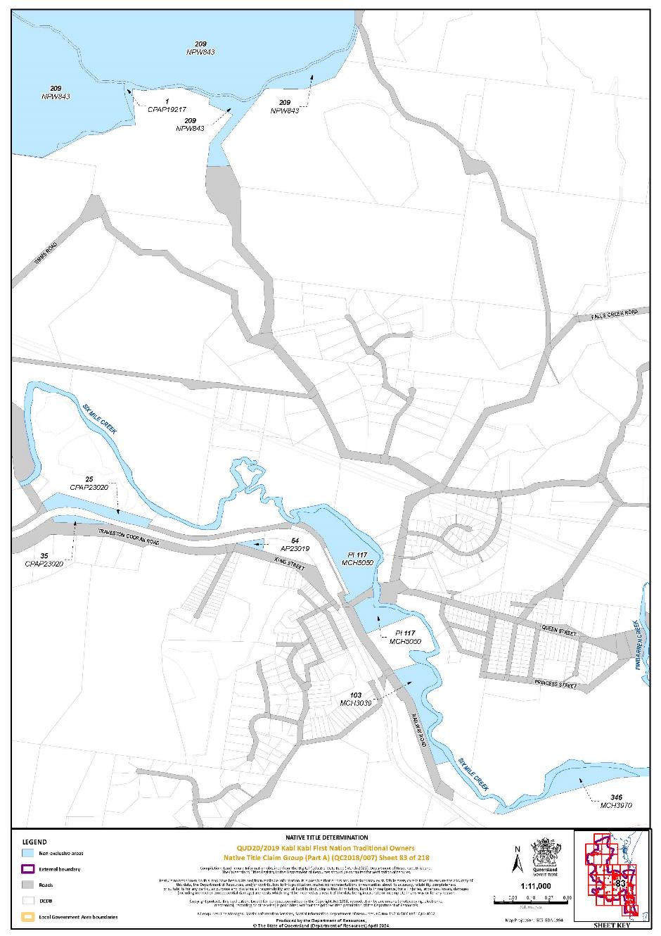
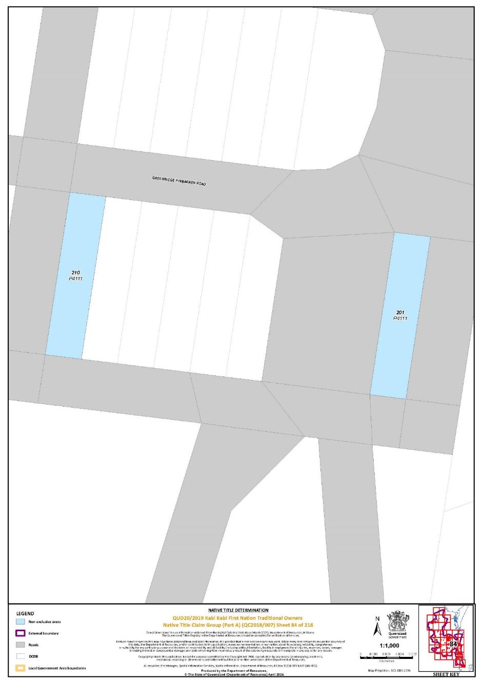
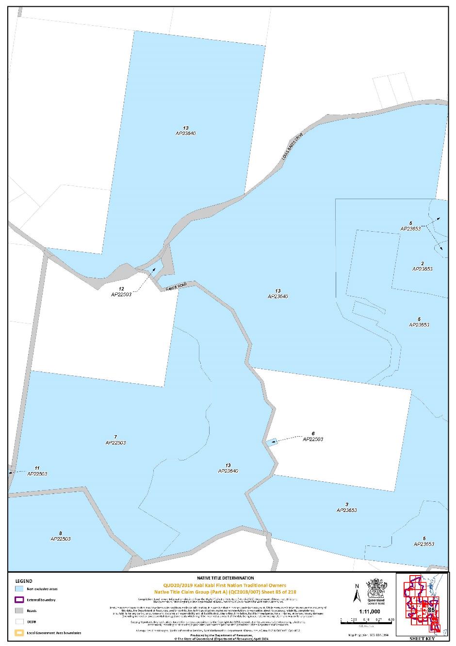
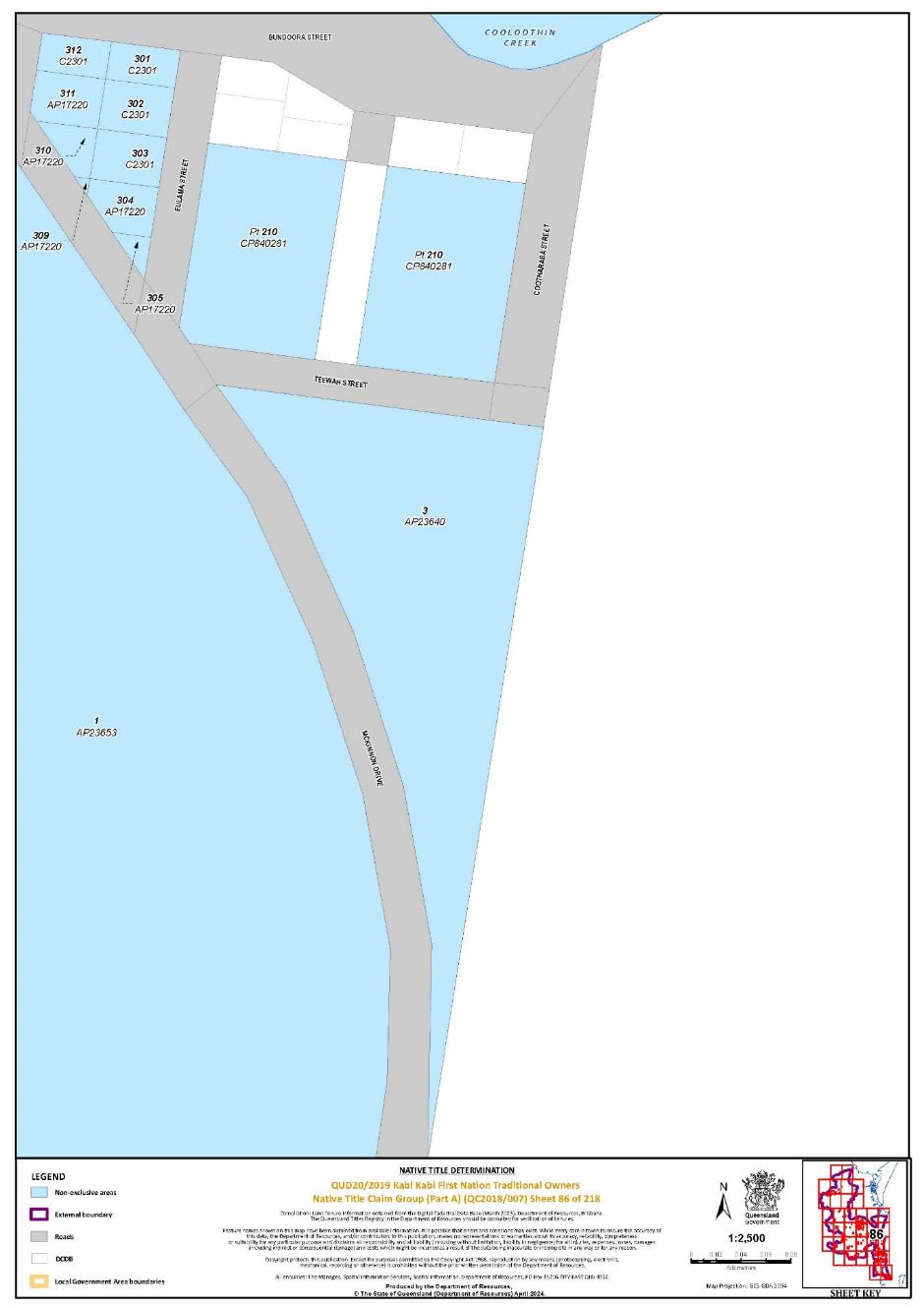
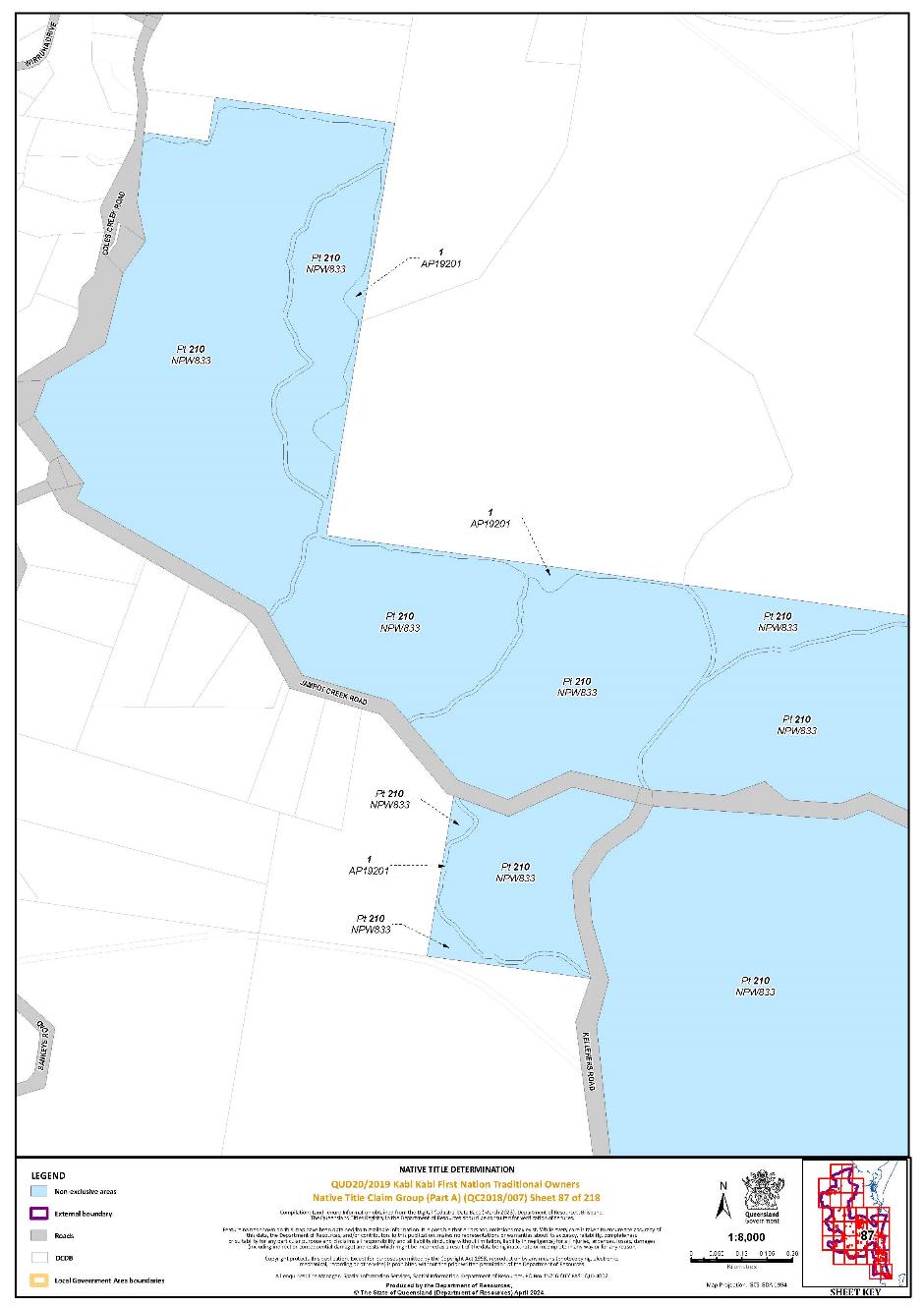
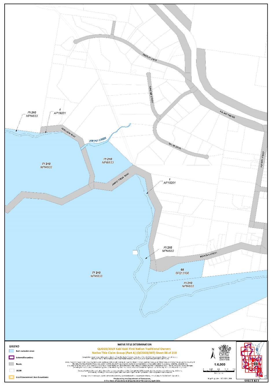
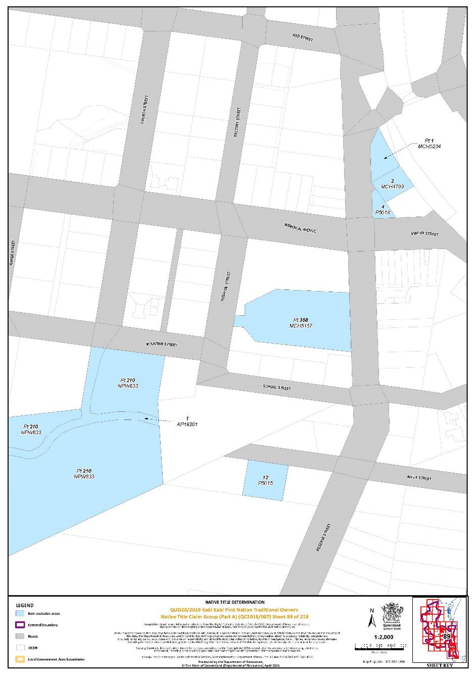
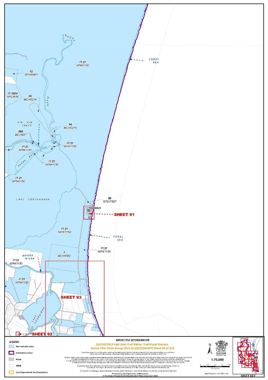
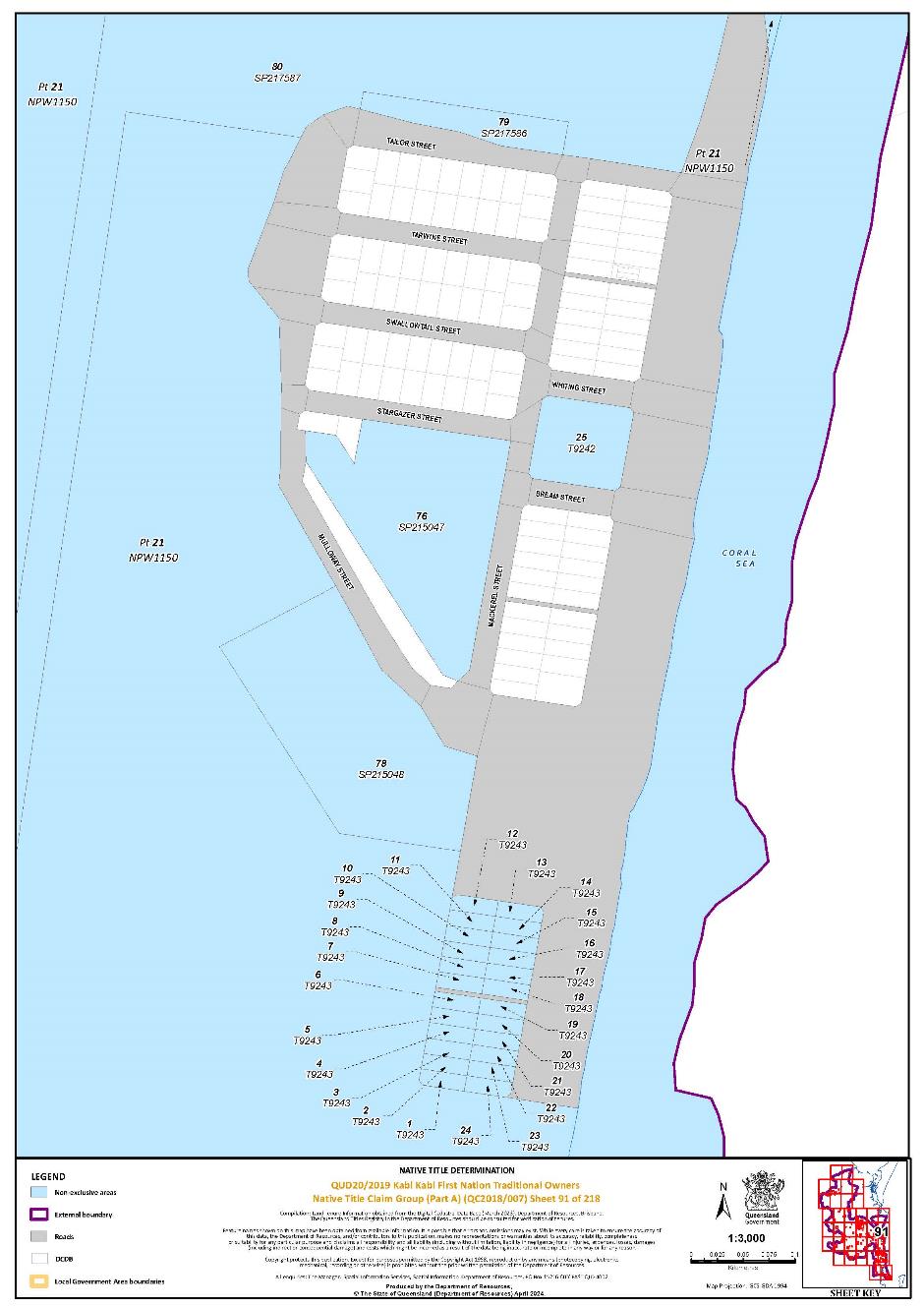
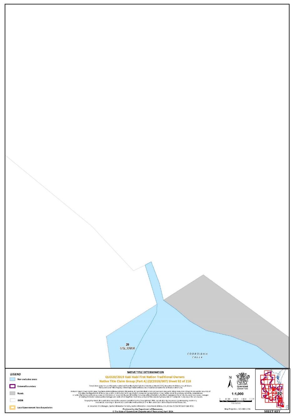
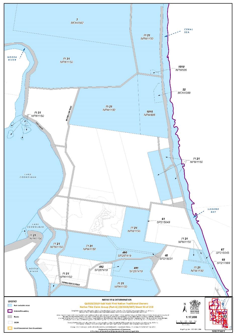

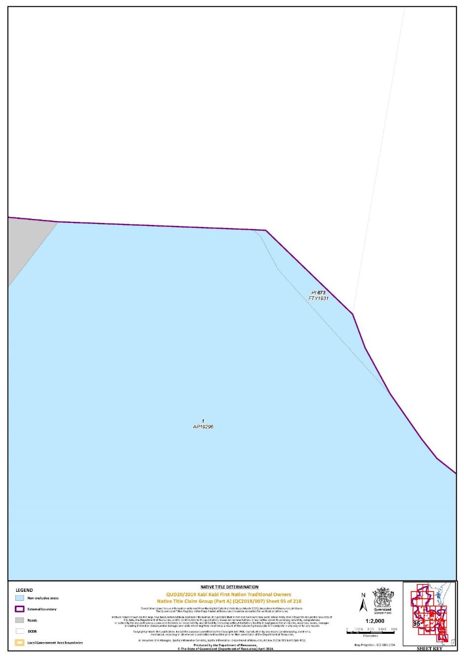
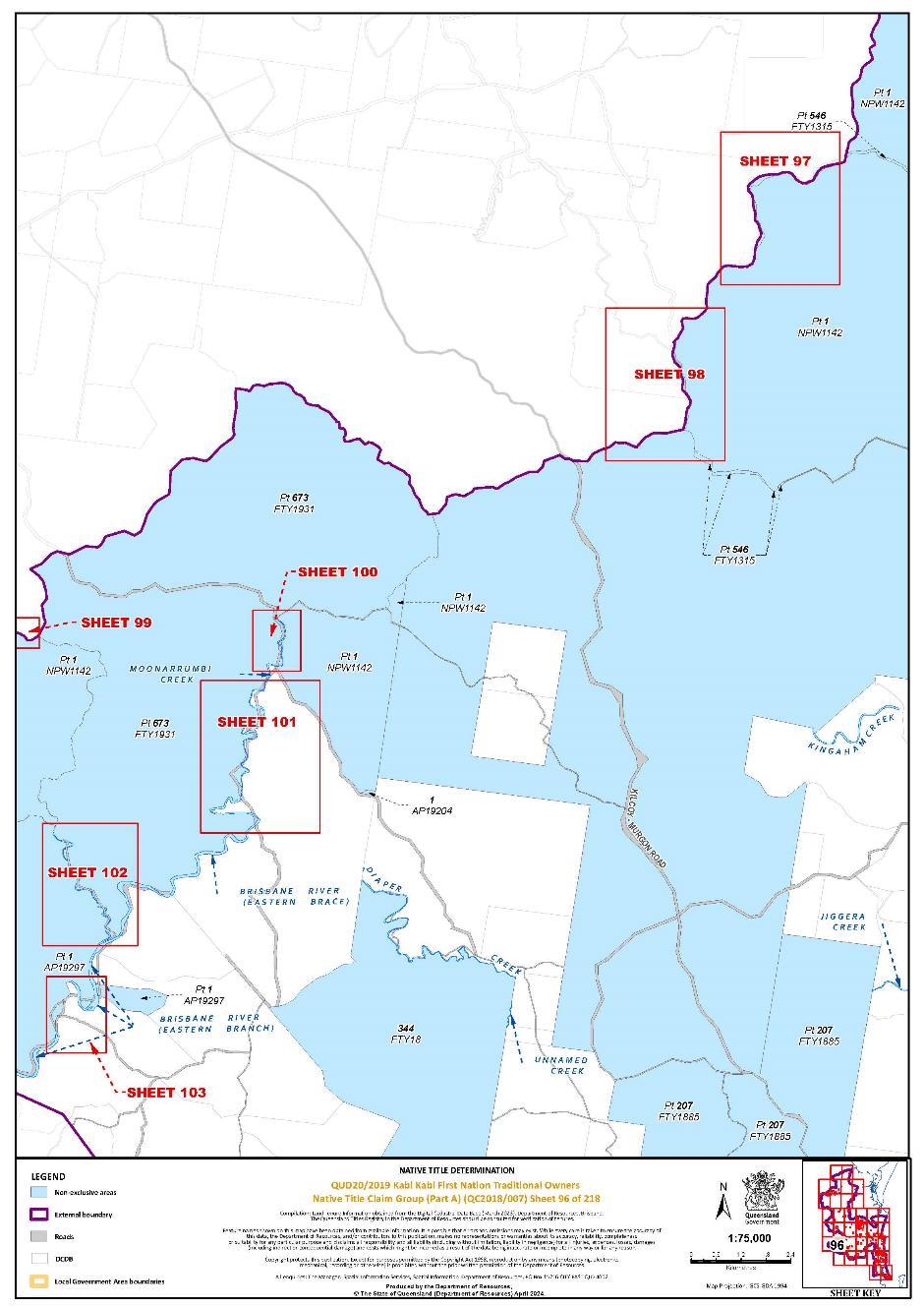
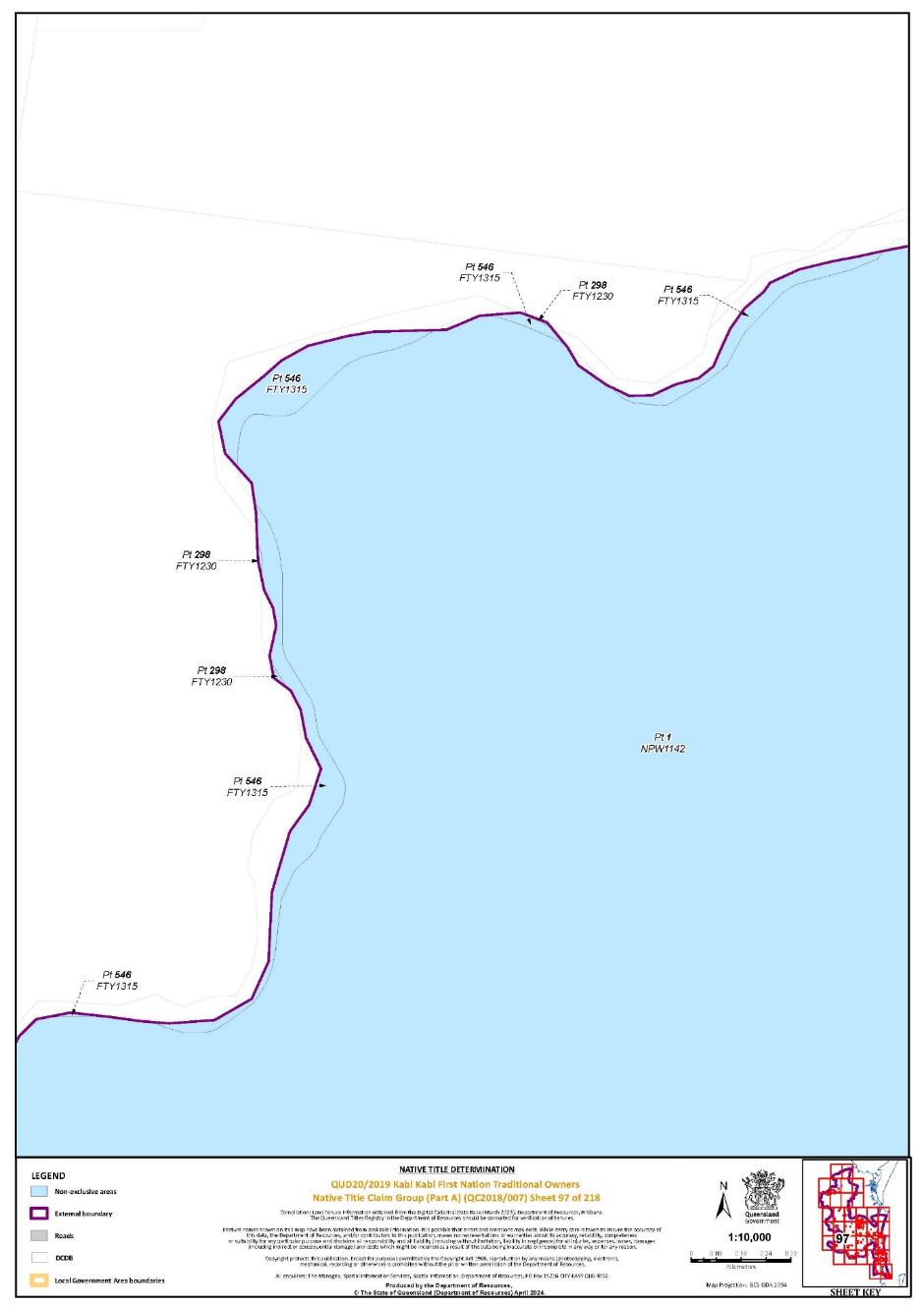
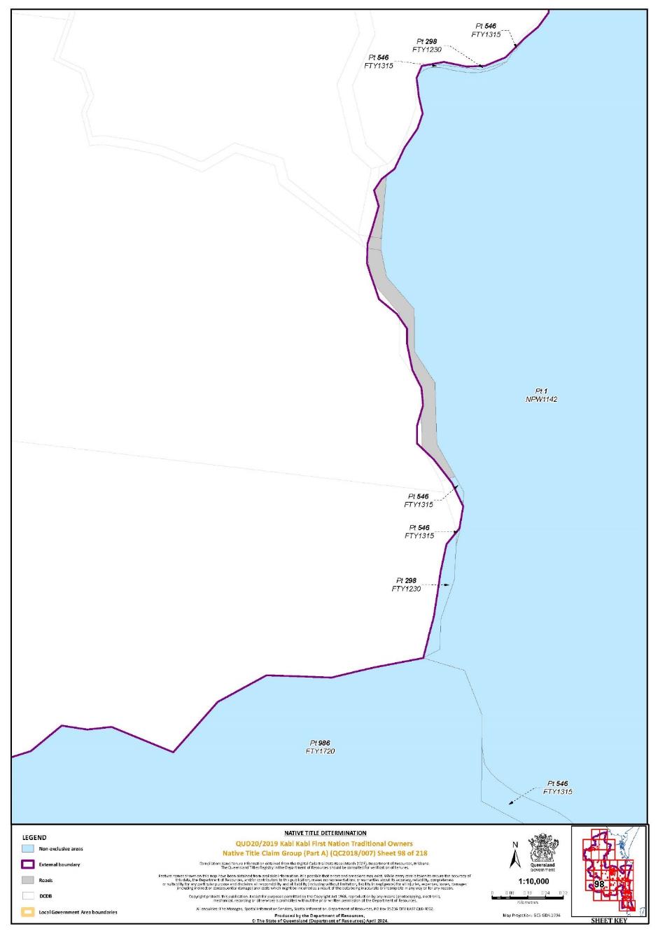
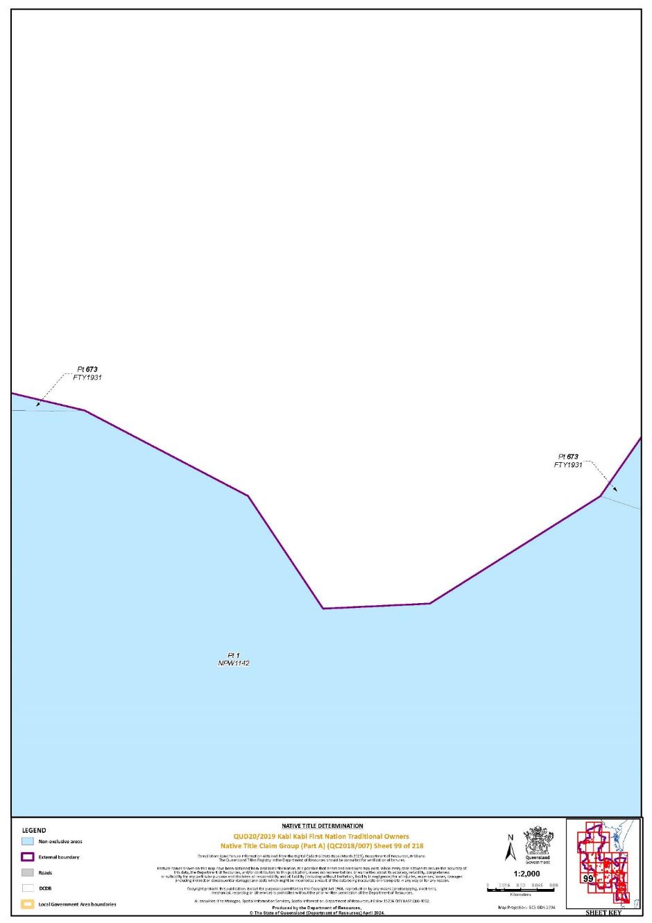
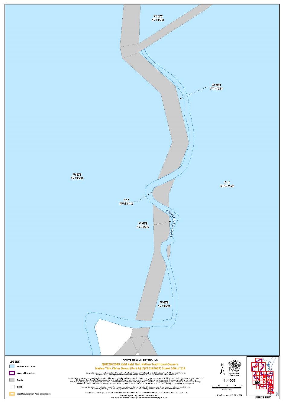
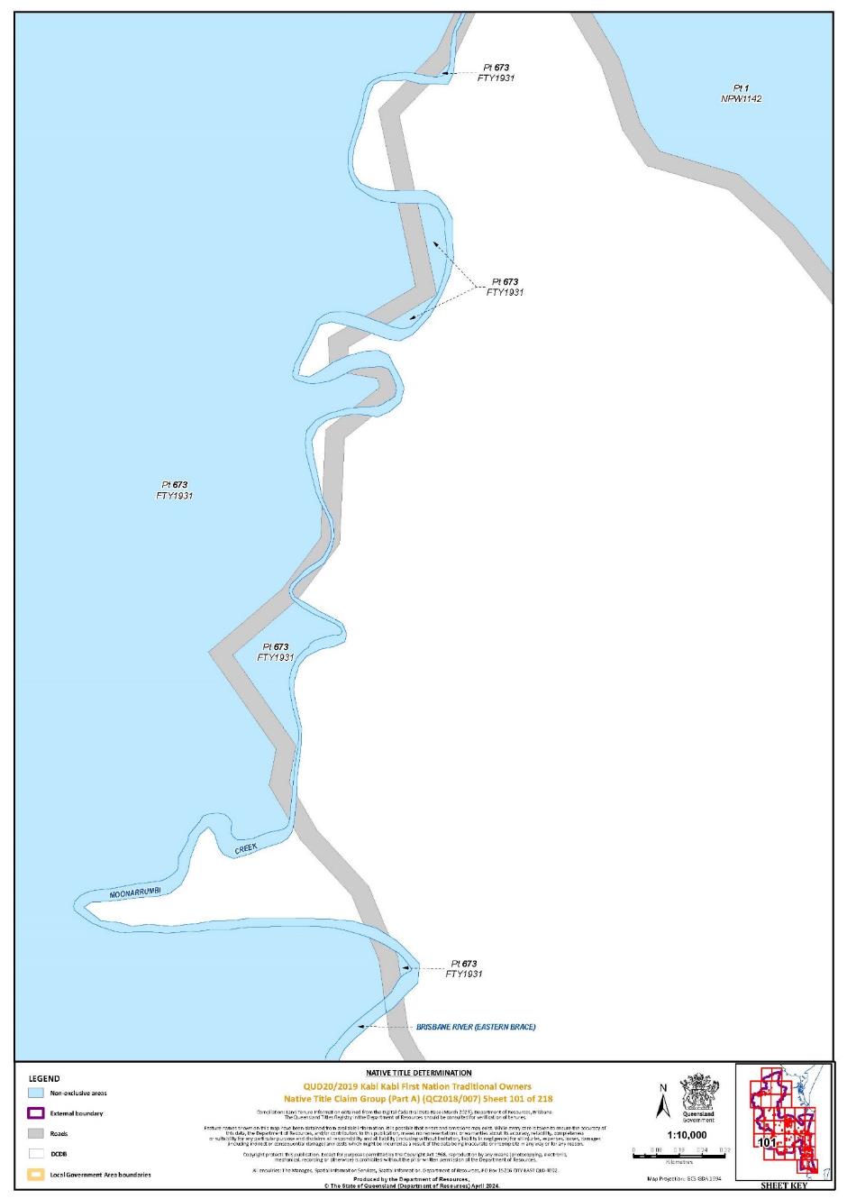
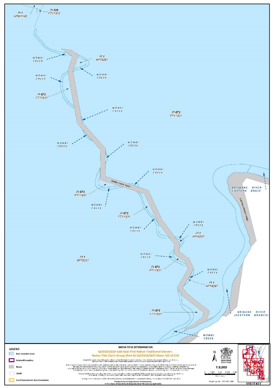
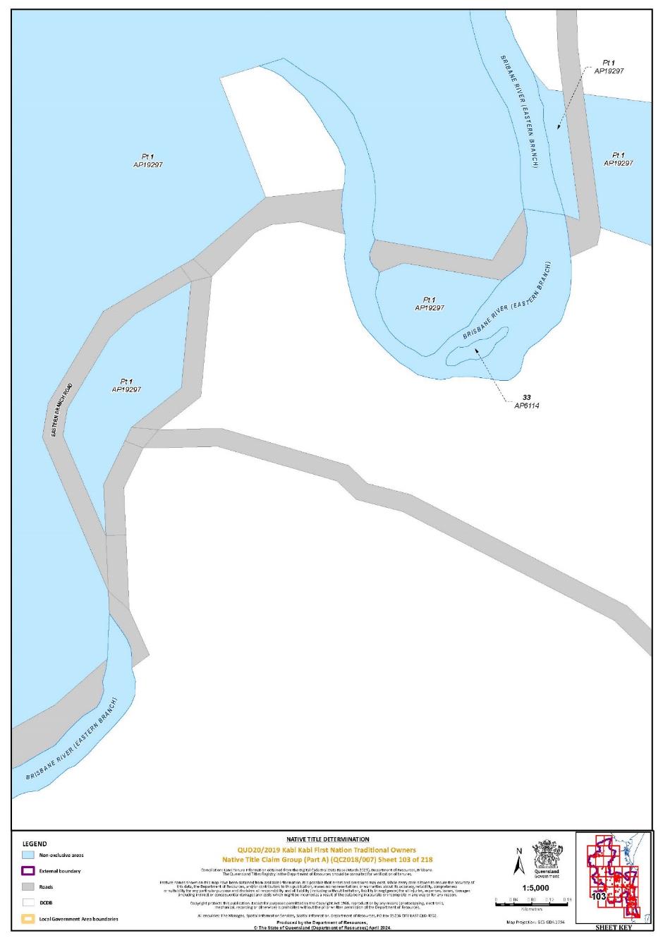
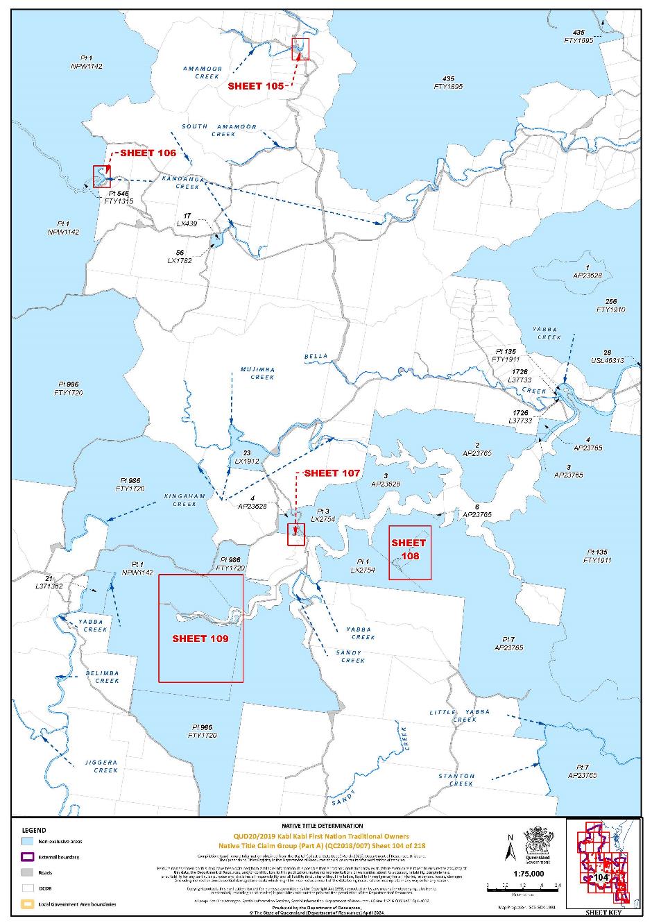
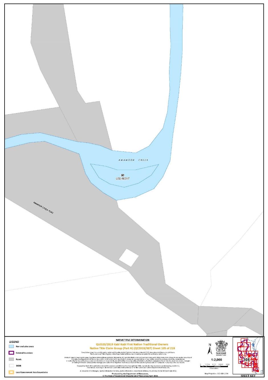
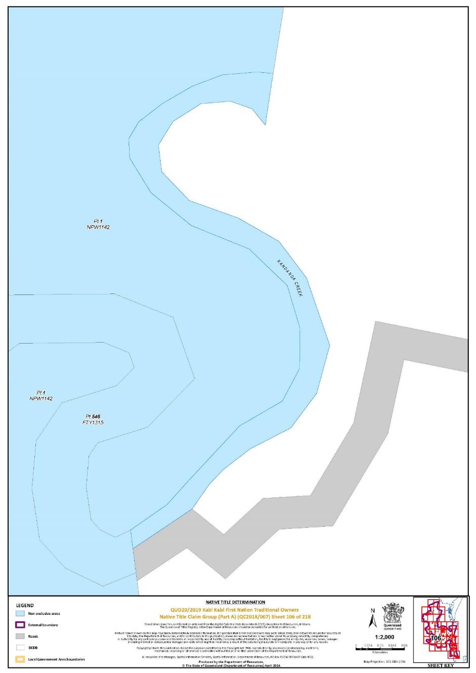
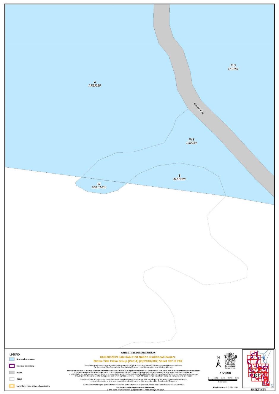
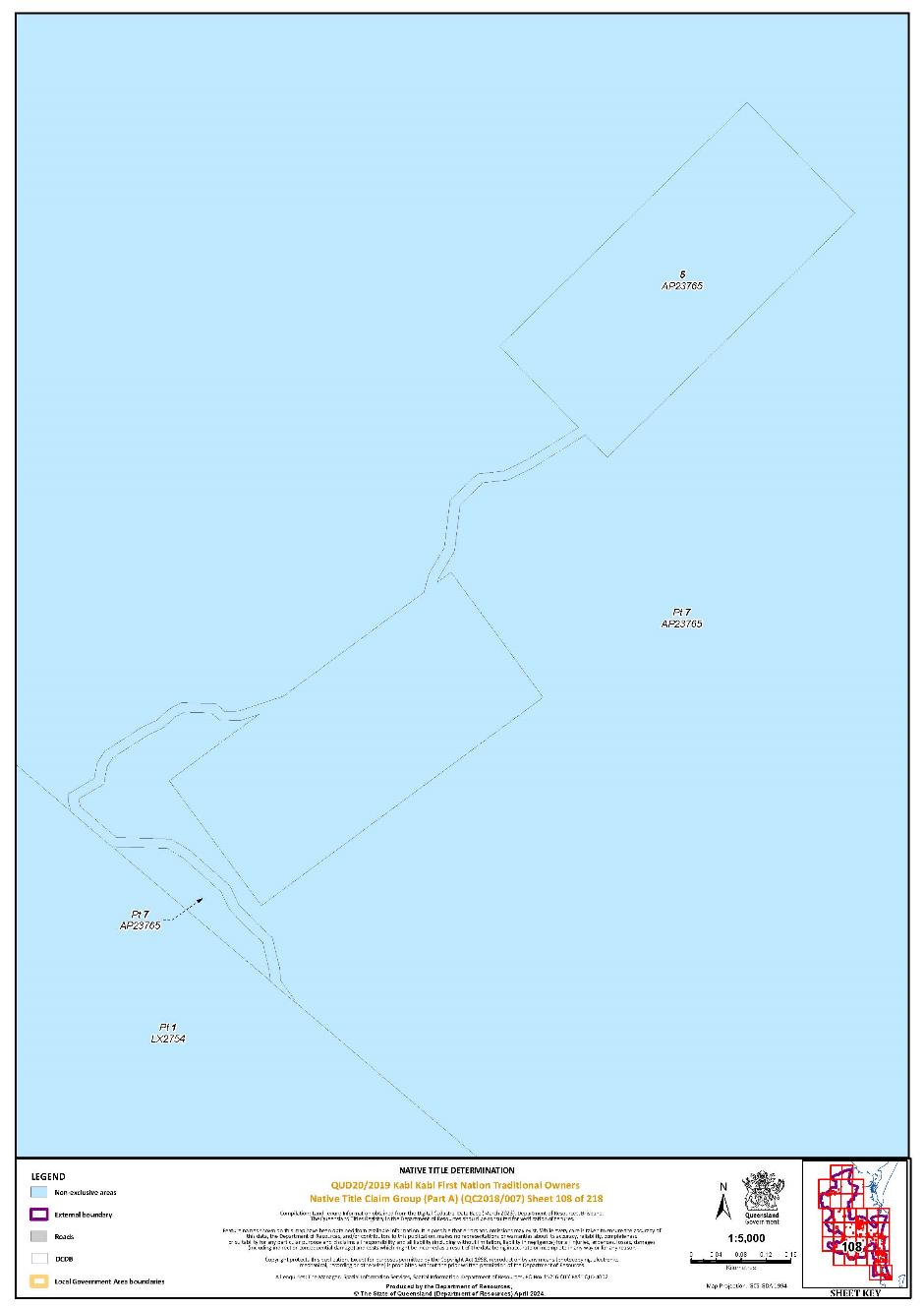
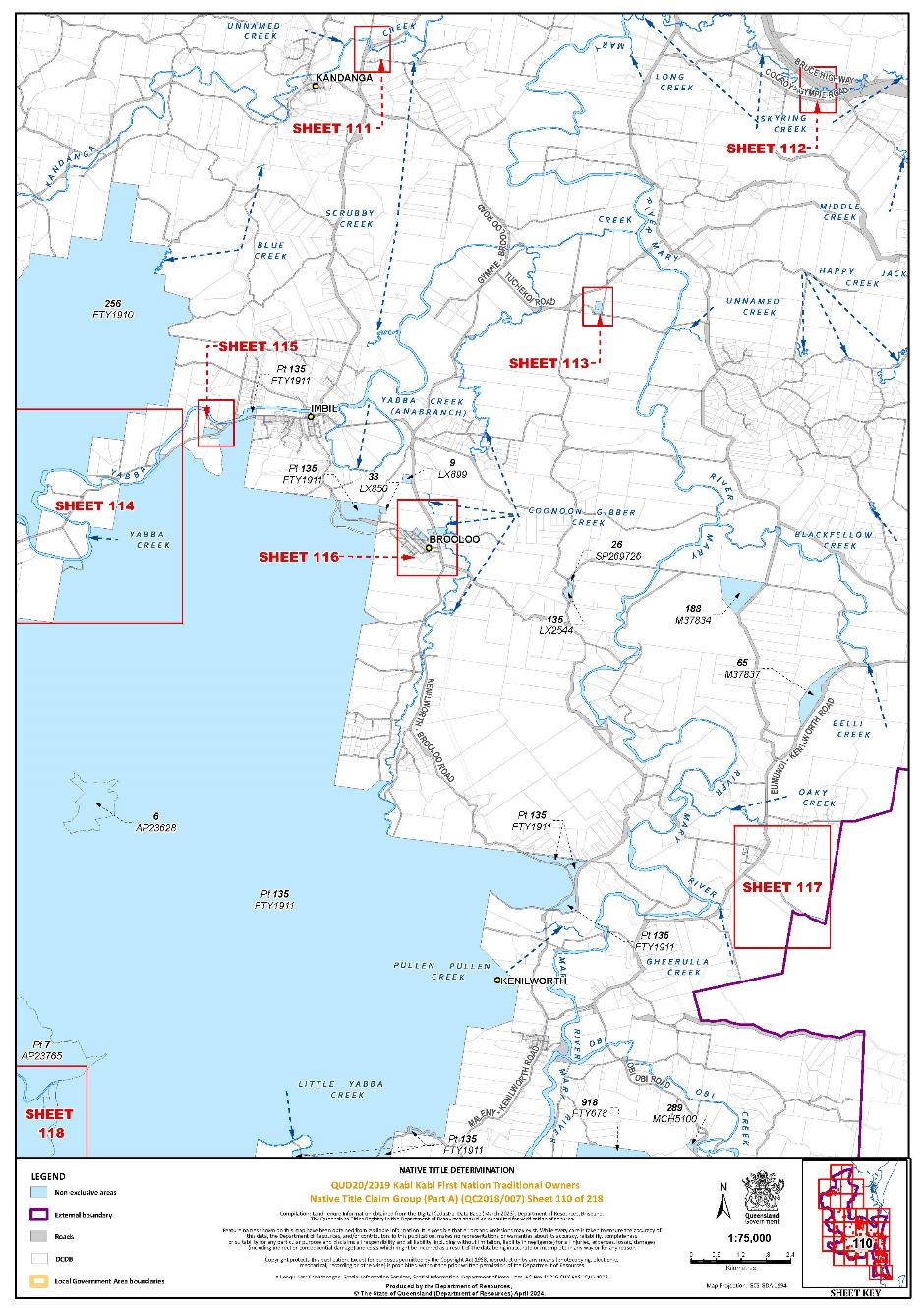
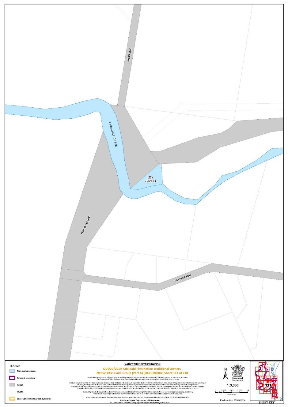
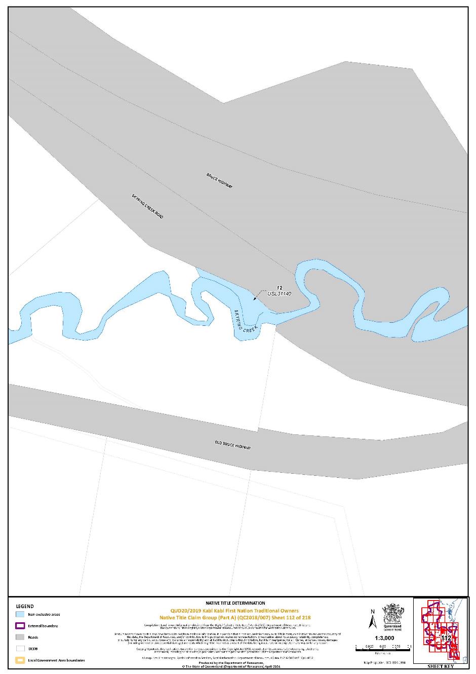
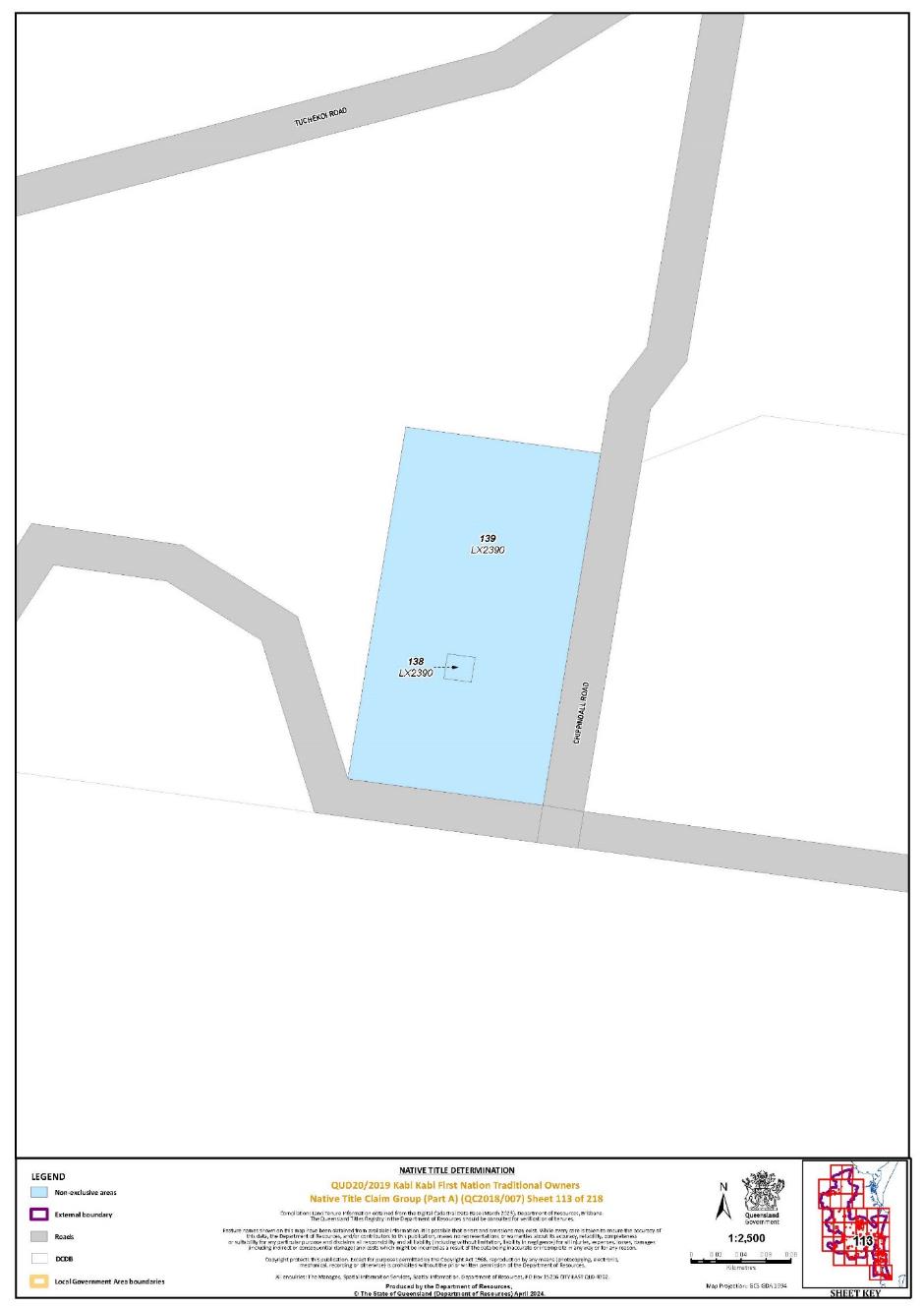
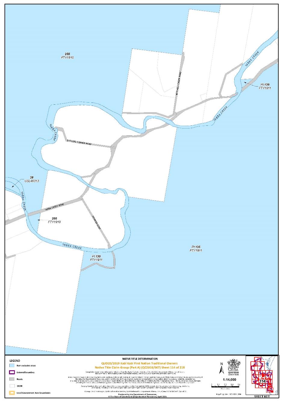
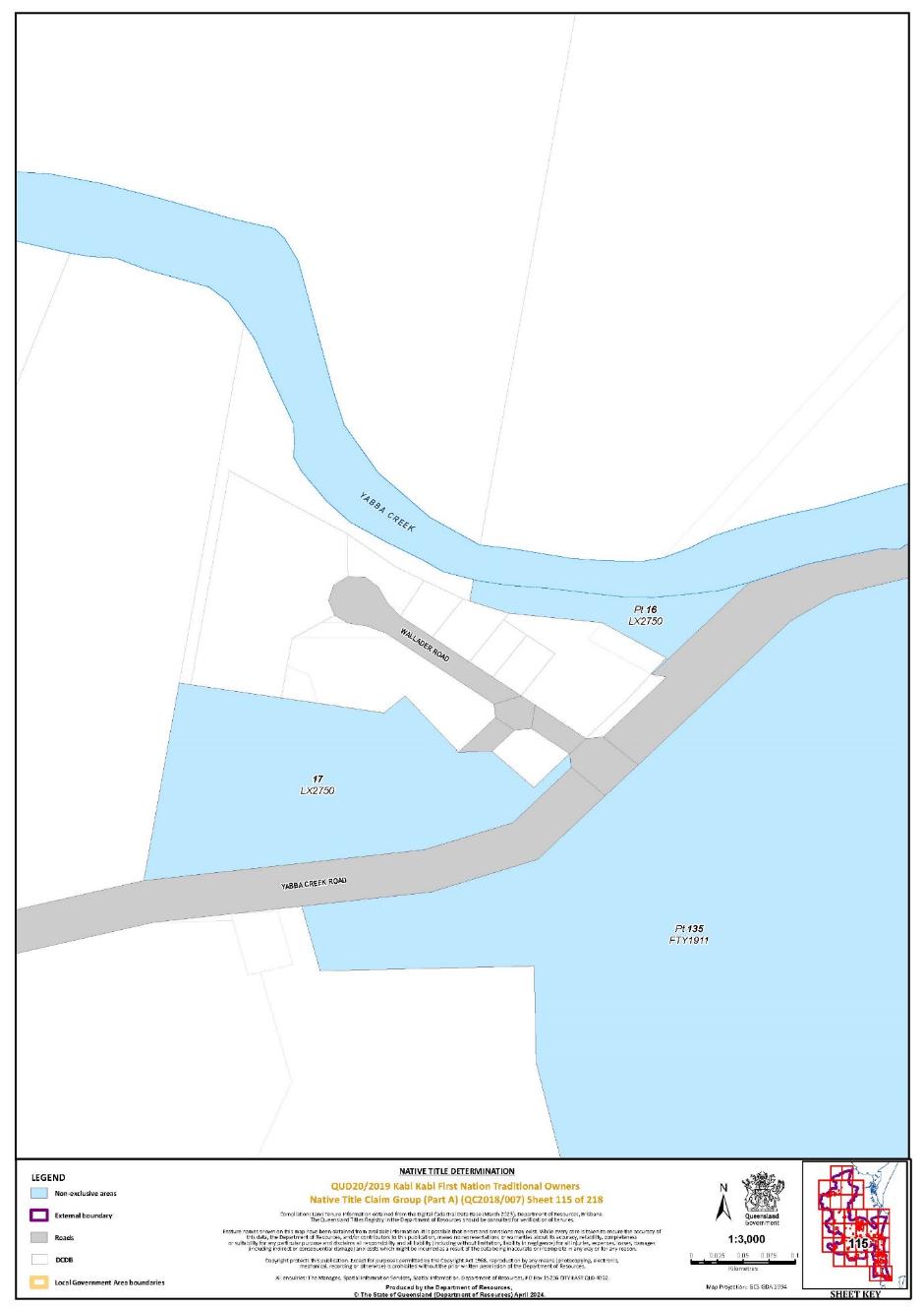
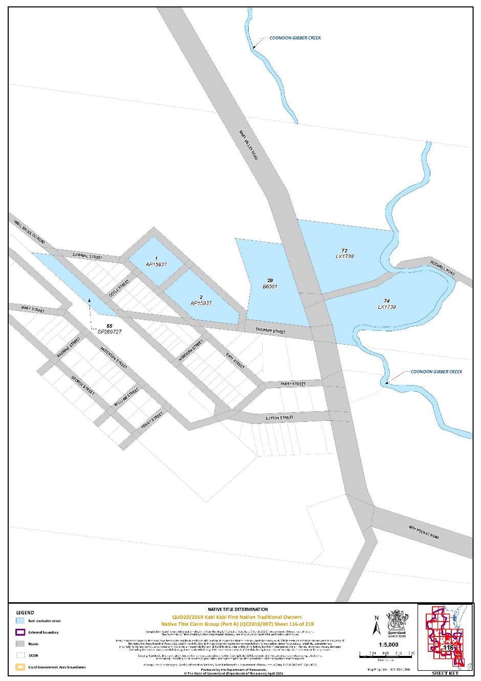
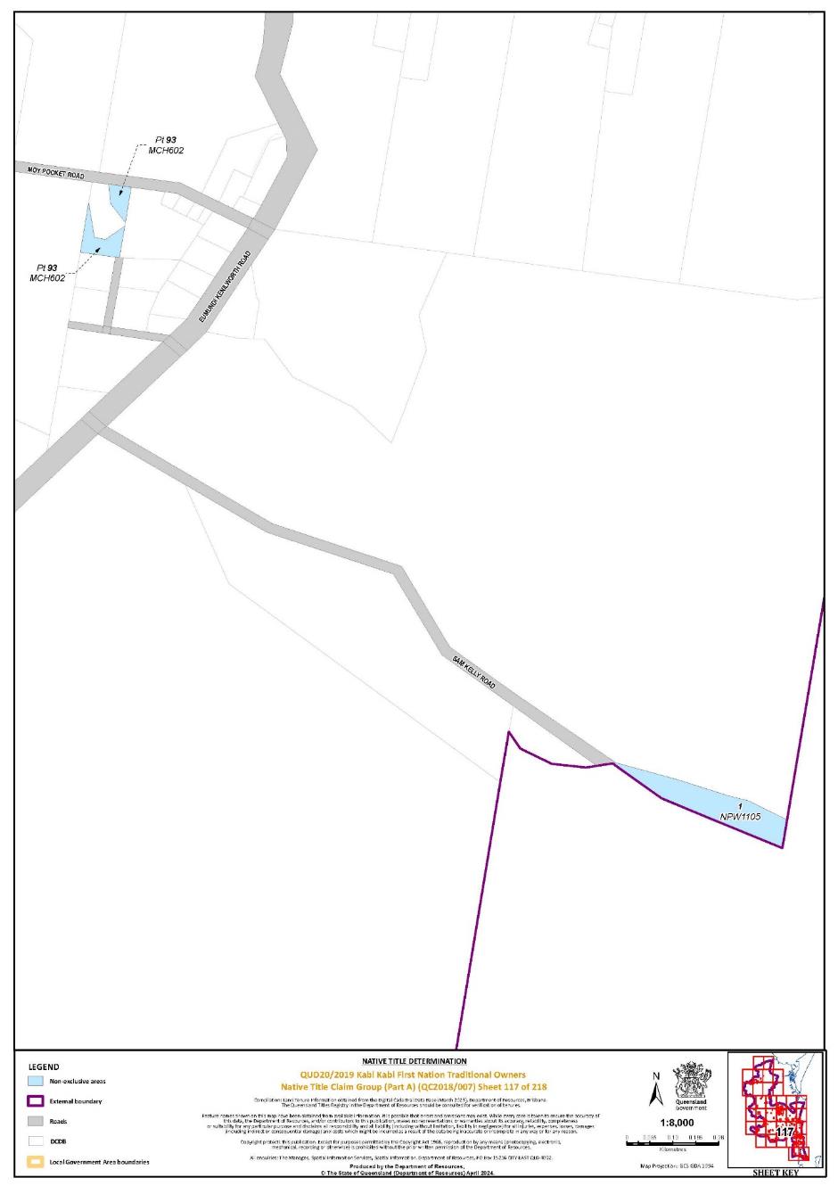
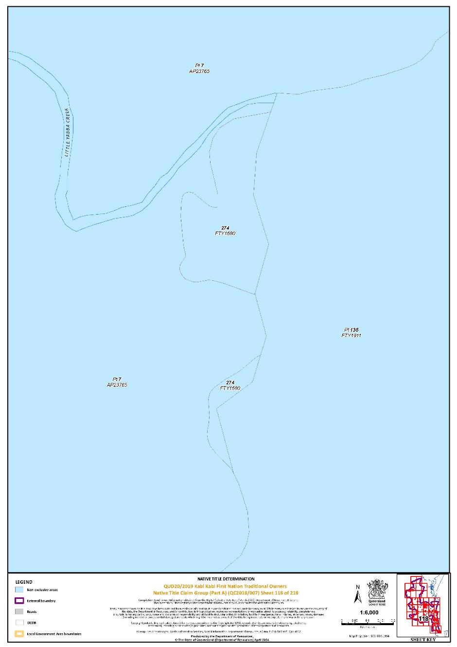
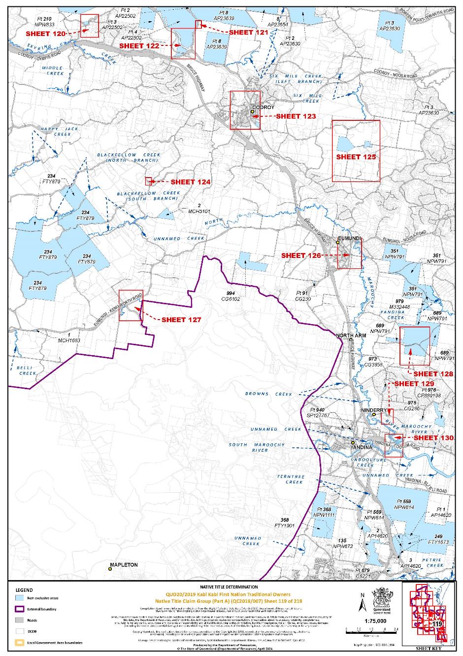
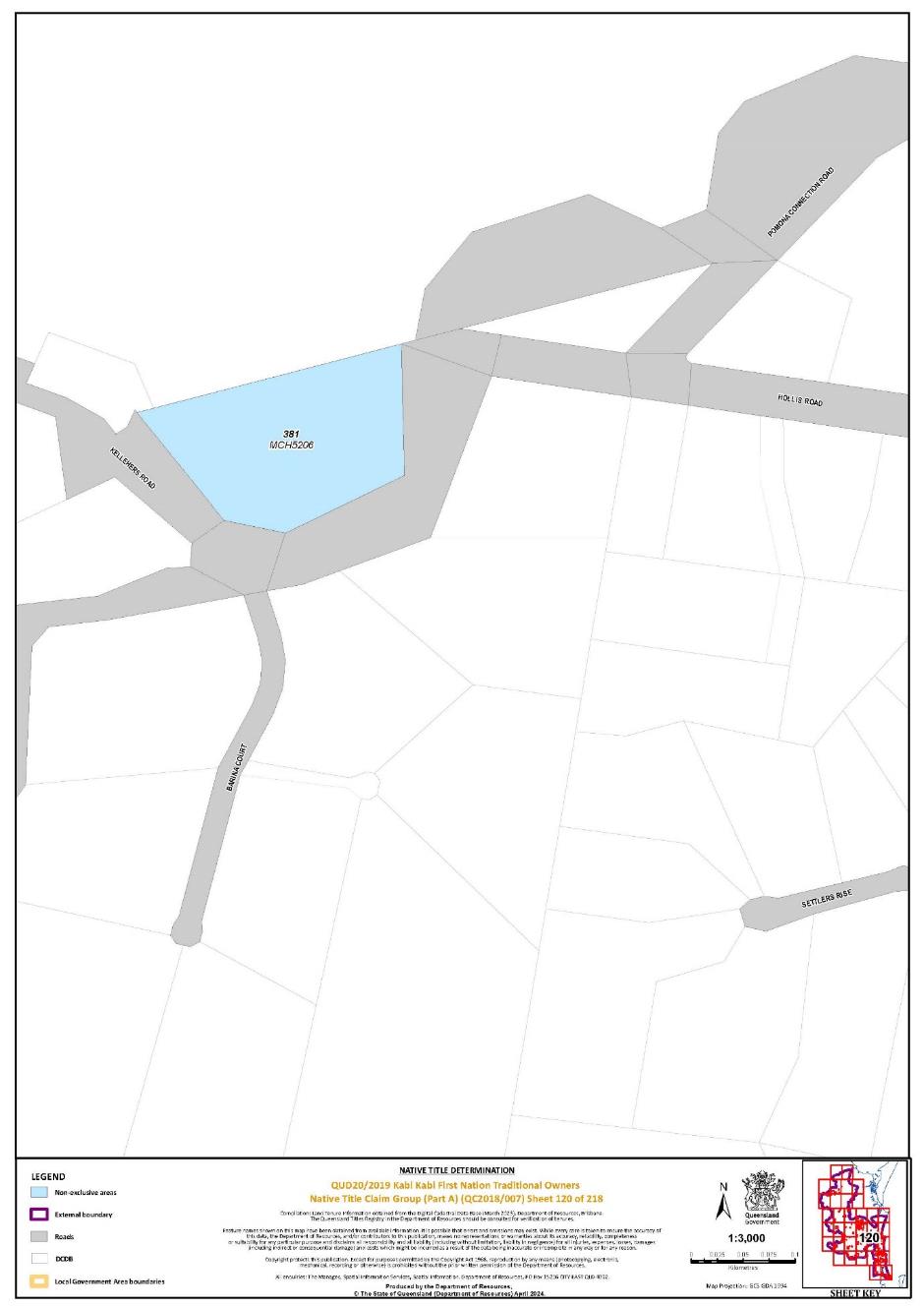
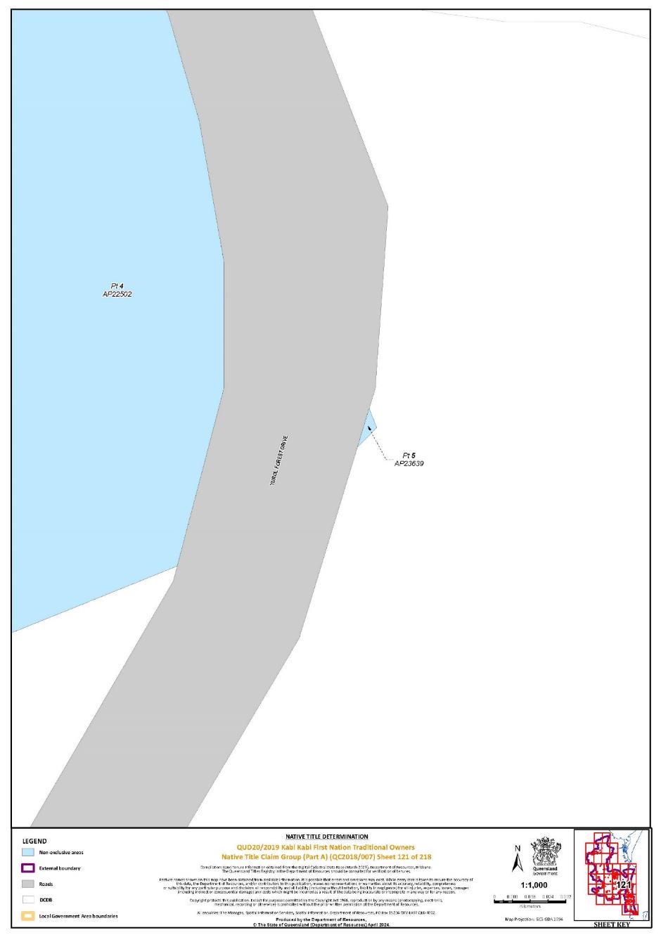
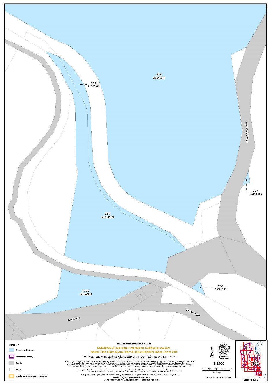
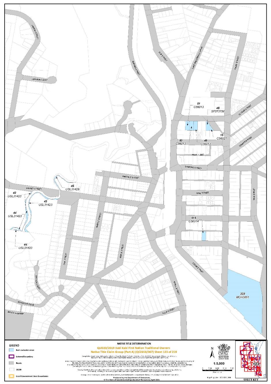
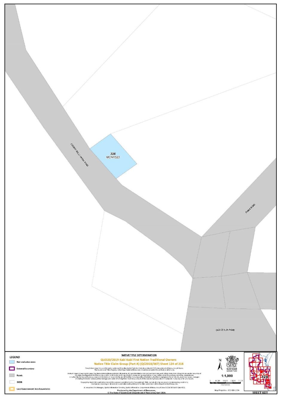
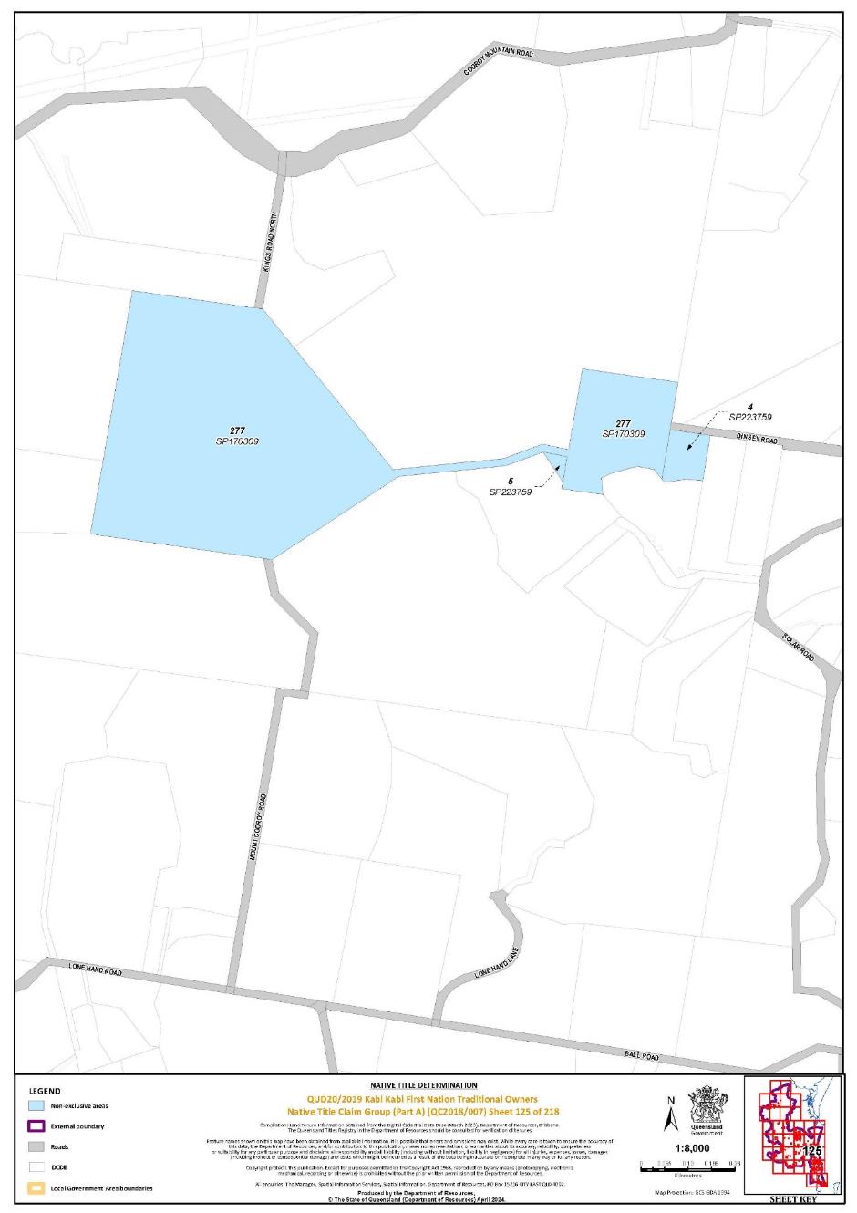
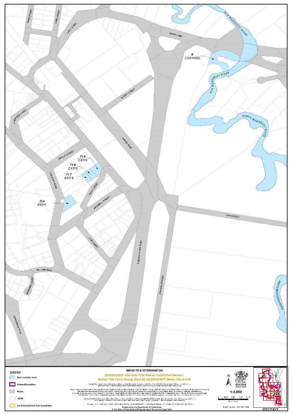
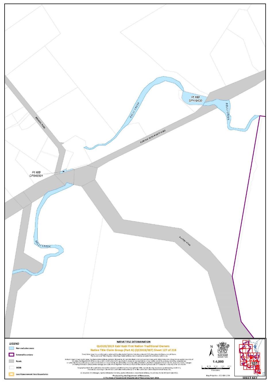
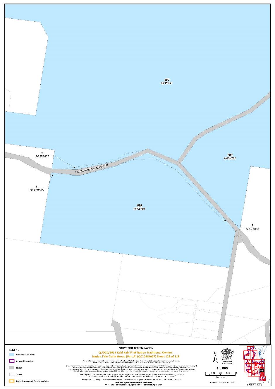
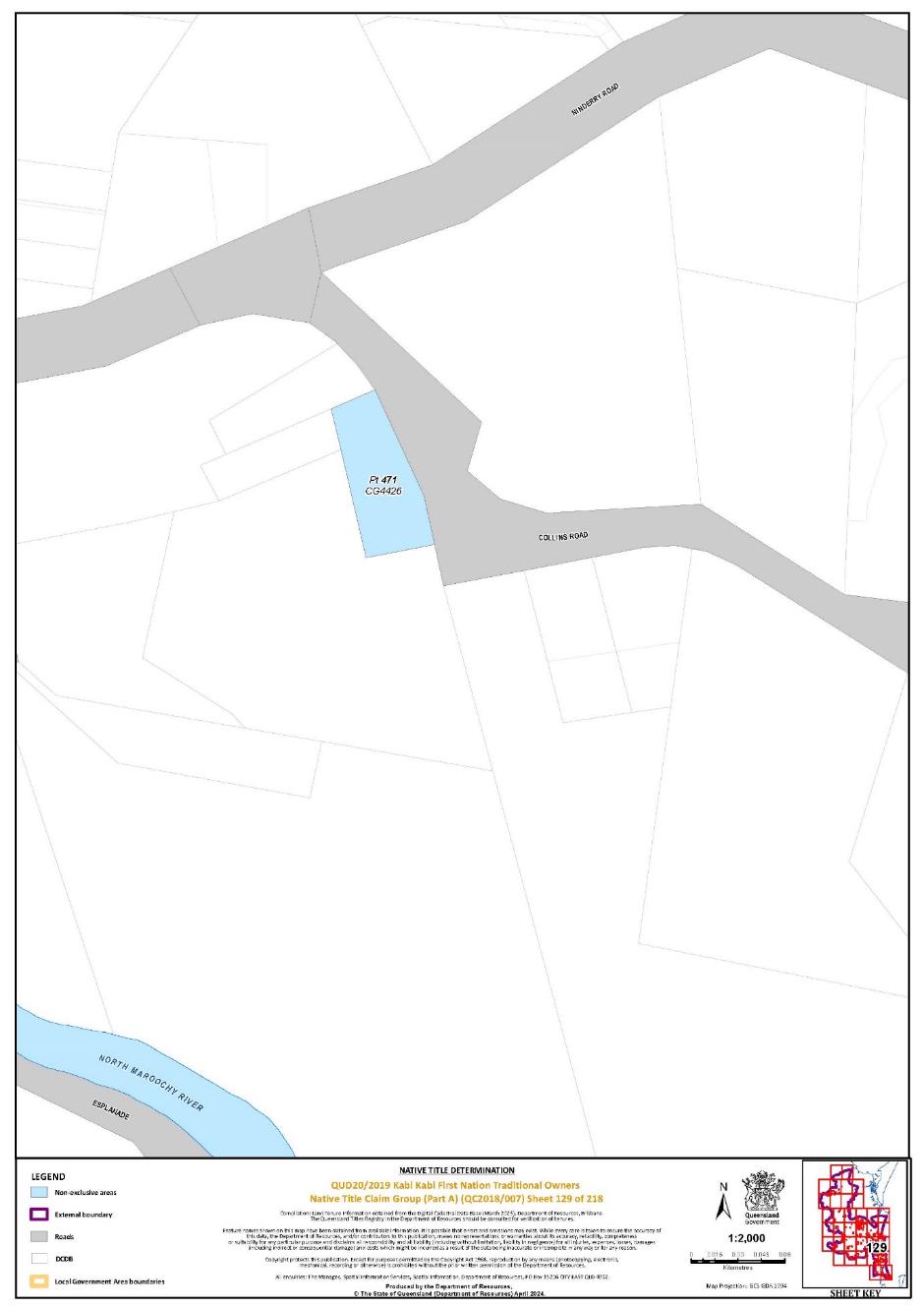
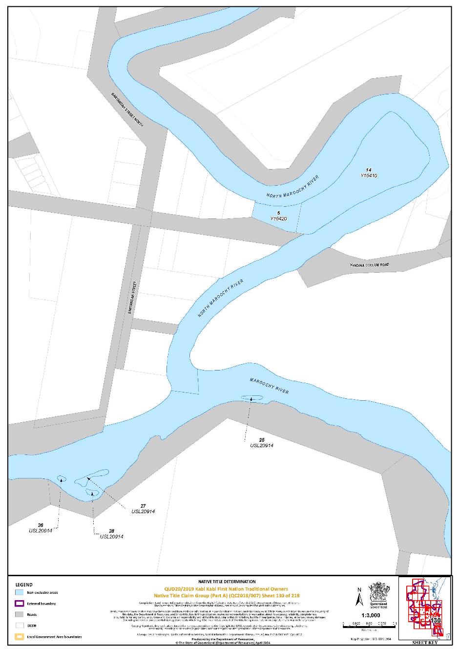
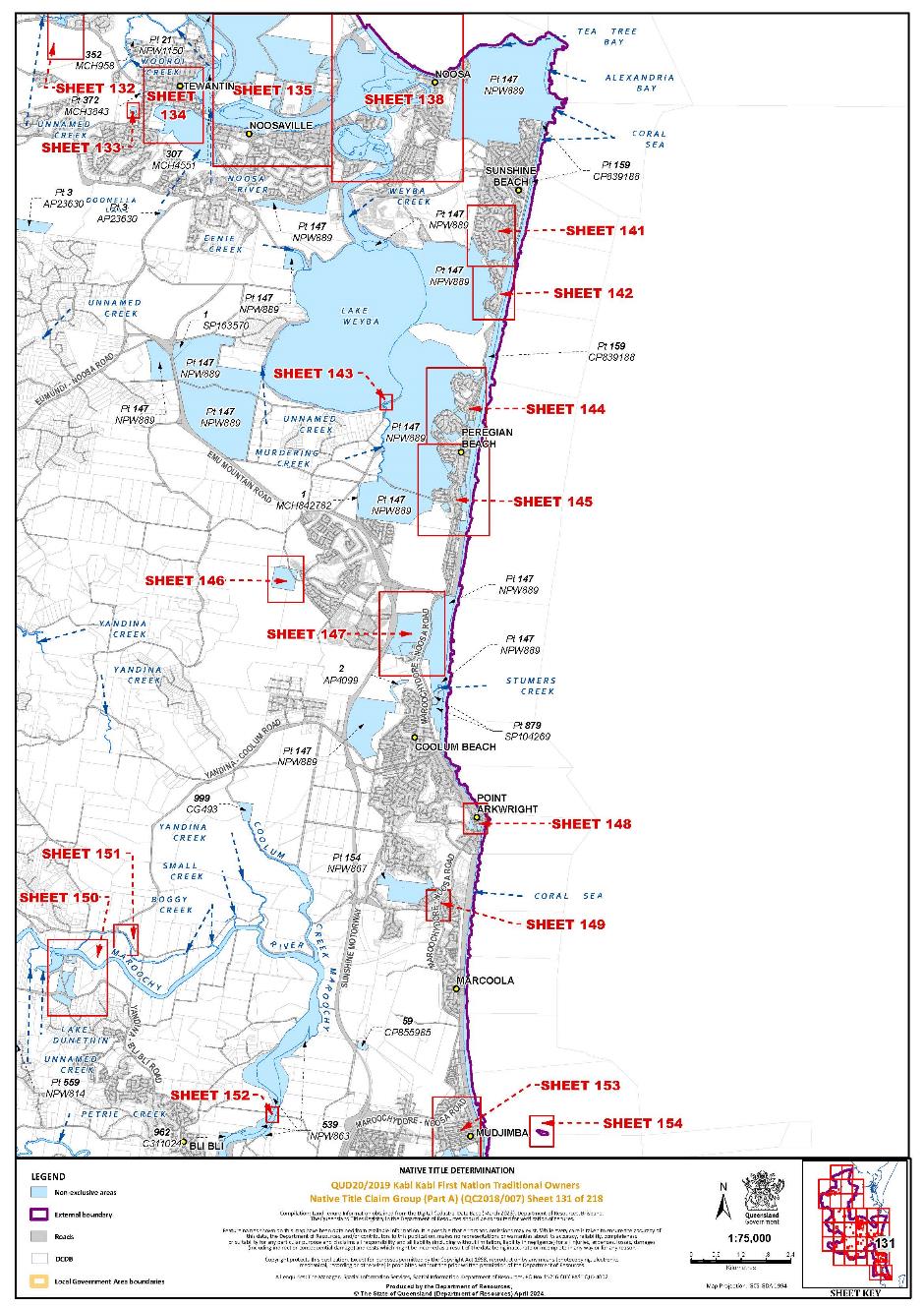
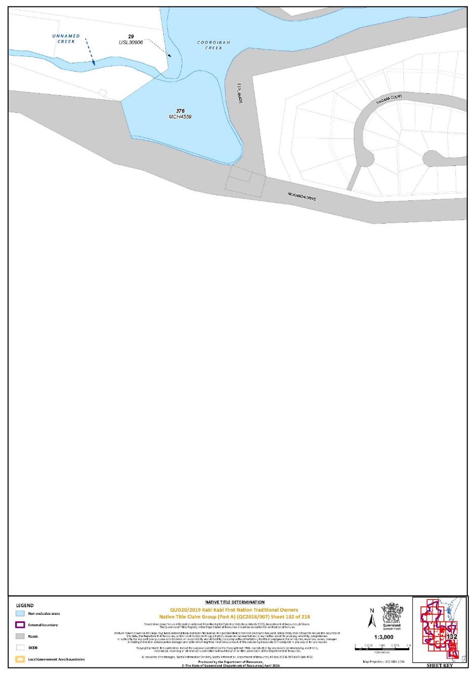
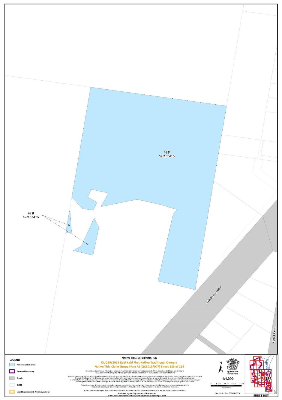
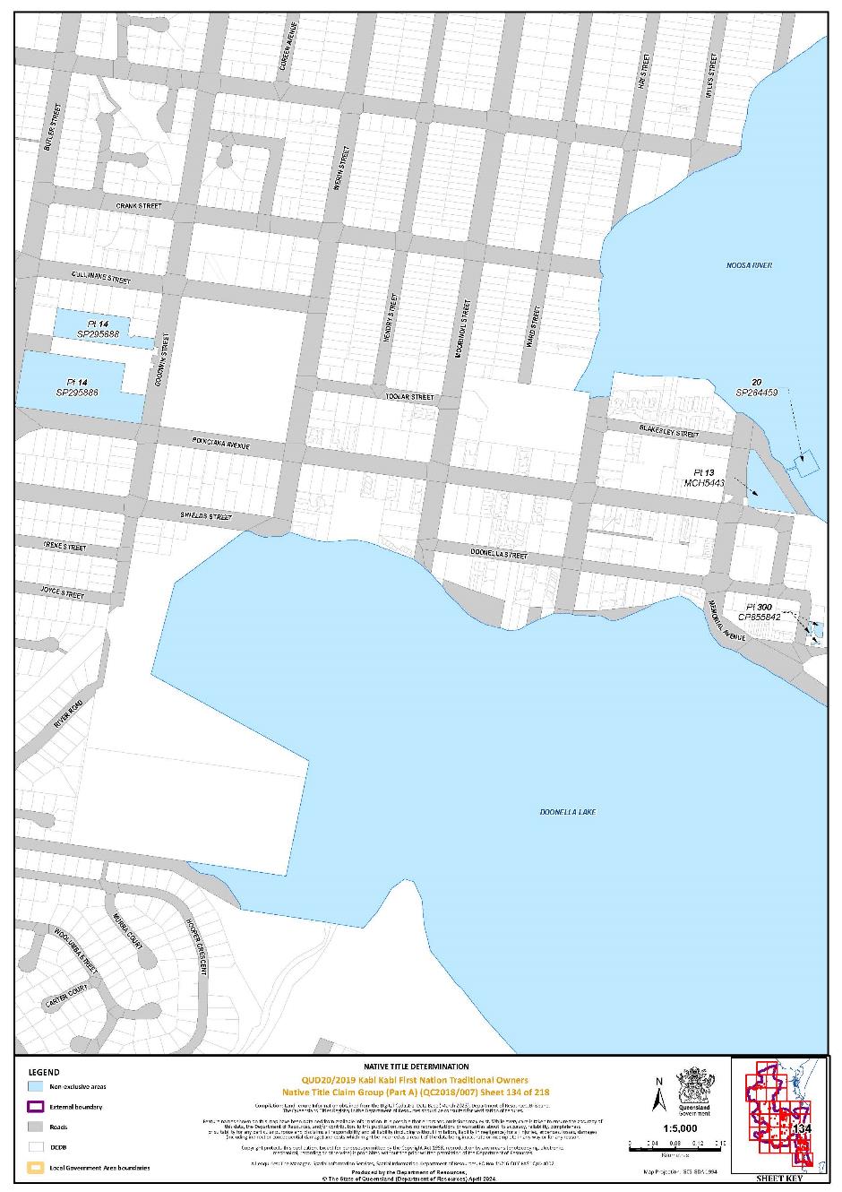
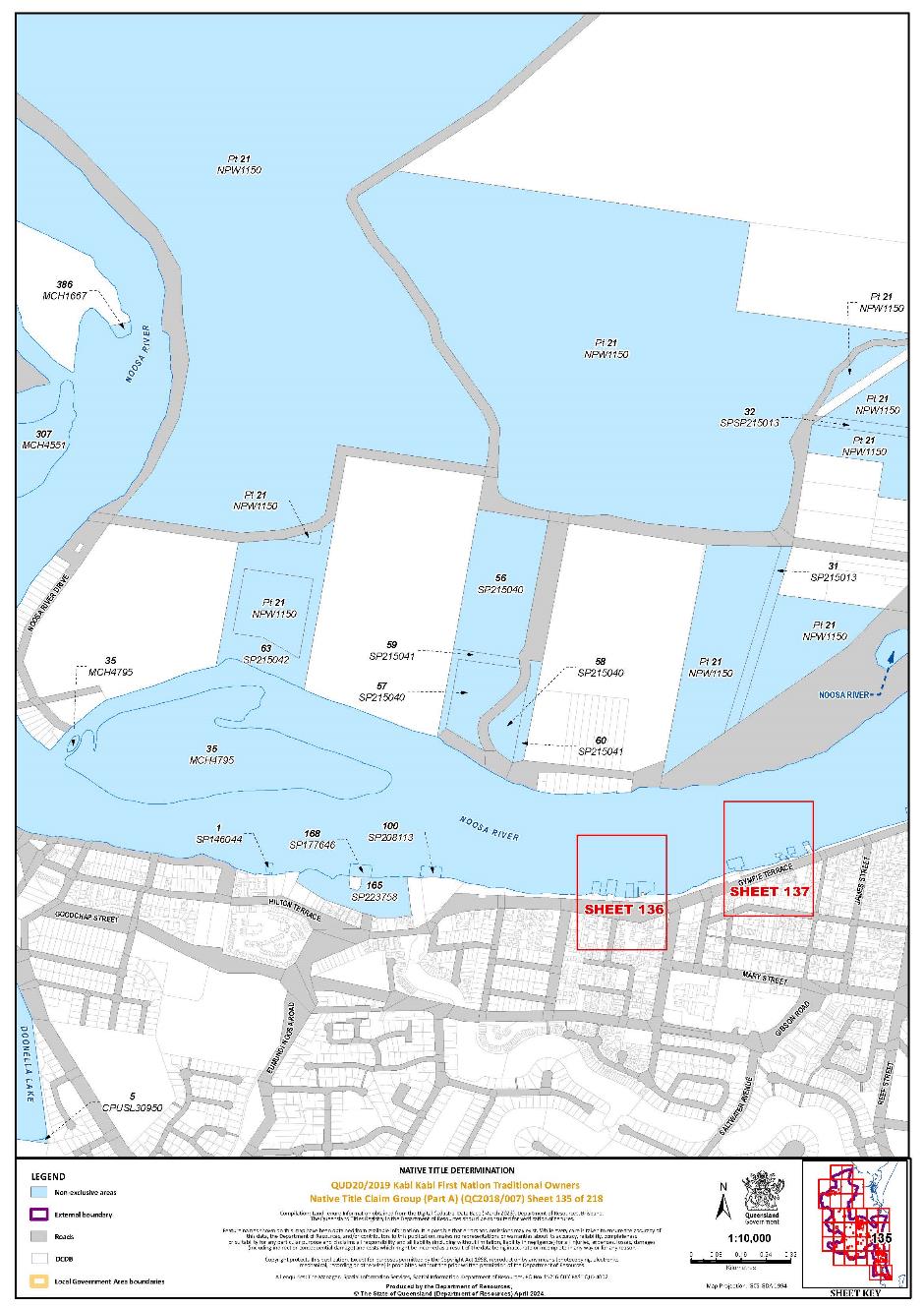
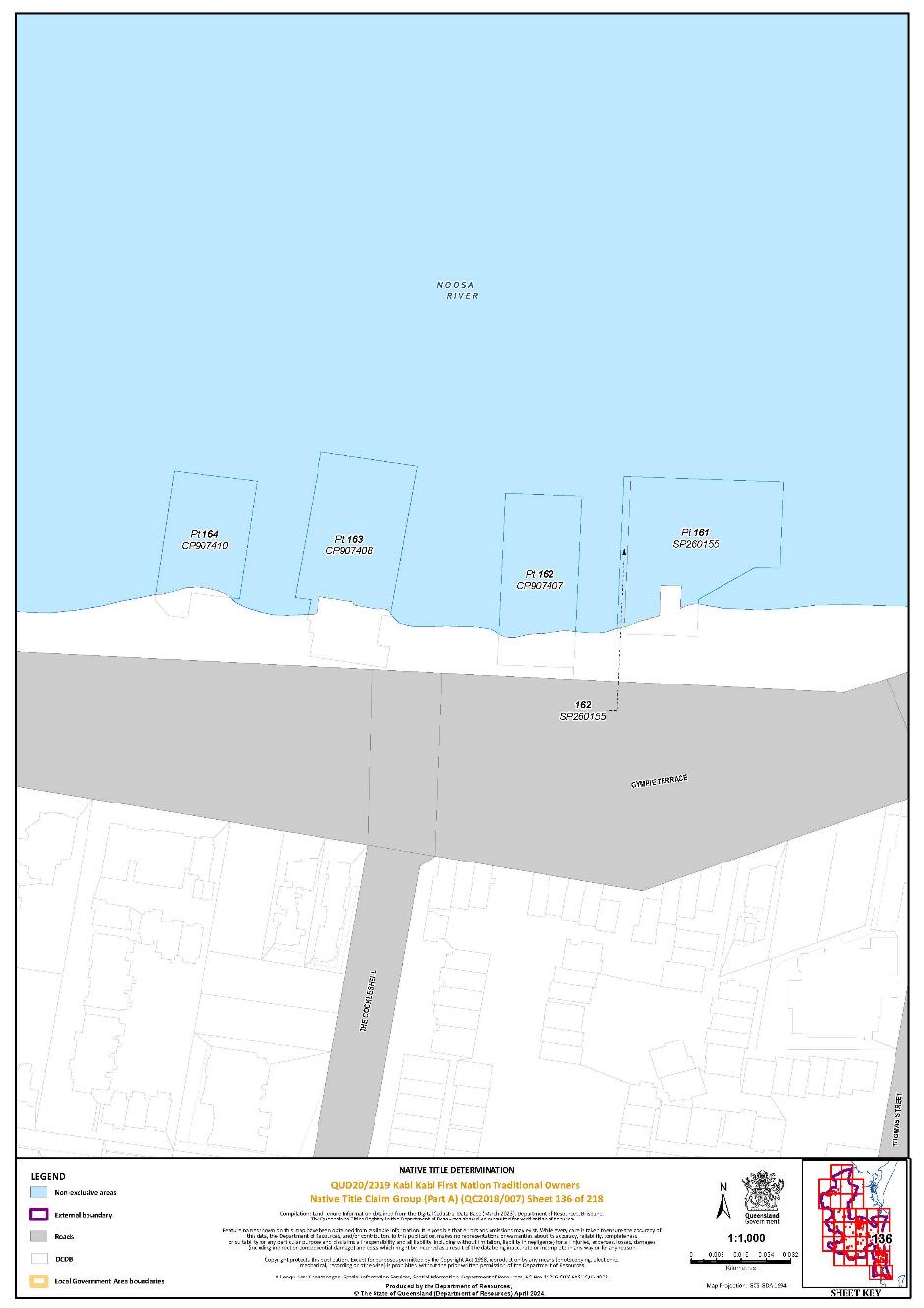
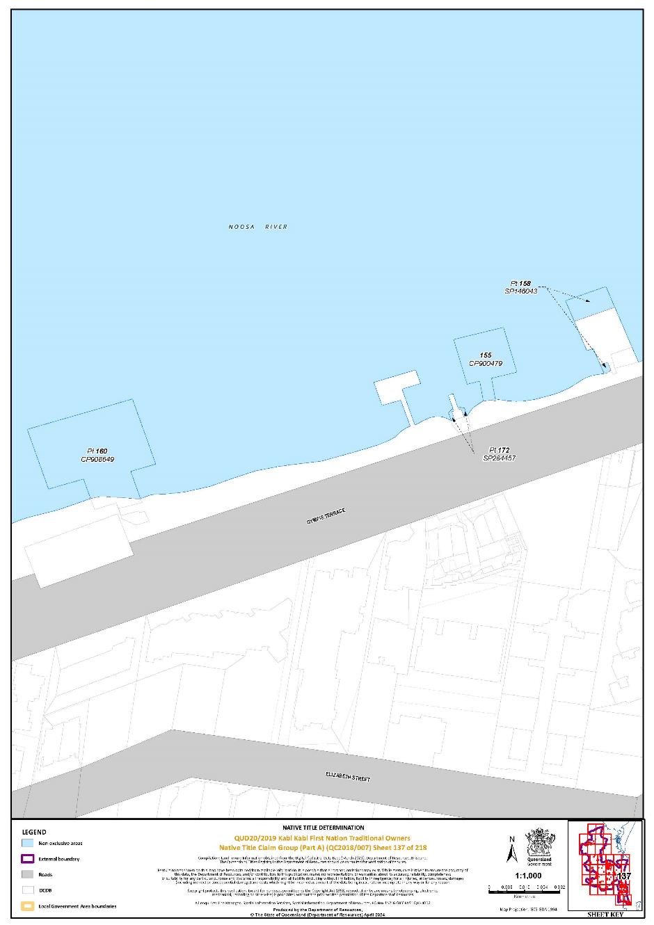
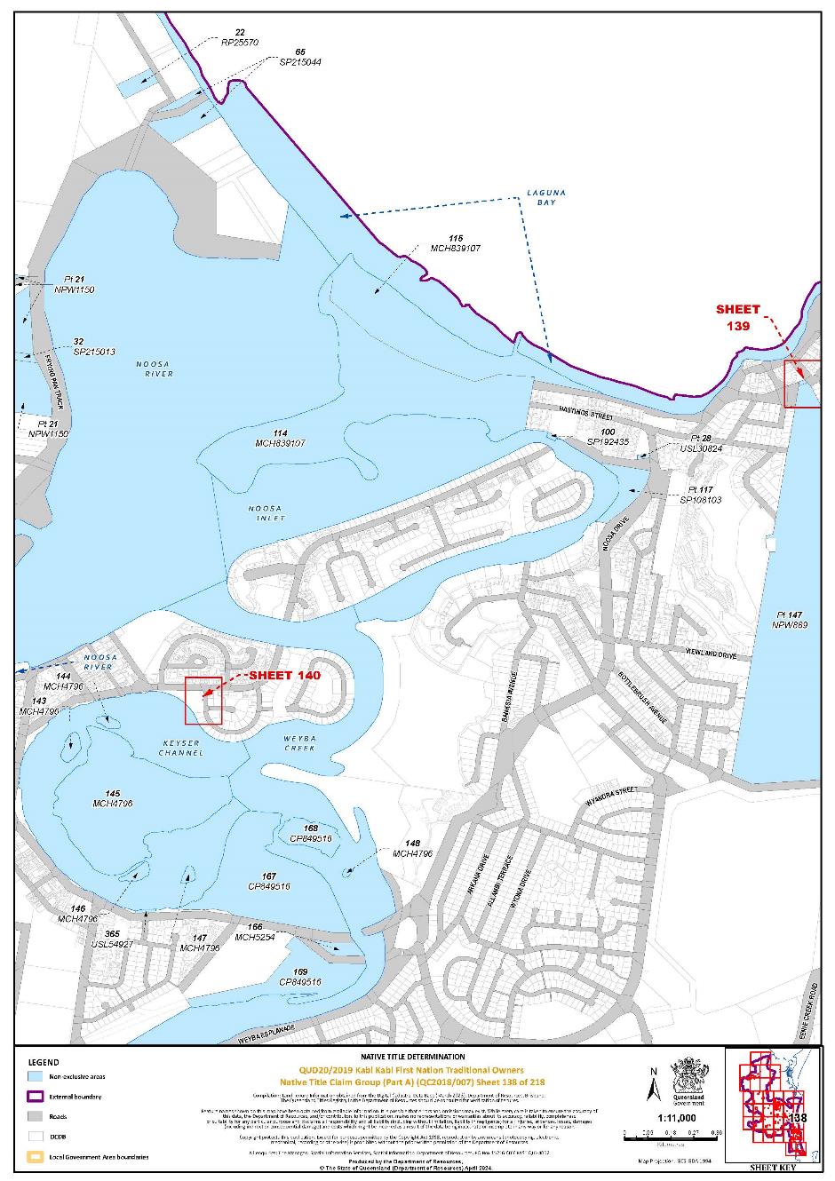
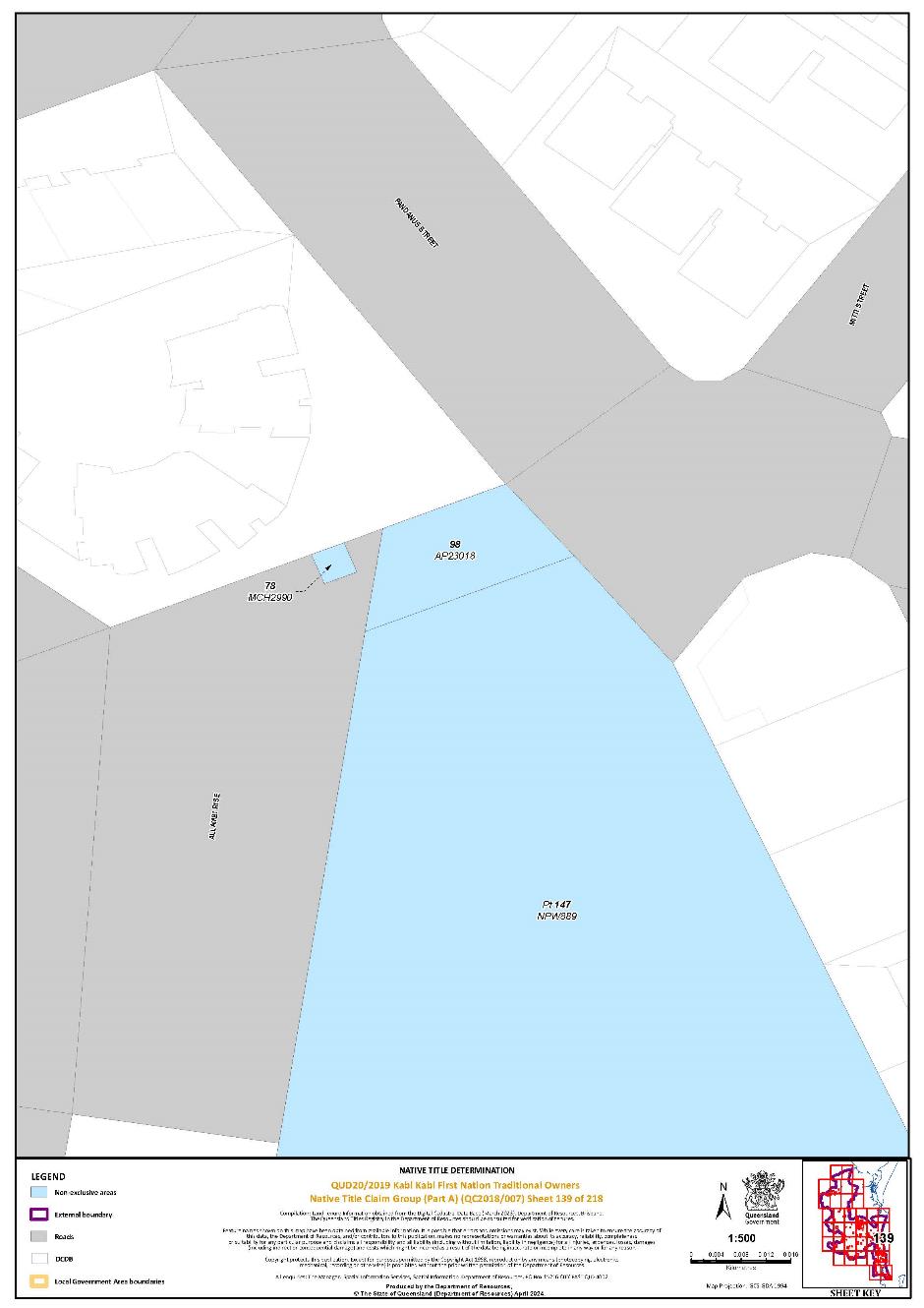
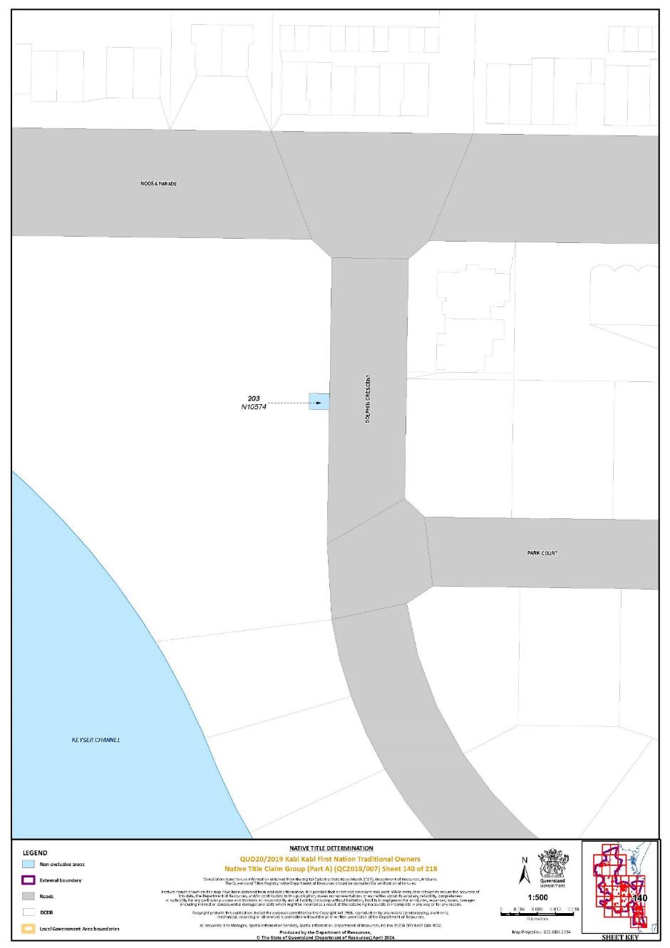
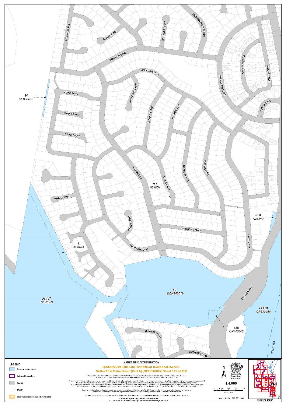

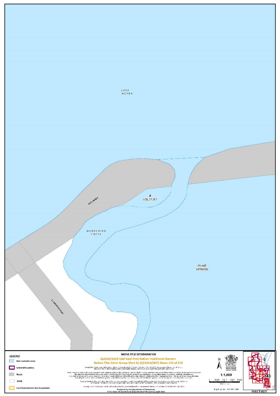
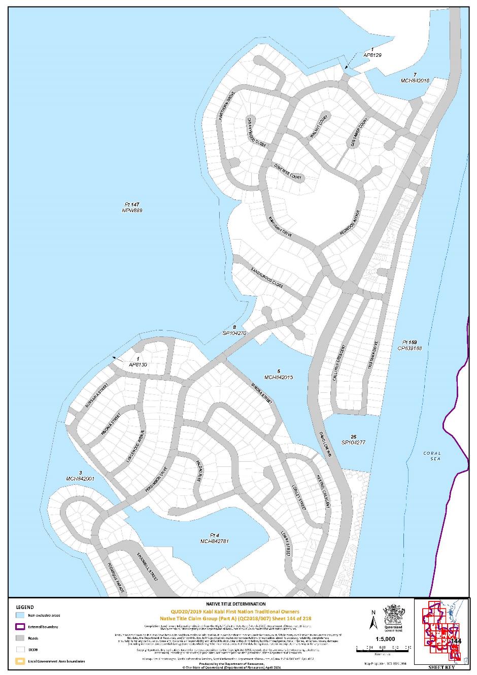
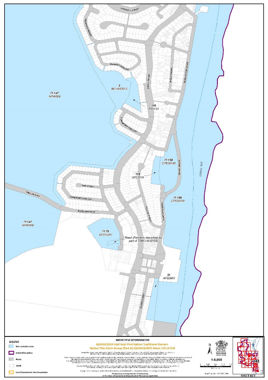
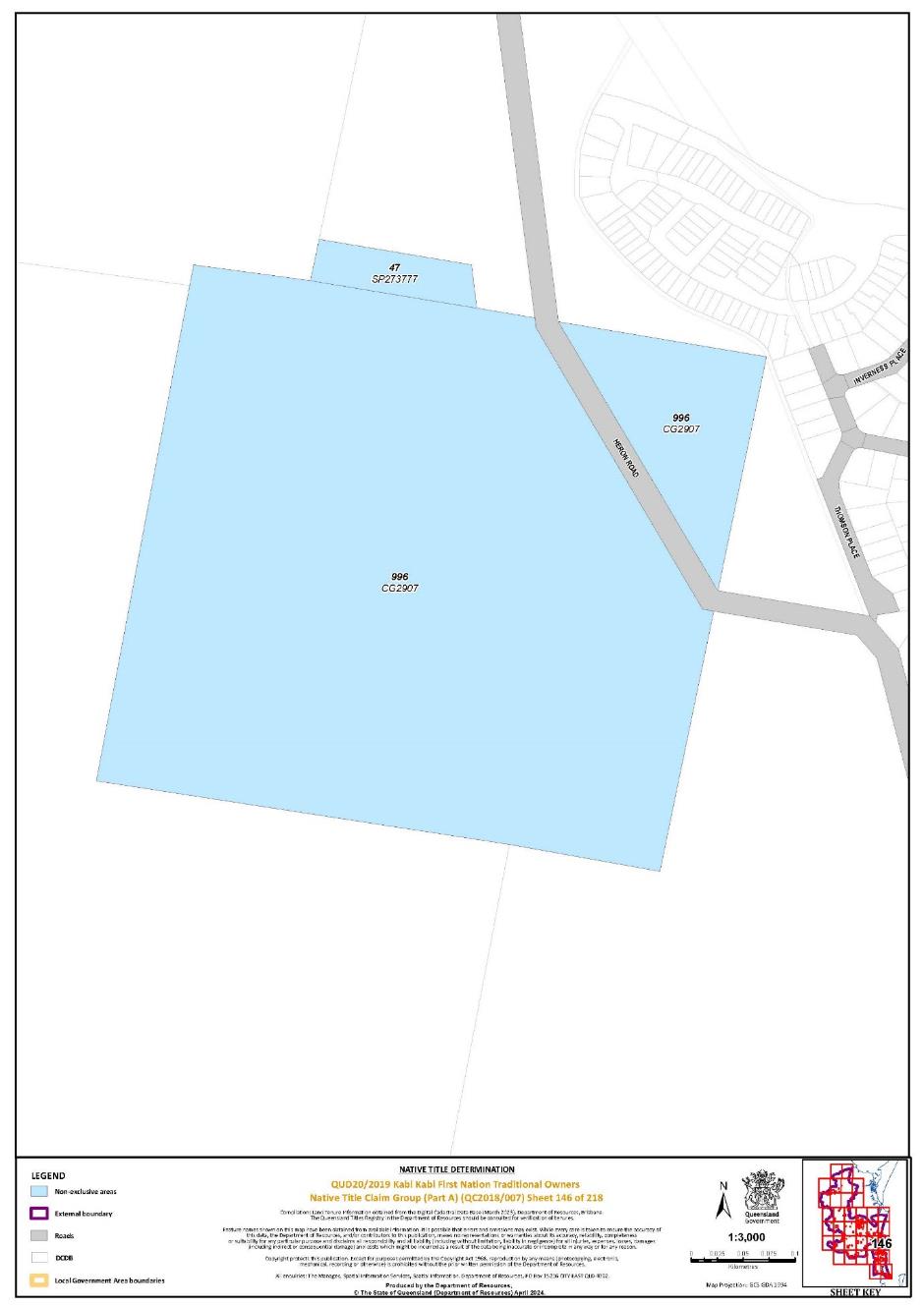
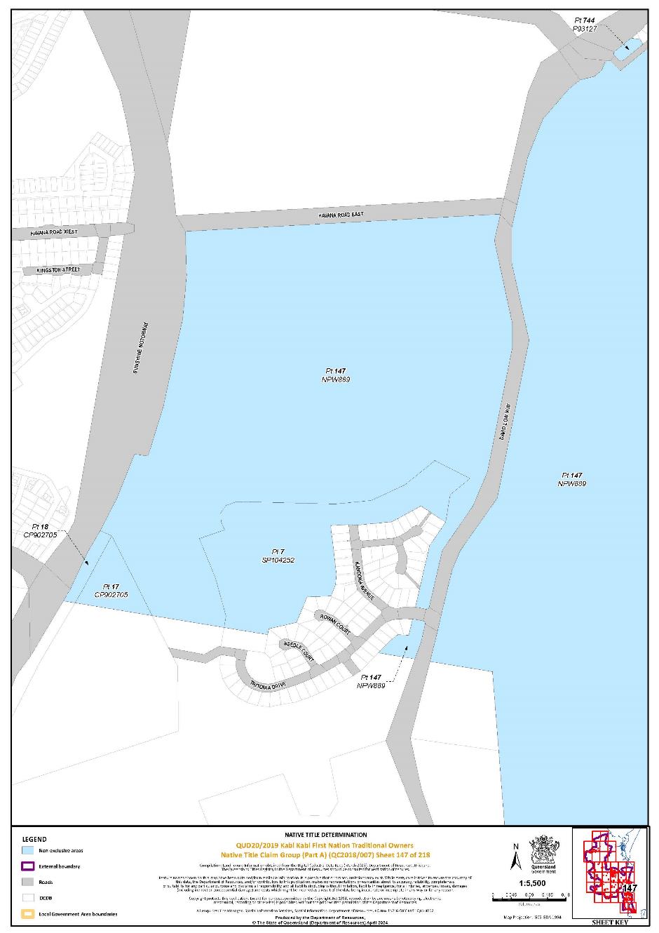
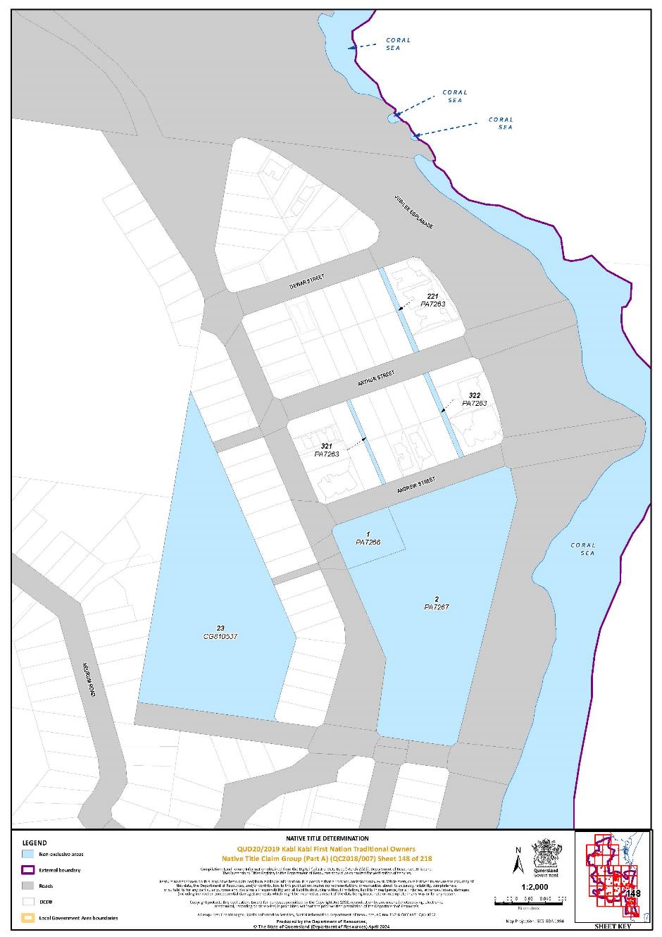
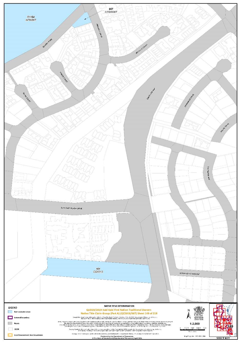
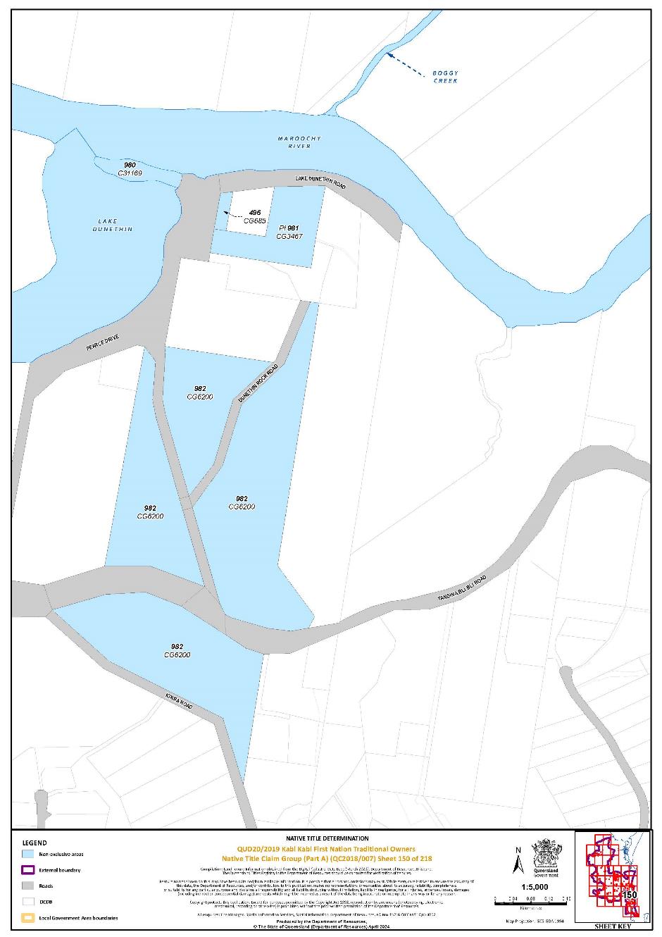
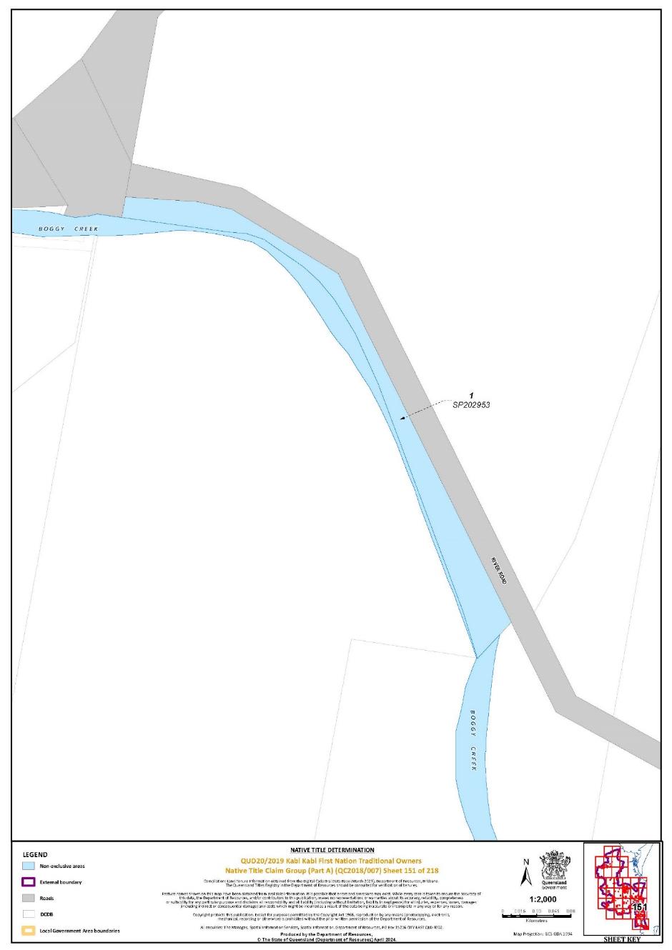
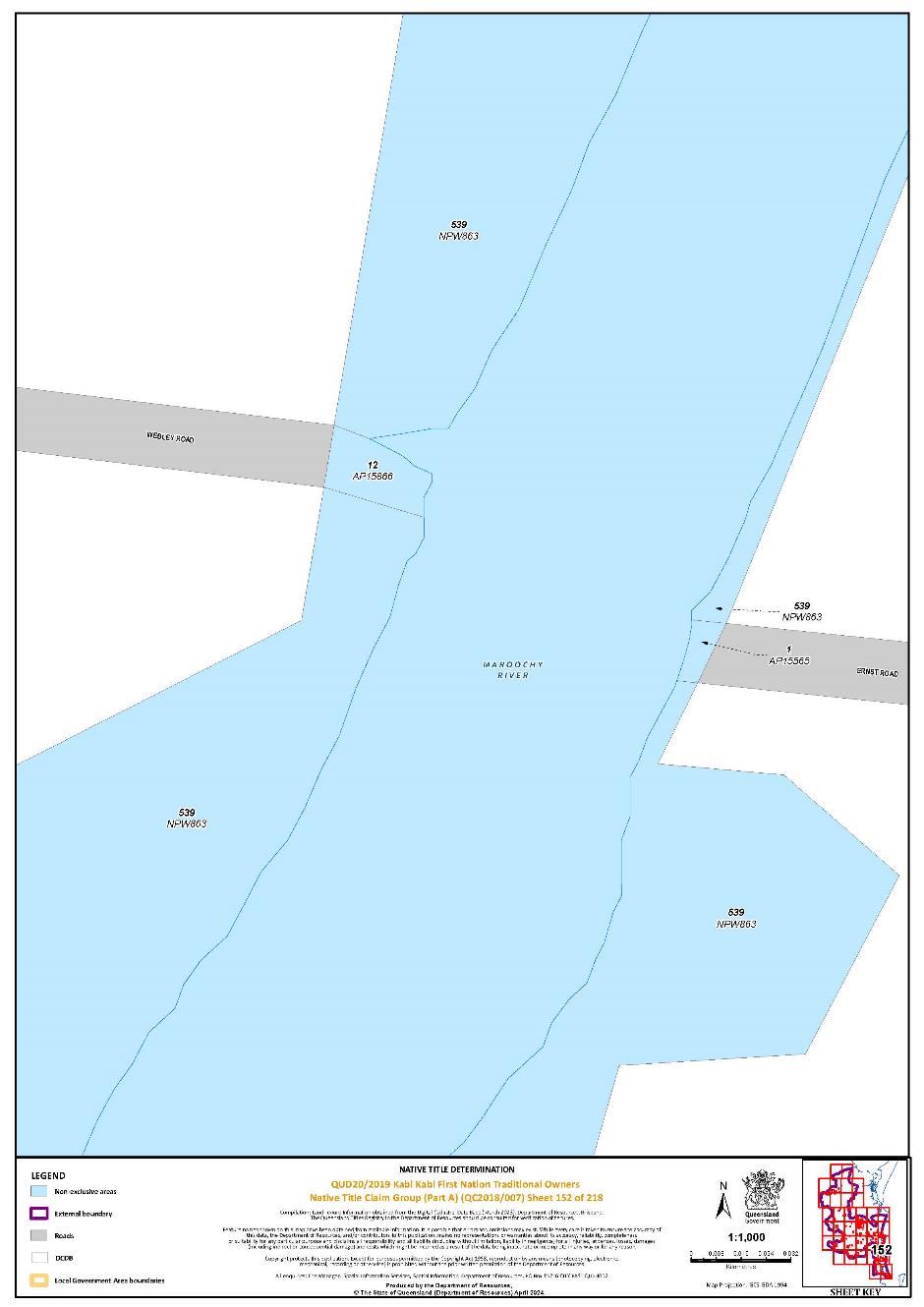
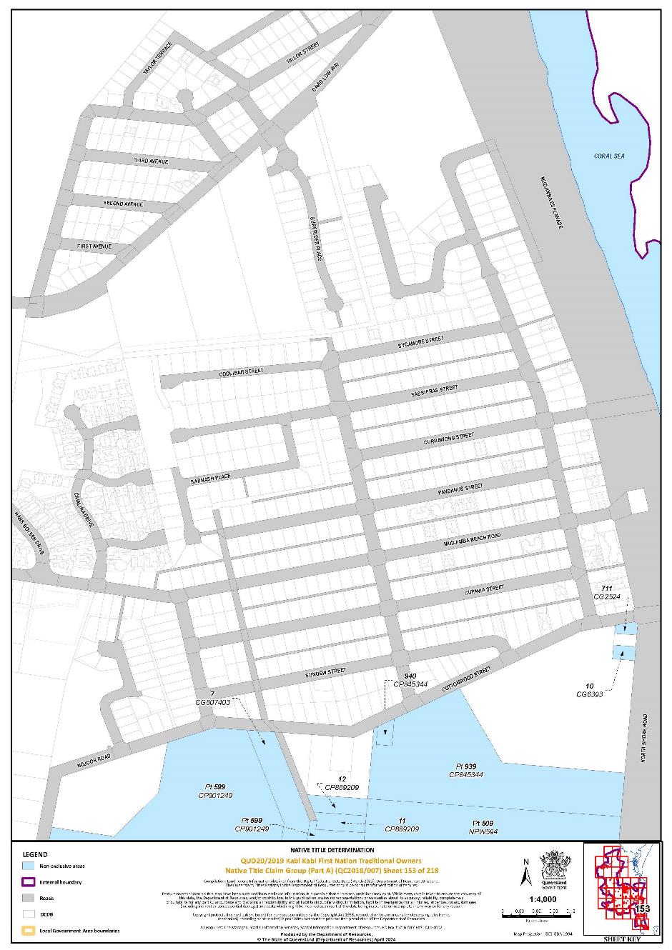
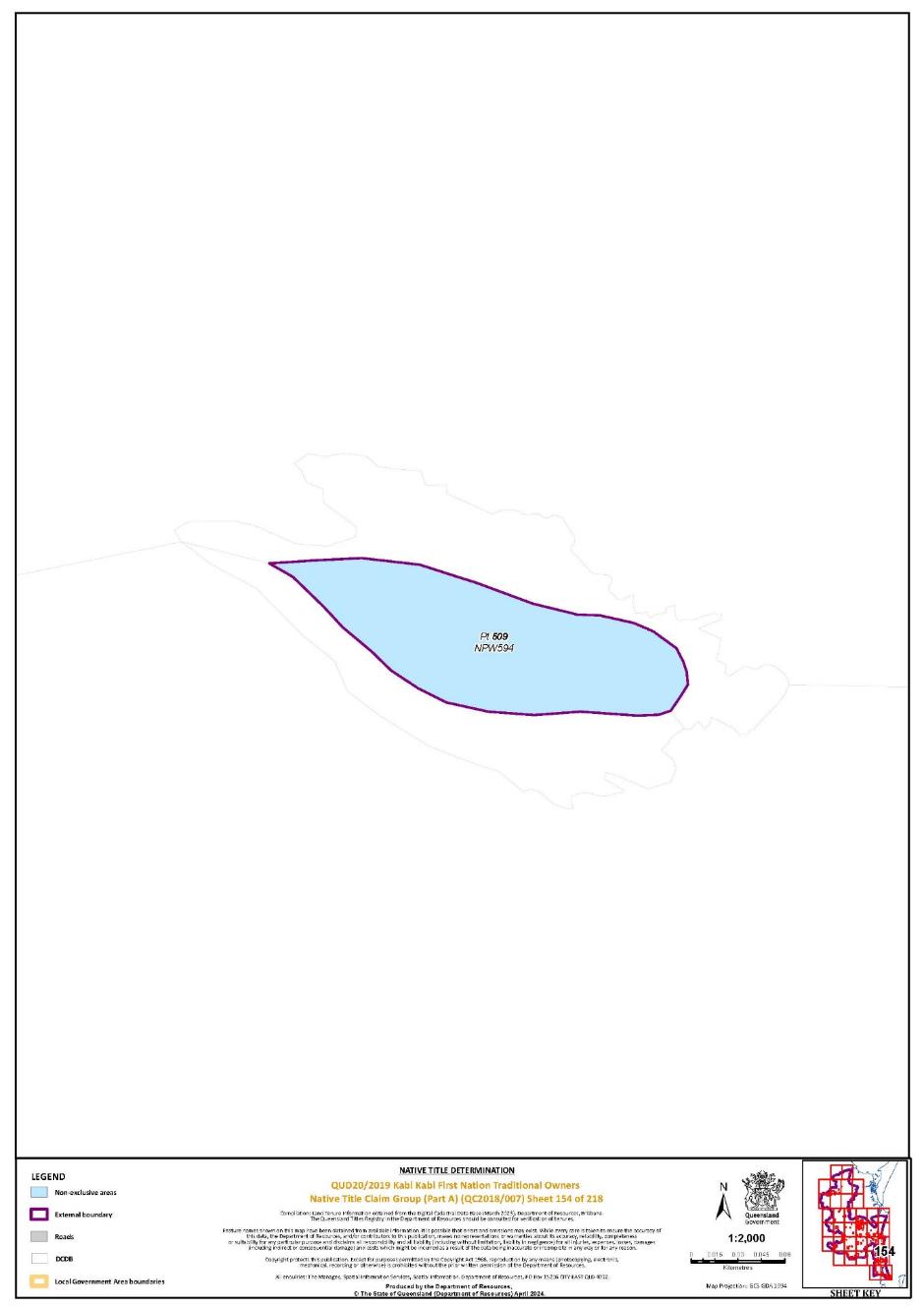
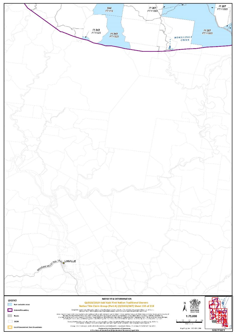
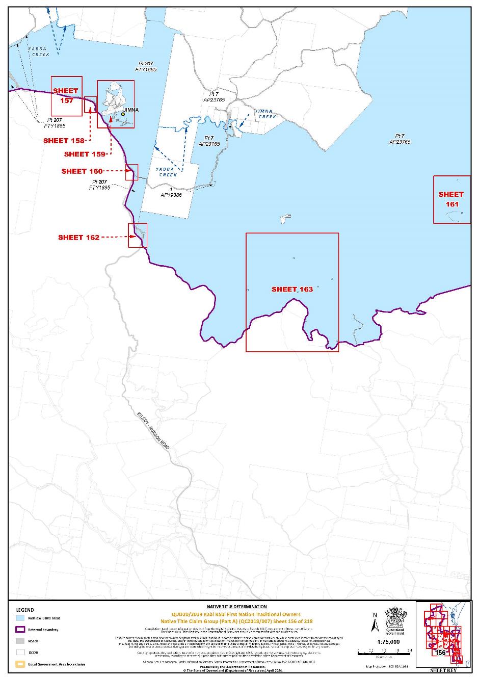
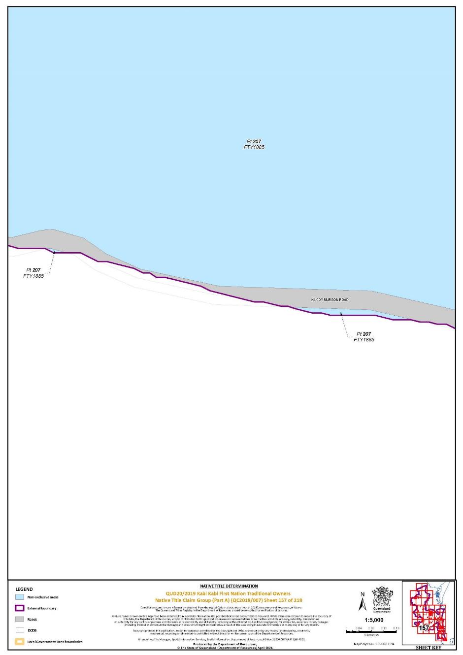
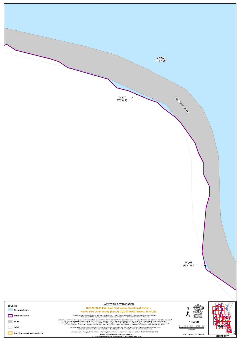
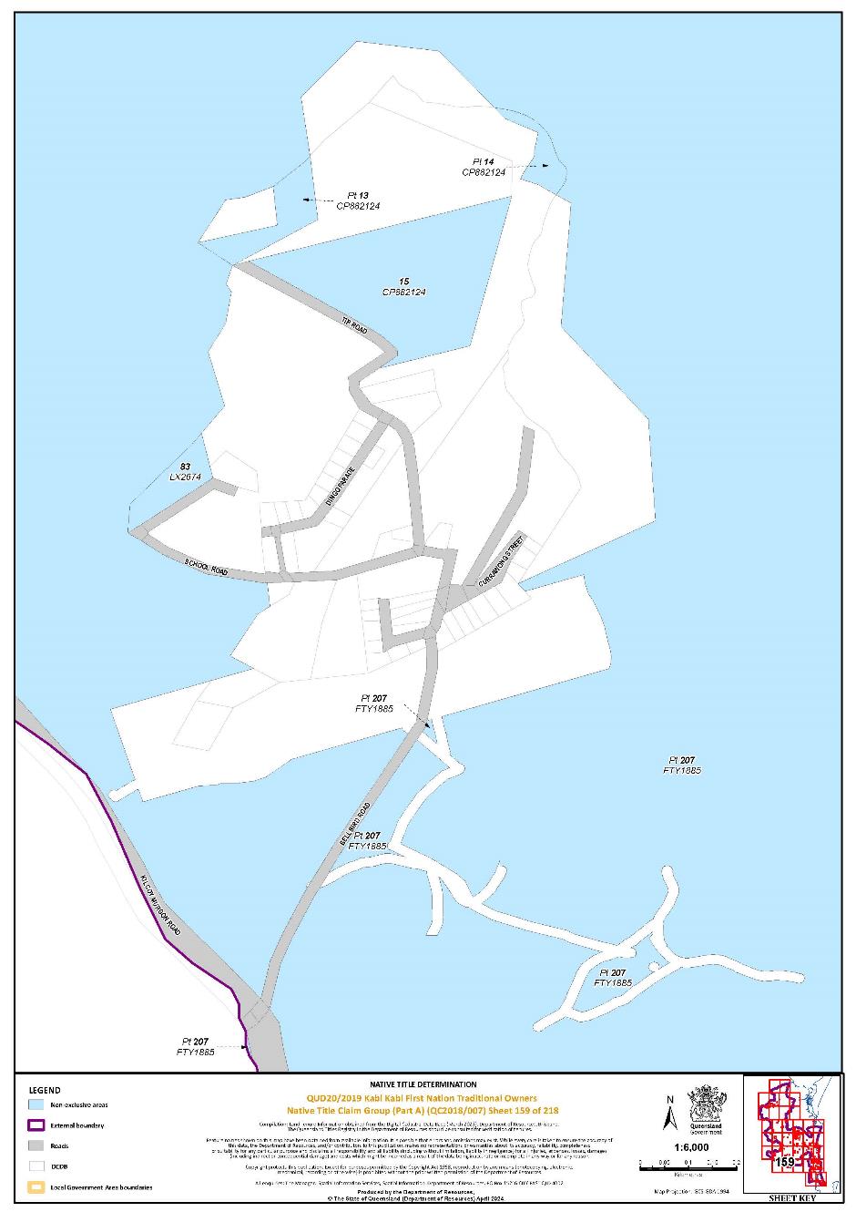
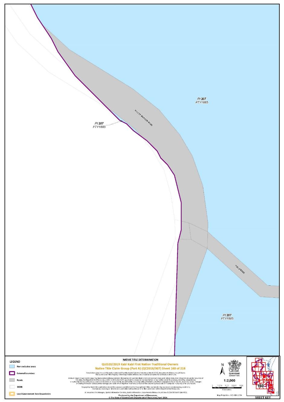
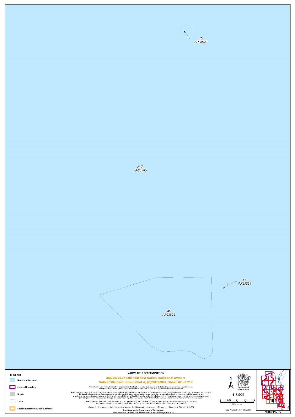
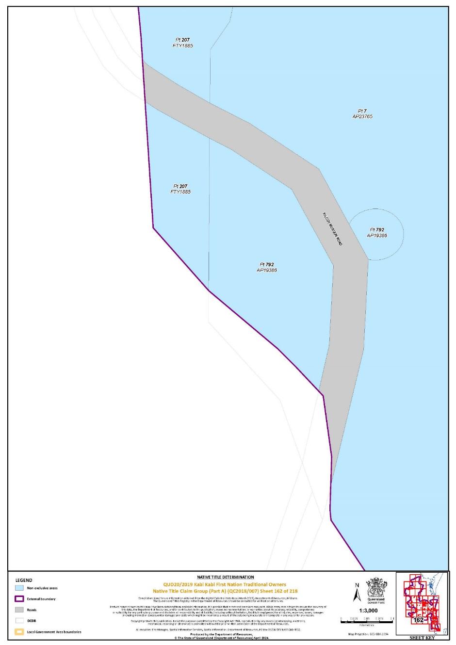
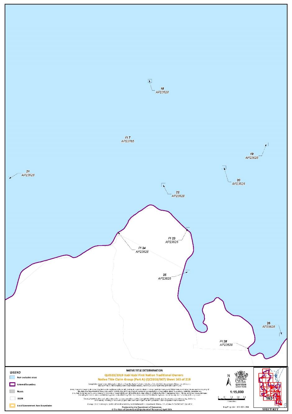
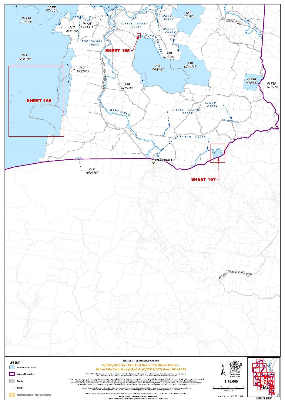
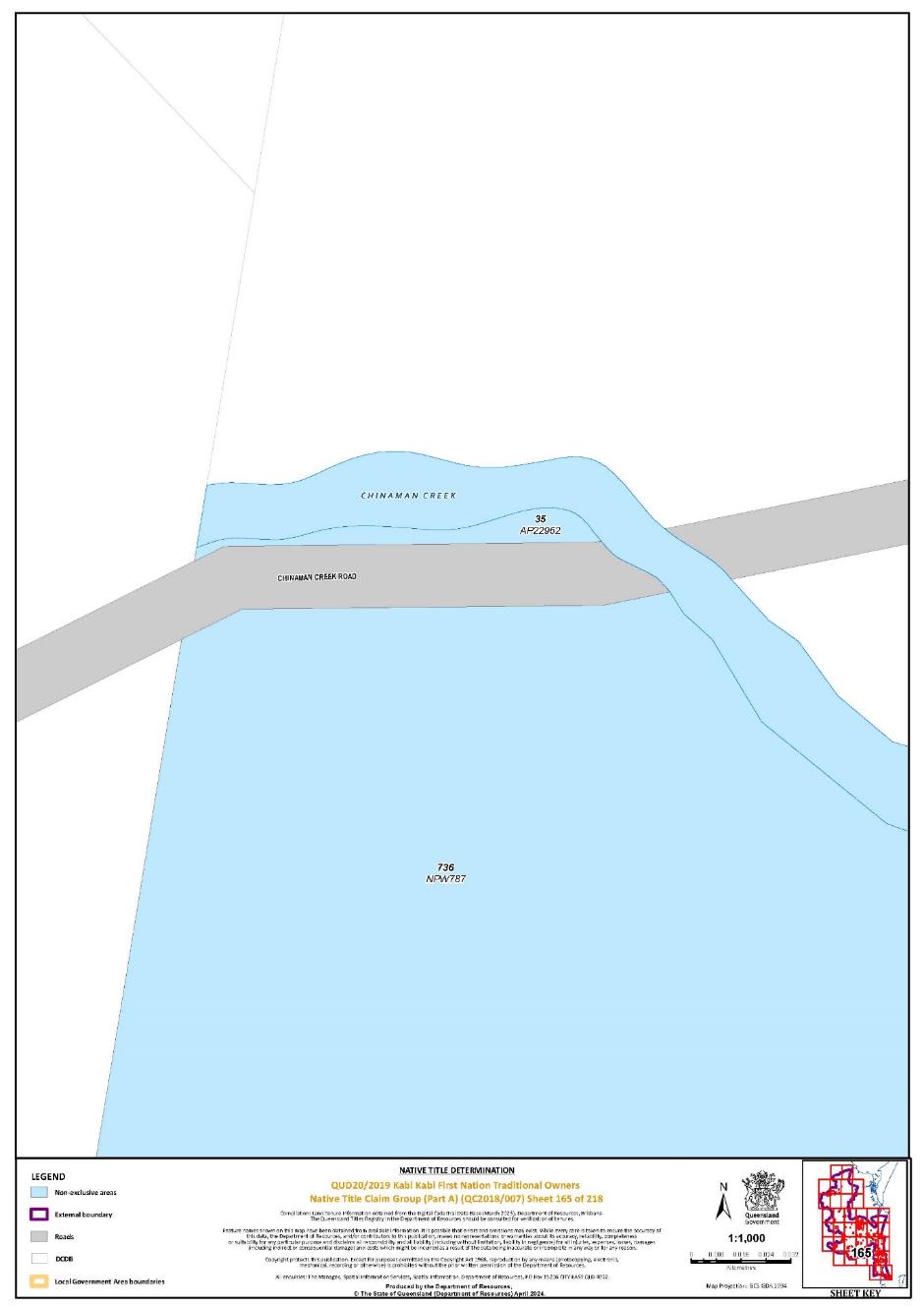
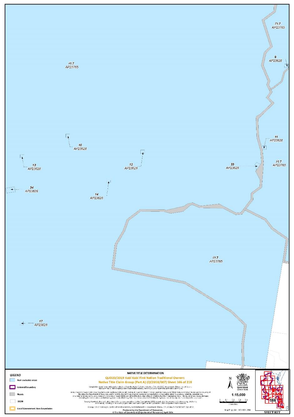
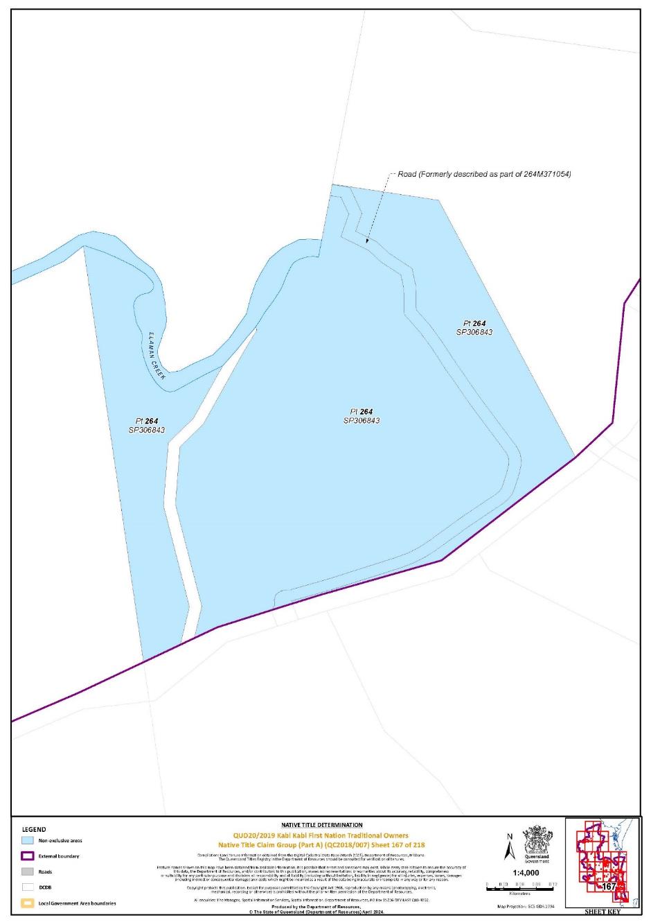
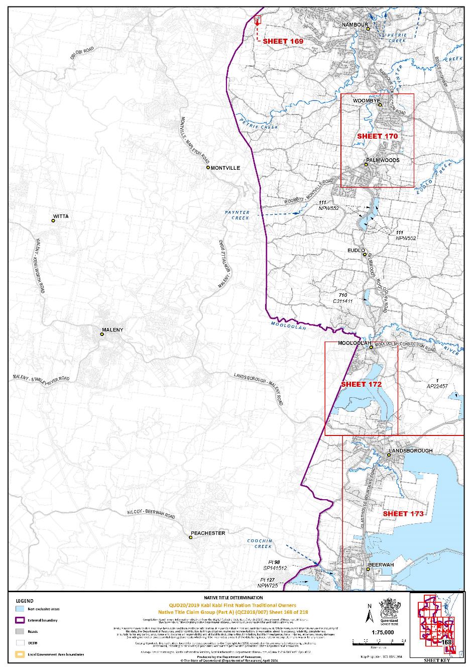
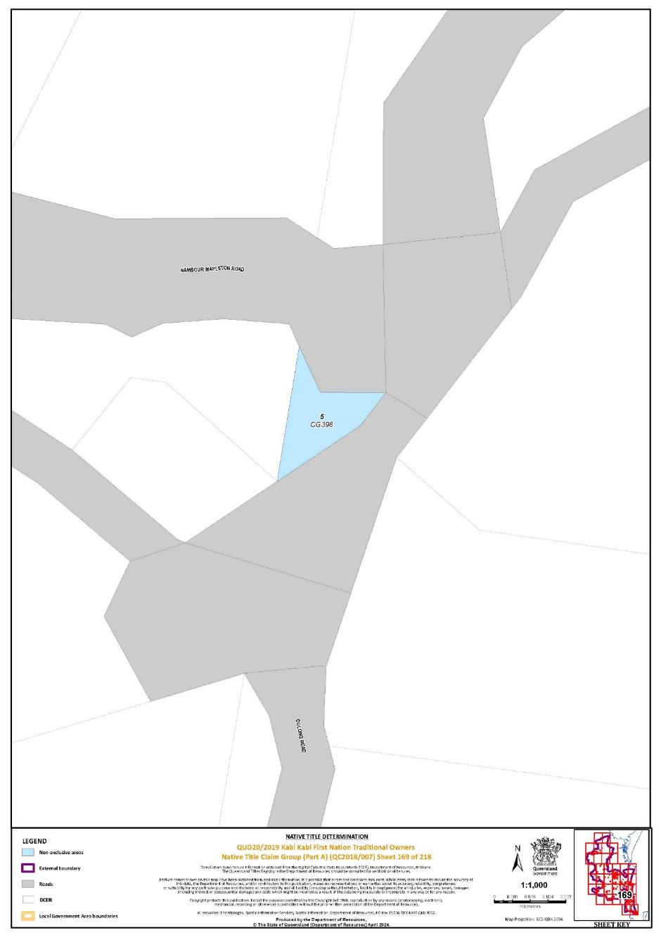
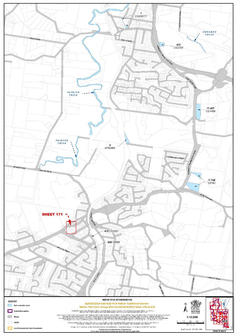
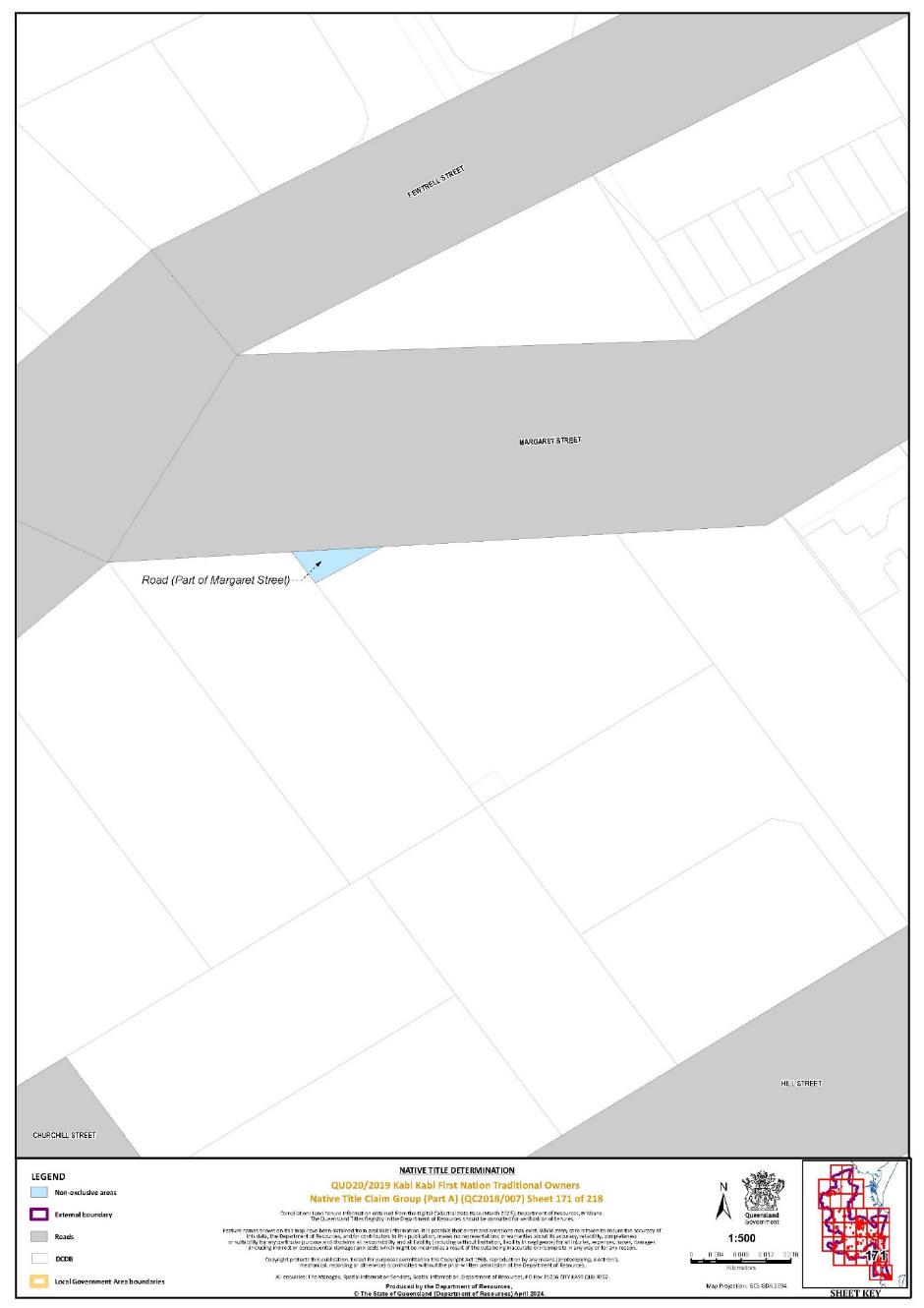
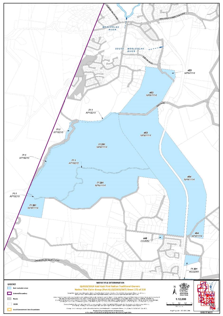
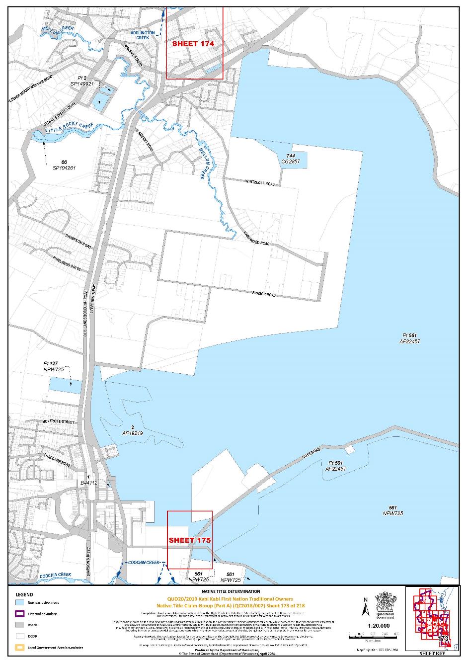
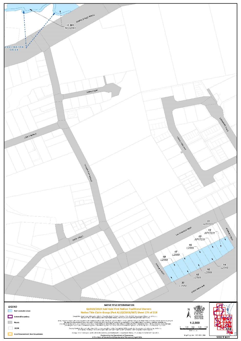
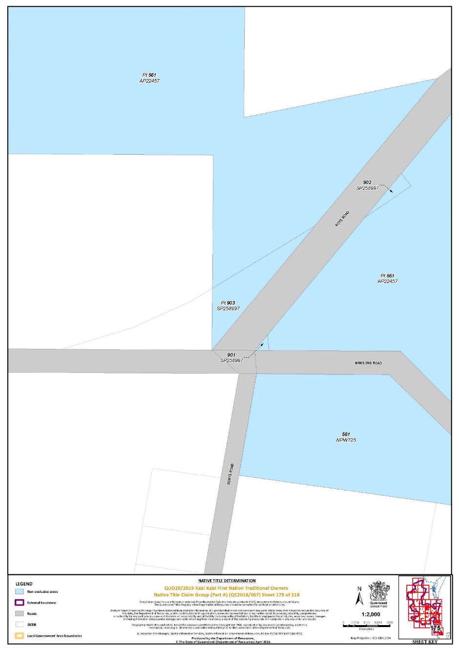
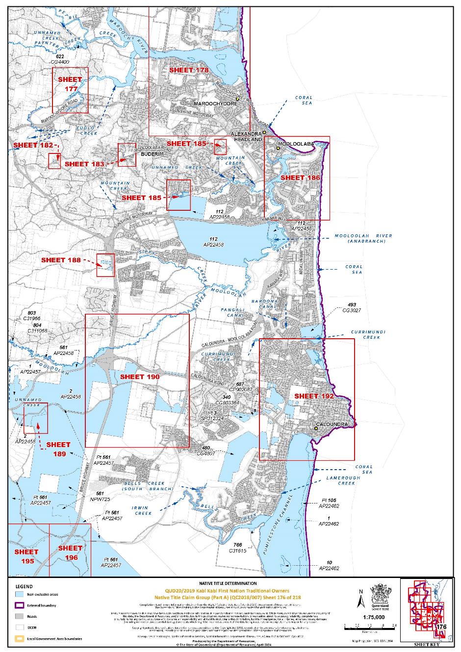
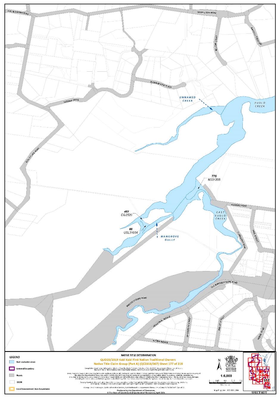
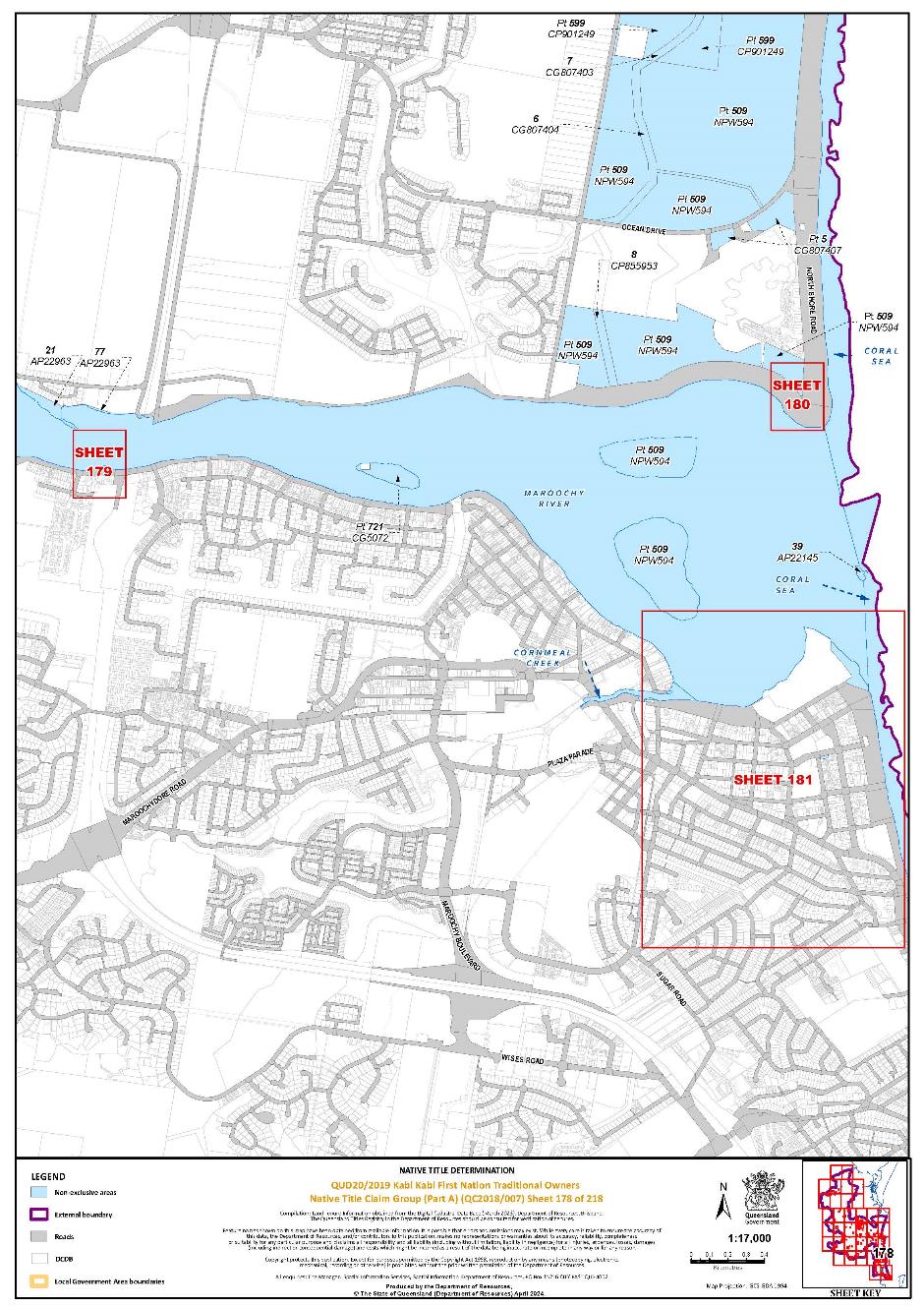
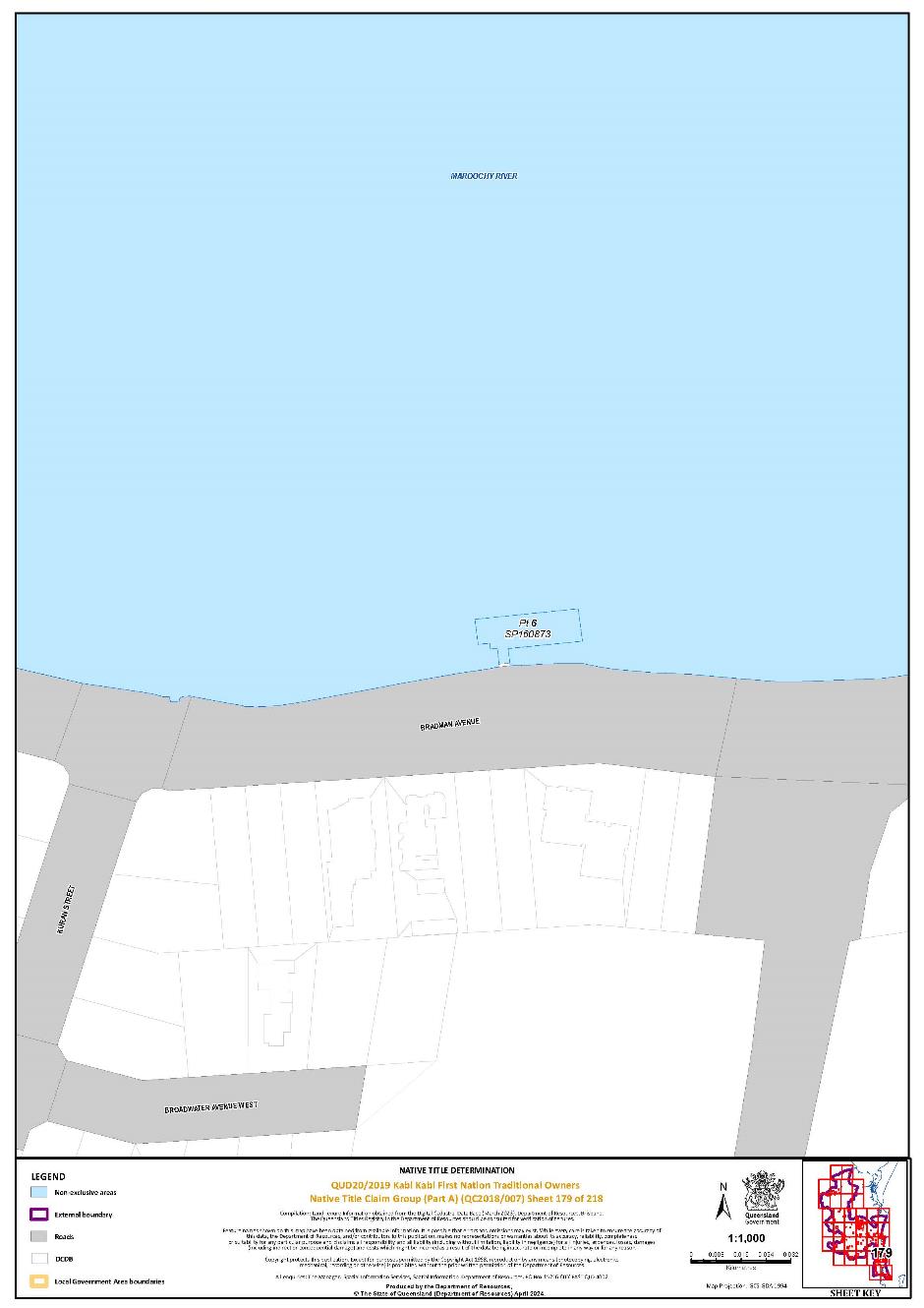
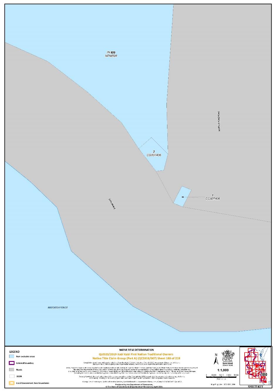
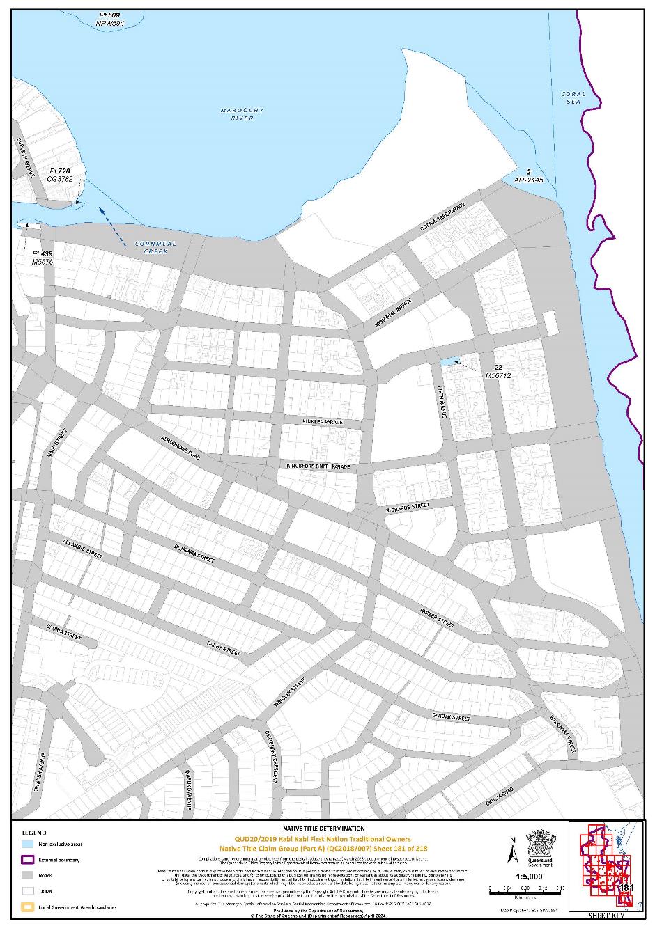
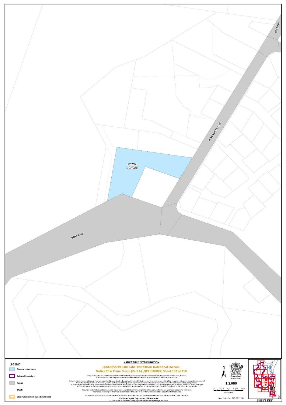
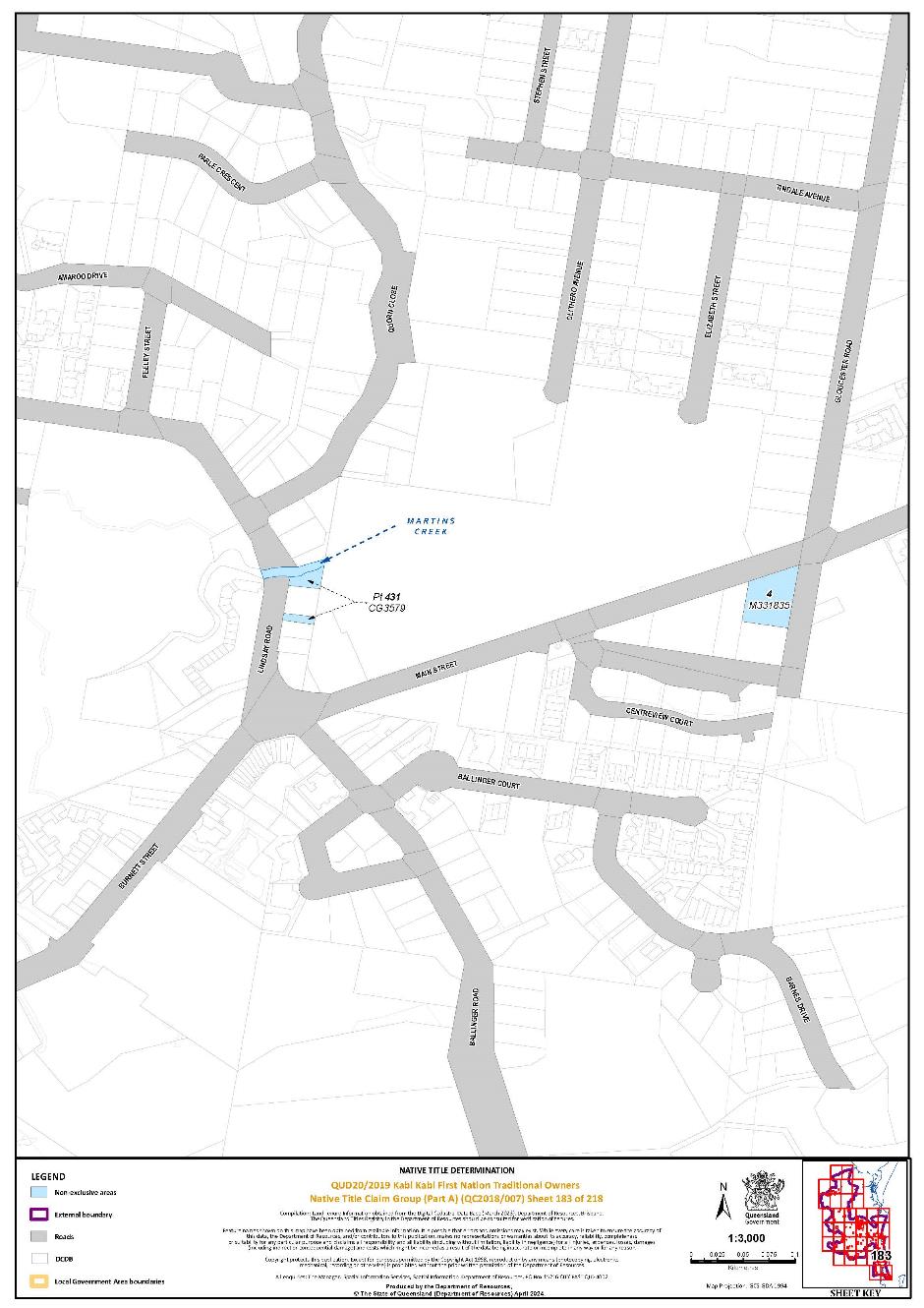
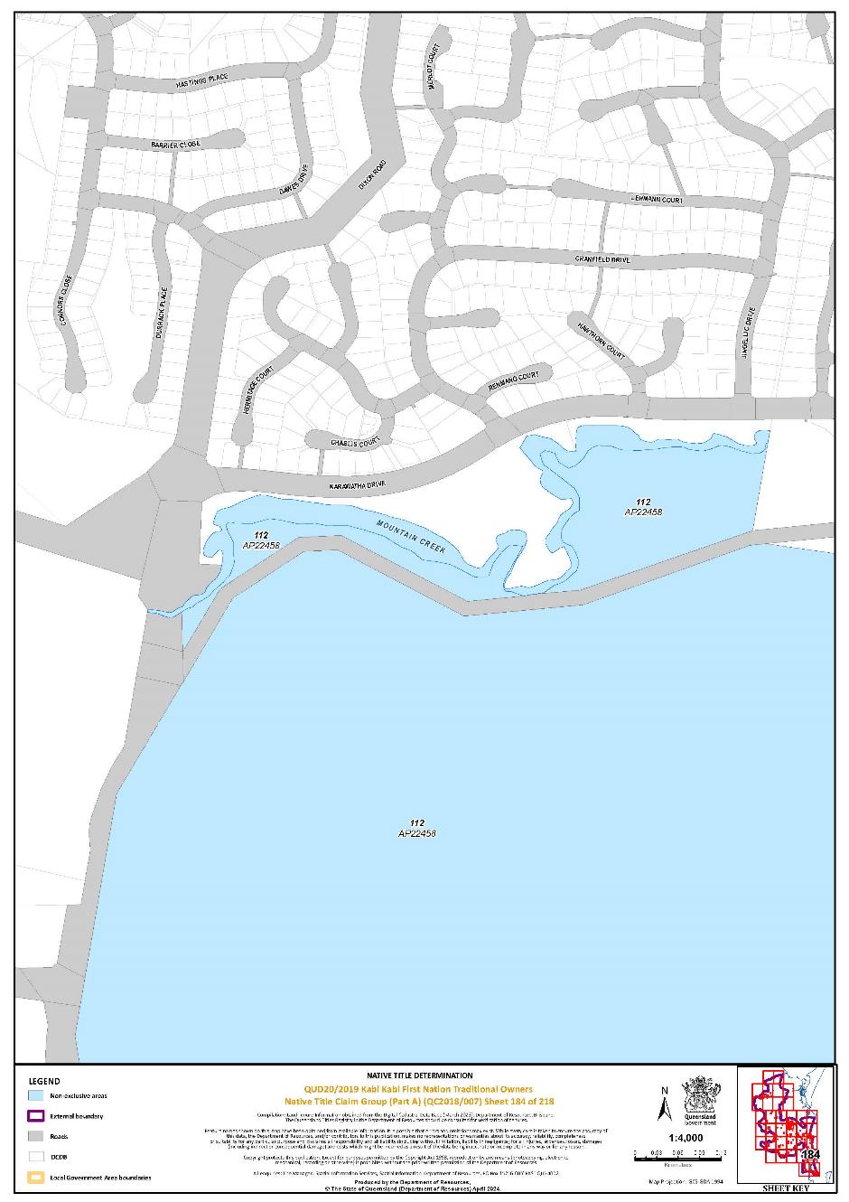
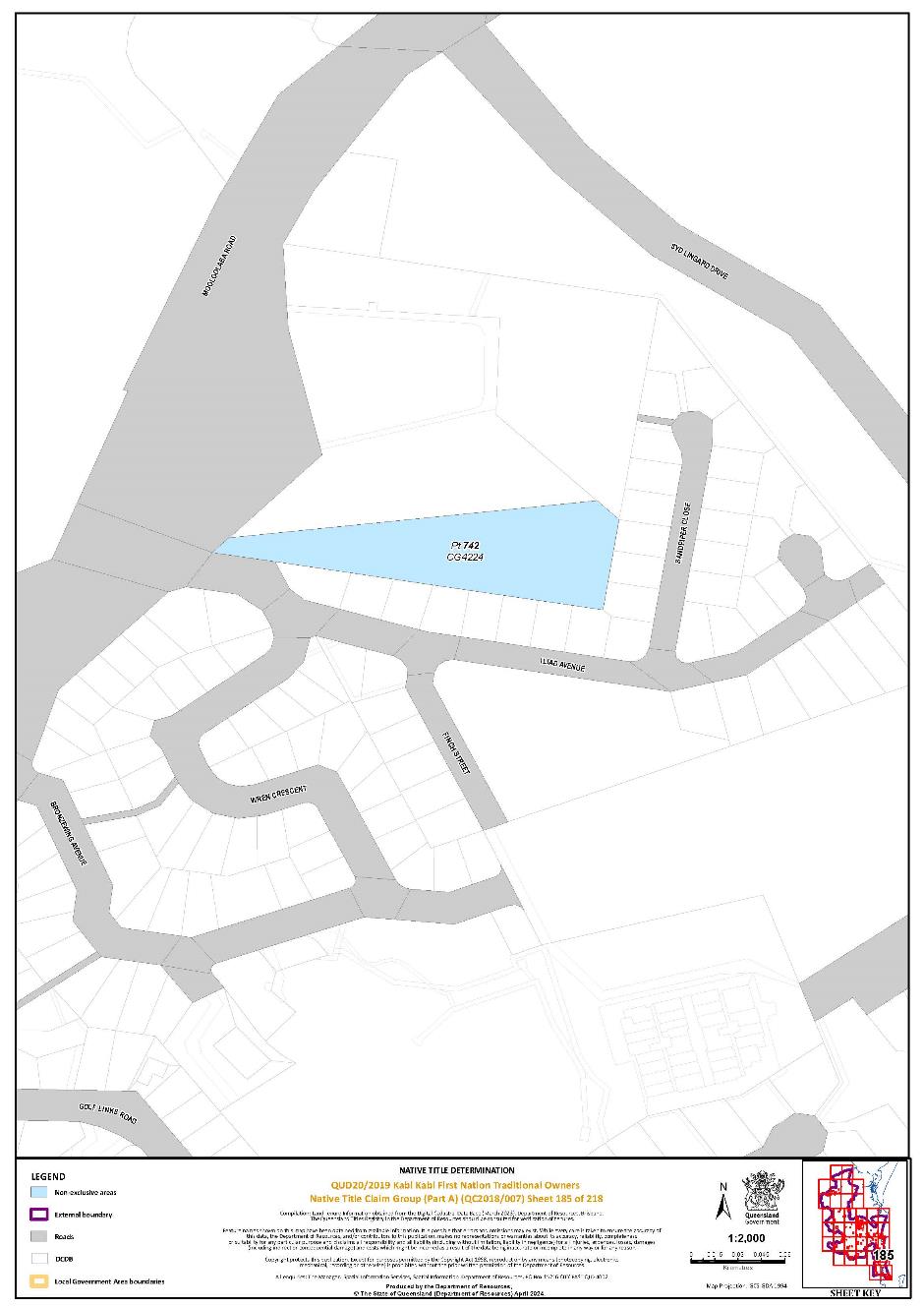
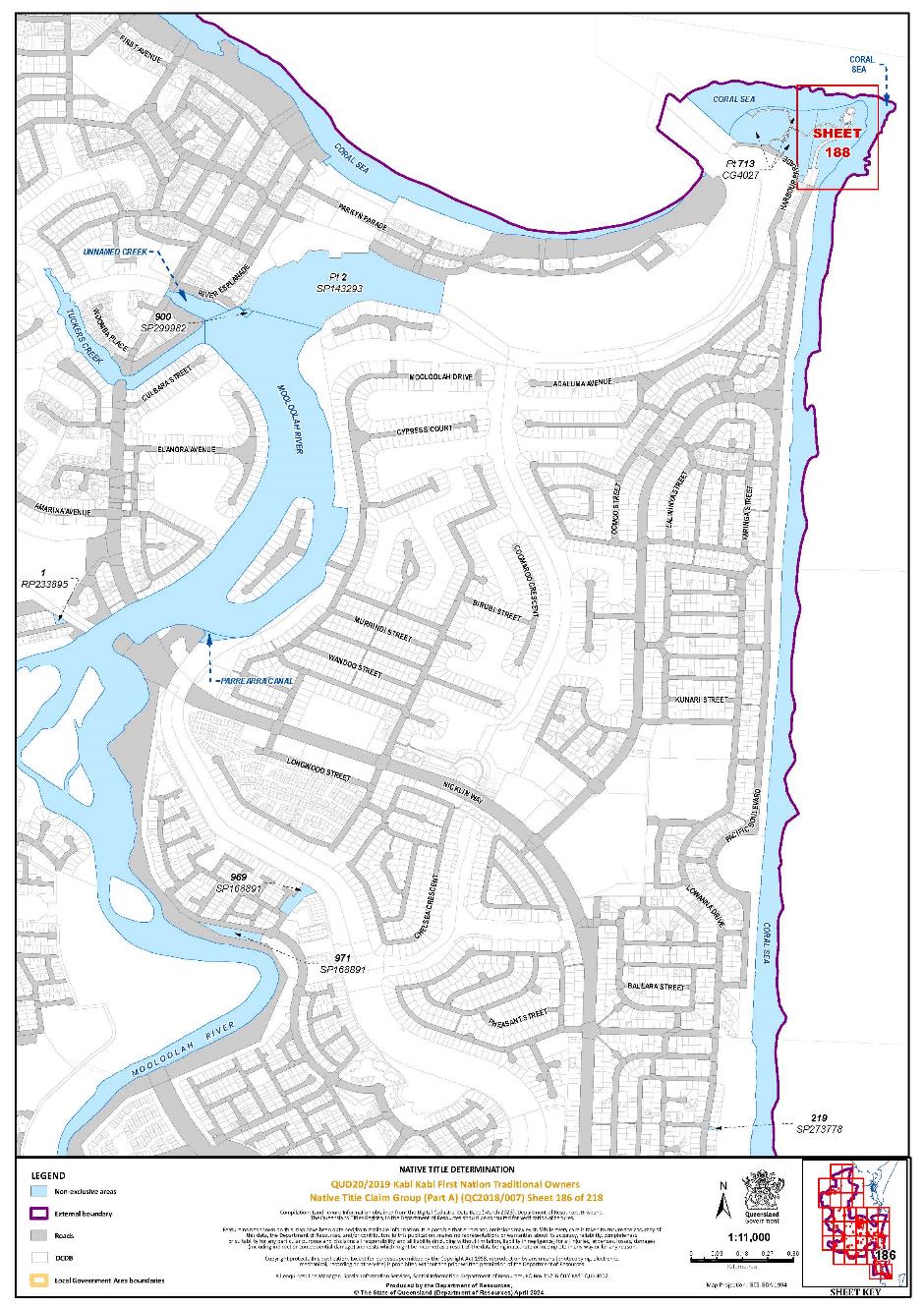
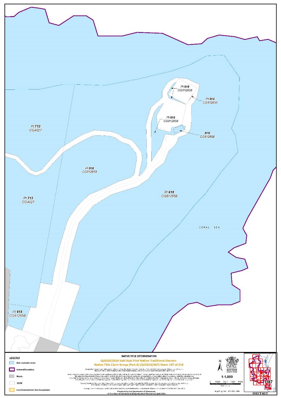
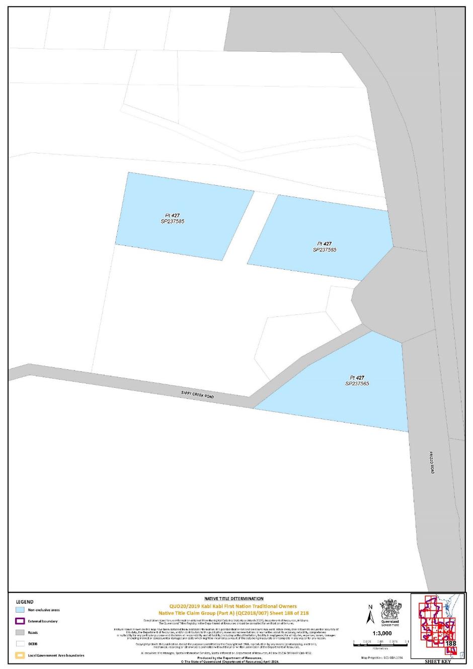
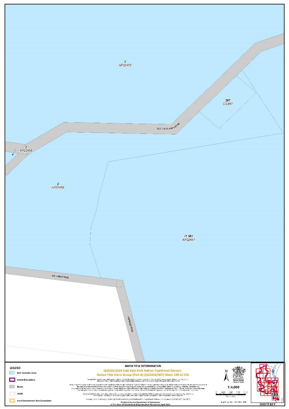
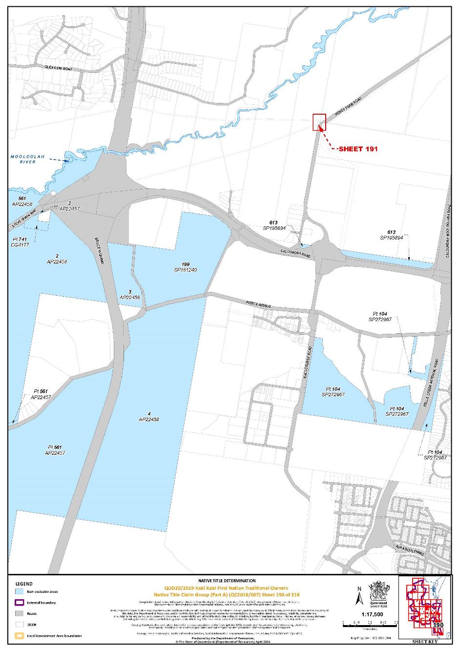
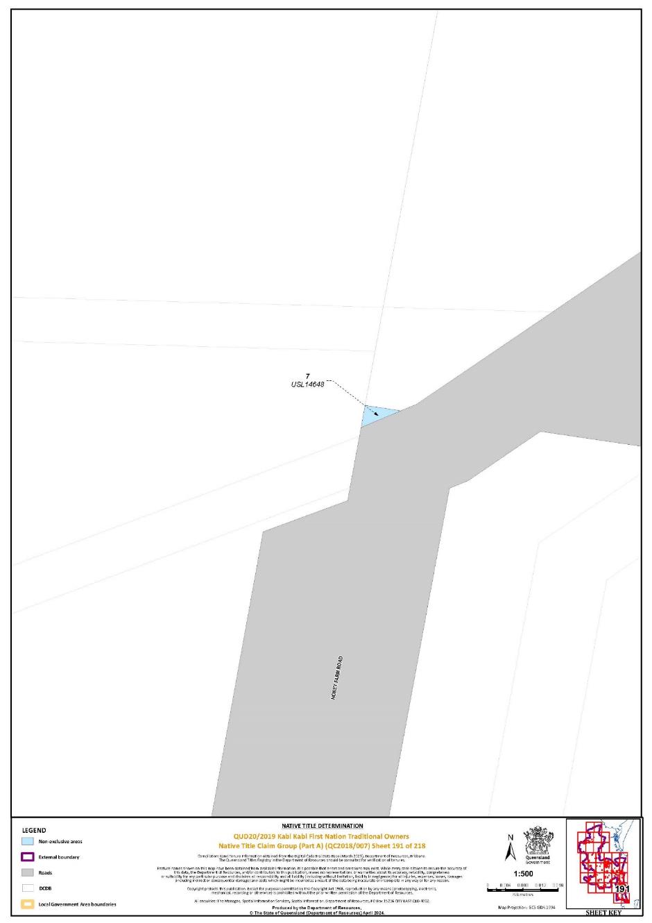
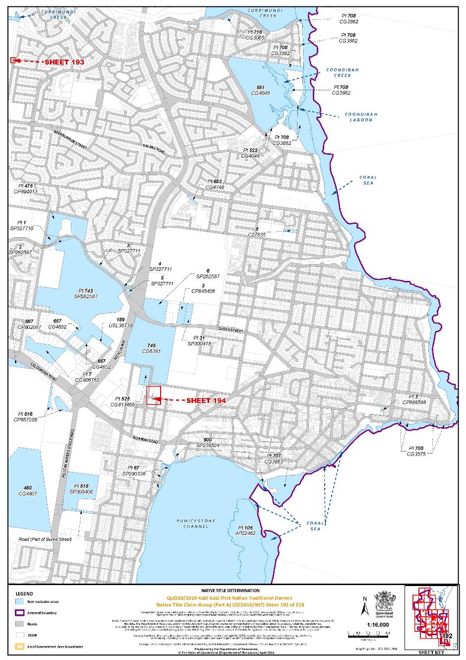
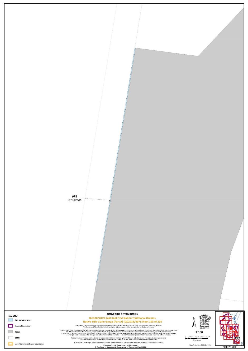
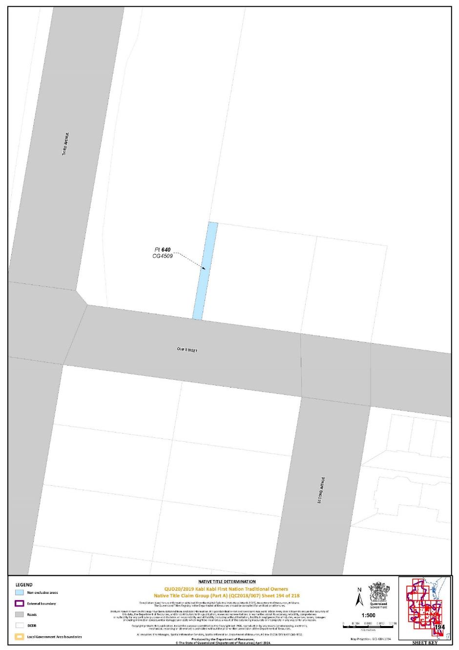
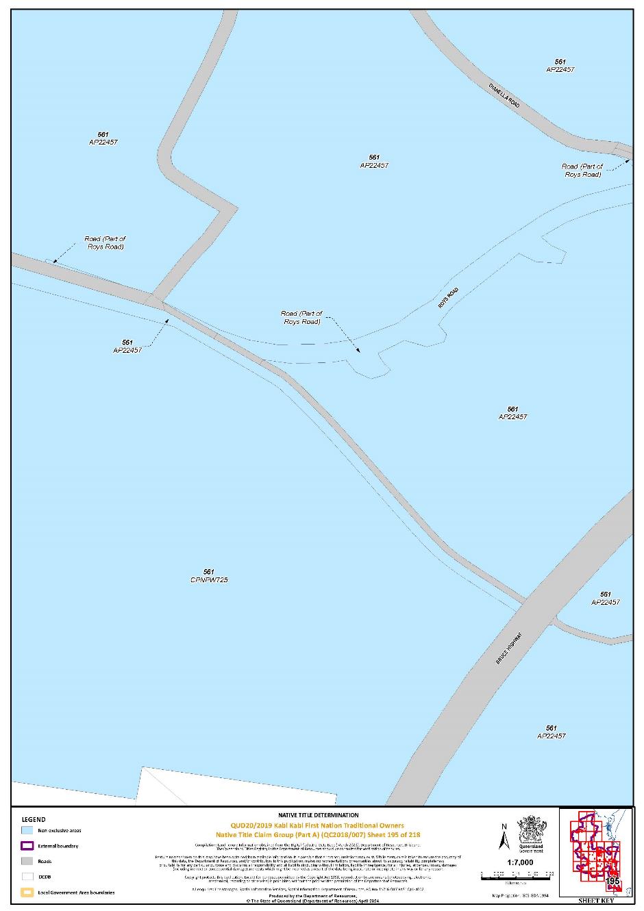
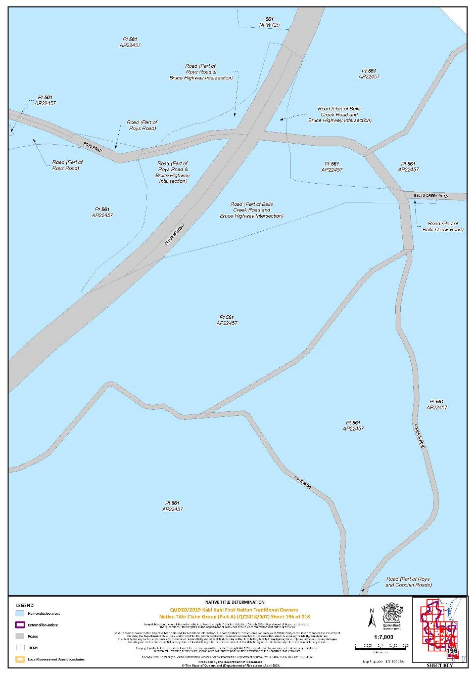
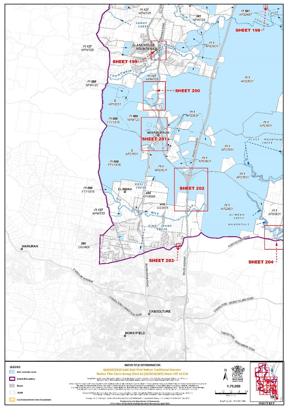
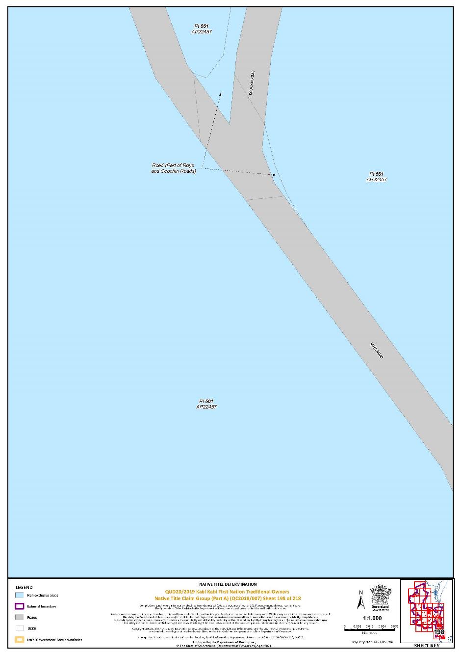
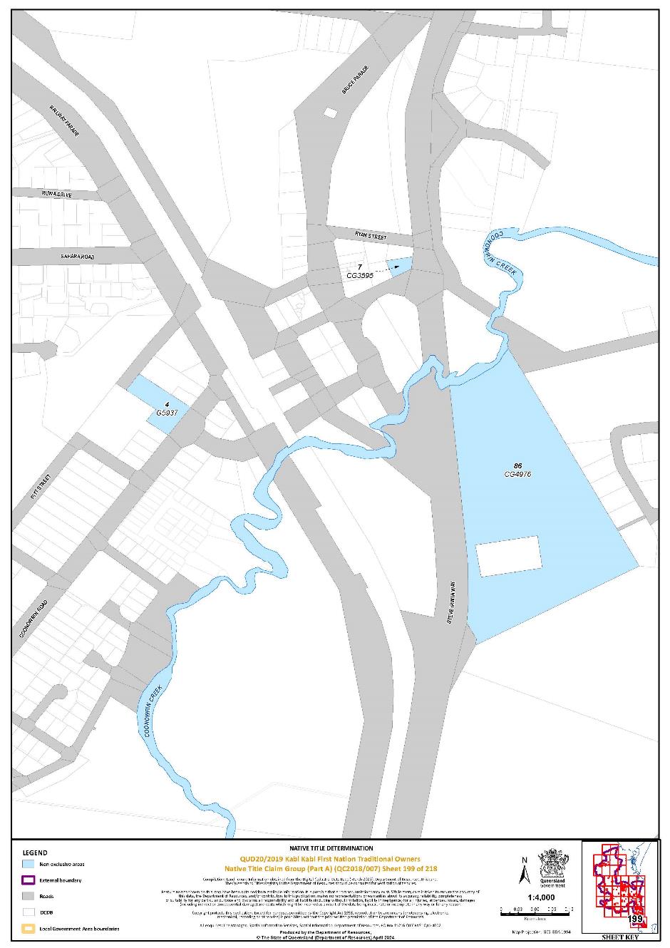
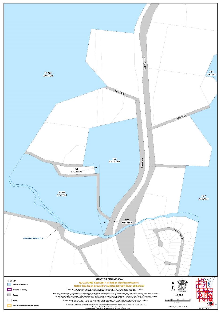
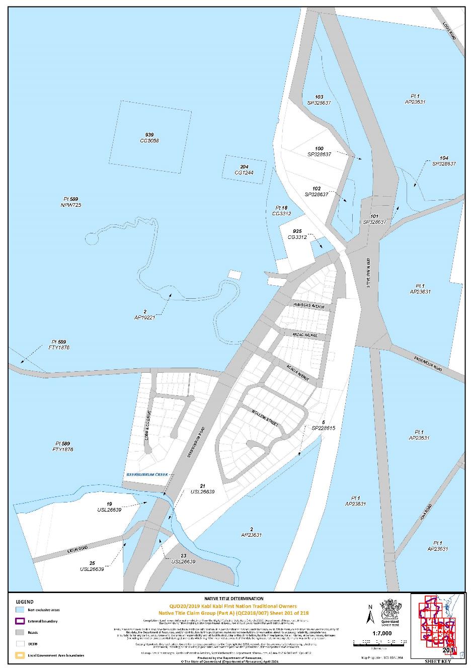
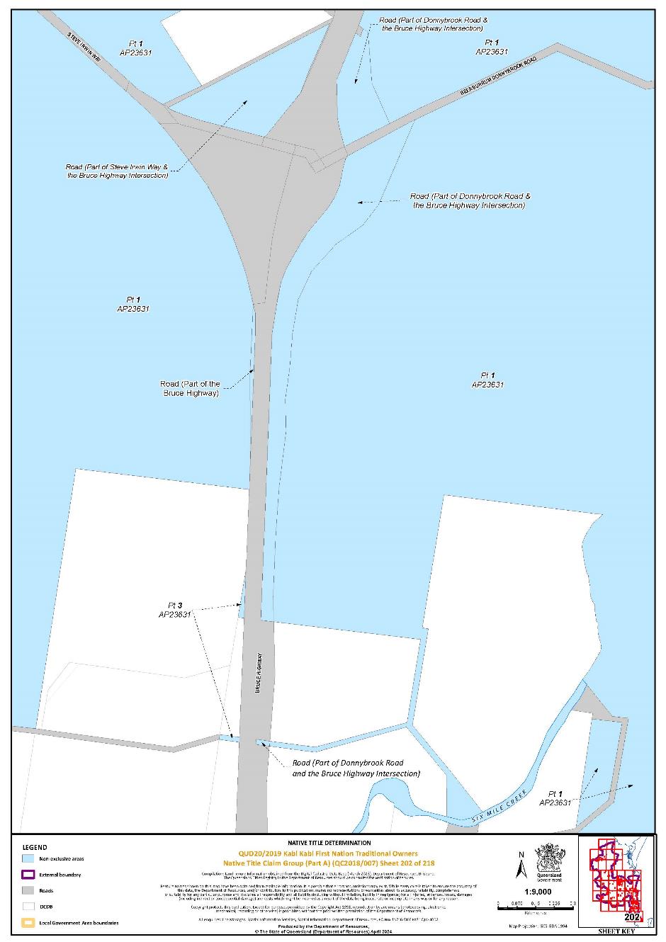
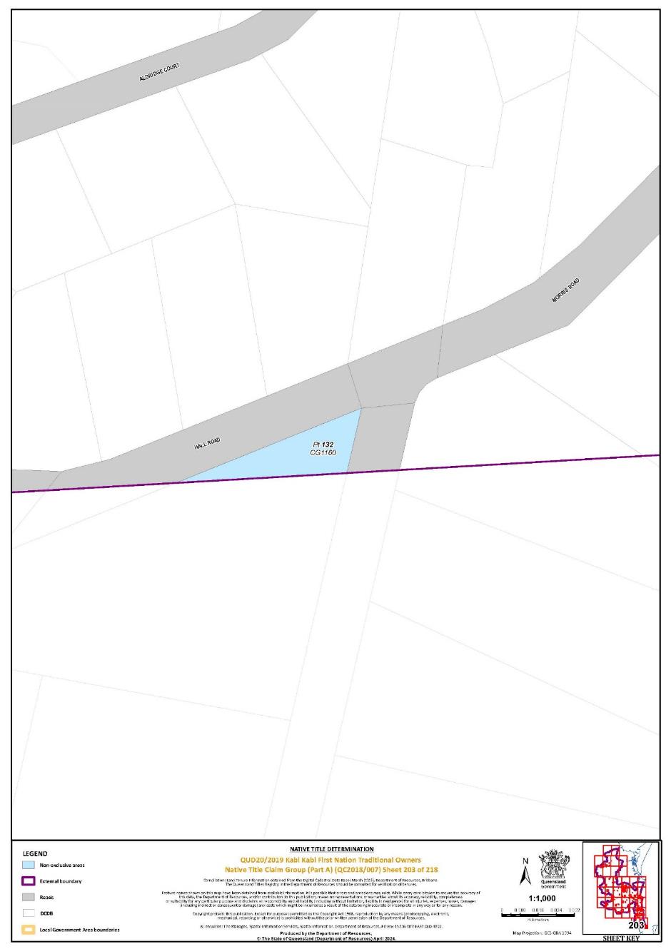
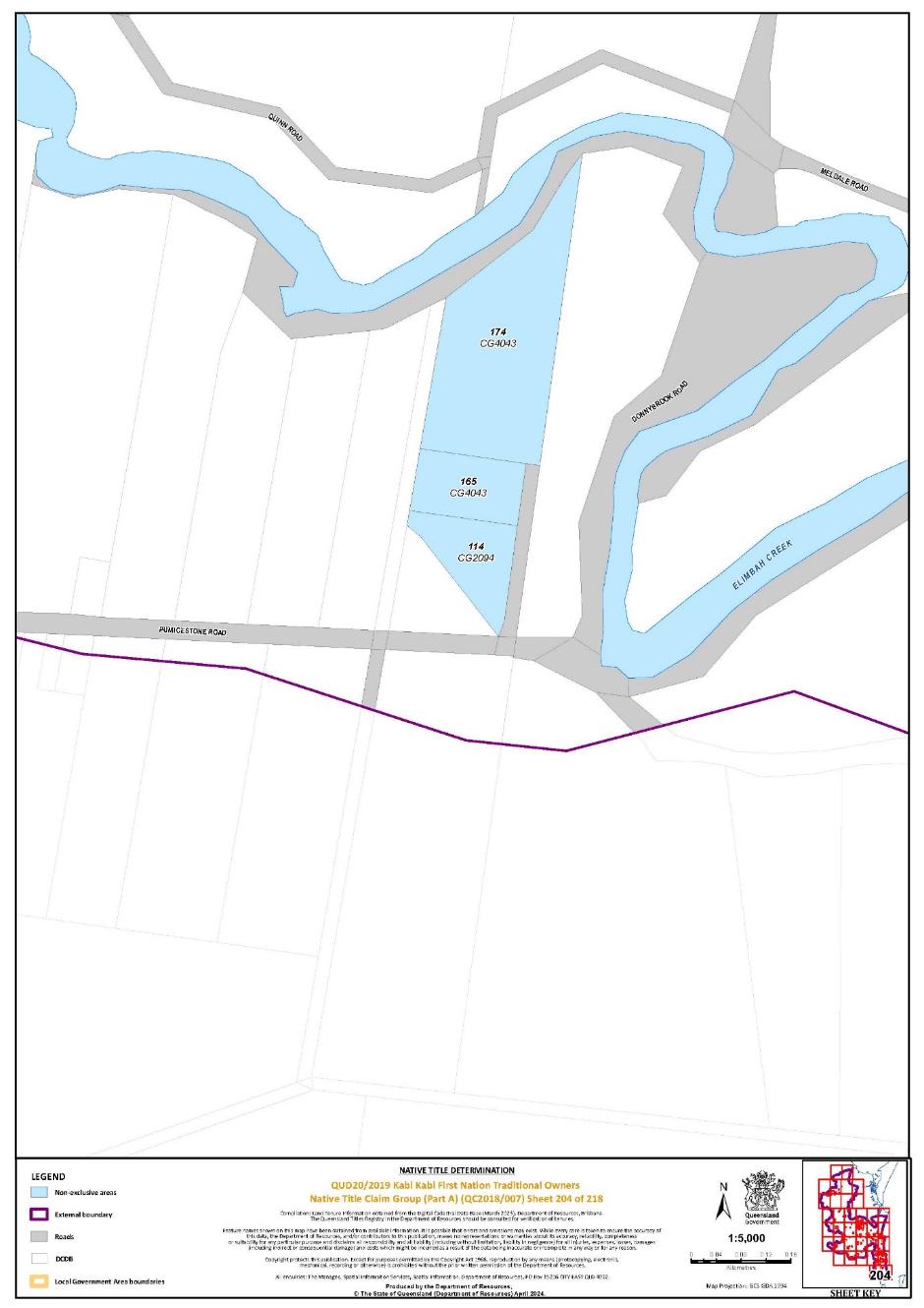
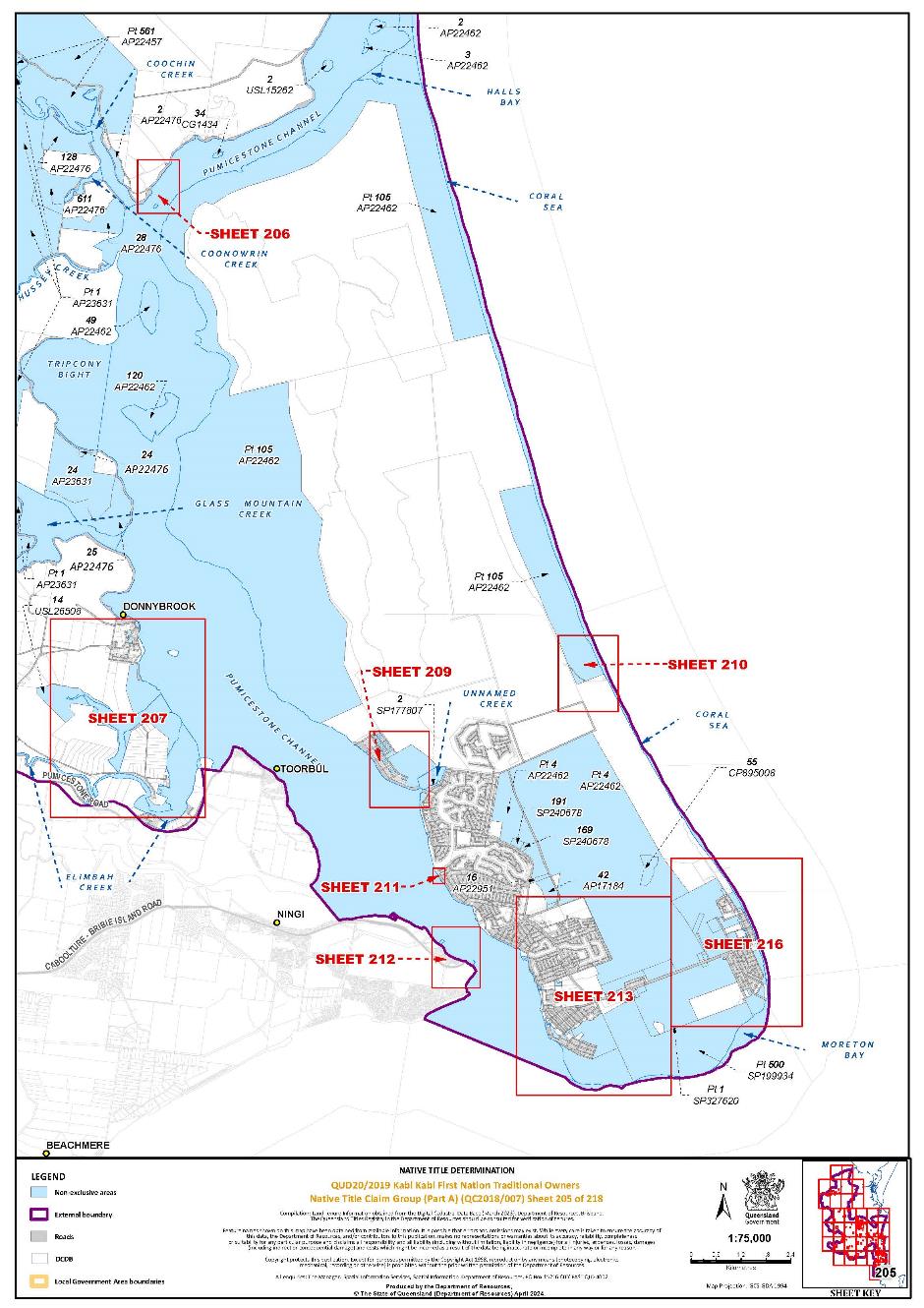
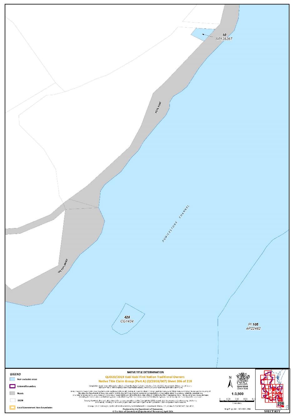
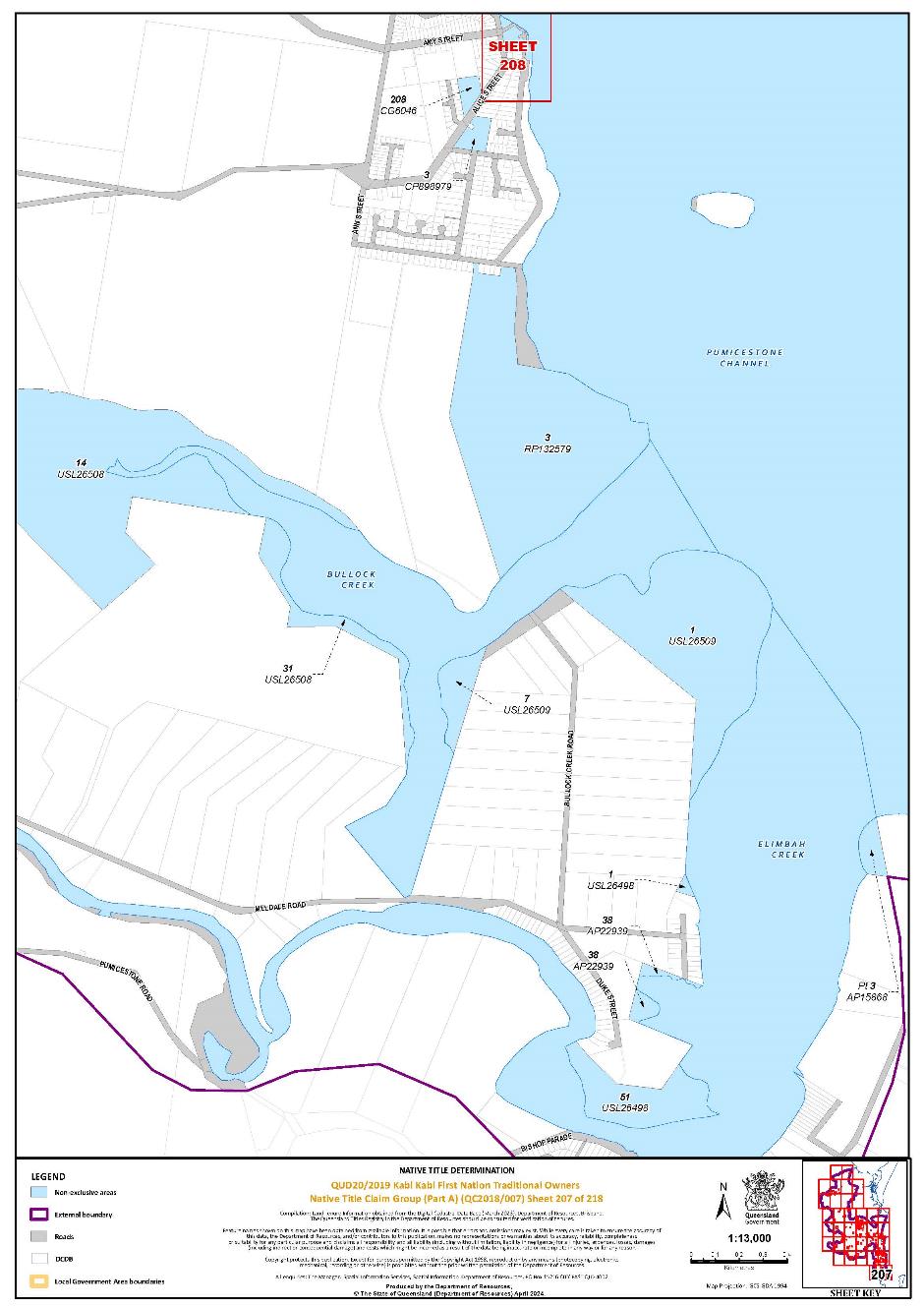
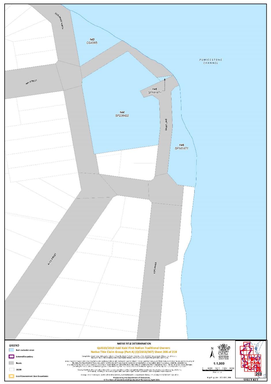
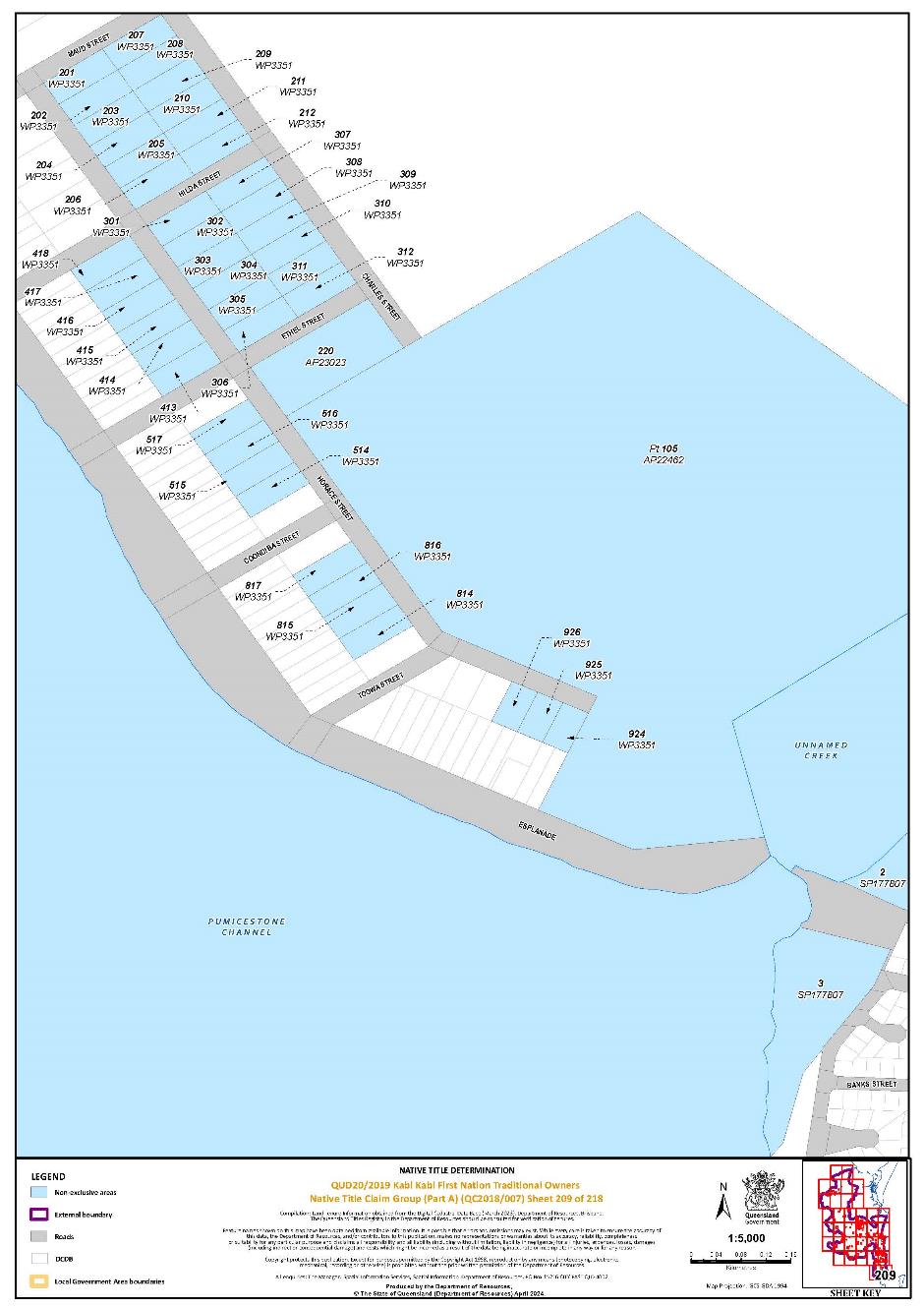
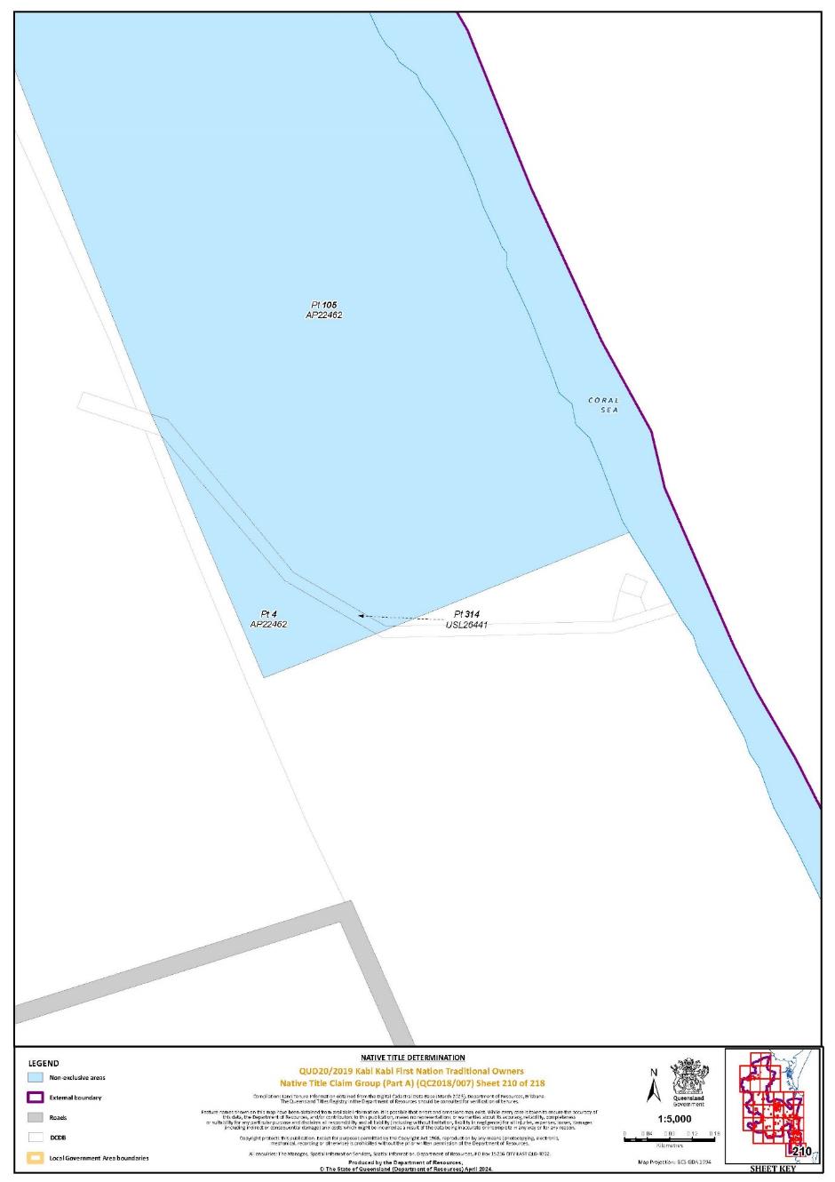
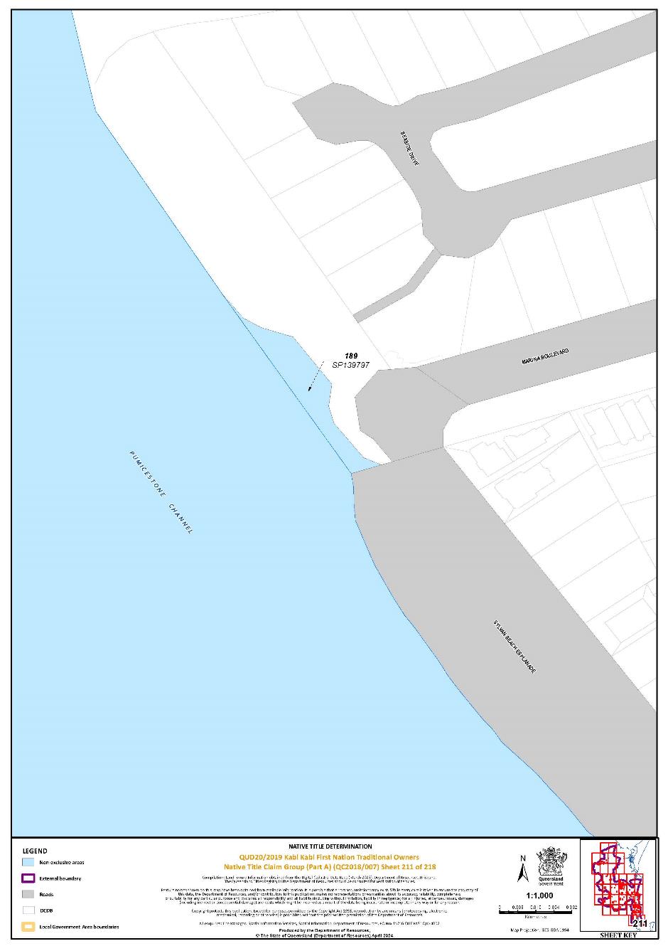
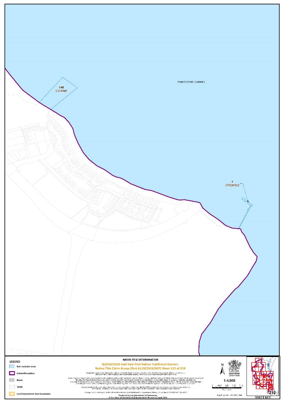
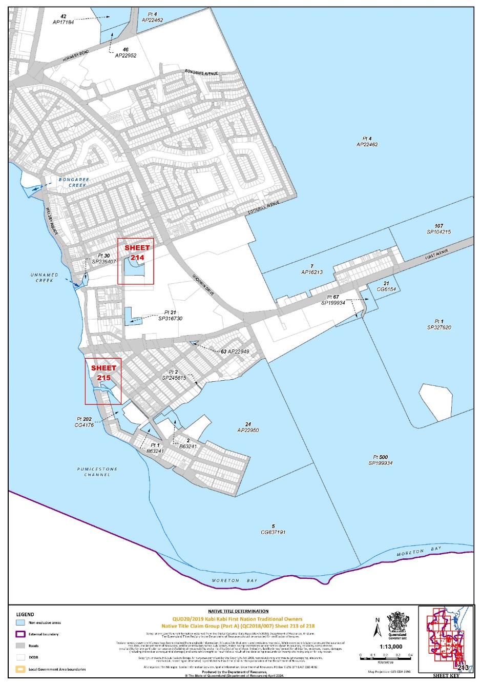
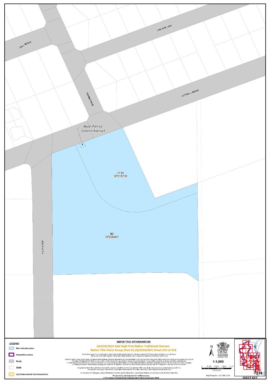
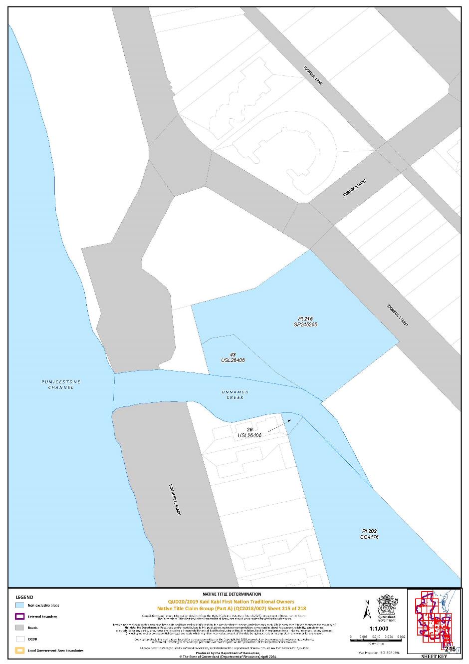
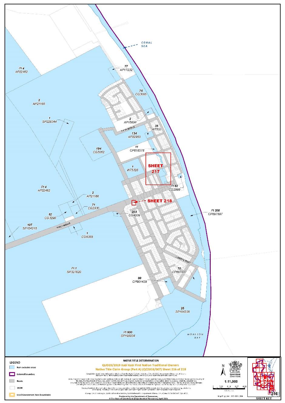
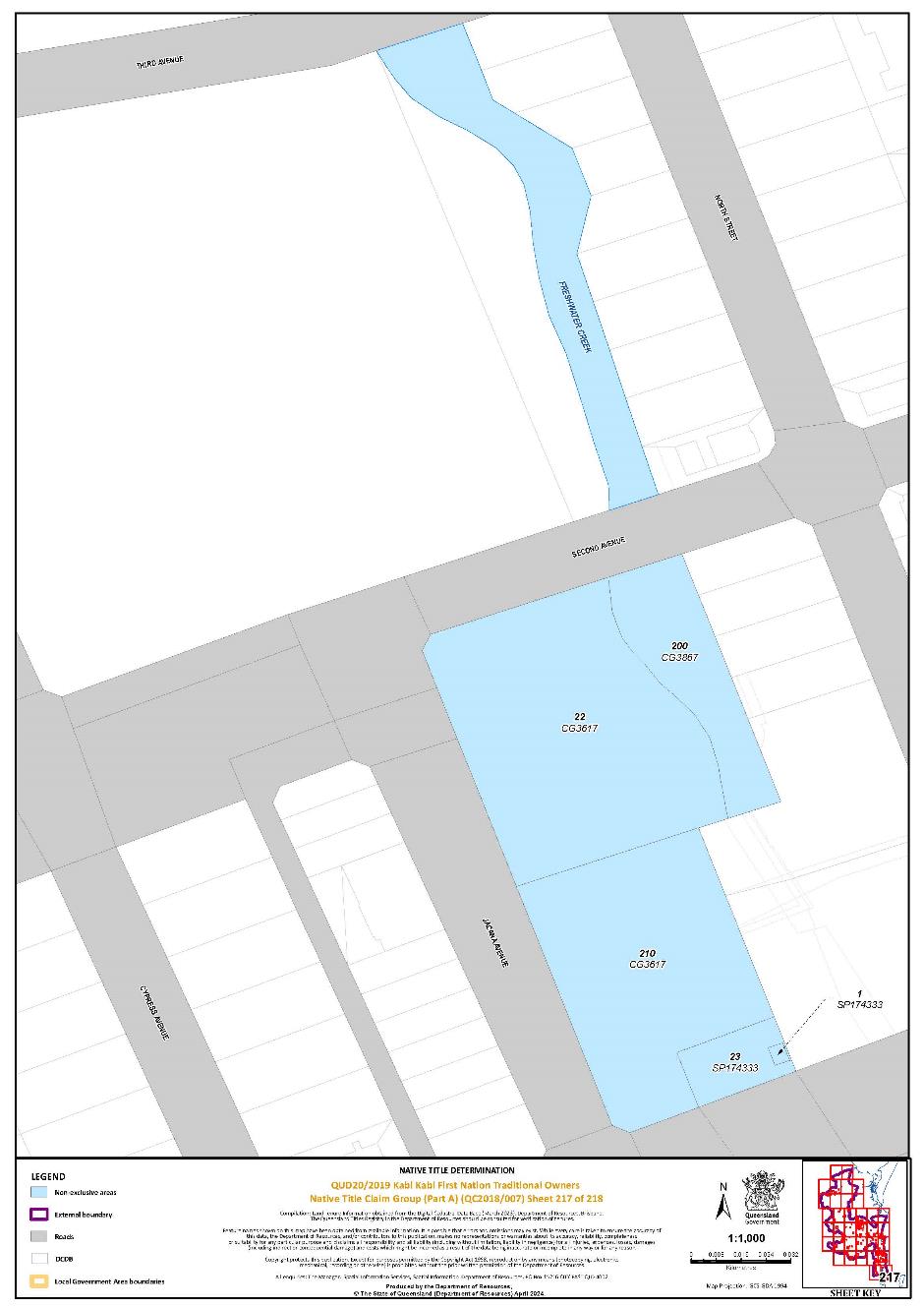
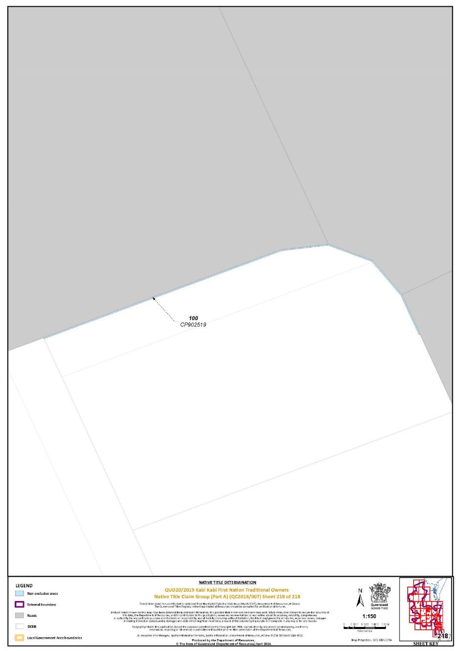 Schedule 7 – Map of Areas Partly Affected by Public Works
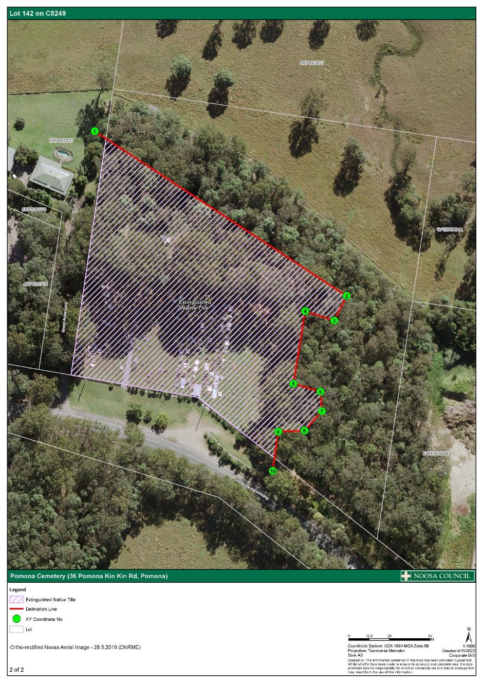
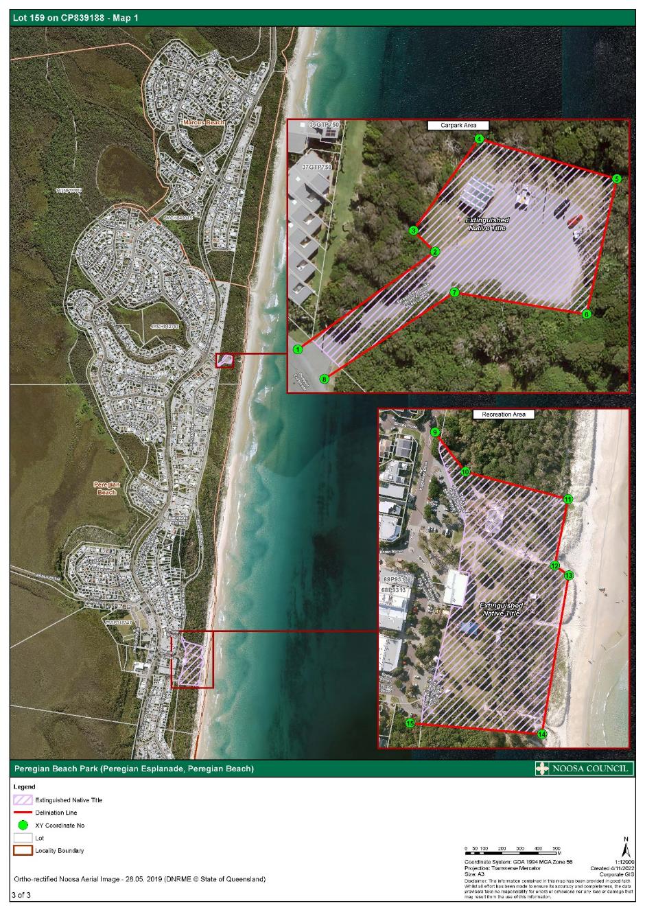
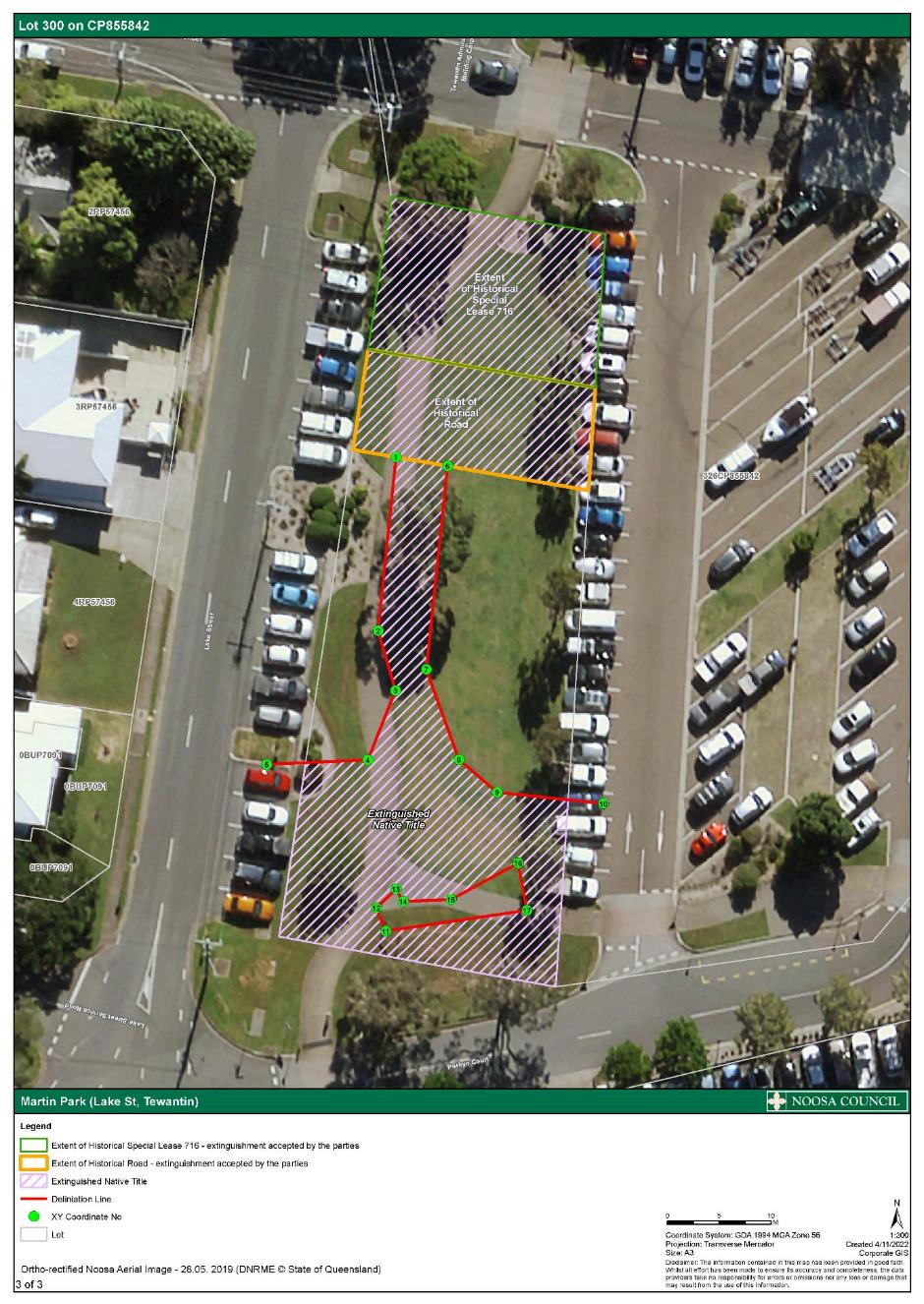
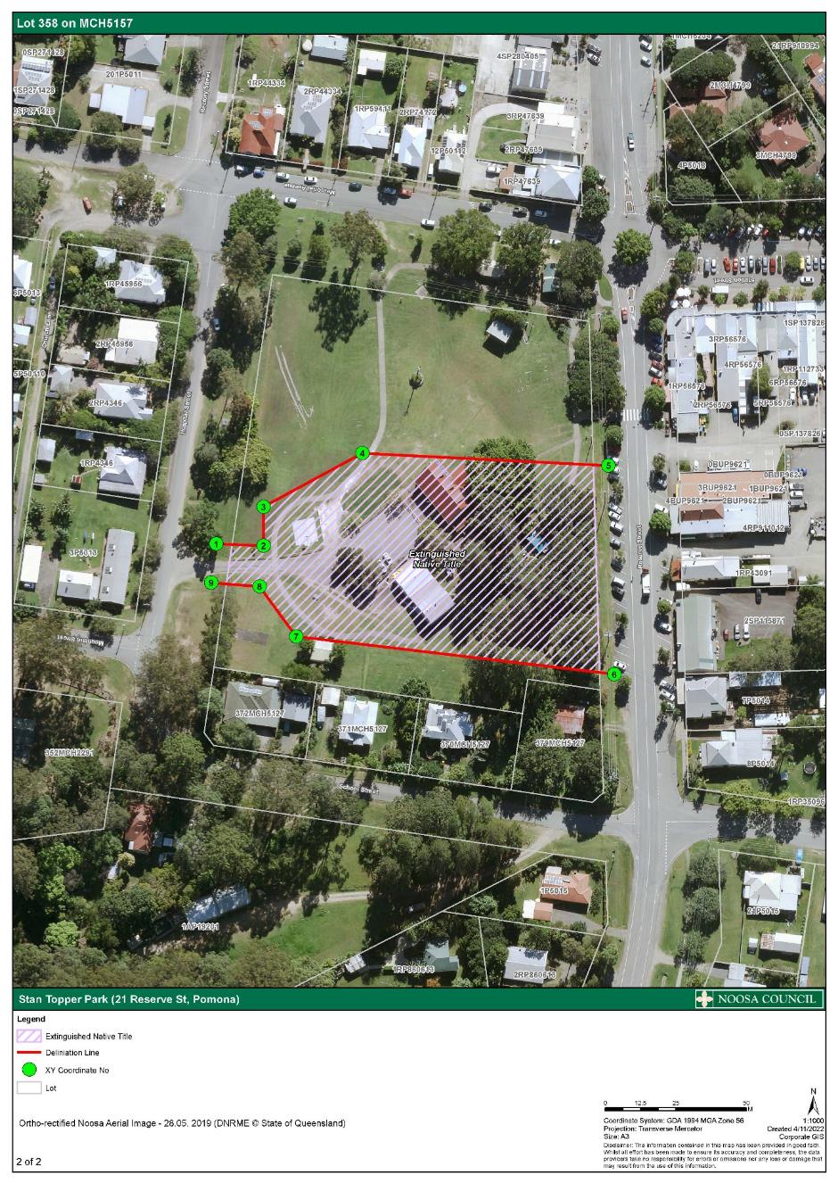
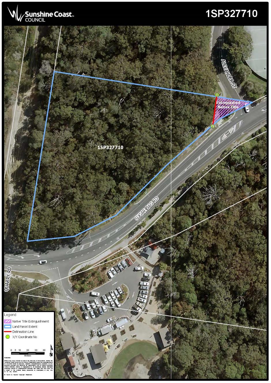
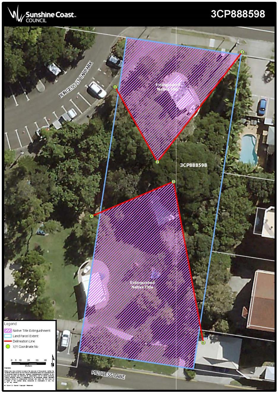
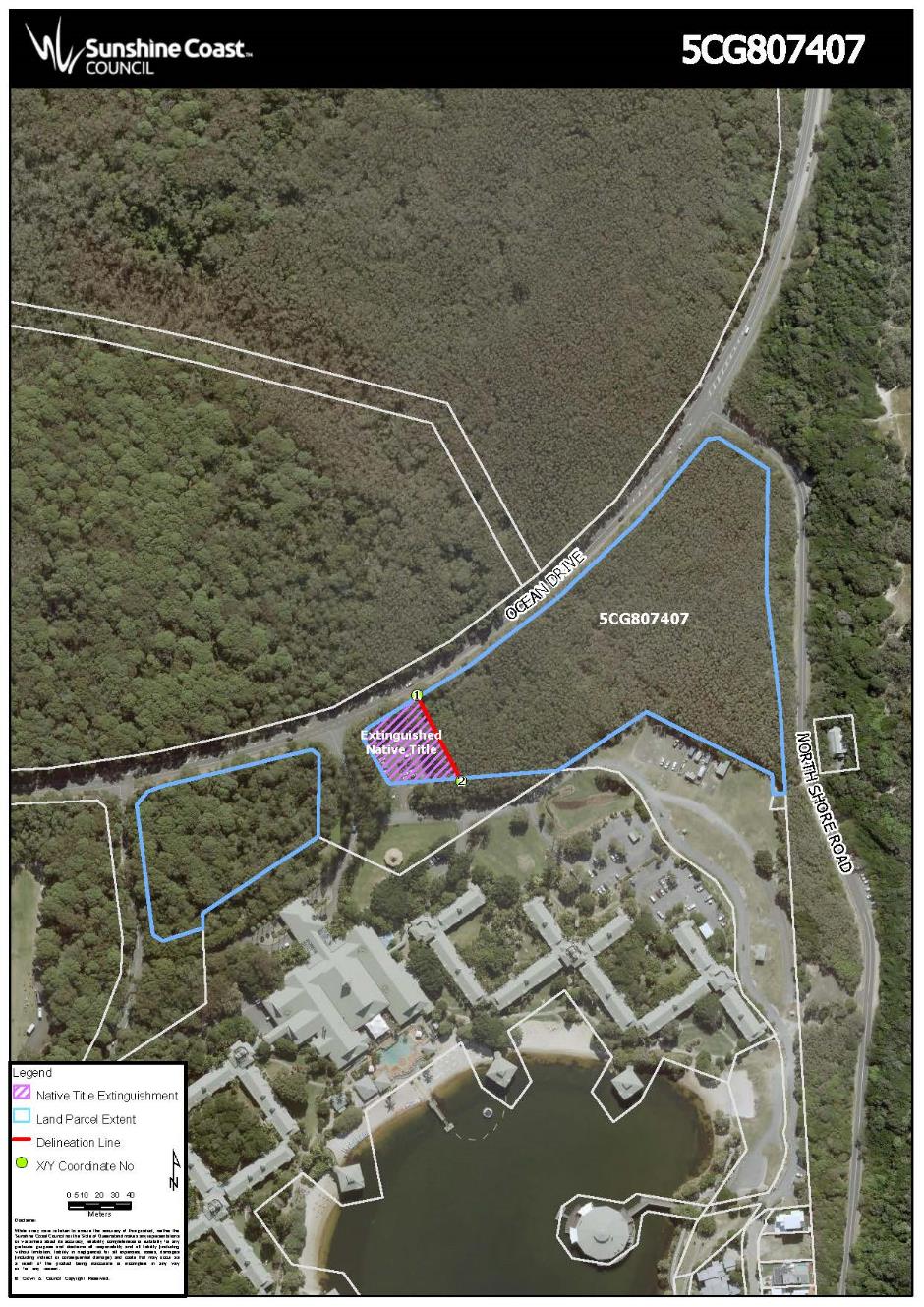
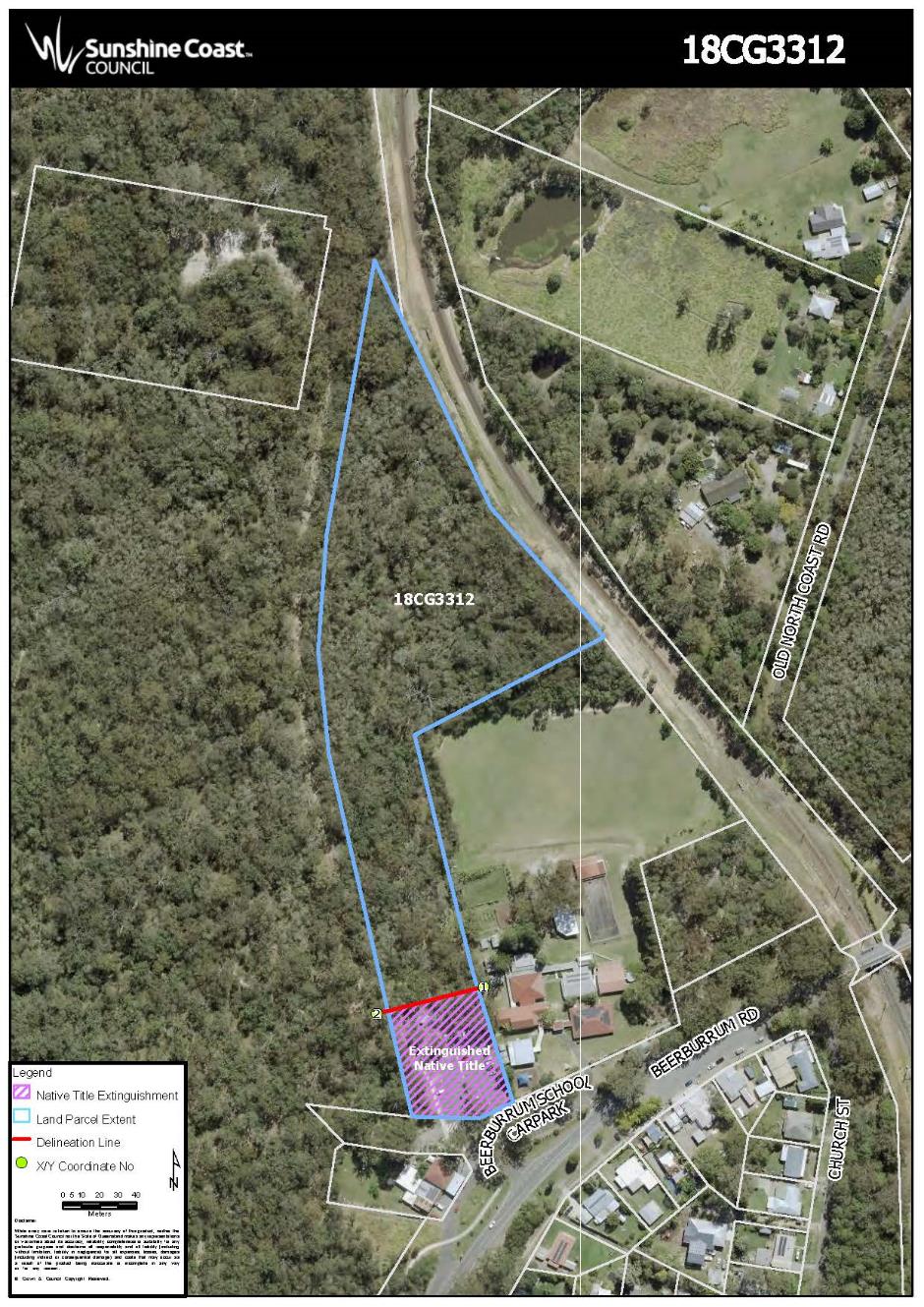
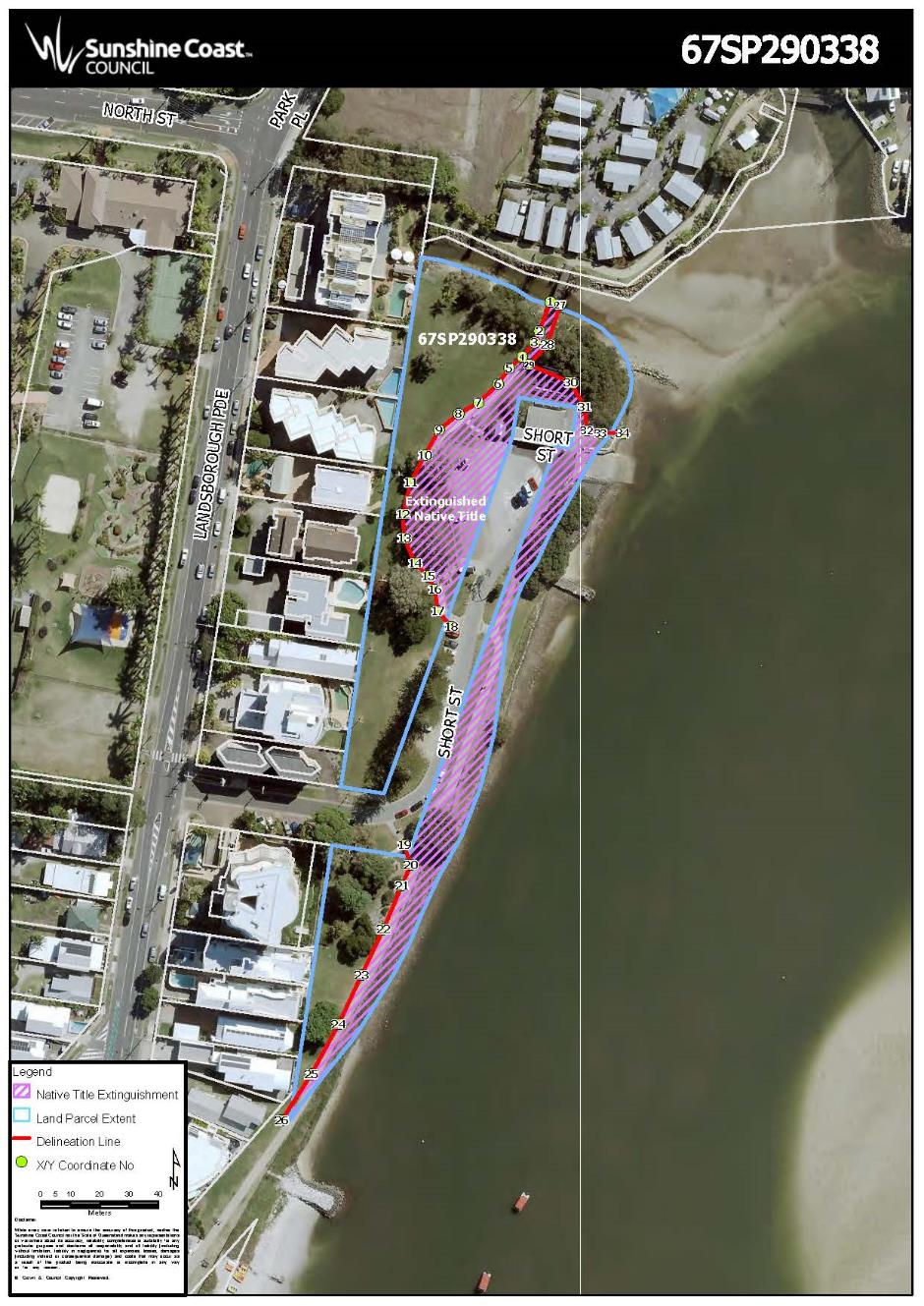
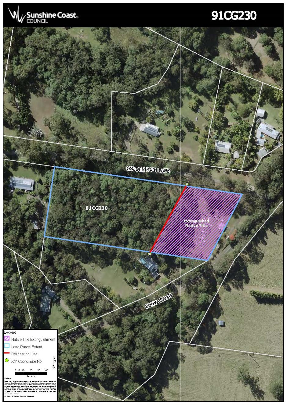
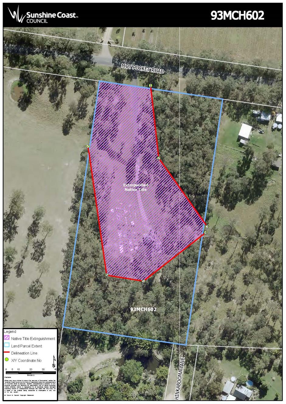
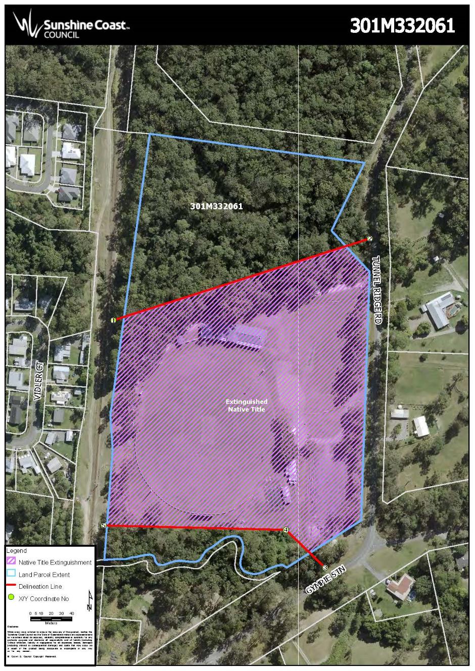
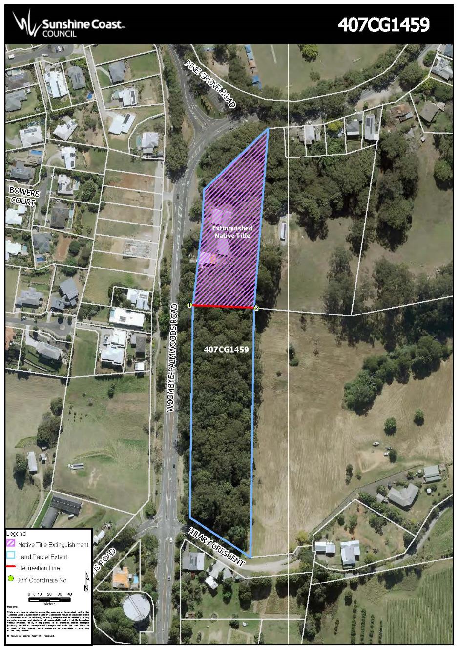
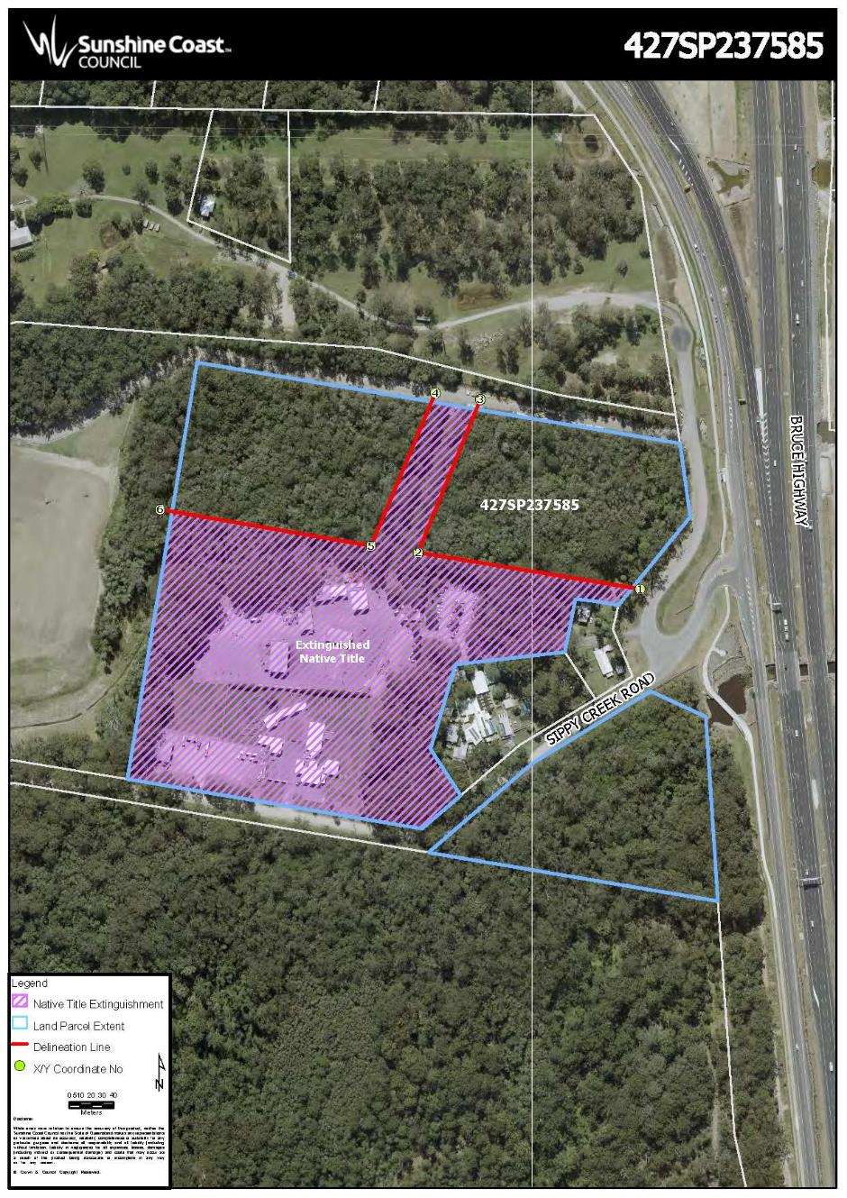
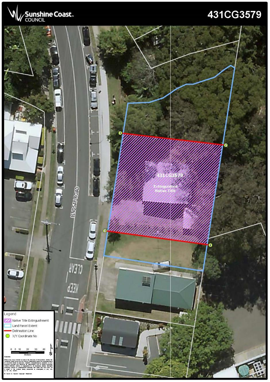
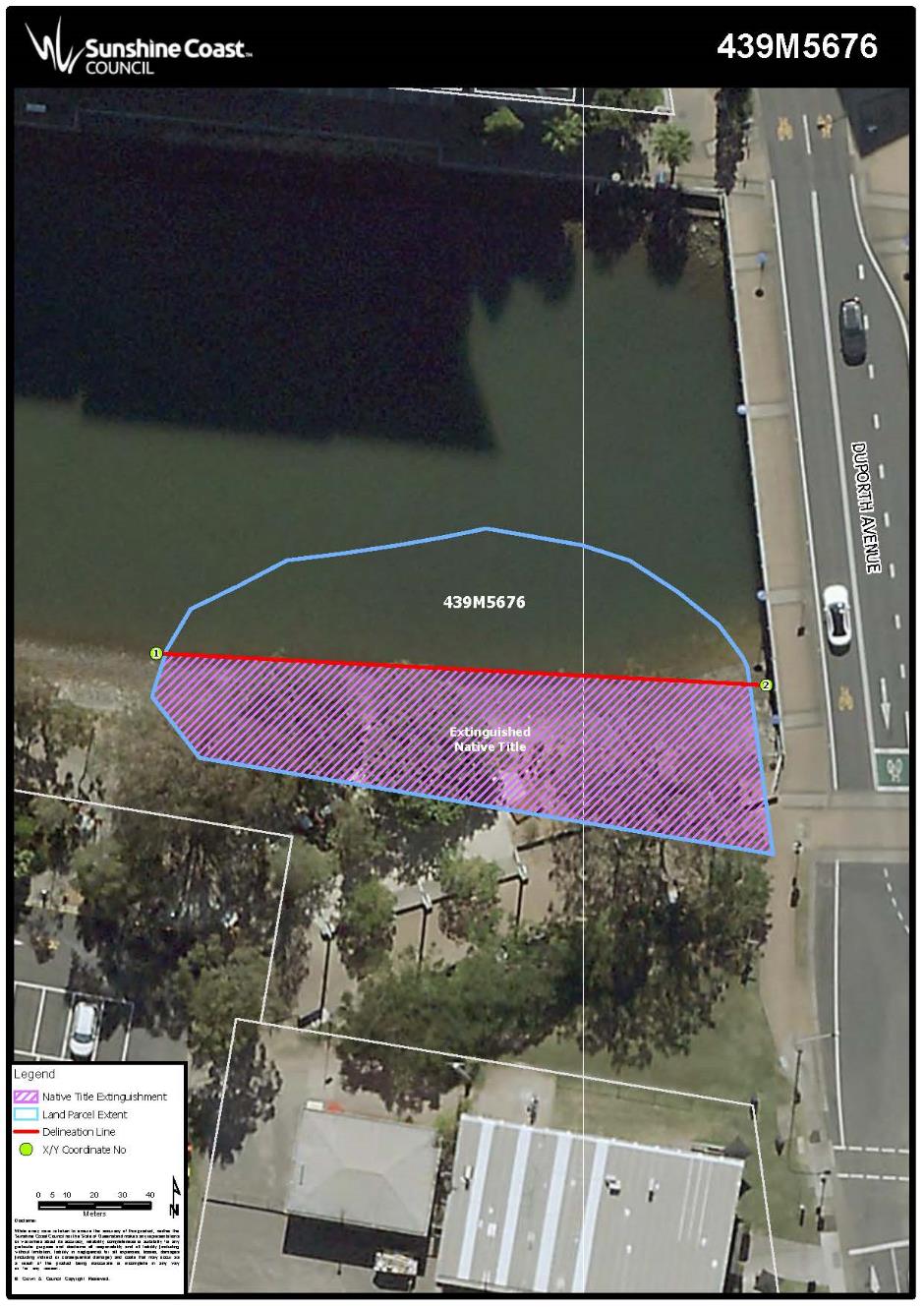
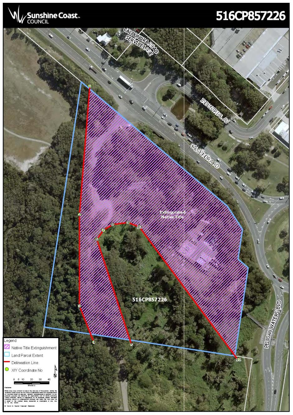
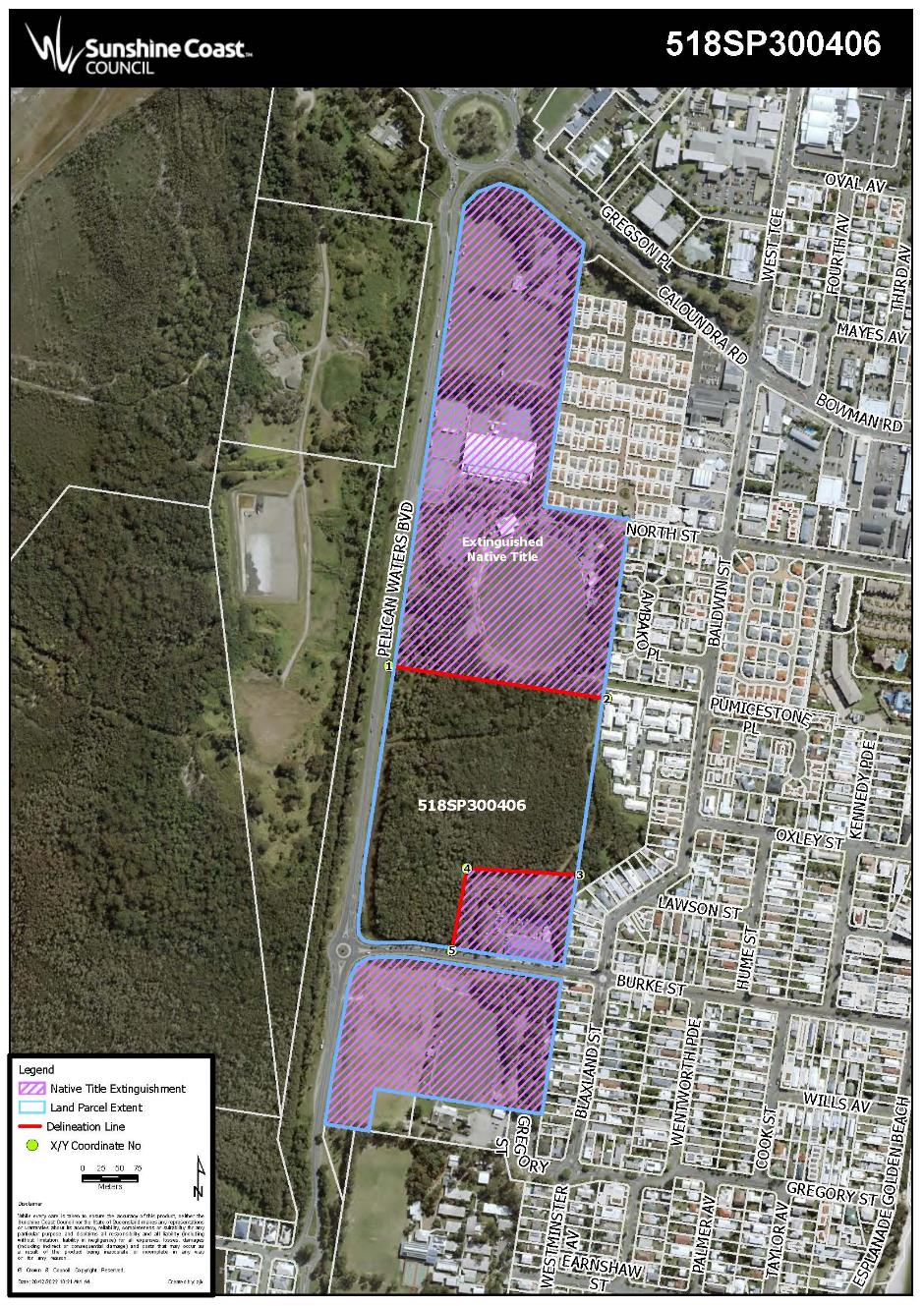
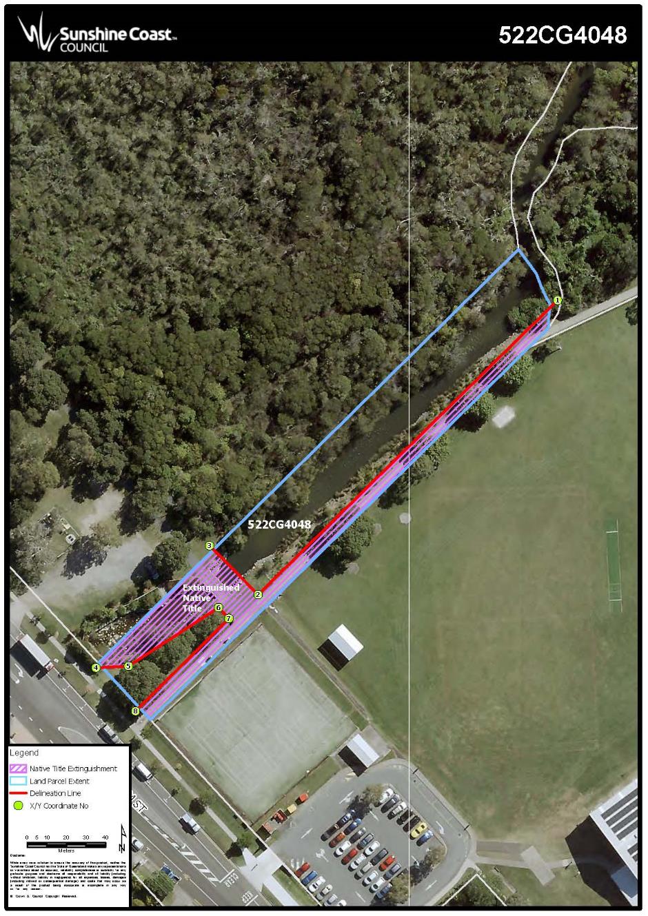
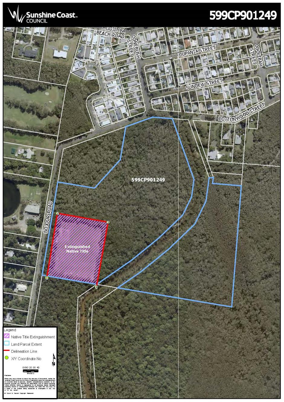
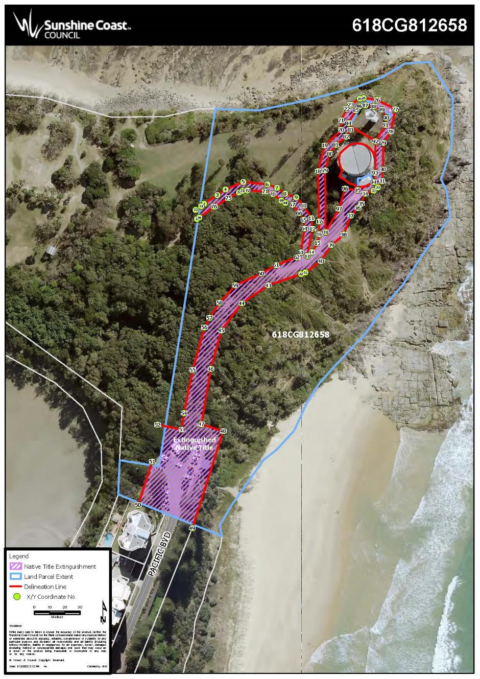
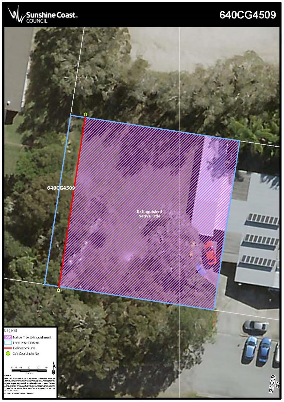
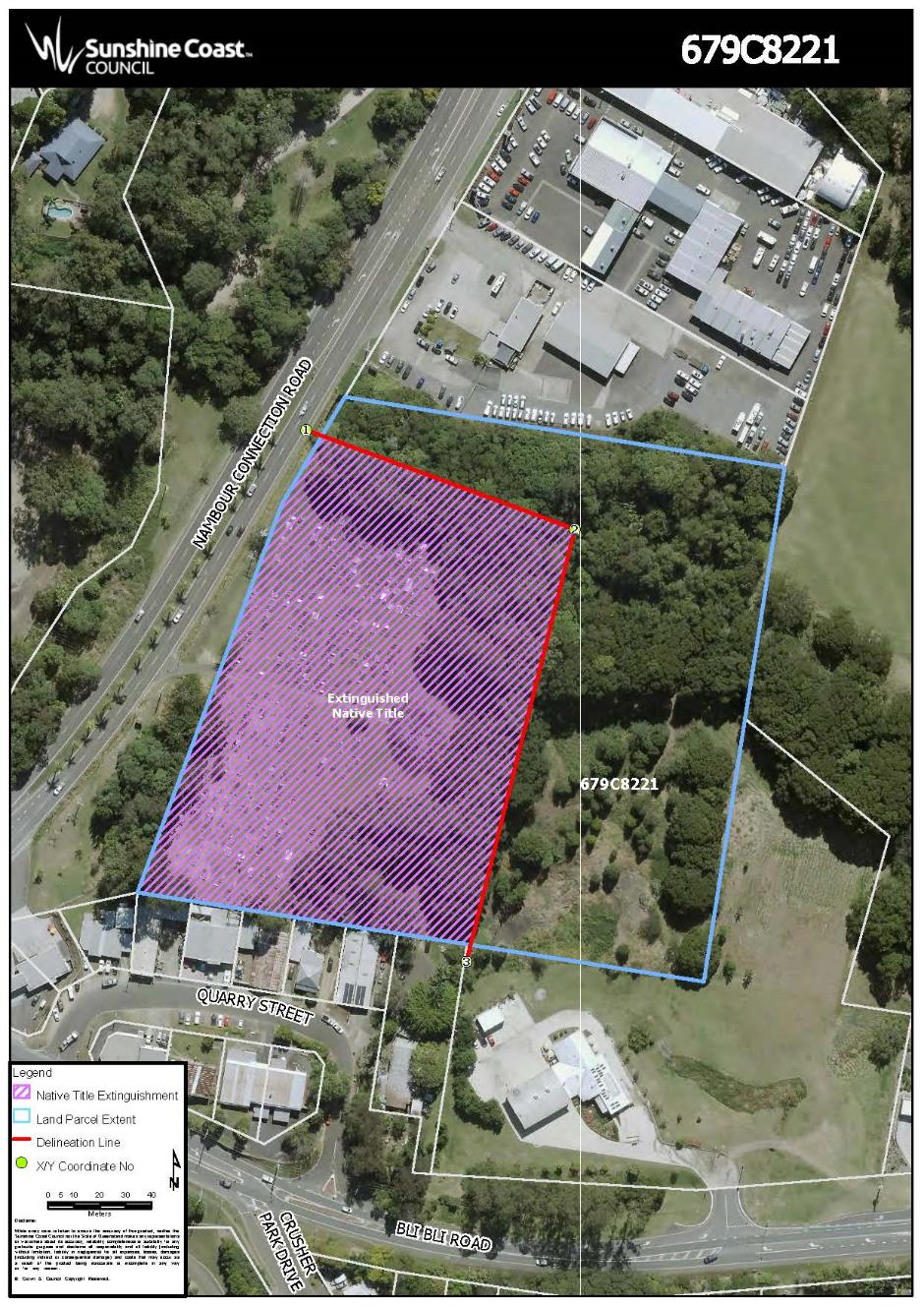
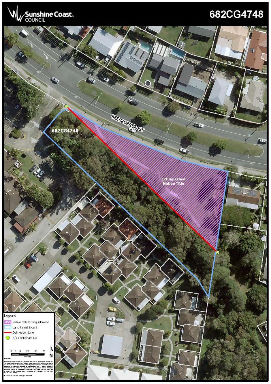
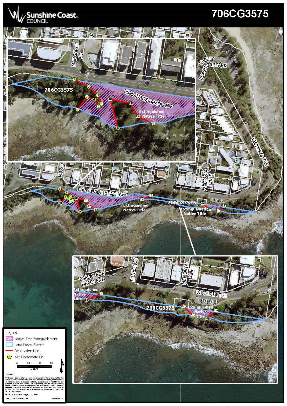
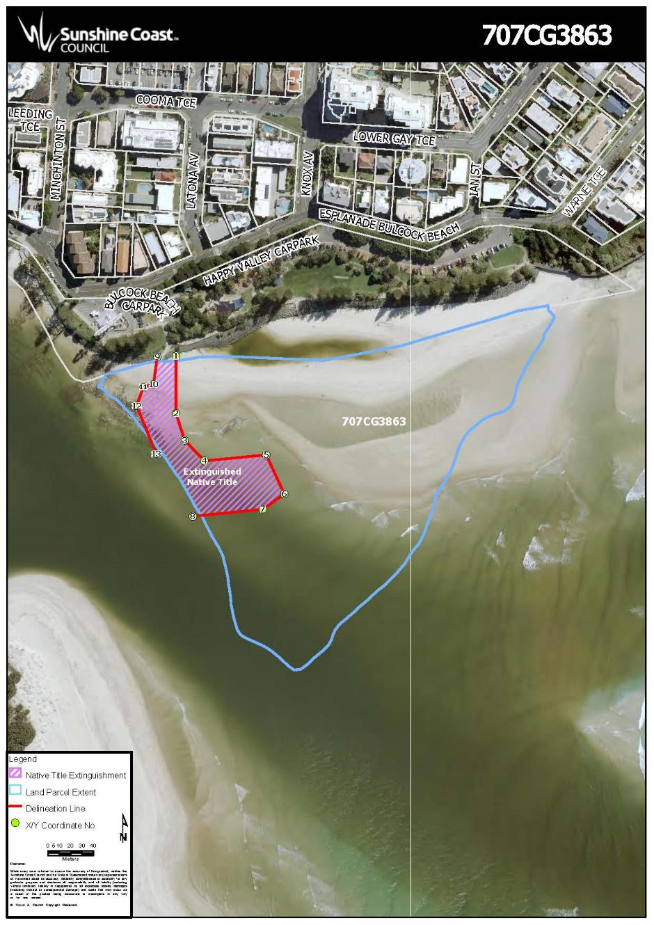
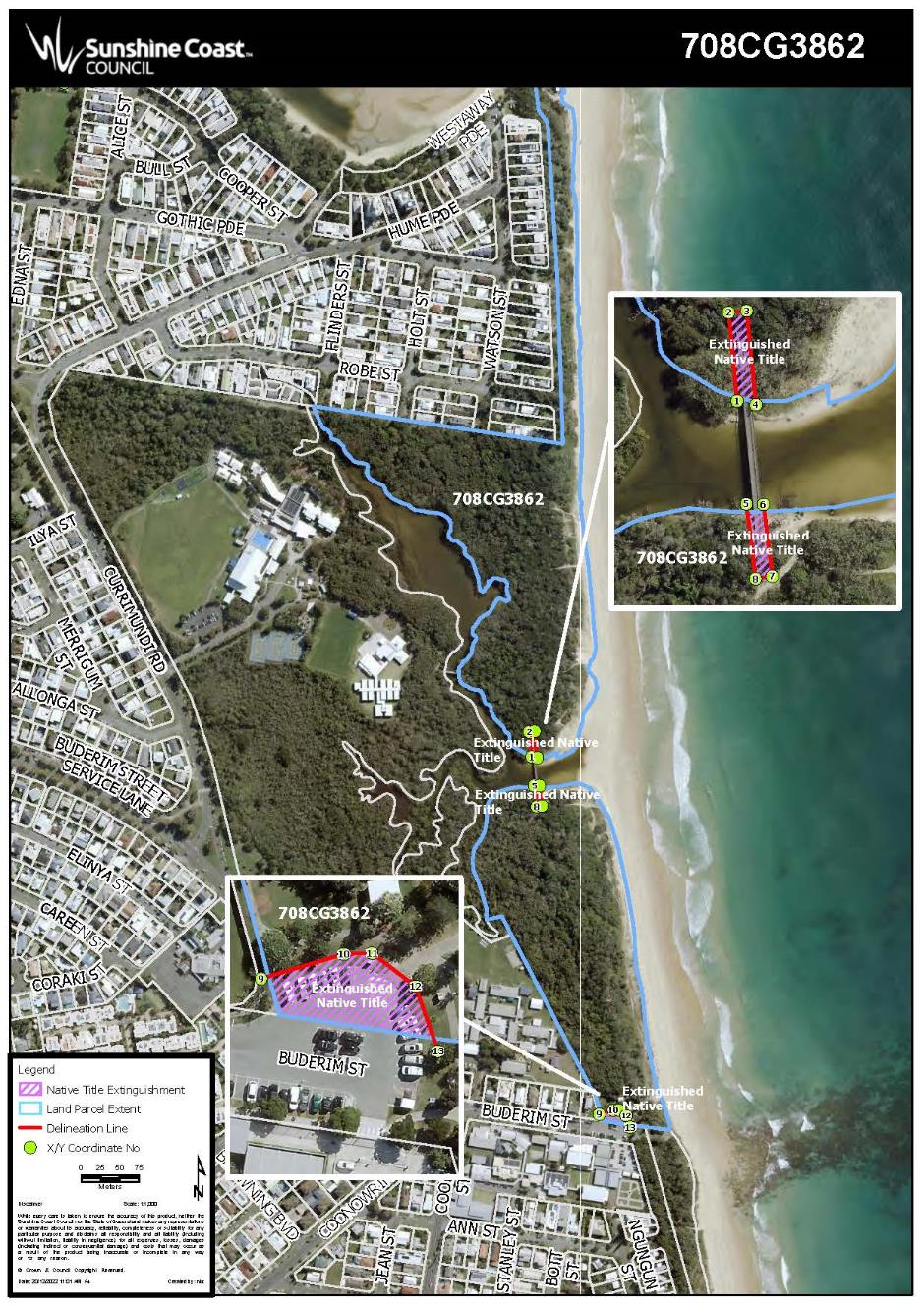
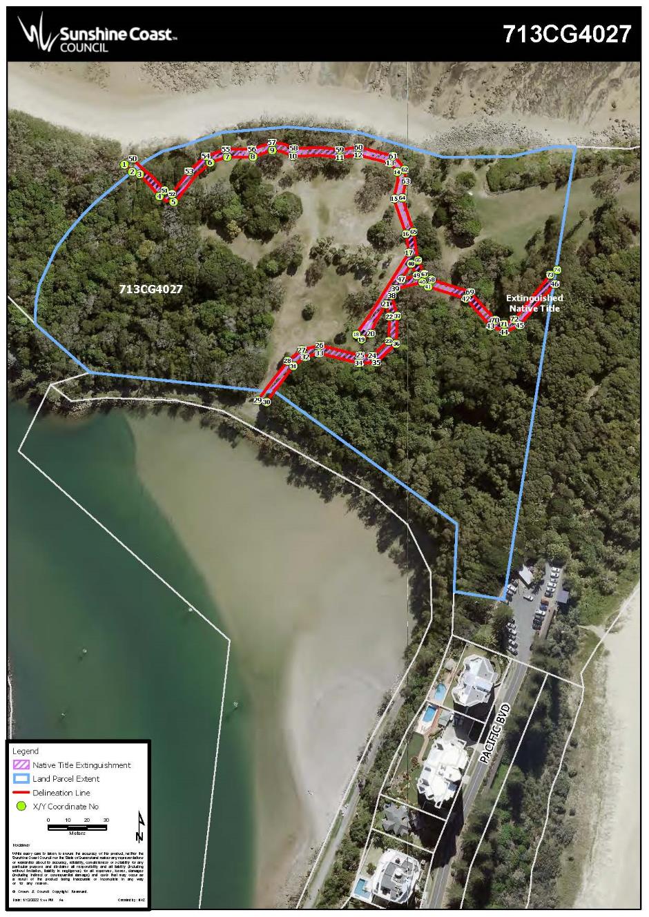
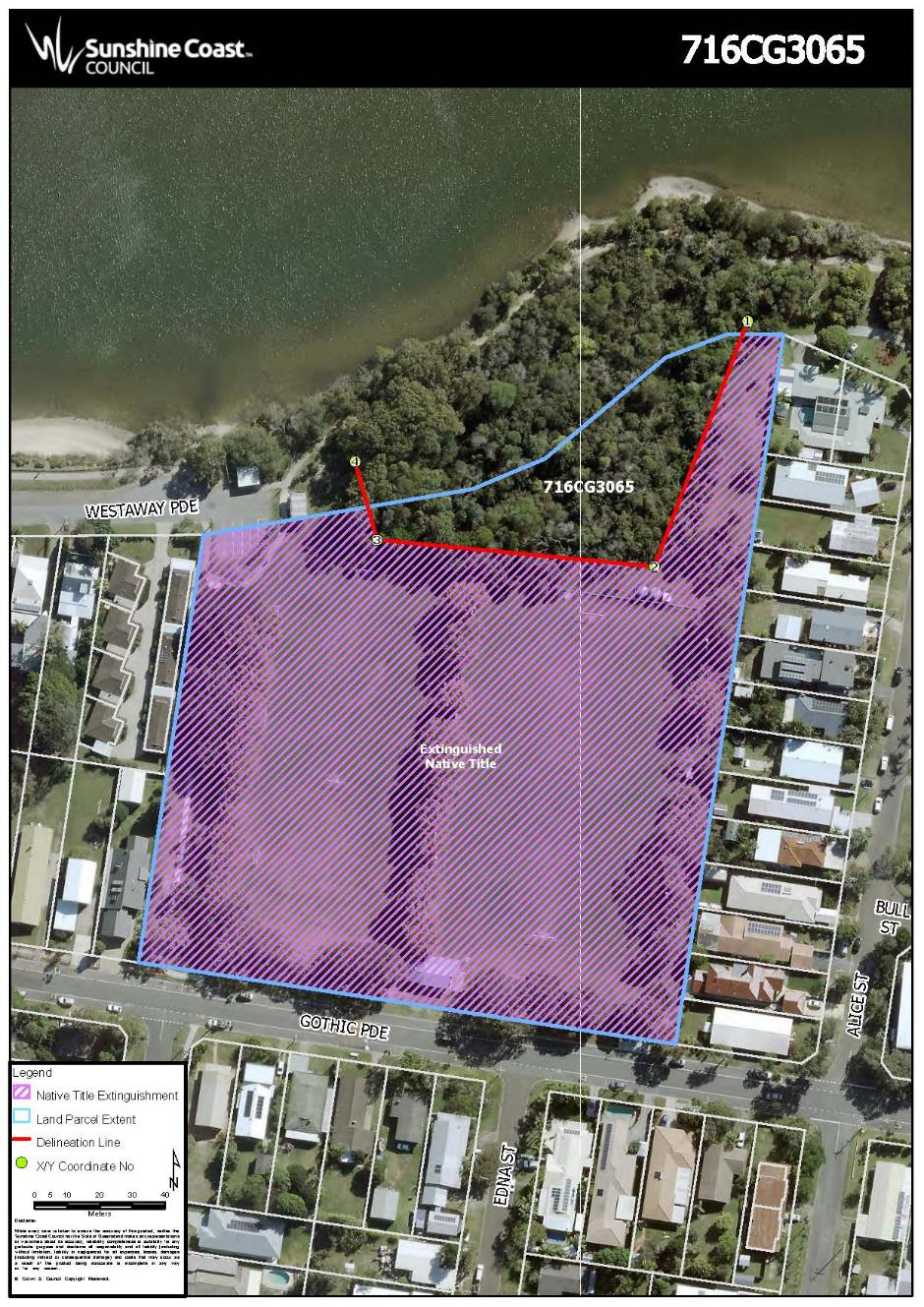
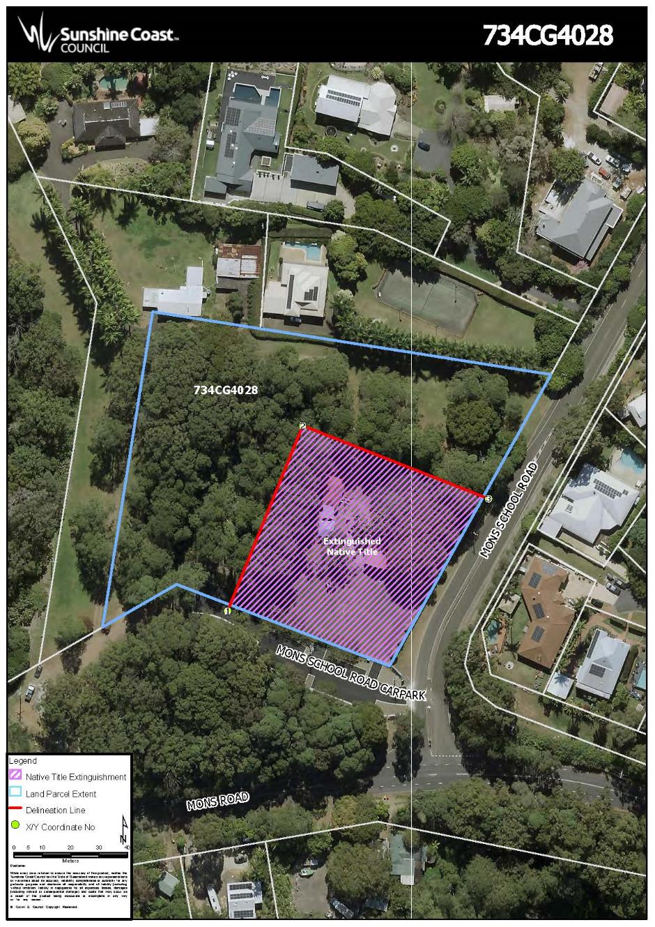
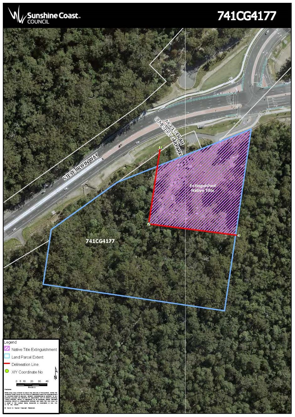
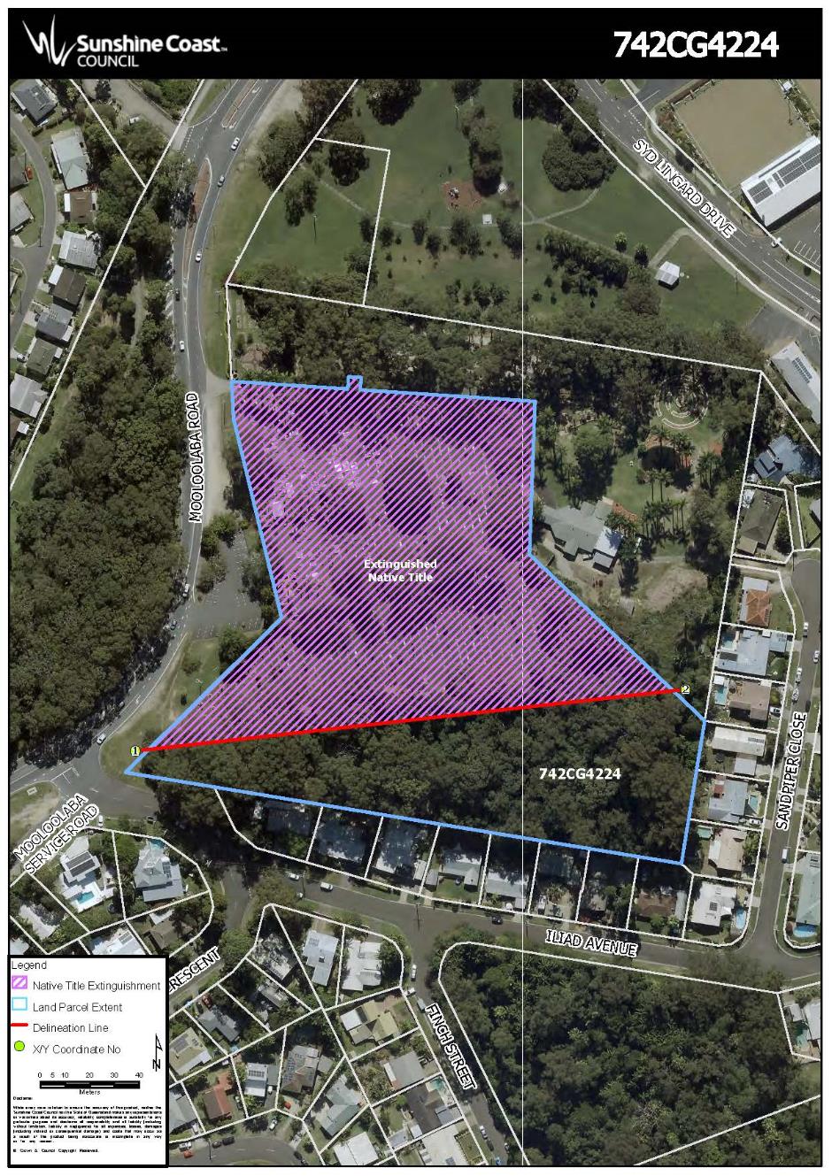
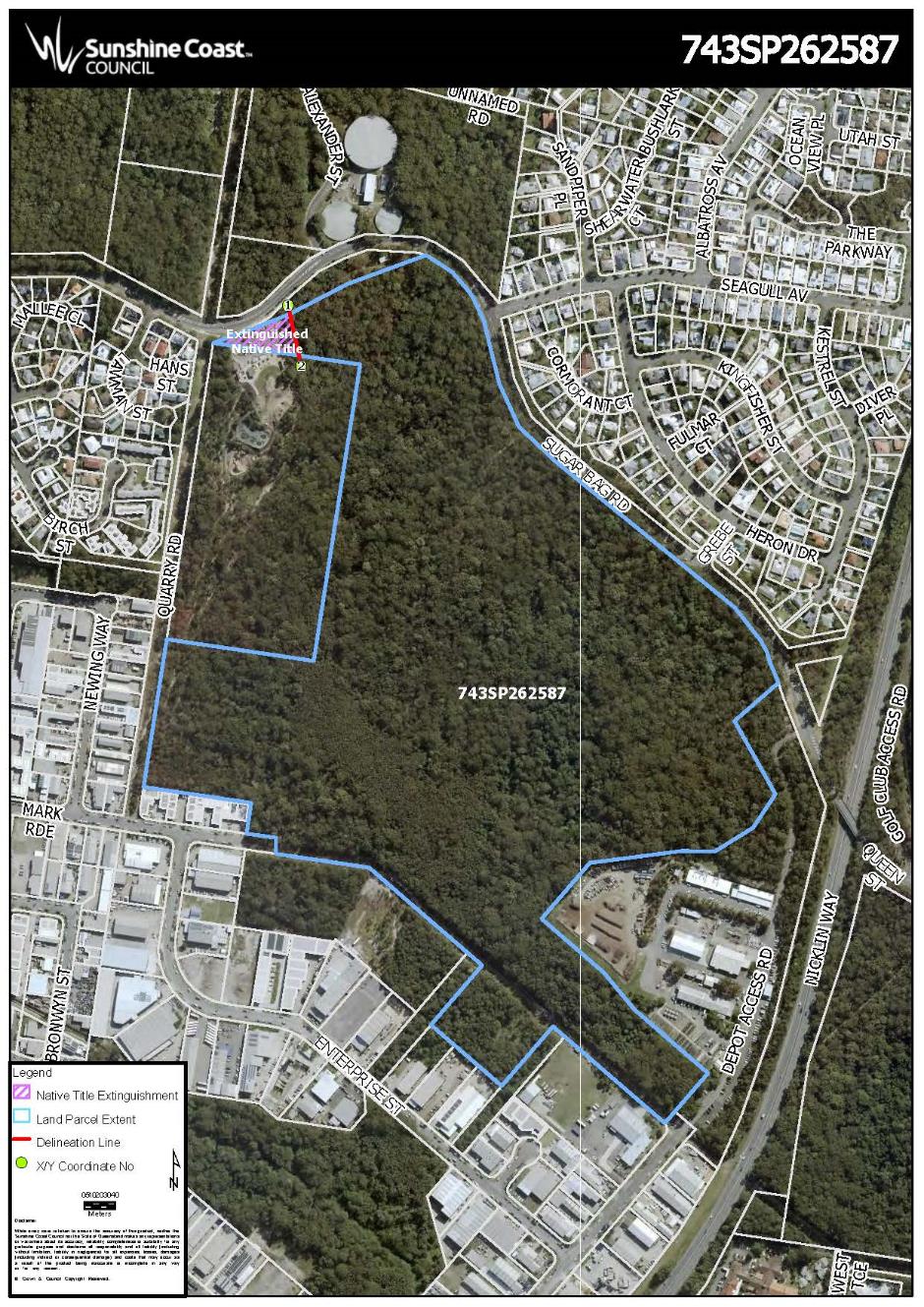
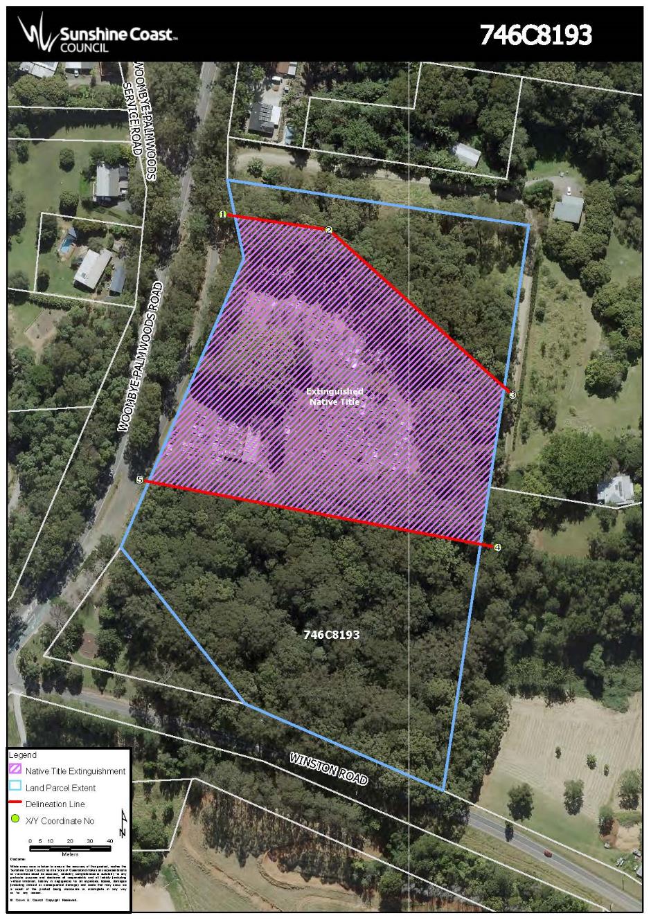
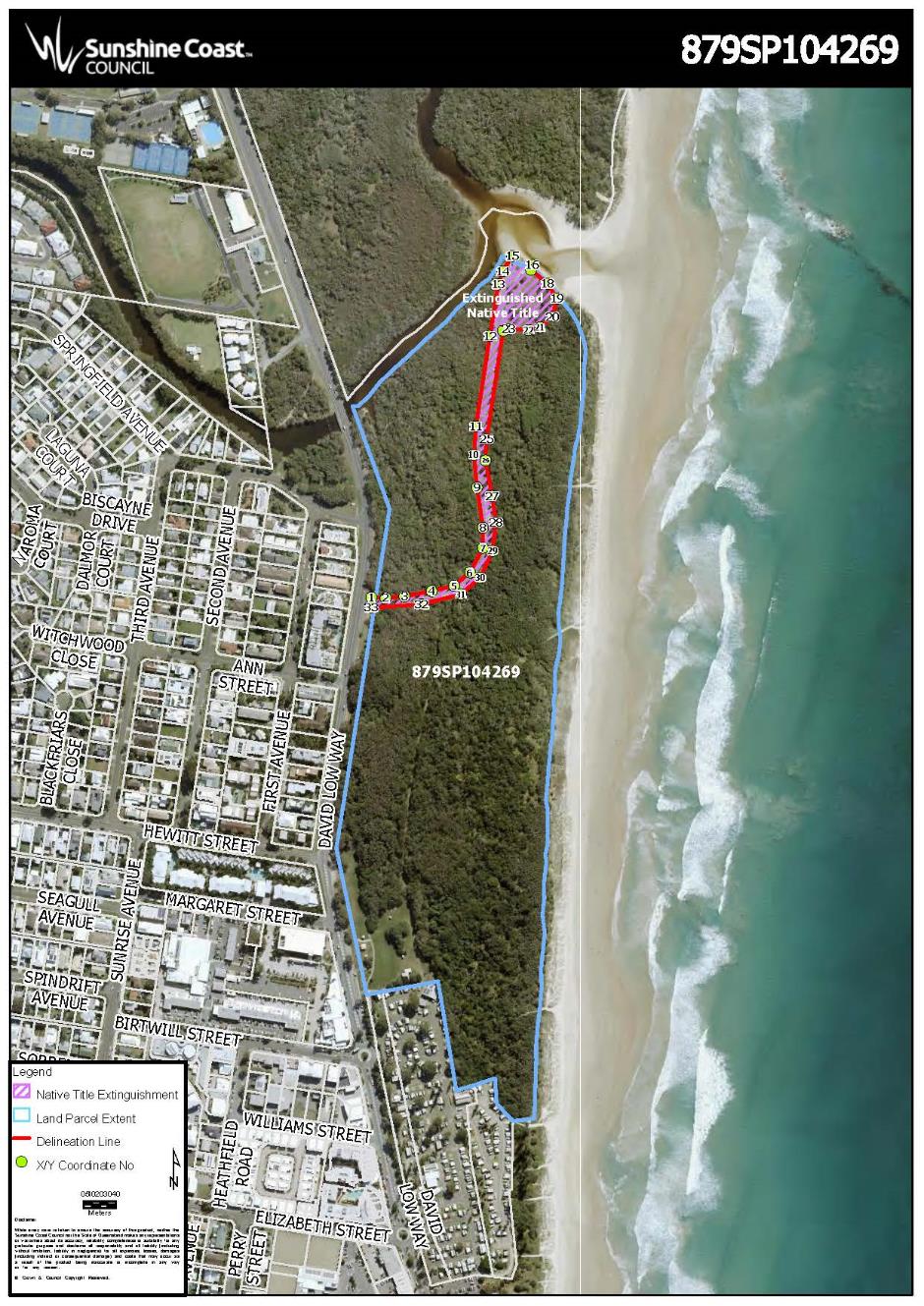
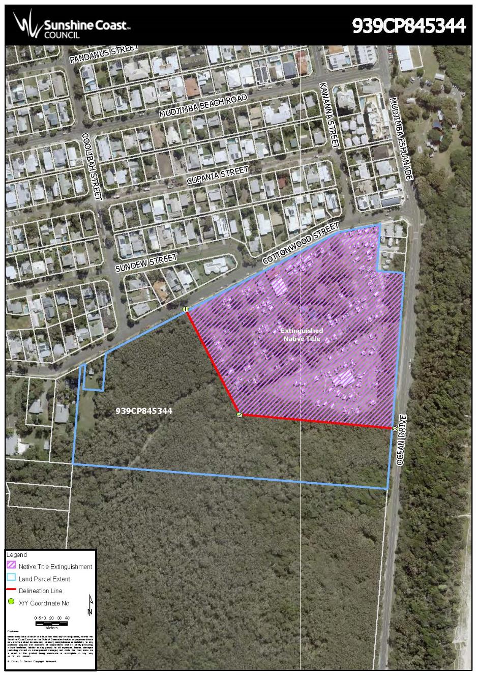
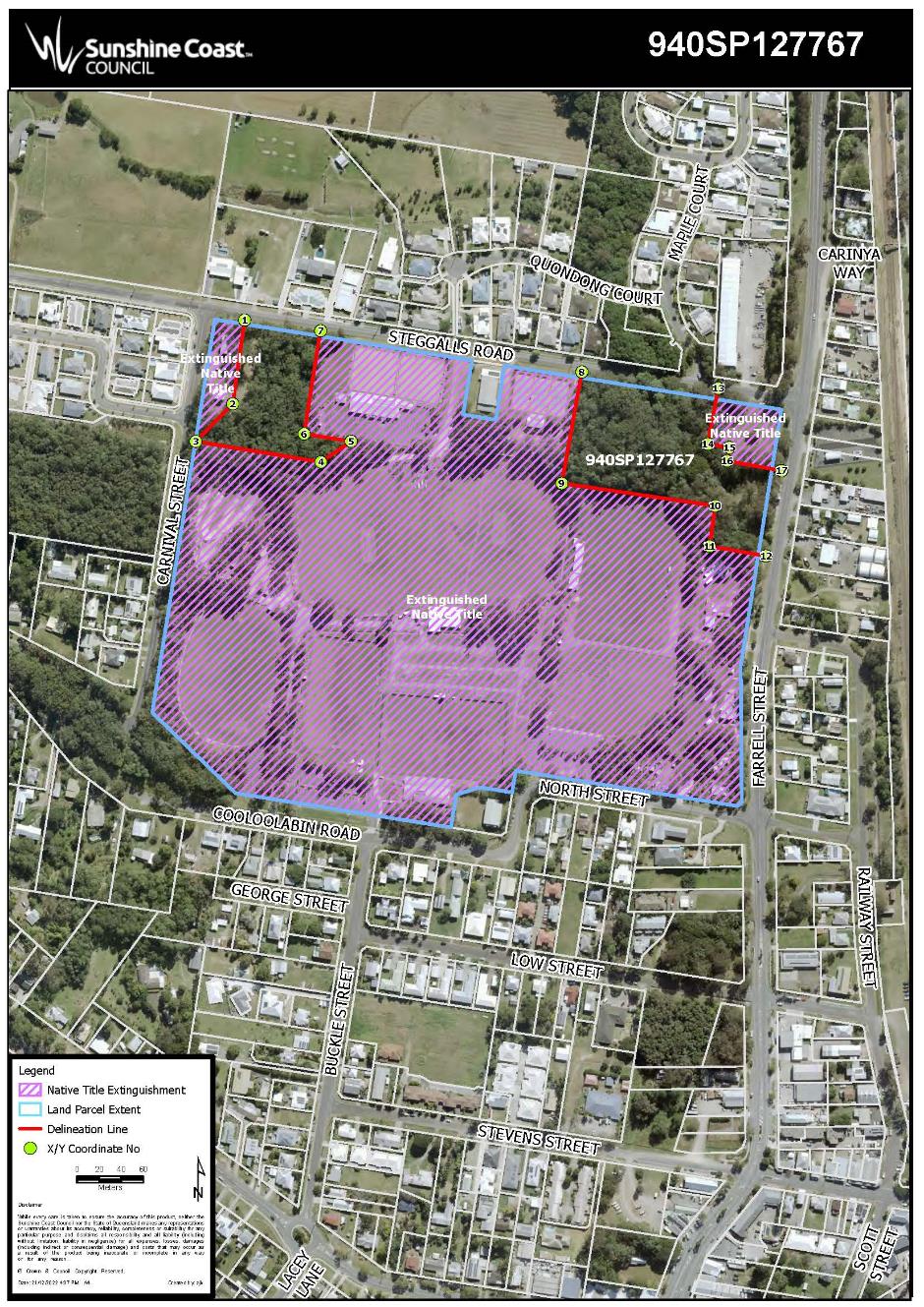
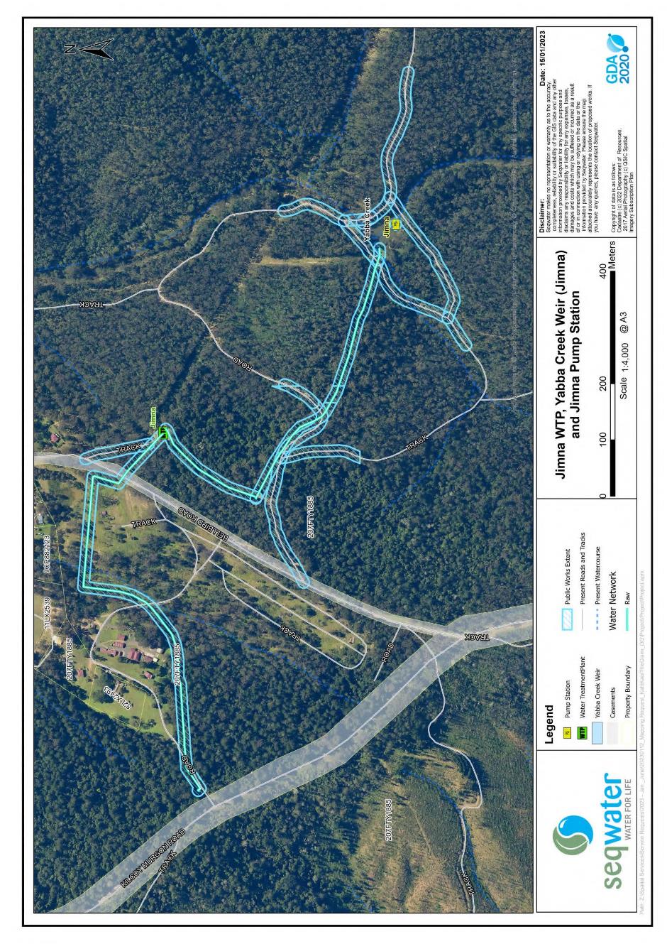
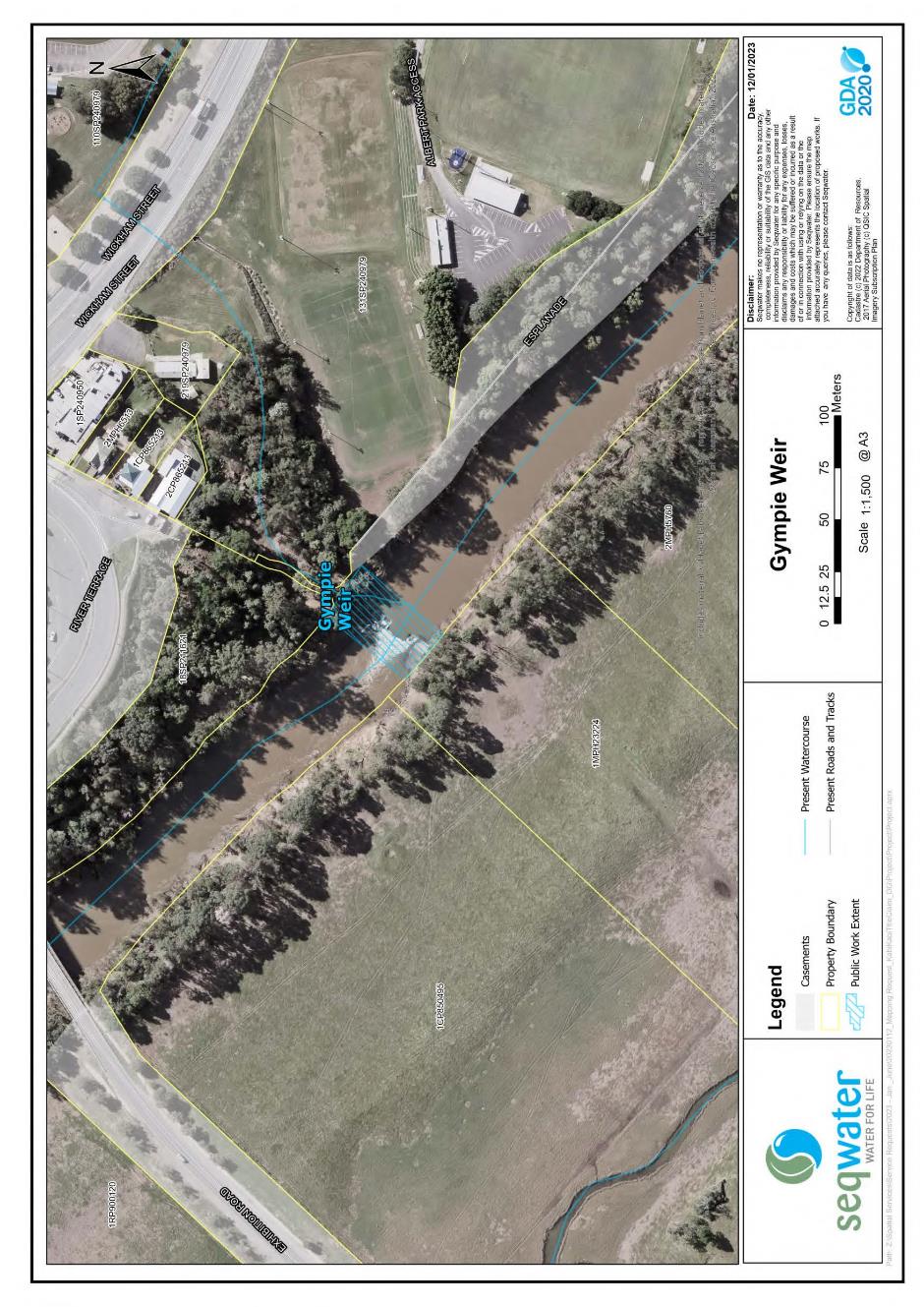
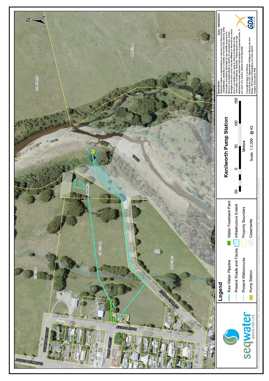
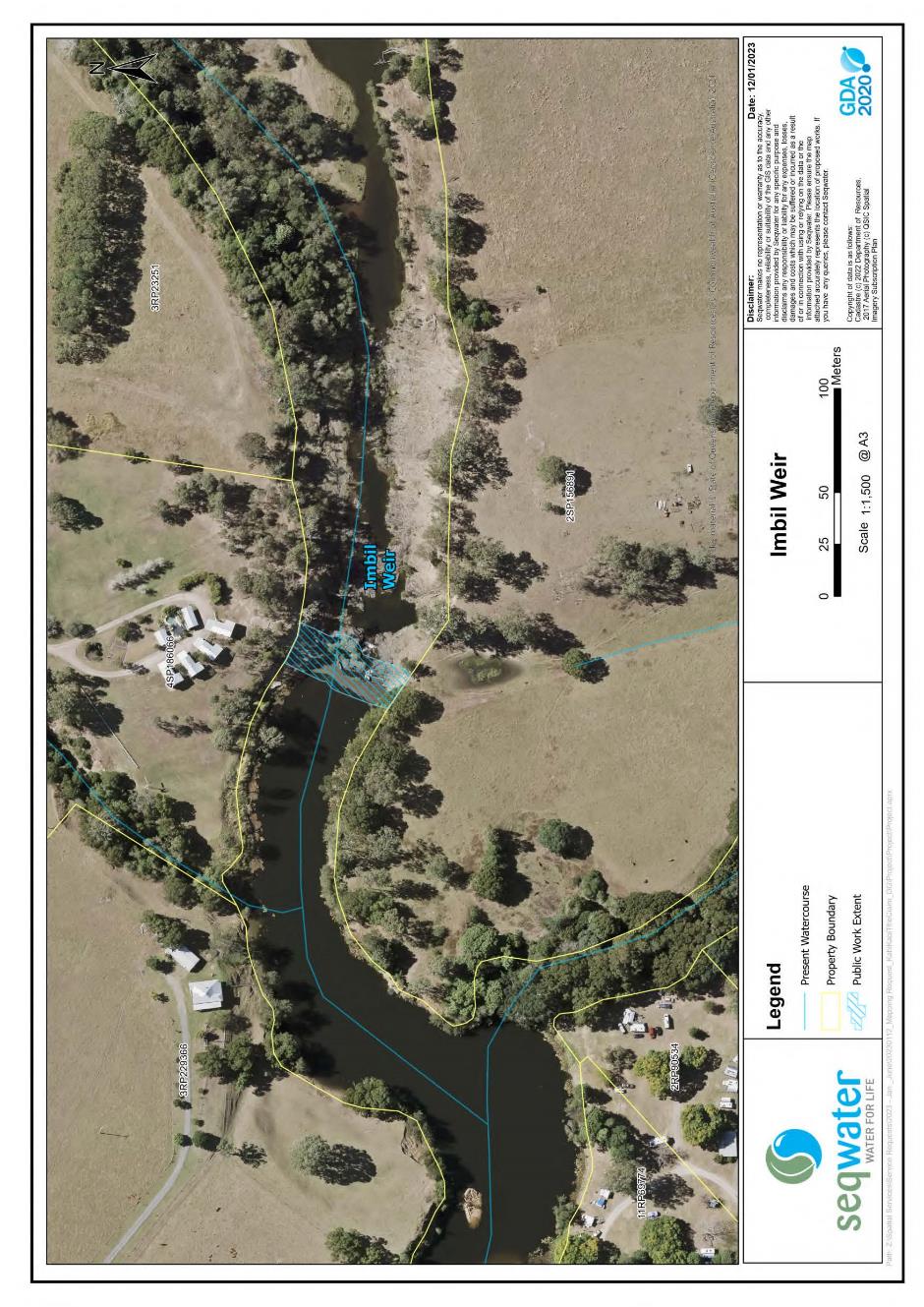
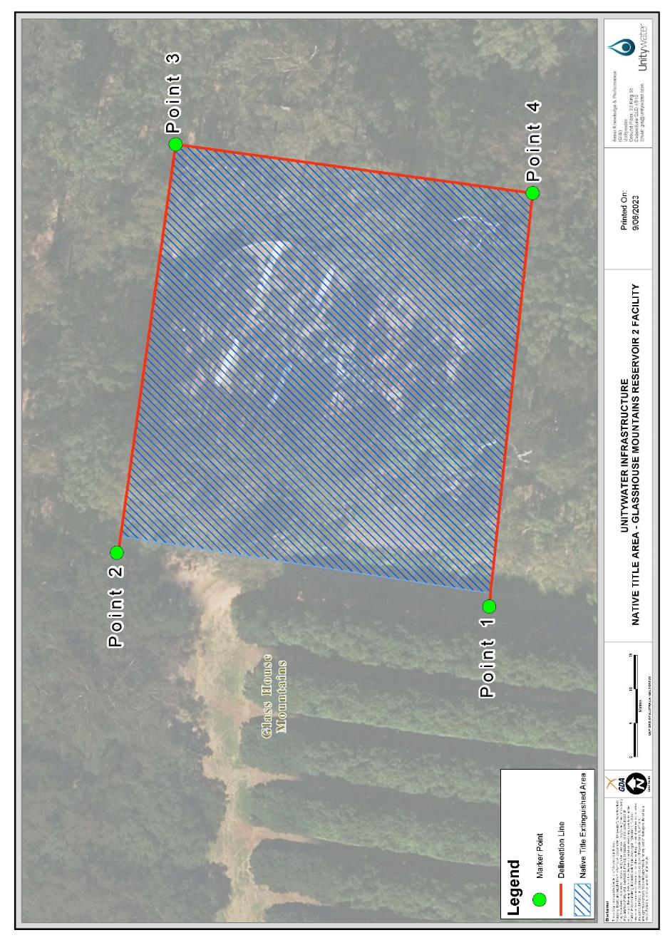
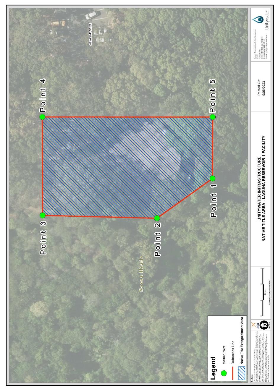
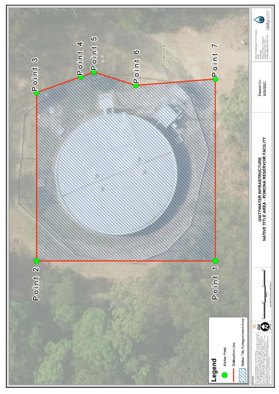
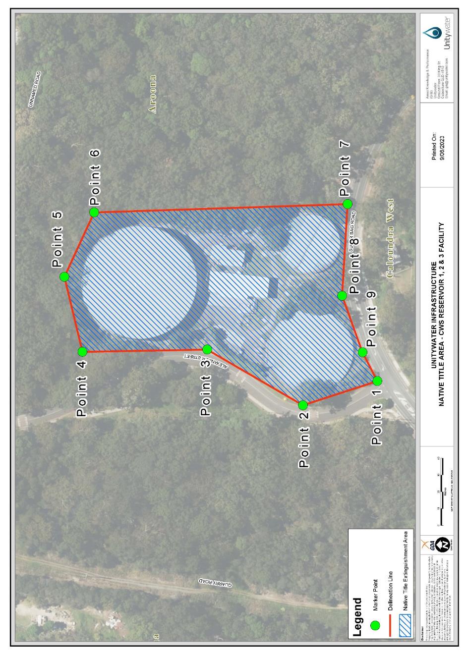
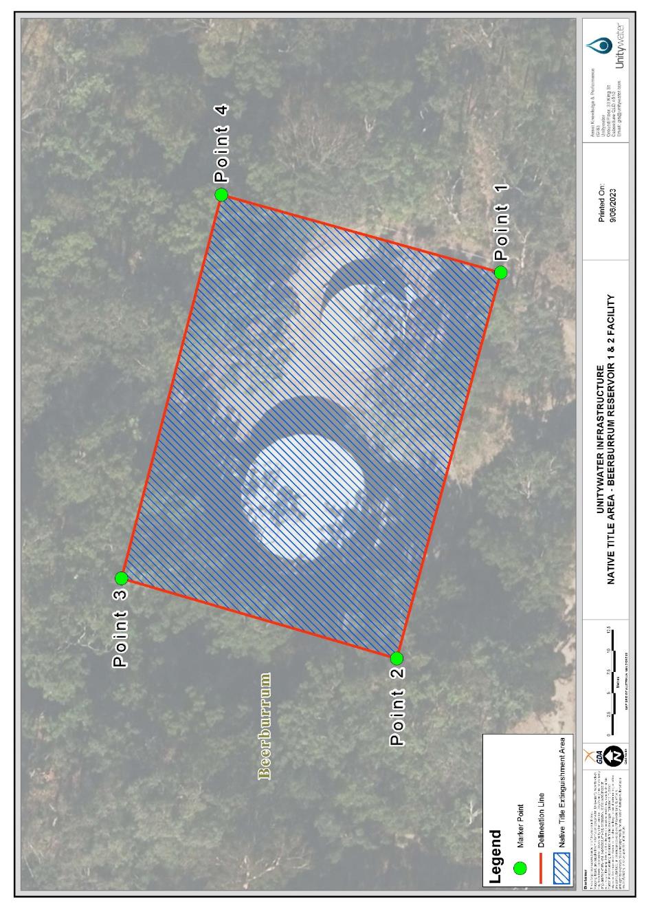
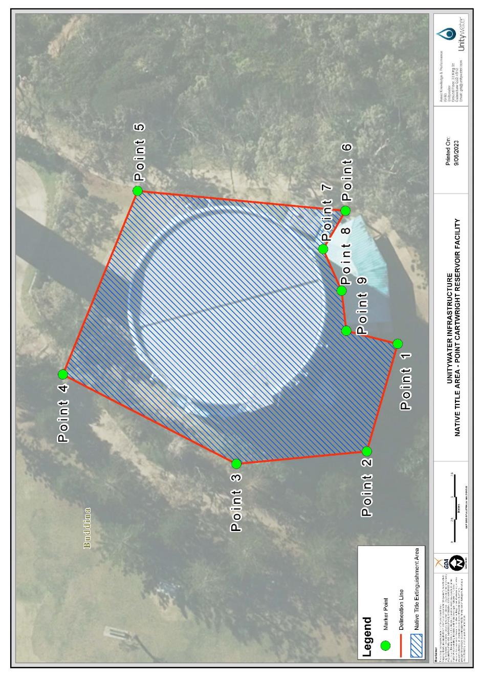
Note: Entry of orders is dealt with in Rule 39.32 of the Federal Court Rules 2011.
REASONS FOR JUDGMENT
COLLIER ACJ
1 Before me is a Native Title Determination Application under the Native Title Act 1993 (Cth) (the Native Title Act) filed on 11 December 2018 by the Kabi Kabi First National Traditional Owners claim group (Kabi Kabi People). With the consent of all parties, Michael Douglas, Helena Gulash, Norman Bond, Melissa Bond, Cecilia Combo, Kerry Jones and Brian Warner (the Applicant) seek orders within s 225 of the Native Title Act, recognising the native title rights and interests held by the Kabi Kabi People in respect of parts of land and waters claimed by them (determination area).
2 The respondents to the determination application are:
(1) State of Queensland;
(2) Commonwealth of Australia;
(3) Bundaberg Regional Council;
(4) Gympie Regional Council;
(5) Moreton Bay Regional Council;
(6) Noosa Shire Council;
(7) Sunshine Coast Regional Council;
(8) Fraser Coast Regional Council;
(9) Somerset Regional Council;
(10) Energex Limited;
(11) Ergon Energy Corporation Limited;
(12) Australian Gas Networks (Qld) Limited;
(13) Northern SEQ Distributor-Retailer Authority trading as “Unitywater”;
(14) Telstra Corporation Limited;
(15) Mrs Catherine Anne Harris;
(16) Queensland Bulk Water Supply Authority trading as Seqwater; and
(17) Amplitel Pty Ltd.
3 An agreement pursuant to s 87A of the Native Title Act has been reached by relevant parties to that effect.
4 It is convenient to set out relevant background material prior to turning to key issues before the Court. In doing so I particularly have regard to the submissions of the Applicant.
THE NATIVE TITLE CLAIM
5 The Kabi Kabi People are comprised of persons who identify as and are recognised as members of the Kabi Kabi People in accordance with the system of traditional laws and customs, and are descendants (including through adoption or raising up in accordance with traditional laws and customs) of one or more of the following apical ancestors:
(1) Maggie Cadenti/Cadente/Cantidi: “Maggie”;
(2) George Parson;
(3) Albert Williams;
(4) Ngimburum;
(5) Kaloma-kuta/Galmaguda/Haloma-kuta/Kal-ma-kuta;
(6) Willie Kina;
(7) Susan Andy;
(8) Jacky Ball (or Baul);
(9) Maggie Cain/Caine;
(10) James Crow/Crowe;
(11) Maggie Palmer;
(12) Emma Dunne;
(13) William/Billy Glenbar;
(14) Annie Laurie;
(15) May Burnett;
(16) Tuppernywoe/"King" Tommy of Noosa;
(17) Dundalli;
(18) Sarah Di:naba Moreton;
(19) Marian/Mary Ann Thompson; or
(20) Towcha
6 The determination area the subject of the determination application consists of approximately 10,280 square kilometres, generally from the southern extent of Bribie Island, Sandstone Point and Elimbah Creek catchment area, to Cooloola National Park, Curra State Forest, Mary River and Isis Rivers, and west to the Brisbane Range, the Burnett Range and Coast Range.
7 The external boundaries are agreed by the parties to the present s 87A Agreement as follows:
The area of land and waters commencing at the intersection of the northern boundary of Berries Road and southern bank of Oaky Creek (Edward Creek) and extending generally northerly and generally north-easterly along southern banks of that creek, and southern banks of Isis River to the western bank of the Burrum River; then easterly to the eastern bank of that river at Latitude 25.212232° South; then generally southerly along banks of that river to Latitude 25.221740° South; then south-westerly to the centreline of Cherwell River at its mouth; then generally south-westerly along the centreline of that river (passing to the north of Lot 20 on CK3227) to Latitude 25.235245° South; then generally south-westerly and generally south-easterly passing through the following co-ordinate points:
Longitude ° (East) | Latitude ° (South) |
152.524182 | 25.264640 |
152.507026 | 25.316109 |
152.502329 | 25.332243 |
152.496610 | 25.351442 |
152.493547 | 25.369006 |
152.493138 | 25.377789 |
152.492934 | 25.385754 |
152.496406 | 25.422108 |
152.498857 | 25.435588 |
152.503555 | 25.446412 |
152.511316 | 25.453969 |
152.521732 | 25.459688 |
152.537255 | 25.463568 |
152.547671 | 25.471329 |
152.556453 | 25.476231 |
152.597097 | 25.491957 |
152.627528 | 25.497471 |
152.637127 | 25.500126 |
152.641621 | 25.502985 |
152.647544 | 25.508500 |
152.648987 | 25.510692 |
Then southerly to the southern bank of the Mary River, west of Maryborough, at Longitude 152.648966° East; then generally southerly along banks of that river to the centreline of Gutchy Creek; then northerly to the centreline of the Mary River at Longitude 152.520670° East, Latitude 25.768908° South; then generally westerly and generally southerly along the centreline of that river (passing to the east of Lot 62 on USL43380) to Latitude 26.069738° South, then generally easterly, generally south-easterly, generally north-westerly and generally easterly to a point on the Lowest Astronomical Tide at Latitude 26.016775° South passing through the following coordinate points:
Longitude ° (East) | Latitude ° (South) |
152.540728 | 26.070082 |
152.551252 | 26.068777 |
152.561681 | 26.066420 |
152.572600 | 26.062148 |
152.582951 | 26.058149 |
152.594555 | 26.050710 |
152.605640 | 26.045363 |
152.616250 | 26.040176 |
152.626855 | 26.034072 |
152.637767 | 26.028579 |
152.647344 | 26.025203 |
152.656885 | 26.022781 |
152.670609 | 26.020952 |
152.687551 | 26.022015 |
152.697621 | 26.024310 |
152.710867 | 26.027329 |
152.719390 | 26.029702 |
152.729950 | 26.032643 |
152.739623 | 26.034682 |
152.750286 | 26.039260 |
152.758524 | 26.045058 |
152.768275 | 26.049636 |
152.778490 | 26.056077 |
152.786275 | 26.062148 |
152.795779 | 26.069840 |
152.802408 | 26.075910 |
152.810093 | 26.082594 |
152.816575 | 26.089550 |
152.824509 | 26.097473 |
152.830175 | 26.103132 |
152.839408 | 26.112352 |
152.845302 | 26.118237 |
152.853244 | 26.126168 |
152.859529 | 26.133404 |
152.867091 | 26.142110 |
152.874534 | 26.150111 |
152.880932 | 26.156989 |
152.887975 | 26.164442 |
152.895990 | 26.172924 |
152.902370 | 26.179376 |
152.912186 | 26.189098 |
152.921646 | 26.196117 |
152.931716 | 26.203441 |
152.942072 | 26.207408 |
152.948144 | 26.206187 |
152.952994 | 26.203746 |
152.958738 | 26.197948 |
152.962658 | 26.192150 |
152.964440 | 26.184520 |
152.965296 | 26.174145 |
152.965262 | 26.167736 |
152.963073 | 26.156445 |
152.960303 | 26.150036 |
152.954480 | 26.141186 |
152.947133 | 26.131421 |
152.937967 | 26.122571 |
152.928801 | 26.113721 |
152.917500 | 26.103651 |
152.907731 | 26.095716 |
152.900462 | 26.088024 |
152.892446 | 26.079542 |
152.887240 | 26.072218 |
152.881716 | 26.062453 |
152.881446 | 26.056024 |
152.887709 | 26.046584 |
152.894669 | 26.040786 |
152.904972 | 26.034988 |
152.920140 | 26.029495 |
152.930892 | 26.025591 |
152.942900 | 26.022781 |
152.953825 | 26.019729 |
152.969307 | 26.016067 |
152.981460 | 26.015152 |
152.991310 | 26.014575 |
153.001796 | 26.014048 |
153.012475 | 26.013512 |
153.022496 | 26.012597 |
153.034629 | 26.011184 |
153.047701 | 26.011490 |
153.064120 | 26.012710 |
153.076282 | 26.013321 |
153.089051 | 26.013931 |
153.101821 | 26.014847 |
153.116412 | 26.015152 |
153.127356 | 26.015457 |
153.140429 | 26.016067 |
Then generally southerly along the Lowest Astronomical Tide to Pumicestone Channel; then south westerly across that Channel to the lowest astronomical tide of the northern coastline of Bribie Island; then generally southerly and generally westerly again along that lowest astronomical tide to the southern end of Pumicestone Channel; then north-westerly across that channel to its intersection with the Lowest Astronomical Tide and onwards to the High Water Mark of the mainland at Sandstone Point at Latitude 27.085939° South; then generally north easterly and generally north westerly along the High Water Mark of Pumicestone Channel, across Ningi Creek, to the southern bank of Elimbah Creek; then southerly to a boundary of Elimbah Creek Catchment Area at Longitude 153.084552° East, Latitude 27.030730° South; then generally southerly and generally westerly along boundaries of that catchment to Longitude 152.961443° East; then generally south westerly passing through the following coordinate points:
Longitude ° (East) | Latitude ° (South) |
152.953269 | 27.038824 |
152.948284 | 27.040590 |
152.946461 | 27.041499 |
152.943437 | 27.042164 |
152.940410 | 27.044176 |
152.938143 | 27.044170 |
152.933606 | 27.045504 |
152.928314 | 27.046835 |
152.924535 | 27.047497 |
152.922266 | 27.048163 |
152.919034 | 27.048236 |
Then westerly to a point on the western boundary of Easement A on RP105208 at Latitude 27.048578° South, a point on the eastern external boundary of Native Title Determination QUD6128/98 Jinibara People (QC98/45); then generally northerly, generally south westerly, generally southerly and generally westerly along eastern and northern external boundaries of that native title determination to a point in Lot 7 on AP23765, a point on the northern boundary of former Lot 2 on AP19208 at Longitude 152.476410° East, further described as:
Generally northerly along western boundaries of A on RP105208, B RP105540, A RP105540, B RP169368, A RP104615, A RP104616, A RP104618, A RP104360 A RP104355 and A RP104359 to a southern boundary of Alcock Road; then northerly to the southernmost south-west corner of Lot 15 RP843783, being a northern boundary of Alcock Road; then generally easterly, generally north-easterly, generally northerly and generally north-westerly along boundaries of that road, western boundaries Old Gympie Road, Beerburrum Woodford Road, again Old Gympie Road and Paper Road to the eastern boundary of Mount Mellum Road; then north-easterly to the southern bank of the Mooloolah River at Longitude 152.956365° East; then generally westerly along the southern banks of that river to Longitude 152.918070° East; then generally northerly passing through the following co-ordinate points:
Longitude ° (East) | Latitude ° (South) |
152.918040 | 26.751710 |
152.916245 | 26.748397 |
152.916522 | 26.736780 |
152.916522 | 26.718249 |
152.914171 | 26.705526 |
152.913756 | 26.700409 |
152.913894 | 26.696952 |
152.911405 | 26.686718 |
152.910022 | 26.680356 |
152.905043 | 26.673165 |
152.902277 | 26.664176 |
152.902001 | 26.663485 |
152.899605 | 26.656017 |
152.899512 | 26.650762 |
152.900341 | 26.645783 |
152.903384 | 26.639007 |
152.906288 | 26.635411 |
152.906979 | 26.630156 |
152.908224 | 26.626975 |
152.918596 | 26.617295 |
152.930489 | 26.601806 |
152.934223 | 26.594477 |
152.937542 | 26.587839 |
152.940723 | 26.582030 |
152.941553 | 26.577743 |
152.942244 | 26.572488 |
152.941691 | 26.566403 |
152.939340 | 26.561978 |
152.936989 | 26.557414 |
152.934223 | 26.550776 |
152.933532 | 26.547595 |
152.933670 | 26.546074 |
152.934361 | 26.545106 |
152.935468 | 26.542478 |
152.938233 | 26.539436 |
152.940584 | 26.537915 |
152.945840 | 26.532245 |
Then northerly to the western boundary of Bunya Road at Latitude 26.517695° South; then generally north-westerly and generally southerly along southern boundaries of that road, Gold Creek Road, Browns Creek Road and eastern boundaries of Anderson Road to its southernmost eastern corner; then generally southerly to a point on the northern boundary of Lot 1239 on NPW1105 at Longitude 152.887569° East passing through the following co-ordinate point:
Longitude ° (East) | Latitude ° (South) |
152.887757 | 26.494490 |
Then westerly, generally southerly, again westerly and again generally southerly along northern and western boundaries of Lot 1239 on NPW1105, western boundary of Lot 2 on AP19232, western boundary of Lot 1239 on NPW1106, again northern boundaries of Lot 1239 on NPW1105, northern boundaries of Lot 2 on AP19232 and again Lot 1239 on NPW1105, northern and western boundaries of again Lot 2 on AP19232 to the northern boundary of Buckby Road; then generally south-easterly, generally southerly and generally westerly along southern, western and northern boundaries of again Lot 1239 on NPW1105 and western and northern boundaries of Lot 4 on AP19232 to a corner on the eastern boundary of Naranga Road at Longitude 152.836465° East, Latitude 26.522126° South; then south-westerly to again a corner of Lot 1239 on NPW1105 at Longitude 152.816277° East; then westerly, generally south-westerly, southerly and generally easterly along northern and western boundaries that lot, northern boundaries Lot 1 on AP19232 and western and southern boundaries of again Lot 1239 on NPW1105 to Longitude 152.797163° East; then southerly to a corner of the western boundary of Kidaman Creek Road at Latitude 26.654626° South passing through coordinate point:
Longitude ° (East) | Latitude ° (South) |
152.795978 | 26.621352 |
Then generally southerly along western boundaries of Kidaman Creek Road, Suicide Road, again Kidaman Creek Road and Curramore Road to an intersection with Maleny Kenilworth Road; then generally westerly along northern boundaries of that road to intersect the eastern bank of the Mary River; then generally westerly passing through the following coordinate points:
Longitude ° (East) | Latitude ° (South) |
152.713548 | 26.728587 |
152.660839 | 26.729212 |
152.641728 | 26.730950 |
152.619799 | 26.734666 |
Then westerly to a point in Lot 7 on AP23765, a corner on an eastern boundary of former Lot 102 on NPW746 at Longitude 152.598821° East, Latitude 26.740418° South; then generally south westerly along southern boundaries of that former lot to its intersection with the northern boundary of Mt Kilcoy Road; then westerly along the northern boundary of that road to Longitude 152.566192° East; then generally westerly passing through Lot 7 on AP23765 along the northern boundaries of an unnamed track (Jimna Bellthorpe Road), and northern boundaries of former Lot 2 on AP19208 to Longitude 152.476410° East, being a point on the external boundary of Native Title Determination QUD6128/1998 Jinibara People.
Then northerly to the western boundaries of the Mary River Catchment Area at Latitude 26.719721° South and generally north-westerly along western boundaries of that catchment to Longitude 152.425480° East; then generally westerly and generally north-westerly passing through the following co-ordinate points:
Longitude ° (East) | Latitude ° (South) |
152.417561 | 26.656021 |
152.406348 | 26.656821 |
152.398339 | 26.657222 |
152.389530 | 26.658423 |
152.381121 | 26.658823 |
152.371910 | 26.659624 |
152.366705 | 26.660425 |
152.359096 | 26.660825 |
152.351236 | 26.660930 |
152.343731 | 26.660880 |
152.336235 | 26.659713 |
152.328721 | 26.658535 |
152.323702 | 26.657370 |
152.317424 | 26.656192 |
152.312348 | 26.656117 |
152.308507 | 26.654920 |
152.302093 | 26.653668 |
152.297129 | 26.651410 |
152.292192 | 26.650290 |
152.284698 | 26.647999 |
152.275454 | 26.644307 |
152.274173 | 26.644283 |
152.246122 | 26.624053 |
152.236321 | 26.610710 |
152.226421 | 26.606219 |
152.216577 | 26.599510 |
152.201827 | 26.588338 |
152.194518 | 26.577218 |
152.137699 | 26.539723 |
Then north westerly to a corner on a western boundary of the Somerset Regional Council at Latitude 26.537032° South, then generally northerly and generally easterly along boundaries of that regional council to a corner at Longitude 152.370763° East; then north-easterly to again a point on the boundary of the Mary River Catchment Area at Longitude 152.370974° East, Latitude 26.461615° South and generally north-easterly, generally north-westerly, generally northerly and again generally north-easterly along boundaries of that catchment area to its intersection with the southern boundary of the Fraser Coast Regional Council; then generally northerly, generally westerly, generally north-westerly and generally north-easterly along boundaries of that regional council to its intersection with the southern boundary of the Bundaberg Regional Council; then northerly and generally north-easterly along boundaries of that regional council back to the commencement point.
In addition, the Determination Area includes Mudjimba Island (Part Lot 509 on NPW594):
The determination area does not include any land and waters within the external boundaries subject to:
• Native Title Determination QUD6128/1998 Jinibara People as determined by the Federal Court 20 November 2012.
• Native Title Determination QUD460/2018 - Butchulla Land & Sea Claim #2 as determined by the Federal Court 13 December 2019.
• Native Title Determination QUD276/2019 - Wakka Wakka People #3 (Part A & B) as determined by the Federal Court 12 April 2022.
• Native Title Determination QUD277/2019 - Wakka Wakka People #4 (Part A) as determined by the Federal Court 12 April 2022.
8 The determination area is represented by the following map:
9 I note that specific areas are excluded from the determination area, including:
• any area that is or has been subject to the following:
(i) any Crown to Crown grant of freehold; and
(ii) any post 23 December 1996 grant of freehold;
• any area that is subject to the following category of leases:
(i) boat harbour;
(ii) housing lease;
(iii) railway lease;
(iv) freeholding lease;
(v) grazing homestead perpetual lease;
(vi) perpetual lease;
(vii) non-competitive lease; and
(viii) manufacturing, industrial, residential or business; and
• Those land and waters within the External Boundary on which, at the time the Application was made, public works were validly constructed, established or situated after 23 December 1996, where s 24JA of the Native Title Act applies, and which wholly extinguished native title.
• Those land and waters within the External Boundary which, at the time the Application was made, were the subject of one or more Pre-existing Rights Based Acts, within the meaning of s 24IB of the Native Title Act, which wholly extinguished native title.
PROCEDURAL HISTORY
10 The proceedings were originally commenced on 31 May 2013, when an application was filed in the Federal Court pursuant to ss 13(1)(a) and 61 of the Native Title Act by members of the Kabi Kabi People (application in QUD280/2013). On 7 August 2013, the Native Title Registrar accepted that application for registration under s 190A of the Native Title Act, and details of that application were entered on the Register of Native Title Claims.
11 On 20 July 2016, following the assessment of connection material provided by the Applicant to the State and the Commonwealth for the purpose of satisfying s 225 of the Native Title Act and informing the scope and expression of native title rights and interests capable of recognition pursuant to s 223 of the Native Title Act, the State advised that it was prepared to enter into substantive negotiations towards a consent determination on various conditions.
12 On 30 November 2016, the Applicant also filed a native title claim application in QUD908/2016 on behalf of the Kabi Kabi People, pursuant to sections 13(1)(a) and 61 of the Native Title Act, in relation to a contiguous area to the south of the application area known as Undambi (Undambi Application).
13 The Native Title Registrar accepted the Undambi Application for registration under s 190A of the Native Title Act on 30 March 2017.
14 On 29 November 2018, Judicial Registrar Grant ordered that the Undambi Application and application in QUD280/2013 be combined to form the present proceedings (Combined Application). The Combined Application was filed in the Court on 11 December 2018 by the Applicant on behalf of the Kabi Kabi People. On 8 February 2019 the Native Title Registrar registered the Combined Application on the Register of Native Title Claims.
15 On 10 January 2019, Registrar Soden relevantly made the following orders in the present proceedings QUD20/2019:
THE COURT NOTES:
1. The content and effect of the order made in the QUD280/2013 Alex Davidson & Ors on behalf of the Kabi Kabi First Nation Traditional Owners Native Title Claim Group proceeding which forms Annexure 1 to this Order.
THE COURT ORDERS THAT:
1. On and from today’s date, all documents filed in this proceeding will be taken to have also been filed in QUD280/2013 Alex Davidson & Ors on behalf of the Kabi Kabi First Nation Traditional Owners Native Title Claim Group.
2. The index of the court file for QUD280/2013 Alex Davidson & Ors on behalf of the Kabi Kabi First Nation Traditional Owners Native Title Claim Group forms Annexure 2 to this Order.
16 On 13 March 2020, the Commonwealth confirmed that it agreed to connection.
17 The Applicant and the State participated in mediation during 2022, and on 29 September 2022 the Applicant and the State agreed in relation to the native title rights and interests proposed to be recognised. Subsequently all remaining parties provided their agreement that native title exists, the nature of the rights and interests proposed to be recognised, and the area over which those rights can be recognised within the determination area.
18 Following my decision in Kabi Kabi First Nation Traditional Owners Native Title Claim Group v State of Queensland [2023] FCA 615 I ordered on 8 August 2023 that the Combined Application be partitioned into three parts as follows:
Part A: Comprising that portion of the area in the Combined Application which is not covered by the Undambi Application, or an area in respect of which Mr Luke Barrowcliffe and Mrs Katherine Barrowcliffe were joined as respondents pursuant to that judgment (the Disputed Area);
Part B: Comprising the area of the Undambi Application and which does not include Part A or Part C; and
Part C: Comprising the Disputed Area and which does not include Part A or Part B.
19 Only Part A is proposed for determination at present.
20 On 3 November 2023 Judicial Registrar Grant granted leave for the Applicant to file a sixth further amended Form 1, which sought to rectify deficiencies in the mapping and technical descriptions in the previous iteration. The sixth further amended Form 1 was accepted for filing on 8 November 2023.
21 At a meeting held on 16 April 2023 an indigenous land use (area) agreement (Tenure Resolution ILUA) between the Kabi Kabi People, Kabi Kabi Peoples Aboriginal Corporation ICN 8996 (Kabi Kabi Corporation) and the State of Queensland was authorised by the native title group over what was originally the Part A and Part B areas prior to the partition. Following to the partitioning of the Combined Application a claim group meeting was held on 12 August 2023 to authorise the amendment of the Tenure Resolution ILUA such that it deals only with the Part A area.
22 It is common ground that the consent determination proposed by the parties would be conditional upon the registration of the Tenure Resolution ILUA, because:
the Tenure Resolution ILUA refers to a number of parcels not included in the proposed consent determination and their surrender is intended to take effect upon registration of the Tenure Resolution ILUA; and
the registration of the Tenure Resolution ILUA is a precondition to the determination orders taking effect.
23 The Applicant submitted that the Tenure Resolution ILUA was executed by the State, the Applicant and the Kabi Kabi Corporation on 20 May 2024, and that it was lodged with the National Native Title Tribunal for registration on 22 May 2024.
MATERIAL ON WHICH THE APPLICANT RELIES
24 The Applicant relies on the following material in support of connection (connection material):
Form 1 dated 3 November 2023
The following expert reports:
• Anthropological Connection Report: Sunshine Coast Region by Anthony Redmond 27/08/2013 dated 27 August 2013;
• Anthropological Connection Report: Appendices by Anthony Redmond dated 27 August 2013;
• Kabi Kabi First Nation Traditional Owners: Supplementary Report by Anthony Redmond dated 30 April 2015; and
• Revised Anthropological Connection Report: Sunshine Coast Region [Kabi Kabi] by Dr Anthony Redmond (the Amended Connection Report) dated 1 April 2015.
The following affidavits:
• Affidavit of Bessie Bond dated 10 November 2014;
• Affidavit of Marjorie Fisher dated 10 November 2014;
• Affidavit of Troy Fisher dated 10 November 2014;
• Affidavit of Mischa Fisher dated 15 December 2014;
• Affidavit of Sue Morgan dated 18 December 2014;
• Affidavit of Nurdon Horace Serico dated 11 May 2015;
• Affidavit of Edna Van Hemmen dated 28 May 2015;
• Affidavit of Graham Anthony Jennings dated 15 July 2015;
• Affidavit of Leisha Krause dated 23 July 2015;
• Affidavit of Les Gordon Muckan dated 30 July 2015;
• Affidavit of Sylvia Bond dated 21 July 2015;
• Affidavit of Hope Gertrude O’Chin dated 24 July 2015;
• Affidavit of Kerry Neill dated 31 July 2015;
• Supplementary Affidavit of Les Gordon Muckan dated 25 November 2015;
• Supplementary Affidavit of Leisha Krause dated 6 November 2015;
• Affidavit of Kerry Jones dated 19 September 2019;
• Affidavit of Norman Bond dated 2 December 2019;
• Supplementary Affidavit of Norman Bond dated 29 July 2020;
• Affidavit of Cecilia Combo dated 5 August 2020;
• Supplementary Affidavit of Kerry Jones 23/07/2020
• Affidavit of Kerry Jones dated 22 February 2022;
• Affidavit of Lyndon Davis dated 29 June 2022;
• Affidavit of Beverly Hand dated 3 February 2022;
• Affidavit of Brian Paul Warner dated 22 February 2022;
• Affidavit of Cecilia Combo dated 16 June 2022;
• Affidavit of Melissa Bond dated 4 July 2022;
• Supplementary Affidavit of Norman Bond dated 4 July 2022;
• Further Supplementary Affidavit of Norman Bond dated 27 July 2022;
• Supplementary Affidavit of Brian Paul Warner dated 4 July 2022; and
• Affidavit of Michael David Frith Allbrook dated 30 May 2024.
Letter dated 22 May 2024 from Kabi Kabi Peoples Aboriginal Corporation to the Federal Court Registry accepting nomination as the RNTBC.
25 In particular, the Applicant relies on a summary of the connection material, Draft Consent Determination Orders attached to the section 87A Agreement, the section 87A Agreement itself filed on 7 June 224, and Mr Allbrook’s affidavit.
SUMMARY OF CONNECTION MATERIAL
26 The summary of the connection material prepared by the Applicant is as follows:
Pre-Sovereignty Society
1. In the pre-sovereignty society, the Kabi Kabi People existed as a part of a larger regional society, but rights and interests to the land were localised to the local country group level. Throughout the regional society, there were several language groups, which were differentiated from each other by a different local language term for the word “no”.
2. Kabi Kabi speaking people, including several subgroups, existed to the north of the North Pine River and extended toward K’gari or Fraser Island at effective sovereignty. Early ethnographers observed that local language groups followed the river drainage systems. Local country groups were associated with speaking a subdialect of the Kabi Kabi language, and this distinguished local country groups from their neighbours. Redmond describes recruitment into these local country groups to be “loosely patrifilial”. This means the method of recruitment maintained a bias towards patrifiliation but also incorporated a combination of matrilineal moieties and a matrilineal system of totems.
3. The speakers of the Kabi Kabi language were united in their shared laws and customs, which included:
a. matrimoieties;
b. subsections inherited through matrifiliation;
c. totemic matri-clans;
d. loose patrifiliation;
e. language identities differentiated by the word “no”;
f. initiation practiced by the regional society and known as Bora/Boorool/Toara/Wandaral;
g. belief in the Sky-Gods and the Rainbow Serpent;
h. organised battles for the members of the regional society;
i. harvest and consumption of local foods such as bunya nuts and mullet at festivals; and
j. loosely patrifilial local countries that practice individual ownership of particular trees or areas along the water.
4. Redmond described the Kabi Kabi People in context of other groups, being bounded to the north by Gurang Gurang and including the catchments of Isis River and Oaky Creek and in the northeast corner by the Batjala [Butchulla] (along with two other local groups: the Ngulungbara and Dulingbara), whose local group territory consisted of K’gari and the adjacent mainland including Maryborough. To the south of Kabi Kabi are the Turrbal located south of the North Pine River. To the southwest and west of Kabi Kabi are the Jinibara and Wakka Wakka. The lower southeast Kabi Kabi group being “in the Conondale Range at the head of the Mary River and on the Mary Plains”. Kabi Kabi country came up against the Wakka Wakka area at Mount Stanley in the southwest corner and continues north occupying the eastern side of the Coast Ranges.
Contemporary Society
5. The Kabi Kabi apical ancestors listed at paragraph [43] above are those whose traditional country was, as far as can be determined from the oral and documentary evidence, within (or partly within) the claim area and whose descendants have maintained their connections to the area. Kabi Kabi People today comprise the descendants of these apical ancestors who held traditional rights and interests on the land within the claim area and were mostly born before or around the time of effective sovereignty.
6. The Kabi Kabi People and their predecessors formed part of a single regional society sharing the same system of traditional laws and customs. The concept of a wider regional society remains current amongst contemporary Kabi Kabi People and this level of society plays a significant role in the promulgation of the claimant’s body of traditional laws and customs, as was the case in the pre-sovereignty era. Within this regional society, Kabi Kabi People, through language identity, form a society united in and by their acknowledgement and observance of a body of laws and customs from which their rights and interests in land and waters arise. Kabi Kabi People today exhibit continuity of connection as an organised society and have continued their occupation, use, enjoyment and sense of rightful entitlement to Kabi Kabi country despite bureaucratic and administrative barriers that persisted throughout the most intense periods of governmental control over the lives of Aboriginal people in south-east Queensland during the 1900s.
7. Today, Kabi Kabi People retain the traditional element of perpetual filiation in recruitment to local groups associated with more or less bounded tracts of country. Rights and interests flow from the traditional right to use and occupy country flowing from filiation to the named Kabi Kabi ancestors. Contemporary Kabi Kabi People commonly refer to the authority vested in knowledgeable elders, particularly when in discussions about land and its resources but also extending to all matters pertaining to family relationships in the region. Further, Kabi Kabi People believe they have retained their traditional right to control access to and authorise the use of their country despite European land tenure laws having severely curtailed the exercise of this right.
8. In the contemporary era, there is a powerful persistence of Kabi Kabi People’s beliefs in elemental powers and the presence of dangerous spirits dwelling in the earth and waters, with the adherence to a rule-based sociality seen as a protective force against dangerous spirit beings. These beliefs form part of the body of law and custom received from Kabi Kabi Peoples’ predecessors and are seen to be authenticated by stories and practices derived from the “old people”. The transmission of traditional stories, songs and dances has been ongoing amongst Kabi Kabi Peoples’ families via their “old people”. A marker of Kabi Kabi Peoples’ identity as traditional owners is the continued practice of harvesting natural resources, hunting and fishing, including preparing and consuming animals, plants and other materials from the area in accordance with traditional laws and customs in relation to their land and waters. Kabi Kabi People continue to acknowledge and observe rules regarding group membership, kinship and marriage, totems, spiritual beliefs and practices, land tenure and protocols of access, gathering, hunting, fishing and other resource use and decision-making in accordance with traditional laws and customs in relation to their lands and waters.
Continuity of Law and Custom
Wider regional society
9. The Kabi Kabi People are recognised as being a part of a wider regional society. The wider regional society adhered to the cosmological belief in the Sky-God, which “…provided a lawful underpinning for human action and exerted a pressure towards conformity to established law and custom.” At this level the laws and customs are expressed strongly, such as creation stories, bora sites, and access to natural resources. A system of local groupings was shared across the broader region and a region-wide system of land tenure was based upon loosely patrifilial local countries, but also allowed individual ownership of the bounty of certain trees and stretches of water within the tracts of country used and governed by local groups.
Creation stories
10. A central feature of the Kabi Kabi Peoples’ belief system relate to the formation of the lands and waters by ancestral spirit beings. These stories govern many aspects of the lives of the Kabi Kabi People, including social rules and systems of land tenure. There is an inextricable link between the geographical landscape of the determination area and the creation stories which give it form.
11. To illustrate this for the purpose of these submissions, two examples are provided. Claimant Lyndon Davis recounts a Dreamtime story which explains the formation of landmarks and also provides the basis for social rules associated with marriage:
The Maroochy River is named after the black swan and Kabi Kabi people have a story that talks about how Mt Coolum and Mt Ninderry and Maroochy River came to be. Coolum and Maroochy were betrothed to each other and were to be married. Ninderry was from the area but he was an outcast.
One day, Ninderry came into the tribe and fell in love with Maroochy, saying that she was going to be his wife. The rest of the tribe told him that Maroochy was already betrothed to Coolum which is the marital law set by the Great Maker. Ninderry said he didn’t care and that he breaks the rules all the time. Ninderry then kidnapped Maroochy and ran away with her.
Coolum took off with a group of warriors and followed Ninderry’s tracks. He found Ninderry, Maroochy and the outcast tribe sleeping and realised that instead of fighting Ninderry it would be easier to just sneak away with Maroochy while they were all sleeping.
While they were sneaking away, Ninderry heard Maroochy and Coolum and set off after them. Ninderry caught up to them near Dunethin Rock. They had a big fight there and Ninderry killed Coolum by chopping off his head. Coolum’s head rolled off his shoulders and where it landed formed Mudjimba / Old Woman’s Island. Coolum’s headless body is still able to be seen to this day at Mount Coolum. Ninderry was punished for what he had done by being turned to stone for breaking the law. He was turned into a rocky outcrop which is why Mount Ninderry is so rocky now.
Maroochy transformed into a black swan and fled up into the mountains because a lot of the tribe blamed her for what had happened to Coolum and Ninderry. For years and years she cried for all that she had lost and her tears pooled at the bottom of the mountains and formed the Maroochy River which flows out to the ocean. Even today at Dunethin Rock the water starts getting saltier because Maroochy cried so much at that location.
12. Claimant Beverly Hand tells the creation story of the Bunya tree and how it relates to family life:
We have this old story about Bonyee (the Bunya) and his brother named Coonoom (the Hoop pine)... What happened was Coonoom and Bonyee they fell in love with a girl, her name was Cooloola (the Cypress pine). So they went to their father (named Namada, which is our word for the Kauri Pine) and said “We both love the same girl who can have her?” So to sort it out, the father armed them with spears and he paced them out and stood them opposite each other and he said you take turns spearing each other and whoever inflicts the most harm will get the girl. You see all the spears that Bonyee threw at Coonoom got him from his waist down and all the spears Coonoom threw at Bonyee got him from the chest up but neither inflicted more harm than the other so the father took Cooloola to be his wife. So no matter how much we fight with our siblings and say bad things to them, when you are faced with actually doing them harm it’s a different matter.
13. Kabi Kabi artists depict these traditional stories in their paintings or dances. Noted artist/dancer, Lyndon Davis, says: “I mainly paint about our stories from around here in Kabi Kabi country and I incorporate the patterns from this district from what I learned from my uncles and families.”
14. Applicant, Melissa Bond, also shares the following:
I learnt painting techniques from Morris Mickelo, who is a senior artist and a Kabi Kabi man… He encouraged me to paint bush tucker and bush medicine and special cultural places for my family, and to use stuff from that place in my artwork. Morris and I do ceramic potting together and he tells me when I should use different patterns to reflect our country and stories.
Totems
15. In the pre-sovereignty society, totems were an important way of managing the environment. Some of these practices are still carried out, such as bunya nut trees belonging to certain people. The person who “owned” the tree would harvest the bunya nuts for distribution. This is a practice that continues to this day, as illustrated by applicant Kerry Jones: “I have been told that my apical ancestor, Susan Andy, planted a bunya tree at Yandina. I show people that tree a lot, it is important to me and my family.”
16. People would have totems they couldn’t eat or care for certain stretches of land, and this is how they shared and regulated the exploitation of the natural resources. Applicant Kerry Jones recounts:
Totems are related to our kinship to the land. For example, your totem might be the kangaroo which means that you are not able to eat it. It also means that you got to look after him because it’s your animal. My totem is the “Mulloo” which is the Black Snake. … I am not supposed to eat the Black Snake, I am supposed to protect it. If I ate a Black Snake I would not feel right for a start, I would be breaking the law.
Rights and interests
17. The rights and interests claimed in the application are based on the premise that at effective sovereignty, the Kabi Kabi People’s ancestors owned the land and waters of the claim area, in accordance with their traditional laws and customs, and that those laws and customs have continued to be acknowledged and observed by the Kabi Kabi People.
18. Contemporary Kabi Kabi People have continued their occupation, use, enjoyment and sense of rightful entitlement to Kabi Kabi country despite the many bureaucratic and administrative barriers, which presented themselves throughout the most intense periods of governmental control over Aboriginal lives in south-east Queensland during the 20th century. The connection material demonstrates that the following rights and interests were exercised by Kabi Kabi People in the claim area in the pre-sovereignty and post-sovereignty period and continue to be exercised by Kabi Kabi People today.
Access, be present on, move about on and travel over the area
19. Contemporary Kabi Kabi People demonstrate their use and occupation of the claim area, and they manifest proprietorial attitudes, which characterise their attachments to tracts of country through their activities and residing on country. This use of country continued throughout the period of most intense surveillance of the Aboriginal population on the Cherbourg settlement and the vigilant and often hostile property owners in the area.
20. As claimant and respected Kabi Kabi elder, Alex Davidson, explains:
Mum’s born in the Mary Valley. And we’ve got Andrew Bolan, and the Yandina mob, the Yandina mob from up this end. One of my grandmothers, a young girl getting about, his family was the last people to be living a traditional lifestyle in the Sunshine Coast. They were the last people walking around there. They come across Maleny there, there’s records of them coming through Woombye. Back down to the coast and back around. So they were still doing their seasons, you know?
21. Applicant, Kerry Jones, explains it in the following way:
My family has always been on Kabi Kabi country and we have had a continuous link to this country going back a long way. Even when my great-great-grandmother [Susan Andy] and her children were stolen off Kabi Kabi country in about 1917 and taken to Taroom or Deebin Creek, they came back and stayed here when they could. Her son Alfred died at Taroom of internal injuries and her son Charlie got an exemption from the Act and came back to Buderim and Mooloolah.
Camp on the area, and for that purpose, erect temporary shelters on the area
22. Kabi Kabi People continue to camp on country and to erect temporary shelters when desired.
23. As claimant, Edna Van Hemmen, explains:
I was born in Kingaroy and mum and dad moved to Gympie when I was about 4 years old. I grew up between lmbil and Kenilworth in a country town called Brooloo…Dad built a tin shack for us to live in….
Dad taught us everything - how to survive in the bush.
We used to go and camp for the weekend, through people's properties out from Brooloo. We walked for miles through the bush to go camping and fish ing. There were never any issues with going through people's properties because all the people knew Dad.
Take resources for the area for any purpose
24. The right to take resources for the area for any purpose is derived in the first instance from the ownership of the land and waters in accordance with the Kabi Kabi People’s traditional laws and customs. Members of the claim group regard themselves as having an entitlement, as of right, to access and take resources for any purpose they see fit.
25. Melissa Bond indicates that:
…if it is from my country I can use the resource forever and a day. If it’s from my country then it is a part of me” and indicated that if she wished to take timber from her country to make objects for sale then “I just break it off and start carving”.
26. Cecilia Combo says, “I can take the resources from my country and do anything I like with them, I can do that because those resources are ours. They were ours long before the whiteman came along.”
27. Brian Warner indicates that he can, and does, take the resources from his country for a variety of purposes and expresses this as an entitlement to control that resource:
I can hunt, fish, trade and take ownership of resources, animals and things on Kabi Kabi country. I also have the right to deny or exclude others from taking, using or even entering Kabi Kabi Country. I can give people permission to take, use or enter Kabi Kabi country. This is because I am connected to the land and I am a Kabi Kabi person.
28. Claimants Kerry Jones and Cecilia Combo both express the sentiment that the natural environment of the Sunshine Coast is their “supermarket” and that they are entitled to access the resources (by hunting, fishing or collecting bush tucker) of their country for their own sustenance without seeking permission from others.
29. Claimants refer to modern restrictions that are taken into account, but the evidence shows that they feel that such restrictions do not apply to them when they exercise their native title right to take and use resources for any purpose. As Lyndon Davis puts it in the context of collecting bunya nuts from private property in Buderim, “I don’t think I need to ask anyone permission to take those bunya nuts, me and my family own them I reckon. Earlier this year, I got hundreds of bunya nuts from that tree.”
30. This sense of entitlement is also well expressed by Beverly Hand in the following way:
…If I see a [bunya] cone growing on freehold or private property, I will ask before going on that land - but that's because of white man's law. I have the right to those cones, so much so that when I see the cones for sale at the [Maleny] food co-op, I just grab one as I walk passed. I've told the co-op that "I'm just collecting my rent". They used to call out after me but now they don't bother. They know me now, and they know that I can take what's from my country. They know that I'm from this place.
31. Indeed, the claimants evidence demonstrates that there is no traditional rule or custom which prohibits the exercise of the right to take and use resources for any purpose, including (as an example) for commercial purposes. As Melissa Bond puts it:
I believe my Granny Elsie would be happy I am making use of things from our country and that I’m not letting it go to waste. She taught me that Kabi Kabi people are not people who waste things. We don’t just get things for our own personal use, it is also to trade with other tribes, for example. Granny Elsie taught me about how trade is a part of Kabi Kabi tradition, through festivals like the Bunya festival. There is no rule under Kabi Kabi law that says you can’t sell things - it’s the opposite. As I said above, it is part of our traditions.
Take and use the water of the area for personal, domestic and non-commercial purposes (including cultural and spiritual purposes)
32. While an exclusive right to water is not recognisable by law, the right to take and use water on Kabi Kabi country for personal, domestic and non-commercial purposes is derived from the ownership of the land and waters in accordance with the claimants’ traditional laws and customs.
33. Kabi Kabi People give evidence about guardian spirits that protect water sources on Kabi Kabi country. Norman Bond deposes that he was taught that a carpet snake moved through the country in the Dreamtime which created the valleys, the rivers and the springs of his country.
34. Lyndon Davis recalls being taught the rules for looking after water as an important resource which was taught to him by his grandmother while living in Buderim as follows:
She knew from a young age that the bottom spring is where you wash your clothes and the top spring collect your water. Everyone knows that if anyone was ever caught up there playing in the top spring water then they would get flogged! That’s what she would say. That was a water spring law. Nan filled me in about that law and so I still respect that law and carry out that law to this day.
35. Applicant Norman Bond recalls being told that permission was required to access certain water sources and that, “areas that have natural springs had cultural rules about access and who could use them or be there at specific times of the year. It’s about law and rituals for both men and women – you don’t go to certain places.”
Participate in cultural activities on the area
36. Kabi Kabi People speak of being taught about traditional festivals (or gatherings) held on Kabi Kabi country where the claimant’s ancestors congregated for the purposes of trade and ceremony with neighbouring groups. Claimants provide evidence about neighbouring groups travelling onto Kabi Kabi country along designated pathways in order to attend these festivals or ceremonial gatherings.
37. The claimant evidence consistently refers to a ceremonial gathering relating to the harvest, consumption and trade of bunya nuts whereby their ancestors would meet with neighbouring groups of people for various purposes. As claimant Lyndon Davis puts it:
…the main thing we learned about the bunya gathering is that people are definitely going to trade their goods… So you know you would be able to trade some of your goods and items whether it be your spears and boomerangs or whether it be your songs and dances.
38. Cecilia Combo describes being taught by her grandmother about the Bunya festival as follows:
…that Wakka Wakka, Kabi Kabi and Jinibara people would meet up in Kabi Kabi country and eat lots of bunya nuts and fish. It was called the Bunya Nut Festival and people would meet up to do trades, like if they had something that they got then they would trade buyna nuts and other resources. They would talk about what had been happening in the area. They would walk from all over their countries to meet and everyone would be welcomed by Kabi Kabi people.
39. The examples above in relation to the Bunya Festival is consistent with the historical record as recognised in the so-called “Bunya Proclamation” of 1842 and accords with the observations of early settlers including Tom Petrie. The current generation of Kabi Kabi People, particularly Beverly Hand, have continued the practice of convening the bunya festival for modern day purposes.
Be buried and bury Native Title Holders within the area
40. The right to be buried and bury Kabi Kabi People on Kabi Kabi country is derived in the first instance from the ownership of the land and waters in accordance with the claimants’ traditional laws and customs. When possible and deemed appropriate by a deceased person’s family, Kabi Kabi People have exercised their responsibility and right to bury deceased relatives in the locales with which those persons, and/or their ancestors, were most clearly associated through their individual life histories and in regard to their family’s connections to country. Claimants continue to exercise this right in accordance with their traditional laws and customs.
41. Applicant Cecilia Combo states:
My grandfather, Jack Baul, is buried on the banks of the Maroochy River. He was a skipper on a boat that would go up and down the river, and he once saved his sons from drowning in the river. Maroochy River is significant to all of our family and it's important that we educate them and show them the river and the connection to my grandfather.
42. Mourning and burial practices are still observed by Kabi Kabi People. The extended kin-network of an individual are often involved in the practices around their death, and kin offer support through visits and cleansing (smoking). Such practices as mourning for periods until the family is “satisfied”, burying the deceased relative in a significant area to the family (this confirms the family’s association to said location), and singing or performing ceremonial dances were observed after the death of an individual. Claimant Lydon Davis provides the following description of the contemporary practice:
I go to other families funerals all the time. Kabi Kabi people do have sorry business… It might be that you have to sacrifice your job to go pay your respects. Most Kabi Kabi people do follow this…The rest of my family always went to funerals though, particularly for Kabi Kabi elders.
I have seen smoking ceremonies at funerals…
43. Today, Kabi Kabi People continue to pass down the stories and beliefs of the ancestral spirits which may cause sickness in those who disobey the laws and customs of the group. Applicant Norman Bond gives the following example:
Those that don’t want to listen will get sick or have bad karma come to them. Kabi Kabi are spiritual people. I have had people come to me with thigh bones that a farmer has taken from a cave on their property. I said to the farmer…that they have to leave those things were they found them. The farmer got really sick and ended up dying. Other times people start getting sick or there might be a bad run of events for certain people or families if they go to the wrong places or did not abide by what was being told to them in regards to our customary ways.
Maintain places of importance and areas of significance to the Native Title Holders under their laws and customs and protect those places and areas from physical harm
44. Kabi Kabi People continue to maintain and protect places of importance and areas of significance within the claim area in accordance with their traditional laws and customs. The existence of these rights are demonstrated through claimant group members participating in cultural heritage surveys with a special focus on bora ceremony sites with the main significance for some claimants being that they follow the precedents of journeys known to have been made by the “old people”. This demonstrates the continuation of traditional laws and customs acknowledged and observed at sovereignty by Kabi Kabi People today.
45. Claimant Lyndon Davis puts it as follows: “Today, I try to make sure I maintain the boras, both physically and spiritually. I can do that because it’s what my ancestors were doing.”
46. Kerry Jones gives the following example of maintaining areas of importance in a contemporary context:
At Muller Park in Bli Bli there is an area that I fought hard to get fenced off. There is a shell midden on the north side of the park and for a long time people were camping on top of it, throwing refuse in it and riding their BMX bikes through it. Before the area started getting developed it was more or less easy to keep people away from that midden but over the last 15 years or so it’s become harder to keep people away. Me and some other Kabi Kabi people talked to the Council and told them that the area around the midden needed to be fenced off so it could be protected. We put up a fence around it, so it is more safe now, more protected.
Teach on the area the physical and spiritual attributes of the area
47. Kabi Kabi People continue to recount their experiences of natural and supernatural events on country and to transfer knowledge to each subsequent generation. Stories relating to traditional places in the landscape have continued to be transmitted across the generations with the transmission pathway a highly valued aspect of the social ownership and use of such stories.
48. Claimant Kerry Jones states:
Dreaming stories are the stories talking about our ancestral beings, how things were created. They are old stories that have been passed down for a long time, generation to generation. They explain what is significant to us and to our people and how important land is and how the land was formed. They are also important because they educate our young ones who learn about Kabi Kabi country and some important laws we got from our old people.
49. As Norman Bond puts it:
My Granny and Uncles taught me this and now, I like to teach others about the signs about our country that we need to take notice of. In today’s world, there are a lot of distractions and I have to really remind myself that the signs are still there. When we don’t take notice of the signs we can find ourselves at times in trouble. I like to share these cultural teachings as a Kabi Kabi man. I try to share as much as I can. I will even share this with people who are not Kabi Kabi, they just have to be open minded and willing to listen.
Hold meetings on the area
50. See submissions in relation to the right to participate in cultural activities on the area at paragraphs [36]-[39] above.
Light fires on the area for domestic purposes including cooking, but not for the purpose of hunting or clearing vegetation
51. The Kabi Kabi People have the right to light fires for cultural, spiritual or domestic purposes as a non-exclusive native title right and interest. The Kabi Kabi People light fires for multiple purposes such as ceremony, connecting to their culture, rejuvenating and healing country, cooking and in crafting. The right to burn country is permitted in accordance with the traditional laws and customs of the Kabi Kabi People and has been exercised with a view to protect, not destroy, land and waters.
52. Fire, and its use, is an important part of traditional law and custom for Kabi Kabi People and manifests in a number Kabi Kabi Dreamtime stories. Brian Warner and Lyndon Davis tell the Dreamtime story of Cooloola and Wantima. In the story, a Dreamtime ancestor used fire to cook a snake associated with the Noosa Headlands. This story, situated at an important location in the claim area tells of how Kabi Kabi people became meat-eaters. This story demonstrates the cultural importance of fire to Kabi Kabi People as a manifestation of creation myths.
53. Kabi Kabi People talk about using fire to create smoke for cultural ceremonies. Cecilia Combo recounts as follows:
As a Kabi Kabi elder, I get asked to do welcome to counties a lot. The councils want a Traditional Owner to welcome them and make them safe. We do this with a smoking ceremony so they are right. It is important to do a welcome to country so that we can let the spirits know its okay and to give them that welcome so they can be protected. If people aren’t welcomed to country then something bad will happen to them.
27 I am satisfied that this summary accurately encapsulates relevant connection material.
RELEVANT LEGISLATION
28 Section 81 of the Native Title Act provides:
Jurisdiction of the Federal Court
The Federal Court has jurisdiction to hear and determine applications filed in the Federal Court that relate to native title and that jurisdiction is exclusive of the jurisdiction of all other courts except the High Court.
29 Section 87A of the Native Title Act empowers the Federal Court to make orders in relation to part of a claimed area. As I have noted, the agreement, and determination currently sought, concerns Part A of the claim area as previously explained. Section 87A provides:
87A Power of Federal Court to make determination for part of an area
Application
(1) This section applies if:
(a) there is a proceeding in relation to an application for a determination of native title;
(b) at any stage of the proceeding after the end of the period specified in the notice given under section 66, agreement is reached on a proposed determination of native title in relation to an area (the determination area) that is part of, but not all of, the area covered by the application; and
(c) all of the following are parties to the agreement:
(i) the applicant;
(ii) each registered native title claimant in relation to any part of the determination area who is a party to the proceeding at the time the agreement is made;
(iv) each representative Aboriginal/Torres Strait Islander body for any part of the determination area who is a party to the proceeding at the time the agreement is made;
(v) each person who holds an interest in relation to land or waters in any part of the determination area at the time the agreement is made, and who is a party to the proceeding at the time the agreement is made;
(vi) each person who claims to hold native title in relation to land or waters in the determination area and who is a party to the proceeding at the time the agreement is made;
(vii) the Commonwealth Minister, if the Commonwealth Minister is a party to, or is intervening in, the proceeding at the time the agreement is made;
(viii) if any part of the determination area is within the jurisdictional limits of a State or Territory, the State or Territory Minister for the State or Territory if the State or Territory Minister is a party to the proceeding at the time the agreement is made;
(ix) any local government body for any part of the determination area who is a party to the proceeding at the time the agreement is made; and
(d) the terms of the proposed determination are in writing and signed by or on behalf of each of those parties.
Note: For agreements reached in relation to the whole of the area covered by the application, see section 87.
When a registered native title claimant is taken to be a party to the agreement
(1A) The requirements that a registered native title claimant be a party to the agreement and sign the terms of the proposed determination are satisfied if:
(a) a majority of the persons who comprise the registered native title claimant are parties to the agreement and sign the terms, unless paragraph (b) applies; or
(b) if conditions under section 251BA on the authority of the registered native title claimant provide for the persons who must become a party to the agreement and sign the terms—those persons are parties to the agreement and sign the terms.
(1B) The persons in the majority must notify the other persons who comprise the registered native title claimant within a reasonable period after becoming parties to the agreement and signing the terms, as mentioned in paragraph (1A)(a). A failure to comply with this subsection does not invalidate the agreement or any signature.
Proposed determination may be filed with the Court
(2) A party to the agreement may file a copy of the terms of the proposed determination of native title with the Federal Court.
Certain parties to the proceeding to be given notice
(3) The Federal Court Chief Executive Officer must give notice to the other parties to the proceeding that the proposed determination of native title has been filed with the Court.
Orders may be made
(4) The Court may make an order in, or consistent with, the terms of the proposed determination of native title without holding a hearing, or if a hearing has started, without completing the hearing, if the Court considers that:
(a) an order in, or consistent with, the terms of the proposed determination would be within its power; and
(b) it would be appropriate to do so.
Note: As the Court’s order involves making a determination of native title, the order needs to comply with section 94A (which deals with the requirements of native title determination orders).
(5) Without limiting subsection (4), if the Court makes an order under that subsection, the Court may also make an order under this subsection that gives effect to terms of the agreement that involve matters other than native title if the Court considers that:
(a) the order would be within its power; and
(b) it would be appropriate to do so.
(6) The jurisdiction conferred on the Court by this Act extends to making an order under subsection (5).
(7) The regulations may specify the kinds of matters other than native title that an order under subsection (5) may give effect to.
Objections
(8) In considering whether to make an order under subsection (4) or (5), the Court must take into account any objections made by the other parties to the proceedings.
Agreed statement of facts
(9) If some or all of the parties to the proceeding have reached agreement on a statement of facts, one of those parties may file a copy of the statement with the Court.
(10) Within 7 days after a statement of facts agreed to by some of the parties to the proceeding is filed, the Federal Court Chief Executive Officer must give notice to the other parties to the proceeding that the statement has been filed with the Court.
(11) In considering whether to make an order under subsection (4) or (5), the Court may accept a statement of facts that has been agreed to by some or all of the parties to the proceedings but only if those parties include:
(a) the applicant; and
(b) the party that the Court considers was the principal government respondent in relation to the proceedings at the time the agreement was reached.
(12) In considering whether to accept under subsection (11) a statement of facts agreed to by some of the parties to the proceedings, the Court must take into account any objections that are made by the other parties to the proceedings within 21 days after the notice is given under subsection (10).
(13) A reference in subsections (9) to (12) to the parties to the proceeding includes a reference to the Commonwealth Minister if the Commonwealth Minister is intervening in the proceeding at the time a statement of facts is agreed.
30 Under s 87A of the Native Title Act the Court may make an order in, or consistent with, the terms of the proposed determination of native title without holding a hearing, or if a hearing has started, without completing the hearing, if the Court considers that an order in, or consistent with, the terms of the proposed determination would be within its power; and it would be appropriate to do so. Section 87A(1)(c) lists required parties to an agreement under s 87A.
ORDERS SOUGHT
31 Materially, the consent orders sought by the Kabi Kabi Applicant include the following:
1. There be a determination of native title in the terms set out below (the determination).
2. The determination will take effect upon the agreement referred to in paragraph 1(a) of Schedule 2 being registered on the Register of Indigenous Land Use Agreements.
3. In the event that the agreement referred to in order 2 is not registered on the Register of Indigenous Land Use Agreements within seven (7) months of the date of this order or such later time as this Court may order, the matter is to be listed for further directions.
4. Each party to the proceedings is to bear its own costs.
5. The determination area is the land and waters described in Schedule 4 and depicted in the map attached to Schedule 6 to the extent those areas are within the External Boundary and not otherwise excluded by the terms of Schedule 5 (the Determination Area). To the extent of any inconsistency between the written description and the map, the written description prevails.
6. Native title exists in the Determination Area.
7. The native title is held by the Kabi Kabi People described in Schedule 1 (the Native Title Holders).
8. Subject to orders 9, 10 and 11 below the nature and extent of the native title rights and interests in relation to the land and waters described in Schedule 4 are the nonexclusive rights to:
(a) access, be present on, move about on and travel over the area;
(b) camp on the area, and for that purpose, erect temporary shelters on the area;
(c) take resources of the area for any purpose;
(d) take and use the Water of the area for personal, domestic and non-commercial communal purposes (including cultural and spiritual purposes);
(e) participate in cultural activities on the area;
(f) be buried and bury Native Title Holders within the area;
(g) maintain places of importance and areas of significance to the Native Title Holders under their laws and customs and protect those places and areas from physical harm;
(h) teach on the area the physical and spiritual attributes of the area;
(i) hold meetings on the area; and
(j) light fires on the area for domestic purposes including cooking, but not for the purpose of hunting or clearing vegetation.
9. The native title rights and interests are subject to and exercisable in accordance with:
(a) the Laws of the State and the Commonwealth; and
(b) the traditional laws acknowledged and traditional customs observed by the Native Title Holders.
10. The native title rights and interests referred to in order 8 do not confer on the Native Title Holders:
(a) possession, occupation, use or enjoyment to the exclusion of all others;
(b) any right to access or take:
(i) minerals as defined in the Mineral Resources Act 1989 (Qld); or
(ii) petroleum as defined in the Petroleum Act 1923 (Qld) and the Petroleum and Gas (Production and Safety) Act 2004 (Qld).
11. There are no native title rights in or in relation to minerals as defined by the Mineral Resources Act 1989 (Qld) and petroleum as defined by the Petroleum Act 1923 (Qld) and the Petroleum and Gas (Production and Safety) Act 2004 (Qld).
12. The nature and extent of any other interests in relation to the Determination Area (or respective parts thereof) are set out in Schedule 2 (the Other Interests).
13. The relationship between the native title rights and interests described in order 8 and the Other Interests described in Schedule 2 is that:
(a) the Other Interests continue to have effect, and the rights conferred by or held under the Other Interests may be exercised notwithstanding the existence of the native title rights and interests;
(b) to the extent the Other Interests are inconsistent with the continued existence, enjoyment or exercise of the native title rights and interests in relation to the land and waters of the Determination Area, the native title continues to exist in its entirety but the native title rights and interests have no effect in relation to the Other Interests to the extent of the inconsistency for so long as the Other Interests exist; and
(c) the Other Interests and any activity that is required or permitted by or under, and done in accordance with, the Other Interests, or any activity that is associated with or incidental to such an activity, prevail over the native title rights and interests and any exercise of the native title rights and interests.
DEFINITIONS AND INTERPRETATION
14. In this determination, unless the contrary intention appears:
“External Boundary” means the area described in Schedule 3;
"High Water Mark" means the ordinary high-water mark at spring tides;
"land" and "waters", respectively, have the same meanings as in the Native Title Act 1993 (Cth);
"Laws of the State and the Commonwealth" means the common law and the laws of the State of Queensland and the Commonwealth of Australia, and includes legislation, regulations, statutory instruments, local planning instruments and local laws;
“Local Government Act” has the meaning given in the Local Government Act 2009 (Qld);
“Local Government Area” has the meaning given in the Local Government Act 2009 (Qld);
“Native Title Determination Application” means the Kabi Kabi People native title determination application accepted for filing on 8 November 2023 in QUD20 of 2019;
“Reserve” means a reserve dedicated or taken to be a reserve under the Land Act 1994 (Qld);
"Water" means:
(a) water which flows, whether permanently or intermittently, within a river, creek or stream;
(b) any natural collection of water, whether permanent or intermittent;
(c) water from an underground water source; and
(d) tidal water;
“Water Infrastructure” has the same meaning as:
(a) that phrase in the South-East Queensland Water (Distribution and Retail Restructuring) Act 2009 (Qld); and
(b) “service provider’s infrastructure” in the Water Supply (Safety and Reliability) Act 2008 (Qld); and
“Works” has the same meaning as in the Electricity Act 1994 (Qld).
Other words and expressions used in this determination have the same meanings as they have in Part 15 of the Native Title Act 1993 (Cth).
32 The Applicant also sought orders that native title be held in trust, and that the Kabi Kabi Peoples Aboriginal Corporation (ICN: 8996), incorporated under the Corporations (Aboriginal and Torres Strait Islander) Act 2006 (Cth):
(a) be the prescribed body corporate for the purpose of ss 56(2)(b) and 56(3) of the Native Title Act; and
(b) perform the functions mentioned in s 57(1) of the Native Title Act after becoming a registered native title body corporate.
POWER OF THE COURT AND APPROPRIATENESS OF ORDERS SOUGHT
33 Section 94A of the Native Title Act provides:
Order containing determination of native title
An order in which the Federal Court makes a determination of native title must set out details of the matters mentioned in section 225 (which defines determination of native title).
(emphasis in original)
34 Key concepts for present purposes are those set out in ss 223, 224 and 225 of the Native Title Act. These sections provide as follows :
223 Native title
Common law rights and interests
(1) The expression native title or native title rights and interests means the communal, group or individual rights and interests of Aboriginal peoples or Torres Strait Islanders in relation to land or waters, where:
(a) the rights and interests are possessed under the traditional laws acknowledged, and the traditional customs observed, by the Aboriginal peoples or Torres Strait Islanders; and
(b) the Aboriginal peoples or Torres Strait Islanders, by those laws and customs, have a connection with the land or waters; and
(c) the rights and interests are recognised by the common law of Australia.
Hunting, gathering and fishing covered
(2) Without limiting subsection (1), rights and interests in that subsection includes hunting, gathering, or fishing, rights and interests.
Statutory rights and interests
(3) Subject to subsections (3A) and (4), if native title rights and interests as defined by subsection (1) are, or have been at any time in the past, compulsorily converted into, or replaced by, statutory rights and interests in relation to the same land or waters that are held by or on behalf of Aboriginal peoples or Torres Strait Islanders, those statutory rights and interests are also covered by the expression native title or native title rights and interests.
Note: Subsection (3) cannot have any operation resulting from a future act that purports to convert or replace native title rights and interests unless the act is a valid future act.
…
224 Native title holder
The expression native title holder, in relation to native title, means:
(a) if a prescribed body corporate is registered on the National Native Title Register as holding the native title rights and interests on trust—the prescribed body corporate; or
(b) in any other case—the person or persons who hold the native title.
225 Determination of native title
A determination of native title is a determination whether or not native title exists in relation to a particular area (the determination area) of land or waters and, if it does exist, a determination of:
(a) who the persons, or each group of persons, holding the common or group rights comprising the native title are; and
(b) the nature and extent of the native title rights and interests in relation to the determination area; and
(c) the nature and extent of any other interests in relation to the determination area; and
(d) the relationship between the rights and interests in paragraphs (b) and (c) (taking into account the effect of this Act); and
(e) to the extent that the land or waters in the determination area are not covered by a non‑exclusive agricultural lease or a non‑exclusive pastoral lease—whether the native title rights and interests confer possession, occupation, use and enjoyment of that land or waters on the native title holders to the exclusion of all others.
Note: The determination may deal with the matters in paragraphs (c) and (d) by referring to a particular kind or particular kinds of non‑native title interests.
35 The Kabi Kabi People assert that, under the traditional laws which they acknowledge and the traditional customs they observe, they possess rights and interests in the determination area, and further that by those laws and customs they have a connection with the determination area as native title holders.
36 I noted earlier in this judgment that a concluded agreement under s 87A of the Native Title Act has been presented to the Court by way of filing. As Moshinsky J observed in Saltmere on behalf of the Indjalandji-Dhidhanu People v Northern Territory of Australia (Rocklands Pastoral Lease Proceeding) [2022] FCA 1040:
22. The principles applicable to s 87 were discussed by Mortimer J in Freddie v Northern Territory [2017] FCA 867 at [15]- [24]. Although that discussion related to s 87 (rather than both s 87 and s 87A) , I consider the principles there set out to be applicable also to s 87A. I note, in particular, the following passages of her Honour’s judgment:
15. In order to be satisfied that the orders sought are within the power of the Court, consideration must be given to other restrictions or requirements in the Native Title Act. For example, the area covered by the orders must not overlap with any other application for determination of native title (s 67(1)); similarly, the area covered by the orders cannot have been the subject of a previously approved determination of native title (s 68). Further, the orders sought will only be within power if they set out the details of the matters required by s 225 (see s 94A) and if they concern rights and interests which the Australian common law is able to recognise (s 223(1)(c)).
16. The Court’s function under s 87 is quite different from its function in a contested application for a determination of native title, and this difference has been confirmed in many authorities of this Court: ...
17. The Court’s function under s 87, and its discretion, must also be understood in the context of the Native Title Act’s emphasis on negotiation and alternative dispute resolution, whereby one particular object of the Native Title Act is to resolve claims to native title without judicial determination in a contested proceeding: ...
18. The concept of “appropriateness” in s 87(1A) also recognises that the determination made by the Court is one made as against the whole world, and not just between the parties to the proceeding: Cox on behalf of the Yungngora People v State of Western Australia [2007] FCA 588 at [3] (French J). The rights conferred are enduring legal rights, proprietary in nature and in recognising them through a determination, the Court must be conscious of their character. The nature of the rights informs considerations such as the clarity of the terms of the determination (as to the claim area, the nature of the native title rights and interests and the manner of affectation on other proprietary interests); the need for appropriate notification and then the free and informed consent of all parties; and finally the State’s agreement that there is a credible and rational basis for the determination proposed.
...
21. Since the determination made by the Court must include the matters set out in s 225 of the Native Title Act, there must be some probative material against which the Court can assess whether those matters can be stated in a determination. The principal source will be the parties’ agreed position put to the Court in the proposed orders and determination setting out the matters required by s 225, together with an agreed statement of facts filed pursuant to s 87(8), joint submissions and any supporting documents such as an expert report. ...
22. In Brown v Northern Territory of Australia [2015] FCA 1268 at [23], Mansfield J described the task to be undertaken by the Court in the following way:
The Court is not required to embark upon an inquiry as to the merits of the claim to be itself satisfied that the orders are supported and in accordance with law: Cox on behalf of the Yungngora People v State of Western Australia [2007] FCA 588 at [3] per French J. However, the Court will consider evidence for the limited purpose of determining whether the State has made a rational decision and is acting in good faith: Munn for and on behalf of the Gunggari People v State of Queensland [2001] FCA 129; (2001) 115 FCR 109 at [29]- [30] per Emmett J.
...
24. The Court is entitled to rely on the processes established by a State (or Territory) for the assessment of claims to native title and, without abdicating its task of determining that the matters set out in s 225 are present in a particular application, is entitled to proceed on the basis the State (or Territory) has made a reasonable and rational assessment of the material to which it has access in deciding to enter into a s 87 agreement: see, in relation to a similar point with respect to s 223 of the Act, King on behalf of the Eringa Native Title Claim Group and the Eringa No 2 Native Title Claim Group v State of South Australia [2011] FCA 1387 at [21] (Keane CJ).
37 Respectfully, I adopt these observations of his Honour, and now find as follows.
Does the Court have power to make the consent determination sought?
38 It is not in dispute that the native title determination application before the Court has been properly made.
39 Nor is it in dispute that the native title determination sought is in relation to an area for which there is no approved determination of native title within the meaning of s 13(1)(a) of the Native Title Act.
40 I am satisfied that there are no other proceedings before the Court relating to native title determination applications that cover any part of the area the subject of the proposed determination which would otherwise require orders to be made under s 67(1) of the Native Title Act.
41 Finally, the form of the orders proposed complies with s 94A and s 225 of the Native Title Act.
42 I am satisfied that the Court has power to make the determination sought.
Is it appropriate that the Court make the consent determination sought?
43 Section 61 of the Native Title Act permits the making of a native title determination application by a person or persons authorised by all the persons who, according to their traditional laws and customs, hold the common or group rights and interests comprising the particular native title claimed, provided the person or persons are also included in the native title claim group. I am satisfied that the applicant in this proceeding was authorised to bring the determination application, because:
Each of Michael Douglas, Helena Gulash, Norman Bond, Melissa Bond, Cecilia Combo, Kerry Jones and Brian Warner is a member of the Kabi Kabi People claim group;
Mr Allbrook, the lawyer representing the Applicant, deposed that he received instructions from the seven members of the applicant on behalf of the Kabi Kabi People;
In her affidavit affirmed 26 February 2019, Ms Anna Rettke, a solicitor employed at that time as a Legal Officer by Queensland South Native Title Services Limited with day to day carriage of the Kabi Kabi application, relevantly deposed:
27. A proposed resolution regarding the appointment of an applicant to replace the current applicant ('the Replacement Applicant') was displayed on the PowerPoint. There was then discussion by the members of the Newly Described Claim Group present at Authorisation Meeting #2 and a general consensus was reached that the Replacement Applicant would be comprised of seven members of the Newly Described Claim Group.
28. Eight members of the Newly Described Claim Group present at Authorisation Meeting 2 nominated for the seven positions as members of the Replacement Applicant. As the number of nominations exceeded the number of individual members to comprise the Replacement Applicant, a secret ballot was conducted to reduce the list to seven persons for the Newly Described Claim Group to consider authorising as the Replacement Applicant:
(a) The name of each nominee was displayed to the meeting for the duration of the voting process.
(b) QSNTS staff members handed a voting slip to each person eligible to vote.
(c) Members of the Newly Described Claim Group cast their vote by writing up to a maximum of seven names on the voting slip and placing the voting slip into one of two ballot boxes.
(d) Matthew Staley and I tallied the votes with members of the Claim Group observing the vote count.
(e) The Chair announced and displayed the names of the seven individuals who gained the highest number of votes and would comprise the proposed group for authorisation as the Replacement Applicant.
29. After all the votes had been tallied, the Chair announced and displayed the names of the seven individuals who gained the highest number of votes and would comprise the proposed group for authorisation as the Replacement Applicant. The following resolutions were then passed by the Newly Described Claim Group:
RESOLUTION 6: AUTHORISATION OF THE REPLACEMENT APPLICANT
That this meeting authorises the following members of the Claim Group as the
Applicant:
(a) to replace the Current Applicant; and
(b) to make the Application under section 668 of the Native Title Act 1993 (Cth) ("NT A") to replace the current Applicant.
And
From the date of this meeting, the Applicant is authorised, subject to the terms and conditions of appointment agreed to and adopted by the meeting, to deal with all matters arising in relation to the Application including making the application under section 64 of the NT A to amend the Kabi Kabi First Nation Traditional Owners claim group description in accordance with the amendments authorised at Authorisation Meeting #1 .
1. Brian Warner
2. Helena Gulash
3. Norman Bond
4. Mick Douglas
5. Kerry Jones
6. Melissa Bond
7. Cecilia Combo
("the Replacement Applicant")
which was moved by Norman Bond, seconded by Kerry Neill and passed unanimously.
30. As a result of the process set out in paragraphs 27 to 29 of this affidavit, the Newly Described Claim Group at Authorisation Meeting #2 authorised the Replacement Applicant and authorised the Replacement Applicant to make an application under section 668 of the Native Title Act 1993 (Cth) ('the NT A') to replace the current applicant and to seek leave to amend the Application pursuant to section 64 of the NTA.
Proposed second further amended application
31. Annexed to this affidavit and marked 'APR-8' is a proposed second further amended application. The proposed second further amended application incorporates the following amendments as authorised at both Authorisation Meeting #1 and Authorisation Meeting #2 on 16 December 2018.
(a) Name of the Applicant(s) has been amended to reflect changes to the Applicant.
(b) Part A - 2 has been amended in light of the authorisation meeting held on 16 December 2018 at which the Replacement Applicant was Authorised to replace the current Applicant.
(c) Schedule A has been amended to provide the amended description of the claim group as authorised on 16 December 2018.
(d) Schedule F - Attachment F has been amended to exclude references to connection information that is no longer relevant due to authorised amendments to the claim group description and to reference the most up to date connection material.
(e) Schedule M - Attachment F has been amended to detail the traditional physical connection of the Kabi Kabi First Nation Traditional Owners as supported by up to date connection material.
(f) Schedule R - has been amended in light of Authorisation Meeting #1 held on 16 December 2018.
(g) Schedule S - has been amended to list the amendments to the amended application contained in the proposed second further amended application.
44 I have set out the summary of the connection material before the Court, which demonstrates that the agreement of the parties to the making of the determination in this proceeding is “rooted in reality” and has a credible basis: see Robertson J in Clancy on behalf of the Auburn Hawkwood People and State of Queensland [2019] FCA 1908 at [26].
45 I am satisfied that proper processes have been followed whereby the connection material adduced by the Applicant has been put to the State and other parties.
46 I am satisfied that the State has taken steps to satisfy itself that there is a credible basis for the present native title application, and is satisfied as to the cogency of the evidence upon which applicants rely: Western Bundjalung People v Attorney General of New South Wales [2017] FCA 992 at [21], Clancy on behalf of the Auburn Hawkwood People and State of Queensland [2019] FCA 1908 at [9]; Ross on behalf of the Cape York United #1 Claim Group v State of Queensland (No 2) (Kuuku Ya’u determination) [2021] FCA 1464 at [92].
47 The Applicant submitted that apart from the State and the Commonwealth, no other respondent parties sought to independently assess the connection material prepared by the Applicant. I am however satisfied, given the length of time during which this proceeding has been on foot, that the other respondent parties have had the opportunity to do so.
PRESCRIBED BODY CORPORATE
48 Pursuant to s 56 of the Native Title Act, the Applicant nominated a prescribed body corporate for the determination area to hold native title in trust, namely Kabi Kabi Peoples Aboriginal Corporation (ICN: 8996). In this respect I note evidence of Mr Allbrook in his affidavit including the following:
15. This affidavit outlines the decisions made by the Kabi Kabi First Nation Traditional Owners claim group (Kabi Kabi People) in relation to the establishment and nomination of a Prescribed Body Corporate (PBC) on their behalf.
Authorisation of PBC
4. On 5 February 2019 the Kabi Kabi Peoples Aboriginal Corporation (Kabi Kabi Corporation) was registered under the Corporations (Aboriginal Torres Strait Islander) Act 2006 (Cth). Attached to this affidavit at annexure MA-01 is a true copy of the certificate of registration signed by James Rose, Delegate of the Registrar of Aboriginaland Torres Strait Islander Corporations.
5. On 16 April 2023, two authorisation meetings were held at Oaks Resort, Caloundra, for the Kabi Kabi People to consider a number of decisions relating to the Kabi Kabi Claim. The first authorisation meeting (Authorisation Meeting) related to the consideration and authorisation of a draft section 87 A agreement with proposed orders for a determination of native title to be made by consent. Further, the Kabi Kabi People were asked to appoint a representative to nominate a PBC to hold native title on trust pursuant to the Native Title Act 1993 (Cth) (NTA).
6. Notice of the Authorisation Meeting was made via public notice, letters, email and text messages to the Kabi Kabi People. The public notice was advertised in the Koori Mail on 22 March 2023. Copies of the tear sheet from the above publication advertising the public notice is annexed to this affidavit at MA-02.
…
9. I confirm that I was present at and present through the entirety of the Authorisation Meeting and the information sessions which preceded it. I attended the Authorisation Meeting as the solicitor on the record for the Kabi Kabi Claim and I provided legal advice in relation to aspects of the proposed decisions, including the functions of a PBC under the NTA.
10. After the Kabi Kabi People discussed the purpose of a PBC, the Chairperson of the Authorisation Meeting, Mr Darryl Pearce, read a resolution to the Kabi Kabi People. Following the reading of the resolution, the resolution was moved and seconded. A vote was conducted and the Kabi Kabi People passed a resolution to nominate the Kabi Kabi Corporation as the PBC to hold on trust the native title rights and interests of the Kabi Kabi People. Annexed to my affidavit and marked MA-03 is a true and correct copy of the resolution passed by the claim group at the Authorisation Meeting held on 16 April 2023.
11. The Kabi Kabi People appointed Mr Norman Bond to be their representative to indicate to the Federal Court of Australia (Court) that they intended to have their native title rights and interests held on trust by the Kabi Kabi Corporation. Mr Bond is known to me as a member of the Kabi Kabi People as a descendant of two apical ancestors of the Kabi Kabi People identified in the proposed minute of consent determination:
(a) Albert Williams; and
(b) Maggie Cadenti/Cadente/Cantidi: “Maggie”.
12. In addition, Mr Bond is well known to me as a member of the Kabi Kabi applicant and he is one of seven persons from whom I receive instructions on behalf of the wider group.
Nomination of PBC
13. In a letter dated 22 May 2024, Mr Bond formally nominated, in writing to the Court, Kabi Kabi Corporation to be determined under section 56 of NTA as the trustee PBC to perform the functions specified in section 57(1) of the NTA upon determination of native title. Annexed to my affidavit and marked MA-04 is a true copy of Mr Bond’s formal nomination to the Court and covering email.
14. It is my understanding that on 22 May 2024, the members of Kabi Kabi Corporation met and resolved to accept the nomination of the Kabi Kabi People to be its trustee PBC upon determination. Annexed to my affidavit and marked MA-05 is a true copy of the Kabi Kabi Corporations’ written consent and confirmation of its acceptance of the nomination as PBC and covering email.
15. Annexed to my affidavit and marked MA-06 is the current Rule Book of the Kabi Kabi Corporation. Kabi Kabi Corporation has received legal advice to ensure that the Rule Book is compliant with the specific requirements for it to operate as a PBC.
49 I accept this evidence in respect of the Kabi Kabi Peoples Aboriginal Corporation.
CONCLUSION
50 In conclusion, I am satisfied that the proposed consent determination satisfies the requirements of ss 94A and 225 of the Native Title Act because:
the persons holding the common or group rights comprising the native title are properly identified;
the nature and extent of the native title rights and interests in relation to the proposed determination area are properly described;
the nature and extent of other interests in relation in the determination area are properly described, and are set out in Schedule 2 of the section 87A Agreement;
the relationship between the rights asserted and interests claimed is appropriately addressed; and
the proposed consent determination states that the native title rights and interests do not confer possession, occupation, use and enjoyment of the land or waters on the native title holders to the exclusion of all others.
51 Accordingly, I am satisfied that the consent orders proposed by the parties:
are in pursuance of an agreement under s 87A of the Native Title Act which has been freely made by the parties on an informed basis; and
are within the power of the Court to make; and
are appropriate for the Court to make.
I certify that the preceding fifty-one (51) numbered paragraphs are a true copy of the Reasons for Judgment of the Honourable Acting Chief Justice Collier. |
Associate:
QUD 20 of 2019 | |
HELENA GULASH | |
Third Applicant: | CECILIA COMBO |
Fourth Applicant: | MELISSA BOND |
Fifth Applicant: | NORMAN BOND |
Sixth Applicant: | KERRY JONES |
BRIAN WARNER | |
Fourth Respondent: | GYMPIE REGIONAL COUNCIL |
Fifth Respondent: | MORETON BAY REGIONAL COUNCIL |
Sixth Respondent: | NOOSA SHIRE COUNCIL |
Seventh Respondent: | SUNSHINE COAST REGIONAL COUNCIL |
Eighth Respondent: | FRASER COAST REGIONAL COUNCIL |
Ninth Respondent: | SOMERSET REGIONAL COUNCIL |
Tenth Respondent: | ENERGEX LIMITED ABN 40 078 849 055 |
Eleventh Respondent: | ERGON ENERGY CORPORATION LIMITED ACN 087 646 062 |
Twelfth Respondent: | AUSTRALIAN GAS NETWORKS (QLD) LIMITED ACN 009 760 883 |
Thirteenth Respondent: | NORTHERN SEQ DISTRIBUTER-RETAILER AUTHORITY TRADING AS UNITYWATER |
Fourteenth Respondent: | TELSTRA CORPORATION LIMITED ACN 051 775 556 |
Fifteenth Respondent: | CATHERINE ANNE HARRIS |
Sixteenth Respondent: Seventeenth Respondent: | QUEENSLAND BULK WATER SUPPLY AUTHORITY TRADING AS SEQWATER AMPITEL PTY LTD AS TRUSTEE OF THE TOWERS BUSINESS OPERATING TRUST (ABN 75 357 171 746) |

