
FEDERAL COURT OF AUSTRALIA
Bell on behalf of the Wakka Wakka People #3 v State of Queensland (No 2) [2022] FCA 370
ORDERS
DATE OF ORDER: |
BEING SATISFIED that an order in the terms set out below is within the power of the Court, and it appearing appropriate to the Court to do so, pursuant to s 87A of the Native Title Act 1993 (Cth).
BY CONSENT THE COURT ORDERS THAT:
1. There be a determination of native title in the terms set out below (the Determination).
2. Each party to the proceedings is to bear its own costs.
BY CONSENT THE COURT DETERMINES THAT:
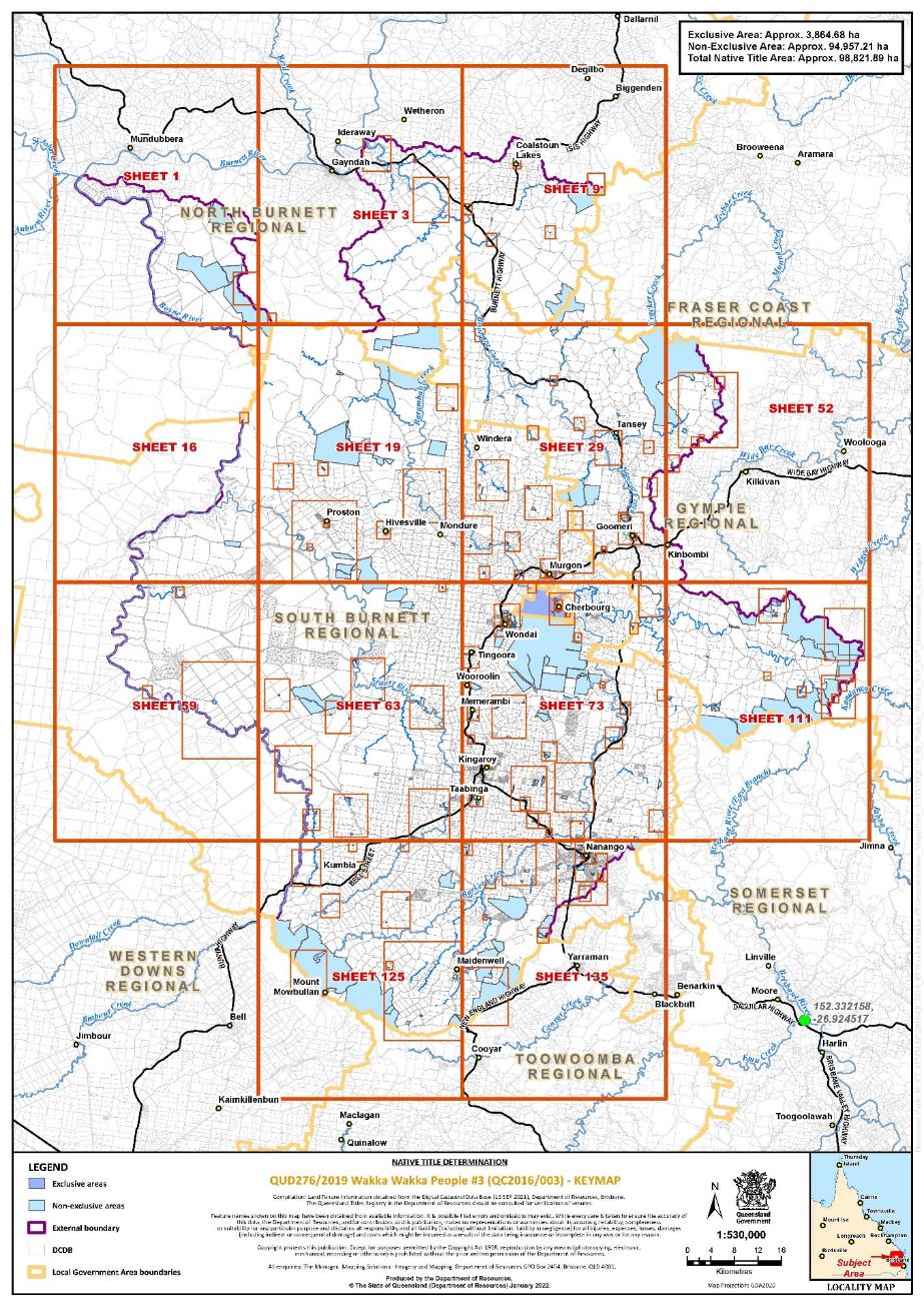
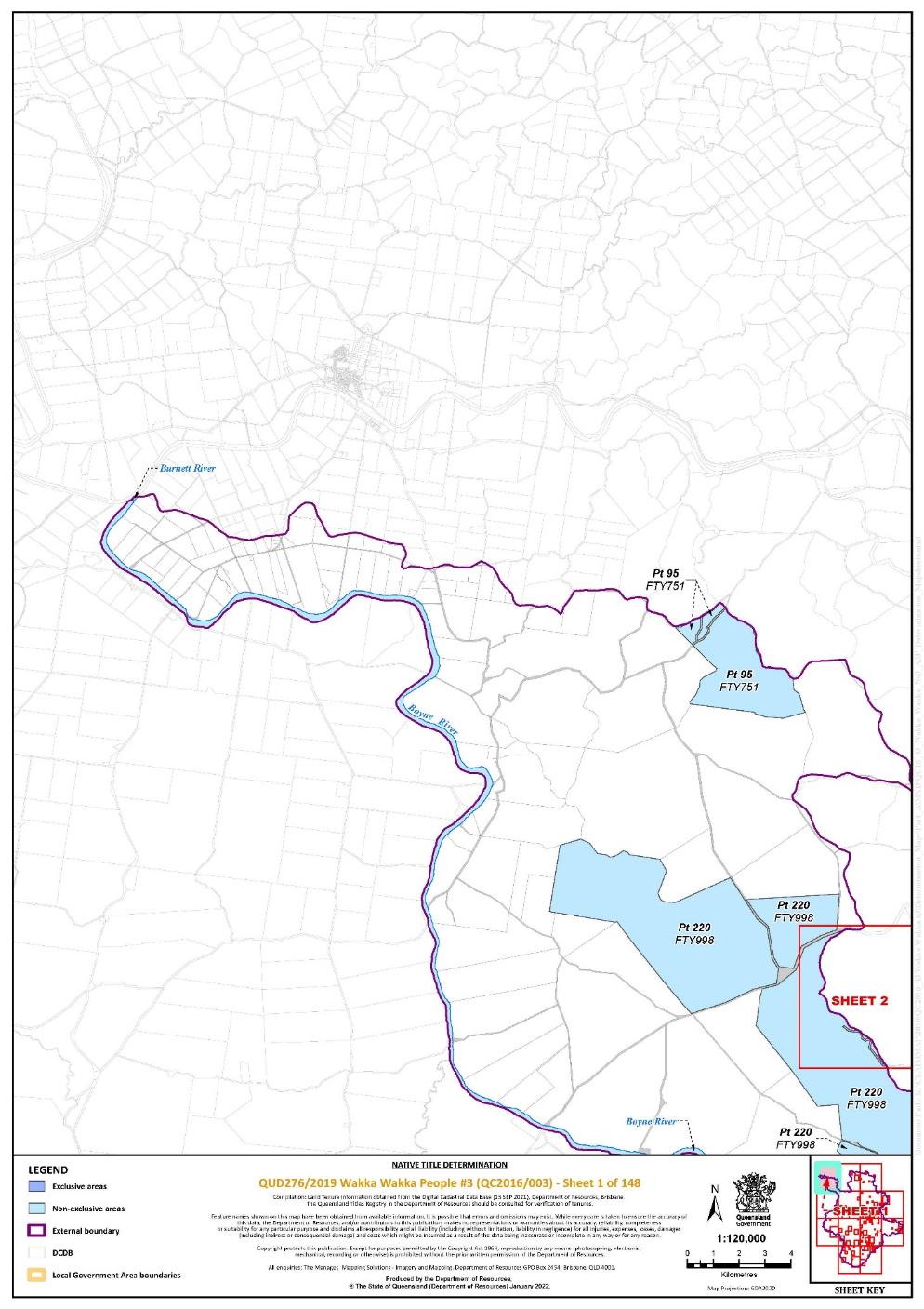
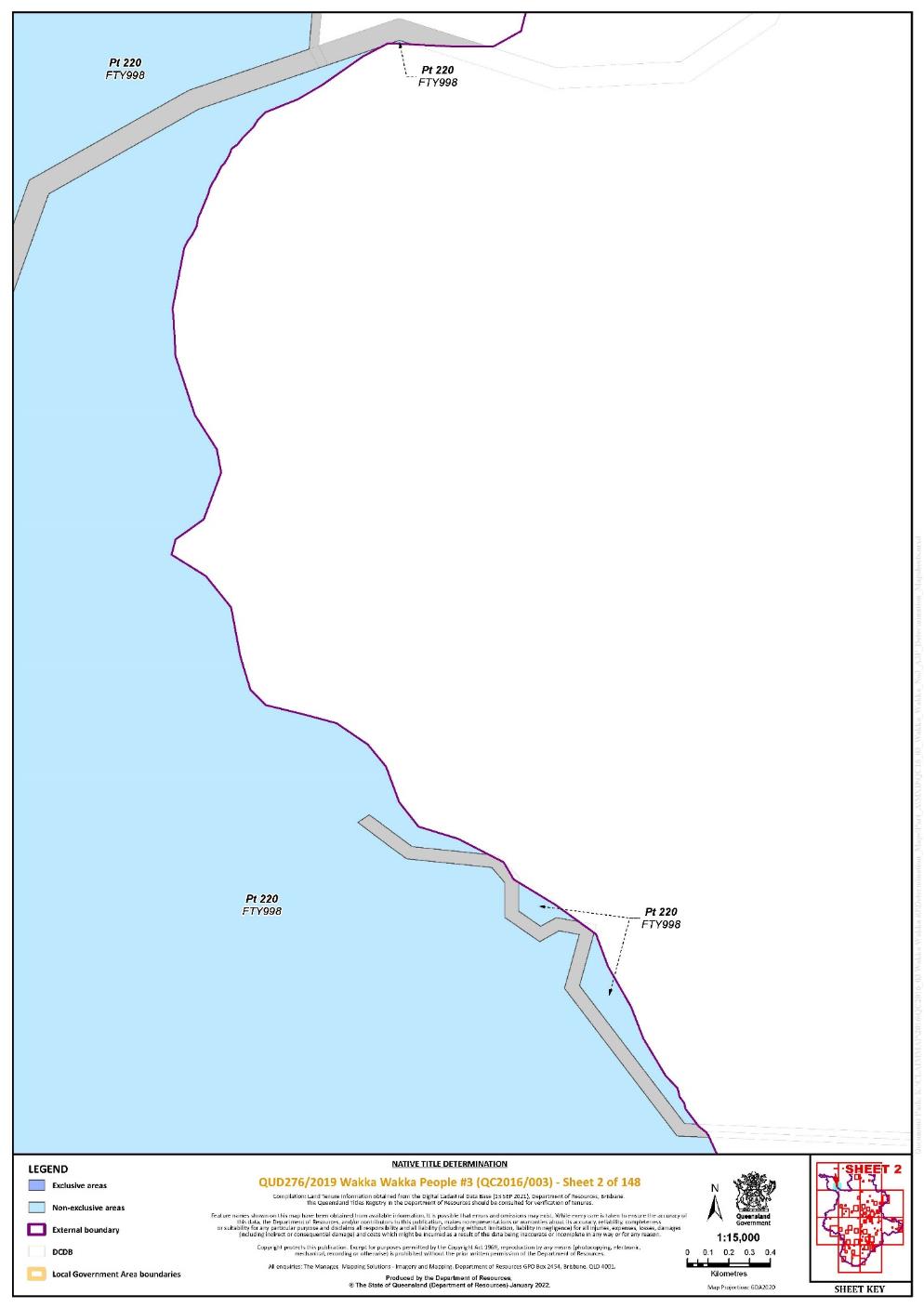
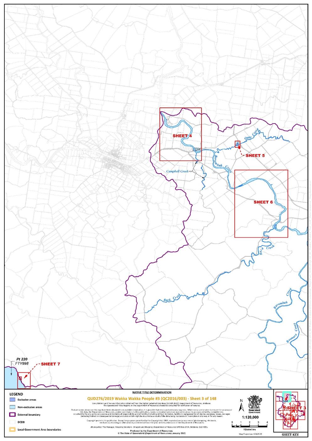
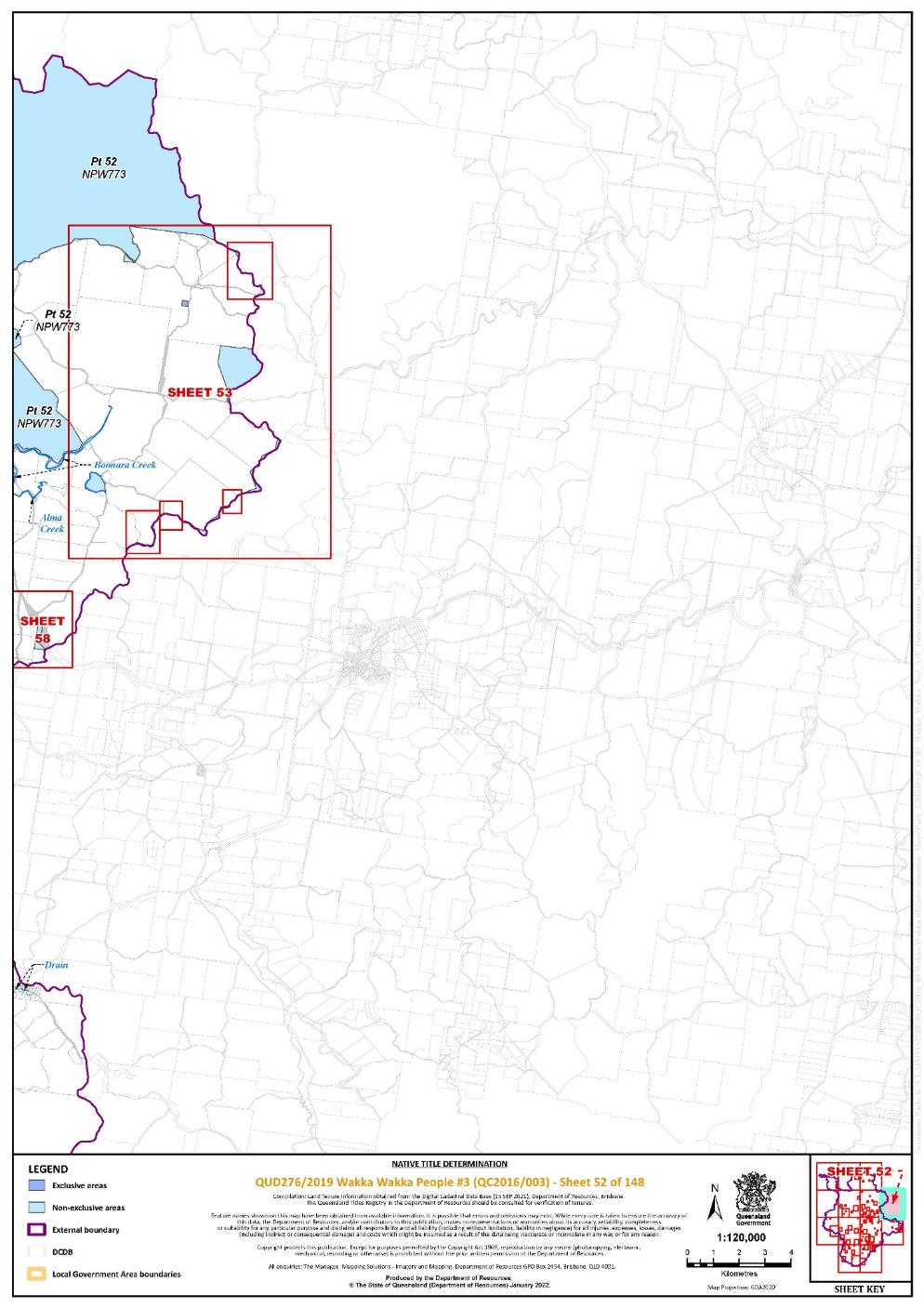
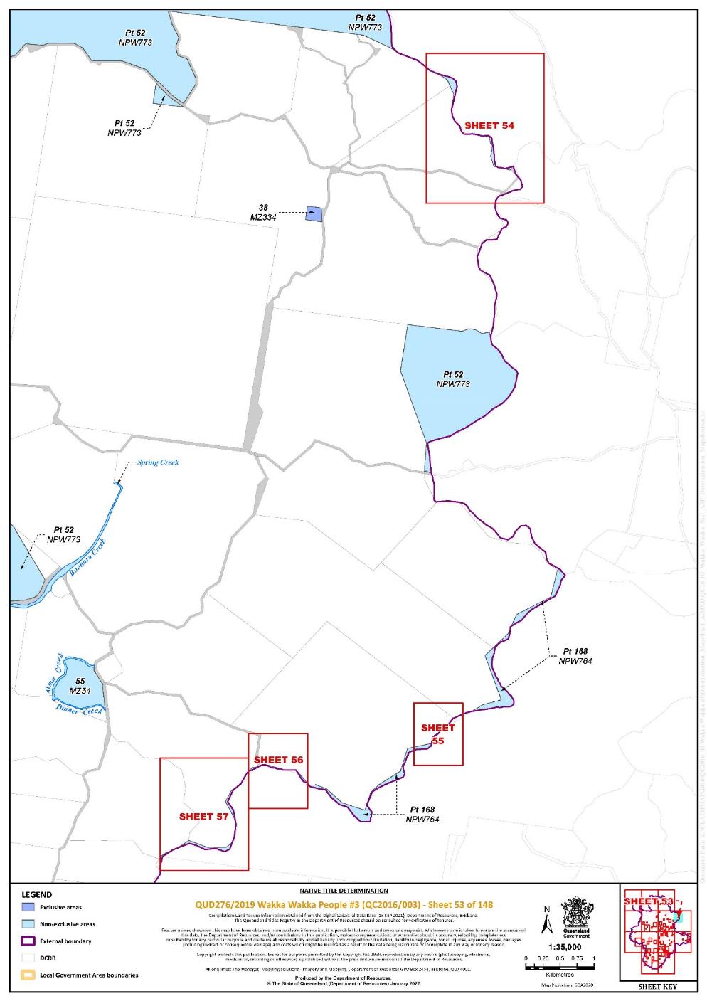
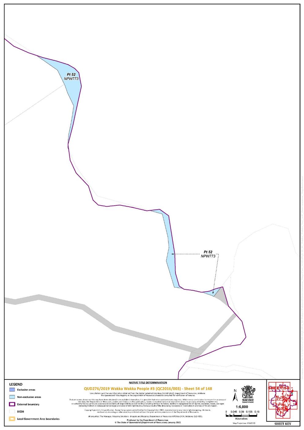
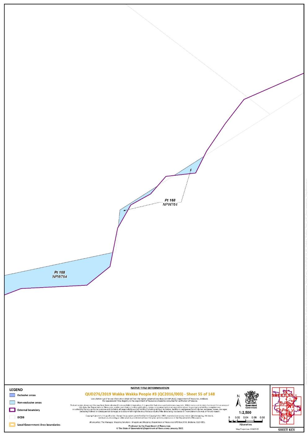
3. The determination area is the land and waters described in Schedule 4 and depicted in the map attached to Schedule 6 to the extent those areas are within the External Boundary and not otherwise excluded by the terms of Schedule 5 (the Determination Area). To the extent of any inconsistency between the written description and the map, the written description prevails.
4. Native title exists in the Determination Area.
5. The native title is held by the Wakka Wakka People described in Schedule 1 (the Native Title Holders).
6. Subject to orders 8, 9 and 10 below the nature and extent of the native title rights and interests in relation to the land and waters described in Part 1 of Schedule 4 are:
(a) other than in relation to Water, the right to possession, occupation, use and enjoyment of the area to the exclusion of all others; and
(b) in relation to Water, the non-exclusive rights to:
(i) hunt, fish and gather from the Water of the area;
(ii) take the Natural Resources of the Water in the area; and
(iii) take the Water of the area,
for personal, domestic and non-commercial communal purposes.
7. Subject to orders 8, 9 and 10 below the nature and extent of the native title rights and interests in relation to the land and waters described in Part 2 of Schedule 4 are the non-exclusive rights to:
(a) access, be present on, move about on and travel over the area;
(b) camp, and live temporarily on the area as part of camping, and for that purpose build temporary shelters;
(c) hunt, fish and gather on the land and waters of the area for personal, domestic and non-commercial communal purposes;
(d) take Natural Resources from the land and waters of the area for personal, domestic and non-commercial communal purposes;
(e) take the Water of the area for personal, domestic and non-commercial communal purposes;
(f) conduct ceremonies on the area;
(g) bury Native Title Holders within the area;
(h) maintain places of importance and areas of significance to the Native Title Holders under their traditional laws and customs and protect those places and areas from physical harm;
(i) teach on the area the physical and spiritual attributes of the area;
(j) hold meetings on the area;
(k) light fires on the area for domestic purposes including cooking, but not for the purpose of hunting or clearing vegetation; and
(l) be accompanied onto the area by certain persons who, though not Native Title Holders, are:
(i) spouses of Native Title Holders; or
(ii) persons required or permitted under the traditional laws acknowledged and traditional customs observed by the Native Title Holders for the performance of, assistance with, or participation in rituals or ceremonies.
8. The native title rights and interests are subject to and exercisable in accordance with:
(a) the Laws of the State and the Commonwealth; and
(b) the traditional laws acknowledged and traditional customs observed by the Native Title Holders.
9. The native title rights and interests referred to in orders 6(b) and 7 do not confer possession, occupation, use or enjoyment to the exclusion of all others.
10. There are no native title rights in or in relation to minerals as defined by the Mineral Resources Act 1989 (Qld) and petroleum as defined by the Petroleum Act 1923 (Qld) and the Petroleum and Gas (Production and Safety) Act 2004 (Qld).
11. The nature and extent of any other interests in relation to the Determination Area (or respective parts thereof) are set out in Schedule 2.
12. The relationship between the native title rights and interests described in orders 6 and 7 and the other interests described in Schedule 2 (the Other Interests) is that:
(a) the Other Interests continue to have effect, and the rights conferred by or held under the Other Interests may be exercised notwithstanding the existence of the native title rights and interests;
(b) to the extent the Other Interests are inconsistent with the continued existence, enjoyment or exercise of the native title rights and interests in relation to the land and waters of the Determination Area, the native title continues to exist in its entirety but the native title rights and interests have no effect in relation to the Other Interests to the extent of the inconsistency for so long as the Other Interests exist; and
(c) the Other Interests and any activity that is required or permitted by or under, and done in accordance with, the Other Interests, or any activity that is associated with or incidental to such an activity, prevail over the native title rights and interests and any exercise of the native title rights and interests.
DEFINITIONS AND INTERPRETATION
13. In this determination, unless the contrary intention appears:
“Animal” means any member of the animal kingdom (other than human), whether alive or dead; |
“External Boundary” means the area described in Schedule 3; |
“land” and “waters”, respectively, have the same meanings as in the Native Title Act 1993 (Cth); |
“Laws of the State and the Commonwealth” means the common law and the laws of the State of Queensland and the Commonwealth of Australia, and includes legislation, regulations, statutory instruments, local planning instruments and local laws; |
“Local Government Act” has the meaning given in the Local Government Act 2009 (Qld); |
“Local Government” has the meaning given in the Local Government Act 2009 (Qld); |
“Local Government Area” has the meaning given in the Local Government Act 2009 (Qld); |
“Natural Resources” means:
|
“Plant” means any member of the plant or fungus kingdom, whether alive or dead and standing or fallen; |
“Reserve” means a reserve dedicated or taken to be a reserve under the Land Act 1994 (Qld); “Water” means:
“Works” has the same meaning as in the Electricity Act 1994 (Qld). |
Other words and expressions used in this determination have the same meanings as they have in Part 15 of the Native Title Act 1993 (Cth).
THE COURT DETERMINES THAT:
14. The native title is held in trust.
15. The Wakka Wakka Native Title Aboriginal Corporation (ICN: 8903), incorporated under the Corporations (Aboriginal and Torres Strait Islander) Act 2006 (Cth), is to:
(a) be the prescribed body corporate for the purpose of ss 56(2)(b) and 56(3) of the Native Title Act 1993 (Cth); and
(b) perform the functions mentioned in s 57(1) of the Native Title Act 1993 (Cth) after becoming a registered native title body corporate.
Note: Entry of orders is dealt with in Rule 39.32 of the Federal Court Rules 2011.
SCHEDULE 1
NATIVE TITLE HOLDERS
1. The Native Title Holders are the Wakka Wakka People. The Wakka Wakka People are those people who identify as Wakka Wakka in accordance with traditional laws acknowledged and traditional customs observed by them and who are the descendants of one or more of the following people:
(a) Jenny Carlo and David Carlo (parents of Princess Carlo);
(b) Minnie Bly (mother of Thomas Simpson), Ethel and Bill Button (father of Ethel Button);
(c) Mother of Maggie Hart (grandmother of Crabbie Chapman and Henry Hart);
(d) Mother of Willie Boy Pickering;
(e) King Billy and Maria of Boondooma (parents of Tommy Dodd of Taabinga);
(f) Maggie West;
(g) Kitty of Boonara;
(h) MiMi;
(i) Kitty (mother of Jack Bulong);
(j) John Bond;
(k) Kitty (mother of Jenny Lind), Jenny Lind and Mick Buck;
(l) Boubijan Cobbo;
(m) Stockman Bligh and Aggie Bligh;
(n) Tommy (aka Boondoon) and Maggie (parents of Willie Bone), Billy McKenzie (father of Chlorine McKenzie), Chlorine McKenzie;
(o) Kate/Katie/Kitty Law;
(p) Emily of Degilbo (mother of Annie);
(q) Taabinga Harry.
SCHEDULE 2
OTHER INTERESTS IN THE DETERMINATION AREA
The nature and extent of the other interests in relation to the Determination Area are the following as they exist as at the date of the determination:
1. The rights and interests of the parties under the following agreements registered on the Register of Indigenous Land Use Agreements:
(a) Florence Bell, Michael Bond Snr, Patricia Bond, Cynthia Button, Kevin Doolan, Arnold Murray, and Carl Simpson on behalf of the Wakka Wakka People #3 (QI2018/019) and the Gympie Regional Council, registered on 13 December 2018 (the Wakka Wakka People #3 and the Gympie Regional Council Indigenous Land Use Agreement); and
(b) TEC Coal Pty Ltd and Stanwell Corporation Limited under the Wakka Wakka #2 and Tarong ILUA (QI2008/027), dated 16 March 2009, between Cyril Couchy, David Anthony Beezley, George Bone, Kevin John Doolan, Michael Bond, Oscar Chapman, Robert Lacy, Beryl Gambrill, Pam Peggy Duncan and Patricia Dawn Bond, on their own behalf and on behalf of the Wakka Wakka People, and TEC Coal Pty Ltd and Tarong Energy Corporation Limited, which was registered on the Register of Indigenous Land Use Agreements on 8 September 2009.
2. The rights and interests of the holders of the following leases or permits granted pursuant to the Land Act 1962 (Qld) or Land Act 1994 (Qld):
(a) term lease for grazing purposes TL0/235010 over Lot 313 on FY509;
(b) term lease for grazing purposes TL0/234138 over Lot 5 on MZ21, within Lot 255 on FTY1025;
(c) term lease for grazing purposes TL0/239788 over Lot A on MZ1179, within Lot 342 on MZ1078;
(d) term lease for grazing purposes TL0/241719 over Lot A on MZ1067, within Lot 108 on MZ1067;
(e) term lease for pastoral purposes TL0/231460 over Lot 14 on MZ830, within Lot 220 on FTY998;
(f) rolling term lease for grazing purposes TL0/212600 over Lot 57 on BO406 and Lot 8 on BO516;
(g) rolling term lease for grazing purposes TL0/234223 over Lot 18 on BO77;
(h) rolling term lease for grazing purposes TL0/231052 over Lot 30 on BO560; and
(i) permit to occupy PO 0/230732 over Lot A on AP14756, within Lot 44 on BO391.
3. The rights and interests of the holders of the following tenements granted pursuant to the Mineral Resources Act 1989 (Qld):
(a) mineral development licence MDL 200;
(b) mineral development licence MDL 201; and
(c) mining lease ML 6674.
4. The rights and interests of Telstra Corporation Limited (ACN 051 775 556):
(a) as the owner or operator of telecommunications facilities within the Determination Area;
(b) created pursuant to the Post and Telegraph Act 1901 (Cth), the Telecommunications Act 1975 (Cth), the Australian Telecommunications Corporation Act 1989 (Cth), the Telecommunications Act 1991 (Cth) and the Telecommunications Act 1997 (Cth), including rights:
(i) to inspect land;
(ii) to install, occupy and operate telecommunications facilities; and
(iii) to alter, remove, replace, maintain, repair and ensure the proper functioning of its telecommunications facilities;
(c) for its employees, agents or contractors to access its telecommunications facilities in and in the vicinity of the Determination Area in the performance of their duties; and
(d) under any lease, licence, access agreement, permit or easement relating to its telecommunications facilities in the Determination Area.
5. The rights and interests of Ergon Energy Corporation (ACN 087 646 062):
(a) as the owner and operator of any Works within the Determination Area;
(b) as a distribution entity and the holder of a distribution authority under the Electricity Act 1994 (Qld);
(c) created under the Electricity Act 1994 (Qld) and the Government Owned Corporations Act 1993 (Qld) including:
(i) rights in relation to any agreement relating to the Determination Area existing or entered into before the date on which these orders are made;
(ii) rights to enter the Determination Area by its employees, agents or contractors to exercise any of the rights and interests referred to in this paragraph; and
(iii) to inspect, maintain and manage any Works in the Determination Area.
6. The rights and interests of Sunwater Limited, including:
(a) an estate in Sunwater land (vested) in Lot 502 on FY2592;
(b) rights, interests and responsibilities as owner, occupier and operator of dams (including impoundment areas), weirs, pipelines, barrages, channels, water treatment plants and other such infrastructure located within the Determination Area;
(c) rights, interests and responsibilities under the Water Act 2000 (Qld) and the Water Supply (Safety and Reliability) Act 2008 (Qld), including as a water service provider, resource operations licence holder and bulk water supplier; and
(d) rights to enter the Determination Area by its employees, agents or contractors to exercise any of the rights and interests referred to in this paragraph 6 of Schedule 2.
7. The rights and interests of Stanwell Corporation Limited:
(a) as the owner and operator of electricity generation and associated facilities in the Determination Area;
(b) as an electricity entity, as that term is defined in the Electricity Act 1994 (Qld), including:
(i) as the holder of a generation authority under the Electricity Act 1994 (Qld);
(ii) rights to enter the Determination Area by its employees, agents or contractors, at any reasonable time, to exercise any of the rights and interests referred to in this paragraph, including to access, inspect, operate, manage, maintain, repair, replace, upgrade or otherwise deal with any electricity generation or associated facilities in the Determination Area; and
(iii) as the owner and operator of the Wivenhoe Dam - Tarong Power Station Pipeline, including the rights to enter the Determination Area by its employees, agents or contractors, at any reasonable time, to access, inspect, operate, manage, maintain, repair, replace, upgrade or otherwise deal with the said pipeline.
(c) arising under the
(i) Cultural Heritage Management Plan - Northern Land Ash Emplacement Project, dated 8 September 2008, between Pam Duncan, Beryl Gambril and George Bone, as Endorsed Aboriginal Parties, and Tarong Energy Corporation Limited, which was approved by a delegate of the Chief Executive under section 107 of the Aboriginal Cultural Heritage Act 2003 (Qld) on 7 May 2009.
8. The rights and interests of Stanwell Corporation Limited and TEC Coal Pty Ltd arising under the Cultural Heritage Investigation Agreement, dated 8 September 2006, as varied on or about 5 September 2008, between Beryl Gambrill, Pam Duncan, Duncan Cobbo, George Bone, Patty Bond and Michael Bond, as Wakka Wakka No. 2 Aboriginal Parties, and Tarong Energy Corporation Limited.
9. The rights and interests of Gympie Regional Council, North Burnett Regional Council, and South Burnett Regional Council (jointly ‘Council’):
(a) under their local government jurisdiction and functions under the Local Government Act 2009 (Qld), under the Stock Route Management Act 2002 (Qld), under any other Local Government Act, or under any other legislation, for that part of the Determination Area within the area declared to be their respective Local Government Areas;
(b) as the:
(i) lessor under any leases which were validly entered into before the date on which these orders are made and whether separately particularised in these orders or not;
(ii) grantor of any licences or other rights and interests which were validly granted before the date on which these orders were made and whether separately particularised in these orders or not;
(iii) holder of any estate or any other interest in land;
(iv) trustee of any Reserves or holder of any interest under access agreements or easements;
(c) as the owner and operator of infrastructure, structures, earthworks, access works and any other facilities and other improvements located in the Determination Area validly constructed or established on or before the date on which these orders are made, including but not limited to:
(i) undedicated but constructed roads except for those not operated by Council;
(ii) water pipelines and water supply infrastructure;
(iii) drainage facilities;
(iv) watering point facilities;
(v) recreational facilities;
(vi) transport facilities;
(vii) gravel pits operated by Council;
(viii) cemetery and cemetery related facilities; and
(ix) community facilities;
(d) to enter the land for the purposes described in paragraphs 9(a), 9(b) and 9(c) above by their employees, agents or contractors to:
(i) exercise any of the rights and interests referred to in this paragraph 9 and paragraph 10 below;
(ii) use, operate, inspect, maintain, replace, restore and repair the infrastructure, facilities and other improvements referred to in paragraph 9(c) above; and
(iii) undertake operational activities in its capacity as a Local Government such as feral animal control, erosion control, waste management and fire management.
10. The rights and interests of the State of Queensland, the Gympie Regional Council, North Burnett Regional Council and South Burnett Regional Council to access, use, operate, maintain and control the dedicated roads in the Determination Area and the rights and interests of the public to use and access the roads.
11. The rights and interests of the State of Queensland in Reserves, the rights and interests of the trustees of those Reserves and the rights and interests of the persons entitled to access and use those Reserves for the respective purpose for which they are reserved.
12. The rights and interests of the State of Queensland or any other person existing by reason of the force and operation of the laws of the State of Queensland, including those existing by reason of the following legislation or any regulation, statutory instrument, declaration, plan, authority, permit, lease or licence made, granted, issued or entered into under that legislation:
(a) the Land Act 1994 (Qld);
(b) the Nature Conservation Act 1992 (Qld);
(c) the Forestry Act 1959 (Qld);
(d) the Water Act 2000 (Qld);
(e) the Petroleum Act 1923 (Qld) or Petroleum and Gas (Production and Safety) Act 2004 (Qld);
(f) the Mineral Resources Act 1989 (Qld);
(g) the Planning Act 2016 (Qld);
(h) the Transport Infrastructure Act 1994 (Qld);
(i) the Fire and Emergency Services Act 1990 (Qld) or Ambulance Service Act 1991 (Qld);
(j) the Fisheries Act 1994 (Qld);
(k) the Vegetation Management Act 1999 (Qld); and
(l) the Stock Route Management Act 2002 (Qld).
13. So far as confirmed pursuant to s 212(2) of the Native Title Act 1993 (Cth) and s18 of the Native Title (Queensland) Act 1993 (Qld) as at the date of this Determination, any existing rights of the public to access and enjoy the following places in the Determination Area:
(a) waterways;
(b) beds and banks or foreshores of waterways;
(c) stock routes; or
(d) areas that were public places at the end of 31 December 1993;
14. The rights and interests of members of the public arising under the common law, including but not limited to the following:
(a) any subsisting public right to fish; and
(b) the public right to navigate.
15. Any other rights and interests:
(a) held by the State of Queensland or Commonwealth of Australia; or
(b) existing by reason of the force and operation of the Laws of the State and the Commonwealth.
SCHEDULE 3
EXTERNAL BOUNDARY
The area of land and waters commencing at the intersection of the western bank of the Boyne River and the southern bank of the Burnett River and extending north-easterly to the northern boundary of the Boyne & Auburn Rivers Sub Basin Catchment Area at Longitude 151.224701° East; then generally easterly and generally southerly along boundaries of that catchment area to its intersection with a northern boundary of the South Burnett Regional Council; then generally easterly along boundaries of that regional council to a corner at Longitude 151.653244° East; then north-easterly to the western boundary of the Barker & Barambah Creeks Sub Basin Catchment Area at Latitude 25.872210° South; then generally north-easterly, generally northerly and generally easterly along boundaries of that catchment area to the eastern boundary of the North Burnett Regional Council; then generally southerly along boundaries of that regional council to its intersection with the northern boundary of the Gympie Regional Council; then generally south-easterly, generally southerly, generally easterly and generally southerly along the boundaries of that regional council to its intersection with the eastern boundary of again the Barker & Barambah Creeks Sub Basin Catchment Area at Latitude 25.886767° South; then generally southerly along boundaries of that catchment area to Latitude 26.461603° South; then southerly to a corner on the southern boundary of again the Gympie Regional Council at Longitude 152.370770° East; then generally westerly and generally southerly along boundaries of that regional council, and southern and eastern boundaries of the South Burnett Regional Council to Latitude 26.663401° South; then westerly to the south-eastern boundary of again the Barker & Barambah Creeks Sub Basin Catchment Area at Longitude 152.074389° East; then generally south-westerly along boundaries of that catchment area to its intersection with the southern boundary of again the South Burnett Regional Council; then generally south-westerly and generally north-westerly along boundaries of that regional council to the south-western corner of Lot 94 on Plan BO27; then generally easterly along the southern boundary of that lot and southern boundaries of Lot 18 on Plan BO27 to the southernmost south-western corner of Lot 12 on Plan RP50030; then north-easterly to the headwaters of the Boyne River at Longitude 151.530431° East, Latitude 26.757979° South; then generally northerly, generally north-westerly, generally northerly and generally north-easterly along the centreline of that river to the intersection with the centreline of Lot 16 on SP107475, also Boondooma Lake (formerly the Boyne River) at Latitude 26.216134 South; then generally north-easterly along the centreline of that Lot, centrelines of Lot 18 on SP107475, Lot 13 on Plan SP107477 and Lot 20 on Plan SP142310 to the northern boundary of Lot 20 on Plan SP142310; then westerly along the boundary of that lot to the western bank of the Boyne River; then generally northerly and generally north-westerly along banks of that river back to the commencement point.
Exclusions
This external boundary description does not include any land and waters within the external boundaries of the following native title determinations and native title applications:
QUD31/2019 – Auburn Hawkwood People as determined by the Federal Court (25 November 2019).
QUD277/2019 – Wakka Wakka People #4 as accepted for registration (26 November 2021).
QUD20/2019 – Kabi Kabi First Nation as accepted for registration (3 November 2021).
Data Reference and Source
External boundary description compiled by Queensland South Native Title Services, based on spatial data sourced from the State of Queensland, Department of Resources (December 2021).
Cadastral data sourced from State of Queensland, Department of Resources (September 2021).
Local Government Boundaries (LGA) sourced from State of Queensland, Department of Resources (November 2020).
Where possible watercourse boundaries were derived from cadastral data elsewhere 1:250K Topographic Vector Data is © Commonwealth of Australia (Geoscience Australia) 2008.
Centreline of former Boyne River derived from cadastral data sourced from State of Queensland, Department of Resources (September 2021).
Catchment boundaries sourced from the Drainage Basin Sub-Areas data sourced from State of Queensland, Department of Resources (May 2021).
Reference Datum
Geographical coordinates are referenced to the Geocentric Datum of Australia 2020 (GDA 2020), in decimal degrees and are based on the spatial reference data acquired from the various custodians at the time.
Use of Coordinates
Where coordinates are used within the description to represent cadastral or topographical boundaries or the intersection with such, they are intended as a guide only. As an outcome to the custodians of cadastral and topographic data continuously recalculating the geographic position of their data based on improved survey and data maintenance procedures, it is not possible to accurately define such a position other than by detailed ground survey.
SCHEDULE 4
DESCRIPTION OF DETERMINATION AREA
The determination area comprises all of the land and waters described by lots on plan, or relevant parts thereof, and any rivers, streams, creeks or lakes described in the first column of the tables in the Parts immediately below, and depicted in the maps in Schedule 6, to the extent those areas are within the External Boundary and not otherwise excluded by the terms of Schedule 5.
Part 1 — Exclusive Areas
All of the land and waters described in the following table and depicted in dark blue on the determination map contained in Schedule 6:
Area description (at the time of the determination) | Determination Map Sheet Reference | Note | ||||||||||||||||||||||||
Lot 1 on Plan AP14515 | 73 | |||||||||||||||||||||||||
Lot 235 on Plan AP15643 | 76 | |||||||||||||||||||||||||
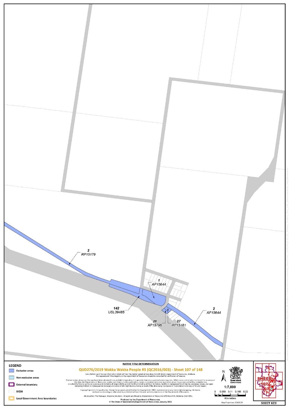
Lot 1 on Plan AP15644 | 107 | |||||||||||||||||||||||||
Lot 2 on Plan AP15644 | 107 | |||||||||||||||||||||||||
Lot 2 on Plan AP15645 | 139 | |||||||||||||||||||||||||
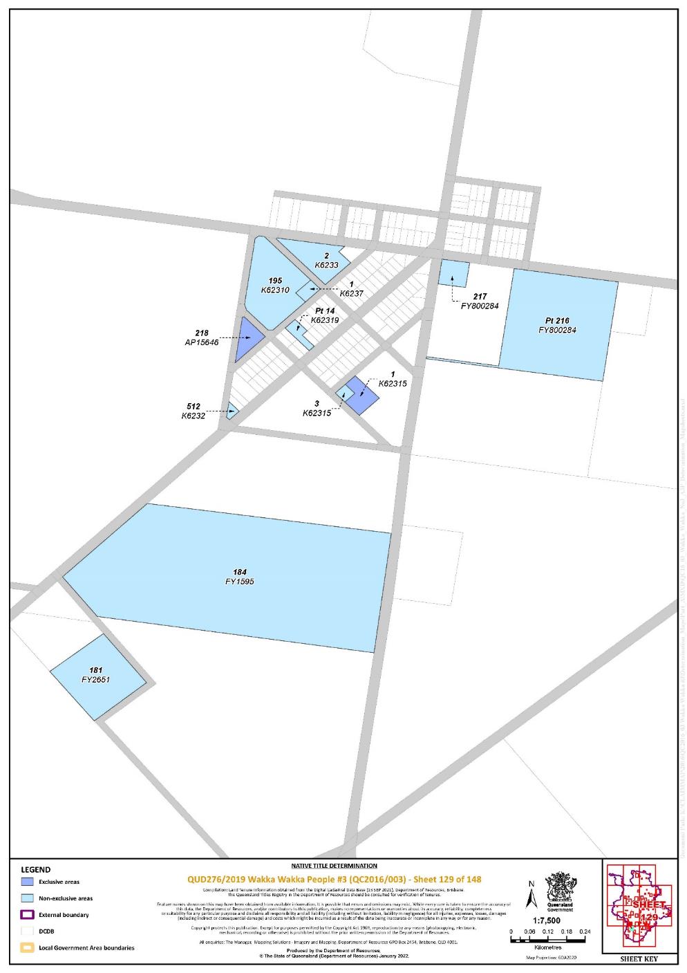
Lot 218 on Plan AP15646 | 129 | |||||||||||||||||||||||||
Lot 28 on Plan AP15796 | 107 | |||||||||||||||||||||||||
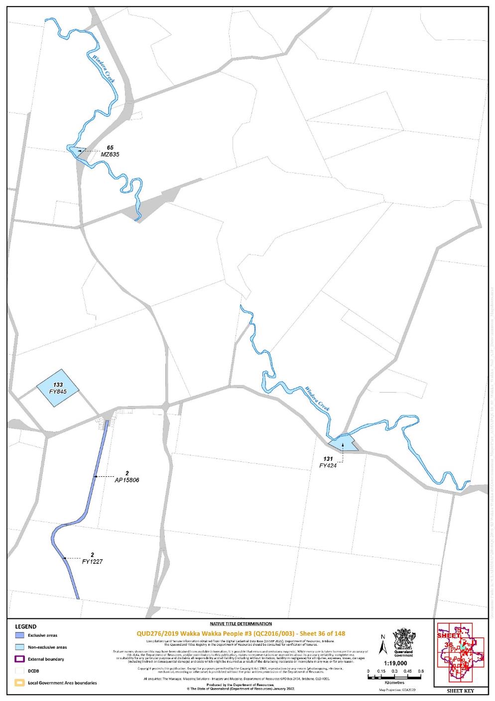
Lot 2 on Plan AP15806 | 36 | |||||||||||||||||||||||||
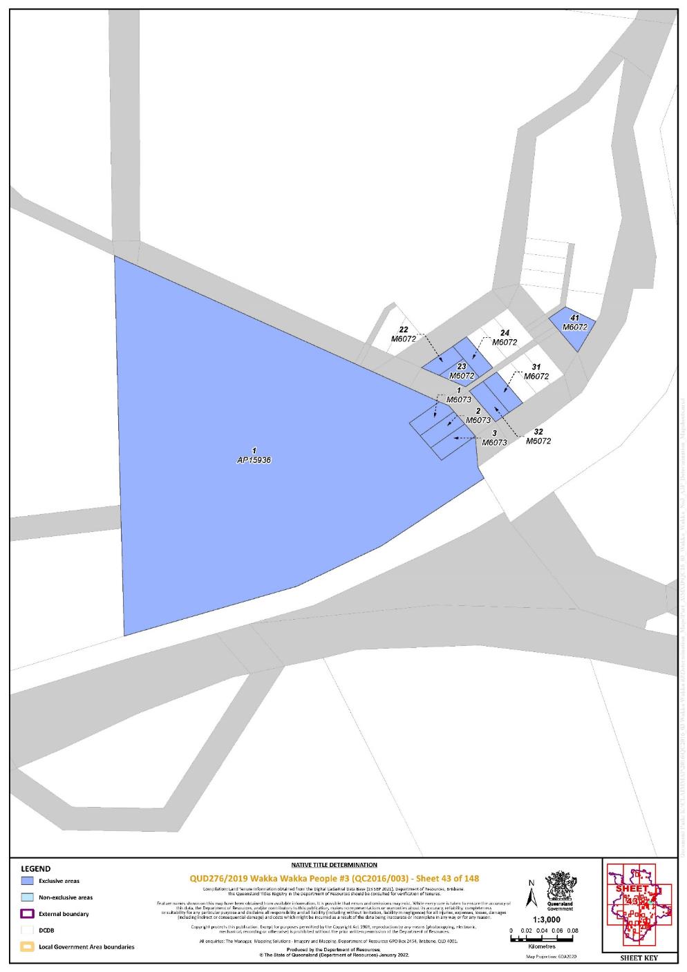
Lot 1 on Plan AP15936 | 43 | |||||||||||||||||||||||||
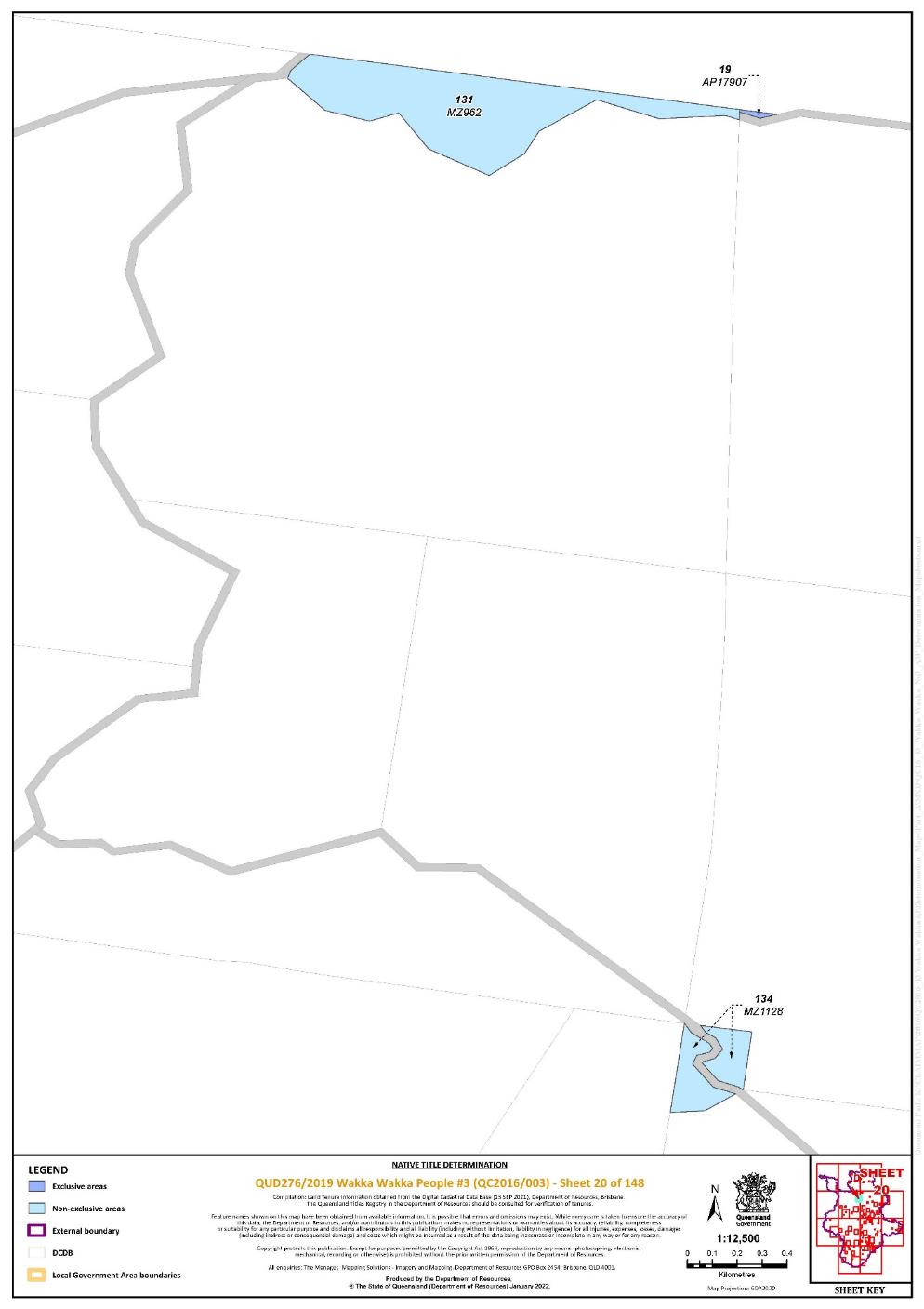
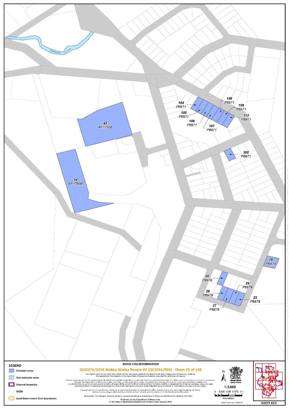
Lot 19 on Plan AP17907 | 20 | |||||||||||||||||||||||||
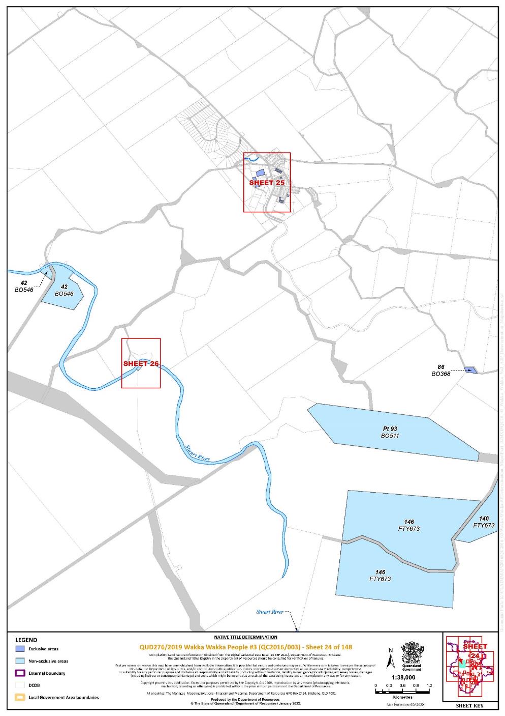
Lot 10 on Plan AP17908 | 25 | |||||||||||||||||||||||||
Lot 42 on Plan AP17908 | 25 | |||||||||||||||||||||||||
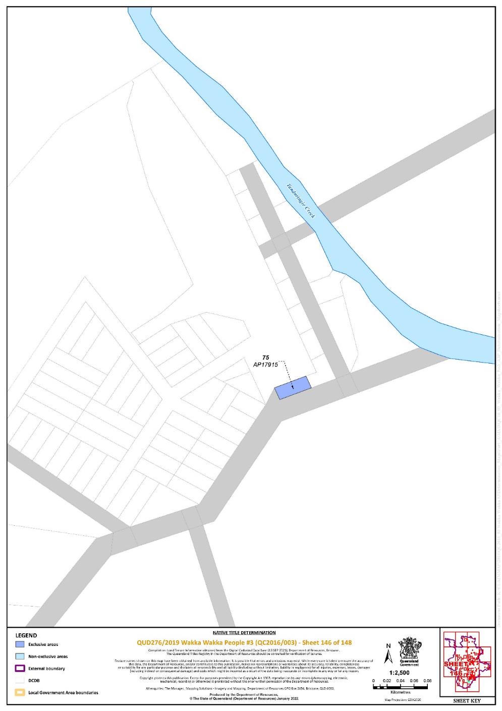
Lot 75 on Plan AP17915 | 146 | |||||||||||||||||||||||||
Lot 43 on Plan AP22151 | 111 | |||||||||||||||||||||||||
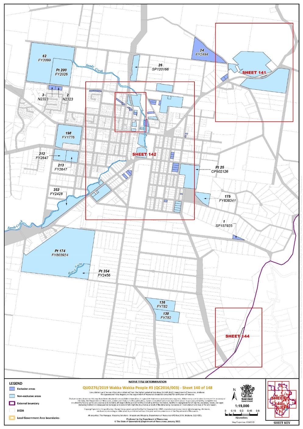
Lot 155 on Plan AP22161 | 142 | |||||||||||||||||||||||||
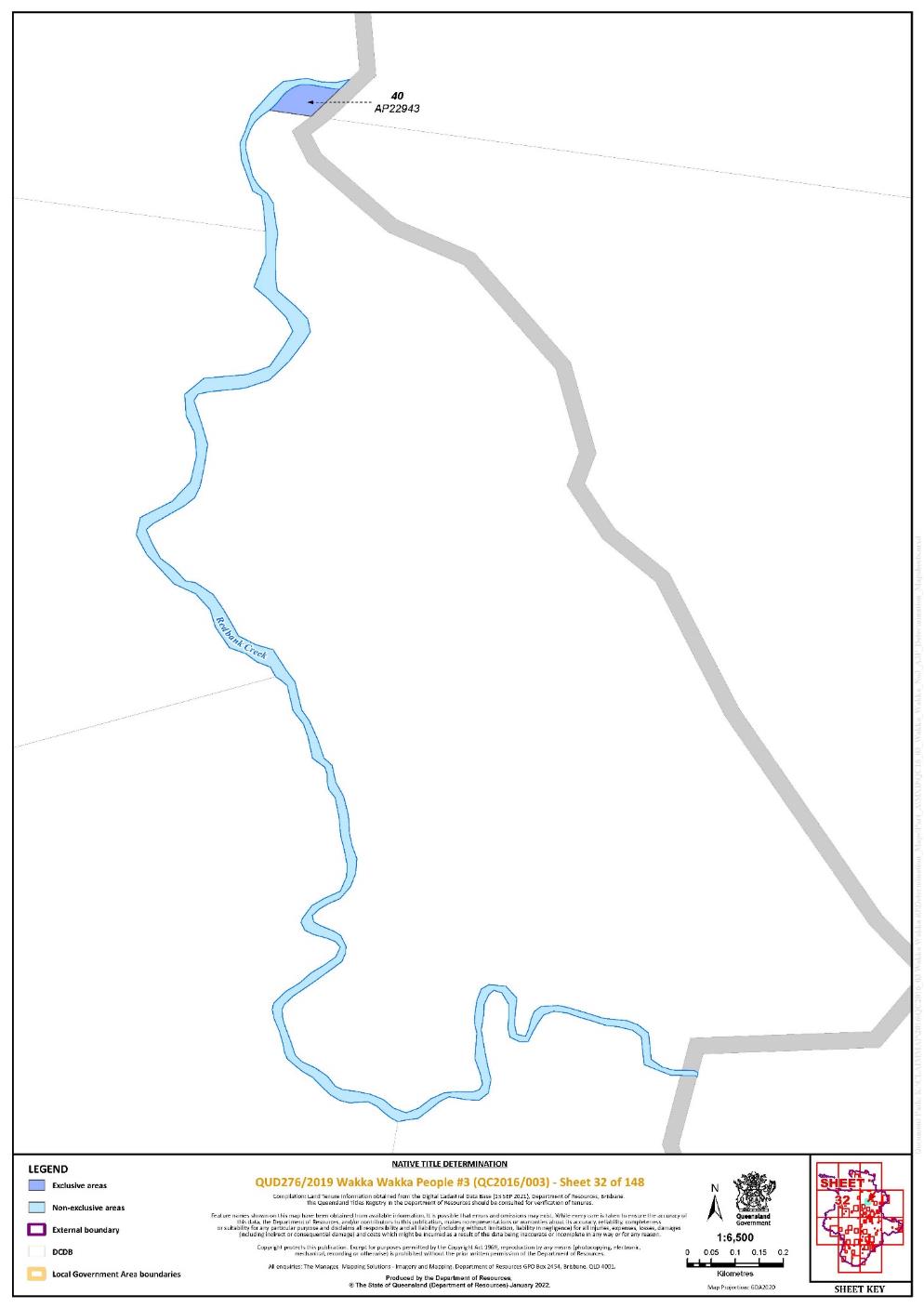
Lot 40 on Plan AP22943 | 32 | |||||||||||||||||||||||||
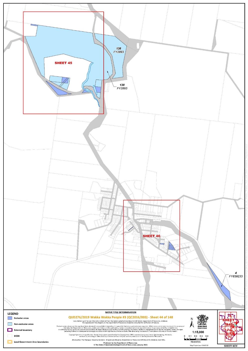
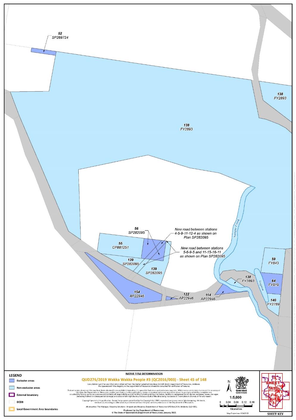
Lot 114 on Plan AP22946 | 45 | |||||||||||||||||||||||||
Lot 122 on Plan AP22946 | 45 | |||||||||||||||||||||||||
Lot 154 on Plan AP22946 | 45 | |||||||||||||||||||||||||
Lot 268 on AP23546 | 138 | |||||||||||||||||||||||||
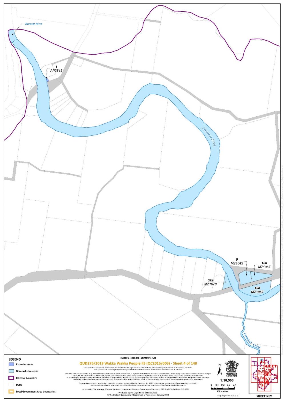
Lot 1 on Plan AP3815 | 4 | |||||||||||||||||||||||||
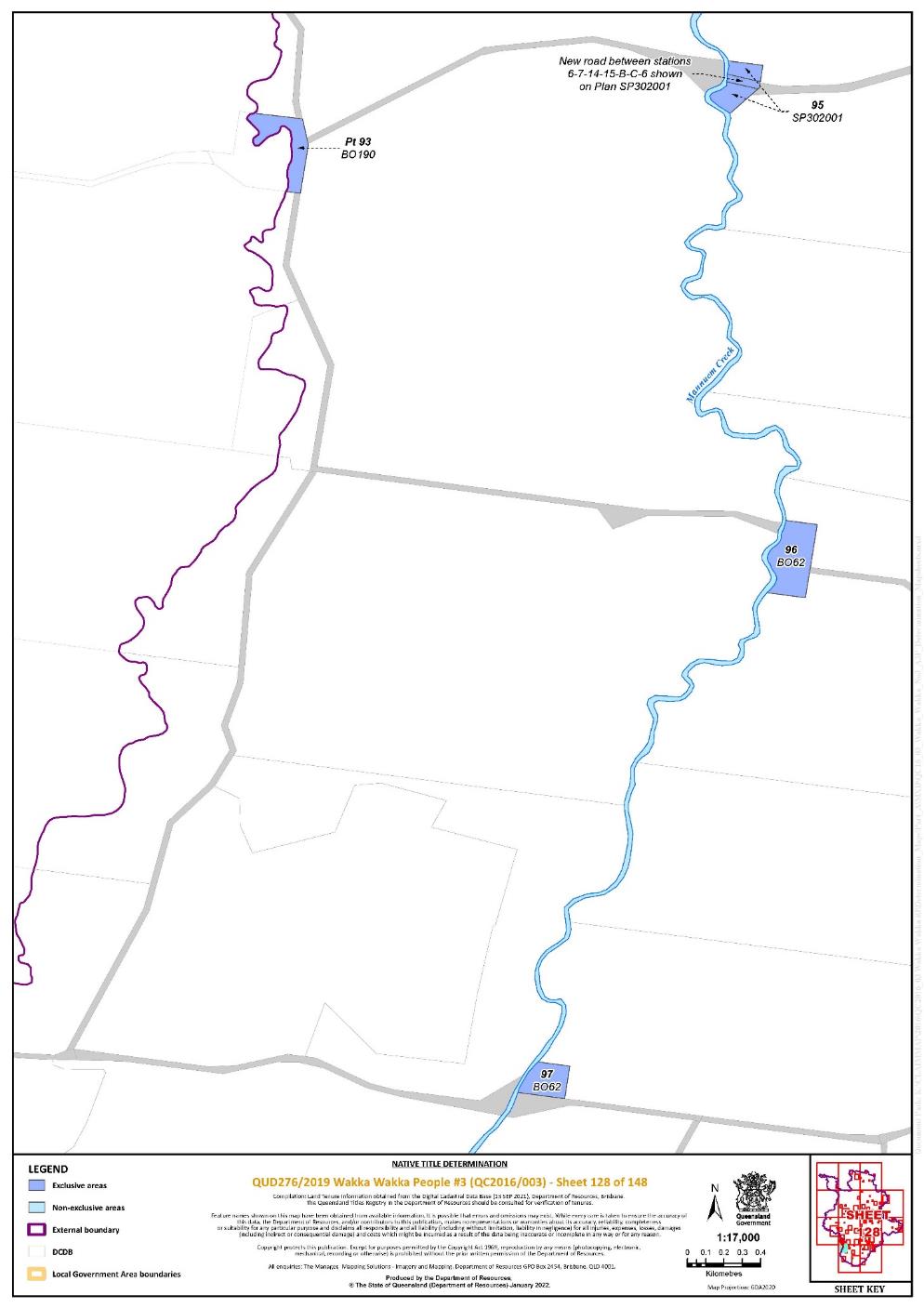
Lot 93 on Plan BO190 | 128 | Pt | ||||||||||||||||||||||||
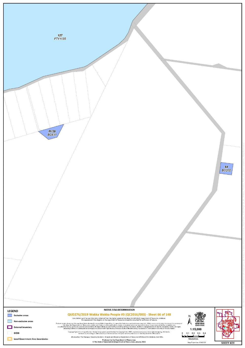
Lot 64 on Plan BO202 | 66 | |||||||||||||||||||||||||
Lot 86 on Plan BO368 | 24 | |||||||||||||||||||||||||
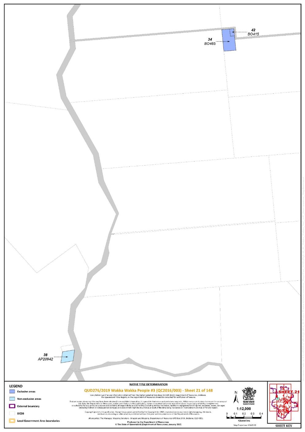
Lot 42 on Plan BO415 | 21 | |||||||||||||||||||||||||
Lot 34 on Plan BO465 | 21 | |||||||||||||||||||||||||
That part of Lot 59 on Plan BO611 excluding the area subject to historical Portion 9 on Plan BO78 | 66 | |||||||||||||||||||||||||
Lot 96 on Plan BO62 | 128 | |||||||||||||||||||||||||
Lot 97 on Plan BO62 | 128 | |||||||||||||||||||||||||
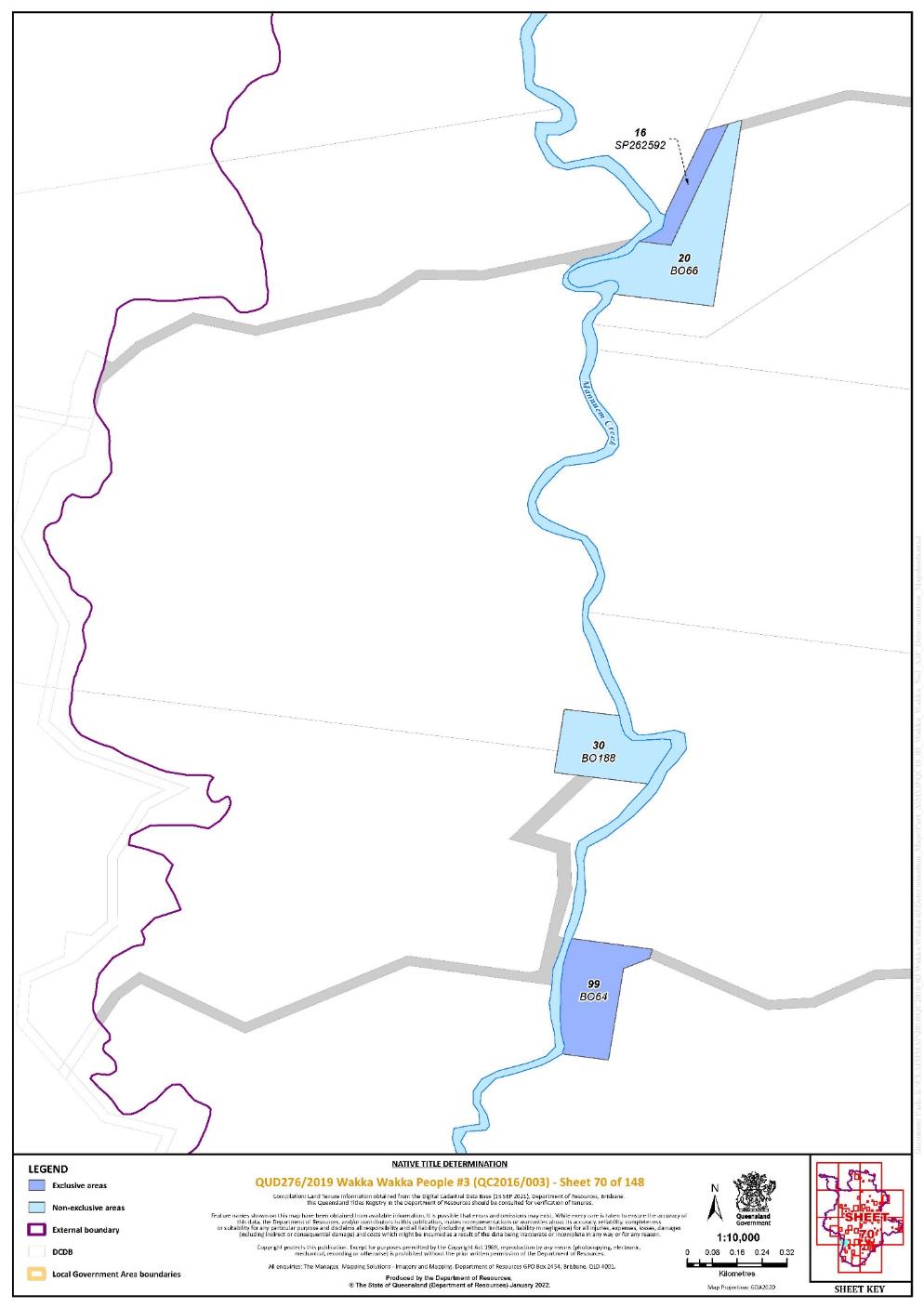
Lot 99 on Plan BO64 | 70 | |||||||||||||||||||||||||
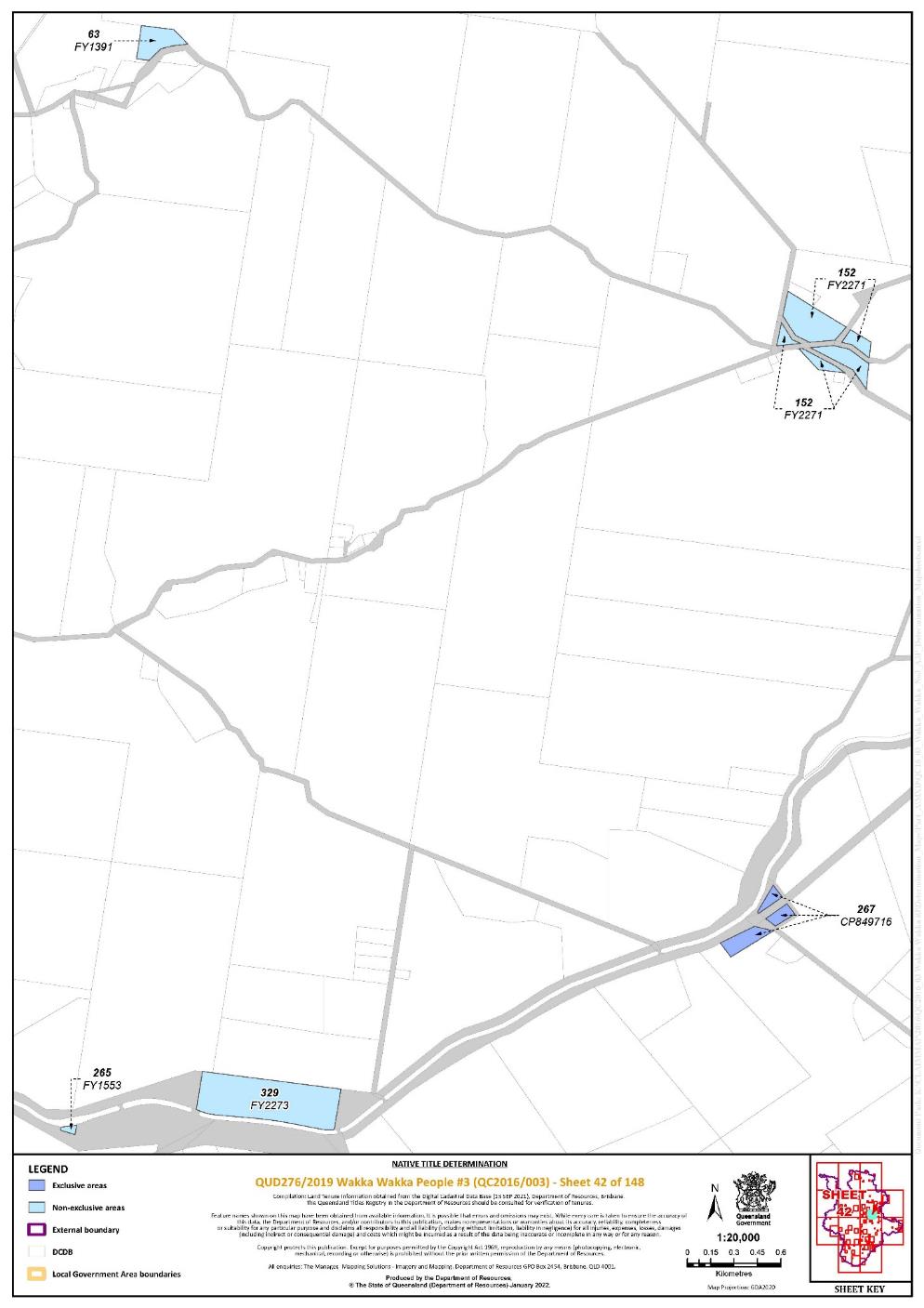
Lot 267 on Plan CP849716 | 42 | |||||||||||||||||||||||||
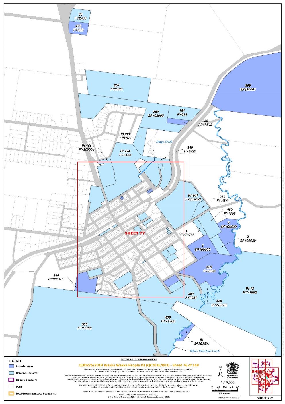
Lot 460 on Plan CP885105 | 76, 77 | |||||||||||||||||||||||||
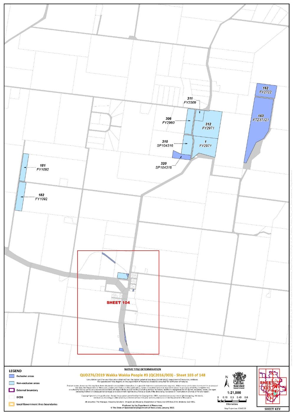
Lot 163 on Plan FTZ37121 | 103 | |||||||||||||||||||||||||
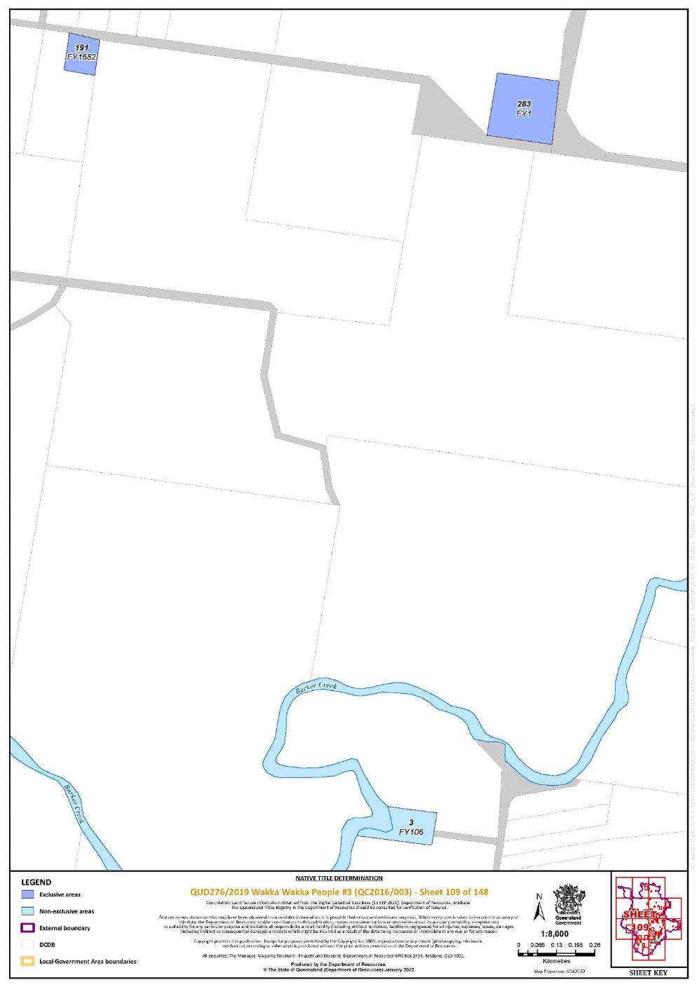
Lot 283 on Plan FY1 | 109 | |||||||||||||||||||||||||
Lot 2 on Plan FY1000 | 37 | |||||||||||||||||||||||||
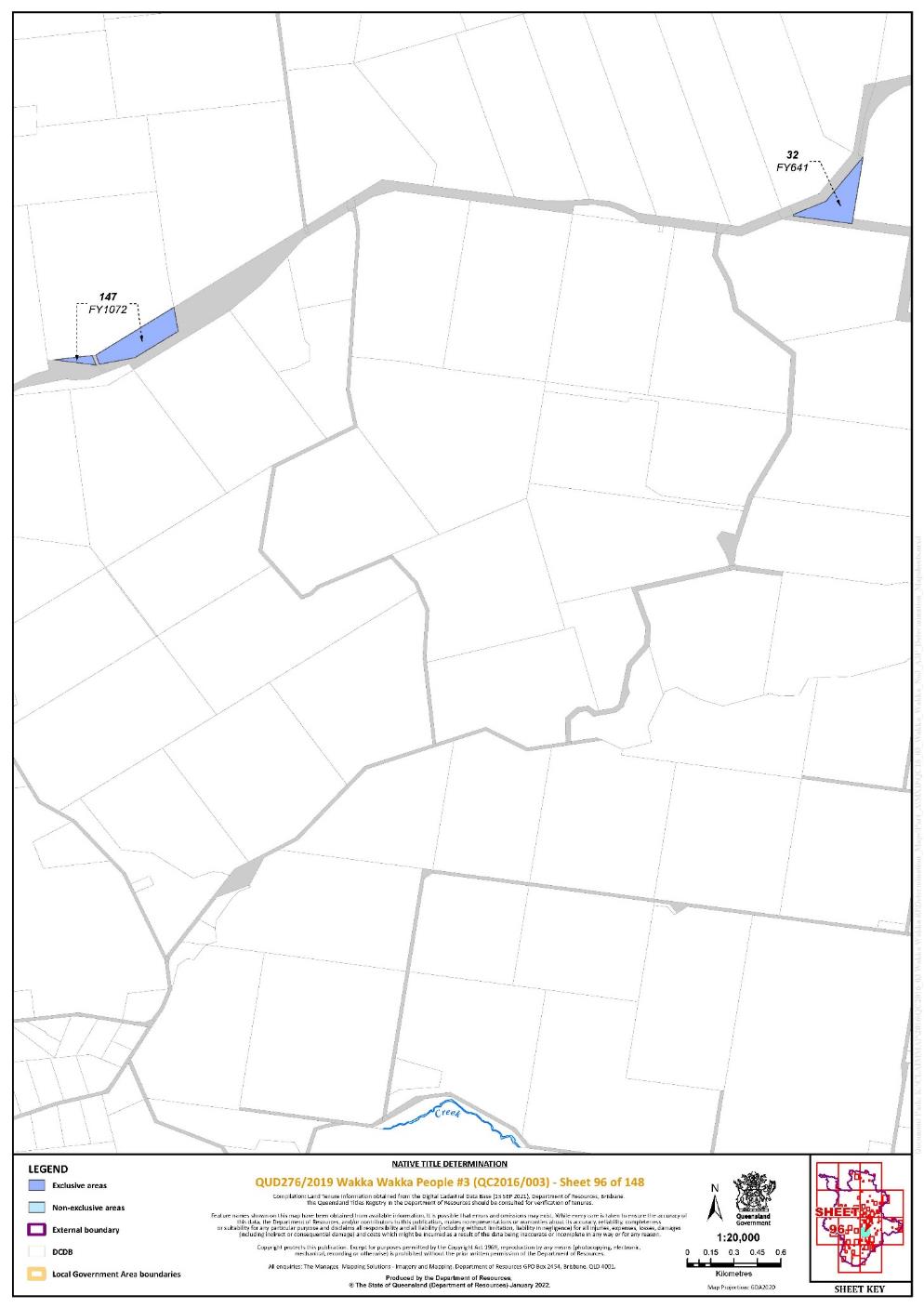
Lot 147 on Plan FY1072 | 96 | |||||||||||||||||||||||||
Lot 77 on Plan FY1173 | 130 | |||||||||||||||||||||||||
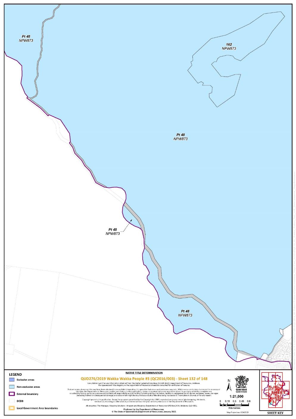
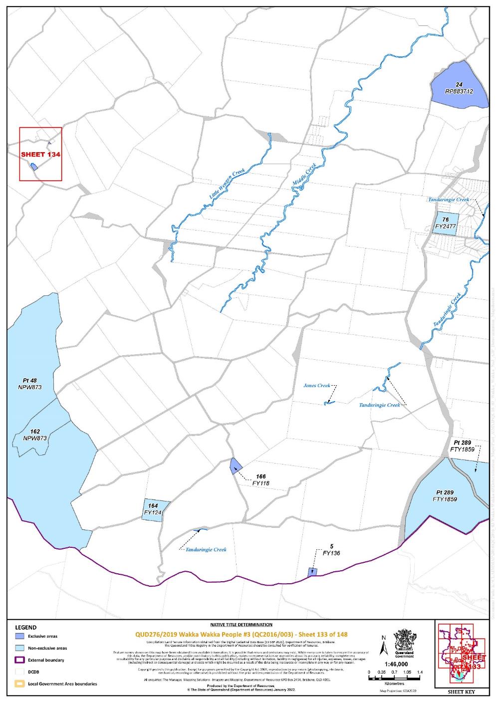
Lot 166 on Plan FY118 | 133 | |||||||||||||||||||||||||
Lot 2 on Plan FY1227 | 36 | |||||||||||||||||||||||||
Lot 5 on Plan FY136 | 133 | |||||||||||||||||||||||||
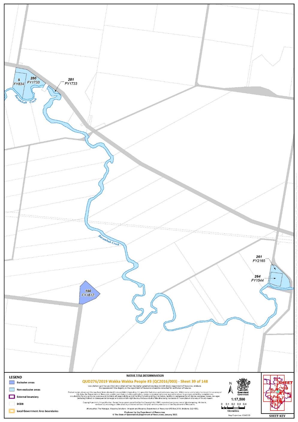
Lot 150 on Plan FY1612 | 39 | |||||||||||||||||||||||||
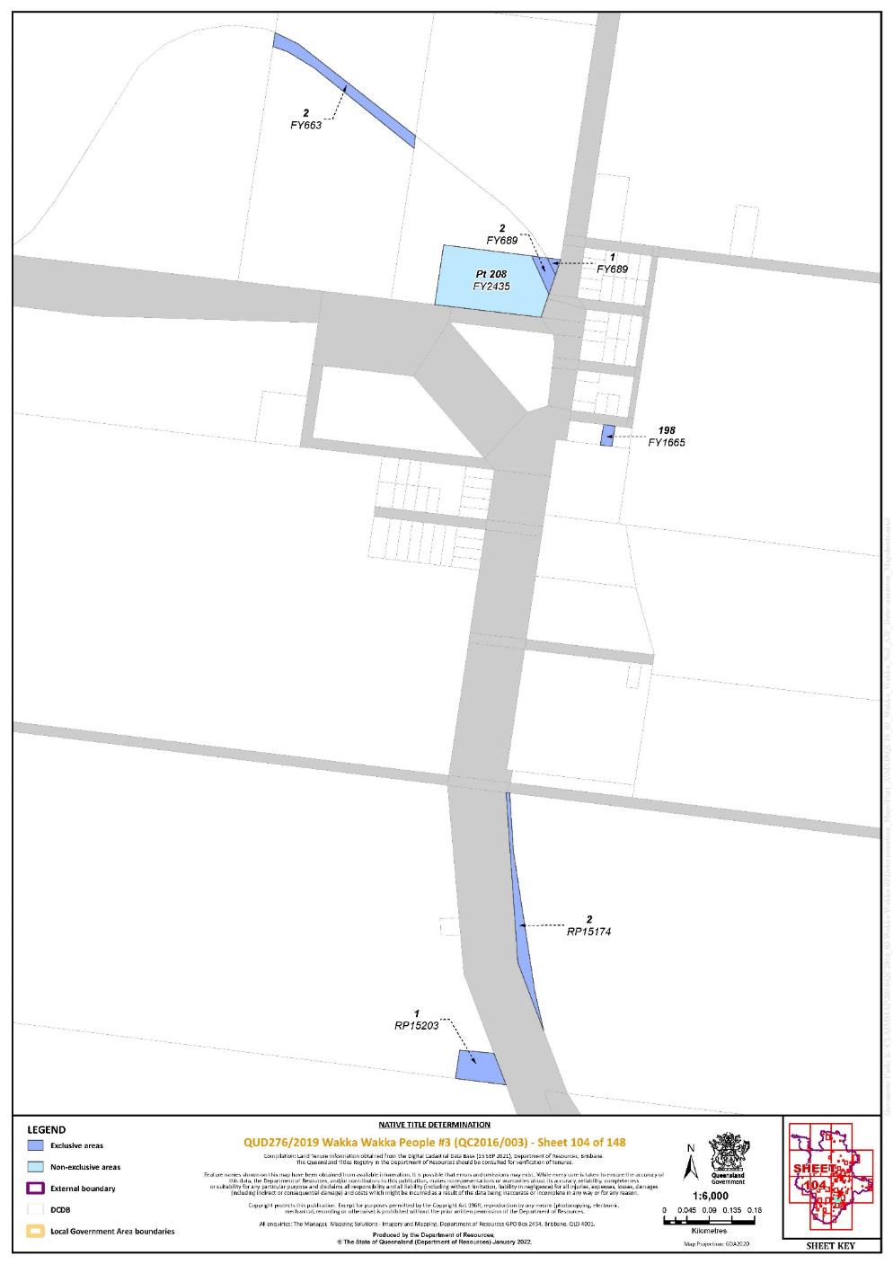
Lot 198 on Plan FY1665 | 104 | |||||||||||||||||||||||||
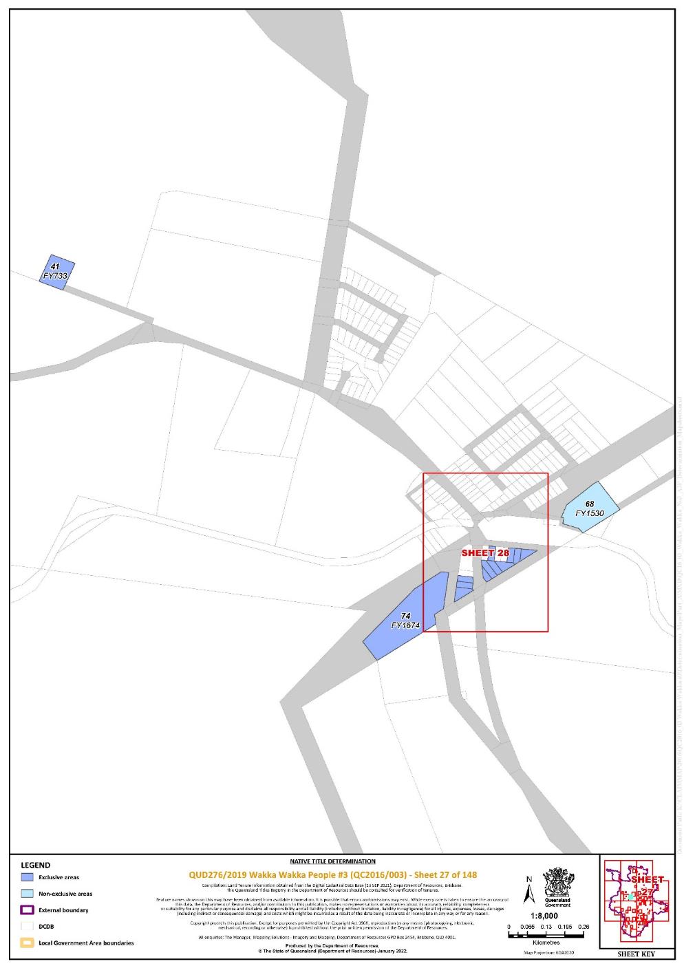
Lot 74 on Plan FY1674 | 27, 28 | |||||||||||||||||||||||||
Lot 191 on Plan FY1682 | 109 | |||||||||||||||||||||||||
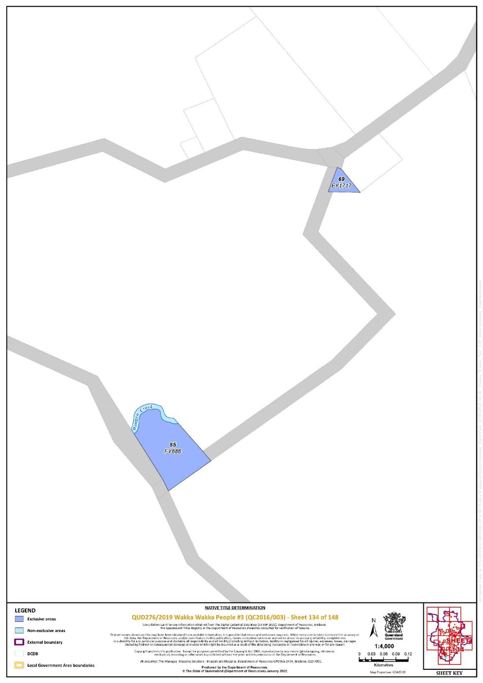
Lot 69 on Plan FY1717 | 134 | |||||||||||||||||||||||||
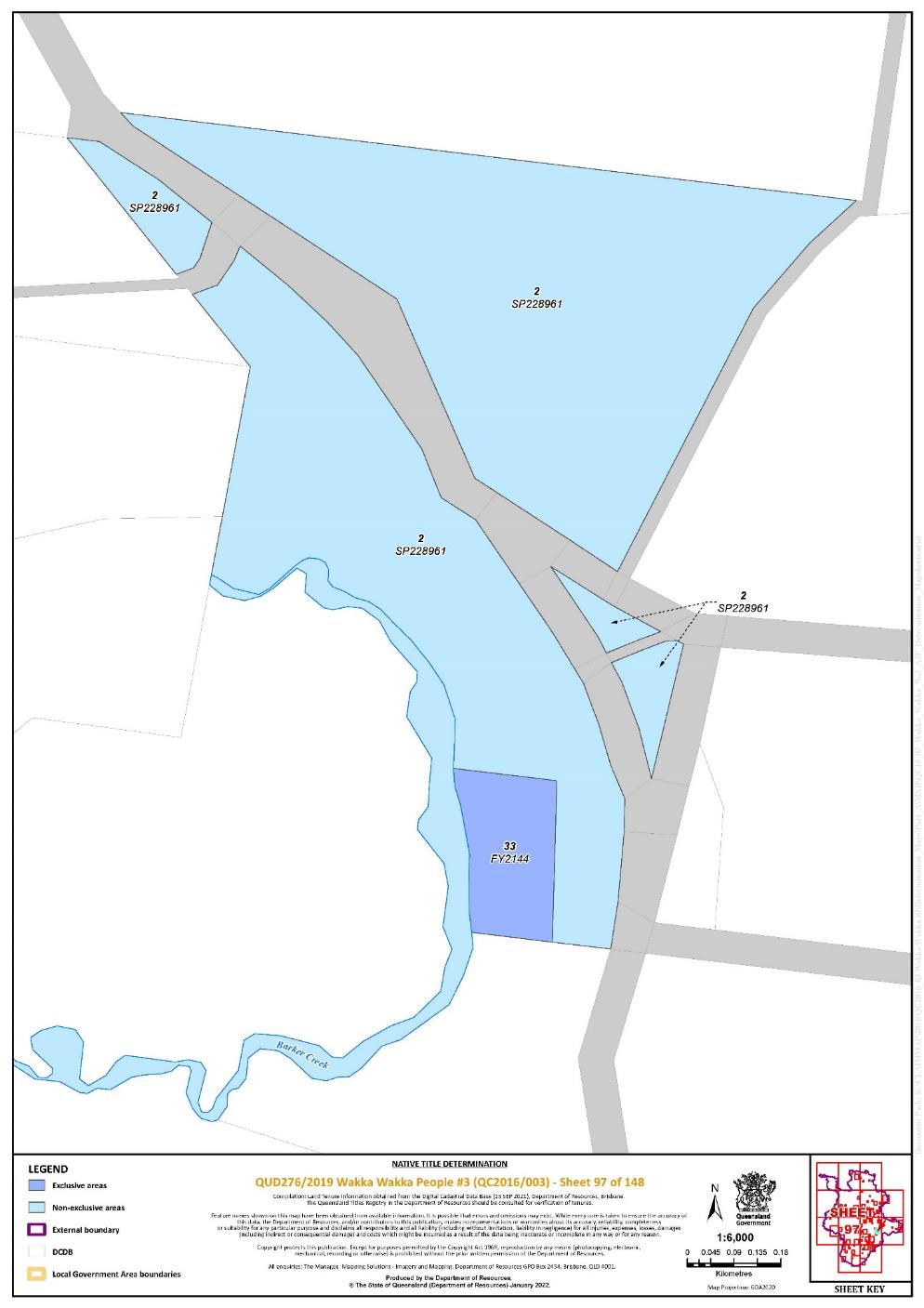
Lot 33 on Plan FY2144 | 97 | |||||||||||||||||||||||||
Lot 89 on Plan FY2181 | 142, 143 | |||||||||||||||||||||||||
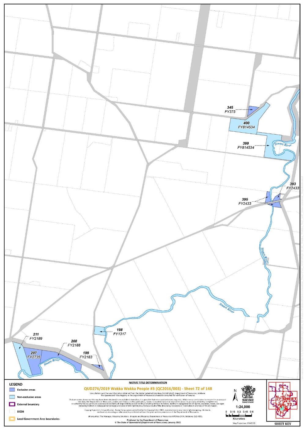
Lot 199 on Plan FY2183 | 72 | |||||||||||||||||||||||||
Lot 208 on Plan FY2188 | 72 | |||||||||||||||||||||||||
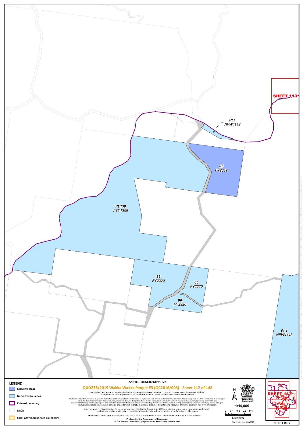
Lot 85 on Plan FY2319 | 112 | |||||||||||||||||||||||||
Lot 462 on Plan FY2396 | 76, 77 | |||||||||||||||||||||||||
Lot 393 on Plan FY2433 | 72 | |||||||||||||||||||||||||
Lot 395 on Plan FY2433 | 72 | |||||||||||||||||||||||||
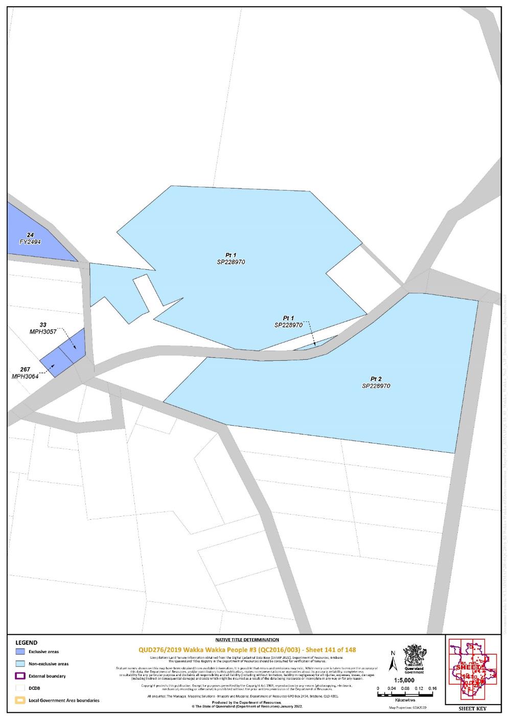
Lot 24 on Plan FY2494 | 140, 141 | |||||||||||||||||||||||||
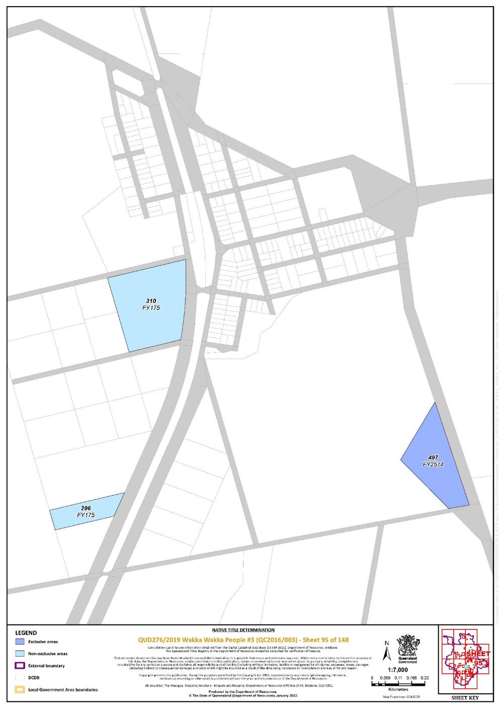
Lot 497 on Plan FY2514 | 95 | |||||||||||||||||||||||||
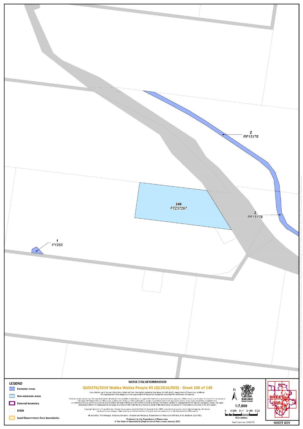
Lot 1 on Plan FY253 | 106 | |||||||||||||||||||||||||
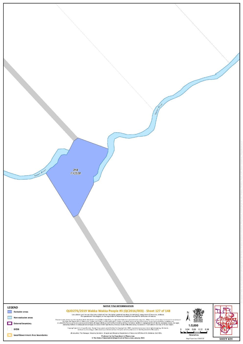
Lot 212 on Plan FY2538 | 127 | |||||||||||||||||||||||||
Lot 376 on Plan FY2639 | 63 | |||||||||||||||||||||||||
Lot 162 on Plan FY2722 | 103 | |||||||||||||||||||||||||
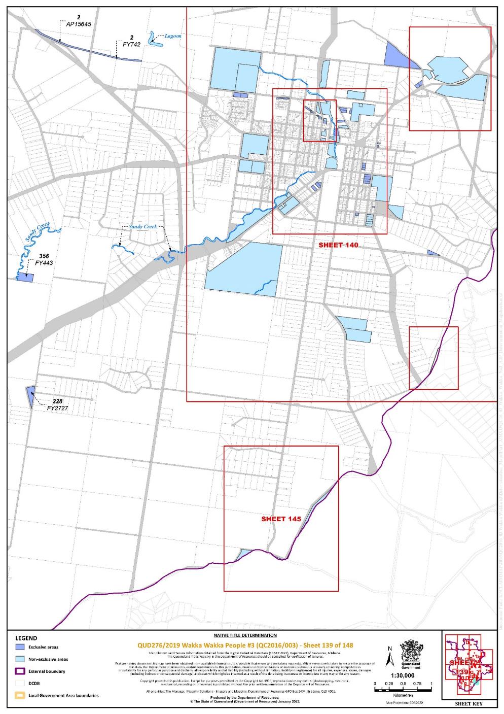
Lot 228 on Plan FY2727 | 139 | |||||||||||||||||||||||||
Lot 207 on Plan FY2735 | 72 | |||||||||||||||||||||||||
Lot 470 on Plan FY2937 | 77 | |||||||||||||||||||||||||
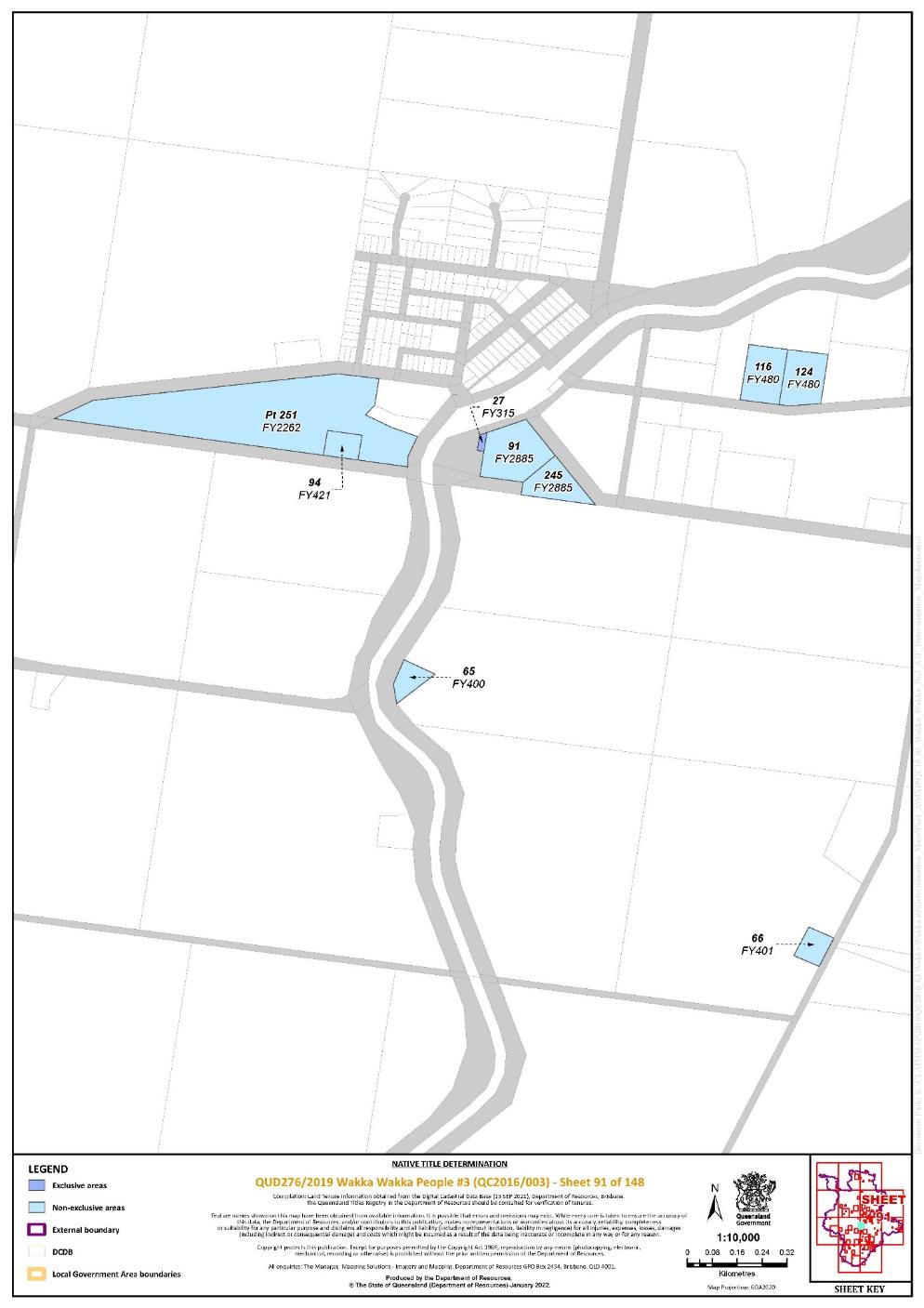
Lot 27 on Plan FY315 | 91 | |||||||||||||||||||||||||
Lot 345 on Plan FY375 | 72 | |||||||||||||||||||||||||
Lot 356 on Plan FY443 | 139 | |||||||||||||||||||||||||
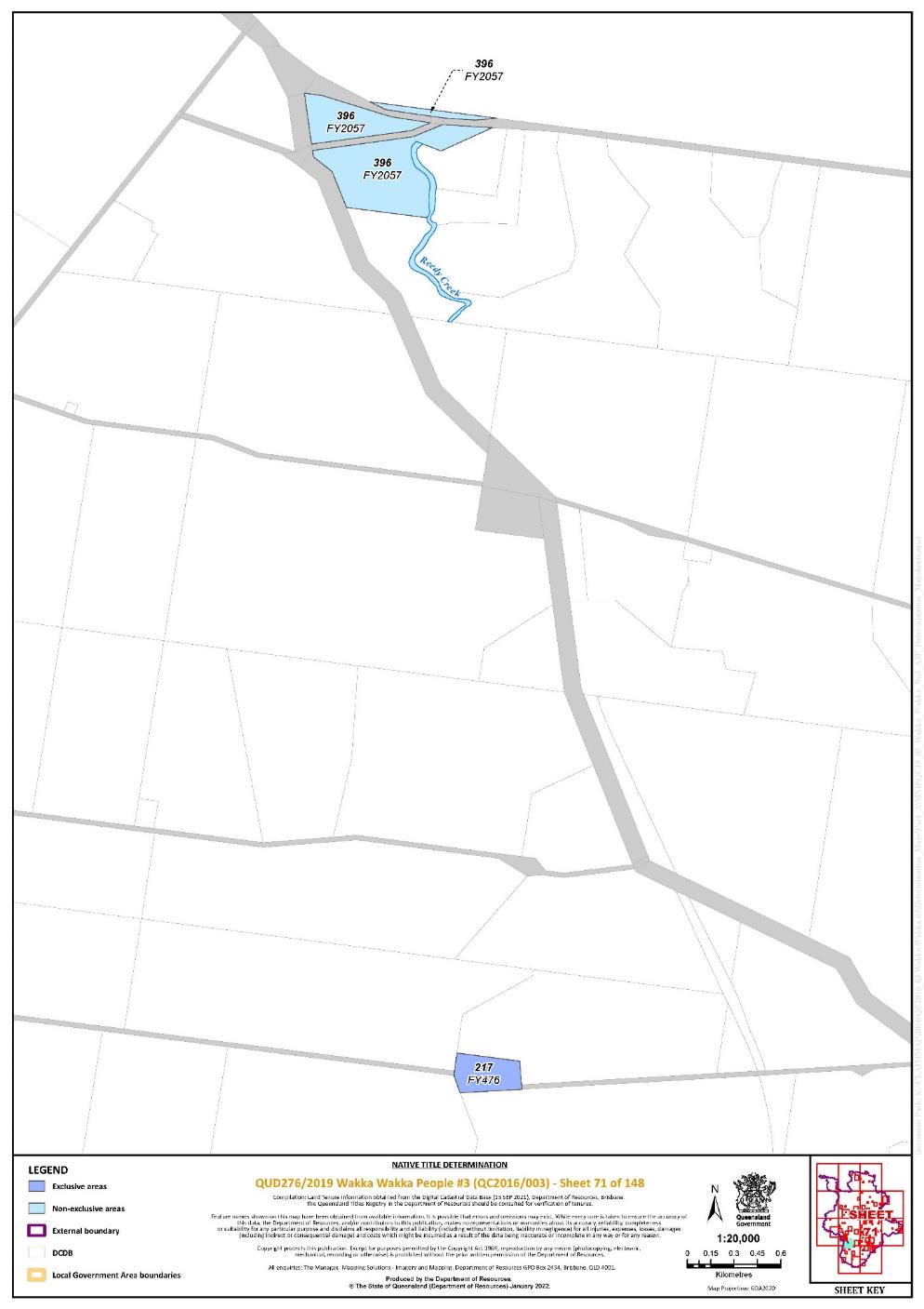
Lot 217 on Plan FY476 | 71 | |||||||||||||||||||||||||
Lot 472 on Plan FY602 | 76 | |||||||||||||||||||||||||
Lot 32 on Plan FY641 | 96 | |||||||||||||||||||||||||
Lot 2 on Plan FY663 | 104 | |||||||||||||||||||||||||
Lot 85 on Plan FY686 | 134 | |||||||||||||||||||||||||
Lot 1 on Plan FY689 | 104 | |||||||||||||||||||||||||
Lot 2 on Plan FY689 | 104 | |||||||||||||||||||||||||
Lot 41 on Plan FY733 | 27 | |||||||||||||||||||||||||
Lot 2 on Plan FY742 | 139 | |||||||||||||||||||||||||
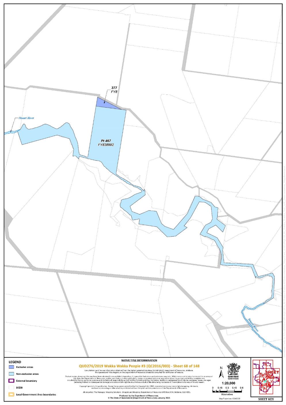
Lot 377 on Plan FY8 | 68 | |||||||||||||||||||||||||
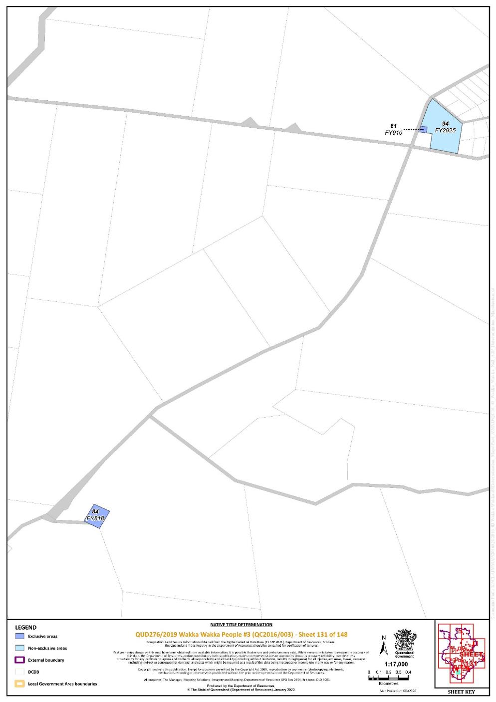
Lot 84 on Plan FY818 | 131 | |||||||||||||||||||||||||
Lot 4 on Plan FY839233 | 44 | |||||||||||||||||||||||||
Lot 61 on Plan FY910 | 131 | |||||||||||||||||||||||||
Lot 64 on Plan FY919 | 45 | |||||||||||||||||||||||||
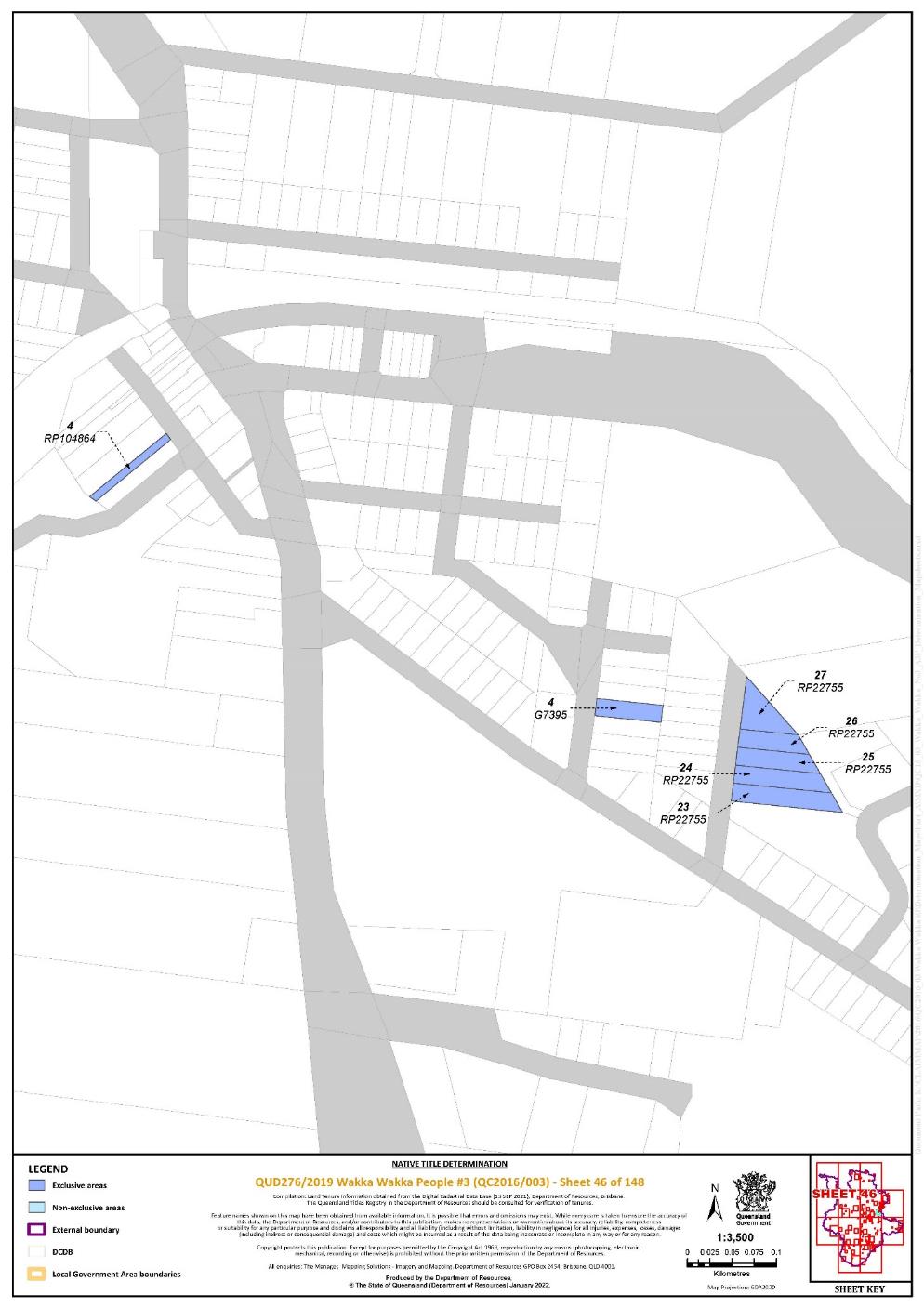
Lot 4 on Plan G7395 | 46 | |||||||||||||||||||||||||
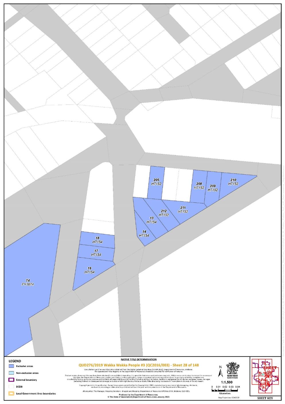
Lot 205 on Plan H7152 | 28 | |||||||||||||||||||||||||
Lot 208 on Plan H7152 | 28 | |||||||||||||||||||||||||
Lot 209 on Plan H7152 | 28 | |||||||||||||||||||||||||
Lot 210 on Plan H7152 | 28 | |||||||||||||||||||||||||
Lot 211 on Plan H7152 | 28 | |||||||||||||||||||||||||
Lot 212 on Plan H7152 | 28 | |||||||||||||||||||||||||
Lot 13 on Plan H7154 | 28 | |||||||||||||||||||||||||
Lot 14 on Plan H7154 | 28 | |||||||||||||||||||||||||
Lot 16 on Plan H7154 | 28 | |||||||||||||||||||||||||
Lot 17 on Plan H7154 | 28 | |||||||||||||||||||||||||
Lot 18 on Plan H7154 | 28 | |||||||||||||||||||||||||
Lot 1 on Plan K62315 | 129 | |||||||||||||||||||||||||
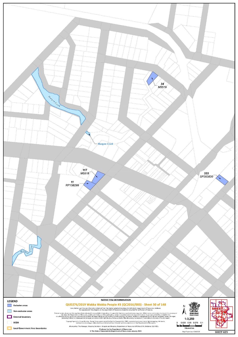
Lot 117 on Plan M5518 | 50 | ^ | ||||||||||||||||||||||||
Lot 34 on Plan M5519 | 50 | |||||||||||||||||||||||||
Lot 22 on Plan M6072 | 43 | |||||||||||||||||||||||||
Lot 23 on Plan M6072 | 43 | |||||||||||||||||||||||||
Lot 24 on Plan M6072 | 43 | |||||||||||||||||||||||||
Lot 31 on Plan M6072 | 43 | |||||||||||||||||||||||||
Lot 32 on Plan M6072 | 43 | |||||||||||||||||||||||||
Lot 41 on Plan M6072 | 43 | |||||||||||||||||||||||||
Lot 1 on Plan M6073 | 43 | |||||||||||||||||||||||||
Lot 2 on Plan M6073 | 43 | |||||||||||||||||||||||||
Lot 3 on Plan M6073 | 43 | |||||||||||||||||||||||||
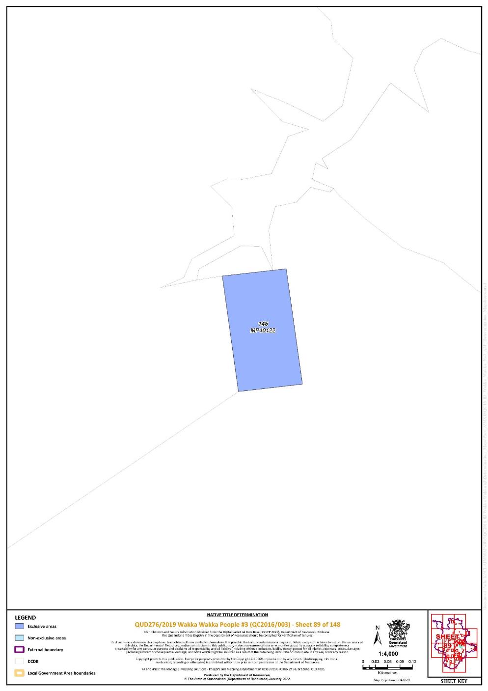
Lot 145 on Plan MP40122 | 89 | |||||||||||||||||||||||||
Lot 33 on Plan MPH3057 | 141 | |||||||||||||||||||||||||
Lot 137 on Plan MPH3062 | 142 | |||||||||||||||||||||||||
Lot 100 on Plan MPH3063 | 142 | |||||||||||||||||||||||||
Lot 255 on Plan MPH3063 | 142 | |||||||||||||||||||||||||
Lot 99 on Plan MPH3063 | 142 | |||||||||||||||||||||||||
Lot 267 on Plan MPH3064 | 141 | |||||||||||||||||||||||||
Lot 7 on Plan MPH40379 | 142 | |||||||||||||||||||||||||
Lot 9 on Plan MPH40379 | 142 | |||||||||||||||||||||||||
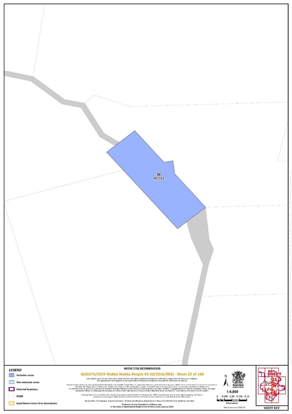
Lot 58 on Plan MZ254 | 22 | |||||||||||||||||||||||||
Lot 38 on Plan MZ334 | 53 | |||||||||||||||||||||||||
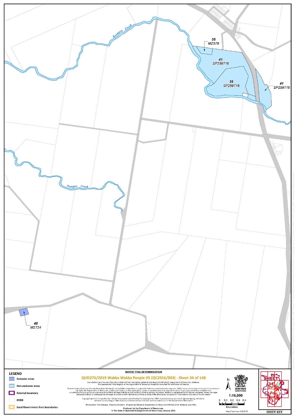
Lot 40 on Plan MZ724 | 34 | |||||||||||||||||||||||||
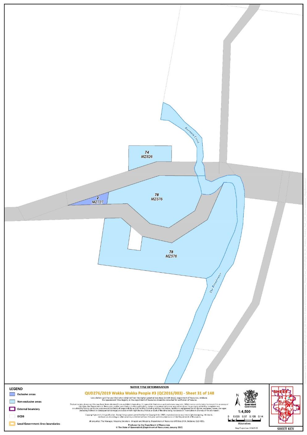
Lot 2 on Plan MZ727 | 31 | |||||||||||||||||||||||||
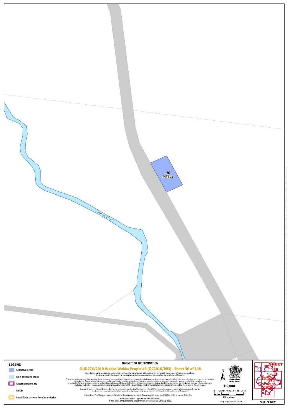
Lot 45 on Plan MZ844 | 30 | |||||||||||||||||||||||||
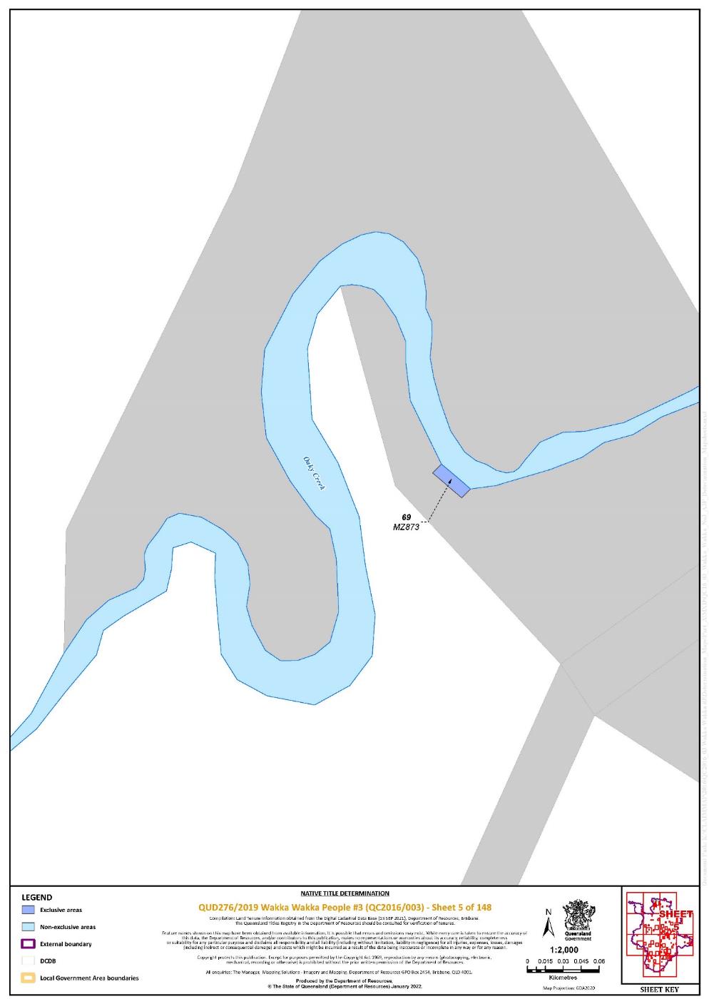
Lot 69 on Plan MZ873 | 5 | |||||||||||||||||||||||||
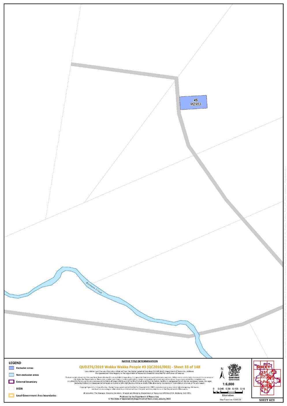
Lot 45 on Plan MZ953 | 33 | |||||||||||||||||||||||||
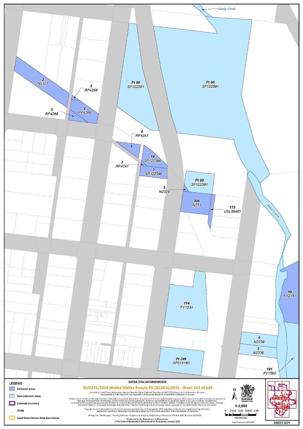
Lot 308 on Plan N231 | 143 | |||||||||||||||||||||||||
Lot 131 on Plan N2320 | 142 | |||||||||||||||||||||||||
Lot 132 on Plan N2320 | 142 | |||||||||||||||||||||||||
Lot 134 on Plan N2320 | 142 | |||||||||||||||||||||||||
Lot 297 on Plan N2320 | 142 | |||||||||||||||||||||||||
Lot 333 on Plan N2320 | 142 | |||||||||||||||||||||||||
Lot 334 on Plan N2320 | 142 | |||||||||||||||||||||||||
Lot 335 on Plan N2320 | 142 | |||||||||||||||||||||||||
Lot 336 on Plan N2320 | 142 | |||||||||||||||||||||||||
Lot 348 on Plan N2320 | 142 | |||||||||||||||||||||||||
Lot 349 on Plan N2320 | 142 | |||||||||||||||||||||||||
Lot 350 on Plan N2320 | 142 | |||||||||||||||||||||||||
Lot 2 on Plan N2323 | 140 | |||||||||||||||||||||||||
Lot 3 on Plan N2323 | 140 | |||||||||||||||||||||||||
Lot 2 on Plan N2325 | 142 | |||||||||||||||||||||||||
Lot 2 on Plan N2327 | 143 | |||||||||||||||||||||||||
Lot 2 on Plan N2329 | 143 | |||||||||||||||||||||||||
Lot 6 on Plan N2360 | 142 | |||||||||||||||||||||||||
Lot 104 on Plan P6971 | 25 | |||||||||||||||||||||||||
Lot 105 on Plan P6971 | 25 | |||||||||||||||||||||||||
Lot 106 on Plan P6971 | 25 | |||||||||||||||||||||||||
Lot 107 on Plan P6971 | 25 | |||||||||||||||||||||||||
Lot 108 on Plan P6971 | 25 | |||||||||||||||||||||||||
Lot 109 on Plan P6971 | 25 | |||||||||||||||||||||||||
Lot 110 on Plan P6971 | 25 | |||||||||||||||||||||||||
Lot 302 on Plan P6971 | 25 | |||||||||||||||||||||||||
Lot 20 on Plan P6979 | 25 | |||||||||||||||||||||||||
Lot 25 on Plan P6979 | 25 | |||||||||||||||||||||||||
Lot 26 on Plan P6979 | 25 | |||||||||||||||||||||||||
Lot 27 on Plan P6979 | 25 | |||||||||||||||||||||||||
Lot 28 on Plan P6979 | 25 | |||||||||||||||||||||||||
Lot 78 on Plan P6979 | 25 | |||||||||||||||||||||||||
Lot 4 on Plan RP104864 | 46 | |||||||||||||||||||||||||
Lot 2 on Plan RP15174 | 104 | |||||||||||||||||||||||||
Lot 2 on Plan RP15178 | 106 | |||||||||||||||||||||||||
Lot 2 on Plan RP15179 | 106, 107 | |||||||||||||||||||||||||
Lot 27 on Plan RP15181 | 107 | |||||||||||||||||||||||||
Lot 1 on Plan RP15203 | 104 | |||||||||||||||||||||||||
Lot 11 on Plan RP158299 | 50 | ^ | ||||||||||||||||||||||||
Lot 23 on Plan RP22755 | 46 | |||||||||||||||||||||||||
Lot 24 on Plan RP22755 | 46 | |||||||||||||||||||||||||
Lot 25 on Plan RP22755 | 46 | |||||||||||||||||||||||||
Lot 26 on Plan RP22755 | 46 | |||||||||||||||||||||||||
Lot 27 on Plan RP22755 | 46 | |||||||||||||||||||||||||
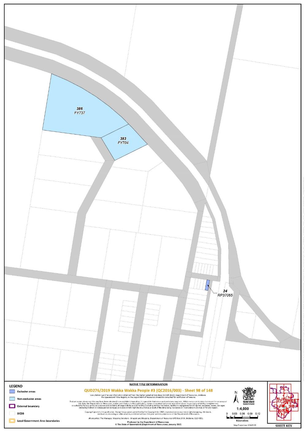
Lot 24 on Plan RP37065 | 98 | |||||||||||||||||||||||||
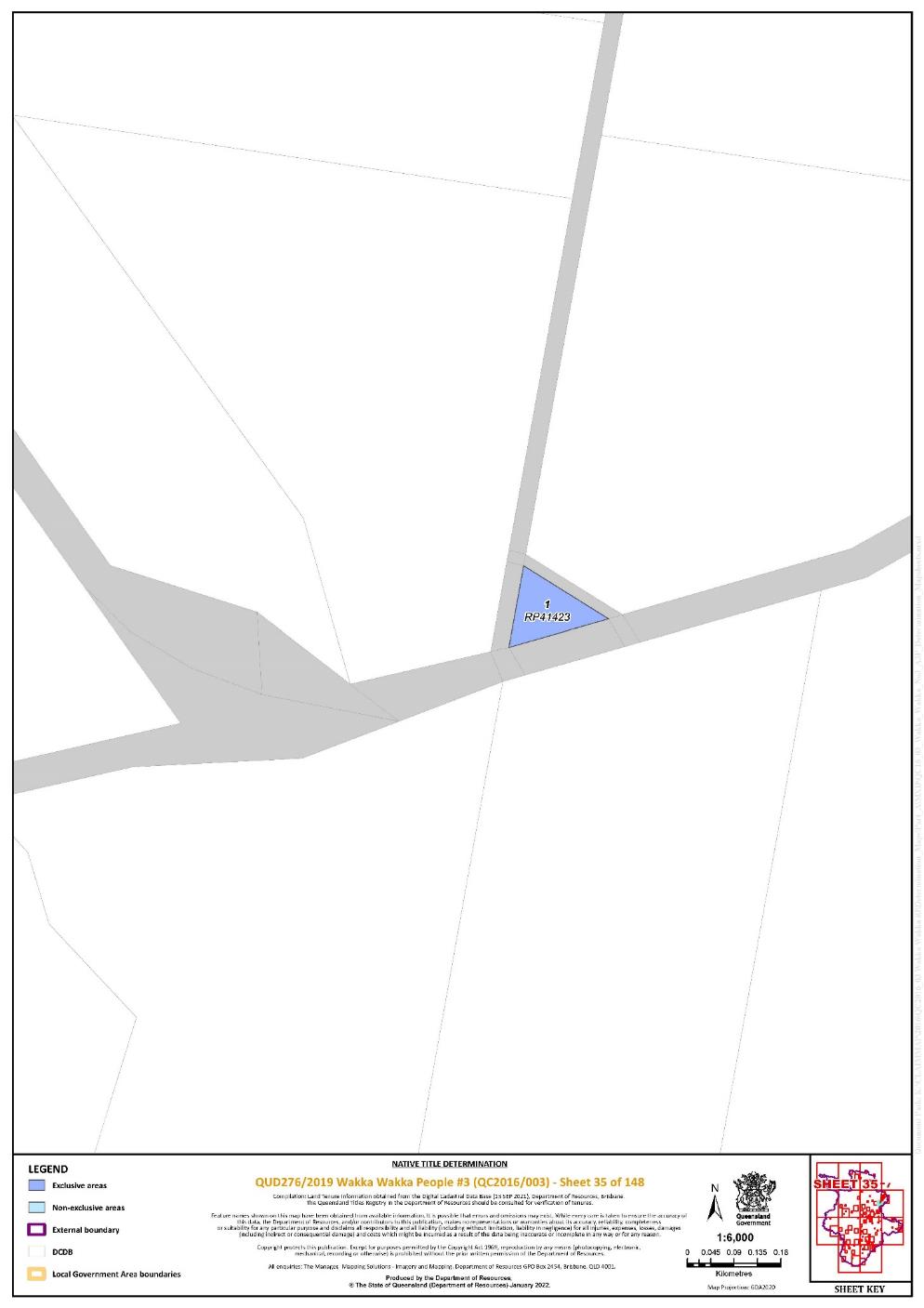
Lot 1 on Plan RP41423 | 35 | |||||||||||||||||||||||||
Lot 3 on Plan RP4247 | 143 | |||||||||||||||||||||||||
Lot 6 on Plan RP4247 | 143 | |||||||||||||||||||||||||
Lot 2 on Plan RP4268 | 143 | |||||||||||||||||||||||||
Lot 3 on Plan RP4268 | 143 | |||||||||||||||||||||||||
Lot 5 on Plan RP4268 | 143 | |||||||||||||||||||||||||
Lot 24 on Plan RP883712 | 133 | ^ | ||||||||||||||||||||||||
Lot 320 on Plan SP104316 | 103 | ^ | ||||||||||||||||||||||||
Lot 48 on Plan SP104353 | 73 | |||||||||||||||||||||||||
Lot 47 on Plan SP104356 | 73 | |||||||||||||||||||||||||
Lot 14 on Plan SP122596 | 143 | |||||||||||||||||||||||||
Lot 3 on Plan SP122596 | 143 | |||||||||||||||||||||||||
Lot 1 on Plan SP157925 | 140 | |||||||||||||||||||||||||
Lot 1 on Plan SP199029 | 76 | |||||||||||||||||||||||||
Lot 3 on Plan SP199029 | 76 | |||||||||||||||||||||||||
Lot 266 on Plan SP249642 | 138 | |||||||||||||||||||||||||
Lot 51 on Plan SP262591 | 76 | |||||||||||||||||||||||||
Lot 16 on Plan SP262592 | 70 | |||||||||||||||||||||||||
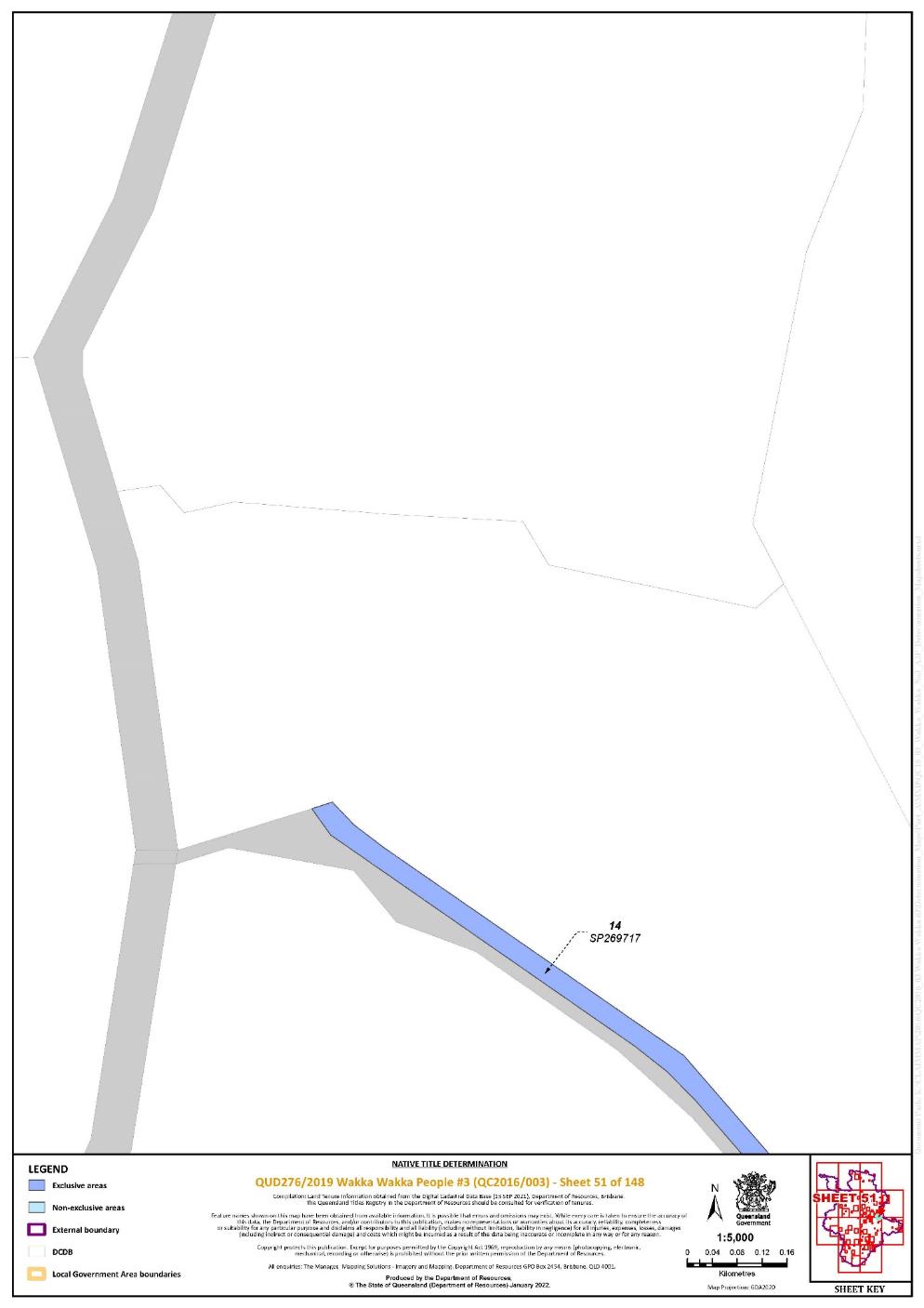
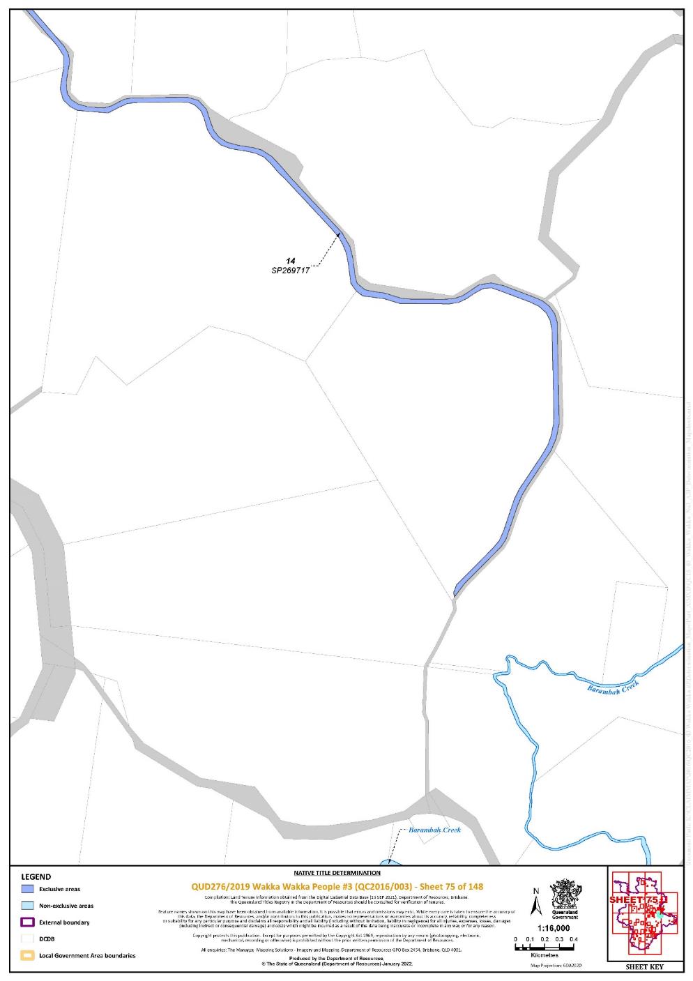
Lot 14 on Plan SP269717 | 29, 51, 75 | |||||||||||||||||||||||||
Lot 66 on Plan SP269720 | 53, 56 | Pt | ||||||||||||||||||||||||
Lot 52 on Plan SP269724 | 45 | |||||||||||||||||||||||||
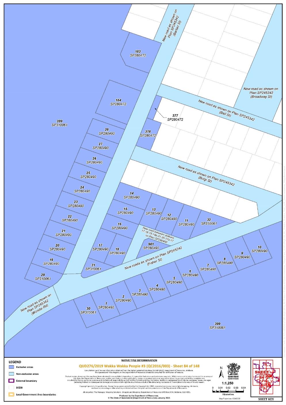
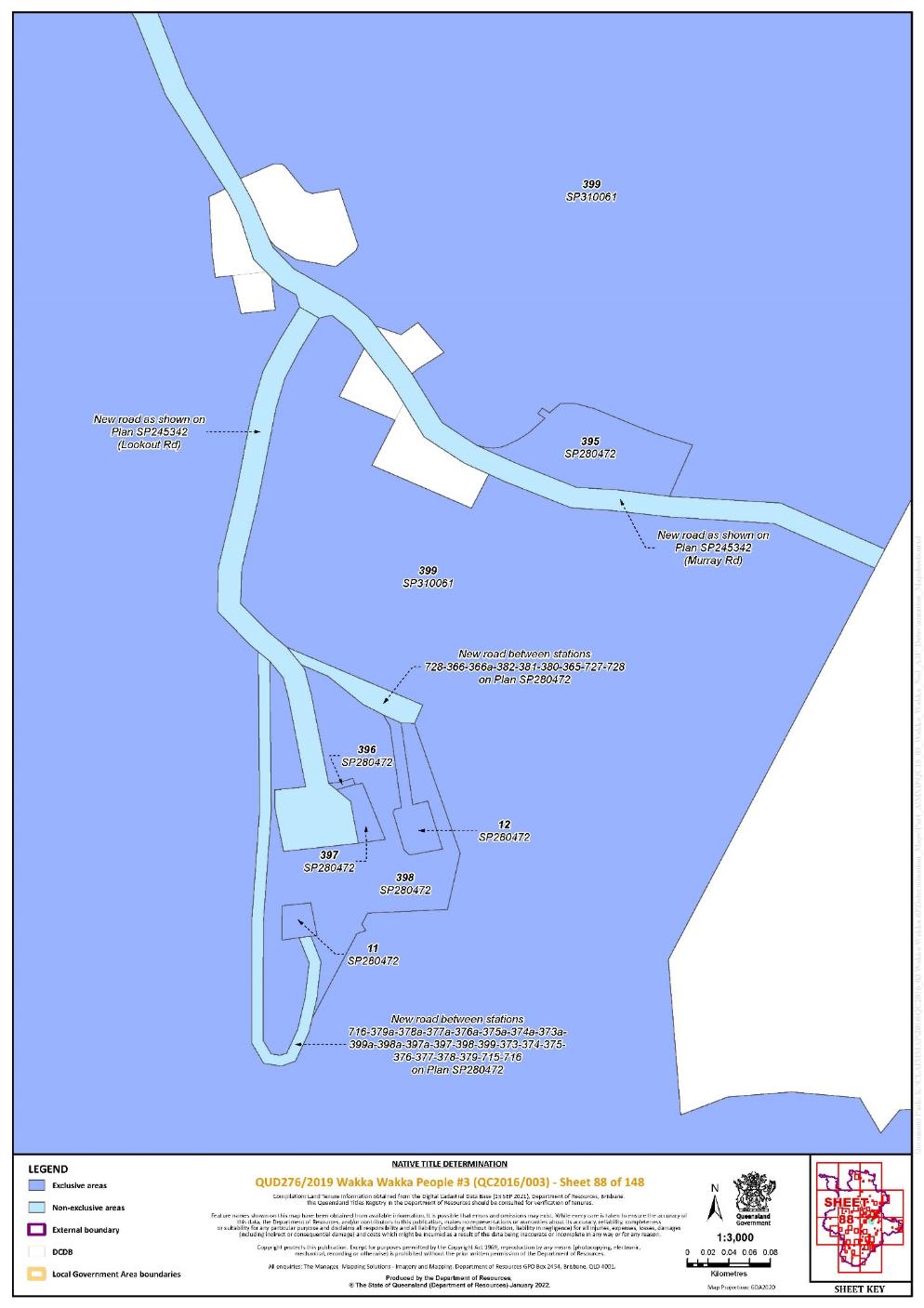
Lot 11 on Plan SP280472 | 88 | ^ | ||||||||||||||||||||||||
Lot 12 on Plan SP280472 | 88 | ^ | ||||||||||||||||||||||||
Lot 13 on Plan SP280472 | 82 | ^ | ||||||||||||||||||||||||
Lot 183 on Plan SP280472 | 84 | ^ | ||||||||||||||||||||||||
Lot 184 on Plan SP280472 | 84 | ^ | ||||||||||||||||||||||||
Lot 186 on Plan SP280472 | 81 | ^ | ||||||||||||||||||||||||
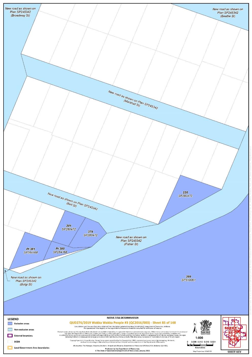
Lot 201 on Plan SP280472 | 85 | ^ | ||||||||||||||||||||||||
Lot 220 on Plan SP280472 | 85 | ^ | ||||||||||||||||||||||||
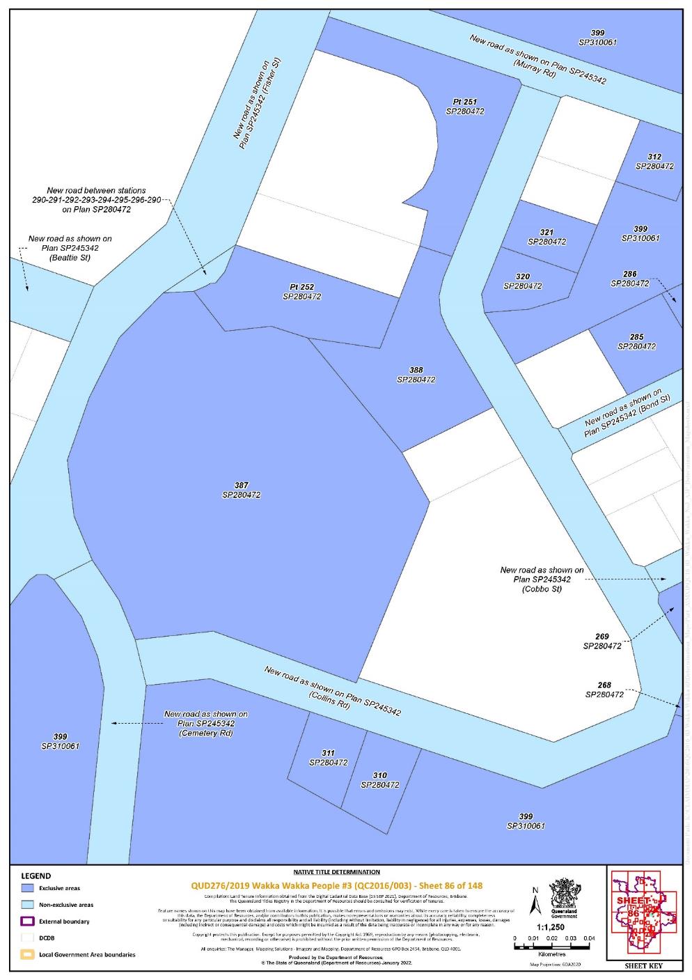
That part of Lot 251 on Plan SP280472 commencing at the north-western corner of that lot and extending generally easterly, southerly and westerly along the boundaries of that lot to Longitude 151.956313° East; then generally north-westerly to the intersection with the western boundary of that lot at Latitude 26.292362° South, passing through the following coordinate points: | 86 | ^ | ||||||||||||||||||||||||
Then northerly along the western boundary of that lot back to the commencement point | ||||||||||||||||||||||||||
That part of Lot 252 on Plan SP280472 south of a line drawn from the western boundary of that lot at Latitude 26.293305° South to the eastern boundary of that lot at Latitude 26.293563° South. | 86 | ^ | ||||||||||||||||||||||||
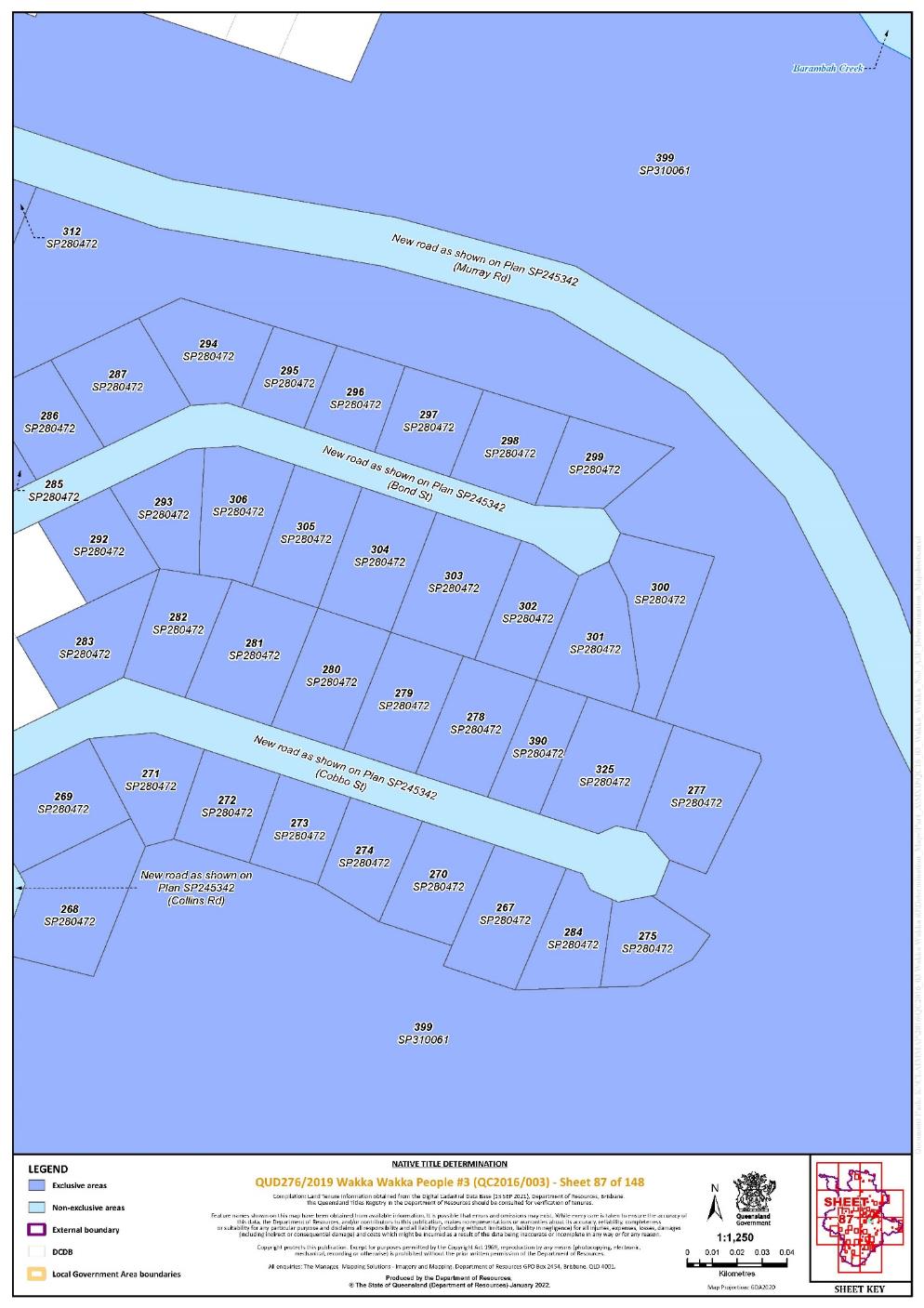
Lot 267 on Plan SP280472 | 87 | ^ | ||||||||||||||||||||||||
Lot 268 on Plan SP280472 | 86, 87 | ^ | ||||||||||||||||||||||||
Lot 269 on Plan SP280472 | 86, 87 | ^ | ||||||||||||||||||||||||
Lot 270 on Plan SP280472 | 87 | ^ | ||||||||||||||||||||||||
Lot 271 on Plan SP280472 | 87 | ^ | ||||||||||||||||||||||||
Lot 272 on Plan SP280472 | 87 | ^ | ||||||||||||||||||||||||
Lot 273 on Plan SP280472 | 87 | ^ | ||||||||||||||||||||||||
Lot 274 on Plan SP280472 | 87 | ^ | ||||||||||||||||||||||||
Lot 275 on Plan SP280472 | 87 | ^ | ||||||||||||||||||||||||
Lot 277 on Plan SP280472 | 87 | ^ | ||||||||||||||||||||||||
Lot 278 on Plan SP280472 | 87 | ^ | ||||||||||||||||||||||||
Lot 279 on Plan SP280472 | 87 | ^ | ||||||||||||||||||||||||
Lot 280 on Plan SP280472 | 87 | ^ | ||||||||||||||||||||||||
Lot 281 on Plan SP280472 | 87 | ^ | ||||||||||||||||||||||||
Lot 282 on Plan SP280472 | 87 | ^ | ||||||||||||||||||||||||
Lot 283 on Plan SP280472 | 87 | ^ | ||||||||||||||||||||||||
Lot 284 on Plan SP280472 | 87 | ^ | ||||||||||||||||||||||||
Lot 285 on Plan SP280472 | 86, 87 | ^ | ||||||||||||||||||||||||
Lot 286 on Plan SP280472 | 86, 87 | ^ | ||||||||||||||||||||||||
Lot 287 on Plan SP280472 | 87 | ^ | ||||||||||||||||||||||||
Lot 292 on Plan SP280472 | 87 | ^ | ||||||||||||||||||||||||
Lot 293 on Plan SP280472 | 87 | ^ | ||||||||||||||||||||||||
Lot 294 on Plan SP280472 | 87 | ^ | ||||||||||||||||||||||||
Lot 295 on Plan SP280472 | 87 | ^ | ||||||||||||||||||||||||
Lot 296 on Plan SP280472 | 87 | ^ | ||||||||||||||||||||||||
Lot 297 on Plan SP280472 | 87 | ^ | ||||||||||||||||||||||||
Lot 298 on Plan SP280472 | 87 | ^ | ||||||||||||||||||||||||
Lot 299 on Plan SP280472 | 87 | ^ | ||||||||||||||||||||||||
Lot 300 on Plan SP280472 | 87 | ^ | ||||||||||||||||||||||||
Lot 301 on Plan SP280472 | 87 | ^ | ||||||||||||||||||||||||
Lot 302 on Plan SP280472 | 87 | ^ | ||||||||||||||||||||||||
Lot 303 on Plan SP280472 | 87 | ^ | ||||||||||||||||||||||||
Lot 304 on Plan SP280472 | 87 | ^ | ||||||||||||||||||||||||
Lot 305 on Plan SP280472 | 87 | ^ | ||||||||||||||||||||||||
Lot 306 on Plan SP280472 | 87 | ^ | ||||||||||||||||||||||||
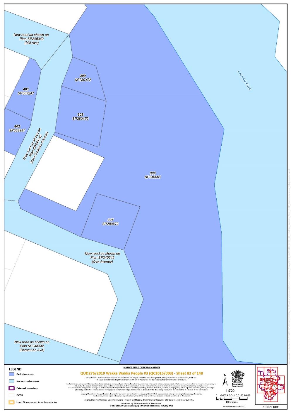
Lot 307 on Plan SP280472 | 83 | ^ | ||||||||||||||||||||||||
Lot 308 on Plan SP280472 | 83 | ^ | ||||||||||||||||||||||||
Lot 309 on Plan SP280472 | 83 | ^ | ||||||||||||||||||||||||
Lot 310 on Plan SP280472 | 86 | ^ | ||||||||||||||||||||||||
Lot 311 on Plan SP280472 | 86 | ^ | ||||||||||||||||||||||||
Lot 312 on Plan SP280472 | 86, 87 | ^ | ||||||||||||||||||||||||
Lot 320 on Plan SP280472 | 86 | ^ | ||||||||||||||||||||||||
Lot 321 on Plan SP280472 | 86 | ^ | ||||||||||||||||||||||||
Lot 325 on Plan SP280472 | 87 | ^ | ||||||||||||||||||||||||
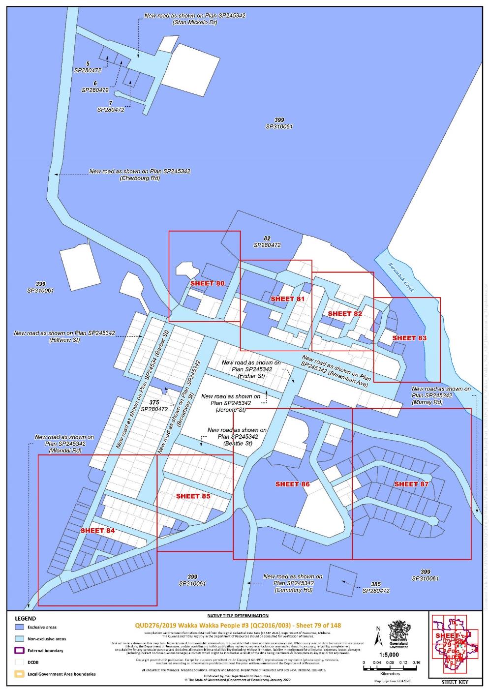
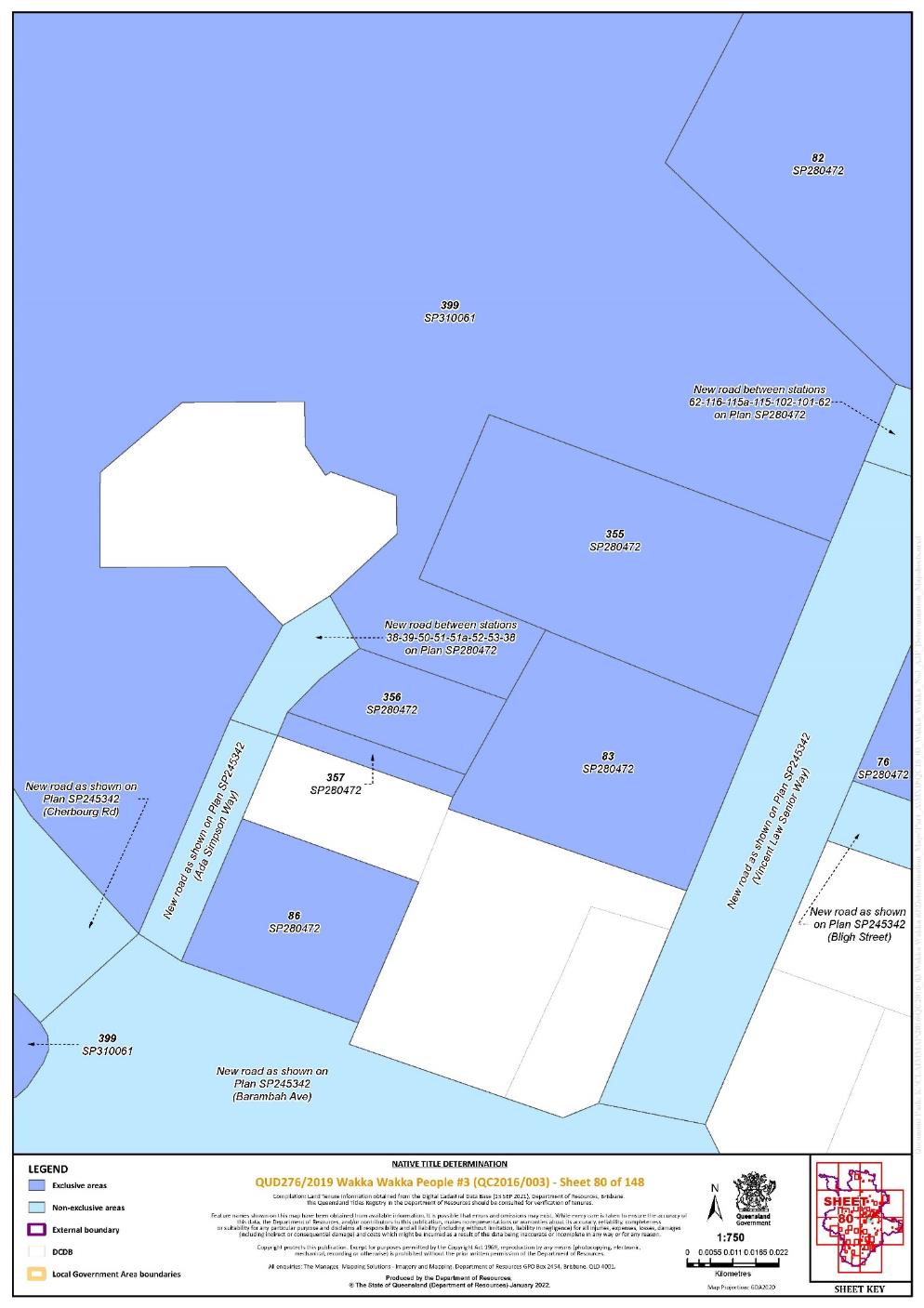
Lot 355 on Plan SP280472 | 80 | ^ | ||||||||||||||||||||||||
Lot 356 on Plan SP280472 | 80 | ^ | ||||||||||||||||||||||||
Lot 357 on Plan SP280472 | 80 | ^ | ||||||||||||||||||||||||
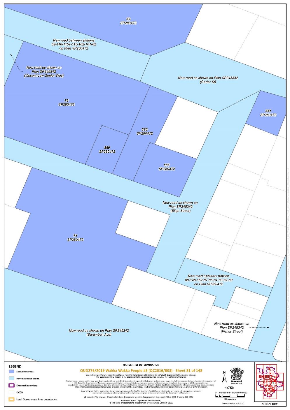
Lot 359 on Plan SP280472 | 81 | ^ | ||||||||||||||||||||||||
Lot 360 on Plan SP280472 | 81 | ^ | ||||||||||||||||||||||||
Lot 361 on Plan SP280472 | 81, 82 | ^ | ||||||||||||||||||||||||
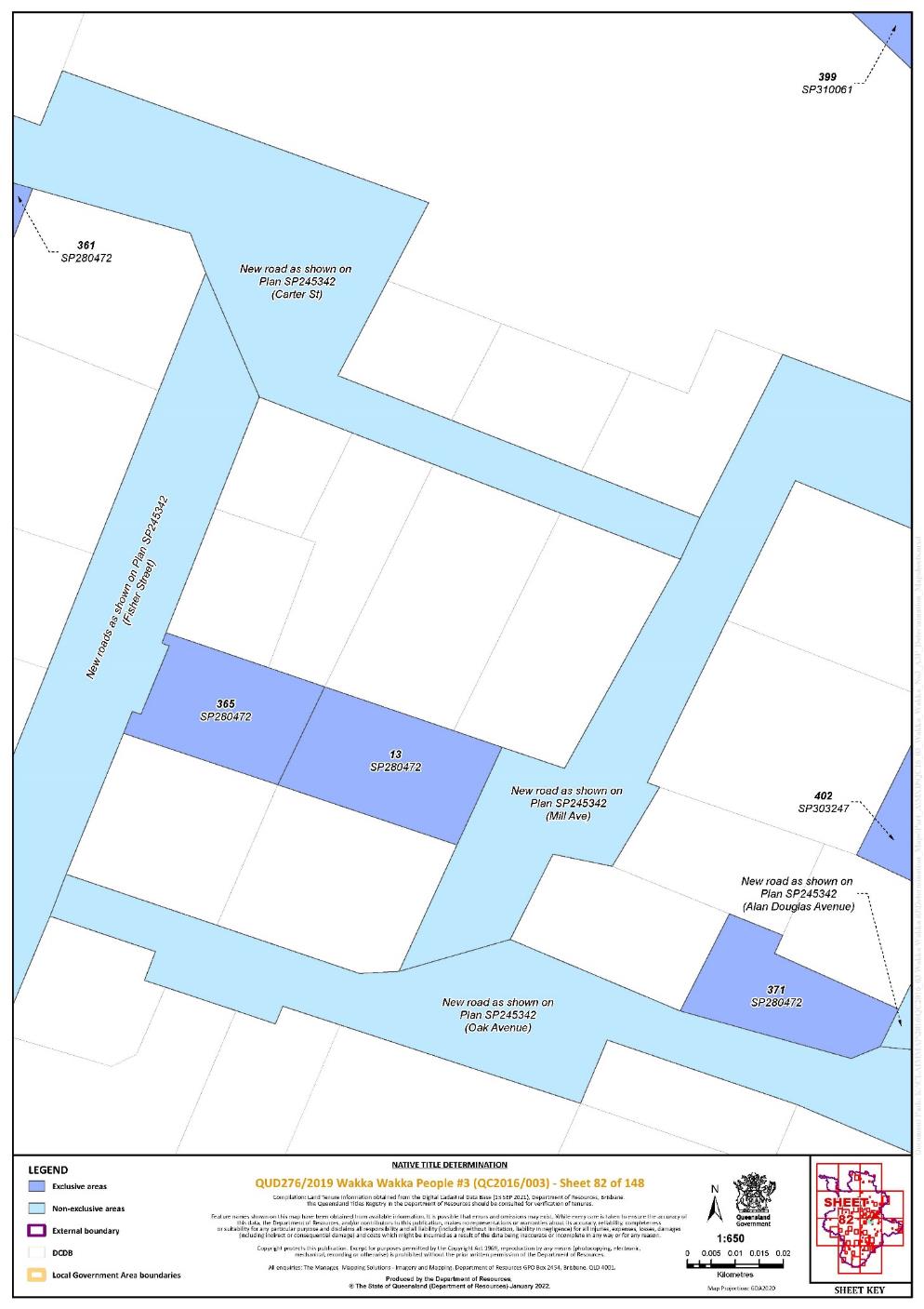
Lot 365 on Plan SP280472 | 82 | ^ | ||||||||||||||||||||||||
Lot 371 on Plan SP280472 | 82 | ^ | ||||||||||||||||||||||||
Lot 375 on Plan SP280472 | 79 | ^ | ||||||||||||||||||||||||
Lot 377 on Plan SP280472 | 84 | ^ | ||||||||||||||||||||||||
Lot 378 on Plan SP280472 | 84 | ^ | ||||||||||||||||||||||||
Lot 379 on Plan SP280472 | 85 | ^ | ||||||||||||||||||||||||
Lot 383 on Plan SP280472 | 78 | ^ | ||||||||||||||||||||||||
Lot 384 on Plan SP280472 | 78 | ^ | ||||||||||||||||||||||||
Lot 385 on Plan SP280472 | 79 | ^ | ||||||||||||||||||||||||
Lot 387 on Plan SP280472 | 86 | ^ | ||||||||||||||||||||||||
Lot 388 on Plan SP280472 | 86 | ^ | ||||||||||||||||||||||||
Lot 390 on Plan SP280472 | 87 | ^ | ||||||||||||||||||||||||
Lot 395 on Plan SP280472 | 88 | ^ | ||||||||||||||||||||||||
Lot 396 on Plan SP280472 | 88 | ^ | ||||||||||||||||||||||||
Lot 397 on Plan SP280472 | 88 | ^ | ||||||||||||||||||||||||
Lot 398 on Plan SP280472 | 88 | ^ | ||||||||||||||||||||||||
Lot 5 on Plan SP280472 | 79 | ^ | ||||||||||||||||||||||||
Lot 6 on Plan SP280472 | 79 | ^ | ||||||||||||||||||||||||
Lot 7 on Plan SP280472 | 79 | ^ | ||||||||||||||||||||||||
Lot 71 on Plan SP280472 | 81 | ^ | ||||||||||||||||||||||||
Lot 76 on Plan SP280472 | 80, 81 | ^ | ||||||||||||||||||||||||
Lot 82 on Plan SP280472 | 79, 80, 81 | ^ | ||||||||||||||||||||||||
Lot 83 on Plan SP280472 | 80 | ^ | ||||||||||||||||||||||||
Lot 86 on Plan SP280472 | 80 | ^ | ||||||||||||||||||||||||
Lot 1 on Plan SP280490 | 84 | ^ | ||||||||||||||||||||||||
Lot 10 on Plan SP280490 | 84 | ^ | ||||||||||||||||||||||||
Lot 11 on Plan SP280490 | 84 | ^ | ||||||||||||||||||||||||
Lot 12 on Plan SP280490 | 84 | ^ | ||||||||||||||||||||||||
Lot 13 on Plan SP280490 | 84 | ^ | ||||||||||||||||||||||||
Lot 14 on Plan SP280490 | 84 | ^ | ||||||||||||||||||||||||
Lot 15 on Plan SP280490 | 84 | ^ | ||||||||||||||||||||||||
Lot 16 on Plan SP280490 | 84 | ^ | ||||||||||||||||||||||||
Lot 17 on Plan SP280490 | 84 | ^ | ||||||||||||||||||||||||
Lot 18 on Plan SP280490 | 84 | ^ | ||||||||||||||||||||||||
Lot 19 on Plan SP280490 | 84 | ^ | ||||||||||||||||||||||||
Lot 2 on Plan SP280490 | 84 | ^ | ||||||||||||||||||||||||
Lot 20 on Plan SP280490 | 84 | ^ | ||||||||||||||||||||||||
Lot 21 on Plan SP280490 | 84 | ^ | ||||||||||||||||||||||||
Lot 22 on Plan SP280490 | 84 | ^ | ||||||||||||||||||||||||
Lot 23 on Plan SP280490 | 84 | ^ | ||||||||||||||||||||||||
Lot 24 on Plan SP280490 | 84 | ^ | ||||||||||||||||||||||||
Lot 25 on Plan SP280490 | 84 | ^ | ||||||||||||||||||||||||
Lot 26 on Plan SP280490 | 84 | ^ | ||||||||||||||||||||||||
Lot 27 on Plan SP280490 | 84 | ^ | ||||||||||||||||||||||||
Lot 28 on Plan SP280490 | 84 | ^ | ||||||||||||||||||||||||
Lot 3 on Plan SP280490 | 84 | ^ | ||||||||||||||||||||||||
Lot 4 on Plan SP280490 | 84 | ^ | ||||||||||||||||||||||||
Lot 5 on Plan SP280490 | 84 | ^ | ||||||||||||||||||||||||
Lot 6 on Plan SP280490 | 84 | ^ | ||||||||||||||||||||||||
Lot 7 on Plan SP280490 | 84 | ^ | ||||||||||||||||||||||||
Lot 8 on Plan SP280490 | 84 | ^ | ||||||||||||||||||||||||
Lot 9 on Plan SP280490 | 84 | ^ | ||||||||||||||||||||||||
Lot 901 on Plan SP280490 | 84 | ^ | ||||||||||||||||||||||||
Lot 56 on Plan SP282095 | 45 | |||||||||||||||||||||||||
Lot 333 on Plan SP283820 | 50 | |||||||||||||||||||||||||
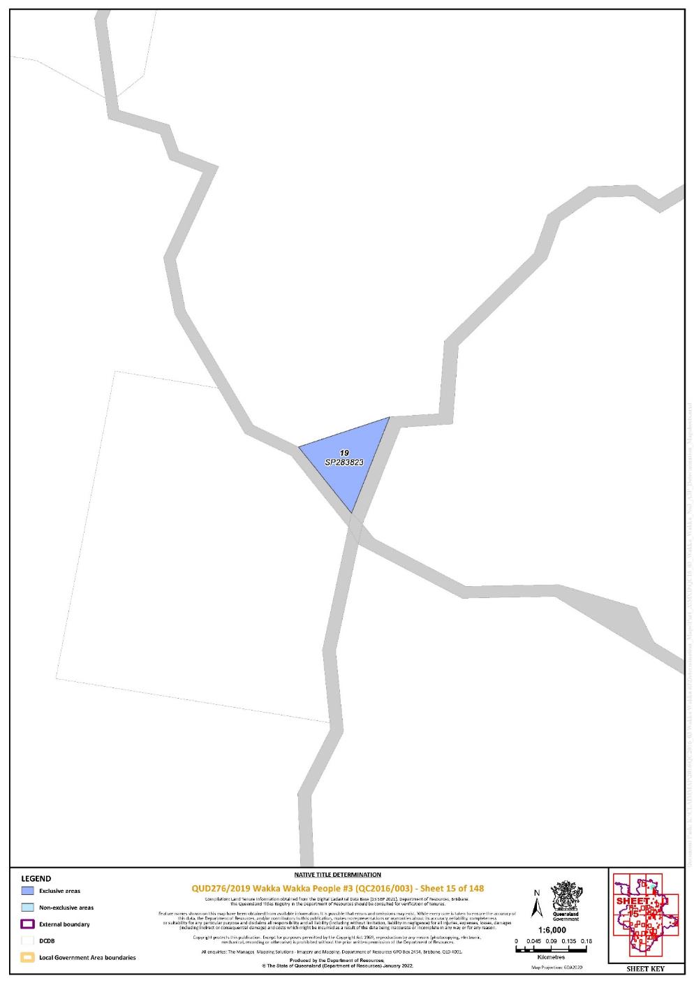
Lot 19 on Plan SP283823 | 15 | |||||||||||||||||||||||||
Lot 380 on Plan SP284168 | 85 | ^ | ||||||||||||||||||||||||
Lot 381 on Plan SP284168 | 85 | ^ | ||||||||||||||||||||||||
Lot 95 on Plan SP302001 | 128 | |||||||||||||||||||||||||
Lot 401 on Plan SP303247 | 83 | ^ | ||||||||||||||||||||||||
Lot 402 on Plan SP303247 | 82, 83 | ^ | ||||||||||||||||||||||||
Lot 29 on Plan SP310061 | 84 | ^ | ||||||||||||||||||||||||
Lot 30 on Plan SP310061 | 84 | ^ | ||||||||||||||||||||||||
Lot 31 on Plan SP310061 | 84 | ^ | ||||||||||||||||||||||||
Lot 32 on Plan SP310061 | 84 | ^ | ||||||||||||||||||||||||
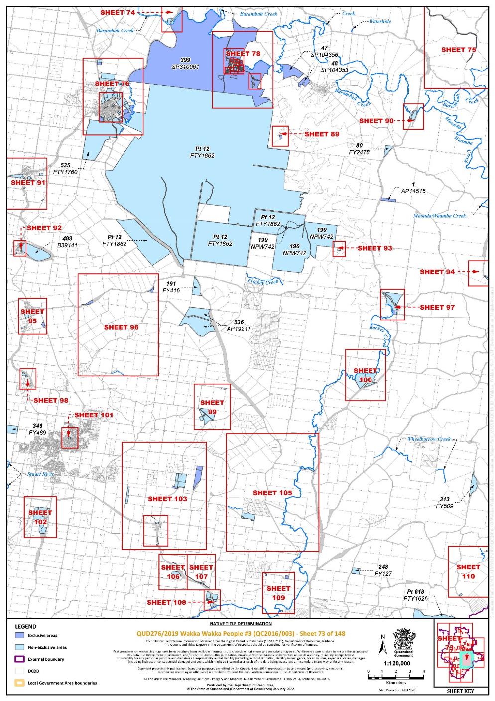
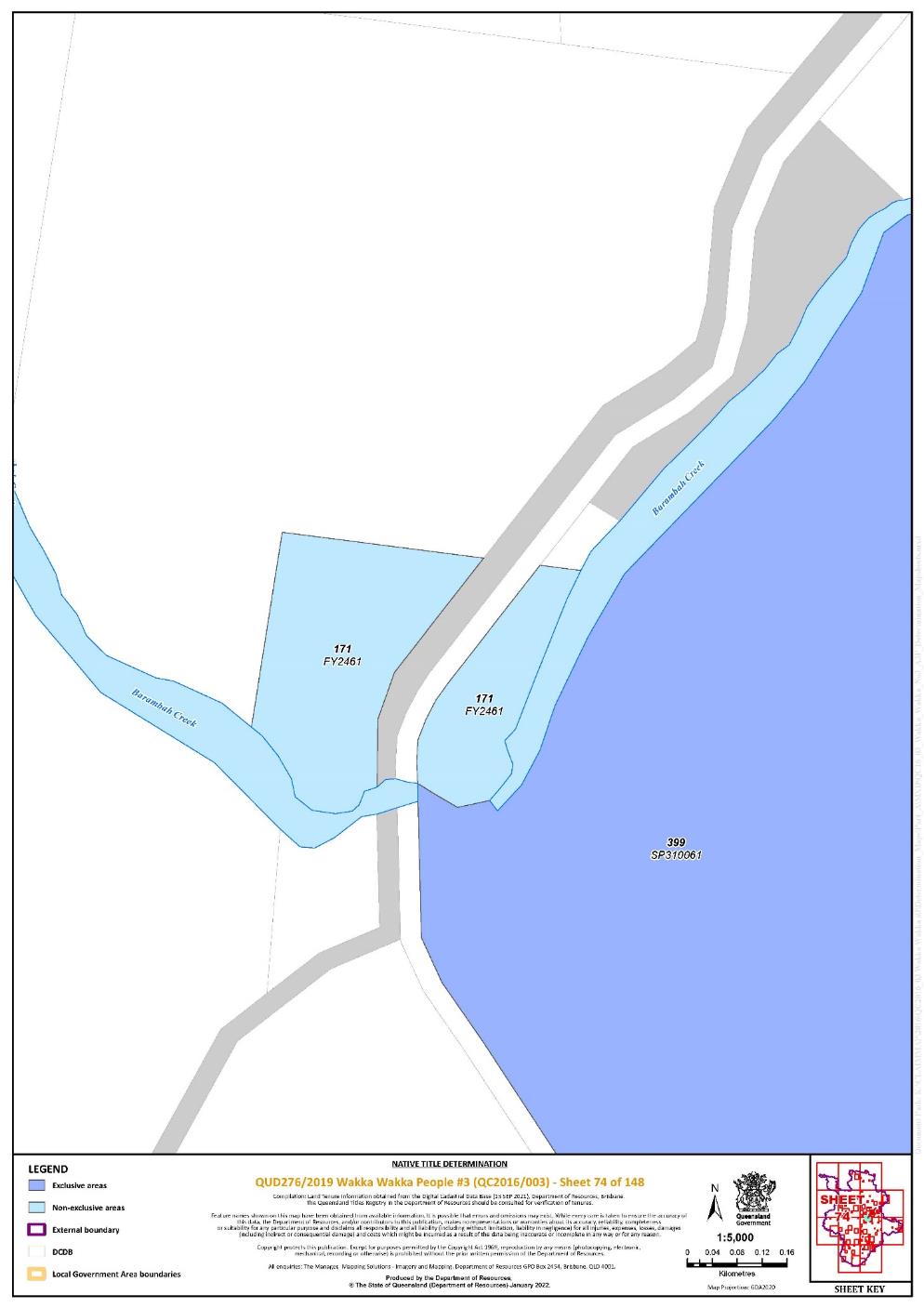
Lot 399 on Plan SP310061 | 73, 74, 76, 78, 79, 80, 82, 83, 84, 85, 86, 87, 88 | ^ | ||||||||||||||||||||||||
Lot 173 on Plan USL39481 | 143 | |||||||||||||||||||||||||
Lot 142 on Plan USL39485 | 107 | |||||||||||||||||||||||||
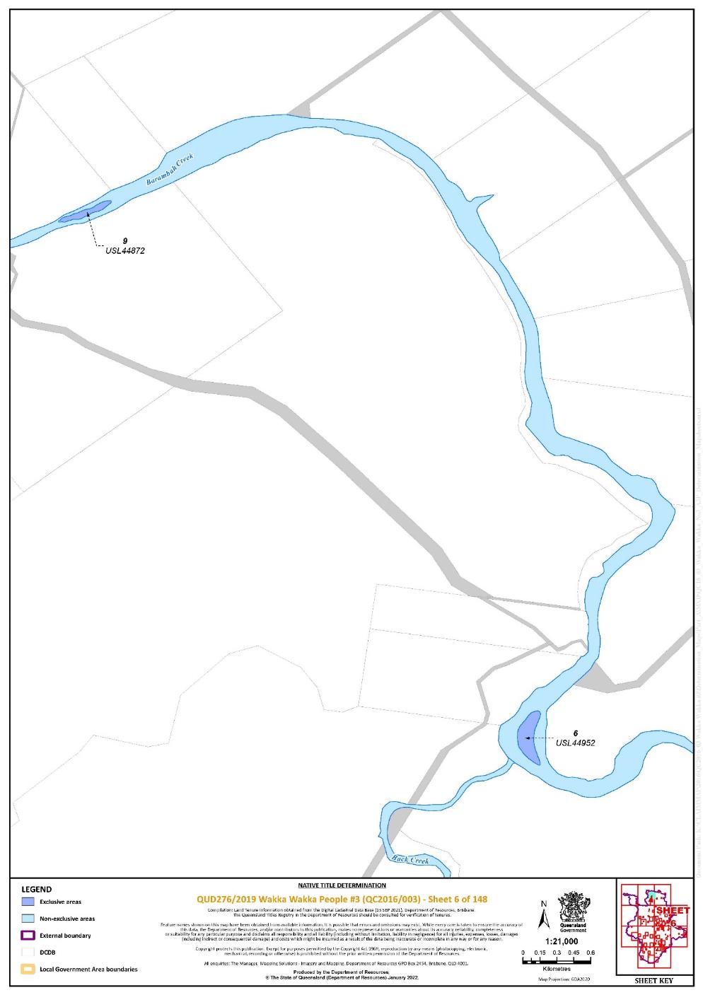
Lot 9 on Plan USL44872 | 6 | |||||||||||||||||||||||||
Lot 6 on Plan USL44952 | 6 | |||||||||||||||||||||||||
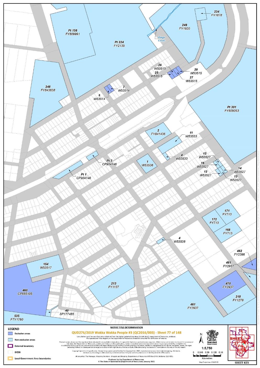
Lot 6 on Plan W53514 | 77 | |||||||||||||||||||||||||
Lot 7 on Plan W53514 | 77 | |||||||||||||||||||||||||
Lot 25 on Plan W53515 | 77 | |||||||||||||||||||||||||
Lot 26 on Plan W53515 | 77 | |||||||||||||||||||||||||
Lot 27 on Plan W53515 | 77 | |||||||||||||||||||||||||
Lot 28 on Plan W53515 | 77 | |||||||||||||||||||||||||
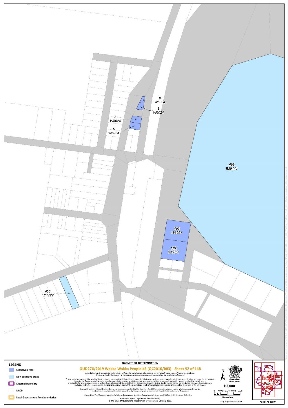
Lot 102 on Plan W6021 | 92 | |||||||||||||||||||||||||
Lot 103 on Plan W6021 | 92 | |||||||||||||||||||||||||
Lot 5 on Plan W6024 | 92 | |||||||||||||||||||||||||
Lot 6 on Plan W6024 | 92 | |||||||||||||||||||||||||
Lot 8 on Plan W6024 | 92 | |||||||||||||||||||||||||
Lot 9 on Plan W6024 | 92 | |||||||||||||||||||||||||
Area of new road between stations 6-7-14-15-B-C-6 shown on Plan SP302001 | 128 | ~ | ||||||||||||||||||||||||
Area of new road between stations 4-5-9-11-12-4 as shown on Plan SP282095 | 45 | ~ |
^ denotes areas to which s 47A of the Native Title Act 1993 (Cth) apply
~ denotes areas to which s 24KA of the Native Title Act 1993 (Cth) apply
“Pt” denotes areas that are part areas as a result of the External Boundary
Part 2 — Non-Exclusive Areas
All of the land and waters described in the following table and depicted in light blue on the determination map contained in Schedule 6:
Area description (at the time of the determination) | Determination Map Sheet Reference | Note | ||||||||||||||||||
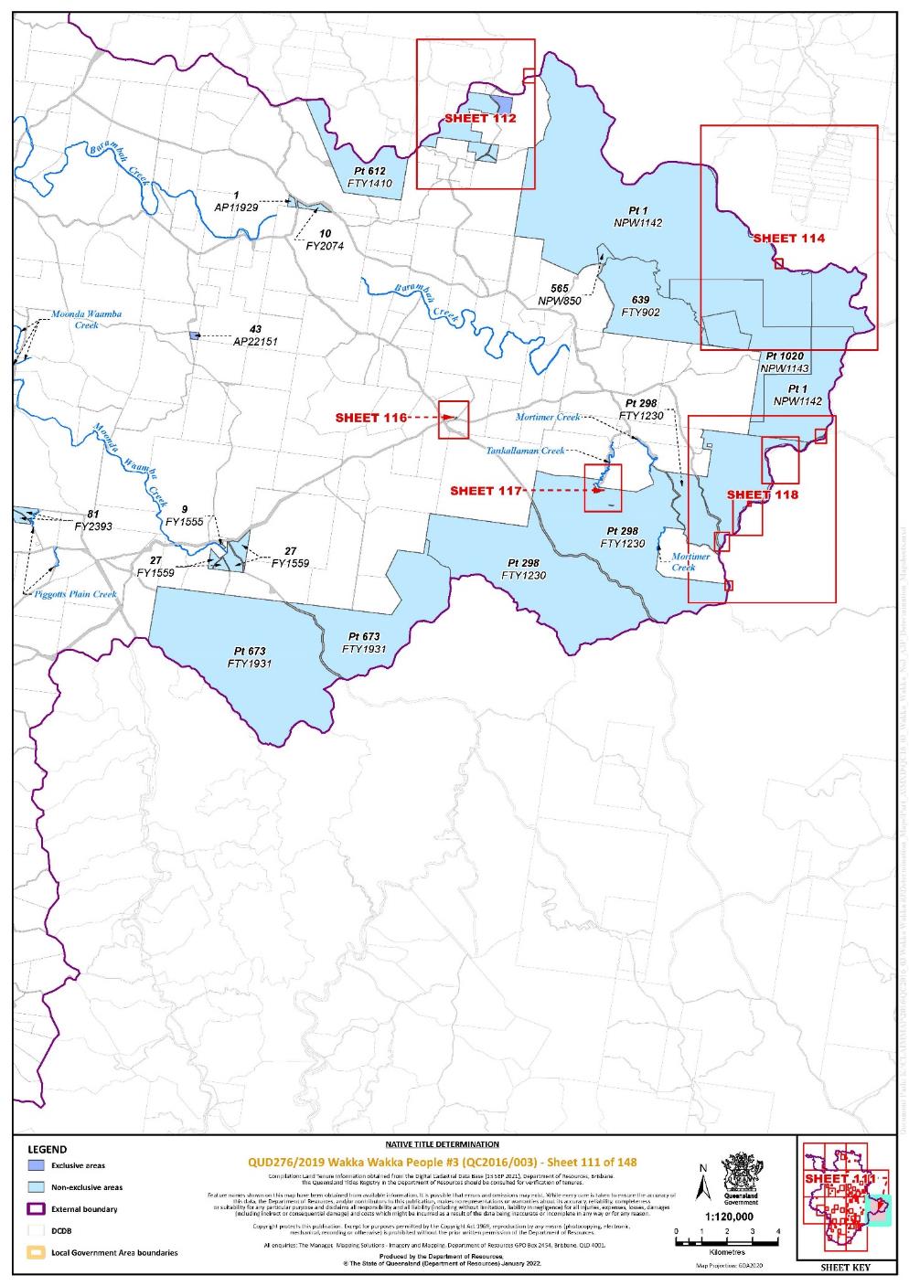
Lot 1 on Plan AP11929 | 111 | |||||||||||||||||||
Lot 536 on Plan AP19211 | 73 | |||||||||||||||||||
Lot 38 on Plan AP20942 | 21 | |||||||||||||||||||
Lot 499 on Plan B39141 | 73, 92 | |||||||||||||||||||
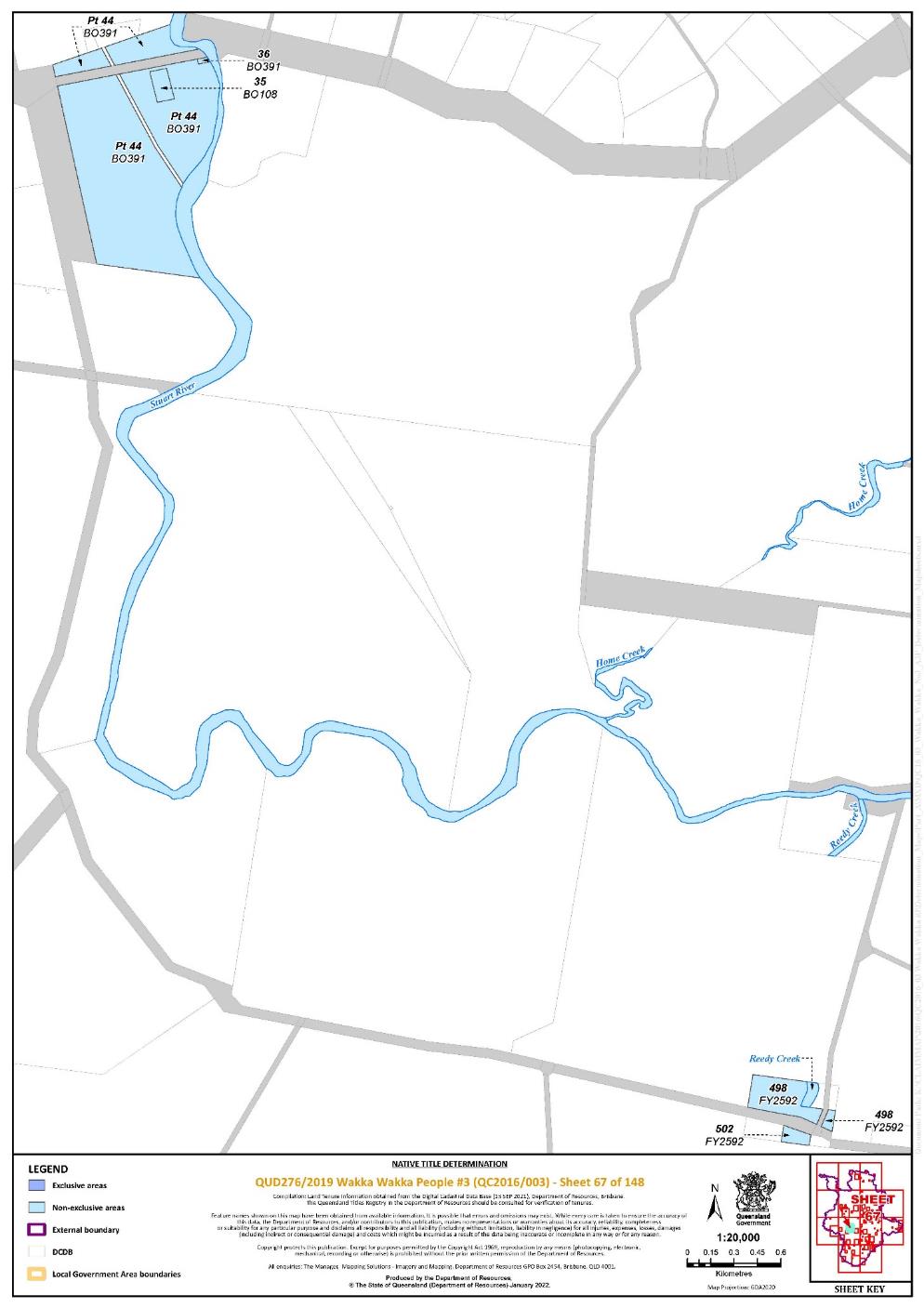
Lot 35 on Plan BO108 | 67 | |||||||||||||||||||
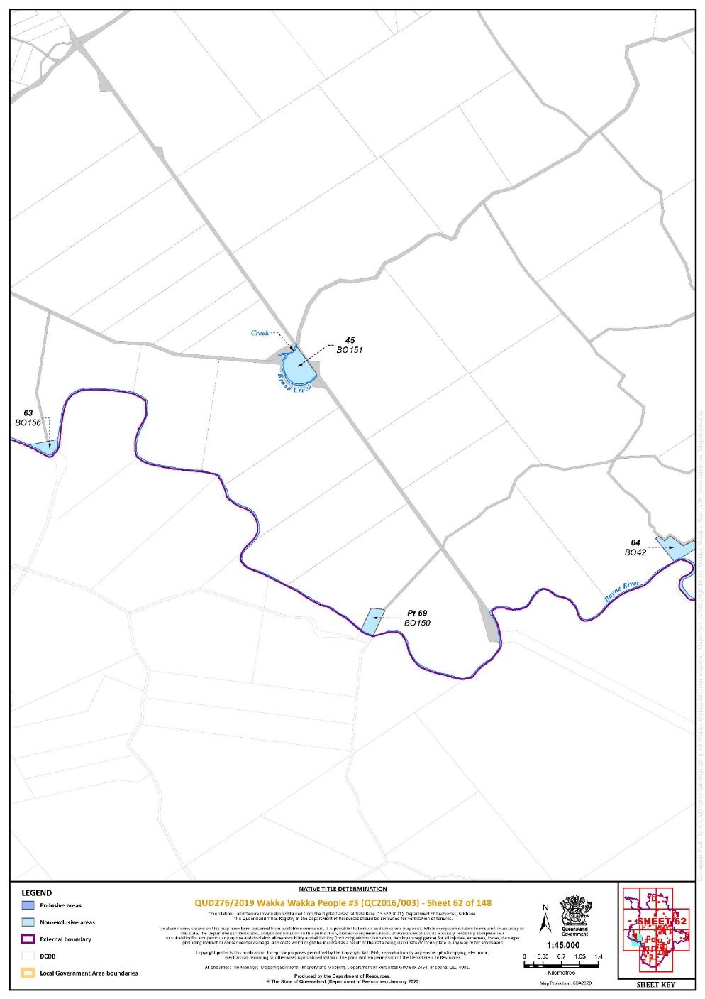
Lot 69 on Plan BO150 | 62 | Pt | ||||||||||||||||||
Lot 45 on Plan BO151 | 62 | |||||||||||||||||||
Lot 63 on Plan BO156 | 62 | |||||||||||||||||||
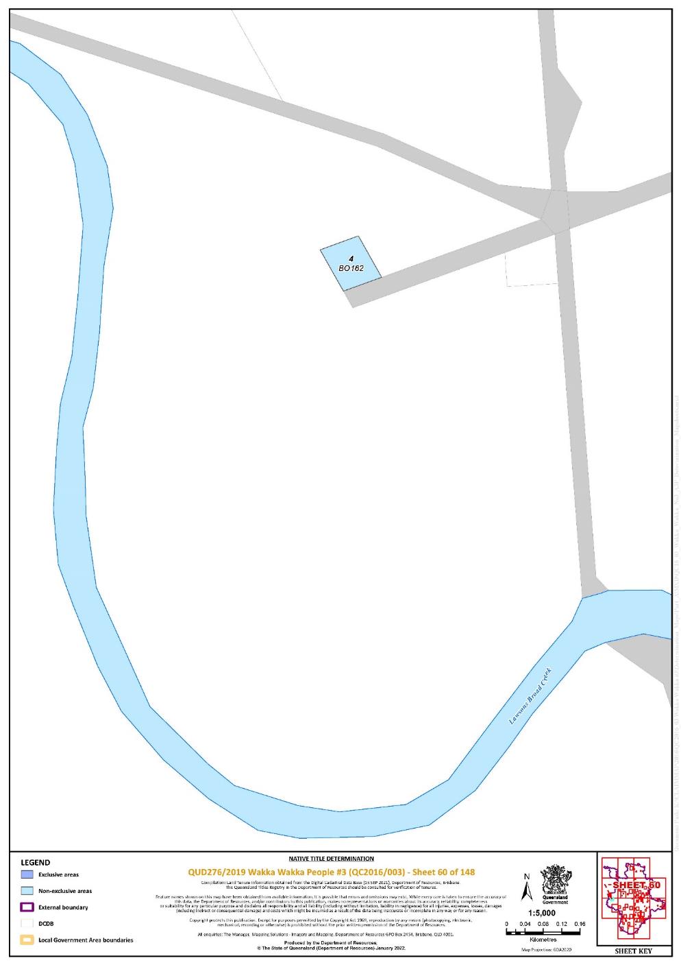
Lot 4 on Plan BO162 | 60 | |||||||||||||||||||
Lot 94 on Plan BO172 | 63 | |||||||||||||||||||
Lot 30 on Plan BO188 | 70 | |||||||||||||||||||
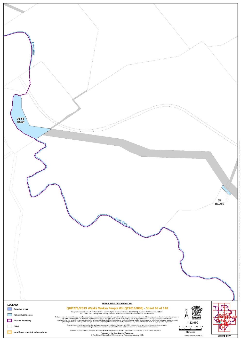
Lot 54 on Plan BO360 | 69 | |||||||||||||||||||
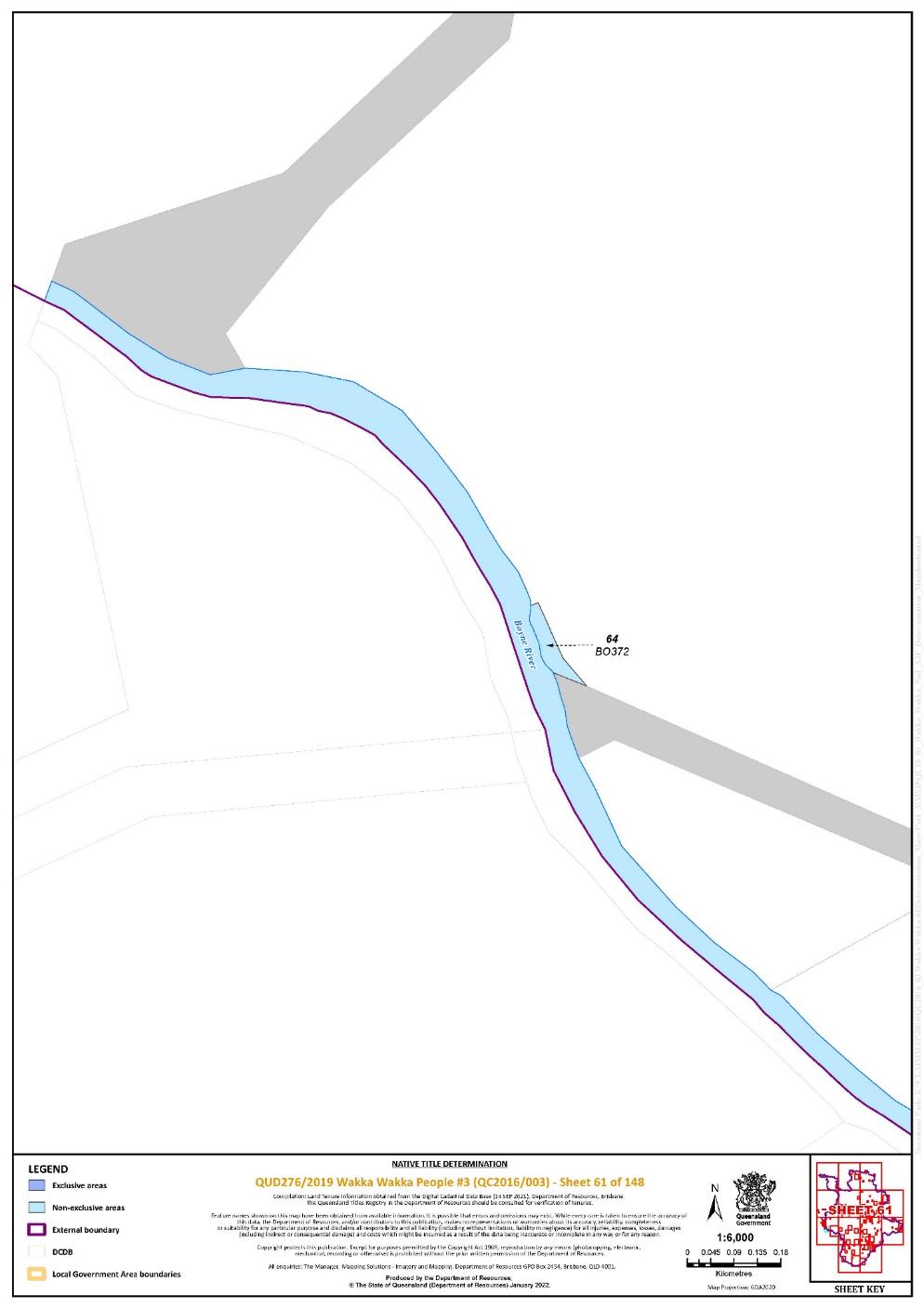
Lot 64 on Plan BO372 | 61 | |||||||||||||||||||
Lot 36 on Plan BO391 | 67 | |||||||||||||||||||
That part of Lot 44 on Plan BO391 excluding Easements A and B on Plan BO391 | 67 | |||||||||||||||||||
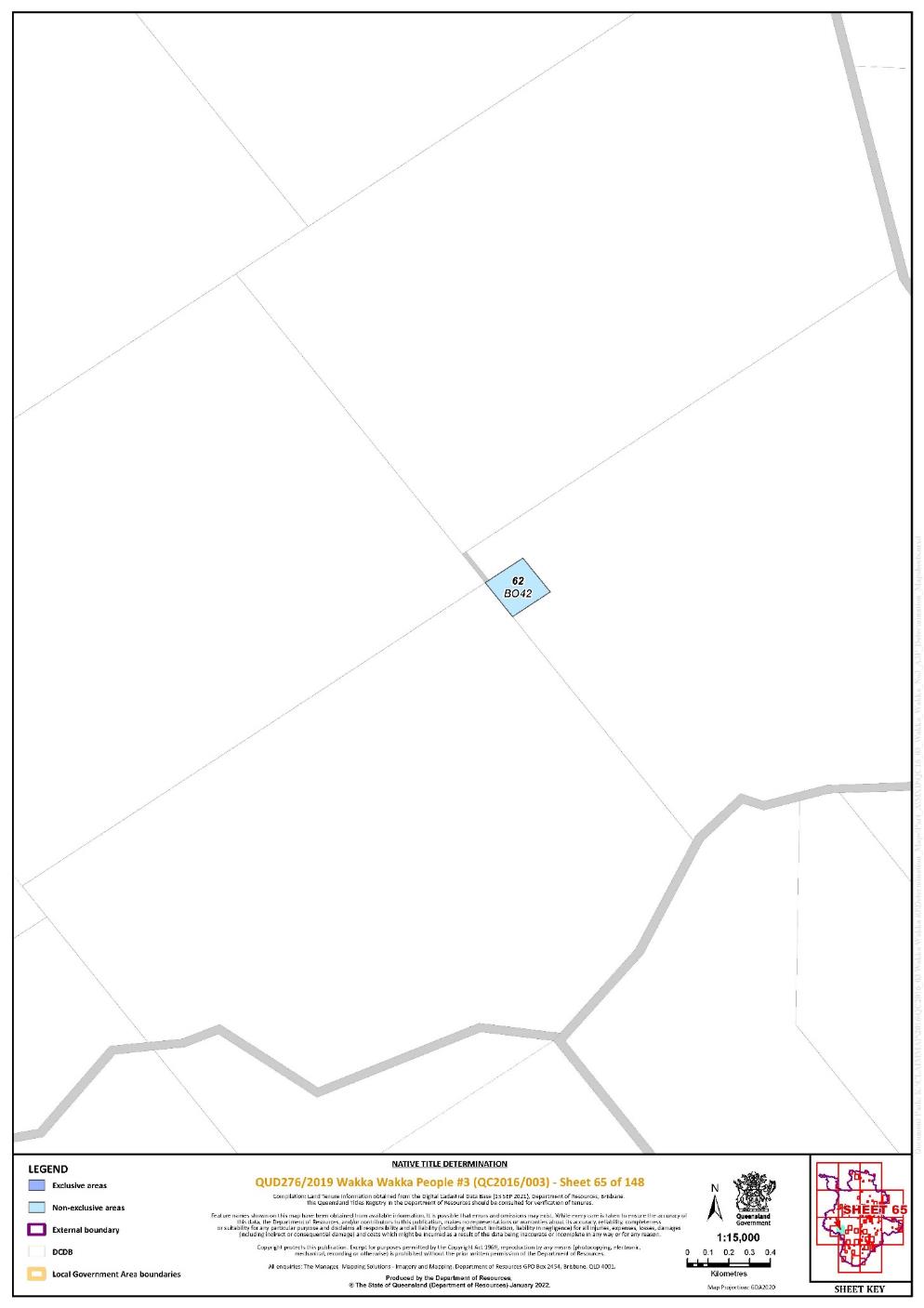
Lot 62 on Plan BO42 | 65 | |||||||||||||||||||
Lot 64 on Plan BO42 | 62, 63 | |||||||||||||||||||
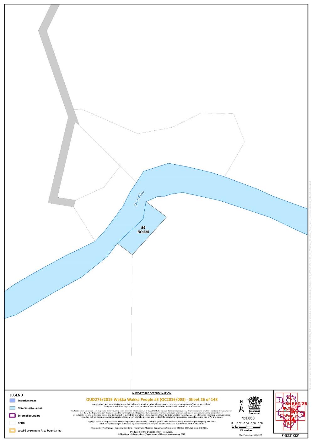
Lot 86 on Plan BO445 | 26 | |||||||||||||||||||
Lot 97 on Plan BO488 | 16 | |||||||||||||||||||
That part of Lot 93 on Plan BO511 excluding the area subject to Road between stations 60-33-70-2-3-4-6-5-64-61-60 on Plan BO48 | 24 | |||||||||||||||||||
Lot 42 on Plan BO546 | 24 | |||||||||||||||||||
Lot 20 on Plan BO66 | 70 | |||||||||||||||||||
Lot 63 on Plan BO98 | 69 | Pt | ||||||||||||||||||
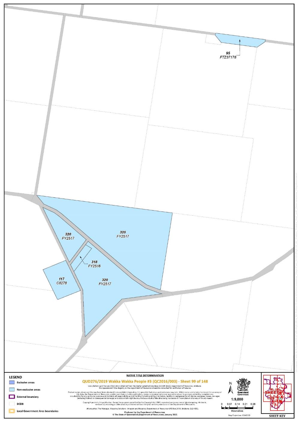
Lot 117 on Plan C8278 | 99 | |||||||||||||||||||
Lot 53 on Plan CL6011 | 11 | |||||||||||||||||||
Lot 189 on Plan CL6011 | 11 | |||||||||||||||||||
Lot 55 on Plan CP881251 | 45 | |||||||||||||||||||
That part of Lot 25 on Plan CP902126 excluding the area subject to Road between stations A-B-C-D on Plan CP902126 | 140, 142 | |||||||||||||||||||
That part of Lot 1 on Plan CP904146 excluding the area subject to former Lot 4 on Plan CP904145 | 77 | |||||||||||||||||||
That part of Lot 3 on Plan CP904146 excluding the area subject to former Lot 4 on Plan CP904145 | 77 | |||||||||||||||||||
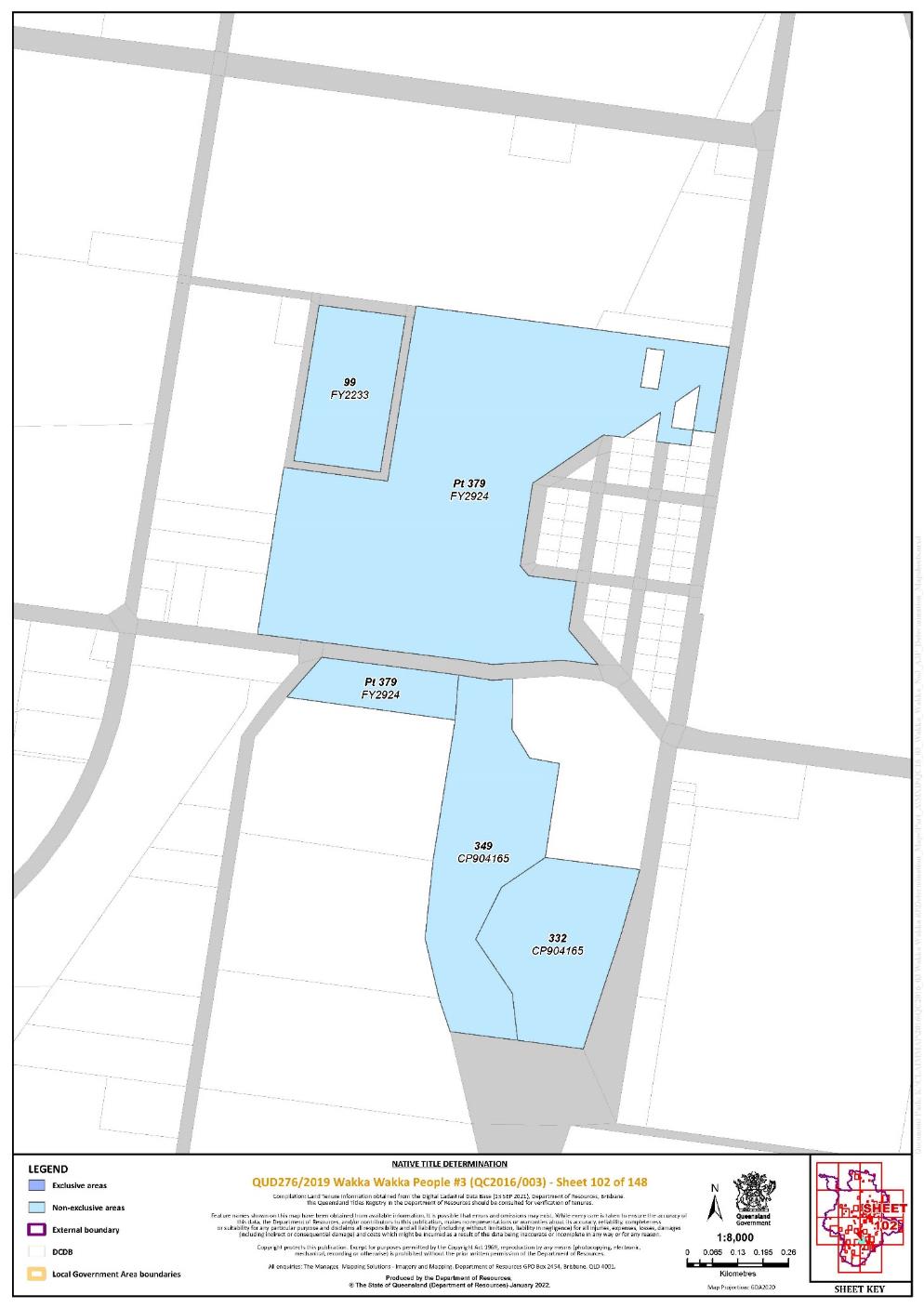
Lot 332 on Plan CP904165 | 102 | |||||||||||||||||||
Lot 349 on Plan CP904165 | 102 | |||||||||||||||||||
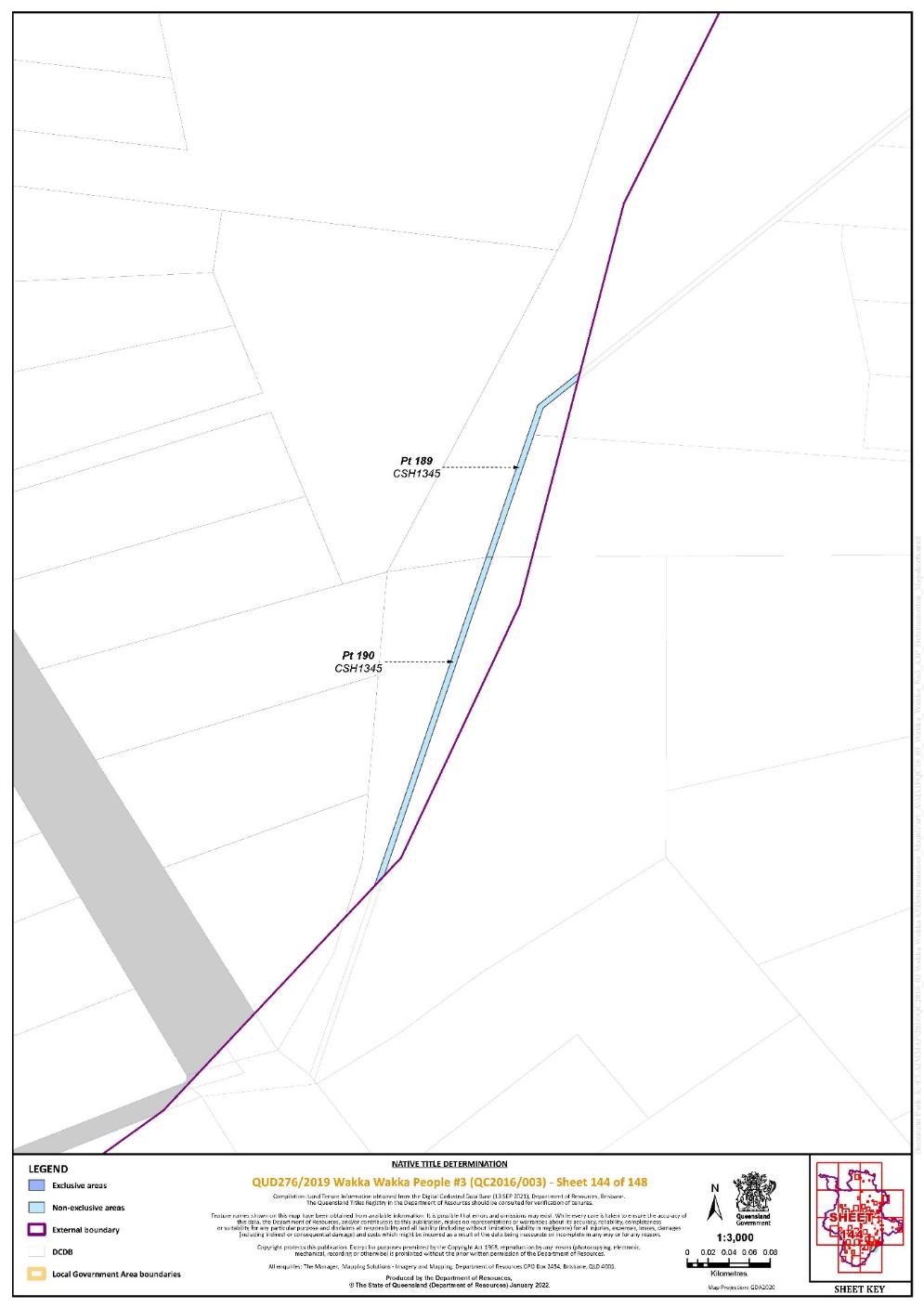
Lot 189 on Plan CSH1345 | 144 | Pt | ||||||||||||||||||
Lot 190 on Plan CSH1345 | 144 | Pt | ||||||||||||||||||
Lot 255 on Plan FTY1025 | 19 | |||||||||||||||||||
Lot 127 on Plan FTY1135 | 63, 66 | |||||||||||||||||||
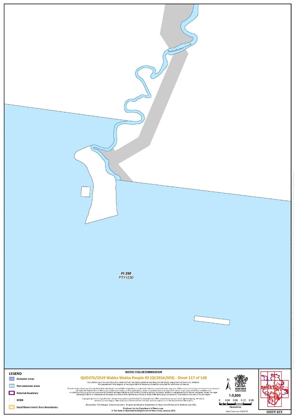
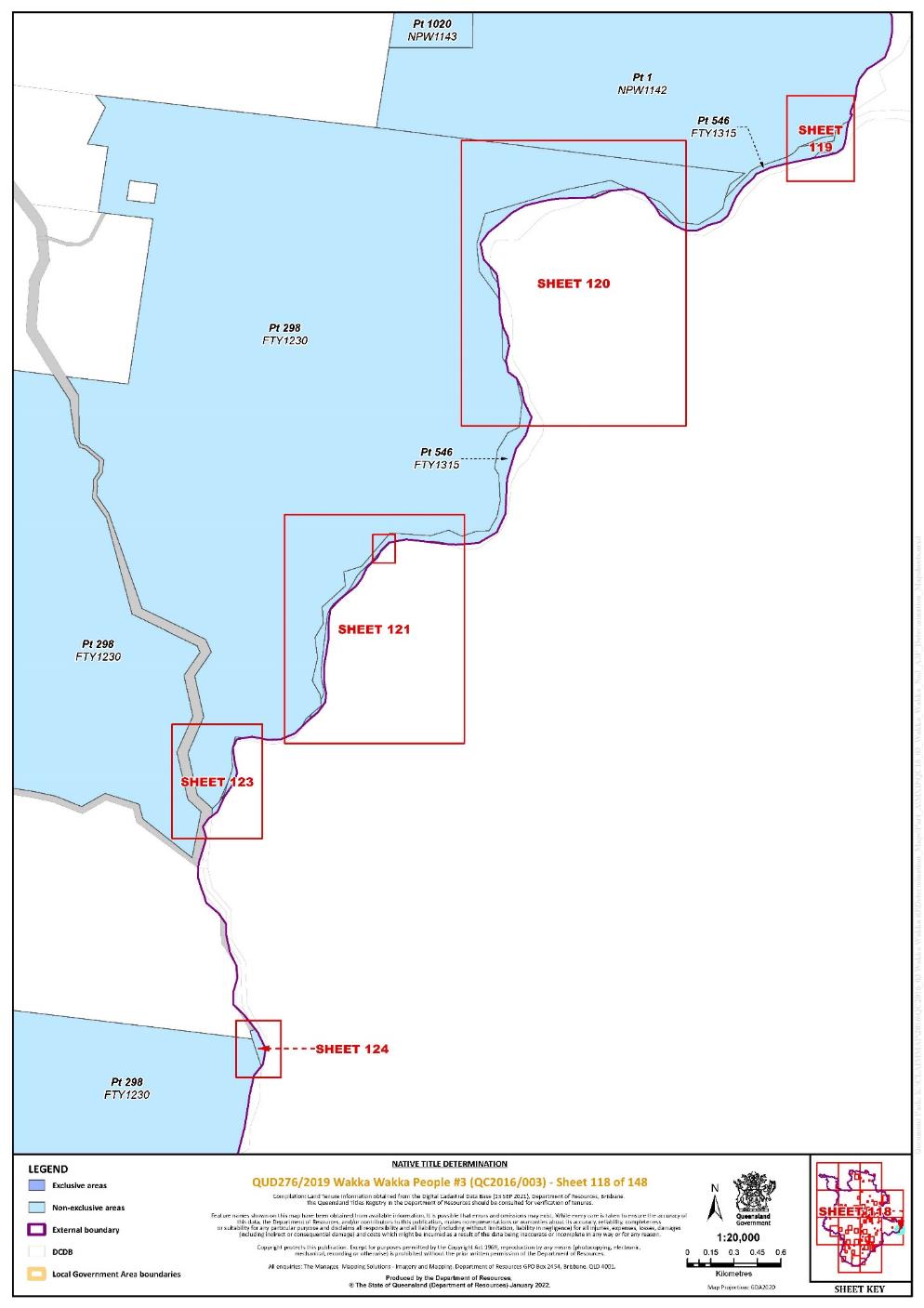
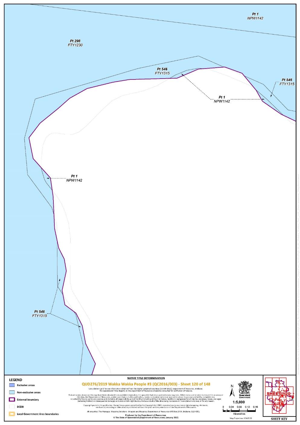
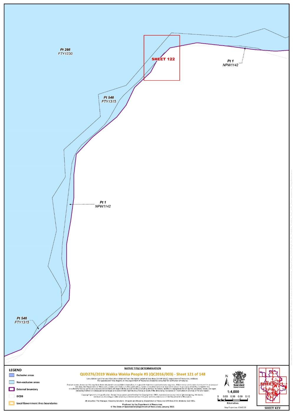
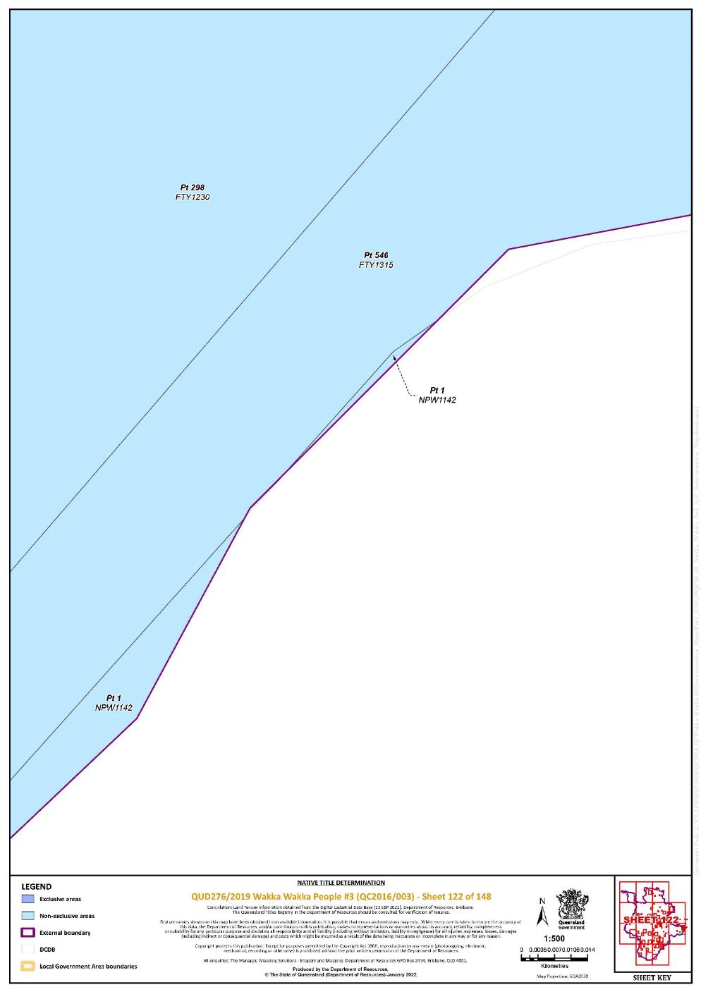
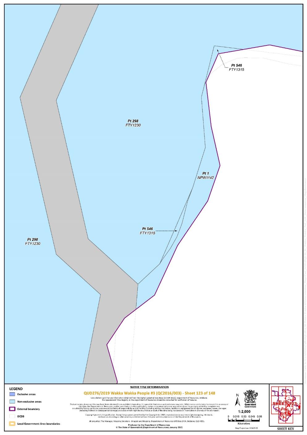
That part of Lot 298 on Plan FTY1230 excluding the areas subject to: - historical Portion 54 on Plan FY1560; - historical Portion 31 on Plan FY1723; - historical Portion 29 on Plan FY645; and - historical Portion 24 on Plan FY1524 | 111, 117, 118, 120, 121, 122, 123, 124 | Pt | ||||||||||||||||||
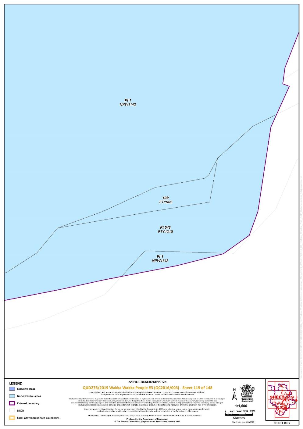
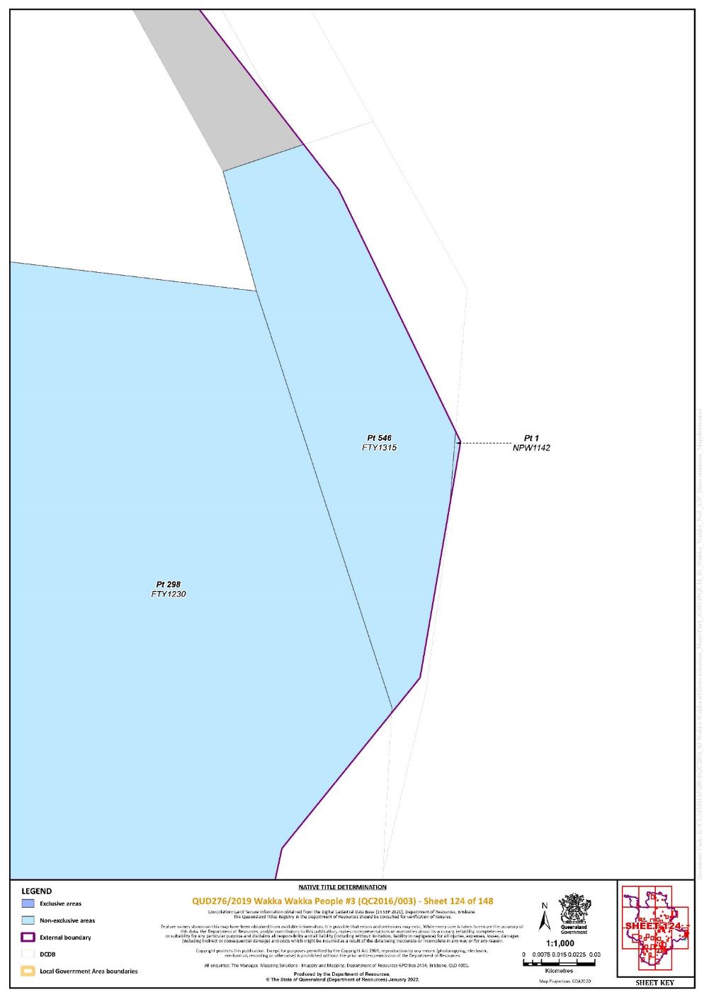
Lot 546 on Plan FTY1315 | 118, 119, 120, 121, 122, 123, 124 | Pt | ||||||||||||||||||
That part of Lot 118 on Plan FTY1342 excluding the area subject to historical Portion 53 on Plan FY901 | 135 | |||||||||||||||||||
Lot 138 on Plan FTY1389 | 112 | Pt | ||||||||||||||||||
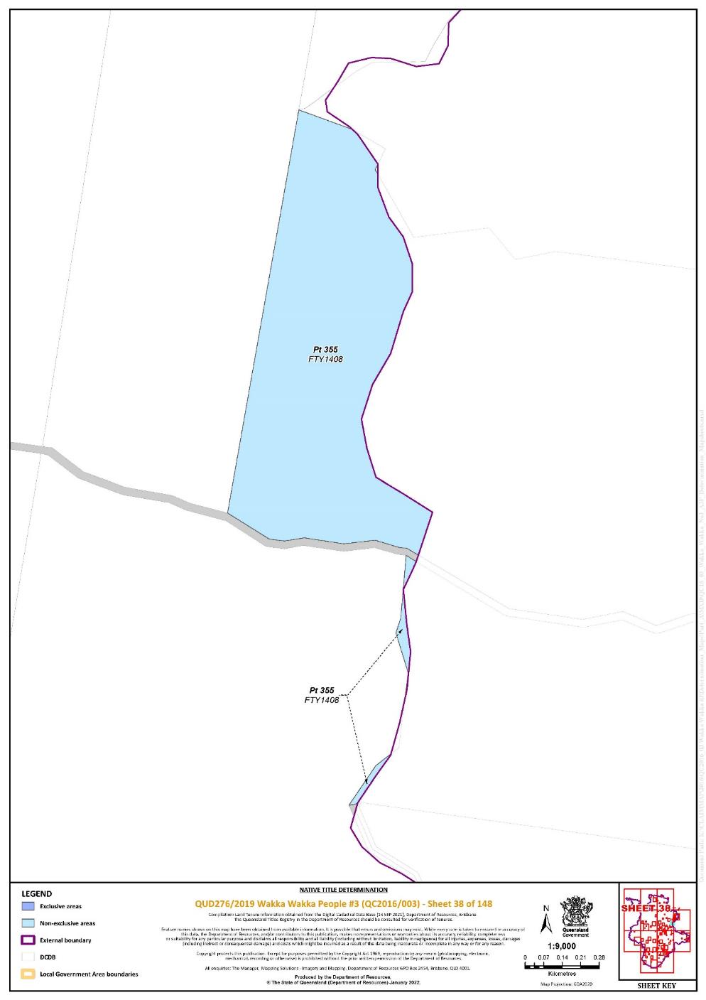
Lot 355 on Plan FTY1408 | 38 | Pt | ||||||||||||||||||
Lot 612 on Plan FTY1410 | 111 | Pt | ||||||||||||||||||
Lot 618 on Plan FTY1626 | 73, 135 | Pt | ||||||||||||||||||
Lot 535 on Plan FTY1760 | 73, 76, 77 | |||||||||||||||||||
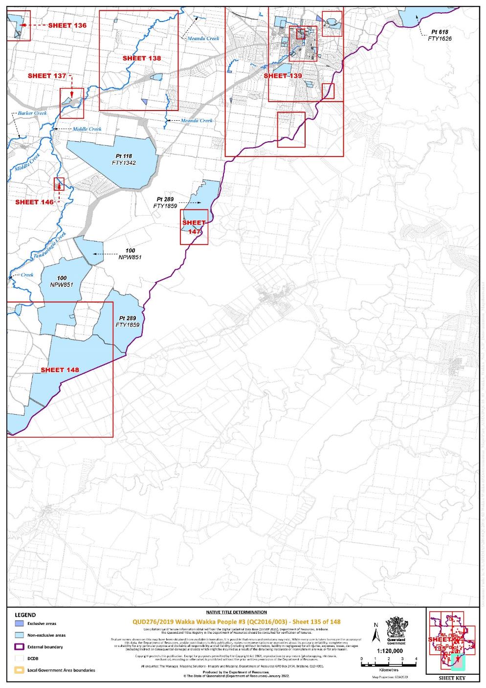
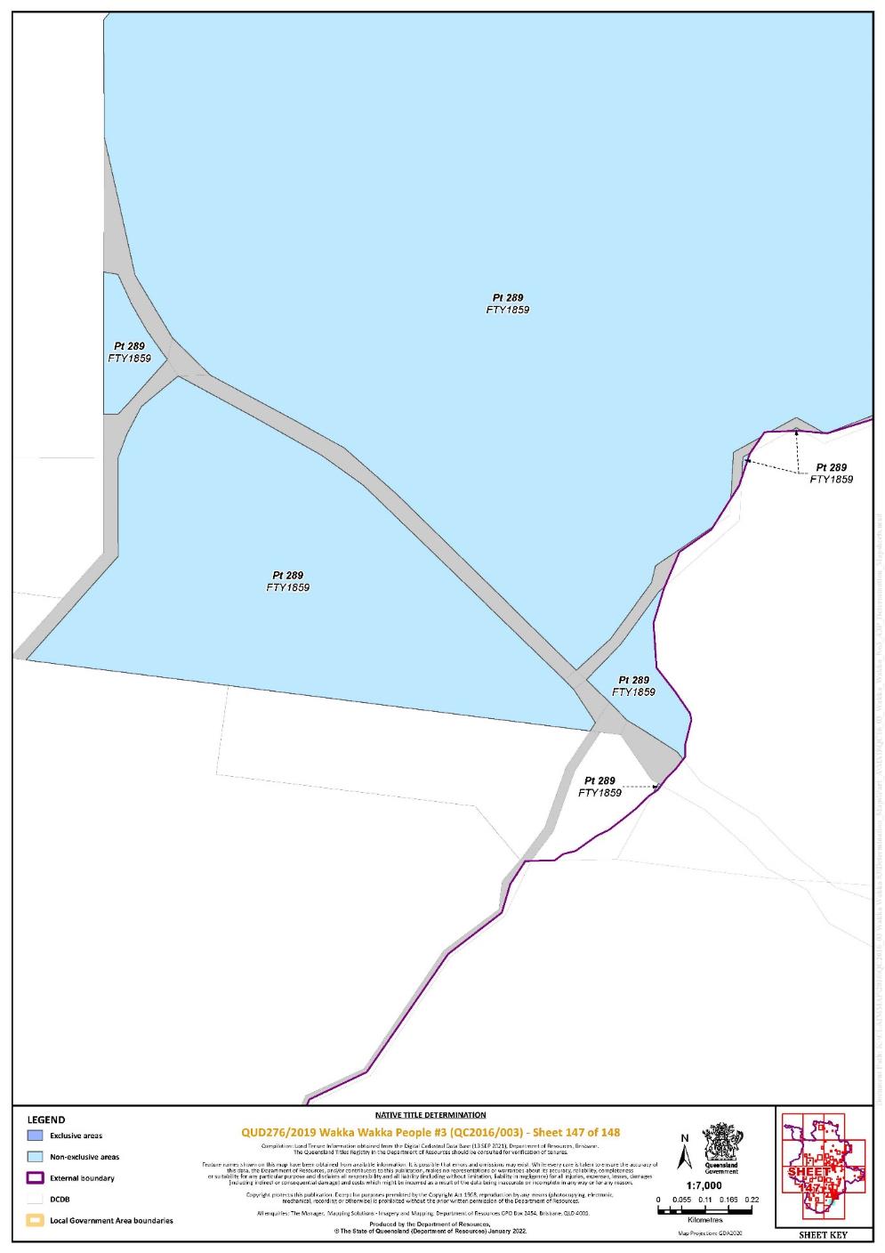
Lot 289 on Plan FTY1859 | 133, 135, 147, 148 | Pt | ||||||||||||||||||
That part of Lot 12 on Plan FTY1862 excluding the areas subject to: - historical Portion 38 on Plan FY516; - historical Portion 53 on Plan FY516; - historical Portion 1 on Plan FTZ3729; - historical Portion 153 on Plan FY778; - historical Portion 152 on Plan FY778; - historical Portion 67 on Plan FTZ37413; - historical Portion 2v on Plan FTZ37150; - historical Portion 3v on Plan FTZ37150; - historical Portion 4v on Plan FTZ37150; - historical Portion 154 on Plan FY1220; - Road between stations 8-8b-1a-1-8 and 2-2b-1b-1-2 on Plan FTZ37413; and Road separating Portion 3v from Portion 4v on Plan FTZ37150 | 73, 76, 78 | |||||||||||||||||||
Lot 673 on Plan FTY1931 | 111 | Pt | ||||||||||||||||||
Lot 254 on Plan FTY1956 | 19 | |||||||||||||||||||
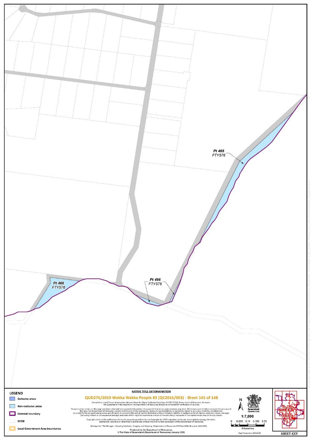
Lot 466 on Plan FTY576 | 145 | Pt | ||||||||||||||||||
Lot 146 on Plan FTY673 | 19, 24, 63 | |||||||||||||||||||
Lot 210 on Plan FTY702 | 19 | |||||||||||||||||||
Lot 95 on Plan FTY751 | 1 | Pt | ||||||||||||||||||
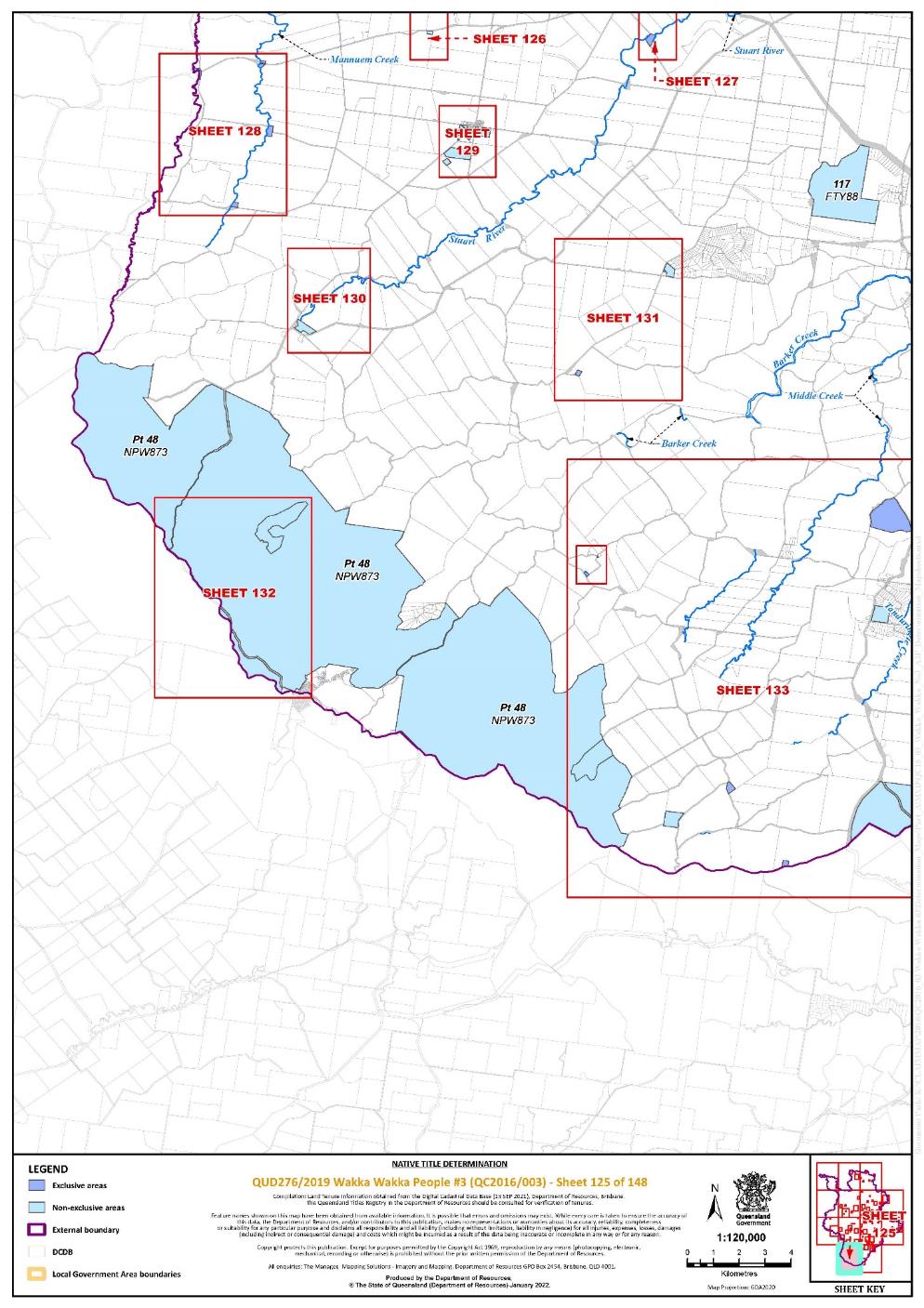
Lot 117 on Plan FTY88 | 125 | |||||||||||||||||||
Lot 639 on Plan FTY902 | 111, 114, 119 | |||||||||||||||||||
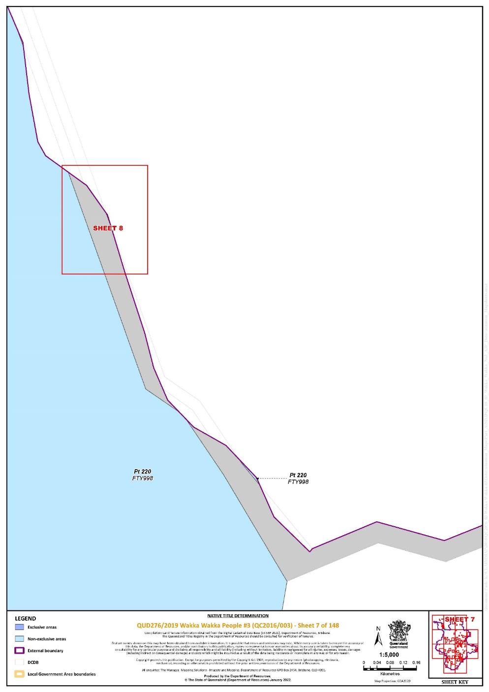
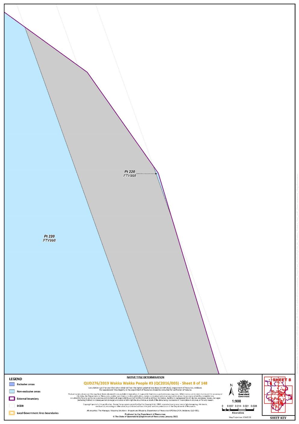
Lot 220 on Plan FTY998 | 1, 2, 3, 7, 8, 17, 19 | Pt | ||||||||||||||||||
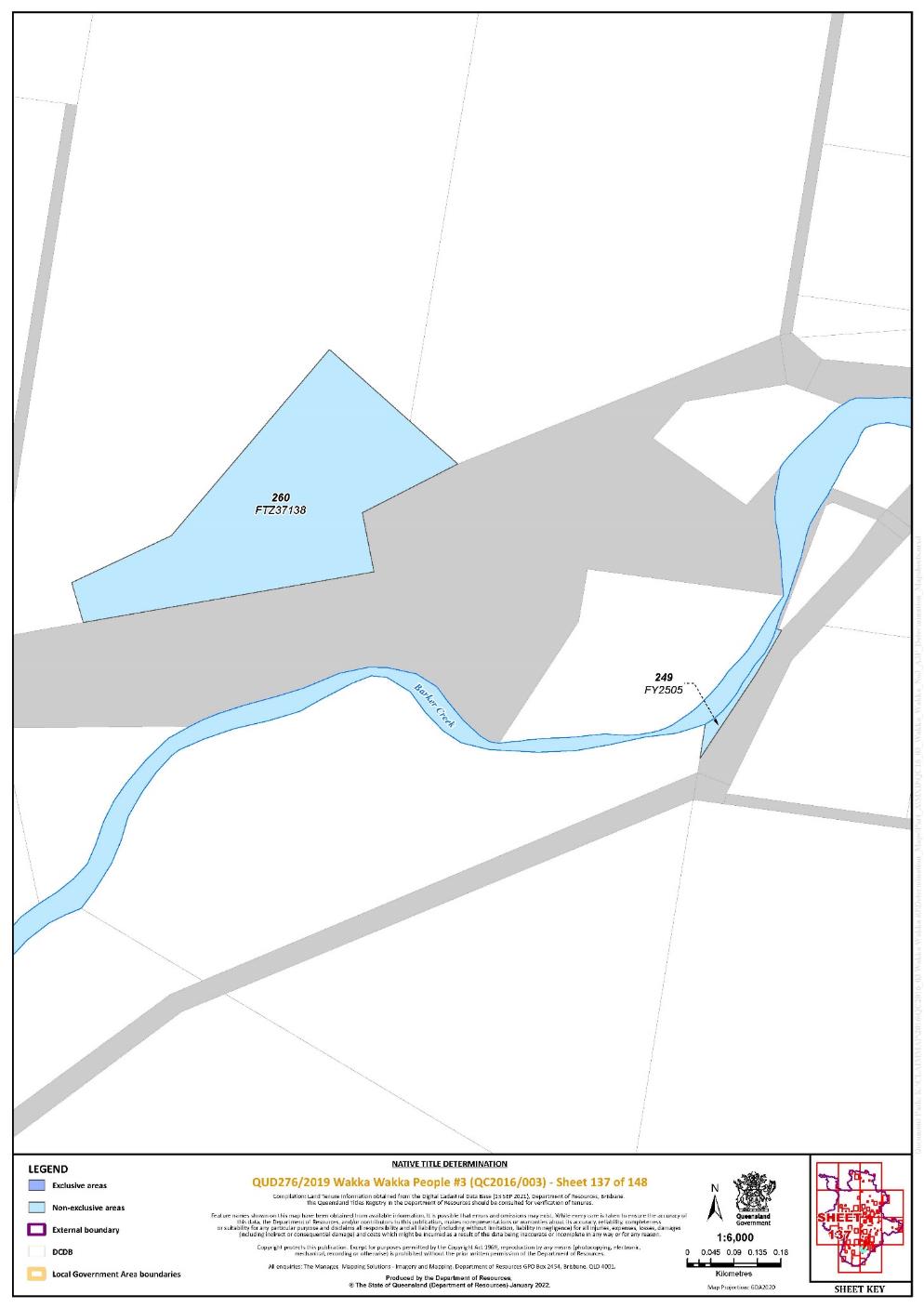
Lot 260 on Plan FTZ37138 | 137 | |||||||||||||||||||
Lot 95 on Plan FTZ37178 | 99 | |||||||||||||||||||
Lot 246 on Plan FTZ37297 | 106 | |||||||||||||||||||
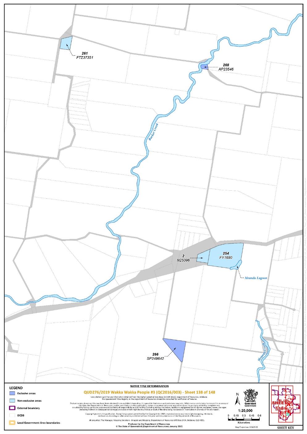
Lot 261 on Plan FTZ37351 | 138 | |||||||||||||||||||
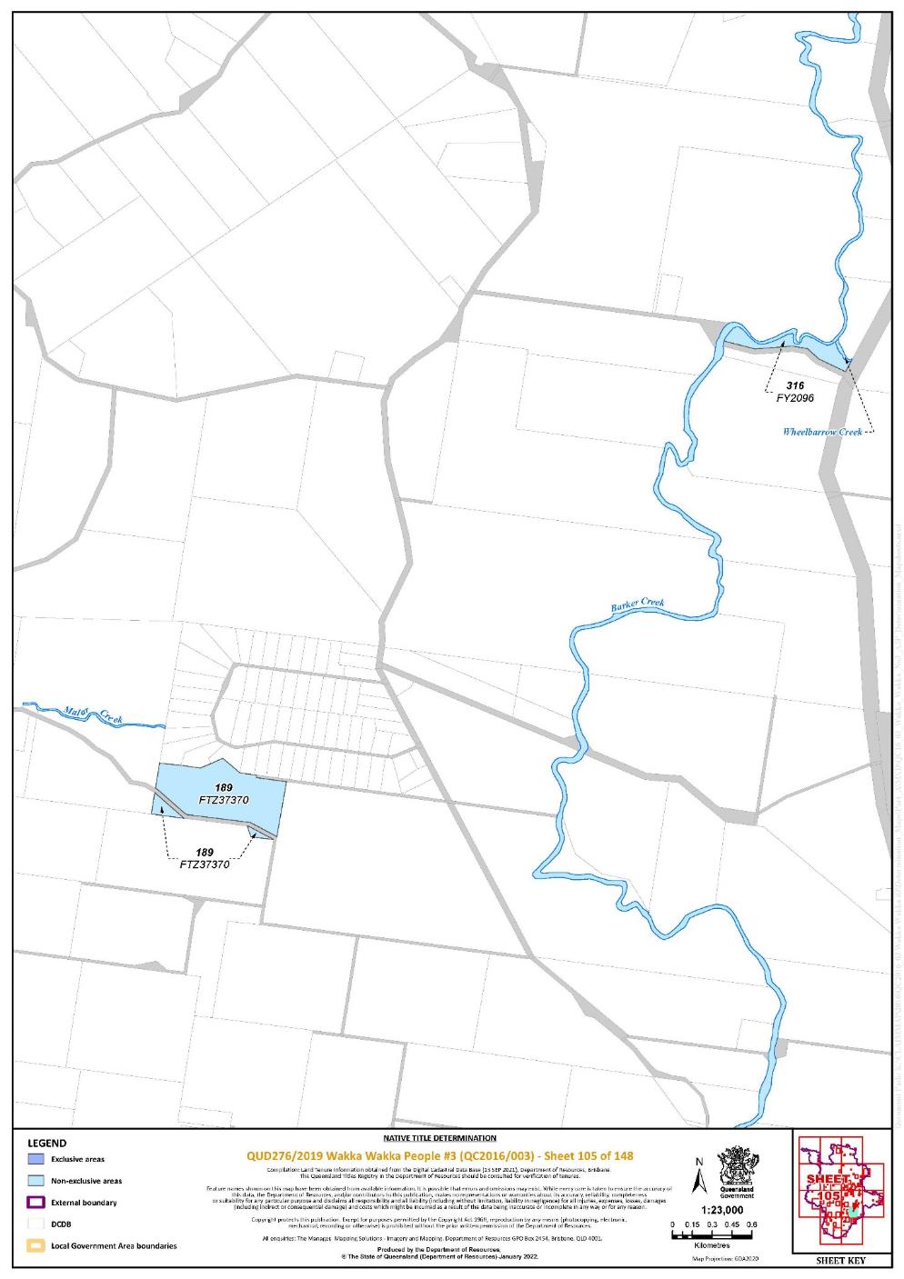
Lot 189 on Plan FTZ37370 | 105 | |||||||||||||||||||
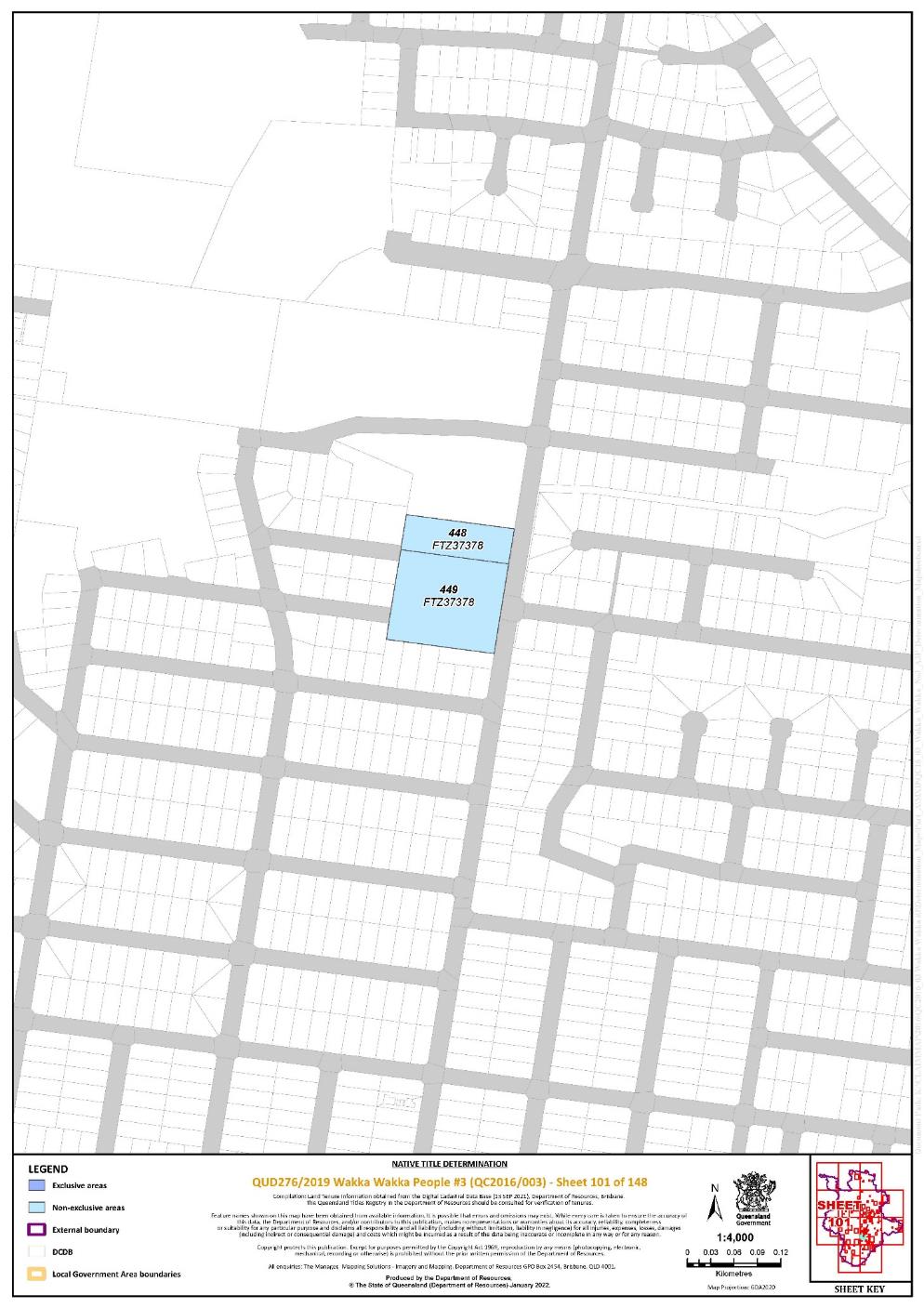
Lot 448 on Plan FTZ37378 | 101 | |||||||||||||||||||
Lot 449 on Plan FTZ37378 | 101 | |||||||||||||||||||
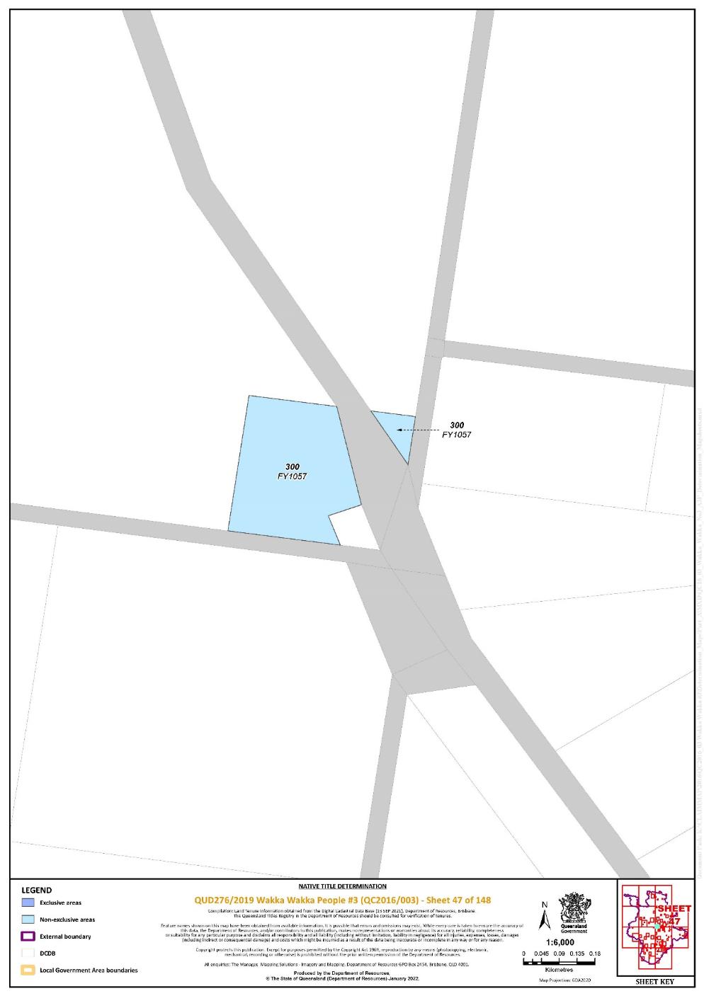
Lot 300 on Plan FY1057 | 47 | |||||||||||||||||||
Lot 3 on Plan FY106 | 109 | |||||||||||||||||||
Lot 181 on Plan FY1092 | 103 | |||||||||||||||||||
Lot 182 on Plan FY1092 | 103 | |||||||||||||||||||
Lot 213 on Plan FY1137 | 77 | |||||||||||||||||||
Lot 164 on Plan FY124 | 133 | |||||||||||||||||||
Lot 248 on Plan FY127 | 73 | |||||||||||||||||||
Lot 218 on Plan FY1278 | 77 | |||||||||||||||||||
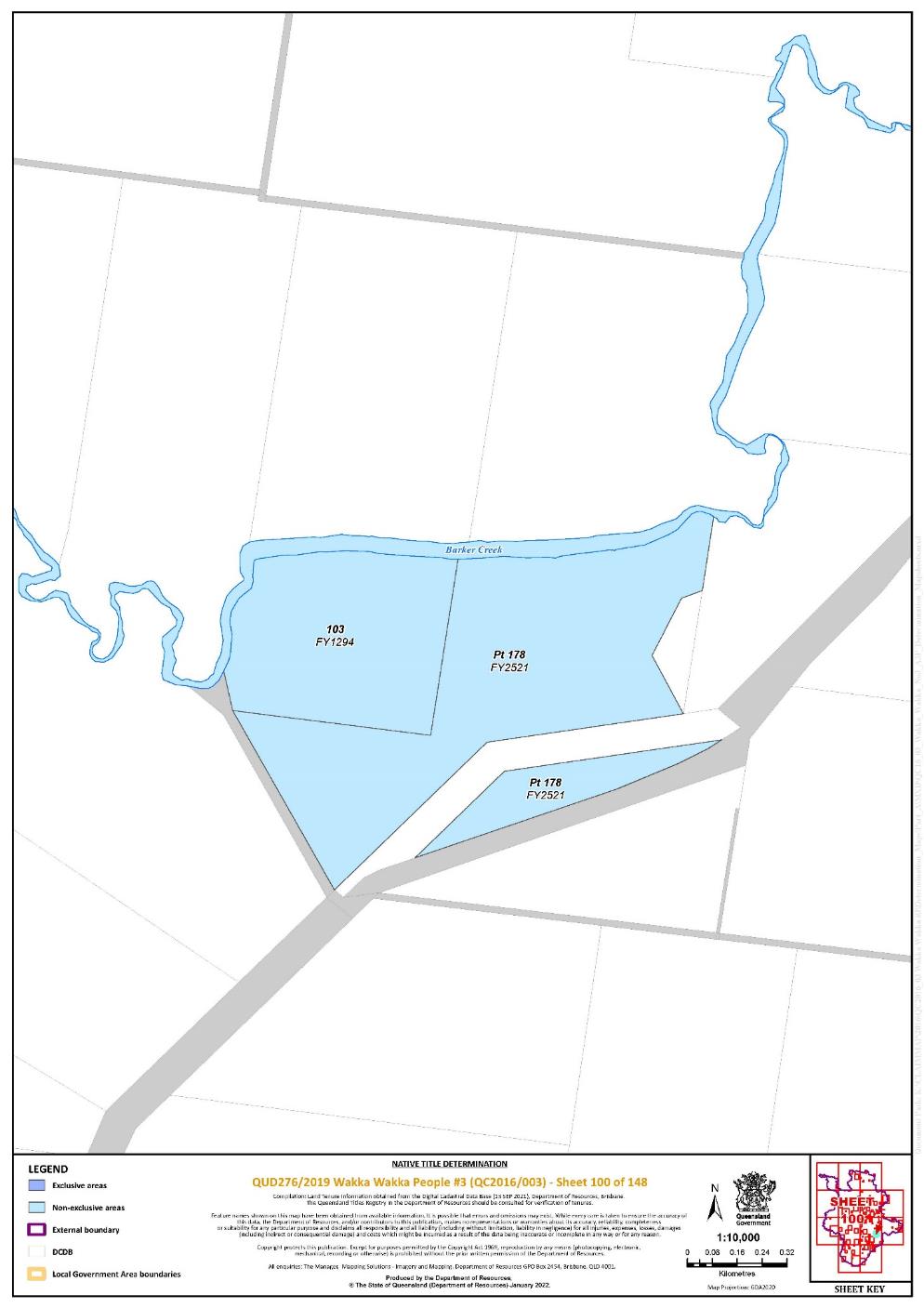
Lot 103 on Plan FY1294 | 100 | |||||||||||||||||||
Lot 198 on Plan FY1317 | 72 | |||||||||||||||||||
Lot 63 on Plan FY1391 | 42 | |||||||||||||||||||
Lot 68 on Plan FY1530 | 27 | |||||||||||||||||||
Lot 184 on Plan FY1534 | 143 | |||||||||||||||||||
Lot 264 on Plan FY1544 | 39 | |||||||||||||||||||
Lot 265 on Plan FY1553 | 42 | |||||||||||||||||||
Lot 9 on Plan FY1555 | 111 | |||||||||||||||||||
Lot 27 on Plan FY1559 | 111 | |||||||||||||||||||
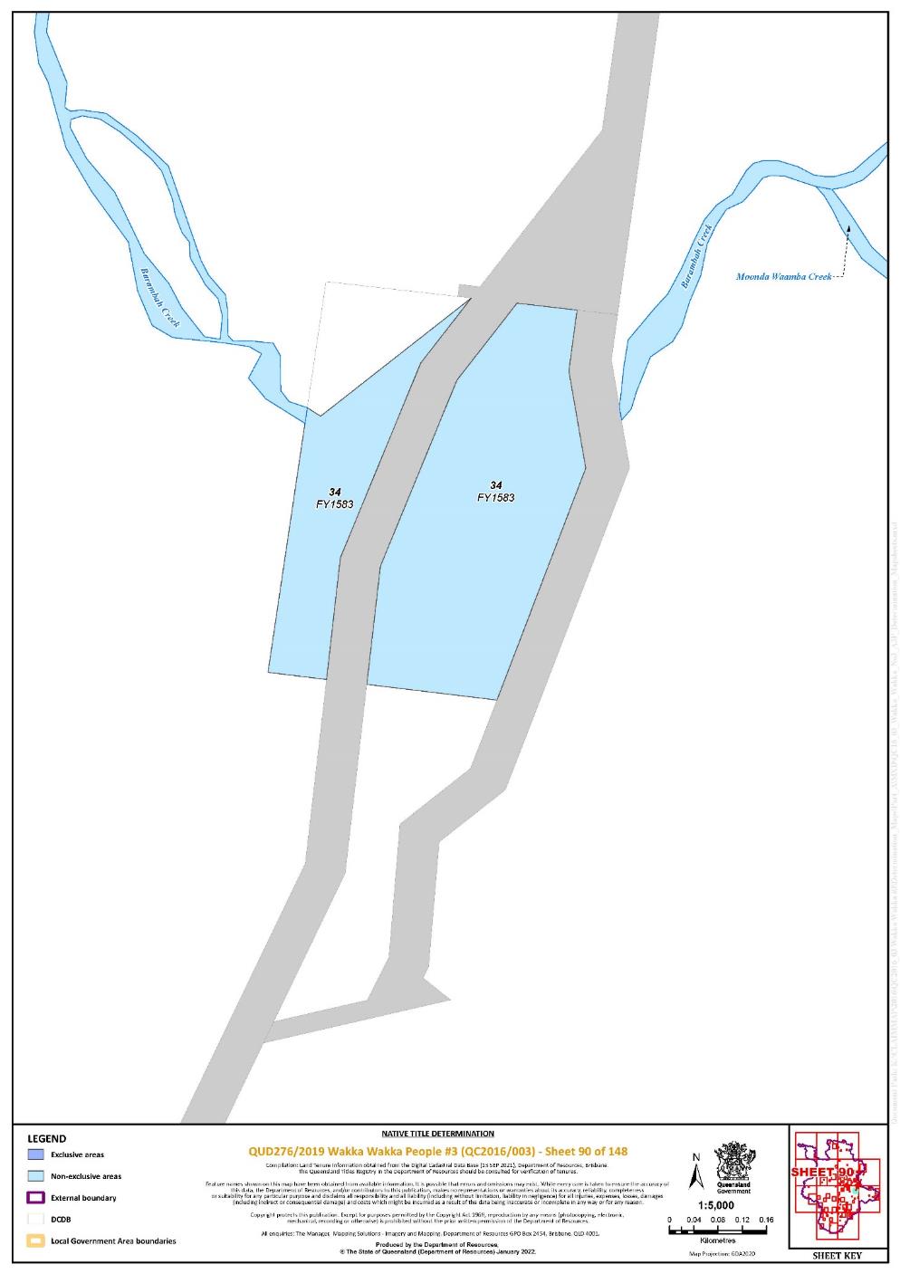
Lot 34 on Plan FY1583 | 90 | |||||||||||||||||||
Lot 191 on Plan FY1592 | 142, 143 | |||||||||||||||||||
Lot 184 on Plan FY1595 | 129 | |||||||||||||||||||
Lot 192 on Plan FY1629 | 142 | |||||||||||||||||||
Lot 254 on Plan FY1690 | 138 | |||||||||||||||||||
Lot 456 on Plan FY1722 | 92 | |||||||||||||||||||
Lot 280 on Plan FY1733 | 39 | |||||||||||||||||||
Lot 281 on Plan FY1733 | 39 | |||||||||||||||||||
Lot 296 on Plan FY175 | 95 | |||||||||||||||||||
Lot 310 on Plan FY175 | 95 | |||||||||||||||||||
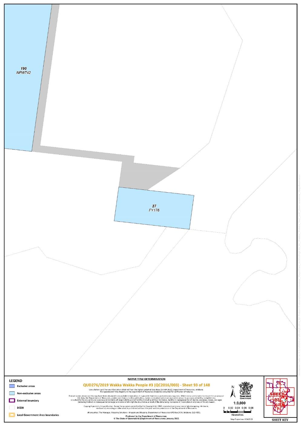
Lot 27 on Plan FY176 | 92 | |||||||||||||||||||
Lot 198 on Plan FY1776 | 140 | |||||||||||||||||||
Lot 469 on Plan FY1805 | 76 | |||||||||||||||||||
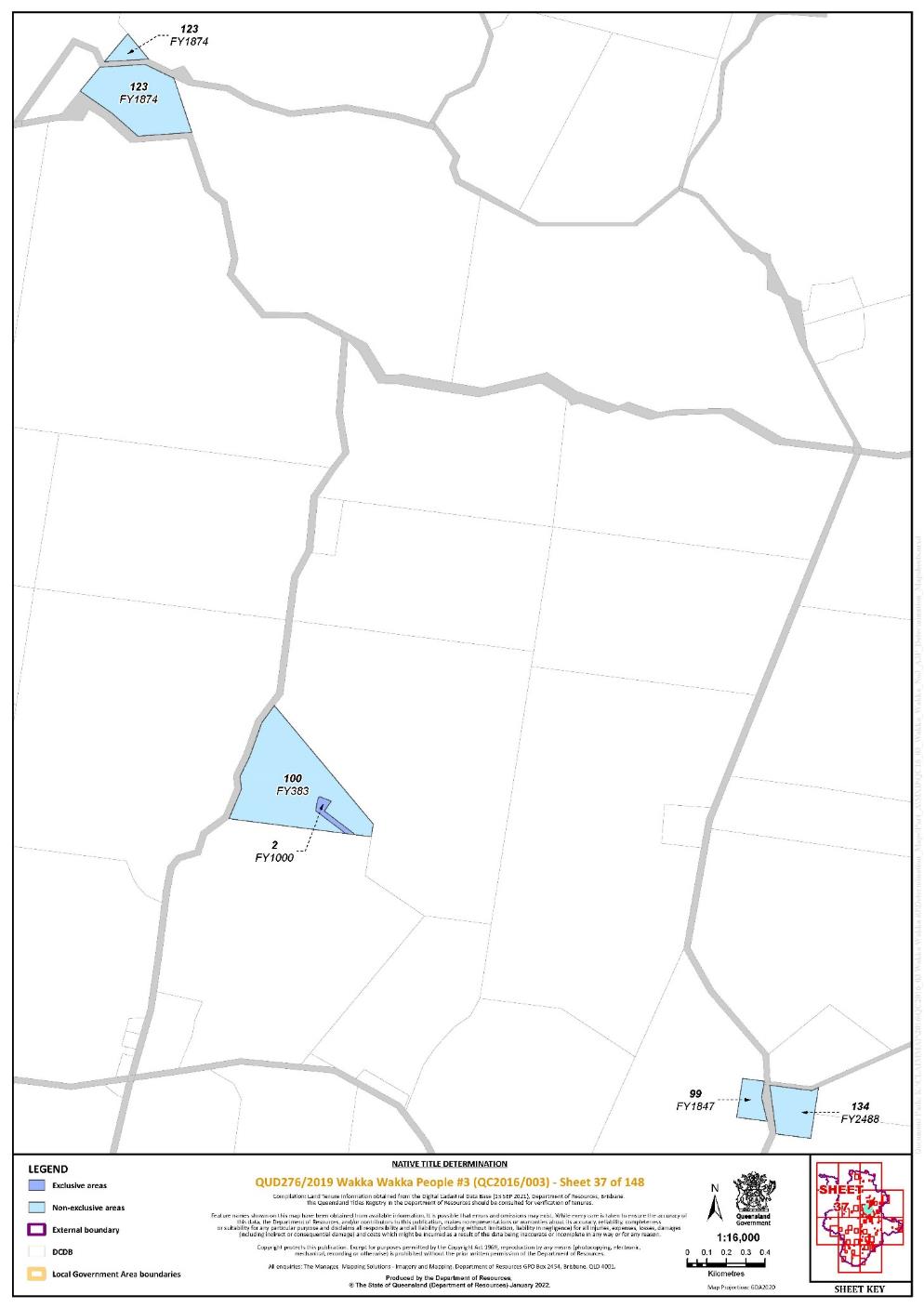
Lot 99 on Plan FY1847 | 37 | |||||||||||||||||||
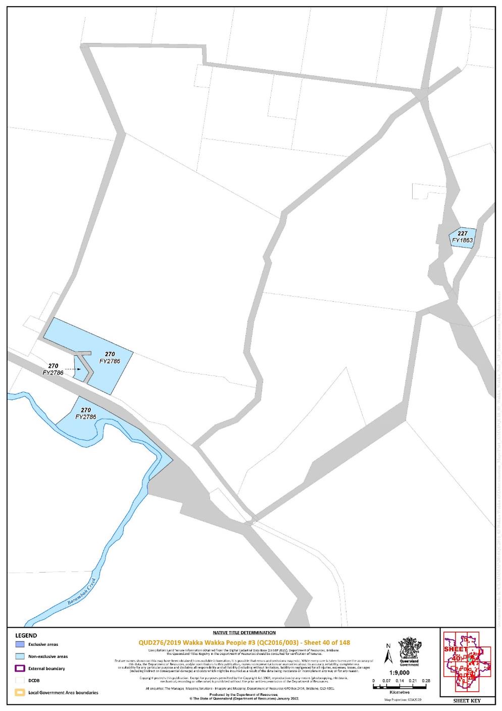
Lot 227 on Plan FY1863 | 40 | |||||||||||||||||||
Lot 123 on Plan FY1874 | 37 | |||||||||||||||||||
Lot 234 on Plan FY1878 | 77 | |||||||||||||||||||
Lot 249 on Plan FY1920 | 76, 77 | |||||||||||||||||||
That part of Lot 200 on Plan FY2026 excluding the area subject to Road between stations 4-4a-6a-6 on Plan FY2026 | 140 | |||||||||||||||||||
Lot 396 on Plan FY2057 | 71 | |||||||||||||||||||
Lot 10 on Plan FY2074 | 111 | |||||||||||||||||||
That part of Lot 222 on Plan FY2077 excluding the areas subject to: - historical Portion 253 on Plan FY1327; and - historical Portion 222 on Plan FY613 | 76 | |||||||||||||||||||
Lot 316 on Plan FY2096 | 105 | |||||||||||||||||||
Lot 62 on Plan FY2099 | 140 | |||||||||||||||||||
That part of Lot 224 on Plan FY2135 excluding the area subject to historical Portion 226 on Plan FY1483 | 76, 77 | |||||||||||||||||||
Lot 261 on Plan FY2165 | 39 | |||||||||||||||||||
Lot 211 on Plan FY2189 | 72 | |||||||||||||||||||
Lot 99 on Plan FY2233 | 102 | |||||||||||||||||||
Lot 7 on Plan FY2239 | 148 | |||||||||||||||||||
That part of Lot 251 on Plan FY2262 excluding the area of Road separating Portions 88 and 125 from Portion 208 on Plan FY939 | 91 | |||||||||||||||||||
Lot 152 on Plan FY2271 | 42 | |||||||||||||||||||
Lot 329 on Plan FY2273 | 42 | |||||||||||||||||||
Lot 86 on Plan FY2320 | 112 | |||||||||||||||||||
Lot 70 on Plan FY2388 | 130 | |||||||||||||||||||
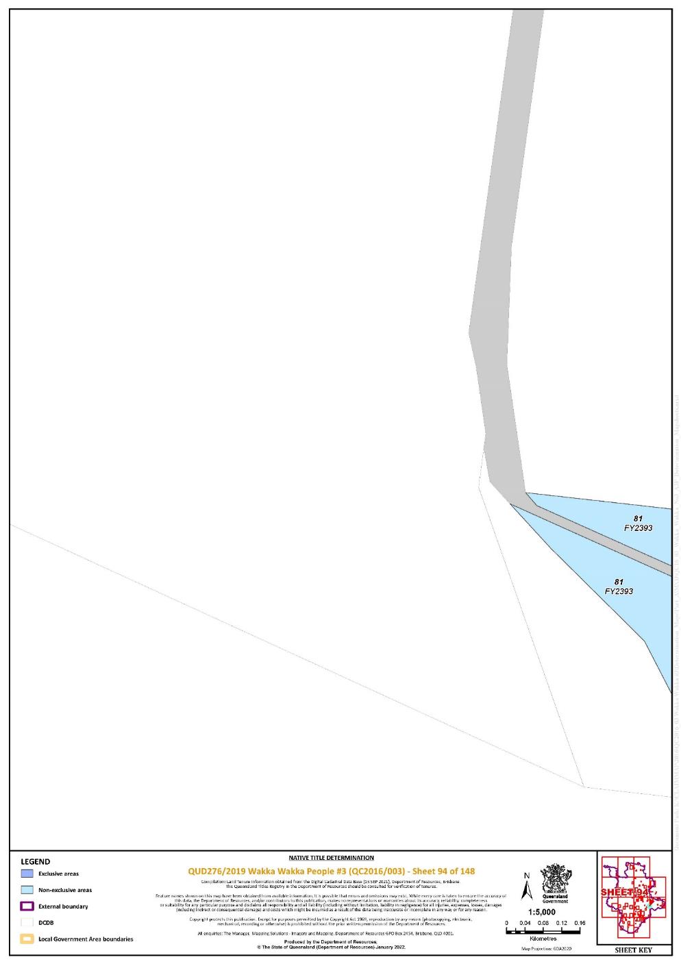
Lot 81 on Plan FY2393 | 94, 111 | |||||||||||||||||||
Lot 352 on Plan FY2428 | 140, 142 | |||||||||||||||||||
That part of Lot 208 on Plan FY2435 excluding the areas subject to: - Lot 221 on Plan FY698; and - Road between stations 4-10-11-12-3 on Plan FY2435 | 104 | |||||||||||||||||||
Lot 85 on Plan FY2438 | 76 | |||||||||||||||||||
Lot 347 on Plan FY2445 | 142 | |||||||||||||||||||
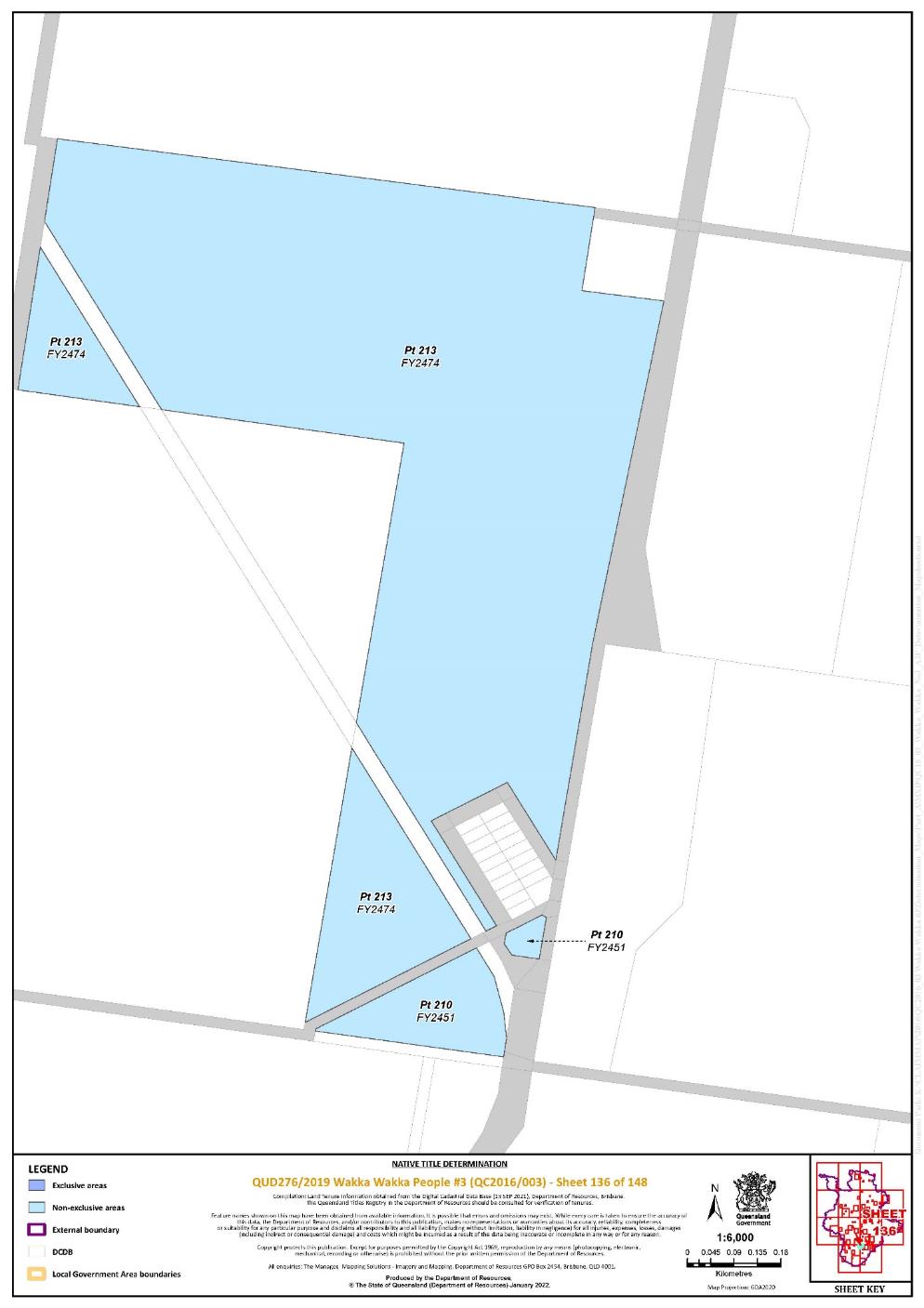
That part of Lot 210 on Plan FY2451 excluding the areas subject to: - Former Railway on Plan FY811; and - Road on Plan G6891 south of a line drawn between coordinates:
| 136 | |||||||||||||||||||
That part of Lot 354 on Plan FY2456 excluding the area subject to Road between stations 6-5-4-19-20-10-6 on Plan FY444 | 140 | |||||||||||||||||||
Lot 171 on Plan FY2461 | 74 | |||||||||||||||||||
That part of Lot 213 on Plan FY2474 excluding the area subject to former Railway on Plan FY811 | 136 | |||||||||||||||||||
Lot 76 on Plan FY2477 | 133 | |||||||||||||||||||
Lot 80 on Plan FY2478 | 73 | |||||||||||||||||||
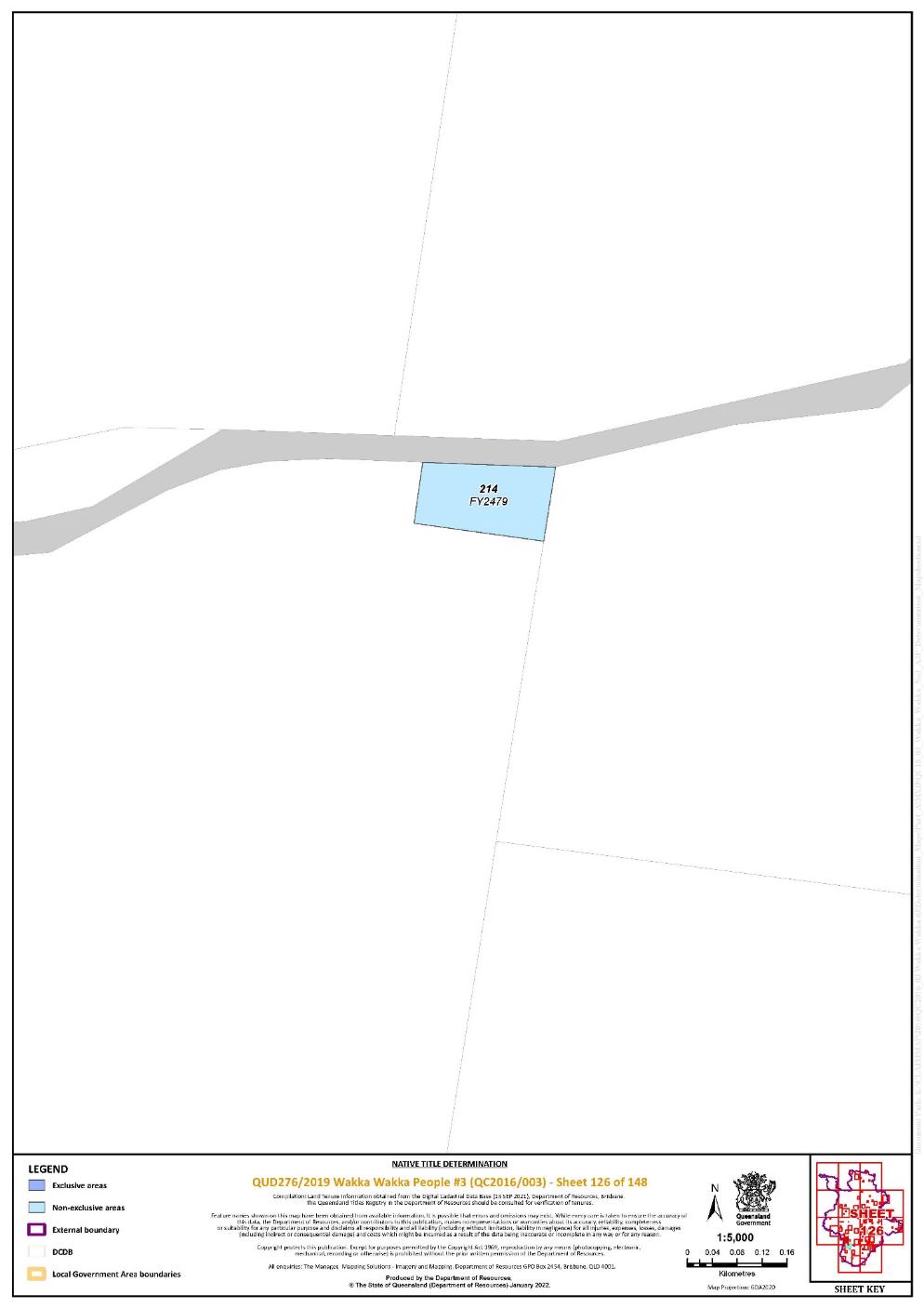
Lot 214 on Plan FY2479 | 126 | |||||||||||||||||||
Lot 134 on Plan FY2488 | 37 | |||||||||||||||||||
Lot 249 on Plan FY2505 | 137 | |||||||||||||||||||
Lot 311 on Plan FY2509 | 103 | |||||||||||||||||||
Lot 318 on Plan FY2516 | 99 | |||||||||||||||||||
Lot 320 on Plan FY2517 | 99 | |||||||||||||||||||
That part of Lot 178 on Plan FY2521 excluding the area defined as: the Road along the south-east boundaries of historical Portions 179 and 178 (camping and water reserve) and its continuation along the south-east boundary of historical Portion 176 for about five chains as shown on Plan FY432 | 100 | |||||||||||||||||||
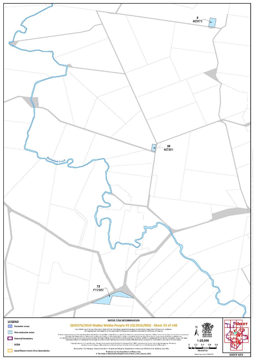
Lot 72 on Plan FY2582 | 23 | |||||||||||||||||||
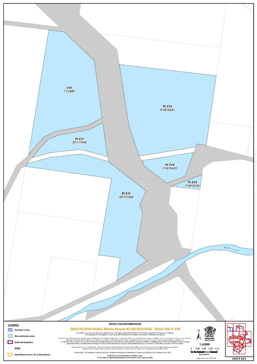
Lot 210 on Plan FY2586 | 108 | |||||||||||||||||||
Lot 498 on Plan FY2592 | 67 | |||||||||||||||||||
Lot 502 on Plan FY2592 | 67 | |||||||||||||||||||
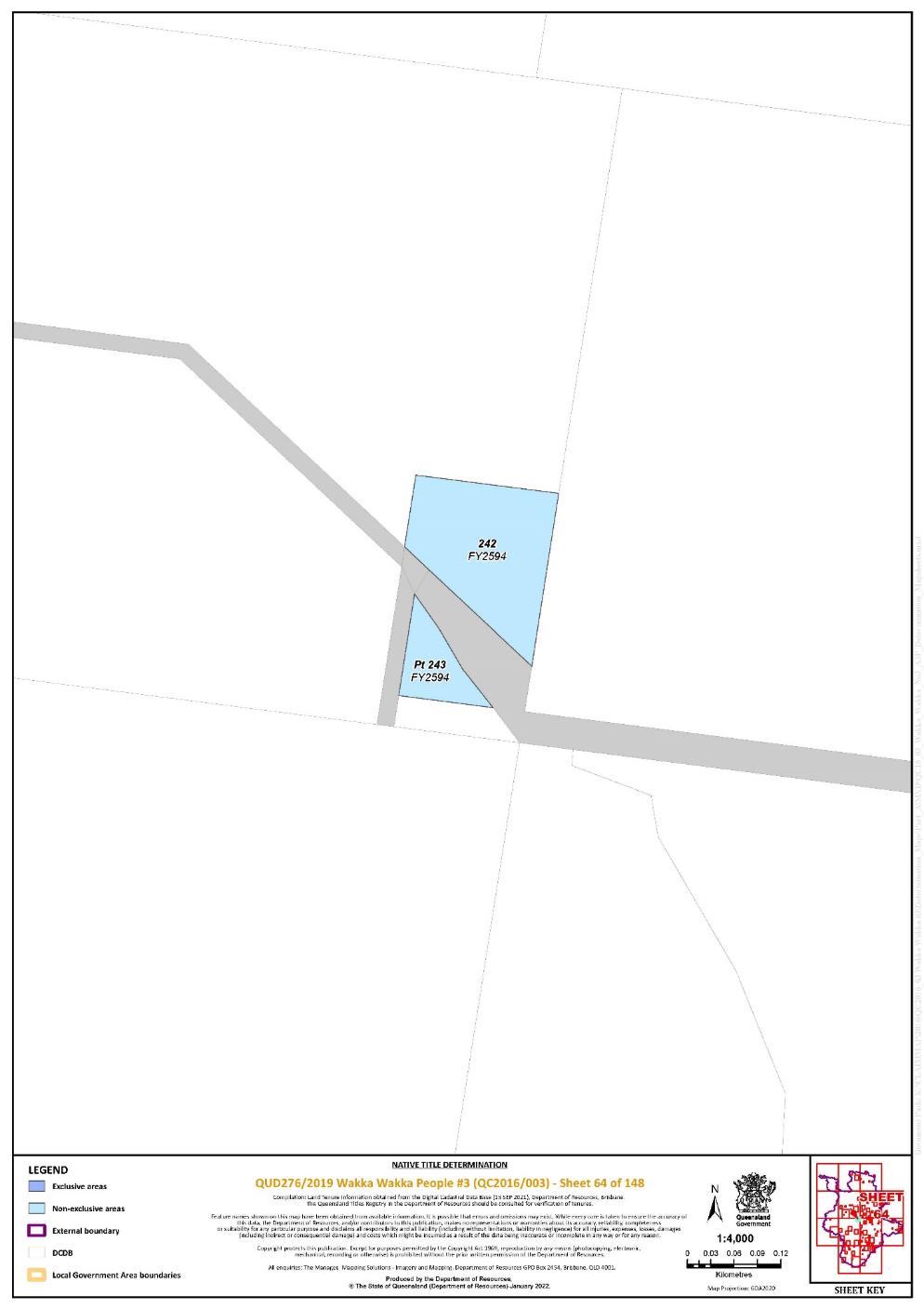
Lot 242 on Plan FY2594 | 64 | |||||||||||||||||||
That part of Lot 243 on Plan FY2594 excluding the area defined as: the Road separating historical Portion 243, part of Reserve for Water (R203), from historical Portion 367v bounded on the east by a line extending from the south-eastern corner of historical Portion 243 to the north-eastern corner of historical Portion 367v as shown on Plan FY302 | 64 | |||||||||||||||||||
Lot 252 on Plan FY2596 | 76 | |||||||||||||||||||
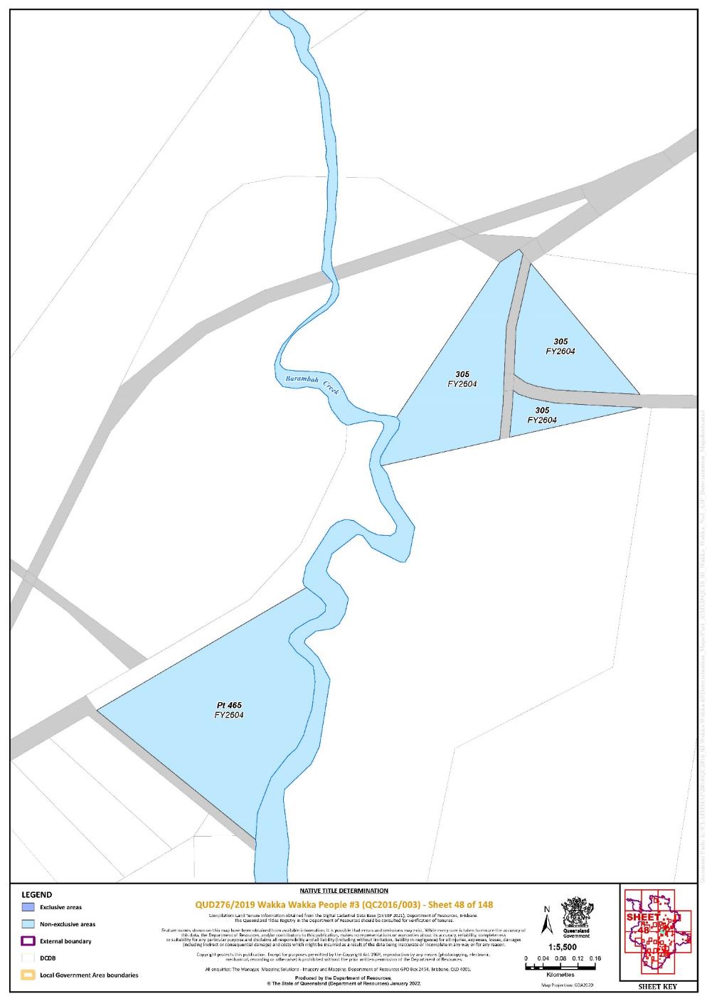
Lot 305 on Plan FY2604 | 48 | |||||||||||||||||||
That part of Lot 465 on Plan FY2604 excluding the area defined as: the Road abutting the north-western boundaries of historical Portion 150 and Recreation Reserve (R276) and its continuation generally north-easterly to Barambah Creek as shown on Plan FY2452 | 48 | |||||||||||||||||||
Lot 212 on Plan FY2647 | 140 | |||||||||||||||||||
Lot 212 on Plan FY2647 | 142 | |||||||||||||||||||
Lot 181 on Plan FY2651 | 129 | |||||||||||||||||||
Lot 223 on Plan FY2704 | 142 | |||||||||||||||||||
Lot 225 on Plan FY2704 | 142 | |||||||||||||||||||
Lot 270 on Plan FY2786 | 40 | |||||||||||||||||||
Lot 257 on Plan FY2788 | 76 | |||||||||||||||||||
Lot 140 on Plan FY2789 | 45 | |||||||||||||||||||
Lot 91 on Plan FY2885 | 91 | |||||||||||||||||||
Lot 245 on Plan FY2885 | 91 | |||||||||||||||||||
Lot 138 on Plan FY2893 | 44, 45 | |||||||||||||||||||
That part of Lot 379 on Plan FY2924 excluding the areas subject to: - historical Portion 36v on Plan FTZ37277; - Allotments 4 and 5 of Section 5 on Plan T3624; - Allotments 4, 8 and 9 on Plan T3621; and - Allotments 3 and 12 of Section 9 on Plan T3624 | 102 | |||||||||||||||||||
Lot 94 on Plan FY2925 | 131 | |||||||||||||||||||
Lot 461 on Plan FY2937 | 76, 77 | |||||||||||||||||||
Lot 306 on Plan FY2960 | 103 | |||||||||||||||||||
Lot 1 on Plan FY2971 | 103 | |||||||||||||||||||
Lot 312 on Plan FY2971 | 103 | |||||||||||||||||||
Lot 100 on Plan FY383 | 37 | |||||||||||||||||||
Lot 65 on Plan FY400 | 91 | |||||||||||||||||||
Lot 66 on Plan FY401 | 91 | |||||||||||||||||||
Lot 191 on Plan FY416 | 73 | |||||||||||||||||||
Lot 94 on Plan FY421 | 91 | |||||||||||||||||||
Lot 131 on Plan FY424 | 36 | |||||||||||||||||||
Lot 116 on Plan FY480 | 91 | |||||||||||||||||||
Lot 124 on Plan FY480 | 91 | |||||||||||||||||||
Lot 346 on Plan FY489 | 63, 73 | |||||||||||||||||||
Lot 313 on Plan FY509 | 73 | |||||||||||||||||||
Lot 186 on Plan FY574 | 49 | |||||||||||||||||||
Lot 151 on Plan FY613 | 76 | |||||||||||||||||||
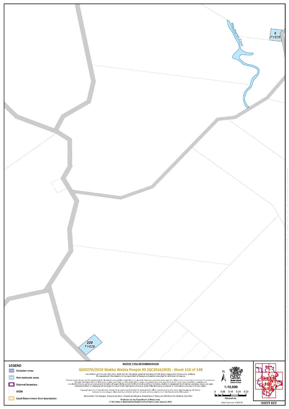
Lot 5 on Plan FY628 | 110 | |||||||||||||||||||
Lot 220 on Plan FY629 | 110 | |||||||||||||||||||
Lot 125 on Plan FY70 | 63 | |||||||||||||||||||
Lot 383 on Plan FY704 | 98 | |||||||||||||||||||
Lot 168 on Plan FY713 | 77 | |||||||||||||||||||
Lot 171 on Plan FY713 | 77 | |||||||||||||||||||
Lot 172 on Plan FY713 | 77 | |||||||||||||||||||
Lot 386 on Plan FY737 | 98 | |||||||||||||||||||
Lot 136 on Plan FY782 | 140 | |||||||||||||||||||
Lot 138 on Plan FY782 | 140 | |||||||||||||||||||
That part of Lot 216 on Plan FY800284 excluding the area subject to historical Portion 62 on Plan FY960 | 129 | |||||||||||||||||||
Lot 217 on Plan FY800284 | 129 | |||||||||||||||||||
That part of Lot 174 on Plan FY803924 excluding the areas subject to: - historical Portion 267 on Plan FY444; - Road between stations 1-2-4-5-1 on Plan FY2698; and - Road between stations 6-5-4-19-20-10-6 on Plan FY444 | 140 | |||||||||||||||||||
That part of Lot 301 on Plan FY809053 excluding the areas subject to: - Road between stations A-B-C-F shown on Plan FY809053; and - Former Railway on Plan LX21 | 76, 77 | |||||||||||||||||||
That part of Lot 156 on Plan FY809991 excluding the area subject to Road between stations 8-4-5-10-16-A and stations E-18-17-B on Plan FY2591 | 76, 77 | |||||||||||||||||||
Lot 399 on Plan FY814534 | 72 | |||||||||||||||||||
Lot 400 on Plan FY814534 | 72 | |||||||||||||||||||
That part of Lot 214 on Plan FY815430 excluding the area subject to Road between stations C-D-E-F on Plan FY815430 | 108 | |||||||||||||||||||
Lot 5 on Plan FY834 | 39 | |||||||||||||||||||
Lot 175 on Plan FY838341 | 140 | |||||||||||||||||||
That part of Lot 467 on Plan FY838992 excluding the areas subject to: - historical Portion 70v on Plan FTZ37342; - historical Portion 67v on Plan FTZ37342; - historical Portion 398 on Plan FY805; - historical Portion 397 on Plan FY805; - historical Portion 403 on Plan FY805; - historical Portion 327 on Plan FY490; - historical Portion 69v on Plan FTZ37342; and - Road separating Portion 62v from Portion 70v on Plan FTZ37342 | 68 | |||||||||||||||||||
Lot 2 on Plan FY841436 | 77 | |||||||||||||||||||
Lot 59 on Plan FY843 | 45 | |||||||||||||||||||
Lot 248 on Plan FY843838 | 77 | |||||||||||||||||||
Lot 133 on Plan FY845 | 36 | |||||||||||||||||||
Lot 195 on Plan K62310 | ||||||||||||||||||||
Lot 3 on Plan K62315 | 129 | |||||||||||||||||||
That part of Lot 14 on Plan K62319 excluding the area subject to Allotment 7 of Section 3 on Plan K6232 | 129 | |||||||||||||||||||
Lot 512 on Plan K6232 | 129 | |||||||||||||||||||
Lot 2 on Plan K6233 | 129 | |||||||||||||||||||
Lot 1 on Plan K6237 | 129 | |||||||||||||||||||
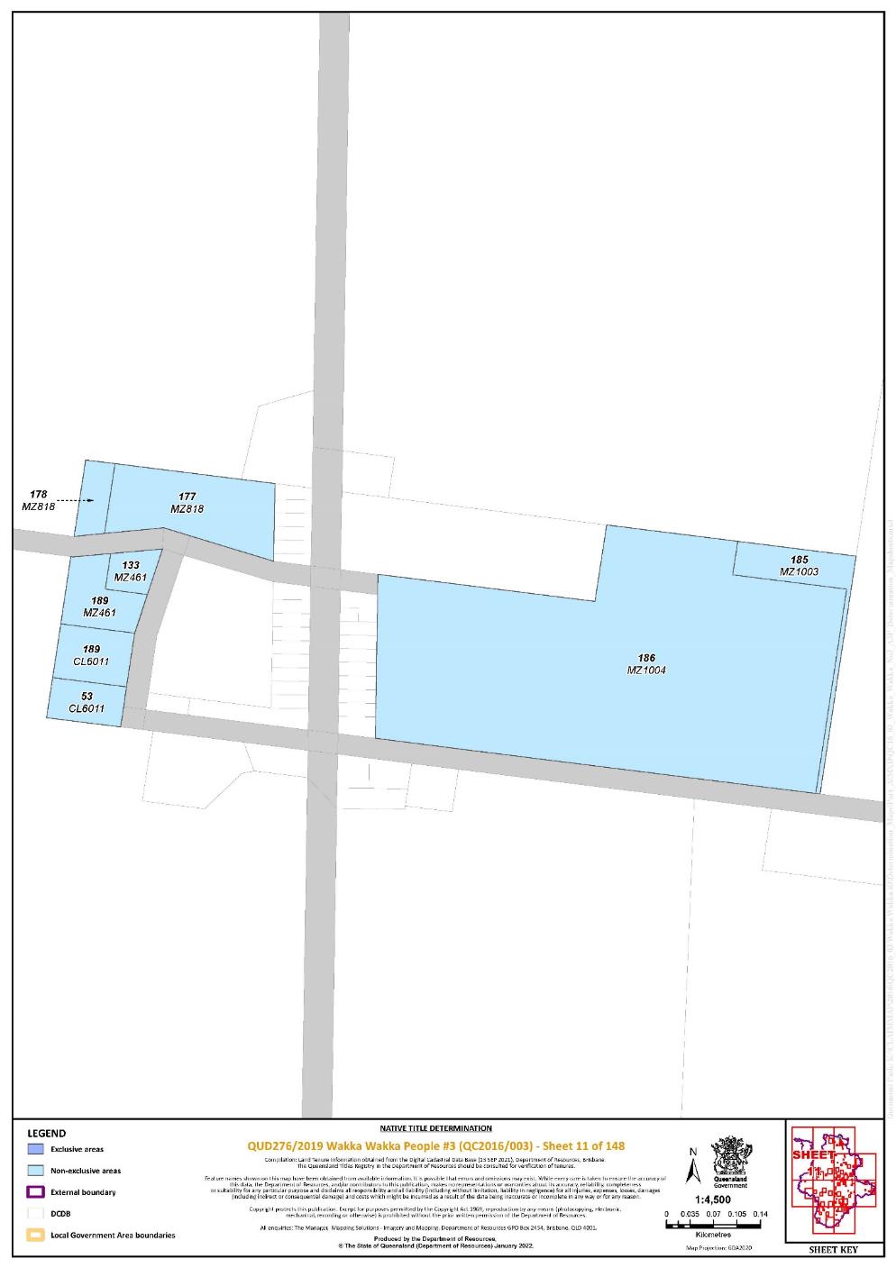
Lot 185 on Plan MZ1003 | 11 | |||||||||||||||||||
Lot 186 on Plan MZ1004 | 11 | |||||||||||||||||||
Lot 9 on Plan MZ1043 | 4 | |||||||||||||||||||
Lot 108 on Plan MZ1067 | 4 | |||||||||||||||||||
Lot 343 on Plan MZ1068 | 19 | |||||||||||||||||||
Lot 342 on Plan MZ1078 | 4 | |||||||||||||||||||
Lot 134 on Plan MZ1128 | 20 | |||||||||||||||||||
Lot 13 on Plan MZ1175 | 19 | |||||||||||||||||||
Lot 124 on Plan MZ397 | 10 | |||||||||||||||||||
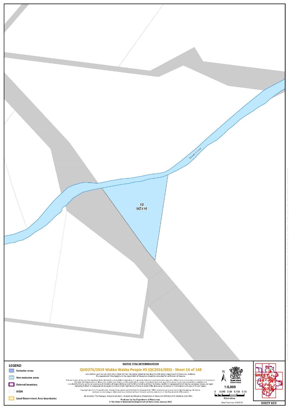
Lot 13 on Plan MZ416 | 14 | |||||||||||||||||||
Lot 133 on Plan MZ461 | 11 | |||||||||||||||||||
Lot 189 on Plan MZ461 | 11 | |||||||||||||||||||
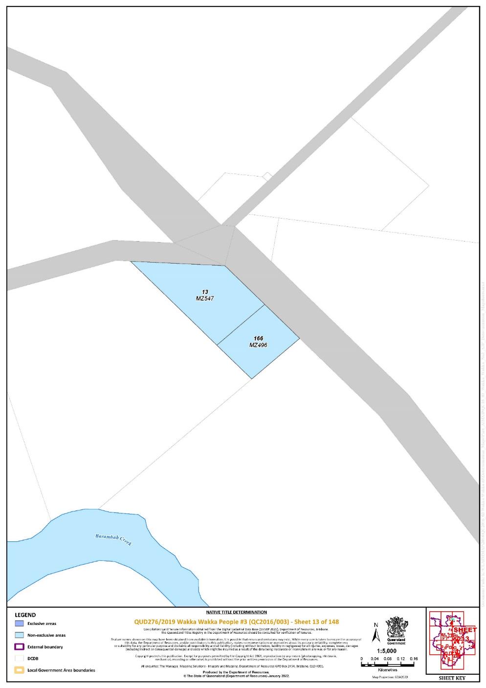
Lot 166 on Plan MZ496 | 13 | |||||||||||||||||||
Lot 38 on Plan MZ501 | 23 | |||||||||||||||||||
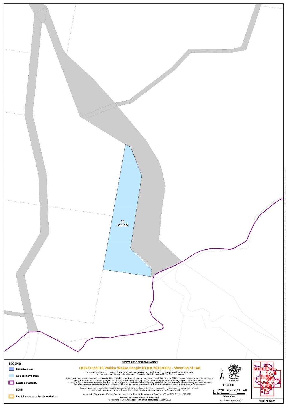
Lot 20 on Plan MZ528 | 58 | |||||||||||||||||||
Lot 55 on Plan MZ54 | 53 | |||||||||||||||||||
Lot 13 on Plan MZ547 | 13 | |||||||||||||||||||
Lot 14 on Plan MZ557 | 19 | |||||||||||||||||||
Lot 78 on Plan MZ576 | 31 | |||||||||||||||||||
Lot 35 on Plan MZ579 | 34 | |||||||||||||||||||
Lot 65 on Plan MZ635 | 36 | |||||||||||||||||||
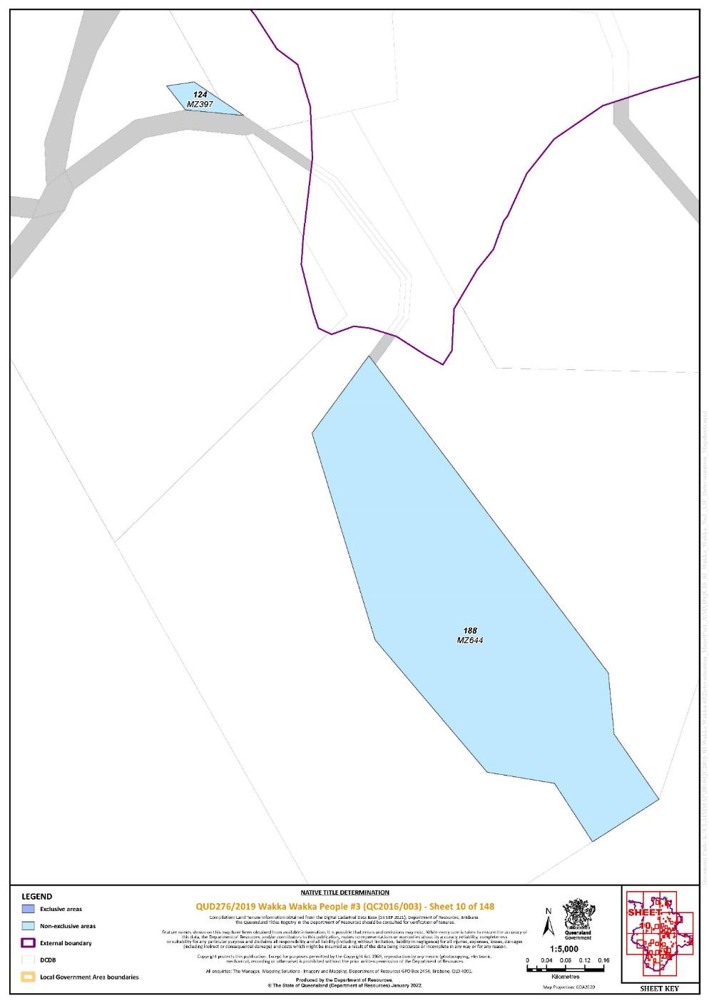
Lot 188 on Plan MZ644 | 10 | |||||||||||||||||||
Lot 8 on Plan MZ673 | 23 | |||||||||||||||||||
Lot 177 on Plan MZ818 | 11 | |||||||||||||||||||
Lot 178 on Plan MZ818 | 11 | |||||||||||||||||||
Lot 74 on Plan MZ826 | 31 | |||||||||||||||||||
Lot 46 on Plan MZ841437 | 9 | |||||||||||||||||||
Lot 131 on Plan MZ962 | 20 | |||||||||||||||||||
Lot 387 on Plan N2320 | 142 | |||||||||||||||||||
Lot 388 on Plan N2320 | 142 | |||||||||||||||||||
Lot 389 on Plan N2320 | 142 | |||||||||||||||||||
Lot 390 on Plan N2320 | 142 | |||||||||||||||||||
Lot 391 on Plan N2320 | 142 | |||||||||||||||||||
Lot 2 on Plan N2339 | 143 | |||||||||||||||||||
Lot 5 on Plan N2339 | 143 | |||||||||||||||||||
Lot 2 on Plan N2349 | 142 | |||||||||||||||||||
Lot 4 on Plan N2359 | 142 | |||||||||||||||||||
Lot 11 on Plan N2366 | 142 | |||||||||||||||||||
Lot 2 on Plan N25396 | 138 | |||||||||||||||||||
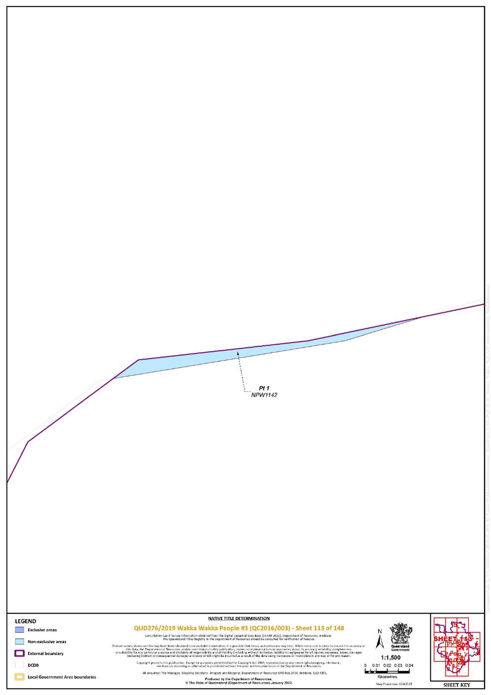
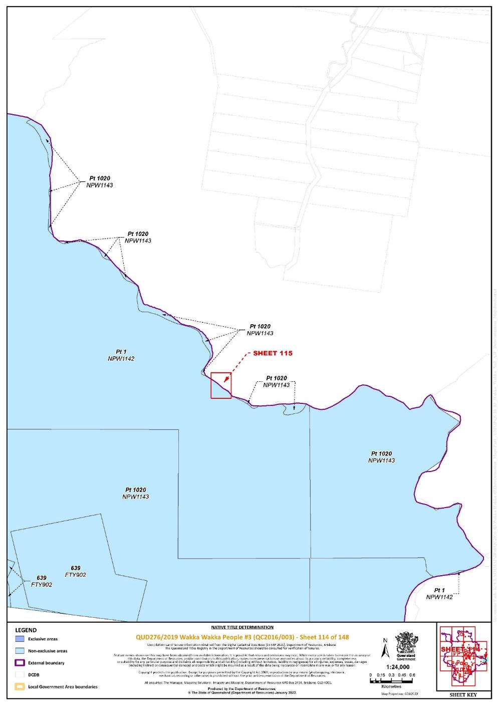
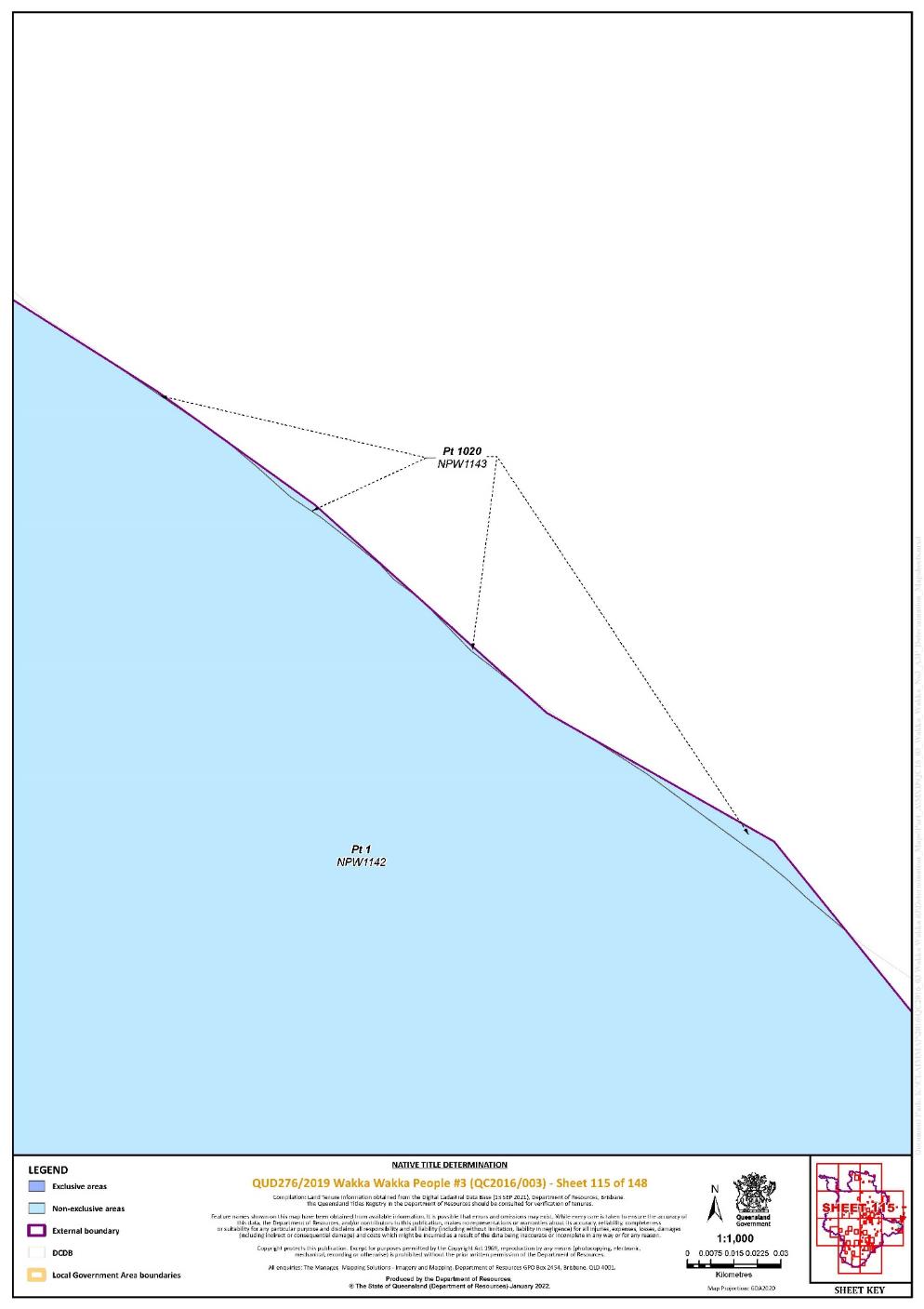
Lot 1 on Plan NPW1142 | 111, 112, 113, 114, 115, 118, 119, 120, 121, 122, 123, 124 | Pt | ||||||||||||||||||
Lot 1020 on Plan NPW1143 | 111, 114, 115,118 | Pt | ||||||||||||||||||
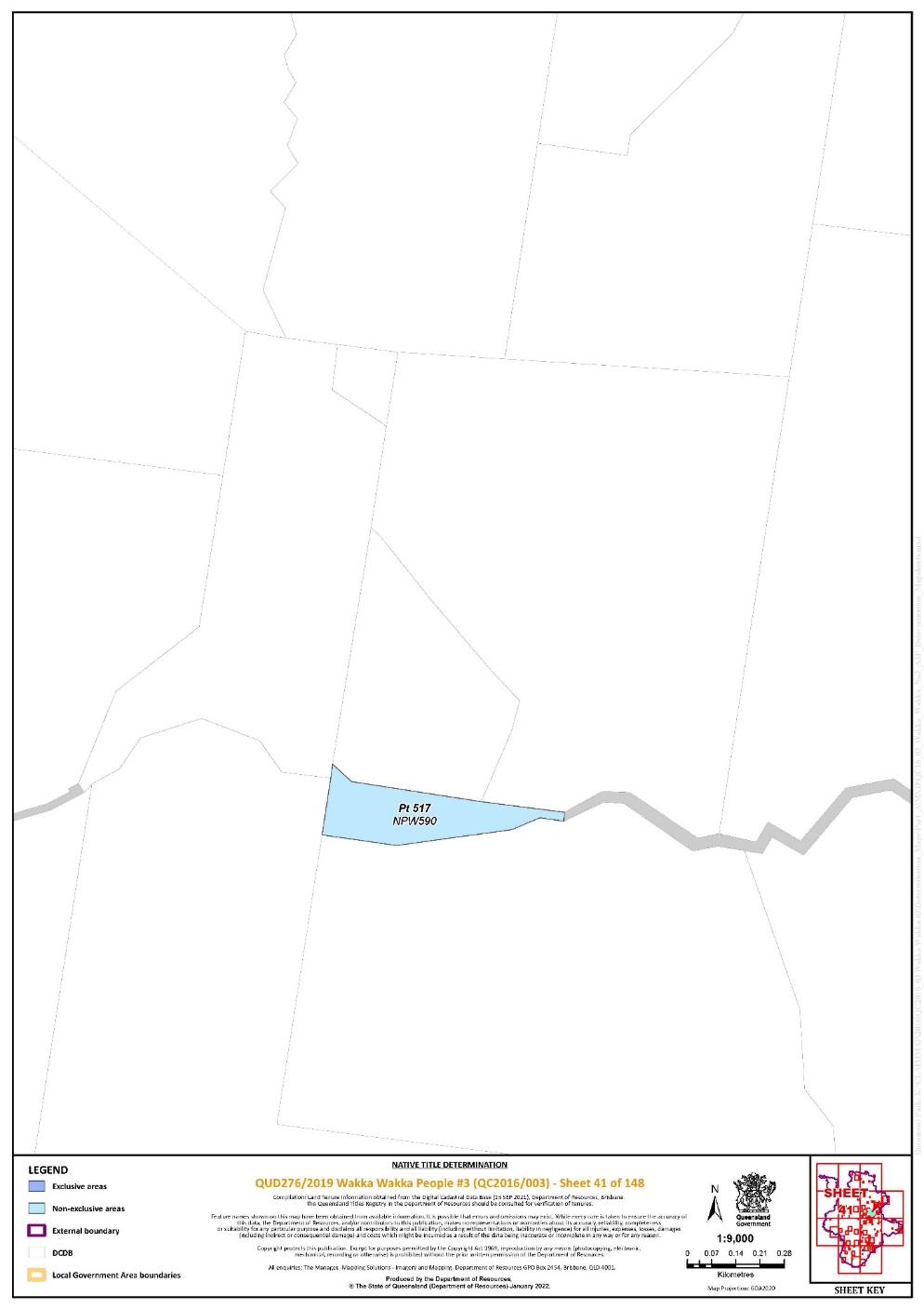
That part of Lot 517 on Plan NPW590 excluding the area subject to part of historical Portion 37 on Plan FY607 | 41 | |||||||||||||||||||
Lot 185 on Plan NPW723 | 9, 29 | |||||||||||||||||||
Lot 186 on Plan NPW731 | 19 | |||||||||||||||||||
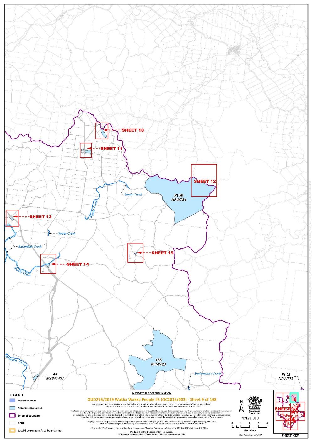
Lot 50 on Plan NPW734 | 9, 12 | Pt | ||||||||||||||||||
Lot 190 on Plan NPW742 | 73, 93 | |||||||||||||||||||
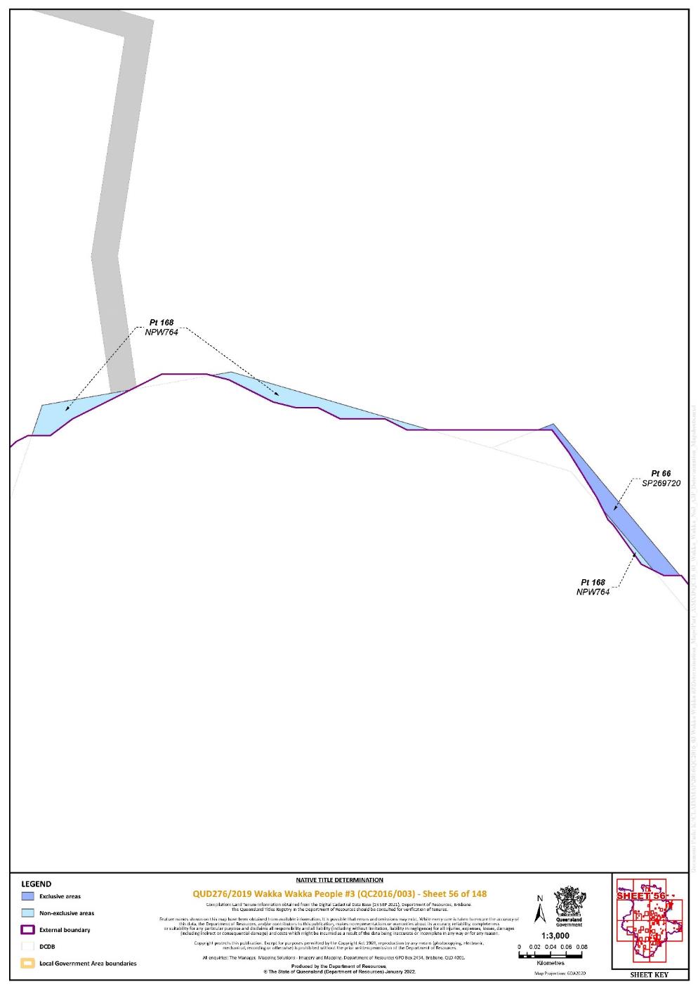
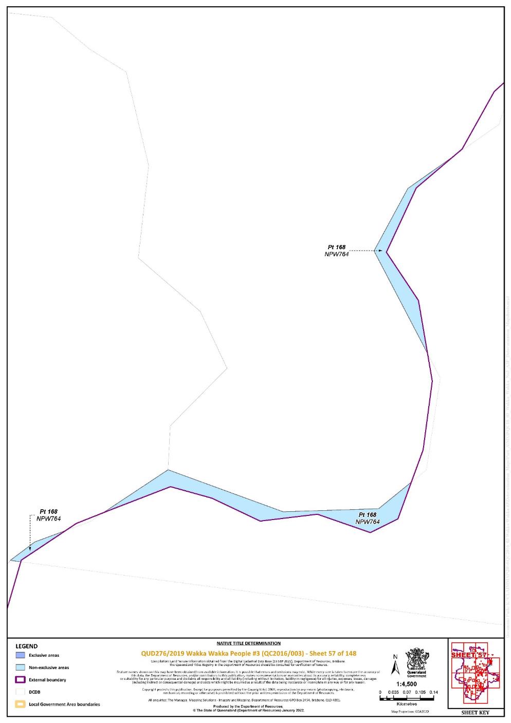
Lot 168 on Plan NPW764 | 53, 55, 56, 57 | Pt | ||||||||||||||||||
Lot 52 on Plan NPW773 | 9, 29, 52, 53, 54 | Pt | ||||||||||||||||||
Lot 183 on Plan NPW803 | 29 | |||||||||||||||||||
Lot 565 on Plan NPW850 | 111 | |||||||||||||||||||
Lot 100 on Plan NPW851 | 135, 148 | |||||||||||||||||||
Lot 48 on Plan NPW873 | 125, 132, 133 | Pt | ||||||||||||||||||
Lot 162 on Plan NPW873 | 132, 133 | |||||||||||||||||||
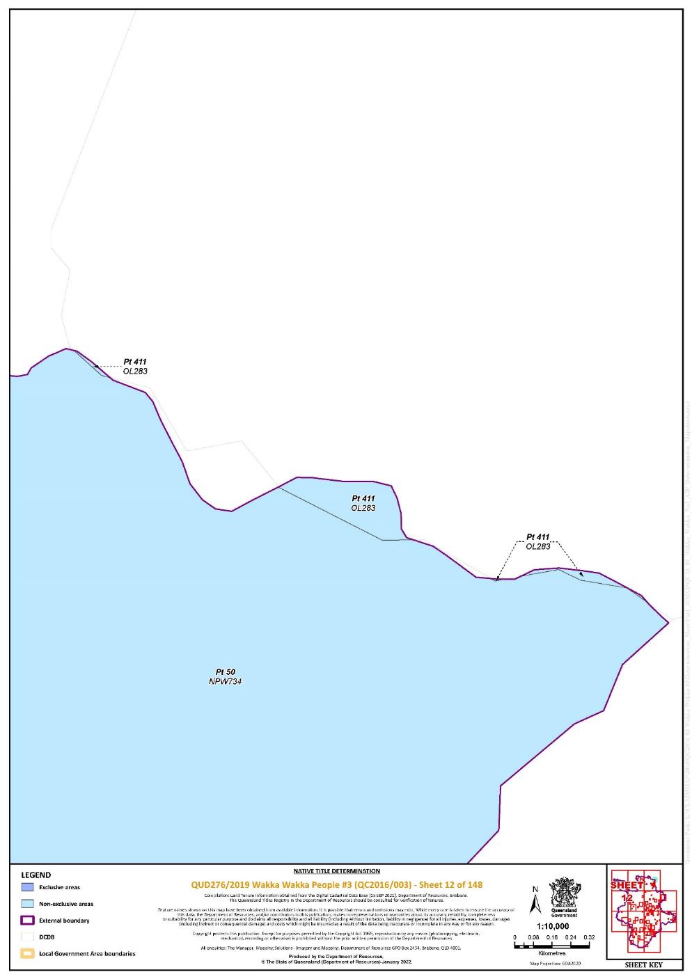
Lot 411 on Plan OL283 | 12 | Pt | ||||||||||||||||||
Lot 250 on Plan SP103905 | 76 | |||||||||||||||||||
Lot 310 on Plan SP104316 | 103 | |||||||||||||||||||
That part of Lot 211 on Plan SP117049 excluding an area of closed Road bounded by the following coordinates:
| 108 | |||||||||||||||||||
That part of Lot 348 on Plan SP119869 excluding the areas subject to: - Former Railway on Plan FY619; - Roads on Plan N231 (George Street, Appin Street and Alfred Street); and - The area subject to the Public Building Reserve bounded by Appin, George, Henry and King Streets on Plan N231 | 142 | |||||||||||||||||||
Lot 26 on Plan SP120166 | 140 | |||||||||||||||||||
That part of Lot 90 on Plan SP122591 excluding the areas subject to: - Allotments 4 – 6 of Section 3 on Plan N231; - Allotment 5 of Section 4 on Plan N231; - Roads on Plan N231 (Grey Street, Dalby Street, Henry Street and the Lane separating Allotments 1 - 5 of Section 3 from Allotments 6 - 10 of Section 3); and - Sub 2 of Pound Reserve on Plan N2328 | 143 | |||||||||||||||||||
Lot 40 on Plan SP177485 | 77 | |||||||||||||||||||
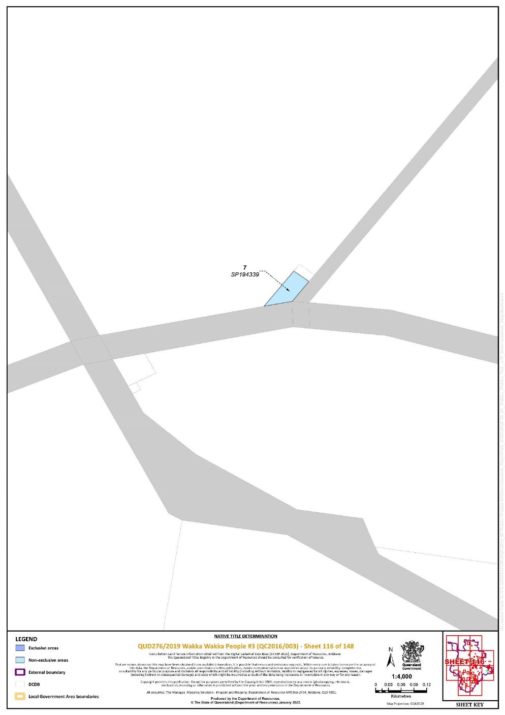
Lot 7 on Plan SP194339 | 116 | |||||||||||||||||||
Lot 2 on Plan SP199029 | 76 | |||||||||||||||||||
Lot 2 on Plan SP228961 | 97 | |||||||||||||||||||
That part of Lot 1 on Plan SP228970 excluding the areas subject to: - MHL19 on Plan MPH14376; - MHL36 on Plan MPH3057; - MHL39 on Plan MPH3057; - MHL41 on Plan MPH3057; and - Road between stations 31-67-64-63-31 and 16-69-A-68-62-61-70-71-16-69 on Plan SP228970 | 141 | |||||||||||||||||||
That part of Lot 2 on Plan SP228970 excluding the area subject to MHL19 on Plan MPH14376 | 141 | |||||||||||||||||||
That part of Lot 9 on Plan SP257249 excluding the area subject to Lot 82 on Plan USL39475 | 142 | |||||||||||||||||||
Lot 36 on Plan SP259716 | 34 | |||||||||||||||||||
Lot 41 on Plan SP259716 | 34 | |||||||||||||||||||
Lot 4 on Plan SP273785 | 76 | |||||||||||||||||||
Lot 468 on Plan SP273785 | 76 | |||||||||||||||||||
That part of Lot 346 on Plan SP313160 excluding the areas subject to: - Former Railway on Plan FY619; and - Former Lot 185 on Plan FY1534 | 143 | |||||||||||||||||||
Lot 139 on Plan SP282095 | 45 | |||||||||||||||||||
Lot 3 on Plan SP292286 | 142 | |||||||||||||||||||
Lot 5 on Plan SP292286 | 142 | |||||||||||||||||||
Lot 154 on Plan W53517 | 77 | |||||||||||||||||||
Lot 12 on Plan W53527 | 77 | |||||||||||||||||||
Lot 13 on Plan W53527 | 77 | |||||||||||||||||||
Lot 14 on Plan W53527 | 77 | |||||||||||||||||||
Lot 15 on Plan W53527 | 77 | |||||||||||||||||||
Lot 16 on Plan W53527 | 77 | |||||||||||||||||||
Lot 4 on Plan W53528 | 77 | |||||||||||||||||||
Lot 4 on Plan W53533 | 77 | |||||||||||||||||||
Lot 11 on Plan W53533 | 77 | |||||||||||||||||||
Lot 1 on Plan W53536 | 77 | |||||||||||||||||||
Area of new road between stations 5-6-9-5 and 11-15-16-11 shown on Plan SP282095 | 45 | ~ | ||||||||||||||||||
An area of new road between stations 17-18-19-19b-31-30-17a-17 on Plan SP280490 | 84 | ~ | ||||||||||||||||||
An area of new road between stations 38-39-50-51-51a-52-53-38 on Plan SP280472 | 80 | ~ | ||||||||||||||||||
An area of new road between stations 62-116-115a-115-102-101-62 on Plan SP280472 | 80, 81 | ~ | ||||||||||||||||||
An area of new road between stations 290-291-292-293-294-295-296-290 on Plan SP280472 | 86 | ~ | ||||||||||||||||||
An area of new road between stations 80-148-162-87-86-84-83-82-80 on Plan SP280472 | 81 | ~ | ||||||||||||||||||
An area of new road between stations 716-379a-378a-377a-376a-375a-374a-373a-399a-398a-397a-397-398-399-373-374-375-376-377-378-379-715-716 on Plan SP280472 | 88 | ~ | ||||||||||||||||||
An area of new road between stations 728-366-366a-382-381-380-365-727-728 on Plan SP280472 | 88 | ~ | ||||||||||||||||||
An area of new road as shown on Plan SP245342, including: - Cherbourg Rd; - Stan Mickelo Dr; - Wondai Rd; - Lookout Rd; - Murray Rd; - Barambah Ave; - Jerome St; - Ada Simpson Way; - Vincent Law Senior Way; - Bligh Street; - Fisher Street - Oak Avenue - Alan Douglas Avenue - Carter St - Mill Ave - Hillview St - Beattie St - Marshall St - Bell St - Broadway St - Bond St - Cobbo St - Collins Rd - Bulgi St - Cemetery Rd - Fisher St - Barber St | 78, 79, 80, 81, 82, 83, 84, 85, 86, 87, 88 | ~ | ||||||||||||||||||
Save for any waters forming part of a lot on plan, all rivers, creeks, streams, and lakes within the External Boundary described in Schedule 3, including but not limited to: - Alma Creek; - Back Creek; - Ballyhew Creek; - Bangora Creek; - Barambah Creek; - Barker Creek; - Boogoorootommy Creek; - Boonara Creek; - Boyne River; - Broad Creek; - Burnett River; - Campbell Creek; - Cloyna Creek; - Dadamarine Creek; - Dangora Creek; - Dingo Creek; - Dinner Creek; | ||||||||||||||||||||
- Geer Creek; - Goonaloom Creek; - Frickey Creek; - Home Creek; - Horse Gully - Jones Creek; - Lawsons Broad Creek; - Little Wengen Creek; - Meandu Creek; - Malar Creek; - Mannuem Creek; - Mare Creek; - Middle Creek; - Moonda Waamba Creek; - Mortimer Creek; - Murgon Creek; - Nangur Creek; - Oaky Creek; - Piggotts Plain Creek; - Planted Creek; - Redbank Creek; - Reedy Creek; - Sandy Creek; - Small Creek - Spring Creek; - Stuart River; - Sunday Creek; - Tanduringie Creek; - Tankallaman Creek; - The Broadwater; - Trinity Creek; - Unnamed creek internal to Lot 9 on Plan SP207434; - Unnamed creek abutting Barambah Creek and the western boundary of Lot 28 on Plan CP890679; - Unnamed creek abutting Broad Creek and the northern boundary of Lot 45 on Plan BO151; - Unnamed creek abutting the eastern boundary of Lot 165 on Plan FY2920; - Unnamed drains abutting the southern boundaries of Lot 29 on Plan FY2946; - Unnamed lagoon bounded by Lot 2 on Plan SP263404 and Lot 2 on Plan CP868817; - Unnamed lagoon bounded by Goomeri West Road, Lot 138 on Plan FY2893, Lot 64 on Plan FY919 and Lot 140 on Plan FY2789; - Unnamed waterhole bounded by Lot 40 on Plan FY618 and Sippels Road; | ||||||||||||||||||||
- Washpool Creek; - Wengen Creek; - Wheelbarrow Creek; - Wigton Creek; - Windera Creek; - Woroon Creek; and - Yellow Waterhole Creek. |
~ denotes areas to which s 24KA of the Native Title Act 1993 (Cth) apply
“Pt” denotes areas that are part areas as a result of the External Boundary
Data Reference and source
Cadastral data sourced from Department of Resources, Qld (September 2021)
Reference datum
Geographical coordinates are referenced to the Geocentric Datum of Australia 2020 (GDA2020), in decimal degrees.
Prepared by the Department of Resources (13 October 2021).
Use of Coordinates
Where coordinates are used within the description to represent cadastral or topographical boundaries or the intersection with such, they are intended as a guide only. As an outcome to the custodians of cadastral and topographic data continuously recalculating the geographic position of their data based on improved survey and data maintenance procedures, it is not possible to accurately define such a position other than by detailed ground survey.
SCHEDULE 5
AREAS NOT FORMING PART OF THE DETERMINATION AREA
The following areas of land and waters are excluded from the Determination Area as described in Part 1 of Schedule 4 and Part 2 of Schedule 4:
1. Those land and waters within the External Boundary which at the time the native title determination application was made were the subject of one or more Previous Exclusive Possession Acts, within the meaning of s 23B of the Native Title Act 1993 (Cth) as they could not be claimed in accordance with s 61A of the Native Title Act 1993 (Cth).
2. Specifically, and to avoid any doubt, the land and waters described in (1) above includes:
(a) the Previous Exclusive Possession Acts described in ss 23B(2) and 23B(3) of the Native Title Act 1993 (Cth) to which s 20 of the Native Title (Queensland) Act 1993 (Qld) applies, and to which none of ss 47, 47A, 47B or 47C of the Native Title Act 1993 (Cth) applied; and
(b) the land and waters on which any public work, as defined in s 253 of the Native Title Act 1993 (Cth), is or was constructed, established or situated, and to which ss 23B(7) and 23C(2) of the Native Title Act 1993 (Cth) and to which s 21 of the Native Title (Queensland) Act 1993 (Qld), applies, together with any adjacent land or waters in accordance with s 251D of the Native Title Act 1993 (Cth).
3. Those land and waters within the External Boundary on which, at the time the native title determination application was made, public works were validly constructed, established or situated after 23 December 1996, where s 24JA of the Native Title Act 1993 (Cth) applies, and which wholly extinguished native title.
4. Those land and waters within the External Boundary which, at the time the native title determination application was made, were the subject of one or more Pre-existing Rights Based Acts, within the meaning of s 24IB of the Native Title Act 1993 (Cth), which wholly extinguished native title.
SCHEDULE 6
MAP OF DETERMINATION AREA
Note: Entry of orders is dealt with in Rule 39.32 of the Federal Court Rules 2011.
[5] | |
[11] | |
[26] | |
[34] | |
[38] |
RANGIAH J:
1 The applicant seeks a determination of native title pursuant to ss 61 and 225 of the Native Title Act 1993 (Cth) (the Act) on behalf of the Wakka Wakka People (the Wakka Wakka People #3 claim).
2 The claim is for the determination of native title over the lands and waters in the central and southern regions of the Burnett River catchment.
3 The Wakka Wakka People #3 claim has been administratively partitioned into three parts: Part A, Part B and Part C. Part A covers the Wakka Wakka People #3 claim area except for Lot 44 on BO391, Lot 35 on BO108 and Lot 36 on BO391. Part B comprises the balance of the claim area, being Lot 44 on BO391, Lot 35 on BO108 and Lot 36 on BO391.
4 The parties have indicated their consent to a determination that the Wakka Wakka People are the holders of the native title in the area covered by Part A and Part B of the claim area.
5 The court is satisfied, for the reasons below, that it is within the power of the Court to make the orders sought, and that it is appropriate to do so.
6 There will also be a determination of native title in respect of Part A of the adjoining Wakka Wakka People #4 claim. The area covered by that claim is to the north of the Wakka Wakka People #3 claim.
7 The preamble to the Act recognises, on behalf of all people of Australia, that the Aboriginal peoples of Australia inhabited the country prior to European settlement and that the Aboriginal peoples were progressively dispossessed of their lands. It records that the Constitution was amended, by the overwhelming vote of the people of Australia, to enable laws such as the Act to be passed and to facilitate recognition by our shared legal system of native title rights and interests.
8 Section 3 of the Act outlines the main objects of the Act as being: to protect and recognise native title, to establish ways in which future dealings affecting native title may proceed and to set the standard for those dealings, to establish a mechanism for determining claims to native title and to provide for, or permit, the validation of past acts, and intermediate period acts, invalidated because of the existence of native title.
9 Section 87A of the Act provides a mechanism for achieving a key objective of the Act, the resolution of claims for native title by agreement. The agreement of the parties to the terms of the proposed orders is consistent with that objective.
10 Section 61 of the Act provides that an application for a determination of native title may be made by a person or persons authorised by all the persons who, according to their traditional laws and customs, hold the common or group rights and interests comprising the particular native title claimed.
11 Native title is defined in s 223(1) of the Act as follows:
Common law rights and interests
(1) The expression native title or native title rights and interests means the communal, group or individual rights and interests of Aboriginal peoples or Torres Strait Islanders in relation to land or waters, where:
(a) the rights and interests are possessed under the traditional laws acknowledged, and the traditional customs observed, by the Aboriginal peoples or Torres Strait Islanders; and
(b) the Aboriginal peoples or Torres Strait Islanders, by those laws and customs, have a connection with the land or waters; and
(c) the rights and interests are recognised by the common law of Australia.
12 Section 225 of the Act describes what is meant by a “determination of native title”:
A determination of native title is a determination whether or not native title exists in relation to a particular area (the determination area) of land or waters and, if it does exist, a determination of:
(a) who the persons, or each group of persons, holding the common or group rights comprising the native title are; and
(b) the nature and extent of the native title rights and interests in relation to the determination area; and
(c) the nature and extent of any other interests in relation to the determination area; and
(d) the relationship between the rights and interests in paragraphs (b) and (c) (taking into account the effect of this Act); and
(e) to the extent that the land or waters in the determination area are not covered by a non exclusive agricultural lease or a non exclusive pastoral lease—whether the native title rights and interests confer possession, occupation, use and enjoyment of that land or waters on the native title holders to the exclusion of all others.
…
13 The application for a determination of native title was filed in the Federal Court on 12 December 2011. On 10 February 2012, the Wakka Wakka People #5 claim was filed in the Federal Court, in respect of the claim area east of, and immediately adjacent to, the area of the Wakka Wakka People #3 claim. On 21 March 2016, the Court made orders that the applications be combined pursuant to s 64(2) of the Act, and further ordered that the combined application be named Florence Bell and others on behalf of the Wakka Wakka People #3. The re-engrossed Wakka Wakka People #3 application was filed in the Federal Court on 29 April 2016.
14 The Wakka Wakka People #3 application has subsequently undergone a series of amendments. On 12 February 2019, the Wakka Wakka People #3 claim was administratively partitioned into Part A and Part B.
15 On 28 November 2019, in Bell on behalf of the Wakka Wakka People #3 v State of Queensland [2019] FCA 2005, with respect to three parcels of land in dispute in the Part B area, I found that native title was extinguished over the part of Lot 44 comprising areas of pipeline easements on BO391 by a previous exclusive possession act within the meaning of s 23B of the Act. I also found that native title was not otherwise extinguished by any previous exclusive possession act within the meaning of s 23B of the Act over any part of Lot 44 on BO391, Lot 35 on BO108 or Lot 36 on BO391.
16 On 1 November 2021, I ordered that the Wakka Wakka People #3 application be further administratively partitioned to create Wakka Wakka People #3 Part C, which comprises areas the subject of Crown-to-Crown grants which are the subject of further negotiations between the applicant and the State.
17 The parties have now indicated their consent to a determination of Part A and Part B of the Wakka Wakka People #3 claim. The application seeks determination of native title on behalf of the Wakka Wakka People over land and waters within the determination area.
18 The persons comprising the applicant are: Florence Bell, Michael Bond (Snr), Patricia Bond, James Chapman, Gary Cobbo, Marissa Cobbo, Shane Dynevor (Jnr), Robert Lacey, Edwin James MiMi, Stephen Pickering, Carl Simpson, Irene Simpson, Cheryl Smith, Sidney Smith, Katrina Watson and Robert West.
19 The respondents to the application are: the State of Queensland, Gympie Regional Council, North Burnett Regional Council, South Burnett Regional Council, Ergon Energy Corporation Limited, Sunwater Limited, Telstra Corporation Limited, Stanwell Corporation Limited, TEC Coal Pty Ltd, Allan John Elsebach, Desmond Roy McCallum, MG Shultz Enterprise Pty Ltd, Mirrimbeena Holdings Pty Ltd, Perrett Grazing Company Pty Ltd and Gary Neil Wharton.
20 All parties to the application have reached agreement that native title exists in Parts A and B of the claim area and as to the nature and extent of those native title rights and interests. That agreement, made under s 87A(1)(b) of the Act, was filed in the Federal Court on 28 February 2022.
21 The evidence of connection filed by the applicant primarily includes claimant evidence in the form of affidavits and witness statements; and two expert reports prepared by anthropologist Dr Kingsley Palmer.
22 The evidence of members of the native title claim group about their traditional laws and customs and rights and responsibilities in respect to land and waters is of the highest importance: Sampi v Western Australia [2005] FCA 777 at [48]. The claimant evidence of connection is comprised of 22 affidavits or witness statements of the following persons:
(a) Statement of Patricia Dawn Bond dated 10 August 2016
(b) Statement of Robert George Lacey dated 2 September 2016
(c) Statement of Loretta May Chapman dated 25 July 2016
(d) Statement of Yvonne Frances Chapman dated 26 July 2016
(e) Statement of Clem Michael Shadford dated 30 September 2016
(f) Statement of Robert West dated 1 September 2016
(g) Statement of Glenys Fredericksen dated 5 October 2016
(h) Statement of Margaret Kay MiMi dated 3 July 2016
(i) Statement of Rodney Samuel Hill dated 2 July 2016
(j) Affidavit of Selina Hill dated 14 March 2015
(k) Statement of John Wragge dated 18 August 2016
(l) Statement of Robert Alan Bond dated 6 August 2016
(m) Statement of Lance Bligh dated 27 September 2016
(n) Statement of Cynthia Button dated 9 August 2016
(o) Statement of William (Billy) Button dated 9 August 2016
(p) Affidavit of Thomas Daniels dated 30 April 2014
(q) Affidavit of Fred Cobbo dated 28 March 2014
(r) Affidavit of Beryl Gambrill (dec) dated 16 June 2012
(s) Statement of Arnold Murray dated 16 September 2016
(t) Statement of Terry Willmot Snr dated 19 August 2016
(u) Statement of Edward MiMi dated 15 February 2019
(v) Statement of Melissa Bond dated 3 February 2019.
23 The applicant also relies on the following reports prepared by Dr Kingsley Palmer:
(a) Wakka Wakka Native Title Application QUD6032/1999 QC 99/33 - Anthropologist’s Report (March 2010) (‘Connection Report’); and
(b) Wakka Wakka People #4 QUD91/2012 and Wakka Wakka People #5 QUD93/2012 Native Title Applications – Anthropologist’s Responsive Report (May 2014) (‘Supplementary Connection Report’).
24 The applicant’s connection material also includes a genealogical report prepared by Anthony Eales, a Research Officer at QSNTS: Wakka Wakka People #4 QUD91/2012 and Wakka Wakka People #5 QUD93/2012 Native Title Applications – Genealogies (May 2014).
25 In the Connection Report, Dr Palmer considers at paragraph [413] there to be, “a substantial continuity of law and custom” that, “can reasonably be supposed to extend back to the time of sovereignty within the application area”. Dr Palmer also concludes at paragraph [319]:
Wakka Wakka society, as it is observable today is based upon and is rooted in a customary system which is likely to have been in operation at the time of sovereignty.
26 Dr Palmer observes that the Wakka Wakka People have continued to observe customary ritual practices, which have been handed down to the present generation by their forebears, including with respect to totemic and spiritual beliefs, sites, bush tucker, dispute resolution and decision making, as well as a common understanding that members of the Wakka Wakka society shared a common language style.
27 Dr Palmer concludes that there is a substantial continuity of the laws and customs that have been observed and practiced by Wakka Wakka People that can reasonably be supposed to extend back to the time of sovereignty within the claim area.
28 The Wakka Wakka People are the descendants of the following persons:
(a) Jenny Carlo and David Carlo (parents of Princess Carlo);
(b) Minnie Bly (mother of Thomas Simpson), Ethel and Bill Button (father of Ethel Button);
(c) Mother of Maggie Hart (Grandmother of Crabbie Chapman and Henry Hart);
(d) Mother of Willie Boy Pickering;
(e) King Billy and Maria of Boondooma (parents of Tommy Dodd of Taabinga);
(f) Maggie West;
(g) Kitty of Boonara;
(h) MiMi;
(i) Kitty (mother of Jack Bulong);
(j) John Bond;
(k) Kitty (mother of Jenny Lind), Jenny Lind and Mick Buck;
(l) Boubijan Cobbo;
(m) Stockman Bligh and Aggie Bligh;
(n) Tommy (aka Boondoon) and Maggie (parents of Willie Bone), Billy McKenzie (father of Chlorine McKenzie), Chlorine McKenzie;
(o) Kate/Katie/Kitty Law;
(p) Emily of Degilbo (mother of Annie);
(q) Taabinga Harry.
29 The evidence filed, including Dr Palmer’s anthropological reports and the witness statements and affidavits provided by the claimants, provides cogent evidence of the continuity of the traditional laws and custom of the Wakka Wakka People from before the time of sovereignty to the present time. The evidence supports the claim that the traditional laws acknowledged and the traditional customs observed give the Wakka Wakka People the right to possess, occupy, use and enjoy land and waters in the claim area.
The agreement reached between the parties
30 Section 87A(4) of the Act gives the Court the power to make an order consistent with the terms of a proposed determination of native title agreed between the parties to the proceeding without holding a hearing in relation to the application if the Court considers that:
(a) an order in, or consistent with the terms of the proposed determination would be within its power; and
(b) it would be appropriate to do so.
31 The conditions under s 87A of the Act that enable the Court to make the determination without a hearing are:
There is a proceeding in relation to an application for a determination of native title: s 87A(1)(a);
At any stage of the proceeding after the end of the period specified in the notice given under s 66 of the Act, agreement is reached on a proposed determination of native title in relation to an area that is part of, but not all of, the area covered by the application: s 87A(1)(b);
Certain persons are parties to the agreement: s 87A(1)(c)
The terms of the proposed determination are in writing and signed by or on behalf of those parties: s 87A(1)(d);
The court is satisfied that an order in, or consistent with, the terms of the proposed determination, would be within its power and the court considers it appropriate to make the orders sought: s 87A(4).
32 In considering whether it is appropriate to make the orders sought, the Court’s role is confined to considering the evidence filed for the purpose of determining whether the parties have entered into an agreement that has been freely made on an informed basis: Nangkiriny (on behalf of the Karajarri People) v State of Western Australia (2002) 117 FCR 6 at [14]. The Court is not required to make a judicial determination of the merits of the claim: Button (on behalf of the Koa People) v State of Queensland [2021] FCA 1190. In considering the appropriateness of the orders, the court is directed to consider whether the parties to the agreement have acted rationally and in good faith: Munn (for and on behalf of the Gunggari People) v State of Queensland (2001) 115 FCR 109 at [30].
33 The Court must also be satisfied that the State, which bears the responsibility for ensuring that the interests of the community are protected, “has taken a real interest in the proceeding”.
34 The Court is satisfied that the parties to the s 87A agreement have entered into the agreement freely on an informed basis and have acted in good faith. The State of Queensland is satisfied that the claim group is an appropriate one to be recognised as holders of native title rights and interests, that it is appropriate to recognise the rights and interests proposed and that it is appropriate for the State to enter into the determination. I am satisfied that the State has taken a “real interest” in the proceeding on behalf of the broader community, demonstrated in particular by the steps taken by the State to thoroughly review the applicant’s evidence and request such further evidence as it considered was required.
35 The requirements of the Act have been satisfied:
There is a proceeding in relation to an application for a determination of native title: s 87A(1)(a).
The period for notification of the application under s 66 of the Act has ended, and the parties to the proposed determination have recorded their agreement as to the terms of a determination of native title in relation to Part A and Part B of the application area: s 87A(1)(b) and (c).
The parties to the proposed determination have recorded their agreement in a signed Minute of Consent: s 87A(1)(d).
An order in terms of the Minute or consistent with the Minute would be within the Court’s power because:
The application has been made in accordance with s 61 of the Act;
The application is for a determination of native title in relation to an area for which there are no other approved determinations of native title: s 13(1)(a); and
the Minute agreed to by the parties complies with ss 94A and 225 of the Act: s 87A(4).
36 In addition, it is appropriate for the Court to make the orders sought because:
(1) The parties have freely entered into the agreement on an informed basis, having had the opportunity to consider and assess the evidence relied upon by the applicant.
(2) The parties have agreed as to the nature and extent of rights and interests, and the proposed determination is unambiguous and certain as to the rights and interests declared.
(3) There are no proceedings before the Court relating to native title determination applications that cover any part of the area that is the subject of this application
(4) The State has played an active role in the negotiation of the determination, and in doing so, has taken an interest in the proceeding on behalf of the community and has given appropriate consideration to the connection material.
37 The terms of the proposed determination also satisfy the requirements of s 225 of the Act.
38 Section 55 of the Act relevantly provides that if the Federal Court proposes to make an approved determination of native title, and the determination is that native title exists at the time of making the determination, the Federal Court must, at the same time or as soon as practicable after it makes the determination, make a determination under ss 56 and 57 of the Act.
39 Section 56(1) of the Act requires that the Court must determine whether the native title is to be held on trust, and if so, by whom. The applicant has consented to orders determining that the native title is to be held in trust. The applicant seeks orders that the Wakka Wakka Native Title Aboriginal Corporation (ICN: 8903) is to be the prescribed body corporate for the purposes of s 56(2)(b) and 56(3) of the Act. The applicant relies on the eighth affidavit of Phoebe Frederick which annexures a copy of a letter from Patricia Bond, a Wakka Wakka person and a member of the applicant claim group, formally nominating the Wakka Wakka Native Title Aboriginal Corporation as the prescribed body corporate.
40 I am satisfied that the Wakka Wakka Native Title Aboriginal Corporation is a prescribed body corporate within reg 4 of the Native Title (Prescribed Bodies Corporate) Regulations 1999 (Cth).
41 It is appropriate to determine that the Wakka Wakka Native Title Aboriginal Corporation is to be the prescribed body corporate for the purpose of s 57 of the Act and perform the functions prescribed in s 57(3) of the Act.
42 The Court will make orders in accordance with the orders agreed by the parties.
I certify that the preceding forty-two (42) numbered paragraphs are a true copy of the Reasons for Judgment of the Honourable Justice Rangiah. |
Associate:
QUD 276 of 2019 | |
SOUTH BURNETT REGIONAL COUNCIL | |
Fifth Respondent: | ERGON ENERGY CORPORATION LIMITED (ACN 087 646 062) |
Sixth Respondent: | SUNWATER LIMITED |
Seventh Respondent: | TELSTRA CORPORATION LIMITED (ACN 33 051 775 556) |
Eighth Respondent: | STANWELL CORPORATION LIMITED (ABN 37 078 848 674) |
Ninth Respondent: | TEC COAL PTY LTD (ABN 55 119 063 900) |
Tenth Respondent: | ALLAN JOHN ELSEBACH |
Eleventh Respondent: | DESMOND ROY MCCALLUM |
Twelfth Respondent: | MG SHULTZ ENTERPRISE PTY LTD |
Thirteenth Respondent: | MIRRIMBEENA HOLDINGS PTY LTD |
Fourteenth Respondent: | PERRETT GRAZING COMPANY PTY LTD |
Fifteenth Respondent: | GARY NEIL WHARTON |

