FEDERAL COURT OF AUSTRALIA
Button on behalf of the Koa People v State of Queensland [2021] FCA 1190
ORDERS
FRANK BUTTON, NATASCHA DUNCAN, WILLIAM GORHAM, PAMELA HEGARTY AND MICHAEL MACE Applicant | ||
AND: | STATE OF QUEENSLAND (and others named in the schedule) First Respondent | |
DATE OF ORDER: | 6 October 2021 |
THE COURT NOTES THAT:
1. Having regard to the need to balance the limited availability of public resources with the competing need to resolve applications for a determination of native title in an efficient, cost effective and timely manner, the parties agree that the question of whether section 47C of the Native Title Act 1993 (Cth) (NTA) would apply to any park area within the External Boundary will be addressed subsequent to this determination.
2. The Koa People (being the proposed native title holders described in Schedule 1 of the determination) have indicated a desire to enter into negotiations with the State of Queensland in relation to whether section 47C of the NTA would have application to the land and waters within that part of Lot 88 of NPW477 subject to former Lot 4719 on PH1040 (being a park area which is excluded from the Determination Area described in order 3) (the park area).
3. Subject to paragraph 4 below, the Applicant and the State agree that, if agreement is reached in accordance with section 47C(1)(b) of the NTA that section 47C is applicable to the park area, the State of Queensland would not oppose an application being brought on behalf of the Koa People pursuant to section 13(1)(a) of the NTA, for a determination that native title exists in relation to the park area.
4. The agreement of the State of Queensland in paragraph 3 above not to oppose an application for a determination that native title exists in relation to the park area is subject to the Koa People and the State having reached agreement on the nature and extent of the native title rights and interests that would be determined to exist in relation to the park area.
BEING SATISFIED that an order in the terms set out below is within the power of the Court, and it appearing appropriate to the Court to do so, pursuant to s 87 of the Native Title Act 1993 (Cth),
BY CONSENT THE COURT ORDERS THAT:
1. There be a determination of native title in the terms set out below (the determination).
2. Each party to the proceedings is to bear its own costs.
BY CONSENT THE COURT DETERMINES THAT:
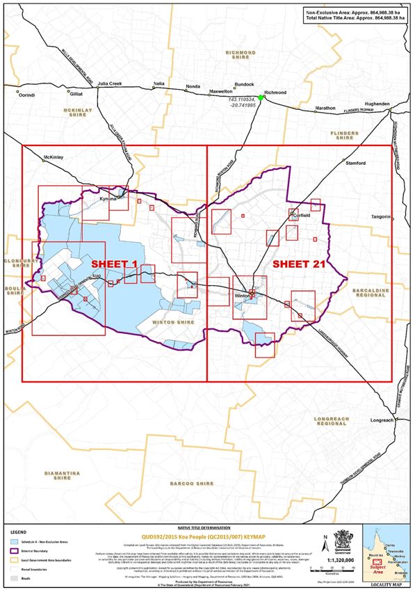
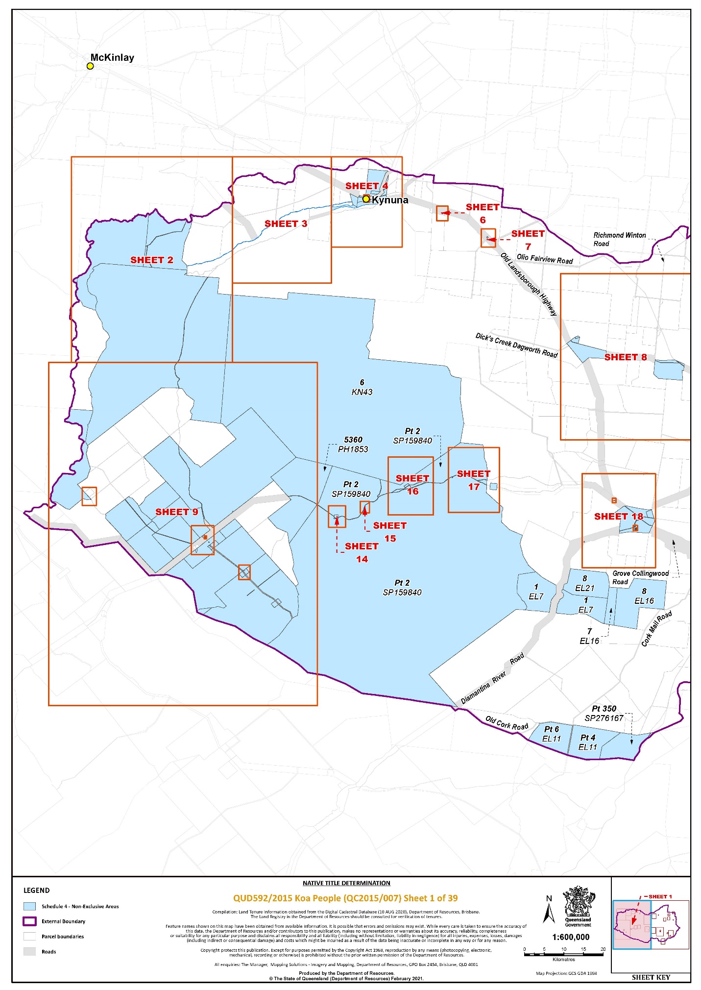
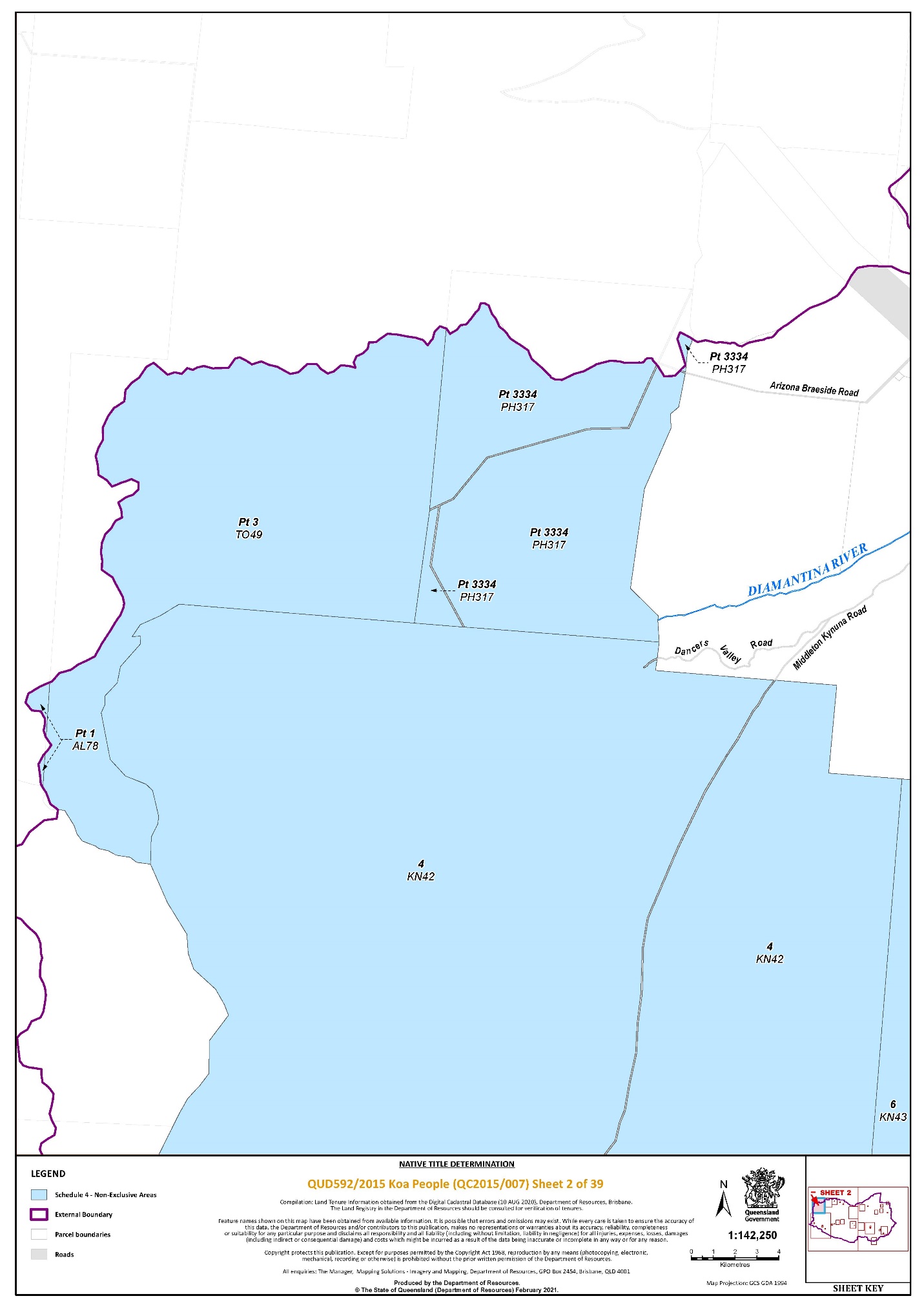
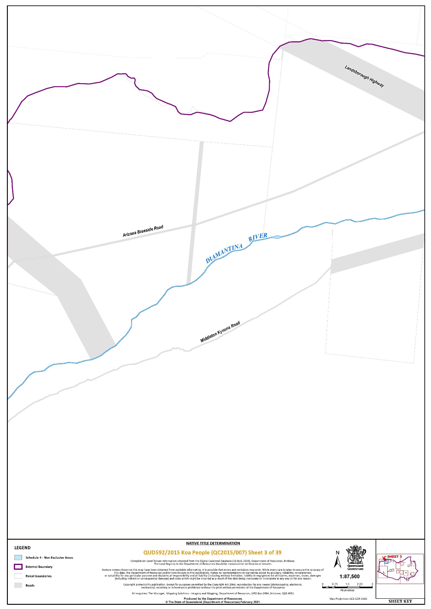
3. The determination area is the land and waters described in Schedule 4 and depicted in the map attached to Schedule 6 to the extent those areas are within the External Boundary and not otherwise excluded by the terms of Schedule 5 (the Determination Area). To the extent of any inconsistency between the written description and the map, the written description prevails.
4. Native title exists in the Determination Area.
5. The native title is held by the Koa People described in Schedule 1 (the Native Title Holders).
6. Subject to Orders 7, 8 and 9 below the nature and extent of the native title rights and interests in relation to the land and waters described in Schedule 4 are the non-exclusive rights to:
(a) access, be present on, move on and travel over the area;
(b) camp, and for that purpose build temporary shelters, on the area;
(c) hunt, fish and gather on the land and waters of the area for personal, domestic and non-commercial communal purposes;
(d) take, use and share Natural Resources from the land and waters of the area for personal, domestic and non-commercial communal purposes;
(e) take and use the Water of the area for personal, domestic and non-commercial communal purposes;
(f) conduct ceremonies on the area;
(g) be buried and bury Native Title Holders within the area;
(h) maintain places of importance and areas of significance to the Native Title Holders under their traditional laws and customs and protect those places and areas from physical harm;
(i) teach on the area the physical and spiritual attributes of the area;
(j) hold meetings on the area; and
(k) light fires on the area for domestic purposes including cooking, but not for the purpose of hunting or clearing vegetation.
7. The native title rights and interests are subject to and exercisable in accordance with:
(a) The Laws of the State and the Commonwealth; and
(b) The traditional laws acknowledged and traditional customs observed by the Native Title Holders.
8. The native title rights and interests referred to in Order 6 do not confer possession, occupation, use or enjoyment to the exclusion of all others.
9. There are no native title rights in or in relation to mineral as defined by the Mineral Resources Act 1989 (Qld) and petroleum as defined by the Petroleum Act 1923 (Qld) and the Petroleum and Gas (Production and Safety) Act 2004 (Qld).
10. The nature and extent of any other interests in relation to the Determination Area (or respective parts thereof) are set out in Schedule 2.
11. The relationship between the native title rights and interests described in Order 6 and the other interests described in Schedule 2 (the Other Interests) is that:
(a) the Other Interests continue to have effect, and the rights conferred by or held under the Other Interests may be exercised notwithstanding the existence of the native title rights and interests;
(b) to the extent the Other Interests are inconsistent with the continued existence, enjoyment or exercise of the native title rights and interests in relation to the land and water of the Determination Area, the native title continues to exist in its entirety but the native title rights and interests have no effect in relation to the Other Interests to the extent of the inconsistency for so long as the Other Interests exist; and
(c) the Other Interests and any activity that is required or permitted by or under, and done in accordance with, the Other Interests, or any activity that is associated with or incidental to such an activity, prevail over the native title rights and interests and any exercise of the native title rights and interests but will not extinguish them except in relation to acts that consist of the construction or establishment of a public work, done after this determination where s 24JA of the Native Title Act 1993 (Cth) applies.
DEFINITIONS AND INTERPRETATION:
12. In this determination, unless the contrary intention appears:
“External Boundary” means the area described in Schedule 3;
“land” and “waters”, respectively, have the same meanings as in the Native Title Act 1993 (Cth);
“Laws of the State and the Commonwealth” means the common law and the laws of the State of Queensland and the Commonwealth of Australia, and includes legislation, regulations, statutory instruments, local planning instruments and local laws;
“Local Government Act” has the meaning given in the Local Government Act 2009 (Qld);
“Local Government Area” has the meaning given in the Local Government Act 2009 (Qld);
“Natural Resources” means:
(a) any animal, plant, fish and bird life found on or in the lands and waters of the Determination Area; and
(b) any clays, soil, sand, gravel or rock found on or below the surface of the Determination Area,
that have traditionally been taken and used by the Native Title Holders, but does not include:
(c) animals that are the private property of another;
(d) crops that are the private personal property of another; and
(e) minerals as defined in the Mineral Resources Act 1989 (Qld); or
(f) petroleum as defined in the Petroleum Act 1923 (Qld) and the Petroleum and Gas (Production and Safety) Act 2004 (Qld).
“Reserve” means a reserve dedicated or taken to be a reserve under the Land Act 1994 (Qld);
“Water” means:
(a) water which flows, whether permanently or intermittently, within a river, creek or stream;
(b) any natural collection of water, whether permanent or intermittent; and
(c) water from an underground water source.
“Works” has the same meaning as in the Electricity Act 1994 (Qld).
Other words and expressions used in this determination have the same meanings as they have in Part 15 of the Native Title Act 1993 (Cth).
THE COURT DETERMINES THAT:
13. The native title is held on trust.
14. The Guwa-Koa Aboriginal Corporation (ICN: 9278), incorporated under the Corporations (Aboriginal and Torres Strait Islander) Act 2006 (Cth), is to:
(a) be the prescribed body corporate for the purpose of ss 56(2)(b) and 56(3) of the Native Title Act 1993 (Cth); and
(b) perform the functions mentioned in s 57(1) of the Native Title Act 1993 (Cth) after becoming a registered native title body corporate.
Note: Entry of orders is dealt with in Rule 39.32 of the Federal Court Rules 2011.
SC DERRINGTON J:
Introduction
1 Mr Frank Button, and others on behalf of the Koa People (Applicant), seek orders under s 87 of the Native Title Act 1993 (Cth) (NTA) for a determination of native title which gives effect to the terms of an agreement reached between the parties (s 87 Agreement) including Draft Consent Determination Orders (Draft Orders). The persons comprising the Applicant are Frank Button, Natasha Duncan, William Gorham, Pamela Hegarty, and Michael Mace.
2 The claim is over land and waters in the upper Diamantina River catchment area and includes the towns of Winton, Kynuna, Corfield and Middleton (Determination Area).
3 The parties have indicated their consent to a determination that the Koa People are the holders of native title in the area covered by the Determination Area.
4 For the reasons set out below, the Court is satisfied that it is within the power of the Court to make the orders sought, and that it is appropriate to do so.
5 As will be explained, the Court’s task in reaching the required state of satisfaction to make a determination of native title under s 87 of the NTA is based on the parties’ free and informed agreement and so does not require judicial determination of the issues in the application. In making such a determination, the Court recognises that rights and interests have existed under the traditional laws and customs of the Koa People for millennia. The effect of the determination is that the Australian community will collectively recognise that those rights have survived fundamental changes in legal regime and are enforced and protected pursuant to the NTA. For that reason, and consistent with the Preamble to the NTA, it is appropriate to record some of the history, prior rights and interests, and rich and diverse culture of the Koa People that was in evidence before this Court and which is described as the Connection Material.
The Koa People
6 The Koa People are described in Schedule 1. They are the biological and adopted descendants of one or more of the following people:
(a) Mary Ann Watson (mother of (at least) Zoe Button nee Watson, Topsy Mitchell, Nancy Chambers nee Watson, George Mitchell, and Valentine Mingo);
(b) Maria Watson (mother of Tommy Watson, George Watson, and Jack Watson);
(c) Jack Chermside (father of Jacob Chermside and Charlie Riley);
(d) Lois Tye/Tie/Tighe;
(e) Lucy Creed (mother of Maria Miller nee Creed aka Maria Jeffries, Timothy Creed, William ‘Trantum’ Creed, Rosie Creed, and Jack Creed); or
(f) Minnie Winton.
7 The submissions before the Court provide that the Connection Material establishes:
(a) that the Koa People today are descended from the peoples of a society who spoke the Koa language (which was part of the Maric group of languages), were the traditional occupants of the headwaters of the Diamantina River around Winton, and used and occupied Koa country prior to 1788;
(b) the Koa apical ancestors were strongly associated with the Koa claim area around the time of European settlement in the region in the mid to late 19th century;
(c) all the descent groups listed on the Koa claim are recognised as Koa families by other Koa families;
(d) to the extent possible under the mission system, following the removal of the Koa People from western Queensland, law and custom, such as respect for elders, decision making processes, representation, and sharing was maintained;
(e) that despite the impact of the removal of the Koa People from the claim area and the impacts of European settlement on the Koa population, Koa People have lived, worked on, and frequently visited Koa country, from the period of removal in the first half of the 20th century to the present;
(f) the acquisition and transfer of traditional law and custom into the modern day, including the widespread belief in ancestral spirits, grounded in specific places, and in totems as spiritual guides and a part of their ancestral connection to country;
(g) that contemporary Koa people maintain aspects of their traditional law and custom and have clear decision-making processes; Koa People also have a strong, cohesive, and active society which has maintained and adapted traditional social processes, especially the right to speak for country, decision-making, and membership;
(h) whilst there have been some adaptions of law and customs, those changes have not affected the laws and customs of the Koa People to the extent that the rights or interests asserted are no longer possessed under the traditional laws;
(i) that the members of the Koa People have maintained a traditional, physical, and spiritual connection to their lands and waters since sovereignty; and
(j) the continuity of Koa People as a society possessing native title in accordance with observed and acknowledged traditional law and custom.
The Determination Area
8 The Determination Area is generally described above. It is defined in Order 3 of the Draft Orders by reference to a written description of the land and waters which is set out in Schedules 4 and 5, and depicted in the map attached to Schedule 6.
The process towards a consent determination
9 The Applicant filed the Koa Application on 16 July 2015. It was referred to the Native Title Registrar who accepted the Application for registration under s 190A of the NTA. The Application was entered on the Register of Native Title Claims on 28 September 2015, and notice was given by the Native Title Registrar under s 66 on 16 December 2015. The closing date for the notification period was 15 March 2016.
10 The Application has since been amended pursuant to orders of the Court. First, by Amended Application filed on 19 July 2017, to replace the original applicant. Secondly, by Further Amended Application filed on 16 October 2019, to reduce the Application area and remove certain respondents. Thirdly, by Second Further Amended Application filed on 27 March 2020 to replace the applicant with the current Applicant. Finally, by a Third Further Amended Application filed on 28 June 2021 to amend the Application to align it with the proposed determination orders.
11 The respondent parties to the Koa Application are:
(a) The State of Queensland (State);
(b) McKinlay Shire Council;
(c) Winton Shire Council;
(d) Ergon Energy Corporation Limited;
(e) Telstra Corporation Limited;
(f) John Charles Little;
(g) Ian Douglas Muir;
(h) Sandra Lynette Muir;
(i) John David Whitehead;
(j) Philippa Leanne Whitehead.
12 Between 31 March 2017 and 20 April 2018, the Applicant provided various anthropological and genealogical reports and witness statements to the State aimed at showing that the Koa People had native title rights and interests in the Determination Area.
13 The Applicant and the State also participated in an on country evidence process between 22 and 25 May 2018.
14 The Applicant provided Connection Material to other respondents at their request.
15 On 13 June 2018, the State advised that it was prepared to enter into substantive negotiations towards a consent determination, on various conditions, including reliance on the Connection Material. Within the context of the case management process, all remaining parties have reached agreement that native title exists and in relation to the nature and extent of the native title rights and interests over the area covered by the Application.
16 Subsequently, all parties executed the Section 87 Agreement to which the Draft Orders are annexed. It was filed on 24 August 2021. The Applicant seeks a determination of native title in the terms of the Draft Orders agreed by the parties.
17 The application for a consent determination is supported by the following materials:
(a) the Third Further Amended Application made pursuant to ss 13(1)(a) and 61 of the NTA;
(b) the s 87 Agreement and Draft Orders;
(c) an affidavit of Rebecca Aleisha-Maree Wagner affirmed on 6 April 2021;
(d) the Applicant’s submissions in support of the application.
THE REQUIREMENTS OF SECTION 87
Whether the Court has power to make the proposed orders
13 Pursuant to s 87(1) of the NTA the Court may make a determination of native title by consent without holding a hearing where:
(a) the period specified in the notice given under s 66 of the NTA has ended (s 87(1));
(b) there is an agreement for a proposed determination of native title in relation to the proceeding (s 87(1)(a));
(c) the terms of the proposed determination, in writing signed by or on behalf of all of the parties, is filed with the Court (s 87(1)(b)); and
(d) the Court is satisfied that an order in, or consistent with, those terms would be within the power of the Court (s 87(1)(c)).
14 Having regard to the material before the Court, it is satisfied that:
(a) the notice period specified in s 66 of the NTA ended long ago, on 15 March 2016; and
(b) there is an agreement for a proposed determination of native title in relation to the proceeding, that the terms of the proposed determination are in writing, have been signed on behalf of all of the parties, and were filed with the Court on 24 August 2021 (s 87(1)(a) and (b)).
15 An order under s 87 of the NTA will be within power (s 87(1)(c)) if: it is consistent with s 94A of the NTA; the rights and interests included in the proposed determination are recognisable by the common law of Australia; and, there is no other native title determination in existence over the area the subject of the proposed determination: Kngwarrey on behalf of the member of the Irrkwal, Irrmam, Ntewerrek, Aharreng, Arrty/Amatyerr and Areyn Landholding Groups v Northern Territory of Australia [2011] FCA 428 at [7].
16 Section 94A provides that an order in which the Court makes a determination of native title must set out details of the matters mentioned in s 225 of the NTA. Section 225 provides:
A determination of native title is a determination whether or not native title exists in relation to a particular area (determination area) of land or waters and, if it does exist, a determination of:
(a) who the persons, or each group of persons, holding the common or group rights comprising the native title are; and
(b) the nature and extent of the native title rights and interests in relation to the determination area; and
(c) the nature and extent of any other interests in relation to the determination area; and
(d) the relationship between the rights and interests in paragraphs (b) and (c) (taking into account the effect of this Act); and
(e) to the extent that the land or waters in the determination area are not covered by a non-exclusive agricultural lease or a non-exclusive pastoral lease – whether the native title rights and interests confer possession, occupation, use and enjoyment of that land or waters on the native title holders to the exclusion of all others.
17 The Court is satisfied as to each of the matters in s 225, being that:
(a) the persons holding the common or group rights comprising the native title are identified as the Koa People in Order 5. The Koa People are the descendants of the ancestors identified in Schedule 1, in accordance with the traditional laws and customs of the Koa People (s 225(a));
(b) the nature and extent of the native title rights and interests in relation to the Determination Area are set out in Orders 6 to 9 (s 225(b));
(c) the nature and extent of any “other interests” in relation to the Determination Area are identified in Order 10 as those set out in Schedule 2 (s 225(c));
(d) the relationship between the rights and interests relevant to subs (b) and (c) of s 225 and described in Order 6 and the other interests described in Schedule 2 is set out in Order 11. The Draft Orders identify all “other interests” in relation to the Determination Area and specify that, to the extent that there is an inconsistency between those “other interests” and the determined native title, the “other interests” will prevail for as long as the “other interests” exist (s 225(d)); and
(e) there are no areas over which exclusive native title is asserted or proposed to be recognised (s 225(e)).
18 The Court is satisfied that the native title rights and interests included in the Draft Orders are capable of being recognised by the common law of Australia.
19 Finally, the Court is satisfied that there is no other native title determination in existence over the area subject to the proposed determination, and that there are no other proceedings before the Court relating to native title determination applications that cover any part of the area subject to the proposed determination and which would otherwise require orders to be made under s 67(1) of the NTA.
20 The Court is satisfied that the orders sought are consistent with the terms of the parties’ agreement as reflected in the Draft Orders, and are within the Court’s power to pronounce.
Whether the proposed orders are appropriate to make
21 Section 87(1A) provides:
The Court may, if it appears to the Court to be appropriate to do so, act in accordance with:
(a) whichever of subsection (2) or (3) is relevant in the particular case; and
(b) if subsection (5) applies in the particular case – that subsection.
22 In the present case, subsection (2) is the relevant subsection and subsection (5) does not apply. Subsection 87(2) provides:
If the agreement is on the terms of an order of the Court in relation to the proceedings, the Court may make an order in, or consistent with, those terms without holding a hearing or, if a hearing has started, without completing the hearing.
23 The words “… if it appears to the Court to be appropriate to do so …” in s 87(1A) confer a discretion on the Court. Once the conditions precedent to the exercise of the discretion have been satisfied, it is unfettered, although it must be exercised judicially in accordance with legal principle. The fact that a determination of native title operates to bind not just the parties to the proceeding but all people in the Australian community underlines the importance of the Court’s consideration of the source of the power and the appropriateness of making the orders sought: Munn v Queensland [2001] FCA 1229; 115 FCR 109 at [26] and [28] (Emmett J).
24 The wording of s 87(1A) and (2) provide that the question for the Court is whether it is appropriate to make an order in the terms of the agreement reached between the parties, and the primary focus of the section is that agreement. As Murphy J said Eagles on behalf of the Combined Thiin-Mah, Warriyangka, Tharrkari and Jiwarli People v State of Western Australia [2019] FCA 508 at [19]-[22]:
[19] In deciding whether it is appropriate to make the proposed orders it must be kept in mind that the Court’s function under s 87 focuses on the making of an agreement by the parties, and the power must be understood in the context of the Act’s emphasis on negotiation and alternative dispute resolution, rather than judicial determination in a contested proceeding. The power in s 87 is only exercisable when an agreement has been reached and the power should be exercised flexibly and with regard to the purpose for which the provisions are designed.
[20] The Court is not necessarily required to make findings or embark on its own inquiry as to the merits of the claim made in an application for a consent determination under s 87: see Ward v State of Western Australia [2006] FCA 1848 (Ward) at [8] (North J); Cox on behalf of the Yungngora People v State of Western Australia [2007] FCA 588 (Cox) at [3] (French J); Lander v State of South Australia [2012] FCA 427 at [11]-[12] (Mansfield J); Freddie v Northern Territory [2017] FCA 867 (Freddie) at [16]-[17] (Mortimer J). Rather, the Court must be satisfied, inter alia, that it is appropriate to make the orders sought. The indicia that will be sufficient to satisfy the Court of the appropriateness of a consent determination will be determined on a case by case basis. In some cases it may be appropriate to make orders under s 87 where the Court has received no evidence of the primary facts substantiating native title if the Court is satisfied that the parties have freely and on an informed basis come to an agreement: see Hughes (on behalf of the Eastern Guruma People) v Western Australia [2007] FCA 365 at [9] and Ward at [8].
[21] Even so, as French J observed in Cox the concept of appropriateness also recognises that the determination made by the Court is one made as against the whole world, and not just between the parties to the proceeding. The Court must be conscious that the rights conferred are enduring legal rights, proprietary in nature. This informs considerations including the requirement for the free and informed consent of all parties and the State’s agreement that there is a credible and rational basis for the determination proposed: Freddie at [18].
[22] The requirements of s 87 may, and will likely, be met where the Court is satisfied that a relevant government respondent (such as the State in the present case), through competent legal representation, is satisfied as to the cogency of the evidence upon which the Applicant relies. The Court is entitled to rely on the processes established by a State or Territory for assessing native title claims and to proceed on the basis that the State or Territory has made a reasonable and rational assessment of the material to which it has had access in deciding to enter into an agreement: Freddie at [23]-[24] and the authorities there cited.
25 The matters to be taken into account include whether: there exists a free and informed agreement between the parties who have had the benefit of independent and competent legal representation in the proceeding; the State has taken a ‘real interest’ in the proceeding on behalf of the broader community; it appears the agreement was freely entered into without duress, fraud or misrepresentation; whether there is evidence before the Court which justifies the order ‘for the purpose of satisfying itself that those parties who have agreed to compromise the matter, particularly the State on behalf of the community generally, are acting in good faith and rationally’: Munn at [30].
26 The Court is satisfied that the s 87 Agreement reflects a free and informed agreement between the parties. It was negotiated in a case management process with the assistance of a Registrar who is experienced in dispute resolution in native title cases. All parties have had the benefit of independent and competent legal representation.
27 The State has taken a ‘real interest’ in the proceeding on behalf of the broader community and given appropriate consideration to the Applicant’s Connection Material, in particular by participating in the on country evidence process.
28 The Connection Material filed by the Applicant in support of the proposed determination is sufficient evidence of the existence of native title, as defined by s 223 of the NTA, and included:
(1) relevant genealogies by Dr Sandra Pannell filed 13 June 2019
(2) report on Anthropologists conference filed 13 June 2019
(3) Anthropological Connection Report for Koa Native Title Claim (February 2016) by Dr Kevin Mayo filed 13 June 2019
(4) further comments on the evidence of Robert Beckett by Dr Kevin Mayo filed 13 June 2019
(5) affidavit of Robert Duncan 15 July 2015 filed 14 June 2019
(6) affidavit of Robert Beckett 15 July 2015 filed 14 June 2019
(7) witness statement of Alana Purcell 28 February 2017 filed 14 June 2019
(8) witness statement of Charlie Chambers 3 March 2017 filed 14 June 2019
(9) witness statement of Elizabeth Jacobs 15 March 2017 filed 14 June 2019
(10) witness statement of Frank Button 5 March 2017 filed 14 June 2019
(11) witness statement of Frank Petersen 24 March 2017 filed 14 June 2019
(12) witness statement of Lesley Williams 21 March 2017 filed 14 June 2019
(13) witness statement of Pam Hegarty 24 March 2017 filed 14 June 2019
(14) witness statement of Robert Beckett 15 February 2017 filed 14 June 2019
(15) witness statement of Sandra Morgan 1 March 2017 filed 14 June 2019
(16) witness statement of William Gorham 14 March 2017 filed 14 June 2019
(17) witness statement of Wesley Conlon 29 August 2017 filed 14 June 2019
(18) witness statement of Dennis Conlon 29 August 2017 filed 14 June 2019
(19) witness statement of Michael Mace 20 October 2017 filed 14 June 2019
(20) witness statement of Robert Duncan 8 September 2017 filed 14 June 2019
(21) witness statement of Hayley Langton 5 October 2017 filed 14 June 2019
(22) further witness statement of Frank Button 27 April 2018 filed 14 June 2019
(23) further unrestricted witness statement of Pam Hegarty 27 April 2018 filed 14 June 2019
(24) amended further unrestricted witness statement of Frank Petersen 14 May 2018 filed 14 June 2019
(25) further restricted witness statement of Frank Petersen 7 August 2017 filed 3 July 2019
(26) further restricted witness statement of Pam Hegarty 10 May 2018 filed 3 July 2019
(27) transcript of on country evidence process (OCEP) – Days 1-4 22 May 2018 filed 3 July 2019
(28) map referred to and used during OCEP filed 18 November 2019
(29) restricted transcript of OCEP – Day 1 22 May 2018 filed 3 July 2019
(30) restricted transcript of OCEP – day 4 25 May 2018 filed 3 July 2019.
29 Having regard to the above, the Court is satisfied that the State, acting on behalf of the broader community, has taken a real interest in the proceeding and has engaged in a thorough examination of the application such that it is properly satisfied that there is a credible basis for the making of the proposed determination pursuant to the requirements of the NTA.
30 The Court is satisfied that, in accordance with s 87 of the NTA, it is appropriate to make a determination of native title in terms of the Draft Orders.
The prescribed body corporate
31 Where the Court proposes to make a determination that native title exists it must determine whether the native title is to be held in trust and if so by whom: ss 55 and 56(1) of the NTA.
32 The Court may determine that the native title is to be held in trust if the common law holders (being the Koa People as described in Schedule 1) have given a nomination of the kind referred to in s 56(2)(a).
33 On 30 March 2021, by letter addressed to Judicial Registrar Grant of the Federal Court, Mr Michael Mace, a member of the Applicant formally nominated the Guwa-Koa Aboriginal Corporation ICN 9278, incorporated under the Corporations (Aboriginal and Torres Strait Islander) Act 2006 (Cth), to be the prescribed body corporate to hold the rights and interests comprising the native title on trust for the common law holders, pursuant to s 56(2)(a) of the NTA. In a statement signed by two directors of the Guwa-Koa Aboriginal Corporation (Annexure RAMW-03 to the Affidavit of Rebecca Wagner filed 6 April 2021) the Guwa-Koa Aboriginal Corporation consented to that nomination.
34 It is therefore appropriate to make Orders 13 and 14 of the Draft Orders to record the Court’s determination that:
(a) the native title is held in trust;
(b) the Guwa-Koa Aboriginal Corporation (ICN: 9278), incorporated under the Corporations (Aboriginal and Torres Strait Islander) Act 2006 (Cth), is to
(i) be the prescribed body corporate for the purposes of ss 56(2)(b) and 56(3) of the NTA; and
(ii) perform the functions mentioned in s 57(1) of the NTA after becoming a registered native title body corporate.
Conclusion
35 For the Koa People, the Section 87 Agreement and the orders herein vindicate their claim for judicial recognition as the people who have always held native title rights and interests in the Determination Area.
I certify that the preceding thirty-five (35) numbered paragraphs are a true copy of the Reasons for Judgment of the Honourable Justice SC Derrington. |
Associate:
QUD 592 of 2015 | |
Third Respondent: Fourth Respondent: Fifth Respondent: Sixth Respondent: Seventh Respondent: Eighth Respondent: Ninth Respondent: Tenth Respondent: | McKinlay Shire Council Winton Shire Council Ergon Energy Corporation Limited CAN 087 646 062 Telstra Corporation Limited CAN 051 775 556 John Charles Little Ian Douglas Muir Sandra Lynette Muir John David Whitehead Phillippa Leanne Whitehead |
SCHEDULE ONE – Native Title Holders
The Native Title Holders are the Koa People. The Koa People are the biological and adopted descendants of one or more of the following people:
(a) Mary Ann Watson (mother of (at least) Zoe Button nee Watson, Topsy Mitchell, Nancy Chambers nee Watson, George Mitchell and Valentine Mingo);
(b) Maria Watson (mother of Tommy Watson, George Watson and Jack Watson);
(c) Jack Chermside (father of Jacob Chermside and Charlie Riley);
(d) Lois Tye/Tie/Tighe;
(e) Lucy Creed (mother of Maria Miller nee Creed aka Maria Jeffries, Timothy Creed, William “Trantum” Creed, Rosie Creed and Jack Creed)
(f) Minnie Winton.
SCHEDULE TWO – Other Interests in the Determination Area
The nature and extent of the other interests in relation to the Determination Area are the following as they exist as at the date of the determination:
1. The rights and interests of the parties under the following agreements registered on the Register of Indigenous Land Use Agreements:
(a) Maiawali & Karuwali #2 EP Backlog Project ILUA registered on 6 December 2002; and
(b) Koa People Tenure Resolution ILUA registered on 13 August 2021.
2. The rights and interests of the holders of water allocations 403981 and 403982 granted pursuant to the Water Act 2000 (Qld) to take 1000ML of water from Hutton Sandstone formation and 135ML of water from Injune Creek Group formation respectively.
3. The rights and interests of Telstra Corporation Limited ACN 051 775 556:
(a) as the owner or operator of telecommunications facilities within the Determination Area;
(b) created pursuant to the Post and Telegraph Act 1901 (Cth), the Telecommunications Act 1975 (Cth), the Australian Telecommunications Corporation Act 1989 (Cth), the Telecommunications Act 1991 (Cth) and the Telecommunications Act 1997 (Cth), including rights:
(i) to inspect land;
(ii) to install, occupy and operate telecommunication facilities; and
(iii) to alter, remove, replace, maintain, repair and ensure the proper functioning of its telecommunications facilities;
(c) for its employees, agents or contractors to access its telecommunication facilities in and in the vicinity of the Determination Area in the performance of their duties; and
(d) under any lease, licence, access agreement, permit or easement relating to its telecommunications facilities in the Determination Area.
4. The rights and interests of Ergon Energy Corporation Limited ACN 087 646 062:
(a) as the owner and operator of any Works within the Determination Area;
(b) as an electricity entity under the Electricity Act 1994 (Qld), including but not limited to:
(i) as the holder of a distribution authority;
(ii) to inspect, maintain and manage any Works in the Determination Area; and
(iii) in relation to any agreement or consent relating to the Determination Area existing or entered into before the date these orders are made; and
(c) to enter the Determination Area by its employees, agents or contractors to exercise any of the rights and interests referred to in this clause.
5. The rights and interests of McKinlay Shire Council and Winton Shire Council (Council):
(a) under their local government jurisdiction and functions under the Local Government Act, under the Stock Route Management Act 2002 (Qld) and under any other legislation, for that part of the Determination Area within the area declared to be their respective Local Government Areas;
(i) lessor under any leases which were validly entered into before the date on which these orders are made and whether separately particularised in these orders or not;
(ii) grantor of any licences or other rights and interests which were validly granted before the date on which these orders were made and whether separately particularised in these orders or not; and
(iii) holder of any estate or any other interest in land, as trustee of any Reserves, under access agreements and easements that exist in the Determination Area;
(c) as the owner and operator of infrastructure, structures, earthworks, access works and any other facilities and other improvements located in the Determination Area validly constructed or established on or before the date on which these orders are made, including but not limited to:
(i) undedicated but constructed roads except for those not operated by Council;
(ii) water pipelines and water supply infrastructure;
(iii) drainage facilities;
(iv) watering point facilities;
(v) recreational facilities;
(vi) transport facilities;
(vii) gravel pits operated by Council;
(viii) cemetery and cemetery related facilities; and
(ix) community facilities; and
(d) to enter the land for the purposes described in paragraphs 5(a), 5(b) and 5(c) above by their employees, agents or contractors to:
(i) exercise any of the rights and interests referred to in this paragraph 5 and paragraph 6 below;
(ii) use, operate, inspect, maintain, replace, restore and repair infrastructure, facilities and other improvements referred to in paragraph 5(c) above; and
(iii) undertake operational activities in its capacity as a local government such as feral animal control, weed control, erosion control, waste management and fire management.
6. The rights and interests of the State of Queensland, the Winton Shire Council and McKinlay Shire Council to access, use, operate, maintain and control the dedicated roads in the Determination Area and the rights and interests of the public to use and access the roads.
7. The rights and interests of the State of Queensland in Reserves, the rights and interests of the trustees of those Reserves and the rights and interests of the persons entitled to access and use those Reserves for the respective purpose for which they are reserved.
8. The rights and interests of the State of Queensland or any other person existing by reason of the force and operation of the laws of the State of Queensland, including those existing by reason of the following legislation or any regulation, statutory instrument, declaration, plan, authority, permit, lease or licence made, granted, issued or entered into under that legislation:
(a) the Land Act 1994 (Qld);
(b) the Nature Conservation Act 1992 (Qld);
(c) the Forestry Act 1959 (Qld);
(d) the Water Act 2000 (Qld);
(e) the Petroleum Act 1923 (Qld) or Petroleum and Gas (Production and Safety) Act 2004 (Qld);
(f) the Mineral Resources Act 1989 (Qld);
(g) the Planning Act 2016 (Qld);
(h) the Transport Infrastructure Act 1994 (Qld);
(i) the Fire and Emergency Services Act 1990 (Qld) or Ambulance Service Act 1991 (Qld);
(j) the Fisheries Act 1994 (Qld); and
(k) the Stock Route Management Act 2002 (Qld).
9. The rights and interests of members of the public arising under the common law, including but not limited to the following:
(a) any subsisting public right to fish; and
(b) the public right to navigate.
10. So far as confirmed pursuant to s 212(2) of the Native Title Act 1993 (Cth) and s 18 of the Native Title Act (Queensland) Act 1993 (Qld) as at the date of this Determination, any existing rights of the public to access and enjoy the following places in the Determination Area:
(a) waterways;
(b) beds and banks or foreshores of waterways;
(c) stock routes; and
(d) areas that were public places at the end of 31 December 1993.
11. Any other rights and interests:
(a) held by the State of Queensland or Commonwealth of Australia; or
(b) existing by reason of the force and operation of the Laws of the State and the Commonwealth.
SCHEDULE THREE – External Boundary
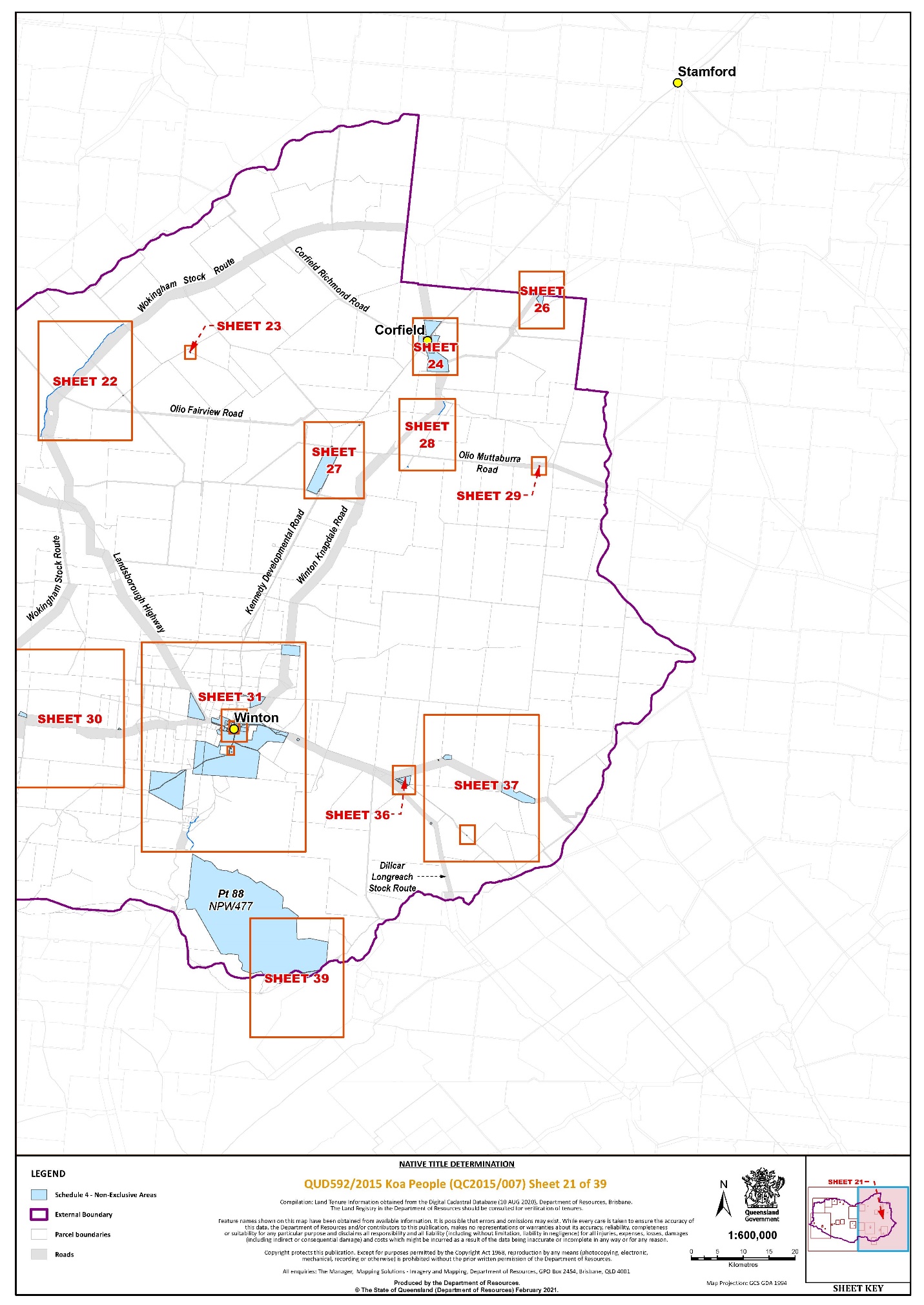
The area of land and waters commencing at the intersection of the Representative Aboriginal and Torres Strait Islander Body (RATSIB) boundary between the Southern and Western Queensland Region and the Northern Queensland Region and the Diamantina River Watershed at Longitude 143.333432° East and extending easterly and generally south-easterly along that RATSIB boundary to again intersect the Diamantina River Watershed at Longitude 143.687375°; then generally southerly, generally south westerly, generally westerly and again generally south-westerly along that watershed to Latitude 22.861963° South then generally north-westerly passing through the following co-ordinate points.
Longitude (East) | Latitude (South) |
142.529185 | 22.861993 |
142.495531 | 22.856981 |
142.463309 | 22.859845 |
142.421062 | 22.860561 |
142.379531 | 22.850536 |
142.326543 | 22.831203 |
142.287160 | 22.815450 |
Then north-westerly to a corner on the northern boundary of the southern severance of Lot 4189 on SP293531 (formerly Lot 4189 on EL813328) at Longitude 142.271220° East; then generally north-westerly along boundaries of that severance to its northernmost north-western corner; then north-westerly to the northernmost north-eastern corner of Lot 3 on EL12 (formerly Lot 3514 on PH1476 (Diomedes Pastoral Holding); then generally westerly along boundaries of that lot and northern boundaries of Lot 1 on BT16 (Finbar Pastoral Holding) to Longitude 141.908886° East; then generally north westerly passing through the following coordinate points.
Longitude (East) | Latitude (South) |
141.871851 | 22.687277 |
141.824592 | 22.667943 |
141.785209 | 22.661499 |
141.764444 | 22.642882 |
141.709308 | 22.607079 |
141.659900 | 22.582733 |
141.619801 | 22.555523 |
141.573974 | 22.541202 |
141.532443 | 22.523301 |
141.523851 | 22.475326 |
141.498073 | 22.448116 |
141.463702 | 22.437375 |
Then westerly to the intersection of northern boundary of Kennedy Developmental Road and the southern boundary of Toolebuc Middleton Road; then generally north-westerly along the southern boundary of that road to its intersection with the western boundary of the Diamantina River Watershed.
Then generally north-easterly, generally northerly and generally easterly along that watershed boundary to its intersection with the Southern and Western Queensland Region and the Northern Queensland Region RATSIB boundary at Longitude 142.049949° East, then generally easterly along that RATSIB boundary to again its intersection with the Diamantina River Watershed at 142.218488° East then generally easterly along that watershed boundary to again its intersection with the RATSIB boundary at Latitude 21.554309° South; then generally southerly and generally easterly again along that RATSIB boundary to again its intersection with the Diamantina River Watershed boundary at 142.272135° East; then generally south easterly, generally easterly and generally north easterly again along that watershed boundary to its intersection with the RATSIB boundary at 142.653614° East; then southerly and north-easterly again along that RATSIB boundary to intersection with the Diamantina River Watershed boundary at 142.698258° East; then generally north-easterly again along that watershed boundary back to the commencement point.
Data Reference and source
External boundary complied by Queensland South Native Title Services based in part on data sourced from the Commonwealth of Australia, NNTT (August 2020).
Cadastral data sourced from State of Queensland, Department of Resources (August 2020).
Watershed boundaries based on spatially updated QLD River Basin 100K data sourced from State of Queensland, Department of Resources (June 2020).
RATSIB data sourced from Commonwealth of Australia, NNTT (January 2020).
Reference datum
Geographical coordinates are referenced to the Geocentric Datum of Australia 1994 (GDA94), in decimal degrees and are based on the spatial reference data acquired from the various custodians at the time.
Use of Coordinates
Where coordinates are used within the description to represent cadastral or topographical boundaries or the intersection with such, they are intended as a guide only. As an outcome to the custodians of cadastral and topographic data continuously recalculating the geographic position of their data based on improved survey and data maintenance procedures, it is not possible to accurately define such a position other than by detailed ground survey.
Prepared by Queensland South Native Title Services (10 September 2020).
SCHEDULE FOUR – Description of Determination Area
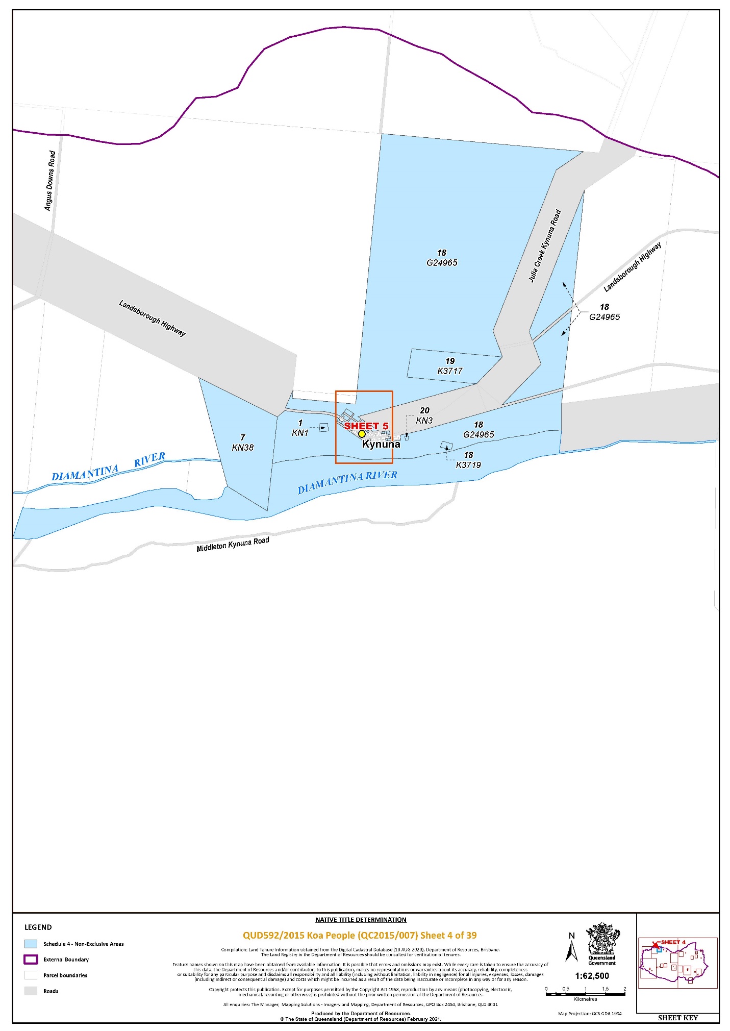
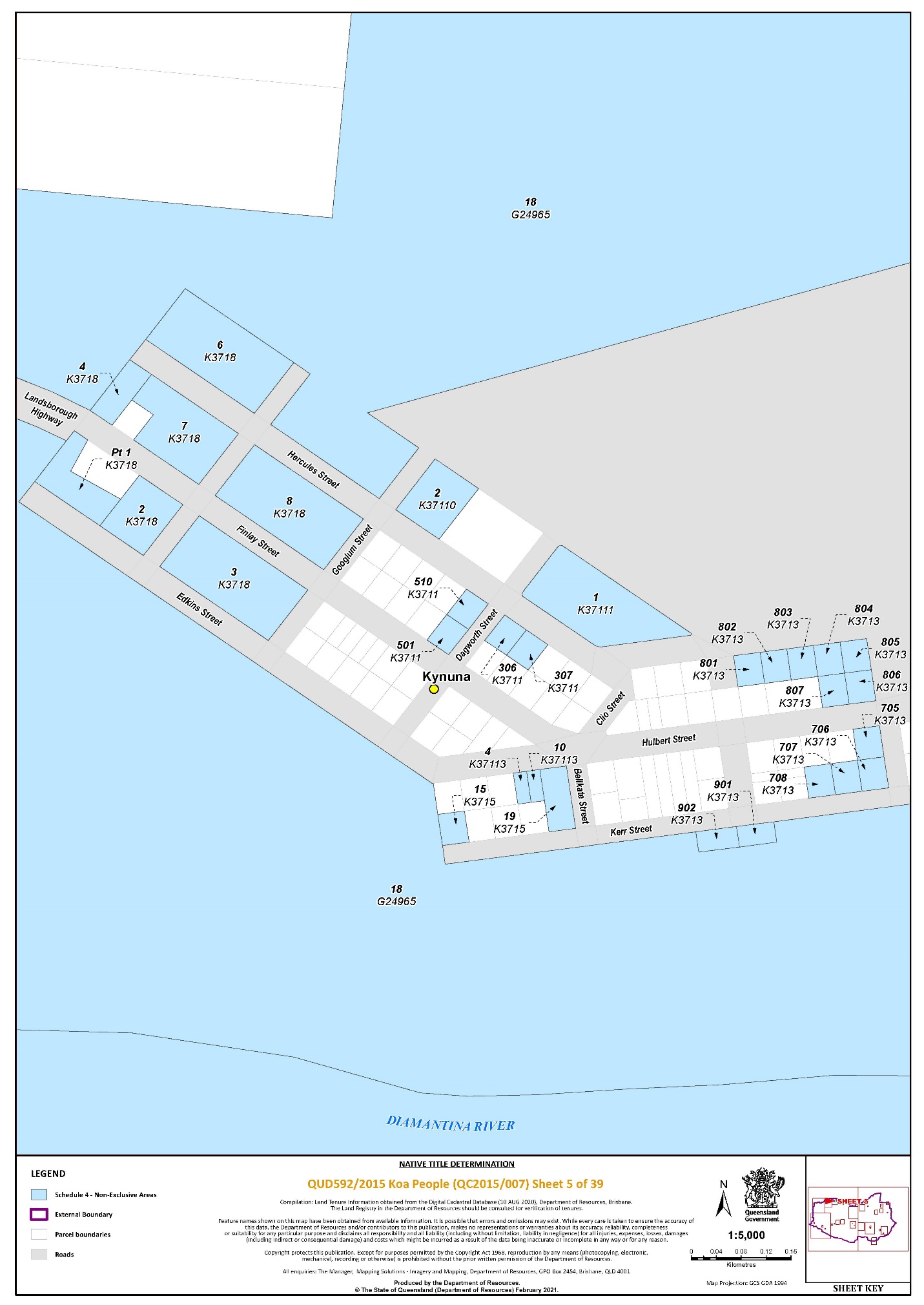
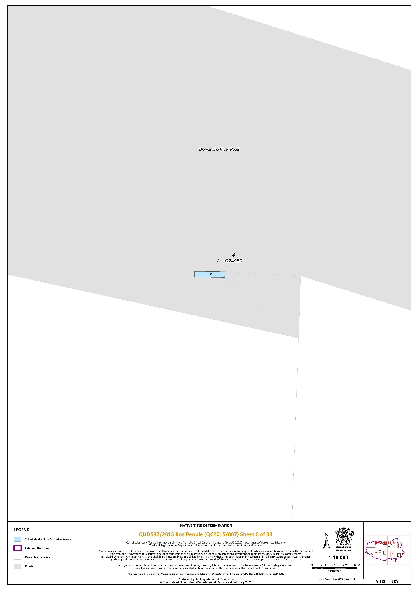
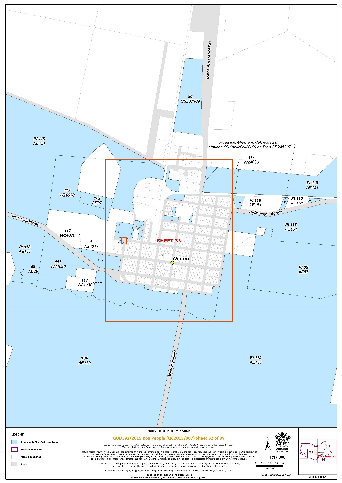
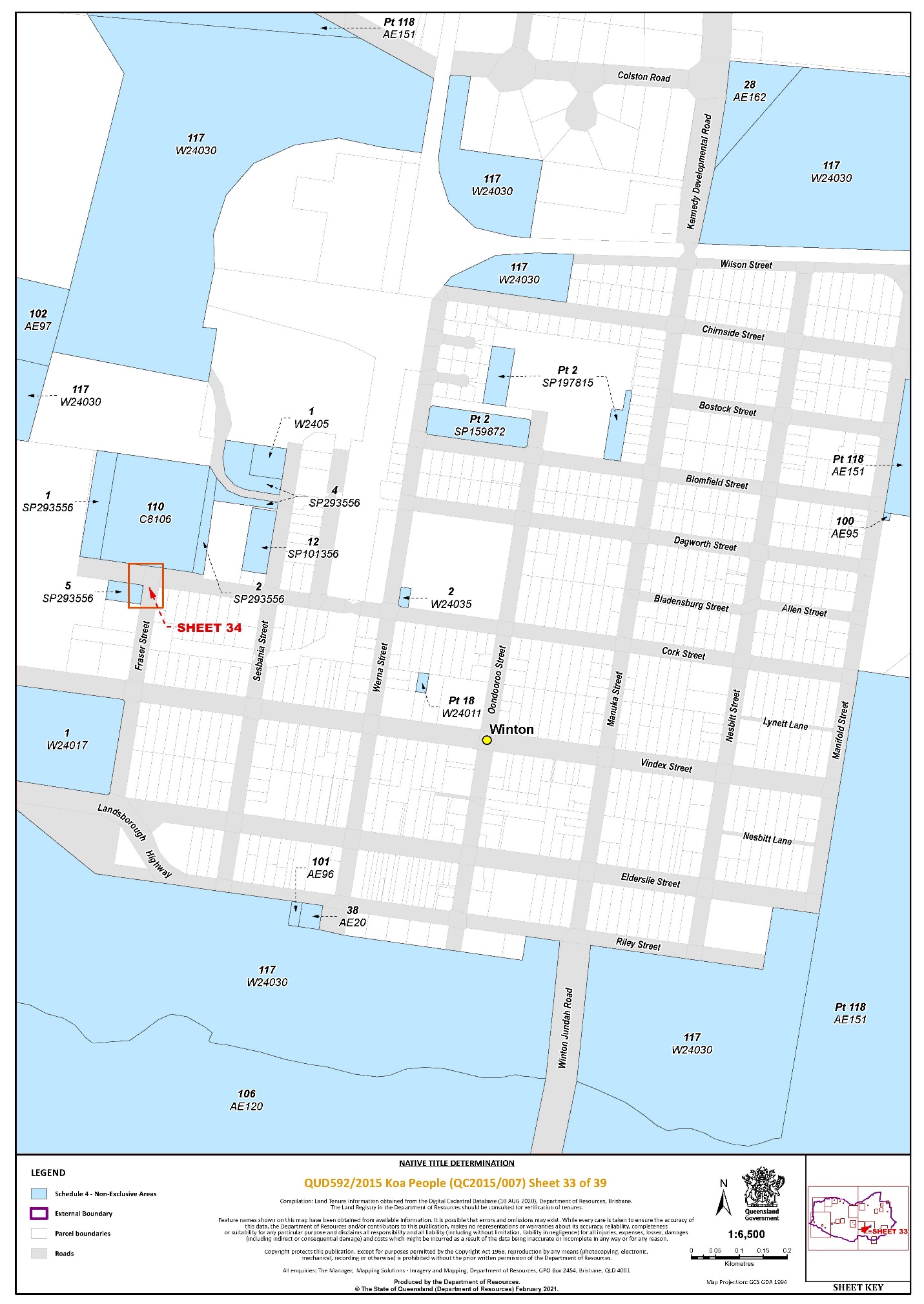
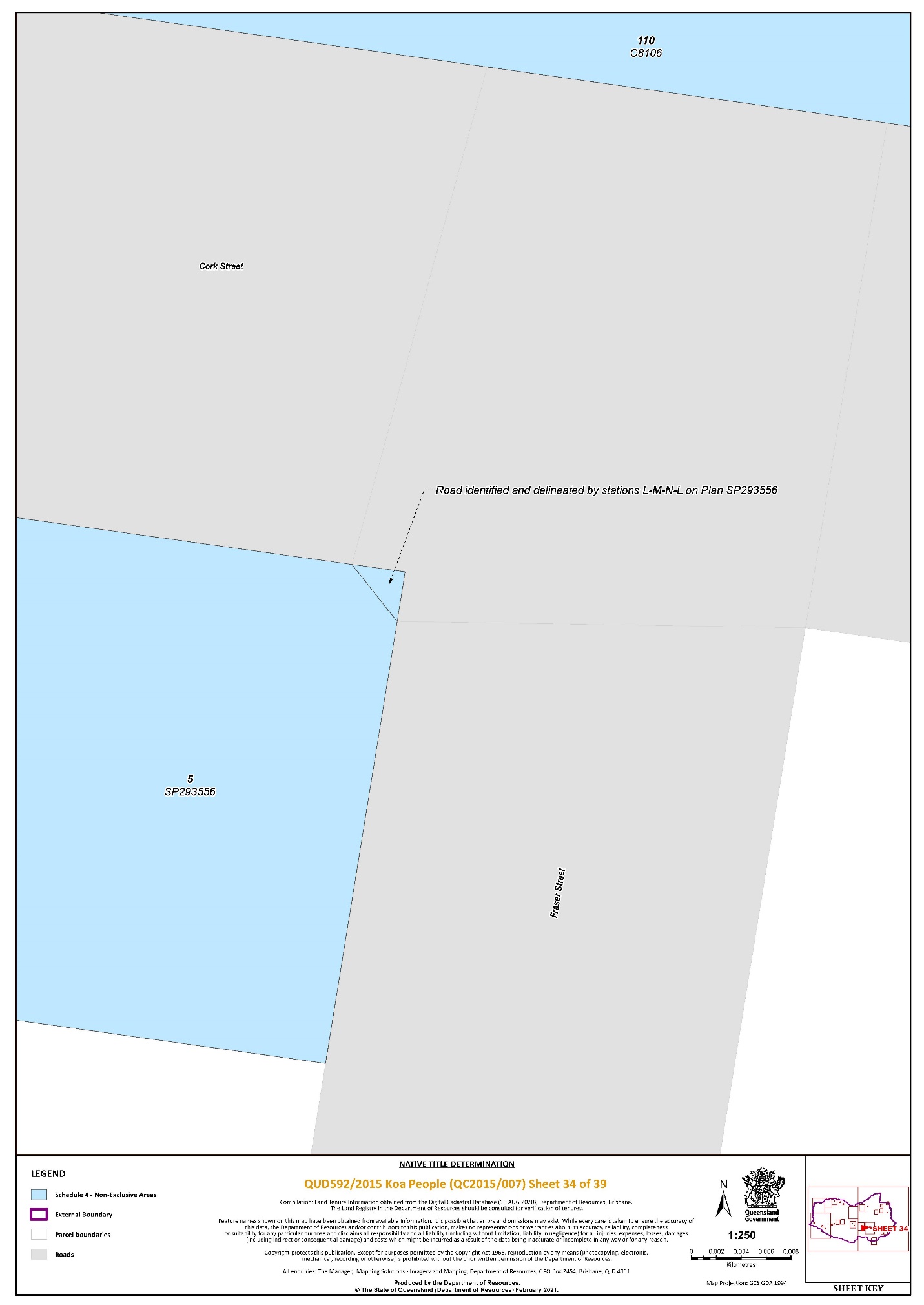
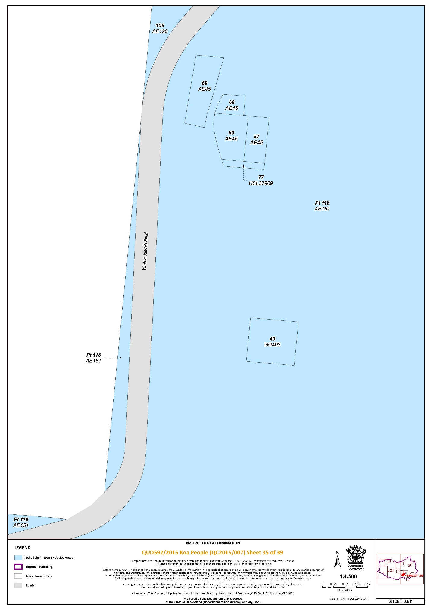
The determination area comprises all of the land and waters described by lots on plan, or relevant parts thereof, and any rivers, streams, creeks or lakes described in the first column of the table immediately below, and depicted in the maps in Schedule 6, to the extent those areas are within the External Boundary and not otherwise excluded by the terms of Schedule 5.
Non-Exclusive Areas
All of the land and waters described in the following table and depicted in light blue on the determination map contained in Schedule 6:
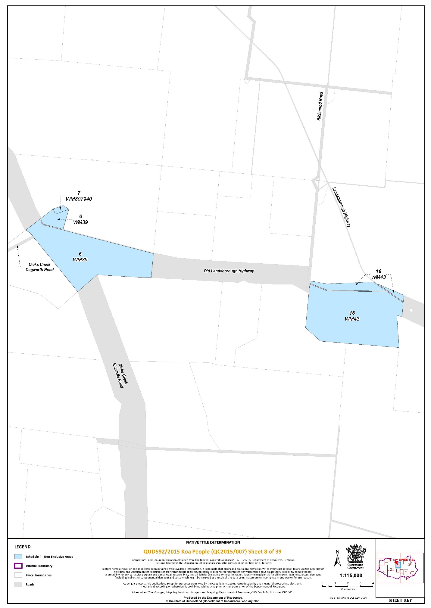
Area description (at the time of the determination) | Determination Map Sheet Reference | ||||||||||||
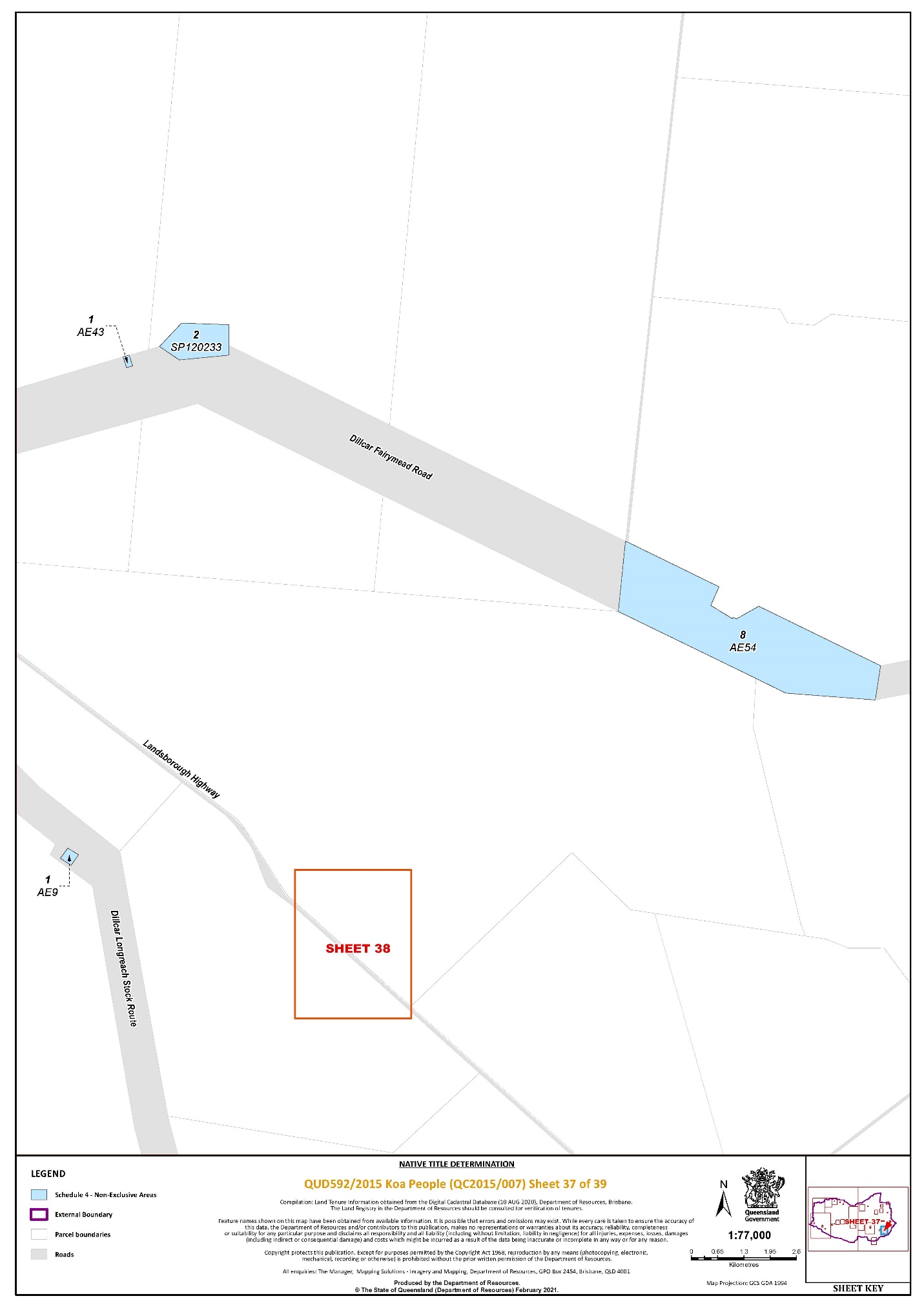
Lot 1 on AE43 | 37 | ||||||||||||
Lot 1 on AE9 | 37 | ||||||||||||
That part of Lot 1 on AL78 that falls within the External Boundary | 2 | ||||||||||||
Lot 1 on CP858384 | 31 | ||||||||||||
Lot 1 on EL14 | 16 | ||||||||||||
Lot 1 on EL7 | 1 | ||||||||||||
Lot 1 on K37111 | 5 | ||||||||||||
Lot 1 on KN1 | 4 | ||||||||||||
That part of Lot 1 on K3718 excluding an area commencing at the eastern-most corner of Lot 1 on K3718, also being a point on the western boundary of Finlay Street (Landsborough Highway) and progressing north-west along the western boundary of that street until a point at Latitude 21.574638° South; then south-westerly to a point at Longitude 141.913793° East, Latitude 21.575092° South; then south-easterly to a point on the south-eastern boundary of Lot 1 on K3718 at Latitude 21.575495° South; then north-easterly along the south-eastern boundary of that lot back to the commencement point. | 5 | ||||||||||||
Lot 1 on SP159840 | 15 | ||||||||||||
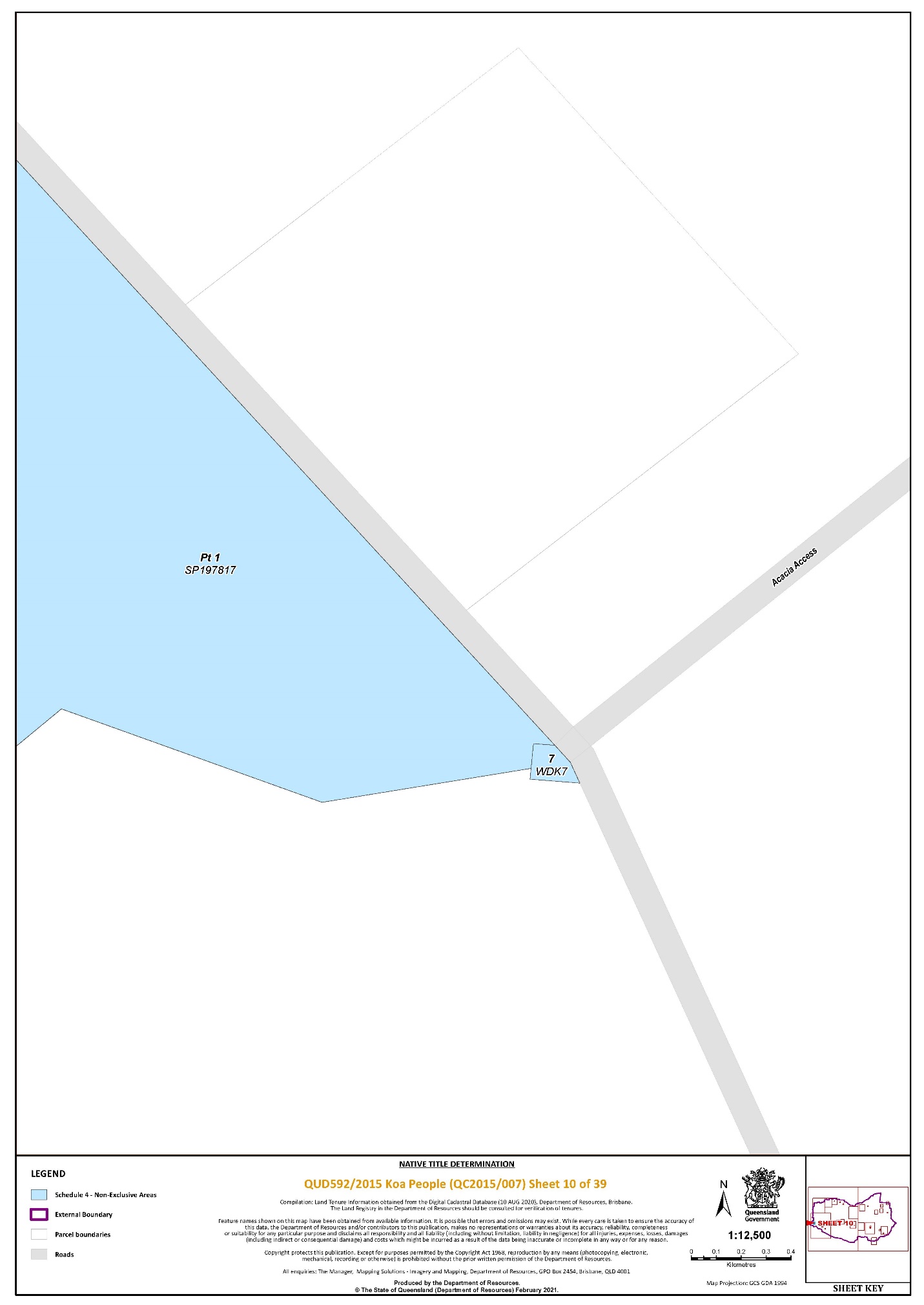
That part of Lot 1 on SP197817 that falls within the External Boundary | 9, 10 | ||||||||||||
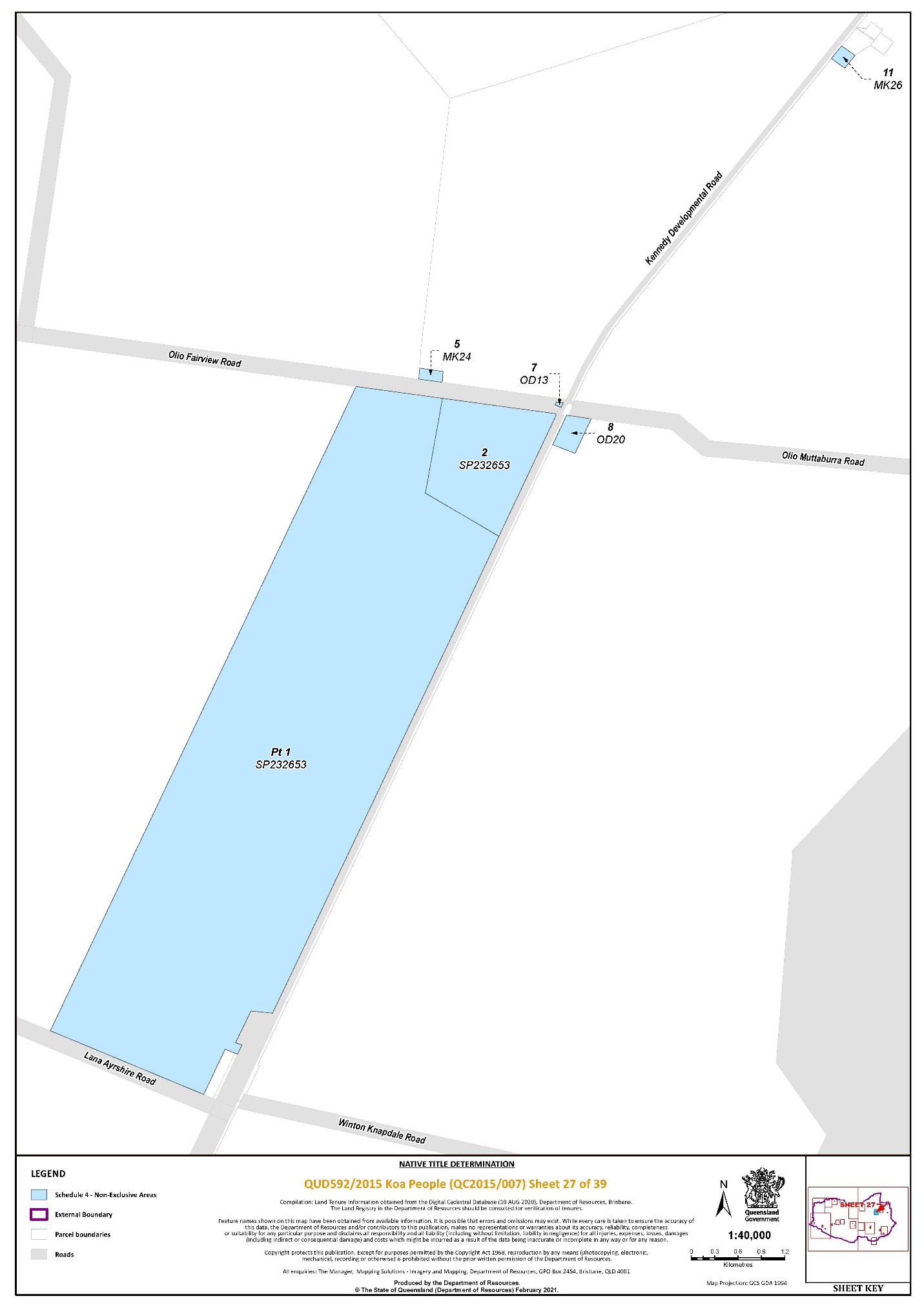
That part of Lot 1 on SP232653 excluding former Portion 1 on OD4 | 27 | ||||||||||||
That part of Lot 1 on USL36384 that falls within the External Boundary | 9 | ||||||||||||
Lot 1 on W24017 | 32, 33 | ||||||||||||
Lot 1 on W2405 | 33 | ||||||||||||
Lot 1 on SP293556 | 33 | ||||||||||||
Lot 2 on K37110 | 5 | ||||||||||||
Lot 2 on K3718 | 5 | ||||||||||||
Lot 2 on SP120233 | 37 | ||||||||||||
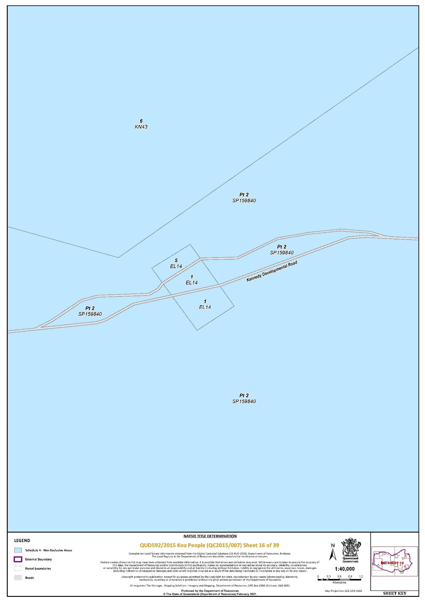
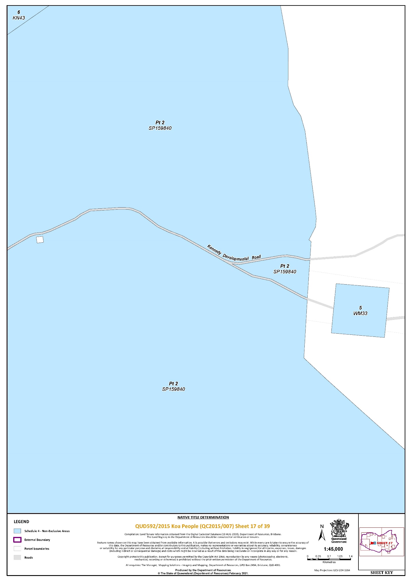
That part of Lot 2 on SP159840 that falls within the External Boundary | 1, 9, 14, 15, 16, 17 | ||||||||||||
That part of Lot 2 on SP159872 excluding an area of closed road identified and delineated by stations A - B - 23 - C - D - E - F - A on SP159872 | 33 | ||||||||||||
That part of Lot 2 on SP197815 excluding an area commencing at the north‐western corner of Lot 2 on SP197815 and extending easterly then southerly along the northern and eastern boundaries of that lot to a point at Latitude 22.381449° South; then westerly then generally southerly passing through the following coordinate points:
Then southerly to the southern boundary of Lot 2 on SP197815 at Longitude 143.041555° East; then generally westerly again along boundaries of that lot to Longitude 143.039706° East; then northerly passing through coordinate point:
Then westerly to the south‐eastern corner of Lot 15 on SP232661; then northerly along the boundary of that lot back to the commencement point. | 33 | ||||||||||||
Lot 2 on SP232653 | 27 | ||||||||||||
Lot 2 on W24035 | 33 | ||||||||||||
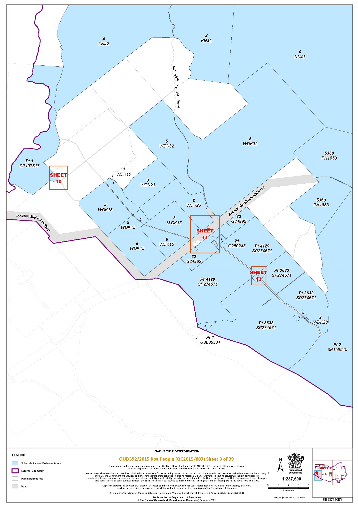
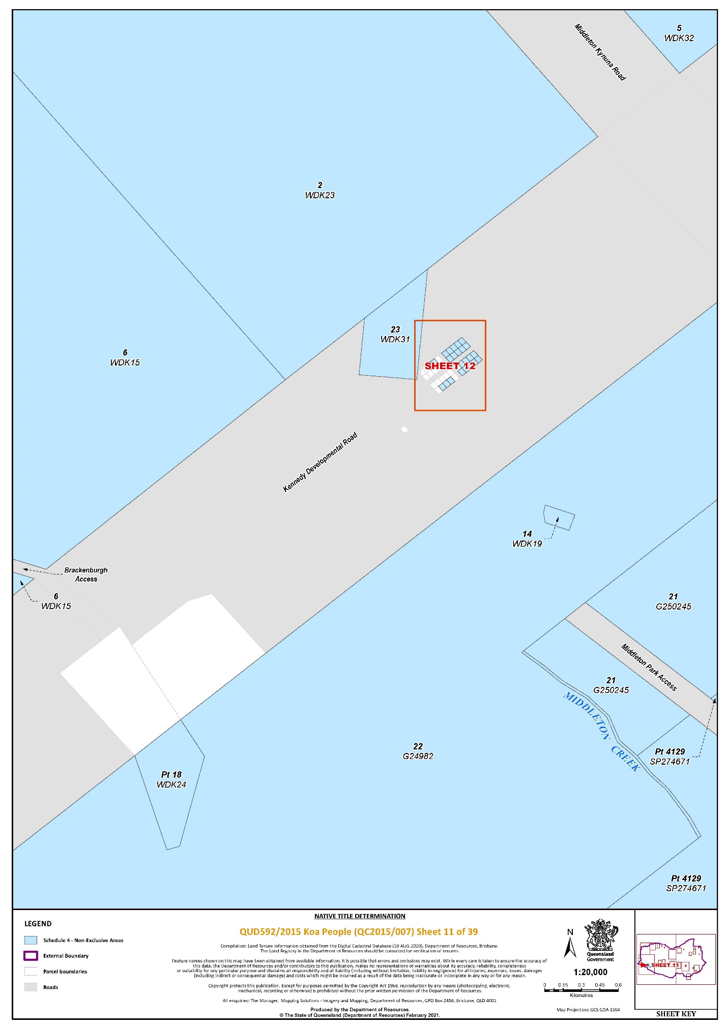
Lot 2 on WDK23 | 9, 11 | ||||||||||||
Lot 2 on WDK28 | 9 | ||||||||||||
Lot 2 on SP293556 | 33 | ||||||||||||
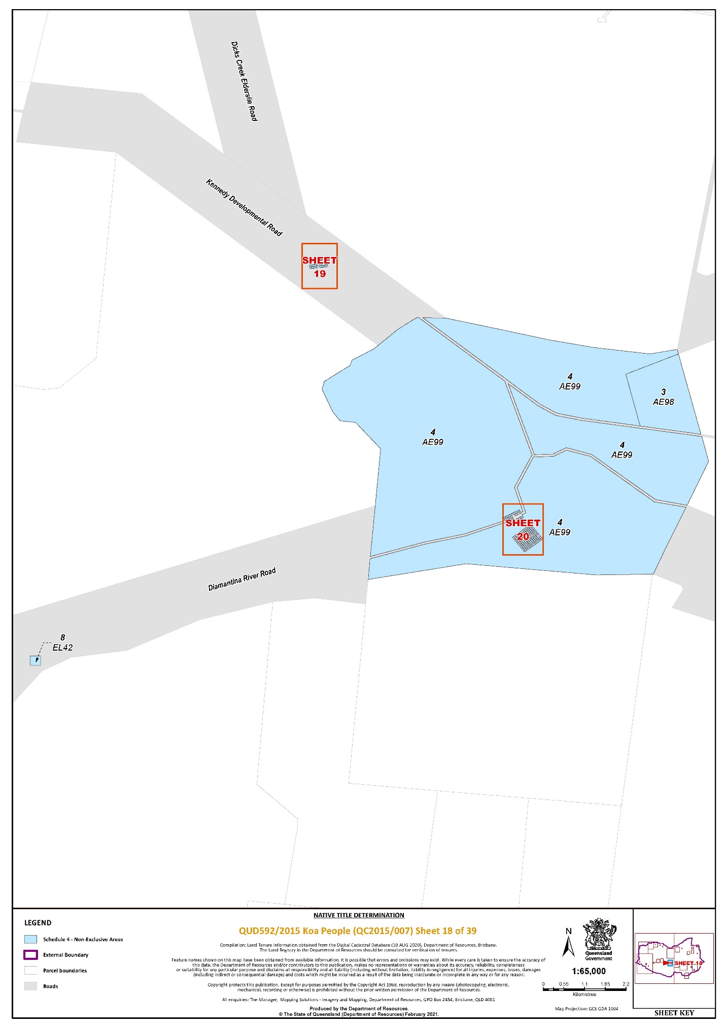
Lot 3 on AE98 | 18 | ||||||||||||
Lot 3 on K3718 | 5 | ||||||||||||
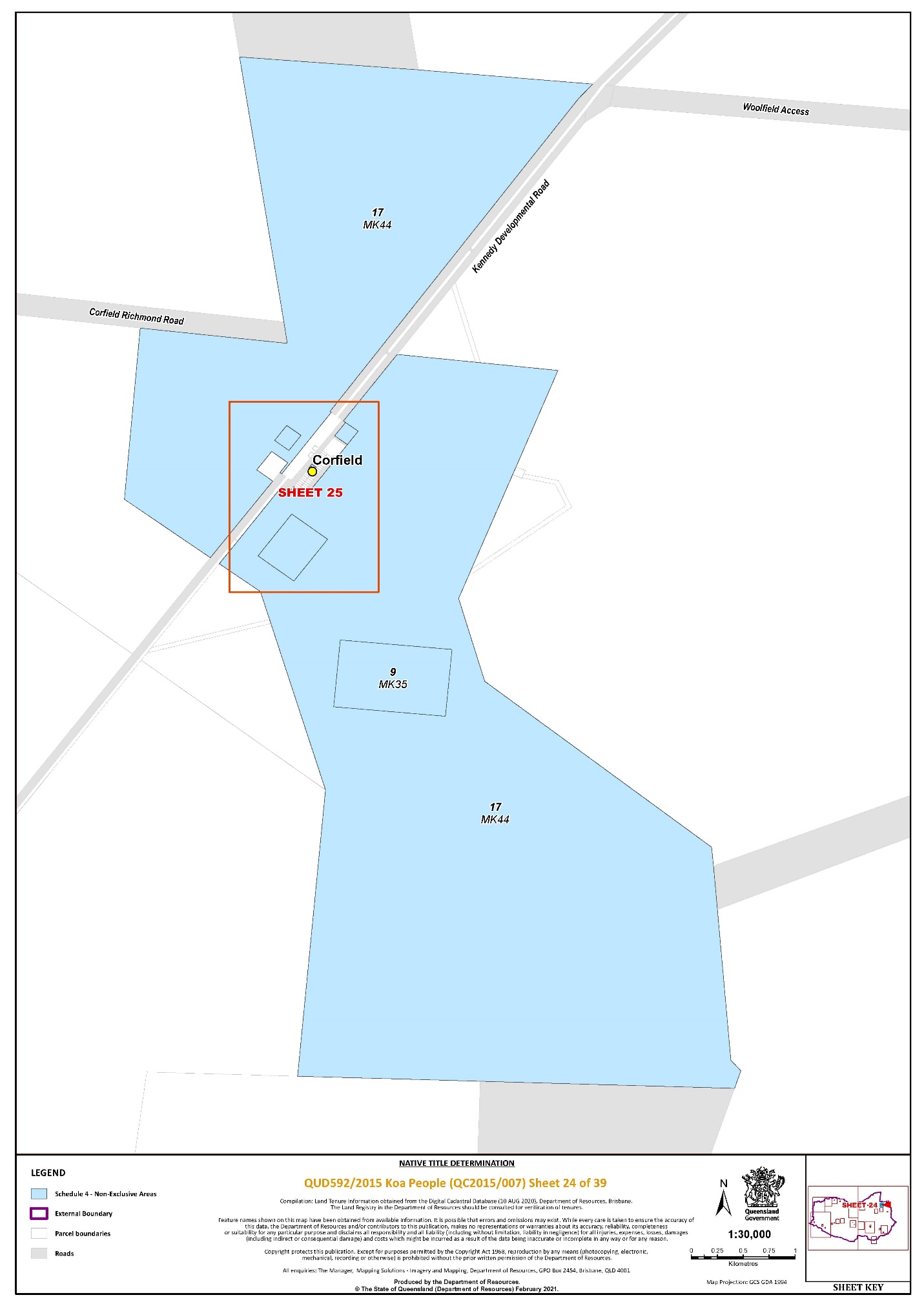
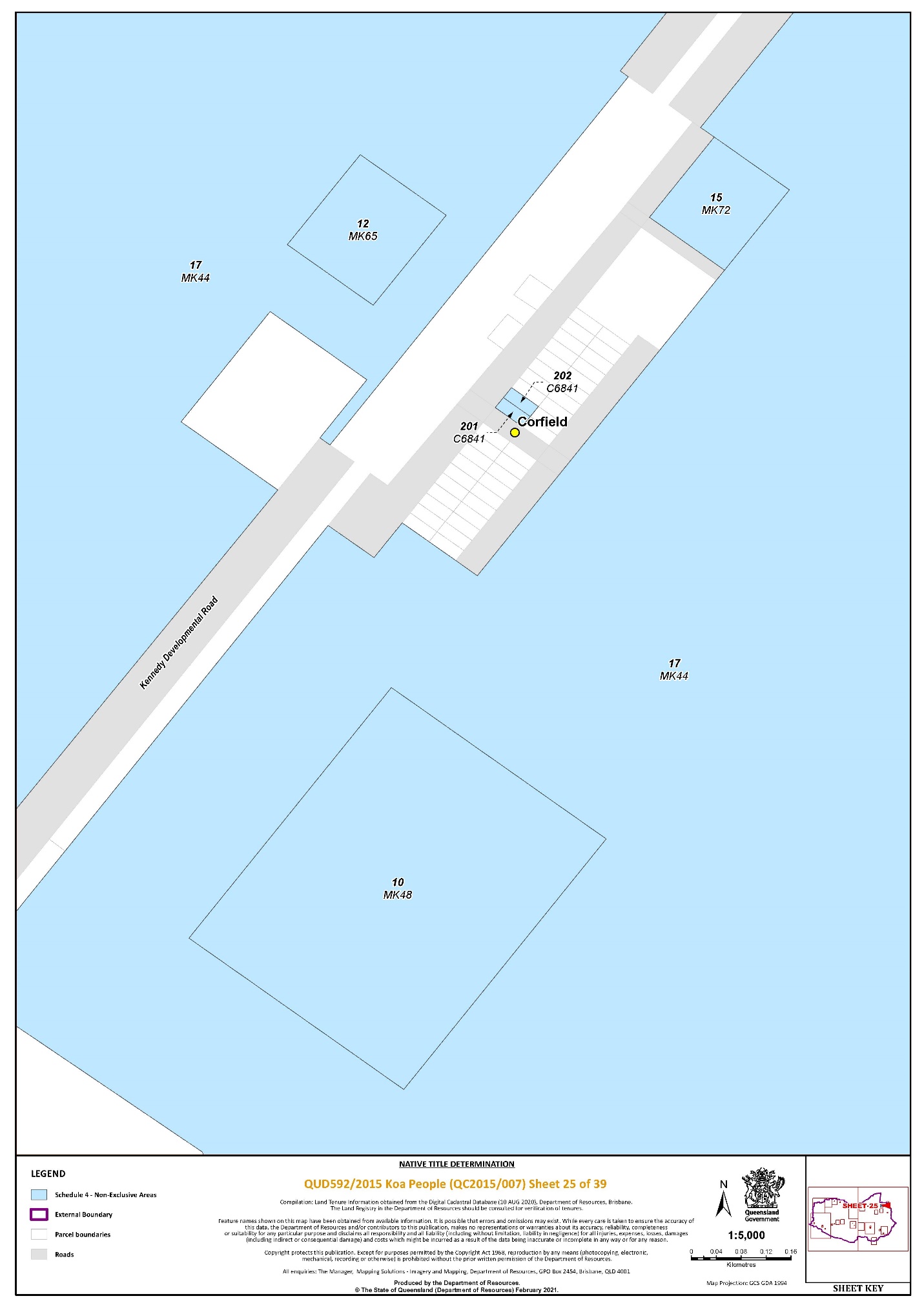
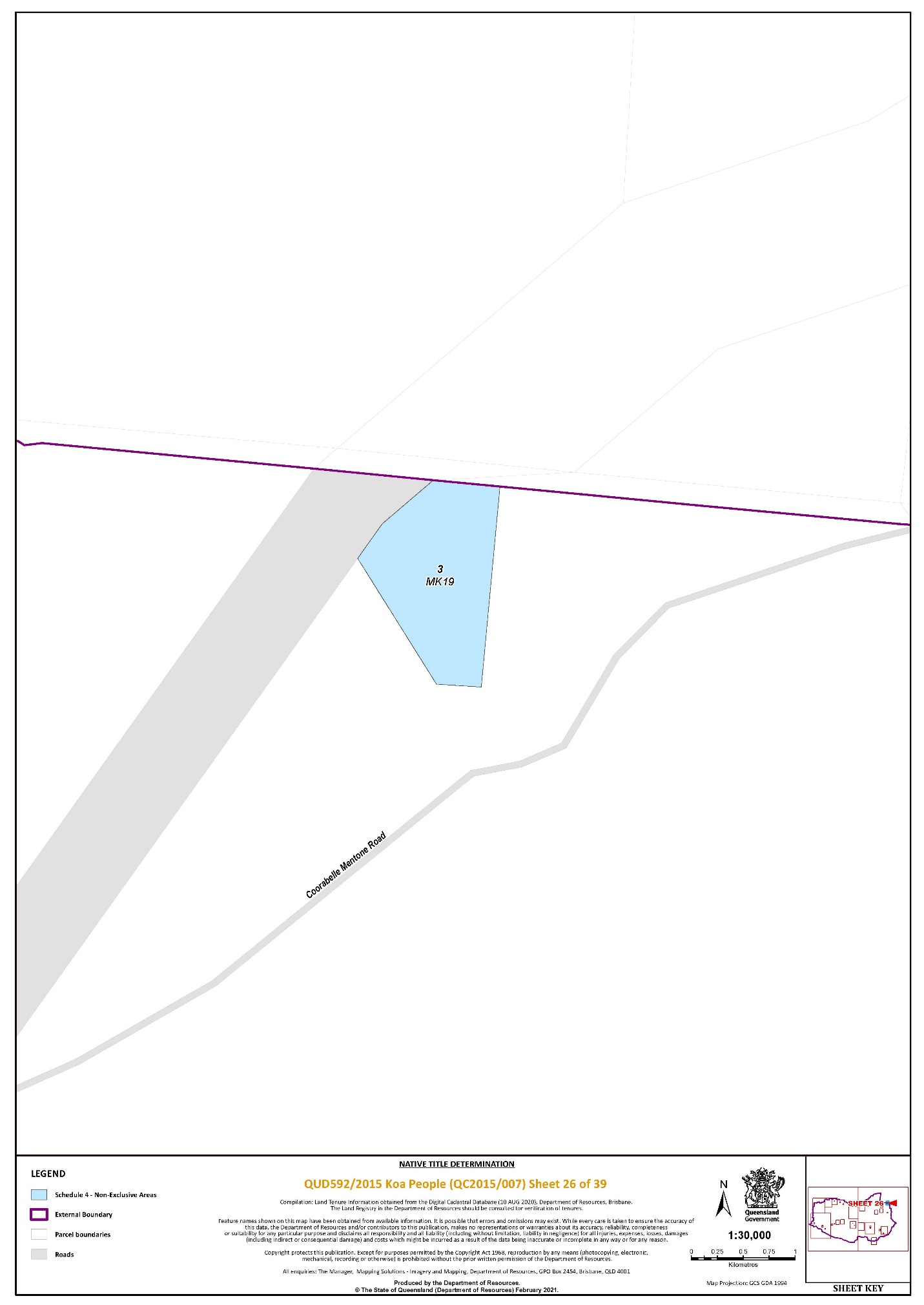
Lot 3 on MK19 | 26 | ||||||||||||
That part of Lot 3 on TO49 that falls within the External Boundary | 2 | ||||||||||||
Lot 3 on WDK23 | 9 | ||||||||||||
Lot 4 on AE99 | 18, 20 | ||||||||||||
That part of Lot 4 on EL11 that falls within the External Boundary | 1 | ||||||||||||
Lot 4 on G24980 | 6 | ||||||||||||
Lot 4 on K37113 | 5 | ||||||||||||
Lot 4 on K3718 | 5 | ||||||||||||
Lot 4 on KN42 | 2, 9 | ||||||||||||
Lot 4 on WDK15 | 9 | ||||||||||||
Lot 4 on SP293556 | 33 | ||||||||||||
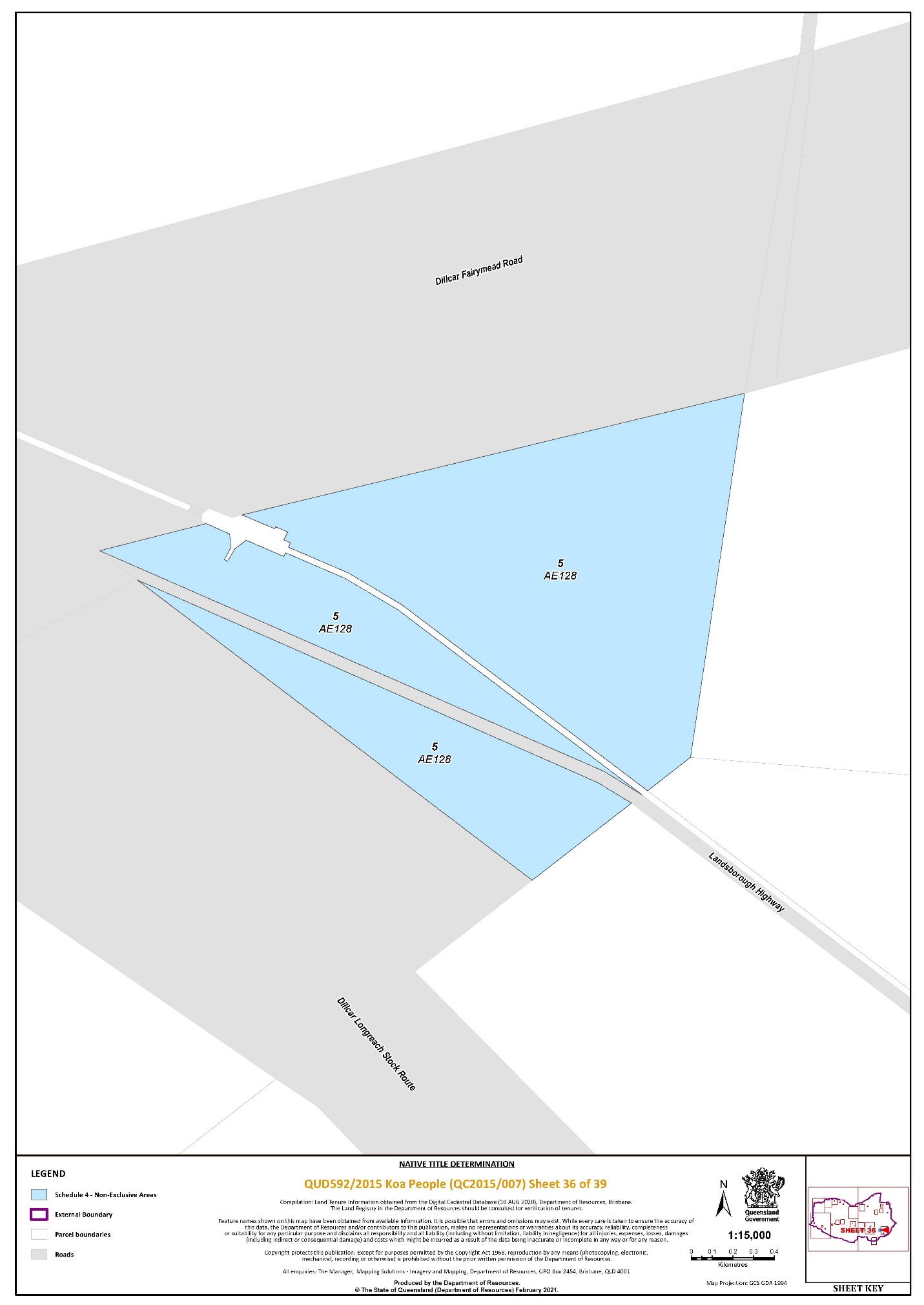
Lot 5 on AE128 | 36 | ||||||||||||
Lot 5 on EL14 | 16 | ||||||||||||
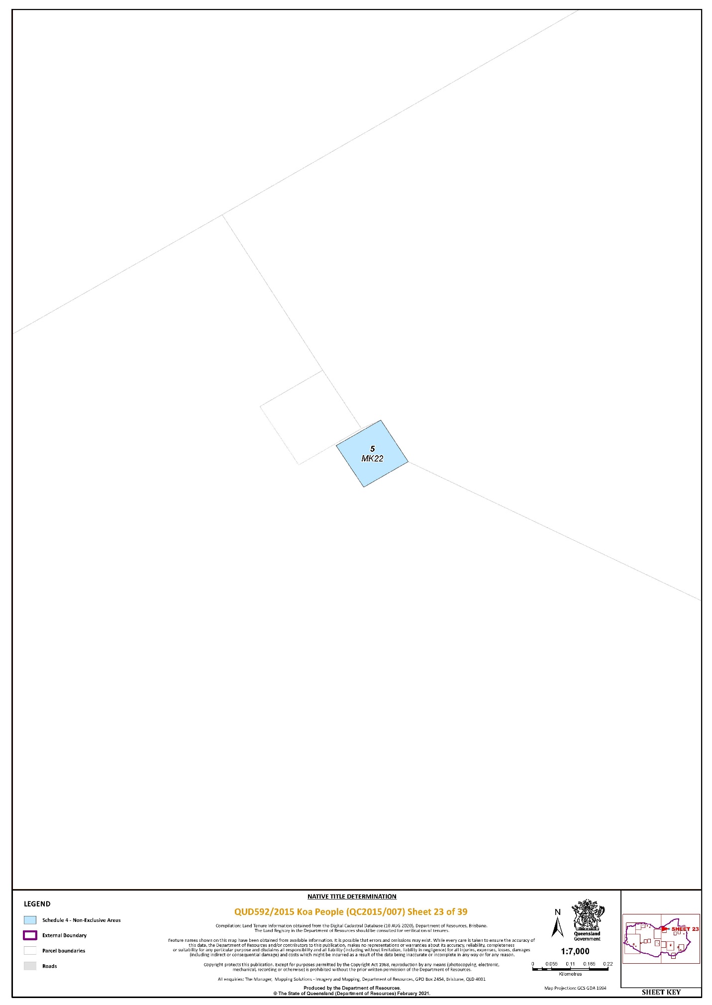
Lot 5 on MK22 | 23 | ||||||||||||
Lot 5 on MK24 | 27 | ||||||||||||
Lot 5 on WDK15 | 9 | ||||||||||||
Lot 5 on WDK32 | 9, 11 | ||||||||||||
Lot 5 on WM33 | 17 | ||||||||||||
Lot 5 on SP293556 | 33, 34 | ||||||||||||
Lot 6 on C2662 | 20 | ||||||||||||
That part of Lot 6 on EL11 that falls within the External Boundary | 1 | ||||||||||||
Lot 6 on K3718 | 5 | ||||||||||||
Lot 6 on KN43 | 1, 2, 9, 16, 17 | ||||||||||||
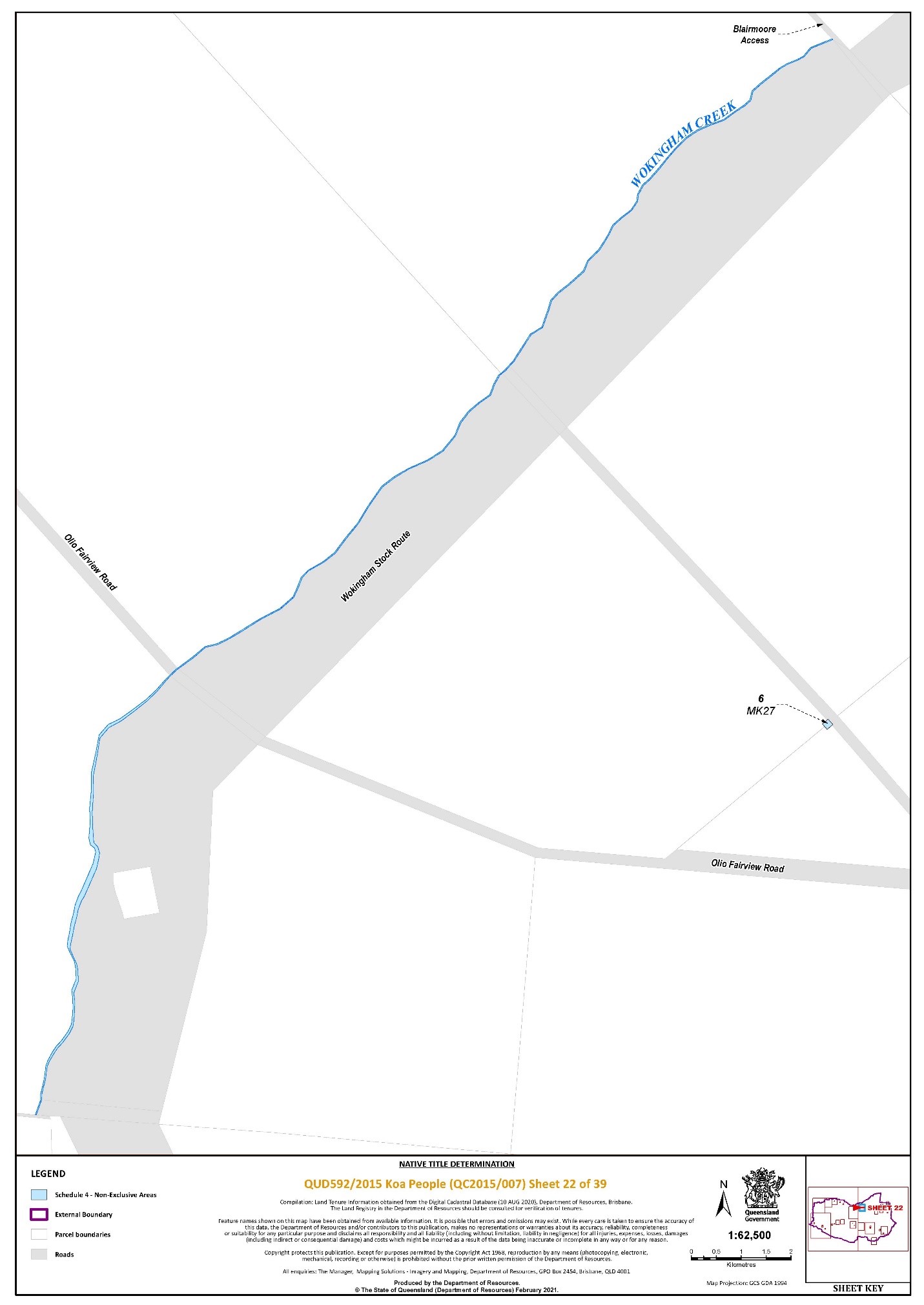
Lot 6 on MK27 | 22 | ||||||||||||
Lot 6 on WDK15 | 9, 11 | ||||||||||||
Lot 6 on WM39 | 8 | ||||||||||||
Lot 7 on AE103 | 30 | ||||||||||||
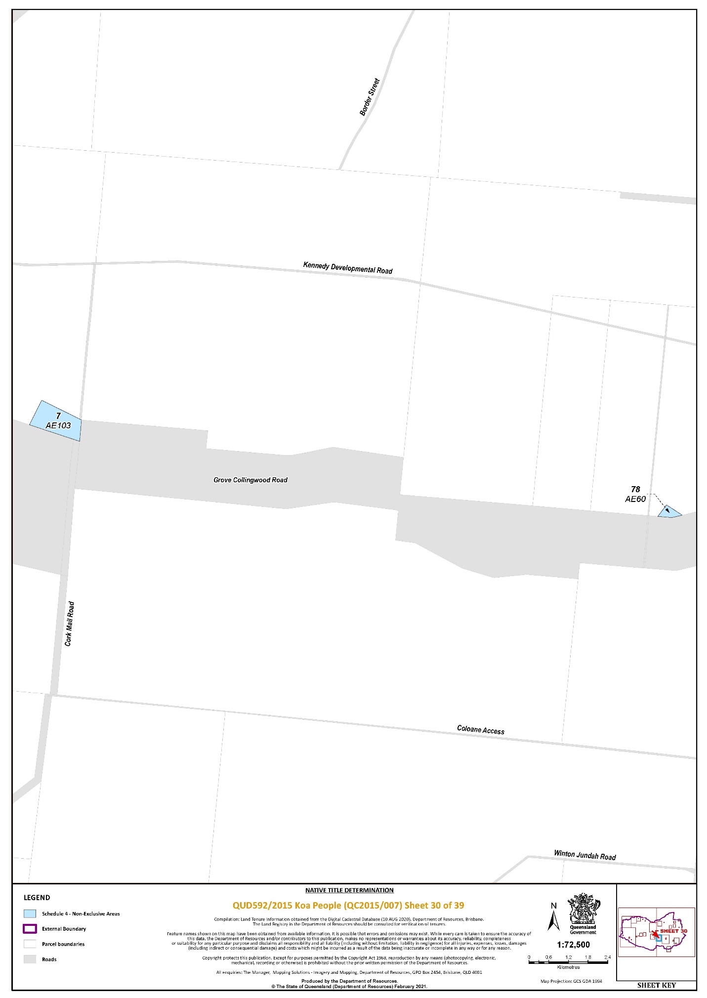
Lot 7 on AE152 | 31 | ||||||||||||
Lot 7 on C2662 | 20 | ||||||||||||
Lot 7 on EL16 | 1 | ||||||||||||
Lot 7 on K3718 | 5 | ||||||||||||
Lot 7 on KN38 | 4 | ||||||||||||
Lot 7 on KN4 | 7 | ||||||||||||
Lot 7 on OD13 | 27 | ||||||||||||
Lot 7 on WDK7 | 10 | ||||||||||||
Lot 7 on WM807940 | 8 | ||||||||||||
Lot 8 on AE54 | 37 | ||||||||||||
Lot 8 on C2662 | 20 | ||||||||||||
Lot 8 on EL16 | 1 | ||||||||||||
Lot 8 on EL21 | 1 | ||||||||||||
Lot 8 on EL42 | 18 | ||||||||||||
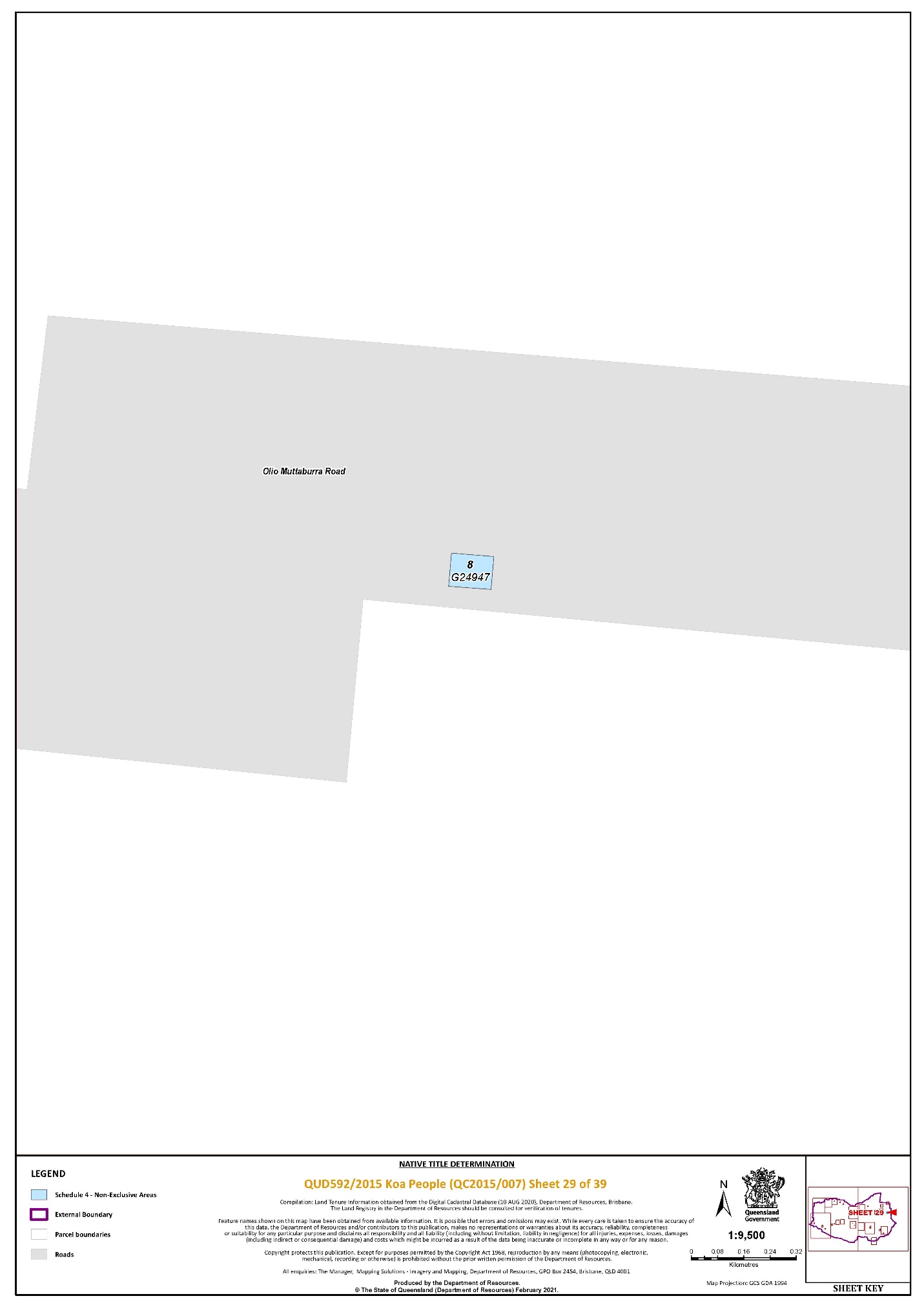
Lot 8 on G24947 | 29 | ||||||||||||
Lot 8 on K3718 | 5 | ||||||||||||
Lot 8 on OD20 | 27 | ||||||||||||
Lot 9 on C2662 | 20 | ||||||||||||
Lot 9 on MK35 | 24 | ||||||||||||
Lot 10 on C2662 | 20 | ||||||||||||
Lot 10 on K37113 | 5 | ||||||||||||
Lot 10 on MK48 | 25 | ||||||||||||
Lot 11 on MK26 | 27 | ||||||||||||
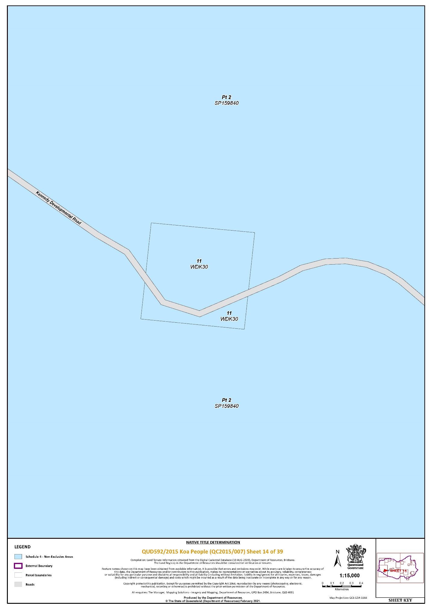
Lot 11 on WDK30 | 14 | ||||||||||||
Lot 12 on MK65 | 25 | ||||||||||||
Lot 12 on SP101356 | 33 | ||||||||||||
Lot 14 on WDK19 | 11 | ||||||||||||
Lot 15 on K3715 | 5 | ||||||||||||
Lot 15 on MK72 | 25 | ||||||||||||
Lot 16 on WM43 | 8 | ||||||||||||
Lot 17 on MK44 | 24, 25 | ||||||||||||
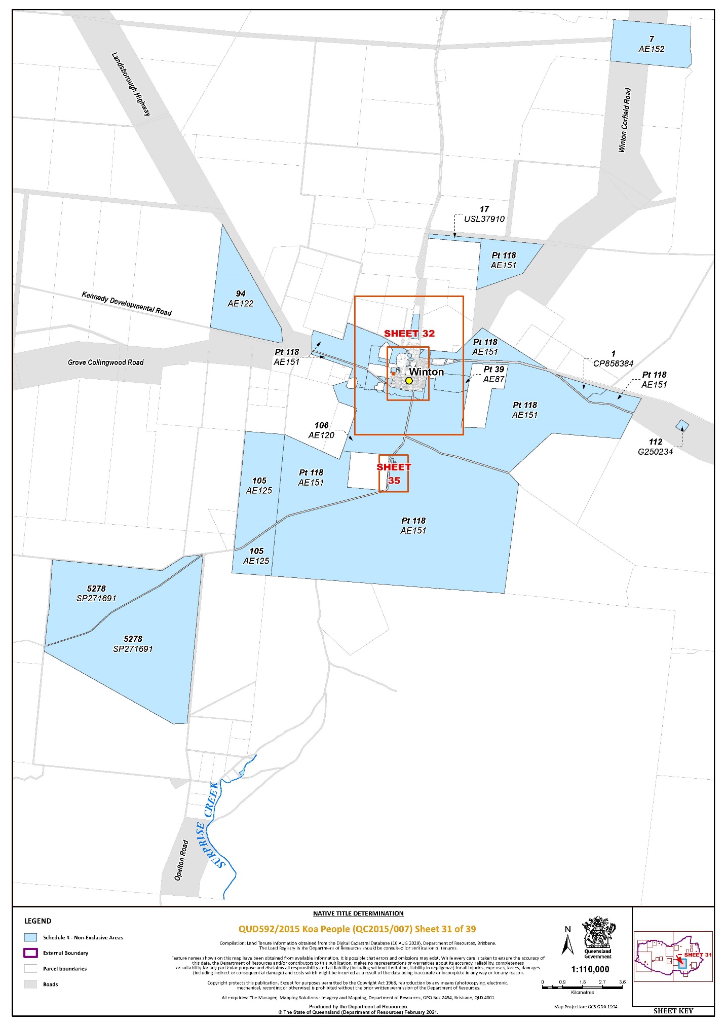
Lot 17 on USL37910 | 31 | ||||||||||||
Lot 18 on G24965 | 4, 5 | ||||||||||||
Lot 18 on K3719 | 4 | ||||||||||||
That part of Lot 18 on W24011 excluding an area southerly of a line commencing at the south-eastern corner of Lot 3 on SP181892 at Latitude 22.387116° South and extending easterly to a point on the eastern boundary of Lot 18 on W24011 at 143.038217° East. | 33 | ||||||||||||
That part of Lot 18 on WDK24 excluding former Main Stock Road identified on G24982 | 11 | ||||||||||||
Lot 19 on K3715 | 5 | ||||||||||||
Lot 19 on K3717 | 4 | ||||||||||||
Lot 19 on WDK27 | 13 | ||||||||||||
Lot 20 on KN3 | 4 | ||||||||||||
Lot 20 on WDK29 | 13 | ||||||||||||
Lot 21 on G250245 | 9, 11 | ||||||||||||
Lot 22 on G24982 | 9, 11 | ||||||||||||
Lot 22 on G24993 | 9 | ||||||||||||
Lot 23 on WDK31 | 11, 12 | ||||||||||||
Lot 28 on AE162 | 33 | ||||||||||||
Lot 38 on AE20 | 33 | ||||||||||||
That part of Lot 39 on AE87 excluding former Portion 63 on AE21 | 31, 32 | ||||||||||||
Lot 43 on W2403 | 35 | ||||||||||||
Lot 57 on AE45 | 35 | ||||||||||||
Lot 58 on AE29 | 32 | ||||||||||||
Lot 59 on AE45 | 35 | ||||||||||||
Lot 68 on AE45 | 35 | ||||||||||||
Lot 69 on AE45 | 35 | ||||||||||||
Lot 77 on USL37909 | 35 | ||||||||||||
Lot 78 on AE60 | 30 | ||||||||||||
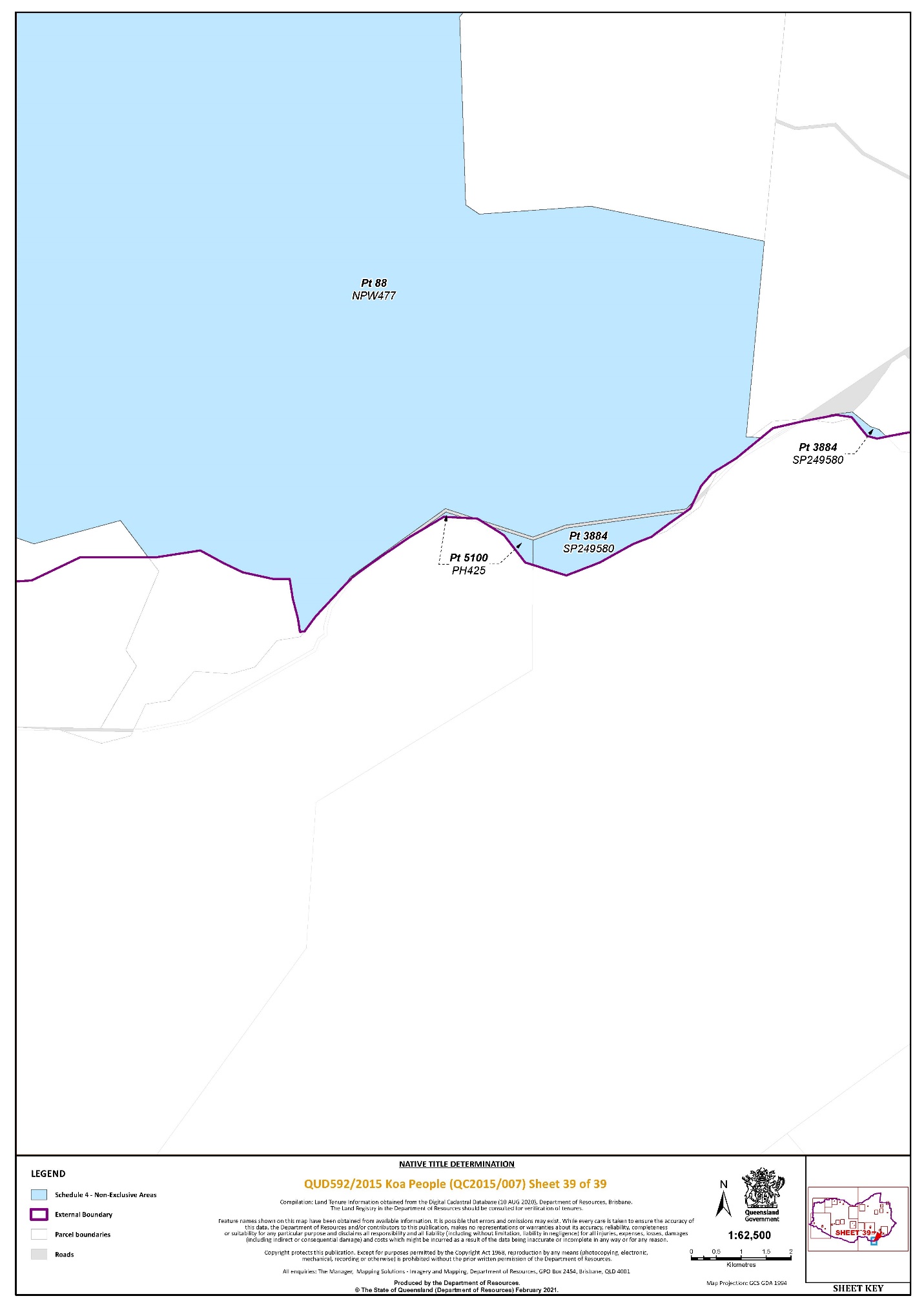
That part of Lot 88 on NPW477 that falls within the External Boundary, excluding former Lot 4719 on PH1040 | 21, 39 | ||||||||||||
Lot 90 on USL37909 | 32 | ||||||||||||
Lot 94 on AE122 | 31 | ||||||||||||
Lot 100 on AE95 | 33 | ||||||||||||
Lot 101 on AE96 | 33 | ||||||||||||
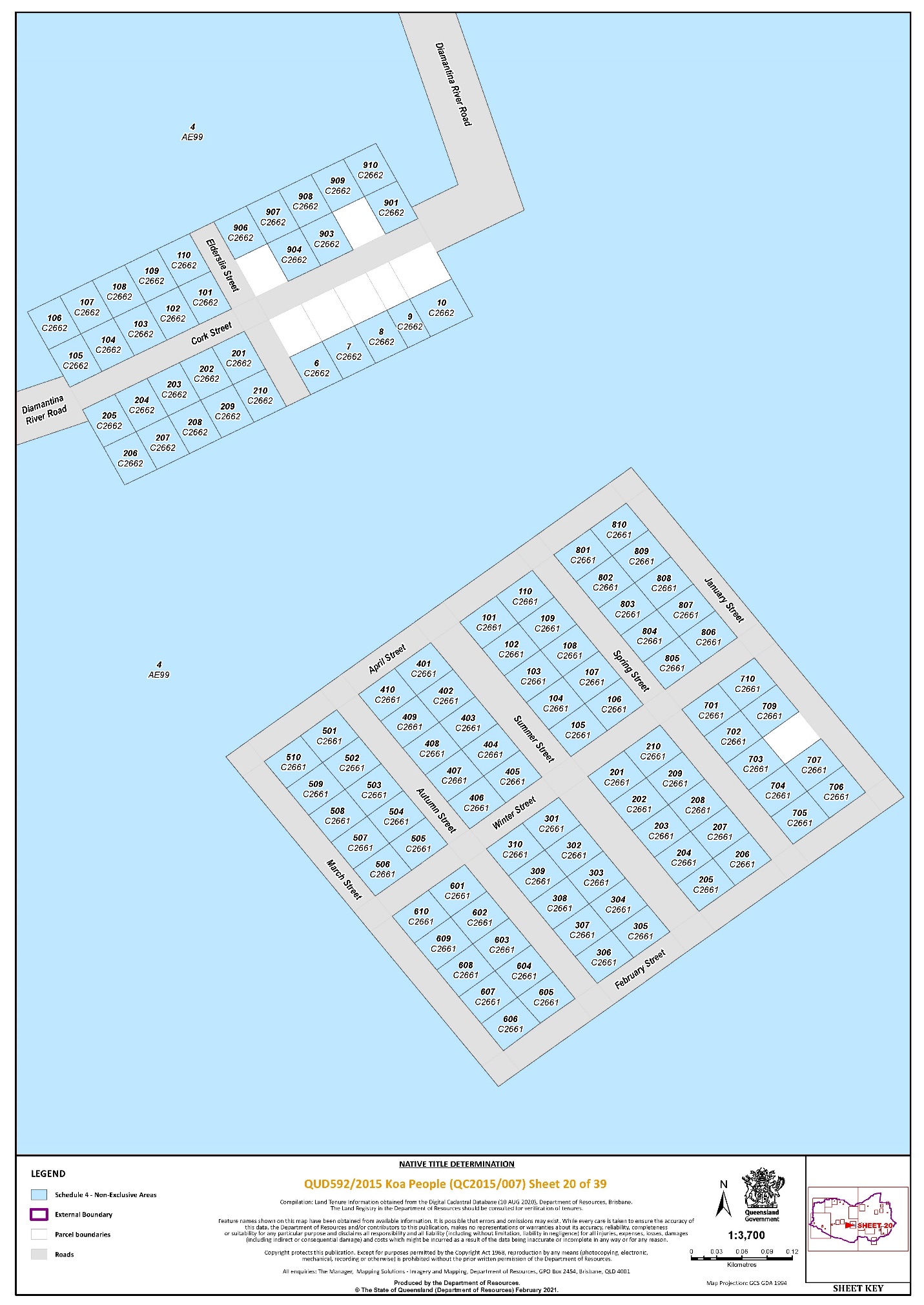
Lot 101 on C2661 | 20 | ||||||||||||
Lot 101 on C2662 | 20 | ||||||||||||
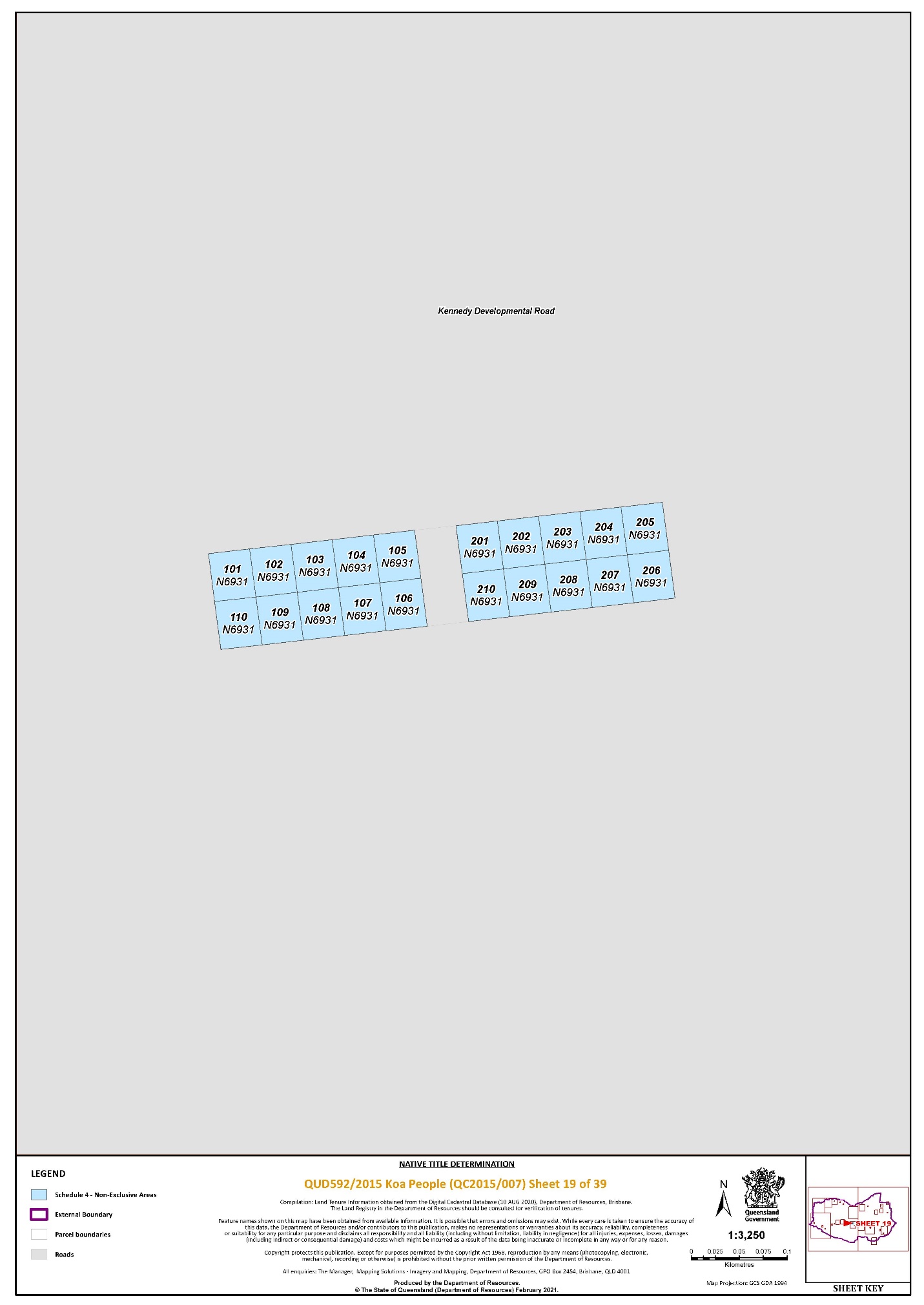
Lot 101 on N6931 | 19 | ||||||||||||
Lot 102 on AE97 | 32, 33 | ||||||||||||
Lot 102 on C2661 | 20 | ||||||||||||
Lot 102 on C2662 | 20 | ||||||||||||
Lot 102 on N6931 | 19 | ||||||||||||
Lot 103 on C2661 | 20 | ||||||||||||
Lot 103 on C2662 | 20 | ||||||||||||
Lot 103 on N6931 | 19 | ||||||||||||
Lot 104 on C2661 | 20 | ||||||||||||
Lot 104 on C2662 | 20 | ||||||||||||
Lot 104 on N6931 | 19 | ||||||||||||
Lot 105 on AE125 | 31 | ||||||||||||
Lot 105 on C2661 | 20 | ||||||||||||
Lot 105 on C2662 | 20 | ||||||||||||
Lot 105 on N6931 | 19 | ||||||||||||
Lot 106 on AE120 ~ | 31, 32, 33, 35 | ||||||||||||
Lot 106 on C2661 | 20 | ||||||||||||
Lot 106 on C2662 | 20 | ||||||||||||
Lot 106 on N6931 | 19 | ||||||||||||
Lot 107 on C2661 | 20 | ||||||||||||
Lot 107 on C2662 | 20 | ||||||||||||
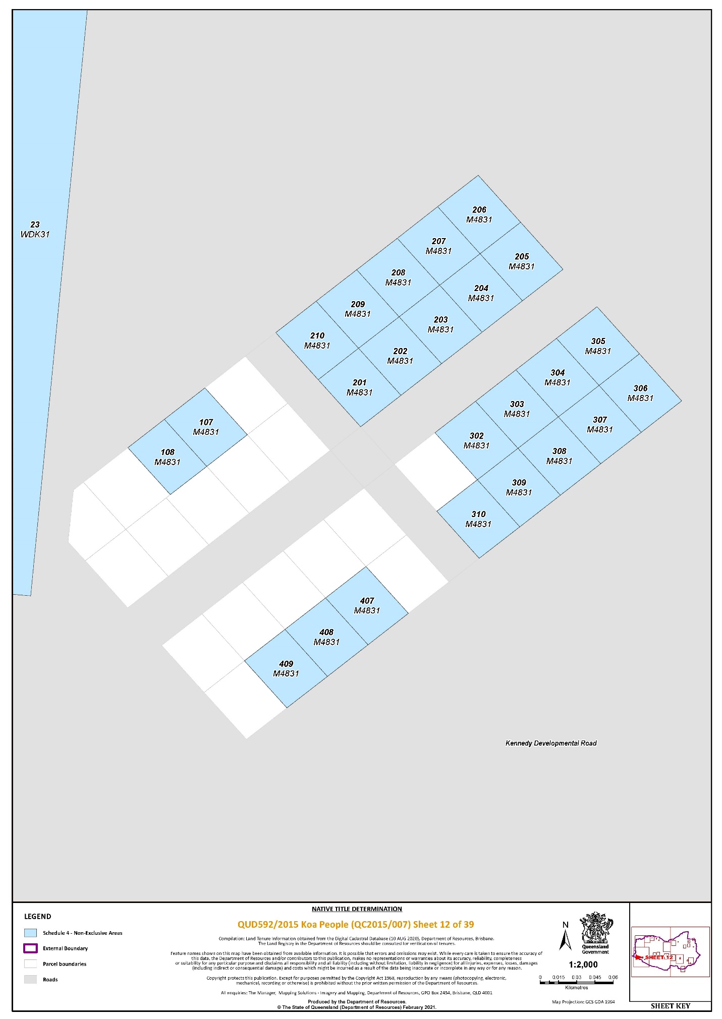
Lot 107 on M4831 | 12 | ||||||||||||
Lot 107 on N6931 | 19 | ||||||||||||
Lot 108 on C2661 | 20 | ||||||||||||
Lot 108 on C2662 | 20 | ||||||||||||
Lot 108 on M4831 | 12 | ||||||||||||
Lot 108 on N6931 | 19 | ||||||||||||
Lot 109 on C2661 | 20 | ||||||||||||
Lot 109 on C2662 | 20 | ||||||||||||
Lot 109 on N6931 | 19 | ||||||||||||
Lot 110 on C2661 | 20 | ||||||||||||
Lot 110 on C2662 | 20 | ||||||||||||
Lot 110 on C8106 | 33, 34 | ||||||||||||
Lot 110 on N6931 | 19 | ||||||||||||
Lot 112 on G250234 | 31 | ||||||||||||
Lot 117 on W24030 | 32, 33 | ||||||||||||
That part of Lot 118 on AE151 excluding former Portion 63 on AE21 | 31, 32, 33, 35 | ||||||||||||
Lot 201 on C2661 | 20 | ||||||||||||
Lot 201 on C2662 | 20 | ||||||||||||
Lot 201 on C6841 | 25 | ||||||||||||
Lot 201 on M4831 | 12 | ||||||||||||
Lot 201 on N6931 | 19 | ||||||||||||
Lot 202 on C2661 | 20 | ||||||||||||
Lot 202 on C2662 | 20 | ||||||||||||
Lot 202 on C6841 | 25 | ||||||||||||
Lot 202 on M4831 | 12 | ||||||||||||
Lot 202 on N6931 | 19 | ||||||||||||
Lot 203 on C2661 | 20 | ||||||||||||
Lot 203 on C2662 | 20 | ||||||||||||
Lot 203 on M4831 | 12 | ||||||||||||
Lot 203 on N6931 | 19 | ||||||||||||
Lot 204 on C2661 | 20 | ||||||||||||
Lot 204 on C2662 | 20 | ||||||||||||
Lot 204 on M4831 | 12 | ||||||||||||
Lot 204 on N6931 | 19 | ||||||||||||
Lot 205 on C2661 | 20 | ||||||||||||
Lot 205 on C2662 | 20 | ||||||||||||
Lot 205 on M4831 | 12 | ||||||||||||
Lot 205 on N6931 | 19 | ||||||||||||
Lot 206 on C2661 | 20 | ||||||||||||
Lot 206 on C2662 | 20 | ||||||||||||
Lot 206 on M4831 | 12 | ||||||||||||
Lot 206 on N6931 | 19 | ||||||||||||
Lot 207 on C2661 | 20 | ||||||||||||
Lot 207 on C2662 | 20 | ||||||||||||
Lot 207 on M4831 | 12 | ||||||||||||
Lot 207 on N6931 | 19 | ||||||||||||
Lot 208 on C2661 | 20 | ||||||||||||
Lot 208 on C2662 | 20 | ||||||||||||
Lot 208 on M4831 | 12 | ||||||||||||
Lot 208 on N6931 | 19 | ||||||||||||
Lot 209 on C2661 | 20 | ||||||||||||
Lot 209 on C2662 | 20 | ||||||||||||
Lot 209 on M4831 | 12 | ||||||||||||
Lot 209 on N6931 | 19 | ||||||||||||
Lot 210 on C2661 | 20 | ||||||||||||
Lot 210 on C2662 | 20 | ||||||||||||
Lot 210 on M4831 | 12 | ||||||||||||
Lot 210 on N6931 | 19 | ||||||||||||
Lot 301 on C2661 | 20 | ||||||||||||
Lot 302 on C2661 | 20 | ||||||||||||
Lot 302 on M4831 | 12 | ||||||||||||
Lot 303 on C2661 | 20 | ||||||||||||
Lot 303 on M4831 | 12 | ||||||||||||
Lot 304 on C2661 | 20 | ||||||||||||
Lot 304 on M4831 | 12 | ||||||||||||
Lot 305 on C2661 | 20 | ||||||||||||
Lot 305 on M4831 | 12 | ||||||||||||
Lot 306 on C2661 | 20 | ||||||||||||
Lot 306 on K3711 | 5 | ||||||||||||
Lot 306 on M4831 | 12 | ||||||||||||
Lot 307 on C2661 | 20 | ||||||||||||
Lot 307 on K3711 | 5 | ||||||||||||
Lot 307 on M4831 | 12 | ||||||||||||
Lot 308 on C2661 | 20 | ||||||||||||
Lot 308 on M4831 | 12 | ||||||||||||
Lot 309 on C2661 | 20 | ||||||||||||
Lot 309 on M4831 | 12 | ||||||||||||
Lot 310 on C2661 | 20 | ||||||||||||
Lot 310 on M4831 | 12 | ||||||||||||
That part of Lot 350 on SP276167 that falls within the External Boundary | 1 | ||||||||||||
Lot 401 on C2661 | 20 | ||||||||||||
Lot 402 on C2661 | 20 | ||||||||||||
Lot 403 on C2661 | 20 | ||||||||||||
Lot 404 on C2661 | 20 | ||||||||||||
Lot 405 on C2661 | 20 | ||||||||||||
Lot 406 on C2661 | 20 | ||||||||||||
Lot 407 on C2661 | 20 | ||||||||||||
Lot 407 on M4831 | 12 | ||||||||||||
Lot 408 on C2661 | 20 | ||||||||||||
Lot 408 on M4831 | 12 | ||||||||||||
Lot 409 on C2661 | 20 | ||||||||||||
Lot 409 on M4831 | 12 | ||||||||||||
Lot 410 on C2661 | 20 | ||||||||||||
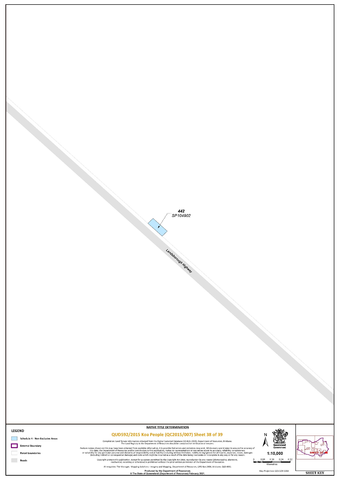
Lot 442 on SP104902 | 38 | ||||||||||||
Lot 501 on C2661 | 20 | ||||||||||||
Lot 501 on K3711 | 5 | ||||||||||||
Lot 502 on C2661 | 20 | ||||||||||||
Lot 503 on C2661 | 20 | ||||||||||||
Lot 504 on C2661 | 20 | ||||||||||||
Lot 505 on C2661 | 20 | ||||||||||||
Lot 506 on C2661 | 20 | ||||||||||||
Lot 507 on C2661 | 20 | ||||||||||||
Lot 508 on C2661 | 20 | ||||||||||||
Lot 509 on C2661 | 20 | ||||||||||||
Lot 510 on C2661 | 20 | ||||||||||||
Lot 510 on K3711 | 5 | ||||||||||||
Lot 601 on C2661 | 20 | ||||||||||||
Lot 602 on C2661 | 20 | ||||||||||||
Lot 603 on C2661 | 20 | ||||||||||||
Lot 604 on C2661 | 20 | ||||||||||||
Lot 605 on C2661 | 20 | ||||||||||||
Lot 606 on C2661 | 20 | ||||||||||||
Lot 607 on C2661 | 20 | ||||||||||||
Lot 608 on C2661 | 20 | ||||||||||||
Lot 609 on C2661 | 20 | ||||||||||||
Lot 610 on C2661 | 20 | ||||||||||||
Lot 701 on C2661 | 20 | ||||||||||||
Lot 702 on C2661 | 20 | ||||||||||||
Lot 703 on C2661 | 20 | ||||||||||||
Lot 704 on C2661 | 20 | ||||||||||||
Lot 705 on C2661 | 20 | ||||||||||||
Lot 705 on K3713 | 5 | ||||||||||||
Lot 706 on C2661 | 20 | ||||||||||||
Lot 706 on K3713 | 5 | ||||||||||||
Lot 707 on C2661 | 20 | ||||||||||||
Lot 707 on K3713 | 5 | ||||||||||||
Lot 708 on K3713 | 5 | ||||||||||||
Lot 709 on C2661 | 20 | ||||||||||||
Lot 710 on C2661 | 20 | ||||||||||||
Lot 801 on C2661 | 20 | ||||||||||||
Lot 801 on K3713 | 5 | ||||||||||||
Lot 802 on C2661 | 20 | ||||||||||||
Lot 802 on K3713 | 5 | ||||||||||||
Lot 803 on C2661 | 20 | ||||||||||||
Lot 803 on K3713 | 5 | ||||||||||||
Lot 804 on C2661 | 20 | ||||||||||||
Lot 804 on K3713 | 5 | ||||||||||||
Lot 805 on C2661 | 20 | ||||||||||||
Lot 805 on K3713 | 5 | ||||||||||||
Lot 806 on C2661 | 20 | ||||||||||||
Lot 806 on K3713 | 5 | ||||||||||||
Lot 807 on C2661 | 20 | ||||||||||||
Lot 807 on K3713 | 5 | ||||||||||||
Lot 808 on C2661 | 20 | ||||||||||||
Lot 809 on C2661 | 20 | ||||||||||||
Lot 810 on C2661 | 20 | ||||||||||||
Lot 901 on C2662 | 20 | ||||||||||||
Lot 901 on K3713 | 5 | ||||||||||||
Lot 902 on K3713 | 5 | ||||||||||||
Lot 903 on C2662 | 20 | ||||||||||||
Lot 904 on C2662 | 20 | ||||||||||||
Lot 906 on C2662 | 20 | ||||||||||||
Lot 907 on C2662 | 20 | ||||||||||||
Lot 908 on C2662 | 20 | ||||||||||||
Lot 909 on C2662 | 20 | ||||||||||||
Lot 910 on C2662 | 20 | ||||||||||||
That part of Lot 3334 on PH317 that falls within the External Boundary | 2 | ||||||||||||
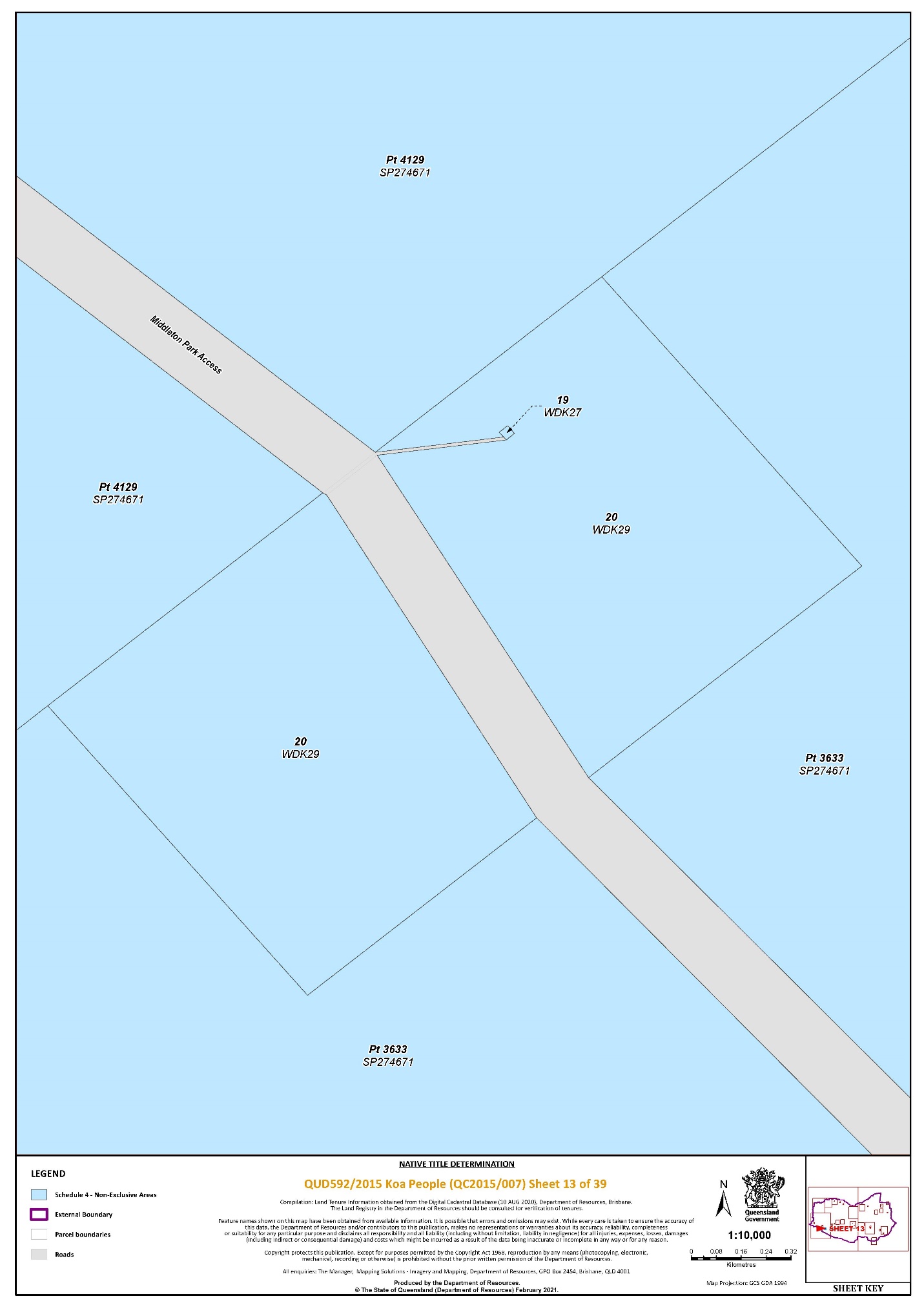
That part of Lot 3633 on SP274671 that falls within the External Boundary | 9, 13 | ||||||||||||
That part of Lot 3884 on SP249580 that falls within the External Boundary | 39 | ||||||||||||
That part of Lot 4129 on SP274671 that falls within the External Boundary | 9, 11, 13 | ||||||||||||
That part of Lot 5100 on PH425 that falls within the External Boundary | 39 | ||||||||||||
Lot 5278 on SP271691 | 31 | ||||||||||||
Lot 5360 on PH1853 | 1, 9 | ||||||||||||
An area of road identified and delineated by stations 19-19a-20a-20-19 on SP246207 | 32 | ||||||||||||
An area of road identified and delineated by stations L-M-N-L on SP293556 | 34 | ||||||||||||
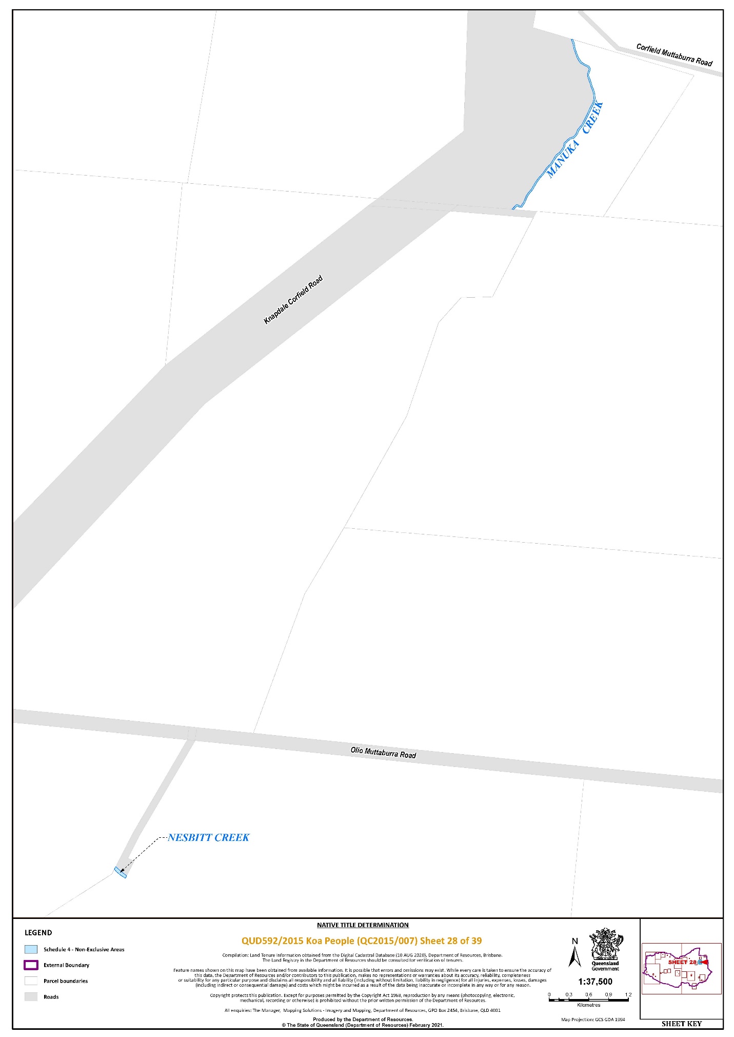
Save for any waters forming part of a lot on plan, all rivers, creeks, streams and lakes within the External Boundary described in Schedule 3, including but not limited to: (i) Diamantina River (ii) Manuka Creek (iii) Middleton Creek (iv) Nesbitt Creek (v) Surprise Creek (vi) Wokingham Creek |
~ denotes an area to which section 47B of the Native Title Act 1993 (Cth) applies
Data Reference and source
Cadastral data sourced from Department of Resources (August 2020).
Reference datum
Geographical coordinates are referenced to the Geocentric Datum of Australia 1994 (GDA94), in decimal degrees.
Use of Coordinates
Where coordinates are used within the description to represent cadastral or topographical boundaries or the intersection with such, they are intended as a guide only. As an outcome to the custodians of cadastral and topographic data continuously recalculating the geographic position of their data based on improved survey and data maintenance procedures, it is not possible to accurately define such a position other than by detailed ground survey.
Prepared by the Department of Resources (3 November 2020).
SCHEDULE FIVE – Areas not forming part of the Determination Area
The following areas of land and waters are excluded from the Determination Area as described in Schedule 4:
1. Those land and waters within the External Boundary which at the time the native title determination application was made were the subject of one or more Previous Exclusive Possession Acts, within the meaning of s 23B of the Native Title Act 1993 (Cth) as they could not be claimed in accordance with s 61A of the Native Title Act 1993 (Cth).
2. Specifically, and to avoid any doubt, the land and waters described in (1) above includes:
(a) the Previous Exclusive Possession Acts described in ss 23B(2) and 23B(3) of the Native Title Act 1993 (Cth) to which s 20 of the Native Title (Queensland) Act 1993 (Qld) applies, and to which none of ss 47, 47A or 47B of the Native Title Act 1993 (Cth) applied; and
(b) the land and waters on which any public work, as defined in s 253 of the Native Title Act 1993 (Cth), is or was constructed, established or situated, and to which ss 23B(7) and 23C(2) of the Native Title Act 1993 (Cth) and to which s 21 of the Native Title (Queensland) Act 1993 (Qld), applies, together with any adjacent land or waters in accordance with s 251D of the Native Title Act 1993 (Cth), and includes, but is not limited to, the whole of the land and waters described as:
(i) That part of Lot 1 on K3718 commencing at the eastern-most corner of Lot 1 on K3718, also being a point on the western boundary of Finlay Street (Landsborough Highway) and progressing north-west along the western boundary of that street until a point at Latitude 21.574638° South; then south-westerly to a point at Longitude 141.913793° East, Latitude 21.575092° South; then south-easterly to a point on the south-eastern boundary of Lot 1 on K3718 at Latitude 21.575495° South; then north-easterly along the south-eastern boundary of that lot back to the commencement point.
(ii) That part of Lot 2 on SP197815 commencing at the north‐western corner of Lot 2 on SP197815 and extending easterly then southerly along the northern and eastern boundaries of that lot to a point at Latitude 22.381449° South; then westerly then generally southerly passing through the following coordinate points:
Longitude (East) | Latitude (South) |
143.041978 | 22.381435 |
143.041912 | 22.381817 |
143.041702 | 22.381792 |
Then southerly to the southern boundary of Lot 2 on SP197815 at Longitude 143.041555° East; then generally westerly again along boundaries of that lot to Longitude 143.039706° East; then northerly passing through coordinate point:
Longitude (East) | Latitude (South) |
143.039889 | 22.380670 |
Then westerly to the south‐eastern corner of Lot 15 on SP232661; then northerly along the boundary of that lot back to the commencement point.
(iii) That part of Lot 18 on W24011 southerly of a line commencing at the south-eastern corner of Lot 3 on SP181892 at Latitude 22.387116° South and extending easterly to a point on the eastern boundary of Lot 18 on W24011 at 143.038217° East.
(iv) Lot 121 on AE112.
3. Those land and waters within the External Boundary on which, at the time the native title determination application was made, public works were validly constructed, established or situated after 23 December 1996, where s 24JA of the Native Title Act 1993 (Cth) applies, and which wholly extinguished native title.
4. Those land and waters within the External Boundary which, at the time the native title determination application was made, were the subject of one or more Pre-existing Rights Based Acts, within the meaning of s 24IB of the Native Title Act 1993 (Cth), which wholly extinguished native title.
5. Those land and waters within Lot 88 on NPW477 subject to former Lot 4719 on PH1040.
Data Reference and source
Cadastral data sourced from Department of Resources (August 2020).
Reference datum
Geographical coordinates are referenced to the Geocentric Datum of Australia 1994 (GDA94), in decimal degrees.
Use of Coordinates
Where coordinates are used within the description to represent cadastral or topographical boundaries or the intersection with such, they are intended as a guide only. As an outcome to the custodians of cadastral and topographic data continuously recalculating the geographic position of their data based on improved survey and data maintenance procedures, it is not possible to accurately define such a position other than by detailed ground survey.
Prepared by the Department of Resources (3 November 2020).
SCHEDULE SIX – Map of Determination Area