
FEDERAL COURT OF AUSTRALIA
Sailor on behalf of the Wangkamahdla People v State of Queensland [2021] FCA 790
Table of Corrections | |
In the first line of paragraph 19, the words “are biological descendants” have been replaced with “include the descendants” |
ORDERS
DATE OF ORDER: |
BEING SATISFIED that an order in the terms set out below is within the power of the Court, and it appearing appropriate to the Court to do so, pursuant to s 87A of the Native Title Act 1993 (Cth).
BY CONSENT THE COURT ORDERS THAT:
1. There be a determination of native title in the terms set out below (the determination).
2. Each party to the proceedings is to bear its own costs.
BY CONSENT THE COURT DETERMINES THAT:
3. The determination area is the land and waters described in Schedule 4 and depicted in the map attached to Schedule 6 to the extent those areas are within the External Boundary and not otherwise excluded by the terms of Schedule 5 (the Determination Area). To the extent of any inconsistency between the written description and the map, the written description prevails.
4. Native title exists in the Determination Area.
5. The native title is held by the Wangkamahdla People described in Schedule 1 (the Native Title Holders).
6. Subject to orders 8, 9 and 10 below the nature and extent of the native title rights and interests in relation to the land and waters described in Part 1 of Schedule 4 are:
(a) other than in relation to Water, the right to possession, occupation, use and enjoyment of the area to the exclusion of all others; and
(b) in relation to Water, the non-exclusive rights to:
(i) hunt, fish and gather from the Water of the area;
(ii) take the Natural Resources of the Water in the area; and
(iii) take the Water of the area for personal, domestic and non-commercial communal purposes.
7. Subject to orders 8, 9 and 10 below the nature and extent of the native title rights and interests in relation to the land and waters described in Part 2 of Schedule 4 are the non-exclusive rights to:
(a) access, be present on, move about on and travel over the area;
(b) camp, and live temporarily on the area as part of camping, and for that purpose build temporary shelters;
(c) hunt, fish and gather on the land and waters of the area;
(d) take Natural Resources from the land and waters of the area;
(e) take the Water of the area for personal, domestic and non-commercial communal purposes;
(f) conduct ceremonies on the area;
(g) bury Native Title Holders within the area;
(h) maintain places of importance and areas of significance to the Native Title Holders under their traditional laws and customs and protect those places and areas from physical harm;
(i) teach on the area the physical and spiritual attributes of the area;
(j) hold meetings on the area; and
(k) light fires on the area for domestic purposes including cooking, but not for the purpose of hunting or clearing vegetation.
8. The native title rights and interests are subject to and exercisable in accordance with:
(a) the Laws of the State and the Commonwealth; and
(b) the traditional laws acknowledged and traditional customs observed by the Native Title Holders.
9. The native title rights and interests referred to in orders 6(b) and 7 do not confer possession, occupation, use or enjoyment to the exclusion of all others.
10. There are no native title rights in or in relation to minerals as defined by the Mineral Resources Act 1989 (Qld) and petroleum as defined by the Petroleum Act 1923 (Qld) and the Petroleum and Gas (Production and Safety) Act 2004 (Qld).
11. The nature and extent of any other interests in relation to the Determination Area (or respective parts thereof) are set out in Schedule 2.
12. The relationship between the native title rights and interests described in orders 6 and 7 and the other interests described in Schedule 2 (the Other Interests) is that:
(a) the Other Interests continue to have effect, and the rights conferred by or held under the Other Interests may be exercised notwithstanding the existence of the native title rights and interests;
(b) to the extent the Other Interests are inconsistent with the continued existence, enjoyment or exercise of the native title rights and interests in relation to the land and waters of the Determination Area, the native title continues to exist in its entirety but the native title rights and interests have no effect in relation to the Other Interests to the extent of the inconsistency for so long as the Other Interests exist; and
(c) the Other Interests and any activity that is required or permitted by or under, and done in accordance with, the Other Interests, or any activity that is associated with or incidental to such an activity, prevail over the native title rights and interests and any exercise of the native title rights and interests.
DEFINITIONS AND INTERPRETATION
13. In this determination, unless the contrary intention appears:
|
|
|
|
|
|
|
|
|
|
|
|
|
|
|
|
|
|
Other words and expressions used in this determination have the same meanings as they have in Part 15 of the Native Title Act 1993 (Cth).
THE COURT DETERMINES THAT:
14. The native title is held in trust.
15. The Mulligan River Aboriginal Corporation (ICN: 9434), incorporated under the Corporations (Aboriginal and Torres Strait Islander) Act 2006 (Cth), is to:
(a) be the prescribed body corporate for the purpose of ss 56(2)(b) and 56(3) of the Native Title Act 1993 (Cth); and
(b) perform the functions mentioned in s 57(1) of the Native Title Act 1993 (Cth) after becoming a registered native title body corporate.
Note: Entry of orders is dealt with in Rule 39.32 of the Federal Court Rules 2011.
SCHEDULE 1
NATIVE TITLE HOLDERS
1. The native title holders are the Wangkamahdla People. The Wangkamahdla People are the descendants (including such people descended by social parenthood or rearing up who are recognised and accepted in accordance with traditional law and custom) of one or more of the following people:
(a) Rainmaker, the father of Joe Rose and Kwetyaneke;
(b) Belia Toby, the father of Billy Butler, Johnny Belia and Ivy (Mutchee) Belia;
(c) Charlie Deemera, the father of Paddy Deemera;
(d) Puppa, the mother of Annie Topsy Hansen (nee Daley);
(e) Toby Roxborough;
(f) Billy (Yummpibilly) Brady, the father of Bessie Brady;
(g) King Peter, the father of Biddy Dinger, Les and Billy Jenkins, Ethel and Donnelly Britcher;
(h) George Quartpot, the father of Tony, Patricia, Kerry, Gladys, Maria and Patrick Quartpot;
(i) Jackie Beauchamp, the father of Paddy Beauchamp and social father of George Quartpot, and Jackie Beauchamp’s brother Aldie;
(j) Dolly of Glenormiston, the mother of Ruby Lyon, Dinger, Peter Western, Lion and Tiger;
(k) Molly, the mother of Judy Sailor and Arthur (Poddy) Daley Jnr;
(l) Polly Docherty, the mother of Jack (Snapshot) Hansen and Bergin Smith;
(m) Dolly, the sister to Polly Docherty and the mother of Charlie Trotman and Jack O’Donnell;
(n) Topsy (also known as Bonny), the mother of James Roxborough Craigie and George Craigie;
(o) Bunny, the mother of Joe, Dora, Peter and Jack Craigie, Dinah Aplin and Donald Bedourie;
(p) Jinny Toby, the mother of George and Fred Age, Queen Ida Toby and Lily Clayton;
(q) Tommy Ferguson, the father of Betty Major;
(r) Kitty Bedourie, the mother of Bessie and Jessie Bedourie, Donald Dee and Emily Denny;
(s) Mother of Turukalanima, Turukalanima was the mother of Norah Jacks, Ivy Nardoo and Monty Cameron;
(t) Lizzie (Wiriwaltu) Green, the mother of Jubilee Page;
(u) Jimmy Mantandi, the father of Clara (Indjiniga) Naylon; or
(v) Alice (Wiyekari), the mother of Mary and Daisy Craigie.
SCHEDULE 2
OTHER INTERESTS IN THE DETERMINATION AREA
The nature and extent of the other interests in relation to the Determination Area are the following as they exist as at the date of the determination:
1. The rights and interests of the holders of the following leases granted pursuant to the Land Act 1962 (Qld) or Land Act 1994 (Qld):
(a) rolling term lease for grazing purposes PDH 4/5331 over Lot 5331 on SP263966 (also known as Adria Downs);
(b) rolling term lease for grazing purposes PDH 4/347 over Lot 1 on SP263959 (also known as Cluny);
(c) rolling term lease for grazing purposes PDH 4/5308 over Lot 1 on SP263960 (also known as Glengyle);
(d) rolling term lease for grazing purposes PH 4/364 over Lot 364 on AM840884 (also known as Glenormiston);
(e) rolling term lease for grazing purposes PH 4/5350 over Lot 3 on SP263939 (also known as Marion Downs);
(f) rolling term lease for nature conservation purposes PH 4/5358 over Lot 5358 on SP272858 (also known as Cravens Peak Station); and
(g) rolling term lease for nature conservation purposes PH 4/5321 over Lot 5321 on CP PH1731 (also known as Ethabuka Station).
2. The rights and interests of Telstra Corporation Limited ACN 051 775 556:
(a) as the owner or operator of telecommunications facilities within the Determination Area;
(b) created pursuant to the Post and Telegraph Act 1901 (Cth), the Telecommunications Act 1975 (Cth), the Australian Telecommunications Corporation Act 1989 (Cth), the Telecommunications Act 1991 (Cth) and the Telecommunications Act 1997 (Cth), including rights:
(i) to inspect land;
(ii) to install, occupy and operate telecommunication facilities; and
(iii) to alter, remove, replace, maintain, repair and ensure the proper functioning of its telecommunications facilities;
(c) for its employees, agents or contractors to access its telecommunication facilities in and in the vicinity of the Determination Area in the performance of their duties; and
(d) under any lease, licence, access agreement, permit or easement relating to its telecommunications facilities in the Determination Area.
3. The rights and interests of Ergon Energy Corporation ACN 087 646 062:
(a) as the owner and operator of any Works (as that term is defined in the Electricity Act 1994 (Qld)) within the Determination Area;
(b) as an electricity entity under the Electricity Act 1994 (Qld), including but not limited to:
(i) as the holder of a distribution authority;
(ii) to inspect, maintain and manage any Works in the Determination Area; and
(iii) in relation to any agreement or consent relating to the Determination Area existing or entered into before the date these orders are made; and
(c) to enter the Determination Area by its employees, agents or contractors to exercise any of the rights and interests referred to in this clause.
4. The rights and interests of the Diamantina Shire Council and Boulia Shire Council (Council):
(a) under their local government jurisdiction and functions under the Local Government Act, under the Stock Route Management Act 2002 (Qld) and under any other legislation, for that part of the Determination Area within the area declared to be their respective Local Government Area under the Local Government Act and Local Government Regulations 2012 (Qld);
(b) as the:
(i) lessor under any leases which were validly entered into before the date on which these orders are made and whether separately particularised in these orders or not;
(ii) grantor of any licences or other rights and interests which were validly granted before the date on which these orders were made and whether separately particularised in these orders or not; and
(iii) holder of any estate or any interest in land, including as trustee of any reserves, under access agreements and easements that exist in the Determination Area;
(c) as the owner and operator of infrastructure, structures, earthworks, access works and any other facilities and other improvements located in the Determination Area validly constructed or established on or before the date on which these orders are made including but not limited to:
(i) undedicated but constructed roads except for those not operated by the relevant Council;
(ii) water pipelines and water supply infrastructure;
(iii) drainage facilities;
(iv) watering point facilities;
(v) recreational facilities;
(vi) transport facilities; and
(vii) community facilities; and
(d) to enter the land for the purposes described in paragraphs 4(a), 4(b) or 4(c) above by their employees, agents or contractors to:
(i) exercise any of the rights and interests referred to in this paragraph 4, and 6 or 7 below;
(ii) use, operate, inspect, maintain, replace, restore and repair the infrastructure, facilities and other improvements referred to in paragraph 4(c) above; and
(iii) undertake operational activities in its capacity as a local government such as feral animal control, weed control, erosion control, waste management and fire management.
5. The rights and interests of the Commonwealth of Australia represented by the Bureau of Meteorology as the owner and operator of meteorological facilities within the Determination Area at Lot 1 on EU9.
6. The rights and interests of the State of Queensland, Boulia Shire Council and Diamantina Shire Council to access, use, operate, maintain and control the dedicated roads in the Determination Area and the rights and interests of the public to use and access the roads.
7. The rights and interests of the State of Queensland, Boulia Shire Council and Diamantina Shire Council in Reserves, the rights and interests of the trustees of those Reserves and the rights and interests of the persons entitled to access and use those Reserves for the respective purpose for which they are reserved, including the rights and interests of the holders of permits issued by the trustees of the Reserves.
8. The rights and interests of the State of Queensland or any other person existing by reason of the force and operation of the laws of the State of Queensland, including those existing by reason of the following legislation or any regulation, statutory instrument, declaration, plan, authority, permit, lease or licence made, granted, issued or entered into under that legislation:
(a) the Fisheries Act 1994 (Qld);
(b) the Land Act 1994 (Qld);
(c) the Nature Conservation Act 1992 (Qld);
(d) the Forestry Act 1959 (Qld);
(e) the Water Act 2000 (Qld);
(f) the Petroleum Act 1923 (Qld) or Petroleum and Gas (Production and Safety) Act 2004 (Qld);
(g) the Mineral Resources Act 1989 (Qld);
(h) the Planning Act 2016 (Qld);
(i) the Transport Infrastructure Act 1994 (Qld); and
(j) the Fire and Rescue Service Act 1990 (Qld) or Ambulance Service Act 1991 (Qld).
9. The rights and interests of members of the public arising under the common law, including but not limited to the following:
(a) any subsisting public right to fish; and
(b) the public right to navigate.
10. Any other rights and interests:
(a) held by the State of Queensland or Commonwealth of Australia; or
(b) existing by reason of the force and operation of the Laws of the State and the Commonwealth.
SCHEDULE 3
EXTERNAL BOUNDARY
The area of land and waters commencing at the intersection of the Queensland - Northern Territory Border and a point on the western boundary of Lot 2312 on PH335 (Pituri Pastoral Holding), being the westernmost south-western corner of Native Title Determination QUD6115/1998 Bularnu Waluwarra & Wangkayujuru People (Lot 5 on Native Title Determination Plan AP20081), and extending south-easterly and generally easterly along southern external boundaries of that determination to the northernmost north-western corner of Lot 3 on SP263939 (Marion Downs Pastoral Holding), further described as:
Commencing at the intersection of the Queensland - Northern Territory Border and a point on the western boundary of Lot 2312 on PH335 (Pituri Pastoral Holding) at Latitude 22.363465° South and extending south-easterly and easterly passing through Longitude 138.139522° East, Latitude 22.449727° South to a corner of Lot 364 on Plan AM840884 (Glenormiston Pastoral Holding) at Longitude 138.247499° East; then generally north-easterly and generally south-easterly along boundaries of that lot to Longitude 138.696694° East; then generally easterly and generally south-easterly to the northernmost north-western corner of Lot 3 on SP263939 (Marion Downs Pastoral Holding) passing through the following coordinate points:
Longitude East | Latitude South |
138.741636 | 22.556179 |
138.818689 | 22.582958 |
138.819617 | 22.582724 |
138.820224 | 22.582570 |
138.884663 | 22.566266 |
138.885222 | 22.566124 |
138.888317 | 22.565342 |
138.888998 | 22.565169 |
138.939189 | 22.579956 |
138.987387 | 22.597190 |
139.008015 | 22.618960 |
Then southerly along an eastern boundary of Lot 394 on PH107 (Roxborough Downs Pastoral Holding), eastern boundaries of Lot 364 on Plan AM840884 (Glenormiston Pastoral Holding) to Latitude 22.975811° South, being the westernmost north-western corner of Native Title Determination QUD6025/1999 Pitta Pitta People (Lot 8 on Native Title Determination Plan AP20092).
Then generally southerly, generally south-easterly and again generally southerly along external boundaries of that determination to its southernmost south-western corner, being the intersection of the eastern boundary of Lot 395 on Plan SP263957 (Sandringham Pastoral Development Holding) and a northern boundary of Lot 1 on SP263959 (Cluny Pastoral Development Holding), further described as:
Generally southerly and generally westerly along eastern and southern boundaries of Lot 364 on Plan AM840884 (Glenormiston Pastoral Holding) to Longitude138.694271° East; then southerly and generally south-easterly to a northern boundary of Lot 395 on Plan SP263957 (Sandringham Pastoral Development Holding) at Longitude 138.854313° East passing through the following Coordinate points:
Longitude East | Latitude South |
138.694266 | 23.540998 |
138.694292 | 23.557712 |
138.712711 | 23.585998 |
138.776944 | 23.684550 |
138.815709 | 23.748103 |
138.834019 | 23.786499 |
138.834139 | 23.786749 |
138.834433 | 23.787328 |
Then north-easterly, generally south-easterly, generally easterly and generally southerly along northern and eastern boundaries of Lot 395 on Plan SP263957 (Sandringham Pastoral Development Holding) to its intersection with a northern boundary of Lot 1 on SP263959 (Cluny Pastoral Development Holding).
Then southerly along the eastern boundary of again Lot 395 on Plan SP263957 (Sandringham Pastoral Development Holding) to its easternmost south-eastern corner and onwards to the northern boundary of Native Title Determination QUD6033/2002 Mithaka People at Longitude 139.740936° East.
Then generally south-westerly along external boundaries of that determination to its intersection with the north-eastern boundary of Native Title Determination SAD6016/1998 The Wangkangurru/Yarluyandi Native Title Claim, further described as:
Generally south-westerly passing through the following coordinate points:
Longitude East | Latitude South |
139.594419 | 24.436282 |
139.528859 | 24.475033 |
139.528360 | 24.475328 |
139.439123 | 24.528073 |
139.257732 | 24.639502 |
139.040063 | 24.766478 |
138.985903 | 24.818863 |
138.985378 | 24.819371 |
138.881993 | 24.919366 |
Then generally north-westerly along external boundaries of Native Title Determination SAD6016/1998 The Wangkangurru/Yarluyandi Native Title Claim to its intersection with the Queensland – Northern Territory Border at Latitude 24.363244, further described as:
Generally north-westerly passing through the following coordinate points:
Longitude East | Latitude South |
138.776218 | 24.954624 |
138.775328 | 24.954309 |
138.634812 | 24.904482 |
138.634218 | 24.904271 |
138.617914 | 24.898490 |
138.460703 | 24.762568 |
138.414436 | 24.722566 |
Then northerly along the Queensland – Northern Territory Border back to the commencement point.
Note:
The application area does not include any lands and waters subject to or within the external boundaries of:
QUD6115/1998 Bularnu Waluwarra & Wangkayujuru People as determined by the Federal Court 27 May 2014.
QUD6025/1999 Pitta Pitta People as determined by the Federal Court 28 August 2012.
QUD6033/2002 Mithaka People as determined by the Federal Court 27 October 2015.
SAD6016/1998 The Wangkangurru/Yarluyandi Native Title Claim as determined by the Federal Court 3 October 2014.
Data Reference and source
Application boundary complied by Queensland South Native Title Services, based in part on data sourced from Commonwealth of Australia, NNTT and State of Queensland, Department of Resources (March 2021).
Native title determination boundaries sourced from Commonwealth of Australia, NNTT (March 2021).
Cadastral data sourced from State of Queensland, Department of Resources (March 2021).
Reference datum
Geographical coordinates are referenced to the Geocentric Datum of Australia 2020 (GDA2020), in decimal degrees and are based on the spatial reference data acquired from the various custodians at the time.
Use of Coordinates
Where coordinates are used within the description to represent cadastral or topographical boundaries or the intersection with such, they are intended as a guide only. As an outcome to the custodians of cadastral and topographic data continuously recalculating the geographic position of their data based on improved survey and data maintenance procedures, it is not possible to accurately define such a position other than by detailed ground survey.
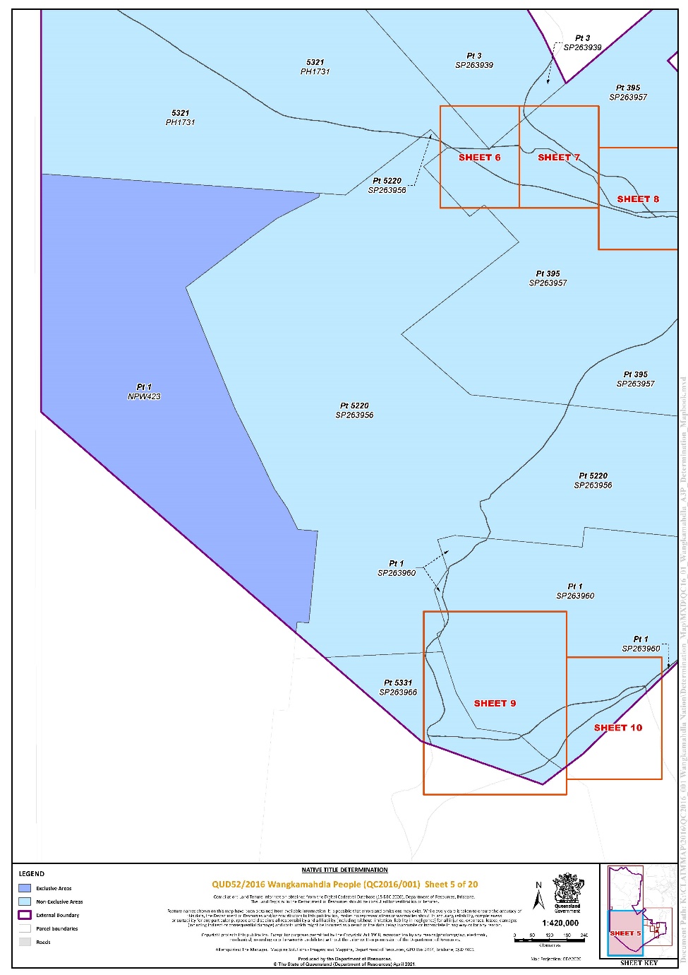
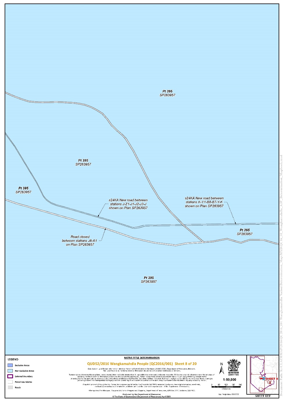
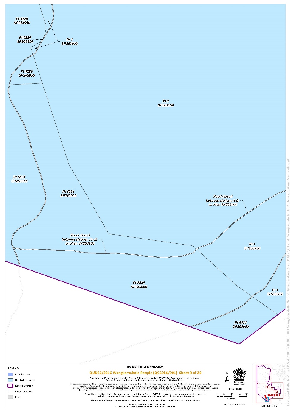
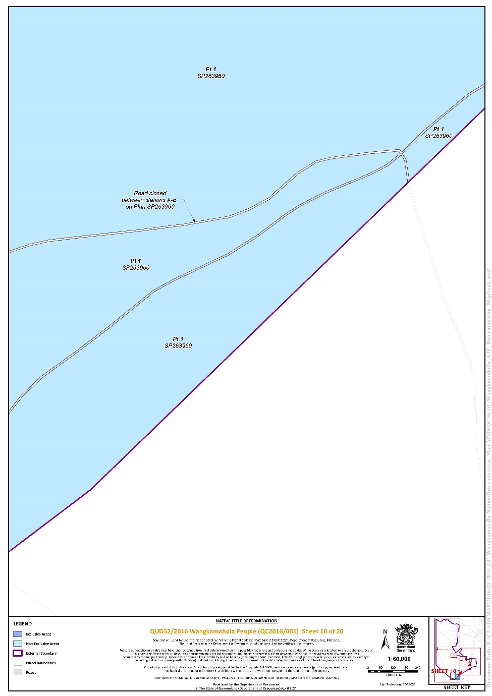
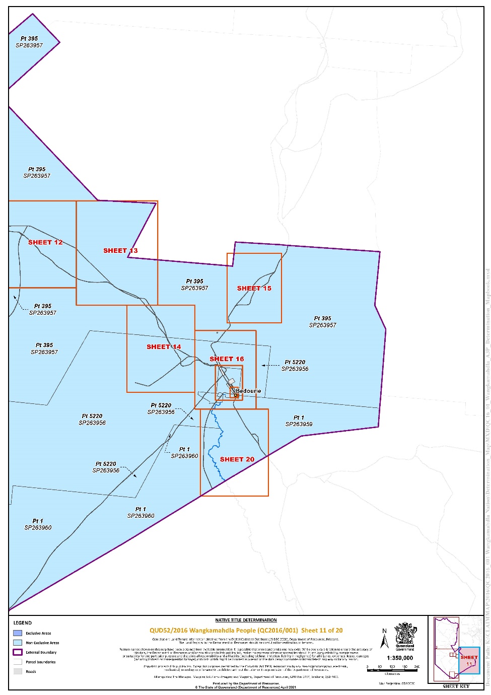
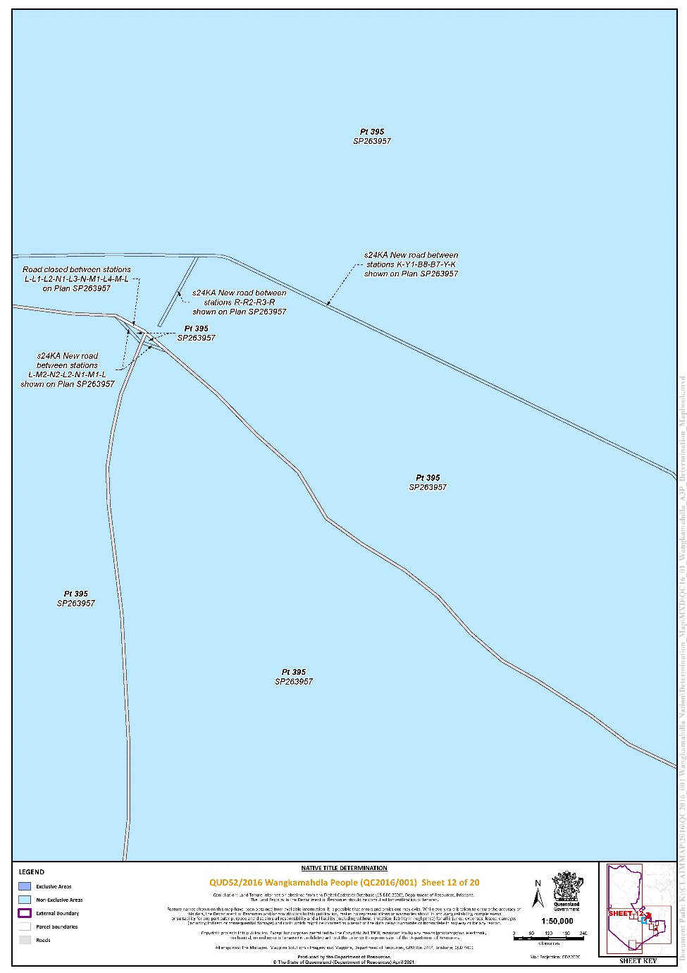
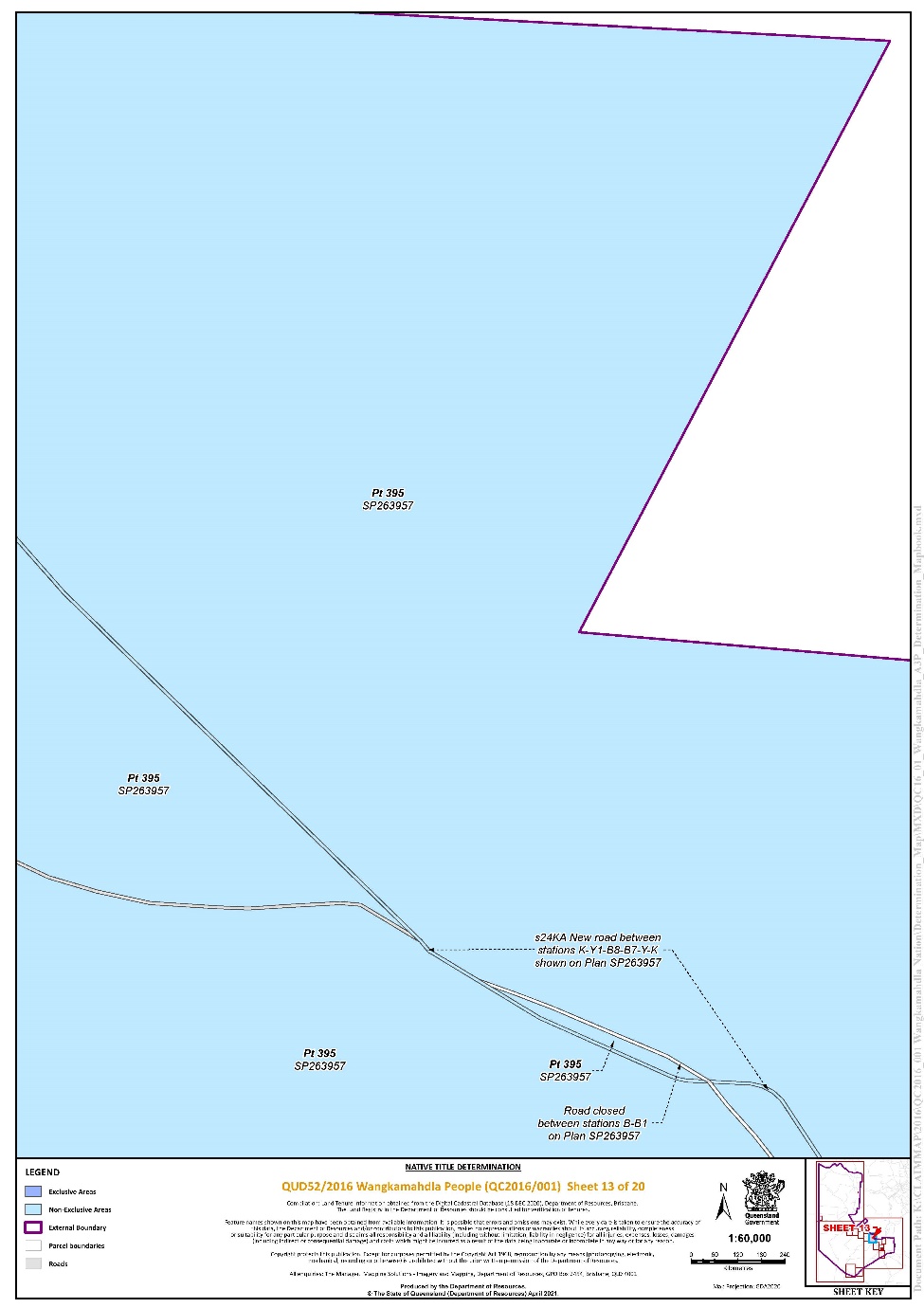
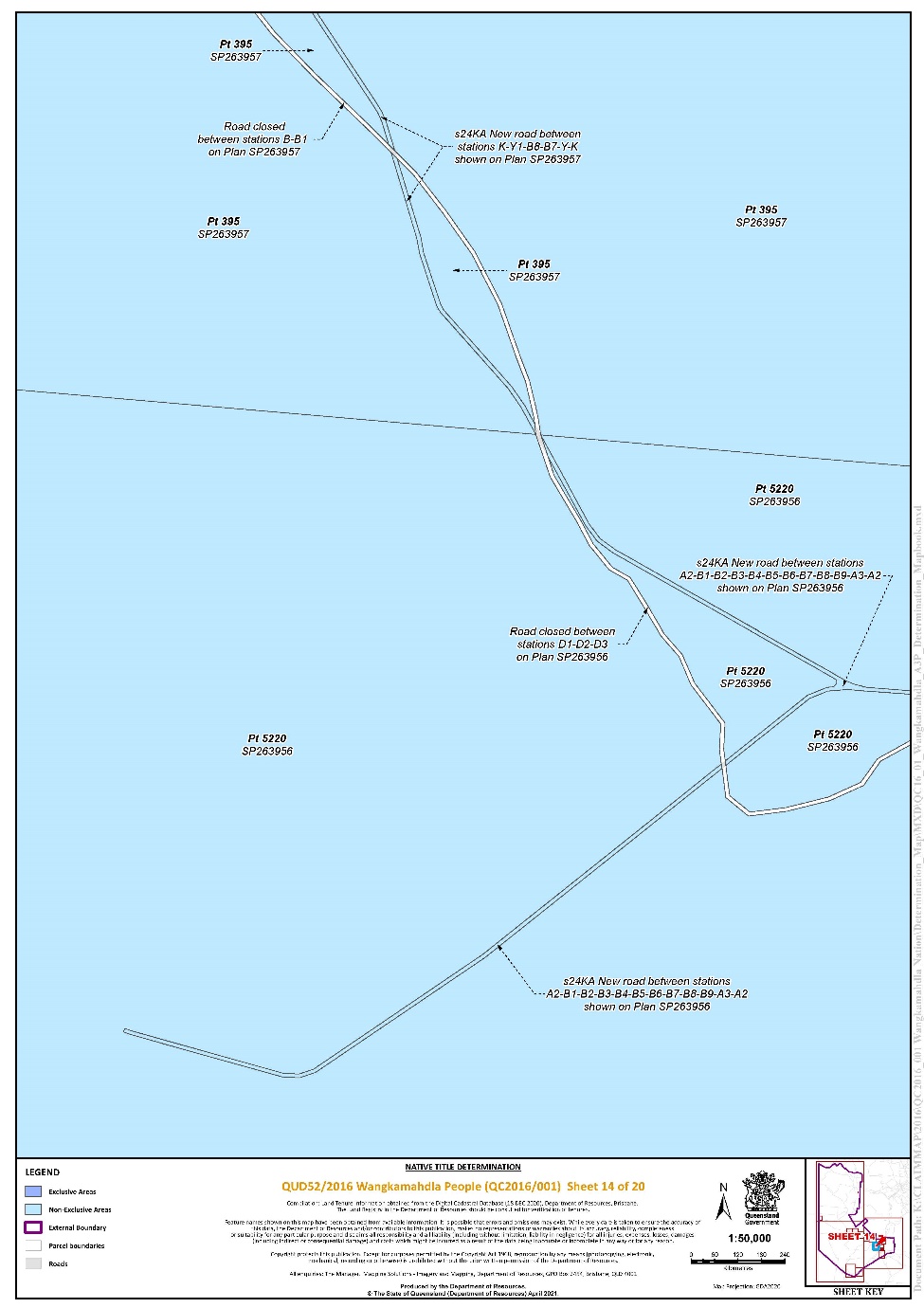
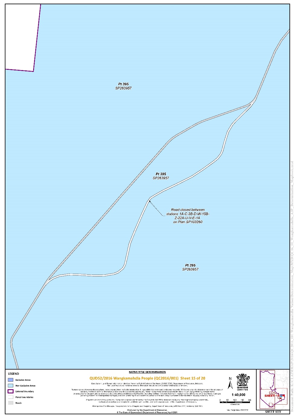
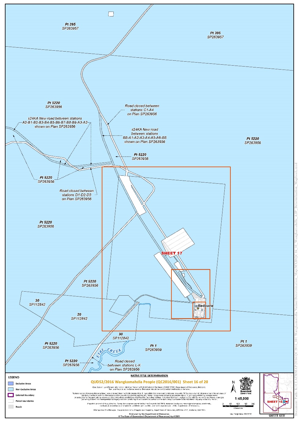
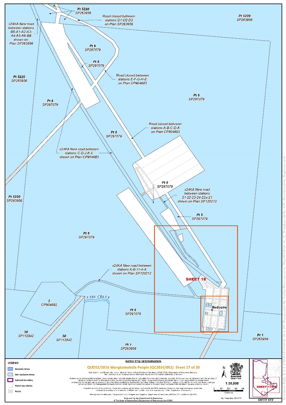
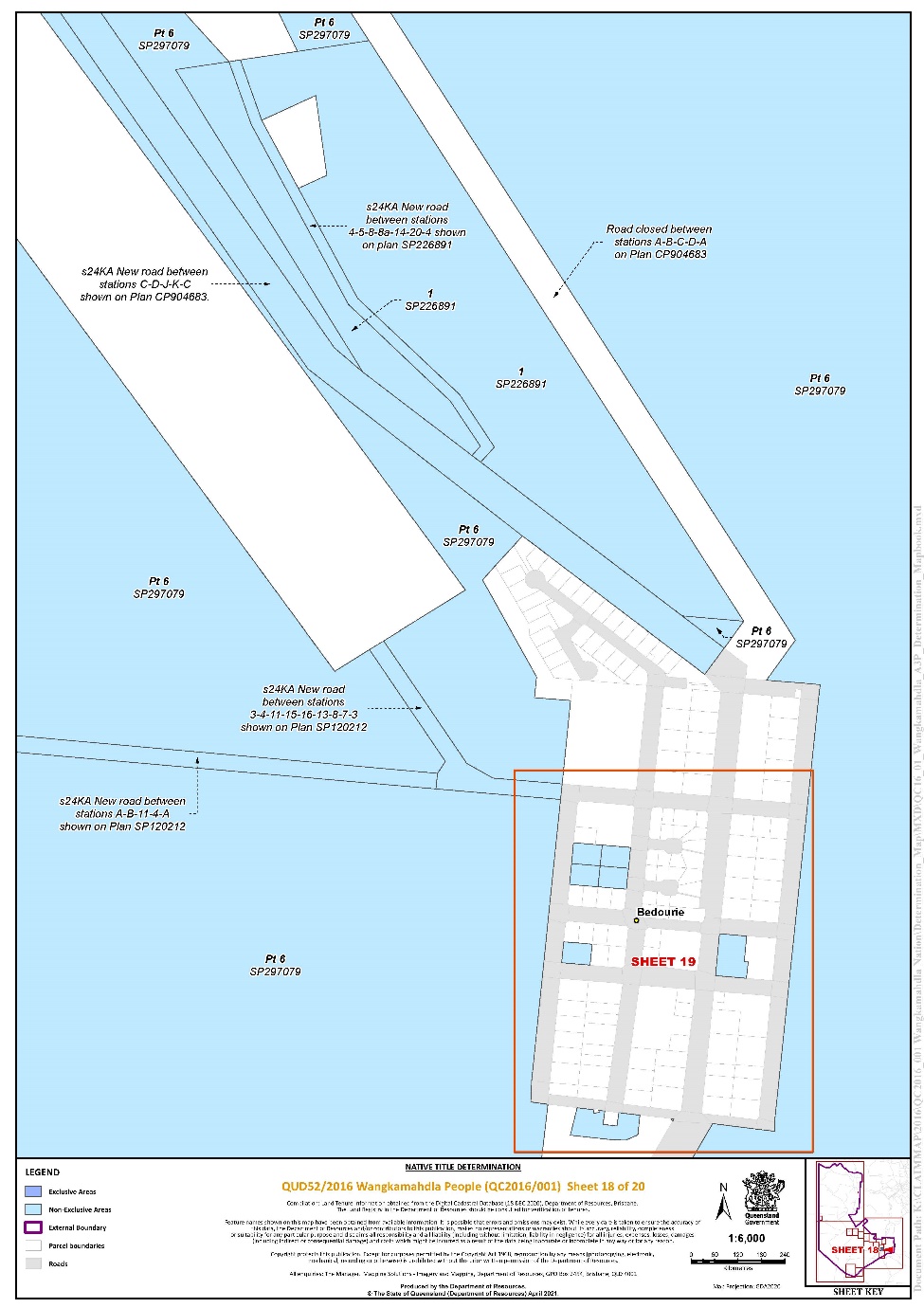
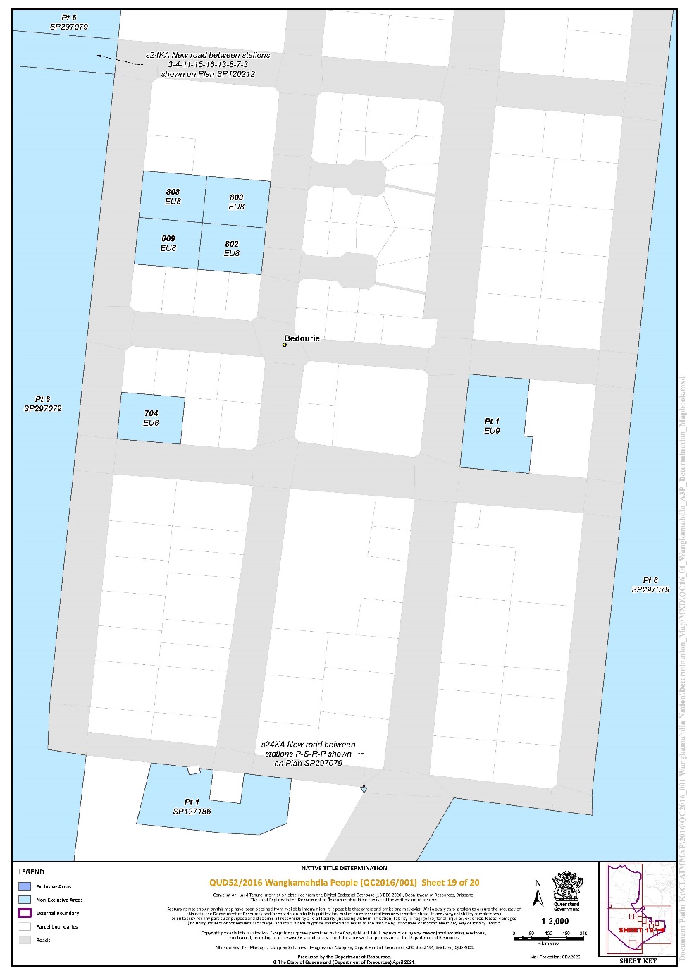
SCHEDULE 4
DESCRIPTION OF DETERMINATION AREA
The determination area comprises all of the land and waters described by lots on plan, or relevant parts thereof, and any rivers, streams, creeks or lakes described in the first column of the tables in the Parts immediately below, and depicted in the maps in Schedule 6, to the extent those areas are within the External Boundary and not otherwise excluded by the terms of Schedule 5.
Part 1 — Exclusive Areas
All of the land and waters described in the following table and depicted in dark blue on the determination map contained in Schedule 6:
Area description (at the time of the determination) | Determination Map Sheet Reference | Note |
Lot 1 on NPW423 | 5 | * Pt |
* denotes area to which s 47A of the Native Title Act 1993 (Cth) applies
“Pt” denotes areas that are part areas as a result of the External Boundary
Part 2 — Non-Exclusive Areas
All of the land and waters described in the following table and depicted in light blue on the determination map contained in Schedule 6:
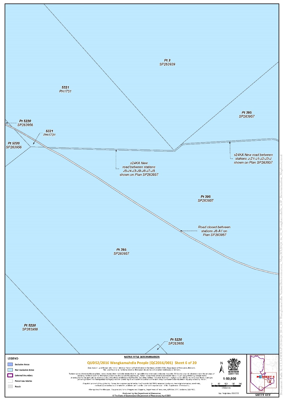
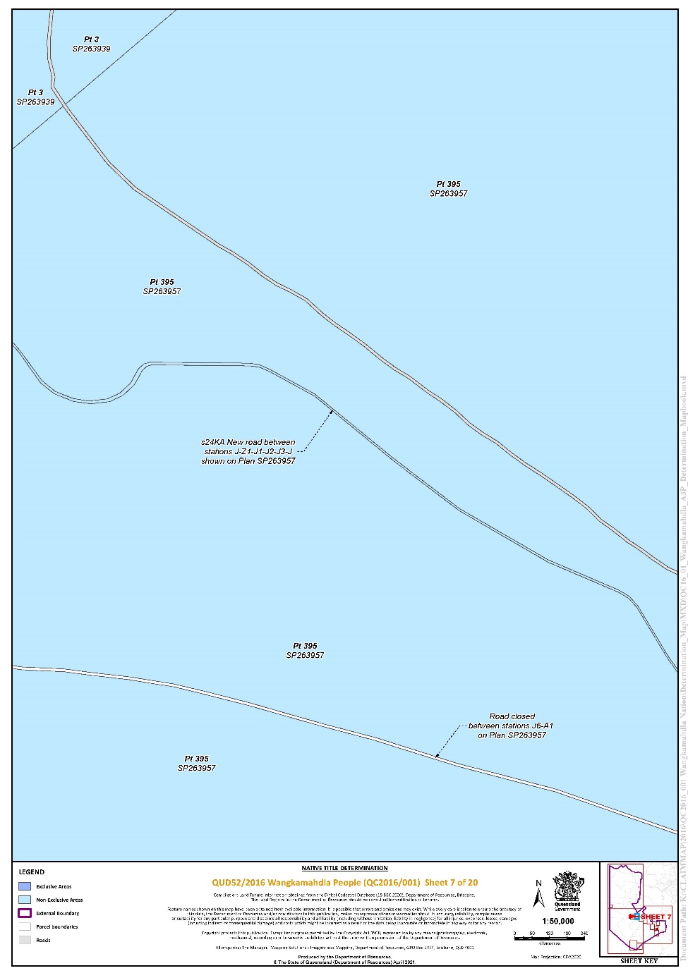
^ denotes areas to which s 24KA of the Native Title Act 1993 (Cth) apply
“Pt” denotes areas that are part areas as a result of the External Boundary
Data Reference and source
Cadastral data sourced from Department of Resources, Qld (15 Mar 2021).
Reference datum
Geographical coordinates are referenced to the Geocentric Datum of Australia 2020 (GDA2020), in decimal degrees.
SCHEDULE 5
AREAS NOT FORMING PART OF THE DETERMINATION AREA
The following areas of land and waters are excluded from the determination area as described in Parts 1 and 2 of Schedule 4:
1. Those land and waters within the External Boundary which at the time the native title determination application was made were the subject of one or more Previous Exclusive Possession Acts, within the meaning of s 23B of the Native Title Act 1993 (Cth) as they could not be claimed in accordance with s 61A of the Native Title Act 1993 (Cth).
2. Specifically, and to avoid any doubt, the land and waters described in (1) above includes:
(a) the Previous Exclusive Possession Acts described in ss 23B(2) and 23B(3) of the Native Title Act 1993 (Cth) to which s 20 of the Native Title (Queensland) Act 1993 (Qld) applies, and to which none of ss 47, 47A or 47B of the Native Title Act 1993 (Cth) applied; and
(b) the land and waters on which any public work, as defined in s 253 of the Native Title Act 1993 (Cth), is or was constructed, established or situated, and to which ss 23B(7) and 23C(2) of the Native Title Act 1993 (Cth) and to which s 21 of the Native Title (Queensland) Act 1993 (Qld), applies, together with any adjacent land or waters in accordance with s 251D of the Native Title Act 1993 (Cth).
3. Those land and waters within the External Boundary on which, at the time the native title determination application was made, public works were validly constructed, established or situated after 23 December 1996, where s 24JA of the Native Title Act 1993 (Cth) applies, and which wholly extinguished native title.
4. Those land and waters within the External Boundary which, at the time the native title determination was made, were the subject of one or more pre-existing rights based acts, within the meaning of 24IB of the Native Title Act 1993 (Cth), which wholly extinguished native title.
SCHEDULE 6
MAP OF DETERMINATION AREA
‘B’
SPECIFIC AREAS NOT FORMING PART OF THE DETERMINATION AREA
No. | Area description (at the time of the determination) | ||||||||||
1. | Lot 101 on Plan SP255349 | ||||||||||
2. | Lot 102 on Plan SP255349 | ||||||||||
3. | Lot 10 on Plan SP112843 | ||||||||||
4. | Lot 111 on Plan SP112841 | ||||||||||
5. | Lot 11 on Plan SP112843 | ||||||||||
6. | Lot 12 on Plan SP112843 | ||||||||||
7. | Lot 13 on Plan SP112843 | ||||||||||
8. | Lot 15 on Plan SP112843 | ||||||||||
9. | Lot 19 on Plan SP112843 | ||||||||||
10. | That part of Lot 1 on Plan EU9 easterly of a line passing through the following coordinate points:
| ||||||||||
11. | Lot 1 on Plan SP120213 | ||||||||||
12. | That part of Lot 1 on SP127186 bounded by the following coordinates:
Data Reference and source Cadastral data sourced from Department of Resources, Qld (12 Mar 2021). Reference datum Geographical coordinates are referenced to the Geocentric Datum of Australia 1994 (GDA94), in decimal degrees. | ||||||||||
13. | Lot 203 on Plan EU8 | ||||||||||
14. | Lot 204 on Plan EU8 | ||||||||||
15. | Lot 208 on Plan EU8 | ||||||||||
16. | Lot 20 on Plan SP112843 | ||||||||||
17. | Lot 21 on Plan SP112843 | ||||||||||
18. | Lot 22 on Plan SP112843 | ||||||||||
19. | Lot 2 on Plan SP120213 | ||||||||||
20. | Lot 2 on Plan SP127186 | ||||||||||
21. | Lot 3 on Plan SP112843 | ||||||||||
22. | Lot 4 on Plan SP112843 | ||||||||||
23. | Lot 504 on Plan RP904678 | ||||||||||
24. | Lot 506 on Plan RP904678 | ||||||||||
25. | Lot 5 on Plan SP112843 | ||||||||||
26. | Lot 6 on Plan SP112843 | ||||||||||
27. | Lot 7 on Plan SP112843 | ||||||||||
28. | Lot 8 on Plan SP112843 | ||||||||||
29. | Lot 9 on Plan SP112843 | ||||||||||
30. | Lot 511 on Plan CP900256 | ||||||||||
31. | Former road (Diamantina Developmental Road) between stations A-B-C-D-A and E-F-G-H-E on Plan CP904683 | ||||||||||
32. | Former road (Eyre Street) between stations 24-23-29-28-24 and 44-48-50-58-44 on Plan CP900256 | ||||||||||
33. | Former road (Nappa Street) between stations 48-49-62-52-48 and 68-22-21-85-84-68 on Plan CP900256 | ||||||||||
34. | Former road (Herbert Street) between stations 3-2-32-31-3 and 37-36-90-99-37 on Plan CP900257 | ||||||||||
35. | Former road (Nappa Street) between stations 85-90-71-69-85 and 105-107-75-72-105 on Plan CP900257 | ||||||||||
36. | Former road (Merri Street) between stations 9-28-25-10b-10a-9 on Plan CP863210 | ||||||||||
37. | Former road (Merri and Herbert Streets) between stations 15b-25-28-30-18-17-15a-15b on Plan CP863210 | ||||||||||
38. | Former road (Wango Street) between stations 2a-3-4-5-2a on Plan SP252151 | ||||||||||
39. | Former road (Wodonga Street) between stations 3-19-17-4-3 on Plan SP187139 | ||||||||||
40. | Former road between stations 1a,C,3b,D,W,15b,Z,22a,U,V,E,1a and 1b,2,3,4,5,12,13,14,21,22,X,Y,15b,15a,5a,4a,3b,B,A,1b on Plan SP103260 | ||||||||||
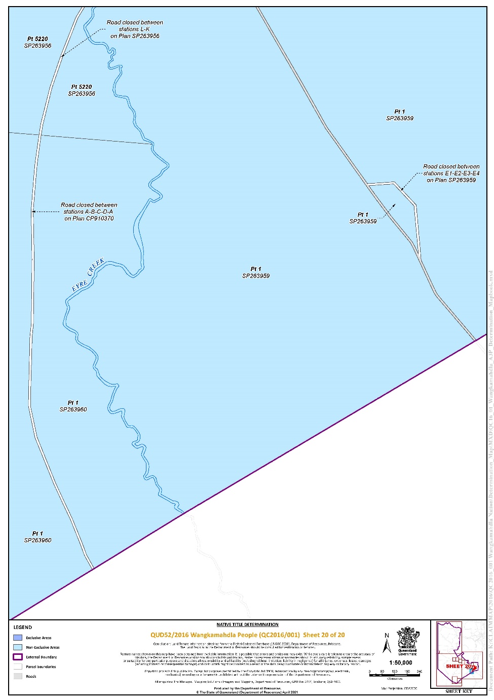
41. | Former road between stations A-B-C-D-A that is on Plan CP910370 | ||||||||||
42. | Former road between stations E1-E2-E3-E4 on Plan SP263959 | ||||||||||
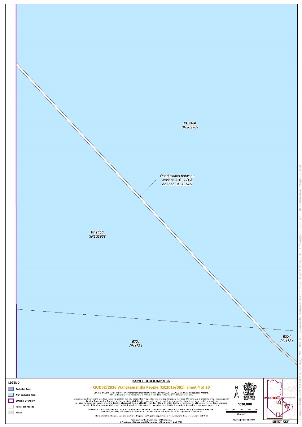
43. | Former road between stations A-B-C-D-A on Plan SP202989 |
Note: Entry of orders is dealt with in Rule 39.32 of the Federal Court Rules 2011.
[6] | |
[12] | |
[23] | |
[30] | |
[33] |
RANGIAH J:
1 The applicant seeks a determination of native title pursuant to ss 61 and 225 of the Native Title Act 1993 (Cth) (the Act) on behalf of the Wangkamahdla People.
2 The claim is over lands and waters in North West Queensland, comprising the lands and waters of the Mulligan River region, stemming from the Toko Range to its lower reaches found in the north-eastern corner of the Simpson Desert. The external boundaries of the claim area cover approximately 29,302 km2.
3 The Court made orders on 30 April 2021 for the administrative division of the area covered by the application into two parts, Part A and Part B. Part A covers the area within the external boundaries except for six identified lots: Lot 1 on SP107130, Lot 2 on SP107130, Lot 3 on SP107130, Lot 4 on SP107130, Lot 5 on SP107130 and Lot 2 on CP904679. These six lots cover less than one square kilometre and form Part B of the claim area.
4 The parties have indicated their consent to a determination that the Wangkamahdla People are the holders of native title in the area covered by Part A of the claim area.
5 By the Court making that determination, the Australian community will collectively recognise that status. But, it is important to emphasise that the Court’s orders do not grant native title. The Court is merely recognising rights and interests that have existed under the traditional laws and customs of the Wangkamahdla People for thousands of years before European settlement.
6 In the preamble, the Act recognises, on behalf of all people of Australia, that the Aboriginal peoples of Australia inhabited the country prior to European settlement and that the Aboriginal peoples were progressively dispossessed of their lands. It records that the Constitution was amended, by the overwhelming vote of the people of Australia, to enable laws such as the Act to be passed and to facilitate recognition by our shared legal system of native title rights and interests.
7 Section 3 of the Act states that the main objects of the Act include to protect and recognise native title, establish ways in which future dealings in relation to native title should proceed, and set standards for those dealings and establish a mechanism for determining native title claims.
8 An objective of the Act is the resolution of claims for native title by agreement. That objective has been facilitated by amendments to s 87A of the Act brought about by the Native Title Amendment Act 2009 (Cth) and the Native Title Legislation Amendment Act 2021 (Cth). The agreement of the parties to the terms of the proposed orders is consistent with that objective.
9 Section 61 of the Act provides that an application for a determination of native title may be made by persons authorised by all the persons, who, according to their traditional laws and customs, hold the common or group rights and interests comprising the particular native title claimed.
10 Section 223(1) of the Act explains the meaning of “native title”:
Common law rights and interests
(1) The expression native title or native title rights and interests means the communal, group or individual rights and interests of Aboriginal peoples or Torres Strait Islanders in relation to land or waters, where:
(a) the rights and interests are possessed under the traditional laws acknowledged, and the traditional customs observed, by the Aboriginal peoples or Torres Strait Islanders; and
(b) the Aboriginal peoples or Torres Strait Islanders, by those laws and customs, have a connection with the land or waters; and
(c) the rights and interests are recognised by the common law of Australia.
11 Section 225 of the Act describes what is meant by a “determination of native title”:
225 Determination of native title
A determination of native title is a determination whether or not native title exists in relation to a particular area (the determination area) of land or waters and, if it does exist, a determination of:
(a) who the persons, or each group of persons, holding the common or group rights comprising the native title are; and
(b) the nature and extent of the native title rights and interests in relation to the determination area; and
(c) the nature and extent of any other interests in relation to the determination area; and
(d) the relationship between the rights and interests in paragraphs (b) and (c) (taking into account the effect of this Act); and
(e) to the extent that the land or waters in the determination area are not covered by a non‑exclusive agricultural lease or a non‑exclusive pastoral lease—whether the native title rights and interests confer possession, occupation, use and enjoyment of that land or waters on the native title holders to the exclusion of all others.
…
12 The application for a determination of native title was filed on 20 January 2016. It seeks a determination on behalf of the Wangkamahdla People over land and waters within the external boundaries of the application area. The application was amended on 25 March 2020 and 10 June 2021.
13 The respondents to the application are the State of Queensland, Boulia Shire Council, the Commonwealth of Australia, Diamantina Shire Council, Ergon Energy Corporation Limited, Telstra Corporation Limited, Arrabury Pastoral Company Pty Ltd, Anthony William Brook, Gary Francis Brook, Jenna Louise Brook, Karen Liana Brook, North Australian Pastoral Company Pty Ltd, S Kidman & Co Ltd, Dalene Marie Wray, and Bush Heritage Australia.
14 There are no overlapping or competing native title claims over the land and waters covered in this application. The area covered by the application is bounded by the Bularnu, Waluwarra & Wangkayujuru People determination to the north, the Pitta Pitta People determination to the east, and the Mithaka People and Wangkangurru/Yarluyandi Native Title Claim determinations to the south.
15 The present determination in respect of Part A of the application area is an important step towards the resolution of the Wangkamahdla People’s claim.
16 All parties to the application have reached agreement that native title exists in Part A of the claim area and as to the nature and extent of those native title rights and interests in relation to Part A of the claimed area. That agreement, made under s 87A(1)(b) of the Act, was filed on 4 June 2021.
17 The evidence of connection filed in the Court by the applicant includes that of Avelina Tarrago, Christine Doyle, Isabel Tarrago, Trevor Dempsey, Danny (Ned) Rose, Patricia Quartpot, Topsy O’Keefe, Shirley Finn, Evelyn James, Brian Nathan, Jean Jacks, Desmond Bedourie, Josephine Barrett, Charles Page, Pauline Aplin, Veda Poole, Trevina Rogers, and Alfred Nathan. The evidence of members of the native title claim group about their traditional laws and customs and rights and responsibilities in respect to land and waters is of the highest importance: Sampi v Western Australia [2005] FCA 777 at [48].
18 The applicant also relies on reports of expert anthropologists as follows:
(1) Mr Peter Blackwood and Ms Mia McCulloch – Expert Anthropology Report dated 31 August 2017, filed on 10 June 2021 with the first affidavit of Shannon McGrellis.
(2) Mr Peter Blackwood and Ms Mia McCulloch – Genealogies dated 31 August 2017, filed on 10 June 2021 with the second affidavit of Shannon McGrellis.
(3) Mr Peter Blackwood – Supplementary Expert Anthropology Report dated 13 August 2018, filed on 10 June 2021 with the fourth affidavit of Shannon McGrellis.
(4) Mr Peter Blackwood and Ms Mia McCulloch – Genealogy of Dolly of Glenormiston dated 4 March 2019, filed with the second affidavit of Shannon McGrellis.
19 The Wangkamahdla People include the descendants of the following persons:
(1) Rainmaker, the father of Joe Rose and Kwetyaneke;
(2) Belia Toby, the father of Billy Butler, Johnny Belia and Ivy (Mutchee) Belia;
(3) Charlie Deemera, the father of Paddy Deemera;
(4) Puppa, the mother of Annie Topsy Hansen (nee Daley);
(5) Toby Roxborough;
(6) Billy (Yummpibilly) Brady, the father of Bessie Brady;
(7) King Peter, the father of Biddy Dinger, Les and Billy Jenkins, Ethel and Donnelly Britcher;
(8) George Quartpot, the father of Tony, Patricia, Kerry, Gladys, Maria and Patrick Quartpot;
(9) Jackie Beauchamp, the father of Paddy Beauchamp and social father of George Quartpot, and Jackie Beauchamp’s brother Aldie;
(10) Dolly of Glenormiston, the mother of Ruby Lyon, Dinger, Peter Western, Lion and Tiger;
(11) Molly, the mother of Judy Sailor and Arthur (Poddy) Daley Jnr;
(12) Polly Docherty, the mother of Jack (Snapshot) Hansen and Bergin Smith;
(13) Dolly, the sister to Polly Docherty and the mother of Charlie Trotman and Jack O’Donnell;
(14) Topsy (also known as Bonny), the mother of James Roxborough Craigie and George Craigie;
(15) Bunny, the mother of Joe, Dora, Peter and Jack Craigie, Dinah Aplin and Donald Bedourie;
(16) Jinny Toby, the mother of George and Fred Age, Queen Ida Toby and Lily Clayton;
(17) Tommy Ferguson, the father of Betty Major;
(18) Kitty Bedourie, the mother of Bessie and Jessie Bedourie, Donald Dee and Emily Denny;
(19) Mother of Turukalanima, Turukalanima was the mother of Norah Jacks, Ivy Nardoo and Monty Cameron;
(20) Lizzie (Wiriwaltu) Green, the mother of Jubilee Page;
(21) Jimmy Mantandi, the father of Clara (Indjiniga) Naylon;
(22) Alice (Wiyekari), the mother of Mary and Daisy Craigie.
20 The evidence filed by the applicant provides cogent evidence that the Wangkamahdla People have maintained a continuous presence on their country, despite the pressures of colonisation which included depopulation and residential aggregation in semi-permanent camps on the outskirts of the townships of Boulia, Bedourie, Dajarra, Birdsville and Urandangi. The evidence supports the claim that the traditional laws acknowledged and the customs observed by the Wangkamahdla People give them the right to possess, occupy, use and enjoy the land and waters in the claim area.
21 The anthropologists’ reports detail the continued acknowledgement and observance by the Wangkamahdla People of a range of laws and customs in respect of language, cultural knowledge, totemic and spiritual beliefs, sites, dispute resolution, decision making, bush tucker and medicines.
22 In their 2017 report, Mr Blackwood and Ms McCulloch opine at paragraph 24:
…[M]embers of the claim group can be said to be the successors of the pre-sovereignty groups which occupied the claim area. Through the processes of post-colonial adaptation noted above, they have maintained a normative system of traditional law and custom which gives rise to their native title rights and interests, and that these laws and customs (and the rights and interests to which they give rise), they have inherited according to traditional law and custom from their distant forebears of the pre-sovereignty groups.
The agreement reached between the parties
23 Section 87A(4) of the Act gives the Court the power to make an order consistent with the terms of a proposed determination of native title agreed between the parties to the proceeding without holding a hearing in relation to the application, if the Court considers that:
(a) an order in, or consistent with, the terms of the proposed determination would be within its power; and
(b) it would be appropriate to do so.
24 The conditions under s 87A of the Act that enable the Court to make the determination without a hearing are:
There is a proceeding in relation to an application for a determination of native title: s 87A(1)(a).
At any stage of the proceeding after the end of the period specified in the notice given under s 66, agreement is reached on a proposed determination of native title in relation to an area that is part of, but not all of, the area covered by the application: s 87A(1)(b).
Certain persons are parties to the agreement: s 87A(1)(c).
The terms of the proposed determination are in writing and signed by or on behalf of each of those parties: s 87A(1)(d).
The Court is satisfied that an order in, or consistent with, those terms would be within its power: s 87A(4) and (5).
The Court considers it appropriate to make the orders sought: s 87A(4) and (5).
25 The Court is not required to embark upon an inquiry as to the merits of the claim to be satisfied that the orders are supportable and in accordance with the law: Cox on behalf of the Yungngora People v State of Western Australia [2007] FCA 588 at [3]. However, the Court will consider evidence for the limited purpose of determining whether the parties who have agreed to compromise the claim, particularly the State on behalf of the community generally, have made a rational decision and are acting in good faith: Munn for and on behalf of the Gunggari People v State of Queensland (2001) 115 FCR 109 at [30]. The primary consideration of the Court is to determine whether there is an agreement and whether it was freely entered on an informed basis: Nangkiriny v State of Western Australia (2002) 117 FCR 6 at [14].
26 State and Territory governments are responsible for ensuring that community interests are protected by getting involved in a process that assesses the underlying evidence as to the existence of native title. In this case, the State of Queensland is satisfied that the claim group is an appropriate one to be recognised as holders of native title rights and interests, that it is appropriate to recognise the rights and interests proposed and that it is appropriate for the State to enter into the determination.
27 The requirements of the Act have been satisfied:
There is a proceeding in relation to an application for a determination of native title: s 87A(1)(a).
The period for notification of the application under s 66 of the Act has ended: s 87A(1)(b).
The parties have reached an agreement as to the terms of a determination of native title in relation to Part A of the application area: s 87A(1)(b).
The parties have recorded their agreement in a Minute of Consent: s 87A(1)(d).
An order in terms of the Minute, or consistent with the Minute, would be within the Court’s power because:
the application has been made in accordance with s 61 of the Act;
the application is for a determination of native title in relation to an area for which there was no approved determination of native title: s 13(1)(a); and
the Minute agreed to by the parties complies with ss 94A and 225 of the Act: s 87A(4).
28 In addition, I am satisfied that it is appropriate for the Court to make the orders sought because:
(1) The active parties have freely entered into an agreement.
(2) The parties have agreed as to the nature and extent of rights and interests, and the proposed determination is unambiguous and certain as to the rights and interests declared.
(3) There are no proceedings before the Court relating to native title determination applications that cover any part of the area that is the subject of this application.
(4) The State has played an active role in the negotiation of the determination and, in doing so, has taken an interest in the proceeding on behalf of the community and given appropriate consideration to the connection material.
29 The terms of the proposed determination also satisfy the requirements of s 225 of the Act.
30 Section 55 of the Act requires the Court to make such determinations as are required by ss 56 and 57 at the same time as or as soon as practicable after the determination of native title is made. Order 15 of the s 87A agreement signed by the parties seeks a determination that the Mulligan River Aboriginal Corporation (ICN 9434) is to be the prescribed body corporate for the purposes of ss 56(2)(b) and 56(3) of the Act to perform the functions set out in s 57(1).
31 The nomination is supported by the seventh affidavit of Shannon McGrellis filed on 11 June 2021, which annexes a letter dated 8 June 2021 from a member of the applicant, Mona Aplin, to this Court nominating the Mulligan River Aboriginal Corporation (ICN 9434) to the be the prescribed body corporate for the purposes of the Act.
32 Accordingly, the Court determines that the Mulligan River Aboriginal Corporation is to be the prescribed body corporate for the purposes of s 56(1) of the Act.
33 The Court will make orders in accordance with the orders agreed by the parties.
I certify that the preceding thirty-three (33) numbered paragraphs are a true copy of the Reasons for Judgment of the Honourable Justice Rangiah. |
Associate:
QUD 52 of 2016 | |
DIAMANTINA SHIRE COUNCIL | |
Fifth Respondent: | ERGON ENERGY CORPORATION LIMITED (ACN 087 646 062) |
Sixth Respondent: | TELSTRA CORPORATION LIMITED |
Seventh Respondent: | ARRABURY PASTORAL COMPANY PTY LTD |
Eighth Respondent: | ANTHONY WILLIAM BROOK |
Ninth Respondent: | GARY FRANCIS BROOK |
Tenth Respondent: | JENNA LOUISE BROOK |
Eleventh Respondent: | KAREN LIANA BROOK |
Twelfth Respondent: | NORTH AUSTRALIAN PASTORAL COMPANY PTY LTD |
Thirteenth Respondent: | S KIDMAN & CO PTY LTD |
Fourteenth Respondent: | DALENE MARIE WRAY |
Fifteenth Respondent: | BUSH HERITAGE AUSTRALIA (ACN 053 639 115) |

