
FEDERAL COURT OF AUSTRALIA
Yindjibarndi Aboriginal Corporation RNTBC v State of Western Australia [2020] FCA 1416
ORDERS
YINDJIBARNDI ABORGINAL CORPORATION RNTBC Applicant | ||
AND: | First Respondent FORTESCUE METALS GROUP PTY LTD Second Respondent YAMATJI MARLPA ABORIGINAL CORPORATION Third Respondent | |
DATE OF ORDER: |
THE COURT NOTES THAT:
A. This application ("Yindjibarndi Variation Application") is made pursuant to sections 13(1)(b) and 61(1) of the Native Title Act 1993 (Cth). It seeks a variation to the approved determination of native title made by the orders of the Court (Moore, North and Mansfield JJ) in proceeding WAD 114 of 2005 on 27 August 2007 (the "Moses determination”).
B. The Yindjibarndi Variation Application seeks to vary the Moses determination by:
(1) recognising a right of exclusive possession held by the Yindjibarndi People over Reserve 40617 and 6 areas (or parts thereof) of unallocated Crown land; and
(2) addressing an ambiguity as to whether Reserve 12260 is within the determination area by providing that no part of Reserve 12260 is covered by the determination (consistent with the written description of the external boundary of the determination area included in the original determination).
C. The variation is sought following:
(1) findings of fact made by the Court (Rares J) on 20 July 2017 in Warrie (formerly TJ) (on behalf of the Yindjibarndi People) v State of Western Australia [2017] FCA 803 to the effect that, under their traditional laws and customs, the Yindjibarndi people hold native title rights of exclusive possession: and the determination made by the Court (Rares J) on 13 November 2017 in Warrie (formerly TJ) (on behalf of the Yindjibarndi people) v State of Western Australia (No. 2) [2017] FCA 1299; and
(2) identification of the determination boundary issue with respect to Reserve 12260 by the National Native Title Tribunal in March 2017.
D. The Applicant in the Yindjibarndi Variation Application, the State of Western Australia and the other Respondents to the Yindjibarndi Variation Application ("the parties") have reached an agreement as to the terms of the orders, and including a varied determination of native title, to be made in relation to the Yindjibarndi Variation Application.
E. The parties filed in the Court a Minute of Proposed Orders and Varied Determination of Native Title setting out the terms of the agreement reached by the parties in relation to the Yindjibarndi Variation Application that they signed on 11 September 2020.
BEING SATISFIED that orders in the terms sought by the parties are within the power of the Court and, it appearing to the Court appropriate to do so pursuant to sections 13(5) and 87A(4) of the Native Title Act, and by the consent of the parties:
THE COURT ORDERS THAT:
1. The substituted determination effected by Order 2 made by the Court in proceeding WAD 114 of 2005 on 27 August 2007 be varied as follows:
(a) In paragraph 4, first line, replace “The native title rights and interests:” with:
“The native title rights and interests in the Ngarluma Native Title Area (including, for the avoidance of doubt, that part of the Yindjibarndi Native Title Area which overlaps the Ngarluma Native Title Area):”
(b) Insert new paragraphs 4A and 4B as follows:
“4A The native title rights and interests in Yindjibarndi Native Title Area are subject to and exercisable in accordance with the traditional laws and customs of the Yindjibarndi People.”
“4B The native title rights and interests in those parts of the Yindjibarndi Native Title Area which do not either form part of the Yindjibarndi Exclusive Possession Area or overlap with the Ngarluma Native Title Area do not confer possession, occupation, use and enjoyment of that land or waters on the Yindjibarndi People to the exclusion of all others.”
(c) In paragraph 5, delete the words “non-exclusive” in the first line;
(d) In paragraph 7, in the first line add the words “4A, 4B,” after the words “paragraphs 4,”;
(e) In paragraph 7, in the second and third lines, replace “in relation to the Yindjibarndi Native Title Area” with:
“in relation to those parts of the Yindjibarndi Native Title Area which do not form part of the Yindjibarndi Exclusive Possession Area”
(f) Insert new paragraph 7A as follows:
“Subject to paragraphs 13 – 15 inclusive, the Yindjibarndi People have the right to the possession, occupation, use and enjoyment of the Yindjibarndi Exclusive Possession Area to the exclusion of all others.”
(g) Insert paragraph 14A as follows:
“14A. The native title rights in paragraph 7A do not confer exclusive rights in relation to water in any watercourse, wetland or underground water source as is defined in the Rights in Water and Irrigation Act 1914 (WA) as at the date of this determination.”
(h) In paragraph 15, delete the words “non-exclusive” in the first line;
(i) In paragraph 17, delete the words “non-exclusive” in the first line;
(j) In the definition of “Yindjibarndi Total Extinguishment Area” in the First Schedule at (8) (“Reserves containing public works), delete the reference to “12260”.
(k) In the First Schedule add the following definition after the definition of the “Yindjibarndi Area”:
“'Yindjibarndi Exclusive Possession Area' means the following land and waters:
Area | Location / Tenure No. | But not including the following areas: |
85 | Reserve 40617 | |
82 | West of Mallina | Not part which falls within the Ngarluma Area |
99 | South of Mt Welcome | Not part which falls within the Ngarluma Area |
110A | Coolawanyah | |
110B | Coolawanyah | |
110C | South of Coolawanyah | Not part which falls within the Hamersley Ranges Area |
114 | East of Res 30071 | Not part which falls within the Ngarluma Area |
(l) Replace the first of the 15 maps which are Attachment 2 to the First Schedule with the first of the 15 maps contained in Attachment 2 to the First Schedule of the Varied Determination of Native Title provided for in Attachment A.; and
(m) Add the following areas to the table of Section 47B Areas in the Fifth Schedule:
Area No. | Location (general) | Extinguishing act(s) disregarded | But not including the following areas: |
82 | West of Mallina | Creation of any prior interest | Not part which falls within the Ngarluma Area |
99 | South of Mt Welcome | Creation of any prior interest | Not part which falls within the Ngarluma Area |
110A | Coolawanyah | Creation of any prior interest | |
110B | Coolawanyah | Creation of any prior interest | |
110C | South of Coolawanyah | Creation of any prior interest | Not part which falls within the Hamersley Ranges Area |
114 | East of Res 30071 | Creation of any prior interest | Not part which falls within the Ngarluma Area |
2. The determination of native title as varied by order 1 above is in the form of the Varied Determination of Native Title provided for in Attachment A.
3. There be no order as to costs.
Note: Entry of orders is dealt with in Rule 39.32 of the Federal Court Rules 2011.
ATTACHMENT A
VARIED DETERMINATION OF NATIVE TITLE
THE COURT ORDERS AND DETERMINES THAT:
1. The ‘Determination Area’ is the land and waters described and depicted in the First Schedule.
Existence of native title
2. Native title does not exist in relation to the following parts of the Determination Area:
(a) the ‘Burrup’ (as described and depicted in the First Schedule);
(b) ‘Offshore Waters’ (as described and depicted in the First Schedule);
(c) ‘Depuch Island’ (as described and depicted in the First Schedule);
(d) the ‘Hamersley Ranges Area’ (as described and depicted in the First Schedule);
(e) the ‘Total Extinguishment Area’ (as described and depicted in the First Schedule).
3. Subject to paragraph 2 above, native title rights and interests exist in the following parts of the Determination Area:
(a) ‘Ngarluma Native Title Area’ (as defined in the First Schedule); and
(b) ‘Yindjibarndi Native Title Area’ (as defined in the First Schedule),
including the ‘Section 47A Area’ and the ‘Section 47B Area’ (as described in the Fifth Schedule) in respect of which extinguishment is disregarded in accordance with sections 47A and 47B of the Native Title Act 1993 (Cth).
4. The native title rights and interests in the Ngarluma Native Title Area (including, for the avoidance of doubt, that part of the Yindjibarndi Native Title Area which overlaps the Ngarluma Native Title Area):
(a) do not confer possession, occupation, use and enjoyment of land or waters on the native title holders to the exclusion of others; and
(b) are not exercisable otherwise than in accordance with and subject to traditional laws and customs for personal, domestic and non-commercial communal purposes (including social, cultural, religious, spiritual and ceremonial purposes).
4A The native title rights and interests in Yindjibarndi Native Title Area are subject to and exercisable in accordance with the traditional laws and customs of the Yindjibarndi People.
4B The native title rights and interests in those parts of the Yindjibarndi Native Title Area which do not either form part of the Yindjibarndi Exclusive Possession Area or overlap the Ngarluma Native Title Area do not confer possession, occupation, use and enjoyment of that land or waters on the Yindjibarndi People to the exclusion of all others.
Native title holders
5. The native title rights and interests which exist in the Determination Area are held by:
(a) ‘Ngarluma People’ (as defined in the Third Schedule) in relation to the Ngarluma Native Title Area; and
(b) ‘Yindjibarndi People’ (as defined in the Third Schedule) in relation to the Yindjibarndi Native Title Area.
Native title rights and interests
6. Subject to paragraphs 4 and 8 to 15 inclusive, the Ngarluma People have the following non-exclusive native title rights and interests in relation to the Ngarluma Native Title Area:
(a) A right to access (including to enter, to travel over and remain);
(b) A right to engage in ritual and ceremony (including to carry out and participate in initiation practices);
(c) A right to camp and to build shelters (including boughsheds, mias and humpies) and to live temporarily thereon as part of camping or for the purpose of building a shelter;
(d) A right to fish from the waters;
(e) A right to collect and forage for bush medicine;
(f) A right to hunt and forage for and take fauna (including fish, shell fish, crab, oysters, sea turtle, dugong, goanna, kangaroo, emu, bush turkey, echidna, porcupine, witchetty grub, swan);
(g) A right to forage for and take flora (including timber logs, branches, bark and leaves, gum, wax, Aboriginal tobacco, fruit, peas, pods, melons, bush cucumber, seeds, nuts, grasses, potatoes, wild onion and honey);
(h) A right to take black, yellow, white and red ochre;
(i) A right to take water for drinking and domestic use;
(j) A right to cook on the land including light a fire for this purpose;
(k) A right to protect and care for sites and objects of significance in the Ngarluma Native Title Area (including a right to impart traditional knowledge concerning the area, while on the area, and otherwise, to succeeding generations and others so as to perpetuate the benefits of the area and warn against behaviour which may result in harm, but not including a right to control access or use of the land by others).
7. Subject to paragraphs 4, 4A, 4B and 8 to 15 inclusive, the Yindjibarndi People have the following non-exclusive native title rights and interests in relation to those parts of the Yindjibarndi Native Title Area which do not form part of the Yindjibarndi Exclusive Possession Area :
(a) A right to access (including to enter, to travel over and remain);
(b) A right to engage in ritual and ceremony (including to carry out and participate in initiation practices);
(c) A right to camp and to build shelters (including boughsheds, mias and humpies) and to live temporarily thereon as part of camping or for the purpose of building a shelter;
(d) A right to fish from the waters;
(e) A right to collect and forage for bush medicine;
(f) A right to hunt and forage for and take fauna (including fish, shell fish, crab, oysters, goanna, kangaroo, emu, turkey, echidna, porcupine, witchetty grub and swan but not including dugong or sea turtle);
(g) A right to forage for and take flora (including timber logs, branches, bark and leaves, gum, wax, Aboriginal tobacco, fruit, peas, pods, melons, bush cucumber, seeds, nuts, grasses, potatoes, wild onion and honey);
(h) A right to take black, yellow, white and red ochre;
(i) A right to take water for drinking and domestic use;
(j) A right to cook on the land including light a fire for this purpose;
(k) A right to protect and care for sites and objects of significance in the Yindjibarndi Native Title Area (including a right to impart traditional knowledge concerning the area, while on the area, and otherwise, to succeeding generations and others so as to perpetuate the benefits of the area and warn against behaviour which may result in harm, but not including a right to control access or use of the land by others).
7A Subject to paragraphs 13 to 15 inclusive, the Yindjibarndi People have the right to the possession, occupation, use and enjoyment of the Yindjibarndi Exclusive Possession Area to the exclusion of all others.
8. The non-exclusive native title rights and interests in relation to the ‘Inter-tidal Zone’ (defined in the First Schedule) do not include the rights in subparagraphs (b), (c), (e), (g), (h), (i), (j) or (k) of paragraph 6 above.
9. The non-exclusive native title rights and interests in relation to the ‘Offshore Islands’ (defined in the First Schedule) do not include any of the native title rights and interests in subparagraphs (a)-(j) of paragraph 6 above.
10. The non-exclusive native title rights and interests in relation to the ‘Cemetery Reserve Area’ (defined in the First Schedule) do not include:
(a) the right to engage in ritual and ceremony referred to in subparagraph (b) of paragraph 6 above, save to the extent it relates to ritual and ceremony for the dead; or
(b) any of the rights in subparagraphs (c), (d), (h), (j) and (k) of paragraph 6 above.
11. The non-exclusive native title rights and interests in relation to the ‘Telstra Area’ (defined in the First Schedule) do not include:
(a) a right to remain (part of right (a) in paragraphs 6 and 7 above); and
12. The non-exclusive native title rights and interests in relation to the ‘Telstra Cable Routes’ (defined in the First Schedule) do not include right (h) in paragraphs 6 and 7 above, to the extent that the right involves digging beneath the surface of that land.
Qualifications
13. Notwithstanding anything in this determination, there are no native title rights and interests in or in relation to:
(a) minerals (including ochres to the extent they are minerals) as defined in the Mining Act 1904 (WA), or in the Mining Act 1978 (WA) before the date of this determination; or
(b) petroleum as defined in the Petroleum Act 1936 (WA), or in the Petroleum Act 1967 (WA) before the date of this determination.
14. There are no native title rights and interests in respect of ‘Subterranean Waters’ (as defined in the First Schedule) in the Determination Area.
14A. The native title rights in paragraph 7A do not confer exclusive rights in relation to water in any watercourse, wetland or underground water source as is defined in the Rights in Water and Irrigation Act 1914 (WA) as at the date of this determination.
15. The native title rights and interests are subject to and exercisable in accordance with the laws of the State and the Commonwealth including the common law.
Other interests
16. The nature and extent of other interests in those parts of the Determination Area where native title exists are set out in the Second Schedule.
17. The relationship between the native title rights and interests and the other interests referred to in paragraph 16 is that:
(a) to the extent that any other interest is a category D past act, a category D intermediate period act or a future act under the Native Title Act 1993 (Cth), or is an act to which sections 47A or 47B Native Title Act 1993 (Cth) applies, and is inconsistent with the continued existence, enjoyment or exercise of the native title rights or interests, the native title continues to exist in its entirety, but the native title rights and interests have no effect in relation to the other interests to the extent of the inconsistency during the currency of those other interests;
(b) in the case of mining leases, pastoral leases, easements and licences granted prior to 1 January 1994, the construction or erection of an improvement required or permitted under such a lease or easement or licence will prevent the exercise of the non-exclusive native title rights and interests at the location of that improvement to the extent that the exercise of those rights are inconsistent with the improvement for so long as the holder of the lease, easement or licence retains the improvement; and
(c) otherwise, the existence and exercise of the native title rights and interests does not prevent the doing of any activity required or permitted to be done by or under the other interests, and the other interests, and the doing of any activity required or permitted to be done by or under the other interests, prevail over the native title rights and interests and may prevent any exercise of the native title rights and interests, but does not extinguish them.
FIRST SCHEDULE – DEFINITIONS
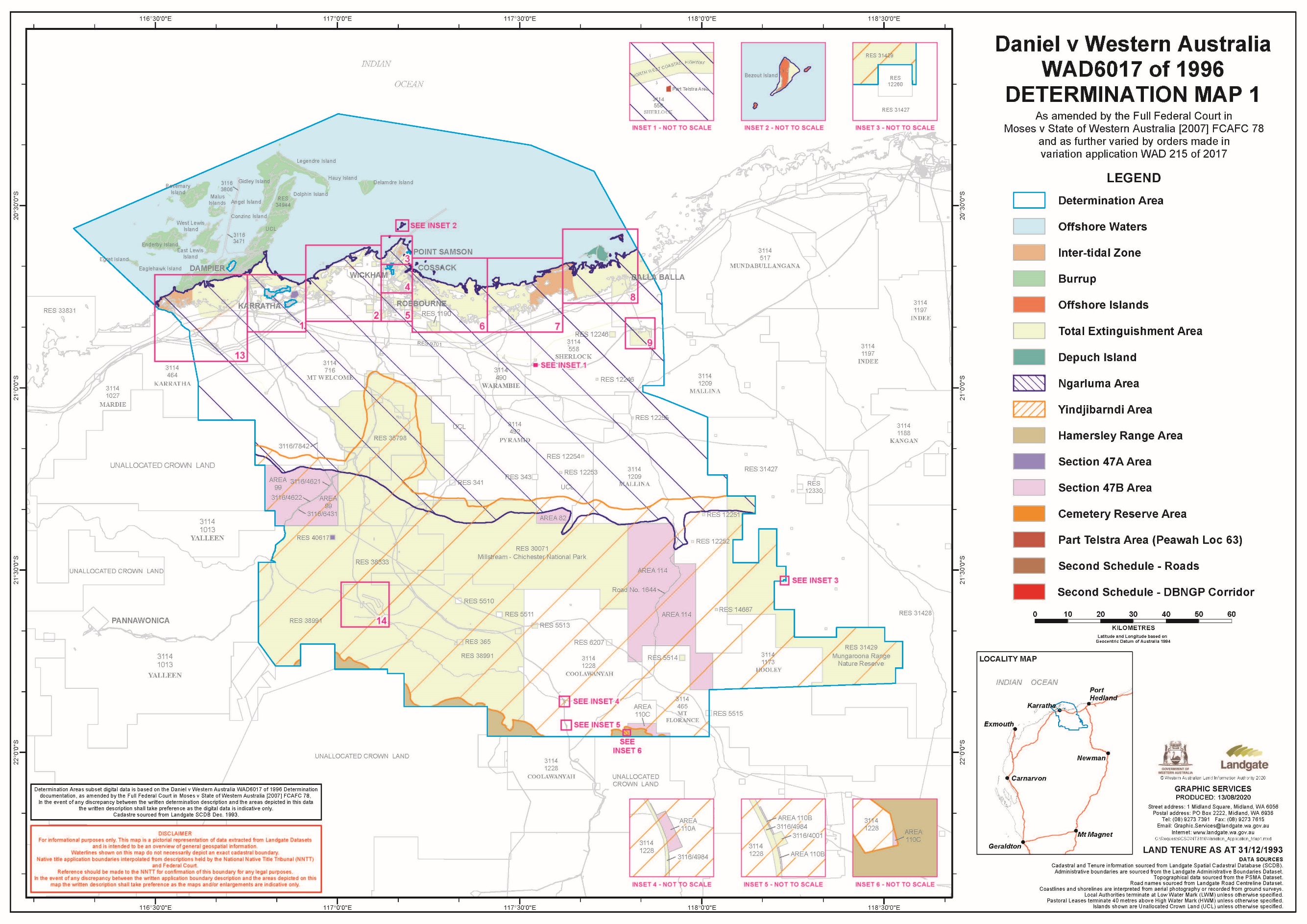
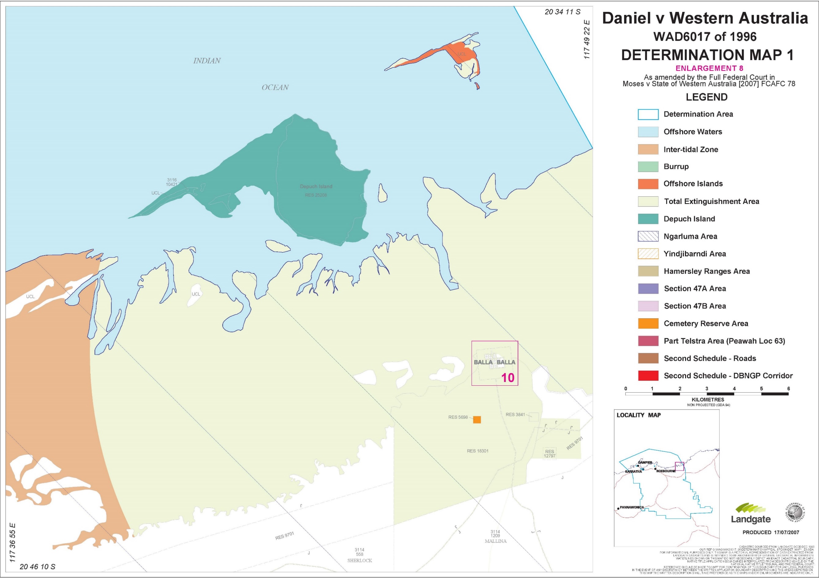
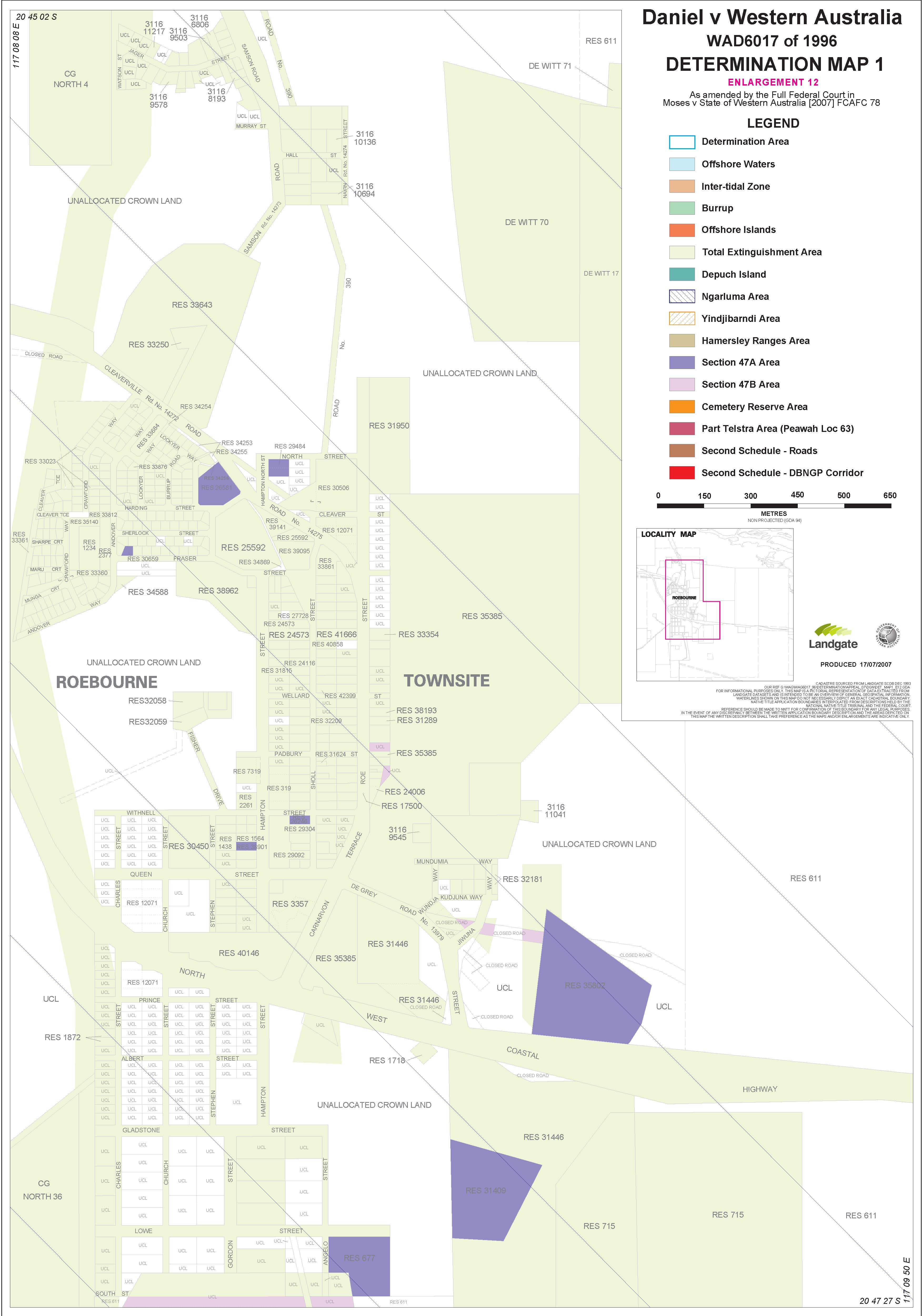
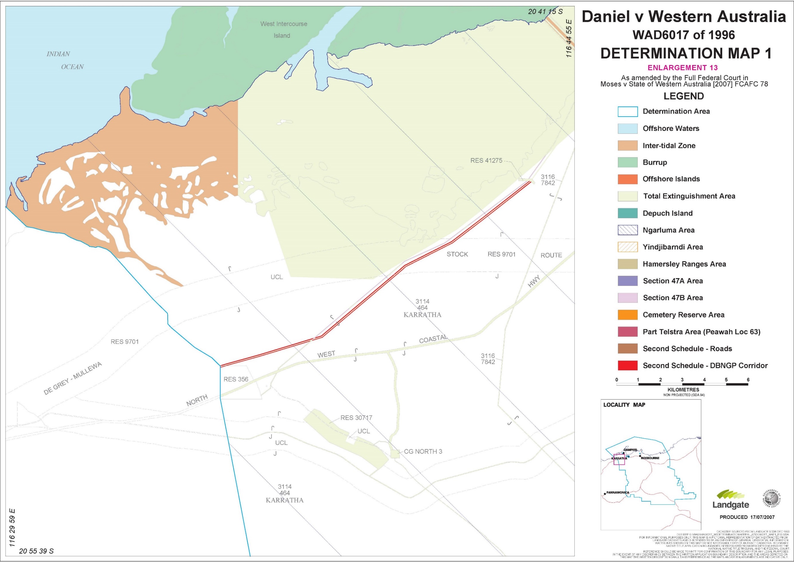
‘Burrup’ means the land and waters shaded in green on the maps marked ‘Map 1’ which are Attachment 2 to this First Schedule.
‘Cemetery Reserve Area’ means the land and waters the subject of reserves 5698, 30904 and 41146, as shaded in orange on the maps marked ‘Map 1’ which are Attachment 2 to this First Schedule.
‘Depuch Island’ means Depuch Island and Sandy Island, West Moore Island and East Moore Island landward of the low water mark, as shaded in dark green on the maps marked ‘Map 1’ which are Attachment 2 to this First Schedule.
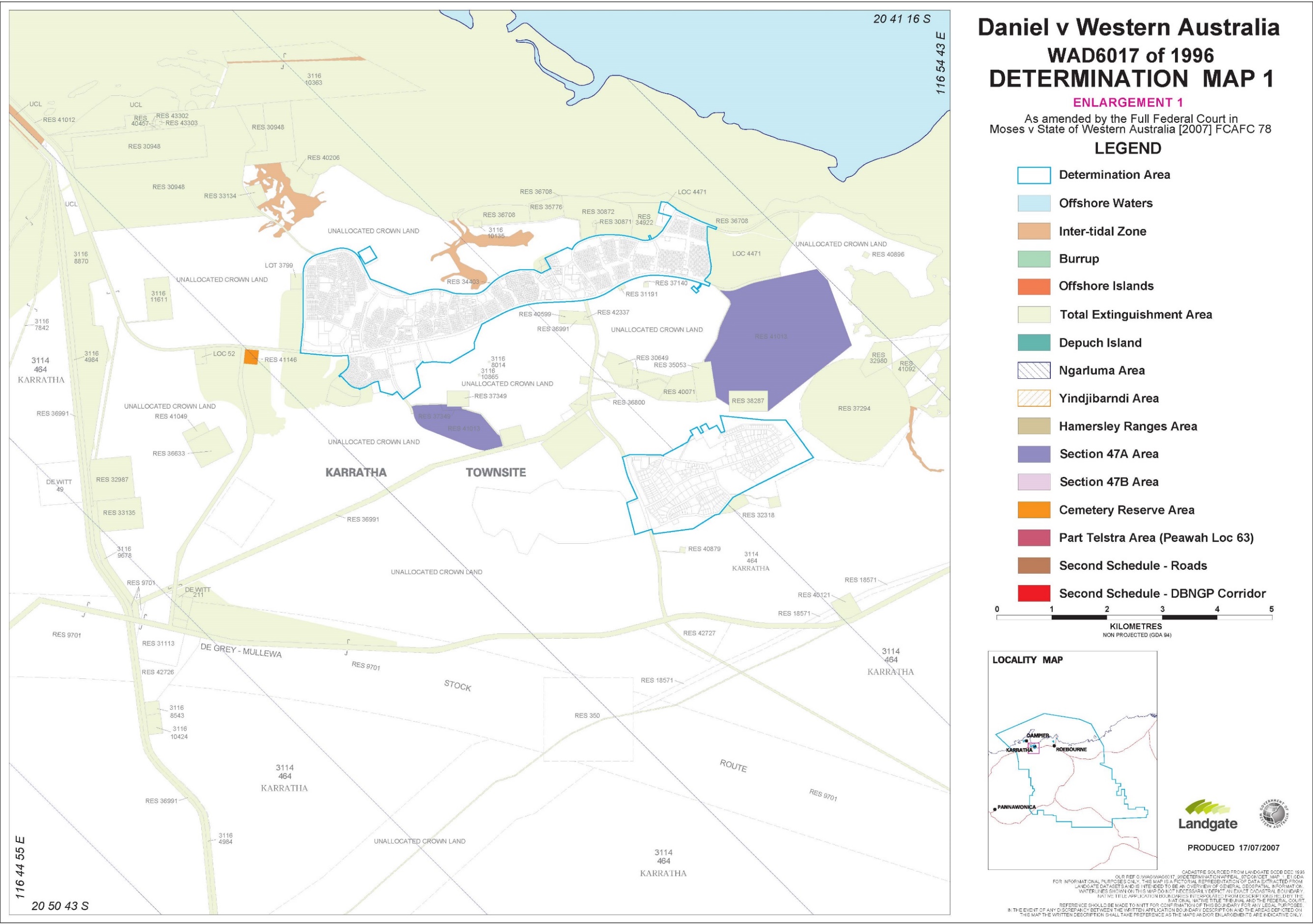
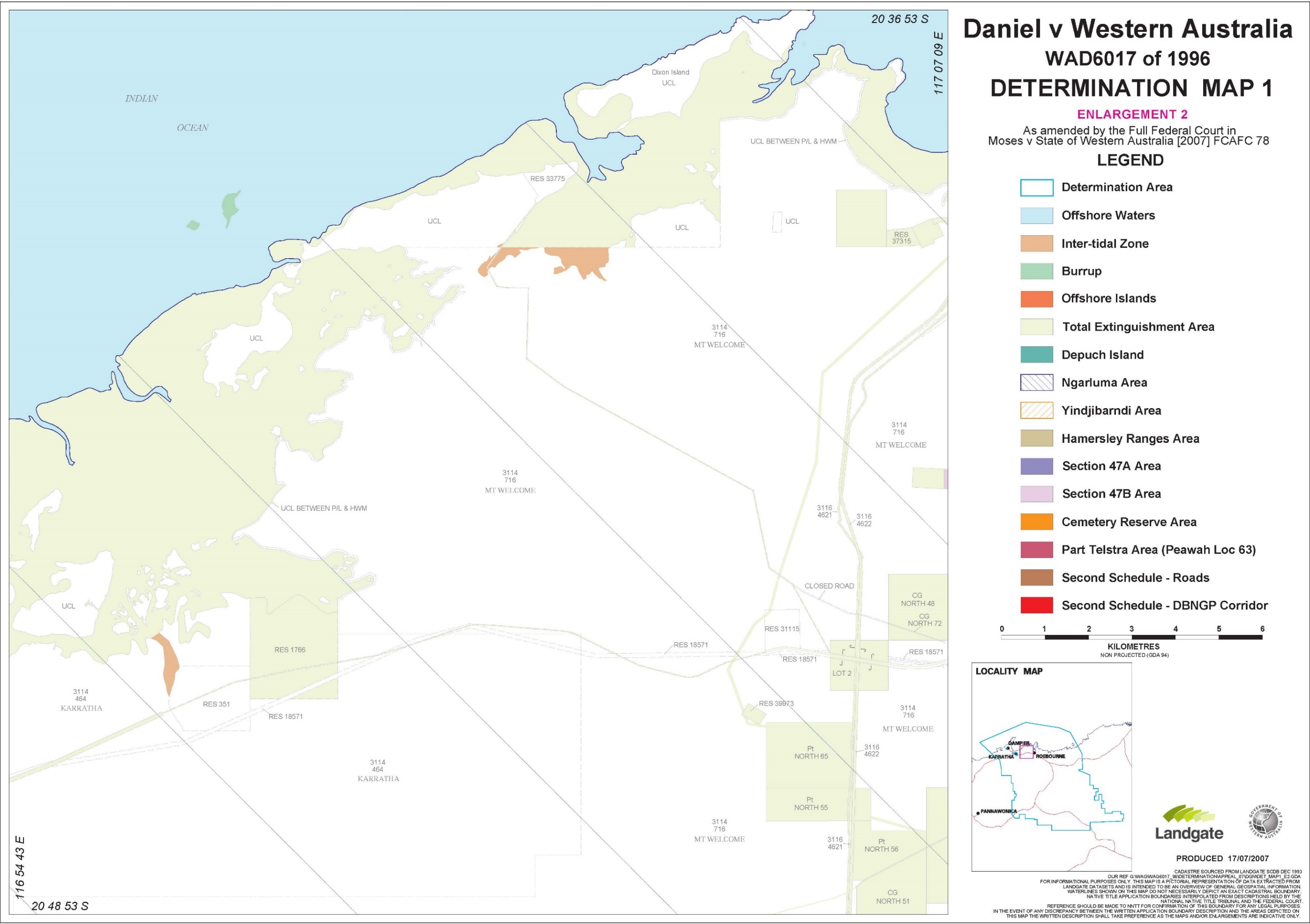
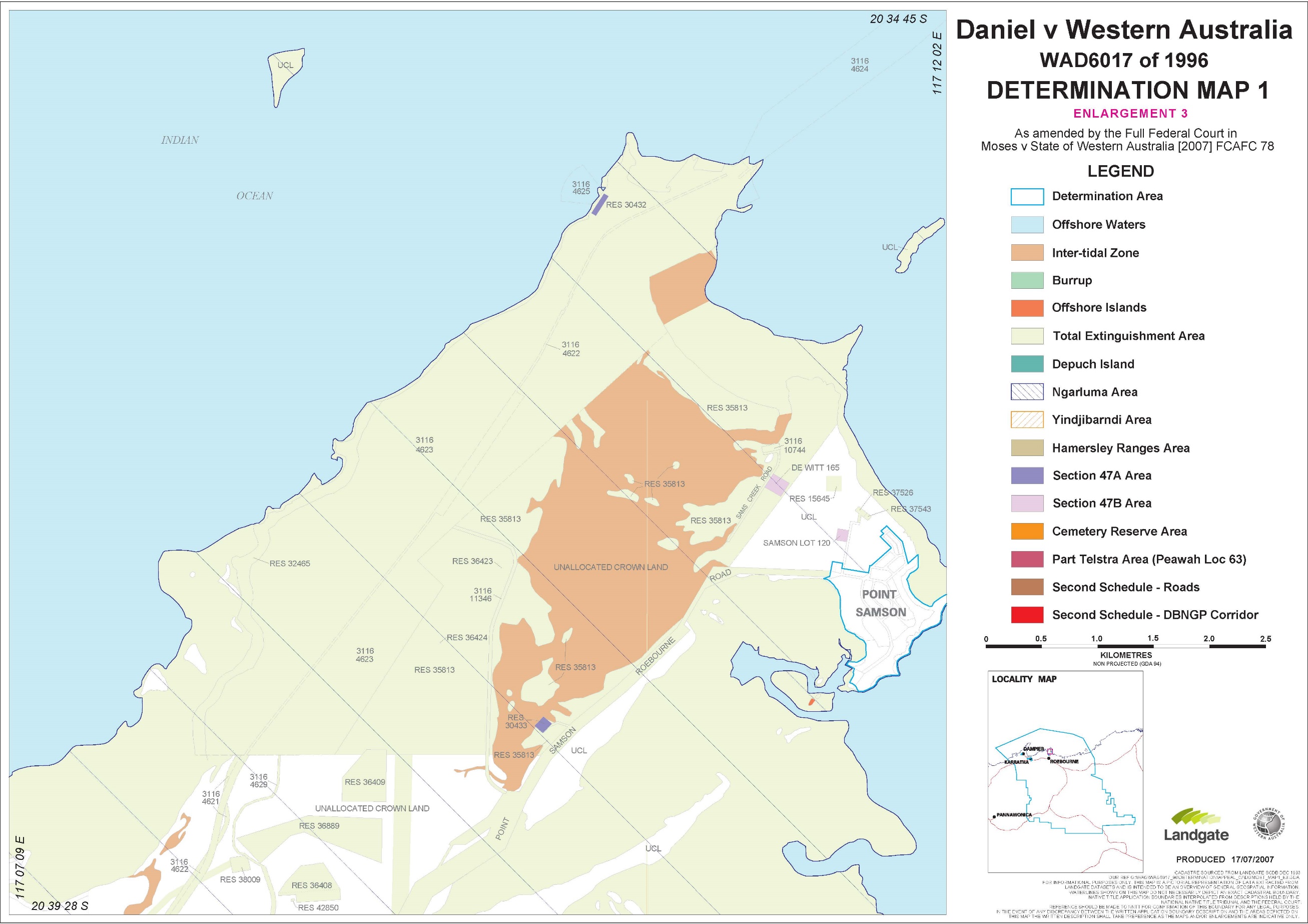
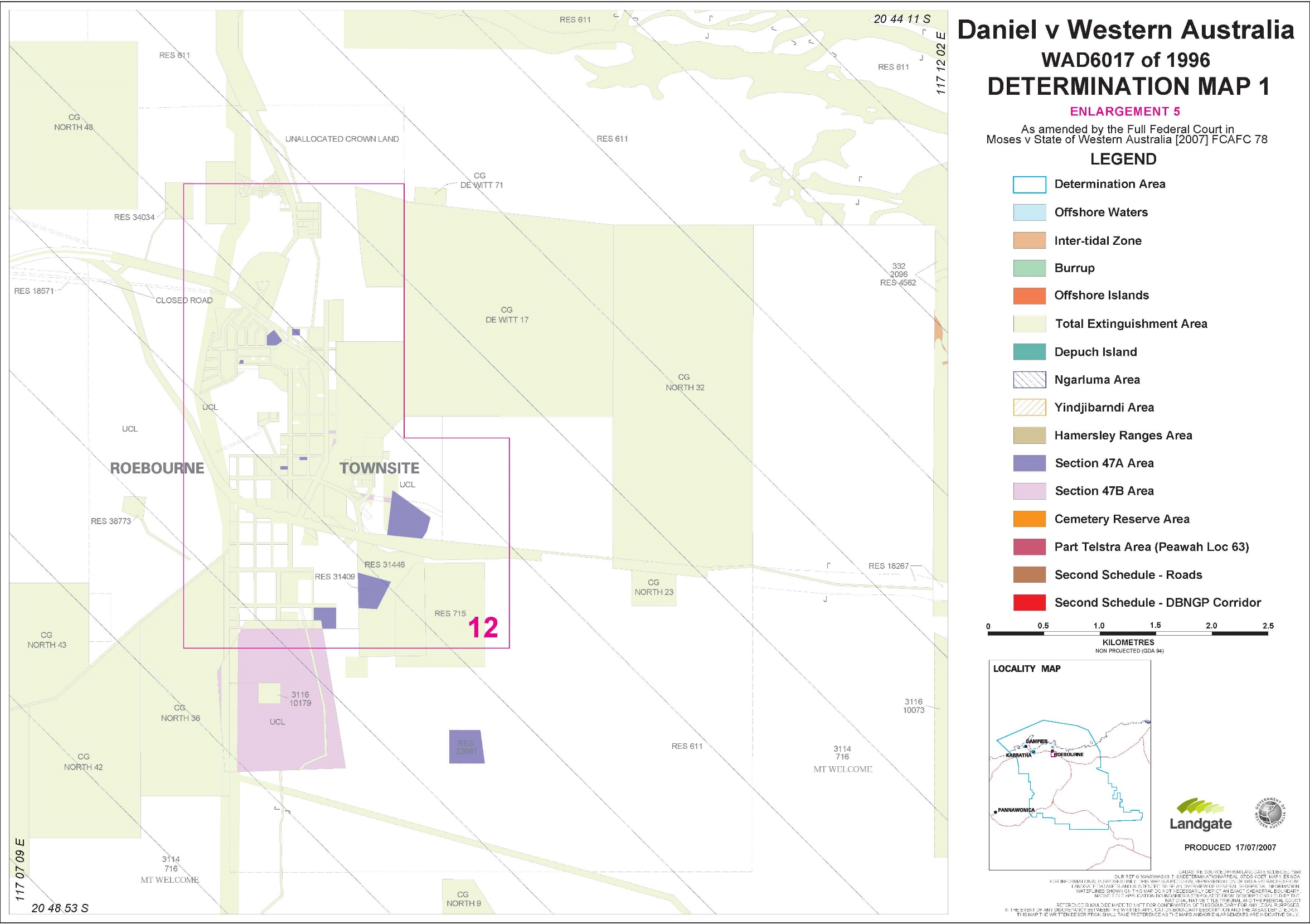
‘Determination Area’ means the land and waters described in Attachment 1 to this First Schedule, being the land and waters bordered in light blue on the maps marked ‘Map 1’ which are Attachment 2 to this First Schedule.
‘Hamersley Ranges Area’ means the land and waters shaded light brown on the maps marked ‘Map 1’ which are Attachment 2 to this First Schedule.
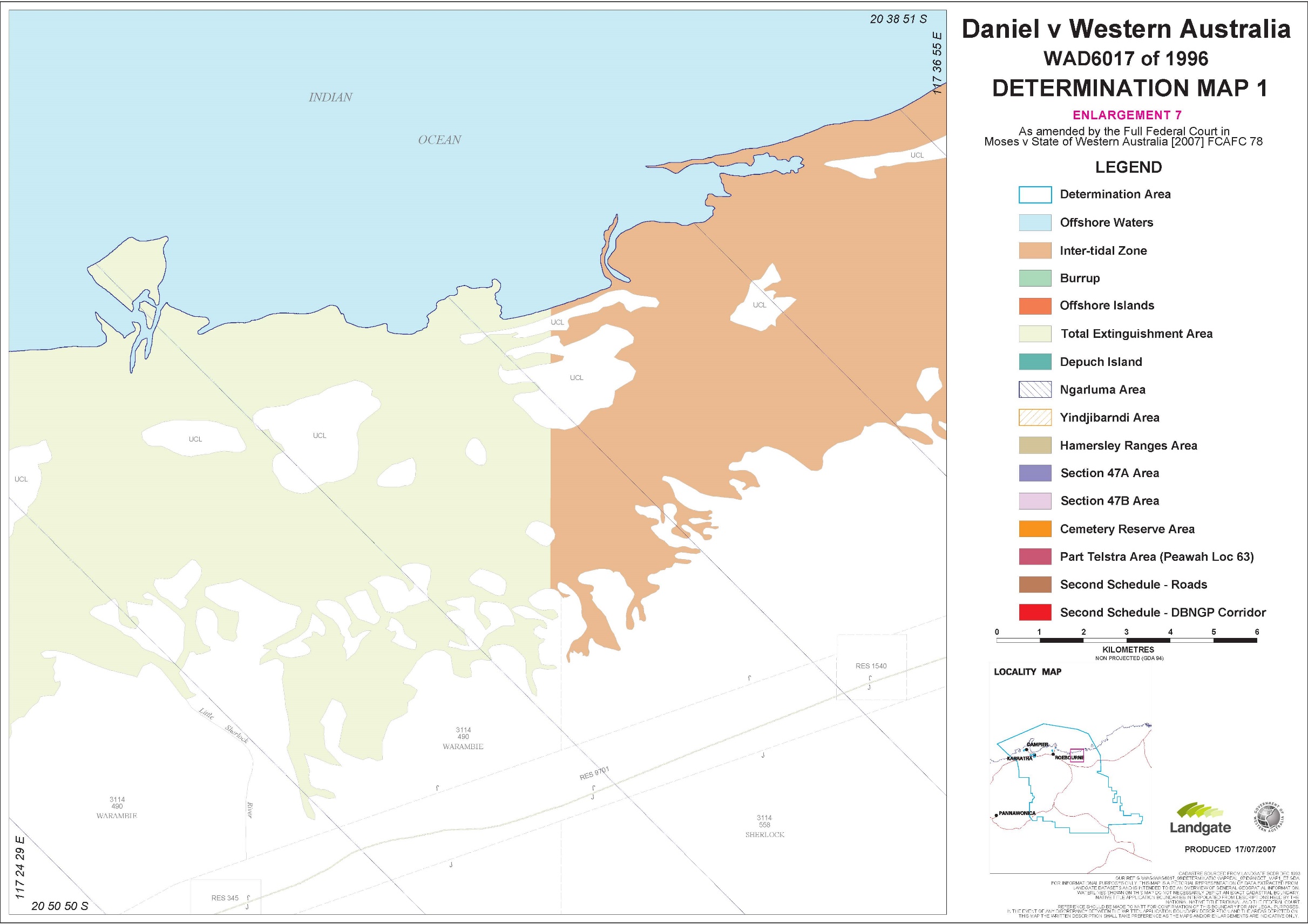
‘Inter-tidal Zone’ means that part of the Ngarluma Native Title Area which is between mean high water mark and mean low water mark, as shaded in orange on the maps marked ‘Map 1’ which are Attachment 2 to this First Schedule.
‘Ngarluma Area’ means the land and waters bordered and hatched in dark blue on the maps marked ‘Map 1’ which are Attachment 2 to this First Schedule.
‘Ngarluma Native Title Area’ means the Ngarluma Area but not including the Ngarluma Total Extinguishment Area.
‘Ngarluma Total Extinguishment Area’ means the land and waters the subject of the following interests:
(1) Certificates of Title
CT Number | Parcel Identification |
3/239 | Roebourne Town Lot 124 |
10/118 | Roebourne Town Lot 174 |
11/48 | Roebourne Town Lot 130 |
11/60 | Roebourne Town Lot 166 |
11/91 | Cossack Town Lot 164 |
14/174 | Roebourne Town Lot 150 |
15/341 | Roebourne Suburban Lot 3 |
15/345 | Cossack Town Lot 165 |
18/329 | North Location 39 |
18/330 | North Location 38 |
18/331 | North Location 37 |
20/36 | Roebourne Town Lot 271 |
21/329A | Cossack Lot 151 |
31/373 | Cossack Town Lot 170 |
33/39 | Cossack Town Lot 160 |
35/14 | Roebourne Town Lot 152 |
35/15 | Roebourne Town Lot 153 |
35/16 | Roebourne Town Lot 154 |
35/17 | Roebourne Town Lot 155 |
35/18 | Roebourne Town Lot 156 |
35/177 | Cossack Town Lot 135 |
35/178 | Cossack Town Lot 136 |
35/283 | Roebourne Town Lot 57 |
35/284 | Roebourne Town Lot 58 |
38/44A | North Location 6 |
39/380A | Roebourne Town Lot 190 |
79/189A | Roebourne Town Lots 144 and 145 |
124/188A | Roebourne Town Lot 114 |
186/197 | Roebourne Town Lots 380 and 381 |
136/2 | Roebourne Town Lots 174 and 175 |
156/22 | Cossack Town Lot 116 |
193/174 | Balla Balla Town Lot 45 |
221/143 | Lot 1 on Deposited Plan 528 |
228/9 | Roebourne Lot 385 |
265/56 | Cossack Town Lot 152 |
267/54 | Cossack Town Lot 424 |
319/143 | Roebourne Lot 115 |
354/50 | Cossack Town Lot 176 |
390/172A | Roebourne Lot 394 |
405/11A | Roebourne Lot 396 |
416/2 | Roebourne Suburban Lot 4 |
416/3 | Roebourne Suburban Lot 5 |
421/143 | Balla Balla Lot 73 |
424/127 | Balla Balla Lot 68 |
445/76 | Roebourne Town Lots 134, 135, 146 and 147 |
451/184A | Roebourne Town Lots 99, 100, 101, 102, 103, 106, 107 and 108 |
451/185A | North Location 4 |
451/186A | North Location 9 |
451/187A | North Location 54 |
451/190A | North Location 72 |
451/192A | North Location 23 |
451/193A | North Location 70 |
451/194A | North Location 26 |
456/131 | Roebourne Town Lot 1 |
464/35A | Portion Roebourne Town Lot 53 |
466/103A | Roebourne Town Lot 21 |
475/37A | Lot 1 on Diagram 41164 |
475/38A | Lot 2 on Diagram 41164 |
486/44A | Portion Roebourne Lots 49 and 50 |
481/143 | Cossack Town Lot 153 |
488/164 | North Location 34 |
506/197A | Lot 13 on Diagram 41455 |
508/149A | Roebourne Lot 438 |
508/165A | Roebourne Lot 436 |
523/114 | Cossack Town Lot 121 |
541/78A | Lot 2 on Plan 528 |
541/82A | Lot 4 on Plan 528 |
550/87 | Cossack Town Lot 145 |
570/65 | Roebourne Town Lots 266, 267, 268, 269, 270, 272, 273, 274, 275, 276, 278, 279, 280, 281, 282, 283, 284, 285, 286, 287, 288 and 289 |
583/51 | Roebourne Townsite 149 |
610/193A | Roebourne Lot 471 |
762/156 | Roebourne Town Lot 123 |
839/108 | De Witt Location 11 (but not insofar as it covers the Section 47B Area) |
1002/353 | Cossack Town Lot 125 |
1020/864 | Roebourne Town Lots 128, 145, 151, 265 and 271 |
1022/225 | De Witt Location 14 |
1024/426 | Part Lots 5 and 7 on Plan 528 |
1031/75 | North Location 71 |
1031/76 | Balla Balla Town Lots 43 and 44 |
1040/615 | Peawah Location 6 |
1046/512 | Roebourne Town Lot 27 |
1093/705 | Roebourne Suburban Lot 16 (but not insofar as it covers the Section 47A Area) |
1093/889 | De Witt Location 15, Roebourne Suburban Lot 9, North Location 36 (part) and Roebourne Suburban Lot 16 (part) (but not insofar as it covers the Section 47B Area) |
1107/653 | Roebourne Lots 162 and 163 |
1113/927 | Cossack Town Lot 124 |
1130/580 | Cossack Town Lot 141 |
1156/380 | North Location 3 |
1160/901 | Roebourne Lot 19 |
1188/398 | Roebourne Lot 105 |
1188/526 | Roebourne Lot 176 |
1188/965 | Roebourne Lot 169 |
1200/267 | Roebourne Lot 54 and Portion Roebourne Town Lot 53 |
1203/514 | Roebourne Lot 121 |
1203/515 | Roebourne Lot 28 |
1222/113 | Roebourne Part Lot 18, Lots 116, 117 |
1225/674 | Roebourne Town Lot 29 |
1238/195 | Roebourne Lot 119 |
1238/229 | Roebourne Lot 6 |
1238/230 | Roebourne Lot 10 |
1238/231 | Roebourne Lot 259 |
1238/595 | Roebourne Lot 127 |
1245/348 | De Witt Location 12 |
1247/338 | Roebourne Lot 188, 189 |
1249/383 | Lot 11 on Plan 528 |
1252/43 | Roebourne Lots 399, 400 |
1259/853 | Roebourne Lot 416 |
1266/926 | Balla Balla Lot 97 |
1316/148 | Roebourne Lots 428, 437, 439, 440, 441, 442, 443, 445 |
1316/347 | Roebourne Lot 196 |
1318/889 | Roebourne Lot 434 |
1320/11 | Roebourne Lot 59 |
1320/12 | Roebourne Lot 60 |
1320/17 | Roebourne Lot 146 |
1322/526 | Lot 1 on Diagram 42823 |
1322/0527 | Lot 2 on diagram 42823 |
1322/528 | Roebourne Lot 397 |
1323/681 | Roebourne Lot 111 |
1328/400 | Roebourne Lot 435 |
1329/912 | Roebourne Lot 421 |
1329/913 | Roebourne Lot 422 |
1335/179 | Portion Roebourne Lot 9 |
1336/708 | Roebourne Lot 428 |
1346/865 | Roebourne Lot 113 |
1348/518 | Roebourne Town Lot 167 |
1349/725 | Roebourne Lot 194 |
1349/726 | Roebourne Lot 195 |
1352/369 | Roebourne Lot 188 |
1363/796 | Cossack Town Lot 170 |
1363/797 | Balla Balla Town Lots 65, 66 & 67 |
1363/798 | Roebourne Town Lot 168 |
1364/592 | Roebourne Lot 415 |
1364/593 | Roebourne Lot 479 |
1364/594 | Roebourne Lot 484 |
1364/595 | Roebourne Lot 485 |
1364/596 | Roebourne Lot 508 |
1364/597 | Roebourne Lot 509 |
1364/598 | Roebourne Lot 515 |
1364/599 | Roebourne Lot 521 |
1364/600 | Roebourne Lot 527 |
1365/847 | North Location 42, 43, 51, 36 (part), 55 (part), 56 (part) & 65 (part) |
1368/185 | Roebourne Lot 492 |
1368/186 | Roebourne Lot 496 |
1368/187 | Roebourne Lot 499 |
1369/444 | Roebourne Lot 519 |
1369/461 | Roebourne Lot 522 |
1376/584 | Roebourne Lot 440 |
1376/585 | Roebourne Lot 441 |
1381/810 | De Witt Location 17 |
1381/811 | De Witt Location 70 & 71 |
1382/158 | Roebourne Lot 413 |
1382/159 | Roebourne Lot 401 |
1382/160 | Roebourne Lot 412 |
1382/161 | Roebourne Lot 408 |
1382/162 | Roebourne Lot 403 |
1384/491 | Karratha Lot 1143 |
1387/780 | Roebourne Lot 143 |
1387/781 | Roebourne Lot 482 |
1387/782 | Roebourne Lot 477 |
1387/783 | Roebourne Lot 483 |
1387/784 | Roebourne Lot 497 |
1387/785 | Roebourne Lot 498 |
1390/918 | Lot 3 on Plan 528 |
1390/952 | North Location 47 |
1390/953 | North Location 2 |
1391/354 | Roebourne Lot 474 |
1396/5 | Roebourne Lot 545 |
1397/994 | Lot 1 of North Location 67 |
1397/995 | North Location 67 |
1401/992 | De Witt Location 83 |
1405/827 | Roebourne Lot 443 |
1435/582 | North Location 16 |
1437/701 | Roebourne Town Lot 30 |
1442/176 | North Locations 10 & 11 |
1443/601 | Karratha Lot 1485 |
1445/635 | Roebourne Lot 534 |
1453/191 | Roebourne Lot 669 |
1453/192 | Roebourne Lot 667 |
1453/193 | Roebourne Lot 665 |
1453/194 | Roebourne Lot 661 |
1453/195 | Roebourne Lot 660 |
1453/196 | Roebourne Lot 658 |
1453/197 | Roebourne Lot 651 |
1453/198 | Roebourne Lot 645 |
1453/199 | Roebourne Lot 642 |
1453/200 | Roebourne Lot 640 |
1455/603 | Roebourne Lot 630 |
1455/604 | Roebourne Lot 629 |
1462/999 | North Location 32 |
1484/784 | Part of Lot 15 on Diagram 42138 |
1490/126 | Roebourne Lot 140, 141, 142 |
1500/542 | Roebourne Town Lot 14 |
1500/543 | Roebourne Town Lot 16 |
1517/780 | Lot 1 on Diagram 53119 |
1517/781 | Lot 2 on Diagram 53119 |
1518/440 | Roebourne Town Lot 31 |
1519/118 | Roebourne Lot 571 |
1519/119 | Roebourne Lot 574 |
1519/120 | Roebourne Lot 575 |
1519/121 | Roebourne Lot 576 |
1519/122 | Roebourne Lot 577 |
1519/123 | Roebourne Lot 578 |
1519/125 | Roebourne Lot 581 |
1519/126 | Roebourne Lot 582 |
1519/127 | Roebourne Lot 583 |
1519/128 | Roebourne Lot 584 |
1519/129 | Roebourne Lot 585 |
1519/130 | Roebourne Lot 586 |
1519/131 | Roebourne Lot 587 |
1519/132 | Roebourne Lot 588 |
1519/133 | Roebourne Lot 589 |
1519/134 | Roebourne Lot 590 |
1519/135 | Roebourne Lot 591 |
1519/136 | Roebourne Lot 592 |
1519/137 | Roebourne Lot 593 |
1519/138 | Roebourne Lot 594 |
1519/139 | Roebourne Lot 596 |
1519/140 | Roebourne Lot 597 |
1519/141 | Roebourne Lot 598 |
1519/142 | Roebourne Lot 599 |
1519/143 | Roebourne Lot 602 |
1519/144 | Roebourne Lot 603 |
1519/145 | Roebourne Lot 604 |
1519/146 | Roebourne Lot 605 |
1519/147 | Roebourne Lot 606 |
1519/148 | Roebourne Lot 607 |
1519/149 | Roebourne Lot 608 |
1519/150 | Roebourne Lot 609 |
1519/151 | Roebourne Lot 610 |
1519/152 | Roebourne Lot 612 |
1519/153 | Roebourne Lot 613 |
1519/154 | Roebourne Lot 614 |
1519/155 | Roebourne Lot 615 |
1519/156 | Roebourne Lot 616 |
1519/157 | Roebourne Lot 617 |
1519/158 | Roebourne Lot 618 |
1519/159 | Roebourne Lot 619 |
1519/160 | Roebourne Lot 621 |
1519/161 | Roebourne Lot 622 |
1519/162 | Roebourne Lot 623 |
1519/163 | Roebourne Lot 624 |
1519/164 | Roebourne Lot 625 |
1519/165 | Roebourne Lot 626 |
1519/166 | Roebourne Lot 627 |
1519/167 | Roebourne Lot 688 |
1519/168 | Roebourne Lot 570 |
1519/169 | Roebourne Lot 569 |
1519/994 | Cossack Lot 117 |
1523/780 | Roebourne Lot 649 |
1523/781 | Roebourne Lot 650 |
1525/178 | Roebourne Lot 407 |
1526/90 | Roebourne Lot 400 |
1526/946 | North Location 48 and portion North Location 64 |
1527/151 | Roebourne Lot 546 |
1531/382 | Roebourne Lot 489 |
1531/439 | Roebourne Lot 480 |
1532/262 | Roebourne Lot 33 |
1546/495 | Roebourne Town Lot 112 |
1550/99 | Roebourne Town Lot 23 |
1563/652 | Roebourne Lot 487 |
1564/269 | Roebourne Lot 644 |
1566/568 | Roebourne Lot 659 |
1566/569 | Roebourne Lot 704 |
1566/570 | Roebourne Lot 705 |
1567/519 | Karratha Lot 1996 |
1567/578 | Roebourne Lot 662 |
1581/605 | Roebourne Lot 409 |
1581/606 | Roebourne Lot 410 |
1581/607 | Roebourne Lot 411 |
1585/796 | Roebourne Lot 531 |
1590/377 | Roebourne Lot 631 |
1590/378 | Roebourne Lot 524 |
1590/379 | Roebourne Lot 420 |
1598/311 | Roebourne Lot 32 |
1598/312 | Roebourne Lot 34 |
1599/430 | Roebourne Lot 507 |
1602/758 | Roebourne Lot 494 |
1604/987 | Roebourne Lot 513 |
1608/922 | Roebourne Lot 643 |
1610/761 | Roebourne Town Lot 264 |
1613/0306 | Roebourne Lot 634 |
1617/564 | Roebourne Lot 635 |
1617/565 | Roebourne Lot 637 |
1619/336 | Roebourne Lot 517 |
1624/832 | Roebourne Lot 469 |
1624/833 | Roebourne Town Lot 193 |
1624/0834 | Roebourne Lot 552 |
1626/166 | Roebourne Lot 264 |
1628/574 | Roebourne Lot 512 |
1632/643 | Roebourne Lot 675 |
1634/0234 | Roebourne Lot 652 |
1634/0235 | Roebourne Lot 653 |
1642/0893 | Roebourne Lot 488 |
1644/525 | Roebourne Lot 126 |
1644/526 | Cossack Town Lot 167 |
1646/278 | Roebourne Lot 495 |
1654/988 | Roebourne Lot 525 |
1654/989 | Roebourne Lot 526 |
1659/66 | Roebourne Lot 429 |
1659/67 | Roebourne Lot 486 |
1659/68 | Roebourne Lot 490 |
1659/69 | Roebourne Lot 503 |
1659/71 | Roebourne Lot 514 |
1659/72 | Roebourne Lot 516 |
1659/73 | Roebourne Lot 523 |
1659/74 | Roebourne Lot 657 |
1659/75 | Roebourne Lot 668 |
1659/869 | Roebourne Suburban Lot 1 (Part Lot 12 on Plan 528) |
1667/5 | Roebourne Lot 417 |
1677/989 | Roebourne Lot 424 |
1683/785 | Cossack Town Lot 149 |
1683/787 | Cossack Town Lot 150 |
1685/729 | Roebourne Lot 423 |
1685/866 | Roebourne Lot 418 |
1687/59 | Roebourne Lot 520 |
1691/19 | Roebourne Lot 405 |
1692/99 | Roebourne Lot 454 |
1694/689 | Roebourne Lot 504 |
1694/857 | Lot 100 on Diagram 67860 |
1694/858 | Portion Roebourne Lot 448 |
1697/31 | Roebourne Lot 753 |
1705/771 | Roebourne Lot 424 |
1708/691 | Roebourne Lot 426 |
1713/478 | Roebourne Lot 459 |
1713/554 | Roebourne Lot 461 |
1714/861 | Roebourne Lot 666 |
1719/18 | Roebourne Lot 547 |
1722/82 | Roebourne Lot 427 |
1723/39 | Roebourne Lot 752 |
1724/734 | Roebourne Lot 432 |
1726/177 | Roebourne Lot 452 |
1728/883 | Roebourne Lot 431 |
1728/884 | Roebourne Lot 437 |
1738/703 | Roebourne Lot 110 |
1738/766 | Roebourne Lot 120 |
1740/598 | Roebourne Lot 656 |
1748/823 | Lot 1 on Diagram 70971 |
1751/134 | Roebourne Lot 447 |
1751/0412 | Roebourne Lot 512 |
1751/413 | Roebourne Lot 749 |
1753/164 | Roebourne Lot 151 |
1773/240 | Roebourne Lot 632 |
1773/241 | Roebourne Lot 636 |
1773/242 | Roebourne Lot 648 |
1773/243 | Roebourne Lot 663 |
1773/867 | Roebourne Lot 638 |
1778/353 | Lot 6 on Plan 528 |
1783/174 | Roebourne Lot 466 |
1785/795 | Lot 12 on Diagram 72573 |
1785/796 | Lot 11 on Diagram 72573 |
1789/434 | Lot 14 on Diagram 41455 |
1792/87 | Karratha Lot 4202 |
1792/687 | Lot 12 on Diagram 72573 |
1795/967 | Roebourne Lot 655 |
1800/365 | Roebourne Lot 501 |
1802/855 | Roebourne Lot 548 |
1810/175 | Roebourne Lot 755 |
1812/355 | Roebourne Lot 564 |
1814/928 | Roebourne Lot 475 |
1817/551 | Roebourne Lot 558 |
1821/191 | Roebourne Lot 419 |
1827/408 | Roebourne Lot 147 |
1827/409 | Roebourne Lot 148 |
1837/802 | Roebourne Lot 529 |
1838/757 | Roebourne Lot 530 |
1845/991 | Roebourne Lot 491 |
1845/992 | Roebourne Lot 481 |
1849/424 | Roebourne Lot 476 |
1857/926 | Roebourne Lot 701 |
1861/571 | Lot 1 on Diagram 41696 |
1861/572 | Lot 2 on Diagram 41696 |
1861/573 | Lot 3 on Diagram 41696 |
1866/336 | Roebourne Lot 478 |
1872/17 | Lot 100 on Diagram 77649 |
1881/279 | Lot 710 on Diagram 78197 |
1881/325 | Roebourne Lot 518 |
1892/697 | Lot 1 on Diagram 78763 |
1903/131 | Roebourne Lot 533 |
1940/136 | Roebourne Lot 464 |
1940/559 | Roebourne Lot 664 |
1946/77 | Lot 1 on Diagram 80812 |
1948/185 | Lot 17 on Diagram 52876 |
1958/220 | Roebourne Town Lot 25 |
1972/692 | Peawah Location 58 |
1977/98 | De Witt Location 153 |
1986/554 | Roebourne Lot 414 |
1991/48 | Karratha Lot 1090 |
1991/423 | Roebourne Lot 537 |
1994/185 | Roebourne Lot 678 |
2009/631 | Roebourne Town Lot 49 |
2023/664 | Roebourne Lot 563 |
2032/535 | Karratha Lot 2637 |
2052/356 | Lot 10 on Diagram 89258 |
2073/140 | Roebourne Lot 460 |
2073/141 | Roebourne Lot 540 |
2081/501 | Roebourne Lot 511 |
2084/921 | Roebourne Lot 500 |
0029/1996 CL |
(2) Town Enrolments:
ET Number | Parcel Identification |
2351 | Roebourne Town Lot 26 |
2354 | Roebourne Town Lot 40 |
2356 | Roebourne Town Lot 39 |
2359 | Roebourne Town Lots 23 and 24 |
2360 | Roebourne Lots 2, 3 |
2366 | Roebourne Lot 5 |
2368 | Roebourne Town Lot 41 |
2500 | Roebourne Suburban Lot 1 |
2919 | Roebourne Suburban Lot 123 |
3047 | Roebourne Suburban Lot 122 |
3087 | Cossack Town Lot 129 |
3088 | Roebourne Town Lot 22 |
3092 | Cossack Town Lot 121 |
4125 | Roebourne Lot 4 |
4386 | Cossack Town Lot 142 |
4387 | Cossack Town Lot 143 |
4388 | Cossack Town Lot 144 |
4466 | Roebourne Town Lot 20 |
4470 | Roebourne Town Lot 47 |
4495 | Roebourne Town Lot 38 |
(3) Town Grants:
GT Number | Parcel Identification |
2/481 | Cossack Town Lot 10 |
3/536 | Cossack Town Lot 110 |
3/629 | Cossack Town Lot 112 |
3/748 | Roebourne Town Lot 122 |
3/778 | Roebourne Town Lot 12 |
3/793 | Cossack Town Lot 154 |
4/980 | Roebourne Town Lot 48 |
4/1031 | Cossack Town Lot 139 |
4/1032 | Cossack Town Lot 140 |
5/1177 | Roebourne Town Lot 109 |
5/1310 | Roebourne Town Lot 55 |
5/1313 | Roebourne Town Lot 157 |
5/1314 | Roebourne Town Lot 158 |
5/1321 | Cossack Town Lot 174 (but not insofar as it covers the Section 47B Area) |
5/1322 | Cossack Town Lot 175 (but not insofar as it covers the Section 47B Area) |
5/1327 | Roebourne Town Lot 173 |
5/1403 | Cossack Town Lot 162 |
5/1407 | Roebourne Town Lot 104 |
6/257 | Roebourne Town Lot 208 |
6/258 | Roebourne Town Lot 177 (but not insofar as it covers the Section 47B Area) |
6/260 | Roebourne Town Lot 199 |
6/263 | Cossack Town Lot 163 |
6/291 | Roebourne Town Lot 164 |
6/292 | Roebourne Town Lot 165 |
6/357 | Roebourne Town Lot 178 (but not insofar as it covers the Section 47B Area) |
7/28 | Roebourne Town Lot 207 |
7/71 | Roebourne Suburban Lot 2 |
7/198 | Roebourne Town Lot 220 |
8/209 | Roebourne Suburban Lot 7 |
8/389 | Cossack Town Lot 166 |
8/395 | Roebourne Town Lot 180 |
8/447 | Roebourne Town Lot 179 |
8/450 | Roebourne Town Lot 183 |
8/458 | Roebourne Town Lot 181 |
8/459 | Roebourne Town Lot 182 |
8/449 | Roebourne Suburban Lot 15 |
8/478 | Cossack Town Lot 169 |
8/484 | Roebourne Town Lot 206 |
8/485 | Roebourne Town Lot 210 |
8/584 | Roebourne Suburban Lot 16 (but not insofar as it covers the Section 47A Area) |
8/588 | Roebourne Town Lot 56 |
8/635 | Cossack Town Lot 106 |
8/636 | Cossack Town Lot 107 |
8/639 | Cossack Town Lot 156 |
9/89 | Roebourne Town Lot 160 |
9/98 | Roebourne Town Lot 159 |
9/657 | Cossack Town Lot 206 |
10/434 | Roebourne Suburban Lot 9 |
15/111 | Roebourne Town Lot 382 |
(4) Country Grants:
GC Number | Parcel Identification |
2/394 | North Location 5 |
2/397 | North Location 7 |
5/77 | North Location 12 |
5/78 | North Location 13 |
7/7 | North Location 38 |
7/127 | North Location 49 |
7/128 | North Location 50 |
(5) Land Grant:
LG Number | Parcel Identification |
1/135 | Roebourne Town Lot 36 |
(6) Memorial of Conveyance:
Number | Parcel Identification |
19/270 | Part Lot 8 on Plan 528 |
(7) Special leases:
3116/00798 (but not insofar as it covers the Section 47B Area) | 3116/04629 | 3116/07616 | 3116/10363 |
3116/01173 | 3116/04659 | 3116/07842 | 3116/10364 |
3116/01310 | 3116/04826 | 3116/07936 | 3116/10424 |
3116/01815 | 3116/04837 | 3116/08193 | 3116/10640 |
3116/02482 | 3116/04866 | 3116/08252 | 3116/10702 |
3116/03211 | 3116/04873 | 3116/08303 | 3116/10707 |
3116/03354 | 3116/04878 | 3116/08543 | 3116/10865 |
3116/03469 | 3116/04896 | 3116/08861 | 3116/10889 |
3116/03470 (but not insofar as it covers the Section 47B Area) | 3116/04907 | 3116/08870 | 3116/11041 |
3116/03471 | 3116/04976 | 3116/09123 | 3116/11084 |
3116/03725 | 3116/04977 | 3116/09124 | 3116/11104 |
3116/03806 | 3116/04984 | 3116/09125 | 3116/11217 |
3116/03807 | 3116/05154 | 3116/09126 | 3116/11281 |
3116/04002 | 3116/05503 | 3116/09127 | 3116/11311 |
3116/04011 | 3116/05552 | 3116/09128 | 3116/11346 |
3116/04358 | 3116/05603 | 3116/09129 | 3116/11465 |
3116/05828 | 3116/09130 | 3116/11543 | |
3116/04384 | 3116/05947 | 3116/09131 | 3116/11567 |
3116/04538 | 3116/05969 | 3116/09132 | 3116/11580 |
3116/04596 | 3116/06037 | 3116/09133 | 3116/11588 |
3116/04597 | 3116/06221 | 3116/09435 | 3116/11611 |
3116/04598 | 3116/06282 | 3116/09503 | 3116/11623 |
3116/04599 | 3116/06499 | 3116/09578 | 3116/11668 |
3116/04600 | 3116/06691 | 3116/09678 | 3116/11671 |
3116/04621 | 3116/06702 | 3116/09914 | 3116/11780 |
3116/04622 | 3116/06806 | 3116/10115 | 3116/4892 |
3116/04623 | 3116/06829 | 3116/10135 | 3116/10694 |
3116/04624 | 3116/06940 | 3116/10136 | |
3116/04625 | 3116/06967 | 3116/10179 | |
3116/04628 | 3116/07615 | 3116/10252 |
(8) Other leases:
1444/152 | 332/1842 | 333a/2190 |
1508/152 | 332/1930 | Lease of Reserve 35798 |
1509/152 | 332/2096 | Lease of Reserve 39161 |
494/153 | 333/721 | I88601 |
519/153 | 333/722 | |
524/153 | 333/726 | |
525/153 | 333/734 |
(9) Roads:
Road ID | Road No | Road Name |
1 | 155 | |
2 | 156 | |
3 | 279 | |
4 | 371 | |
5 | 388 | North West Coastal Highway |
6 | 390 | Roebourne Wittenoom Road |
7 | 391 | |
8 | 392 | |
9 | 393 | |
10 | 407 | |
11 | 432 | North West Coastal Highway |
12 | 656 | |
13 | 657 | |
14 | 658 | |
15 | 1206 | |
16 | 1644 | |
18 | 7694 | |
19 | 7695 | |
20 | 7696 | |
21 | 14625 | |
22 | 14780 | |
25 | 15215 | |
26 | 15389 | |
27 | 16088 | |
28 | 18651 | |
29 | Road | |
30 | Sams Creek Road | |
31 | Point Samson Roebourne Road | |
32 | Point Samson Roebourne Road | |
33 | Point Samson Roebourne Road | |
34 | Point Samson Roebourne Road | |
35 | Road | |
36 | Point Samson Roebourne Road | |
37 | Point Samson Roebourne Road | |
39 | North West Coastal Highway | |
40 | 15863 | North West Coastal Highway |
41 | Croul Road | |
42 | Road | |
43 | 15863 | North West Coastal Highway |
44 | 432 | North West Coastal Highway |
45 | 15863 | North West Coastal Highway |
46 | Burrup Road | |
47 | 18785 | Mof Road |
48 | Burrup, Village and Bay Roads | |
49 | 18741 | Griffin Road |
50 | Hearson Cove and Burrup Roads | |
51 | Burrup Road | |
52 | 16312 | |
53 | Cinders Road | |
54 | Cinders Road | |
55 | 16211 | Cinders Road |
56 | 16211 | Cinders Road |
57 | 15444 | Dampier Road |
58 | 15444 | Dampier Road |
59 | 15444 | |
60 | 15444 | Dampier Road |
61 | Road | |
62 | 17821 | Madigan Road |
63 | Rosemary Road | |
64 | Gwen Road | |
65 | Karratha Road | |
66 | Corral Road | |
67 | Mystery Road | |
68 | Robins Road | |
69 | 18673 | Kennels Road |
70 | 388 | |
71 | Karratha Road | |
72 | 14530 | |
73 | 17922 | Madigan Road |
74 | Rankin Road | |
75 | Roads | |
76 | Roads | |
77 | Roads | |
78 | Roads | |
79 | Jager Street | |
80 | Jager Street, Samson Road and Murray Road | |
81 | 15861 | Watson Street |
82 | 14273 | Samson Road |
83 | 14274 | Nairn Street |
84 | 14272 | Cleaverville Road |
85 | 14275 | |
86 | Burrup Road and Lockyer Way | |
87 | Roads | |
88 | Cleaver Court | |
89 | Roads | |
90 | Roads | |
91 | Roads | |
92 | Roads | |
93 | 390 | Scholl Street |
94 | 390 | Scholl Street |
95 | 15597 | Fisher Drive |
96 | 13979 | De Grey Street |
97 | 13979 | De Grey Street |
98 | 15864 | Jiwuna Way |
99 | Jiwuna Way | |
100 | 15863 | North West Coastal Highway |
101 | Road | |
102 | 15863 | North West Coastal Highway |
103 | 15863 | North West Coastal Highway |
104 | 15863 | North West Coastal Highway |
105 | Roads | |
106 | 13959 | North West Coastal Highway |
Section of road 390 shown in Government Gazette 31 August 1893 page 869 | ||
3705 | Portion of Point Samson - Roebourne Road | |
Road on Deposited Plan 217003 | ||
Portion of Point Samson-Roebourne Road (shown on Deposited Plans 214781 and 214782) | ||
Hakea Place (shown on Deposited Plan 214782) | ||
Portion of Spinifex Road (shown on Deposited Plan 214782) as shown on Map 1 | ||
Tamarind Place (shown on Deposited Plan 214782) |
(10) Resumptions:
Parcel No (Whole or part of) | Parcel Type | Government Gazette Details (containing extent of resumption) |
3116/4629 | Special Lease | 21.02.1995 pp 576, 577 |
394/439 | Pastoral Lease | 09.08.1974 p 2966 |
3114/439 | Pastoral Lease | 09.08.1974 p 2966 |
3114/464 | Pastoral Lease | 18.05.1979 p 1329 |
3114/466 | Pastoral Lease | 09.08.1974 p 2966 |
3114/716 | Pastoral Lease | 18.05.1979 p 1329 |
28.01.1983 p 356 | ||
1240/869 | Freehold | 23.08.1985 p 3005 |
1240/868 | Freehold | 23.08.1985 p 3005 |
1240/867 | Freehold | 23.08.1985 p 3005 |
1067/369 | Freehold | 23.08.1985 p 3005 |
R 611 | Reserve | 21.02.1995 pp 576, 577 |
R 613 | Reserve | 21.02.1995 pp 576, 577 |
part R 9701 | Reserve | 18.05.1979 p 1330 |
R 30948 | Reserve | 28.10.1997 p 5977 |
part R 31113 | Reserve | 18.05.1979 p 1330 |
part R 31114 | Reserve | 18.05.1979 p 1330 |
R 41012 | Reserve | 28.10.1997 p 5977 |
Land marked off and more particularly described on Plan PWD WA 48208-1-3-4-5-6-7-8 | 18.05.1979 p 1329 | |
Karratha Lot 4631, Crown land volume 3113 folio 465 | Unallocated Crown land | Taking order dated 20.11.2001 |
Land shown on Deposited plans 194628 & 28085 | Unallocated Crown land | Taking order dated 05.01.04 |
(11) Vested reserves:
492 | 30717 | 33666 | 36424 | 37967 | 40877 |
715 | 30871 | 33812 | 36633 | 38009 | 40879 |
1186 | 30872 | 33861 | 36708 | 38193 | 40896 |
1564 | 30948 | 33864 | 36778 | 38287 | 41012 |
1721 | 31289 | 33945 | 36800 | 38387 | 41049 |
1724 | 31429 | 34034 | 36813 | 38616 | 41092 |
1729 | 31446 | 34129 | 36889 | 38773 | 41275 |
4562 | 31624 | 34254 | 36907 | 38962 | 41594 |
12346 | 31815 | 34403 | 36908 | 39095 | 41636 |
12464 | 31950 | 34588 | 36909 | 39140 | 41666 |
12654 | 31999 | 34631 | 36910 | 39141 | 41739 |
15645 | 32059 | 34687 | 36911 | 39161 | 41764 |
17500 | 32209 | 34922 | 36912 | 39202 | 42039 |
18301 | 32318 | 34944 | 36913 | 39775 | 42080 |
24006 | 32465 | 35053 | 36915 | 39776 | 42311 |
24116 | 32980 | 35140 | 36991 | 39777 | 42337 |
24573 | 32981 | 35385 | 37120 | 39778 | 42399 |
25208 | 32987 | 35452 | 37121 | 39973 | 42820 |
25981 (but not insofar as it covers the Section 47B Area) | 33023 | 35776 | 37140 | 40071 | 42850 |
27211 | 33134 | 35798 | 37294 | 40121 | 43195 |
28352 | 33135 | 35813 (but not insofar as it covers the Section 47B Area | 37314 | 40146 | 43302 |
29092 | 33250 | 35823 | 37315 | 40174 | 43303 |
29304 | 33354 | 35892 | 37349 | 40206 | 43734 |
30071 | 33360 | 36408 | 37526 | 40457 | 44103 |
30450 | 33361 | 36409 | 37669 | 40599 | 44292 |
30617 | 33577 | 36416 | 37835 | 40718 | 44452 |
30649 | 33643 | 36423 | 40858 |
(12) Part of vested reserves
21807 | Not insofar as it covers the same land as Reserve 35802 or insofar as it covers the Section 47B Area |
31768 | Not insofar as it covers the Section 47B Area |
(13) Reserves containing public works:
187 | 1732 | 12253 | 33876 | 37780 |
188 | 1766 | 12254 | 34034 | 38492 |
268 | 3357 | 12255 | 34255 | 40877 |
347 | 3619 | 17074 | 34403 | 41012 |
898 | 3841 | 18301 | 35053 | 44452 |
1190 | 3950 | 25592 | 35360 | 46193 |
1449 | 5908 | 30506 | 36633 | |
1468 | 5923 | 31191 | 36800 | |
1718 | 5933 | 31446 | 37120 | |
1722 | 7319 | 32058 | 37121 | |
1723 | 8532 | 32059 | 37349 | |
1725 | 9355 | 32181 | 37543 | |
1728 | 12246 | 33354 | 37680 |
(14) Easements containing public works:
Number | Vestee/Owner |
3134B/211 | State Energy Commission of WA |
3134B/327 | State Energy Commission of WA |
3134B/342 | State Energy Commission of WA |
3134B/350 | State Energy Commission of WA |
3134B/351 | State Energy Commission of WA |
3134B/353 | State Energy Commission of WA |
3134B/372 | State Energy Commission of WA |
3134B/373 | State Energy Commission of WA |
3134B/389 | State Energy Commission of WA |
3134B/39 | State Energy Commission of WA |
3134B/40 | State Energy Commission of WA |
3134B/41 | State Energy Commission of WA |
3134B/42 | State Energy Commission of WA |
3134B/43 | State Energy Commission of WA |
3134B/44 | State Energy Commission of WA |
3134B/45 | State Energy Commission of WA |
3134B/46 | State Energy Commission of WA |
3134B/47 | State Energy Commission of WA |
3134B/48 | State Energy Commission of WA |
3134B/55(1) | State Energy Commission of WA |
3134B/55(2) | State Energy Commission of WA |
3134B/56 | State Energy Commission of WA |
(15) Other public works:
Description | Area no. |
Harding Dam Supply Main (De Witt loc 187) | 554 |
Cape Lambert Supply Main extension (including Wickham, Cape Lambert, Roebourne and Point Samson tanks) | 130, 308 and land described in Government Gazette 9 August 1974 page 2966 |
Cossack Radio Transmitter and the land on which it is constructed within the meaning of section 251D of the Native Title Act 1993 (Cth), being a square area of no greater than 100m2 (10m x 10m) within Roebourne Suburban Lot 127 | Part of 533 |
(16) Mining tenements:
Tenement No. |
BA 47/035 |
BA 47/093 |
BA 47/101 |
RA 47/102 |
TL 11 |
ML 253SA |
(17) Port areas:
Dampier Port Area |
Port Walcott Port Area |
Balla Balla Port Area |
Point Samson Boat Harbour |
(18) Legislation:
Area extinguished | |
Cossack-Roebourne Tramway Act 1886 | All of Area no.568 |
(19) Seabed lease:
Seabed Lease (Product Loading Jetty) to Woodside Joint Venturers |
‘Offshore Islands’ means the land landward of the mean low water mark of islands in the Offshore Waters, excluding the Burrup and Depuch Island and the Ngarluma Total Extinguishment Area, as shaded in red on the maps marked ‘Map 1’ which are Attachment 2 to this First Schedule.
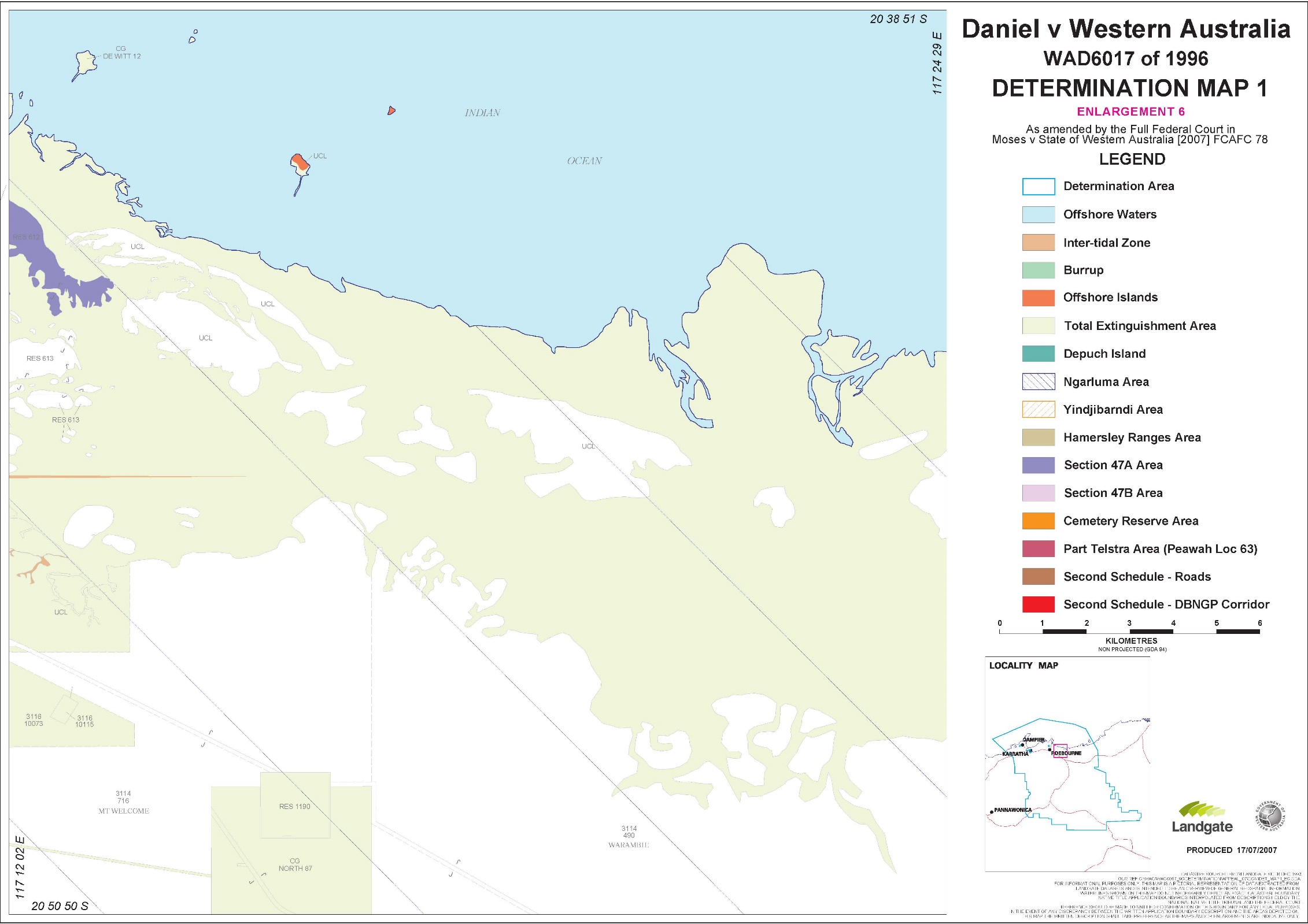
‘Offshore Waters’ means the waters within the Determination Area seaward of the mean low water mark of the coastline, as shaded in light blue on the maps marked ‘Map 1’ which are Attachment 2 to this First Schedule.
‘Subterranean Waters’ means waters which are for the time being contained in aquifers underneath the natural surface of the Determination Area; but does not include such waters to the extent they have percolated to the natural surface of the Determination Area.
‘Telstra Area’ means the land comprising Telstra Corporation Limited's:
(1) customer terminal sites; and
(2) Mount Fraser Optical Fibre Regenerator site, being Peawah Location 63, as shown on the maps marked ‘Map 1’ which are Attachment 2 to this First Schedule.
‘Telstra Cable Routes’ means the land and waters through which Telstra Corporation Limited's underground cabling is installed.
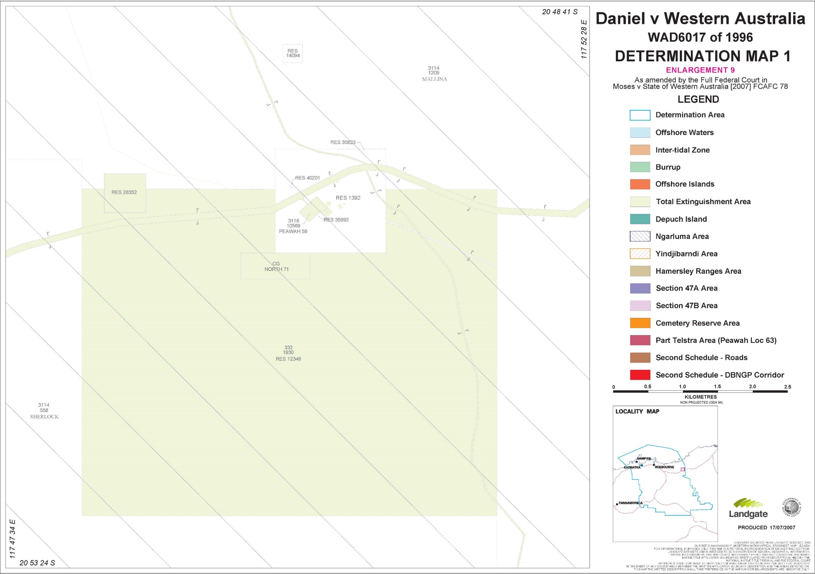
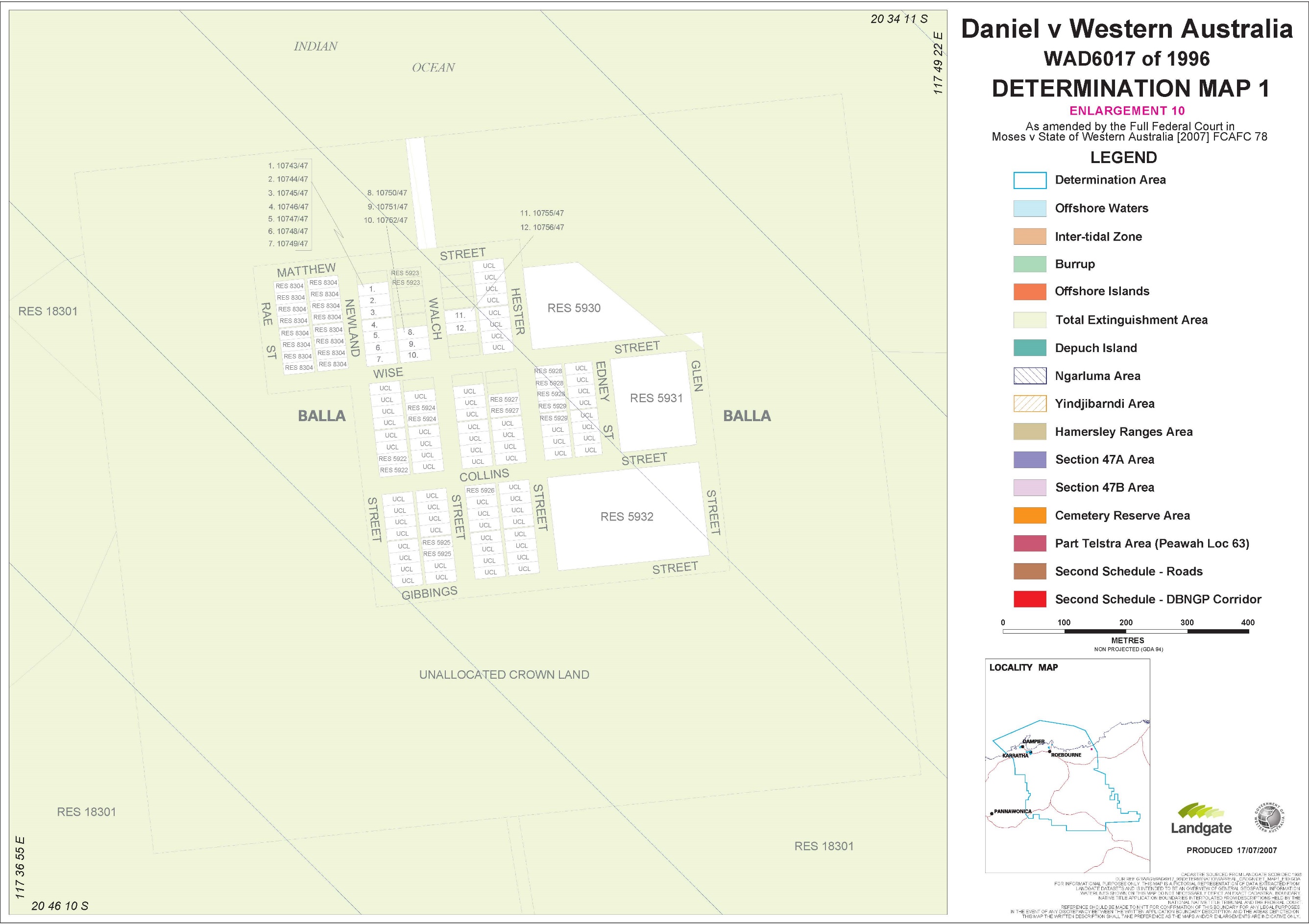
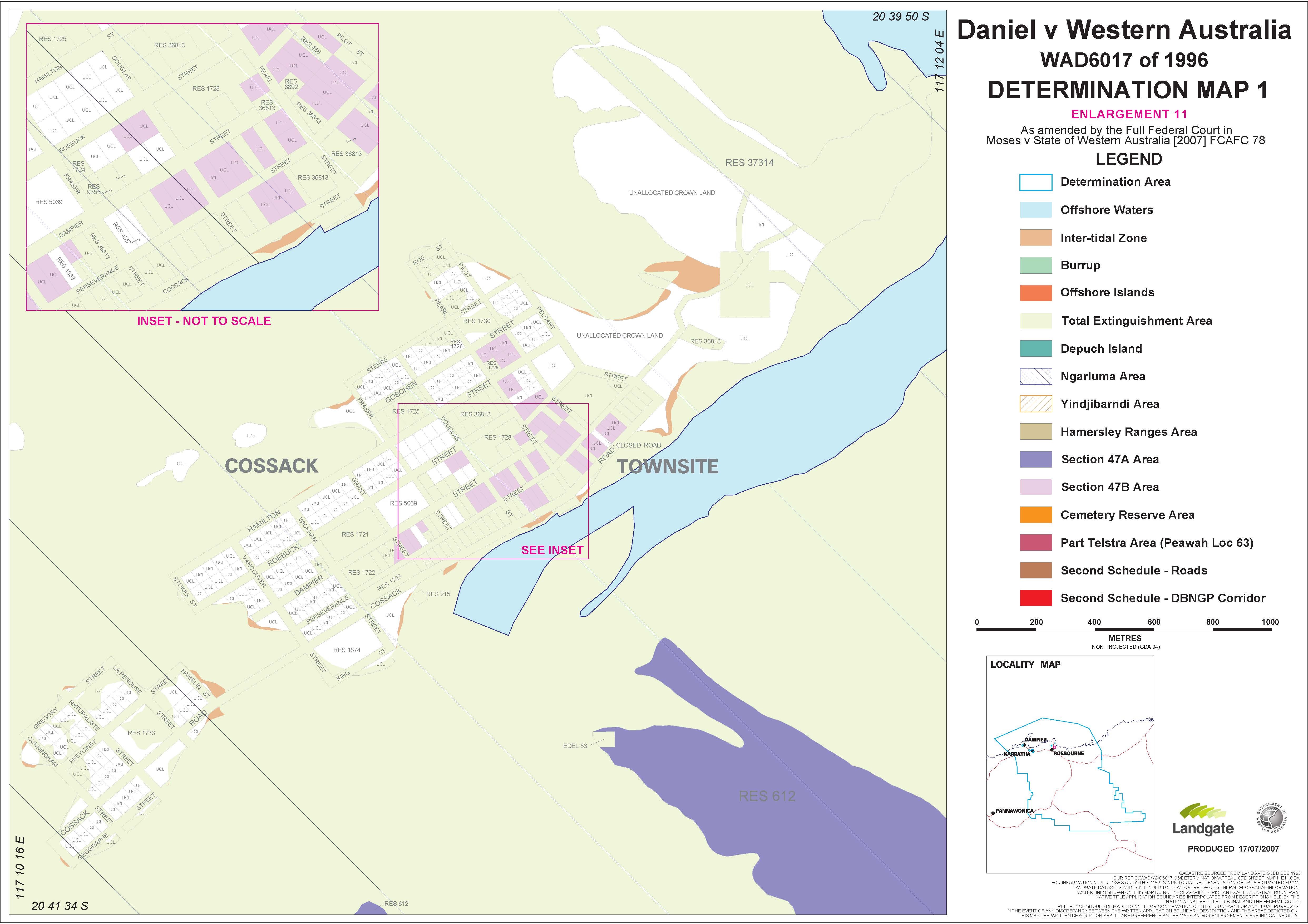
‘Total Extinguishment Area’ means the Ngarluma Total Extinguishment Area and the Yindjibarndi Total Extinguishment Area, as shaded in olive on the maps marked ‘Map 1’ which are Attachment 2 to this First Schedule. In the event of an inconsistency between the written description of the Ngarluma Total Extinguishment Area or the Yindjibarndi Total Extinguishment Area and the Total Extinguishment Area as depicted on the Maps in Attachment 2, the written description prevails.
‘Yindjibarndi Area’ means the land and waters bordered and hatched in orange on the maps marked ‘Map 1’ which are Attachment 2 to this First Schedule.
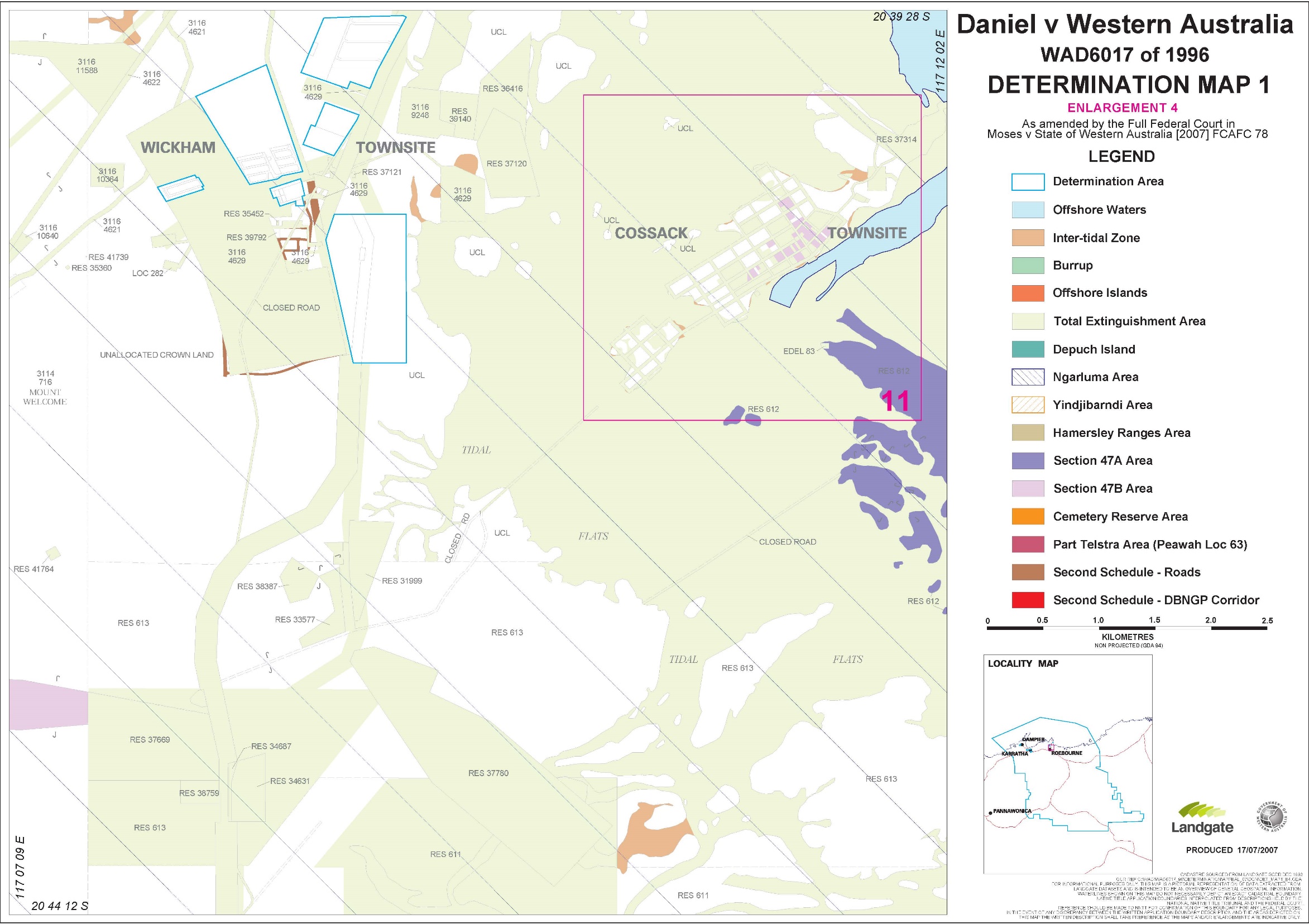
‘Yindjibarndi Exclusive Possession Area’ means the following land and waters:
Area | Location / Tenure No. | But not including the following areas: |
85 | Reserve 40617 | |
82 | West of Mallina | Not part which falls within the Ngarluma Area |
99 | South of Mt Welcome | Not part which falls within the Ngarluma Area |
110A | Coolawanyah | |
110B | Coolawanyah | |
110C | South of Coolawanyah | Not part which falls within the Hamersley Ranges Area |
114 | East of Res 30071 | Not part which falls within the Ngarluma Area |
‘Yindjibarndi Native Title Area’ means the Yindjibarndi Area but not including the Yindjibarndi Total Extinguishment Area.
‘Yindjibarndi Total Extinguishment Area’ means the land and waters the subject of the following interests:
(1) Certificates of Title
CT Number | Parcel Identification |
582/121 | North Location 18 |
1193/65 | North Location 15 |
(2) Country Grants:
GC Number | Parcel Identification |
2/720 | North Location 8 |
9/209 | North Location 24 |
(3) Special leases:
3116/04001 | 3116/04621 | 3116/06431 | 3116/08475 |
3116/04002 | 3116/04622 | 3116/07842 | 3116/08476 |
3116/04011 | 3116/04892 | 3116/08474 | 3116/4984 |
(4) Other leases:
Lease of Reserve 35798 |
(5) Roads:
Road ID | Road No | Road Name |
1 | 155 | |
6 | 390 | Roebourne Wittenoom Road |
16 | 1644 | |
17 | 1645 | |
23 | 14832 | |
24 | 14833 |
(6) Resumptions:
Parcel No. (Whole or part of) | Parcel Type | Government Gazette Details (containing extent of resumption) |
394/475 | Pastoral Lease | 21.09.1973 p 3534 |
394/978 | Pastoral Lease | 15.06.1973 p 2274 |
21.09.1973 p 3534 | ||
394/1468 | Pastoral Lease | 15.06.1973 p 2274 |
3114/788 | Pastoral Lease | 12.03.1982 p 823 (but not including the area of Reserve 41013) |
North Location 8 | Freehold | 12.03.1982 p 823 |
(7) Vested reserves:
382 | 14687 | 31429 | 38333 | 40091 |
1780 | 24392 | 35798 | 38790 | 40743 |
3305 | 30071 | 36991 | 38991 |
(8) Reserves containing public works:
365 | 5514 | 12252 | 38492 |
3305 | 12251 |
(9) Other public works:
Description | Area no. |
Asburton location 55 | 72 |
Ashburton location 58 | 95 |
Ashburton location 59 | 94 |
De witt location 93 | 90 |
De witt location 182 | 181 |
North location 18 | 100 |
FIRST SCHEDULE – ATTACHMENT 1
EXTERNAL BOUNDARY DESCRIPTION
DETERMINATION AREA
All those lands and waters commencing at a point in the Indian Ocean at Latitude 20.563408 South and Longitude 116.275471 East and extending northeasterly and generally southeasterly passing through the following co-ordinate positions:
Latitude (South) | Longitude (East) |
20.248663 | 117.001327 |
20.334568 | 117.530137 |
20.405810 | 117.703908 |
20.683758 | 117.858200 |
20.697005 | 117.865980 |
20.697002 | 117.865984 |
20.740812 | 117.889433 |
Thence southerly to the easternmost northeastern corner of Pastoral Lease 3114/558 (Sherlock Station); Thence southerly, westerly and again southerly along boundaries of that pastoral lease to a southeastern corner; Thence southeasterly to Latitude 21.025485 South, Longitude 117.880424 East; Thence southeasterly to Latitude 21.029842 South, Longitude 117.892260 East; Thence southeasterly to the westernmost northwestern corner of Reserve 31427; Thence southerly, easterly and again southerly along boundaries of that reserve to the northern boundary of Reserve 31429 (Mungaroona Range Nature Reserve); Thence easterly and generally southeasterly along boundaries of that reserve to a eastern corner at Latitude 21.809846 South; Thence westerly to Latitude 21.813716 South, Longitude 118.422139 East; Thence westerly to Latitude 21.817967 South, Longitude 118.301556 East; Thence westerly to a western corner of Pastoral Lease 3114/1173 (Hooley Station) at Latitude 21.827702 South; Thence westerly and southerly along boundaries of that pastoral lease to a northern boundary of Reserve 5515; Thence southerly to the intersection of the southern boundary of Reserve 5515 with a western boundary of Pastoral Lease 3114/1173 (Hooley Station); Thence southerly along that western boundary to a western corner of that pastoral lease and onwards to Latitude 21.955976 South, Longitude 118.020315 East; Thence westerly to a southeastern corner of Pastoral Lease 3114/1228 (Coolawanyah Station); Thence westerly along a southern boundary of that pastoral lease to a southeastern corner; Thence westerly to Latitude 21.955893 South, Longitude 117.494065 East; Thence westerly to Latitude 21.955894 South, Longitude 117.411064 East; Thence north to a eastern corner of Unallocated Crown; Thence northerly along a eastern boundary of that unallocated crown land to a southern boundary of Reserve 38991; Thence northerly and generally westerly along boundaries of that reserve to a northeastern boundary of Ashburton Location 148 (Reserve 38991); Thence northwesterly along that boundary to a eastern corner of Pastoral Lease 3114/1013 (Yalleen Station); Thence northerly, easterly and generally northwesterly along boundaries of that pastoral lease to Longitude 116.819303 East; Thence westerly to a western boundary of Special Lease 3116/4622 at Latitude 21.474046 South; Thence generally northerly along western boundaries of that special lease to a northern boundary of Reserve 38991; Thence westerly along that boundary of that reserve to a eastern boundary of Pastoral Lease 3114/1013 (Yalleen Station); Thence northerly and westerly along boundaries of that pastoral lease to Longitude 116.800532 East; Thence northerly to a southern boundary of Pastoral Lease 3114/716 (Mt Welcome Station) at Longitude 116.800535 East; Thence westerly, northerly, again westerly and again northerly along boundaries of that pastoral lease to its westernmost northwestern corner; Thence northerly to the southwestern corner of the southern severance of Reserve 356; Thence northerly along the western boundary of that severance to its northwestern corner; Thence northerly to and northerly along the western boundary of the northern severance of Reserve 356 to Latitude 20.844722 South; Thence northwesterly to Latitude 20.841057 South, Longitude 116.589897 East; Thence northwesterly to Latitude 20.836480 South, Longitude 116.582319 East; Thence northwesterly to a eastern corner of Reserve 9701 at Longitude 116.572288 East; Thence generally northwesterly along northeastern boundaries of that reserve to a northern corner; Thence northwesterly to the High Water Mark of the Indian Ocean at Longitude 116.546795 East; Thence generally northwesterly along that high water mark to Longitude 116.510163 East; Thence northwesterly to Latitude 20.783849 South, Longitude 116.508825 East; Thence northwesterly back to the commencement point.
EXCLUSIONS
Dampier
All those lands and waters commencing at the intersection of the High Water Mark with the northern boundary of Special Lease 3116/3907 and extending southeasterly, generally southerly, southwesterly and generally northwesterly along boundaries of that special lease to the High Water Mark; Thence generally northeasterly along that high water mark back to the commencement point.
Karratha
All those lands and waters commencing at the intersection of a western boundary of Reserve 34922 with a northern side of Searipple Road and extending generally easterly along northern sides of that road to a western boundary of Reserve 44015; Thence northwesterly, northeasterly and southeasterly along boundaries of that reserve to a northern side of Searipple Road; Thence generally northeasterly along sides of that road to a southern boundary of Karratha Lot 1481 as shown on Department of Land Information Deposited Plan 182315; Thence westerly, northerly, easterly, southeasterly and southerly along boundaries of that lot to a northern boundary of Mystery Road; Thence generally southeasterly along sides of that road to Longitude 116.871324 East; Thence southerly to a southern side of Mystery Road at Longitude 116.871197; Thence northwesterly along sides of that road to a eastern side of Maitland Road; Thence southwesterly and generally southerly along eastern sides of that road to a northern side of Millstream Road; Thence southeasterly, southerly and northwesterly along sides of that road to a eastern boundary of Reserve 32197; Thence generally southwesterly, southeasterly, southwesterly, northwesterly, northeasterly, again southeasterly and generally northeasterly along boundaries of that reserve to a southern side of Millstream Road; Thence generally westerly and generally southwesterly along southern sides of that road and southern sides of Dampier Road to a eastern boundary of Reserve 34105; Thence generally southwesterly and westerly along boundaries of that reserve to a southeastern corner of Reserve 37085; Thence westerly and northwesterly along boundaries of that reserve to a eastern boundary of Reserve 37774; Thence southerly, southwesterly, again southerly and again southwesterly along boundaries of that reserve to a eastern side of Rosemary Road; Thence southwesterly to a western side of Rosemary Road at Latitude 20.755515 South; Thence northwesterly along western sides of that road to the easternmost corner of Karratha Lot 2636 as shown on Department of Land Information Deposited Plan 214685; Thence southwesterly, northwesterly and northerly along boundaries of that lot to a southern side of Radley Drive; Thence generally southwesterly along sides of that road to a eastern boundary of reserve 40708; Thence southerly, westerly and northerly along boundaries of that reserve to a southern side of Radley Drive; Thence generally southwesterly and generally northwesterly along sides of that drive to a southeastern side of Baynton Drive; Thence southwesterly, northwesterly and generally northeasterly along sides of that Drive to a southwestern boundary of Reserve 40989; Thence northwesterly, northeasterly and southeasterly along boundaries of that reserve to a western side of Baynton Drive; Thence generally northeasterly and generally northerly along sides of that drive to a southern side of Dampier Road; Thence generally westerly along southern sides of that road to the prolongation southerly of the western side of Balmoral Road; Thence northerly to and generally northerly, generally northeasterly and generally southeasterly along sides of that road to a northern boundary of Lot 2654 as shown on Department of Land Information Deposited Plan 184357; Thence northeasterly, northwesterly, again northeasterly and southwesterly along boundaries of that lot and onwards to the northernmost corner of Lot 4210 as shown on Department of Land Information Deposited Plan 29179; Thence southwesterly along the northwestern boundary of that lot to its westernmost corner; Thence northwesterly to the southernmost corner of Lot 2654 as shown on Department of Land Information Deposited Plan 184357; Thence northwesterly and southwesterly along boundaries of that lot to a northeastern side of Balmoral Road; Thence generally southeasterly along sides of that road to a northern side of a Closed Road as shown on Department of Land Information Deposited Plan 213104; Thence southeasterly along that side of that closed road to a northern side of Balmoral Road; Thence generally northeasterly along sides of that road to a northwestern side of Warambie Road; Thence easterly and generally northeasterly along sides of that road to the southeastern corner of Reserve 33666; Thence northwesterly along the northeastern boundary of that reserve to the westernmost corner of Reserve 41119, being Lot 4545; Thence northeasterly along the northern boundary of that lot and the northern boundary of Reserve 41120 to the westernmost northwestern corner of Lot 1121 as shown on Department of Land Information Deposited Plan 175620; Thence northeasterly and southeasterly along boundaries of that lot to a western side of Searipple Road; Thence generally northeasterly and generally easterly along sides of that road back to the commencement point.
All those lands and waters commencing at the northernmost corner of the northeastern severance of Reserve 35098 and extending southeasterly along the eastern boundary of that severance to the northwestern boundary of Reserve 35097; Thence northeasterly along that boundary of that reserve to the southernmost corner of reserve 31834; Thence northwesterly, northeasterly and southeasterly along boundaries of that reserve to the northwestern boundary of Reserve 35097; Thence northeasterly and southeasterly along boundaries of that reserve to a northern boundary of Karratha Lot 2567 as shown on Department of Land Information Deposited Plan 214664; Thence northeasterly along the northern boundary of that lot to a western boundary of Unallocated Crown Land, previously Lot 1058 as shown on Department of Land Information Deposited Plan 211552; Thence northerly, easterly, southeasterly and southwesterly along boundaries of that unallocated crown land to the easternmost boundary of Karratha Lot 4601 as shown on Department of Land Information Deposited Plan 35280; Thence southwesterly along the southeastern boundary of that lot to the northernmost corner of the northern severance of Reserve 32318; Thence southwesterly along the northwestern boundary of that severance to its westernmost corner; Thence southwesterly to the northernmost corner of the southern severance of Reserve 32318; Thence generally southwesterly along northwestern boundaries of that severance to a northern boundary of Pastoral Lease 3114/464 (Karratha Station); Thence generally southwesterly along boundaries of that pastoral lease to a eastern side of Karratha Road; Thence northerly along that side of that road to the southernmost corner of the southeastern severance of Lot 971; Thence southwesterly to the southeastern corner of the southwestern severance of Lot 971; Thence southwesterly and northerly along boundaries of that lot to the southwestern corner of Venn Road; Thence northerly and northeasterly along sides of that road to a western side of Karratha Road; Thence generally northerly along western sides of that road to the prolongation southwesterly of the northern side of Mooligunn Road; Thence northeasterly to and northeasterly, easterly and southeasterly along northern sides of that road to a western boundary of the southwestern severance of Reserve 35098; Thence generally northeasterly along boundaries of that severance to a western side of Keating Road; Thence generally northeasterly along sides of that road to a southwestern boundary of the northeastern severance of Reserve 35098; Thence northwesterly and northeasterly along boundaries of that severance back to the commencement point.
Point Samson
All those lands and waters commencing at the northernmost corner of Point Samson Lot 197 as shown on Department of Land Information Deposited Plan 186712 and extending southeasterly along the northeastern boundary of that lot to a northeastern side of Meares Drive; Thence southeasterly and southerly along sides of that drive to a northwestern boundary of Reserve 23664; Thence northeasterly along that boundary of that reserve to the Point Samson Townsite Boundary; Thence generally southeasterly, generally southwesterly, generally northerly, generally easterly and again generally northerly along that townsite boundary to the westernmost corner of Point Samson Lot 197 as shown on Department of Land Information Deposited Plan 186712; Thence northeasterly along the northwestern boundary of that lot back to the commencement point.
Wickham
All that land comprising Reserves 35972, 35973 and 37370.
All those lands and waters commencing at the northeastern corner of Wickham Lot 103 as shown on Department of Land Information Deposited Plan 175534 and extending southerly and southwesterly along boundaries of that lot to a eastern side of Mulga Way; Thence southerly along that side of that way to a northeastern corner of Lot 104 as shown on Department of Land Information Deposited Plan 175534; Thence southerly, westerly and northerly along boundaries of that lot to a southern side of Mulga Way, a point on a present boundary of portion of Special Lease 3116/4629; Thence southwesterly, generally northwesterly, northeasterly and southerly along boundaries of that special lease back to the commencement point.
All those lands and waters commencing at the northwestern corner of Walcott Drive, a point on a present boundary of portion of Special Lease 3116/4629 and extending northeasterly, generally southeasterly and southwesterly along boundaries of that special lease to the southeastern corner of Walcott Drive road reserve; Thence southwesterly and northwesterly along sides of that drive back to the commencement point.
All those lands and waters commencing at Latitude 20.662706 South and Longitude 117.141458 East, a point on a present boundary of portion of Special Lease 3116/4629 and extending southeasterly, generally southwesterly and northwesterly along boundaries of that special lease to a northern corner; Thence northeasterly back to the commencement point.
All that land comprising Reserve 31274 and Unallocated Crown Land, being Wickham Town Lot 112.
All those lands and waters commencing at Latitude 20.658647 South and Longitude 117.146449 East and extending easterly to the northernmost northwestern corner of Wilson Way; Thence easterly along the northern boundary of that way to the northwestern corner of Wickham Lot 44 as shown on Department of Land Information Deposited Plan 211961; Thence easterly along the northern boundary of that lot and continuing easterly along the northern boundaries of Lots 45 to 51 inclusive to a western side of the Point Samson Roebourne Road; Thence generally easterly and generally southwesterly along sides of that road to the northeastern corner of portion of Special Lease 3116/4629; Thence northwesterly and southwesterly along boundaries of that special lease to a southern boundary of Wickham Lot 97 as shown on Department of Land Information Deposited Plan 211961; Thence northwesterly along that boundary of that lot to its westernmost corner; Thence northwesterly to Latitude 20.663391 South, Longitude 117.144469 East; Thence northeasterly back to the commencement point.
Note: Geographic Co-ordinates provided in Decimal Degrees
Cadastral boundaries sourced from Department of Land Administration Spatial Cadastral Data dated December 1993.
Datum: Geocentric Datum of Australia 1994 (GDA94)
FIRST SCHEDULE – ATTACHMENT 2
SECOND SCHEDULE
OTHER INTERESTS
The nature and extent of other interests in those parts of the Determination Area where native title exists, as at 1 June 2004, are as follows:
(a) the interests of the public in the use of, and of the State and local government in the care control and management of, the road being lot 4688 on Deposited Plan 31421;
(b) the interests of the holders of the following pastoral leases:
3114/ 464 | 3114/ 0716 |
3114/465 | 3114/ 1228 |
3114/ 490 | 3114/ 1173 |
3114/ 492 | 3114/1209 |
3114/ 558 | 398/ 824 |
(c) the interests of persons in whom the following reserves are vested and of persons who have the care, control and management of the reserves, and interests of persons entitled to access and use those reserves for the respective purposes for which they are reserved, and interests of persons in leases of the reserves:
Reserve 341 | Reserve 5932 |
Reserve 342 | Reserve 6207 |
Reserve 343 | Reserve 8304 |
Reserve 345 | Reserve 9701 |
Reserve 348 | Reserve 12790 |
Reserve 349 | Reserve 12797 |
Reserve 350 | Reserve 12799 |
Reserve 352 | Reserve 14094 |
Reserve 356 | Reserve 18267 |
Reserve 363 | Reserve 18571 |
Reserve 611 | Reserve 22681 |
Reserve 612 | Reserve 24954 |
Reserve 613 | Reserve 26246 |
Reserve 1388 | Reserve 26581 |
Reserve 1392 | Reserve 29484 |
Reserve 1539 | Reserve 30432 |
Reserve 1540 | Reserve 30433 |
Reserve 1726 | Reserve 30659 |
Reserve 1730 | Reserve 30717 |
Reserve 1733 | Reserve 31113 |
Reserve 1795 | Reserve 31115 |
Reserve 1874 | Reserve 31409 |
Reserve 2377 | Reserve 33775 |
Reserve 5069 | Reserve 34253 |
Reserve 5510 | Reserve 34256 |
Reserve 5511 | Reserve 34869 |
Reserve 5515 | Reserve 35802 |
Reserve 5698 | Reserve 38901 |
Reserve 5922 | Reserve 40201 |
Reserve 5924 | Reserve 40617 |
Reserve 5925 | Reserve 41013 |
Reserve 5926 | Reserve 41146 |
Reserve 5927 | Reserve 42726 |
Reserve 5928 | Reserve 42727 |
Reserve 5929 | Reserve 46200 |
Reserve 5930 | Reserve 46888 |
(d) the interests of the holders of the following mining and petroleum tenements including the interests of those holders in statutory rights of access to such tenements:
E 4700562 | G 4700044 | M 4700238 | P 4701015 |
E 4700566 | L 4700010 | M 4700243 | P 4701016 |
E 4700574 | L 4700013 | M 4700248 | P 4701059 |
E 4700651 | L 4700016 | M 4700249 | P 4701076 |
E 4700653 | L 4700020 | M 4700251 | P 4701081 |
E 4700760 | L 4700024 | M 4700253 | P 4701106 |
E 4700871 | L 4700037 | M 4700257 | P 4701139 |
E 4700878 | L 4700042 | M 4700272 | P 4701140 |
E 4700905 | L 4700057 | M 4700293 | P 4701141 |
E 4700938 | L 4700124 | M 4700297 | P 4701142 |
E 4700956 | M 4700003 | M 4700298 | P 4701143 |
E 4700966 | M 4700027 | M 4700312 | P 4701144 |
E 4700967 | M 4700029 | M 4700313 | P 4701145 |
E 4701015 | M 4700042 | M 4700314 | P 4701146 |
E 4701048 | M 4700043 | M 4700323 | P 4701147 |
E 4701049 | M 4700045 | M 4700324 | P 4701148 |
E 4701063 | M 4700046 | M 4700330 | P 4701149 |
E 4701088 | M 4700055 | M 4700339 | P 4701150 |
E 4701103 | M 4700056 | M 4700346 | P 4701151 |
E 4701105 | M 4700062 | M 4700349 | P 4701152 |
E 4701107 | M 4700081 | M 4700350 | P 4701153 |
E 4701124 | M 4700113 | M 4700357 | P 4701154 |
E 4701156 | M 4700135 | M 4700359 | P 4701155 |
E 4701160 | M 4700145 | M 4700360 | TR 7005461 |
E 4701168 | M 4700161 | M 4700363 | TR 7005975 |
G 4700002 | M 4700169 | M 4700389 | TR 7005976 |
G 4700022 | M 4700223 | M 4700464 | |
G 4700025 | M 4700236 | ||
G 4700043 | M 4700237 |
(e) the interests of the holders of the following easements:
EA259 | EA293 | EA307 |
EA260 | EA294 | EA308 |
EA261 | EA295 | EA309 |
EA270 | EA297 | EA310 |
EA271 | EA303 | EA311 |
EA287 | EA306 | 3134B/225 |
EA292 |
(f) the interests of the DBNGP Land Access Minister in the land in the DBNGP Corridor, including State corridor rights, under the Dampier to Bunbury Pipeline Act 1997 (WA), and the interests of any other person in land in the DBNGP Corridor under sections 34 and 36 of the Dampier to Bunbury Pipeline Act 1997 (WA), the subject of the following taking orders (which land is depicted on ‘Map 1’):
Description | Tenure | Taking order |
Portion of De Witt location 264 on Deposited Plan 220363 as shown on Deposited Plans 215501, 215502, 220810 and 220811 | Pastoral lease 3114/464 | I209652 |
De Witt Location 494 on Deposited Plan 220811 | Unallocated Crown land | I209611 |
Portion of De Witt location 112 on Deposited Plan 214329 as shown on Deposited Plans 215501 and 220811 | Reserve 356 | I209634 |
Portion of De Witt location 28 on Deposited Plans 241372, 219363 and 192898 as shown on Deposited Plans 215501 and 220810 | Unallocated Crown land | I209623 |
Portion of Lot 648 on Deposited Plan 29591 as shown on Deposited Plans 215501 and 220810 | Reserve 9701 | I209619 |
(g) the interests of the holders of the following petroleum pipeline permits:
PL 8 | PL 38 |
PL 22 | PL 40 |
(h) the interests of the Crown and the public in the following dedicated roads (which are depicted on ‘Map 1’ as ‘Second Schedule - Roads’):
Portion of Point Samson-Roebourne Road (shown on Deposited Plans 214781 and 214782) |
Portion of Spinifex Road (shown on Deposited Plan 214782) |
Portion of Carse Street (shown on Deposited Plans 216664) |
Ghost Gum Street (shown on Deposited Plan 216664) |
Mallee Way (shown on Deposited Plan 216664) |
Kurrajong Road (shown on Deposited Plan 214781) |
Walcott Drive (shown on Deposited Plan 214781) |
(i) the public right to fish in tidal waters;
(j) the public right to navigate in tidal waters;
(k) the interests of persons to whom valid and validated rights and interests have been granted by the Crown pursuant to statute or otherwise in the exercise of its executive power;
(l) the right to access land by an employee or agent or instrumentality of the State, Commonwealth or any local government or other statutory authority as required in the performance of his or her statutory or common law duties;
(m) so far as confirmed pursuant to section 14 of the Titles (Validation) and Native Title (Effect of Past Acts) Act 1995 (WA) as at 5 May 1999, public access to and enjoyment of:
(i) waterways;
(ii) beds and banks or foreshores of waterways;
(iii) coastal waters;
(iv) beaches;
(v) areas that were public places at the end of 31 December 1993;
(n) the interests of Telstra Corporation Limited, being:
(i) rights and interests as the owner or operator of telecommunications facilities within the Determination Area, including customer radio terminals and overhead and underground cabling;
(ii) rights and interests pursuant to the Post and Telegraph Act 1901 (Cth), the Telecommunications Act 1975 (Cth), the Australian Telecommunications Corporation Act 1989 (Cth), the Telecommunications Act 1991 (Cth) and the Telecommunications Act 1997 (Cth);
(iii) rights of access by employees, agents or contractors of Telstra Corporation Limited to its facilities in and in the vicinity of the Determination Area in the performance of their duties;
(iv) the right to occupy the Mount Fraser Optical Fibre Regenerator site (Peawah location 63); and
(v) interests as the holders of easements 3134B/622, 3134B/625 and 3134B/627;
(o) any interests of the Crown in any capacity, or of any statutory authority, in any public works within the Determination Area which were constructed or commenced to be constructed or used after 23 December 1996;
(p) the interests of holders of licenses issued under the:
(i) Land Act 1933 (WA) and the Land Administration Act 1997 (WA);
(ii) Fish Resources Management Act 1994 (WA);
(iii) Mining Act 1978 (WA);
(iv) Jetties Act 1926 (WA);
(v) Wildlife Conservation Act 1950 (WA);
(vi) Conservation and Land Management Act 1984 (WA);
(vii) Rights in Water and Irrigation Act 1914 (WA);
(viii) Transport Co-ordination Act 1966 (WA); and
(ix) Water Services Coordination Act 1995 (WA);
(q) the interests of holders of permits issued under the:
(i) Land Act 1933 (WA);
(ii) Land Administration Act 1997 (WA); and
(iii) Country Areas Water Supply Act By-laws under the Country Areas Water Supply Act 1947 (WA);
(r) the interests of the Crown, Water Corporation and the local government in the enforcement of, and the exercise of rights and responsibilities under, the following by-laws:
(i) Country Areas Water Supply Act By-laws under the Country Areas Water Supply Act 1947 (WA);
(ii) The Municipality of the Shire of Roebourne By-laws Relating to Parks, Public Reserves, Sports Grounds, Recreation Grounds or Open Space Areas vested in the Council under the Local Government Act 1960 (WA);
(s) rights or interests held by reason of the force and operation of the laws of the State or of the Commonwealth;
(t) the agreement as amended and ratified by the Iron Ore (Robe River) Agreement Act 1964 and rights and interests comprised in, conferred under or in accordance with or pursuant to that agreement;
(u) the agreement as amended and ratified by the Dampier Solar Salt Industry Agreement Act 1967 and rights and interests comprised in, conferred under or in accordance with or pursuant to that agreement; and
(v) the agreement as amended and ratified by the Iron Ore (Hamersley Range) Agreement Act 1963 and rights and interests comprised in, conferred under or in accordance with or pursuant to that agreement.
THIRD SCHEDULE
NATIVE TITLE HOLDERS
‘Ngarluma People’ are Aboriginal persons who recognise themselves as, and are recognised by other Ngarluma People as, members of the Ngarluma language group.
‘Yindjibarndi People’ are Aboriginal persons who recognised themselves as, and are recognised by other Yindjibarndi People as, members of the Yindjibarndi language group.
FOURTH SCHEDULE
OVERLAPPING CLAIMS
The extent to which Applications WAD 127 of 1997 and WAD 6256 of 1998 and WAD 6169 of 1998 overlap with application WAD 6017 of 1998 is depicted on the attached map marked ‘Map 2’.
FOURTH SCHEDULE – ATTACHMENT
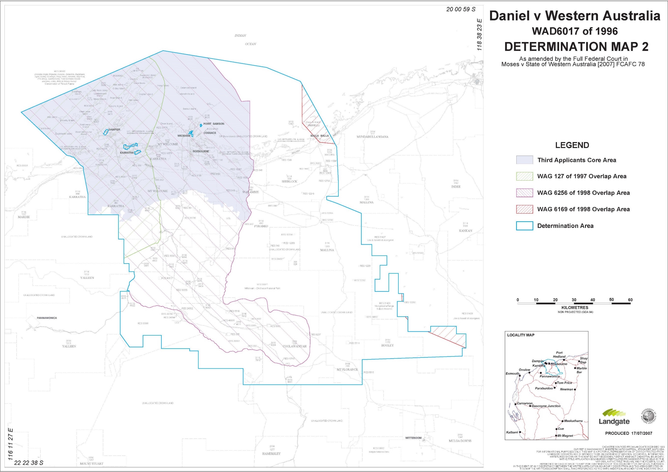
FIFTH SCHEDULE
SECTION 47A AND 47B NATIVE TITLE ACT AREAS
Extinguishment of native title is disregarded, in accordance with section 47A of the Native Title Act 1993 (Cth), in the following areas as depicted in purple on the maps marked ‘Map 1’ which are Attachment 2 to the First Schedule (‘Section 47A Area’):
Area No. | Tenure No. |
54 | part Reserve 612 |
327 | Reserve 677 |
186 | Reserve 22681 |
333 | Reserve 26246 |
278 | Reserve 26581 |
295 | Reserve 29484 |
124 | Reserve 30432 |
140 | Reserve 30433 |
288 | Reserve 30659 |
359 | Reserve 31409 |
343 | Reserve 35802 |
331 | Reserve 38901 |
85 | Reserve 40617 |
396 | Reserve 41013 |
Extinguishment of native title is disregarded, in accordance with section 47B of the Native Title Act 1993 (Cth), in the following areas as depicted in pink on the maps marked ‘Map 1’ which are Attachment 2 to the First Schedule (‘Section 47B Area’):
Area No. | Location (general) | Extinguishing act(s) disregarded | But not including the following areas: |
82 | West of Mallina | Creation of any prior interest | Not part which falls within the Ngarluma Area |
99 | South of Mt Welcome | Creation of any prior interest | Not part which falls within the Ngarluma Area |
110A | Coolawanyah | Creation of any prior interest | |
110B | Coolawanyah | Creation of any prior interest | |
110C | South of Coolawanyah | Creation of any prior interest | Not part which falls within the Hamersley Ranges Area |
114 | East of Res 30071 | Creation of any prior interest | Not part which falls within the Ngarluma Area |
132 | Point Samson | Part vested reserve 35813 and vested reserve 37932 | |
133 | Point Samson | Special lease 3116/04371 | |
148 | Cossack | Part vested reserve 25981 | Not part covered by E47/650 |
183 | Roebourne | Part vested reserve 31768, part De Witt Location 15, part De Witt Location 11, part North Location 36 | Not part within townsite, part covered by easements 3134B/604, 3134B/55(1) and 3134B/43, road 42 and Cape Lambert Supply Main Extension |
241B | Karratha Station | Part special lease 3116/03470 | Not part covered by ML253SA |
241C | Karratha Station | Part special lease 3116/03470 | Not part covered by E47/635, E47/645, easement 3134B/211 |
322 | Roebourne | Town grant 5/1324, part town grants 6/258 and 6/357 | |
342 | Roebourne | Part special lease 3116/00798; part vested reserve 21807 | |
Part 502 | Cossack | Town grants 11/92 and 11/94 | |
512 | Cossack | Town grants 5/1320 and 6/82, part town grants 5/1321 and 5/1322 | Not part covered by E47/512 |
515 | Cossack | Town grant 8/479 | |
532 | Cossack | Town enrolments 2915, 2925, 3085 and 3093; Town grants 2/231, 2/482, 2/484, 2/499, 3/500, 3/630, 5/1211, 5/1319, 7/245 | |
533 | Cossack | Certificates of title 3/231 and 7/397; Town enrolments 2918, 3089, 3091; Town grant 5/1212 | Not part covered by Cossack Radio Transmitter |
535 | Cossack | Town grants 2/468, 2/483, 3/535, 5/1265, 5/1272, 5/1282, 5/1317 and 9/656 | |
Part 538 | Cossack | Town grants 9/550, 9/551, 9/552, 9/553 and 9/544 | |
542 | Cossack | Lease 1138/152 |
RARES J:
1 Today marks what is likely to be the end of a legal journey that the Yindjibarndi people commenced on 8 June 1994 (the first application). That is when they first sought a determination under the Native Title Act 1993 (Cth) that would confirm what has been the case since time immemorial, namely that they possess and have possessed native title rights and interests under their traditional laws and customs since Minkala (God) sent the Marrga, in the creation times, to give form to everything that is Yindjibarndi. In their beliefs the Marrga gave Yindjibarndi country to the Yindjibarndi people.
2 The law of Australia has recognised, through two determinations that this Court has made in 2007 and 2017, that the Yindjibarndi people have native title rights and interests in two large areas in the Pilbara under their traditional laws and customs, including the Bidarra law, that the Yindjibarndi people still acknowledge and observe today. As I said in my judgment in Warrie (formerly TJ) (on behalf of the Yindjibarndi people) v Western Australia (2017) 365 ALR 624 at 628 [1] and 641 [37], the Yindjibarndi people have inhabited those areas since before British sovereignty or European settlement and, as a society, have continuously acknowledged, observed and been united by those laws and customs.
3 The Court today will vary the earlier of those determinations so as to expand the Yindjibarndi people’s rights and interests. This will recognise that the Yindjibarndi have the right, under both their laws and customs and the law of Australia, to exclude all manjangu (strangers) from coming onto a significant area of Yindjibarndi country unless the Yindjibarndi give permission for that to occur.
4 I explained the deep importance to the Yindjibarndi people of this traditional law and custom in my judgment in Warrie 365 ALR at 646–659 [46]–[107]. I will set out below a brief history of the legal journey to today before turning to the basis for the orders that I will make.
Litigation background
5 After a long trial, on 3 July 2003 RD Nicholson J published his reasons for finding that the Yindjibarndi people had non-exclusive, but not exclusive, native title rights and interests over a large area of land and waters in the Pilbara (the Moses land): Daniel v State of Western Australia [2003] FCA 666.
6 Six days later, on 9 July 2003 the Yindjibarndi people filed a second application relating to land and waters immediately to the south of the Moses land.
7 On 2 May 2005, Nicholson J made a determination of native title under s 225 of the Act in the first application (the 2005 determination) giving effect to his earlier findings that the Yindjibarndi had only non-exclusive native title rights and interests in the Moses land: Daniel v State of Western Australia [2005] FCA 536. As part of the 2005 determination, Nicholson J determined that Yindjibarndi Aboriginal Corporation (YAC), as a prescribed body corporate, pursuant to s 56(2)(b) of the Act, would hold on trust the non-exclusive rights and interests in the Moses land from time to time comprising the native title of the common law holders, being the Yindjibarndi people.
8 On 27 August 2007 the Full Court of this Court allowed, in part, an appeal from that determination and made an amended determination of native title (the 2007 determination): cf Moses v Western Australia (2007) 160 FCR 148. The 2007 determination did not disturb the 2005 determination in respect of the Yindjibarndi holding only non-exclusive native title rights and interests in the land and waters now in issue.
9 I heard the trial of the second application in 2015 and 2016. On 20 July 2017 I published my reasons for finding that the Yindjibarndi people held native title rights and interests in another large area of land and waters (the Warrie land) immediately to the south of the Moses land: Warrie 365 ALR 624. I found that the Yindjibarndi people held exclusive native title rights and interests that conferred the right to possession, occupation, use and enjoyment of four significant parcels of unallocated Crown land (UCL) and a reserve: Warrie 365 ALR at 668 [149]–[151], 701–704 [289]–[302]. I also held that Nicholson J’s finding (in Daniel [2003] at [421]–[422]) that the Yindjibarndi people had had “remarkably maintained a strong sense of connection to their lands”, that remained unbroken, continued to apply (365 ALR at 643 [42]).
10 On 13 November 2017, I made final orders and a determination of native title giving effect to my earlier reasons (the 2017 determination) in Warrie (formerly TJ) (on behalf of the Yindjibarndi People) v State of Western Australia (No 2) (2017) 366 ALR 467. As part of the 2017 determination, I determined, pursuant to s 56(2)(b) of the Act, that Yindjibarndi Ngurra Aboriginal Corporation would hold on trust the rights and interests in the Warrie land from time to time comprising the Yindjibarndi people’s native title.
11 On 15 May 2017, while my decision was reserved, YAC filed a revised native title determination application, that it subsequently amended (the revised application) in respect of the Moses land pursuant to ss 13(1)(b) and 61(1) of the Act. The revised application seeks to vary the 2007 determination. It asks that the Court now, in effect, makes orders that would give the Yindjibarndi people exclusive, rather than non-exclusive, native title rights and interests over areas on the Moses land on the same basis that I had found them to have over the Warrie land.
12 In Warrie 365 ALR at 724 [389]–[390], I found that the Yindjibarndi people had not engaged in an abuse of process, in the second application, by seeking a determination that they had exclusive native title rights and interests in the Warrie land even though the 2007 determination had held that they only had non-exclusive native title rights and interests. I held that the pending revised application, if granted, could cure any potential inconsistency resulting from a finding that, since before sovereignty, the Yindjibarndi had continuously acknowledged and observed their traditional laws and customs that required a manjangu to seek permission to enter, or conduct activity on, Yindjibarndi country.
13 Nicholson J in Daniel [2003] FCA 666 at [292] had characterised that law or custom as only “a matter of respect rather than a recognition of a right to control”. However, about four years after his Honour’s decision and after the 2007 determination, a Full Court of this Court decided that such a traditional law or custom could amount to a normative requirement that would ensure that native title holders could protect their land and waters from strangers and manage its spiritual dangers as a “gatekeeper”: Griffiths v Northern Territory (2007) 165 FCR 391 at 428–429 [127]. I found that, had the law been decided in this way when Nicholson J determined Daniel [2003] FCA 666, it was probable that his Honour would have characterised his finding about the character of the need to seek permission to enter Yindjibarndi country in the same way as I did (Warrie 365 ALR at 722 [382]). I will return to this finding later.
14 On 18 October 2019 Jagot, Robertson, Griffiths, Mortimer and White JJ dismissed an appeal from my decision: Fortescue Metals Group v Warrie (2019) 273 FCR 350. By then, the State had accepted my decision and argued (contrary to its stance at the trial) in support of the Yindjibarndi people’s case.
15 On 29 May 2020 the High Court refused Fortescue Metals Group Ltd’s (FMG) application for special leave to appeal from the Full Court’s decision: Fortescue Metals Group Ltd v Warrie [2020] HCA Trans 65 (Keane and Edelman JJ) on the basis that it was concerned with the application of settled principle.
16 Once the High Court had refused FMG special leave, it withdrew its defence and ceased to take an active part in this proceeding. That effectively left YAC and the State as the only active parties.
This application
17 The revised application seeks an order to vary the 2007 determination so as to now recognise that the Yindjibarndi people have exclusive possession of seven areas within its boundaries. Those areas are reserve 40617 and UCLs 82, 99, 110A, 110B, 110C and 114.
18 An application for the Court to make a determination of native title over part of an area including in an application (such as the first application here) can be made under s 87A. Such an application must satisfy the criteria that s 87A stipulates. I will consider those requirements below.
19 First, on 8 November 2017, the notification process under the Act for the revised application concluded. At that time, there were four respondent parties, namely the State, FMG, Yamatji Marlpa Aboriginal Corporation and the Ngarluma Aboriginal Corporation RNTBC (NAC). NAC was then a party because the Ngarluma people had made a joint application in 1994 that Nicholson J decided in Daniel [2003] FCA 666. His Honour held that both the Yindjibarndi and the Ngarluma peoples held non-exclusive native title rights and interests over an area in the north west of the Moses land. However, because the revised application did not affect that area, on 11 June 2020 I granted NAC leave to withdraw as a party under s 84(7) of the Act.
20 Secondly, YAC, Yamatji, as the representative body, the State and FMG negotiated, and are all parties to, the terms of a consent determination dated 11 September 2020 that they signed and filed so as to resolve the revised application (s 87A(1) and (2)).
21 Thirdly, the Chief Executive Officer of the Federal Court did not need to give any notice under s 87A(3), because all of the parties to this proceeding signed the consent determination.
Consideration
22 Importantly, the Court has a discretion to make an order in, or consistent with, the terms of a consent determination without holding a hearing if it considers that, first, such an order would be within its powers and, secondly, it would be appropriate to do so (s 87A(4)).
23 There are no statutory requirements governing the negotiation of agreements under ss 87 and 87A of the Act. Nor does s 87A(4) impose any precondition beyond that any orders for a consent determination of native title, be ones that the Court considers are within its power to make and that it would be “appropriate” for the Court to exercise its power to do so. The Court must make such an evaluation of the s 87A agreement having regard to the subject-matter, scope and purpose of the Act: The Queen v Australian Broadcasting Tribunal; Ex parte 2HD Pty Ltd (1979) 144 CLR 45 at 49 per Stephen, Mason, Murphy, Aickin and Wilson JJ.
24 A relevant consideration in assessing the appropriateness of making a consent determination under s 87A is the overarching purpose of the civil practice and procedure provisions contained in ss 37M and 37N of the Federal Court of Australia Act 1976 (Cth). Relevantly, s 37N(1) imposes a duty on the parties to conduct the proceeding, including negotiations for settlement, such as the present, that has culminated in an agreement under s 87A of the Act, in a way that is consistent with that overarching purpose: Oil Basins Ltd v Watson [2014] FCAFC 154 at [145] per Siopis, McKerracher and Barker JJ. I am satisfied that the parties have acted in accordance with s 37N in arriving at the consent determination.
25 Negotiations that lead to consent orders, such as the ones I am making today, resolve significant parts of litigation and have a very important place in our court system. They enable the parties to achieve results that are acceptable to all of them but that may not have been available if the Court had to decide the dispute. And, of course, such agreements also enable the Court to deal more quickly with other people’s cases.
26 Here, the parties have cooperated with appropriate and commendable effort to bring about the terms of the consent determination. YAC and the State filed joint submissions in support of its being made. Those submissions outlined the basis on which the State, on behalf of the community, agreed to the changes they seek to the 2007 determination. No party led any evidence on this application. I have considered the matters discussed in the joint submissions for the purpose of deciding whether to make the consent determination.
27 In proceedings of this kind the Court must consider the public interest as to whether the agreement under s 87A should be given the force of law. This is because a determination of native title does not affect only the parties in the proceeding. Rather, a determination of native title is a legally binding decision that applies to everyone in Australia and can only be changed by another court order. It has effects on the rights and interests of not only the holders of the native title rights and interests, but those of the State and the members of the community, including in respect of the use of public land and waters covered by a reserve or unallocated Crown land.
28 Because of this, the State has a particular responsibility, as an institution of Government, to inform the Court of all relevant considerations for and against the making of the particular consent determination that may affect the public interest. The State has a duty to look after and act in the interests of the whole community: cf Munn (for and on behalf of the Gunggari People) v Queensland (2001) 115 FCR 109 at 115 [29]–[30] per Emmett J.
29 Here, the consent determination reflects a resolution of the claims of the Yindjibarndi people that the parties considered appropriate. It also reflects the unusual circumstances of there having been two trials about the laws and customs of the Yindjibarndi people that led to the 2007 and 2017 determinations.
30 Both Nicholson J and I heard many witnesses give evidence to support the findings that led to these two determinations. However, as I have explained, after the 2007 determination was made, the understanding of the law changed about the significance of the need for a person such as a manjangu to ask permission before entering Yindjibarndi country: Griffiths 165 FCR 391. As a result, YAC and the State have re-evaluated the evidence before Nicholson J and his Honour’s findings. They have made careful submissions about why the reserve and six UCLs should now be included in a revised determination of native title as areas over which the Yindjibarndi people hold exclusive native title rights and interests.
31 I will first consider whether an order in, or consistent with, the terms of the consent determination would be within the power of the Court in respect of each of the seven areas of land and waters. I will then consider whether it is appropriate to make the consent determination.
The basis for making a revised determination
32 The power of the Court to vary or revoke a previous approved determination of native title that the Court has made is conferred and conditioned in s 13(1)(b) and (5) of the Act. It is an exceptional power. A fundamental principle of our system of justice is that, ordinarily, a judicial decision based on the evidence and arguments after a hearing of a proceeding should be final and binding. The usual position is that the Court’s decision not only finalises all disputes about what happened as matters of fact but also determines what the law is as it applies to those facts. Ordinarily, none of the parties to that decision can ever dispute what the Court found except by an appeal. That is because in such a decision the Court decides the rights of the parties in the litigation once for all, putting a complete end to the dispute. That gives effect to the principle of finality in the law: cf Warrie 365 ALR at 720 [375]–[376].
33 But, when the Parliament enacted the Native Title Act, it recognised that decisions about native title rights and interests involved questions that affected, or could affect, large areas of land and waters and many persons including, of course, one or more indigenous peoples, some of whom might cease over time to acknowledge and observe some or all of their traditional laws and customs (see s 223 of the Act). Alternatively, new evidence or circumstances may emerge that require a variation or revocation of an earlier determination or the interests of justice might require that to be done. In my judgment in Warrie 365 ALR at 720 [373]–[376] I discussed how s 13(1)(b) and (5) operated: cf Warrie 273 FCR at 384–392 [99]–[129] esp at 390–391 [123]–[124] per Jagot and Mortimer JJ, 457–461 [384]–[395] per Robertson and Griffiths JJ, cf too 501–502 [571]–[576] where White J took a different view to that I had expressed.
34 That is why s 13(5) provides two grounds on which the Court can vary or revoke a previous judicial determination of native title. These are, first, where events have taken place since the determination was made that have caused it no longer to be correct, or, secondly, the interests of justice require the variation or revocation to be made.
35 In Murray on behalf of the Yilka Native Title Claimants v State of Western Australia (No 5) [2016] FCA 752 at [2451], McKerracher J said that s 13(5) contemplated that the native title holders or the native title rights might change or that the original determination contained an error or omission. Indeed, here, as I will explain, there was a mapping error in the 2007 determination that caused a small reserve to be depicted on a map as part of Yindjibarndi country, when Nicholson J had held that it was not. The power under s 13(5) is clearly available to correct such mistakes.
36 However, up to now, the research of the lawyers for YAC and the State have only found two cases where the Court has exercised the power under s 13(5): Tarlka Matuwa Piarku (Aboriginal Corporation) RNTBC v Western Australia [2017] FCA 40 and Wakamurru (Aboriginal Corporation) RNTBC v Western Australia (in which the Court made orders on 24 April 2020, but gave no published reasons). In both of those cases, the variations came about because of a recent decision of the High Court that changed the law that this Court had applied in making the original determination (Tarlka [2017] FCA 40 varied the earlier determination in WF (deceased) on behalf of the Wiluna People v Western Australia [2013] FCA 755 as a consequence of Western Australia v Brown (2014) 253 CLR 507. Wakamurru varied an earlier determination as a consequence of Helicopter Tjungarrayi v Western Australia (2019) 366 ALR 603).
Reserve 40617
37 This reserve is a small area near the western boundary of the Moses land, a small distance below UCL 99.
38 Nicholson J determined that s 47A of the Act applied to the reserve so that any earlier extinguishment of native title had to be disregarded. On that basis, the reserve was included in the land and waters in schedule 5 of the 2007 determination as an area to which s 47A applied.
39 On 9 September 1988, the reserve was set aside and vested in the Aboriginal Lands Trust to be held expressly for the “Use and Benefit of Aboriginal Inhabitants” under s 29 of the Land Act 1933 (WA). That complied with the requirements of s 47A(1)(b)(ii) of the Act.
40 On 22 May 1989 the Ngurrawaana Group Aboriginal Corporation entered into a 99 year lease of the reserve with the Trust. Since at least then, a large number of Yindjibarndi people lived, some permanently, others seasonally, on the reserve in the Ngurrawaana community. Nicholson J took evidence during the trial of the first application there. The State accepted during that hearing that, for the purposes of s 47A(1)(a) and (c), one or more members of the Yindjibarndi people occupied the reserve, when the first application was made in relation to it in 1994.
41 Accordingly, I am satisfied that s 47A applies to the reserve. In the 2017 determination, I found that the native title rights and interests of the Yindjibarndi people in their land and waters are exclusive, to the extent that they have not been wholly or partly extinguished. It follows that it is within the Court’s power to vary the 2007 determination to reflect, as the State accepts, that they have exclusive rights and interests over the reserve.
The UCL areas
42 I will briefly describe the six UCLs. UCL 82 is an area on the northern boundary of Millstream-Chichester National Park immediately below the area jointly held with the Ngarluma people. This is at the southern edge of the Mallina and Pyramid stations, close to Grant Spring and Brockman Spring.
43 UCL 99 is located on the north western side of the Moses land immediately below the area in which both the Yindjibarndi and Ngarluma peoples have non-exclusive rights and interests.
44 UCLs 110A, 110B, 110C are three small parcels located close to each other on or near the southern boundary of the Moses land near where it adjoins the northern boundary of the Warrie land. Indeed, UCL 110C is located on that boundary.
45 UCL 114 is a relatively large area on the eastern boundary of Millstream-Chichester National Park extending south from the jointly held area. It is also bordered by Mallina, Hooley and Coolawanyah stations. Nunyerry creek runs through it. There is an important law ground on its southern boundary at Klobar.
The issue about whether s 47B applies to the six UCLs
46 The Act enables exclusive and non-exclusive native title rights and interests to be recognised over public land and waters if certain conditions under s 47B are met, even though at some time in the past those areas had been freehold or leased. The conditions relevant here are in broad outline that:
(1) when the first application was made in 1994, the particular areas in that claim were not covered by a freehold estate, lease, a Government permission, licence or authority to use the land and waters for public purposes or a particular purpose or subject to a resumption process; and
(2) one or more of the Yindjibarndi people occupied the relevant area.
47 After the commencement of the revised application, I ordered that the parties file pleadings to identify the issues that the Court would need to decide. Those pleadings identified only one dispute between YAC and the State in relation to whether s 47B(2) operated to enable the Court to disregard any prior acts that may have extinguished the Yindjibarndi people’s exclusive native title rights and interests in each of the six UCL areas. That dispute concerned whether one or more of the Yindjibarndi people occupied each of the six UCLs in 1994.
48 In their joint submissions YAC and the State explained in some detail how they arrived at their resolution of the occupation issue. I have considered those submissions on the basis of what Jagot J held in Western Bundjalung People v Attorney-General of New South Wales [2017] FCA 992 at [20]–[21], to see whether they supply a credible or cogent basis for a conclusion that the requirements of s 223(1) exist for the Court to make the consent determination of native title now. Jagot J said there:
It is also apparent from the authorities that the Court recognises that the State party is effectively the guardian of all of the interests of its people in a native title claim. It should go without saying that the people to whom the State owes a duty include the Aboriginal people who are the claimants. Thus it would be wrong for the State to conceive of its role as merely a gatekeeper through which cogent claims may ultimately be permitted to pass if the claim is one that comes to be supported by so much material that, in all probability, the claim would succeed before the Court if litigated; in particular, ensuring prima facie cogent claims are resolved by agreement in a timely and fair manner, at a reasonable and proportionate cost to claimant groups, is an important part of the public interest the State is intended to protect and promote.
In reconciling its multiple duties the orthodox position which has emerged and been settled for many years is that the State should not require an applicant to prove to it on the balance of probabilities that each of the requirements of s 223 is satisfied. For the State party to discharge its duties not only to the public at large but also to the claim group and to the Court, and to fulfil its fundamental obligations of fidelity to the objects of the NTA and the requirements of the Court Act, it looks for only a credible or cogent basis to conclude that the requirements of s 223 are satisfied whether or not that basis would constitute admissible evidence in contested litigation or would enable the Court to make findings about s 223 in favour of an applicant on the balance of probabilities. As North J said in Lovett on behalf of the Gunditjmara People v State of Victoria [2007] FCA 474:
36 The focus of the section is on the making of an agreement by the parties. This reflects the importance placed by the Act on mediation as the primary means of resolving native title applications. Indeed, Parliament has established the National Native Title Tribunal with the function of conducting mediations in such cases. The Act is designed to encourage parties to take responsibility for resolving proceedings without the need for litigation. Section 87 must be construed in this context. The power must be exercised flexibly and with regard to the purpose for which the section is designed.
37 In this context, when the Court is examining the appropriateness of an agreement, it is not required to examine whether the agreement is grounded on a factual basis which would satisfy the Court at a hearing of the application. The primary consideration of the Court is to determine whether there is an agreement and whether it was freely entered into on an informed basis: Nangkiriny v State of Western Australia (2002) 117 FCR 6; [2002] FCA 660, Ward v State of Western Australia [2006] FCA 1848. Insofar as this latter consideration applies to a State party, it will require the Court to be satisfied that the State party has taken steps to satisfy itself that there is a credible basis for an application: Munn v Queensland (2001) 115 FCR 109; [2001] FCA 1229. There is a question as to how far a State party is required to investigate in order to satisfy itself of a credible basis for an application. One reason for the often inordinate time taken to resolve some of these cases is the overly demanding nature of the investigation conducted by State parties. The scope of these investigations demanded by some States is reflected in the complex connection guidelines published by some States.
38 The power conferred by the Act on the Court to approve agreements is given in order to avoid lengthy hearings before the Court. The Act does not intend to substitute a trial, in effect, conducted by State parties for a trial before the Court. Thus, something significantly less than the material necessary to justify a judicial determination is sufficient to satisfy a State party of a credible basis for an application. The Act contemplates a more flexible process than is often undertaken in some cases. These comments relate to the requirements of s 87, and are not intended to reflect on the conduct of the State in this case.
(emphasis added)
UCL 82
49 YAC referred the State to evidence given at the trial before Nicholson J about a song relating to the locale together with information from Michael Woodley, whom I found was a tharngu, or senior lawman, and one of the Yindjibarndi most knowledgeable in the Bidarra law (Warrie 365 ALR at 646 [46]) and Mrs RW, a now deceased elder. They provided the information about reasonably frequent historical and recent visits to places, in or proximate, to UCL 82. Mrs RW had described annual visits to the area, camping and using a pool at Jiripaga adjacent to UCL 82. The State considered that this was a sufficient basis to show that one or more Yindjibarndi occupied UCL 82 in 1994.
UCL 99
50 The State was satisfied that it could consent to the inclusion of UCL 99 on the basis of:
the proximity of UCL 99 to the presence of the Ngurrawaana community on the reserve;
detailed information that Michael Woodley provided about use of UCL 99 by him and other Yindjibarndi residents of the community;
Michael Woodley’s description of particular food sources and camping sites there; and
Kenny Jerrold’s evidence to Nicholson J on country in the Ngurin area concerning that area which is about 15 to 20 kilometres north east of UCL 99.
UCLs 110A, 110B and 110C
51 Nicholson J took evidence in the bed of Hooley Creek very close to UCL 110C. That portion is close to Bangkangarra, on the Warrie land, where I took evidence. YAC referred the State to evidence given in both proceedings and further information from Michael Woodley. That evidence and information indicated that Yindjibarndi people had travelled habitually though, camped in and used the general area of which UCLs 110A, 110B and 110C form a part. The State was aware from its own involvement in the first application and subsequent proceedings that this area was well travelled and of spiritual significance for the Yindjibarndi people.
UCL 114
52 Nicholson J visited the areas immediately to the north of UCL 114 and took a significant amount of evidence about Yindjibarndi people visiting, camping in and using the area both in and around UCL 114. Michael Woodley provided the State with further information about his and his family camping along Nunyerry Creek in the 1990s. Several witnesses gave similar evidence before me in the second application.
Occupation
53 The State assessed the material as to occupation. It had regard to its Guide to Evidentiary Requirements of Occupation under Sections 47A and 47B of the Native Title Act 1993 (Cth), the legal principles as to what amounts to occupation, including those in Banjima People v State of Western Australia (2015) 231 FCR 456 and independent advice from the State Solicitor’s Office. The State submitted that it formed the view that the information that YAC had provided was sufficiently credible or cogent to demonstrate that each of the six UCLs and the reserve was occupied in 1994 within the meaning of s 47B(1)(c).
54 I am satisfied that, in agreeing to the consent determination, the State has acted in accordance with its duties as Jagot J explained in Western Bundjalung [2017] FCA 992 at [20]–[21]. The joint submissions explained why YAC and the State considered that there was a credible or cogent basis for concluding that each of the six UCLs was occupied in 1994. I am satisfied that this provides a sufficient foundation on which I can act to make the consent determination.
The status of reserve 12260
55 The written terms of the 2007 determination entirely excluded reserve 12260, which is a small parcel on the eastern boundary of the Moses land, from the area in which the Yindjibarndi held native title rights and interests. When preparing a map for the revised determination, the National Native Title Tribunal identified an error in a map in the 2007 determination. The error was that reserve 12260 was depicted as included in the Moses land instead of being excluded from it. On 8 March 2017, the Tribunal notified YAC of that mapping error. Subsequently, the Court has included the land and waters in reserve 12260 as part of its approved consent determination of the Kariyarra people’s native title rights and interests: Gordon (on behalf of the Kariyarra Native Title Claim Group) v State of Western Australia [2018] FCA 1990.
56 YAC and the State agree that no part of reserve 12260 is in Yindjibarndi country and that the revised determination should include a corrected map. That has been made in Map 1 which, in inset 3, shows that reserve 12260 is now to be excluded from the determination area. This correction is appropriate.
Is it appropriate to make the consent determination?
57 There is a credible and cogent basis to conclude that the Yindjibarndi people have the same rights and interests in the Moses land as I explained that they had in the Warrie land in my reasons in Warrie 365 ALR 624. That is because I was satisfied, in accordance with s 223(1) of the Act, that those are the same rights and interests, possessed under the traditional laws acknowledged, and the traditional customs observed, by the Yindjibarndi people, that by those laws and customs they have a connection with all of those lands and waters and that the common law of Australia recognises those rights and interests.
58 Indeed, I found in Warrie 365 ALR at 722 [382] (which Jagot and Mortimer JJ affirmed in Warrie 273 FCR at 398 [155]–[157] with the agreement of Robertson and Griffiths JJ at 461 [397] and White J at 491 [528]):
Nicholson J saw the surviving practice as “a matter of respect rather than in recognition of a right to control” (Daniel [2003] FCA 666 at [292]) and found that there was no present “exercise … of this aspect of the right claimed”. The “exercise” of a right to control access based on the Yindjibarndi’s role, under their traditional laws and customs, to act as gatekeepers to their country is conceptually different to the concept underpinning the “respect” that his Honour found. Yet, had his Honour been invited, as Griffiths 165 FCR 391 subsequently established, to consider that, what he termed, the “surviving practice” of “respect” reflected the importance that those indigenous people who showed that “respect” attached to the ability of the Yindjibarndi to open the spiritual gates, it is possible, indeed probable, that his Honour would have come to the same findings as I have.
(emphasis added)
59 In light of the Full Court’s finding that there was no error in that conclusion, the 2007 determination should be varied so as to apply s 47B(2) to the reserve and the six UCLs. That will ensure that the Yindjibarndi people’s rights and interests in those lands and waters are exclusive.
Conclusion
60 As I have noted earlier, s 13(5) provides two alternate grounds for a variation of an approved determination of native title. Here, I am satisfied that the interests of justice require the variation of the 2007 determination (s 13(5)(b)). This will make the native title rights and interests of the Yindjibarndi people consistent across the Moses land and the Warrie land. It will now be possible, after many years of struggle, for them to know that the law of Australia guarantees that they may exercise their right of exclusive possession once again, together with their concomitant right to exclude all manjangu.
61 Therefore, it is appropriate that I make today a consent determination in terms consistent with those agreed by the parties.
I certify that the preceding sixty-one (61) numbered paragraphs are a true copy of the Reasons for Judgment of the Honourable Justice Rares. |
Associate:

