
FEDERAL COURT OF AUSTRALIA
Mooney on behalf of the Yuwibara People and State of Queensland [2020] FCA 170
ORDERS
DATE OF ORDER: |
BEING SATISFIED that an order in the terms set out below is within the power of the Court, and it appearing appropriate to the Court to do so, pursuant to s 87 of the Native Title Act 1993 (Cth)
BY CONSENT THE COURT ORDERS THAT:
1. There be a determination of native title in the terms set out below (the determination).
2. The determination of native title for the following parcels will take effect upon the agreement referred to in paragraph 1 of Schedule 2 being registered on the Register of Indigenous Land Use Agreements:
(a) Lot 132 on USL44444;
(b) Lot 71 on USL37679;
(c) That part of Lot 1 on AP22276 described as Permit to Occupy No.0/218998 over Lot 1 on AP10082;
(d) Lot 2 on AP22022;
(e) Lot 70 on SP150994;
(f) Lot 12 on SP150994;
(g) That part of Lot 83 on USL39222 described as Permit to Occupy No. 0/209736 over Lot 1 on AP2024;
(h) That part of Lot 502 on SP112980 excluding the area formerly described as Lot 502 on CI3595; and
(i) That part of Lot 291 on C124552 which is described in Part 3 of Schedule 4.
3. In the event that the agreement referred to in paragraph 1 of Schedule 2 is not registered on the Register of Indigenous Land Use Agreements within twelve (12) months of the date of this order the matter be listed for further directions.
4. Each party to the proceedings is to bear its own costs.
BY CONSENT THE COURT DETERMINES THAT:
5. The determination area is the land and waters described in Schedule 4 and depicted in the map attached to Schedule 6 to the extent those areas are within the External Boundary and not otherwise excluded by the terms of Schedule 5 (the Determination Area). To the extent of any inconsistency between the written description and the map, the written description prevails.
6. Native title exists in the Determination Area.
7. The native title is held by the Yuwibara People described in Schedule 1 (the Native Title Holders).
8. Subject to orders 12, 13 and 14 below the nature and extent of the native title rights and interests in relation to the land and waters described in Part 1 of Schedule 4 are:
(a) other than in relation to Water, the right to possession, occupation, use and enjoyment of the area to the exclusion of all others; and
(b) in relation to Water, the non-exclusive rights to:
(i) hunt, fish and gather from the Water of the area;
(ii) take the Natural Resources of the Water in the area; and
(iii) take the Water of the area, for personal, domestic and non-commercial communal purposes.
9. Subject to orders 12, 13 and 14 below the nature and extent of the native title rights and interests in relation to the land and waters described in Part 2 of Schedule 4 are the non-exclusive rights to:
(a) access, be present on, move about on and travel over the area;
(b) remain and camp on the area, and for those purposes erect shelters and other structures that are not permanent in nature;
(c) hunt, fish and gather on the land and waters of the area;
(d) take the Natural Resources from the land and waters of the area;
(e) take the Water of the area for personal, domestic and non-commercial communal purposes;
(f) conduct ceremonies on the area;
(g) be buried and bury Native Title Holders within the area;
(h) maintain places of importance and areas of significance to the Native Title Holders under their traditional laws and customs and protect those places and areas from physical harm;
(i) teach on the area the physical and spiritual attributes of the area;
(j) hold meetings on the area; and
(k) light fires on the area for domestic purposes including cooking, but not for the purpose of hunting or clearing vegetation.
10. Subject to orders 12, 13 and 14 below the nature and extent of the native title rights and interests in relation to the land and waters described in Part 3 of Schedule 4 are:
(a) for any part of a parcel that is located on the landward side of the High Water Mark:
(i) other than in relation to Water, the right to possession, occupation, use and enjoyment of the area to the exclusion of all others; and
(ii) in relation to Water, the non-exclusive rights to:
(A) hunt, fish and gather from the Water of the area;
(B) take the Natural Resources of the Water in the area; and
(C) take the Water of the area, for personal, domestic and non- commercial communal purposes; and
(b) for any part of a parcel that is located on the seaward side of the High Water Mark, the rights and interests described in order 9 above.
11. Subject to orders 12, 13 and 14 below the nature and extent of the native title rights and interests in relation to the land and waters described in Part 4 of Schedule 4 are the non-exclusive rights to:
(a) access, be present on, move about on and travel over the area;
(b) hunt, fish and gather on the area;
(c) take seawater of the area for personal, domestic and non-commercial communal purposes; and
(d) teach on the area the physical and spiritual attributes of the area.
12. The native title rights and interests are subject to and exercisable in accordance with:
(a) the Laws of the State and the Commonwealth; and
(b) the traditional laws acknowledged and traditional customs observed by the Native Title Holders.
13. The native title rights and interests referred to in orders 8(b), 9, 10(a)(ii), 10(b) and 11 do not confer possession, occupation, use or enjoyment to the exclusion of all others.
14. There are no native title rights in or in relation to minerals as defined by the Mineral Resources Act 1989 (Qld) and petroleum as defined by the Petroleum Act 1923 (Qld) and the Petroleum and Gas (Production and Safety) Act 2004 (Qld).
15. The nature and extent of any other interests in relation to the Determination Area (or respective parts thereof) are set out in Schedule 2.
16. The relationship between the native title rights and interests described in orders 8, 9, 10 and 11 and the other interests described in Schedule 2 (the Other Interests) is that:
(a) the Other Interests continue to have effect, and the rights conferred by or held under the Other Interests may be exercised notwithstanding the existence of the native title rights and interests;
(b) to the extent the Other Interests are inconsistent with the continued existence, enjoyment or exercise of the native title rights and interests in relation to the land and waters of the Determination Area, the native title continues to exist in its entirety but the native title rights and interests have no effect in relation to the Other Interests to the extent of the inconsistency for so long as the Other Interests exist; and
(c) the Other Interests and any activity that is required or permitted by or under, and done in accordance with, the Other Interests, or any activity that is associated with or incidental to such an activity, prevail over the native title rights and interests and any exercise of the native title rights and interests but will not extinguish them except in relation to acts that consist of the construction or establishment of a public work, done after this determination where s 24JA of the Native Title Act 1993 (Cth) applies.
DEFINITIONS AND INTERPRETATION
17. In this determination, unless the contrary intention appears:
“External Boundary” means the area described in Schedule 3;
“High Water Mark” has the meaning given in the Land Act 1994 (Qld);
“land” and “waters”, respectively, have the same meanings as in the Native Title Act 1993 (Cth);
“Laws of the State and the Commonwealth” means the common law and the laws of the State of Queensland and the Commonwealth of Australia, and includes legislation, regulations, statutory instruments, local planning instruments and local laws;
“Local Government Act” has the meaning given in the Local Government Act 2009 (Qld);
“Local Government Area” has the meaning given in the Local Government Act 2009 (Qld);
“Low Water Mark” has the meaning given in the Land Act 1994 (Qld);
“Natural Resources” means:
(a) any animal, plant, fish and bird life found on or in the lands and waters of the Determination Area; and
(b) any clays, soil, sand, gravel or rock found on or below the surface of the Determination Area,
that have traditionally been taken and used by the Native Title Holders, but does not include:
(a) animals that are the private personal property of another;
(b) crops that are the private personal property of another; and
(c) minerals as defined in the Mineral Resources Act 1989 (Qld); or
(d) petroleum as defined in the Petroleum Act 1923 (Qld) and the Petroleum and Gas (Production and Safety) Act 2004 (Qld);
“Reserve” means a reserve dedicated or taken to be a reserve under the Land Act 1994 (Qld);
“Water” means:
(e) water which flows, whether permanently or intermittently, within a river, creek or stream;
(f) any natural collection of water, whether permanent or intermittent; and
(g) tidal water.
“Works” has the same meaning as in the Electricity Act 1994 (Qld).
Other words and expressions used in this determination have the same meanings as they have in Part 15 of the Native Title Act 1993 (Cth).
THE COURT DETERMINES THAT:
18. The native title is held in trust.
19. The Yuwi Aboriginal Corporation (ICN: 8608), incorporated under the Corporations (Aboriginal and Torres Strait Islander) Act 2006 (Cth), is to:
(a) be the prescribed body corporate for the purpose of ss 56(2)(b) and 56(3) of the Native Title Act 1993 (Cth); and
(b) perform the functions mentioned in s 57(1) of the Native Title Act 1993 (Cth) after becoming a registered native title body corporate.
LIST OF SCHEDULES
Schedule 1 – Native Title Holders
Schedule 2 – Other Interests in the Determination Area
Schedule 3 – External Boundary
Schedule 4 – Description of Determination Area
Schedule 5 – Areas Not Forming Part of the Determination Area
Schedule 6 – Map of Determination Area
Schedule 1 – Native Title Holders
1. The Native Title Holders are the Yuwibara People. The Yuwibara People are the bloodline descendants of one or more of the following people:
(a) Peter Nolan:
(b) Jane Morris, mother of Peter Smith and Frank Morris;
(c) Molly, mother of Bill Bargo (aka Bill Tonga) and Annie Bargo (aka Annie Tonga);
(d) Johanna Hazeldean;
(e) Mungo, King of Hamilton, father of Spoonbill;
(f) Jerry McDonald; or
(g) Janie (McDonald).
Schedule 2 – Other Interests in the Determination Area
The nature and extent of the other interests in relation to the Determination Area are the following as they exist as at the date of the determination:
1. The rights and interests of the parties to the Yuwibara People Interim Indigenous Land Use Agreement between Melanie Roseveen Kemp on her own behalf and on behalf of the Yuwibara People, Yuwi Aboriginal Corporation ICN 8608, Matthew McDonnell, Jennifer Van Der Starre, Irene Adams, Hayley Mann, Madeline Jones, Bernard Tonga and Pamela Young, the State of Queensland, Norman George Ladley and Sharon Lillian Ladley, Gary Andrew McDermott and Mackay Regional Council, authorised by the native title claim group on 14 December 2019 (the Yuwibara People Interim Indigenous Land Use Agreement);
2. The rights and interests of Telstra Corporation Limited ACN 051 775 556:
(a) as the owner or operator of telecommunications facilities within the Determination Area;
(b) created pursuant to the Post and Telegraph Act 1901 (Cth), the Telecommunications Act 1975 (Cth), the Australian Telecommunications Corporation Act 1989 (Cth), the Telecommunications Act 1991 (Cth) and the Telecommunications Act 1997 (Cth), including rights:
(i) to inspect land;
(ii) to install, occupy and operate telecommunication facilities; and
(iii) to alter, remove, replace, maintain, repair and ensure the proper functioning of its telecommunications facilities;
(c) for its employees, agents or contractors to access its telecommunication facilities in and in the vicinity of the Determination Area in the performance of their duties; and
(d) under any lease, licence, permit, access agreement or easement relating to its telecommunications facilities in the Determination Area, including in relation to:
(i) Lot 4 on SP278050;
(ii) Lot 377 on CI3437;
(iii) Lot 1 on M30416; and
(iv) Lot 150 on NPW854.
3. The rights and interests of Ergon Energy Corporation ACN 087 646 062:
(a) as the owner and operator of any Works (as that term is defined in the Electricity Act 1994 (Qld)) within the Determination Area;
(b) as an electricity entity under the Electricity Act 1994 (Qld), including but not limited to:
(i) as the holder of a distribution authority;
(ii) to inspect, maintain and manage any Works in the Determination Area; and
(iii) in relation to any agreement or consent relating to the Determination Area existing or entered into before the date these orders are made; and
(c) to enter the Determination Area by its employees, agents or contractors to exercise any of the rights and interests referred to in this paragraph.
4. The rights and interests of North Queensland Bulk Ports Corporation ABN 36 136 880 218:
(a) as trustee of the following reserves located within the Determination Area:
(i) Reserve 483 for Harbour Board purposes over Lot 5 on Plan CP886045, Lot 13 on Plan SP115931, Lot 23 on Plan SP123751, Lot 39 on Plan SP115932, Lot 70 on Plan SP123751 and that part of Lot 12 on Plan SP287967 which is located within the Determination Area;
(ii) Reserve 778 for Park and Recreation Purposes over Lot 373 on Plan CI2729; and
(iii) Reserve 873 for Harbour Board Purposes over Lot 583 on Plan CI3457;
(b) as the holder of the following perpetual leases (where those leases fall within the Determination Area):
(i) Perpetual lease 0/215031 over Lot 126 on SP123776;
(ii) Perpetual lease 0/214944 over Lot 130 on SP105841 and Lot 134 on SP185573;
(iii) Perpetual lease 0/230187 over Lot 135 on SP185580;
(iv) Perpetual lease 0/214948 over Lot 143 on SP121683;
(v) Perpetual lease 0/212986 over Lot 63 on SP143358;
(vi) Perpetual lease 0/214947 over Lot 95 on SP231132;
(vii) Perpetual lease 0/234064 over Lot 96 on SP231132; and
(viii) Perpetual lease 0/236567 over Lot 1 on SP256335;
(c) as the holder of Permit to Occupy 233949 over Lot C on AP19508; and
(d) as the holder of Sales Permit 20090852 over Lot 12 on SP287967 (for that part of the Sales Permit which is within the Determination Area);
5. The rights and interests of Aurizon Network Pty Ltd (ACN 132 181 116), Aurizon Operations Limited (ACN 124 649 967) and Aurizon Property Pty Ltd (ACN 145 991 724):
(a) in relation to rail transport infrastructure under the Transport Infrastructure Act 1994 (Qld); and
(b) under any lease, licence, easement, permit or agreement within the Determination Area.
6. The rights and interests of the holder of the following easements:
(a) Easement in gross number 702742869 burdening the land over Easement C on Survey Plan 101148 on Lot 4 on Registered Plan 724921;
(b) Easement number 700851350 burdening the land to Lot 32 on Registered Plan 882366 over Easement A on Registered Plan 882366 on Lot 133 on Survey Plan 256544;
(c) Easement number 702503304 benefiting the land over Easement B on Survey Plan 101146 on Lot 4 on Registered Plan 724921;
(d) Easement in gross number 601097520 burdening the land over Easement A on Registered Plan 727037 on Lot 131 on Survey Plan 136318;
(e) Easement in gross number 702734108 burdening the land over Easement B on Survey Plan 112757 on Lot 16 on Survey Plan 195520;
(f) Easement in gross number 601408672 burdening the land over Easement A on Registered Plan 806568 on Lot 60 on Survey Plan 185551 and Lot 61 on Survey Plan 185551;
(g) Easement in gross number 601422923 burdening the land over Easement A on Registered Plan 813203 on Lot 3 on Survey Plan 255612;
(h) Easement number 719011846 burdening the land to Lot 3 on Survey Plan 117891 over Easement C on Survey Plan 129630 on Lot 20 on Survey Plan 129630;
(i) Easement number 719057950 burdening the land to Lot 3 on Survey Plan 117891 over Easement B on Survey Plan 129630 on Lot 19 on Survey Plan 129630;
(j) Easement number 719266879 burdening the land to Lot 3 on Survey Plan 117891 over Easement A on Survey Plan 177555 on Lot 21 on Survey Plan 244906; and
(k) Easement number 719266881 burdening the land to Lot 3 on Survey Plan 117891 over Easement D on Survey Plan 136155 on Lot 21 on Survey Plan 244906.
7. The rights and interests of Mackay Regional Council (Council):
(a) under its local government jurisdiction and functions under the Local Government Act 2009 (Qld), under the Stock Route Management Act 2002 (Qld) and under any other legislation, for that part of the Determination Area within the area declared to be the Council’s local government area;
(b) as the:
(i) lessor under any leases which were validly entered into before the date on which these orders are made and whether separately particularised in these orders or not;
(ii) grantor of any licences or other rights and interests which were validly granted before the date on which these orders were made and whether separately particularised in these orders or not;
(iii) holder of any estate or interest in land, and as trustee of any Reserves, that exist in the Determination Area, including as trustee of:
1. Lot 11 on SP214686;
2. Lot 564 on SP288934;
3. Lot 101 on SP178465;
4. Lot 5 on SP288929;
5. Lot 199 on CI838605; and
6. that part of Lot 581 on SP116066 known as Queens Park which is not included in Schedule 5;
(c) as the owner and operator of infrastructure, and those facilities and other improvements located in the Determination Area validly constructed or established on or before the date on which these orders are made, including but not limited to:
(i) dedicated roads operated by Council;
(ii) gravel pits operated by Council;
(iii) undedicated but constructed roads except for those not operated by Council;
(iv) water pipelines, water supply infrastructure, levees and flood mitigation infrastructure;
(v) drainage facilities;
(vi) cemetery and cemetery-related facilities; and
(vii) camping and holiday park facilities.
(d) to enter the land for the purposes described in paragraphs 7(a), 7(b) or 7(c) above by its employees, agents or contractors to:
(i) exercise any of the rights and interests referred to in this paragraph 7;
(ii) inspect, maintain and repair the infrastructure, facilities and other improvements referred to in paragraph 7(c) above; and
(iii) undertake operational activities in its capacity as a local government such as feral animal control, weed control, erosion control, waste management and fire management.
8. The rights and interests of the Great Barrier Reef Marine Park Authority and any other person existing by reason of the force of operation of:
(a) the Great Barrier Reef Marine Park Act 1975 (Cth);
(b) the Great Barrier Reef Marine Park Regulations 2019 (Cth);
(c) the Great Barrier Reef Marine Park (Declaration of Amalgamated Marine Park Area) Proclamation 2004 (Cth); and
(d) the Great Barrier Reef Marine Park Zoning Plan 2003 (Cth).
9. The rights and interests of the Australian Maritime Safety Authority as the owner, manager or operator of aids to navigation pursuant to section 190 of the Navigation Act 2012 (Cth), and in performing the functions of the Authority under section 6(1) of the Australian Maritime Safety Authority Act 1990 (Cth) including to be a national marine safety regulator, to combat pollution in the marine environment and to provide a search and rescue service.
10. The rights and interests of the State of Queensland and the Mackay Regional Council to access, use, operate, maintain and control the dedicated roads in the Determination Area and the rights and interests of members of the public to use and access the roads.
11. The rights and interests of the State of Queensland in Reserves, the rights and interests of the trustees of those Reserves and the rights and interests of the persons entitled to access and use those Reserves for the respective purpose for which they are reserved, including the rights and interests of the holders of permits issued by the trustees of the Reserves.
12. The rights and interests of the State of Queensland or any other person existing by reason of the force and operation of the laws of the State of Queensland, including those existing by reason of the following legislation or any regulation, statutory instrument, declaration, plan, authority, permit, lease or licence made, granted, issued or entered into under that legislation:
(a) the Fisheries Act 1994 (Qld);
(b) Land Act 1994 (Qld), including:
(i) permit to occupy for storage purposes No.240918 over Lot 1 on AP15951 held by Glenn Alfred Breadsell; and
(c) the Coastal Protection and Management Act 1995 (Qld);
13. The rights and interests of members of the public arising under the common law, including but not limited to the following:
(a) any subsisting public right to fish; and
(b) the public right to navigate.
14. Any other rights and interests:
(a) held by the State of Queensland or Commonwealth of Australia; or
(b) existing by reason of the force and operation of the Laws of the State and the Commonwealth.
Schedule 3 – External Boundary
The area of land and waters:
Commencing at a point on the western boundary of Lot 658 on FTY1807 at Latitude 20.739848° South and extending generally north easterly, generally easterly and south easterly through the following coordinate points.
Longitude° East | Latitude° South |
148.469107 | 20.727484 |
148.500280 | 20.685377 |
148.566096 | 20.695592 |
148.588086 | 20.691851 |
148.605308 | 20.689118 |
148.640831 | 20.683507 |
148.680966 | 20.676889 |
148.700803 | 20.673005 |
148.729406 | 20.672717 |
148.809985 | 20.671566 |
148.836134 | 20.671462 |
149.564192 | 21.229802 |
Then southerly to a point on the North Queensland Region RATSIB boundary at Longitude 149.571218° East; then westerly along that RATSIB boundary to the southeast corner of Lot 1 on RA4204, also being a corner on the southern boundary of the Mackay Regional Council; then westerly and generally south westerly along that Local Government boundary to its intersection with a line joining Longitude 149.251814° East, Latitude 21.751646° South and Longitude 149.226844° East, Latitude 21.725872° South, being a point on the eastern boundary of native title determination QUD380/2008 Barada Barna People (QCD2016/007); then generally north westerly passing through the following coordinate points.
Longitude° East | Latitude° South |
149.226844 | 21.725872 |
149.199591 | 21.690654 |
Then north westerly along a line towards Longitude 149.192322° East, Latitude 21.676977° South until its intersection with the south western boundary of the northern severance of Lot 6 on AP19344; then generally northerly along the western boundaries of that lot, Lot 4 on AP19344, Lot 179 on AP19344, Lot 144 on CI3617, southern boundaries of Lot 149 on SP129956 and Lot 10 on SP253071, western boundaries of Lot 5 on AP19344 to the southeast corner of Lot 46 on AP19344; then north easterly to a corner on the eastern boundary of Lot 5 on AP19344 at Latitude 21.613510° South; then generally north easterly, generally south westerly and generally northerly along the eastern boundary of that lot, eastern boundaries of an unnamed road, again Lot 5 on AP19344 to southern boundary of Lot 63 on CI662; then westerly and northerly along southern and western boundaries of that lot and western boundary of Lot 1 on SP230465 to a corner at Latitude 21.501134° South; then generally northerly passing through the following coordinate points.
Longitude° East | Latitude° South |
149.213204 | 21.490894 |
149.216249 | 21.476007 |
Then north westerly to the northwest corner of Lot 1 on RP812168; then again north westerly to the southernmost corner of Lot 4 on RP727915; then generally north westerly along the southern boundaries of that lot and Lots 3 and 2 on RP727915 to its southwest corner; then north westerly to a corner on the southern boundary of Lot 6 on RP736971 at Longitude 149.195144° East; then south westerly along that boundary to a corner at Longitude 149.193910° East; then generally southerly and generally westerly passing through the following coordinate points.
Longitude° East | Latitude° South |
149.188730 | 21.468991 |
149.191615 | 21.475342 |
149.190704 | 21.478773 |
149.187143 | 21.478640 |
Then south westerly to the western boundary of Lot 33 on CI205 at Latitude 21.482076° South; then again south westerly to the eastern boundary of Lot 1 on RP705809 at Latitude 21.483572° South; then southerly, generally northerly and generally south westerly passing through the following coordinate points.
Longitude° East | Latitude° South |
149.169338 | 21.491276 |
149.164272 | 21.486113 |
149.167114 | 21.477191 |
149.162835 | 21.469620 |
149.162051 | 21.468146 |
149.159054 | 21.472052 |
149.155011 | 21.468856 |
149.151802 | 21.472154 |
149.153686 | 21.477116 |
Then south westerly to the northeast corner of Lot 2 on CI2717; then southerly along the eastern boundary of that lot to its southeast corner; then south easterly, generally south westerly and generally north westerly passing through the following points.
Longitude° East | Latitude° South |
149.146467 | 21.498099 |
149.143199 | 21.501244 |
149.128716 | 21.502734 |
149.121727 | 21.496904 |
Then north westerly to southernmost corner of Lot 1 on SP190057 at approx. Longitude 149.114991° East; then generally easterly along that lot boundary to its south-easternmost corner; then north easterly to the eastern boundary of Lot 4 on SP224851 at Latitude 21.481968° South; then northerly along that lot boundary to its north-eastern corner; then north easterly to the south-easternmost corner of Lot 5 on SP125131; then northerly and generally westerly along the eastern and northern boundaries of that lot to its northernmost corner; then northerly along the western boundary of Lot 3 on RP867599 to the southeast corner of Lot 11 on RP864686; then north westerly to the southwest corner of Lot 7 on SP183085; then generally north westerly passing through Longitude 149.109134° East, Latitude 21.442535° South to the southeast corner of Lot 61 on CI1552; then generally northerly along the eastern boundaries of that lot to the northwest corner of Lot 3 on RP704527; then generally easterly along northern boundaries of that lot to its north-easternmost corner; then easterly to the north eastern corner of the north-eastern severance of Lot 1503 on C124405; then north easterly to a point on the eastern boundary of Lot 56 on CI158 at Latitude 21.420982° South; then north easterly, north westerly and south westerly passing through the following coordinate points.
Longitude° East | Latitude° South |
149.137862 | 21.414625 |
149.132601 | 21.411306 |
149.129143 | 21.413818 |
Then westerly to the easternmost corner of Lot 4 on USL37724; then generally westerly and generally northerly along northern and eastern boundaries of that lot and eastern boundary of Lot 42 on C124709 to its northeast corner; then north westerly to the northwest corner of Lot 2 on RP732723; then north westerly to a point on the western boundary of Lot 2 on SP262645 at Latitude 21.367554° South (being the northwest corner of former Lot 15 on C124583); then north westerly to a corner on the north eastern boundary of Lot 11 on SP238587 at Latitude 21.363975° South; then north easterly and northerly along boundaries of that lot to the northwest corner of Lot 5 on SP170230; then north westerly to the southwest corner of the western severance of Lot 1299 on C124301; then north easterly and generally north westerly along eastern and northern boundaries of Lot 579 on OL257 to its northwest corner; then westerly and southerly passing through Longitude 149.015769° East, Latitude 21.339859° South to the southeast corner of Lot 1 on RP703977; then southerly, westerly, generally northerly and generally westerly along the northern boundaries of Lot 1 on AP19318 to the eastern boundary of Lot 696 on OL264; then generally northerly, generally westerly, generally southerly and westerly along the boundaries of that lot, northern and western boundaries of Lot 20 on CI86 and again northern boundaries of Lot 696 on OL264 to the southwest corner of Lot 1080 on C124334; then northerly to the northeast corner of Lot 69 on C124594; then northerly to the northwest corner of Lot 1020 on C124171; then northeast to the north-easternmost corner of Lot 1 on AP19311; then westerly, southerly and westerly along the northern boundaries of that lot to Longitude 148.950698° East; then southerly to the northeast corner of Lot 746 on C12471; then generally southerly along the eastern boundary of that lot, western boundaries of Lot 696 on OL264, Lot 1 on AP19313, again Lot 696 on OL264 and Lot 866 on FTY1946 to Latitude 21.329561° South; then westerly to the southeast corner of Lot 5 on RP732435; then again westerly along the southern boundaries of that lot and Lot 6 on RP732435 to a point at Longitude 148.934051° East; then generally northerly passing through Longitude 148.930490° East, Latitude 21.319710° South to the southwest corner of Lot 40 on CI3257; then northerly to the southwest corner of Lot 30 on CI3790; then northerly, generally westerly, generally northerly, generally westerly and generally southerly along the northern and eastern boundaries of Lot 1 on AP19319 to a south eastern corner of Lot 2 on SP256762 at approx. Longitude 148.910518° East; then generally south westerly and generally northerly passing through the following coordinate points.
Longitude° East | Latitude° South |
148.909288 | 21.294718 |
148.904896 | 21.300848 |
148.895022 | 21.305465 |
148.885731 | 21.301883 |
148.889226 | 21.296753 |
148.887290 | 21.287698 |
148.881698 | 21.279832 |
148.887919 | 21.258834 |
Then north westerly to the north-western corner of Lot 105 on CI4024 (also being a north-eastern corner of Lot 1 on AP19319); then westerly, generally southerly, generally westerly and generally southerly along the northern boundaries of Lot 1 on AP19319, western boundaries of Lot 956 on FTY1941, eastern boundaries of the eastern severance of Lot 29 on C124749, again western boundaries of Lot 956 on FTY1941 and again Lot 1 on AP19319 to Longitude 148.840703° East; then south westerly to northernmost corner of the southern severance of Lot 2 on RP736949; then generally south easterly and generally south westerly along the western bank of Black Waterhole Creek and northern bank of Blacks Creek to the north-easternmost corner of Lot 6 on CI646; then generally westerly along the northern boundary of that lot to Longitude 148.812247° East; then generally north westerly passing through Longitude 148.812271° East, Latitude 21.301876° South to the southwest corner of Lot 143 on CI387; then northerly, generally westerly and generally north westerly along the northeast boundary of Lot 431 on FTY1830 to the northwest corner of Lot 42 on CI444; then north westerly to the southernmost corner of Lot 47 on CI27; then generally north westerly again along the northern boundary of Lot 431 on FTY1830 to the eastern corner of Lot 1 on CP886932; then generally north westerly along the northern boundaries of that lot and onwards to a corner on the eastern boundary of Lot 30 on CP908406 at Latitude 21.183259° South; then northerly to the southernmost corner of Lot 3 on SP282350; then generally north westerly along the southern boundary of that lot and Lot 185 on CI1197 to Lot 2 on CP899741; then generally northerly and generally westerly along the northern boundaries of that lot to a north western corner at Latitude 21.172894° South; then south westerly to an eastern corner of Lot 31 on NPW947 at Longitude 148.596592° East, Latitude 21.175466° South; then generally westerly along the southern boundary of that lot to an unnamed road; then generally westerly along the northern boundaries of that road to the northernmost corner of Lot 3 on RP886942; then generally north westerly passing through Longitude 148.502224° East, Latitude 21.157523° South to the eastern boundary of Eungella Dam Road at Latitude 21.157506° South; then generally north easterly and generally north westerly along eastern and northern boundaries of that road to Lot 2 on SP305817 (Former Lot 2 on HLN149); then easterly and generally northerly along the western boundaries of Lot 31 on NPW947 to the southern boundary of the Mackay-Eungella Road reserve; then north easterly to the southern-most corner of Lot 2 on E57210; then generally north easterly along the western boundaries of the Mackay-Eungella Road reserve to again a western boundary of Lot 31 on NPW947 at Latitude 21.131235°; then generally northerly along the boundaries of that lot to Latitude 21.128111° South; then northerly to the southernmost corner of Lot 88 on HLN129; then north westerly along the southern boundary of that lot and Lot 68 on HLN135 and onwards to a corner on the eastern boundary of Lot 6 on RP801507 at Latitude 21.126400° South; then generally north westerly along the southern boundary of Cummings Street and Schumanns Road (southern severance) to the northernmost corner of Lot 12 on RP898369; then generally north westerly, north easterly and generally south easterly along the boundaries of a severance of Lot 31 on NPW947, Lots 1 and 2 on RP849125 and the northern severance of Lot 68 on HLN135 to again Lot 31 on NPW947; then generally north easterly, generally easterly and generally northerly along northern and western boundaries of Lot 31 on NPW947 to the northernmost corner of Lot 3 on RP741375; then generally northerly along eastern boundaries of Dalrymple Road and an unnamed road (east of Lot 1 on RP741375) to the westernmost corner of Lot 71 on CI920; then south easterly and generally north easterly along the boundaries of Lot 31 on NPW947 to the southern boundary of former Lot 573 on FTY507 at Latitude 21.024989° South; then generally north easterly, southerly, easterly, generally northerly, generally north westerly, westerly, northerly and generally north westerly along eastern boundaries of that former lot, identified by a line passing through the following coordinate points.
Longitude° East | Latitude° South |
148.598671 | 21.025035 |
148.597330 | 21.021536 |
148.596876 | 21.020015 |
148.596763 | 21.018081 |
148.597089 | 21.016494 |
148.597889 | 21.015489 |
148.599851 | 21.014885 |
148.605062 | 21.014830 |
148.608280 | 21.014695 |
148.609832 | 21.014525 |
148.611491 | 21.013883 |
148.613143 | 21.012694 |
148.621460 | 21.004298 |
148.622397 | 21.003820 |
148.623395 | 21.003655 |
148.624201 | 21.003855 |
148.625019 | 21.004943 |
148.625586 | 21.006111 |
148.625933 | 21.007515 |
148.625952 | 21.009261 |
148.625909 | 21.012810 |
148.625738 | 21.016046 |
148.626242 | 21.017569 |
148.626591 | 21.018813 |
148.626606 | 21.020219 |
148.626312 | 21.022331 |
148.626515 | 21.023805 |
148.627286 | 21.024290 |
148.628074 | 21.024459 |
148.629190 | 21.024194 |
148.631870 | 21.024210 |
148.636102 | 21.024714 |
148.637057 | 21.024776 |
148.637446 | 21.024421 |
148.637504 | 21.022891 |
148.637385 | 21.022190 |
148.636989 | 21.020261 |
148.636730 | 21.017082 |
148.637948 | 21.013854 |
148.639051 | 21.011964 |
148.641737 | 21.009583 |
148.642553 | 21.009013 |
148.643049 | 21.008182 |
148.642703 | 21.007237 |
148.641686 | 21.006613 |
148.641115 | 21.005775 |
148.640990 | 21.004547 |
148.641307 | 21.002821 |
148.642246 | 21.000590 |
148.642079 | 20.998463 |
148.641586 | 20.994583 |
148.641575 | 20.993599 |
148.641787 | 20.992430 |
148.642340 | 20.991310 |
148.642352 | 20.989795 |
148.642085 | 20.988551 |
148.641950 | 20.986536 |
148.641543 | 20.985664 |
148.640878 | 20.985056 |
148.640090 | 20.982614 |
148.637871 | 20.973985 |
148.636300 | 20.968199 |
148.636416 | 20.964957 |
148.637401 | 20.961258 |
148.638345 | 20.958933 |
148.640931 | 20.956419 |
148.641329 | 20.955222 |
148.641010 | 20.953541 |
148.639727 | 20.952151 |
148.637739 | 20.951294 |
148.635422 | 20.950965 |
148.633879 | 20.949926 |
Then north westerly to the southern boundary of Lot 658 on FTY1807 at Longitude 148.632824° East; then generally northerly along the southern and western boundaries of that lot to a point at Latitude 20.787390° South; then south westerly to Longitude 148.475052° East, Latitude 20.791251° South and onwards to a point on the Burdekin River catchment area at Latitude 20.791494° South; then generally northerly along that catchment boundary to its intersection with the western boundary of Lot 658 on FTY1807 at Latitude 20.754210° South; then generally north westerly along the western boundary of that lot back to the commencement point.
This external boundary specifically excludes all land and waters subject to: Determination of native title QUD380/2008 Barada Barna People (QCD2016/007) as determined by the Federal Court on 29 June 2016; and
Determination of native title QUD372/2006 Widi People of the Nebo Estate #1 (QCD2019/004) as determined by the Federal Court on 31 July 2019.
Note
Data Reference and source
Application boundary compiled by National Native Title Tribunal based on information or instructions provided by the applicants.
Local Government Authorities data sourced from Department of Natural Resources, Mines and Energy, Qld (August 2019).
RATSIB data compiled by NNTT based on reference material sourced from FaHCSIA 2016.
Cadastre data sourced from of Natural Resources and Mines, Qld (August 2019).
Rivers/Creeks based on cadastre, otherwise topographic 1:250K vector data © Commonwealth of Australia (Geoscience Australia) 2003.
Drainage Sub-Basin data supplied by Department of Natural Resources and Mines, (February 2009).
Reference datum
Geographical coordinates have been provided by the NNTT Geospatial Services and are referenced to the Geocentric Datum of Australia 1994 (GDA94), in decimal degrees and are based on the spatial reference data acquired from the various custodians at the time.
Use of Coordinates
Where coordinates are used within the description to represent cadastral or topographical boundaries or the intersection with such, they are intended as a guide only. As an outcome to the custodians of cadastral and topographic data continuously recalculating the geographic position of their data based on improved survey and data maintenance procedures, it is not possible to accurately define such a position other than by detailed ground survey.
Prepared by Geospatial Services, National Native Title Tribunal (15 November 2019).
Schedule 4 – Description of Determination Area
The determination area comprises all of the land and waters described in Parts 1, 2, 3 and 4 immediately below, and depicted in the maps in Schedule 6, to the extent those areas are within the External Boundary and not otherwise excluded by the terms of Schedule 5.
Part 1 – Exclusive Areas
All of the land and waters described in the following table and depicted in dark blue on the determination map contained in Schedule 6:
Area description (at the time of the determination) | Determination Map Sheet Reference | Note | ||||||||||
Lot 1 on Plan AP5552 | 35 | |||||||||||
Lot 1 on Plan AP7903 | 17 | * | ||||||||||
Lot 1 on Plan AP7927 | 96 | |||||||||||
Lot 1 on Plan AP7930 | 11 | |||||||||||
Lot 1 on Plan AP10090 | 11 | |||||||||||
Lot 1 on Plan AP14096 | 11 | |||||||||||
Lot 1 on Plan AP14110 | 11 | |||||||||||
Lot 1 on Plan AP14121 | 53 | * | ||||||||||
Lot 1 on Plan AP14130 | 46 | |||||||||||
Lot 126 on Plan AP14130 | 46 | |||||||||||
Lot 1 on Plan AP14131 | 12 | |||||||||||
Lot 2 on Plan AP14131 | 12 | |||||||||||
Lot 1 on Plan AP14157 | 104 | |||||||||||
Lot 90 on Plan AP14162 | 97 | |||||||||||
Lot 233 on Plan AP14163 | 106 | |||||||||||
Lot 3 on Plan AP14167 | 97 | |||||||||||
Lot 1 on Plan AP14176 | 68 | |||||||||||
Lot 10 on Plan AP15546 | 77 | |||||||||||
Lot 1 on Plan AP15590 | 33 | |||||||||||
Lot 2 on Plan AP15590 | 33 | |||||||||||
Lot 3 on Plan AP15619 | 63 | |||||||||||
Lot 1 on Plan AP15953 | 77 | |||||||||||
Lot 2 on Plan AP15954 | 43 | |||||||||||
Lot 209 on Plan AP17158 | 10 | |||||||||||
Lot 1 on Plan AP17236 | 96 | |||||||||||
Lot 2 on Plan AP17236 | 96 | |||||||||||
Lot 3 on Plan AP17236 | 96 | |||||||||||
Lot 146 on Plan AP17237 | 104 | |||||||||||
Lot 133 on Plan AP17238 | 67 | * | ||||||||||
Lot 1 on Plan AP17448 | 86 | |||||||||||
Lot 76 on Plan AP17492 | 17 | |||||||||||
That part of Lot 51 on Plan AP19384 formerly described as Lot 51 on Plan USL33754 and Lot 5 on Plan USL33755 | 16 and 18 | |||||||||||
Lot 1 on Plan AP19476 | 17 | |||||||||||
Lot 1 on Plan AP19501 | 10 | |||||||||||
Lot 2 on Plan AP19501 | 10 | |||||||||||
Lot 3 on Plan AP19501 | 10 | |||||||||||
Lot 4 on Plan AP19501 | 10 | |||||||||||
That part of Lot 1 on AP19542 excluding the area formerly described as Lot 1 on Plan PER6597 | 100 | |||||||||||
Lot 1 on Plan AP20281 | 53 | |||||||||||
Lot 2 on Plan AP20282 | 53 | |||||||||||
Lot 1 on Plan AP21076 | 82 | |||||||||||
Lot 2 on Plan AP22022 | 11 | ** | ||||||||||
Lot 1 on Plan AP22281 | 68 | |||||||||||
Lot 1 on Plan AP22283 | 110 | |||||||||||
Lot 2 on Plan AP22283 | 110 | |||||||||||
Lot 1 on Plan AP22286 | 99 | |||||||||||
Lot 2 on Plan AP22286 | 99 | |||||||||||
Lot 1 on Plan AP22289 | 99 | |||||||||||
Lot 3 on Plan AP22289 | 106 | |||||||||||
Lot 1 on Plan AP22793 | 11 | |||||||||||
Lot 1 on Plan AP22802 | 59 | |||||||||||
Lot 12 on Plan AP22803 | 42 | |||||||||||
Lot 2 on Plan B8234 | 2 | |||||||||||
Lot 71 on Plan C124115 | 31 | |||||||||||
Lot 119 on Plan C124155 | 8 | |||||||||||
Lot 206 on Plan C124226 | 46 | |||||||||||
Lot 1 on Plan C124476 | 86 | |||||||||||
Lot 6 on Plan C124559 | 63 | |||||||||||
Lot 18 on Plan C124599 | 48 | * | ||||||||||
Lot 177 on Plan CI31 | 27 | |||||||||||
Lot 184 on Plan CI177 | 53 | |||||||||||
Lot 48 on Plan CI296 | 95 and 97 | |||||||||||
Lot 141 on Plan CI328 | 27 | |||||||||||
Lot 73 on Plan CI424 | 51 | |||||||||||
Lot 205 on Plan CI600 | 30 | |||||||||||
Lot 366 on Plan CI643 | 72 | + | ||||||||||
Lot 86 on Plan CI737 | 111 | Pt | ||||||||||
Lot 151 on Plan CI805 | 92 | |||||||||||
Lot 92 on Plan CI865 | 2 | |||||||||||
Lot 175 on Plan CI921 | 28 | |||||||||||
Lot 94 on Plan CI927 | 8 | |||||||||||
Lot 84 on Plan CI996 | 27 | |||||||||||
Lot 133 on Plan CI1023 | 8, 10 and 29 | |||||||||||
Lot 319 on Plan CI1315 | 31 | |||||||||||
Lot 187 on Plan CI1545 | 11 | |||||||||||
Lot 80 on Plan CI1871 | 54 | |||||||||||
Lot 161 on Plan CI2016 | 31 | * | ||||||||||
Lot 171 on Plan CI2016 | 31 | * | ||||||||||
Lot 151 on Plan CI2158 | 27 | |||||||||||
Lot 26 on Plan CI2588 | 79 | |||||||||||
Lot 95 on Plan CI2698 | 52 | |||||||||||
Lot 98 on Plan CI2750 | 53 | |||||||||||
Lot 191 on Plan CI3111 | 11 | |||||||||||
Lot 436 on Plan CI3210 | 18 | |||||||||||
Lot 237 on Plan CI3225 | 11 | + | ||||||||||
That part of Lot 599 on CI3321 excluding the area of former Allotment 2 of Section 6 on S2572 and Allotment 3 of Section 6 on S2572. | 43 | + | ||||||||||
Lot 539 on Plan CI3342 | 31 | + | ||||||||||
Lot 583 on Plan CI3457 | 41 | + | ||||||||||
Lot 65 on Plan CI3470 | 87 | |||||||||||
Lot 128 on Plan CI3512 | 97 | |||||||||||
Lot 96 on Plan CI3539 | 8 and 10 | |||||||||||
Lot 549 on Plan CI3576 | 16 | |||||||||||
Lot 99 on Plan CI3583 | 29 | |||||||||||
Lot 336 on Plan CI3669 | 20 | |||||||||||
Lot 143 on Plan CI3832 | 92 | + | ||||||||||
Lot 134 on Plan CI3881 | 97 | * | ||||||||||
Lot 138 on Plan CI3931 | 97 | + | ||||||||||
Lot 190 on Plan CI3936 | 45 | + | ||||||||||
That part of Lot 296 on Plan CI3986 excluding the area formerly described as Lot 296 on Plan CI2031 | 63 | + | ||||||||||
Lot 37 on Plan CI4025 | 106 | |||||||||||
Lot 549 on Plan CI4031 | 65 | ^ | ||||||||||
Lot 128 on Plan CI4079 | 89 | |||||||||||
Lot 2 on Plan CI4130 | 78 | * | ||||||||||
Lot 548 on Plan CI4234 | 43 | + | ||||||||||
Lot 443 on Plan CI4258 | 43 | + | ||||||||||
Lot 7 on Plan CI4302 | 96 | |||||||||||
Lot 397 on Plan CI616 | 105 | |||||||||||
Lot 1 on Plan CI810420 | 80 | |||||||||||
Lot 282 on Plan CI838638 | 31 | * | ||||||||||
That part of Lot 1 on Plan CP855597 excluding the areas formerly described as Allotments 2-5 of Section 6 on Plan S2572 and Lot 374 on Plan K124484 | 43 | + | ||||||||||
Lot 3 on Plan CP864655 | 53 | |||||||||||
Lot 12 on Plan E1113 | 77 | |||||||||||
Lot 13 on Plan E1113 | 77 | |||||||||||
Lot 18 on Plan E1113 | 77 | |||||||||||
Lot 19 on Plan E1113 | 77 | |||||||||||
Lot 403 on Plan E1113 | 78 | * | ||||||||||
Lot 404 on Plan E1113 | 78 | * | ||||||||||
Lot 405 on Plan E1113 | 78 | * | ||||||||||
Lot 406 on Plan E1113 | 78 | * | ||||||||||
Lot 407 on Plan E1113 | 78 | * | ||||||||||
Lot 803 on Plan E1113 | 78 | |||||||||||
Lot 2 on Plan E11111 | 77 | + | ||||||||||
Lot 2 on Plan G4541 | 90 | |||||||||||
Lot 3 on Plan G4541 | 90 | |||||||||||
Lot 4 on Plan G4541 | 90 | |||||||||||
Lot 5 on Plan G4541 | 90 | |||||||||||
Lot 6 on Plan G4541 | 90 | |||||||||||
Lot 7 on Plan G4541 | 90 | |||||||||||
Lot 8 on Plan G4541 | 90 | |||||||||||
Lot 9 on Plan G4541 | 90 | |||||||||||
Lot 10 on Plan G4541 | 90 | |||||||||||
Lot 11 on Plan G4541 | 90 | |||||||||||
Lot 12 on Plan G4541 | 90 | |||||||||||
Lot 13 on Plan G4541 | 90 | |||||||||||
Lot 14 on Plan G4541 | 90 | |||||||||||
Lot 15 on Plan G4541 | 90 | |||||||||||
Lot 21 on Plan G4541 | 90 | |||||||||||
Lot 27 on Plan G4541 | 90 | |||||||||||
Lot 28 on Plan G4541 | 90 | |||||||||||
Lot 29 on Plan G4541 | 90 | |||||||||||
Lot 30 on Plan G4541 | 90 | |||||||||||
Lot 31 on Plan G4541 | 90 | |||||||||||
Lot 32 on Plan G4541 | 90 | |||||||||||
Lot 33 on Plan G4541 | 90 | |||||||||||
Lot 34 on Plan G4541 | 90 | |||||||||||
Lot 35 on Plan G4541 | 90 | |||||||||||
Lot 36 on Plan G4541 | 90 | |||||||||||
Lot 37 on Plan G4541 | 90 | |||||||||||
Lot 38 on Plan G4541 | 90 | |||||||||||
Lot 39 on Plan G4541 | 90 | |||||||||||
Lot 40 on Plan G4541 | 90 | |||||||||||
Lot 41 on Plan G4541 | 90 | |||||||||||
Lot 42 on Plan G4541 | 90 | |||||||||||
Lot 43 on Plan G4541 | 90 | |||||||||||
Lot 44 on Plan G4541 | 90 | |||||||||||
Lot 45 on Plan G4541 | 90 | |||||||||||
Lot 46 on Plan G4541 | 90 | |||||||||||
Lot 47 on Plan G4541 | 90 | |||||||||||
Lot 48 on Plan G4541 | 90 | |||||||||||
Lot 49 on Plan G4541 | 90 | |||||||||||
Lot 50 on Plan G4541 | 90 | |||||||||||
Lot 51 on Plan G4541 | 90 | |||||||||||
Lot 52 on Plan G4541 | 90 | |||||||||||
Lot 53 on Plan G4541 | 90 | |||||||||||
Lot 54 on Plan G4541 | 90 | |||||||||||
Lot 61 on Plan G4541 | 90 | |||||||||||
Lot 64 on Plan G4541 | 90 | |||||||||||
Lot 65 on Plan G4541 | 90 | |||||||||||
Lot 71 on Plan G4541 | 90 | |||||||||||
Lot 138 on Plan G4541 | 89 and 90 | |||||||||||
Lot 139 on Plan G4541 | 89 | |||||||||||
Lot 140 on Plan G4541 | 90 | |||||||||||
Lot 141 on Plan G4541 | 90 | |||||||||||
Lot 205 on Plan K2731 | 107 | |||||||||||
Lot 206 on Plan K2731 | 107 | |||||||||||
Lot 207 on Plan K2731 | 107 | |||||||||||
Lot 304 on Plan K2731 | 107 | |||||||||||
Lot 305 on Plan K2731 | 107 | |||||||||||
Lot 306 on Plan K2731 | 107 | |||||||||||
Lot 307 on Plan K2731 | 107 | |||||||||||
Lot 308 on Plan K2731 | 107 | |||||||||||
Lot 309 on Plan K2731 | 107 | |||||||||||
Lot 310 on Plan K2731 | 107 | |||||||||||
Lot 311 on Plan K2731 | 107 | |||||||||||
Lot 312 on Plan K2731 | 107 | |||||||||||
Lot 313 on Plan K2731 | 107 | |||||||||||
Lot 314 on Plan K2731 | 107 | |||||||||||
Lot 315 on Plan K2731 | 107 | |||||||||||
Lot 316 on Plan K2731 | 107 | |||||||||||
Lot 317 on Plan K2731 | 107 | |||||||||||
Lot 418 on Plan K2731 | 107 | |||||||||||
Lot 419 on Plan K2731 | 107 | |||||||||||
Lot 420 on Plan K2731 | 107 | |||||||||||
Lot 503 on Plan K2731 | 107 | |||||||||||
Lot 504 on Plan K2731 | 107 | |||||||||||
Lot 505 on Plan K2731 | 107 | |||||||||||
Lot 506 on Plan K2731 | 107 | |||||||||||
Lot 507 on Plan K2731 | 107 | |||||||||||
Lot 508 on Plan K2731 | 107 | |||||||||||
Lot 509 on Plan K2731 | 107 | |||||||||||
Lot 510 on Plan K2731 | 107 | |||||||||||
Lot 511 on Plan K2731 | 107 | |||||||||||
Lot 512 on Plan K2731 | 107 | |||||||||||
Lot 513 on Plan K2731 | 107 | |||||||||||
Lot 514 on Plan K2731 | 107 | |||||||||||
Lot 515 on Plan K2731 | 107 | |||||||||||
Lot 601 on Plan K2731 | 107 | |||||||||||
Lot 602 on Plan K2731 | 107 | |||||||||||
Lot 603 on Plan K2731 | 107 | |||||||||||
Lot 604 on Plan K2731 | 107 | |||||||||||
Lot 605 on Plan K2731 | 107 | |||||||||||
Lot 617 on Plan K2731 | 107 | |||||||||||
Lot 618 on Plan K2731 | 107 | |||||||||||
Lot 619 on Plan K2731 | 107 | |||||||||||
Lot 620 on Plan K2731 | 107 | |||||||||||
Lot 803 on Plan K2731 | 108 | |||||||||||
Lot 812 on Plan K2731 | 108 | |||||||||||
Lot 813 on Plan K2731 | 108 | |||||||||||
Lot 814 on Plan K2731 | 108 | |||||||||||
Lot 815 on Plan K2731 | 108 | |||||||||||
Lot 816 on Plan K2731 | 108 | |||||||||||
Lot 817 on Plan K2731 | 108 | |||||||||||
Lot 818 on Plan K2731 | 108 | |||||||||||
Lot 4 on Plan M91116 | 63 | |||||||||||
Lot 36 on Plan MPH25152 | 90 | |||||||||||
Lot 37 on Plan MPH25152 | 90 | |||||||||||
Lot 91 on Plan MPH25152 | 90 | |||||||||||
That part of Lot 401 on Plan NPW539 formerly described as (Rocky Island) | 16 | |||||||||||
That part of Lot 129 on Plan NPW664 excluding the area formerly described as Lot 268 on Plan CI968 | 31 | |||||||||||
Lot 404 on Plan NPW689 | 101 | Pt | ||||||||||
That part of Lot 540 on Plan NPW885 formerly described as Lot 96 on Plan SP104458, Lot 3 on Plan USL35470 and Lot 13 on Plan USL35471 | 83 and 86 | |||||||||||
That part of Lot 31 on Plan NPW947 formerly described as Lot 149 on Plan CI2589 | 29 | Pt | ||||||||||
That part of Lot 239 on Plan NPW1110 excluding the area formerly described as Lot 215 on Plan CI3543 | 10, 11 and 12 | |||||||||||
That part of Lot 405 on Plan NPW1133 formerly described as Lot 587 on Plan CI3345 | 62 | |||||||||||
Lot 5 on Plan RP737822 | 63 | |||||||||||
Lot 554 on Plan RP747326 | 1 | |||||||||||
Lot 1 on Plan RP800661 | 56 | |||||||||||
Lot 3 on Plan RP837889 | 56 | |||||||||||
Lot 10 on Plan RP840767 | 28 | |||||||||||
Lot 18 on Plan S25727 | 43 | * | ||||||||||
Lot 48 on Plan S25746 | 43 | + | ||||||||||
Lot 31 on Plan S25749 | 43 | + | ||||||||||
Lot 75 on Plan S53617 | 96 | |||||||||||
Lot 1 on Plan S53618 | 96 | |||||||||||
Lot 2 on Plan S53618 | 96 | |||||||||||
Lot 8 on Plan S53625 | 96 | |||||||||||
Lot 1 on Plan S53641 | 96 | |||||||||||
Lot 277 on Plan SP8862 | 39 | |||||||||||
Lot 901 on Plan SP100982 | 43 | |||||||||||
Lot 904 on Plan SP100982 | 43 | |||||||||||
Lot 900 on Plan SP104493 | 70 | ^ | ||||||||||
Lot 1 on Plan SP109554 | 10 | |||||||||||
Lot 2 on Plan SP109870 | 10 | |||||||||||
Lot 1 on Plan SP109872 | 10 | |||||||||||
Lot 8 on Plan SP112434 | 10 | |||||||||||
Lot 26 on Plan SP112435 | 10 | |||||||||||
Lot 16 on Plan SP114006 | 105 | |||||||||||
Lot 3 on Plan SP114693 | 10 | |||||||||||
Lot 4 on Plan SP114694 | 10 | |||||||||||
Lot 5 on Plan SP114695 | 10 | |||||||||||
Lot 6 on Plan SP114696 | 10 | |||||||||||
Lot 7 on Plan SP114697 | 10 | |||||||||||
Lot 12 on Plan SP114698 | 10 | |||||||||||
Lot 15 on Plan SP114699 | 10 | |||||||||||
Lot 16 on Plan SP114700 | 10 | |||||||||||
Lot 18 on Plan SP114701 | 10 | |||||||||||
Lot 19 on Plan SP114702 | 10 | |||||||||||
Lot 22 on Plan SP114703 | 10 | |||||||||||
Lot 25 on Plan SP114705 | 10 | |||||||||||
Lot 2 on Plan SP114706 | 10 | |||||||||||
Lot 1 on Plan SP114707 | 10 | |||||||||||
Lot 67 on Plan SP120246 | 63 | + | ||||||||||
Lot 68 on Plan SP120246 | 63 | |||||||||||
Lot 902 on Plan SP121169 | 43 | |||||||||||
Lot 903 on Plan SP121169 | 43 | |||||||||||
Lot 905 on Plan SP121169 | 43 | |||||||||||
Lot 65 on Plan SP133099 | 63 | |||||||||||
Lot 2 on Plan SP145076 | 63 | ^ | ||||||||||
Lot 170 on Plan SP154751 | 27 | |||||||||||
Lot 1 on Plan SP159578 | 90 | |||||||||||
Lot 20 on Plan SP162549 | 43 | + | ||||||||||
Lot 441 on Plan SP162549 | 43 | + | ||||||||||
Lot 1 on Plan SP179906 | 48 | |||||||||||
Lot 9 on Plan SP179906 | 48 | |||||||||||
Lot 580 on Plan SP185794 | 43 | + | ||||||||||
Lot 10 on Plan SP192797 | 73 | |||||||||||
Lot 1 on Plan SP210149 | 89 | |||||||||||
Lot 6 on Plan SP210149 | 89 and 90 | |||||||||||
Lot 331 on Plan SP210149 | 87 | |||||||||||
Lot 1217 on Plan SP210149 | 87 and 89 | |||||||||||
Lot 1664 on Plan SP210149 | 87, 89 and 90 | |||||||||||
Lot 4753 on Plan SP210149 | 89 and 90 | |||||||||||
That part of Lot 169 on Plan SP212075 excluding area formerly described as road and delineated by stations B-C-D-E-B on Plan SP212075 | 11 | |||||||||||
That part of Lot 11 on SP214686 excluding the area of former Special Lease 41164 | 65 | + | ||||||||||
Lot 901 on Plan SP215375 | 63 | |||||||||||
Lot 902 on Plan SP215375 | 63 | |||||||||||
Lot 903 on Plan SP215375 | 63 | |||||||||||
Lot 1 on Plan SP217436 | 95 | |||||||||||
Lot 5 on Plan SP217912 | 67 | |||||||||||
Lot 6 on Plan SP217912 | 67 | |||||||||||
Lot 1 on Plan SP233538 | 63 | ^ | ||||||||||
Lot 10 on Plan SP244487 | 47 | * | ||||||||||
Lot 2 on Plan SP249134 | 89 and 90 | |||||||||||
Lot 9 on Plan SP249158 | 26 | |||||||||||
That part of Lot 901 on Plan SP256526 excluding the areas formerly described as Lot 360 on Plan CI467 and Lot 364 on Plan CI584 | 63 and 70 | |||||||||||
Lot 8 on Plan SP257950 | 45 | |||||||||||
Lot 1 on Plan SP259152 | 18 | ^ | ||||||||||
Lot 901 on Plan SP266405 | 98 | |||||||||||
Lot 3 on Plan SP278050 | 89 and 90 | |||||||||||
Lot 2 on Plan SP278060 | 77 | |||||||||||
That part of Lot 564 on Plan SP288934 excluding the area formerly described as Lot 9 on Plan S25724 and an area subject to Public Works described as commencing at a point on the western boundary of Lot 564 on SP288934 at Latitude 21.066764° South, and extending south-easterly, north-easterly, again south-easterly, then south-westerly to a corner on the western boundary of that lot at Latitude 21.067129° South, passing through the following coordinates:
Then north-westerly along the western boundary of that lot back to the commencement point. Data Reference and source Cadastral data sourced from Department of Natural Resources, Mines and Energy, Qld (July 2019) Reference datum Geographical coordinates are referenced to the Geocentric Datum of Australia 1994 (GDA94), in decimal degrees. Use of Coordinates Where coordinates are used within the description to represent cadastral or topographical boundaries or the intersection with such, they are intended as a guide only. As an outcome to the custodians of cadastral and topographic data continuously recalculating the geographic position of their data based on improved survey and data maintenance procedures, it is not possible to accurately define such a position other than by detailed ground survey. Prepared by the Department of Natural Resources, Mines and Energy (7 November 2019). | 43 | + | ||||||||||
Lot 5 on Plan SP288929 | 68 | ^ | ||||||||||
Lot 6 on Plan SP288929 | 68 | |||||||||||
Lot 1 on Plan SP294835 | 12 | ^ | ||||||||||
Lot 168 on Plan SP294835 | 11 and 12 | |||||||||||
Lot 901 on Plan SP302879 | 43 | |||||||||||
Lot 5 on Plan USL26860 | 64 | |||||||||||
Lot 11 on Plan USL26861 | 63 | |||||||||||
Lot 14 on Plan USL26861 | 64 | |||||||||||
Lot 56 on Plan USL26884 | 65 | |||||||||||
Lot 9 on Plan USL26995 | 53 | |||||||||||
Lot 71 on Plan USL33716 | 8 | |||||||||||
Lot 45 on Plan USL33722 | 25 | |||||||||||
Lot 2 on Plan USL33723 | 7 | |||||||||||
Lot 3 on Plan USL33723 | 10 | |||||||||||
Lot 5 on Plan USL33723 | 7 | |||||||||||
Lot 6 on Plan USL33723 | 7 | |||||||||||
Lot 3 on Plan USL33729 | 11 | |||||||||||
Lot 49 on Plan USL33729 | 11 | |||||||||||
Lot 17 on Plan USL33731 | 9 | |||||||||||
Lot 31 on Plan USL33741 | 10 | |||||||||||
Lot 13 on Plan USL33742 | 15 | |||||||||||
Lot 151 on Plan USL33746 | 18 | |||||||||||
Lot 200 on Plan USL33746 | 18 | |||||||||||
Lot 81 on Plan USL33749 | 17 | |||||||||||
Lot 1 on Plan USL33758 | 16 | |||||||||||
That part of Lot 7 on USL33758 excluding the area formerly described as Lot A on Plan AP4265 | 19 | |||||||||||
Lot 64 on Plan USL33759 | 13 | |||||||||||
Lot 76 on Plan USL33759 | 14 | |||||||||||
Lot 7 on Plan USL33722 | 9 | |||||||||||
Lot 7 on Plan USL35442 | 61 | * | ||||||||||
Lot 10 on Plan USL35457 | 85 | |||||||||||
Lot 24 on Plan USL35462 | 85 | |||||||||||
Lot 18 on Plan USL36299 | 37 | |||||||||||
Lot 19 on Plan USL36334 | 62 | |||||||||||
Lot 51 on Plan USL37380 | 3 | |||||||||||
Lot 56 on Plan USL37382 | 4 | |||||||||||
Lot 3 on Plan USL37393 | 2 | |||||||||||
Lot 37 on Plan USL37600 | 31 | |||||||||||
Lot 1 on Plan USL37620 | 34 | |||||||||||
Lot 47 on Plan USL37654 | 45 | |||||||||||
Lot 25 on Plan USL37665 | 32 | |||||||||||
Lot 69 on Plan USL37679 | 54 | |||||||||||
Lot 71 on Plan USL37679 | 54 | ** | ||||||||||
Lot 74 on Plan USL37679 | 54 | |||||||||||
Lot 1 on Plan USL37682 | 57 | |||||||||||
Lot 37 on Plan USL37685 | 53 | |||||||||||
Lot 88 on Plan USL37708 | 79 | |||||||||||
Lot 158 on Plan USL37717 | 78 | |||||||||||
Lot 12 on Plan USL37742 | 80 | |||||||||||
Lot 5 on Plan USL37744 | 81 | |||||||||||
Lot 6 on Plan USL39192 | 101 | |||||||||||
Lot 1 on Plan USL39200 | 90 | |||||||||||
Lot 2 on Plan USL39200 | 90 | |||||||||||
Lot 3 on Plan USL39200 | 90 | |||||||||||
Lot 87 on Plan USL39218 | 96 | |||||||||||
That part of Lot 83 on Plan USL39222 excluding the area described as Permit to Occupy No. 0/209736 over Lot 1 on AP2024 | 104 | |||||||||||
That part of Lot 83 on USL39222 described as Permit to Occupy No. 0/209736 over Lot 1 on AP2024 | 104 | ** | ||||||||||
Lot 92 on Plan USL39222 | 104 | |||||||||||
Lot 133 on Plan USL39222 | 104 | |||||||||||
Lot 91 on Plan USL39244 | 104 | |||||||||||
Lot 67 on Plan USL39247 | 93 | |||||||||||
Lot 137 on Plan USL39248 | 89 | |||||||||||
Lot 86 on Plan USL39250 | 97 | |||||||||||
Lot 4 on Plan USL39270 | 99 | |||||||||||
Lot 45 on Plan USL39274 | 103 | |||||||||||
Lot 42 on Plan USL39275 | 105 | |||||||||||
Lot 125 on Plan USL4444 | 27 | |||||||||||
Lot 132 on Plan USL44444 | 27 | ** | ||||||||||
Lot 5 on Plan USL44455 | 75 | |||||||||||
Lot 58 on Plan USL44459 | 46 | |||||||||||
Lot 69 on Plan USL44463 | 24 and 28 | |||||||||||
Lot 42 on Plan USL44465 | 46 | |||||||||||
Lot 110 on Plan USL44466 | 28 | |||||||||||
Lot 51 on Plan USL44474 | 49 | |||||||||||
Lot 126 on Plan USL44474 | 49 | |||||||||||
Lot 8 on Plan USL44476 | 45 | |||||||||||
Lot 55 on Plan USL44478 | 44 | |||||||||||
That part of Lot 9 on Plan USL54507 excluding the area formerly described as Lot 1 on AP3258 | 6 | Pt | ||||||||||
Lot 10 on Plan USL54507 | 5 | |||||||||||
An area identified as road and delineated by stations 6-5-4-6 on Plan SP302864 | 18 | ^ | ||||||||||
An area identified as road and delineated by stations B-A-7-E-D-20-21-22-B on Plan SP257950 | 45 | ^ | ||||||||||
An area identified as road (part of Old Hampden Road) and formerly described as Lot 158 on Plan CI1684 | 55 | ^ |
* denotes areas to which section 47B of the Native Title Act 1993 (Cth) applies
^ denotes areas to which s 24KA of the Native Title Act 1993 (Cth) applies
+ denotes areas to which the non-extinguishment principle applies
“Pt” denotes areas that are part areas as a result of the External Boundary
** denotes areas to which the determination will take effect upon the Yuwibara People Interim Indigenous Land Use Agreement being registered on the Register of Indigenous Land Use Agreements
Part 2 – Non-Exclusive Areas
All of the land and waters described in the following table and depicted in light blue on the determination map contained in Schedule 6:
Area description (at the time of the determination) | Determination Map Sheet Reference | Note | ||||||||
Lot 1 on Plan AP15947 | 61 | |||||||||
Lot 1 on Plan AP15951 | 13 | |||||||||
Lot 1 on Plan AP15952 | 18 | |||||||||
Lot 1 on Plan AP15955 | 38 | |||||||||
Lot 1 on Plan AP17397 | 68 | |||||||||
That part of Lot 1 on Plan AP19311 excluding the area formerly described as Lot 38 on Plan CI2742 | 76 | Pt | ||||||||
That part of Lot 1 on Plan AP19312 excluding the area formerly described as Lot 24V on Plan CI76 | 29 | |||||||||
Lot 1 on Plan AP19319 | 76 | Pt | ||||||||
Lot 1 on Plan AP19320 | 24 and 29 | |||||||||
Lot 1 on Plan AP19324 | 24 and 28 | Pt | ||||||||
Lot 1 on Plan AP19344 | 103 | |||||||||
Lot 2 on Plan AP19344 | 95 | |||||||||
Lot 3 on Plan AP19344 | 103 | |||||||||
Lot 4 on Plan AP19344 | 103 and 111 | Pt | ||||||||
Lot 5 on Plan AP19344 | 103 | Pt | ||||||||
Lot 6 on Plan AP19344 | 103 | Pt | ||||||||
Lot 7 on Plan AP19344 | 111 | Pt | ||||||||
That part of Lot 179 on Plan AP19344 excluding the area formerly described as Lot 103 on Plan CI1703 | 103 | |||||||||
Lot 1 on Plan AP19384 | 16 | |||||||||
Lot 3 on Plan AP19384 | 22 | |||||||||
Lot 4 on Plan AP19384 | 22 and 23 | |||||||||
Lot 60 on Plan AP19384 | 16, 21, 22 and 23 | |||||||||
That part of Lot 1 on AP19542 formerly described as Lot 1 on Plan PER6597 | 100 | |||||||||
Lot 1 on AP21291 | 102 | |||||||||
Lot 2 on AP21291 | 102 | |||||||||
Lot 149 on Plan C124150 | 83 | |||||||||
Lot 145 on Plan C124661 | 83 | |||||||||
Lot 152 on Plan C124724 | 48 | |||||||||
Lot 113 on Plan CI143 | 49 | |||||||||
Lot 37 on Plan CI183 | 54 | |||||||||
Lot 57 on Plan CI277 | 36 | |||||||||
Lot 7 on Plan CI369 | 49 | |||||||||
Lot 104 on Plan CI609 | 46 | |||||||||
Lot 110 on Plan CI702 | 15 | |||||||||
Lot 48 on Plan CI859 | 91 | |||||||||
Lot 104 on Plan CI895 | 4 | |||||||||
Lot 82 on Plan CI1149 | 29 | |||||||||
Lot 83 on Plan CI1149 | 29 | |||||||||
Lot 132 on Plan CI1149 | 29 | |||||||||
Lot 133 on Plan CI1149 | 29 | |||||||||
Lot 116 on Plan CI1206 | 40 | |||||||||
Lot 175 on Plan CI1321 | 8 | |||||||||
Lot 176 on Plan CI1321 | 15 | |||||||||
Lot 74 on Plan CI1325 | 48 | |||||||||
Lot 66 on Plan CI1341 | 2 | |||||||||
Lot 44 on Plan CI1408 | 89 | |||||||||
Lot 68 on Plan CI1435 | 61 | |||||||||
Lot 394 on Plan CI1474 | 69 | |||||||||
Lot 335 on Plan CI1590 | 53 | |||||||||
Lot 194 on Plan CI1888 | 9 | |||||||||
Lot 101 on Plan CI1894 | 95, 99, 106, 107 and 108 | |||||||||
Lot 240 on Plan CI1999 | 46 | |||||||||
Lot 37 on Plan CI2070 | 81 | |||||||||
Lot 69 on Plan CI2131 | 69 | |||||||||
Lot 422 on Plan CI2131 | 69 | |||||||||
Lot 26 on Plan CI2144 | 96 | |||||||||
Lot 397 on Plan CI2206 | 31 | |||||||||
Lot 201 on Plan CI2230 | 8 | |||||||||
Lot 424 on Plan CI2258 | 71 | |||||||||
Lot 141 on Plan CI2378 | 31 | |||||||||
Lot 36 on Plan CI2415 | 77 | |||||||||
Lot 567 on Plan CI2482 | 70 | |||||||||
Lot 568 on Plan CI2483 | 70 | |||||||||
Lot 108 on Plan CI2434 | 92 | Pt | ||||||||
Lot 90 on Plan CI2593 | 103 | |||||||||
Lot 215 on Plan CI2654 | 28 | |||||||||
Lot 95 on Plan CI2707 | 96 | |||||||||
Lot 373 on Plan CI2729 | 43 | |||||||||
Lot 322 on Plan CI2731 | 33 | |||||||||
Lot 546 on Plan CI2768 | 29 | |||||||||
Lot 602 on Plan CI2785 | 43 | |||||||||
Lot 213 on Plan CI2852 | 60 | |||||||||
Lot 137 on Plan CI2871 | 103 | |||||||||
Lot 43 on Plan CI2905 | 83 | |||||||||
Lot 22 on Plan CI2907 | 106 | |||||||||
Lot 355 on Plan CI2914 | 64 | |||||||||
Lot 177 on Plan CI2927 | 29 | |||||||||
Lot 178 on Plan CI2927 | 29 and 44 | |||||||||
Lot 347 on Plan CI2998 | 64 | |||||||||
Lot 276 on Plan CI3133 | 38 | |||||||||
Lot 179 on Plan CI3143 | 48 | |||||||||
Lot 593 on Plan CI3002 | 64 | |||||||||
Lot 594 on Plan CI3002 | 64 | |||||||||
Lot 63 on Plan CI3162 | 84 | |||||||||
Lot 57 on Plan CI3200 | 83 | |||||||||
Lot 265 on Plan CI3220 | 64 | |||||||||
Lot 242 on Plan CI3232 | 27 | |||||||||
Lot 148 on Plan CI3272 | 87 | |||||||||
Lot 338 on Plan CI3275 | 64 | |||||||||
Lot 223 on Plan CI3286 | 46 | |||||||||
Lot 121 on Plan CI3302 | 54 | |||||||||
Lot 557 on Plan CI3324 | 63 | |||||||||
Lot 79 on Plan CI3382 | 52 | |||||||||
Lot 482 on Plan CI3405 | 63 | |||||||||
Lot 483 on Plan CI3406 | 63 | |||||||||
Lot 430 on Plan CI3431 | 68 | |||||||||
Lot 377 on Plan CI3437 | 58 | |||||||||
Lot 572 on Plan CI3482 | 63, 65 and 69 | |||||||||
Lot 524 on Plan CI3748 | 65 | |||||||||
Lot 108 on Plan CI3873 | 104 | |||||||||
Lot 446 on Plan CI3928 | 63 and 69 | |||||||||
Lot 537 on Plan CI3928 | 63 | |||||||||
Lot 55 on Plan CI3930 | 106 | |||||||||
Lot 56 on Plan CI3930 | 106 | |||||||||
Lot 187 on Plan CI3946 | 63 | |||||||||
That part of Lot 465 on Plan CI3953 excluding the area formerly described as Lot 590 on Plan K124865 | 18 | |||||||||
Lot 540 on Plan CI3988 | 39 | |||||||||
Lot 62 on Plan CI4022 | 77 | |||||||||
Lot 129 on Plan CI4087 | 86 | |||||||||
Lot 150 on Plan CI4120 | 103 | |||||||||
Lot 65 on Plan CI4133 | 61 | |||||||||
Lot 88 on Plan CI4135 | 2 | |||||||||
Lot 118 on Plan CI4154 | 85 | |||||||||
Lot 145 on Plan CI4154 | 85 | |||||||||
That part of Lot 134 on Plan CI4188 excluding the area formerly described as Lot A on Plan CI4456 | 91 | |||||||||
That part of Lot 326 on Plan CI4189 excluding the area formerly described as Lot 590 on Plan K124865 | 18 | |||||||||
Lot 64 on Plan CI4212 | 77 | |||||||||
Lot 1 on Plan CI4229 | 77 | |||||||||
Lot 335 on Plan CI4299 | 23 | |||||||||
Lot 142 on Plan CI4284 | 97 | |||||||||
Lot 47 on Plan CI4308 | 76 | |||||||||
That part of Lot 457 on CI4369 excluding the area of former Special Lease 929 and various public works | 70 | |||||||||
Lot 152 on Plan CI4385 | 31 | |||||||||
Lot 49 on Plan CI4397 | 79 | |||||||||
Lot 90 on Plan CI4442 | 2 | |||||||||
Lot 62 on Plan CI4448 | 2 | |||||||||
Lot 80 on Plan CI4541 | 33 | |||||||||
Lot 225 on Plan CI4543 | 60 | |||||||||
That part of Lot 31 on Plan CI811864 excluding the area formerly described as Lot 6A on Plan C124593 | 77 | |||||||||
Lot 1 on Plan CI835229 | 86 | |||||||||
Lot 71 on Plan CI835229 | 86 | |||||||||
Lot 34 on Plan CI835232 | 77 | |||||||||
Lot 1 on Plan CP817052 | 58 | |||||||||
Lot 1 on Plan CP841920 | 24 | |||||||||
Lot 412 on Plan CP852610 | 18 | |||||||||
That part of Lot 388 on Plan CP852637 excluding the area formerly described as road and delineated by stations 7-15-A-B-7 and C-14-13-9-C on Plan CP852637 | 63 | |||||||||
Lot 1 on Plan CP858175 | 89 | |||||||||
Lot 1 on Plan CP883463 | 44 | |||||||||
Lot 17 on Plan CP883743 | 63 | |||||||||
Lot 1 on Plan CP884900 | 104 | |||||||||
Lot 20 on Plan CP884900 | 104 | |||||||||
Lot 5 on Plan CP886045 | 63 | |||||||||
That part of Lot 174 on Plan CP894725 excluding the areas formerly described as Allotments 4 and 8 of Section 33 on Plan M912 | 63 | |||||||||
Lot 1 on Plan CP899739 | 91 | |||||||||
Lot 107 on Plan CP901136 | 65 | |||||||||
That part of Lot 152 on Plan CP907573 excluding the area formerly described as Lot 152 on Plan CI4368 | 89 | |||||||||
That part of Lot 147 on Plan CP909286 excluding the area formerly described as Lot 108 on Plan CI1332 | 82 | |||||||||
That part of Lot 1 on E11113 excluding the area formerly described as a strip of road of varying width abutting the south-western and north-western boundaries of section 17, as shown on plan RA2260 | 77 | |||||||||
Lot 61 on Plan E1113 | 77 | |||||||||
Lot 299 on Plan E8041 | 42 | |||||||||
Lot 652 on Plan FTY2 | 1 | Pt | ||||||||
Lot 434 on Plan FTY1485 | 8 | |||||||||
That part of Lot 658 on Plan FTY1807 excluding the area formerly described as Lot 137 on Plan CI1645 | 1, 3, 8 and 9 | |||||||||
Lot 431 on Plan FTY1830 | 75 | Pt | ||||||||
That part of Lot 929 on Plan FTY1874 excluding the areas formerly described as Lot 168 on Plan CI2502 and Lot 169 on Plan CI2500 | 31 | |||||||||
That part of Lot 867 on Plan FTY1940 excluding the area formerly described as Lot 24V on Plan CI76 | 29 | |||||||||
That part of Lot 661 on Plan FTY1947 excluding the area formerly described as Lot 31 on Plan CI221 | 24 and 29 | |||||||||
Lot 104 on Plan K6721 | 104 | |||||||||
Lot 101 on Plan K12412 | 69 | |||||||||
Lot 556 on Plan K12416 | 63 | |||||||||
Lot 540 on Plan K103357 | 10 | |||||||||
Lot 75 on Plan K124550 | 61 | |||||||||
Lot 3 on Plan M30412 | 50 | |||||||||
Lot 10 on Plan M30413 | 49 | |||||||||
Lot 6 on Plan M30414 | 49 | |||||||||
Lot 8 on Plan M30414 | 49 | |||||||||
Lot 1 on Plan M30415 | 49 | |||||||||
Lot 1 on Plan M30416 | 49 | |||||||||
Lot 21 on Plan M30418 | 49 | |||||||||
That part of Lot 5 on M30422 excluding the area formerly described as Victoria Street as shown on Plan M3041 | 50 | |||||||||
Lot 3 on Plan M91118 | 68 | |||||||||
Lot 7 on Plan M91118 | 68 | |||||||||
Lot 8 on Plan M91118 | 68 | |||||||||
Lot 2 on Plan M91155 | 70 | |||||||||
Lot 3 on Plan M91155 | 70 | |||||||||
Lot 4 on Plan M91155 | 70 | |||||||||
Lot 5 on Plan M91155 | 70 | |||||||||
Lot 19 on Plan M91160 | 70 | |||||||||
Lot 1 on Plan M91171 | 68 | |||||||||
Lot 12 on Plan M91207 | 65 | |||||||||
Lot 801 on Plan NPW8 | 101, 106, and 110 | Pt | ||||||||
That part of Lot 405 on Plan NPW1133 formerly described as Lot 565 on Plan CI3458 | 72 | |||||||||
That part of Lot 401 on NPW539 excluding the area formerly known as Rocky Island, the area formerly known as Newry Island former Lot 367 on CI1720 and Lot 368 on CI1720, and that part of former Rabbit Island formerly known as Lot 372 on CI1837 | 10, 14 and 16 | |||||||||
That part of Lot 219 on Plan NPW779 excluding the area formerly described as Lot 86 on Plan CI1748 | 40 | |||||||||
Lot 150 on Plan NPW854 | 31, 33 and 35 | |||||||||
That part of Lot 537 on Plan NPW856 excluding the area formerly known as Portion 38 on CI1548 | 62 | |||||||||
That part of Lot 148 on Plan NPW944 excluding the areas formerly described as Lots 92 and 170 on Plan CI2501, Lot 169 on Plan CI2500 and Lot 168 on Plan CI2502 | 48 and 52 | |||||||||
Lot 228 on Plan NPW946 | 29 | |||||||||
That part of Lot 31 on Plan NPW947 excluding the area formerly described as Lot 149 on Plan CI2589 | 1, 3, 8, 24, 25, 26, 27, 29 | |||||||||
That part of Lot 239 on Plan NPW1110 formerly described as Lot 215 on Plan CI3543 | 10 and 11 | |||||||||
Lot 506 on Plan OL254 | 28 | |||||||||
Lot 545 on Plan OL255 | 111 | |||||||||
Lot 551 on Plan OL256 | 82 | Pt | ||||||||
Lot 650 on Plan OL258 | 95 | |||||||||
Lot 709 on Plan OL267 | 44 | Pt | ||||||||
That part of Lot 482 on Plan OL409 excluding the area formerly described as Lot 590 on Plan K124865 | 16 and 17 | |||||||||
Lot 189 on Plan P5231 | 46 | |||||||||
Lot 210 on Plan P5231 | 46 | |||||||||
Lot 801 on Plan P5237 | 46 | |||||||||
Lot 12 on Plan RP893243 | 89 | |||||||||
Lot 301 on Plan S25715 | 43 | |||||||||
Lot 21 on Plan S25720 | 43 | |||||||||
Lot 29 on Plan S25736 | 43 | |||||||||
Lot 900 on Plan SP100951 | 63 | |||||||||
Lot 203 on Plan SP104457 | 48 | |||||||||
Lot 112 on Plan SP104463 | 104 | |||||||||
Lot 130 on Plan SP105841 | 88 | |||||||||
Lot 900 on Plan SP107829 | 54 | |||||||||
That part of Lot 448 on Plan SP112233 excluding the area formerly described as Lot 447 on Plan CI2547 | 69 | |||||||||
Lot 449 on Plan SP112233 | 63 and 69 | |||||||||
That part of Lot 502 on Plan SP112980 excluding the area formerly described as Lot 502 on Plan CI3595 | 69 | ** | ||||||||
Lot 151 on Plan SP114089 | 48 | |||||||||
Lot 901 on Plan SP114708 | 71 | |||||||||
Lot 2 on Plan SP115427 | 109 | |||||||||
Lot 39 on Plan SP115932 | 63 | |||||||||
Lot 13 on Plan SP115931 | 64 | |||||||||
That part of Lot 581 on SP116066 excluding an area subject to Public Works described as commencing at a point on the northern boundary of Lot 581 on SP116066 at Longitude 149.197010° East, and extending south-easterly, then south-westerly along the boundaries of that lot to a point at Longitude 149.197010° East, and extending south-easterly, then south-westerly along the boundaries of that lot to a point at Latitude 21.147913° South; then north-westerly back to the commencement point.
Data Reference and source Cadastral data sourced from Department of Natural Resources, Mines and Energy, Qld (July 2019) Reference datum Geographical coordinates are referenced to the Geocentric Datum of Australia 1994 (GDA94), in decimal degrees. Use of Coordinates Where coordinates are used within the description to represent cadastral or topographical boundaries or the intersection with such, they are intended as a guide only. As an outcome to the custodians of cadastral and topographic data continuously recalculating the geographic position of their data based on improved survey and data maintenance procedures, it is not possible to accurately define such a position other than by detailed ground survey. Prepared by the Department of Natural Resources, Mines and Energy (7 November 2019). | 70 | |||||||||
That part of Lot 143 on Plan SP121683 excluding the area formerly described as Lot 75 on Plan CI1893 | 87 | |||||||||
Lot 23 on Plan SP123751 | 41, 43 and 62 | |||||||||
Lot 70 on Plan SP123751 | 63 | |||||||||
Lot 126 on Plan SP123776 | 74, 87 and 88 | |||||||||
Lot 150 on Plan SP131425 | 44 | |||||||||
Lot 187 on Plan SP131425 | 44 | |||||||||
Lot 2 on Plan SP135633 | 59 and 63 | |||||||||
Lot 3 on Plan SP135633 | 59 | |||||||||
Lot 3 on Plan SP143210 | 59 | |||||||||
That part of Lot 63 on SP143358 excluding an area subject to Public Works described as commencing at the northernmost corner of Lot 63 on SP143358 at Latitude 21.101249 South, and extending south-easterly, generally north-easterly, then south-westerly along the northern and eastern boundaries of that lot to a point at Latitude 21.109988 South; then south-westerly to a point on the eastern boundary of Lot 64 on SP118293 at Latitude 21.110047 South; then north-easterly and generally south-westerly along the boundaries of that lot to a point at Latitude 21.110024 South; then westerly to a south-eastern corner of Lot 61 on SP118293 at Longitude 149.229495 East; then northerly and westerly along the boundaries of that lot, then generally northerly, south-easterly, and north-westerly along the boundaries of Lot 63 on SP143358 back to the commencement point. Data Reference and source Cadastral data sourced from Department of Natural Resources, Mines and Energy, Qld (October 2019) Reference datum Geographical coordinates are referenced to the Geocentric Datum of Australia 1994 (GDA94), in decimal degrees. Use of Coordinates Where coordinates are used within the description to represent cadastral or topographical boundaries or the intersection with such, they are intended as a guide only. As an outcome to the custodians of cadastral and topographic data continuously recalculating the geographic position of their data based on improved survey and data maintenance procedures, it is not possible to accurately define such a position other than by detailed ground survey. Prepared by the Department of Natural Resources, Mines and Energy (9 October 2019). | 62 and 63 | |||||||||
Lot 9 on Plan SP148997 | 49 | |||||||||
Lot 12 on Plan SP150994 | 63 | ** | ||||||||
Lot 70 on Plan SP150994 | 63 | ** | ||||||||
Lot 76 on Plan SP159573 | 54 | |||||||||
That part of Lot 26 on Plan SP164944 excluding the area formerly described as Lot 444 on Plan CI3277 | 63 | |||||||||
Lot 134 on Plan SP185573 | 88 | |||||||||
Lot 135 on Plan SP185580 | 88 | |||||||||
Lot 10 on Plan SP190204 | 1 | |||||||||
Lot 902 on Plan SP190229 | 63 | |||||||||
Lot 100 on Plan SP190921 | 58 | |||||||||
That part of Lot 1 on Plan SP204625 excluding the area formerly described as Lot 137 on Plan CI1645 | 1 and 3 | |||||||||
Lot 143 on Plan SP204625 | 3 | |||||||||
Lot 144 on Plan SP204625 | 3 | |||||||||
Lot 146 on Plan SP210149 | 89 | |||||||||
Lot 900 on Plan SP215375 | 63 | |||||||||
Lot 103 on Plan SP230173 | 94 | |||||||||
Lot 95 on Plan SP231132 | 87 | |||||||||
Lot 96 on Plan SP231132 | 87 and 88 | |||||||||
Lot 702 on Plan SP235528 | 95 and 99 | |||||||||
Lot 389 on Plan SP237091 | 63 | |||||||||
Lot 73 on Plan SP237111 | 48 | |||||||||
Lot 8 on Plan SP237682 | 77 | |||||||||
Lot 9 on Plan SP237682 | 77 | |||||||||
That part of Lot 532 on SP239851 excluding the area formerly described as a Trustee Lease over part of former portion 154 on CI437 | 63 and 71 | |||||||||
That part of Lot 901 on Plan SP256526 formerly described as Lot 360 on Plan CI467 and Lot 364 on Plan CI584 | 63 and 70 | |||||||||
Lot 36 on Plan SP249140 | 82 | |||||||||
Lot 23 on Plan SP252765 | 68 | |||||||||
That part of Lot 4 on Plan SP255643 excluding the area formerly described as Allotment 1 of Section 12 on Plan M3042 | 50 | |||||||||
Lot 91 on Plan SP255646 | 71 | |||||||||
Lot 562 on Plan SP255646 | 71 | |||||||||
Lot 1 on Plan SP256335 | 62, 74, 87 and 88 | |||||||||
Lot 140 on Plan SP257950 | 45 | |||||||||
Lot 541 on Plan SP262629 | 16 and 17 | |||||||||
That part of Lot 226 on Plan SP271095 excluding the area formerly described as Lots 21-24 on Plan W1907 | 60 | |||||||||
Lot 4 on Plan SP278050 | 89 and 90 | ^ | ||||||||
Lot 317 on Plan SP278421 | 31 | |||||||||
That part of Lot 12 on SP287967 excluding an area described as commencing at the intersection of the northern boundary of Lot 12 on SP287967 with the easternmost corner of Lot 100 on SP287967, and extending generally south-easterly along the boundaries of Lot 12 on SP287967 to a point at Latitude 21.116487° South; then westerly and southerly to a point on the southern boundary of that lot at Longitude 149.211026° East, passing through the following coordinate points:
Then generally north-westerly along the southern boundaries of that lot to a point at Latitude 21.114942° South; then north-easterly to a point on the boundary of that lot at Latitude 21.113640° South, passing through Longitude 149.207247° East, Latitude 21.114612° South; then north-easterly, south-easterly and again north-easterly back to the commencement point. Data Reference and source Cadastral data sourced from Department of Natural Resources, Mines and Energy, Qld (July 2019) Reference datum Geographical coordinates are referenced to the Geocentric Datum of Australia 1994 (GDA94), in decimal degrees. Use of Coordinates Where coordinates are used within the description to represent cadastral or topographical boundaries or the intersection with such, they are intended as a guide only. As an outcome to the custodians of cadastral and topographic data continuously recalculating the geographic position of their data based on improved survey and data maintenance procedures, it is not possible to accurately define such a position other than by detailed ground survey. Prepared by the Department of Natural Resources, Mines and Energy (27 September 2019). | 63 and 64 | |||||||||
Lot 72 on Plan SP302056 | 29 | |||||||||
That part of Lot 7 on Plan USL33758 formerly described as Lot A on Plan AP4265 | 19 | |||||||||
That part of Lot 9 on Plan USL54507 formerly described as Lot 1 on AP3258 | 6 | |||||||||
Lot 95 on Plan W19012 | 60 | |||||||||
Lot 212 on Plan W19029 | 60 | |||||||||
Lot 3 on Plan W19037 | 60 | |||||||||
Lot 6 on Plan W19037 | 60 | |||||||||
Lot 206 on Plan Z8501 | 89 | |||||||||
An area identified as road and delineated by stations 15-16-D-E-15 on Plan SP257950 | 45 | ^ | ||||||||
An area identified as road (part of Harbour Road) and delineated by stations A–B–C–D–A on Plan SP287967 | 64 | ^ | ||||||||
Save for any waters forming part of a lot on plan, all rivers, creeks, streams and lakes within the External Boundary described in Schedule 3, including but not limited to: O’Connell River; Boundary Creek; Zamia Creek Alligator Creek; Blackrock Creek; Catherine Creek; Dempster Creek; Hervey Creek; Cedar Creek; St Helens Creek; Barren Creek; Carey Creek; Mystery Creek; Murray Creek; Bashford Creek; Jolimont Creek; Dry Creek; Sandfly Creek; One Mile Creek; Small Creek; Nobbler Creek; Clunys Creek; Victor Creek; Cattle Creek; Owens Creek; Finch Hatton Creek; McGregor Creek; Macquarie Creek; Palm Tree Creek; Niddoes Creek; Constant Creek; Kitty Creek; Macartney Creek; Six Mile Creek; Seven Mile Creek; Eight Mile Creek; Nine Mile Creek; Ten Mile Creek; Neilson Creek; Reliance Creek; Leila Creek; Mccreadys Creek; Eimeo Creek; Grasstree Creek; Pioneer River; Sandy Creek; Bakers Creek; Maclennan Creek; Fursden Creek; Vines Creek; Barnes Creek; Cut Creek; Draper Creek; Ross Creek; Bell Creek; Sandringham Creek and Sandringham Lagoon; Splitters Creek; Cabbage Tree Creek; Louisa Creek; Middle Creek; Plane Creek; Plum Tree Creek; Dawson Creek; Cherry Tree Creek; Arrowroot Creek; Rocky Dam Creek; Station Creek; and Cape Creek. | 1-5, 8-11, 15-17, 19, 24-25, 27-29, 31-38, 40-42, 44-48, 51-55, 57-65, 66-69, 72, 74-80, 82-86, 88-89, 91-94, 96, 98, 102-110 | |||||||||
Commencing at the intersection of the high water mark with the northern boundary of native title claim QUD12/2019 Yuwibara People (QC2013/007) and extending easterly along the boundary of that native title claim to the intersection with the low water mark, then generally south-easterly along the low water mark to the intersection with the southern boundary of that native title claim, then westerly along the boundary of that native title claim to the intersection with the high water mark, then generally north-westerly along the high water mark back to the commencement point. Data Reference and source • Native title determination application QUD12/2019 Yuwibara People (QC2013/007) as accepted for registration on 09/02/2014 • Low water mark as defined in the Land Act 1994 • High water mark as defined in the Land Act 1994 Reference datum Geographical coordinates are referenced to the Geocentric Datum of Australia 1994 (GDA94), in decimal degrees. Use of Coordinates Where coordinates are used within the description to represent cadastral or topographical boundaries or the intersection with such, they are intended as a guide only. As an outcome to the custodians of cadastral and topographic data continuously recalculating the geographic position of their data based on improved survey and data maintenance procedures, it is not possible to accurately define such a position other than by detailed ground survey. Prepared by the Department of Natural Resources, Mines and Energy (19 September 2019). | ||||||||||
^ denotes areas to which s 24KA of the Native Title Act 1993 (Cth) applies
+ denotes areas to which the non-extinguishment principle applies
“Pt” denotes areas that are part areas as a result of the External Boundary
** denotes areas to which the determination will take effect upon the Yuwibara People Interim Indigenous Land Use Agreement being registered on the Register of Indigenous Land Use Agreements
Part 3 – Areas which may be Exclusive or Non-Exclusive
All of the land and waters described in the following table and depicted in teal on the determination map contained in Schedule 6:
Area description (at the time of the determination) | Determination Map Sheet Reference | Note | ||||||||||||
Lot 1 on Plan AP14147 | 63 | |||||||||||||
Lot 137 on Plan AP14149 | 42 | |||||||||||||
Lot 2 on Plan AP14176 | 68 | |||||||||||||
Lot 102 on Plan AP15589 | 62 | |||||||||||||
Lot 1 on Plan AP15954 | 43 | |||||||||||||
Lot 82 on Plan AP17235 | 86 | |||||||||||||
Lot 1 on Plan AP17430 | 65 | |||||||||||||
Lot 1 on Plan AP21292 | 97 | |||||||||||||
Lot 9 on Plan AP21992 | 83 | |||||||||||||
Lot 15 on Plan AP22027 | 18 | * | ||||||||||||
That part of Lot 1 on Plan AP22276 excluding the area described as Permit to Occupy No.0/218998 over Lot 1 on AP10082 | 63 | |||||||||||||
That part of Lot 1 on AP22276 described as Permit to Occupy No.0/218998 over Lot 1 on AP10082 | 63 | ** | ||||||||||||
Lot 2 on Plan AP22289 | 99 and 106 | |||||||||||||
That part of Lot 291 on C124552 excluding an area subject to Public Works described as commencing at a point on the western boundary of Lot 291 on C124552 at Latitude 21.119511° South, and extending easterly to a point on the eastern boundary of that lot at Latitude 21.119556° South, passing through the following coordinate points:
Then south-westerly along the eastern boundary of that lot to a point at Latitude 21.119595° South; then westerly to a point on the western boundary of that lot at Latitude 21.119556° South, passing through the following coordinate points:
Then northerly along the western boundary of that lot back to the commencement point. Data Reference and source Cadastral data sourced from Department of Natural Resources, Mines and Energy, Qld (July 2019) Reference datum Geographical coordinates are referenced to the Geocentric Datum of Australia 1994 (GDA94), in decimal degrees. Use of Coordinates Where coordinates are used within the description to represent cadastral or topographical boundaries or the intersection with such, they are intended as a guide only. As an outcome to the custodians of cadastral and topographic data continuously recalculating the geographic position of their data based on improved survey and data maintenance procedures, it is not possible to accurately define such a position other than by detailed ground survey. Prepared by the Department of Natural Resources, Mines and Energy (7 November 2019). | 65 | ** | ||||||||||||
Lot 7 on Plan C124559 | 63 | |||||||||||||
Lot 14 on Plan C124728 | 84 | |||||||||||||
Lot 36 on Plan CI698 | 83 | |||||||||||||
Lot 209 on Plan CI1031 | 63 | |||||||||||||
Lot 378 on Plan CI1988 | 17 | |||||||||||||
Lot 395 on Plan CI2165 | 17 | |||||||||||||
Lot 162 on Plan CI2775 | 64 | |||||||||||||
Lot 315 on Plan CI3611 | 64 | |||||||||||||
Lot 89 on Plan CI4155 | 38 | |||||||||||||
Lot 28 on Plan CI4307 | 84 | |||||||||||||
Lot 398 on Plan CI4371 | 33 | + | ||||||||||||
Lot 290 on Plan CI838 | 67 | |||||||||||||
Lot 199 on Plan CI838605 | 10 | + | ||||||||||||
Lot 101 on Plan K2731 | 107 | |||||||||||||
Lot 102 on Plan K2731 | 107 | |||||||||||||
Lot 103 on Plan K2731 | 107 | |||||||||||||
Lot 104 on Plan K2731 | 107 | |||||||||||||
Lot 105 on Plan K2731 | 107 | |||||||||||||
Lot 106 on Plan K2731 | 107 | |||||||||||||
Lot 107 on Plan K2731 | 107 | |||||||||||||
Lot 108 on Plan K2731 | 107 | |||||||||||||
Lot 109 on Plan K2731 | 107 | |||||||||||||
Lot 110 on Plan K2731 | 107 | |||||||||||||
Lot 111 on Plan K2731 | 107 | |||||||||||||
Lot 112 on Plan K2731 | 107 | |||||||||||||
Lot 113 on Plan K2731 | 107 | |||||||||||||
Lot 114 on Plan K2731 | 107 | |||||||||||||
Lot 115 on Plan K2731 | 107 | |||||||||||||
Lot 116 on Plan K2731 | 107 | |||||||||||||
Lot 117 on Plan K2731 | 107 | |||||||||||||
Lot 118 on Plan K2731 | 107 | |||||||||||||
Lot 119 on Plan K2731 | 107 | |||||||||||||
Lot 120 on Plan K2731 | 107 | |||||||||||||
Lot 201 on Plan K2731 | 107 | |||||||||||||
Lot 202 on Plan K2731 | 107 | |||||||||||||
Lot 203 on Plan K2731 | 107 | |||||||||||||
Lot 204 on Plan K2731 | 107 | |||||||||||||
Lot 208 on Plan K2731 | 107 | |||||||||||||
Lot 209 on Plan K2731 | 107 | |||||||||||||
Lot 210 on Plan K2731 | 107 | |||||||||||||
Lot 211 on Plan K2731 | 107 | |||||||||||||
Lot 212 on Plan K2731 | 107 | |||||||||||||
Lot 213 on Plan K2731 | 107 | |||||||||||||
Lot 214 on Plan K2731 | 107 | |||||||||||||
Lot 215 on Plan K2731 | 107 | |||||||||||||
Lot 216 on Plan K2731 | 107 | |||||||||||||
Lot 217 on Plan K2731 | 107 | |||||||||||||
Lot 218 on Plan K2731 | 107 | |||||||||||||
Lot 219 on Plan K2731 | 107 | |||||||||||||
Lot 220 on Plan K2731 | 107 | |||||||||||||
Lot 301 on Plan K2731 | 107 | |||||||||||||
Lot 302 on Plan K2731 | 107 | |||||||||||||
Lot 303 on Plan K2731 | 107 | |||||||||||||
Lot 318 on Plan K2731 | 107 | |||||||||||||
Lot 319 on Plan K2731 | 107 | |||||||||||||
Lot 320 on Plan K2731 | 107 | |||||||||||||
Lot 401 on Plan K2731 | 107 | |||||||||||||
Lot 402 on Plan K2731 | 107 | |||||||||||||
Lot 403 on Plan K2731 | 107 | |||||||||||||
Lot 404 on Plan K2731 | 107 | |||||||||||||
Lot 405 on Plan K2731 | 107 | |||||||||||||
Lot 406 on Plan K2731 | 107 | |||||||||||||
Lot 407 on Plan K2731 | 107 | |||||||||||||
Lot 408 on Plan K2731 | 107 | |||||||||||||
Lot 409 on Plan K2731 | 107 | |||||||||||||
Lot 410 on Plan K2731 | 107 | |||||||||||||
Lot 411 on Plan K2731 | 107 | |||||||||||||
Lot 412 on Plan K2731 | 107 | |||||||||||||
Lot 413 on Plan K2731 | 107 | |||||||||||||
Lot 414 on Plan K2731 | 107 | |||||||||||||
Lot 415 on Plan K2731 | 107 | |||||||||||||
Lot 416 on Plan K2731 | 107 | |||||||||||||
Lot 417 on Plan K2731 | 107 | |||||||||||||
Lot 501 on Plan K2731 | 107 | |||||||||||||
Lot 502 on Plan K2731 | 107 | |||||||||||||
Lot 516 on Plan K2731 | 107 | |||||||||||||
Lot 517 on Plan K2731 | 107 | |||||||||||||
Lot 518 on Plan K2731 | 107 | |||||||||||||
Lot 519 on Plan K2731 | 107 | |||||||||||||
Lot 520 on Plan K2731 | 107 | |||||||||||||
Lot 606 on Plan K2731 | 107 | |||||||||||||
Lot 607 on Plan K2731 | 107 | |||||||||||||
Lot 608 on Plan K2731 | 107 | |||||||||||||
Lot 609 on Plan K2731 | 107 | |||||||||||||
Lot 610 on Plan K2731 | 107 | |||||||||||||
Lot 611 on Plan K2731 | 107 | |||||||||||||
Lot 612 on Plan K2731 | 107 | |||||||||||||
Lot 613 on Plan K2731 | 107 | |||||||||||||
Lot 614 on Plan K2731 | 107 | |||||||||||||
Lot 615 on Plan K2731 | 107 | |||||||||||||
Lot 616 on Plan K2731 | 107 | |||||||||||||
Lot 701 on Plan K2731 | 107 and 108 | |||||||||||||
Lot 702 on Plan K2731 | 108 | |||||||||||||
Lot 703 on Plan K2731 | 108 | |||||||||||||
Lot 704 on Plan K2731 | 108 | |||||||||||||
Lot 705 on Plan K2731 | 108 | |||||||||||||
Lot 706 on Plan K2731 | 108 | |||||||||||||
Lot 707 on Plan K2731 | 108 | |||||||||||||
Lot 708 on Plan K2731 | 108 | |||||||||||||
Lot 709 on Plan K2731 | 108 | |||||||||||||
Lot 710 on Plan K2731 | 108 | |||||||||||||
Lot 711 on Plan K2731 | 108 | |||||||||||||
Lot 712 on Plan K2731 | 108 | |||||||||||||
Lot 713 on Plan K2731 | 108 | |||||||||||||
Lot 714 on Plan K2731 | 108 | |||||||||||||
Lot 715 on Plan K2731 | 108 | |||||||||||||
Lot 716 on Plan K2731 | 108 | |||||||||||||
Lot 801 on Plan K2731 | 108 | |||||||||||||
Lot 802 on Plan K2731 | 108 | |||||||||||||
Lot 804 on Plan K2731 | 108 | |||||||||||||
Lot 805 on Plan K2731 | 108 | |||||||||||||
Lot 806 on Plan K2731 | 108 | |||||||||||||
Lot 807 on Plan K2731 | 108 | |||||||||||||
Lot 808 on Plan K2731 | 108 | |||||||||||||
Lot 809 on Plan K2731 | 108 | |||||||||||||
Lot 810 on Plan K2731 | 108 | |||||||||||||
Lot 811 on Plan K2731 | 108 | |||||||||||||
Lot 3 on Plan K12422 | 67 | |||||||||||||
Lot 2 on Plan M91205 | 63 | |||||||||||||
Lot 3 on RP706638 | 67 | |||||||||||||
Lot 900 on Plan SP104486 | 63 | |||||||||||||
Lot 24 on Plan SP114704 | 10 | |||||||||||||
Lot 25 on Plan SP143212 | 64 | |||||||||||||
That part of Lot 101 on Plan SP178465 excluding the area formerly described as Lot 484 on Plan CI4260 | 65 | ^ | ||||||||||||
Lot 12 on Plan SP201862 | 67 | |||||||||||||
Lot 284 on Plan SP201862 | 65, 66 and 67 | + | ||||||||||||
Lot 2 on Plan SP233538 | 63 | |||||||||||||
That part of 102 on Plan SP295287 that was formerly described as Lot 12 on Plan SP214686 | 65 | |||||||||||||
Lot 103 on Plan SP295287 | 65 | |||||||||||||
Lot 10 on Plan SP302864 | 18 | |||||||||||||
Lot 902 on Plan SP302879 | 41 and 43 | |||||||||||||
Lot 2 on Plan USL26860 | 64 | |||||||||||||
Lot 2 on Plan USL26861 | 63 | |||||||||||||
Lot 6 on Plan USL26861 | 63 | |||||||||||||
Lot 5 on Plan USL26866 | 64 | |||||||||||||
Lot 1 on Plan USL26874 | 68 | |||||||||||||
Lot 7 on Plan USL26893 | 67 | |||||||||||||
Lot 134 on Plan USL26953 | 42 | |||||||||||||
Lot 18 on Plan USL26965 | 58 | |||||||||||||
Lot 9 on Plan USL33739 | 10 | |||||||||||||
Lot 1 on Plan USL35469 | 84 | |||||||||||||
Lot 57 on Plan USL37379 | 3 | |||||||||||||
Lot 60 on Plan USL37379 | 3 | |||||||||||||
Lot 11 on Plan USL37603 | 27 | |||||||||||||
Lot 10 on Plan USL37619 | 36 | |||||||||||||
Lot 26 on Plan USL37775 | 40 | |||||||||||||
Lot 51 on Plan USL39204 | 89 | |||||||||||||
Lot 100 on Plan USL39250 | 97 | |||||||||||||
Lot 23 on Plan USL39258 | 106 | |||||||||||||
Lot 11 on Plan USL39259 | 99 | |||||||||||||
Lot 10 on Plan USL39270 | 95 and 99 | |||||||||||||
Lot 38 on Plan USL39272 | 95 and 98 | |||||||||||||
Lot 119 on Plan CI1611 | 86 | |||||||||||||
Lot 158 on Plan CI1701 | 95, 106, 107 and 108 | |||||||||||||
Lot 94 on Plan CI4133 | 61 | |||||||||||||
Lot 105 on Plan CI4435 | 86 | |||||||||||||
Lot 84 on Plan CI801503 | 86 | |||||||||||||
Lot 1 on Plan CP864647 | 18 | |||||||||||||
Lot 156 on Plan K103274 | 86 | |||||||||||||
Lot 447 on Plan SP154088 | 63 | + | ||||||||||||
Lot 102 on Plan SP178464 | 65 | ^ |
* denotes areas to which section 47B of the Native Title Act 1993 (Cth) applies
^ denotes areas to which s 24KA of the Native Title Act 1993 (Cth) applies
+ denotes areas to which the non-extinguishment principle applies
** denotes areas to which the determination will take effect upon the Yuwibara People Interim Indigenous Land Use Agreement being registered on the Register of Indigenous Land Use Agreements
Part 4 – Sea areas
Commencing at the intersection of the low water mark with the northern boundary of native title claim QUD12/2019 Yuwibara People (QC2013/007) and extending easterly, south-easterly, southerly and westerly along the boundaries of that native title claim, further described as passing through the following coordinate points:
Longitude °(East) | Latitude °(South) |
148.729406 | 20.672717 |
148.809985 | 20.671566 |
148.836134 | 20.671462 |
149.564192 | 21.229802 |
149.571218 | 21.631275 |
And continuing westerly along the southern boundary of that native title claim to its intersection with the low water mark, then generally north-westerly along the low water mark back to the commencement point.
Exclusive of the following islands and their intertidal zones:
Lot on Plan | Name | Alias |
Lot 1 on AP15951 | ||
Lot 1 on AP19542 | Taffy Island | |
Lot 1 on AP22283 | ||
Lot 10 on USL54507 | ||
Lot 2 on AP22283 | ||
Lot 2 on USL33723 | High Islands | |
Lot 3 on USL33723 | High Islands | |
Lot 30 on CI3118 | Temple Island Recreation Reserve | |
Lot 366 on CI643 | ||
Lot 39 on CI563 | ||
Lot 40 on CI3118 | ||
Lot 401 on NPW539 | Newry Islands National Park | Acacia Island; Mausoleum Island; Newry Island; Outer Newry Island; Rocky Island |
Lot 404 on NPW689 | Northumberland Islands National Park | Irving Island |
Lot 405 on NPW1133 | Yuwi Paree Toolkoon National Park | Flat Top Island; Round Top Island |
Lot 5 on USL33723 | Cave Island | |
Lot 583 on CI3457 | ||
Lot 6 on USL33723 | Pigeon Island | |
Lot 6 on USL39192 | Cullen Islet | |
Lot 64 on USL33759 | Croaker Rock | |
Lot 9 on USL54507 |
Data Reference and source
• Native title determination application QUD12/2019 Yuwibara People (QC2013/007) as accepted for registration on 09/02/2014
• Low water mark as defined in the Land Act 1994
Reference datum
Geographical coordinates are referenced to the Geocentric Datum of Australia 1994 (GDA94), in decimal degrees.
Use of Coordinates
Where coordinates are used within the description to represent cadastral or topographical boundaries or the intersection with such, they are intended as a guide only. As an outcome to the custodians of cadastral and topographic data continuously recalculating the geographic position of their data based on improved survey and data maintenance procedures, it is not possible to accurately define such a position other than by detailed ground survey.
Schedule 5 – Areas Not Forming Part of the Determination Area
The following areas of land and waters are excluded from the determination area as described in Parts 1, 2, 3 and 4 of Schedule 4:
1. Those land and waters within the External Boundary which at the time the native title determination application was made were the subject of one or more Previous Exclusive Possession Acts, within the meaning of s 23B of the Native Title Act 1993 (Cth) as they could not be claimed in accordance with s 61A of the Native Title Act 1993 (Cth).
2. Specifically, and to avoid any doubt, the land and waters described in (1) above includes:
(a) the Previous Exclusive Possession Acts described in ss 23B(2) and 23B(3) of the Native Title Act 1993 (Cth) to which s 20 of the Native Title (Queensland) Act 1993 (Qld) applies, and to which none of ss 47, 47A or 47B of the Native Title Act 1993 (Cth) applied, including, but not limited to the whole of the land and waters described as:
(i) That part of Lot 12 on SP287967 formerly described as Portion 171 on C12428 and an area enclosed by the following coordinate points:
Longitude (East) | Latitude (South) |
149.209295 | 21.112719 |
149.209552 | 21.112927 |
149.209380 | 21.113113 |
149.209124 | 21.112901 |
Data Reference and source
• Cadastral data sourced from Department of Natural Resources, Mines and Energy, Qld (March 2019)
Reference datum
• Geographical coordinates are referenced to the Geocentric Datum of Australia 1994 (GDA94), in decimal degrees.
Use of Coordinates
Where coordinates are used within the description to represent cadastral or topographical boundaries or the intersection with such, they are intended as a guide only. As an outcome to the custodians of cadastral and topographic data continuously recalculating the geographic position of their data based on improved survey and data maintenance procedures, it is not possible to accurately define such a position other than by detailed ground survey.
(ii) Lot 319 on CI2635;
(iii) Lot 7 on SP191169;
(iv) Lot 120 on SP236263;
(v) Lot 3 on RP742353;
(vi) Lot 10 on SP187035;
(vii) Lot 101 on SP114711;
(viii) Lot 19 on SP240442;
(ix) Lot 21 on SP240443;
(x) Lot 251 on SP114711;
(xi) Lot 32 on SP112709;
(xii) Lot 111 on SP112710;
(xiii) Lot 131 on SP112708;
(xiv) Lot 127 on SP112707;
(xv) Lot 126 on SP112707;
(xvi) Lot 125 on SP112707;
(xvii) Lot 123 on SP112705;
(xviii) Lot 120 on SP112705;
(xix) That part of Lot 100 on SP112704 formerly described as Lot 731 on K124972;
(xx) Lot 121 on SP112705;
(xxi) Lot 122 on SP112705;
(xxii) Lot 124 on SP112706;
(xxiii) Lot 4 on SP236644;
(xxiv) Lot 4 on SP234126;
(xxv) Lot 17 on SP234124;
(xxvi) Lot 154 on SP129953;
(xxvii) Lot 153 on SP129954;
(xxviii) Lot 7 on SP187032;
(xxix) Lot 13 on SP187037;
(xxx) Lot 9 on SP187034;
(xxxi) Lot 12 on SP187036;
(xxxii) Lot 271 on SP121180;
(xxxiii) Lot 8 on SP187033;
(xxxiv) Lot 46 on SP235530;
(xxxv) Lot 3 on SP187029;
(xxxvi) Lot 5 on SP187030;
(xxxvii) Lot 11 on SP174147;
(xxxviii) Lot 6 on SP187031;
(xxxix) Lot 2 on SP256544;
(xl) Lot 3 on SP256544;
(xli) Lot 4 on SP256544;
(xlii) Lot 22 on SP108549.
(b) the land and waters on which any public work, as defined in s 253 of the Native Title Act 1993 (Cth), is or was constructed, established or situated, and to which ss 23B(7) and 23C(2) of the Native Title Act 1993 (Cth) and to which s 21 of the Native Title (Queensland) Act 1993 (Qld), applies, together with any adjacent land or waters in accordance with s 251D of the Native Title Act 1993 (Cth), and includes, but is not limited to, the whole of the land and waters described as:
(i) Lot 5 on SP234126;
(ii) Lot 2 on SP234080;
(iii) Lot 18 on SP234124;
(iv) Lot 19 on SP234132;
(v) Lot 6 on SP129955;
(vi) Lot 149 on SP129956;
(vii) Lot 32 on SP135519;
(viii) Lot 29 on SP135519;
(ix) That part of Lot 100 on SP112704 excluding the area formerly described as Lot 731 on K124972;
(x) Lot 153 on SP129954;
(xi) Lot 20 on SP190265;
(xii) That part of Lot 63 on SP143358 which is not included in Part 2 of Schedule 4;
(xiii) Lots 41 on SP136319;
(xiv) Lot 42 on SP136319;
(xv) Lot 43 on SP185559;
(xvi) That part of Lot 12 on SP287967 extinguished by public works described as commencing at the north-easternmost corner of Lot 12 on CP906295 and extending southerly along the eastern boundary of that lot to a point at Latitude 21.116487° South; then generally westerly and southerly to a point on the southern boundary of that lot at Longitude 149.211026° East, passing through the following coordinates:
Longitude (East) | Latitude (South) |
149.212304 | 21.116605 |
149.211441 | 21.116223 |
149.211110 | 21.116461 |
Then westerly, generally north-westerly, southerly and again westerly along the southern boundaries of that lot to a point at Longitude 149.206708° East, then northerly to the intersection with the south-eastern corner of Lot 319 on CI2635, then northerly along the eastern boundary of that lot to a point at Latitude 21.114942° South, then north-easterly and northerly to a point on the boundary of Lot 12 on CP906295 at Latitude 21.113640° South, passing through Longitude 149.207247° East, Latitude 21.114612° South; then north-easterly along the boundary of that lot to a point at Longitude 149.209278° East, then south-easterly, north-easterly and north-westerly to a point on the northern boundary of that lot at Longitude 149.209374° East, passing through the following coordinate points:
Longitude (East) | Latitude (South) |
149.209300 | 21.112670 |
149.209380 | 21.112640 |
Then south-easterly ng the boundary of that lot back to the commencement point. Exclusive of former Portion 171 on C12428 and an area enclosed by the following coordinate points:
Longitude (East) | Latitude (South) |
149.209295 | 21.112719 |
149.209552 | 21.112927 |
149.209380 | 21.113113 |
149.209124 | 21.112901 |
(xvii) Lot 501 on SP193999;
(xviii) Lot 403 on SP110547;
(xix) Lot 100 on USL10485;
(xx) Lots 4 and 6 on SP232808;
(xxi) Lot 5 on CP800783;
(xxii) That part of Lot 564 on SP288934 commencing at a point on the western boundary of Lot 564 on SP288934 at Latitude 21.066764° South, and extending south-easterly, north-easterly, again south-easterly, then south-westerly to a corner on the western boundary of that lot at Latitude 21.067129° South, passing through the following coordinates:
Longitude (East) | Latitude (South) |
149.225536 | 21.066788 |
149.225635 | 21.066706 |
149.225815 | 21.066938 |
149.225739 | 21.067072 |
Then north-westerly along the western boundary of that lot back to the commencement point**;
(xxiii) That part of Lot 291 on C124552 commencing at a point on the western boundary of Lot 291 on C124552 at Latitude 21.119511° South, and extending easterly to a point on the eastern boundary of that lot at Latitude 21.119556° South, passing through the following coordinate points:
Longitude (East) | Latitude (South) |
149.182159 | 21.119508 |
149.182207 | 21.119512 |
Then south-westerly along the eastern boundary of that lot to a point at Latitude 21.119595° South; then westerly to a point on the western boundary of that lot at Latitude 21.119556° South, passing through the following coordinate points:
Longitude (East) | Latitude (South) |
149.182212 | 21.119558 |
149.182149 | 21.119553 |
Then northerly along the western boundary of that lot back to the commencement point**; and
(xxiv) That part of Lot 581 on SP116066 commencing at a point on the northern boundary of Lot 581 on SP116066 at Longitude 149.197010° East, and extending south-easterly, then south-westerly along the boundaries of that lot to a point at Latitude 21.147913° South; then north-westerly back to the commencement point**.
**denotes areas for which the following applies:
Data Reference and source
• Cadastral data sourced from Department of Natural Resources, Mines and Energy, Qld (July 2019)
Use of Coordinates
Where coordinates are used within the description to represent cadastral or topographical boundaries or the intersection with such, they are intended as a guide only. As an outcome to the custodians of cadastral and topographic data continuously recalculating the geographic position of their data based on improved survey and data maintenance procedures, it is not possible to accurately define such a position other than by detailed ground survey.
Reference datum
Geographical coordinates are referenced to the Geocentric Datum of Australia 1994 (GDA94), in decimal degrees.
3. Those land and waters within the External Boundary where native title was acquired in accordance with the Acquisition of Land Act 1967 (Qld), and includes, but is not limited to, the whole of the land and waters described as:
(i) Lot 3 on SP241757;
(ii) Lot 6 on SP241757;
(iii) Lot 5 on SP241757;
(iv) Lot 1 on SP241757;
(v) Lot 2 on SP241757;
(vi) Lot 4 on SP241757.
4. Those land and waters within the External Boundary on which, at the time the native title determination application was made, public works were validly constructed, established or situated after 23 December 1996, where s 24JA of the Native Title Act 1993 (Cth) applies, and which wholly extinguished native title.
5. Those land and waters within the External Boundary which, at the time the native title determination application was made, were the subject of one or more Pre-existing Rights Based Acts, within the meaning of s 24IB of the Native Title Act 1993 (Cth), which wholly extinguished native title.
6. The following land and waters within the External Boundary which were freehold at the time the native title determination application was made, and therefore specifically excluded by Schedule B of the Form 1 Native Title Determination Application Claimant Application:
(a) Lot 9 on SP222455;
(b) Lot 13 on RP806561;
(c) Lot 29 on CI3993;
(d) Lot 1 on SP222442;
(e) Lot 136 on CI3164;
(f) Lot 101 on SP108584;
(g) Lot 30 on SP135519;
(h) Lot 21 on SP190265;
(i) Lot 9 on SP244504;
(j) Lot 8 on SP217425;
(k) Lot 54 on CI2374;
(l) Lot 3 on SP117891;
(m) Lot 18 on SP129630;
(n) Lot 26 on SP308342;
(o) Lot 1 on SP282850; and
(p) Lot 235 on M912.
Schedule 6 – Map of Determination Area
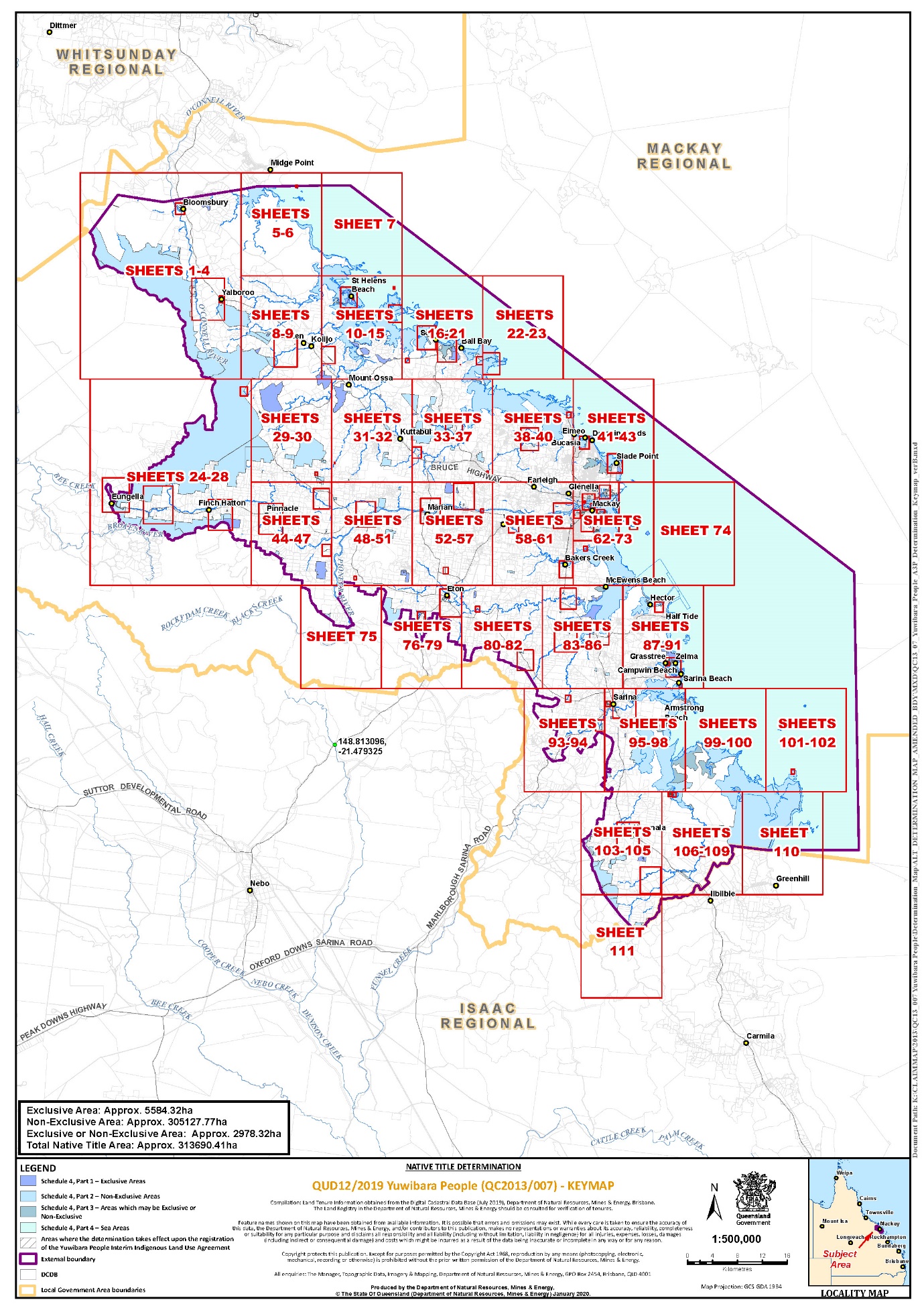
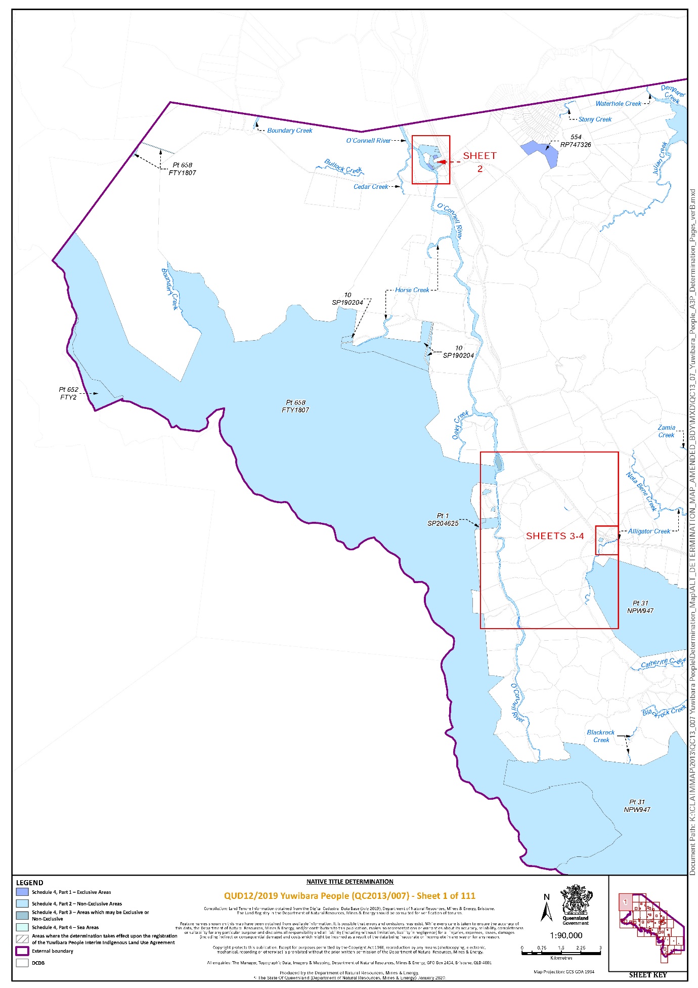
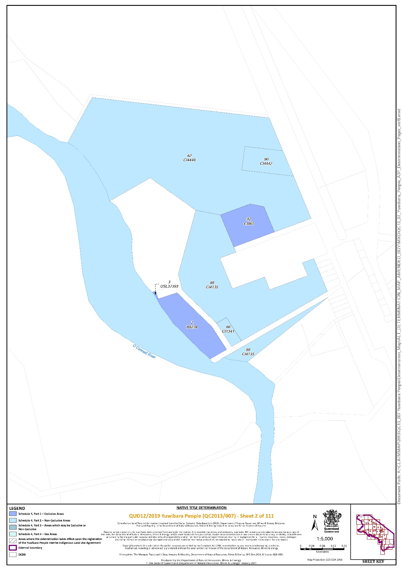
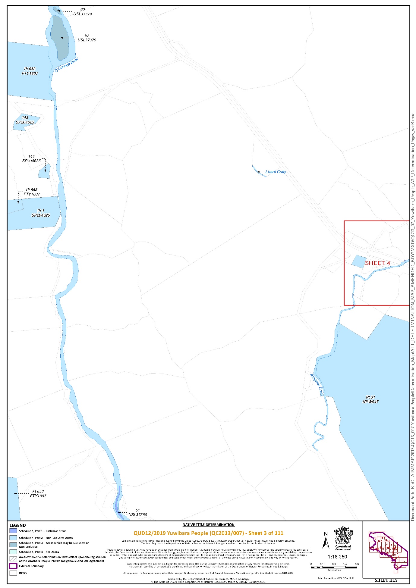
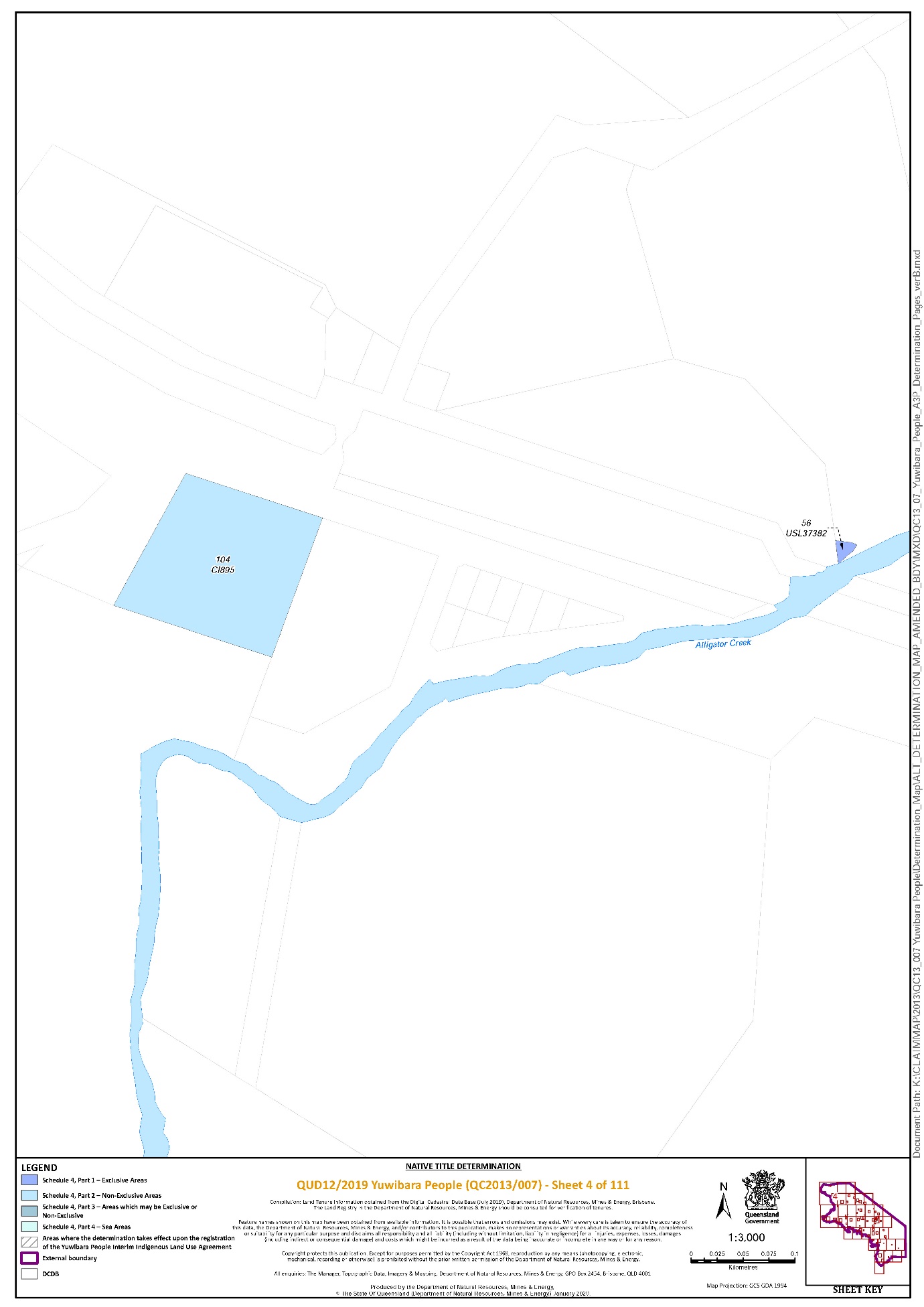
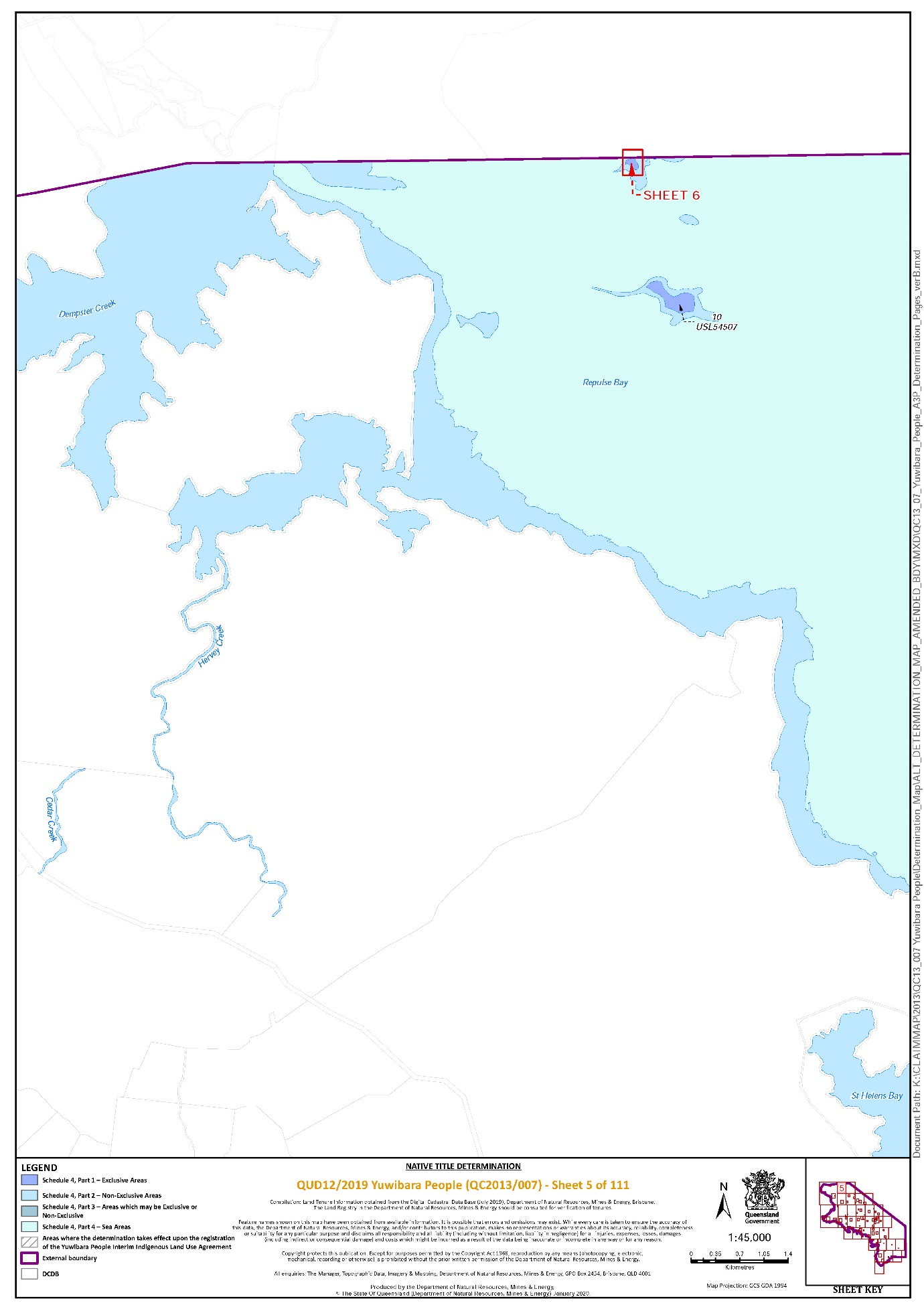
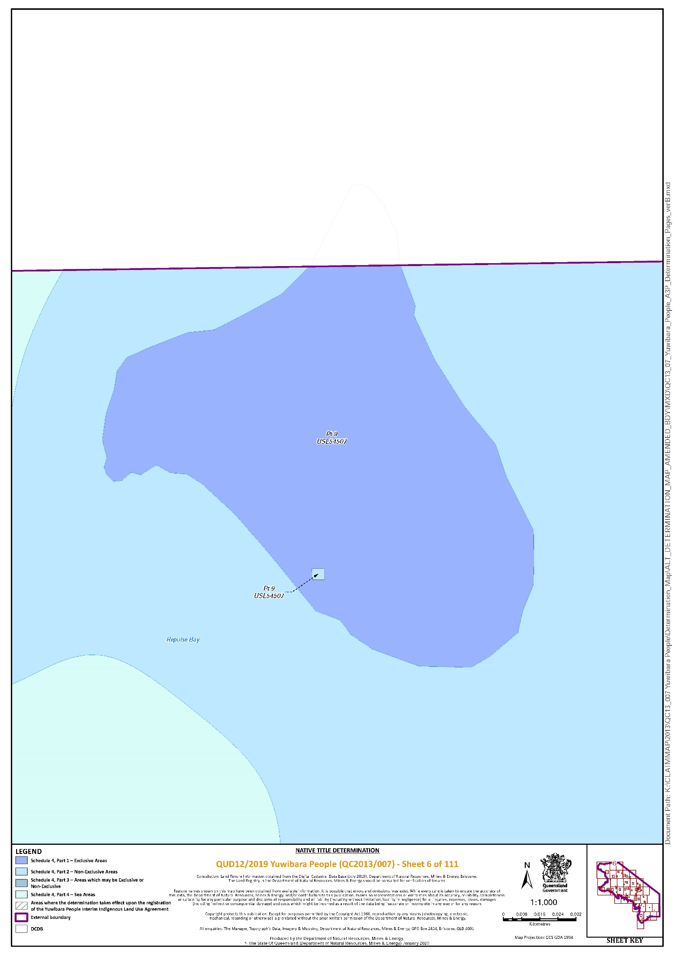
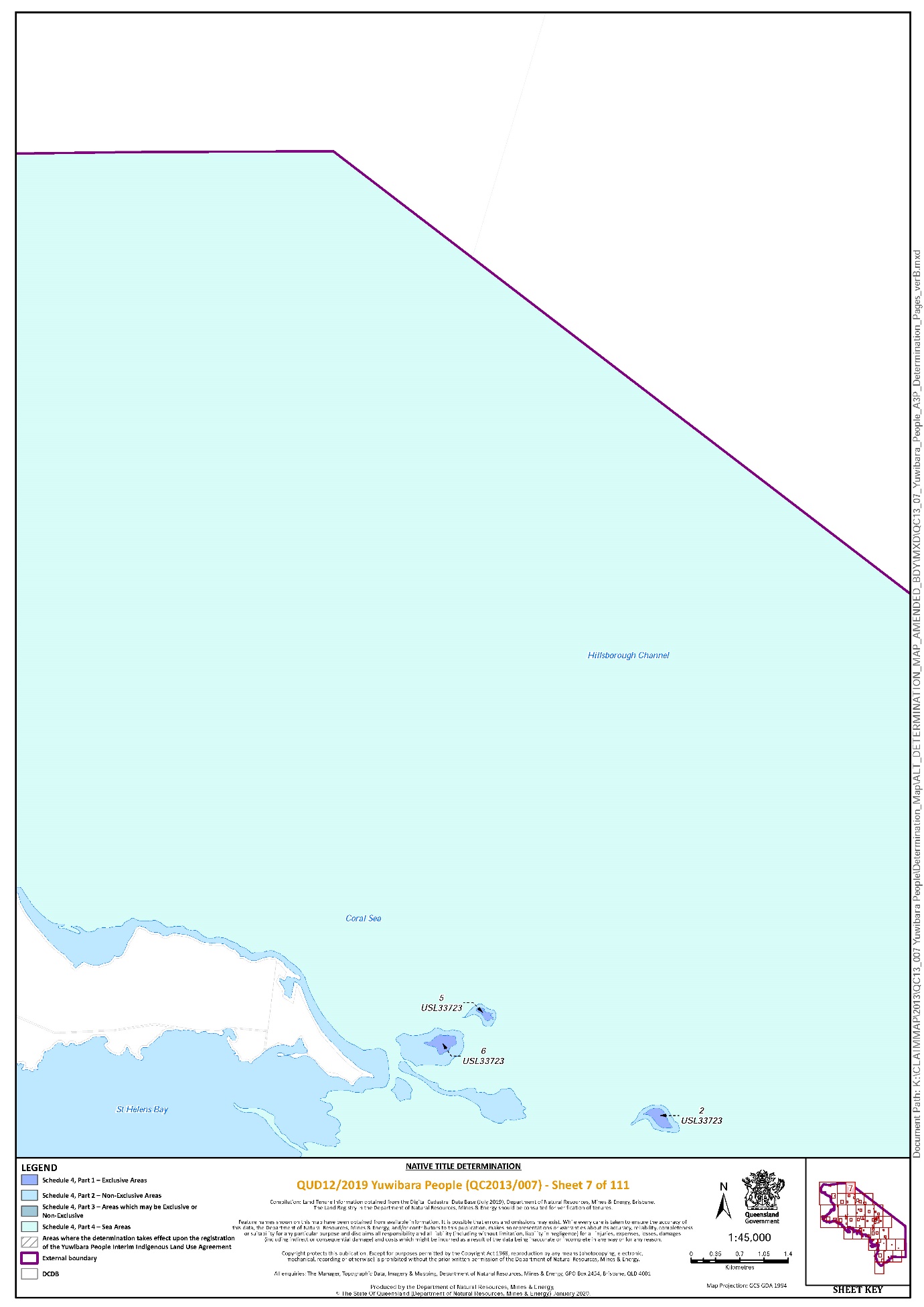
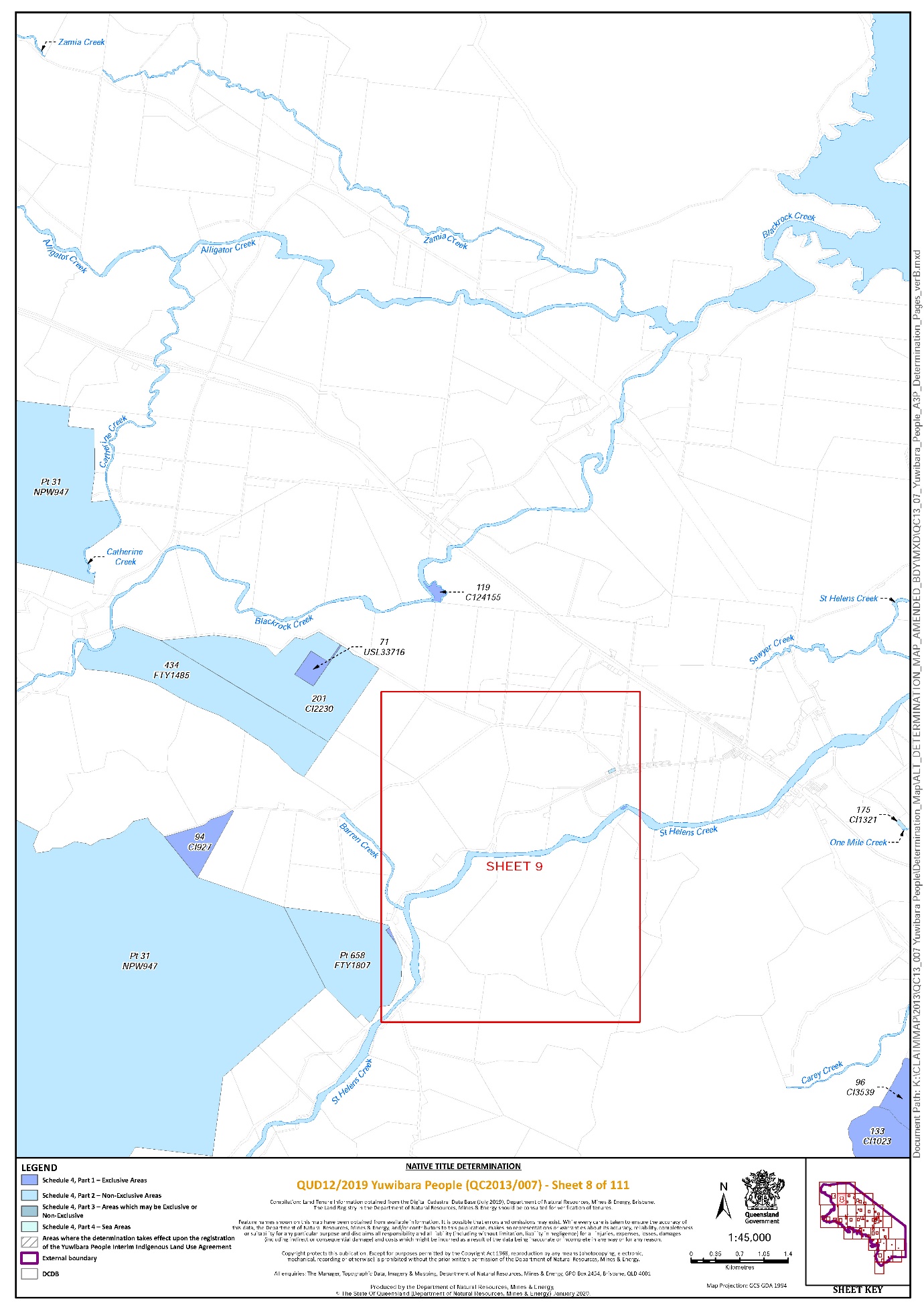
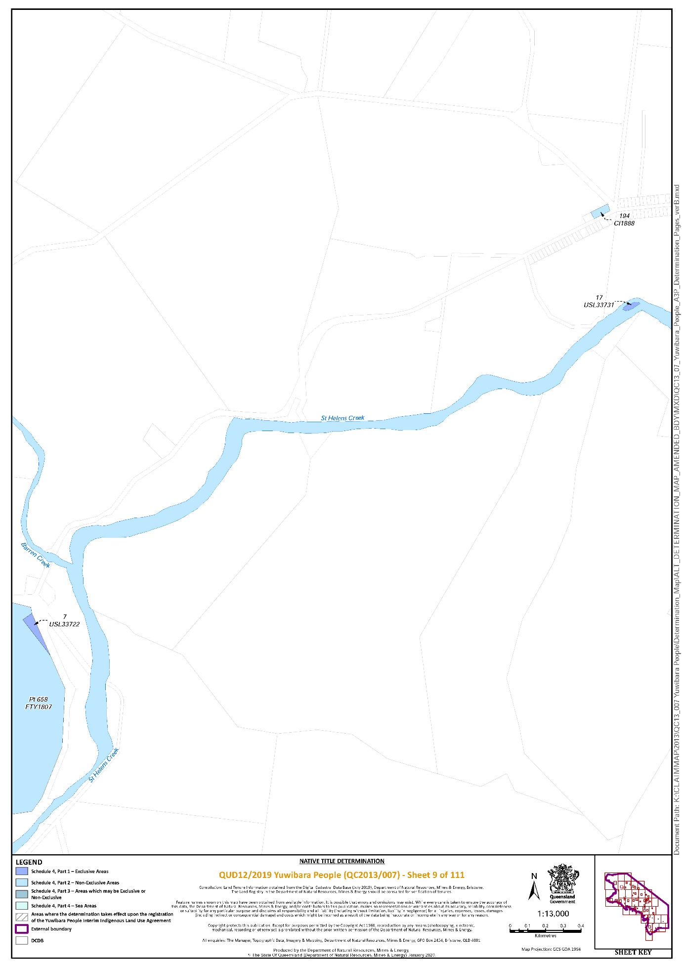
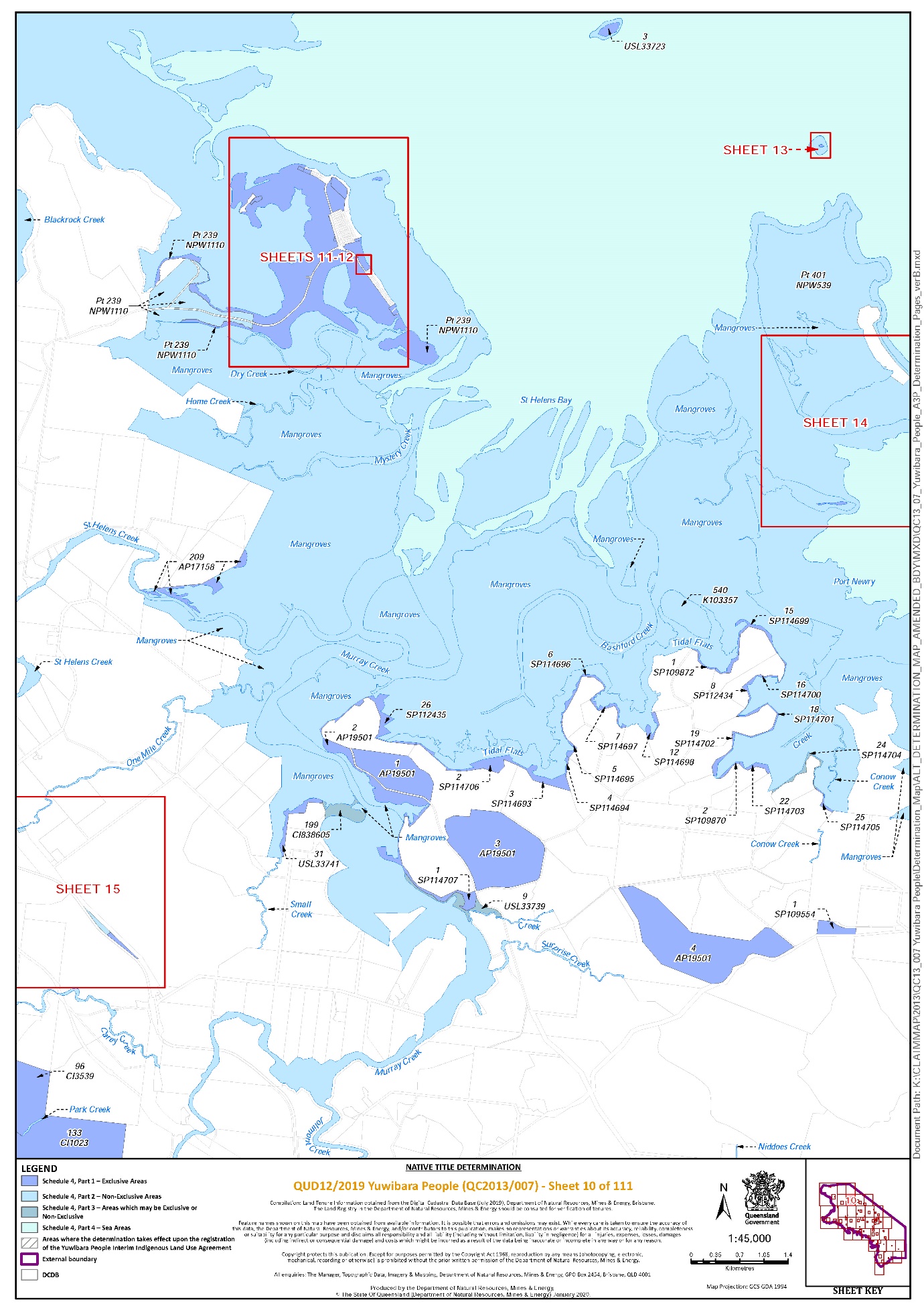
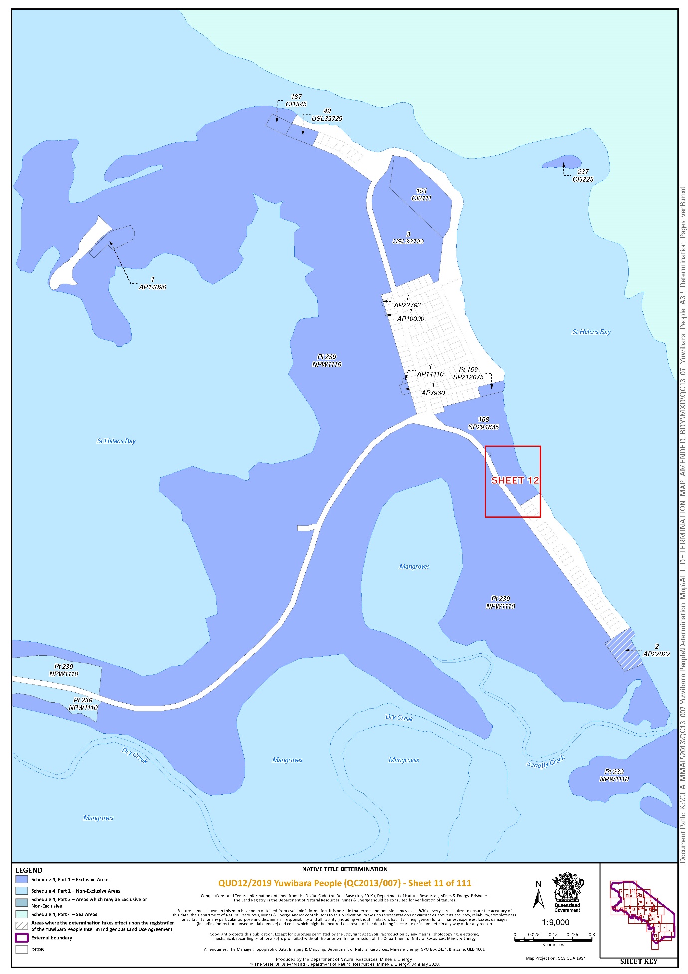
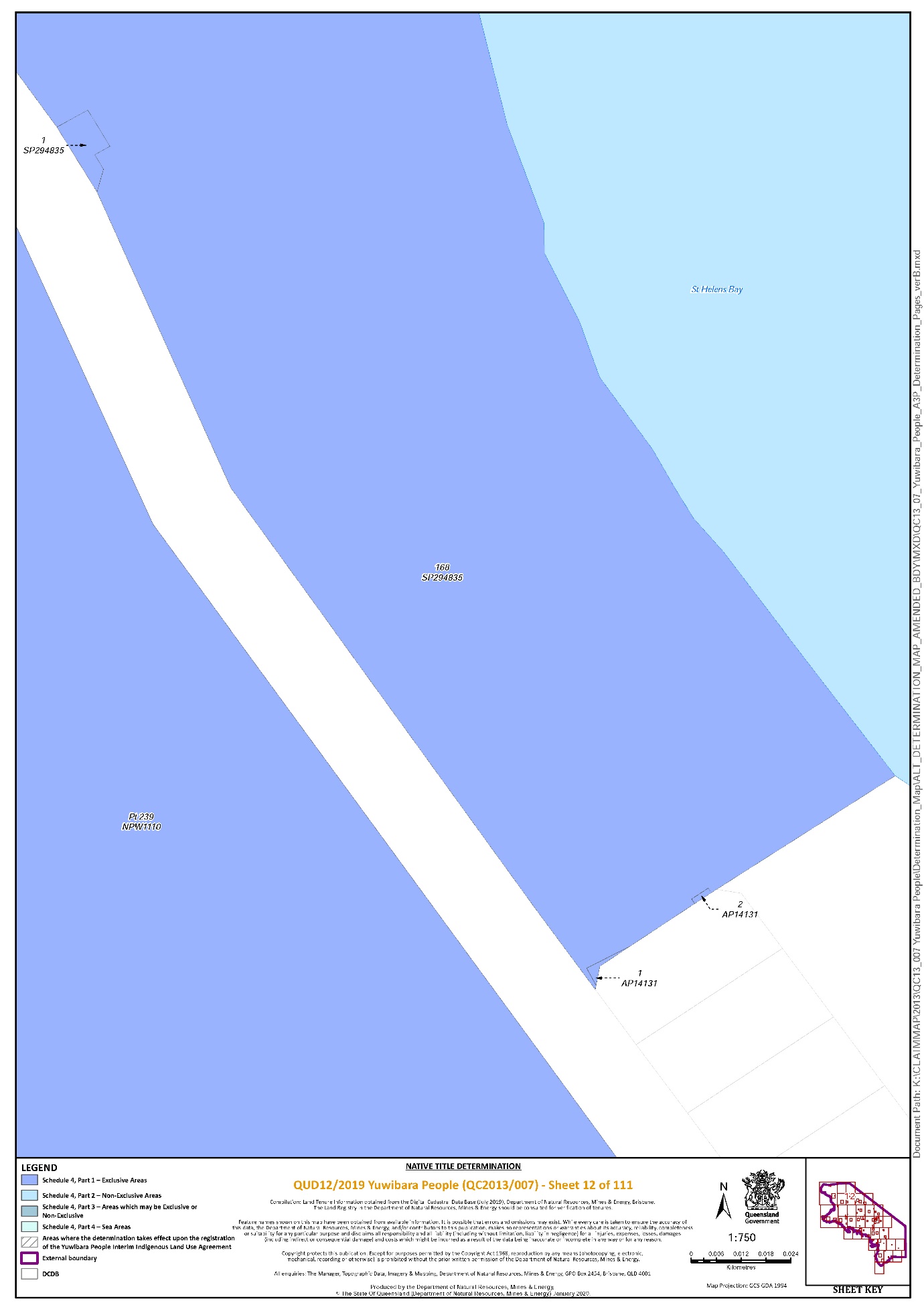
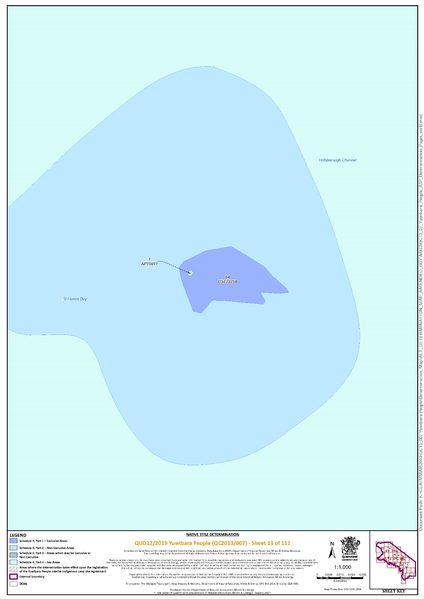
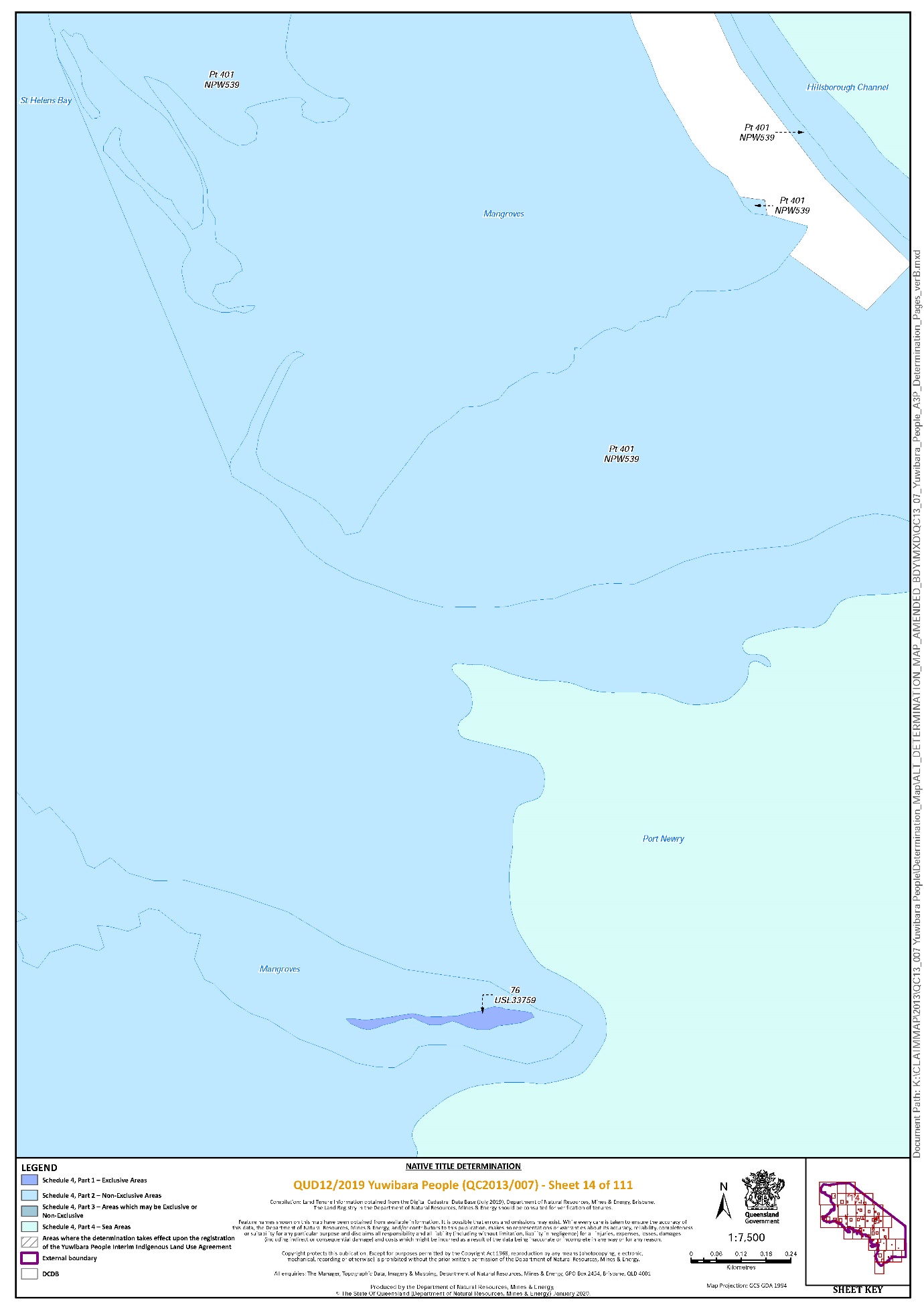
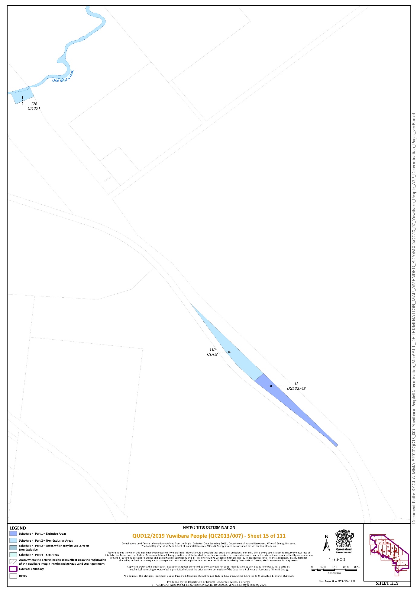
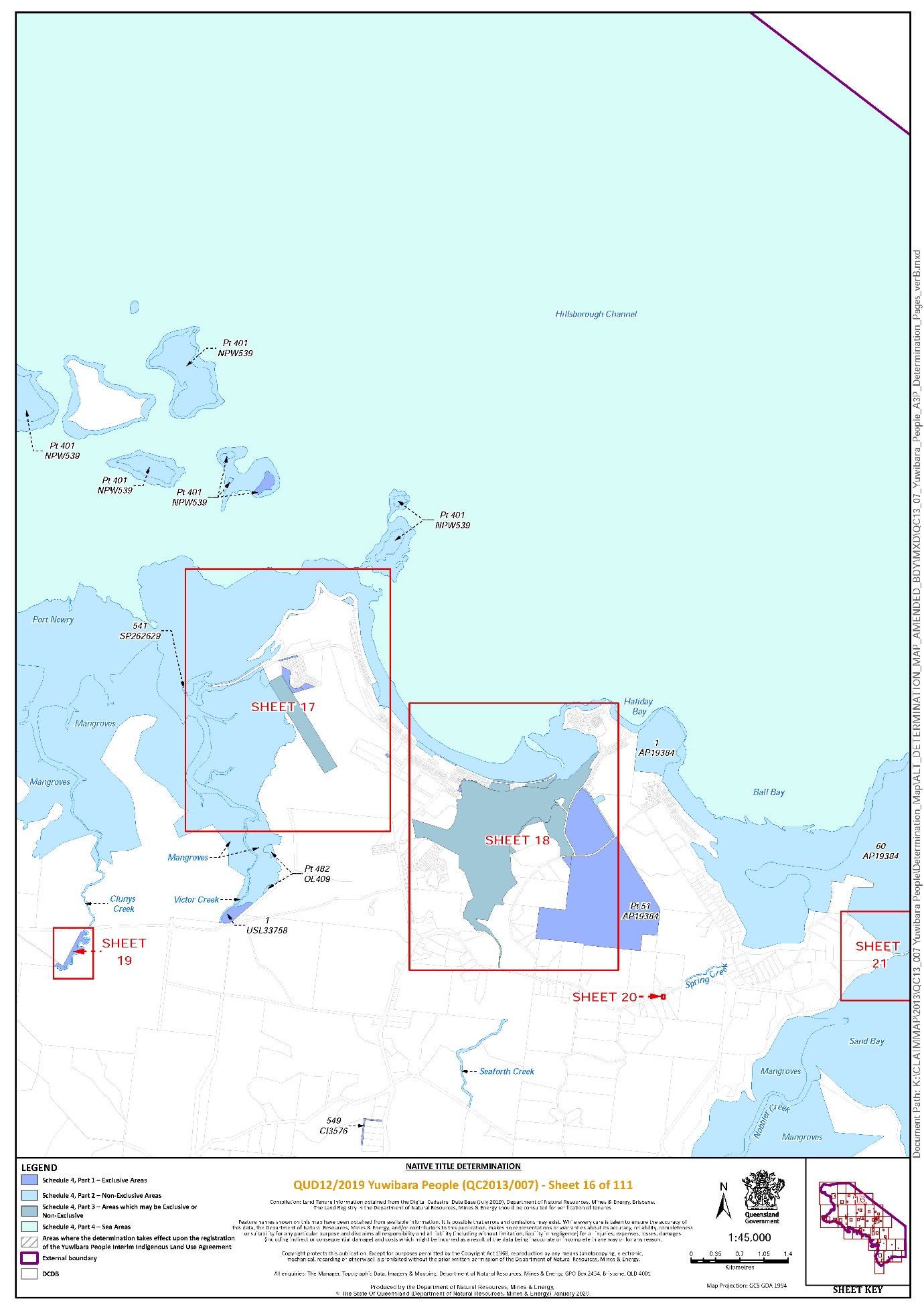
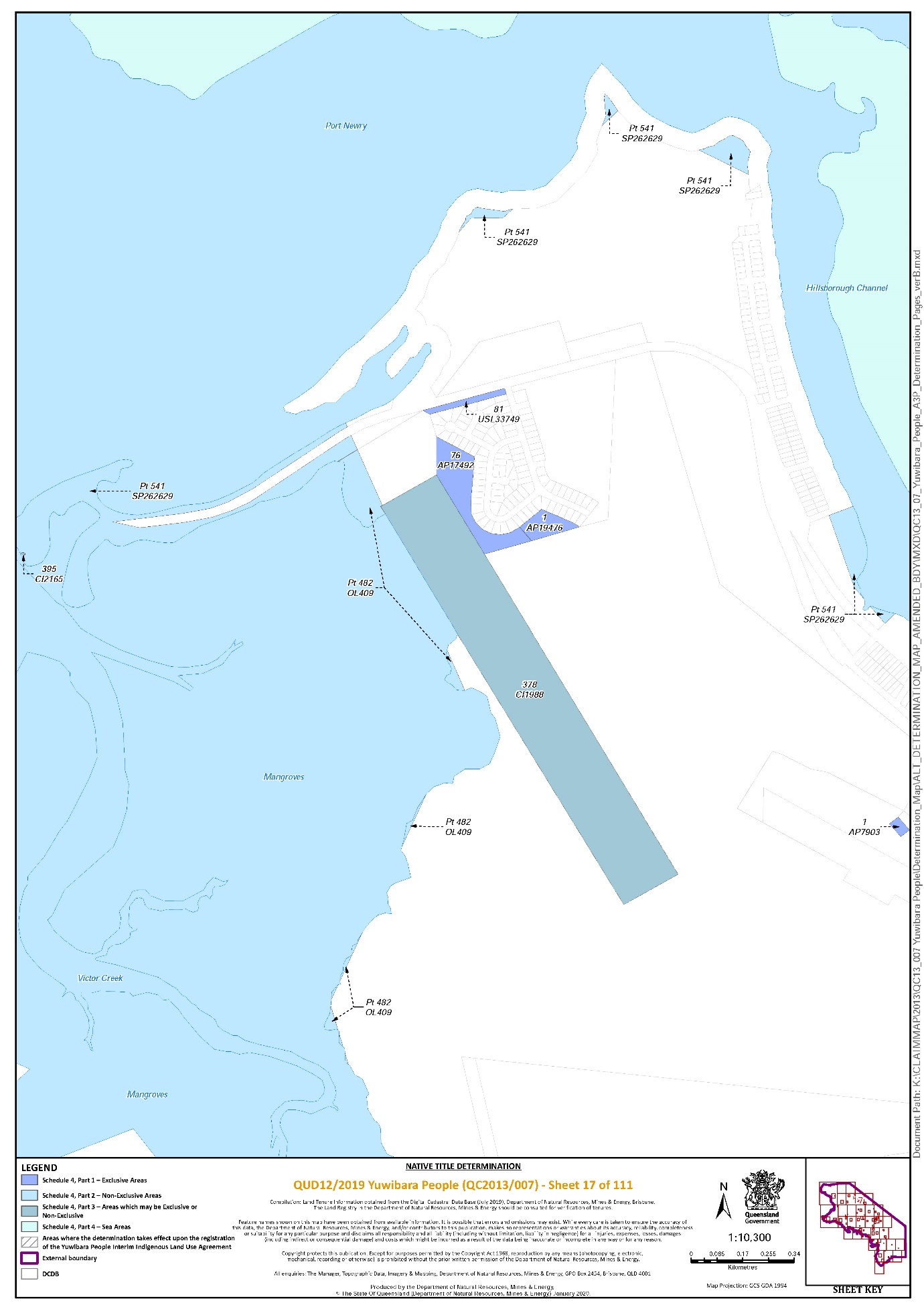
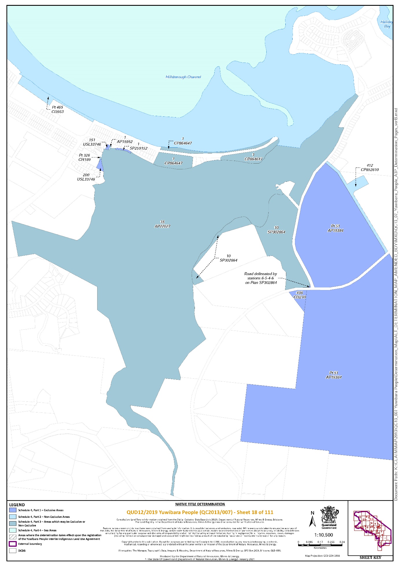
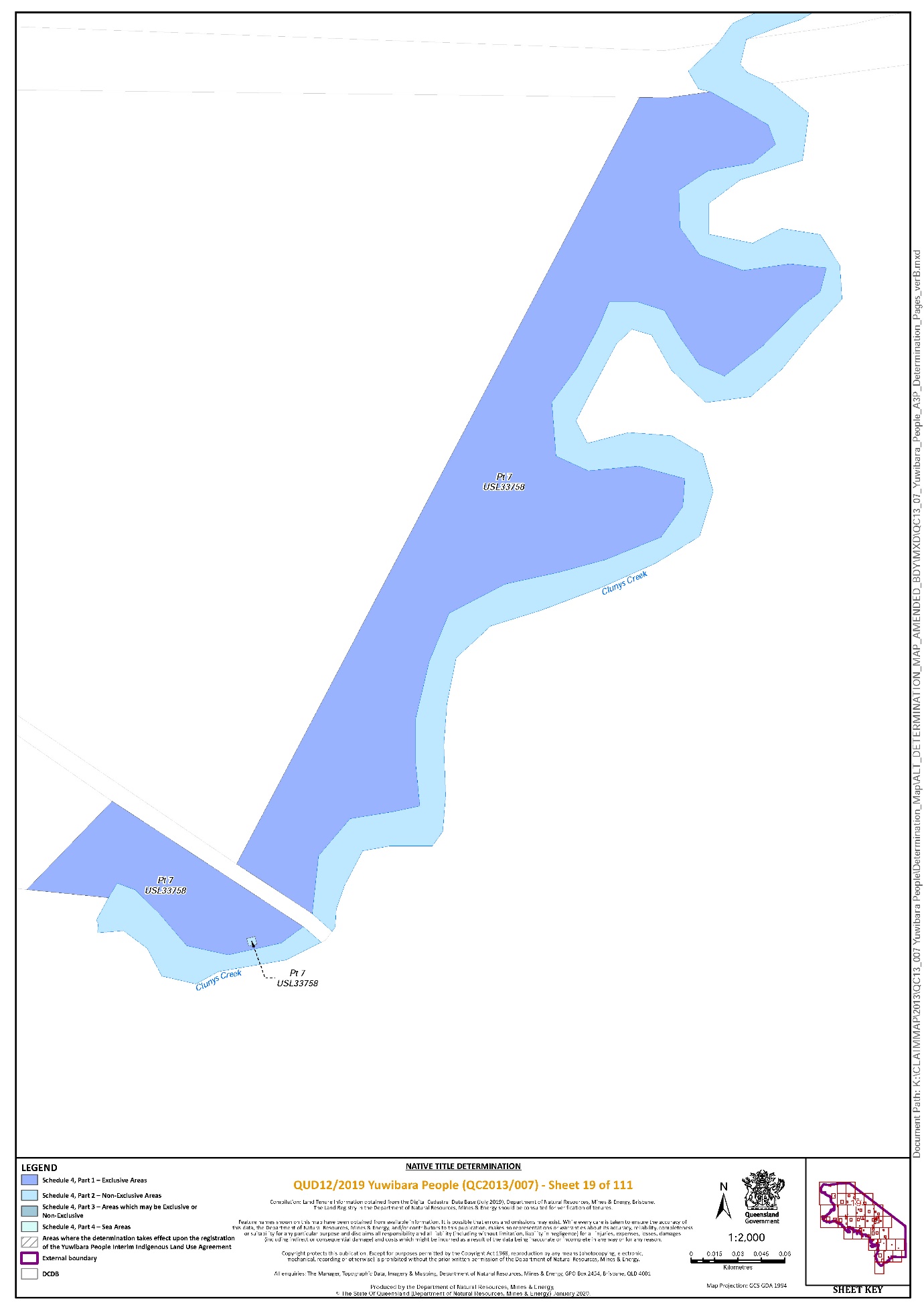
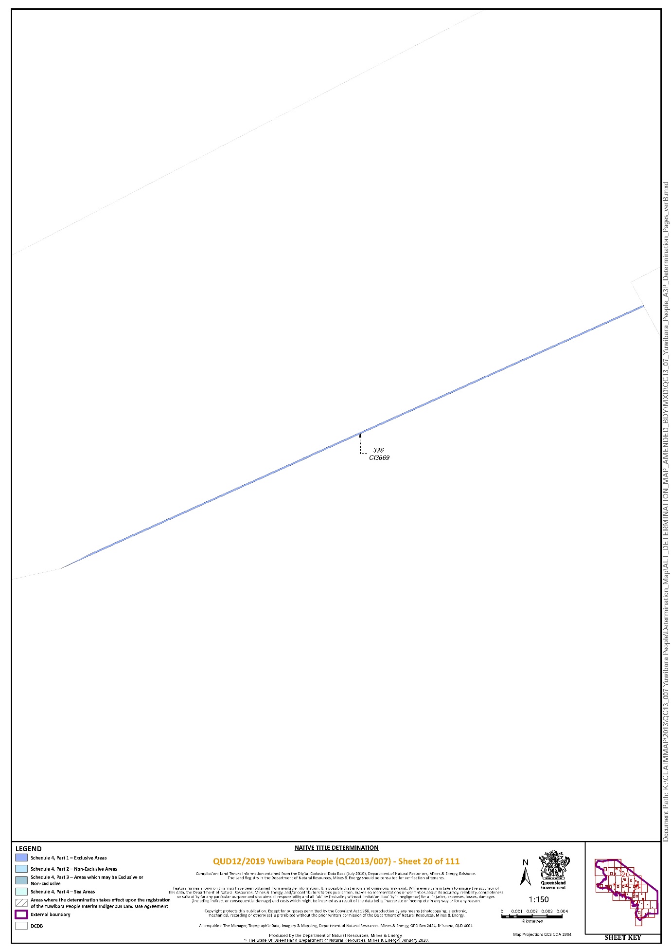
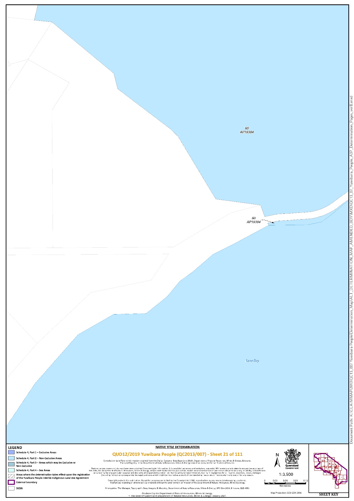
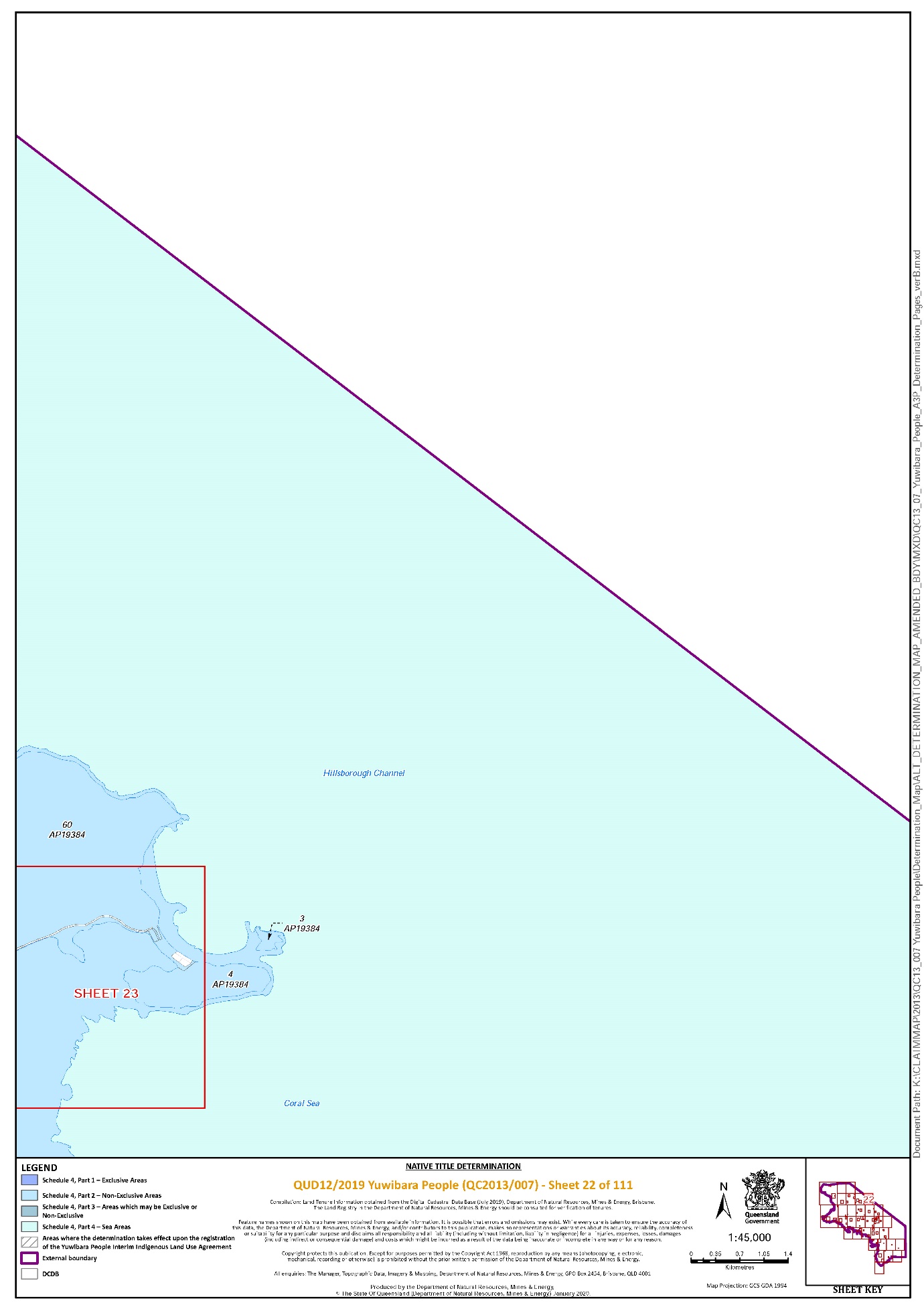
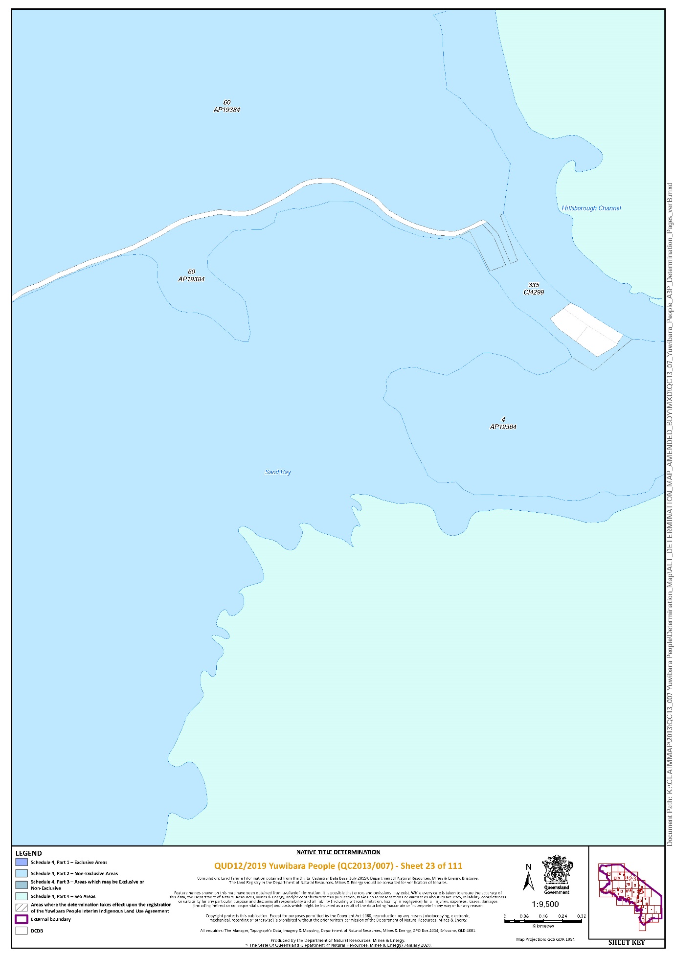
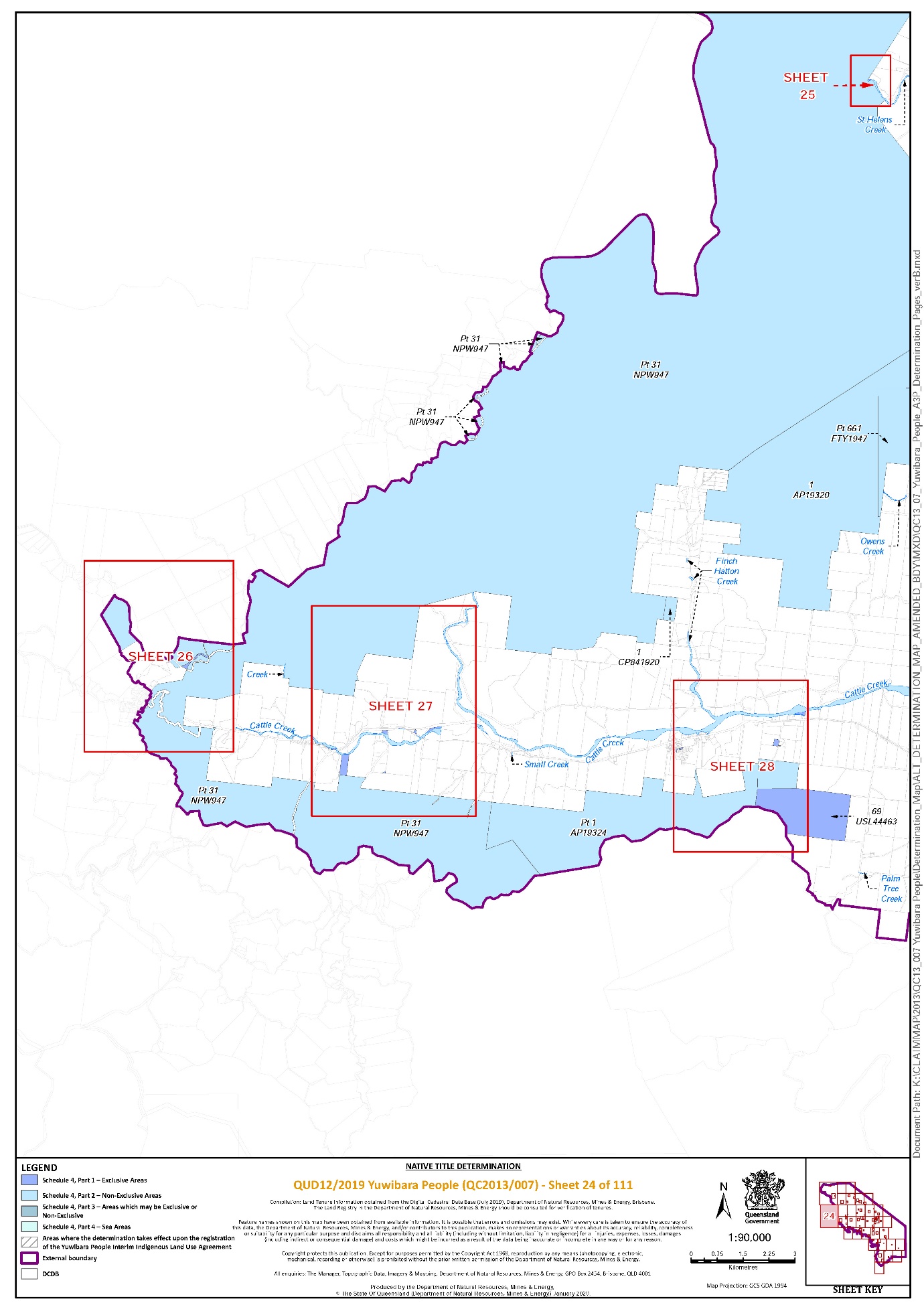
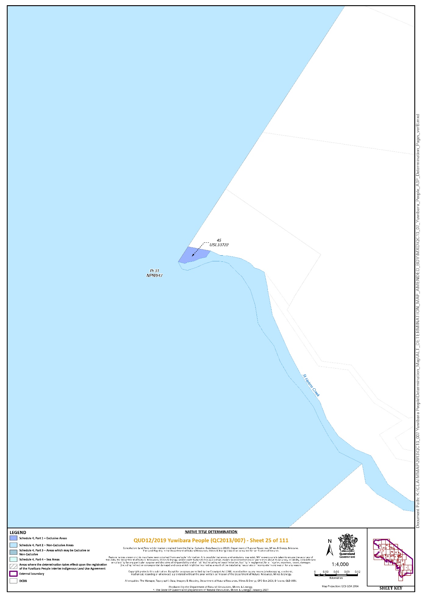
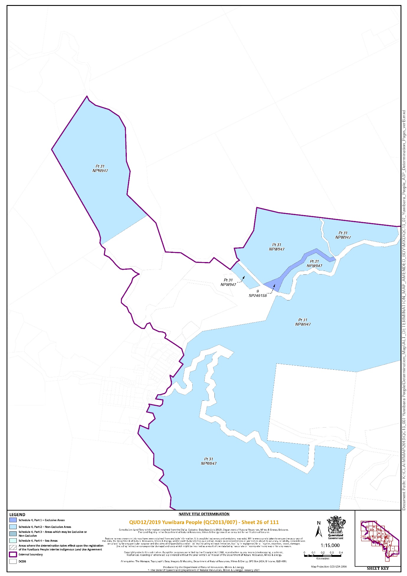
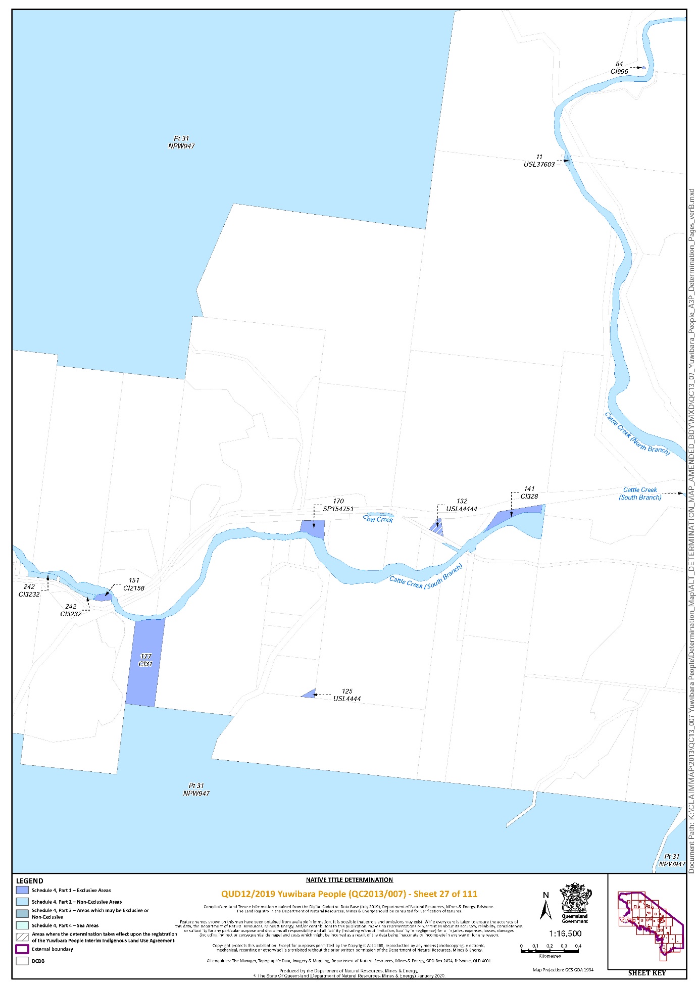
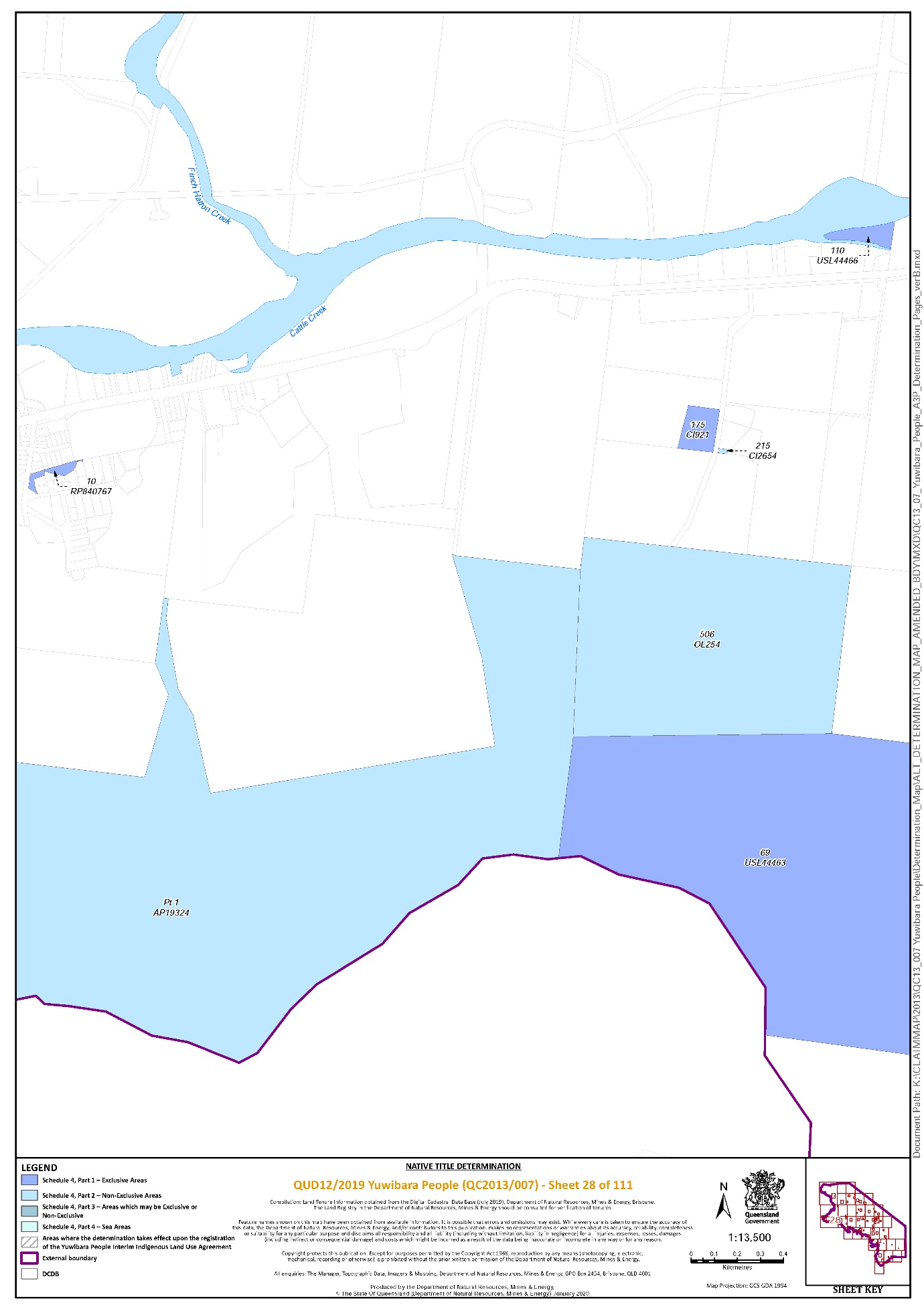
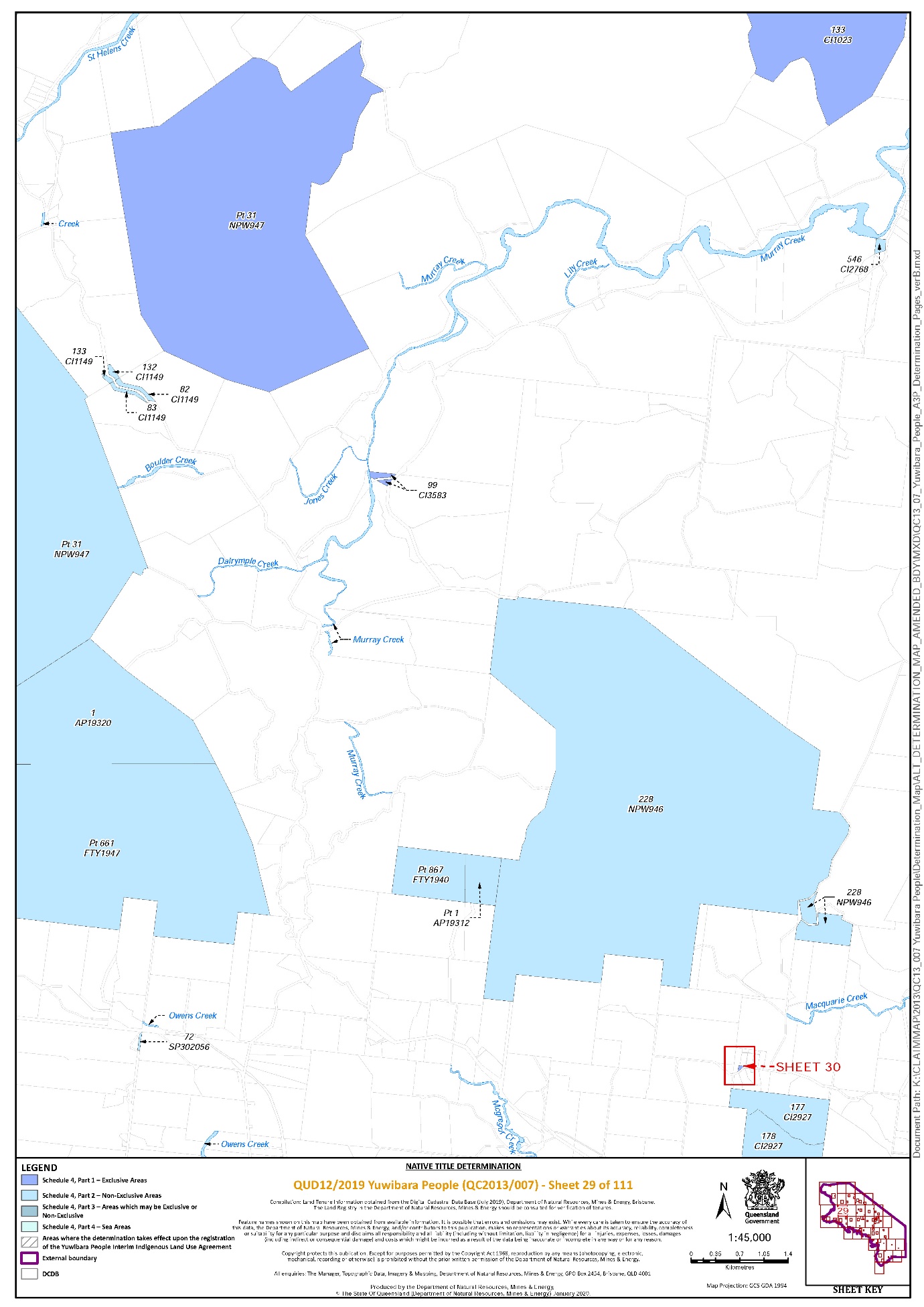
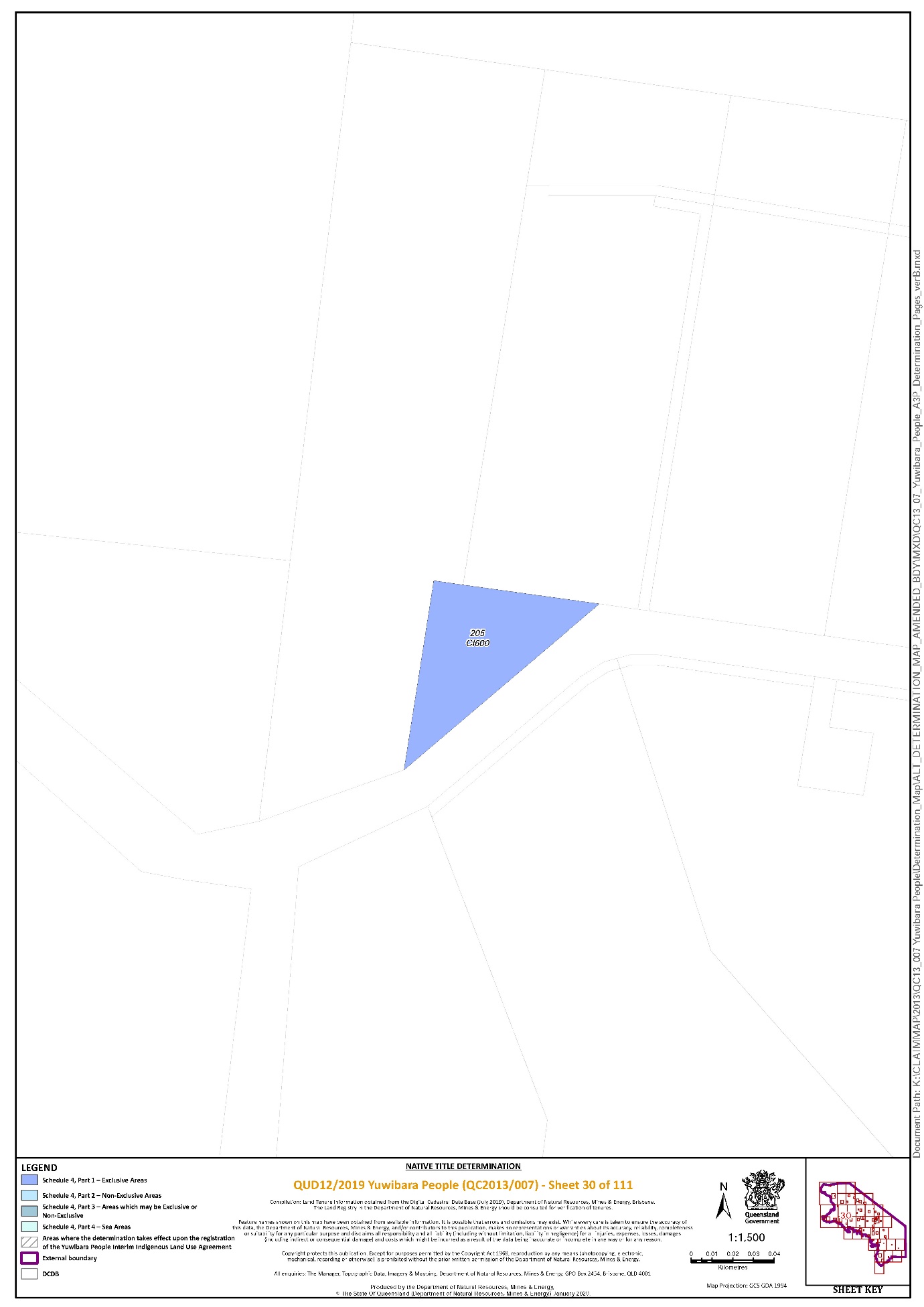
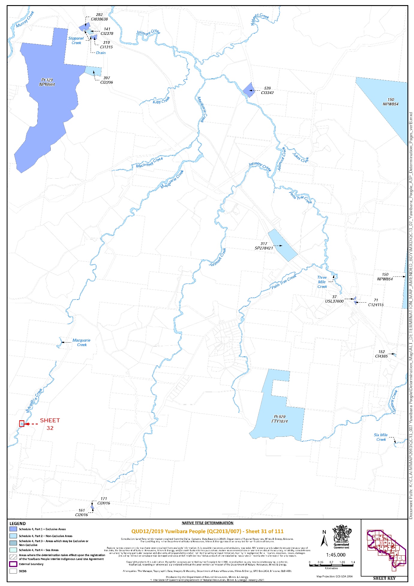
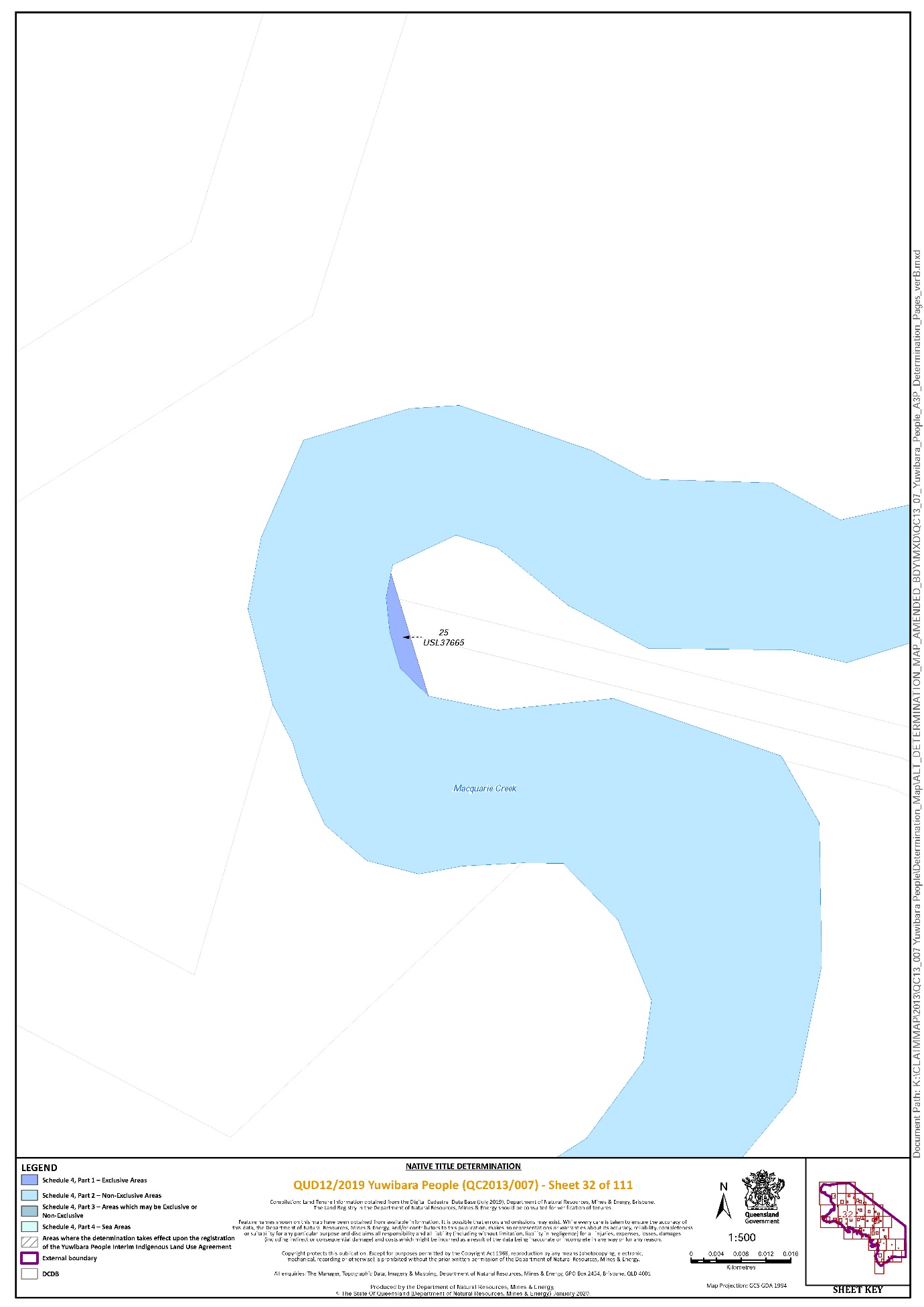
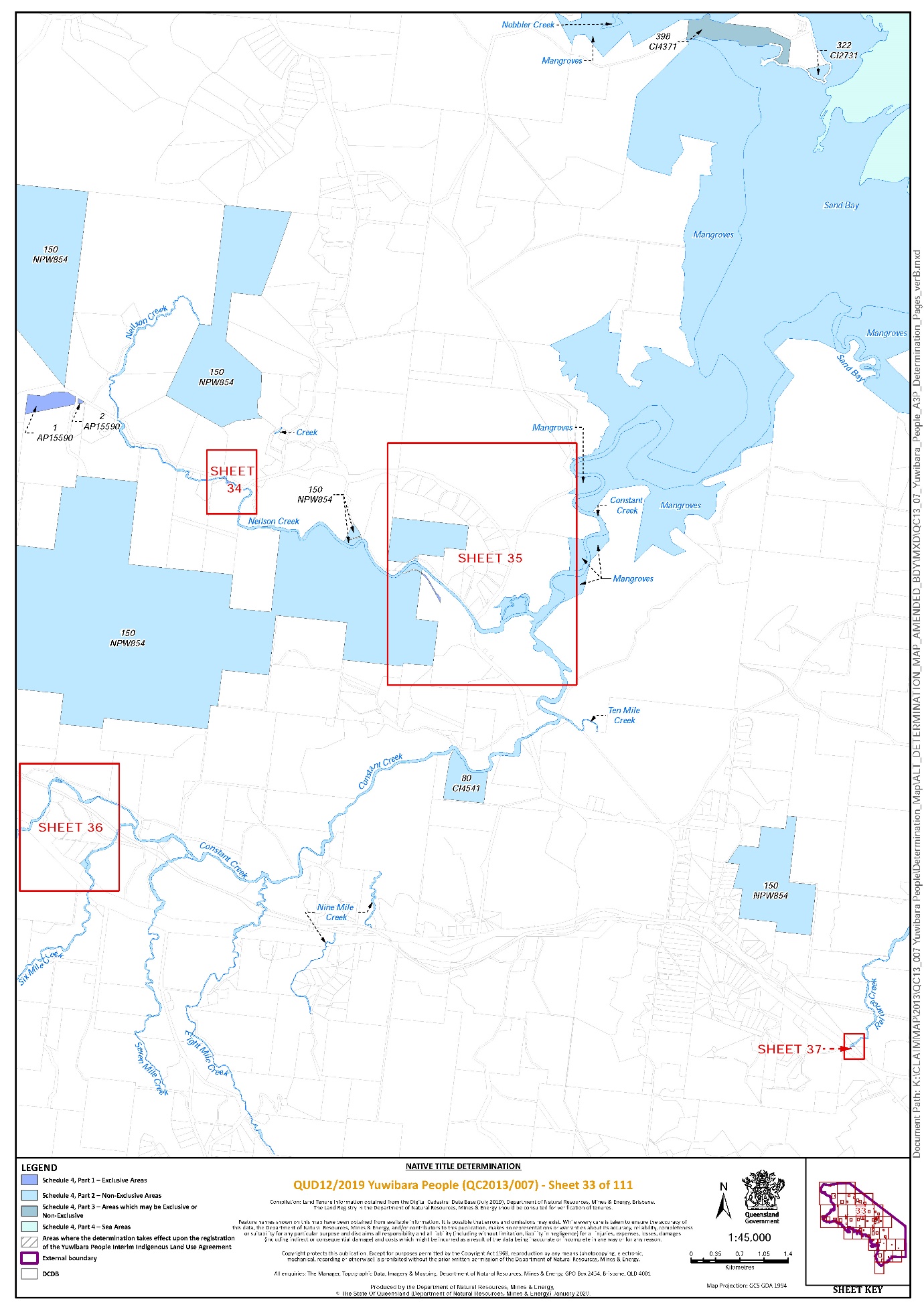
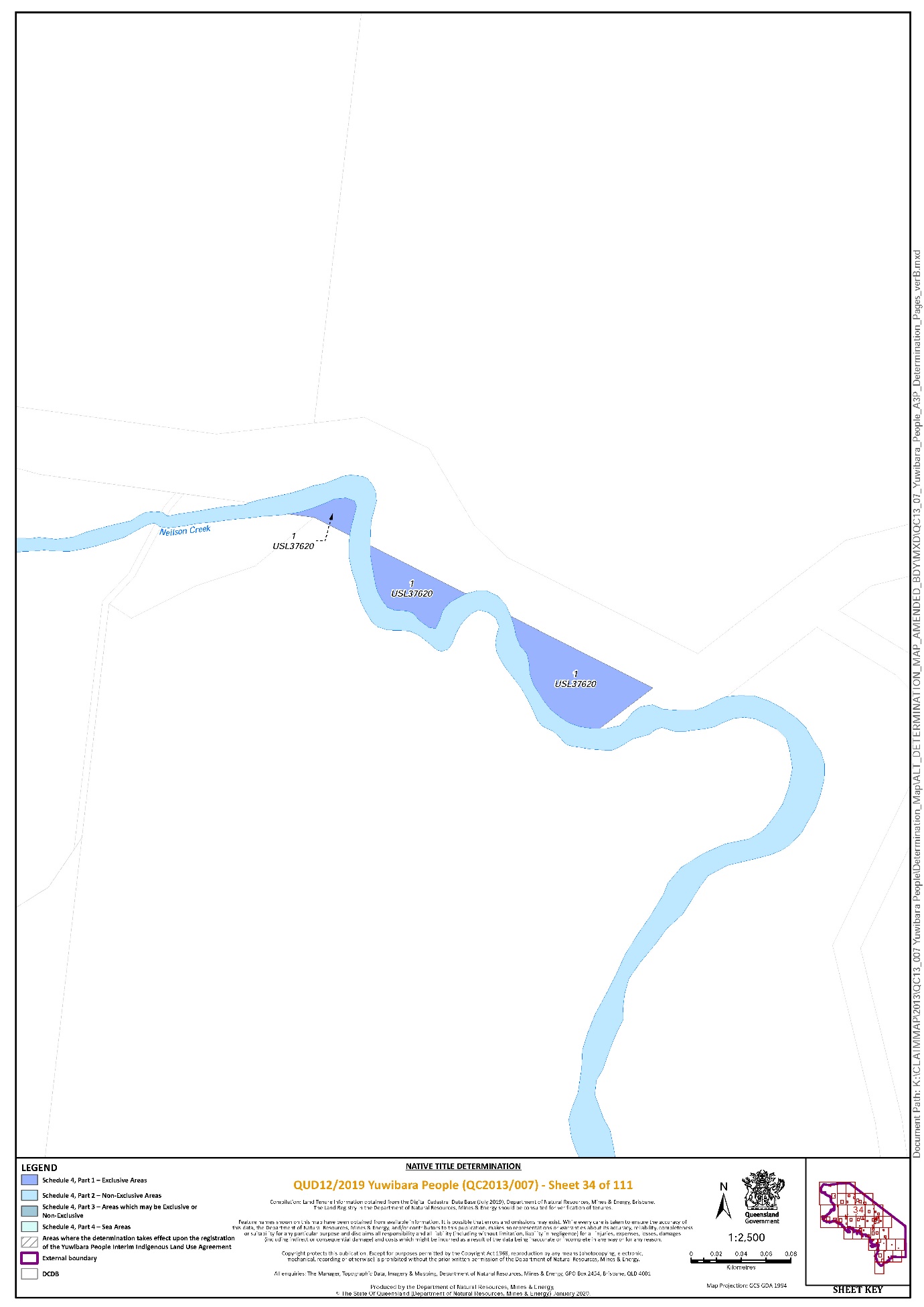
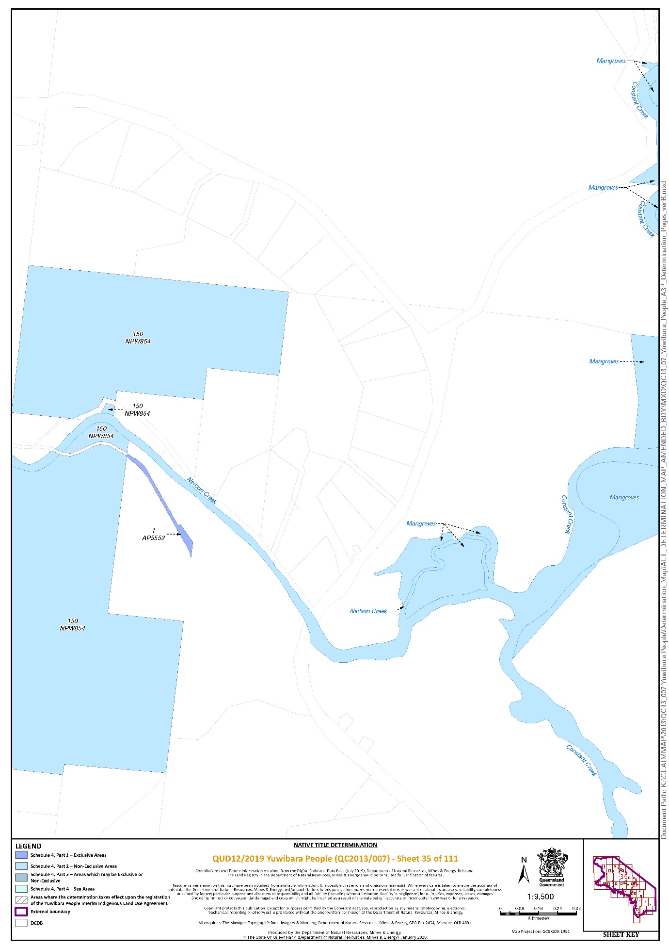
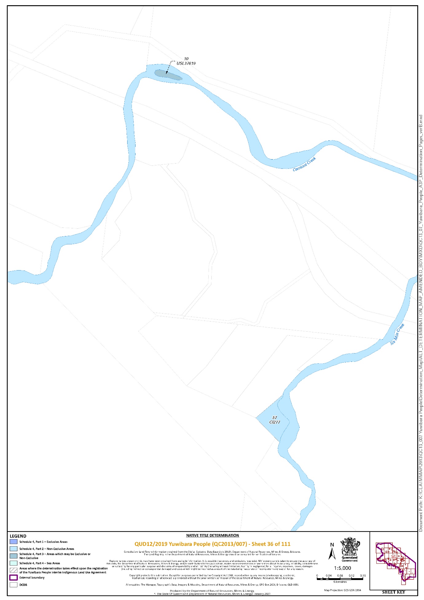
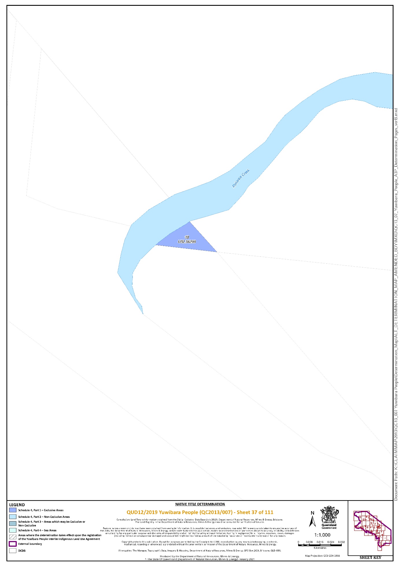
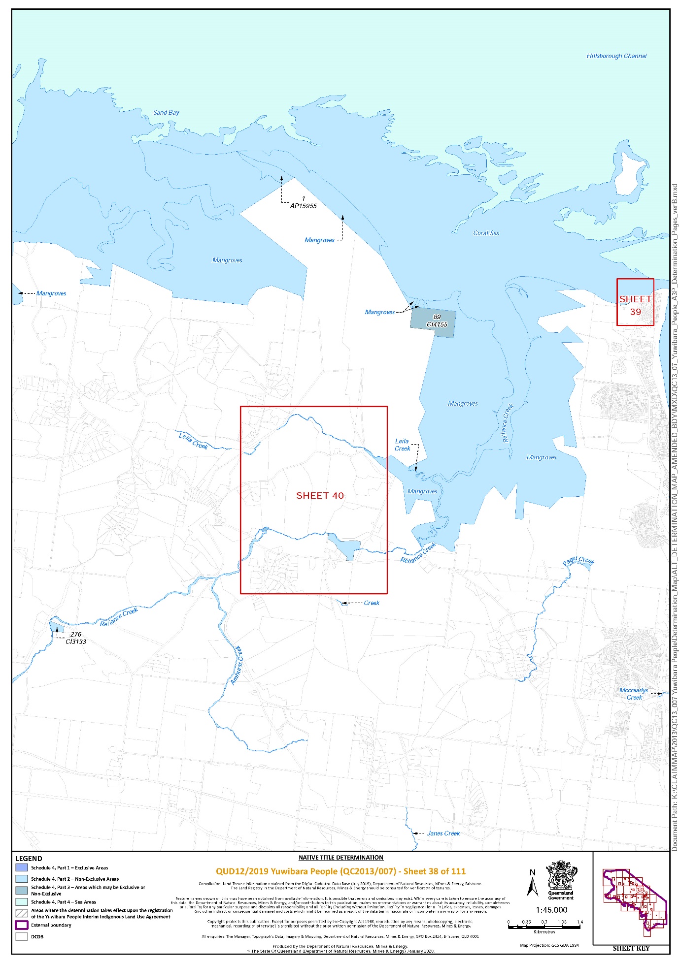
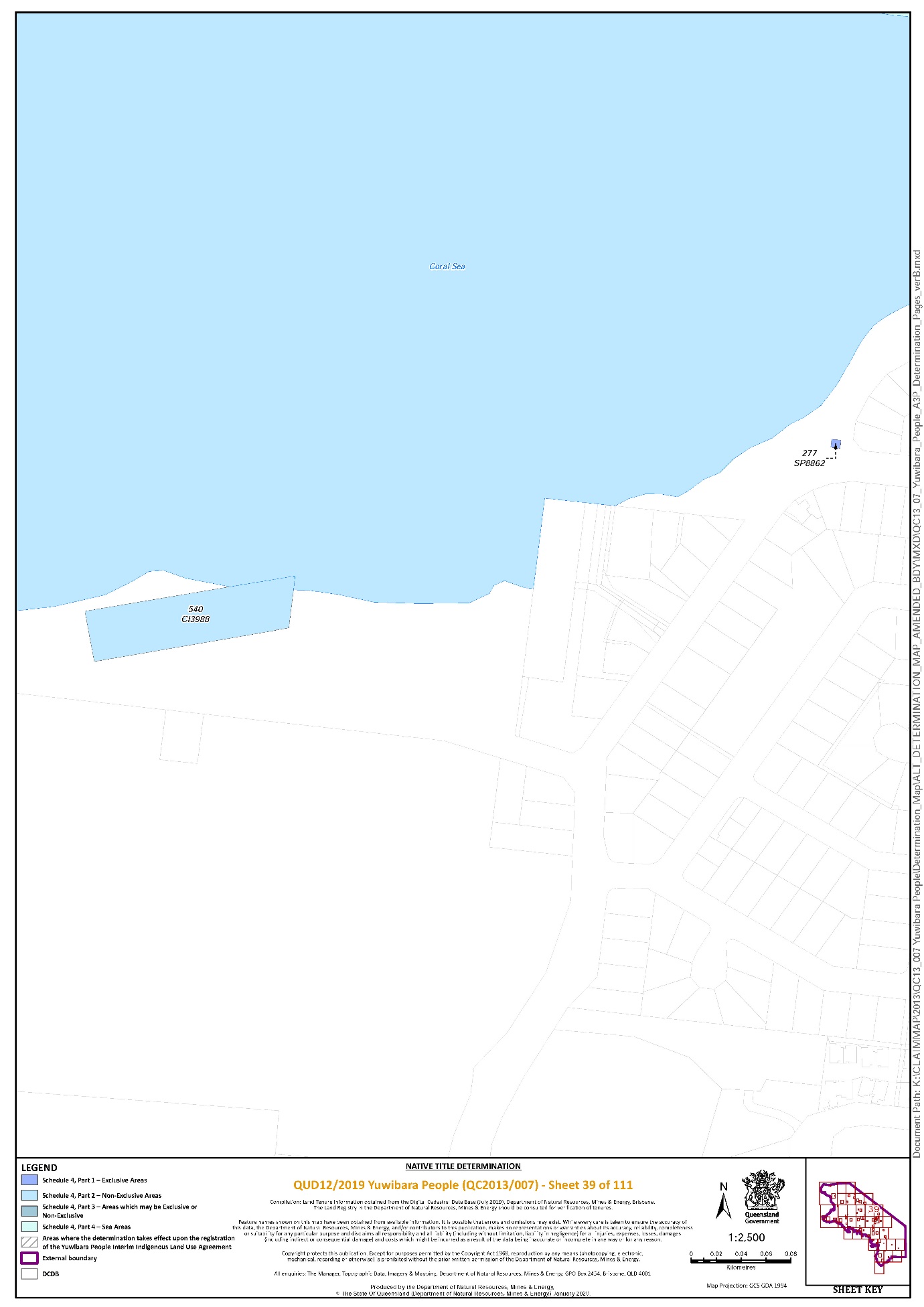
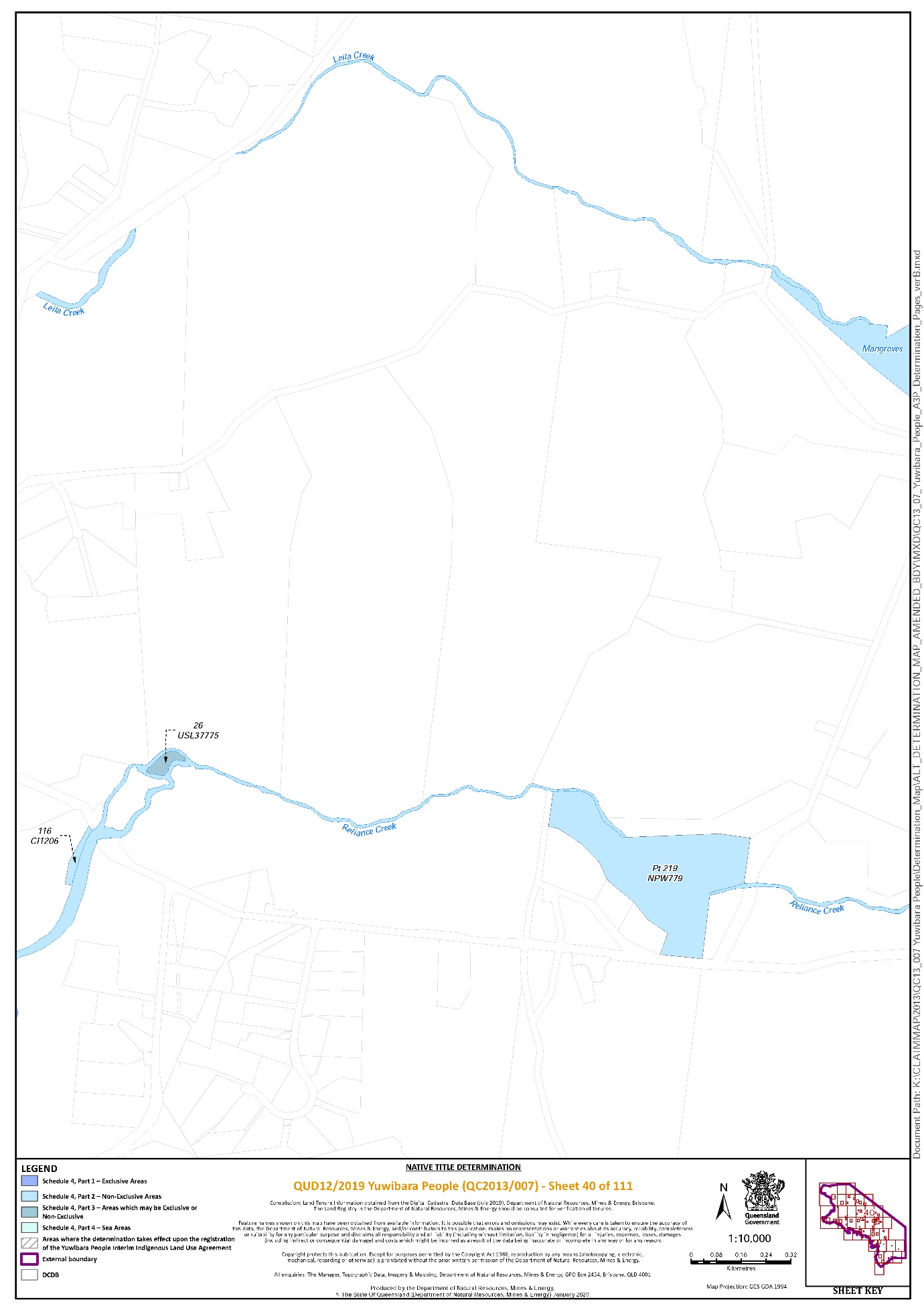
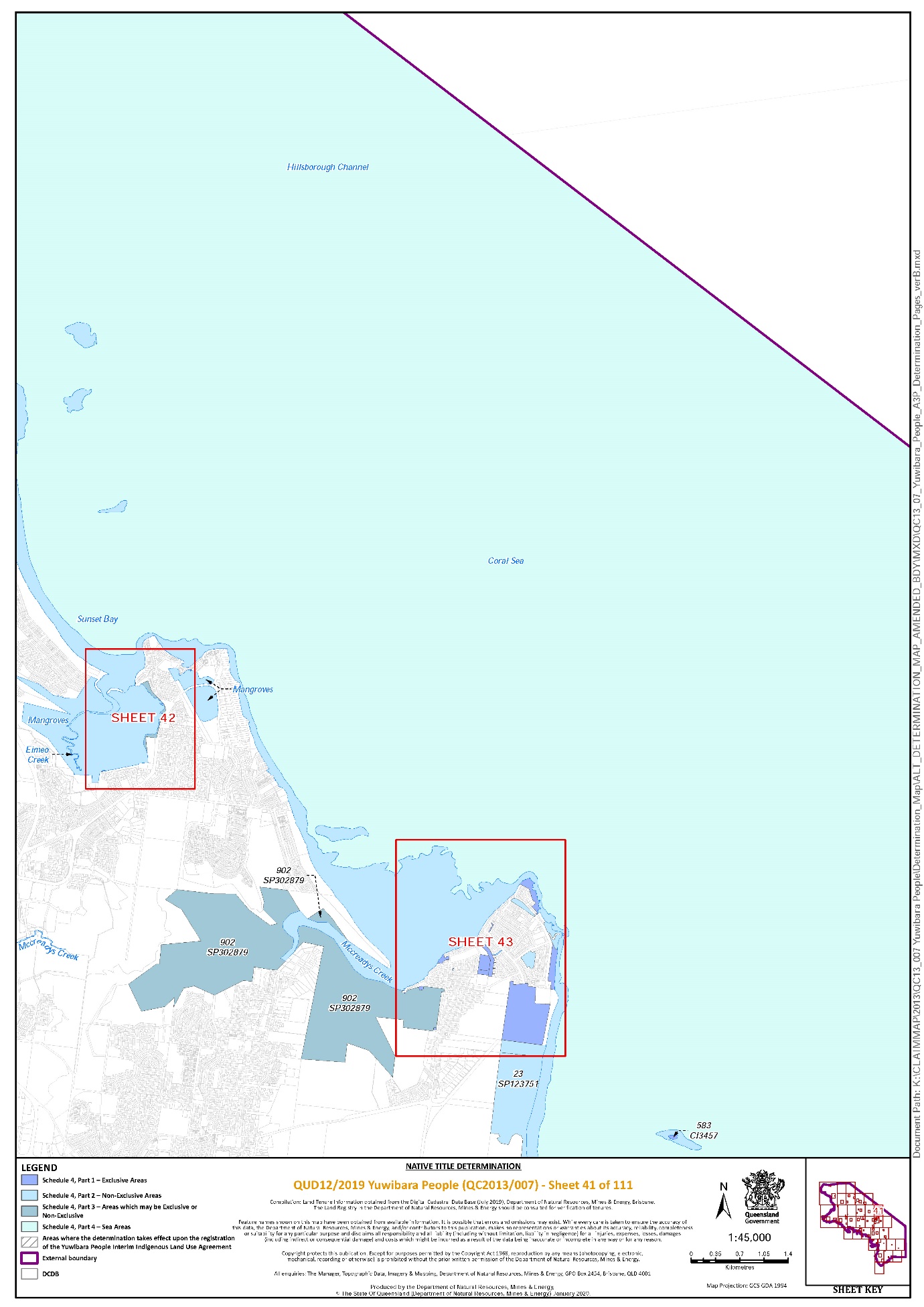
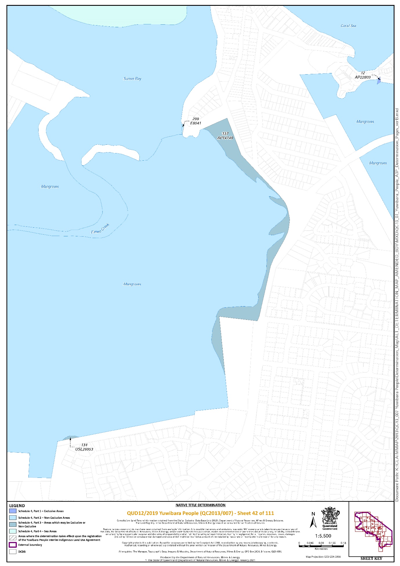
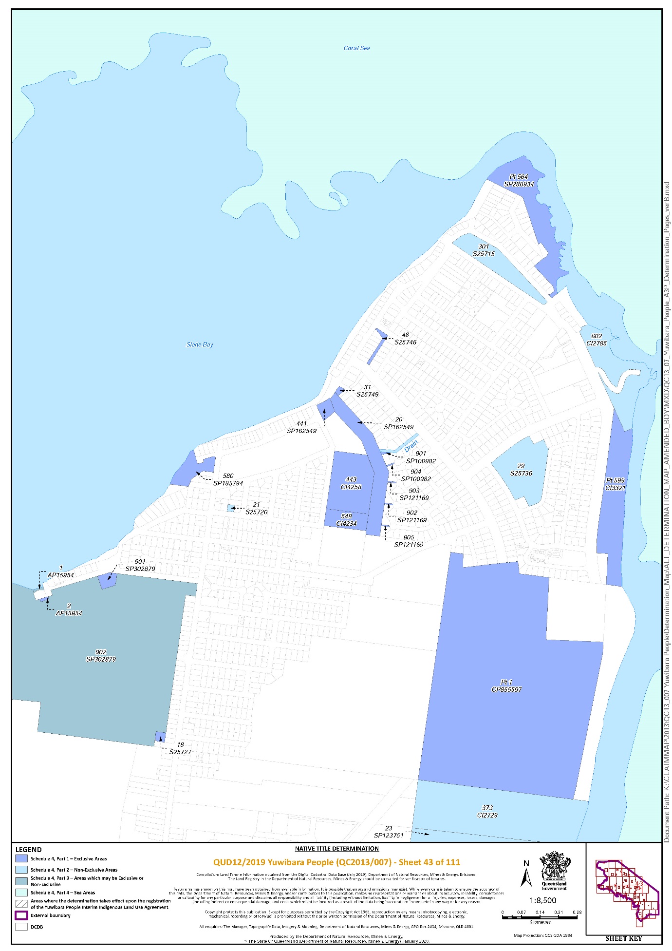
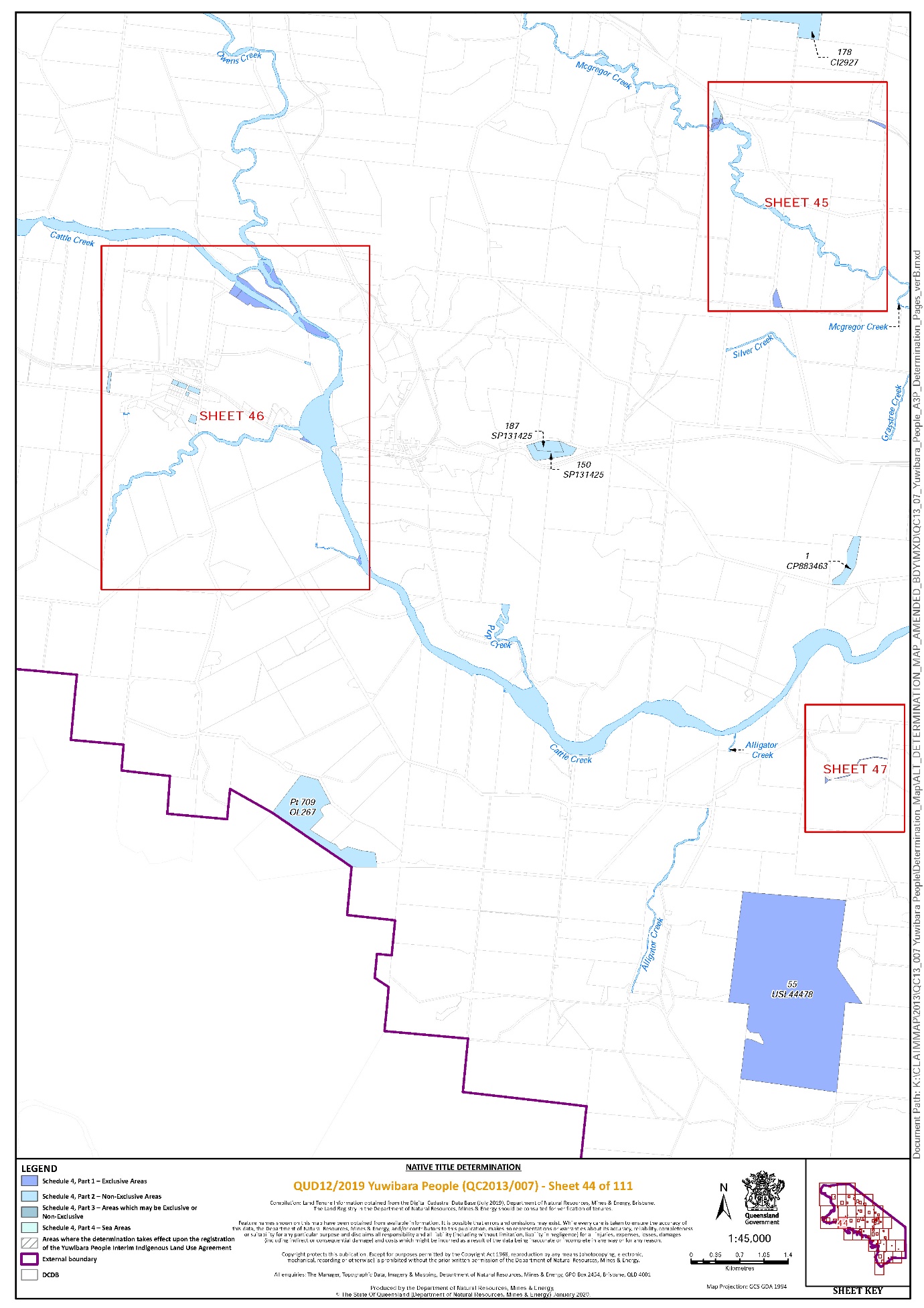
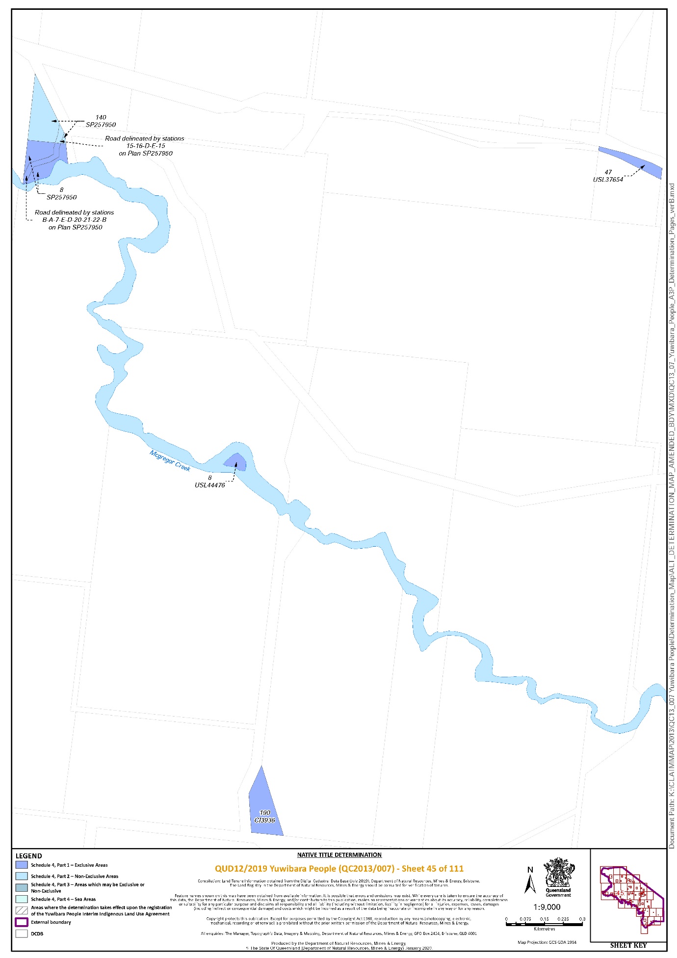
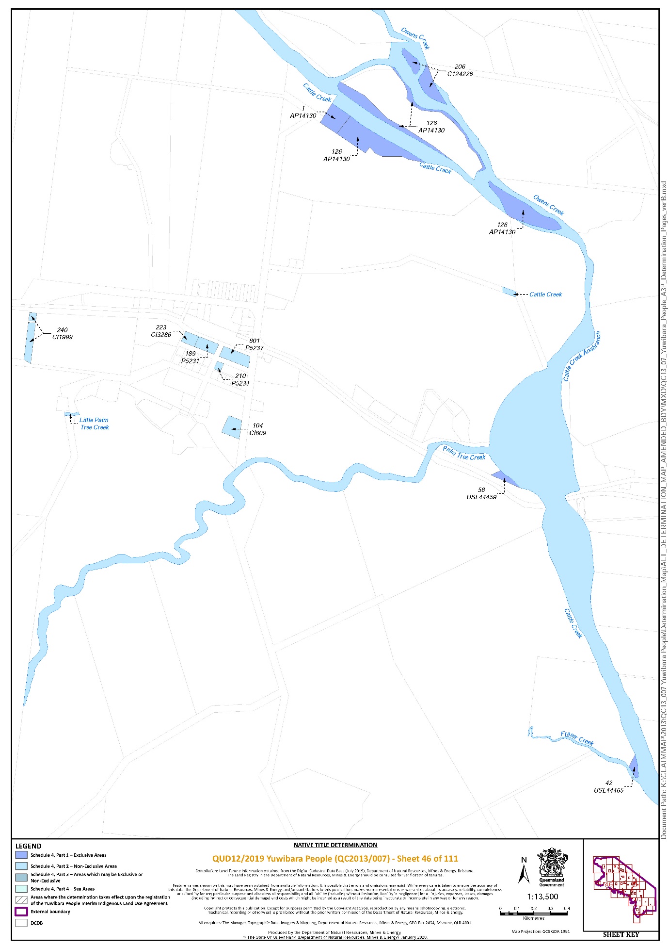
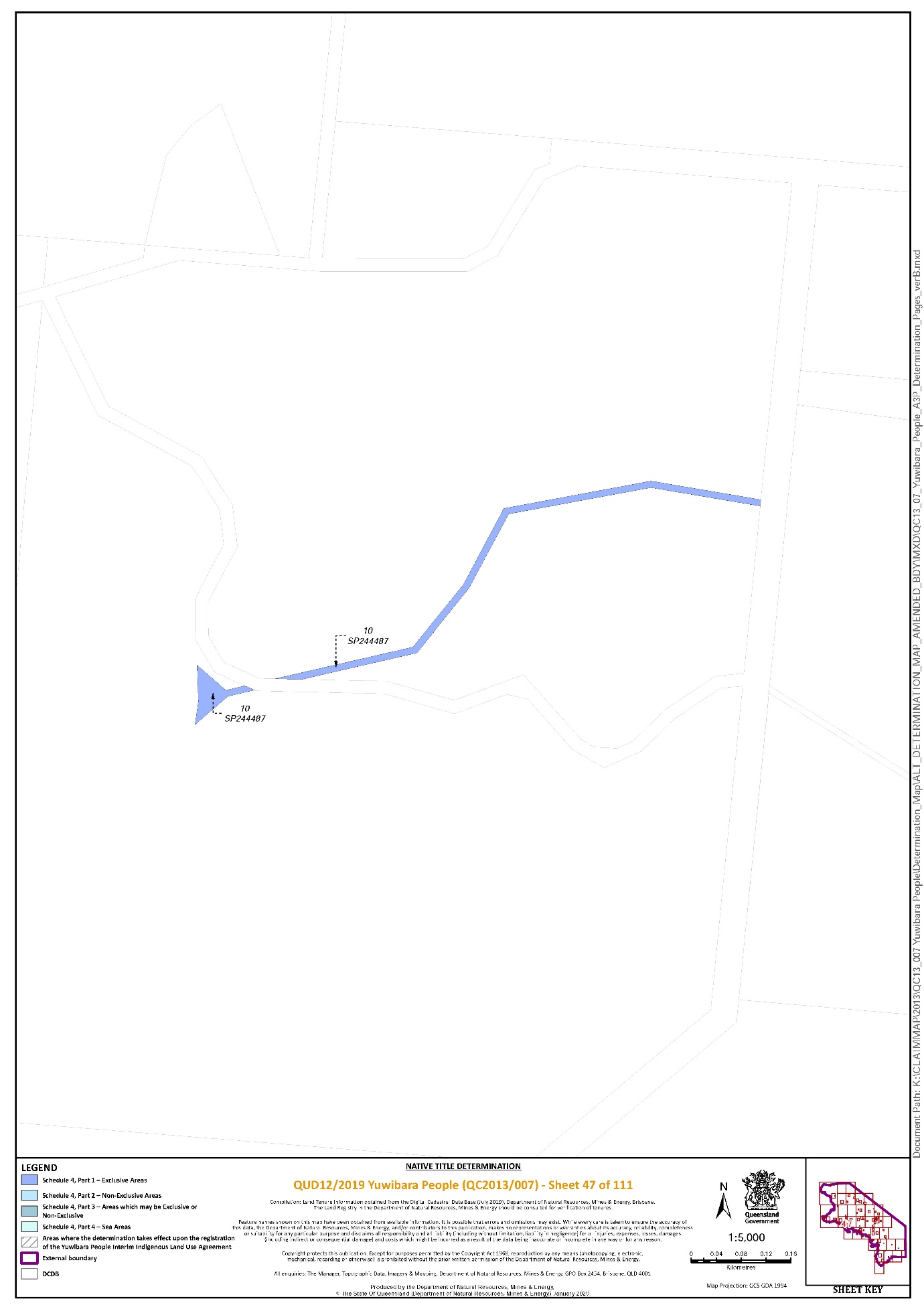
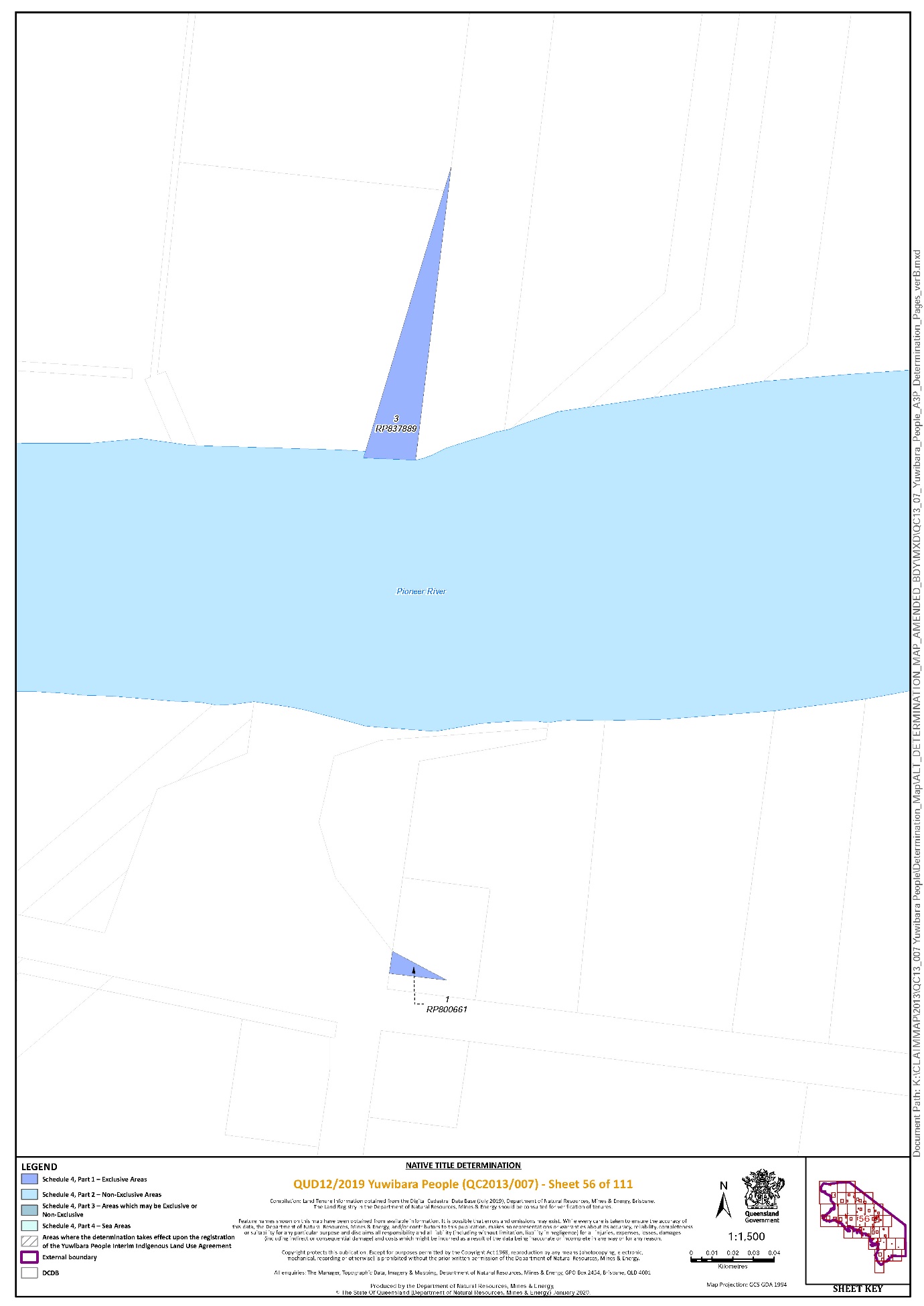
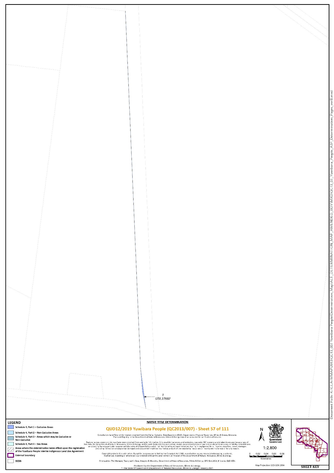
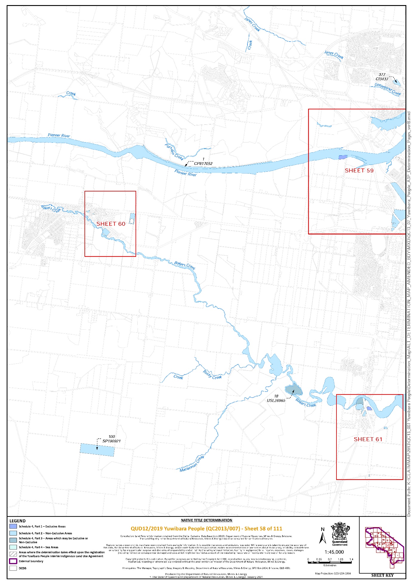
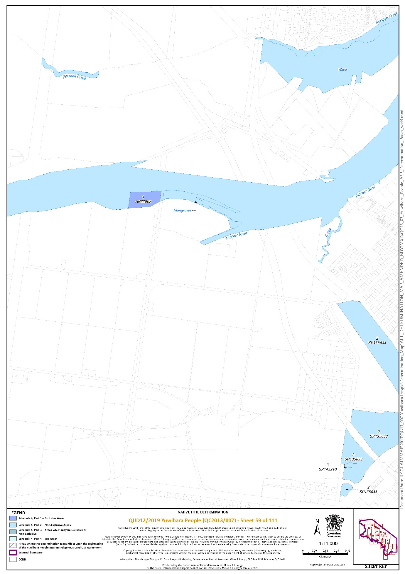
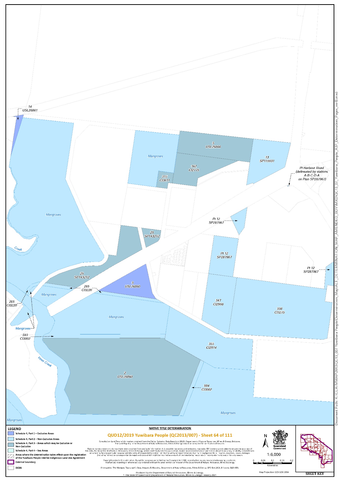
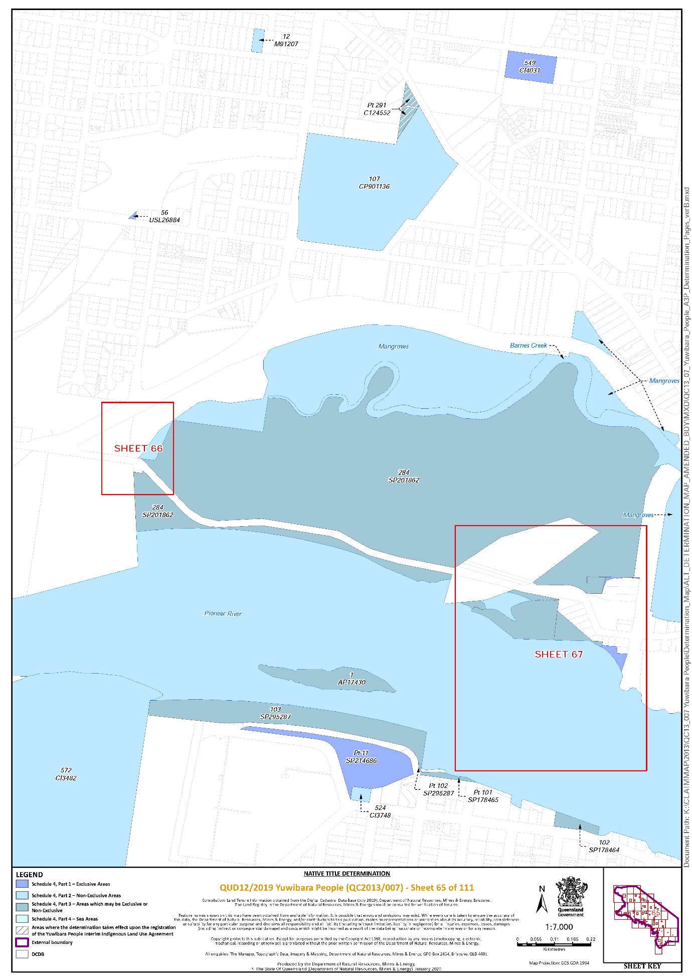
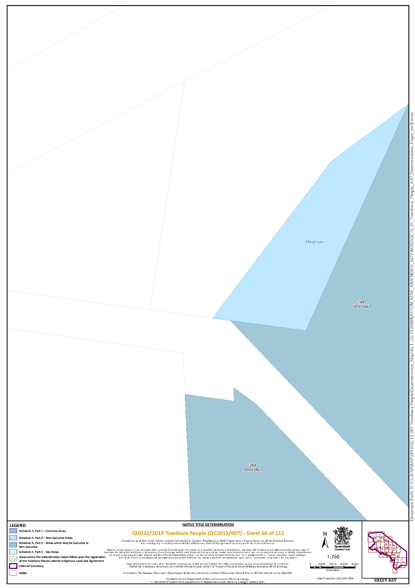
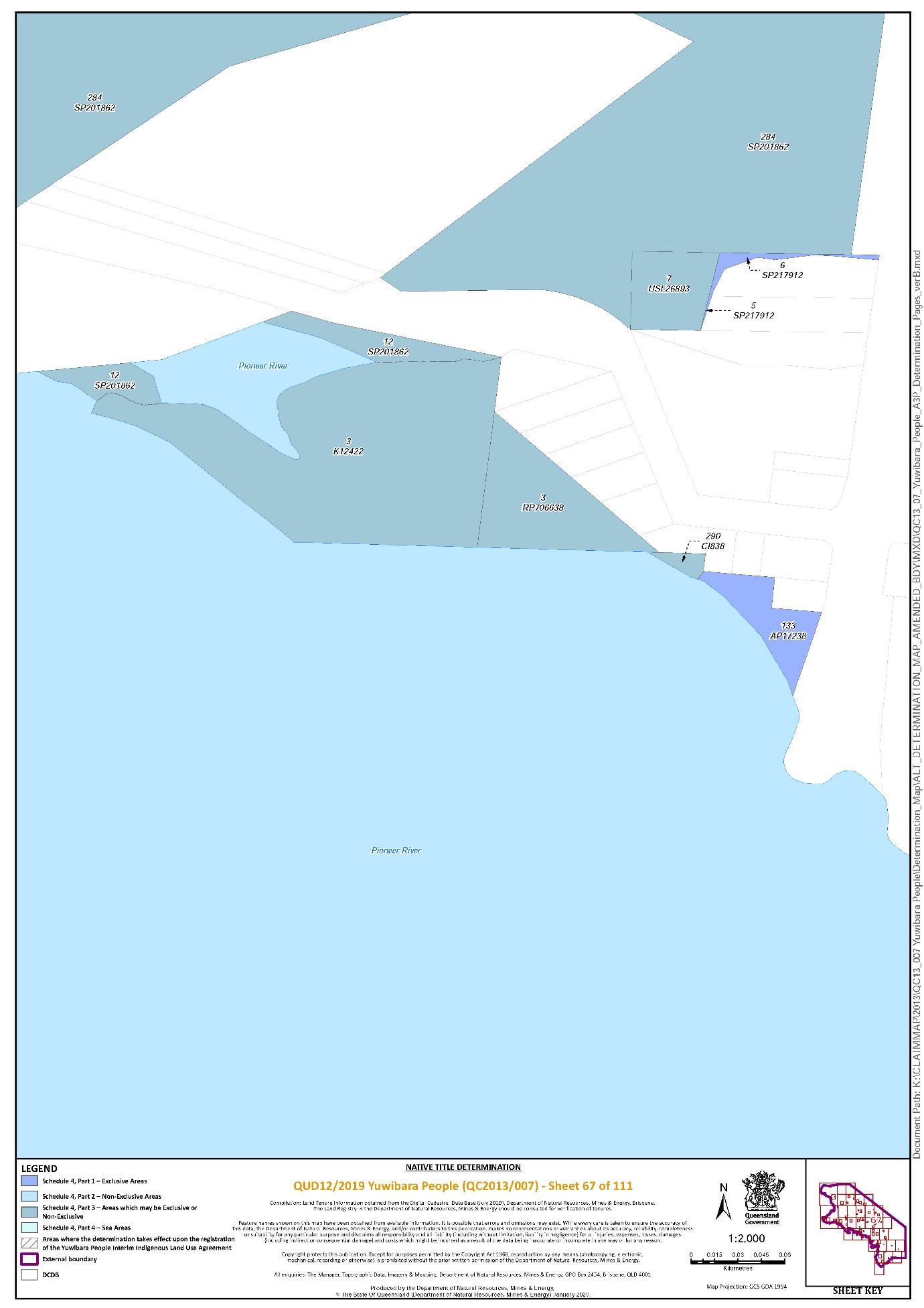
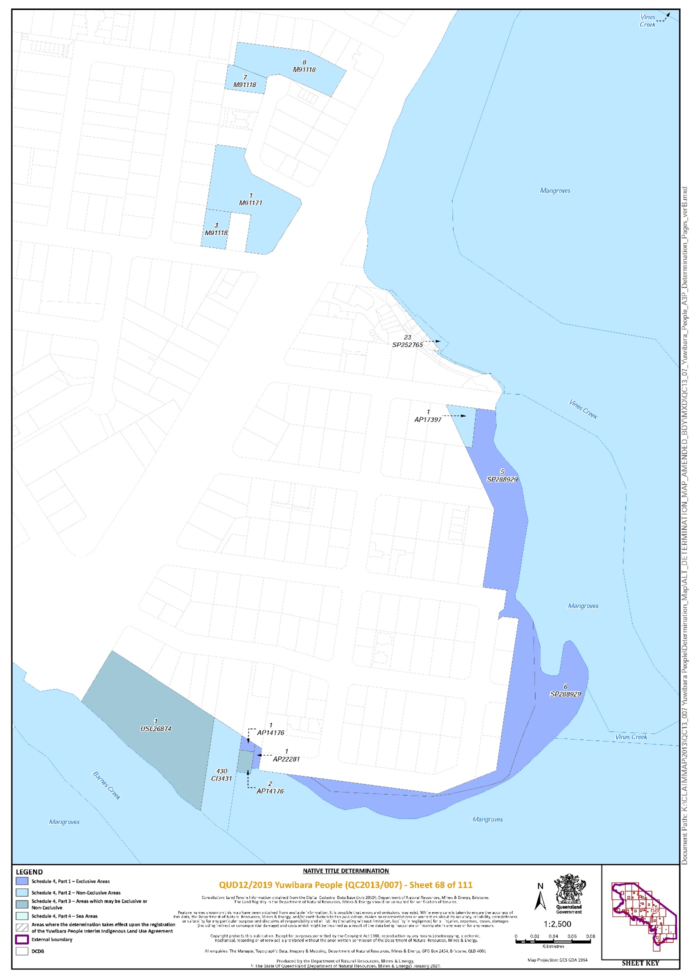
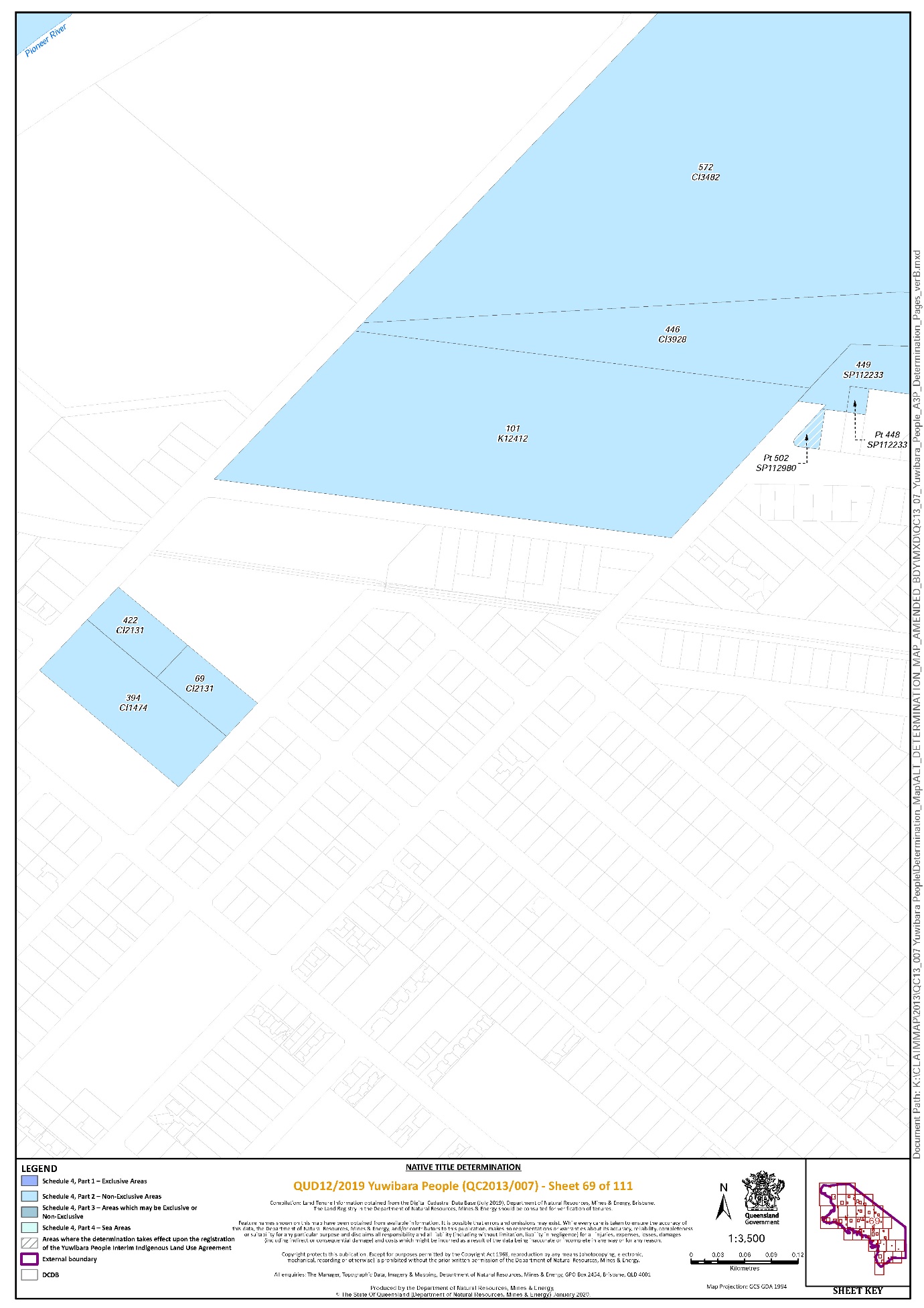
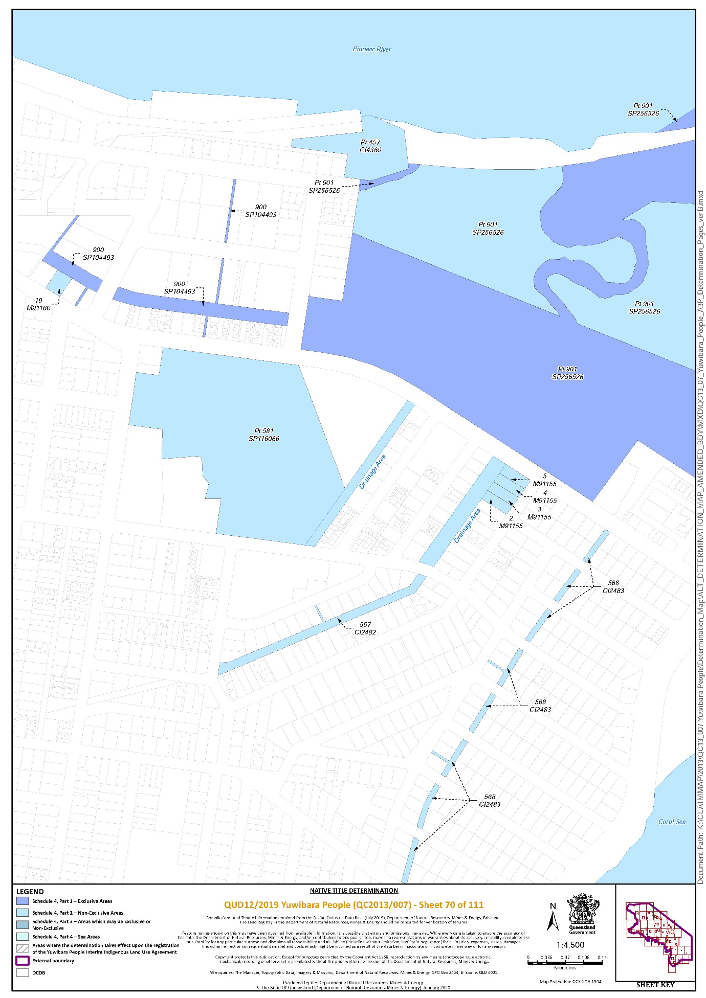
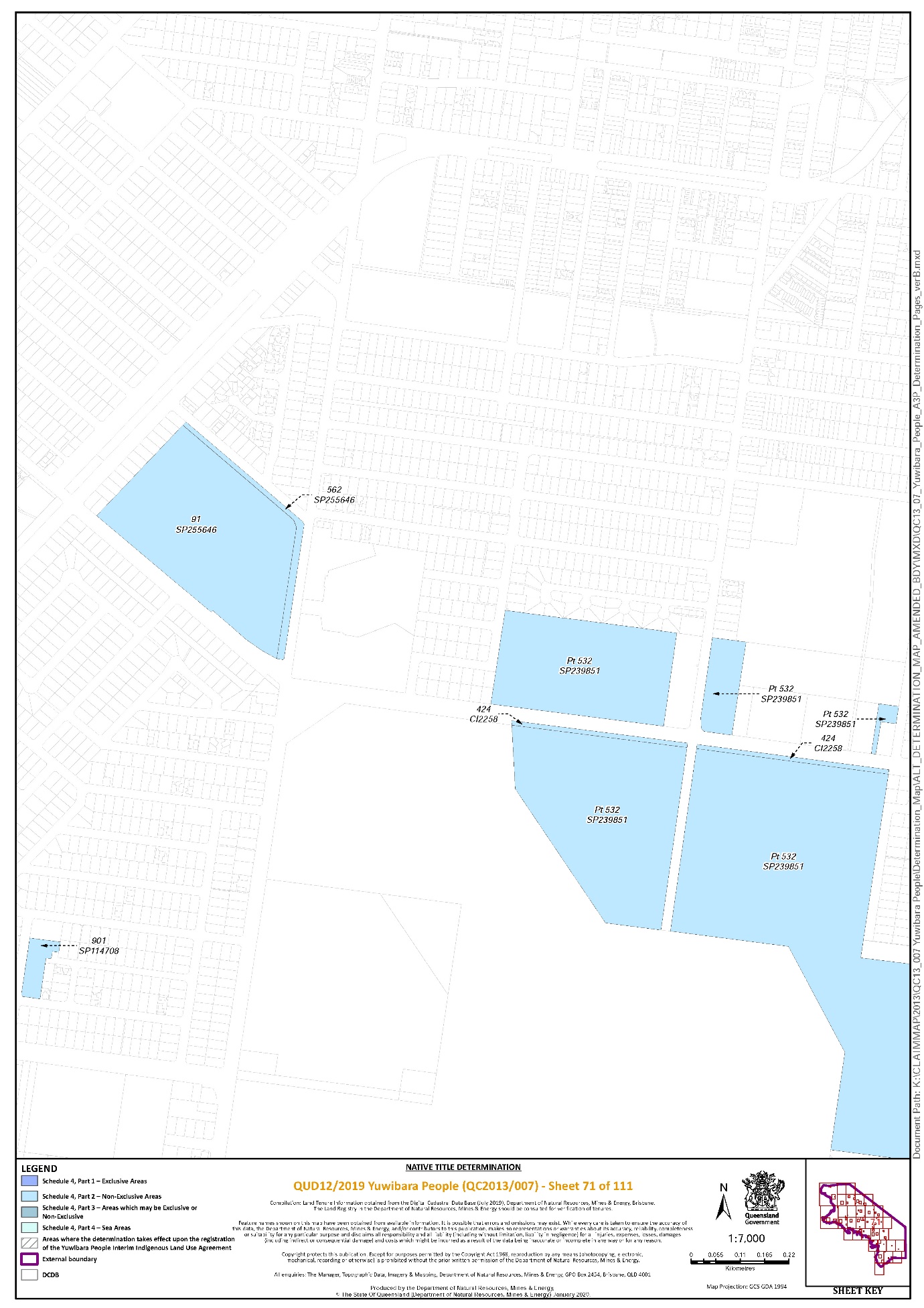
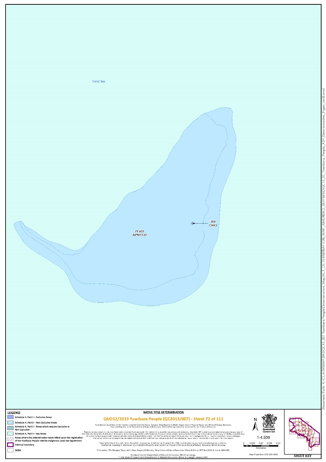
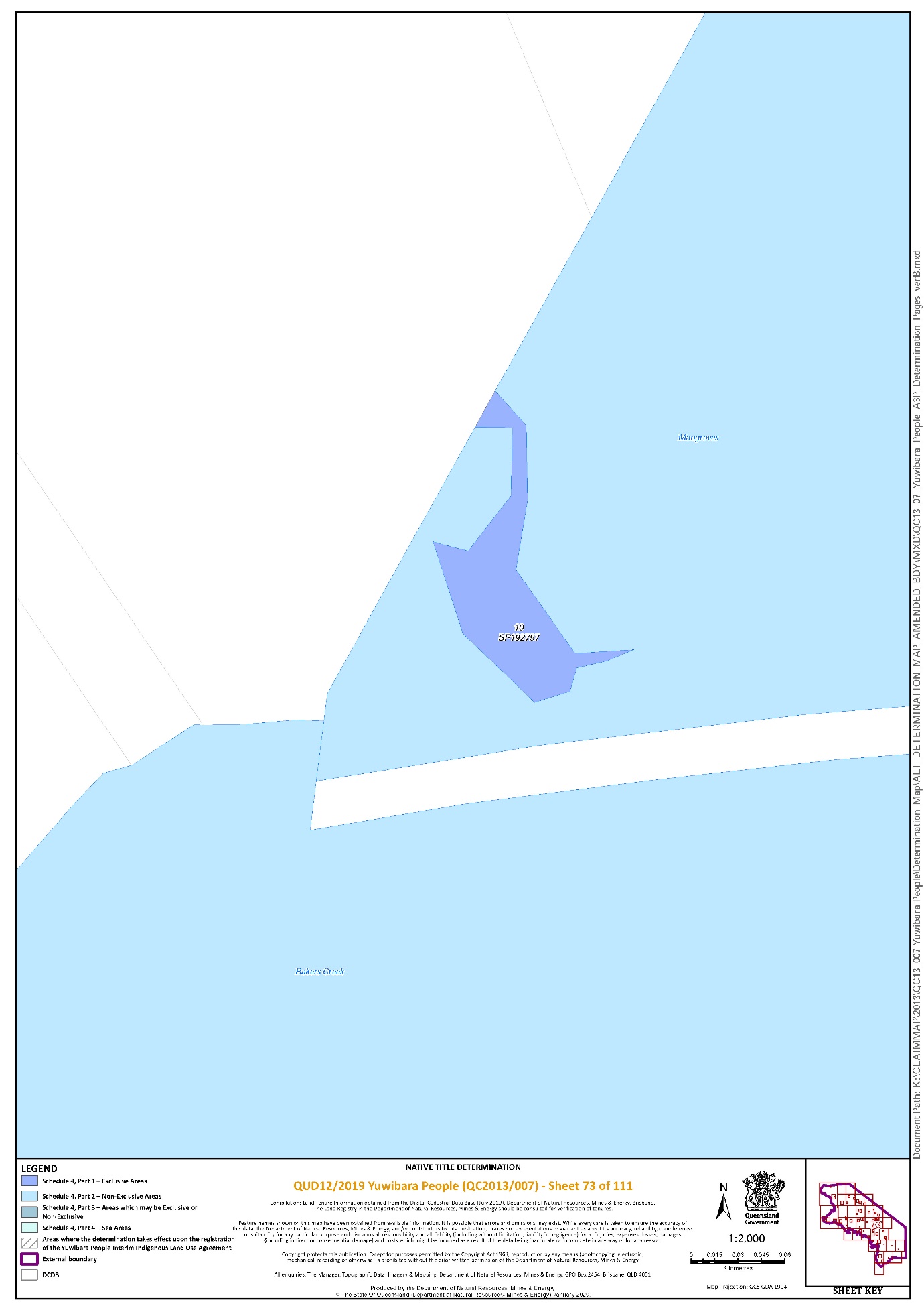
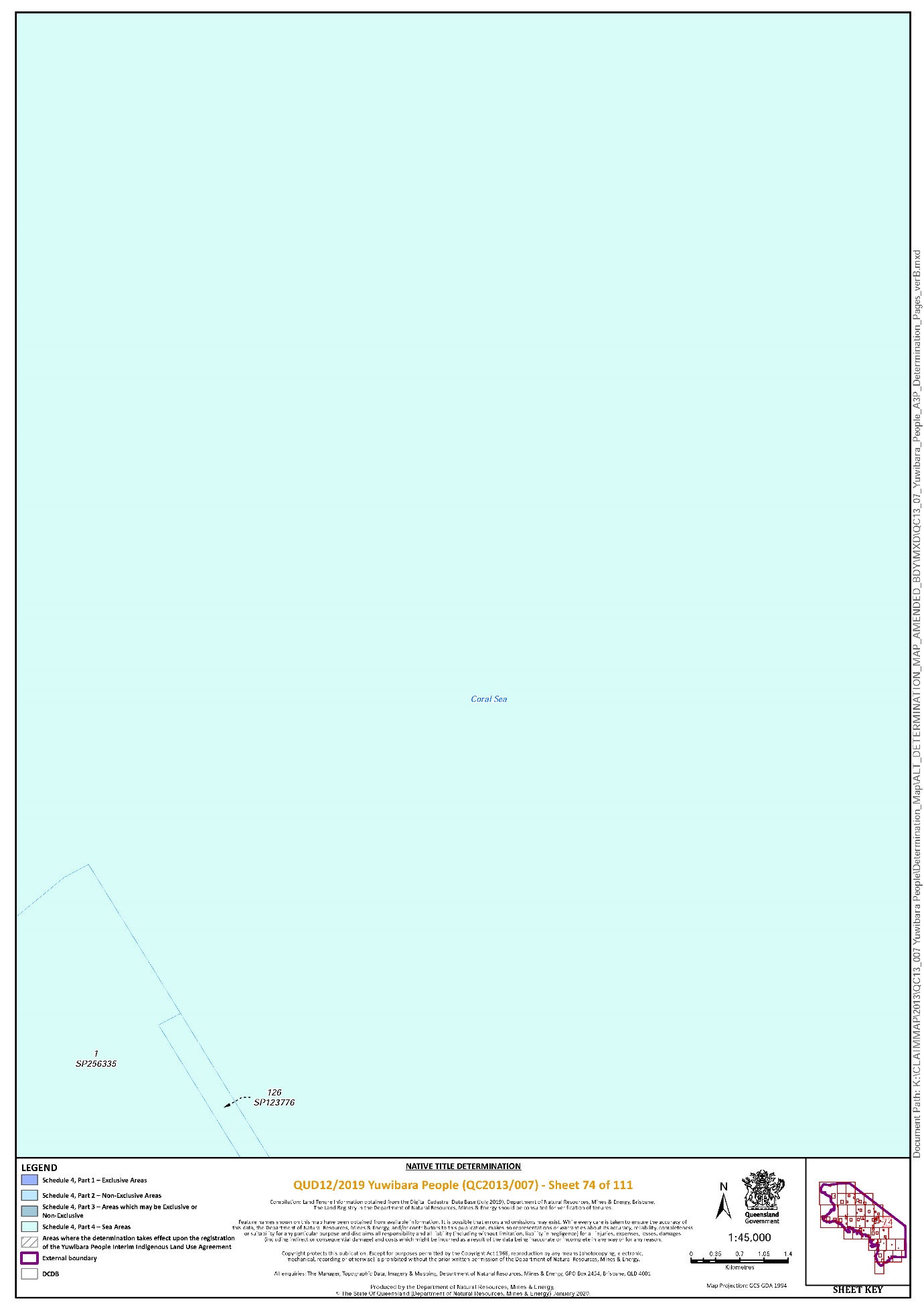
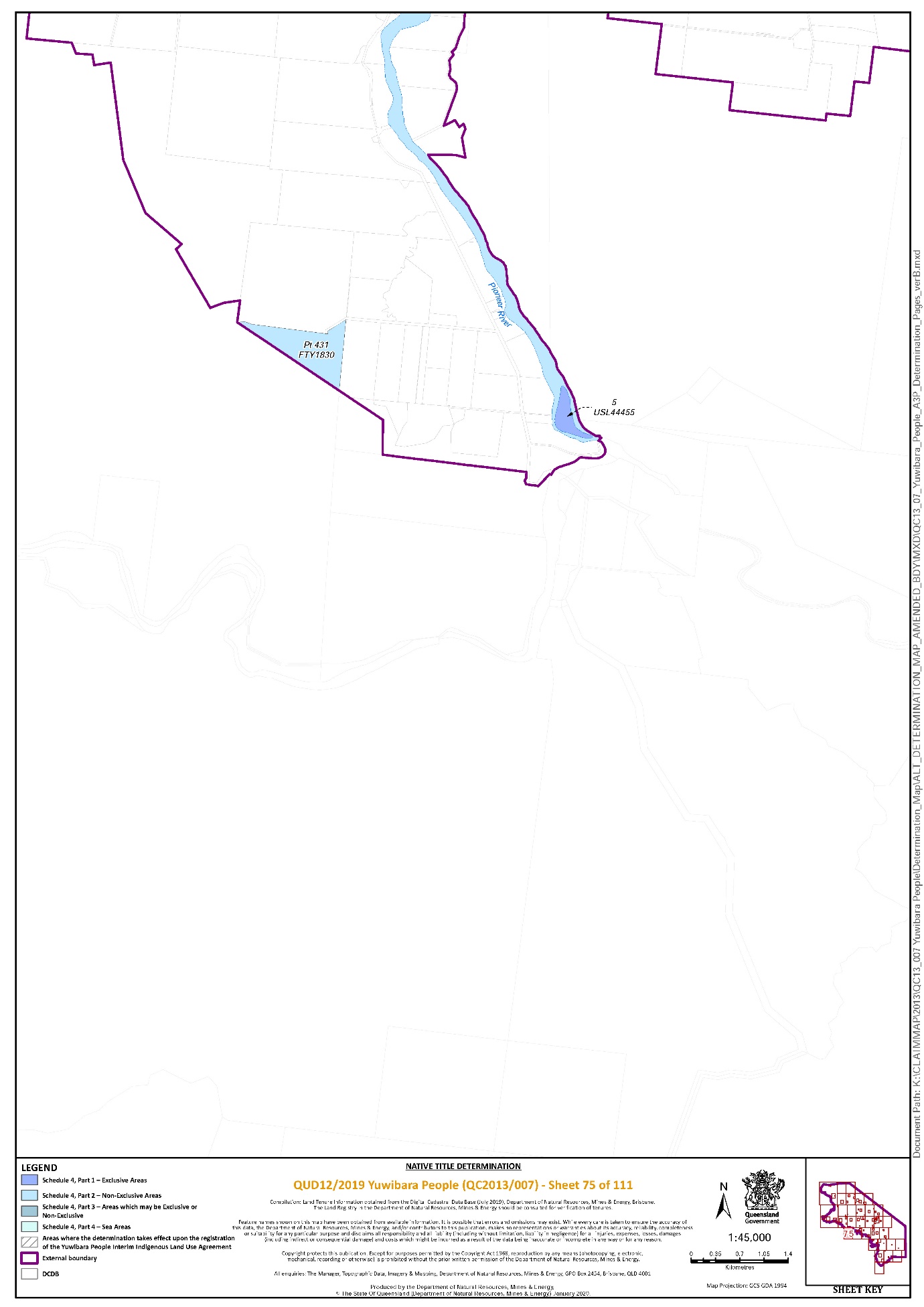
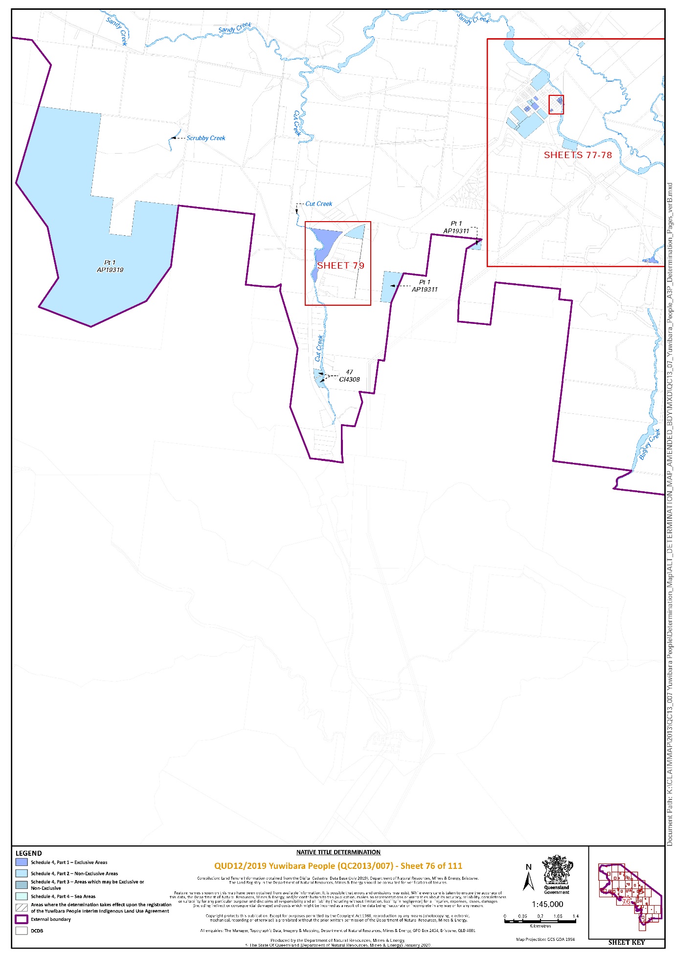
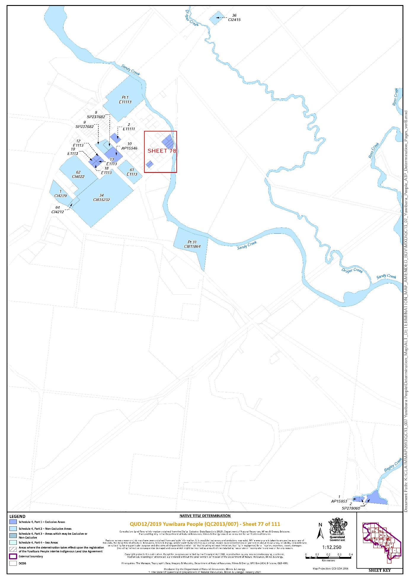
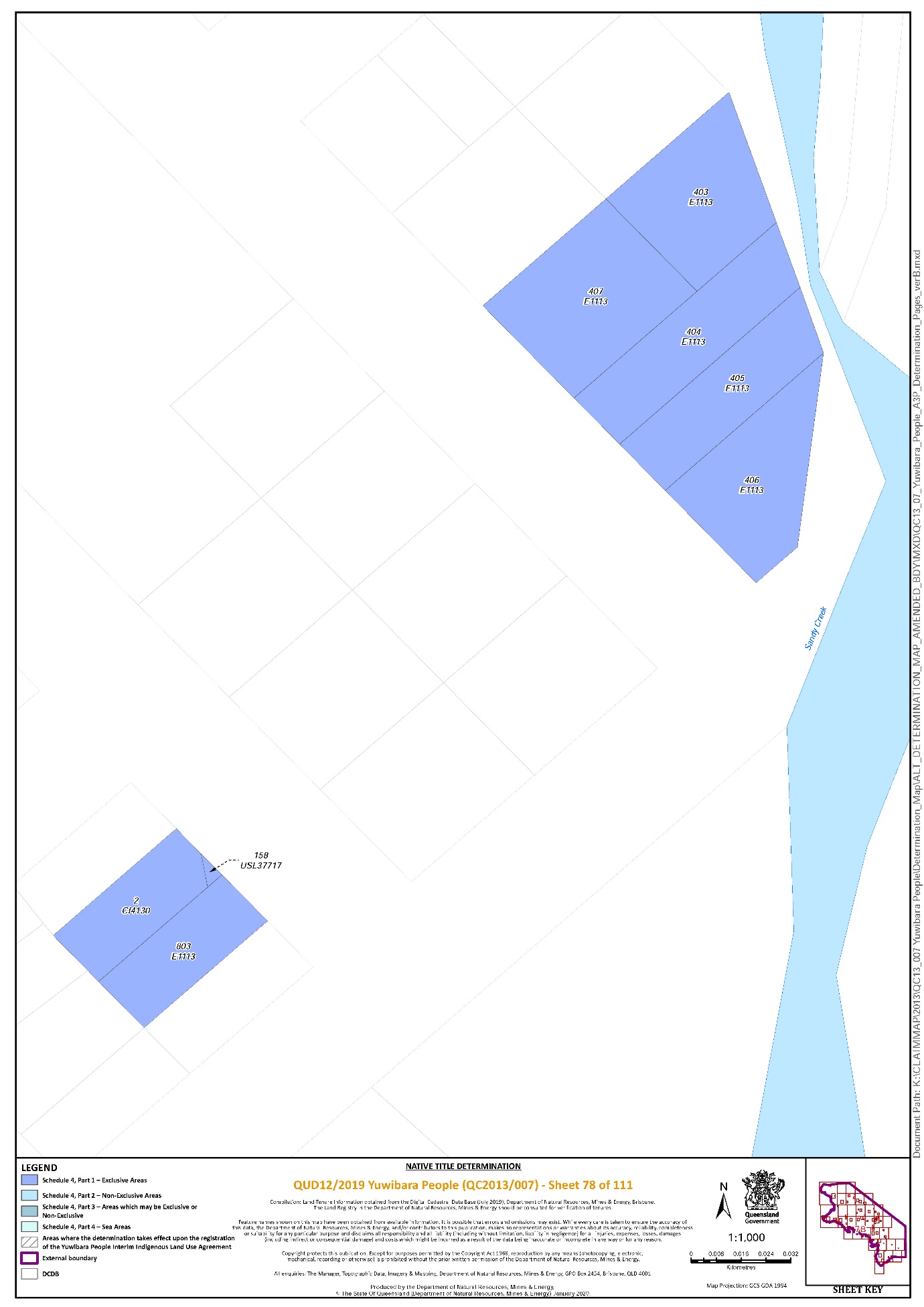
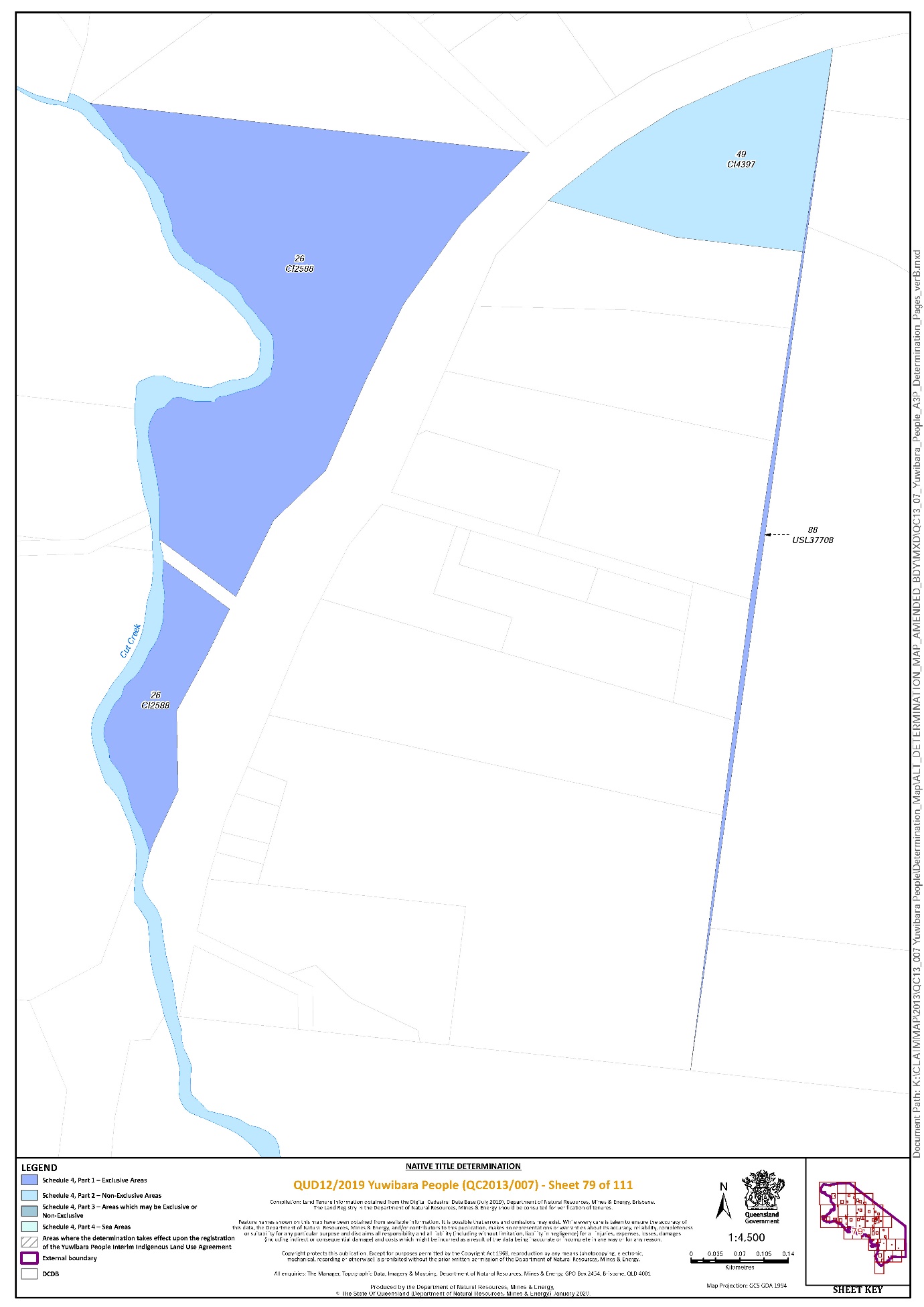
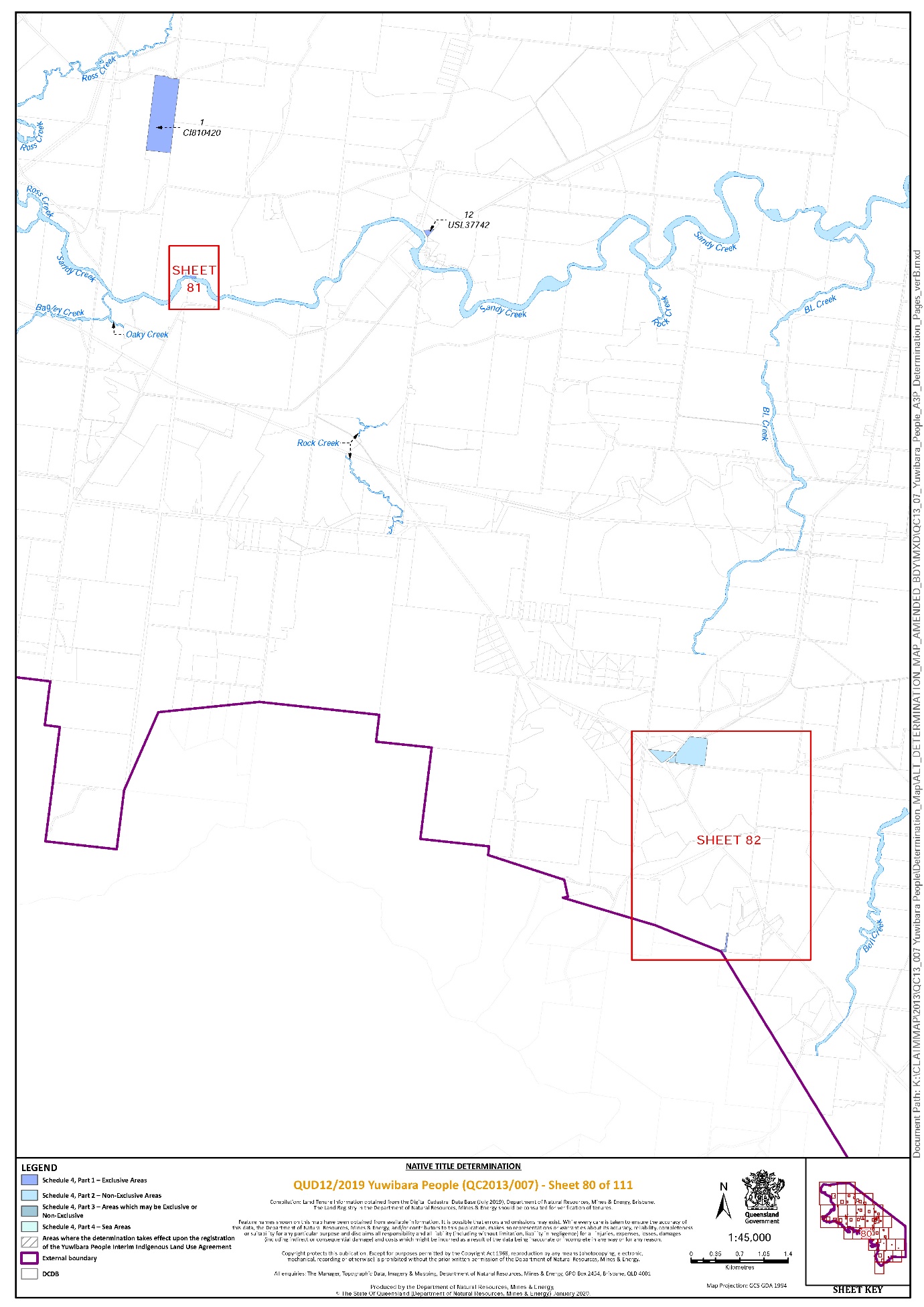
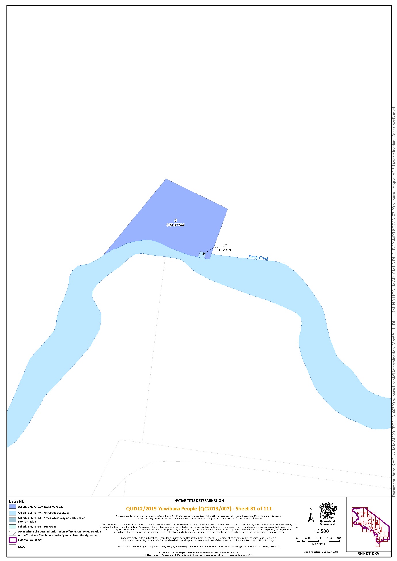
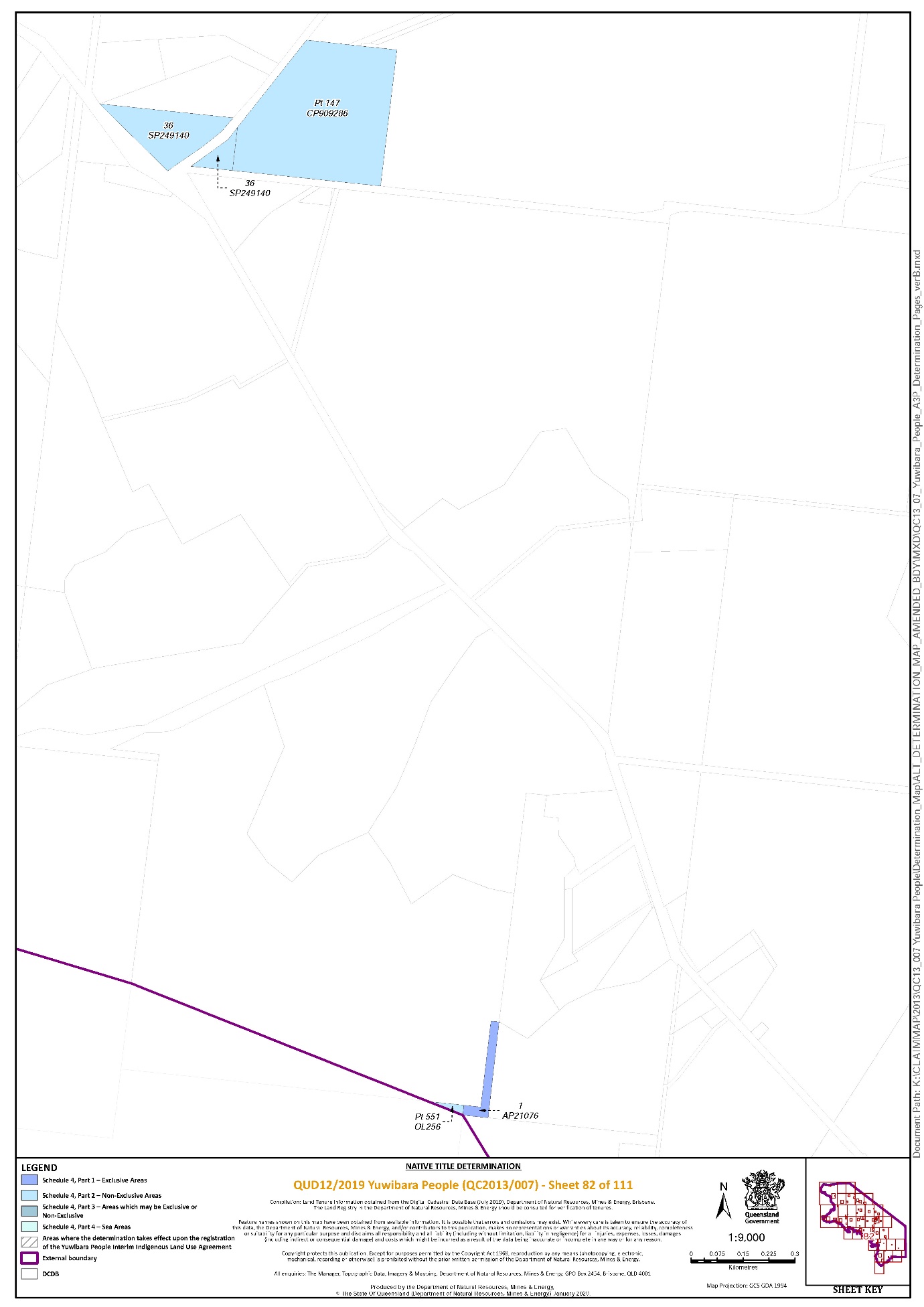
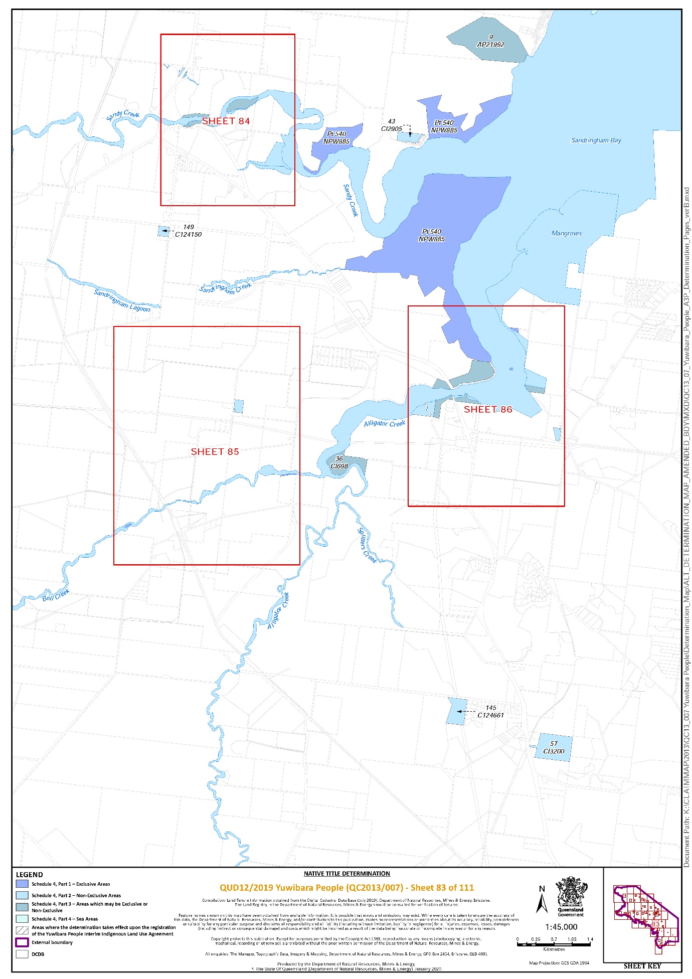
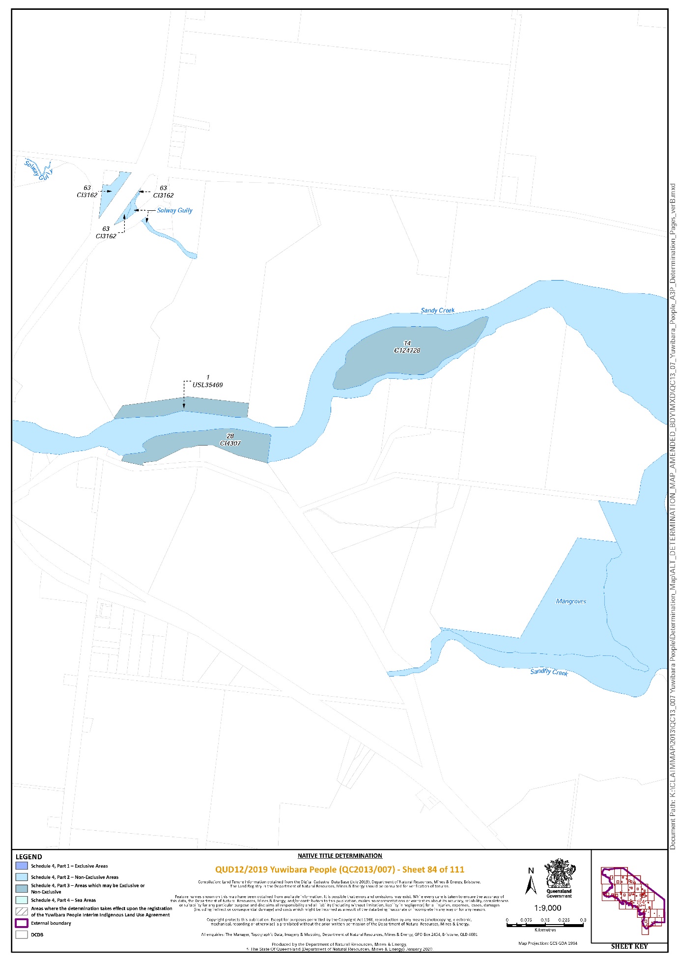
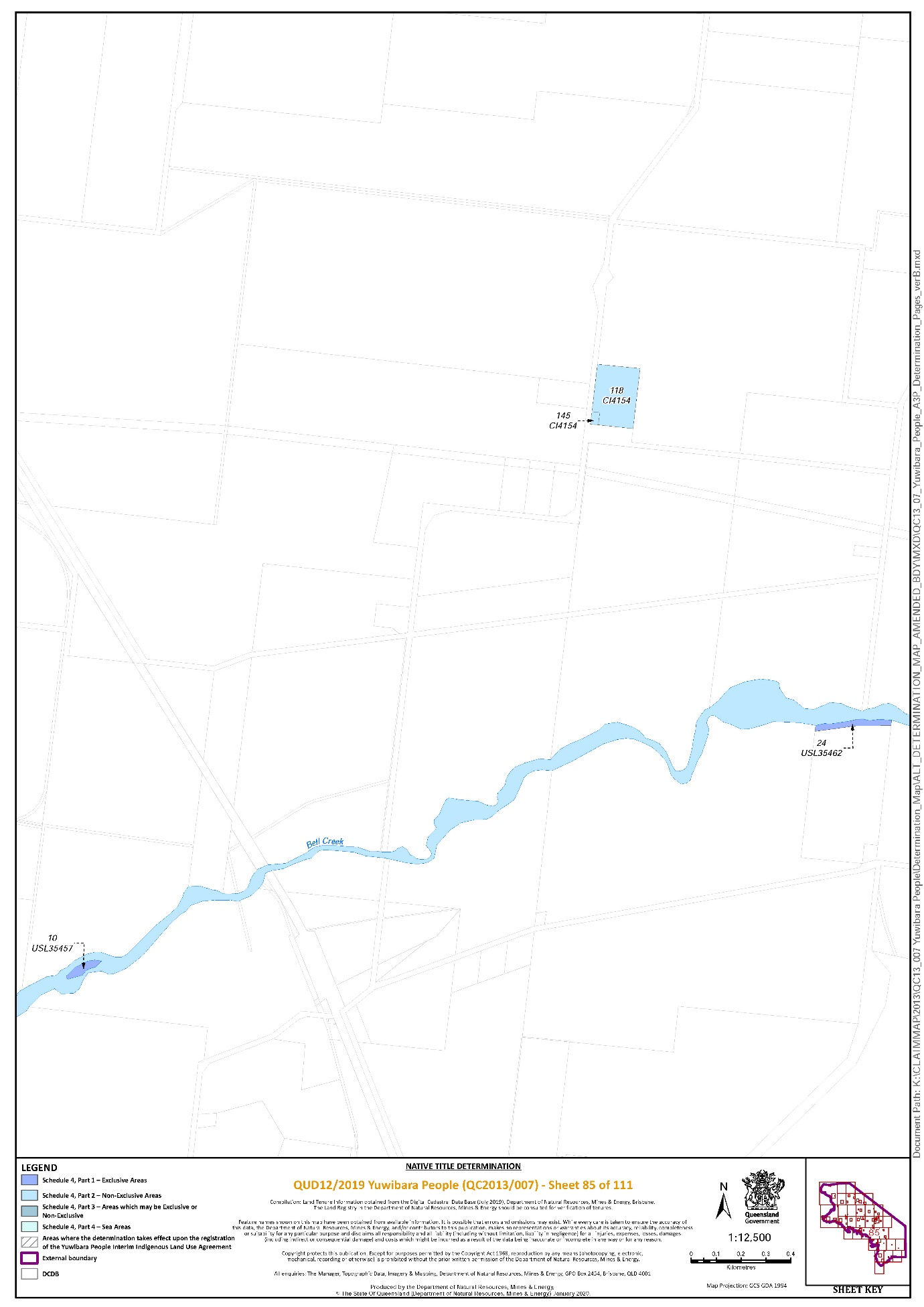
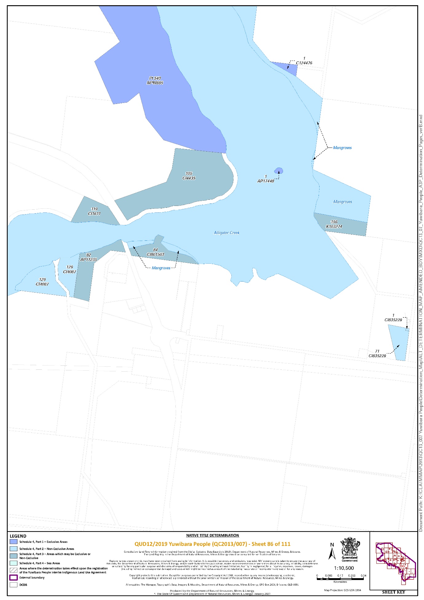
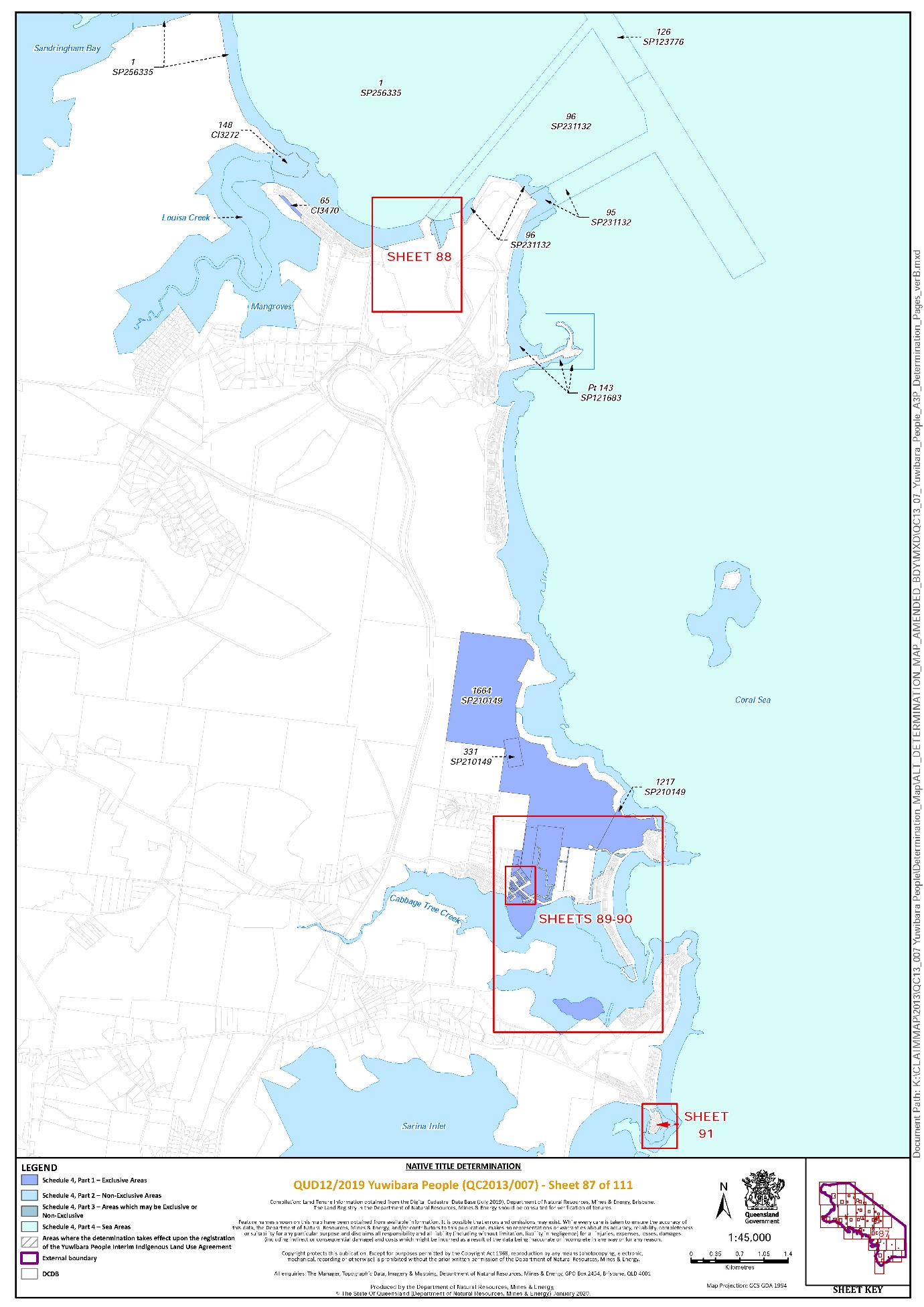
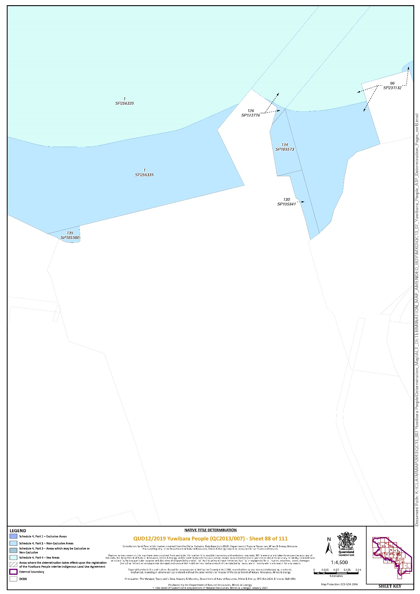
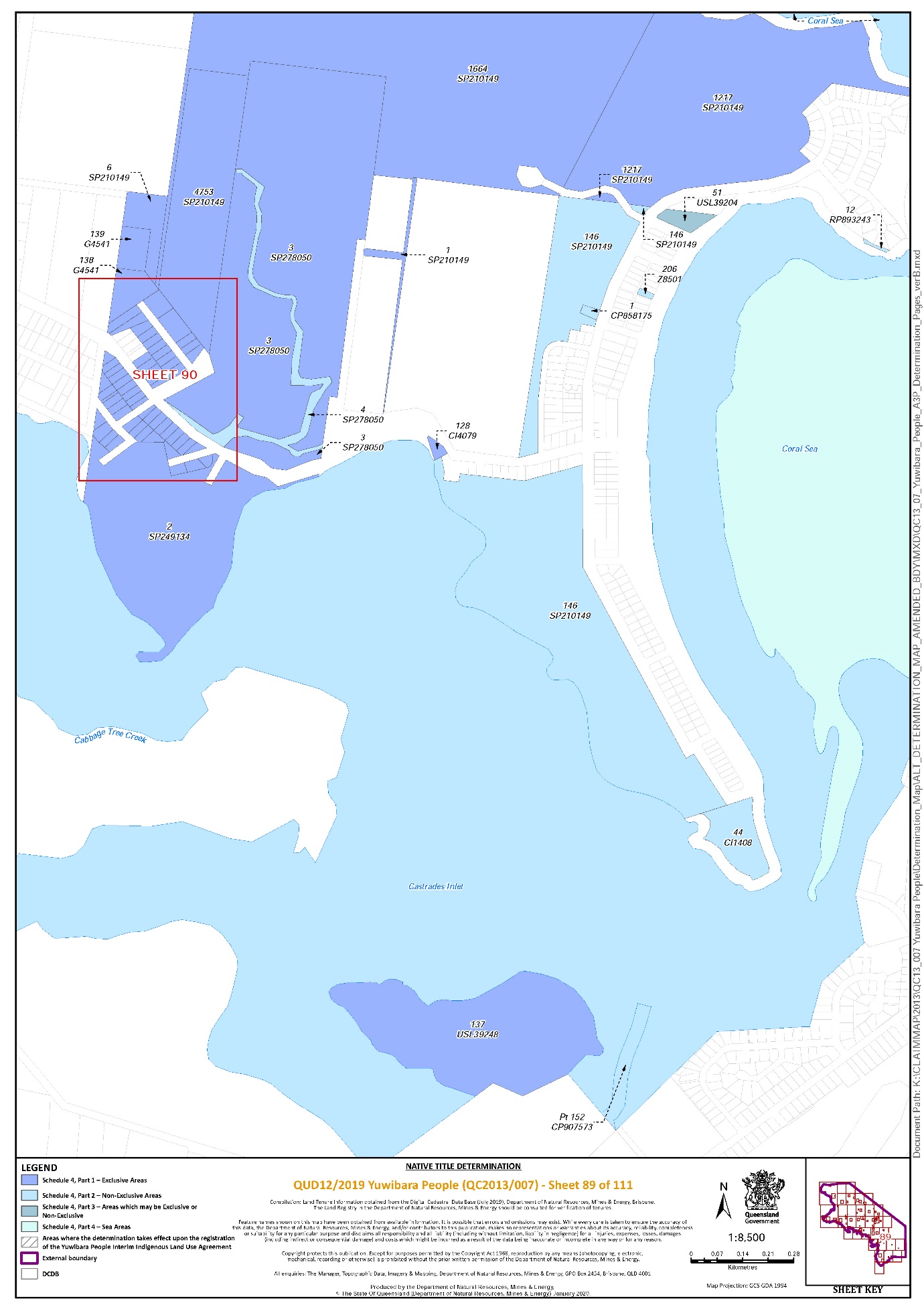
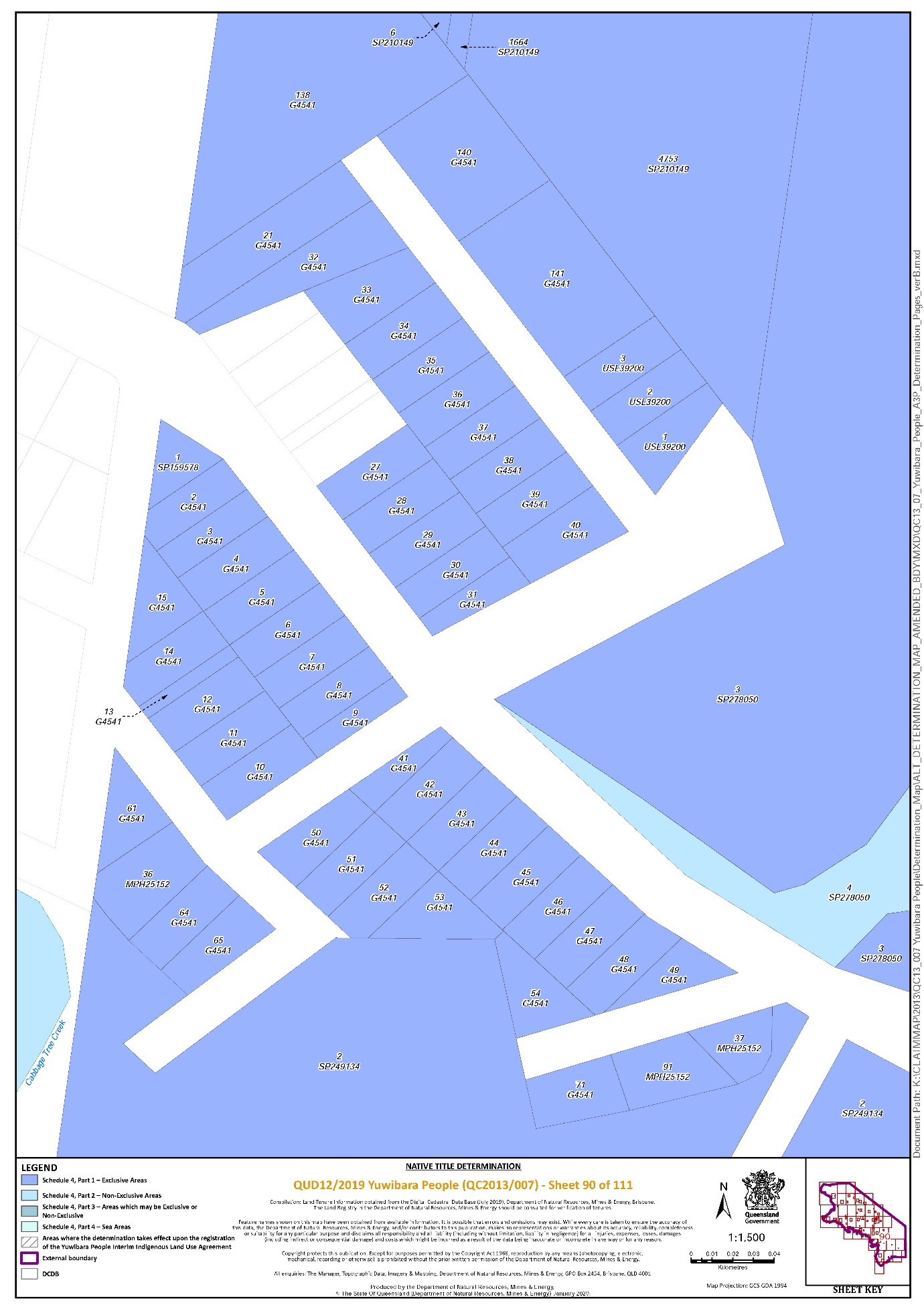
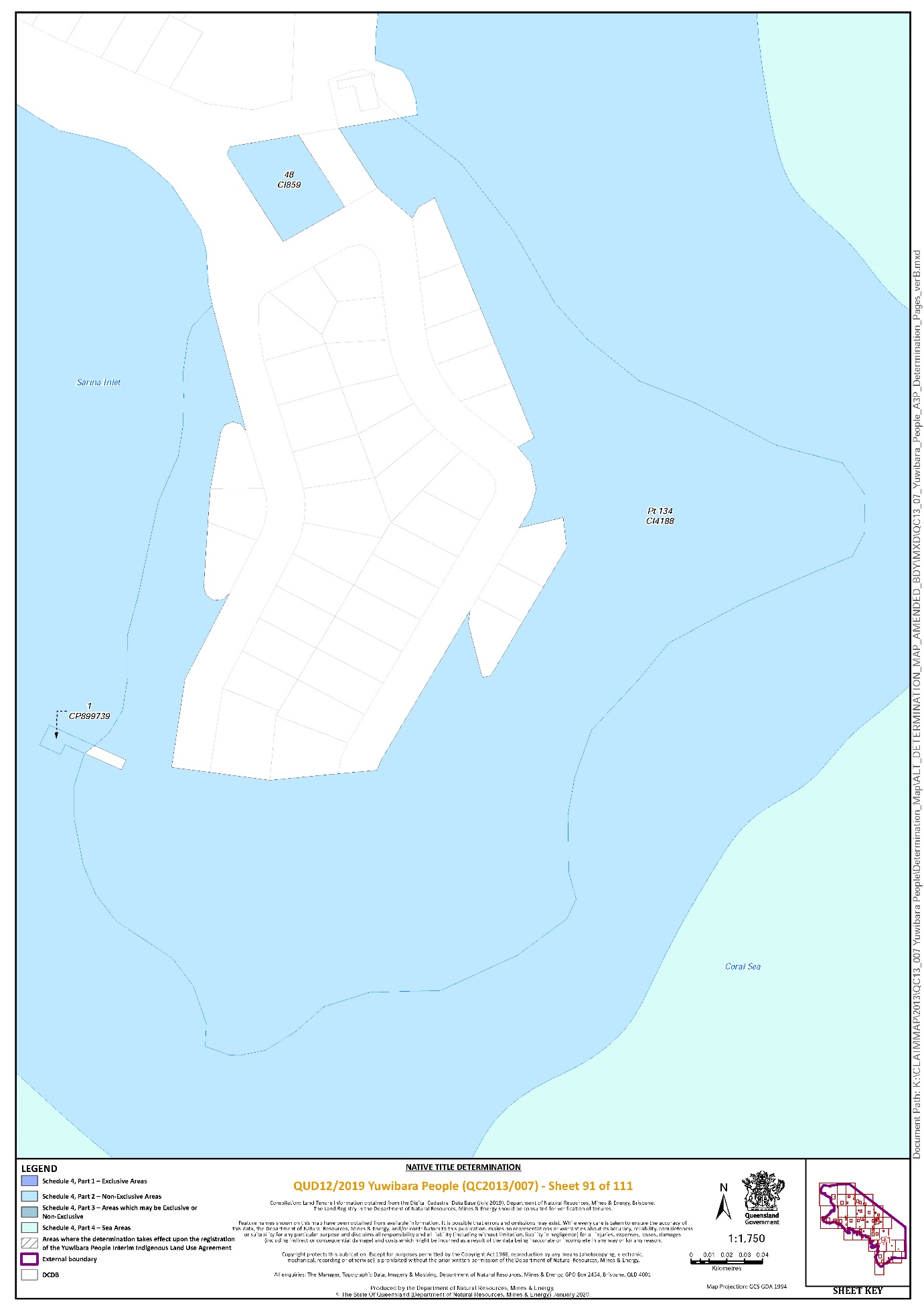
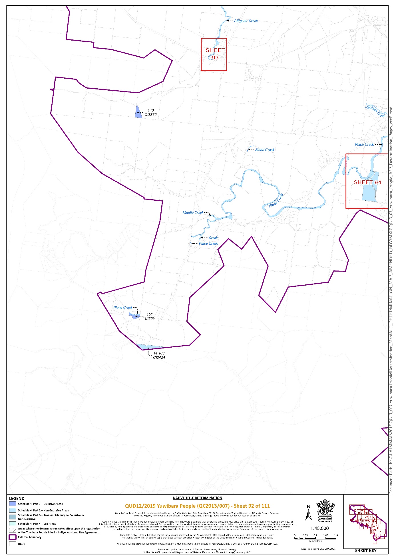
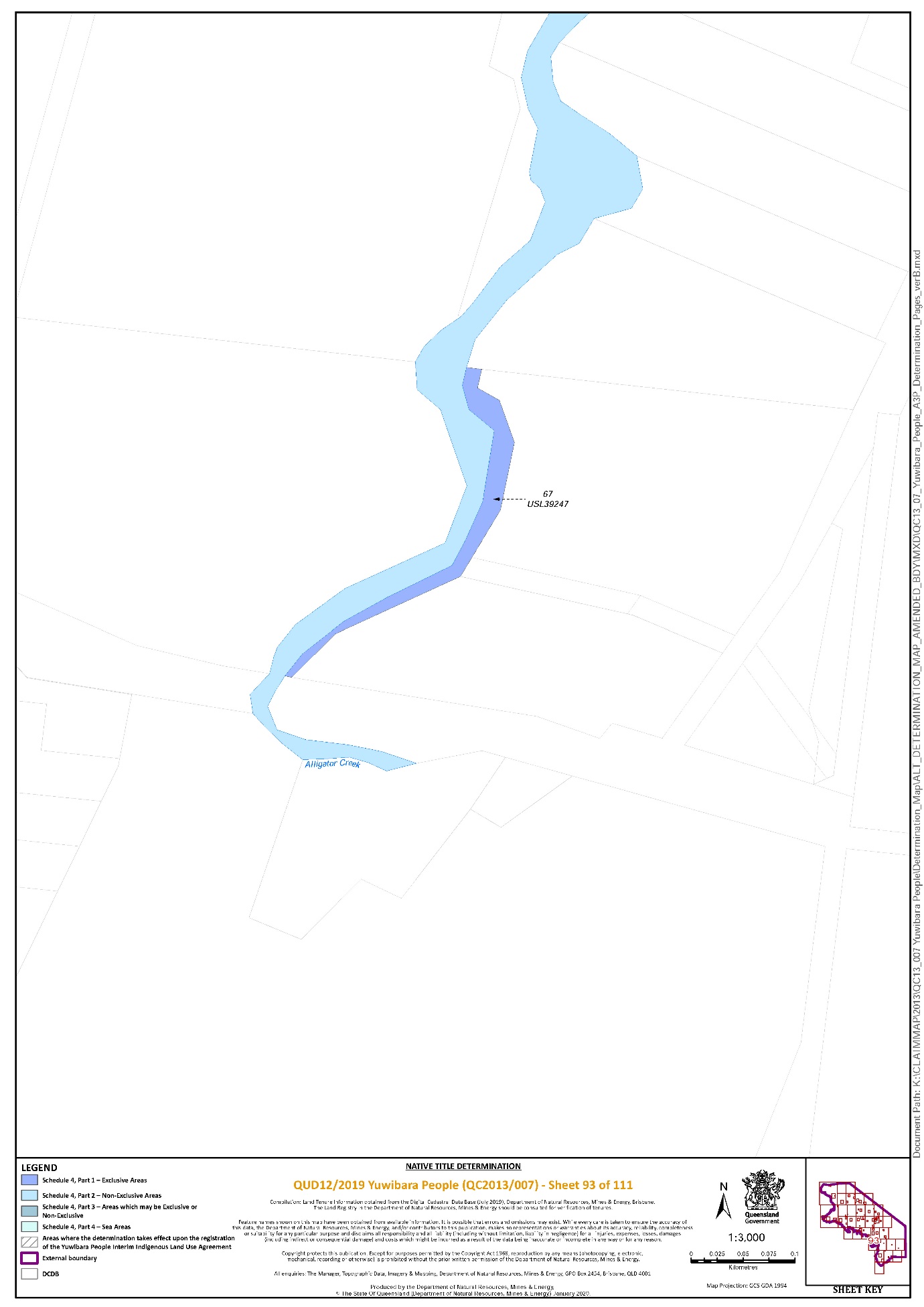
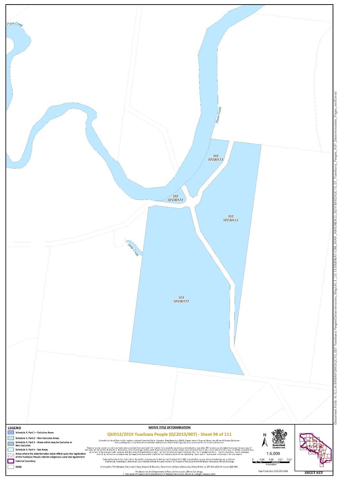
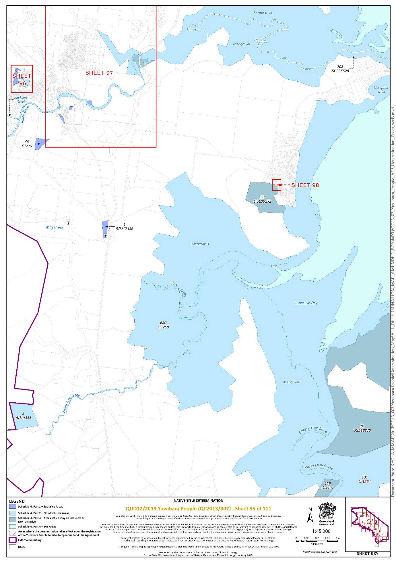
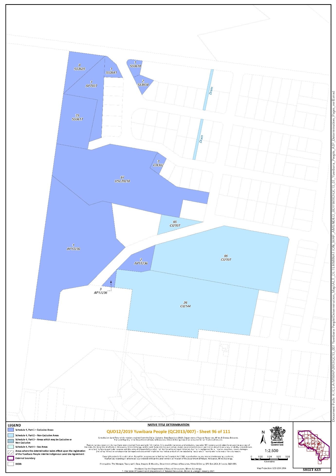
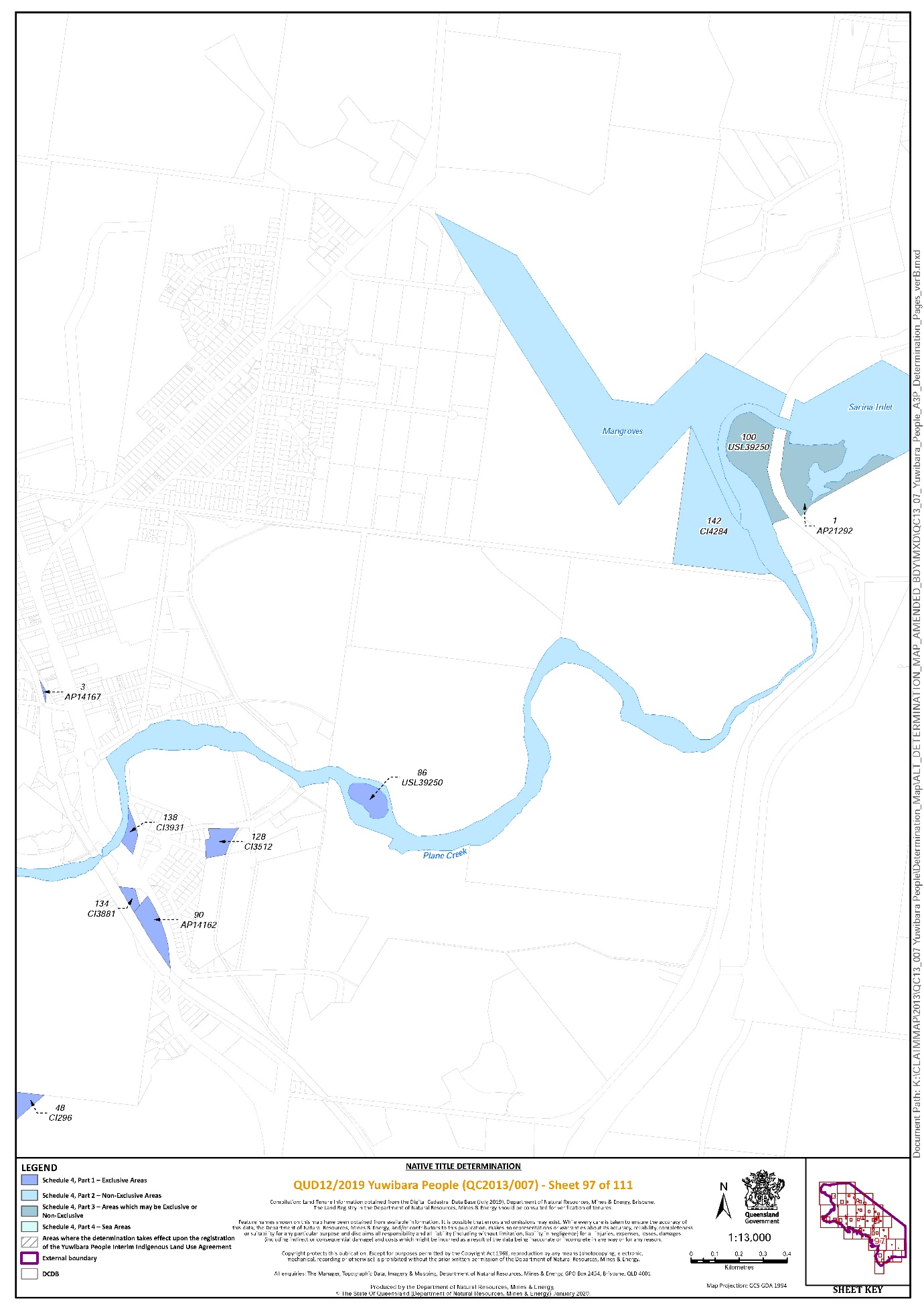
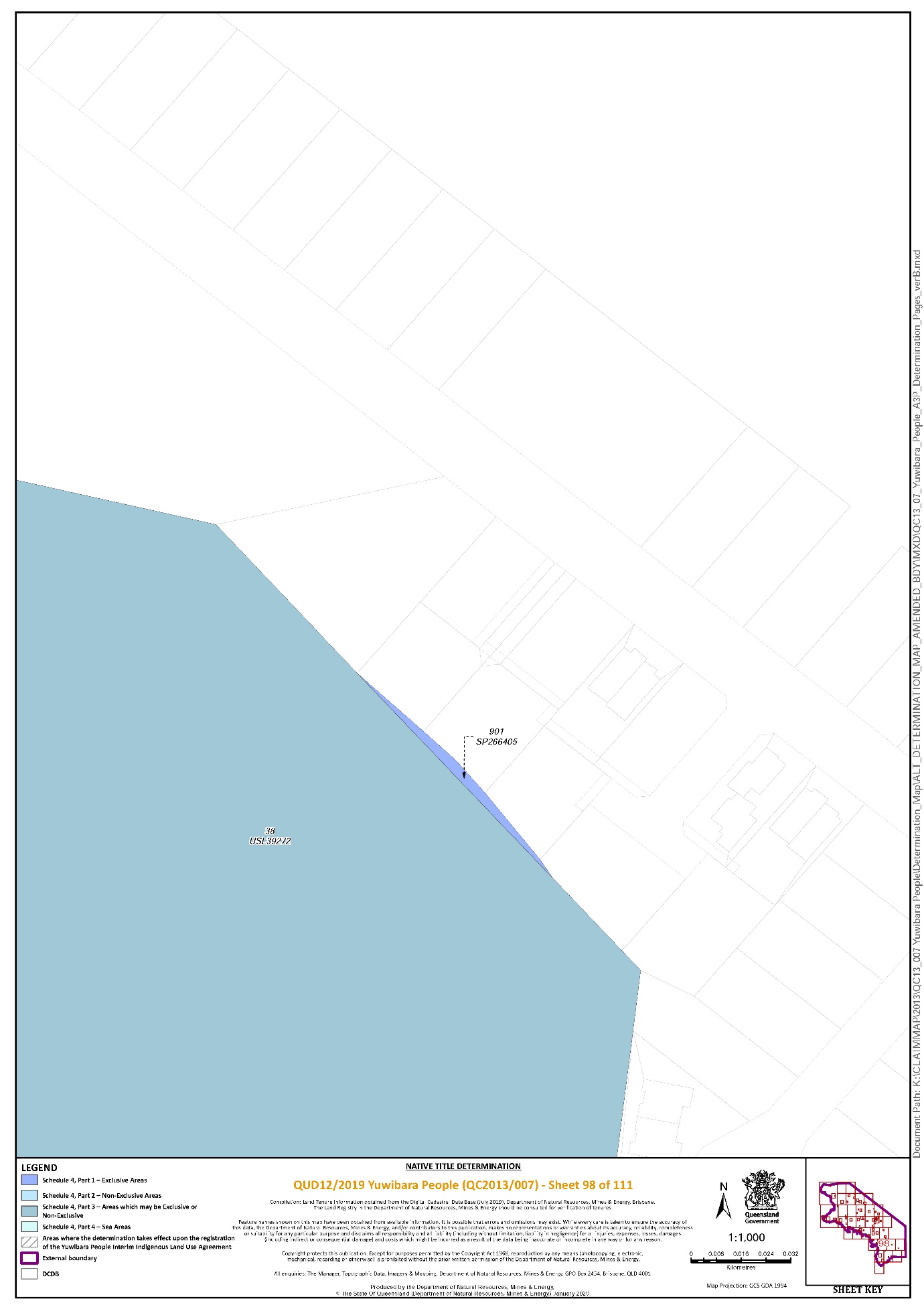
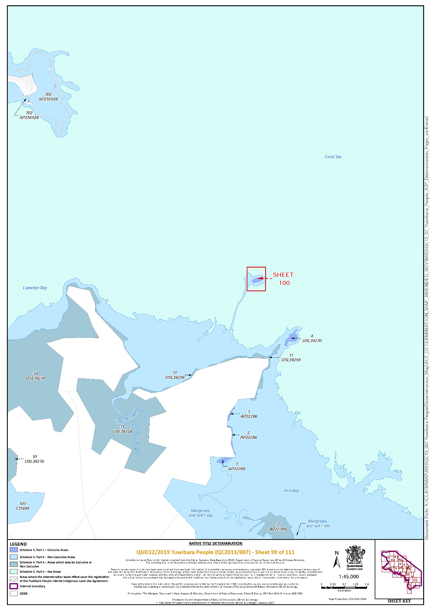
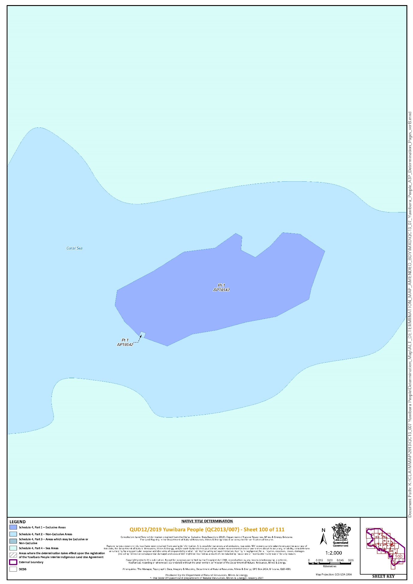
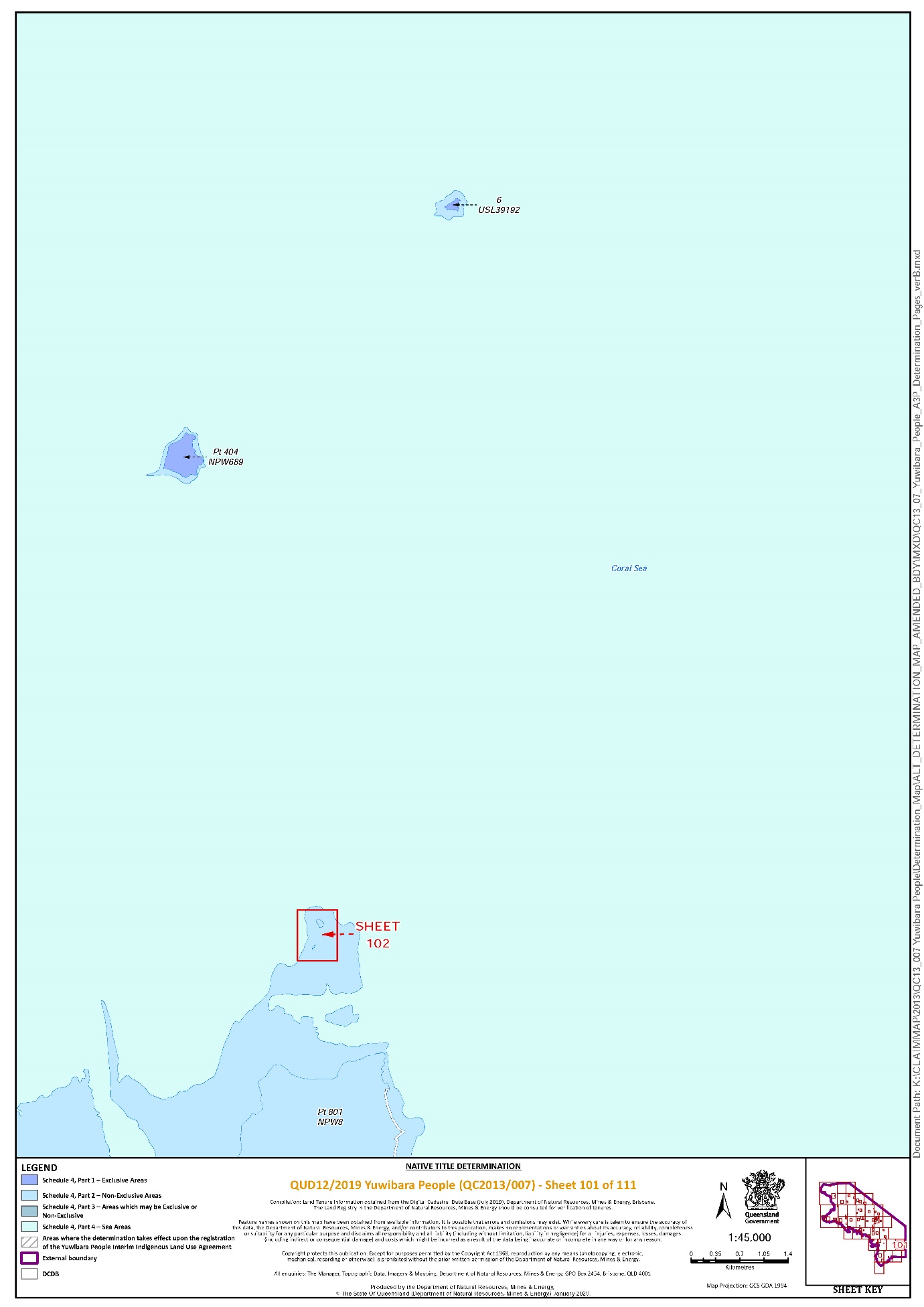
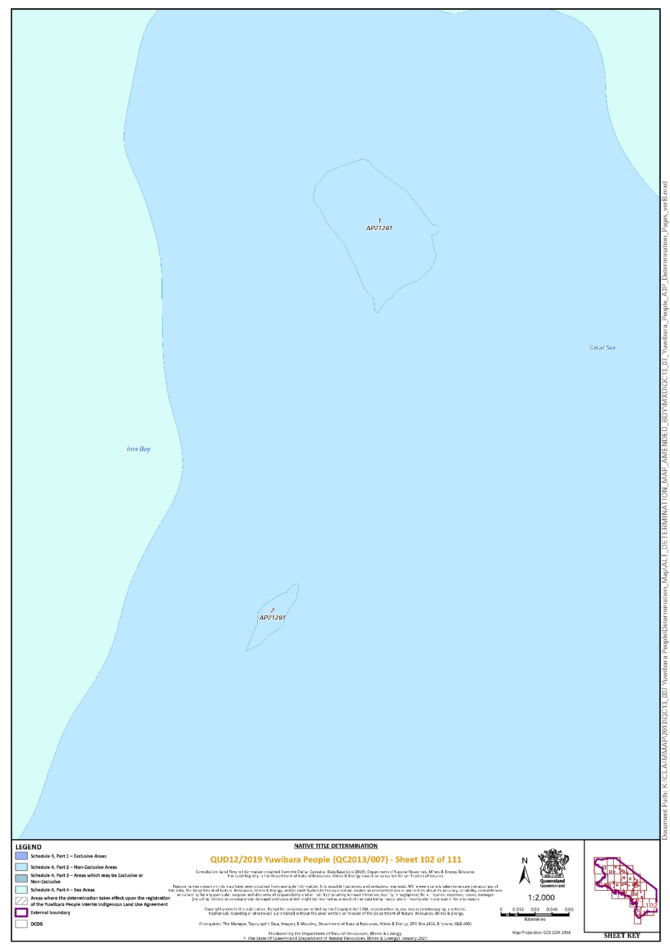
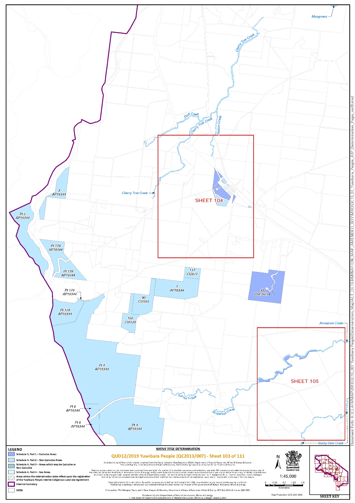
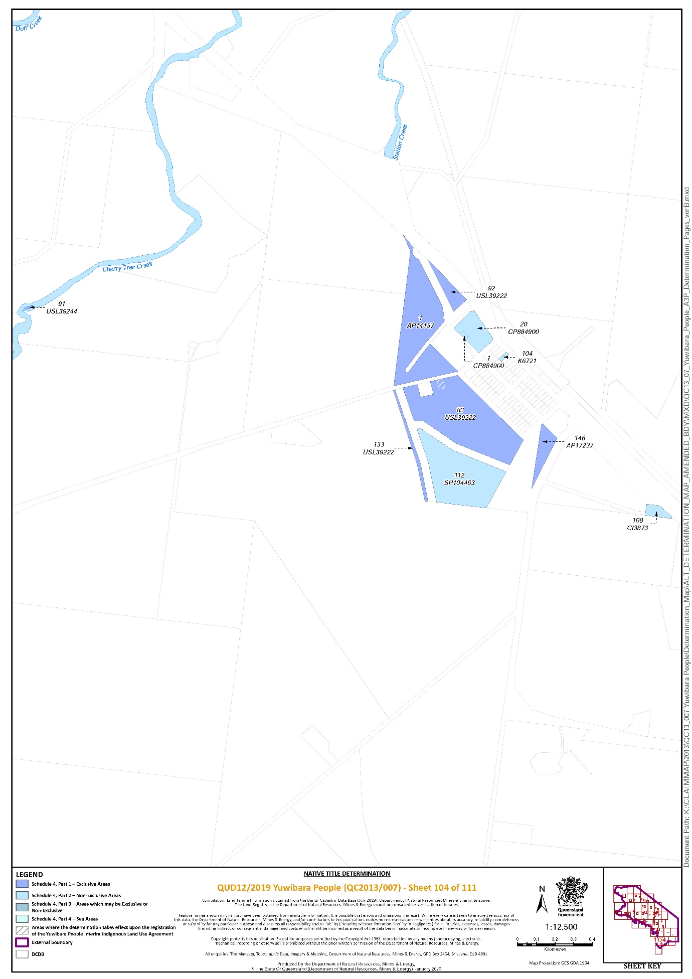
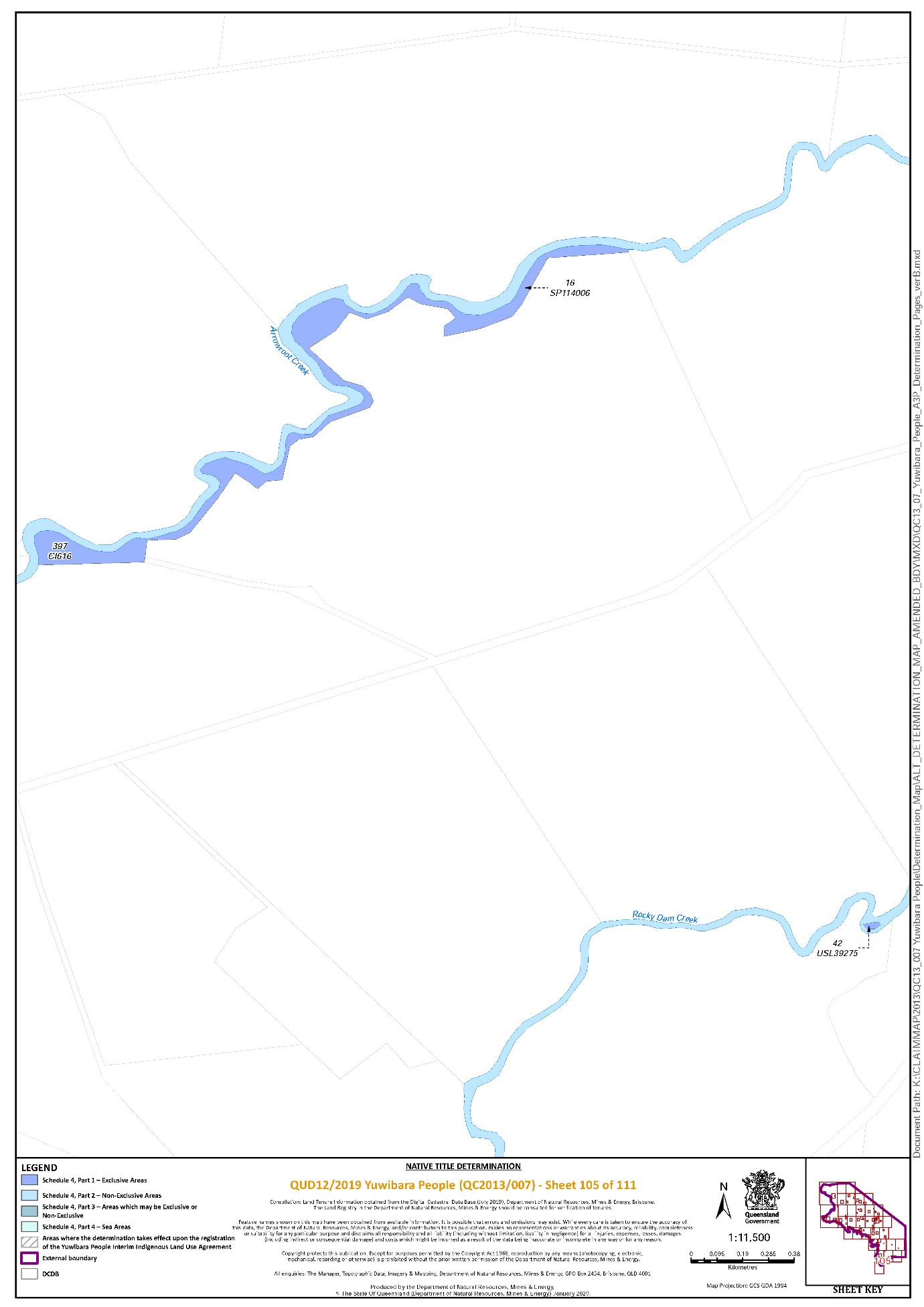
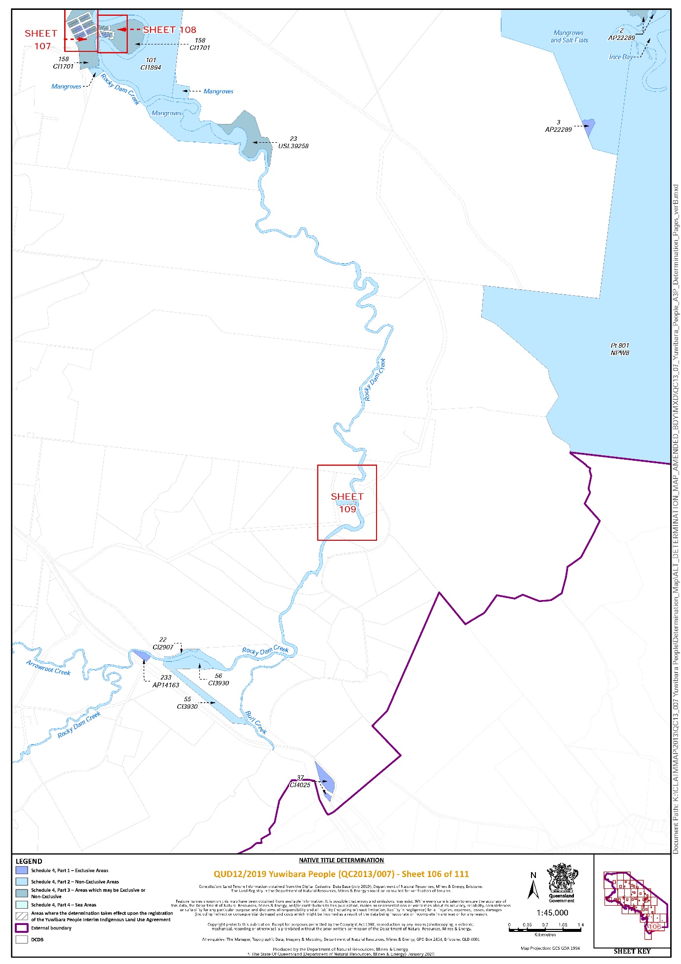
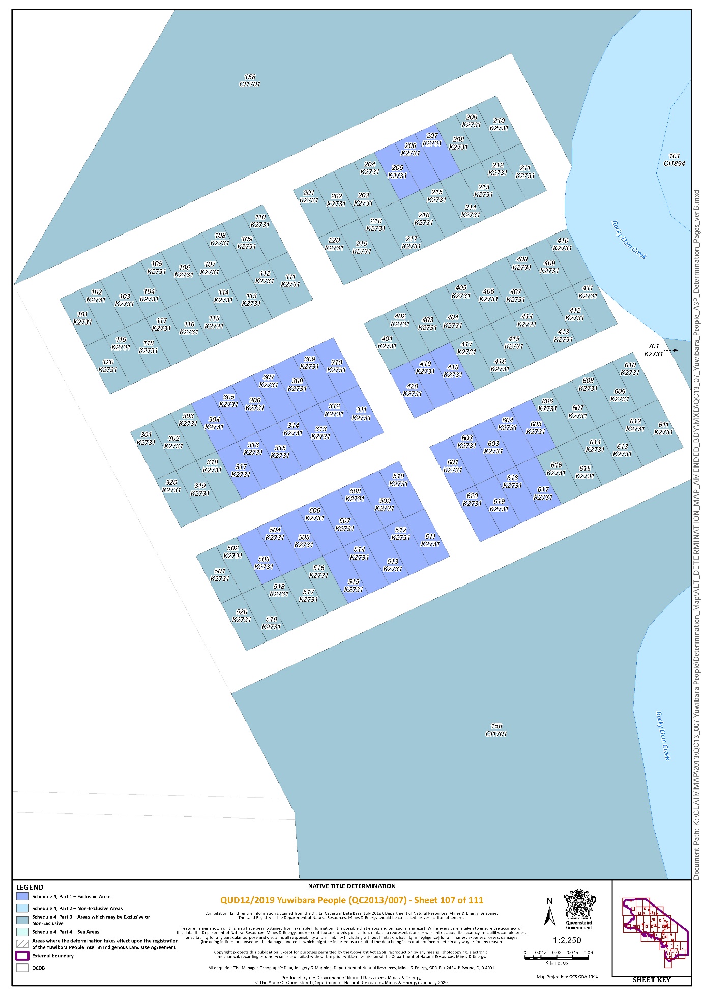
Note: Entry of orders is dealt with in Rule 39.32 of the Federal Court Rules 2011.
ROBERTSON J:
Introduction
1 This Claim, the Yuwibara Application, covers an area of approximately 6450 square kilometres (the Claim Area) in the Mackay area of Queensland. It is described as an area of land and waters on the central coast of Queensland which takes in the town of Mackay, the coastal plains and valleys from near Ilbilbie in the south to Midge Point (Midgeton) in the north, and west across the Pioneer Valley to the foothills of the Connors and the Clarke Ranges.
2 The Claim was filed in this Court on 29 October 2013 and entered on the Register of Claims maintained by the Native Title Registrar on 9 January 2014.
3 On 12 March 2014, the Claim was notified by the Native Title Registrar in accordance with s 66 of the Native Title Act 1993 (Cth), with a notification closing date of 11 June 2014. Leave to amend the Claim was granted on 29 January 2020 and the amended Claim was filed the same day.
4 As a result of successful case management, all parties to the Claim have reached agreement that native title exists and as to the nature and extent of those native title rights and interests over the area covered by the Claim.
5 The applicant seeks a determination of native title by agreement of the parties under s 87 of the Native Title Act in the terms set out in the Determination on behalf of the Yuwibara People over lands and waters comprising the Claim Area.
6 The Claim is made on behalf of the Yuwibara People who have a connection to the Claim Area in accordance with their respective traditional laws acknowledged and traditional customs observed. The Yuwibara native title claim group is comprised of all those persons who are the bloodline descendants of one or more of the following ancestors:
1. Peter Nolan
2. Jane Morris, mother of Peter Smith and Frank Morris
3. Molly, mother of Bill Bargo (aka Bill Tonga) and Annie Bargo (aka Annie Tonga)
4. Johanna Hazeldean
5. Mungo, King of Hamilton, father of Spoonbill
6. Jerry McDonald; or
7. Janie (McDonald).
7 The respondents are the State of Queensland, the Commonwealth of Australia, Mackay Regional Council, Telstra Corporation Ltd, Ergon Energy Corporation Ltd, Aurizon Network Pty Ltd, Aurizon Operations Limited, Aurizon Property Pty Ltd, North Queensland Bulk Ports Corporation, SunWater Limited, Kim Frances Borg, Robert John Borg, Norman George Ladley, Sharon Lillian Ladley, Gary Andrew McDermott, Colin Edward Byrnes, Anthony John Collard, Noel Robert Gray, Russell William Marriage and Michael Wayne Wood.
8 As I have indicated, the parties have agreed to the terms of a determination of native title recorded in an agreement pursuant to s 87 of the Native Title Act, this agreement having been executed by the parties and filed on 7 February 2020.
9 The Court has a discretion to make an order in those terms without holding a hearing if the conditions in s 87(1)(a)-(c) of the Native Title Act are met and if it appears to the Court to be appropriate to do so: s 87(1A)-(2).
10 When a native title claim is resolved by consent, the applicant does not have to prove their case at a hearing. If an agreement between the parties to a determination is reached, the Court may, if satisfied that an order consistent with the terms of the agreement would be within the power of the Court and it appears appropriate, make a native title determination over the whole or part of a claim area without a hearing. The focus is on whether there is an agreement between parties that was “freely entered into on an informed basis”: Lovett v Victoria [2007] FCA 474 at [37] per North J, citing Nagkiriny v Western Australia [2002] FCA 660; 117 FCR 6 and Ward v Western Australia [2006] FCA 1848. In relation to the State, the Court should be assured that such a party has “taken steps to satisfy itself that there is a credible basis for an application”, or is “satisfied as to the cogency of the evidence upon which applicants rely”: Lovett at [37]; Munn v Queensland [2001] FCA 1229; 115 FCR 109 at [29] per Emmett J.
11 As submitted by the applicant, all parties have had the benefit of independent and competent legal advice and have freely entered into an agreement under s 87 relating to the proposed determination; it is consistent with the objects of the Native Title Act that issues and disputes concerning native title are resolved by mediation; the State has taken a “real interest” in the proceeding on behalf of the community and given appropriate consideration to the applicant’s connection material; the connection material filed by the applicant is sufficient evidence of the existence of native title, as defined in s 223 of the Native Title Act and supports the making of the Determination; the requirements of ss 94A and 225 of the Native Title Act are met by the proposed determination; and the Determination is unambiguous and is certain as to the rights declared.
The evidence
12 The applicant has provided the State with a number of reports produced by expert anthropologists and other material for the purpose of satisfying it of the existence of native title within the meaning of s 223. These reports and materials provided the basis for the agreement under s 87. The applicant relies on the s 87 agreement and Dr Alison Pembroke’s report entitled “Yuwibara People Connection Report”, dated 26 August 2015, exhibited to the affidavit of Nigel Walter Hales, sworn on 31 January 2020, for the purpose of satisfying the Court as to the appropriateness of making orders in terms of the Determination.
13 I find that the Yuwibara People remain connected to their ancestors’ country in accordance with a normative system of traditional laws and customs under which they hold native title rights and interests in the Claim Area.
14 The applicant also relied on documents accompanying the amended Form 1, which included in particular the affidavit of Gary Theodore Mooney sworn on 4 July 2013. He deposed to: his family and ancestors; the Yuwibara country and living and camping on country; fishing, hunting and gathering; traditional medicine; taboo places, mythology and spiritual belief; language; totems; food taboos; family gatherings and support networks; burial and funeral ceremonies; marriage rules; dispute settlement; knowledge of country and sites; protecting and caring for country; and permission to enter and visit country.
15 Dr Pembroke described the content of the traditional laws and customs maintained and observed by the Yuwibara People. Her opinion was that the traditional laws and customs continued to be adhered to and passed on from the pre-sovereign society to contemporary Yuwibara People today.
16 Dr Pembroke’s findings, in summary, were as follows.
17 At [120], Dr Pembroke found that, as a whole, the group identified with the Yuwibara/Yuibera label; and the members of the group had maintained a traditional, physical and spiritual connection to their lands and waters since sovereignty. The group identified themselves by the Yuwibara name in the very early contact era. Whether the Yuwibara label was used in pre-contact times cannot be known for certain, but was largely irrelevant, given the group, however labelled, has endured.
18 Dr Pembroke records that she found the laws and customs of the Yuwibara People include, but are not limited to, the following:
a) a system of recruitment to the land-owning group
b) a system of land tenure
c) a regional system
d) section system
e) totemism
f) marriage
g) bloodlines
h) kinship
i) naming practices
j) age and gender based knowledge and authority
k) mythology
l) dispute settlements
m) avoidance behaviour
n) permission
19 Dr Pembroke gave her opinion, which I accept, that there existed a pre-sovereign society which acknowledged and observed a system of traditional laws and customs at the time of first settlement in 1862. The Yuwibara People have substantially maintained their identity from generation to generation from that pre-sovereign society, and they have maintained and continuously observed their traditional laws and customs. It is by virtue of this identity and bloodline connection and its inherent body of laws and customs that they, as a whole group, are connected to the country around the Mackay/Pioneer Valley region. While some laws and customs observed and acknowledged by Yuwibara People are consistent with those laws and customs observed more broadly by other groups, clearly there exist specific beliefs and customs particular to the Yuwibara People. Dr Pembroke had demonstrated the continued observance of Yuwibara laws and customs by the claimants and their predecessors.
20 Dr Pembroke records that the native title rights and interests in Yuwi traditional lands and waters arise primarily through the Law of Descent. That is, the principal mechanism by which Yuwi people acquire rights and interests in country is by virtue of their genealogical descent from one of the named apical ancestors. Following that primary law, certain laws and customs (as Dr Pembroke described in the preceding Part of her report), give rise to the native title rights and interests of the Yuwi group.
21 Dr Pembroke explained that she grouped into three main categories the eight native title rights and interests claimed by the Yuwibara People: the first pertaining to their traditional lands and waters; the second to the resources of those lands and waters; and the third to the cultural knowledge and practices of the Yuwi people.
22 Dr Pembroke provided, in Table 6 to her report, a non-exhaustive list of examples, summarising: the laws and customs of the Yuwibara People; the rights and interests arising from those laws and customs; and the present-day activities that demonstrate the continued observance and exercise of those laws and customs, and the enactment of the Yuwibara People’s rights and interests. It is not necessary to set out Table 6 here.
23 The connection material was assessed by the State for the purpose of determining whether a credible basis for the Claim existed, and whether the requirements of s 223(1) were met. Thereafter, the parties entered into negotiations over the terms by which the Claim could be resolved by consent.
24 I accept the submissions made on behalf of the applicant as follows. No submissions were filed by the respondents.
25 The evidence shows the Yuwibara People today, and in 1900, as an organised society that possesses native title rights and interests in accordance with observed and acknowledged traditional laws and customs. The evidence establishes the intergenerational transfer of Yuwibara People’s cultural knowledge, laws and customs throughout the 20th century. From this, I infer that the Yuwibara People today are descended from a community of people, including four “barra” groups around Mackay, who spoke variations of what is now known as Yuwibara language and who used and occupied Yuwibara country prior to 1788. I accept that the Yuwibara People’s laws and customs have their origins in a pre-sovereignty Yuwibara society.
26 I find that the Yuwibara People have continuously maintained a traditional, physical and spiritual connection to their lands and water since sovereignty, and possessed native title rights and interests in accordance with observed and acknowledged traditional law and custom. The evidence identifies a community of Yuwibara People in the early days of European contact from the 1880s. Despite the impact of sustained settlement in the Yuwibara claim area and the impacts of European settlement on the Yuwibara population, Yuwibara People have continued to possess native title in accordance with observed and acknowledged traditional law and custom. While there have been some adaptations of laws and customs as a result of the impacts of sustained European settlement, those changes have not affected the laws and customs of the Yuwibara People such that it can no longer be said that the rights or interests asserted are possessed under their traditional laws acknowledged and the traditional customs observed.
27 The evidence establishes that the rights and interests described in the Determination are not antithetical to fundamental tenets of the common law and, subject to permissible adaptation, existed at sovereignty, survived that fundamental change in legal regime, and now can be enforced and protected. As such, they are recognised by the common law of Australia.
28 There is also in evidence the affidavit of Mr David Glenn Saylor, solicitor, sworn 1 August 2013 which outlined the steps taken by North Queensland Land Council Aboriginal Corporation in notifying a Yuwibara authorisation meeting which was held on 27 June 2013 in Mackay. The purpose of this meeting was to consider and authorise: the making and lodging of a new Yuwibara native title claim; a Yuwibara person or persons as the applicant; the applicant to lodge a new claim pursuant to s 61 of the Native Title Act; and the applicant to deal with all matters arising under the Native Title Act in relation to the new claim pursuant to s 62A. I find that the meeting was duly notified and a total of 85 notification letters and authorisation notices were mailed to those whose names appeared on the Yuwibara contact register.
29 Also part of the amended Form 1 are three affidavits dealing with authorisation. Each affidavit was sworn on 27 June 2013. The first was the affidavit of Mr Gary Theodore Mooney. The second was the affidavit of Ms Jenifer Olive Darr. The third was the affidavit of Ms Melanie Roseveen Kemp. I find that the meeting on 27 June 2013 was attended by persons acknowledged as Yuwibara People and respected by the claim group to discuss and make decisions on their behalf. I also find that the applicant was authorised: to file the claim; to deal with all matters arising in relation to the application; and to deal with all matters arising in relation to future act matters.
30 Finally, there is in evidence an affidavit of Ms Phoebe Mawby Smart, paralegal, which deposes to an authorisation meeting on 14 December 2019 at which members of the Yuwibara People who responded to public notices authorised the filing of the amended Form 1 and entry into the s 87 agreement. I accept Ms Smart’s evidence.
Consideration
31 I find the connection material demonstrates that the agreement of the parties to the making of orders in the form of the Determination is “rooted in reality” and has a credible basis.
32 The applicant submits, and I find, that the Court can be satisfied that the agreement of the parties recorded in the s 87 agreement has been freely entered into on an informed basis. As the applicant submits, all of the parties to the proceeding are legally represented and have been at all material times during the course of the negotiations.
33 I find that the period specified in the notice under s 66 has ended and that an agreement has been reached between all the parties in relation to the terms of an order. The terms of that agreement, in writing signed by or on behalf of the parties, have been filed with the Court, and I am satisfied that orders in, or consistent with, those terms would be within the power of the Court: the native title rights and interests that are proposed to be determined are recognised by the common law of Australia and the requirements of s 94A are satisfied because, as I go on to consider, each of the requirements in s 225 are met.
34 Section 55 provides that at the same time as, or as soon as practicable after, making a determination that native title exists, the Court must make the determination provided for in ss 56 and 57. Section 56 requires a determination of whether the native title is to be held in trust and, if so, by whom. Section 57 specifies the authorised functions of a prescribed body corporate in particular circumstances.
35 The Yuwi Aboriginal Corporation was registered by the Office of the Registrar of Indigenous Corporations on 20 April 2017. Documents relevant to the registration and nomination of the Yuwi Aboriginal Corporation as Prescribed Body Corporate and its acceptance of the nomination were filed as annexures to the affidavit of Nigel Hales sworn 31 January 2020.
36 On the basis of what is set out in the affidavit of Mr Hales (including its annexures), he having attended a meeting of the members of the native title claim group in these proceedings on 14 December 2019, I accept:
(a) the Yuwi Aboriginal Corporation ICN 8608 has been incorporated under the Corporations (Aboriginal and Torres Strait Islander) Act 2006 (Cth) (CATSI Act).
(b) the membership of the Yuwi Aboriginal Corporation is limited to Aboriginal and Torres Strait Islander People;
(c) the Yuwi Aboriginal Corporation’s rules provide membership may comprise all adult native title holders as described in the proposed determination, that is, all Yuwibara People as persons who have native title rights and interests in relation to the land or waters to which the proposed determination relates;
(d) by virtue of the eligibility requirements to be a member of the Yuwi Aboriginal Corporation, all current members are included in the proposed determination as native title holders; and
(e) the Yuwi Aboriginal Corporation’s objects are, inter alia, to:
(i) be and perform the functions of a prescribed body corporate (and following registration as a registered native title body corporate, the functions of a registered native title body corporate) holding Native Title in trust pursuant to a determination of the Court made pursuant to Section 56 of the Native Title Act;
(ii) upon becoming a registered native title body to perform the functions of a registered native title body as required by the Native Title Act and the Native Title (Prescribed Body Corporate) Regulations 1999 (Cth) (PBC Regulations);
(iii) protect, preserve and advance the traditions, laws, languages, special knowledge, culture and customs of Aboriginal persons, especially of the Native Title Holders.
37 The applicant submits, and I find, that ss 56 and 57 of the Native Title Act are satisfied. In addition to the matters outlined in the preceding paragraphs, the following matters are also relevant:
(a) the applicant established the Yuwi Aboriginal Corporation and nominated it to be the prescribed body corporate; and
(b) on 14 December 2019 the Yuwi Aboriginal Corporation has consented to being nominated.
38 Pursuant to regulation 4 of the PBC Regulations, the Yuwi Aboriginal Corporation is eligible for nomination pursuant to s 56(2) because, at the time of the determination:
(a) it is an Aboriginal and Torres Strait Islander corporation (being a corporation registered under the CATSI Act);
(b) the purposes of becoming a registered native title body corporate are set out in the objects of the Yuwi Aboriginal Corporation;
(c) all of its members are included, or proposed to be included, in the proposed determination as native title holders;
(d) at all times after the s 56 determination is made, all members of the corporation will be persons who have native title rights and interests in relation to the land or waters to which the proposed determinations relate; and
(e) the corporation meets the indigeneity requirements of s 29-5 of the CATSI Act.
39 The applicant submits, and I find, that the proposed determination satisfies the requirements of ss 94A and 225 of the Native Title Act because:
(a) the persons holding the common or group rights comprising the native title are properly identified in Schedule 1;
(b) the nature and extent of the native title rights and interests in relation to the Determination Area are properly described in [8]-[14];
(c) the nature and extent of any other interests in relation to the Determination Area are described in [15]-[16] and Schedule 2;
(d) the relationship between the rights and interests in paragraphs (b) and (c) is appropriately dealt with in [16]; and
(e) Part 1 of Schedule 4, read with [8], describes areas where the native title rights and interests confer possession, occupation, use and enjoyment of that land or waters on the native title holders to the exclusion of all others. In relation to “Water” as defined, there are non-exclusive rights: to hunt, fish and gather from the Water of the area; take the “Natural Resources”, as defined, of the Water in the area; and take the Water of the area, for personal, domestic and non-commercial communal purposes.
Conclusion and orders
40 In these circumstances the Court makes the orders sought in accordance with the agreement of the parties. The Court congratulates the parties and their advisers.
I certify that the preceding forty (40) numbered paragraphs are a true copy of the Reasons for Judgment herein of the Honourable Justice Robertson. |
Associate:
QUD 12 of 2019 | |
TELSTRA CORPORATION LIMITED ABN 33 051 775 556 | |
Fifth Respondent: | ERGON ENERGY CORPORATION LIMITED ACN 087 646 062 |
Sixth Respondent: | AURIZON NETWORK PTY LTD (ACN: 132 181 116) |
Seventh Respondent: | AURIZON OPERATIONS LIMITED (ACN: 124 649 967) |
Eighth Respondent: | AURIZON PROPERTY PTY LTD ACN 145 991 724 |
Ninth Respondent: | NORTH QUEENSLAND BULK PORTS CORPORATION LIMITED ACN 136 880 218 |
Tenth Respondent: | SUNWATER LIMITED ABN 020 276 523 |
Eleventh Respondent: | KIM FRANCES BORG |
Twelfth Respondent: | ROBERT JOHN BORG |
Thirteenth Respondent: | NORMAN GEORGE LADLEY |
Fourteenth Respondent: | SHARON LILLIAN LADLEY |
Fifteenth Respondent: | GARY ANDREW MCDERMOTT |
Sixteenth Respondent: | COLIN EDWARD BYRNES |
Seventeenth Respondent: | ANTHONY JOHN COLLARD |
Eighteenth Respondent: | NOEL ROBERT GRAY |
Nineteenth Respondent: | RUSSELL WILLIAM MARRIAGE |
Twentieth Respondent: | MICHAEL WAYNE WOOD |

