
FEDERAL COURT OF AUSTRALIA
Clancy on behalf of the Auburn Hawkwood People and State of Queensland [2019] FCA 1908
ORDERS
DATE OF ORDER: |
BEING SATISFIED that an order in the terms set out below is within the power of the Court, and it appearing appropriate to the Court to do so, pursuant to s 87 of the Native Title Act 1993 (Cth)
BY CONSENT THE COURT ORDERS THAT:
1. There be a determination of native title in the terms set out below (the determination).
2. Each party to the proceedings is to bear its own costs.
BY CONSENT THE COURT DETERMINES THAT:
3. The determination area is the land and waters described in Schedule 4 and depicted in the map attached to Schedule 6 to the extent those areas are within the External Boundary and not otherwise excluded by the terms of Schedule 5 (the Determination Area). To the extent of any inconsistency between the written description and the map, the written description prevails.
4. Native title exists in the Determination Area.
5. The native title is held by the Auburn Hawkwood People described in Schedule 1 (the Native Title Holders).
6. Subject to orders 8, 9 and 10 below, the nature and extent of the native title rights and interests in relation to the land and waters described in Part 1 of Schedule 4 are:
(a) other than in relation to Water, the right to possession, occupation, use and enjoyment of the area to the exclusion of all others; and
(b) in relation to Water, the non-exclusive rights to:
(i) hunt, fish and gather from the Water of the area;
(ii) take and use the Natural Resources of the Water in the area; and
(iii) take and use the Water of the area.
for personal, domestic and non-commercial communal purposes.
7. Subject to orders 8, 9 and 10 below, the nature and extent of the native title rights and interests in relation to the land and waters described in Part 2 of Schedule 4 are the non-exclusive rights to:
(a) access, be present on, move about on and travel over the area;
(b) camp, and live temporarily on the area as part of camping, and for that purpose build temporary shelters;
(c) hunt, fish and gather on the land and waters of the area for personal, domestic and non-commercial communal purposes;
(d) take and use Natural Resources from the land and waters of the area for personal, domestic and non-commercial communal purposes;
(e) take and use the Water of the area for personal, domestic and non-commercial communal purposes;
(f) conduct ceremonies on the area;
(g) be buried and bury Native Title Holders within the area;
(h) maintain places of importance and areas of significance to the Native Title Holders under their traditional laws and customs and protect those places and areas from physical harm;
(i) teach on the area the physical and spiritual attributes of the area;
(j) hold meetings on the area; and
(k) light fires on the area for domestic purposes including cooking, but not for the purpose of hunting or clearing vegetation.
8. The native title rights and interests are subject to and exercisable in accordance with:
(a) the Laws of the State and the Commonwealth; and
(b) the respective traditional laws acknowledged and traditional customs observed by the Native Title Holders.
9. The native title rights and interests referred to in orders 6(b) and 7 do not confer possession, occupation, use or enjoyment to the exclusion of all others.
10. There are no native title rights in or in relation to minerals as defined by the Mineral Resources Act 1989 (Qld) and petroleum as defined by the Petroleum Act 1923 (Qld) and the Petroleum and Gas (Production and Safety) Act 2004 (Qld).
11. The nature and extent of any other interests in relation to the Determination Area (or respective parts thereof) are set out in Schedule 2.
12. The relationship between the native title rights and interests described in orders 6 and 7 and the other interests described in Schedule 2 (the Other Interests) is that:
(a) the Other Interests continue to have effect, and the rights conferred by or held under the Other Interests may be exercised notwithstanding the existence of the native title rights and interests;
(b) to the extent the Other Interests are inconsistent with the continued existence, enjoyment or exercise of the native title rights and interests in relation to the land and waters of the Determination Area, the native title continues to exist in its entirety but the native title rights and interests have no effect in relation to the Other Interests to the extent of the inconsistency for so long as the Other Interests exist; and
(c) the Other Interests and any activity that is required or permitted by or under, and done in accordance with, the Other Interests, or any activity that is associated with or incidental to such an activity, prevail over the native title rights and interests and any exercise of the native title rights and interests.
DEFINITIONS AND INTERPRETATION
13. In this determination, unless the contrary intention appears:
“External Boundary” means the area described in Schedule 3;
“land” and “waters”, respectively, have the same meanings as in the Native Title Act 1993 (Cth);
“Laws of the State and the Commonwealth” means the common law and the laws of the State of Queensland and the Commonwealth of Australia, and includes legislation, regulations, statutory instruments, local planning instruments and local laws;
“Local Government Act” has the meaning given in the Local Government Act 2009 (Qld);
“Local Government Area” has the meaning given in the Local Government Act 2009 (Qld);
“Natural Resources” means:
(a) any animal, plant, fish and bird life found on or in the lands and waters of the Determination Area; and
(b) any clays, soil, sand, gravel or rock found on or below the surface of the Determination Area,
that have traditionally been taken and used by the Native Title Holders, but does not include:
(a) animals that are the private personal property of another;
(b) crops that are the private personal property of another;
(c) minerals as defined in the Mineral Resources Act 1989 (Qld); or
(d) petroleum as defined in the Petroleum Act 1923 (Qld) and the Petroleum and Gas (Production and Safety) Act 2004 (Qld);
“Reserve” means a reserve dedicated or taken to be a reserve under the Land Act 1994 (Qld);
“Water” means:
(a) water which flows, whether permanently or intermittently, within a river, creek or stream;
(b) any natural collection of water, whether permanent or intermittent; and
(c) water from an underground water source;
“Works” has the same meaning as in the Electricity Act 1994 (Qld).
Other words and expressions used in this determination have the same meanings as they have in Part 15 of the Native Title Act 1993 (Cth).
THE COURT DETERMINES THAT:
14. The native title is held in trust.
15. The Auburn Hawkwood People Aboriginal Corporation (ICN: 9127), incorporated under the Corporations (Aboriginal and Torres Strait Islander) Act 2006 (Cth), is to:
(a) be the prescribed body corporate for the purpose of ss 56(2)(b) and 56(3) of the Native Title Act 1993 (Cth); and
(b) perform the functions mentioned in s 57(1) of the Native Title Act 1993 (Cth) after becoming a registered native title body corporate.
Note: Entry of orders is dealt with in Rule 39.32 of the Federal Court Rules 2011.
LIST OF SCHEDULES
Schedule 1 | – Native Title Holders |
Schedule 2 | – Other Interests in the Determination Area |
Schedule 3 | – External Boundary |
Schedule 4 | – Description of Determination Area |
Schedule 5 | – Areas Not Forming Part of the Determination Area |
Schedule 6 | – Map of Determination Area |
Schedule 1 – Native Title Holders
1. The Native Title Holders are the Auburn Hawkwood People who have a connection to the Determination Area in accordance with their respective traditional laws acknowledged and traditional customs observed and are the biological descendants of one or more of the following people:
(a) Bojimba & Narrygn;
(b) Ginalene, the mother of Ernest Pope;
(c) Tilly, the mother of Harry Blucher;
(d) Grace, the mother of Fanny Joyce;
(e) Jack Hornet Snr, the father of Jack Hornet;
(f) Thomas Clancy;
(g) Maria, the mother of Isabella Hooper;
(h) Amy, wife of John Bond;
(i) Billy and Selena, parents of Jacob;
(j) Bessie Rawbelle;
(k) Billy McKenzie;
(l) Maggie West;
(m) Jackanapes;
(n) Jinnie, the mother of Ranji Logan;
(o) Rosie, the mother of John Barra;
(p) Mergwin - Blay;
(q) Kitty of Boondooma;
(r) King Billy and Maria of Boondooma;
(s) Jessie Fuller;
(t) Mi Mi; or
(u) Maggie Hart.
Schedule 2 – Other Interests in the Determination Area
The nature and extent of the other interests in relation to the Determination Area are the following as they exist as at the date of the determination:
1. The rights and interests of the parties under the following agreements registered on the Register of Indigenous Land Use Agreements:
(a) Wakka Wakka 2 and Tarong ILUA (QI2008/027) registered 8 September 2009;
(b) Djaku-nde and Jangerie Jangerie and Wakka Wakka Peoples and QGC PTY Limited ILUA (QI2010/005) registered 17 September 2010; and
(c) Djaku-nde and Jangerie Jangerie and Wakka Wakka People and QGC Pty Limited (Balance Area) ILUA registered 1 November 2010.
2. The rights and interests of Telstra Corporation Limited ACN 051 775 556:
(a) as the owner or operator of telecommunications facilities within the Determination Area;
(b) created pursuant to the Post and Telegraph Act 1901 (Cth), the Telecommunications Act 1975 (Cth), the Australian Telecommunications Corporation Act 1989 (Cth), the Telecommunications Act 1991 (Cth) and the Telecommunications Act 1997 (Cth), including rights:
(i) to inspect land;
(ii) to install, occupy and operate telecommunication facilities; and
(iii) to alter, remove, replace, maintain, repair and ensure the proper functioning of its telecommunications facilities;
(c) for its employees, agents or contractors to access its telecommunication facilities in and in the vicinity of the Determination Area in the performance of their duties; and
(d) under any lease, licence, access agreement, permit or easement relating to its telecommunications facilities in the Determination Area.
3. The rights and interests of Ergon Energy Corporation Limited ACN 087 646 062:
(a) as the owners and operator of any Works within the Determination Area;
(b) as an electricity entity under the Electricity Act 1994 (Qld), including but not limited to:
(i) as the holders of a distribution authority;
(ii) to inspect, maintain and manage any Works in the Determination Area; and
(iii) in relation to any agreement or consent relating to the Determination Area existing or entered into before the date these orders are made; and
(c) to enter the Determination Area by its employees, agents or contractors to exercise any of the rights and interests referred to in this clause.
4. The rights and interests of the Banana Shire Council, Western Downs Regional Council, North Burnett Regional Council and South Burnett Regional Council as the local government for that part of the Determination Area within their respective Local Government Area, including:
(a) their powers, functions, responsibilities and jurisdiction under a Local Government Act;
(b) their rights and interests under any interest in land or waters within the Determination Area including under any lease, license, access agreement, easement or Reserve in the Determination Area;
(c) the rights to use, operate, maintain, replace, restore, remediate, repair and otherwise exercise all other rights as the owners and operators of infrastructure, structures, earthworks, access works, facilities and other improvements within the Determination Area;
(d) the rights under any agreements between the local government and third parties which relate to land or water in the Determination Area; and
(e) the rights of their employees, agents and contractors to enter upon the Determination Area for the purpose of performing their powers and responsibilities under paragraphs (a) to (d).
5. The rights and interests of members of the public arising under the common law, including but not limited to the following:
(a) any subsisting public right to fish; and
(b) the public right to navigate.
6. Any other rights and interests:
(a) held by the State of Queensland or Commonwealth of Australia; or
(b) existing by reason of the force and operation of the Laws of the State and the Commonwealth.
Schedule 3 – External Boundary
The area of land and waters commencing:
At a point on the eastern boundary of Lot 64 on Plan FTY1828 (Camboon State Forest) at Latitude 25.111339° South, being a point on the eastern boundary of Native Title Determination QUD6006/00 Wulli Wulli People (QC00/07), and extending east to an eastern boundary of Lot 226 on Plan FTY656; then generally southerly along eastern boundaries of that lot, north eastern boundaries of Lot 19 on Plan PH524 and north eastern boundaries of Lot 227 on Plan FTY1244 to the intersection of the southern boundary of Glencoe Road and the western boundary of Calrossie Road; then generally easterly and generally southerly along northern and eastern boundaries of the southern severance of Lot 1 on Plan RW854, again eastern and northern boundaries of Lot 227 on Plan FTY1244 to the northernmost north western corner of Lot 1 on Plan WK144; then generally easterly and generally south westerly along boundaries of that lot, eastern boundaries of Lot 13 on PlanWK87 and an eastern boundary of Lot 14 on Plan WK87 to the northernmost corner of Lot 10 on Plan WK227; then generally south easterly along boundaries of that lot, generally easterly and generally southerly along northern boundaries of Lot 42 on Plan FTY1497, northern and eastern boundaries of Lot 4 on Plan WK228 to the easternmost north eastern corner of that lot at Latitude 25.466556° South; then easterly to the headwaters of Target Creek at Longitude 150.836420° East, Latitude 25.468380° South; then generally south easterly along the centreline of that creek to Longitude 150.864500° East; then southerly to the westernmost corner of Lot 7 on Plan WK149; then generally southerly, generally easterly and again generally southerly along eastern boundaries of Lot 2 on Plan WK179, northern and eastern boundaries of Lot 4 on Plan WK45 and an eastern boundary of Lot 44 on Plan FTY892 to a corner of that lot at Latitude 25.644832° South; then easterly to a corner on the western boundary of Lot 5 on Plan WK231 at Latitude 25.649256° South; then generally south easterly along western boundaries of that lot to the northern boundary of Hawkwood Road; then generally easterly along northern boundaries of that road to Longitude 151.052311° East; then north easterly to a south western corner of the southern severance of Lot 5 on Plan WK231 at Longitude 151.056444° East; then easterly along the southern boundary of the southern severance of that lot to its south eastern corner at Latitude 25.642540° South; then easterly to the north western corner of Lot 71 on Plan WK8; then generally easterly along the northern boundaries of that lot to its north eastern corner; then northerly to a corner on the northern boundary of Lot 43 on Plan FTY1717 at Longitude 151.101418° East; then generally north easterly along boundaries of that lot to a corner at Longitude 151.121819° East; then north easterly to a corner on the southern boundary of Pearlinga Road at Longitude 151.136273° East; then generally easterly along southern boundaries of that road to the western bank of St John Creek; then generally easterly and generally southerly along the western bank of that creek to the western bank of the Burnett River; then generally westerly, generally south easterly and generally southerly along the western bank of that river, and the western bank of Boyne River to the northern boundary of Lot 20 on Plan SP142310 (Boondooma Lake); then easterly to the centreline of that lot and generally southerly along the centreline of Boondooma Lake (being the centreline of Lot 20 on Plan SP142310) to Latitude 26.136451° South; then generally south westerly along the centreline of that lake and onwards generally southerly, generally south easterly and again generally southerly along the centreline of the Boyne River to its source at Longitude 151.531067° East, Latitude 26.757582° South; then south westerly to the south western corner of Lot 12 on Plan RP50030; then generally south westerly and generally westerly along southern boundaries of Lot 18 on Plan BO27 and Lot 94 on Plan BO27 to the western boundary of South Burnett Regional Council; then generally westerly, generally northerly and generally north westerly along boundaries of that regional council to the north western corner of Lot 60 on Plan BO252; then generally northerly along western boundaries of Lot 42 on Plan BO160 to Jacksons Road; then north easterly to the south western corner of Lot 2 on Plan RP200370; then north westerly to the north eastern corner of Lot 8 on Plan AU51 (being a south eastern corner of former Lot 302 on Plan FTY1349); then northerly and easterly along boundaries of Lot 9 on Plan AU51 to western bank of the Burnett River Watershed at Longitude 151.116671° East; then generally northerly and generally north westerly along western boundaries of that watershed to its intersection with a northern boundary of again the South Burnett Regional Council boundary; then generally westerly and northerly along boundaries of that regional council boundary and generally westerly along northern boundaries of Lot 302 on Plan FTY1964 (former Lot 302 on Plan FTY1349) to its intersection with an unnamed road and Auburn Road at Longitude 150.703053° East; then generally northerly along the western boundary of Auburn Road to the southern boundary of the Burnett River Watershed at Longitude 150.703267° East; then generally westerly along southern boundaries of that watershed to its intersection with the southern boundary of Lot 25 on Plan FT111, then north easterly and generally northerly along boundaries of that lot, eastern and northern boundaries of Lot 23 on Plan FT111, northern boundaries of Lot 21 on Plan FT111 to a point on the southern boundary of Native Title Determination QUD6162/98 Iman People 2 (QC97/55) at Longitude 150.282442° East; then generally northerly along the eastern boundary of that native title determination application passing through the following coordinate points:
Longitude East | Latitude South |
150.308255 | 26.048253 |
150.308732 | 26.047165 |
150.309274 | 26.045925 |
150.309713 | 26.044922 |
150.309903 | 26.044489 |
150.309818 | 26.042685 |
150.308019 | 26.038174 |
150.309820 | 26.033767 |
150.307752 | 26.029398 |
150.307871 | 26.003085 |
150.308111 | 26.003116 |
150.313730 | 25.990028 |
150.321854 | 25.986373 |
150.323213 | 25.985215 |
150.324499 | 25.984321 |
150.325795 | 25.982969 |
150.326841 | 25.981384 |
150.328155 | 25.979115 |
150.328949 | 25.977525 |
150.329497 | 25.975473 |
150.330051 | 25.973191 |
150.329839 | 25.971126 |
150.329876 | 25.969294 |
150.329908 | 25.967691 |
150.330448 | 25.966096 |
150.331752 | 25.964286 |
150.332794 | 25.962929 |
150.334351 | 25.961123 |
150.335646 | 25.959771 |
150.337199 | 25.958194 |
150.338494 | 25.956842 |
150.339794 | 25.955260 |
150.341107 | 25.952992 |
150.342411 | 25.951182 |
150.343720 | 25.949142 |
150.345278 | 25.947336 |
150.346840 | 25.945301 |
150.347895 | 25.943257 |
150.349203 | 25.941217 |
150.349996 | 25.939627 |
150.350122 | 25.939409 |
150.350406 | 25.938918 |
150.351046 | 25.937812 |
150.351843 | 25.935993 |
150.352124 | 25.934623 |
150.352392 | 25.933738 |
150.345598 | 25.932809 |
150.350000 | 25.919783 |
150.349474 | 25.911914 |
150.351116 | 25.911440 |
150.350921 | 25.910887 |
150.353451 | 25.909665 |
150.355608 | 25.910117 |
150.369092 | 25.905219 |
150.371424 | 25.904371 |
150.372944 | 25.905061 |
150.378016 | 25.903920 |
150.384614 | 25.897279 |
150.387152 | 25.894760 |
150.395049 | 25.895584 |
Then easterly to a corner on the north western boundary of Lot 22 on Plan SP263821 (former Lot 5 on Plan NT364) at Longitude 150.396023° East; then generally easterly and generally northerly along the western boundaries of that lot and the western boundary of Lot 21 on Plan SP263821 and Lot 5 on Plan NT196 to the intersection with the northern boundary of Western Downs Regional Council; then generally northerly along the western boundary for that regional council boundary to the intersection with the southern boundary of Native Title Determination QUD6006/00 Wulli Wulli People (QC00/07), being the intersection of the southern bank of an unnamed creek and the eastern boundary of Lot 3 on Plan FT840 at Latitude 25.645318° South; then generally northerly along boundaries of that lot and eastern boundaries of Lot 4064 on Plan SP149056 (former Lot 4064 on Plan PH1477) to Longitude 150.415251° East; then generally westerly and generally northerly to a south western corner of Lot 47 on Plan FTY1480 at Longitude 150.405708° East passing though the following coordinate points:
Longitude East | Latitude South |
150.411283 | 25.600931 |
150.408991 | 25.599232 |
150.407739 | 25.597269 |
150.406873 | 25.594622 |
150.406131 | 25.592205 |
150.405390 | 25.589789 |
150.405160 | 25.586692 |
150.404800 | 25.584166 |
150.404818 | 25.581873 |
150.404837 | 25.579352 |
150.404864 | 25.575913 |
150.404887 | 25.572933 |
150.404916 | 25.569266 |
150.404940 | 25.566171 |
150.404962 | 25.563421 |
150.405362 | 25.580675 |
150.405884 | 25.558732 |
150.405916 | 25.556627 |
Then generally northerly and generally north westerly along western boundaries of Lot 47 on Plan FTY1480 to the eastern boundary of Lot 1 on Plan DW63; then northerly along the boundary of that lot to a corner at Latitude 25.461511° South; then generally north easterly to again a corner on the eastern boundary of Lot 1 on Plan DW63 at Latitude 25.419196° South passing through the following coordinate points:
Longitude East | Latitude South |
150.375990 | 25.459526 |
150.376548 | 25.457667 |
150.377825 | 25.454797 |
150.378973 | 25.452617 |
150.380747 | 25.451249 |
150.382263 | 25.450915 |
150.384661 | 25.450933 |
150.386807 | 25.450836 |
150.388327 | 25.449811 |
150.389980 | 25.447520 |
150.392511 | 25.446157 |
150.394416 | 25.443984 |
150.395566 | 25.441227 |
150.395579 | 25.438808 |
150.395597 | 25.435583 |
150.395108 | 25.432699 |
150.394491 | 25.429930 |
150.394001 | 25.427161 |
150.392631 | 25.424155 |
Then generally north easterly again along eastern boundaries of Lot 1 on Plan DW63, Eastern boundaries of Lot 23 on Plan DW516, eastern boundaries of Lot 2 on Plan DW556 and southern and eastern boundaries of Lot 64 on Plan FTY1828 to Latitude 25.321315° South then generally northerly to again a point on the eastern boundary of Lot 64 on Plan FTY1828 at Latitude 25.316809° South passing through the following coordinate points:
Longitude East | Latitude South |
150.441617 | 25.320874 |
150.442655 | 25.320753 |
150.440860 | 25.317226 |
Then generally north easterly again along eastern boundaries of Lot 64 on Plan FTY1828 to Longitude 150.449965° East, then generally north easterly to again a point on the eastern boundary of Lot 64 on Plan FTY1828 at Latitude 25.268993° South passing through the following coordinate points:
Longitude East | Latitude South |
150.450360 | 25.280248 |
150.451381 | 25.277721 |
150.452278 | 25.274502 |
150.453425 | 25.271860 |
Then generally north easterly and generally easterly again along boundaries of Lot 64 on Plan FTY1828 to Longitude 150.478922° East, then generally north easterly and generally easterly to again a point on the eastern boundary of that lot at Latitude 25.185232° South, passing through the following coordinate points:
Longitude East | Latitude South |
150.494997 | 25.185576 |
150.496550 | 25.185492 |
150.497782 | 25.185185 |
150498714 | 25.185109 |
Then generally north easterly again along boundaries of Lot 64 on Plan FTY1828 to Longitude 150.544586° East, then generally north easterly to again a point on the eastern boundary of Lot 64 on Plan FTY1828 at Latitude 25.156017° South, passing through the following coordinate points:
Longitude East | Latitude South |
150.548244 | 25.162498 |
150.550391 | 25.161014 |
150.552664 | 25.159301 |
150.556323 | 25.157136 |
Then generally northerly and generally north easterly again along boundaries of Lot 64 on Plan FTY1828 to Latitude 25.123924° South, then generally north easterly to a point on the eastern boundary of Lot 64 on Plan FTY1828 at Longitude 150.575141° East passing through the following coordinate points:
Longitude East | Latitude South |
150.571505 | 25.118849 |
150.572499 | 25.117856 |
150.574733 | 25.114131 |
Then generally north easterly and north westerly again along the boundaries of Lot 64 on Plan FTY1828, also being boundaries of Native Title Determination QUD6006/00 Wulli Wulli People (QC00/07), back to the commencement point.
Exclusions
The Determination Area does not include the land and waters subject to the following:
QUD6006/00 - Wulli Wulli People (QC00/07) as determined by the Federal Court on 18 July 2017; and
QUD6162/1998 - Iman People 2 (QC97/55) as determined by the Federal Court on 23 June 2016.
Data Reference and Source
Cadastral data sourced from the Department of Natural Resources and Mines, Qld (February 2014).
Where available watercourse boundaries were derived from Cadastral data sourced from Department of Natural Resources and Mines, Qld (May 2008) or 1:250K Topographic Vector Data © Commonwealth of Australia (Geoscience Australia) 2008.
Catchment boundaries derived from The South East Queensland Environmental Values Sub-catchments v2.0 dataset sourced from Department of Natural Resources and Mines, Qld (August 2010).
Local Government Authorities data sourced from Department of Natural Resources and Mine, Qld (February 2014).
Reference Datum
Geographical coordinates have been provided by the NNTT Geospatial Services and are referenced to the Geocentric Datum of Australia 1994 (GDA94), in decimal degrees and are based on the spatial reference data acquired from the various custodians at the time.
Use of Coordinates
Where coordinates are used within the description to represent cadastral or topographical boundaries or the intersection with such, they are intended as a guide only. As an outcome to the custodians of cadastral and topographic data continuously recalculating the geographic position of the data based on improved survey and data maintenance procedures, it is not possible to accurately define such a position other than by detailed ground survey.
Prepared by Geospatial Services, National Native Title Tribunal (3 July 2014).
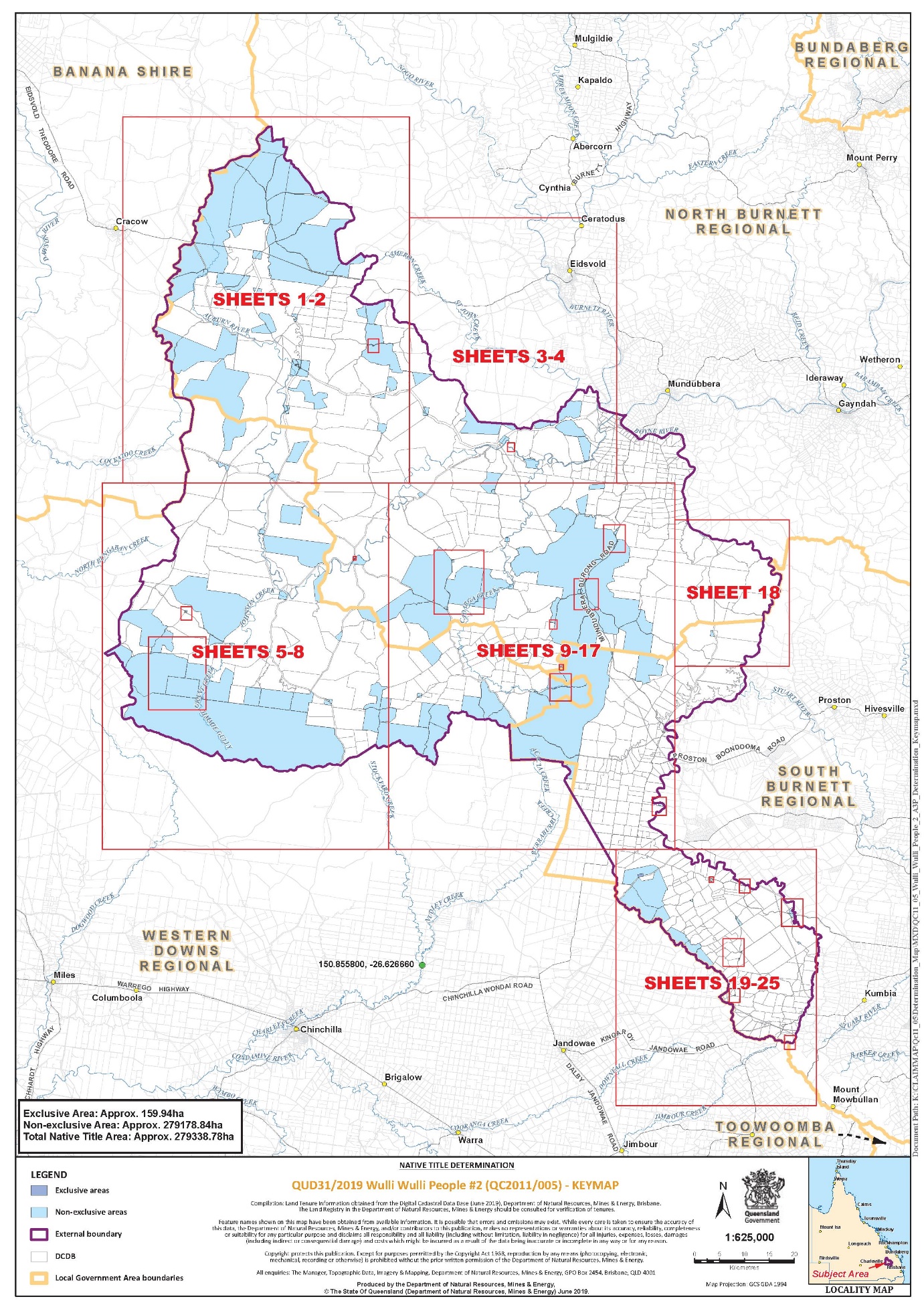
Schedule 4 – Description of Determination Area
The Determination Area comprises all of the land and waters described by lots on plan, or relevant parts thereof, and any rivers, streams, creeks or lakes described in the first column of the tables in the Parts immediately below, and depicted in the maps in Schedule 6, to the extent those areas are within the External Boundary and not otherwise excluded by the terms of Schedule 5.
Part 1 – Exclusive Areas
All of the land and waters described in the following table and depicted in dark blue on the determination map contained in Schedule 6:
Area description (at the time of the determination) | Determination Map Sheet Reference |
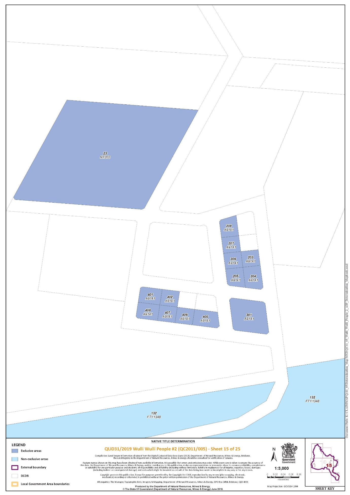
Lot 203 on Plan A9141 | Sheet 15 of 25 |
Lot 204 on Plan A9141 | Sheet 15 of 25 |
Lot 205 on Plan A9141 | Sheet 15 of 25 |
Lot 206 on Plan A9141 | Sheet 15 of 25 |
Lot 207 on Plan A9141 | Sheet 15 of 25 |
Lot 208 on Plan A9141 | Sheet 15 of 25 |
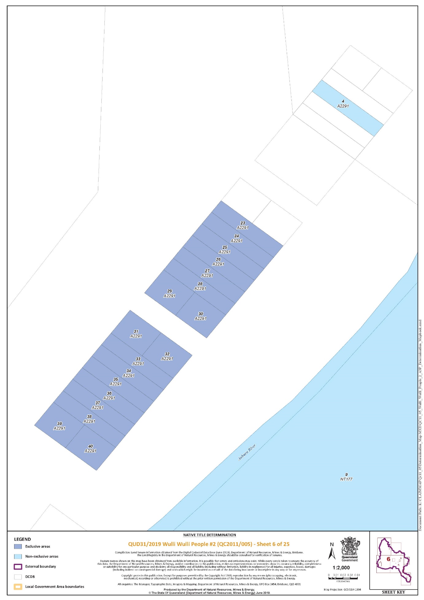
Lot 23 on Plan A2291 | Sheet 6 of 25 |
Lot 23 on Plan NT202 | Sheet 15 of 25 |
Lot 24 on Plan A2291 | Sheet 6 of 25 |
Lot 25 on Plan A2291 | Sheet 6 of 25 |
Lot 26 on Plan A2291 | Sheet 6 of 25 |
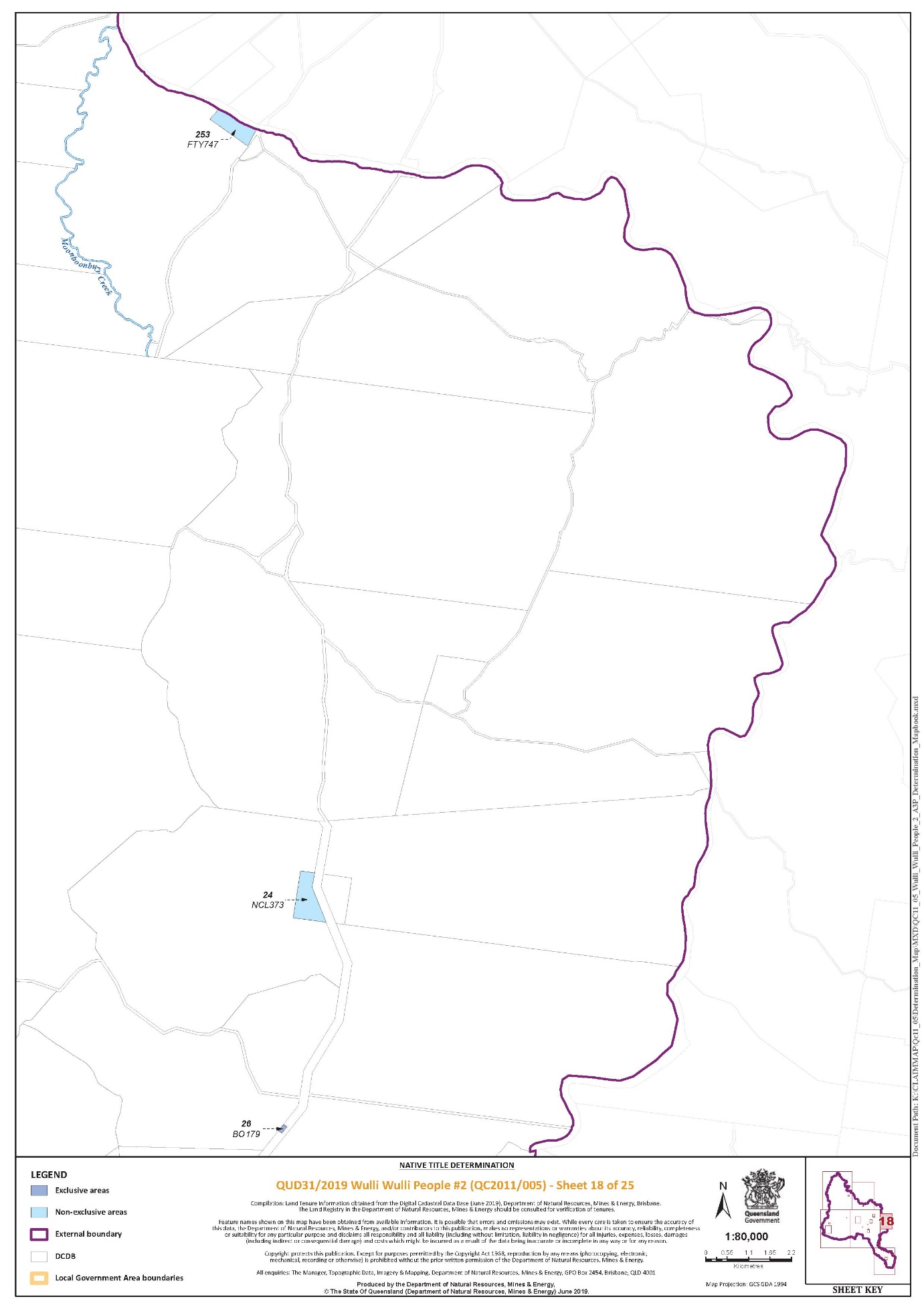
Lot 26 on Plan BO179 | Sheet 18 of 25 |
Lot 27 on Plan A2291 | Sheet 6 of 25 |
Lot 28 on Plan A2291 | Sheet 6 of 25 |
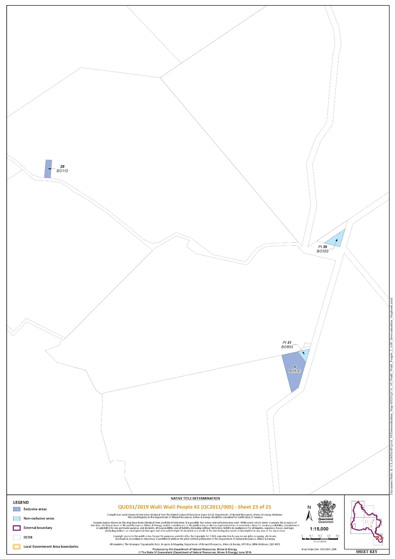
Lot 28 on Plan BO112 | Sheet 23 of 25 |
Lot 29 on Plan A2291 | Sheet 6 of 25 |
Lot 30 on Plan A2291 | Sheet 6 of 25 |
Lot 301 on Plan A9141 | Sheet 15 of 25 |
Lot 31 on Plan A2291 | Sheet 6 of 25 |
Lot 32 on Plan A2291 | Sheet 6 of 25 |
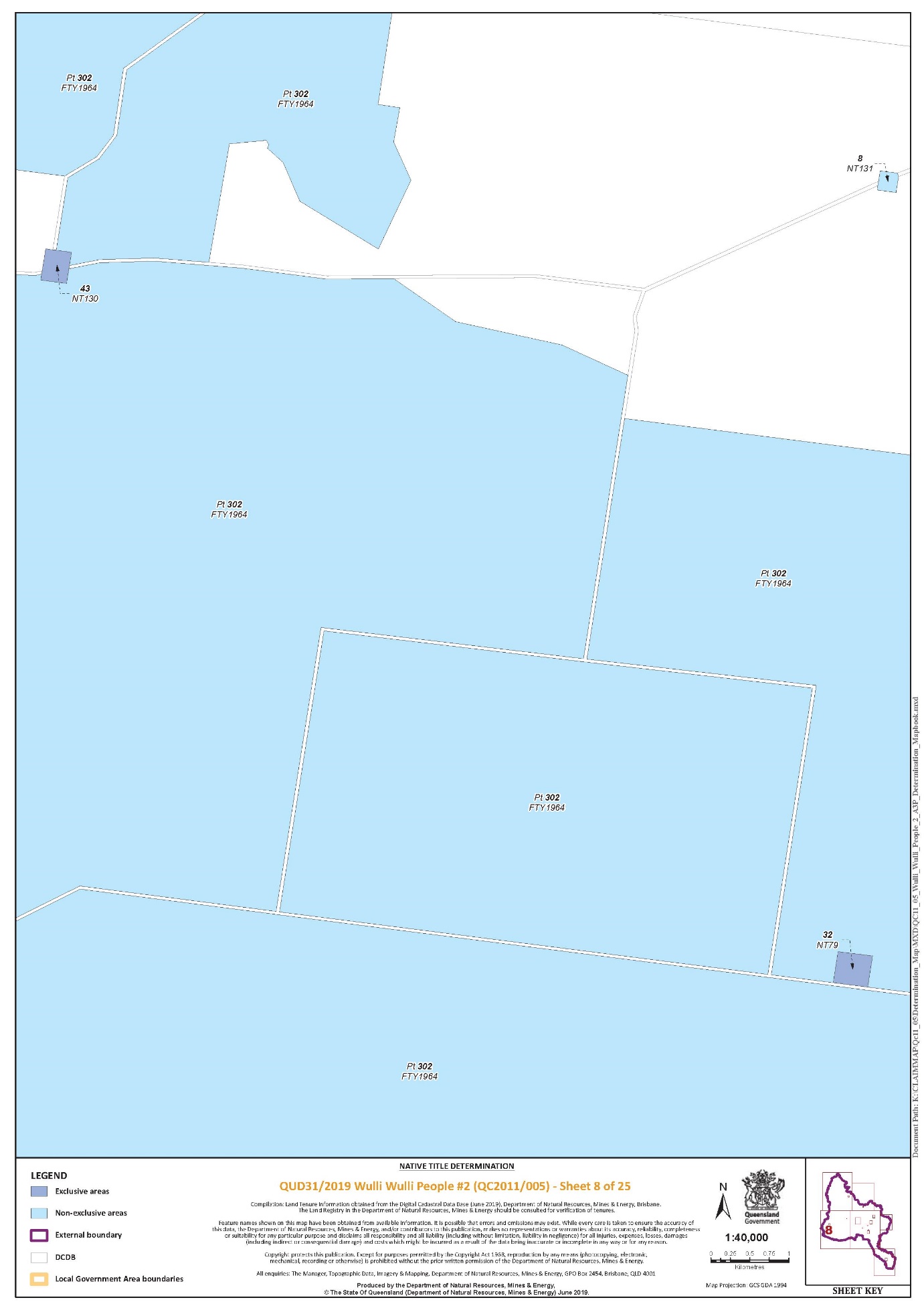
Lot 32 on Plan NT79 | Sheet 8 of 25 |
Lot 33 on Plan A2291 | Sheet 6 of 25 |
Lot 34 on Plan A2291 | Sheet 6 of 25 |
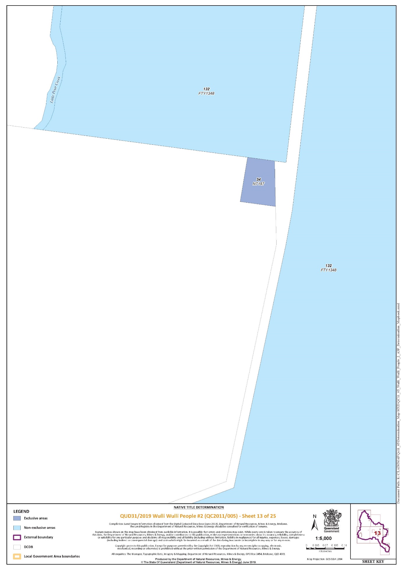
Lot 34 on Plan NT147 | Sheet 13 of 25 |
Lot 35 on Plan A2291 | Sheet 6 of 25 |
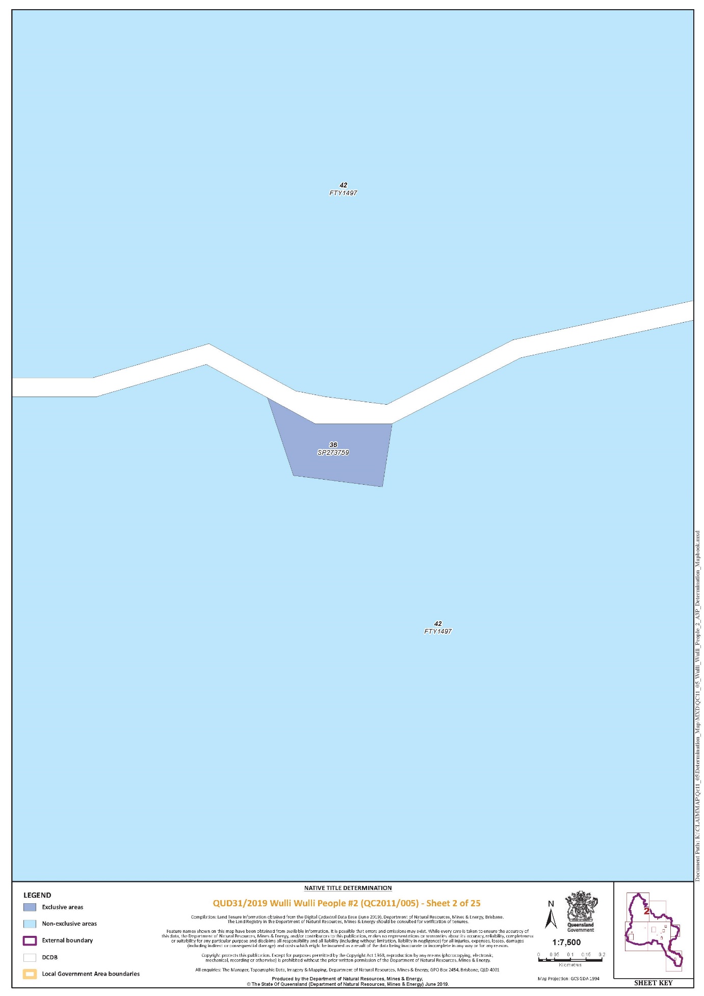
Lot 36 on Plan A2291 | Sheet 6 of 25 |
Lot 36 on Plan SP273759 | Sheet 2 of 25 |
Lot 37 on Plan A2291 | Sheet 6 of 25 |
Lot 38 on Plan A2291 | Sheet 6 of 25 |
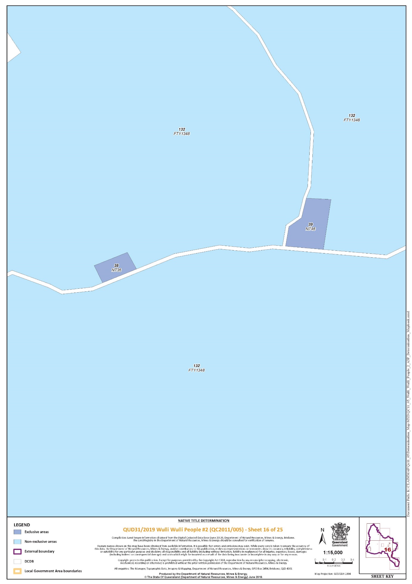
Lot 38 on Plan NT36 | Sheet 16 of 25 |
Lot 39 on Plan A2291 | Sheet 6 of 25 |
Lot 39 on Plan NT46 | Sheet 16 of 25 |
Lot 4 on Plan BO630 | Sheet 23 of 25 |
Lot 40 on Plan A2291 | Sheet 6 of 25 |
Lot 401 on Plan A9141 | Sheet 15 of 25 |
Lot 402 on Plan A9141 | Sheet 15 of 25 |
Lot 405 on Plan A9141 | Sheet 15 of 25 |
Lot 406 on Plan A9141 | Sheet 15 of 25 |
Lot 407 on Plan A9141 | Sheet 15 of 25 |
Lot 408 on Plan A9141 | Sheet 15 of 25 |
Lot 43 on Plan NT130 | Sheet 8 of 25 |
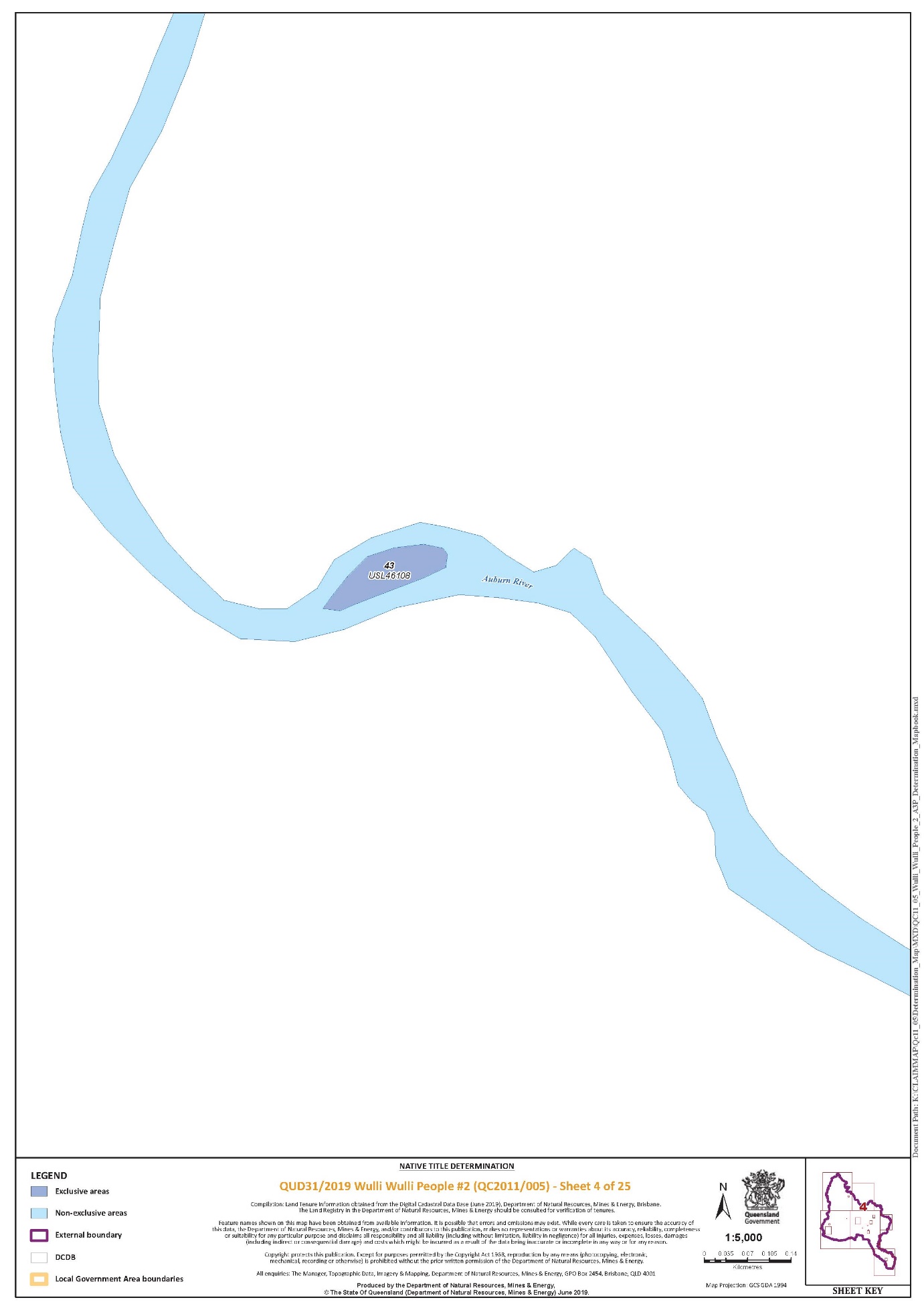
Lot 43 on Plan USL46108 | Sheet 4 of 25 |
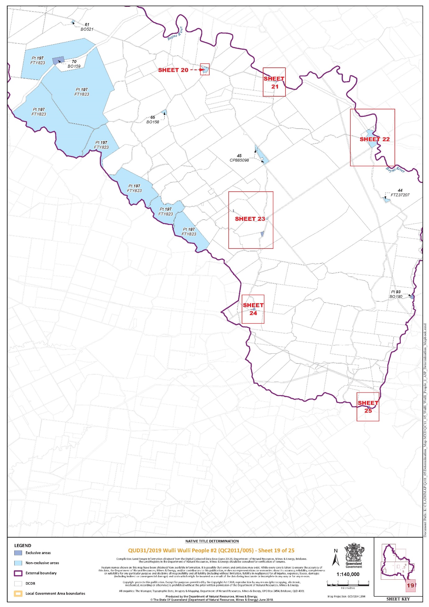
Lot 70 on Plan BO159 | Sheet 19 of 25 |
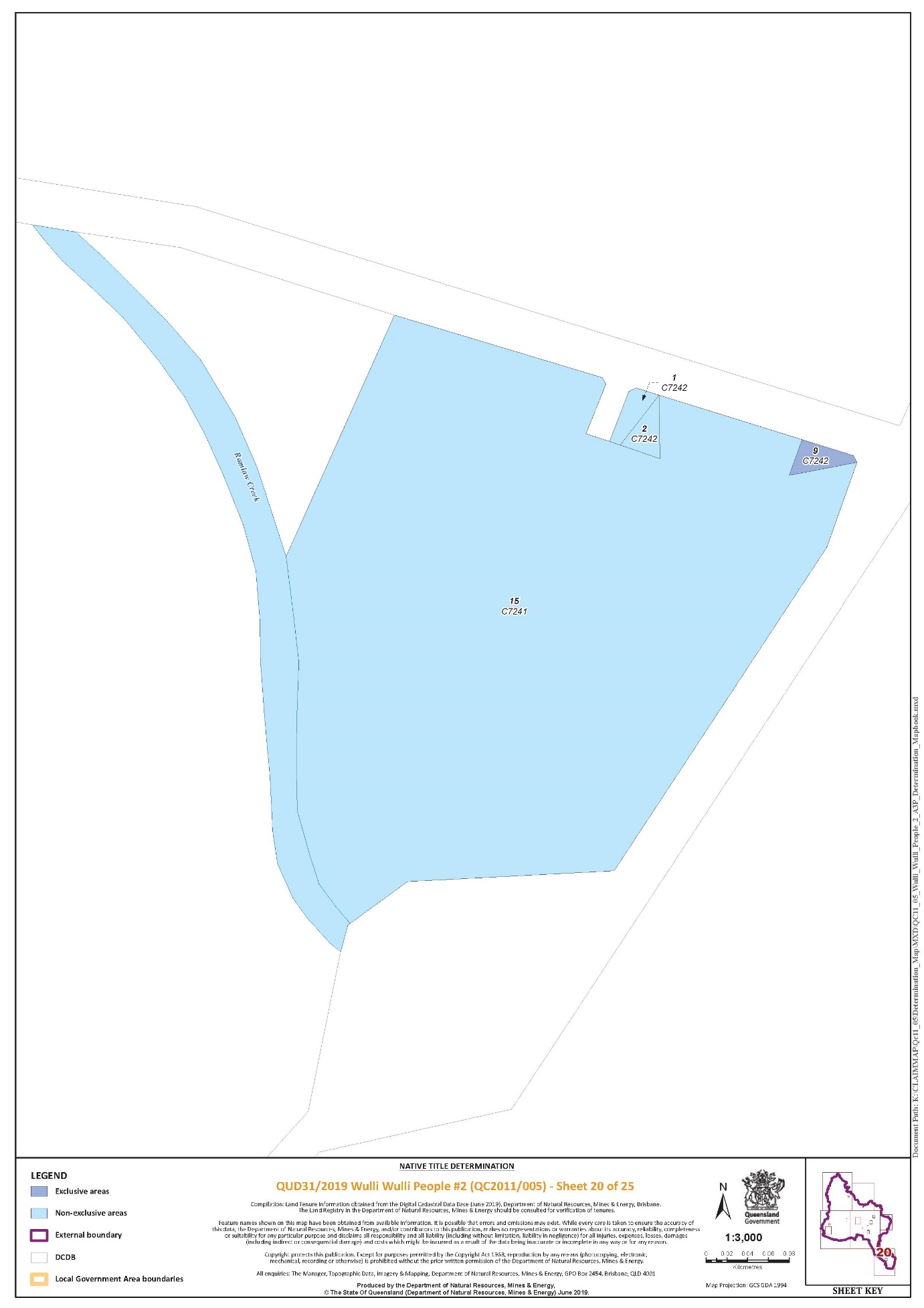
Lot 9 on Plan C7242 | Sheet 20 of 25 |
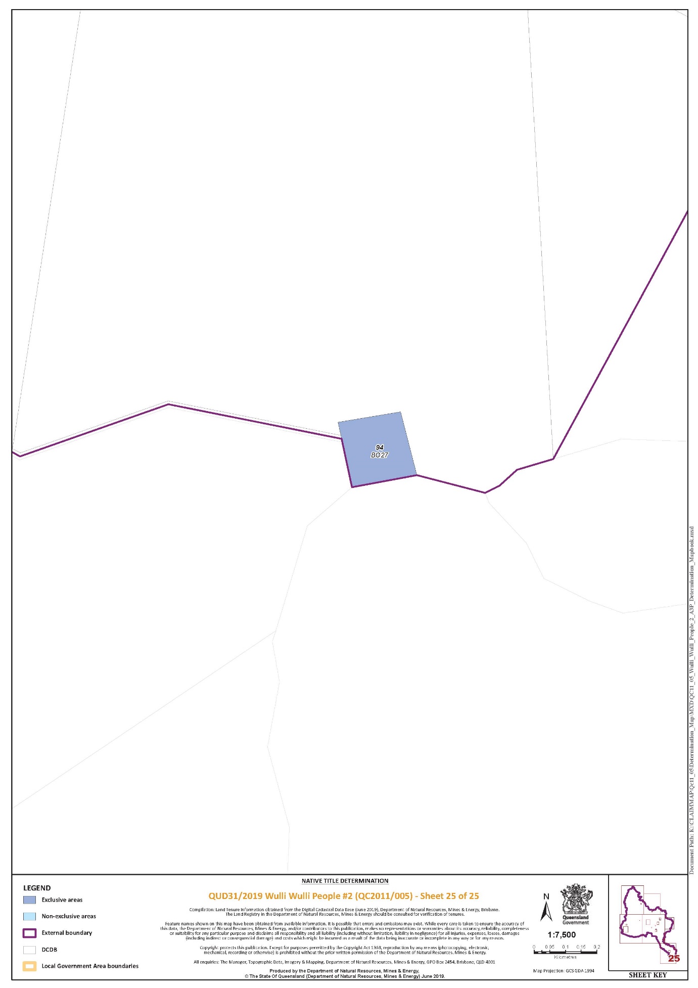
Lot 94 on Plan BO27 | Sheet 19 and 25 of 25 |
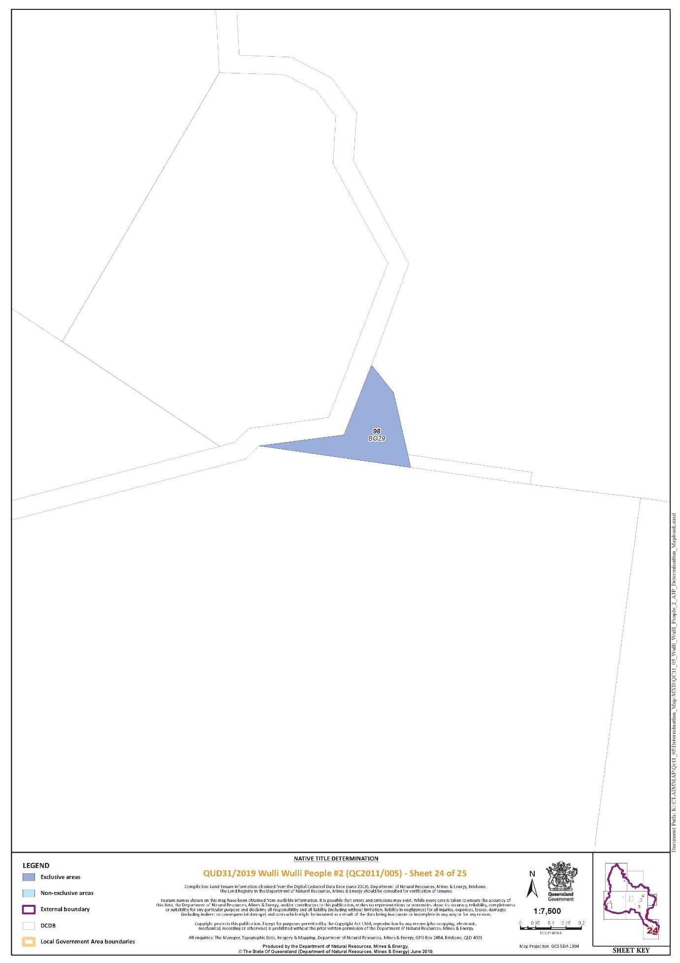
Lot 98 on Plan BO29 | Sheet 19 and 24of 25 |
That part of Lot 93 on Plan BO190 that falls within the External Boundary | Sheet 19 of 25 |
Part 2 – Non-Exclusive Areas
All of the land and waters described in the following table and depicted in light blue on the determination map contained in Schedule 6:
Area description (at the time of the determination) | Determination Map Sheet Reference |
Lot 1 on Plan C7242 | Sheet 20 of 25 |
Lot 10 on Plan NT244 | Sheet 5 of 25 |
Lot 10 on Plan NT76 | Sheet 9 of 25 |
Lot 10 on Plan WK190 | Sheet 1 of 25 |
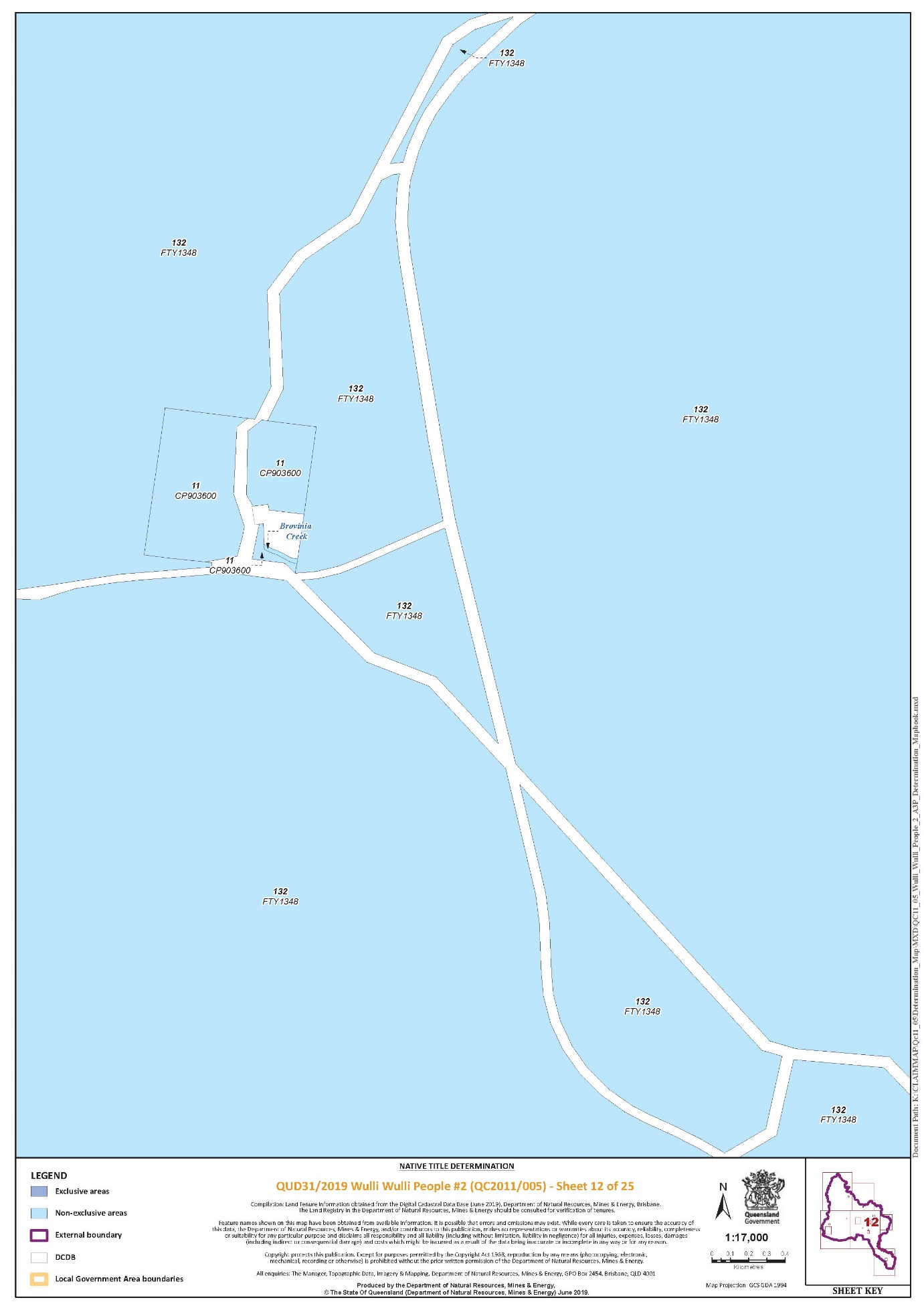
Lot 11 on Plan CP903600 | Sheet 12 of 25 |
Lot 11 on Plan NT217 | Sheet 5 of 25 |
Lot 11 on Plan WK119 | Sheet 1 of 25 |
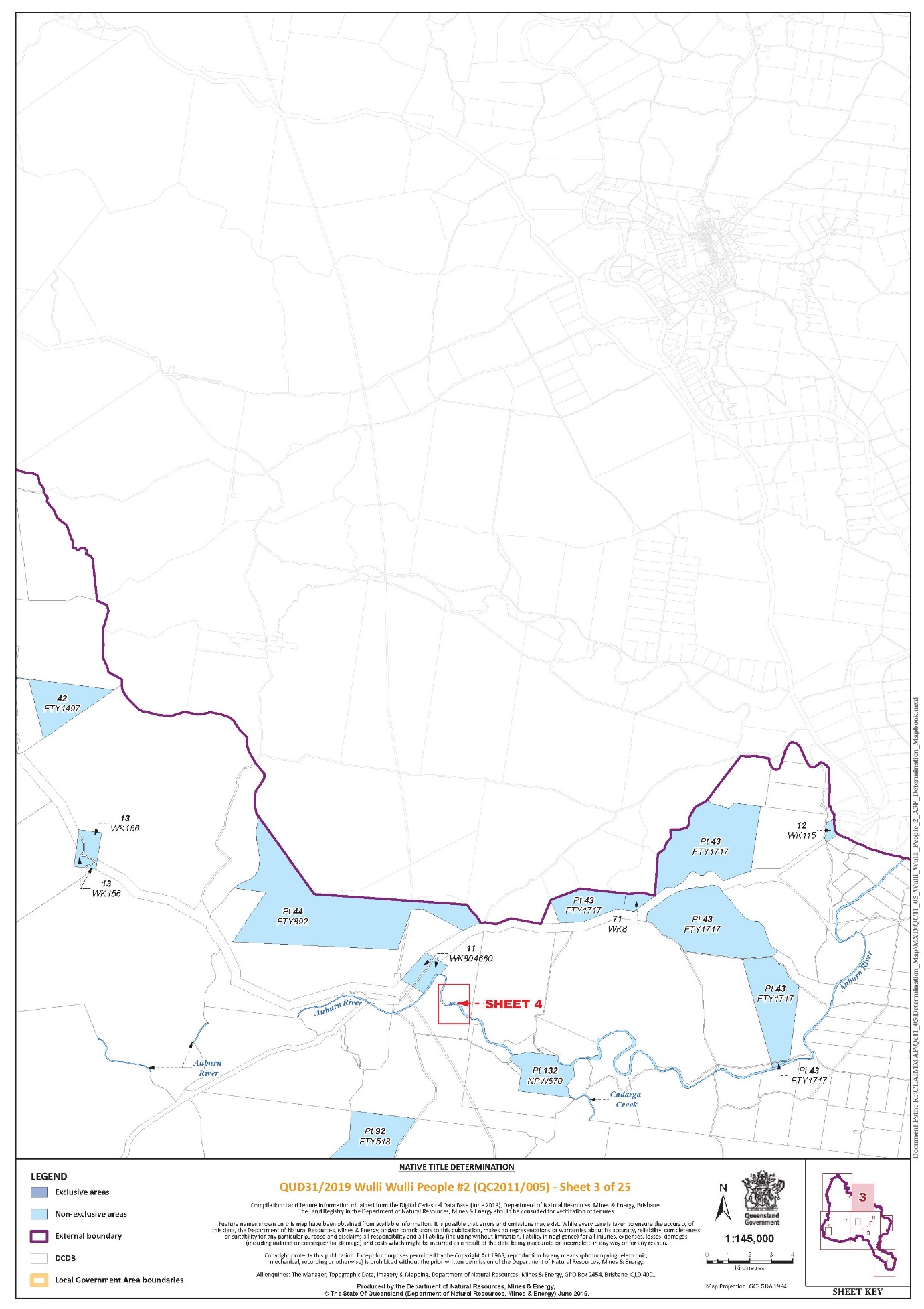
Lot 11 on Plan WK804660 | Sheet 3 of 25 |
Lot 12 on Plan NT336 | Sheet 11 of 25 |
Lot 12 on Plan WK115 | Sheet 3 of 25 |
Lot 12 on Plan WK34 | Sheet 1 of 25 |
Lot 13 on Plan NT337 | Sheet 11 of 25 |
Lot 13 on Plan WK156 | Sheet 3 of 25 |
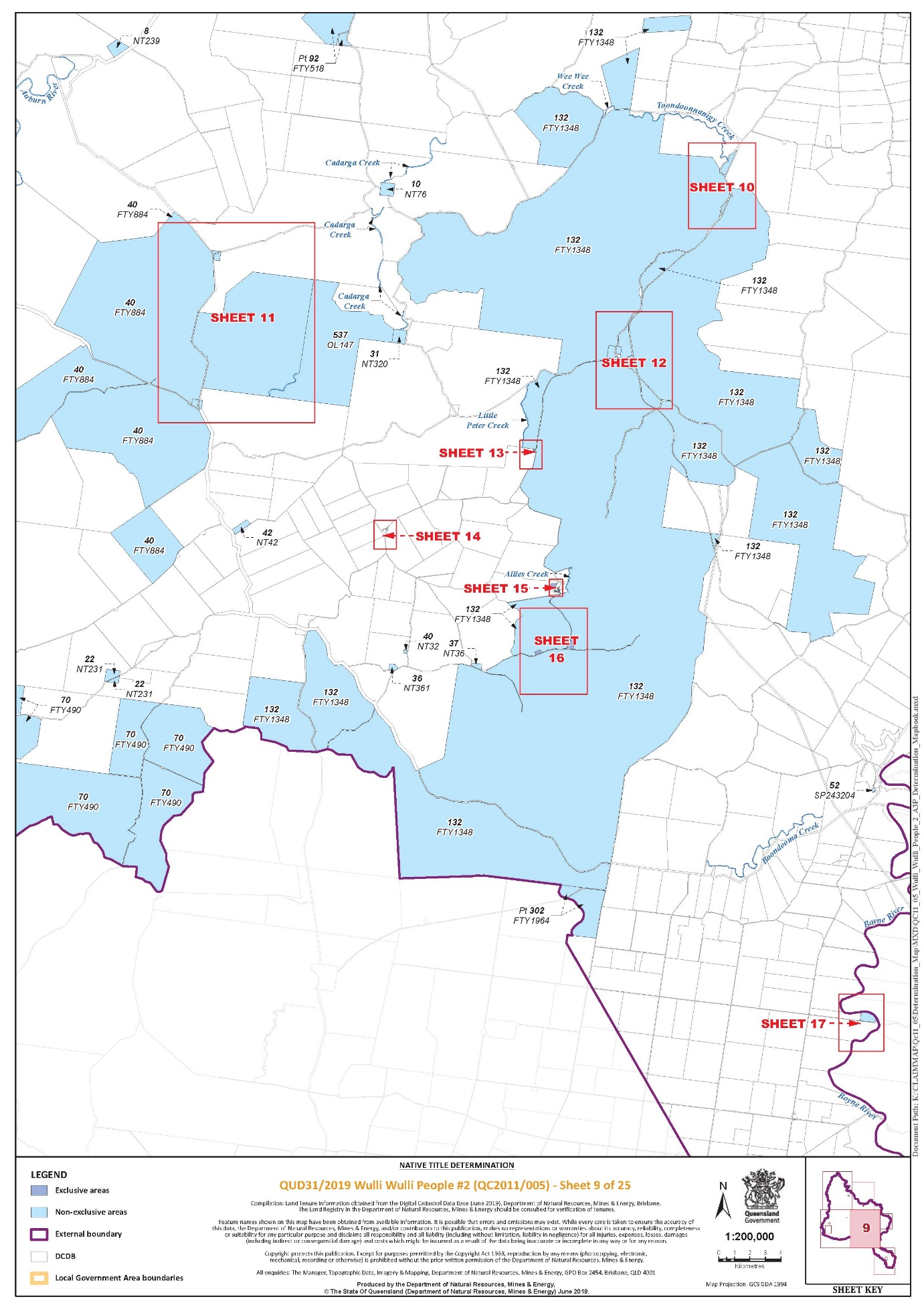
Lot 132 on Plan FTY1348 | Sheet 16 of 25 |
Lot 15 on Plan C7241 | Sheet 20 of 25 |
Lot 15 on Plan NT370 | Sheet 5 of 25 |
Lot 16 on Plan WK191 | Sheet 1 of 25 |
Lot 16 on Plan WK80 | Sheet 1 of 25 |
Lot 17 on Plan WK199 | Sheet 1 of 25 |
Lot 19 on Plan PH524 | Sheet 1 of 25 |
Lot 2 on Plan C7242 | Sheet 20 of 25 |
Lot 20 on Plan WK85 | Sheet 1 of 25 |
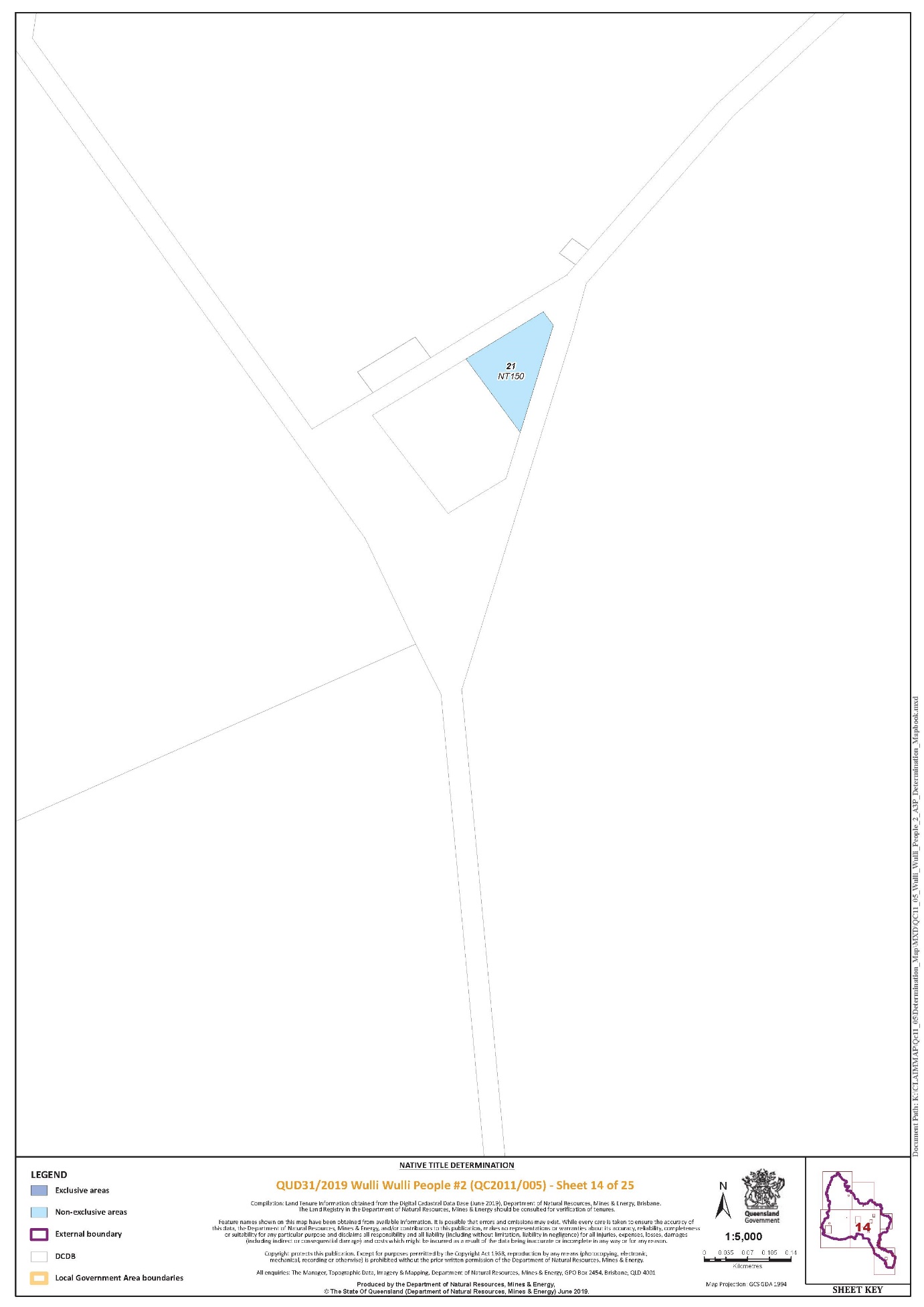
Lot 21 on Plan NT150 | Sheet 14 of 25 |
Lot 21 on Plan WK88 | Sheet 1 of 25 |
Lot 22 on Plan NT231 | Sheet 9 of 25 |
Lot 227 on Plan FTY1244 | Sheet 1 of 25 |
Lot 24 on Plan NCL373 | Sheet 18 of 25 |
Lot 253 on Plan FTY747 | Sheet 18 of 25 |
Lot 31 on Plan NT320 | Sheet 9 of 25 |
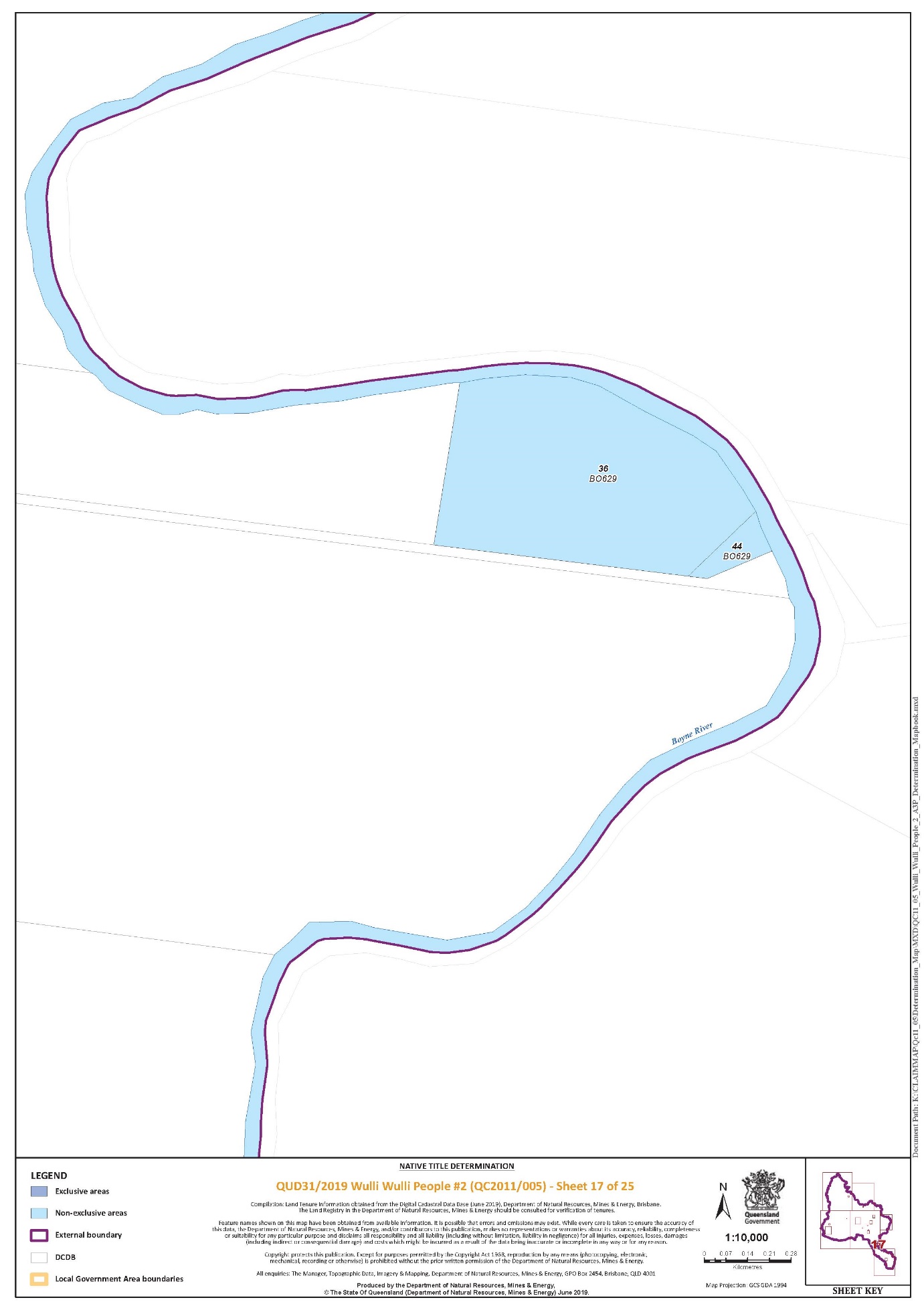
Lot 36 on Plan BO629 | Sheet 17 of 25 |
Lot 36 on Plan NT361 | Sheet 9 of 25 |
Lot 37 on Plan NT36 | Sheet 9 of 25 |
Lot 4 on Plan NT194 | Sheet 1 of 25 |
Lot 4 on Plan A2291 | Sheet 6 of 25 |
Lot 4 on Plan NT207 | Sheet 5 of 25 |
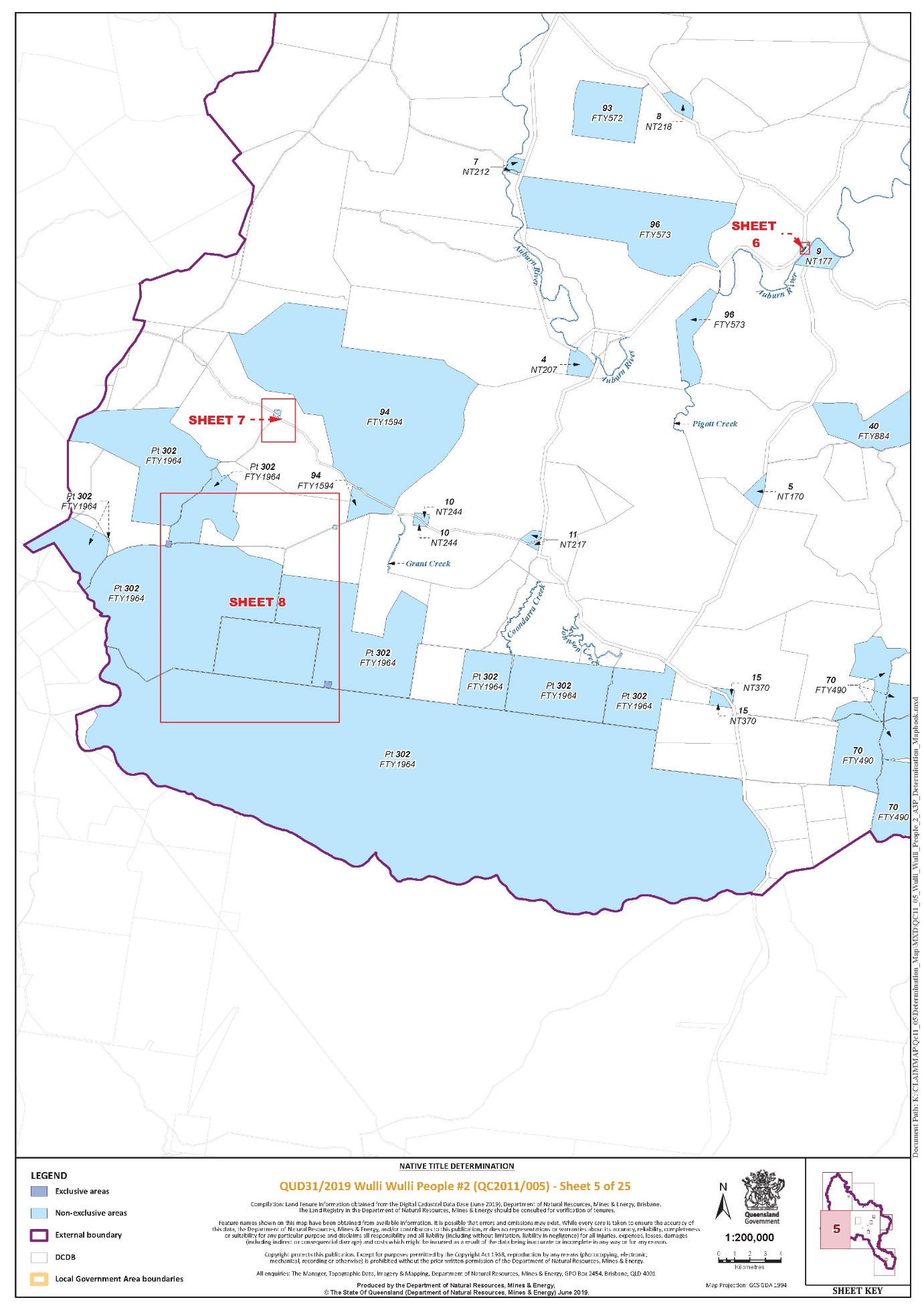
Lot 40 on Plan FTY884 | Sheet 5, 9, 11 of 25 |
Lot 40 on Plan NT32 | Sheet 9 of 25 |
Lot 42 on Plan FTY1497 | Sheet 1, 2, 3 of 25 |
Lot 42 on Plan NT42 | Sheet 9 of 25 |
Lot 44 on Plan BO629 | Sheet 17 of 25 |
Lot 44 on Plan FTZ37207 | Sheet 19 of 25 |
Lot 45 on Plan CP885098 | Sheet 19 of 25 |
Lot 47 on Plan FTY1480 | Sheet 1 of 25 |
Lot 48 on Plan FTY872 | Sheet 1 of 25 |
Lot 49 on Plan FTY1194 | Sheet 1 of 25 |
Lot 5 on Plan NT170 | Sheet 5 of 25 |
Lot 52 on Plan SP243204 | Sheet 9 of 25 |
Lot 537 on Plan OL147 | Sheet 11 of 25 |
Lot 61 on Plan BO521 | Sheet 19 of 25 |
Lot 65 on Plan BO158 | Sheet 19 of 25 |
Lot 7 on Plan NT212 | Sheet 5 of 25 |
Lot 7 on Plan NT243 | Sheet 1 of 25 |
Lot 70 on Plan FTY490 | Sheet 5, 9 of 25 |
Lot 71 on Plan WK8 | Sheet 3 of 25 |
Lot 8 on Plan NT131 | Sheet 8 of 25 |
Lot 8 on Plan NT218 | Sheet 5 of 25 |
Lot 8 on Plan NT239 | Sheet 9 of 25 |
Lot 9 on Plan NT177 | Sheet 6 of 25 |
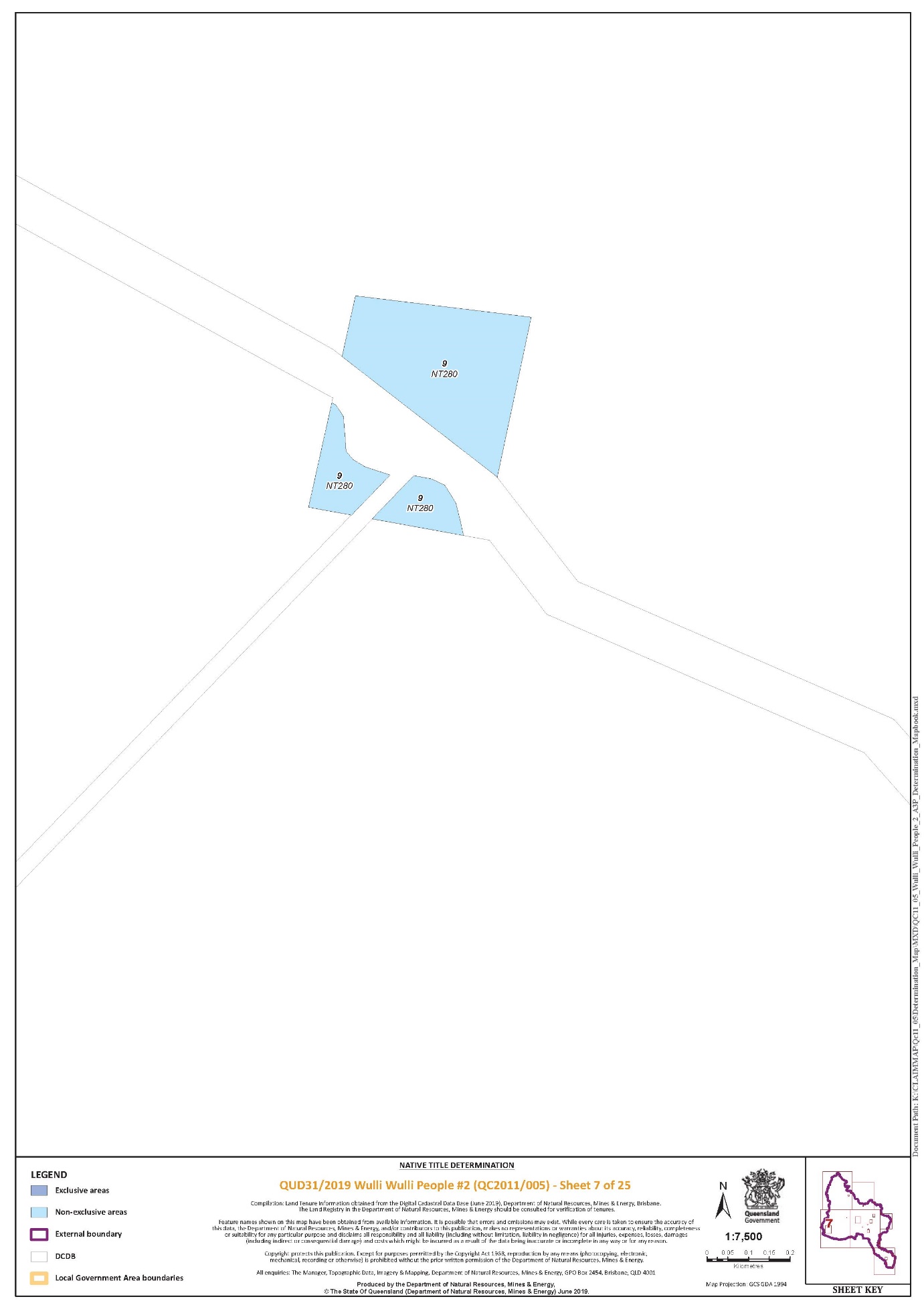
Lot 9 on Plan NT280 | Sheet 7 of 25 |
Lot 9 on Plan WK120 | Sheet 1 of 25 |
Lot 9 on Plan WK83 | Sheet 1 of 25 |
Lot 93 on Plan FTY572 | Sheet 5 of 25 |
Lot 94 on Plan FTY1594 | Sheet 5 of 25 |
Lot 95 on Plan FTY1191 | Sheet 1 of 25 |
Lot 96 on Plan FTY573 | Sheet 5 of 25 |
Lot 97 on Plan FTY867 | Sheet 1 of 25 |
That part of Lot 132 on Plan NPW670 excluding the area formerly described as Portion 5 on WK202 | Sheet 3 of 25 |
That part of Lot 197 on Plan FTY823 that falls within the External Boundary excluding the area formerly described as Portion 39 on BO159 | Sheet 19 of 25 |
That part of Lot 226 on Plan FTY656 that falls within the External Boundary | Sheet 1 of 25 |
That part of Lot 228 on Plan FTY1854 excluding the areas formerly described as Lot 3 on WK146 and Lot 8 on WK171 | Sheet 1 of 25 |
That part of Lot 302 on Plan FTY1964 that falls within the External Boundary excluding the area formerly described as Portion 8 on NT81 | Sheet 5, 8, 9 of 25 |
That part of Lot 31 on Plan BO603 excluding the area formerly described as Portion 11 on BO81 | Sheet 23 of 25 |
That part of Lot 39 on Plan BO352 excluding the area shown as Three Chain Road on BO335 | Sheet 23 of 25 |
That part of Lot 4064 on Plan SP149056 that falls within the External Boundary | Sheet 1 of 25 |
That part of Lot 43 on Plan FTY1717 that falls within the External Boundary | Sheet 3 of 25 |
That part of Lot 44 on Plan FTY892 that falls within the External Boundary | Sheet 3 of 25 |
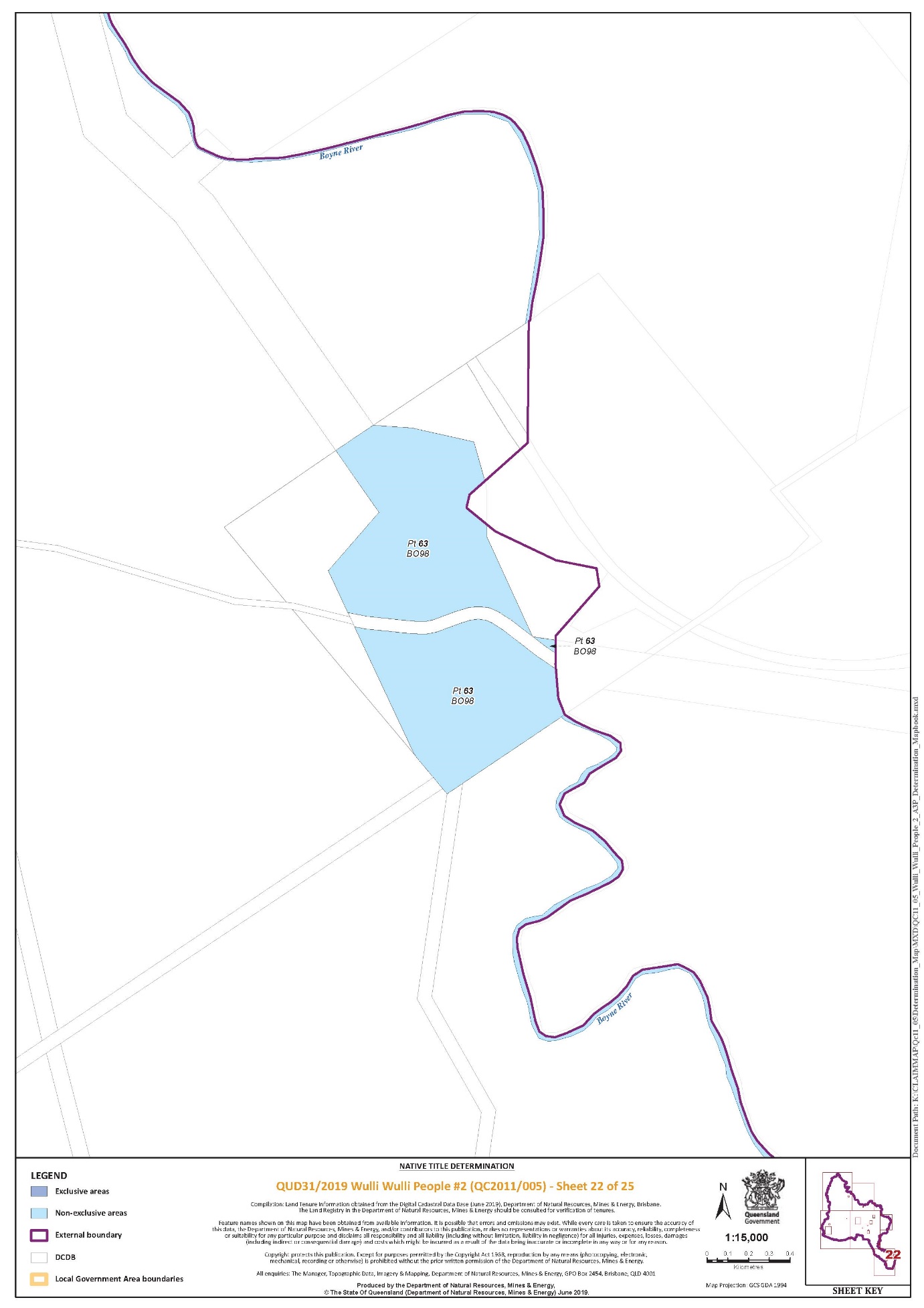
That part of Lot 63 on Plan BO98 that falls within the External Boundary excluding Kingaroy-Burrandowan Road | Sheet 22 of 25 |
That part of Lot 64 on Plan FTY1828 that falls within the external boundary | Sheet 1 of 25 |
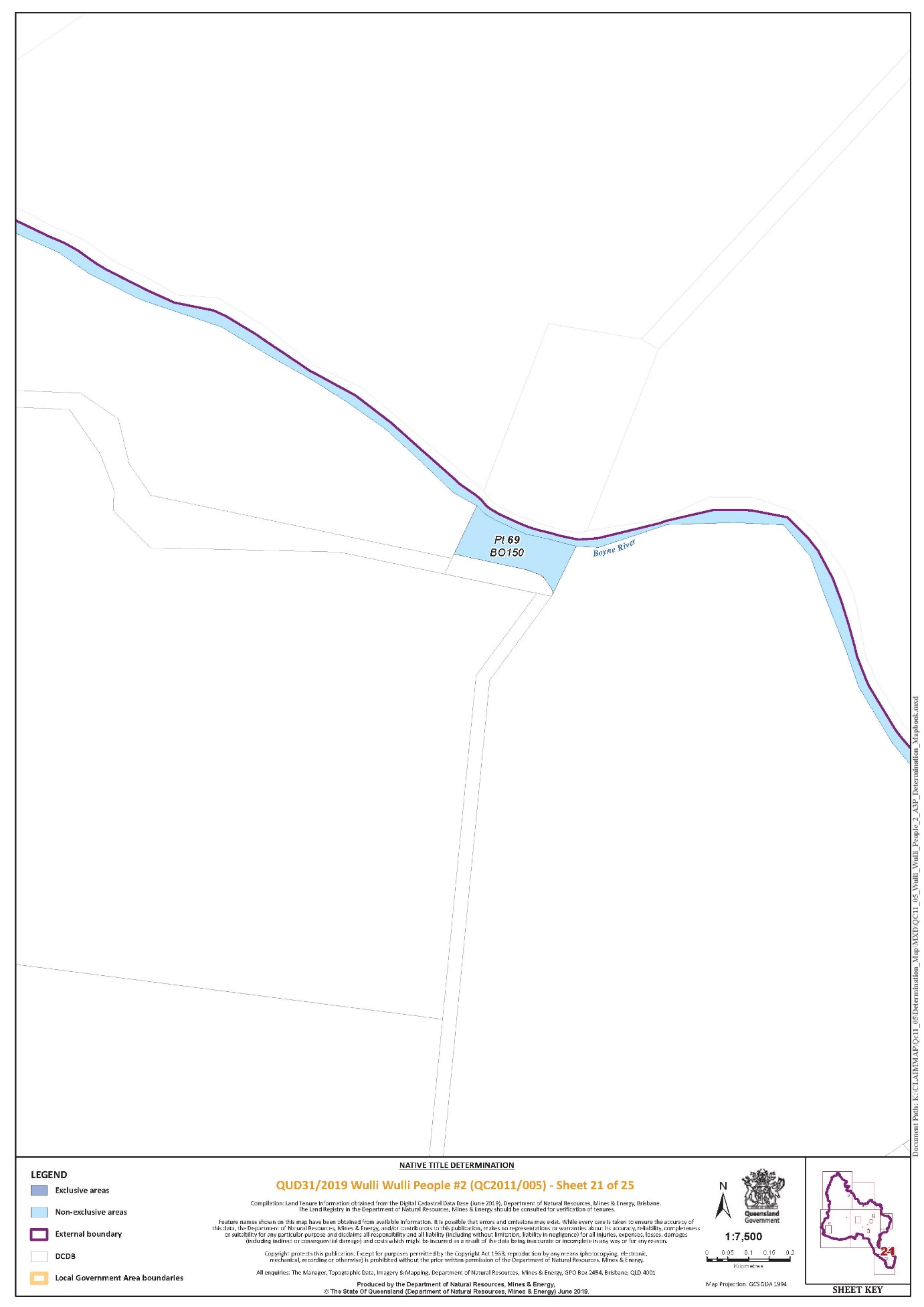
That part of Lot 69 on Plan BO150 that falls within the External Boundary excluding Kingaroy-Burrandowan Road | Sheet 21 of 25 |
That part of Lot 92 on Plan FTY518 excluding the area formerly described as Portion 16 on NT90 | Sheet 3, 9 of 25 |
Allies Creek Auburn River Boondooma Creek Boyne River Brovinia Creek Cadarga Creek Chess Creek Coondarra Creek Fishy Creek Grant Creek Johnson Creek Little Peter Creek Moonboonbury Creek Pigott Creek Ramlaw Creek Redbank Creek Thistle Creek Toondoonnanigy Creek Wee Wee Creek | |
Schedule 5 – Areas Not Forming Part of the Determination Area
The following areas of land and waters are excluded from the Determination Area as described in Part 1 of Schedule 4 and Part 2 of Schedule 4:
1. Those land and waters within the External Boundary which, at the time the native title determination application was made, were the subject of one or more Previous Exclusive Possession Acts, within the meaning of s 23B of the Native Title Act 1993 (Cth) as they could not be claimed in accordance with s 61A of the Native Title Act 1993 (Cth).
2. Specifically, and to avoid any doubt, the land and waters described in (1) above include:
(a) the Previous Exclusive Possession Acts described in ss 23B(2) and 23B(3) of the Native Title Act 1993 (Cth) to which s 20 of the Native Title (Queensland) Act 1993 (Qld) applies, and to which none of ss 47, 47A or 47B of the Native Title Act 1993 (Cth) applied; and
(b) the land and waters on which any public work, as defined in s 253 of the Native Title Act 1993 (Cth), is or was constructed, established or situated, and to which ss 23B(7) and 23C(2) of the Native Title Act 1993 (Cth) and to which s 21 of the Native Title (Queensland) Act 1993 (Qld), applies, together with any adjacent land or waters in accordance with s 251D of the Native Title Act 1993 (Cth).
3. Those land and waters within the External Boundary on which, at the time the native title determination application was made, public works were validly constructed, established or situated after 23 December 1996, where s 24JA of the Native Title Act 1993 (Cth) applies, and which wholly extinguished native title.
4. Those land and waters within the External Boundary which, at the time the native title determination application was made, were the subject of one or more Pre-existing Rights Based Acts, within the meaning of s 24IB of the Native Title Act 1993 (Cth), which wholly extinguished native title.
Schedule 6 – Map of Determination Area
ROBERTSON J:
Introduction
1 This claim, the Auburn Hawkwood Claim, covers an area of approximately 9,786 square kilometres (the Claim Area) in central Queensland.
2 The Claim was filed in the Federal Court on 23 September 2011 and entered on the Register of Claims maintained by the Native Title Registrar on 16 December 2011. On 13 June 2012 it was notified by the Native Title Registrar in accordance with s 66 of the Native Title Act 1993 (Cth) with a notification date of 12 September 2012. Leave to amend the Claim was granted on 4 August 2014, 16 June 2017, 13 July 2017 and 30 September 2019.
3 The Claim Area predominately consists of pastoral properties, national parks and state forests. Key geographical features include the Auburn River and Mount Narayen to which the Auburn Hawkwood People claim a deep spiritual connection.
4 The applicant seeks a determination of native title under s 61 of the Native Title Act in the terms set out in the Determination on behalf of the Auburn Hawkwood People over various lands in the local government areas of the Banana Shire Council, Western Downs Regional Council, North Burnett Regional Council and South Burnett Regional Council.
5 The claim is made on behalf of the Auburn Hawkwood People who have a connection to the determination area in accordance with their respective traditional laws acknowledged and traditional customs observed and are the biological descendants of: Bojimba & Narrygn; Ginalene, the mother of Ernest Pope; Tilly, the mother of Harry Blucher; Grace, the mother of Fanny Joyce; Jack Hornet Snr, the father of Jack Hornet; Thomas Clancy; Maria, the mother of Isabella Hooper; Amy, wife of John Bond; Billy and Selina, parents of Jacob; Bessie Rawbelle; Billy McKenzie; Maggie West; Jackanapes; Jinnie, the mother of Ranji Logan; Rosie, the mother of John Barra; Mergwin Blay; Kitty of Boondooma; King Billy and Maria of Boondooma; Jessie Fuller; Mi Mi; or Maggie Hart.
6 The respondents are the State of Queensland, Banana Shire Council, Western Downs Regional Council, North Burnett Regional Council, South Burnett Regional Council, Telstra Corporation Limited, Ergon Energy Corporation Limited and a number of pastoralists.
7 The parties have agreed to the terms of a determination of native title recorded in an agreement pursuant to s 87 of the Native Title Act, this agreement having been executed by the parties on 8 November 2019.
8 The Court has a discretion therefore to make an order in those terms without holding a hearing.
9 As summarised in the written submission on behalf of the applicant dated 4 November 2019, when a native title claim is resolved by consent, the applicant does not have to prove their case at a hearing. If an agreement between the parties to a determination is reached, the Court may, if satisfied that an order consistent with the terms of the agreement would be within the power of the Court and it appears appropriate, make a native title determination over the whole or part of a claim area without a hearing. The focus is on whether there is an agreement between parties that was “freely entered into on an informed basis”. In relation to the State, the Court should be assured that such a party has “taken steps to satisfy itself that there is a credible basis for an application”, or is “satisfied as to the cogency of the evidence upon which applicants rely”.
The evidence
10 I find that the Auburn Hawkwood People remain connected to their ancestors’ country in accordance with a normative system of traditional laws and customs under which they hold native title rights and interests in the Claim Area.
11 In addition to material accompanying the applicant’s Further Amended Form 1: Native Title Determination Application, the following evidence from the Auburn Hawkwood People was provided to the State demonstrating their connection to the Claim Area through activities carried out in the course of their lives in accordance with the teaching of their Elders and in ongoing observation of traditional laws and customs:
(a) Affidavit of Alice West affirmed 2 February 2012;
(b) Affidavit of Dennis Cobbo dated 2 February 2012;
(c) Affidavit of Audrey Jane Clancy affirmed 2 March 2012;
(d) Affidavit of Pamela Blucher affirmed 30 March 2012;
(e) Affidavit of Robert Arnold Bond affirmed 22 February 2012;
(f) Affidavit of Rodney James Dodd affirmed 2 September 2012;
(g) Affidavit of Douglas Graham Hoehne affirmed 2 March 2012;
(h) Affidavit of Rodney Wayne Fuller affirmed 2 September 2012;
(i) Affidavit of Rose Margaret Dodd affirmed 31 March 2012;
(j) Affidavit of Margaret Francis Hure affirmed 23 August 2012;
(k) Affidavit of Leonard John Clancy affirmed 2 March 2012;
(l) Affidavit of Alick James Saltner affirmed 20 November 2012;
(m) Affidavit of Brian Allen Clancy affirmed 27 November 2012;
(n) Affidavit of Elizabeth Patricia Law affirmed 9 August 2012;
(o) Affidavit of Harold John Chapman affirmed 8 August 2012;
(p) Affidavit of Harry Thomas Blucher affirmed 9 August 2012;
(q) Affidavit of Albert Keith Thomson affirmed 26 October 2012
(r) Affidavit of Kevin Leonard Clancy affirmed 26 November 2012;
(s) Affidavit of Agnes Hoehne affirmed 2 March 2012;
(t) Affidavit of Stephen Joseph Collins affirmed on 23 May 2013;
(u) Affidavit of Drew Keith Anthony Millar affirmed on 28 November 2012;
(v) Affidavit of Thomas Anthony Blucher 10 May 2013;
(w) Affidavit of Jeffrey Hooper Williams affirmed 6 June 2013;
(x) Affidavit of Edward Fuller affirmed 23 May 2013;
(y) Affidavit of Adrienne Blucher affirmed 7 April 2015;
(z) Affidavit of Rory James Boney affirmed 25 July 2017;
(aa) Affidavit of Harry Rodney Hill dated 12 May 2015;
(bb) Affidavit of Loretta May Chapman affirmed 1 July 2016;
(cc) Affidavit of Yvonne Frances Chapman affirmed 2 July 2016;
(dd) Witness statement of Margaret Kay MiMi dated 3 July 2016;
(ee) Witness statement of Rodney Samuel Hill dated 2 July 2016;
(ff) Affidavit of Edwina Chapman dated 1 December 2017; and
(gg) Affidavit of Kevin Cowburn dated 1 December 2017.
12 As submitted on behalf of the applicant, the claimants gave specific evidence of their spiritual attachment to, knowledge of, and continuing use of the Claim Area and its natural resources. Their statements illustrate an enduring attachment to the Claim Area and demonstrate how they access areas for traditional purposes including hunting, gathering and spiritual purposes. This material is rich in detail, and I accept it.
13 The applicant relies on the following expert evidence:
(a) “Anthropological Report for the Native Title Claims of the Wulli Wulli People (QUD6006/2000 and QUD311/11)” prepared by Dr Fiona Powell dated 30 November 2012;
(b) “Archaeological Cultural Heritage Review within Wulli Wulli People Native Title Claim (QUD6006/2000) (QC00/7) and Wulli Wulli People #2 native title claim (QUD311/2011) (QC11/5) Central Queensland” prepared by Susan Davies (archaeologist and anthropologist) dated 2012;
(c) “The Wulli Wulli People Final Historical Report” prepared by Dr Rosalind Kidd dated November 2012;
(d) “Linguistic Report for Wulli Wulli People Native Title Determination Application (QUD6006/2000) and Wulli Wulli People #2 Native Title Determination (QUD311/2011)” prepared by Michael Walsh (linguist) dated 30 November 2012;
(e) “Wulli Wulli and Wakka Wakka Peoples QUD311/2011 & Wulli Wulli People QUD6006/2000 Supplementary Report” prepared by Dr Powell dated July 2015;
(f) “Wulli Wulli and Wakka Wakka Peoples QUD311/2011 Anthropologist’s Further Supplementary Report” prepared by Dr Powell dated 12 December 2016;
(g) “Anthropological Review of the Wulli #2 Native Title Claim with particular regard to evidence connecting the descendants of Maggie Hart & Mi Mi to the Claim Area” prepared by Dr Kevin Mayo dated November 2017;
(h) “Response to Questions by the State in relation to Anthropological Review of the Wulli Wulli #2 Native Title Claim with particular regard to the evidence connecting the descendants of Maggie Hart & Mi Mi to the Claim Area” prepared by Dr Kevin Mayo dated March 2018; and
(i) Report of Conference of Experts (Dr Mayo, Dr Powell and Dr Kenny) held on 24 and 25 May 2018 in Brisbane.
14 The applicant submitted, and I find, that Dr Powell and Dr Mayo in their reports reviewed historical records regarding initial contact between the Auburn Hawkwood People and the first explorers and settlers in the Claim Area. They described references to Aboriginal people, their camps, activities, and customs observed by pastoralists and early settlers who first occupied the Claim Area. Many of the claim group’s ancestors obtained exemptions from the statutory regime that governed Aboriginal peoples’ lives in Queensland. Dr Powell explained how this allowed many families to remain on their country by working on properties within the Claim Area such as Hawkwood, Auburn, Coondarra, Knockbreak, Redbank, Yerilla and Rockybar stations.
15 Dr Powell and Dr Mayo also described the movement of Auburn Hawkwood People from these early pastoral stations into the towns of Eidsvold and Mundubbera as well as their removal and resettlement on reserves such as Cherbourg, Woorabinda and Taroom. Dr Powell and Dr Mayo’s reports set out what the historical record revealed about the exercise of rights and interests claimed by the Auburn Hawkwood People in the Auburn/South Burnett region.
16 Dr Powell described the content of the traditional laws and customs acknowledged and observed by Auburn Hawkwood People, particularly those governing the use and occupation of land and waters within the Claim Area. In Dr Powell’s opinion those laws and customs had been observed by the claimants and their ancestors at the time of first European settlement, and by inference, from sovereignty. Her opinion was that the laws and customs observed by Auburn Hawkwood People had continued to be acknowledged and observed by each generation of Auburn Hawkwood People since sovereignty.
17 Dr Powell observed the strong desire of Auburn Hawkwood People to maintain their social and cultural responsibilities to their traditional country through employment in the pastoral industry. Cultural heritage monitoring work and interactions with developers were other contemporary means of continuing traditional responsibilities the Auburn Hawkwood People have to protect their country.
18 Dr Powell considered that while no evidence was found of a change in the fundamental tenets underlying the traditional laws of the pre-sovereignty land-holding group that relate to the holding of rights and interests in the land, waters and resources of the Claimed Areas, evidence was found of adaptation in some traditional practices.
19 Dr Kidd addressed: (a) when and how each claim area, or part thereof, was first occupied and used by early Europeans settlers for pastoral or other purposes; (b) what was written about the Aboriginal people who occupied those areas at that time; (c) the nature and extent of the interaction between the early settlers and the Aboriginal people who occupied those areas at that time; (d) the nature and extent of the interaction between early settlers and Aboriginal people since then, and the extent to which that interaction allowed members of the Wulli Wulli native title claim group (past and present) to physically occupy or access the claim areas; and (e) the impact that legislation and other events has had on the ability of members of that claim group (past and present) to physically occupy or access the claim areas.
20 Dr Kidd’s findings, in summary, were as follows:
A. Earliest records confirm a large Aboriginal presence across the claim area. Henry Stuart Russell’s party in 1842 encountered ‘considerable numbers’ of up to ‘four hundred men at a time’. Frank Bannah said ‘the blacks were numerous’ in the EIDSVOLD district in the late 1840s. In the 1850s ‘hundreds of natives’ trekked past the KNOCKBREAK homestead on their way to CAMBOON. In mid-1857 two camps comprising as many as one thousand fighting men met for an event on PALM TREE CREEK.
B. Surviving records reveal a common perception of the tribes occupying the claim area as a discernible group. Raids by DAWSON RIVER Aborigines on those of the BURNETT area were said to be common. First settlers were on constant alert against the ‘wild blacks of the district’, aware that ‘the DAWSON blacks were notoriously savage’ and a ‘war like tribe’ that ‘resented the intrusion of white men within their territory.’ From ROCKY SPRINGS Philip Lamb wrote of the ‘blacks in his district’ harbouring men of the DAWSON tribe.
C. Even so, by the early 1850s there was a level of coexistence on many stations, due in part to the shortage of white labour; references locate camps of ‘quiet blacks’ on YERILLA, CAMBOON, HAWKWOOD, COCKATOO, HORNET BANK and BUNGABAN. The bora ground below CAMBOON station was known to be ‘a great meeting ground of the blacks’, accessed by Aboriginal pathways traversing both DYKEHEAD and AUBURN.
D. Early settlers recognised that the rapid influx of Europeans and massive sheep flocks fanned retaliatory attacks on shepherds, flocks and stations; the mass murder at HORNET BANK proving the crisis point. There is no doubt post-HORNET BANK reprisals were catastrophic for Aboriginal people across and beyond the DAWSON and BURNETT river areas. Yet even at the height of the killings groups are recorded remaining on stations at YERILLA, BOONDOOMA, AUBURN, CAMBOON and HAWKWOOD. Within days of the HORNET BANK massacre a big gathering of Aborigines ‘mustered very strong’ on AUBURN station from ‘perhaps about three or four hundred miles’. Subsequently, the ‘DAWSON RIVER tribe’ again trekked to the Bunyas, an alleged HORNET BANK leader in the midst.
E. There seems little doubt that many fugitives returned to station camps within a few years of the eighteen-month dispersal action. Research identified camps on KNOCKBREAK, BOONDOOMA, and CAMBOON in the 1870s; at HAWKWOOD, AUBURN, BUNGABAN, CRACOW, DYKEHEAD and GLANDORE in the 1880s. During this time ‘frequently five or six hundred natives’ from ‘both near and far’ gathered for ceremonies at the bora ground on CAMBOON, passing their corroborees ‘from tribe to tribe and far and wide’. Continuing treks to the BUNYA MOUNTAINS still included ‘the DAWSON blacks’; in 1902 a ‘mob of blacks’ passed through DYKEHEAD on their way to HAWKWOOD. At this time BOONDOOMA station ‘stretched to the Bunyas’.
F. Records from the 1890s and early 1900s show that as stockmen on the unfenced stations, Aboriginal workers travelled vast distances on long musters across land including CAMBOON, CRACOW, ISLA, WATERTON, COONAMBULA, HAWKWOOD, NOGO JUNCTION, RAWBELLE, CULCRAGIE, BOOLGAL, DEBINGAL, HEATHWOOD, EUROKA, KNOCKBREAK and ISLA (sic).
G. The vast stations were increasingly fragmented under legislation from the 1860s onwards, and severe droughts at the turn of the century and around 1916 led owners on stations like AUBURN and HAWKWOOD to call on provisions of the Aboriginal Act of 1897 to have some Aboriginal families removed to government settlements. While official records during the twentieth century show ‘removals’ did occur from stations in the claim area, files show that Aboriginal presence continued: a large number of workers in regular local employment were never brought ‘under the Act’; some families taken to settlements were subsequently ‘exempted’ and allowed to return; some individuals absconded from settlements to return to family and work and were later exempted.
H. In addition, non-exempt Aboriginal labour was at a premium, being tightly regulated and heavily discounted. In 1914 there was ‘a surprising number of blacks’ employed in the BURNETT and DAWSON districts, particularly (in the claim area) on HAWKWOOD, CRACOW, ROCKYBAR; in 1919 the prevalence of Aboriginal workers in the districts was again reported. In the 1920s Aboriginal camps were mentioned at EIDSVOLD, GAYNDAH and HAWKWOOD, which is likely not the only station to host corroborees at this time.
I. ‘Large numbers’ of Aboriginal people, including drovers and workers from outlying stations, were regular visitors to the fortnightly cattle sales at EIDSVOLD in the 1940s, where they would camp on the outskirts and hold corroborees; white residents were also familiar with local Aboriginal people of that time. References sighted for the 1960s described a collection of Aboriginal families camping on the riverbanks at THEODORE, and also a large number of Aboriginal children at the EIDSVOLD school.
J. There seems little doubt that Aboriginal employment, both longstanding local exempt workers and contracted non-exempt labour, was the vehicle which allowed families to remain or return to country despite the post-HORNET BANK dispersals.
K. In the time available, evidence located indicates members of the following families have maintained a persisting presence in and around the claim area: BLIGH, BLUCHER, BOND, CHAPMAN, CLANCY, DODD, FULLER, HEATHWOOD, HORNET, LOGAN, McLENNAN, MI MI, POPE, SALTNER, WALSH, WEST.
21 Ms Davies’ report addressed the evidence that the area she identified as the Project Area (the combined Wulli Wulli People (QC00/7) and Wulli Wulli People #2 (QC11/5) Native Title Claim Areas) was occupied and used by Aboriginal people prior to and after contact (approximately 1845) and whether that evidence indicates that the Project Area was used for specific purposes or activities.
22 Ms Davies reviewed the archaeological cultural heritage and found ample evidence of Aboriginal occupation of the Project Area prior to and after non-indigenous settlement of the region. She found that relative dating indicated occupation may have been for at least 5,000 years. The report referred to a total of 3,273 recorded and known sites, and collected items, which was considered to indicate an “extraordinary wealth and diversity of Aboriginal cultural heritage” within the Project Area. The evidence was found to clearly demonstrate extensive, and in some areas, intensive occupation, as represented by the variety of site and artefact types. These included: stone artefact scatters; middens; engraving; art (painting and/or stencils); ceremonial grounds and massacre sites. Ms Davies considered that the sites, as well as the spiritual and social ties, extended from the traditional past to the present, with the recorded and known sites dating from pre-contact to contact with non-indigenous people and post-contact periods and demonstrated continuity of occupation and knowledge in relation to country.
23 The report found that many sites were connected and were not spatially confined or site restrictive, with connections between stations such as a pathway between Camboon and Hawkwood. Letters written in the 1930s were found to reflect continuous occupation with information about Aboriginal people “bred and born in the district”, and to highlight that connections between Camboon and Hawkwood continued into the post-contact period. Documentation of “glass artefacts within archaeological sites; the use of metal axes; station and other camps from 1855 to the 1950s and fringe camps from the 1930s to the 1970s” provided evidence that occupation continued into the contact and post-contact periods.
24 In some areas a lack of recorded or known cultural heritage sites was considered by Ms Davies to reflect an area not subject to cultural heritage surveys and assessment, rather than indicating an absence of use. She considered in summarising the evidence of prior Aboriginal occupation that the cultural landscape in which the Project Area is located is a “living interwoven mosaic of spiritual and social ties”.
25 The connection material was assessed by the State for the purpose of determining whether a credible basis for the Auburn Hawkwood Claim existed, and whether the requirements of s 223(1) were met. Queries raised by the State following its assessment of the connection material were addressed by the provision of additional evidence. Following the provision of that material the parties entered into negotiations over the terms by which the Auburn Hawkwood Claim could be resolved by consent.
Consideration
26 I find the connection material demonstrates that the agreement of the parties to the making of the Proposed Determination is “rooted in reality” and has a credible basis.
27 The affidavit of Ms Christine Anne Royan affirmed 27 August 2019, which I accept, provides details about how:
(a) the Auburn Hawkwood People’s intention to enter into the Proposed Determination was notified;
(b) information meetings were held during July 2019, and an authorisation meeting held on 3 August 2019 at Mundubbera to give the Auburn Hawkwood People the opportunity to consider the Proposed Determination; and
(c) the Auburn Hawkwood People decided at the authorisation meeting to enter into the Proposed Determination.
28 The applicant submits, and I find, that the Court can be satisfied that the agreement of the parties recorded in the s 87 Agreement has been freely entered into on an informed basis. As the applicant submits, all of the parties to the proceeding are legally represented and have been at all material times during the course of the negotiations.
29 I find that the period specified in the notice under s 66 has ended and that an agreement has been reached between all the parties in relation to the terms of an order. The terms of that agreement, in writing signed by or on behalf of the parties, have been filed with the Court, and I am satisfied that an order in, or consistent with, those terms would be within the power of the Court: the native title rights and interests that are proposed to be determined are recognised by the common law of Australia and the requirements of s 94A are satisfied because, as I go on to consider, each of the requirements in s 225 are met.
30 Section 55 provides that at the same time as, or as soon as practicable after, making a determination, the Court must make the determination provided for in ss 56 and 57. Section 56 requires a determination of whether the native title is to be held in trust and, if so, by whom. Section 57 specifies the authorised functions of a prescribed body corporate in particular circumstances.
31 I accept what is set out at [10]-[11] of the affidavit of Ms Elizabeth Patricia Law affirmed 6 September 2019, Ms Law having attended the meeting of the claim group at Mundubbera on 3 August 2019:
(a) the Auburn Hawkwood People Aboriginal Corporation ICN 9127 has been incorporated under the Corporations (Aboriginal and Torres Strait Islander) Act 2006 (Cth) (CATSI Act).
(b) the membership of the Auburn Hawkwood People Aboriginal Corporation is limited to Aboriginal and Torres Strait Islander People;
(c) the Auburn Hawkwood People Aboriginal Corporation’s rules provide membership may comprise all adult native title holders as described in the proposed determination, that is, all Auburn Hawkwood People as persons who have native title rights and interests in relation to the land or waters to which the proposed determination relates;
(d) all of the Auburn Hawkwood People Aboriginal Corporation’s members were, as at the time of that affidavit, included in the proposed determination as native title holders; and
(e) the Auburn Hawkwood People Aboriginal Corporation’s objectives are, inter alia:
(i) to be the subject of a determination under ss 55, 56(2) and 56(3) in respect of the Auburn Hawkwood Claim;
(ii) to perform the role and functions of a trustee prescribed body corporate in accordance with the Native Title Act and the Native Title (Prescribed Body Corporate) Regulations 1999 (Cth) (PBC Regulations) for and on behalf of the Auburn Hawkwood People;
(iii) to become a registered native title body corporate within the meaning of the Native Title Act, and carry out its functions for and on behalf of the Auburn Hawkwood People; and
(iv) to protect, promote and manage the native title rights and interests of the common law holders as authorised by the common law holders.
32 The Auburn Hawkwood People Aboriginal Corporation was registered by the Office of the Registrar of Aboriginal Corporations on 5 September 2019. Documents relevant to the registration and nomination of the Auburn Hawkwood People Aboriginal Corporation as Prescribed Body Corporate and its acceptance of the nomination were filed as annexures to the affidavit of Ms Law affirmed 6 September 2019.
33 The written consent of the Auburn Hawkwood People Aboriginal Corporation for the purposes of s 56(2) is contained in a letter dated 5 September 2019 from Ms Christine Bosworth as the secretary of the Auburn Hawkwood People Aboriginal Corporation.
34 The applicant submits, and I find, that ss 56 and 57 of the Native Title Act are satisfied. In addition to the matters outlined in the preceding paragraphs, the following matters are also relevant:
(a) the Auburn Hawkwood People decided at a meeting held at Mundubbera on 3 August 2019 (“the Mundubbera Meeting”) to establish a Prescribed Body Corporate to hold the determined native title rights on trust for the common law holders;
(b) the Auburn Hawkwood People in attendance at the Mundubbera Meeting directed the applicant to establish a Prescribed Body Corporate;
(c) the Court subsequently directed the applicant to file material in support of the determination of the Prescribed Body Corporate;
(d) the applicant established the Auburn Hawkwood People Aboriginal Corporation;
(e) the applicant directed one of its members, Ms Law, to nominate the Auburn Hawkwood People Aboriginal Corporation to be trustee of the native title;
(f) Ms Law nominated the Auburn Hawkwood People Aboriginal Corporation to be the Prescribed Body Corporate; and
(g) the Auburn Hawkwood People Aboriginal Corporation has consented to being nominated.
35 Pursuant to regulation 4 of the PBC Regulations, the Auburn Hawkwood People Aboriginal Corporation is eligible for nomination pursuant to s 56(2) because, at the time of the determination:
(a) it is an Aboriginal and Torres Strait Islander corporation (being a corporation registered under the CATSI Act);
(b) the purposes of becoming a registered native title body corporate are set out in the objects of the Auburn Hawkwood People Aboriginal Corporation;
(c) all of its members are included, or proposed to be included, in the proposed determination as native title holders;
(d) at all times after the s 56 determination is made, all members of the corporation will be persons who have native title rights and interests in relation to the land or waters to which the proposed determinations relate; and
(e) the corporation meets the indigeneity requirements of s 29-5 of the CATSI Act.
36 The applicant submits, and I find, that the proposed determination satisfies the requirements of ss 94A and 225 of the Native Title Act because:
(a) the persons holding the common or group rights comprising the native title are properly identified in Schedule 1;
(b) the nature and extent of the native title rights and interests in relation to the Determination Area are properly described in paragraphs 6 and 7;
(c) the nature and extent of any other interests in relation to the Determination Area are described in Schedule 2;
(d) the relationship between the rights and interests in paragraphs (b) and (c) is appropriately dealt with in paragraph 12; and
(e) Part 1 of Schedule 4 describes areas where the native title rights and interests confer possession, occupation, use and enjoyment of that land or waters on the native title holders to the exclusion of all others.
Conclusion and orders
37 In these circumstances the Court makes the order sought in accordance with the agreement of the parties. The Court congratulates the parties and their advisers.
I certify that the preceding thirty-seven (37) numbered paragraphs are a true copy of the Reasons for Judgment herein of the Honourable Justice Robertson. |
Associate:
QUD 31 of 2019 | |
ERGON ENERGY CORPORATION LIMITED | |
Fifth Respondent: | NORTH BURNETT REGIONAL COUNCIL |
Sixth Respondent: | SOUTH BURNETT REGIONAL COUNCIL |
Seventh Respondent: | TELSTRA CORPORATION LIMITED ACN 33 051 775 556 |
Eighth Respondent: | MICHAEL VINCENT BAKER |
Ninth Respondent: | THOMAS JAMES BANCROFT |
Tenth Respondent: | DUNCAN WILLIAM BROWN |
Eleventh Respondent: | GLENYS PAULINE BROWN |
Twelfth Respondent: | MARK RICHMOND BROWN |
Thirteenth Respondent: | PHILLIP RICHMOND BROWN |
Fourteenth Respondent: | HUGH NORMAN MACKLEY CAMPBELL |
Fifteenth Respondent: | LINDSAY GORDON GRONO |
Sixteenth Respondent: | GEOFFREY THOMAS HARTWIG |
Seventeenth Respondent: | MARGARET OLIVE HARZER |
Eighteenth Respondent: | BRUCE RAYMOND HUTCHINSON |
Nineteenth Respondent: | VIVIEN CLARE HUTCHINSON |
Twentieth Respondent: | DARCY FREDERICK KNUDSEN |
Twenty-First Respondent: | JOHN DAVID LINDENMAYER |
Twenty-Second Respondent: | LORRAINE FAHEY LINDENMAYER |
Twenty-Third Respondent: | ALEXANDRA WINTER O’NEILL |
Twenty-Fourth Respondent: | JAMES ANTHONY O’NEILL |
Twenty-Fifth Respondent: | RICK ERNEST PAYNE |
Twenty-Sixth Respondent: | JUDITH ELIZABETH ANN PLANT |
Twenty-Seventh Respondent: | ROBERT JOHN PLANT |
Twenty-Eighth Respondent: | ROBERT LESLIE RICHARD PLANT |
Twenty-Ninth Respondent: | RAYMOND SPENCER POULSEN |
Thirtieth Respondent: | LYLE GEORGE PURNELL |
Thirty-First Respondent: | COLIN ANDREW SEILER |
Thirty-Second Respondent: | JOAN MAY SEILER |
Thirty-Third Respondent: | LYNNELLE EVELYN SEILER |
Thirty-Fourth Respondent: | PETER ALFRED SEILER |
Thirty-Fifth Respondent: | PETER NOEL THOMPSON |
Thirty-Sixth Respondent: | SHARON MAREE THOMPSON |
Thirty-Seventh Respondent: | GLENVILLE ROLAND TUCKER |
Thirty-Eighth Respondent: | JAMES BARRY TUCKER |
Thirty-Ninth Respondent: | LEONARD EDWIN TUCKER |
Fortieth Respondent: | PETER LEONARD TUCKER |
Forty-First Respondent: | NOELEEN KAY VANDERHAVE |
Forty-Second Respondent: | ROSS JOHN VANDERHAVE |
Forty-Third Respondent: | LINDSAY KEITH WALTERS |
Forty-Fourth Respondent: | JEANETTE ANNE YOUNG |
Forty-Fifth Respondent: | WILLIAM HENRY YOUNG |

