
FEDERAL COURT OF AUSTRALIA
Pegler on behalf of the Widi People of the Nebo Estate #1 v State of Queensland (No 2) [2019] FCA 1159
ORDERS
DATE OF ORDER: |
THE COURT ORDERS THAT:
BY CONSENT THE COURT ORDERS THAT:
1. There be a determination of native title in the terms set out below (the determination).
2. Each party to the proceedings is to bear its own costs.
BY CONSENT THE COURT DETERMINES THAT:
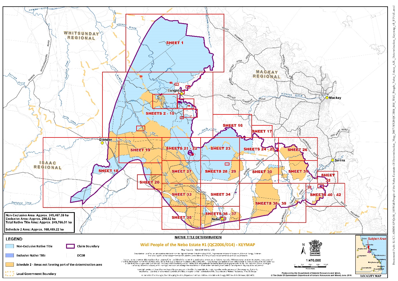
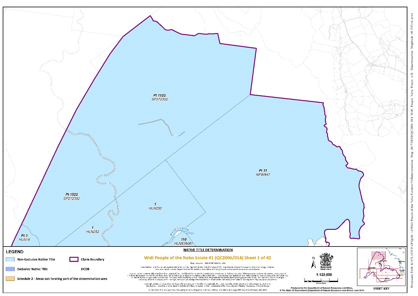
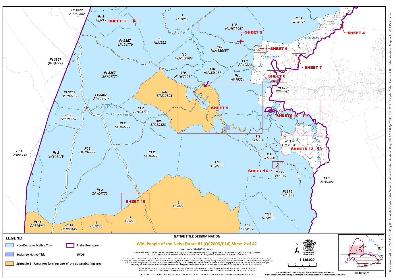
3. The Determination Area is the land and waters described in Schedule 1, and depicted in the map attached to Schedule 1. To the extent of any inconsistency between the written description and the map, the written description prevails.
4. Native title exists in relation to the Determination Area described in Part 1 and Part 2 of Schedule 1.
5. The native title is held by the Widi People described in Schedule 3 (the native title holders).
6. Subject to paragraphs 8, 9 and 10 below the nature and extent of the native title rights and interests in relation to the land and waters described in Part 1 of Schedule 1 are:
(a) other than in relation to Water, the right to possession, occupation, use and enjoyment of the area to the exclusion of all others; and
(b) in relation to Water, the non-exclusive rights to:
(i) hunt, fish and gather from the Water of the area;
(ii) take and use the Natural Resources of the Water in the area; and
(iii) take and use the Water of the area,
for personal, domestic and non-commercial communal purposes.
7. Subject to paragraphs 8, 9 and 10 below the nature and extent of the native title rights and interests in relation to the land and waters described in Part 2 of Schedule 1 are the non-exclusive rights to:
(a) access, be present on, move about on and travel over the area;
(b) camp, and live temporarily on the area as part of camping, and for that purpose build temporary shelters;
(c) hunt, fish and gather on the land and waters of the area for personal, domestic and non-commercial communal purposes;
(d) take, use, share and exchange Natural Resources from the land and waters of the area for personal, domestic and non-commercial communal purposes;
(e) take and use the Water of the area for personal, domestic and non-commercial communal purposes;
(f) conduct ceremonies on the area;
(g) be buried and bury native title holders within the area;
(h) maintain places of importance and areas of significance to the native title holders under their traditional laws and customs and protect those places and areas from physical harm;
(i) teach on the area the physical and spiritual attributes of the area;
(j) hold meetings on the area; and
(k) light fires on the area for domestic purposes including cooking, but not for the purpose of hunting or clearing vegetation.
8. The native title rights and interests are subject to and exercisable in accordance with:
(a) the Laws of the State and the Commonwealth; and
(b) the traditional laws acknowledged and traditional customs observed by the native title holders.
9. The native title rights and interests referred to in paragraphs 6(b) and 7 do not confer possession, occupation, use or enjoyment to the exclusion of all others.
10. There are no native title rights in or in relation to minerals as defined by the Mineral Resources Act 1989 (Qld) and petroleum as defined by the Petroleum Act 1923 (Qld) and the Petroleum and Gas (Production and Safety) Act 2004 (Qld).
11. The nature and extent of any other interests in relation to the Determination Area (or respective parts thereof) are set out in Schedule 4.
12. The relationship between the native title rights and interests described in paragraphs 6 and 7 and the other interests described in Schedule 4 (the “other interests”) is that:
(a) the other interests continue to have effect, and the rights conferred by or held under the other interests may be exercised notwithstanding the existence of the native title rights and interests;
(b) to the extent the other interests are inconsistent with the continued existence, enjoyment or exercise of the native title rights and interests in relation to the land and waters of the Determination Area, the native title continues to exist in its entirety but the native title rights and interests have no effect in relation to the other interests to the extent of the inconsistency for so long as the other interests exist; and
(c) the other interests and any activity that is required or permitted by or under, and done in accordance with, the other interests, or any activity that is associated with or incidental to such an activity, prevail over the native title rights and interests and any exercise of the native title rights and interests.
DEFINITIONS AND INTERPRETATION
13. In this determination, unless the contrary intention appears:
“land” and “waters”, respectively, have the same meanings as in the Native Title Act 1993 (Cth); |
“Laws of the State and the Commonwealth” means the common law and the laws of the State of Queensland and the Commonwealth of Australia, and includes legislation, regulations, statutory instruments, local planning instruments and local laws; |
“Natural Resources” means: (a) any animal, plant, fish and bird life found on or in the lands and waters of the Determination Area; and (b) any clays, soil, sand, gravel or rock found on or below the surface of the Determination Area, that have traditionally been taken and used by the native title holders, but does not include: (a) animals that are the private personal property of another; (b) crops that are the private personal property of another; and (c) minerals as defined in the Mineral Resources Act 1989 (Qld) or petroleum as defined in the Petroleum Act 1923 (Qld) and the Petroleum and Gas (Production and Safety) Act 2004 (Qld); |
“Water” means: (a) water which flows, whether permanently or intermittently, within a river, creek or stream; (b) any natural collection of water, whether permanent or intermittent; and (c) water from an underground water source; |
“Works” has the same meaning as in the Electricity Act 1994 (Qld). |
Other words and expressions used in this determination have the same meanings as they have in Part 15 of the Native Title Act 1993 (Cth).
THE COURT DETERMINES THAT:
14. The native title is not held in trust.
15. The Widi Aboriginal Corporation (ICN: 8911) incorporated under the Corporations (Aboriginal and Torres Strait Islander) Act 2006 (Cth), is to:
(a) be the prescribed body corporate for the purpose of s 57(2) of the Native Title Act 1993 (Cth); and
(b) perform the functions mentioned in s 57(3) of the Native Title Act 1993 (Cth) after becoming a registered native title body corporate.
SCHEDULE 1
DETERMINATION AREA
A. Description of Determination Area
The Determination Area comprises all of the land and waters described in Parts 1 and 2 below, to the extent that they are within the external boundary described in Part 3 below, and depicted on the determination map, excluding the areas described in Schedule 2.
Part 1 — Exclusive Areas
All of the land and waters described in the following table and depicted in dark blue on the determination map:
Area description (as at date of determination) | Determination map sheet number |
Lot 1 on Plan N11017** | Sheet 37 |
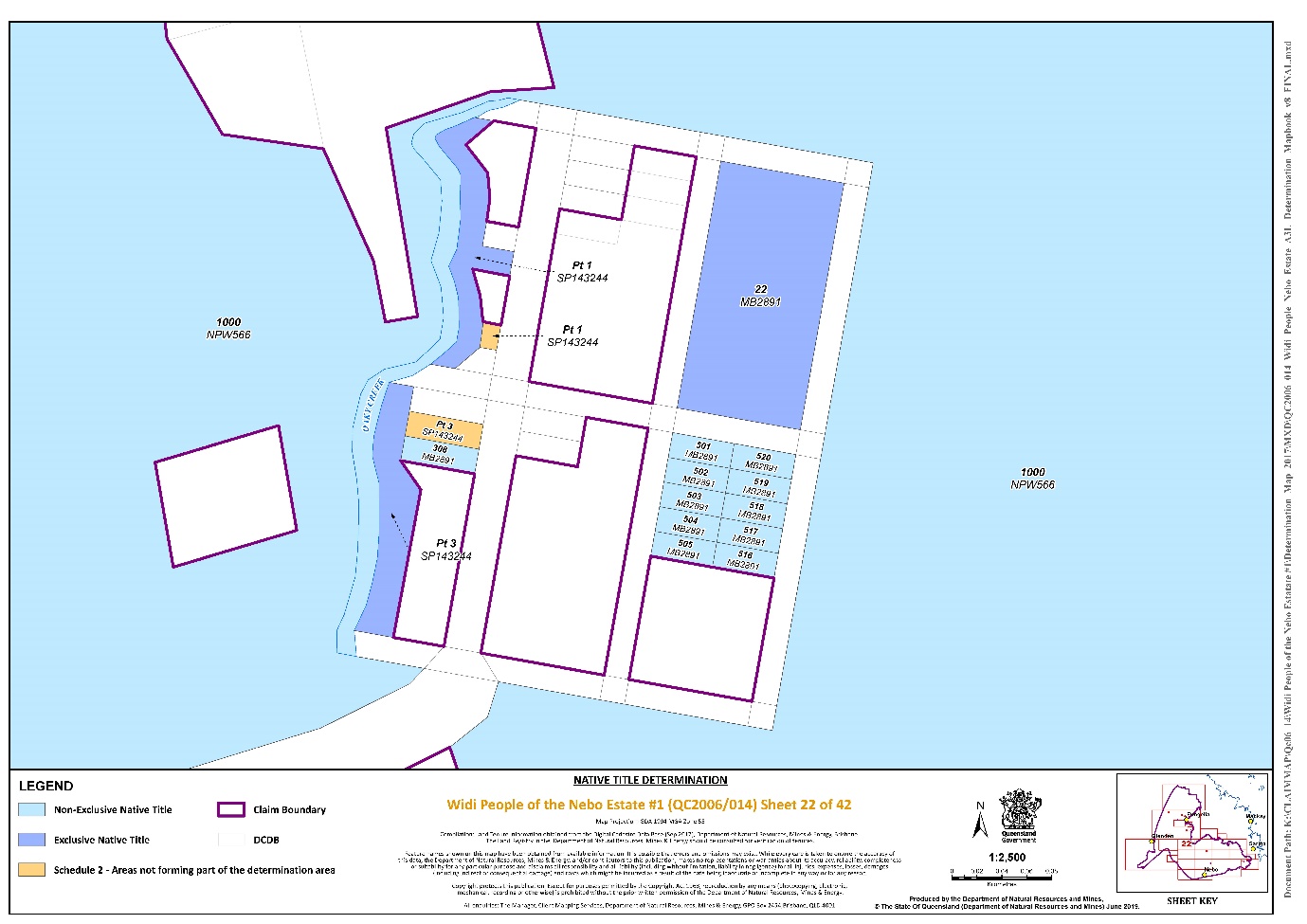
That part of Lot 1 on Plan SP143244 that is within the external boundary described in Part 3 and excluding the area formerly described as Lot 102 on Plan MB2891* | Sheet 22 |
That part of Lot 1 on Plan SP213251 that is within the external boundary described in Part 3* | Sheet 36 |
Lot 182 on Plan N1101** | Sheet 37 |
Lot 183 on Plan N1101** | Sheet 37 |
Lot 184 on Plan N1101** | Sheet 37 |
Lot 185 on Plan N1101** | Sheet 37 |
Lot 19 on Plan WHS450** | Sheet 31 |
That part of Lot 2 on Plan SP213251 that is within the external boundary described in Part 3* | Sheet 36 |
Lot 22 on Plan MB2891* | Sheet 22 |
Lot 28 on Plan SP132656* | Sheets 36 and 37 |
That part of Lot 3 on Plan SP143244 that is within the external boundary described in Part 3 and excluding the area formerly described as Lot 309 on Plan MB2891* | Sheet 22 |
Lot 4 on Plan N11015** | Sheet 37 |
Lot 8 on Plan N11015** | Sheet 37 |
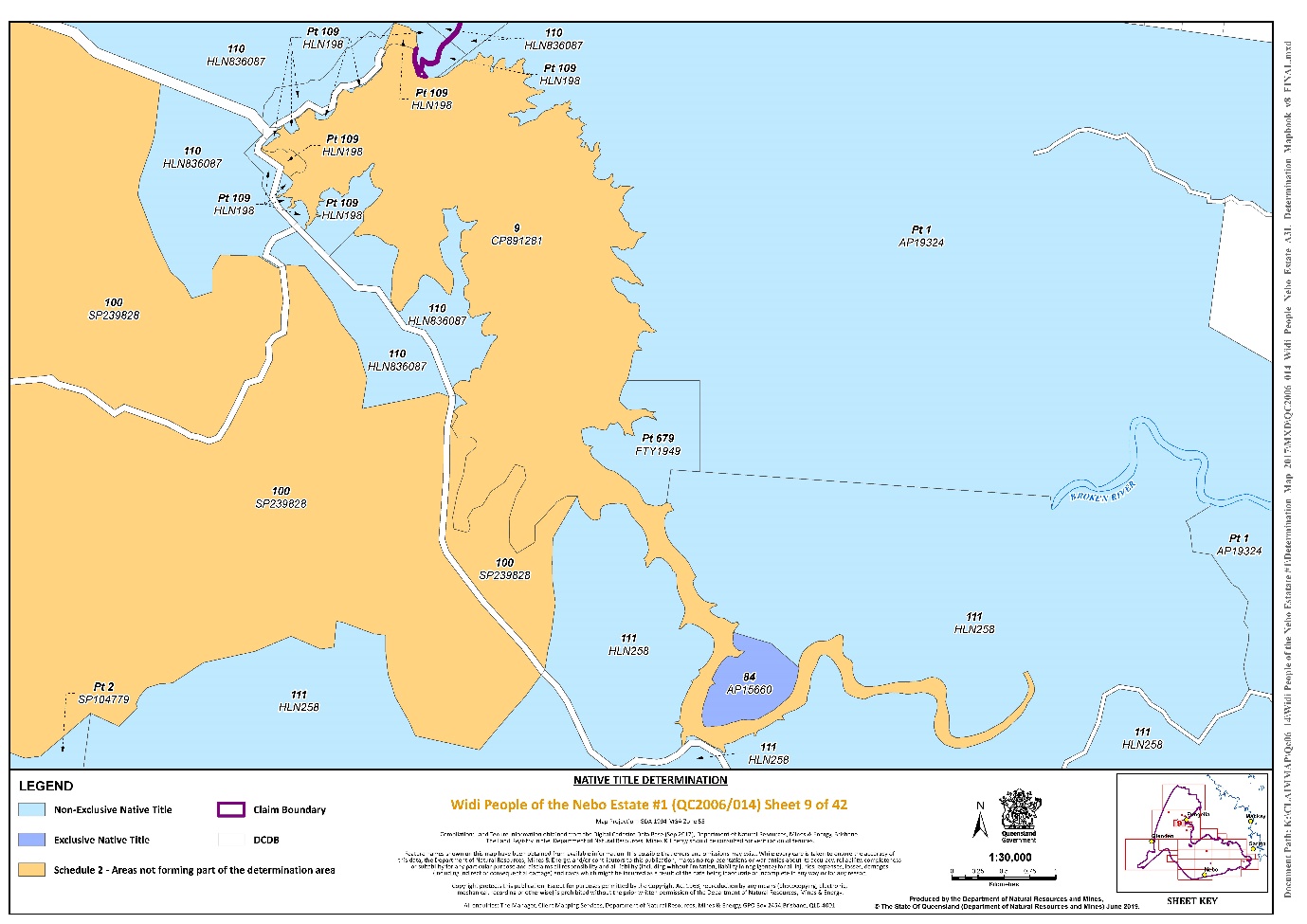
Lot 84 on Plan AP15660* | Sheet 9 |
Lot 96 on Plan SP237089** | Sheet 36 |
Lot 1 on Plan AP5233 | Sheet 36 |
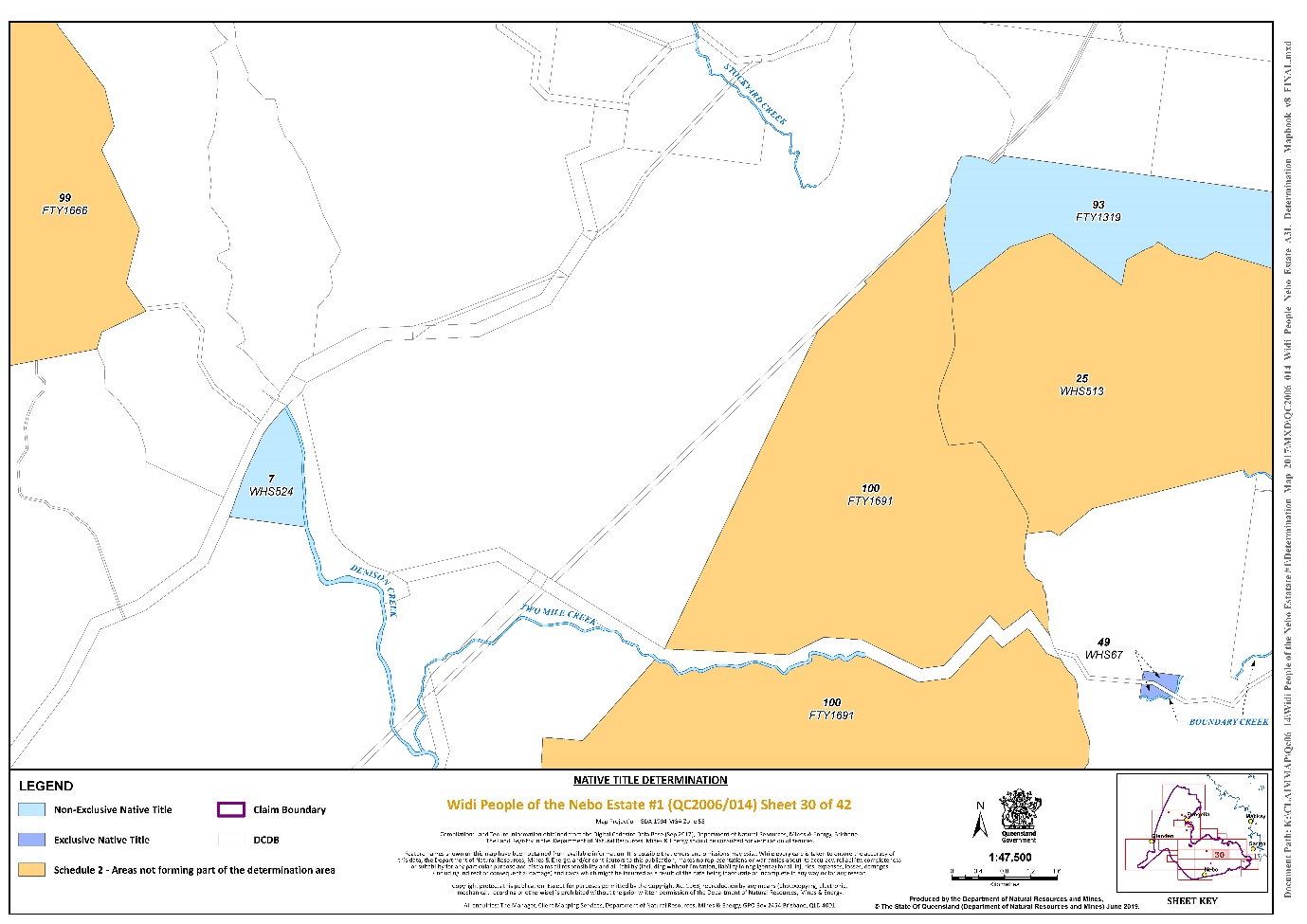
Lot 49 on Plan WHS67 | Sheet 30 |
Lot 111 on Plan AP15661 | Sheet 8 |
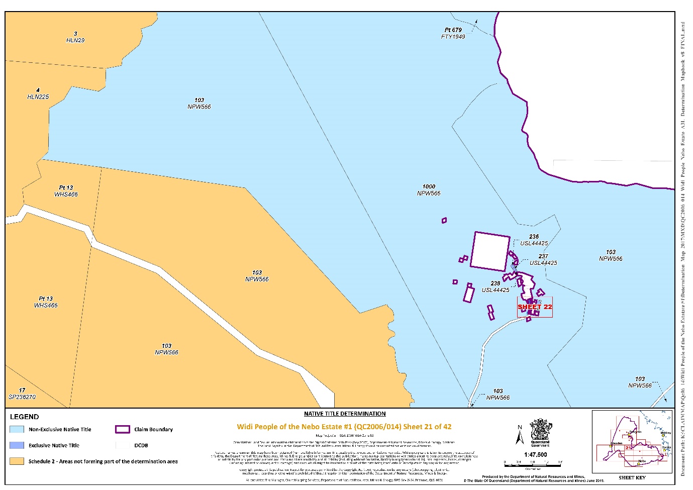
Lot 236 on Plan USL44425* | Sheet 21 |
Lot 237 on Plan USL44425* | Sheet 21 |
Lot 238 on Plan USL44425* | Sheet 21 |
* denotes areas to which s47B of the Native Title Act 1993 (Cth) applies
** denotes areas to which the non-extinguishment principle applies
Part 2 — Non-Exclusive Areas
All of the land and waters described in the following table and depicted in light blue on the determination map:
Area description (as at date of determination) | Determination map sheet number |
That part of Lot 1 on Plan CP866146 that is within the external boundary described in Part 3 | Sheet 2 |
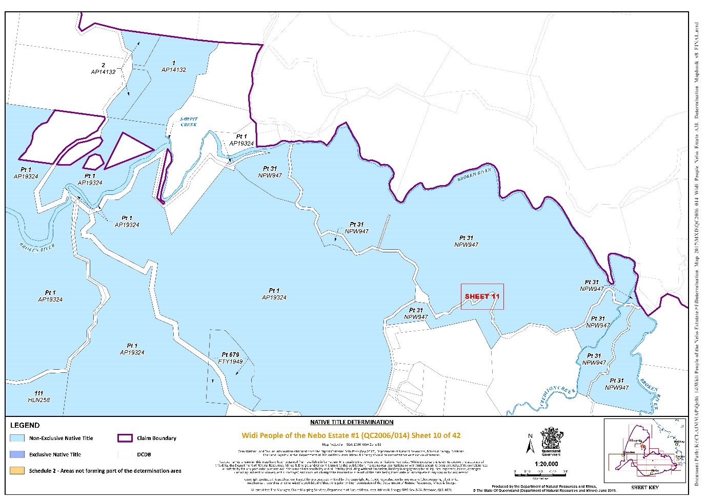
That part of Lot 1 on Plan AP19324 that is within the external boundary described in Part 3 | Sheets 2, 6, 8, 9, 10 and 12 |
Lot 1 on Plan WHS126 | Sheet 42 |
Lot 1 on Plan SP117383 | Sheet 8 |
Lot 101 on Plan SP123959 | Sheet 36 |
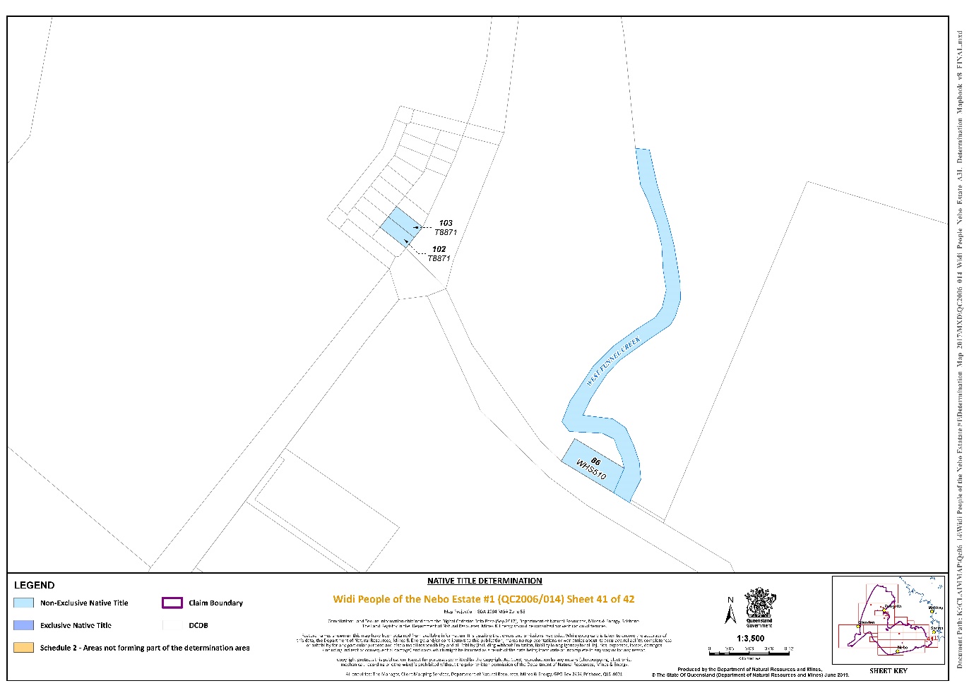
Lot 102 on Plan T8871 | Sheet 41 |
Lot 102 on Plan SP144386 | Sheet 37 |
Lot 103 on Plan T8871 | Sheet 41 |
Part of Lot 109 on Plan HLN198 excluding that part described in Schedule 2 | Sheet 9 |
Lot 13 on Plan WHS34 | Sheet 27 |
Lot 15 on Plan WHS188 | Sheet 36 |
Lot 159 on Plan CI3695 | Sheet 8 |
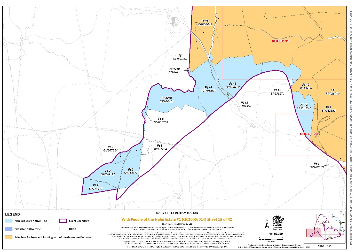
Lot 18 on Plan CP866443 | Sheet 18 |
Lot 2 on Plan AP14132 | Sheet 10 |
Lot 2 on Plan E57210 | Sheet 8 |
Lot 2 on Plan WHS66 | Sheet 38 |
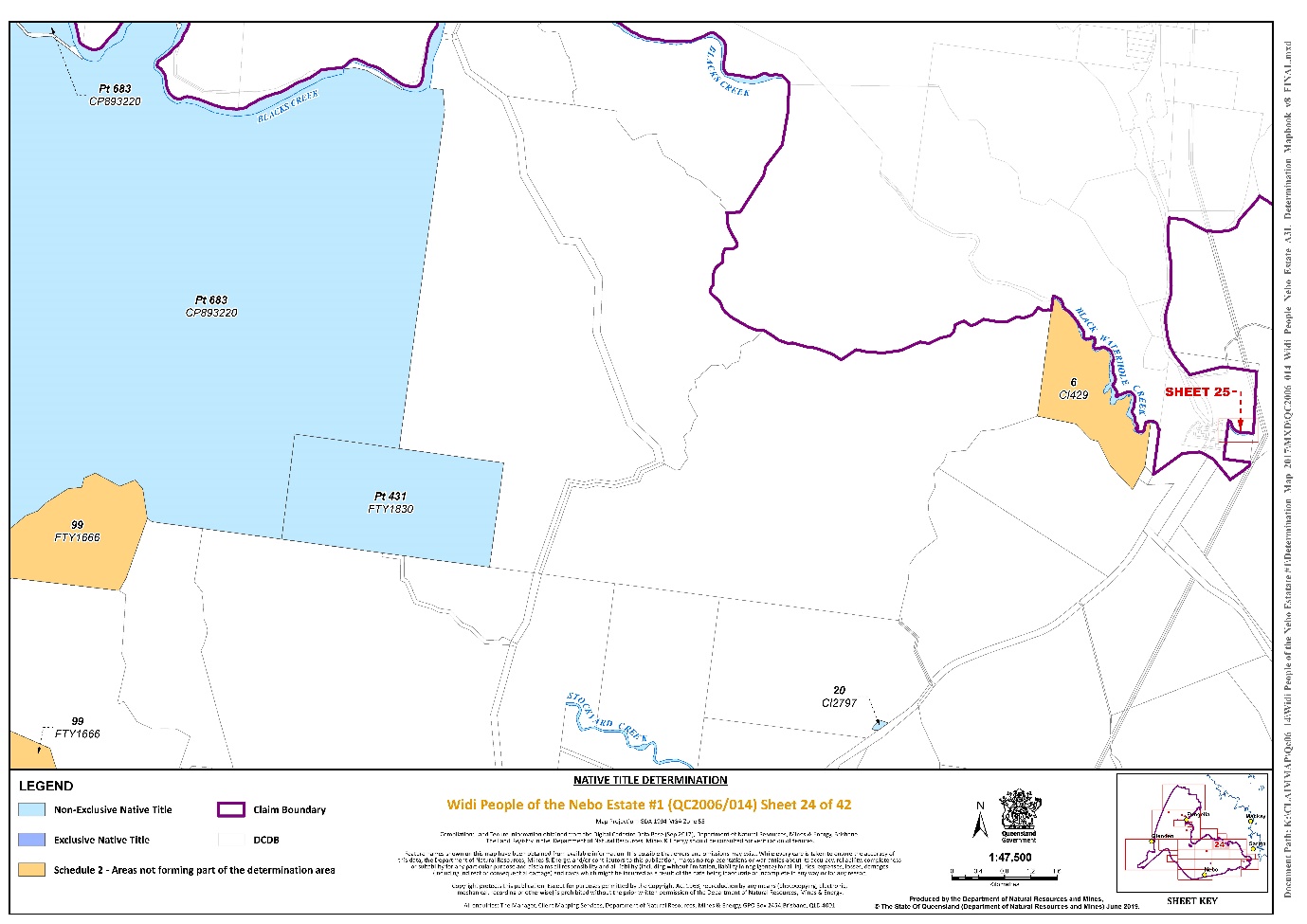
Lot 20 on Plan CI2797 | Sheet 24 |
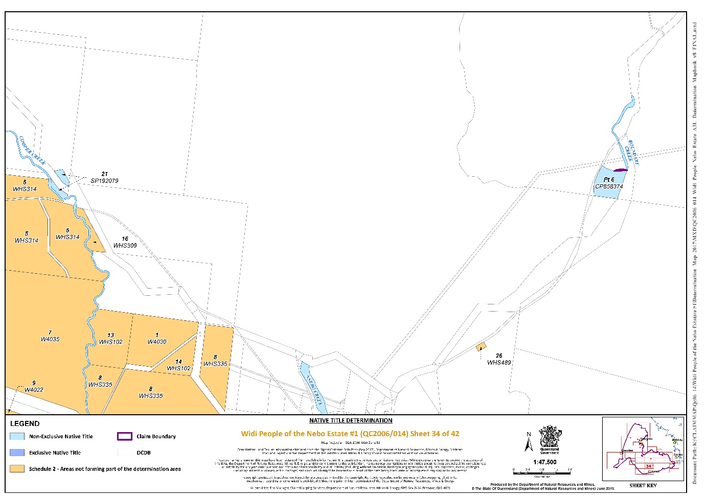
Lot 21 on Plan SP192079 | Sheet 34 |
Lot 3 on Plan E5728 | Sheet 8 |
Lot 3 on Plan SP117383 | Sheet 8 |
Lot 3 on Plan SP144386 | Sheets 36 and 37 |
Lot 30 on Plan SP192078 | Sheet 33 |
Lot 308 on Plan MB2891 | Sheet 22 |
Lot 4 on Plan SP230175 | Sheets 36 and 37 |
Lot 501 on Plan MB2891 | Sheet 22 |
Lot 502 on Plan MB2891 | Sheet 22 |
Lot 503 on Plan MB2891 | Sheet 22 |
Lot 504 on Plan MB2891 | Sheet 22 |
Lot 505 on Plan MB2891 | Sheet 22 |
Lot 516 on Plan MB2891 | Sheet 22 |
Lot 517 on Plan MB2891 | Sheet 22 |
Lot 518 on Plan MB2891 | Sheet 22 |
Lot 519 on Plan MB2891 | Sheet 22 |
Lot 520 on Plan MB2891 | Sheet 22 |
Lot 55 on Plan HLN242 | Sheet 14 |
That part of Lot 6 on Plan CP858374 that is within the external boundary described in Part 3 | Sheet 34 |
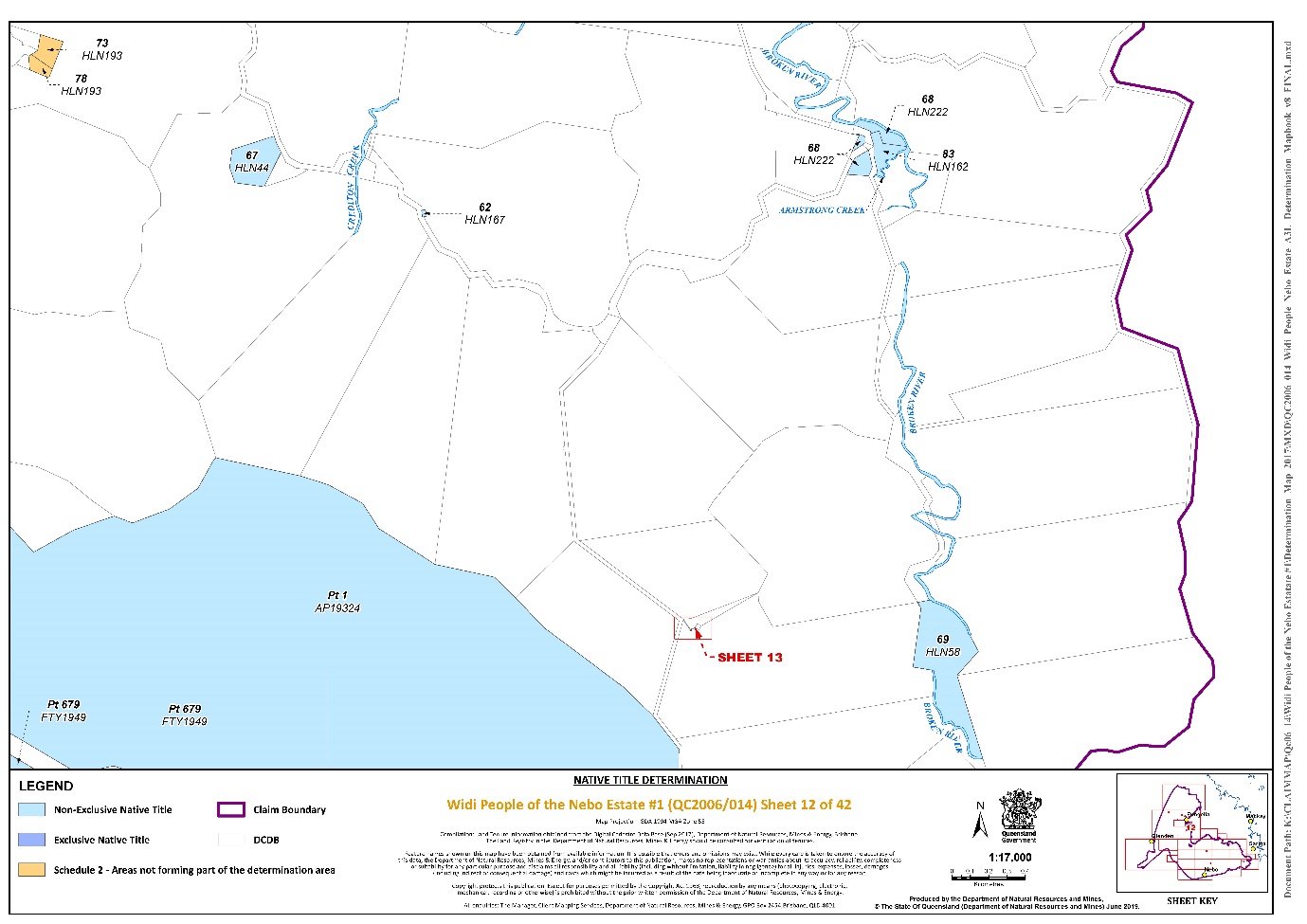
Lot 62 on Plan HLN167 | Sheet 12 |
Lot 64 on Plan N1109 | Sheets 36 and 37 |
Lot 64 on Plan WHS109 | Sheet 38 |
Lot 68 on Plan HLN222 | Sheet 12 |
Lot 69 on Plan HLN58 | Sheet 12 |
Lot 7 on Plan WHS524 | Sheet 30 |
Lot 72 on Plan WHS472 | Sheet 42 |
Lot 77 on Plan WHS475 | Sheets 36 and 37 |
Lot 83 on Plan HLN162 | Sheet 12 |
Lot 86 on Plan WHS510 | Sheet 41 |
Lot 87 on Plan WHS187 | Sheet 38 |
Lot 93 on Plan N1101 | Sheet 37 |
Lot 94 on Plan N1101 | Sheet 37 |
Lot 98 on Plan SP230174 | Sheets 37 |
Lot 1 on Plan AP14132 | Sheet 10 |
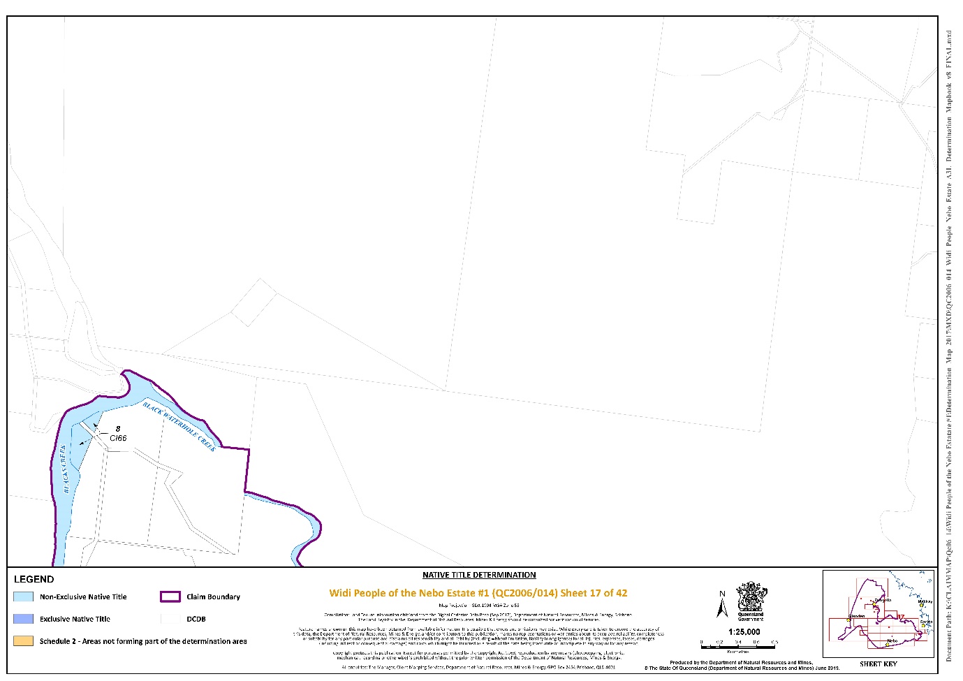
Lot 8 on Plan CI66 | Sheet 17 |
That part of Lot 1 on Plan AP14639 excluding the area formerly described as Lot 18 on Plan WHS324 | Sheet 27 |
Lot 1000 on Plan NPW566 | Sheets 2, 21, 22, 27 and 28 |
That part of Lot 103 on Plan NPW566 excluding the areas formerly described as Lots 18 and 19 on Plan WHS324 | Sheets 2, 21, 23, 27 and 28 |
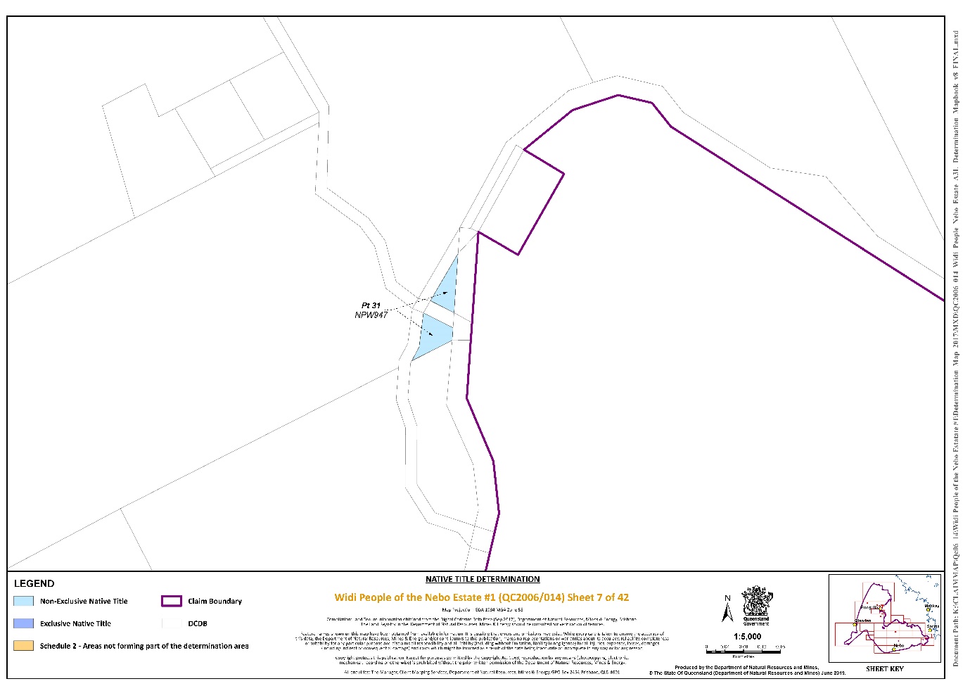
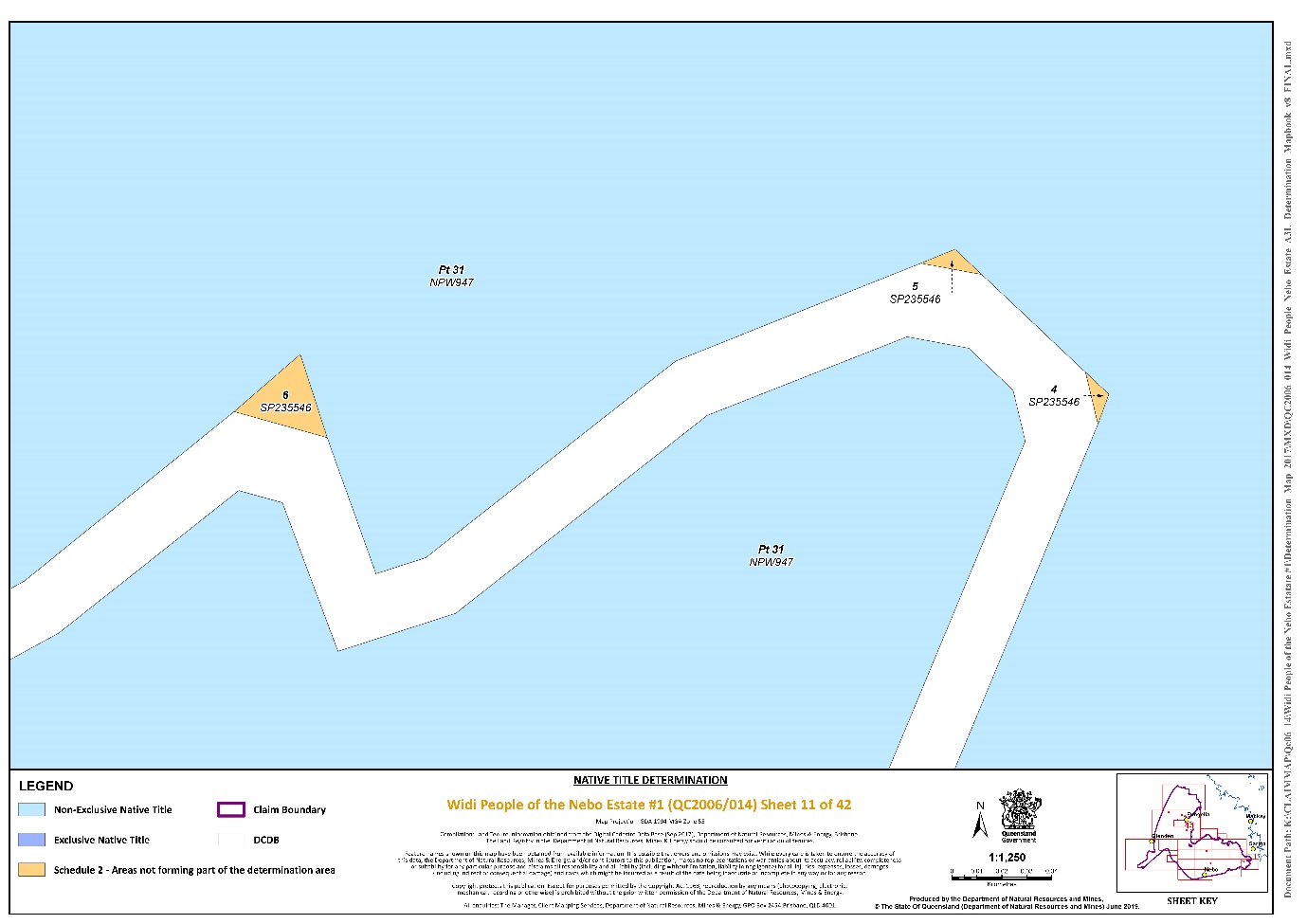
That part of Lot 31 on Plan NPW947 that is within the external boundary described in Part 3 | Sheets 1, 2, 7, 10 and 11 |
Lot 1 on Plan HLN252 | Sheets 1, 2 and 3 |
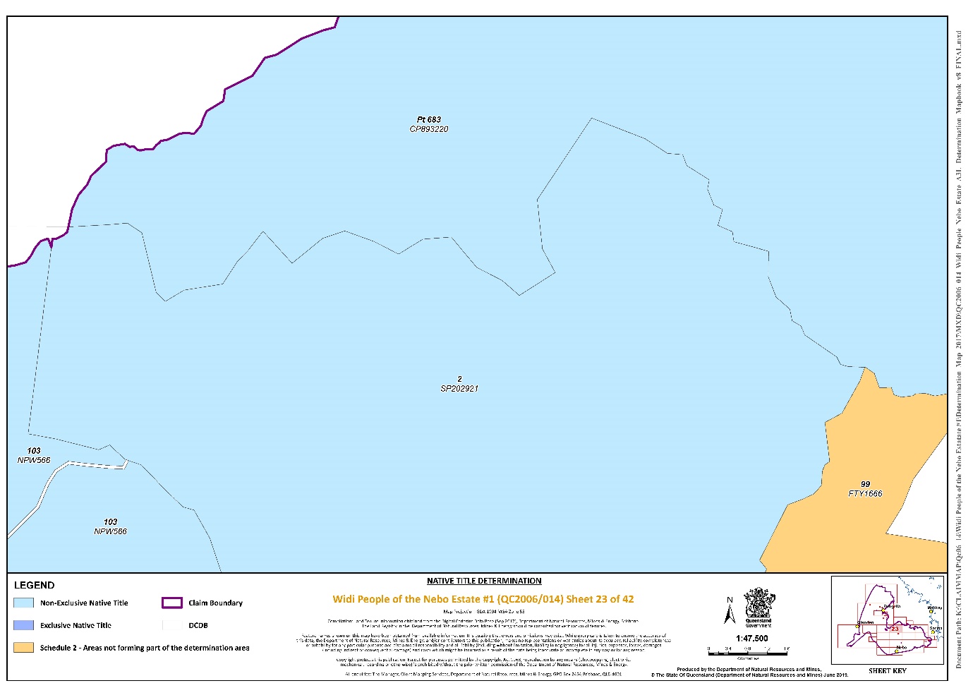
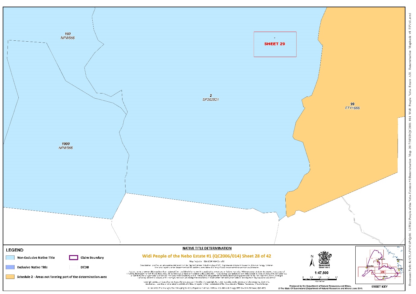
Lot 1 on Plan SP202921 | Sheet 29 |
Lot 11 on Plan HLN219 | Sheet 15 |
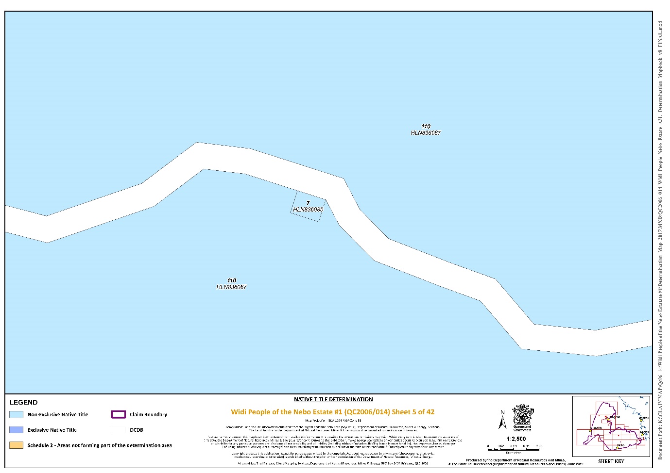
Lot 110 on Plan HLN836087 | Sheets 1, 2, 5, 6 and 9 |
Lot 111 on Plan HLN258 | Sheets 2, 9, 10 and 14 |
That part of Lot 12 on Plan SP236271 (now described as Lot 12 on SP303309) that is within the external boundary described in Part 3 | Sheets 18, 19, 20 and 33 |
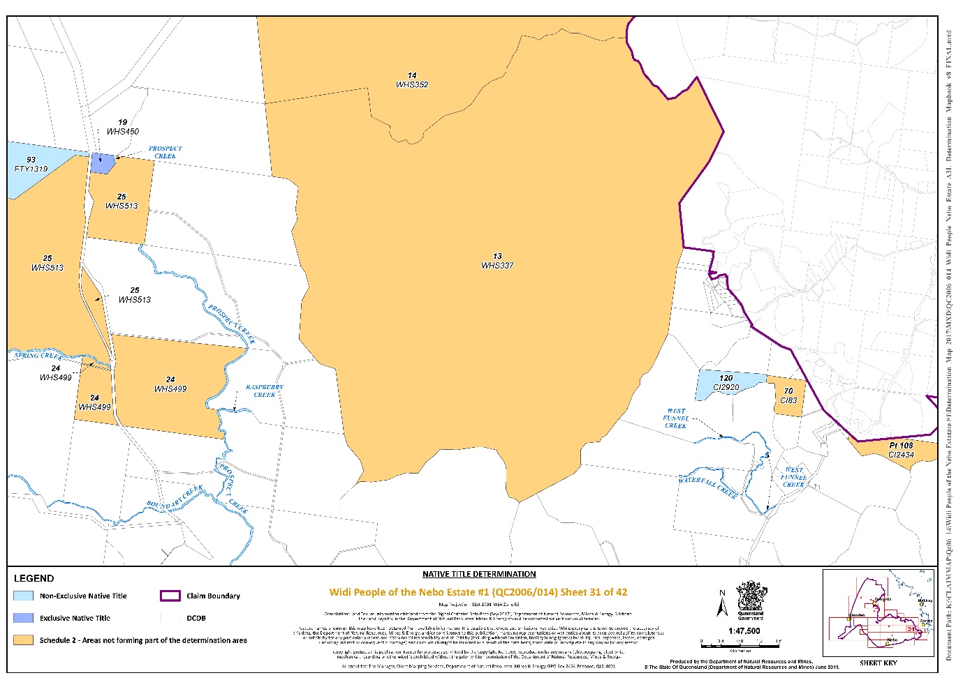
Lot 120 on Plan CI2920 | Sheet 31 |
That part of Lot 1522 on Plan SP272352 that is within the external boundary described in Part 3 | Sheets 1 and 2 |
That part of Lot 18 on Plan SP104452 that is within the external boundary described in Part 3 | Sheets 18 and 19 |
That part of Lot 2 on Plan SP104779 that is within the external boundary described in Part 3 | Sheets 2, 9 and 15 |
Lot 2 on Plan SP202921 (now described as Lots 2 and 3 on Plan SP296671) | Sheets 23, 28 and 29 |
That part of Lot 2 on Plan SP214117 that is within the external boundary described in Part 3 | Sheet 18 |
That part of Lot 3 on Plan HLN19 that is within the external boundary described in Part 3 | Sheets 1, 2 and 3 |
Lot 3 on Plan HLN241 | Sheet 3 |
That part of Lot 3357 on Plan SP104779 that is within the external boundary described in Part 3 | Sheet 2 |
That part of Lot 4260 on Plan SP104451 that is within the external boundary described in Part 3 | Sheet 18 |
Lot 44 on Plan WHS231 | Sheet 38 |
Lot 60 on Plan WHS326 | Sheet 36 |
Lot 67 on Plan HLN44 | Sheet 12 |
That part of Lot 683 on Plan CP893220 that is within the external boundary described in Part 3 | Sheets 16, 23 and 24 |
Lot 7 on Plan HLN836085 | Sheet 5 |
That part of Lot 8 on Plan GV807254 that is within the external boundary described in Part 3 | Sheet 18 |
That part of Lot 431 on Plan FTY1830 that is within the external boundary described in Part 3 | Sheet 24 |
That part of Lot 679 on Plan FTY1949 that is within the external boundary described in Part 3 | Sheets 2, 8, 9, 10, 12, 14 and 21 |
Lot 93 on Plan FTY1319 | Sheets 30 and 31 |
Save for any waters forming part of a lot on plan, all waterways, natural lakes, creeks and rivers within the external boundary described in Part 3, including but not limited to: | Sheets 1, 2, 9, 10, 12, 14, 16, 17, 22, 24, 25, 26, 27, 30, 31, 32, 33, 34, 35, 36, 37, 38, 40, 41 and 42 |
(i) Armstrong Creek; (ii) Bee Creek; (iii) Blacks Creek; (iv) Black Waterhole Creek; (v) Boundary Creek; (vi) Broken River; (vii) Cooper Creek; (viii) Crediton Creek; (ix) Crescent Creek; (x) Denison Creek; (xi) East Funnel Creek; (xii) Funnel Creek; (xiii) Hazlewood Creek; (xiv) Hut Creek; (xv) Lower John Creek; (xvi) Massey Creek; (xvii) Nebo Creek; (xviii) Oakey Creek, (xix) Pla Creek; (xx) Prospect Creek; (xxi) Raspberry Creek; (xxii) Sawpit Creek; (xxiii) Spring Creek; (xxiv) Stockyard Creek; (xxv) Teemburra Creek; (xxvi) Two Mile Creek; and (xxvii) West Funnel Creek. |
Part 3 – External Boundary Description
Commencing at the easternmost corner on the eastern boundary of the Native Title Determination QUD6244/1998 Birriah People (QCD2016/001); also being the southernmost point of Lot 4611 on Plan SP270181 (Mount Crompton Holding) and extending generally north easterly along the eastern boundary of that lot to intersect the watershed (Drainage Basin) of the Gap Creek at Latitude 20.784527° South; then generally south easterly and generally easterly along that watershed and Star Creek Watershed (Drainage Basin) passing through the following coordinate points:
Longitude ° (East) | Latitude ° (South) |
148.392353 | 20.784527 |
148.394726 | 20.787590 |
148.395851 | 20.789885 |
148.400045 | 20.790937 |
148.406796 | 20.796579 |
148.409967 | 20.799543 |
148.413138 | 20.800213 |
148.417229 | 20.799352 |
148.428174 | 20.804229 |
148.444028 | 20.805856 |
148.448426 | 20.803369 |
Then easterly to a corner on the eastern boundary of Lot 1522 on Plan SP272352 (Urannah Pastoral Holding) at Latitude 20.803790° South; then generally easterly and generally south easterly along boundaries of that lot to a north western corner of Lot 31 on Plan NPW947 (Eungella National Park) at Latitude 20.869234° South; then generally easterly and generally south easterly along the northern boundary of that National Park to Longitude 148.632823° East, being the western boundary of former Lot 104 on Plan NPW532; then generally southerly, generally westerly, generally northerly and generally south westerly along the western boundaries of that former lot to its intersection with the eastern boundary of Dalrymple Road at Latitude 21.024989° South (also being a western corner of Lot 31 on Plan NPW947 (Eungella National Park), passing through the following coordinate points.
Longitude ° (East) | Latitude ° (South) |
148.633879 | 20.949926 |
148.635422 | 20.950965 |
148.637739 | 20.951294 |
148.639727 | 20.952151 |
148.641010 | 20.953541 |
148.641329 | 20.955222 |
148.640931 | 20.956419 |
148.638345 | 20.958933 |
148.637401 | 20.961258 |
148.636416 | 20.964957 |
148.636300 | 20.968199 |
148.637871 | 20.973985 |
148.640090 | 20.982614 |
148.640878 | 20.985056 |
148.641543 | 20.985664 |
148.641950 | 20.986536 |
148.642085 | 20.988551 |
148.642352 | 20.989795 |
148.642340 | 20.991310 |
148.641787 | 20.992430 |
148.641575 | 20.993599 |
148.641586 | 20.994583 |
148.642079 | 20.998463 |
148.642246 | 21.000590 |
148.641307 | 21.002821 |
148.640990 | 21.004547 |
148.641115 | 21.005775 |
148.641686 | 21.006613 |
148.642703 | 21.007237 |
148.643049 | 21.008182 |
148.642553 | 21.009013 |
148.641737 | 21.009583 |
148.639051 | 21.011964 |
148.637948 | 21.013854 |
148.636730 | 21.017082 |
148.636989 | 21.020261 |
148.637385 | 21.022190 |
148.637504 | 21.022891 |
148.637446 | 21.024421 |
148.637057 | 21.024776 |
148.636102 | 21.024714 |
148.631870 | 21.024210 |
148.629190 | 21.024194 |
148.628074 | 21.024459 |
148.627286 | 21.024290 |
148.626515 | 21.023805 |
148.626312 | 21.022331 |
148.626606 | 21.020219 |
148.626591 | 21.018813 |
148.626242 | 21.017569 |
148.625738 | 21.016046 |
148.625909 | 21.012810 |
148.625952 | 21.009261 |
148.625933 | 21.007515 |
148.625586 | 21.006111 |
148.625019 | 21.004943 |
148.624201 | 21.003855 |
148.623395 | 21.003655 |
148.622397 | 21.003820 |
148.621460 | 21.004298 |
148.613143 | 21.012694 |
148.611491 | 21.013883 |
148.609832 | 21.014525 |
148.608280 | 21.014695 |
148.605062 | 21.014830 |
148.599851 | 21.014885 |
148.597889 | 21.015489 |
148.597089 | 21.016494 |
148.596763 | 21.018081 |
148.596876 | 21.020015 |
148.597330 | 21.021536 |
148.598671 | 21.025035 |
Then westerly to a western corner of Lot 31 on Plan NPW947 (Eungella National Park) at Latitude 21.024989° South, then generally south westerly along the western boundaries of Lot 31 on Plan NPW947 (Eungella National Park), crossing Dalrymple Road numerous times, to the south western corner of Lot 71 on Plan CI920, also a corner on the eastern boundary of Dalrymple Road; then generally southerly along eastern boundaries of an unnamed road (east of Lot 1 on Plan RP741375) and again Dalrymple Road to the northern corner of Lot 3 on Plan RP741375; then again along western boundaries of Lot 31 on Plan NPW947 (Eungella National Park) to the northern boundary of Lot 68 on Plan HLN135, also being an eastern corner of Schumanns Road; then generally north westerly along the southern boundaries of that road to the northernmost corner of the western severance of Lot 31 on Plan NPW947 (Eungella National Park); then generally south westerly and generally south easterly along western boundaries of that National Park to the northernmost corner of Lot 12 on Plan RP898369, also being a point on the southern boundary of Schumanns Road; then generally south easterly along the southern boundaries of that road and Cummings Street to an eastern corner of Lot 6 on Plan RP801507 at Latitude 21.126400° South; then easterly to a south western corner of Lot 68 on Plan HLN135; then generally easterly along the southern boundaries of that lot and Lot 88 on plan HLN129 to the western boundary of North Street; then south easterly to a western corner of the eastern severance Lot 31 on Plan NPW947 (Eungella National Park) at Latitude 21.128111° South; then generally southerly, generally westerly, generally southerly and generally easterly along the western boundary of that Lot, eastern boundary of Lot 2 on Plan E57210, again western boundary of Lot 31 on Plan NPW947 (Eungella National Park), crossing Mackay-Eungella Road, Eungella Dam Road and Diggings Road, and along northern boundaries of Lot 2 on Plan AP14132 and Lot 1 on Plan AP14132 to its easternmost corner; then easterly to a western corner on the western boundary of Eungella Dam Road at Latitude 21.157427° South; then generally southerly along that western boundary of that road to the north eastern corner of Lot 6 on Plan RP745807; then southerly along the eastern boundary of that lot to the northern bank of Broken River then generally easterly and generally south easterly along the north bank of that river to the western boundary of Lot 17 on Plan HLN50; then generally north easterly and generally south easterly along the northern boundary of that lot to its north easternmost corner at Longitude 148.558315° East; then south easterly across Clarke Range Road to a north western corner on the western boundary of the eastern severance of Lot 1 on Plan AP19324 (Crediton Forest Reserve); then generally southerly and generally south westerly along the western boundaries of that severance and Lot 679 on Plan FTY1949 (Crediton State Forest) to a south eastern corner of Plateau Road; then southerly to a point on the western boundary of the Pioneer River watershed (Drainage Basin) at Latitude 21.249932° South; then generally southerly and generally easterly along the western boundary of that watershed to its intersection with the western boundary of Lot 2 on SP296671; then generally north easterly along western boundaries of that lot and Lot 683 on Plan CP893220 (Teemburra Pastoral Lease) to the southern bank of Rocky Dam Creek; then onwards to the centreline of Blacks Creek; then generally north easterly along the centerline of that creek to the eastern boundary of Lot 683 on Plan CP893220; then easterly across Blacks Creek to the western boundary of Lot 431 on Plan FTY 1830 (Mia Mia State Forest) at Latitude 21.278377° South; then generally south easterly, generally easterly and generally northerly along the western and southern boundaries of that State Forest, Lot 1486 on Plan C124502, again Lot 431 on Plan FTY 1830 (Mia Mia State Forest), the northern bank of Blacks Creek and the western bank of Blackwater Hole Creek to the northernmost corner of the southern severance of Lot 2 on Plan RP736949; then across Blackwater Hole Creek to the western boundary of Lot 1 on plan AP19319 (Ben Mohr State Forest) at Longitude 148.840703° East; then generally south easterly, generally southerly and generally south easterly along the southern boundaries of that Ben Mohr State Forest (Lot 1 on plan AP19319 and Lot 956 on Plan FTY 1941) to the western boundary of Lot 46 on Plan CI4532; then southerly, generally easterly, generally northerly and generally westerly along western, southern, eastern and northern boundaries of that lot, the eastern boundary of Ready Street and again southern eastern and northern boundaries of again Lot 46 on Plan CI4532 to its intersection with the eastern boundary of Peak Downs Highway; then generally northerly along the eastern boundary of that highway to the southern boundary of Lot 866 on Plan FTY1946 (Spencer Gap State Forest); then generally easterly along the southern boundary of that State Forest (Lot 866 on Plan FTY1946 and Lot 1 on AP19318), northern and eastern boundaries of Lot 14 on Plan WH352 and Lot 13 on Plan WHS337 to the north western corner of Lot 2 on SP255689 (being part of former Lot 46 on Plan CI1790; then easterly, generally southerly and generally south easterly along the northern boundary of that lot, northern and eastern boundaries of Middle Creek Road, northern and southern boundaries of Lot 3 on Plan RP717898, again eastern and northern boundaries of Middle Creek Road, northern boundaries of Lot 5 on Plan RP717898, again northern and eastern boundaries of Middle Creek Road, western and southern boundaries of Lot 1 on Plan RP846375 and southern boundaries of Lot 1 on Plan SP190057 to a southern corner of that lot at 149.114991° East; then generally south easterly, generally easterly and north westerly to the southernmost corner of Lot 11 on Plan SP225742, also being a point on the northern boundary of Lot 19 on Plan CI113, passing through the following coordinate points.
Longitude ° (East) | Latitude ° (South) |
149.121727 | 21.496904 |
149.128716 | 21.502734 |
149.143199 | 21.501244 |
149.146467 | 21.498099 |
Then generally easterly and generally southerly easterly along the northern boundaries of Lot 19 on Plan CI113, Lot 41 on Plan SP214539, Lot 2 on Plan RP811861, northern and eastern boundaries of Lot 36 on Plan WHS458, Lot 66 on Plan WHS143 and eastern boundaries of Lot 2 on Plan RP612465 to the north easternmost corner of the northern severance of Lot 34 on Plan WHS456; then generally westerly and generally south westerly along northern and western boundaries of that severance to the eastern boundary of East Funnel Creek Road; then south westerly along the eastern boundary of that road to the southernmost corner of Lot 71 on WHS472; then generally north easterly along eastern boundaries of that lot to the southern boundary of a western severance of Lot 34 on Plan WHS456; then southerly to the northern boundary of westernmost severance of Lot 34 on Plan WHS456 (crossing East Funnel Creek) at Longitude 149.160152° East; then generally south westerly and generally north easterly along boundaries of that severance to an eastern corner at Longitude 149.159581° East; then south easterly to a point on the western boundary of a south western severance of that lot at Latitude 21.538673° South; then southerly along the western boundary of that severance to a northern corner of Lot 33 on Plan WHS106; then generally south easterly and generally south westerly along the southern and western boundaries of Lot 34 on Plan WHS456 (crossing East Funnel Creek (Right Branch) and an unnamed road numerous times) to a northern boundary of Lot 5 on AP19344 (Former Lot 1 on Plan AP19300; then generally westerly and generally south westerly along northern and western boundaries of that lot, eastern and southern boundaries of Lot 1 on Plan WHS429 to an eastern corner on the eastern boundary of Lot 5 on Plan CP898383; then generally north westerly to a northern corner of the western boundary of Saunders Road at Latitude 21.611831° South, passing through Longitude 149.117600° East Latitude 21.619011° South; then north westerly and south westerly to the southernmost corner of Lot 1 on Plan RP61608, also being a point on the western bank of Funnel Creek, passing through Longitude 149.087112° East, Latitude 21.600507° South; then generally southerly and generally westerly along the western and northern banks of Funnel Creek to a south eastern corner of Lot 3 on SP1334472 at Latitude 21.616385° South; then generally south westerly to a corner on the eastern boundary of Marlborough Sarina Road at Latitude 21.633275° South, passing through Longitude 149.042273° East Latitude 21.622870° South and generally north westerly along the Pine Mountain Ridgeline to a point on the eastern boundary of Lot 4 on Plan WHS25 at Latitude 21.619907° South, passing through the following coordinate points.
Longitude ° (East) | Latitude ° (South) |
148.992190 | 21.635250 |
148.977982 | 21.635302 |
148.974359 | 21.636531 |
148.968313 | 21.630586 |
Then generally westerly to a point on the watershed (Drainage Basin) of Blue Mountain Creek at Longitude 148.953041° East, Latitude 21.620252° South; then generally southerly along that watershed and the watershed of Back Creek to Longitude 148.911247° East, Latitude 21.669742° South (being a point on the northern boundary of Dismissed Native Title Determination Application QUD6011/01 Barada Barna Kabalbara and Yetimarla People 3 (QC2001/013)), passing through the following coordinate points.
Longitude ° (East) | Latitude ° (South) |
148.949987 | 21.622340 |
148.949366 | 21.628911 |
148.949555 | 21.638658 |
148.947491 | 21.640592 |
148.935842 | 21.643535 |
148.927721 | 21.655940 |
148.919069 | 21.661393 |
Then generally westerly, generally north westerly and generally south westerly along the northern boundary of that dismissed Native Title Determination Application to a point on western boundary of Red Hill Road reserve at Latitude 21.629817° South, passing through the following coordinate points.
Longitude ° (East) | Latitude ° (South) |
148.884967 | 21.674264 |
148.845243 | 21.682529 |
148.815603 | 21.687845 |
148.794081 | 21.692243 |
148.780921 | 21.694932 |
148.739926 | 21.700844 |
148.705871 | 21.706163 |
148.680017 | 21.711476 |
148.670356 | 21.713936 |
148.652907 | 21.718557 |
148.632102 | 21.723868 |
148.604365 | 21.732126 |
148.579757 | 21.732142 |
148.563982 | 21.732152 |
148.548827 | 21.728631 |
148.539346 | 21.723928 |
148.529233 | 21.718638 |
148.519749 | 21.712758 |
148.505830 | 21.701586 |
148.495076 | 21.693353 |
148.483045 | 21.680412 |
148.472277 | 21.668060 |
148.457721 | 21.654532 |
148.443791 | 21.639827 |
148.429855 | 21.623357 |
148.412758 | 21.605122 |
148.402616 | 21.591004 |
148.395635 | 21.578648 |
148.386133 | 21.567472 |
148.369065 | 21.558067 |
148.349460 | 21.544543 |
148.333006 | 21.529840 |
148.321571 | 21.506305 |
148.315844 | 21.491594 |
148.311369 | 21.473941 |
148.308797 | 21.459228 |
148.304337 | 21.446283 |
148.299886 | 21.435692 |
148.293449 | 21.429871 |
148.283152 | 21.427887 |
148.271601 | 21.429522 |
148.262012 | 21.431596 |
148.245628 | 21.438081 |
148.234926 | 21.445739 |
148.226125 | 21.455750 |
148.222657 | 21.459648 |
148.213552 | 21.469884 |
148.199070 | 21.479310 |
148.187741 | 21.488146 |
148.175781 | 21.496983 |
148.165089 | 21.507584 |
148.149354 | 21.519954 |
148.131725 | 21.531737 |
148.114738 | 21.547050 |
148.100268 | 21.560008 |
148.088949 | 21.571786 |
148.075109 | 21.584155 |
148.058737 | 21.594760 |
148.039862 | 21.611251 |
148.027288 | 21.625385 |
Then northerly along the western boundary of Red Hill Road to intersect the southern boundary of Lot 2 on Plan SP214117; then generally south westerly and northerly across Red Hill Road and along the southern and western boundaries of Lot 2 on SP214117 to intersect the southern boundary of an unnamed road reserve; then northerly across that road reserve to its northernmost eastern corner; then north easterly to a point on the western boundary of the Fitzroy River Basin at Latitude 21.594085° South; then generally north easterly, generally northerly generally easterly and again generally northerly along the western boundary of that river basin to Latitude 21.425373° South; then northerly to a point on the eastern boundary of Native Title Determination Application QUD6244/1998 Birriah People (QC1998/012) at Longitude 148.146892° East, Latitude 21.269584° South; then generally north easterly along the eastern boundary of that native title determination application back to the commencement point, passing through the following coordinate points.
Longitude ° (East) | Latitude ° (South) |
148.162832 | 21.221641 |
148.177147 | 21.175238 |
148.197838 | 21.123860 |
148.214411 | 21.083889 |
148.215213 | 21.081956 |
148.217284 | 21.076961 |
148.235545 | 21.031604 |
148.250184 | 21.002388 |
148.268468 | 20.964993 |
148.286743 | 20.927596 |
148.307467 | 20.887850 |
148.328231 | 20.853924 |
148.346562 | 20.825836 |
Exclusions
The Form 1 filed on 17 July 2019 specifically excludes:
1. In the vicinity of the Britton Road - Locality of Elphinstone Mt -
i) Lot 153 on USL44425;
ii) Lot 465 on MP35481 (Former Lot 154 on USL44425);
iii) Part of Lot 1000 on NPW566 (Subject to Former Lots 155 - 156 on USL44425);
iv) Lots 157 - 167 on USL44425, Lot 39 on MP36221 (Former Lot 168 on USL44425);
v) Lots 169 - 184 on USL44425;
vi) Part of Lot 1 on SP143244 (Subject to Former Lots 103 - 104 & 107 - 110 on MB2891);
vii) Lot 204 on MB2891;
viii) Part of Lot 2 on SP143244 (Subject to Former Lots 205 - 217 on MB2891);
ix) Lots 218 - 220MB2891;
x) Part of Lot 3 on SP143244 (Subject to Former Lots 301 - 307 on MB2891);
xi) Lot 4 on SP143244 (Former Lots 403 - 420 on MB2891); and
xii) Lot 5 on SP143244 (Former Lots 506 - 515 on MB2891).
2. In the vicinity of the Nebo Creek – Locality of Nebo -
i) Lot 128 on SP104462 (Former Lot 10 on N11012);
ii) Lots 120 – 127 on N1101;
iii) Lots 1 – 2 on SP235058 (Former Lot 100 on N1101);
iv) Lots 111 – 117 on N1101;
v) Lot 92 on N1101;
vi) Lot 95 on N1101;
vii) Lots 22 – 27 on N1101; and
viii) Lot 194 on N1101.
3. In the vicinity of the Boundary Creek - Locality of Nebo -
i) Part of Lot 6 on CP858374 (Subject to Former Lot 7 on USL39910).
4. In the vicinity of the East Funnell Creek Road - Locality of Koumala -
i) Lot 45 on WHS109.
5. In the vicinity of the East Funnell Creek Road - Locality of Bong Bong -
i) Lot 4 on USL36885; and
ii) Lot 6 on USL36885.
6. In the vicinity of the Bucks Creek - Locality of Eungella -
i) Part of Lot 1 on AP19324 (Subject to Former Lots 102 - 104 on HLN171 and Lot 2 on USL44435).
7. In the vicinity of the Bee Creek Road - Locality of Eungella –
i) Lot 86 on SP104465 (Former Lot 86 on USL44408); and
ii) Lot 1 on CP805069.
8. In the vicinity of the Broken River - Locality of Eungella –
i) Lot 101 on HLN169.
9. In the vicinity of the East Funnel Creek Road - Locality of Eungella –
i) Lot 71 on WHS472.
Reference datum
Geographical coordinates have been provided by the NNTT Geospatial Services and are referenced to the Geocentric Datum of Australia 1994 (GDA94), in decimal degrees and are based on the spatial reference data acquired from the various custodians at the time.
Data Reference and source
• Cadastral data sourced from Department of Natural Resources and Mines, Qld (September 2017).
• Watercourses are wherever possible based on Cadastre data sourced from Department of Natural Resources and Mines (Qld) August 2013; else interpreted from 1:250k Topographic vector data © Commonwealth of Australia (Geoscience Australia) 2006.
• Drainage Sub-Basin data supplied by Department of Natural Resources and Mines, (20 Feb 2009).
Use of Coordinates
Where coordinates are used within the description to represent cadastral or topographical boundaries or the intersection with such, they are intended as a guide only. As an outcome to the custodians of cadastral and topographic data continuously recalculating the geographic position of their data based on improved survey and data maintenance procedures, it is not possible to accurately define such a position other than by detailed ground survey.
PART 4
MAP AND DETERMINATION AREA


SCHEDULE 2
AREAS NOT FORMING PART OF THE DETERMINATION AREA
The following areas of land and waters are excluded from the Determination Area.
1. Those land and waters within the External Boundary, which at the time the native title determination application was made;
(a) were the subject of one or more Previous Exclusive Possession Acts, within the meaning of s 23B of the Native Title Act 1993 (Cth); and
(b) to which none of ss 47, 47A or 47B of the Native Title Act 1993 (Cth) applied at the time of the native title determination application;
are excluded from the Determination Area as they could not be claimed in accordance with s 61A of the Native Title Act 1993 (Cth).
2. Specifically, and to avoid any doubt, the land and waters described in (1) above includes, the tenure based exclusions under ss 23B(2) and 23B(3) of the Native Title Act 1993 (Cth) to which s 20 of the Native Title (Queensland) Act 1993 (Qld) applies, and includes, but is not limited to, the whole of the land and waters described as:
Area description (as at date of determination) | Determination map sheet number |
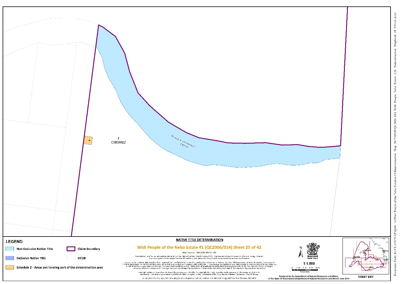
Lot 1 on Plan CI809662 | Sheet 25 |
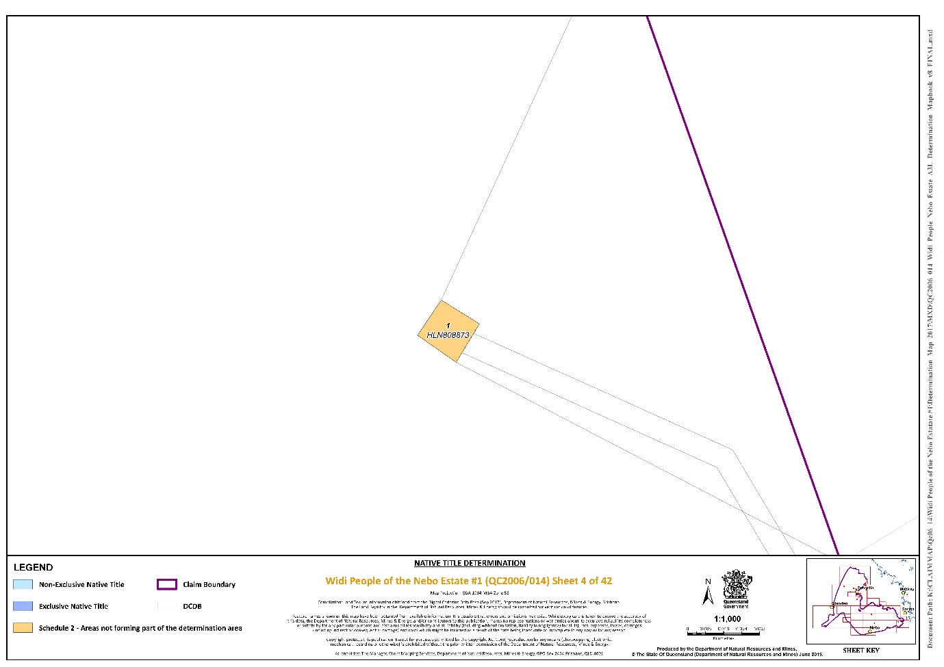
Lot 1 on Plan HLN808873 | Sheet 4 |
That part of Lot 1 on Plan SP143244 that is subject to the area formerly described as Lot 102 on Plan MB2891 | Sheet 22 |
Lot 12 on Plan RP898369 | Sheet 8 |
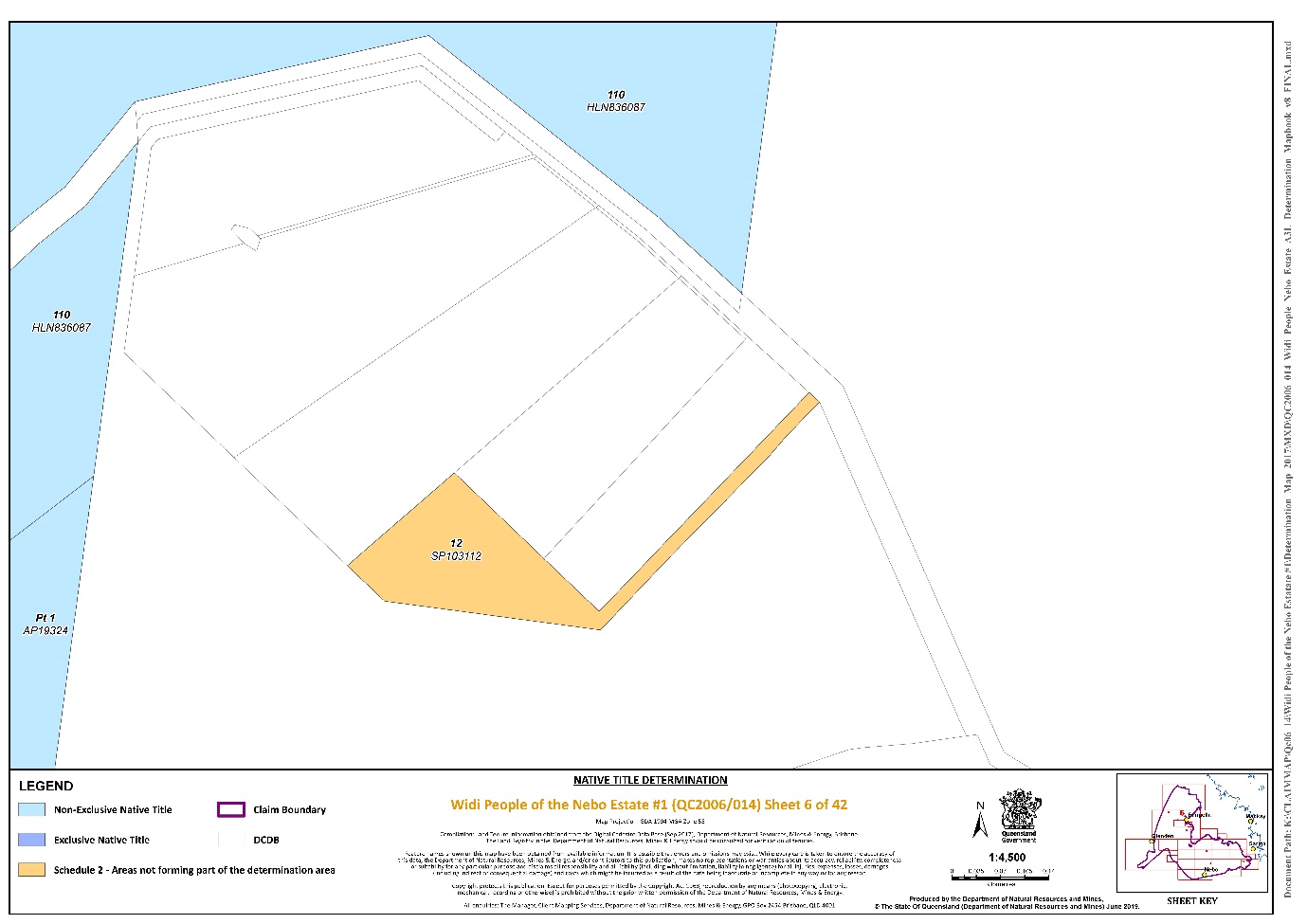
Lot 12 on Plan SP103112 | Sheet 6 |
Lot 26 on Plan WHS489 | Sheet 34 |
That part of Lot 3 on Plan SP143244 that subject to the area formerly described as Lot 309 on Plan MB2891 | Sheet 22 |
Lot 610 on Plan N1101 | Sheet 37 |
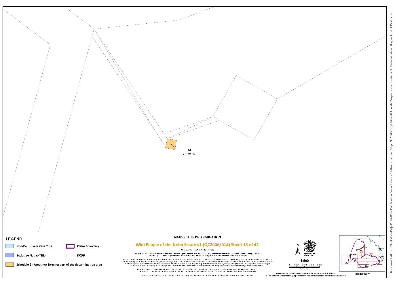
Lot 74 on Plan HLN189 | Sheet 13 |
Lot 74 on Plan WHS436 | Sheet 36 |
Lot 8 on Plan SP179909 | Sheet 8 |
That part of Lot 108 on Plan CI2434 that is within the external boundary described in Part 3 of Schedule 1 | Sheets 31 and 32 |
Lot 94 on Plan HLN151 | Sheet 8 |
That part of Lot 1 on Plan AP14639 formerly described as Lot 18 on Plan WHS324 | Sheet 27 |
That part of Lot 103 on Plan NPW566 formerly described as Lots 18 and 19 on Plan WHS324 | Sheets 21 and 27 |
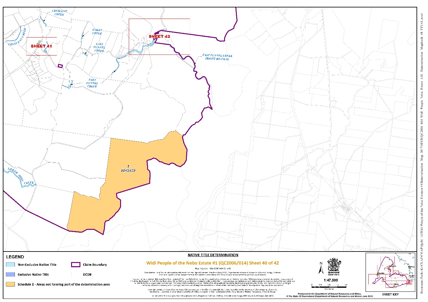
Lot 1 on Plan WHS429 | Sheet 40 |
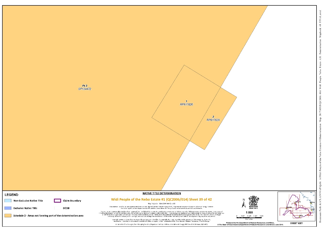
Lot 1 on Plan RP617630 | Sheet 39 |
Lot 100 on Plan SP239828 | Sheets 2 and 9 |
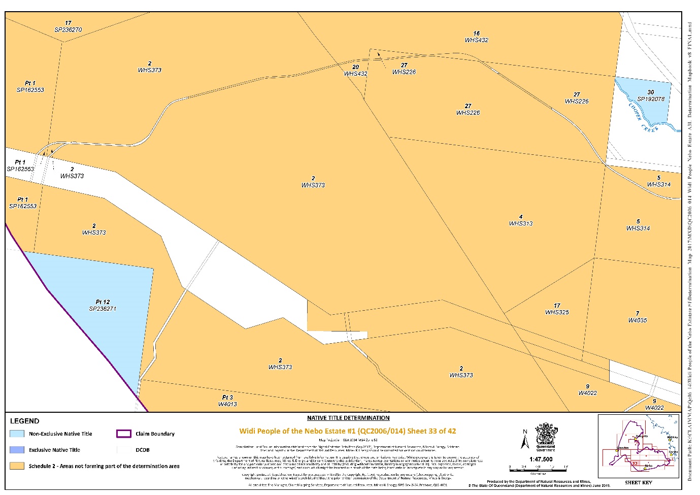
Lot 13 on Plan WHS337 | Sheet 31 |
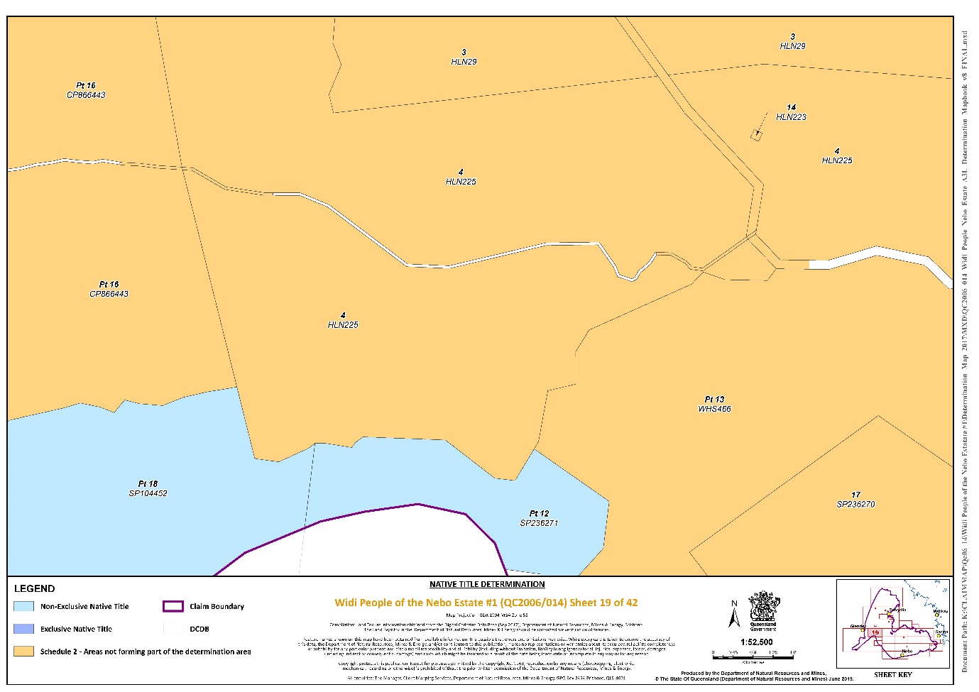
That part of Lot 13 on Plan WHS466 that is within the external boundary described in Part 3 of Schedule 1 | Sheets 18, 19 and 21 |
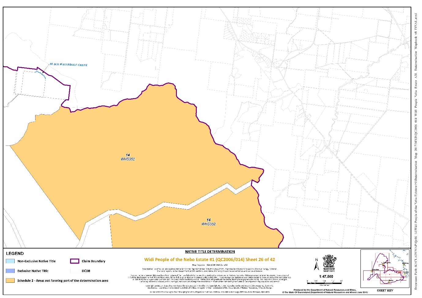
Lot 14 on Plan WHS352 | Sheets 26 and 31 |
That part of Lot 16 on Plan CP866443 that is within the external boundary described in Part 3 of Schedule 1 | Sheets 2, 18 and 19 |
Lot 16 on Plan WHS309 | Sheet 34 |
Lot 16 on Plan SP236270 | Sheet 20 |
Lot 17 on Plan SP236270 | Sheets 18, 19, 20, 21, 27 and 33 |
Lot 2 on Plan RP617629 | Sheet 39 |
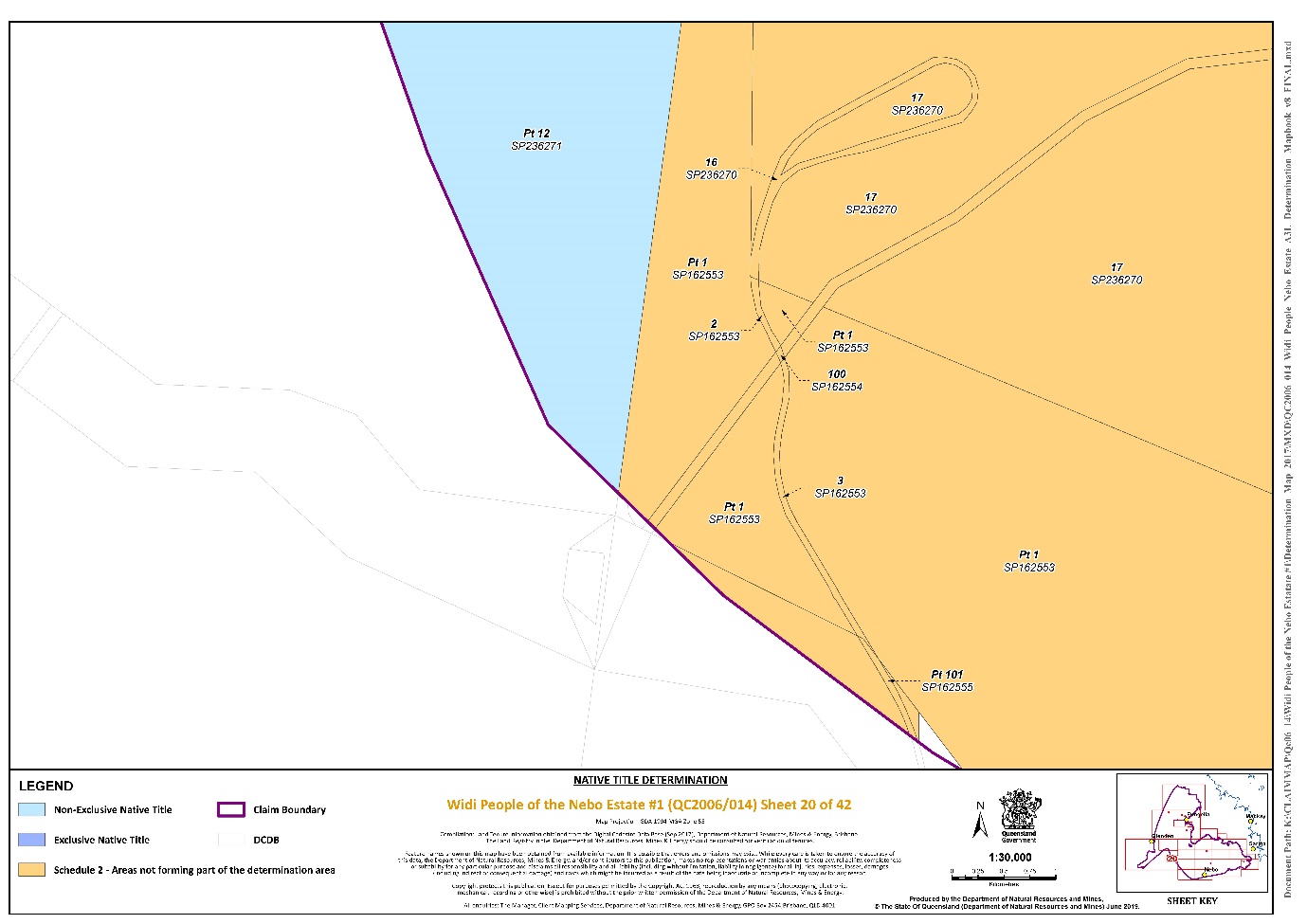
Lot 2 on Plan SP162553 | Sheet 20 |
Lot 204 on Plan N1101 | Sheet 37 |
Lot 207 on Plan N1101 | Sheet 37 |
Lot 24 on Plan WHS499 | Sheet 31 |
Lot 25 on Plan WHS513 | Sheets 30 and 31 |
That part of Lot 3 on Plan WHS25 that is within the external boundary described in Part 3 of Schedule 1 | Sheet 38 |
Lot 3 on Plan SP162553 | Sheet 20 |
That part of Lot 4 on Plan WHS25 that is within the external boundary described in Part 3 of Schedule 1 | Sheet 38 |
That part of Lot 4 on Plan WHS33 that is within the external boundary described in Part 3 of Schedule 1 | Sheets 36 and 38 |
Lot 5 on Plan WHS47 | Sheets 36 and 38 |
Lot 6 on Plan CI429 | Sheet 24 |
That part of Lot 6 on Plan W4015 that is within the external boundary described in Part 3 of Schedule 1 | Sheet 35 |
Lot 70 on Plan CI83 | Sheet 31 |
Lot 73 on Plan HLN193 | Sheet 12 |
Lot 78 on Plan HLN193 | Sheet 12 |
Lot 100 on Plan FTY1691 | Sheets 30 and 38 |
Lot 99 on Plan FTY1666 | Sheets 23, 24, 28 and 30 |
Lot 14 on Plan HLN223 | Sheet 19 |
Lot 20 on Plan WHS432 | Sheet 33 |
Lot 17 on Plan WHS325 | Sheet 33 |
Lot 7 on Plan W4035 | Sheets 33 and 34 |
Lot 9 on Plan W4022 | Sheets 33, 34, 35 and 36 |
That part of Lot 1 on Plan SP162553 that is within the external boundary described in Part 3 of Schedule 1 | Sheets 18, 20 and 33 |
Lot 2 on Plan WHS373 | Sheets 27, 33 and 35 |
Lot 17 on Plan WHS324 | Sheet 27 |
Lot 16 on Plan WHS432 | Sheets 27 and 33 |
Lot 27 on Plan WHS226 | Sheet 33 |
Lot 4 on Plan WHS313 | Sheet 33 |
Lot 5 on Plan WHS314 | Sheets 33 and 34 |
That part of Lot 3 on Plan W4013 that is within the external boundary described in Part 3 of Schedule 1 | Sheets 33 and 35 |
Lot 1 on Plan WHS11 | Sheet 35 |
Lot 4 on Plan HLN225 | Sheets 2, 19 and 21 |
Lot 3 on Plan HLN29 | Sheets 2, 15, 19 and 21 |
That part of Lot 7 on Plan WHS139 that is within the external boundary described in Part 3 of Schedule 1 | Sheet 35 |
Lot 7 on Plan W4016 | Sheets 35 and 36 |
Lot 8 on Plan W4016 | Sheets 35 and 36 |
Lot 10 on Plan W4031 | Sheet 36 |
Lot 92 on Plan W404 | Sheet 36 |
Lot 9 on Plan W406 | Sheet 36 |
Lot 8 on Plan WHS335 | Sheets 34 and 36 |
Lot 1 on Plan W4030 | Sheet 34 |
Lot 93 on Plan W405 | Sheet 36 |
That part of Lot 11 on Plan WHS1 that is within the external boundary described in Part 3 of Schedule 1 | Sheet 36 |
Lot 90 on Plan W403 | Sheet 36 |
Lot 13 on Plan WHS102 | Sheet 34 |
Lot 14 on Plan WHS102 | Sheet 34 |
Lot 91 on Plan W403 | Sheet 36 |
Lot 46 on Plan N1101 | Sheet 37 |
Lot 904 on Plan N1101 | Sheet 37 |
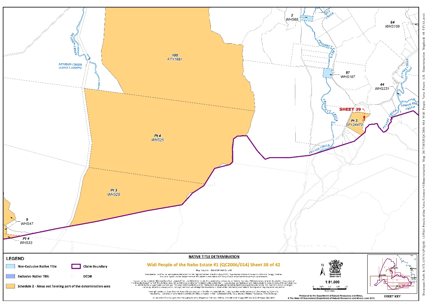
That part of Lot 3 on Plan SP134472 that is within the external boundary described in Part 3 of Schedule 1 | Sheets 38 and 39 |
3. The land or waters on which any public work, as defined in s 253 of the Native Title Act 1993 (Cth), is or was constructed, established or situated, and to which ss 23B(7) and 23C(2) of the Native Title Act 1993 (Cth) and to which s 21 of the Native Title (Queensland) Act 1993 (Qld), applies, together with any adjacent land or waters in accordance with s 251D of the Native Title Act 1993 (Cth), and includes, but is not limited to, the whole of the land and waters described as:
Area description (as at date of determination) | Determination map sheet number |
Lot 1 on Plan RA3574 | Sheet 37 |
Lot 4 on Plan SP235546 | Sheet 11 |
Lot 5 on Plan SP235546 | Sheet 11 |
Lot 6 on Plan SP235546 | Sheet 11 |
Lot 7 on Plan N11015 | Sheet 37 |
Lot 9 on Plan CP891281 | Sheet 9 |
Lot 100 on Plan SP162554 | Sheet 20 |
That part of Lot 101 on Plan SP162555 that is within the external boundary described in Part 3 of Schedule 1 | Sheet 20 |
That part of Suttor Development Road that is within the external boundary of MDL 353 (a mineral development licence granted under the Mineral Resources Act 1989 (Qld)) as at the date of this determination | Sheet 33 |
That part of Collinsville Elphinstone Road that is within that part of the area of ML 4738 (a mining lease administered under the Mineral Resources Act 1989 (Qld)) as at the date of this determination that is within the external boundary described in Part 3 of Schedule 1 | Sheet 18 |
That part of Hail Creek Road that is within that part of the area of ML 4738 (a mining lease administered under the Mineral Resources Act 1989 (Qld)) as at the date of this determination that is within the external boundary described in Part 3 of Schedule 1 | Sheets 20 and 27 |
That part of Suttor Development Road that is within that part of the area of ML 4738 (a mining lease administered under the Mineral Resources Act 1989 (Qld)) as at the date of this determination that is within the external boundary described in Part 3 of Schedule 1 | Sheet 33 |
That part of an unnamed road that is within that part of the area of ML 4738 (a mining lease administered under the Mineral Resources Act 1989 (Qld)) as at the date of this determination that is within the external boundary described in Part 3 of Schedule 1 | Sheet 18 |
That part of Suttor Development Road that is within the area of EPC 658 (an exploration permit for coal granted under the Mineral Resources Act 1989 (Qld)) as at the date of this determination | Sheet 33 |
That part of the unnamed roads that are within the area of EPC 658 (an exploration permit for coal granted under the Mineral Resources Act 1989 (Qld)) as at the date of this determination | Sheets 33 and 35 |
That part of Turrawulla Road that is within that part of the area of MDL 442 (a mineral development licence granted under the Mineral Resources Act 1989 (Qld)) as at the date of this determination that is within the external boundary described in Part 3 of Schedule 1 | Sheets 2, 15 and 19 |
That part of Suttor Development Road that is within that part of the area of MDL 442 (a mineral development licence granted under the Mineral Resources Act 1989 (Qld)) as at the date of this determination that is within the external boundary described in Part 3 of Schedule 1 | Sheet 20 |
That part of Hail Creek Road that is within that part of the area of MDL 442 (a mineral development licence granted under the Mineral Resources Act 1989 (Qld)) as at the date of this determination that is within the external boundary described in Part 3 of Schedule 1 | Sheet 20 |
That part of an unnamed road that is within that part of the area of MDL 442 (a mineral development licence granted under the Mineral Resources Act 1989 (Qld)) as at the date of this determination that is within the external boundary described in Part 3 of Schedule 1 | Sheet 19 |
That part of Turrawulla Road that is within that part of the area of EPC 752 (an exploration permit for coal granted under the Mineral Resources Act 1989 (Qld)) as at the date of this determination that is within the external boundary described in Part 3 of Schedule 1 | Sheets 2, 15 and 19 |
That part of Turrawulla Road that dissects Lot 2 on SP104779 and which is subject to Lot A on Plan AP3682 as at the date of this determination | Sheet 2 |
That part of an unnamed road that is within that part of the area of EPC 752 (an exploration permit for coal granted under the Mineral Resources Act 1989 (Qld)) as at the date of this determination that is within the external boundary described in Part 3 of Schedule 1 | Sheet 19 |
That part of Lot 109 on Plan HLN198 described by the following coordinates: | Sheet 9 |
AREA A
EASTING (m) | NORTHING (m) | EASTING (m) | NORTHING (m) | |
644126.728 | 7662119.635 | 644427.080 | 7662115.153 | |
644228.201 | 7662372.793 | 644422.694 | 7662090.430 | |
644382.117 | 7662326.433 | 644419.751 | 7662103.805 | |
644386.228 | 7662315.332 | 644415.200 | 7662116.327 | |
644391.162 | 7662303.820 | 644402.396 | 7662126.003 | |
644400.619 | 7662297.242 | 644381.227 | 7662134.113 | |
644413.775 | 7662292.719 | 644336.271 | 7662148.342 | |
644426.521 | 7662288.196 | 644286.763 | 7662161.149 | |
644435.566 | 7662284.085 | 644239.815 | 7662170.825 | |
644442.556 | 7662277.095 | 644217.673 | 7662172.993 | |
644446.667 | 7662267.639 | 644208.062 | 7662170.943 | |
644445.434 | 7662253.660 | 644199.988 | 7662166.969 | |
644441.734 | 7662223.235 | 644193.965 | 7662161.329 | |
644442.145 | 7662209.667 | 644189.480 | 7662156.972 | |
644444.200 | 7662193.221 | 644185.075 | 7662157.009 | |
644446.667 | 7662183.353 | 644183.945 | 7662157.810 | |
644451.190 | 7662168.963 | 644181.150 | 7662159.791 | |
644454.068 | 7662152.928 | 644145.260 | 7662109.152 | |
644451.230 | 7662130.333 | 644126.728 | 7662119.635 | |
644441.329 | 7662132.089 |
AREA B
EASTING (m) | NORTHING (m) | EASTING (m) | NORTHING (m) | |
642949.836 | 7661187.116 | 643322.336 | 7661081.444 | |
642956.697 | 7661157.723 | 643337.193 | 7661066.584 | |
642981.050 | 7661141.386 | 643349.986 | 7661055.439 | |
643012.403 | 7661135.104 | 643364.018 | 7661041.817 | |
643033.038 | 7661130.564 | 643375.160 | 7661024.481 | |
643054.498 | 7661125.610 | 643380.113 | 7661009.208 | |
643065.641 | 7661126.849 | 643380.855 | 7660994.761 | |
643075.958 | 7661133.453 | 643375.078 | 7660975.774 | |
643087.926 | 7661147.900 | 643367.237 | 7660951.833 | |
643097.005 | 7661153.266 | 643356.094 | 7660940.275 | |
643104.021 | 7661153.679 | 643337.523 | 7660932.020 | |
643123.005 | 7661149.138 | 643321.428 | 7660928.305 | |
643139.513 | 7661149.551 | 643305.333 | 7660928.718 | |
643151.893 | 7661153.266 | 643292.952 | 7660934.909 | |
643164.687 | 7661148.313 | 643280.984 | 7660933.671 | |
643179.544 | 7661136.755 | 643268.190 | 7660924.590 | |
643191.099 | 7661126.849 | 643253.333 | 7660913.445 | |
643200.591 | 7661123.546 | 643239.302 | 7660899.823 | |
643205.543 | 7661131.802 | 643224.032 | 7660894.870 | |
643205.131 | 7661142.534 | 643211.651 | 7660897.347 | |
643205.956 | 7661149.138 | 643207.524 | 7660894.457 | |
643217.099 | 7661153.679 | 643151.884 | 7660932.977 | |
643229.067 | 7661150.377 | 643167.126 | 7660987.391 | |
643267.447 | 7661128.500 | 642988.059 | 7661111.361 | |
643280.241 | 7661114.053 | 642963.562 | 7661128.321 | |
643294.685 | 7661101.257 | 642941.563 | 7661143.551 | |
643313.669 | 7661091.350 | 642949.836 | 7661187.116 |
SCHEDULE 3
NATIVE TITLE HOLDERS
The Widi People are the biological or adopted descendants of one or more of the following people:
(a) Jean White, mother of Albert Butterworth;
(b) Mr Clark (“of Suttor Station”) & Jinny (“of Stockton Station”), whose known children are Charlie Clark and Dick Clark;
(c) Jinny (“of Stockton Station”), whose known child (with Mr Watson) is Charlie Watson;
(d) Siblings Tommy Emmerson/Iffley and Arthur Emmerson;
(e) Roger (“of Nebo district”), whose known child is Emily Rogers;
(f) Neddy Thorney, whose known child is Sarah Mate Mate nee Thorney/Sauney;
(g) Sophie of Nebo whose known children include Jack Skeen, William Skeen, Norman Skeen, Elsie Skeen and Mary Skeen;
(h) Dick (“of Nebo”), whose known child is Sam Murray;
(i) Billy (“of Nebo”) & Molly (“of Oxford Downs Station”), whose known children are Jessie and Billy Sullivan;
(j) Harry Monsell Snr (“of Lake Elphinstone”) whose known children are Lily Sullivan, Flora Doyle and Harry Monsell Jnr;
(k) King (“of Fort Cooper”) & Meg (“of Fort Cooper”), whose known children are Johnny, Mick, Mitchell Dalton, Paddy, Emma and Annie;
(l) Ida (“from Nebo”), whose known child is Rene Hess;
(m) Maggie, whose known children are Norman Brown Snr, George “Duke” Barker and Ina Darwin.
SCHEDULE 4
OTHER INTERESTS IN THE DETERMINATION AREA
The nature and extent of the other interests in relation to the Determination Area are the following as they exist as at the date of the determination:
1. The rights and interests of the parties under the following agreements:
(a) Widi People and Exe Creek (Turrawulla) Pastoral Holding ILUA between the Applicant and Noel James Griffin Comerford and Errol Henry Comerford, which was authorised by the native title group on 14 December 2018, and that agreement once it becomes registered as a body corporate ILUA following execution of the agreement by the registered native title body corporate; and
(b) The Widi People/Cloverly ILUA between the Applicant and Judith Elizabeth Cook and Noel Michael Cook , which was authorised by the native title group on 14 December 2018, and that agreement once it becomes registered as a body corporate ILUA following execution of the agreement by the registered native title body corporate.
2. The rights and interests of the parties under the following registered agreements:
(a) The agreement between James Butterworth, Ronald Watson, Marilyn Duncan, Gregory Dunrobin, Kenneth Dodd, Graham Sauney, Oswald Skeen, Frank Tiers, Maurice Dallachy, Linda Wailu and Eileen Pegler on their own behalf and on behalf of the Wiri People and Arrow Energy Pty Ltd (ACN 078 521 936) QI2011/034 registered 14 December 2011;
(b) The agreement between Wiri RNTC (the Registered Native Title Claimant for the Wiri People Core Country Native Title Claim, which at the date of this agreement comprised James Butterworth, Ronald Watson, Marilyn Duncan, Gregory Dunrobin, Kenneth Dodd, Graham Sauney, Oswald Skeen, Frank Tiers, Maurice Dallachy, Linda Wailu and Eileen Pegler) and QGC Pty Ltd (ACN 089 642 553) QI2012/061 registered 21 September 2012; and
(c) The Widi People and Local Government ILUA QI2019/003 registered 4 July 2019.
3. The rights and interests of Telstra Corporation Limited (ACN 051 775 556):
(a) as the owner or operator of telecommunications facilities within the Determination Area;
(b) created pursuant to the Post and Telegraph Act 1901 (Cth), the Telecommunications Act 1975 (Cth), the Australian Telecommunications Corporation Act 1989 (Cth), the Telecommunications Act 1991 (Cth) and the Telecommunications Act 1997 (Cth), including rights:
(i) to inspect land;
(ii) to install, occupy and operate telecommunications facilities; and
(iii) to alter, remove, replace, maintain, repair and ensure the proper functioning of its telecommunications facilities;
(c) for its employees, agents or contractors to access its telecommunications facilities in and in the vicinity of the Determination Area in performance of their duties; and
(d) under any lease, licence, permit, access agreement or easement relating to its telecommunications facilities in the Determination Area.
4. The rights and interests of Ergon Energy Corporation (ACN 087 646 062):
(a) as the owner and operator of any Works within the Determination Area;
(b) as a distribution entity and the holder of a distribution authority under the Electricity Act 1994 (Qld);
(c) created under the Electricity Act 1994 (Qld) and the Government Owned Corporations Act 1993 (Qld) including:
(i) rights in relation to any agreement relating to the Determination Area existing or entered into before the date on which these orders are made;
(ii) rights to enter the Determination Area by its employees, agents or contractors to exercise any of the rights and interests referred to in this paragraph; and
(iii) to inspect, maintain and manage any works in the Determination Area.
5. The rights and interests of Aurizon Network Pty Ltd (ACN 132 181 116):
(a) in relation to rail transport infrastructure under the Transport Infrastructure Act 1994 (Qld); and
(b) under any lease, licence, easement, permit or agreement within the Determination Area.
6. The rights and interests of the holder of the following easements:
(a) Lot T on Crown Plan 866136;
(b) Lot P on Crown Plan 866134;
(c) Lot Q on Crown Plan 866134;
(d) Lot R on Crown Plan 866134;
(e) Lot S on Crown Plan 866135;
(f) Lot U on Crown Plan 866136; and
(g) Lot A on Crown Plan 866130.
7. The rights and interests of:
(a) Peabody West Burton Pty Ltd (ACN 117 316 695) as the holder of an interest in EPC 682, EPC 708, EPC 836 and MDL 3010 granted pursuant to the Mineral Resources Act 1989 (Qld); and
(b) Peabody Energy Australia PCI Rush Pty Ltd (ACN 128 817 461) as the holder of an interest in EPC 1607 granted pursuant to the Mineral Resources Act 1989 (Qld).
8. The rights and interests of the holder of mining lease ML 4738 granted under the Mining Act 1968-1975 (Qld) and administered under the Mineral Resources Act 1989 (Qld) which, at the date of this determination, is comprised of some or all of Queensland Coal Pty Limited (ACN 000 003 921), Hail Creek Coal Holdings Pty Limited (ACN 625 050 722), Nippon Steel Australia Pty Limited (ACN 001 445 049), Marubeni Coal Pty Ltd (ACN 009 932 236) and Sumisho Coal Development Queensland Pty Ltd (ACN 082 435 149).
9. The rights and interests of the registered lessees of Lot 13 Crown Plan WHS466 as the grantees of the easement registered in the Queensland Land Registry under the Land Title Act 1994 (Qld) and the Land Act 1994 (Qld) and allocated number 704622393 and burdening Lot 2 SP104779, and who at the date of this determination are some or all of Queensland Coal Pty Limited (ACN 000 003 921), Hail Creek Coal Holdings Pty Limited (ACN 625 050 722), Nippon Steel Australia Pty Limited (ACN 001 445 049), Marubeni Coal Pty Ltd (ACN 009 932 236) and Sumisho Coal Development Queensland Pty Ltd (ACN 082 435 149).
10. The rights of Queensland Coal Pty Limited (ACN 000 003 921), Hail Creek Coal Holdings Pty Limited (ACN 625 050 722), Nippon Steel Australia Pty Limited (ACN 001 445 049), Marubeni Coal Pty Ltd (ACN 009 932 236) and Sumisho Coal Development Queensland Pty Ltd (ACN 082 435 149) as holders of mining lease ML 4738 to use the area of Lot 2 SP104779 for access, including for water supply.
11. The rights and interests of Queensland Coal Pty Limited (ACN 000 003 921), Nippon Steel Australia Pty Limited (ACN 001 445 049) (previously named Nippon Steel & Sumitomo Metal Australia Pty Ltd), Sumisho Coal Development Queensland Pty Ltd (ACN 082 435 149) and Marubeni Coal Pty Ltd (ACN 009 932 236) as registered permittees under Permit to Occupy 0/236990 Title reference 40067002 registered over Lot 15 on Crown Plan WHS188.
12. The rights and interests of the Isaac Regional Council and Mackay Regional Council to access, use, operate, maintain and control the dedicated roads in the Determination Area and the rights and interests of the public to use and access the roads.
13. The rights and interests of Isaac Regional Council and Mackay Regional Council:
(a) under their local government jurisdiction and functions under the Local Government Act, under the Stock Route Management Act 2002 (Qld) and under any other legislation, for that part of the Determination Area within the area declared to be their respective local government areas;
(b) as the:
(i) lessor under any leases which were validly entered into before the date on which these orders are made and whether separately particularised in these orders or not;
(ii) grantor of any licences or other rights and interests which were validly granted before the date on which these orders were made and whether separately particularised in these orders or not;
(iii) holder of any estate or interest in land, as trustee of any reserves, that exist in the Determination Area;
(c) as the owner and operator of infrastructure, and those facilities and other improvements located in the Determination Area validly constructed or established on or before the date on which these orders are made, including but not limited to:
(i) undedicated but constructed roads except for those not operated by Council;
(ii) water pipelines and water supply infrastructure;
(iii) drainage facilities;
(iv) watering point facilities; and
(v) recreational facilities.
(d) to enter the land for the purposes described in paragraphs 13(a), 13(b) and 13(c) by their employees, agents or contractors to:
(i) exercise any of the rights and interests referred to in paragraphs 12 and 13;
(ii) inspect, maintain and repair the infrastructure, facilities and other improvements referred to in paragraph (c) above;
(iii) undertake operational activities in its capacity as a local government such as feral animal control, weed control, erosion control, waste management and fire management.
14. The rights and interests of Airservices Australia:
(a) as the holder of special lease for communication SL/0/200552 over Lot 7 on Crown Plan HLN836085, granted pursuant to the Land Act 1962 (Qld); and
(b) in a licence from the registered lessee over Lot 110 on HLN836087.
15. The rights and interests of Sally Borg as the holder of Registered Lease Reference No. 711137291 granted under the Land Act 1994 over Lot 2 on CP WHS66, Title Reference 49004959.
16. The rights and interest of Andrew Thomas Deguara under Permit to Occupy Reference No 239982 over Lot 8 on CI66, Title Reference 40074095.
17. The rights and interest of Queensland Electricity Transmission Corporation Limited trading as Powerlink Queensland (ACN 078 849 233):
(a) as the owner and operator of any Works within the Determination Area;
(b) as an electricity entity under the Electricity Act 1994 (Qld) including rights to enter and pass through the Determination Area to access, use, maintain, repair, replace, upgrade or otherwise deal with Works; and;
(c) under any lease, licence, easement, permit or agreement within the Determination Area.
18. The rights and interests of SunWater Limited (ACN 131 034 985) (SunWater) and Eungella Water Pipeline Pty Ltd (ACN 070 999 236) (Eungella Water Pipeline):
(a) SunWater in Lot 109 on HLN198 (as trustee of recreation reserve 20885) (ACN 131 034 985);
(b) Eungella Water Pipeline in:
(i) Lot 109 on HLN198 (Easement in Gross 703378532);
(ii) Lot 110 on HLN836087 (Easement in Gross 703225954);
(iii) Lot 100 on SP239828 (Easement in Gross 703226255 and Easement in Gross 703226261);
(iv) Lot 2 on SP104779 (Easement in Gross 703570522 and Easement in Gross 703570535);
(v) Lot 4 on HLN225 (Easement in Gross 703319046);
(vi) Lot 16 on CP866443 (Easement in Gross 703324406);
(vii) Eungella Water Pipeline and associated infrastructure.
19. The rights and interests of the State of Queensland or any other person existing by reason of the force and operation of the laws of the State of Queensland, including those existing by reason of the following legislation or any regulation, statutory instrument, declaration, plan, authority, permit, lease or licence made, granted, issued or entered into under that legislation:
(a) the Land Act 1994 (Qld);
(b) the Nature Conservation Act 1992 (Qld);
(c) the Forestry Act 1959 (Qld);
(d) the Water Act 2000 (Qld);
(e) the Petroleum Act 1923 (Qld) or Petroleum and Gas Act 2004 (Qld);
(f) the Mineral Resources Act 1989 (Qld); and
(g) the Fisheries Act 1994 (Qld).
20. The rights and interests of members of the public arising under the common law, including but not limited to any subsisting public right to fish.
21. So far as confirmed pursuant to s 212(2) of the Native Title Act 1993 (Cth) and s18 of the Native Title Act (Queensland) Act 1993 (Qld) as at the date of this determination, any existing public access to, and enjoyment of, the following places in the Determination Area:
(a) waterways;
(b) beds and banks or foreshores of waterways;
(c) stock routes; and
(d) areas that were public places at the end of 31 December 1993.
22. Any other rights and interests:
(a) held by the State of Queensland or Commonwealth of Australia; or
(b) existing by reason of the force and operation of the Laws of the State and the Commonwealth.
Note: Entry of orders is dealt with in Rule 39.32 of the Federal Court Rules 2011.
RANGIAH J:
1 The applicant seeks a determination of native title pursuant to ss 61 and 225 of the Native Title Act 1993 (Cth) (the Act) on behalf of the Widi People of the Nebo Estate #1 (the Widi People).
2 The claim area is in Central Queensland and encompasses the town of Nebo, which is about 100 km to the south-west of Mackay.
3 The parties have indicated their consent to a determination that the Widi People are the holders of native title in the area covered by the application.
The Native Title Act
4 The Act was enacted for the purpose of protecting and recognising native title, to establish ways in which future dealings in relation to native title should proceed, to set standards for those dealings and to establish a mechanism for determining native title claims.
5 An objective of the Act is the resolution of claims for the recognition of native title by agreement. That objective has been facilitated by amendments to s 87 of the Act brought about by the Native Title Amendment Act 2009 (Cth). The agreement of the parties to the terms of the proposed orders is consistent with the objects of the Act.
6 In its preamble, the Act recognises, on behalf of all people of Australia, that the Aboriginal peoples of Australia inhabited the country for many years prior to European settlement and that the Aboriginal peoples were progressively dispossessed of their lands. It records that the Constitution was amended, by the overwhelming vote of the people of Australia, to enable laws such as the Act to be passed and to facilitate recognition by our shared legal system of native title rights and interests.
7 The Court is asked to make a determination that native title is held by the Widi People in the claim area. By making that determination, the Australian community will collectively recognise that status. But, it is important to emphasise that the Court’s orders do not grant native title. The Court is merely recognising rights and interests that have existed under the traditional laws and customs of the Widi People since well before European settlement.
8 Section 61 of the Act provides that a native title determination application may be made by persons authorised by all the persons who, according to their traditional laws and customs, hold the common or group rights and interests comprising the particular native title claimed.
9 Section 223(1) of the Act explains the meaning of “native title”:
(1) The expression native title or native title rights and interests means the communal, group or individual rights and interests of Aboriginal peoples or Torres Strait Islanders in relation to land or waters, where:
(a) the rights and interests are possessed under the traditional laws acknowledged, and the traditional customs observed, by the Aboriginal peoples or Torres Strait Islanders; and
(b) the Aboriginal peoples or Torres Strait Islanders, by those laws and customs, have a connection with the land or waters; and
(c) the rights and interests are recognised by the common law of Australia.
10 Section 225 of the Act describes what is meant by a “determination of native title”:
225 Determination of native title
A determination of native title is a determination whether or not native title exists in relation to a particular area (the determination area) of land or waters and, if it does exist, a determination of:
(a) who the persons, or each group of persons, holding the common or group rights comprising the native title are; and
(b) the nature and extent of the native title rights and interests in relation to the determination area; and
(c) the nature and extent of any other interests in relation to the determination area; and
(d) the relationship between the rights and interests in paragraphs (b) and (c) (taking into account the effect of this Act); and
(e) to the extent that the land or waters in the determination area are not covered by a non-exclusive agricultural lease or a non-exclusive pastoral lease—whether the native title rights and interests confer possession, occupation, use and enjoyment of that land or waters on the native title holders to the exclusion of all others.
The application
11 The application was filed on 29 September 2006. A further amended application was filed on 17 July 2019. It seeks a determination of native title on behalf of the Widi People over land and waters within the external boundaries of the application area.
12 The respondents to the application are the State of Queensland, Isaac Regional Council, Mackay Regional Council, Ergon Energy Corporation Ltd, Telstra Corporation Ltd, Aurizon Network Ltd, Marubeni Coal Pty Ltd, Nippon Steel & Sumitomo Metal Australia Pty Ltd, Queensland Coal Pty Ltd, Sumisho Coal Development Queensland Pty Ltd, Hail Creek Coal Holdings Pty Ltd, Peabody West Burton Pty Ltd, Errol Henry Comerford and Noel James Griffin Comerford, Judith Elizabeth Cook, Noel Michael Cook, Kelli Maree Durie, Casey Ann McFadzen, Trent Bryson William McFadzen, Brian James Moohin, Catherine Delma Moohin, Alexander Barnard Gibson Turner, David W Wright, Andrew Thomas Deguara and Sally Borg and Sunwater.
13 All parties to the application have reached agreement that native title exists and as to the nature and extent of those native title rights and interests in relation to the claimed area. That agreement, made under s 87(2) of the Act, was filed on 25 July 2019.
14 The evidence of connection filed in the Court by the applicant is as follows:
(1) Daniel Leo, (2015) Native Title Expert Report About The Widi People of the Nebo Estate, Birri Gubba Regional Society, Central Queensland.
(2) Affidavit of Kenneth Stewaurt Peters Dodd sworn 10 February 2009.
(3) Statement of Ronald Charles Dallachy signed 11October 2013.
(4) Statement of Linda Wailu signed 12 October 2013.
(5) Statement of Graham Sauney signed 12 October 2012.
(6) Statement of James Henry Butterworth signed 28 May 2013.
(7) Statement of Paul Royce Butterworth signed 28 May 2013.
(8) Statement of Eileen Beryl Pegler signed 30 May 2013.
(9) Statement of Noreen Martin signed 30 May 2013.
(10) Statement of Marilyn Duncan signed 1 June 2013.
(11) Statement of James Sauney signed 7 August 2013.
(12) Statement of Late Barbara Sauney signed 7 August 2013.
(13) Statement of Celeste Walsh signed 22 August 2013.
(14) Statement of Lorraine McLennan signed 21 August 2013.
(15) Statement of Charles Watson signed 27 August 2013.
(16) Statement of Christine Enid Skeen signed 2 May 2013.
15 Mr Leo, an anthropologist, describes the Widi People as part of a wider regional society of Aboriginal people known as the Birri Gubba People. There are three language-defined subregions of the Birri Gubba region, including the southern, Wiri sub-region. The Wiri People comprise a member of land-owning groupings. Amongst them is the Widi, a land-owning grouping for the Nebo District.
16 Mr Leo concludes:
It is my opinion that the information about the existence, distribution and nature of named Aboriginal groupings within the Birri Gubba Region provided by an array of sources over the first 50 years of European settlement (1861 to 1910) demonstrate that:
a. the entire Region was occupied by Aboriginal populations;
b. these populations were formed into distinct, named groupings;
c. these named groupings occupied and owned defined tracts of country, that is, they were localised, land-owning groupings associated with a touri—with an estate—and thus they were the Traditional Native Title Holding Group;
d. spatially, the land-owning groupings of the inland domain tended to be more or less evenly distributed along major watercourses, with their estates straddling waterways (hence occupying sections of a catchment and with many boundaries on watersheds);
e. spatially, the land-owning groupings of the coastal domain occupied sections of the coast and adjacent hinterland, with major waterways tending to be boundaries;
f. a land-owning grouping was named after a notable plant or animal associated with their estate, or after a prominent geographic characteristic of that territory, or after historical events associated with that country or people;
g. the -bura suffix (or alternate spellings thereof) is used to denote the names of such land-owning groupings;
h. the Bura Groupings of the Region were interrelated by commonalities of language and socio-cultural practices (such as intermarriage) and as such were part of a wider Regional System; and,
i. through conquest or extinction, one Bura Grouping replaced another as the occupiers and owners of an estate.
(Footnote omitted.)
17 Mr Leo concludes that the Toolgimburra and the Mungullaburra Bura Groupings occupied and owned estates in the claim area.
18 Mr Leo goes onto say:
It is my view that the historical and contemporary information … about the Pre-Sovereignty Society demonstrate that Widi Territory is located within an area that was part of a Regional System of localised, land-owning groupings. This Regional System —a Cultural Bloc—regulates intergroup activity and interaction. It is underpinned by certain commonalities, or more precisely, by consistent and harmonised Systems of Recruitment to Land-owning Groupings and of Land Tenure, which are the two sets of Laws & Customs relating to land and waters. There are also commonalities arising from a System of Religious Beliefs, which is, in part, a Law & Custom relating to land insofar as it is the basis for a spiritual connection to country.
19 The Widi People are described as the biological or adopted descendants of 15 named apical ancestors. Mr Leo describes ten current family lineages from those apical ancestors.
20 Mr Leo’s report and the affidavits filed provide cogent evidence demonstrating that the Widi People have maintained a set of traditional laws and customs handed down from their ancestors. The material demonstrates that the Widi People continue to exercise and enjoy their native title rights and interests on a regular basis within the claim area. The Widi People acknowledge, not only a genealogical connection between themselves and their forebears, but also cultural connection based upon their laws and customs. The evidence supports the claim that that traditional laws acknowledged and the customs observed by the Widi People give them the right to possess, occupy and use and enjoy the land and waters in the claim area.
The agreement reached between the parties
21 Section 87 of the Act gives the Court the power to make an order consistent with the terms of an agreement between the parties to the proceeding without holding a hearing in relation to the application.
22 The conditions under s 87 of the Act that enable the Court to make the determination without a hearing are:
(1) The period specified in the notice given under s 66 of the Act in relation to the application has ended and there is an agreement between all the parties on the terms of a proposed order of the Court in relation to the proceedings: s 87(1)(a).
(2) The terms of the proposed determination agreement are in writing and are signed by or on behalf of the parties and filed with the Court: s 87(1)(b).
(3) The Court is satisfied that an order in, or consistent with, those terms would be within its power: s 87(1)(c).
(4) The Court considers it appropriate to make the orders sought: s 87(1A) and (2).
23 The Act encourages parties to take responsibility for resolving the proceedings without the need for the Court to intervene by way of a hearing. Therefore, when the Court is examining whether it is “appropriate” to make the orders sought, the focus is upon the making of the agreement between the parties. In Lovett on behalf of the Gunditjmara People v State of Victoria [2007] FCA 474, North J said at [36]–[37]:
The Act is designed to encourage parties to take responsibility for resolving proceedings without the need for litigation. Section 87 must be construed in this context. The power must be exercised flexibly and with regard to the purpose for which the section is designed.
In this context, when the Court is examining the appropriateness of an agreement, it is not required to examine whether the agreement is grounded on a factual basis which would satisfy the Court at a hearing of the application. The primary consideration of the Court is to determine whether there is an agreement and whether it was freely entered into on an informed basis. Insofar as this latter consideration applies to a State party, it will require the Court to be satisfied that the State party has taken steps to satisfy itself that there is a credible basis for an application.
(Citations omitted.)
24 It is not the role of the Court to enquire as to the merits of the claim. The Court must be satisfied that the orders sought are supported and in accordance with the law: Cox on behalf of the Yungngora People v State of Western Australia [2007] FCA 588 at [3] per French J. The Court is to consider evidence only for the purpose of determining whether the State is acting in good faith and has made a rational decision: Munn (for and on behalf of the Gunggari People) v State of Queensland (2001) 115 FCR 109 at [29]–[30] per Emmett J. In Wik and Wik Way Native Tile Claim Group v State of Queensland (2009) 258 ALR 306; [2009] FCA 789 at [16] and Kowanyama People v State of Queensland [2009] FCA 1192 at [22], Greenwood J held that, while it is not necessary for the Court to consider the body of material that would be available to it in the course of a contested hearing, it ought to have regard to sufficient material which is capable of demonstrating that the agreement and the proposed orders are “rooted in reality”.
25 State and Territory governments are responsible for ensuring that community interests are protected by getting involved in a process that assesses the underlying evidence as to the existence of native title. In this case, the State is satisfied that the claim group is an appropriate one to be recognised as holders of native title rights and interests, that it is appropriate to recognise the rights and interests proposed and that it is appropriate for the State to enter into the determination.
26 The requirements of s 87 of the Act have been satisfied:
(1) The period for notification of the Application under s 66 of the Act has ended: s 87(1)(a).
(2) The parties have reached an agreement as to the terms of a determination of native title: s 87(1)(a)(i).
(3) The parties have recorded their agreement in a Minute of Consent: s 87(1)(b).
(4) An order in terms of the Minute, or consistent with the Minute, would be within the Court’s power because:
(a) the application has been made in accordance with s 61 of the Act;
(b) the application is for a determination of native title in relation to an area for which there was no approved determination of native title: s 13(1)(a);
(c) the Minute agreed to by the parties complies with ss 94A and 225 of the Act: s 87(1)(c).
27 In addition, it is appropriate for the Court to make the orders sought because:
(1) The active parties have freely entered into the agreement.
(2) The parties have agreed as to the nature and extent of rights and interests, and the proposed determination is unambiguous and certain as to the rights and interests declared.
(3) There are no proceedings before the Court relating to native title determination applications that cover any part of the area that is the subject of this application that would otherwise require orders under s 67(1) of the Act.
(4) The State has played an active role in the negotiation of the determination and, in doing so, has taken an interest in the proceeding on behalf of the community and given appropriate consideration to the connection material.
28 The terms of the proposed determination also satisfy the requirements of s 225 of the Act.
Prescribed Body Corporate
29 Section 56(1) of the Act requires that the Court must determine whether the native title is to be held on trust, and if so, by who.
30 The applicant submits that the Court should determine, in accordance with the agreement between the parties, that the native title is not to be held on trust and that the Widi Aboriginal Corporation (ICN 8911) be the prescribed body corporate for the purpose of s 57(2) of the Act and perform the functions mentioned in s 57(3) of the Act. The applicant relies upon the affidavit of their solicitor, David Glen Saylor, in support of that submission.
31 The applicant has filed a form nominating the Widi Aboriginal Corporation for the purpose of performing the functions mentioned in s 57(3). The nomination has been made by Paul Butterworth, who is a member of the applicant and is authorised to make the nomination. The consent of the Widi Aboriginal Corporation has also been filed. I am satisfied that the Widi Aboriginal Corporation is a prescribed body corporate within reg 4 of the Native Title (Prescribed Bodies Corporate) Regulations 1999 (Cth). Accordingly, I am satisfied that s 57(2)(a) of the Act has been complied with.
32 It is appropriate to determine that the native title is not to be held on trust and that the Widi Aboriginal Corporation (ICN 8911) be the prescribed body corporate for the purpose of s 57(2) of the Act and perform the functions mentioned in s 57(3) of the Act.
I certify that the preceding thirty-two (32) numbered paragraphs are a true copy of the Reasons for Judgment herein of the Honourable Justice Rangiah. |
QUD 372 of 2006 | |
TELSTRA CORPORATION LIMITED (ACN 051 775 556) | |
Fifth Respondent: | ERGON ENERGY CORPORATION LIMITED |
Sixth Respondent: | AURIZON NETWORK PTY LTD (ACN 132 181 116) |
Seventh Respondent: | MARUBENI COAL PTY LTD (ACN 009 932 236) |
Eighth Respondent: | NIPPON STEEL AUSTRALIA PTY LIMITED (ACN 001 445 049) |
Ninth Respondent: | QUEENSLAND COAL PTY LIMITED ACN 000 003 921) |
Tenth Respondent: | SUMISHO COAL DEVELOPMENT QUEENSLAND PTY LTD (ACN 082 435 149) |
Eleventh Respondent: | PEABODY WEST BURTON PTY LTD |
Twelfth Respondent: | ERROL HENRY COMERFORD |
Thirteenth Respondent: | NOEL JAMES GRIFFIN COMERFORD |
Fourteenth Respondent: | JUDITH ELIZABETH COOK |
Fifteenth Respondent: | NOEL MICHAEL COOK |
Sixteenth Respondent: | KELLIE MAREE DURIE |
Seventeenth Respondent: | CASEY ANN MCFADZEN |
Eighteenth Respondent: | TRENT BRYSON WILLIAM MCFADZEN |
Nineteenth Respondent: | BRIAN JAMES MOOHIN |
Twentieth Respondent: | CATHERINE DELMA MOOHIN |
Twenty-First Respondent: | ALEXANDER BARNARD GIBSON TURNER |
Twenty-Second Respondent: | DAVID W WRIGHT |
Twenty-Third Respondent: | ANDREW THOMAS DEGUARA |
Twenty-Fourth Respondent: | SALLY BORG |
Twenty-Fifth Respondent: | SUNWATER |
Twenty-Sixth Respondent: | HAIL CREEK COAL HOLDINGS PTY LIMITED (ACN 625 050 722) |

