
FEDERAL COURT OF AUSTRALIA
Miller on behalf of the Birriah People v State of Queensland [2016] FCA 271
Table of Corrections | |
5 April 2016 | In paragraph 1(a) of Schedule 4 – Other Interests in the Determination Area, “24 and 25 February 2016” has been inserted after “the State of Queensland on”. |
5 April 2016 | In paragraph 1(b) of Schedule 4 – Other Interests in the Determination Area, “24 February 2016” has been inserted after “the State of Queensland on”. |
ORDERS
DATE OF ORDER: |
BEING SATISFIED that an order in the terms set out below is within the power of the Court, and it appearing appropriate to the Court to do so, pursuant to s 87A of the Native Title Act 1993 (Cth)
BY CONSENT THE COURT ORDERS THAT:
1. There be a determination of native title in the terms set out below (the “determination”).
2. The exercise of the native title rights and interests referred to in paragraph 8 of the determination in relation to Lot 3 on Plan SP149509 be suspended for a period of nine months from the date of the determination or until the indigenous land use agreement referred to in paragraph 1(b) of Schedule 4 is registered (whichever occurs first).
3. The exercise of the native title rights and interests referred to in paragraph 9 of the determination in relation to Lot 20 on Plan G112828 be suspended for a period of nine months from the date of the determination or until the indigenous land use agreement referred to in paragraph 1(b) of Schedule 4 is registered (whichever occurs first).
4. Each party to the proceedings is to bear its own costs.
BY CONSENT THE COURT DETERMINES THAT:
5. The Determination Area is the land and waters described in Schedule 1, and depicted in the map attached to Schedule 1. To the extent of any inconsistency between the written description and the map, the written description prevails.
6. Native title exists in relation to that part of the Determination Area described in Part 1 and Part 2 of Schedule 1.
7. The native title is held by the Birriah People described in Schedule 3 (the “native title holders”).
8. Subject to paragraphs 10, 11 and 12 below the nature and extent of the native title rights and interests in relation to the land and waters described in Part 1 of Schedule 1 are:
(a) other than in relation to Water, the right to possession, occupation, use and enjoyment of the area to the exclusion of all others; and
(b) in relation to Water, the non-exclusive rights to:
(i) hunt, fish and gather from the Water of the area;
(ii) take and use the Natural Resources of the Water in the area; and
(iii) take and use the Water of the area,
for personal, domestic and non-commercial communal purposes.
9. Subject to paragraphs 10, 11 and 12 below the nature and extent of the native title rights and interests in relation to the land and waters described in Part 2 of Schedule 1 are the non-exclusive rights to:
(a) access, be present on, move about on and travel over the area;
(b) camp, and for that purpose build temporary shelters;
(c) hunt, fish and gather on the land and waters of the area for personal, domestic and non-commercial communal purposes;
(d) take, use, share and exchange Natural Resources from the land and waters of the area for personal, domestic and non-commercial communal purposes;
(e) take and use the Water of the area for personal, domestic and non-commercial communal purposes;
(f) conduct ceremonies on the area;
(g) be buried and bury native title holders within the area;
(h) maintain places of importance and areas of significance to the native title holders under their traditional laws and customs and protect those places and areas from physical harm;
(i) teach on the area the physical and spiritual attributes of the area;
(j) hold meetings on the area; and
(k) light fires on the area for domestic purposes including cooking, but not for the purpose of hunting or clearing vegetation.
10. The native title rights and interests are subject to and exercisable in accordance with:
(a) the Laws of the State and the Commonwealth;
(b) the traditional laws acknowledged and traditional customs observed by the native title holders; and
(c) the terms and conditions of the agreements referred to in paragraph 1 of Schedule 4.
11. The native title rights and interests referred to in paragraphs 8(b) and 9 do not confer possession, occupation, use or enjoyment to the exclusion of all others.
12. There are no native title rights in or in relation to minerals as defined by the Mineral Resources Act 1989 (Qld) and petroleum as defined by the Petroleum Act 1923 (Qld) and the Petroleum and Gas (Production and Safety) Act 2004 (Qld).
13. The nature and extent of any other interests in relation to the Determination Area (or respective parts thereof) are set out in Schedule 4.
14. The relationship between the native title rights and interests described in paragraphs 8 and 9 and the other interests described in Schedule 4 (the "other interests") is that:
(a) the other interests continue to have effect, and the rights conferred by or held under the other interests may be exercised notwithstanding the existence of the native title rights and interests;
(b) to the extent the other interests are inconsistent with the continued existence, enjoyment or exercise of the native title rights and interests in relation to the land and waters of the Determination Area, the native title continues to exist in its entirety but the native title rights and interests have no effect in relation to the other interests to the extent of the inconsistency for so long as the other interests exist;
(c) the other interests and any activity that is required or permitted by or under, and done in accordance with, the other interests, or any activity that is associated with or incidental to such an activity, prevail over the native title rights and interests and any exercise of the native title rights and interests; and
(d) in relation to pastoral leases wholly or partly within the Determination Area, and without limiting the operation of paragraphs 14(a) to 14(c) above, as set out in Schedule 5.
DEFINITIONS AND INTERPETATION
15. In this determination, unless the contrary intention appears:
“land” and “waters”, respectively, have the same meanings as in the Native Title Act 1993 (Cth);
“Laws of the State and the Commonwealth” means the common law and the laws of the State of Queensland and the Commonwealth of Australia, and includes legislation, regulations, statutory instruments, local planning instruments and local laws;
“Natural Resources” means:
(a) any animal, plant, fish and bird life found on or in the lands and waters of the Determination Area; and
(b) any clays, soil, sand, gravel or rock found on or below the surface of the Determination Area,
that have traditionally been taken and used by the native title holders, but does not include:
(a) animals that are the private personal property of another;
(b) crops that are the private personal property of another; and
(c) minerals as defined in the Mineral Resources Act 1989 (Qld) or petroleum as defined in the Petroleum Act 1923 (Qld) and the Petroleum and Gas (Production and Safety) Act 2004 (Qld);
“Water” means:
(a) water which flows, whether permanently or intermittently, within a river, creek or stream;
(b) any natural collection of water, whether permanent or intermittent; and
(c) water from an underground water source.
Other words and expressions used in this determination have the same meanings as they have in Part 15 of the Native Title Act 1993 (Cth).
THE COURT DETERMINES THAT:
16. The native title is held in trust.
17. The Birriah Aboriginal Corporation ICN 8261, incorporated under the Corporations (Aboriginal and Torres Strait Islander) Act 2006 (Cth), is to:
(a) be the prescribed body corporate for the purpose of ss 56(2)(b) and 56(3) of the Native Title Act 1993 (Cth); and
(b) perform the functions mentioned in s 57(1) of the Native Title Act 1993 (Cth) after becoming a registered native title body corporate.
LIST OF SCHEDULES
Schedule 1 — DETERMINATION AREA ix
Schedule 2 — AREAS NOT FORMING PART OF THE DETERMINATION AREA cxvii
Schedule 3 — NATIVE TITLE HOLDERS cxxiv
Schedule 4 — OTHER INTERESTS IN THE DETERMINATION AREA cxxv
Schedule 5 – EXERCISE OF NATIVE TITLE RIGHTS AND INTERESTS ON PASTORAL LEASES cxxxiv
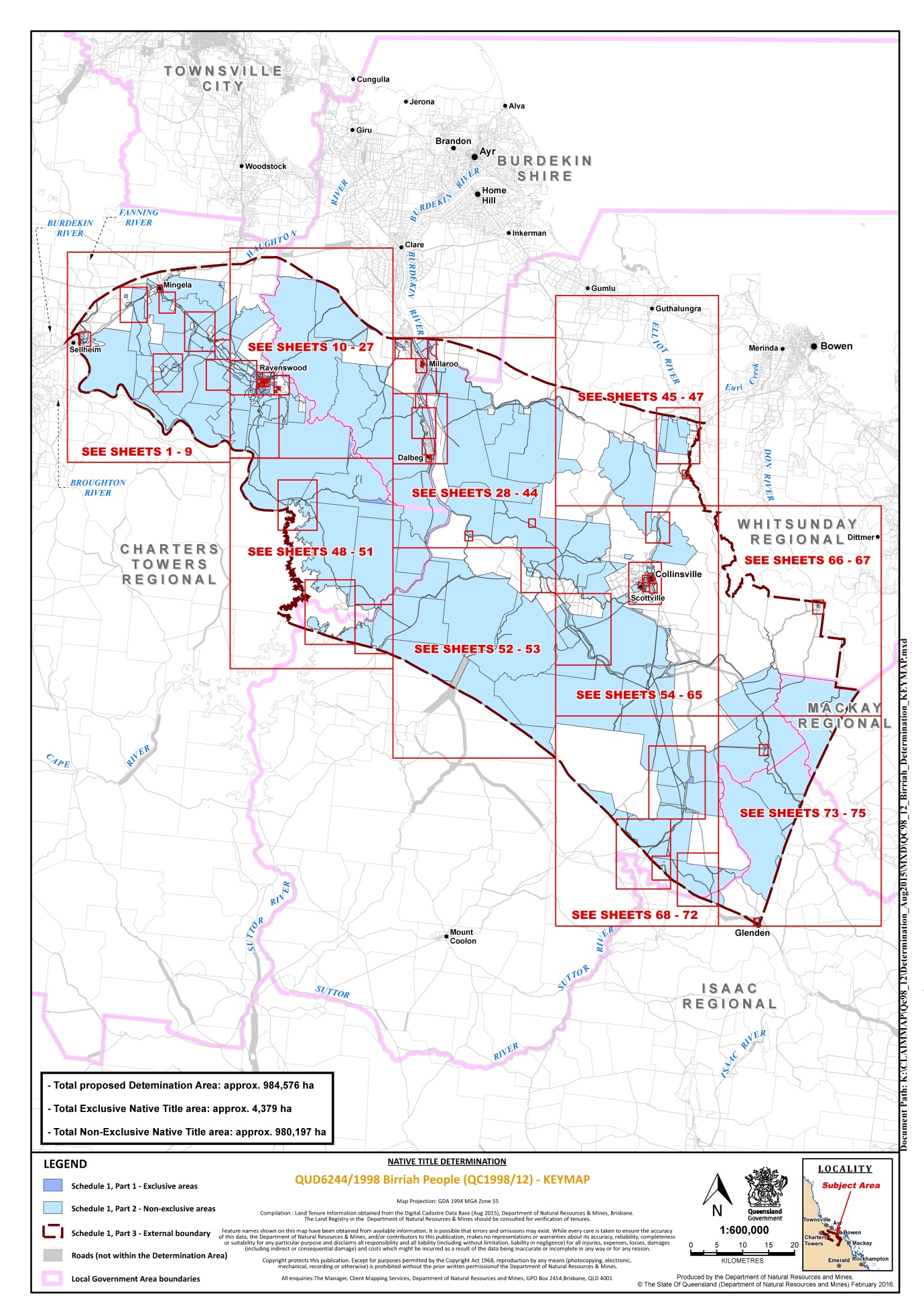
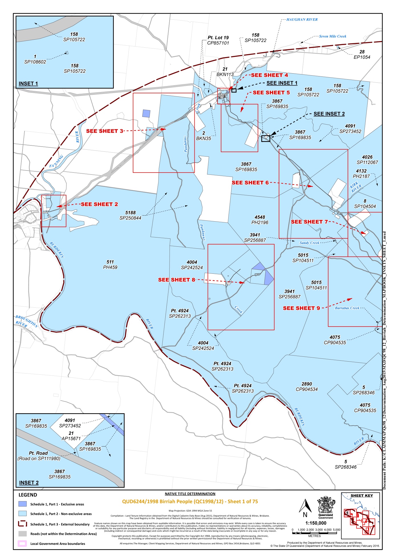
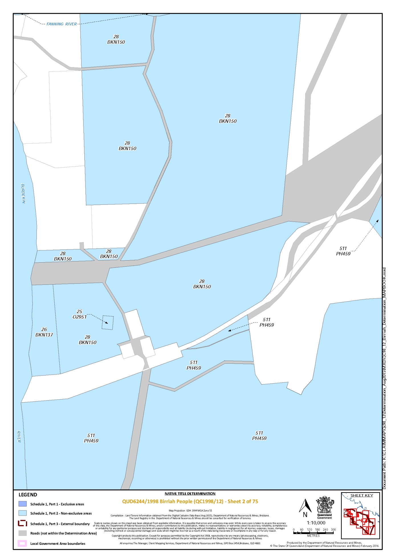
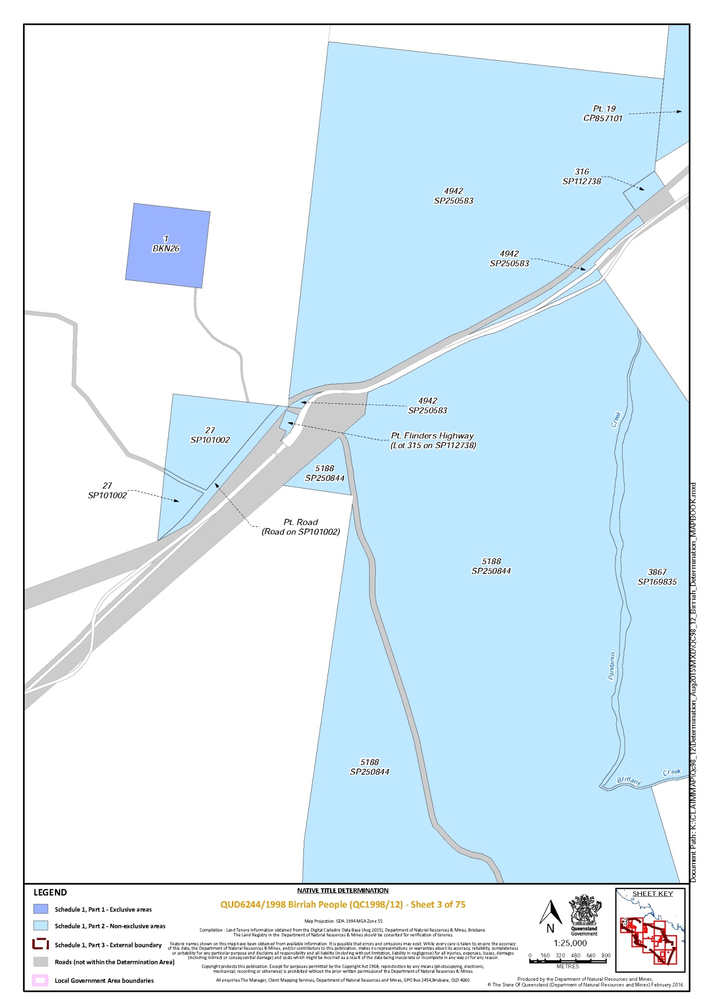
SCHEDULE 1 — DETERMINATION AREA
A. Description of Determination Area
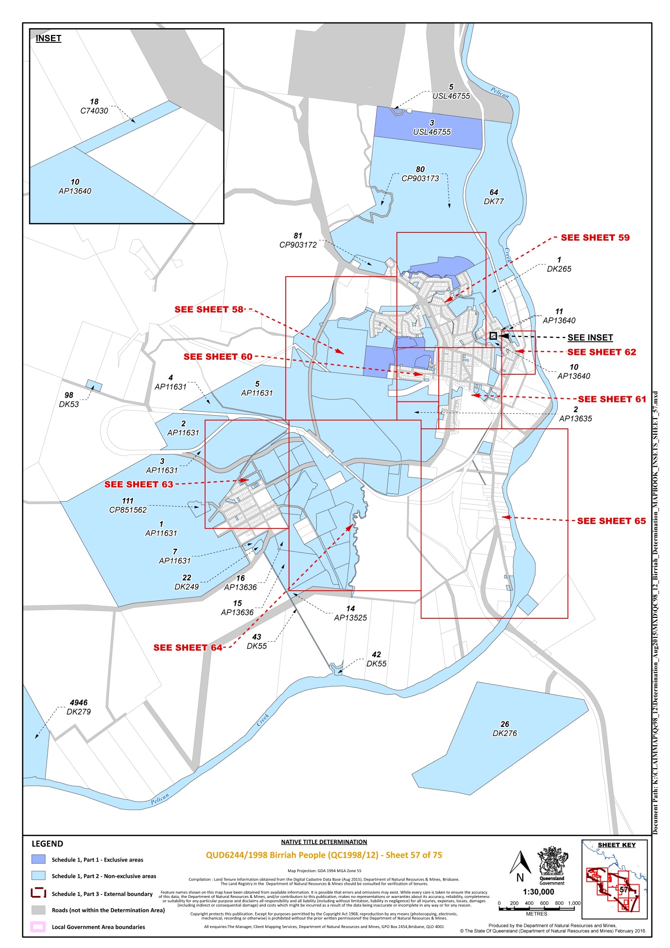
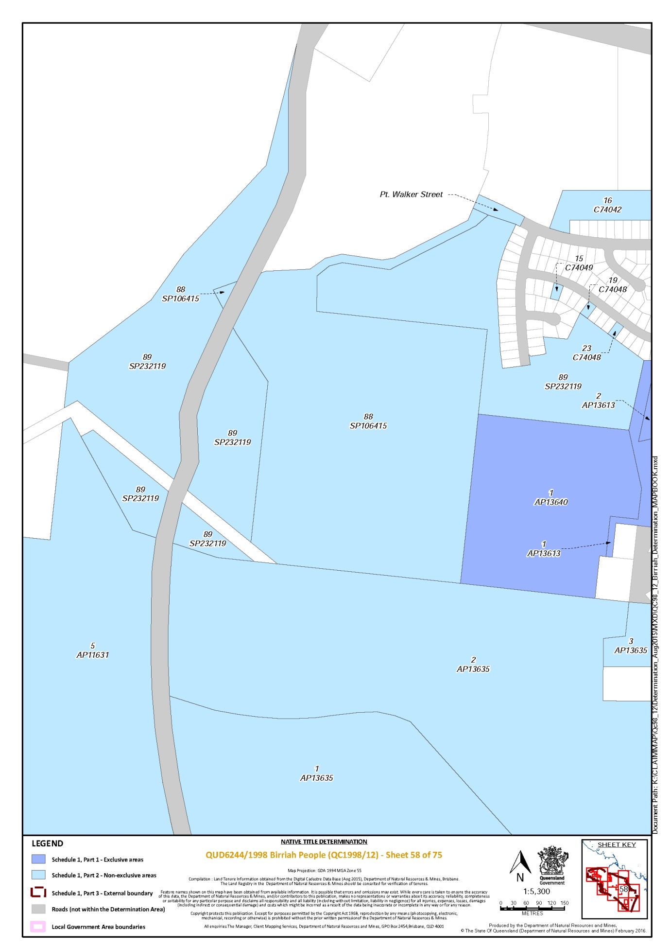
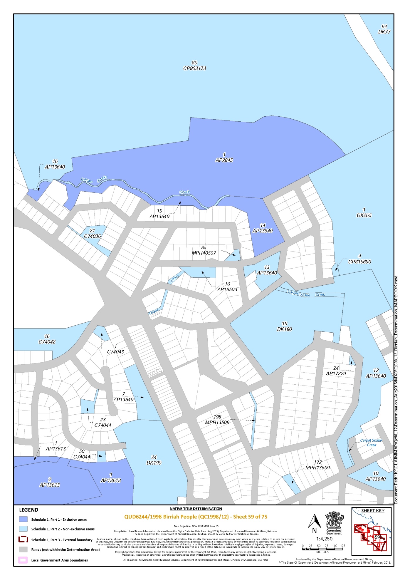
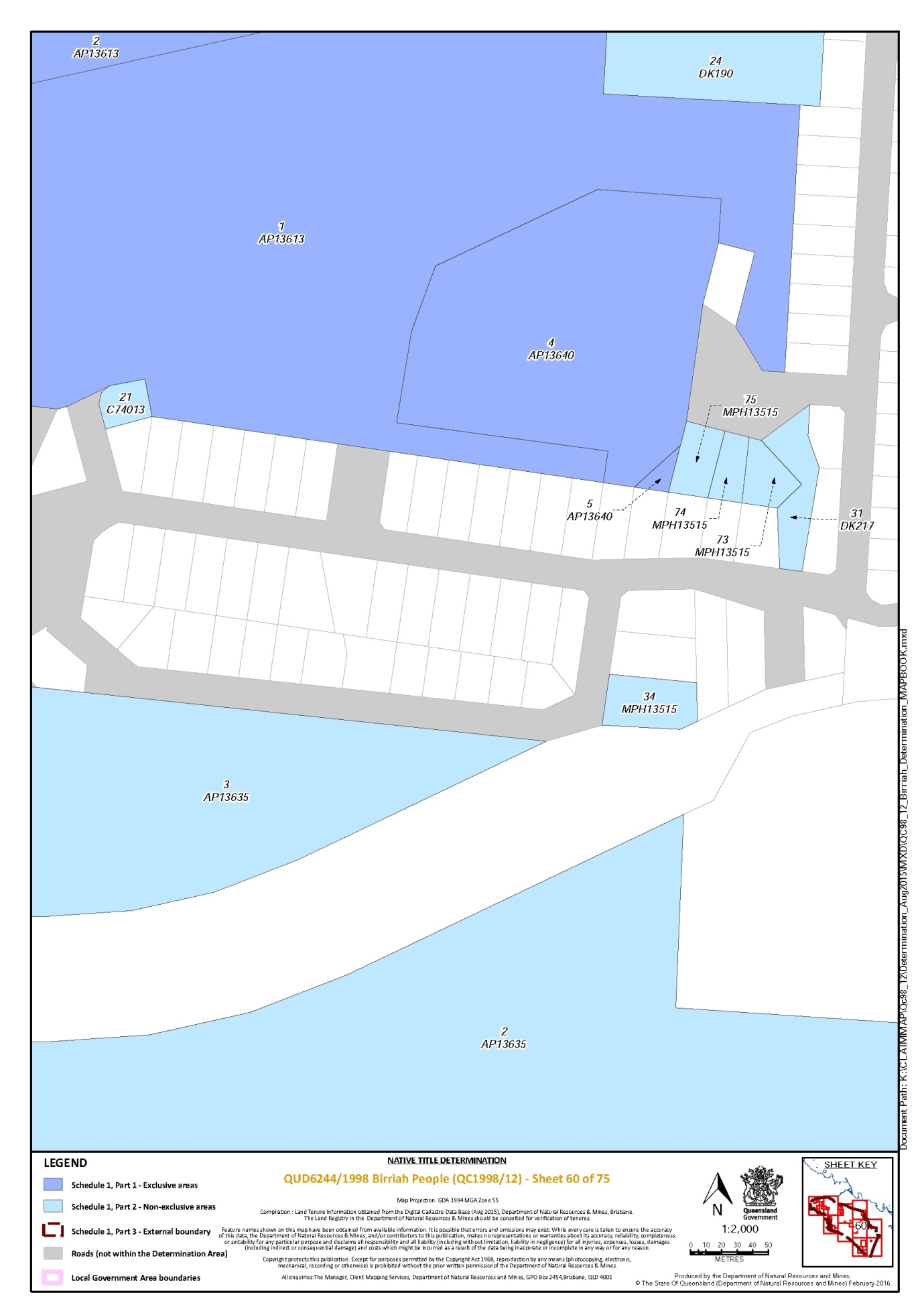
The Determination Area comprises all of the land and waters described in Parts 1 and 2 below, to the extent that they are within the external boundary described in Part 3 below, and depicted on the determination map, excluding the areas described in Schedule 2.
Part 1 — Exclusive Areas
All of the land and waters described in the following table and depicted in dark blue on the determination map:
Area description (as at date of determination) | Determination map sheet number |
Lot 1 on Plan AP2845 | 59 |
That part of Lot 1 on Plan AP10097 that is within the external boundary described in Part 3 | 75 |
Lot 1 on Plan AP11729 | 37 |
Lot 1 on Plan AP13613 | 58, 59, 60 |
Lot 1 on Plan AP13640 | 58 |
Lot 1 on Plan AP15549 | 26 |
Lot 1 on Plan AP15858 | 13 |
Lot 1 on Plan AP2086 | 28, 48 |
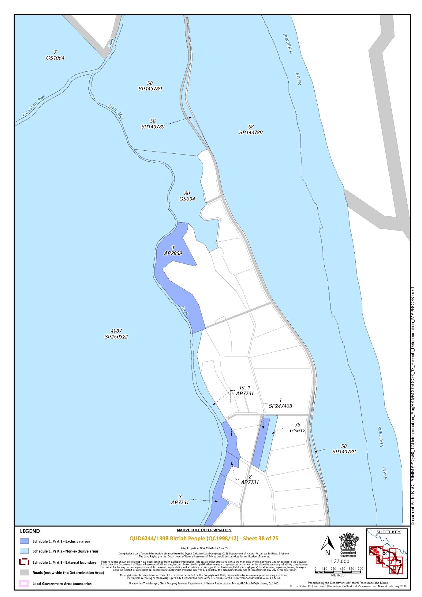
Lot 1 on Plan AP2859 | 38 |
Lot 1 on Plan AP3534 | 12 |
Lot 1 on Plan AP3540 | 12 |
Lot 1 on Plan AP9323 | 12, 23 |
Lot 1 on Plan BKN26 | 3 |
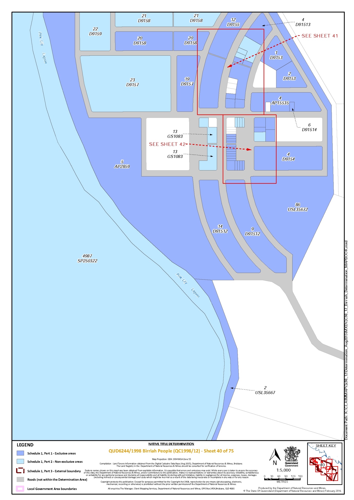
Lot 1 on Plan D9153 | 40, 41 |
Lot 1 on Plan M91011 | 35 |
Lot 1 on Plan M91012 | 35 |
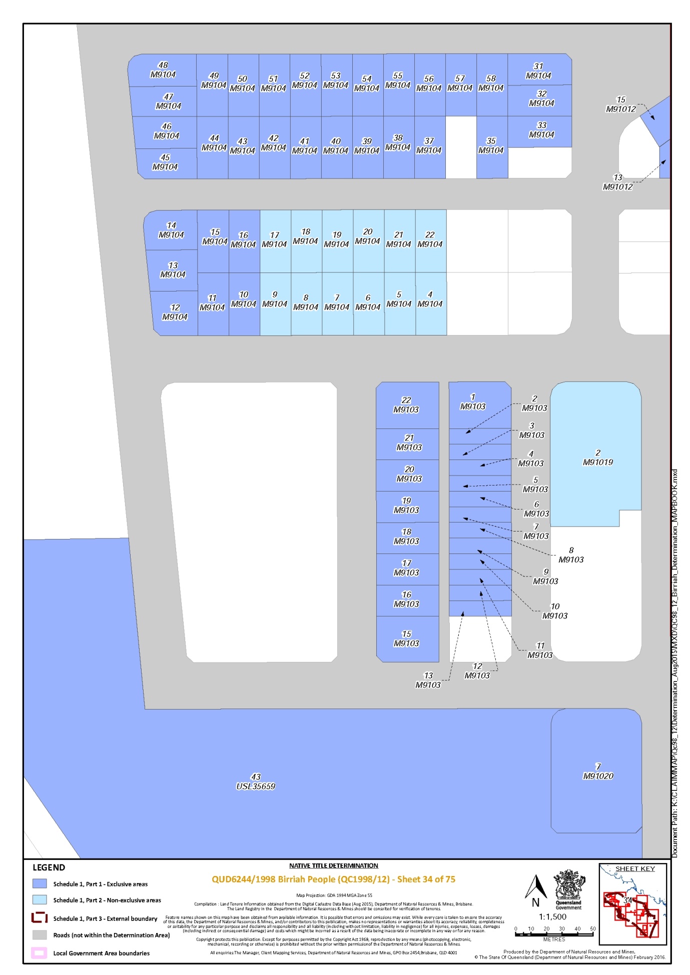
Lot 1 on Plan M9103 | 34 |
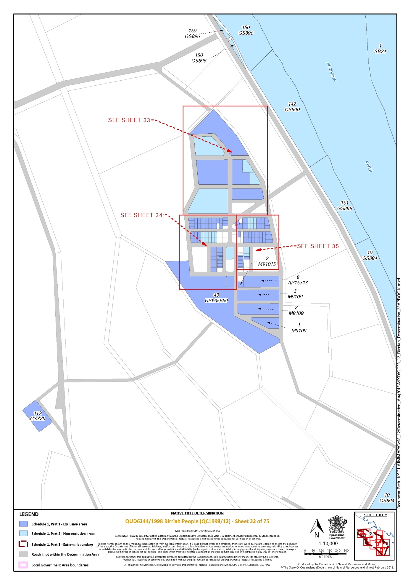
Lot 1 on Plan M9109 | 32 |
Lot 1 on Plan SP247468 | 38 |
Lot 10 on Plan AP2789 | 11, 13 |
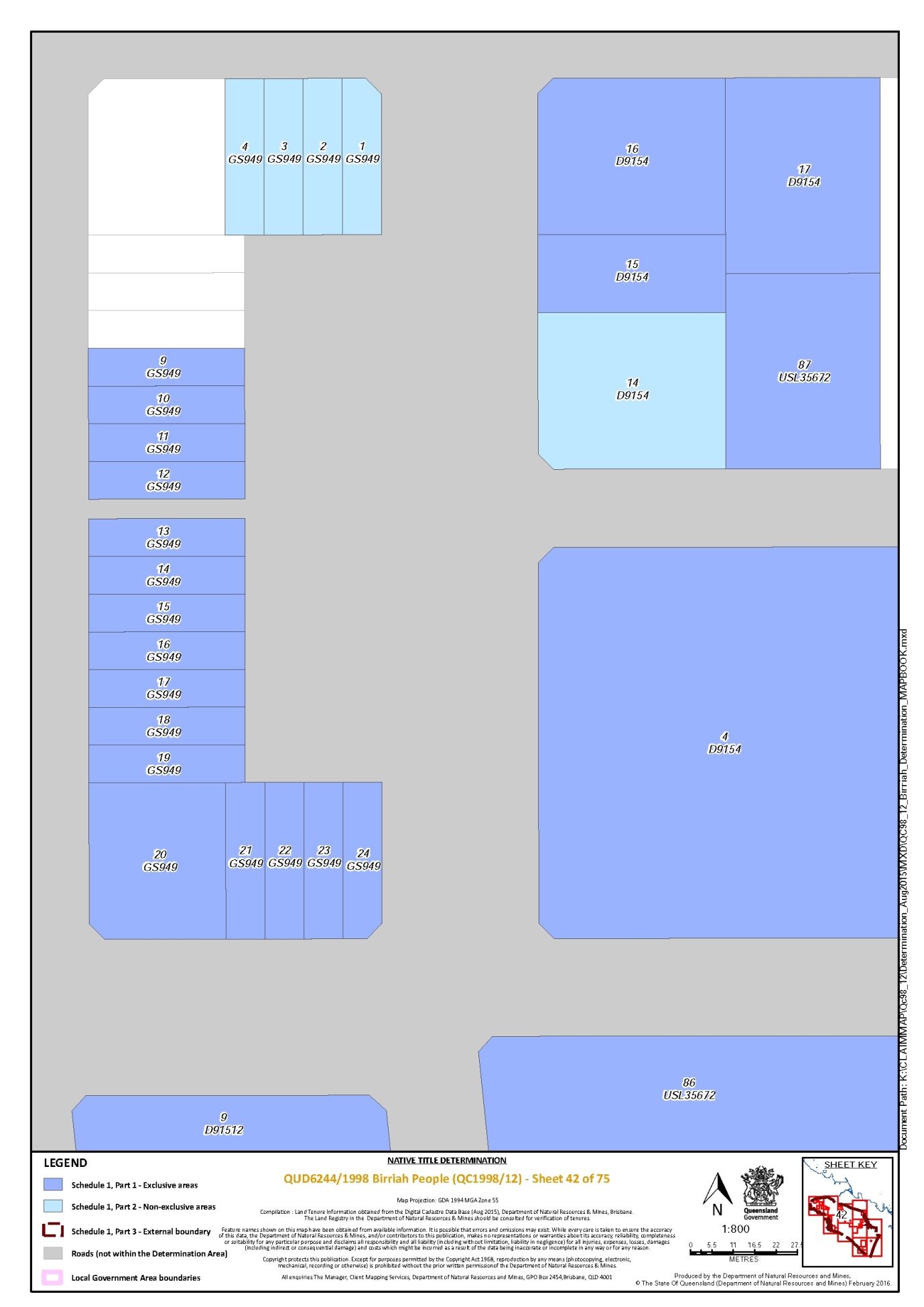
Lot 10 on Plan GS949 | 42 |
Lot 10 on Plan M91011 | 35 |
Lot 10 on Plan M91012 | 35 |
Lot 10 on Plan M9102 | 35 |
Lot 10 on Plan M9103 | 34 |
Lot 10 on Plan M9104 | 34 |
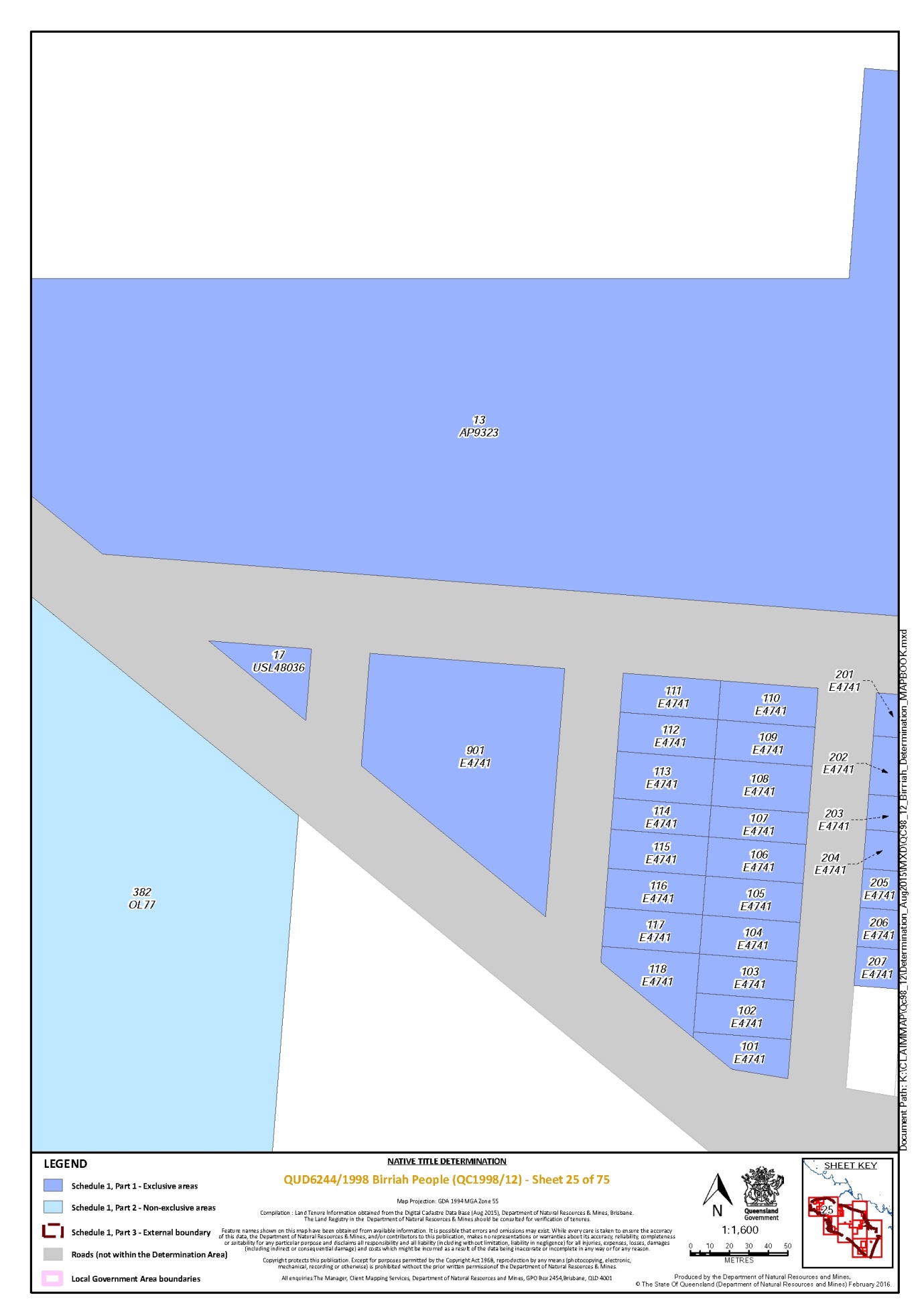
Lot 101 on Plan E4741 | 25 |
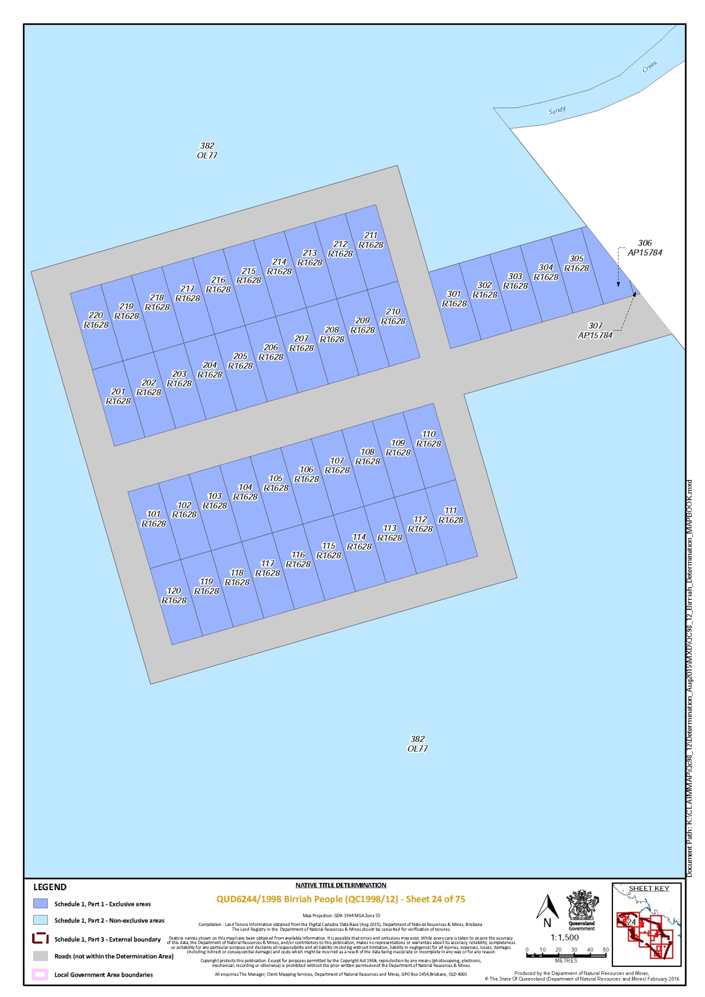
Lot 101 on Plan R1628 | 24 |
Lot 102 on Plan E4741 | 25 |
Lot 102 on Plan R1628 | 24 |
Lot 103 on Plan E4741 | 25 |
Lot 103 on Plan R1628 | 24 |
Lot 104 on Plan E4741 | 25 |
Lot 104 on Plan R1628 | 24 |
Lot 105 on Plan E4741 | 25 |
Lot 105 on Plan R1628 | 24 |
Lot 106 on Plan E4741 | 25 |
Lot 106 on Plan R1628 | 24 |
Lot 107 on Plan E4741 | 25 |
Lot 107 on Plan R1628 | 24 |
Lot 108 on Plan E4741 | 25 |
Lot 108 on Plan R1628 | 24 |
Lot 109 on Plan E4741 | 25 |
Lot 109 on Plan R1628 | 24 |
Lot 11 on Plan D91513 | 41 |
Lot 11 on Plan GS949 | 42 |
Lot 11 on Plan M91011 | 35 |
Lot 11 on Plan M91012 | 35 |
Lot 11 on Plan M9102 | 35 |
Lot 11 on Plan M9103 | 34 |
Lot 11 on Plan M9104 | 34 |
Lot 110 on Plan E4741 | 25 |
Lot 110 on Plan R1628 | 24 |
Lot 111 on Plan E4741 | 25 |
Lot 111 on Plan R1628 | 24 |
Lot 112 on Plan E4741 | 25 |
Lot 112 on Plan GS329 | 32 |
Lot 112 on Plan R1628 | 24 |
Lot 113 on Plan E4741 | 25 |
Lot 113 on Plan R1628 | 24 |
Lot 114 on Plan E4741 | 25 |
Lot 114 on Plan R1628 | 24 |
Lot 115 on Plan E4741 | 25 |
Lot 115 on Plan R1628 | 24 |
Lot 116 on Plan E4741 | 25 |
Lot 116 on Plan R1628 | 24 |
Lot 117 on Plan E4741 | 25 |
Lot 117 on Plan R1628 | 24 |
Lot 118 on Plan E4741 | 25 |
Lot 118 on Plan R1628 | 24 |
Lot 119 on Plan R1628 | 24 |
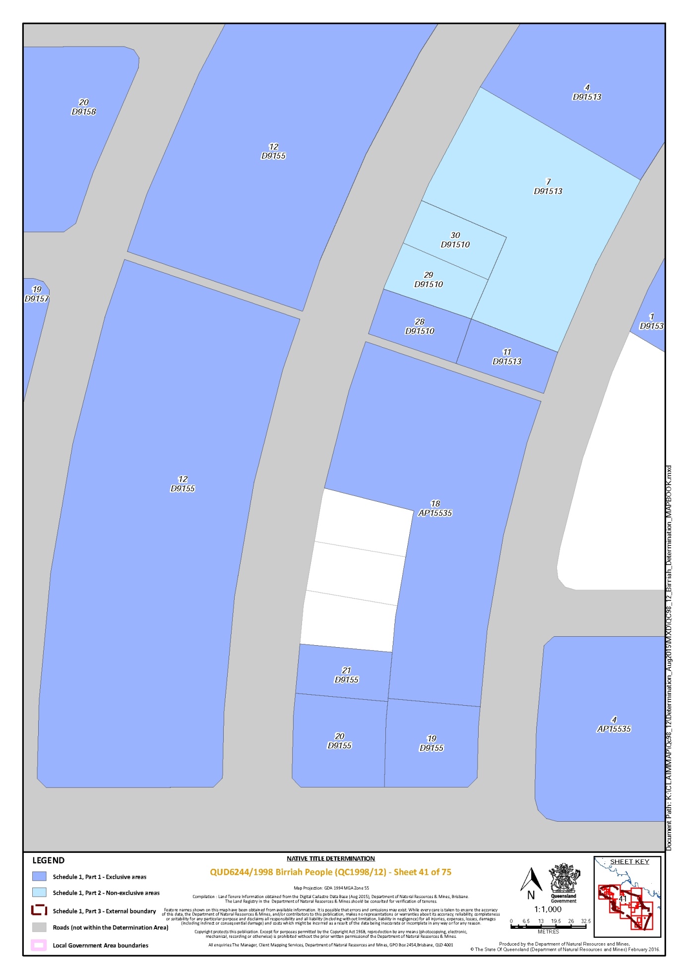
Lot 12 on Plan D9155 | 39, 40, 41 |
Lot 12 on Plan GS949 | 42 |
Lot 12 on Plan M91011 | 35 |
Lot 12 on Plan M91012 | 35 |
Lot 12 on Plan M9102 | 35 |
Lot 12 on Plan M9103 | 34 |
Lot 12 on Plan M9104 | 34 |
Lot 120 on Plan R1628 | 24 |
Lot 120 on Plan SP143384 | 28 |
Lot 121 on Plan SP143384 | 28 |
Lot 1246 on Plan MPH4893 | 4 |
Lot 1247 on Plan MPH4893 | 4 |
Lot 1248 on Plan MPH4893 | 4 |
Lot 128 on Plan USL48036 | 23, 27 |
Lot 13 on Plan AP15670 | 5 |
Lot 13 on Plan AP15858 | 13 |
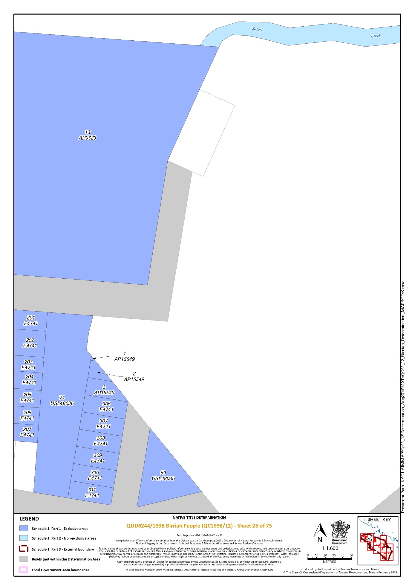
Lot 13 on Plan AP9323 | 12, 23, 25, 26 |
Lot 13 on Plan GS949 | 42 |
Lot 13 on Plan M91012 | 34, 35 |
Lot 13 on Plan M9102 | 35 |
Lot 13 on Plan M9103 | 34 |
Lot 13 on Plan M9104 | 34 |
Lot 14 on Plan AP13640 * | 59 |
Lot 14 on Plan D91512 | 40 |
Lot 14 on Plan GS949 | 42 |
Lot 14 on Plan M9102 | 35 |
Lot 14 on Plan M9104 | 34 |
Lot 14 on Plan MRY12 | 48 |
Lot 14 on Plan USL46733 | 10, 48 |
Lot 14 on Plan USL48141 | 4 |
Lot 15 on Plan AP13640 * | 59 |
Lot 15 on Plan D9154 | 42 |
Lot 15 on Plan GS949 | 42 |
Lot 15 on Plan M91012 | 34, 35 |
Lot 15 on Plan M9102 | 35 |
Lot 15 on Plan M9103 | 34 |
Lot 15 on Plan M9104 | 34 |
Lot 16 on Plan AP13640 | 59 |
Lot 16 on Plan D9154 | 42 |
Lot 16 on Plan GS949 | 42 |
Lot 16 on Plan M9102 | 35 |
Lot 16 on Plan M9103 | 34 |
Lot 16 on Plan M9104 | 34 |
Lot 16 on Plan USL48171 | 11 |
Lot 161 on Plan USL48036 | 23, 27 |
Lot 17 on Plan D9154 | 42 |
Lot 17 on Plan GS949 | 42 |
Lot 17 on Plan M91012 | 35 |
Lot 17 on Plan M9102 | 35 |
Lot 17 on Plan M9103 | 34 |
Lot 17 on Plan USL48036 | 25 |
Lot 18 on Plan AP15535 | 41 |
Lot 18 on Plan AP3534 | 12, 22 |
Lot 18 on Plan GS949 | 42 |
Lot 18 on Plan M91012 | 35 |
Lot 18 on Plan M9102 | 35 |
Lot 18 on Plan M9103 | 34 |
Lot 19 on Plan D9155 | 41 |
Lot 19 on Plan D9157 | 40, 41 |
Lot 19 on Plan GS949 | 42 |
Lot 19 on Plan M91011 | 35 |
Lot 19 on Plan M9103 | 34 |
Lot 2 on Plan AP11729 | 37 |
Lot 2 on Plan AP13613 | 58, 59, 60 |
Lot 2 on Plan AP15549 | 26 |
Lot 2 on Plan AP15858 | 13 |
Lot 2 on Plan AP3534 | 12, 22 |
Lot 2 on Plan AP7731 | 38 |
Lot 2 on Plan D9153 | 40 |
Lot 2 on Plan M91011 | 35 |
Lot 2 on Plan M91012 | 35 |
Lot 2 on Plan M91015 | 32 |
Lot 2 on Plan M9103 | 34 |
Lot 2 on Plan M9109 | 32 |
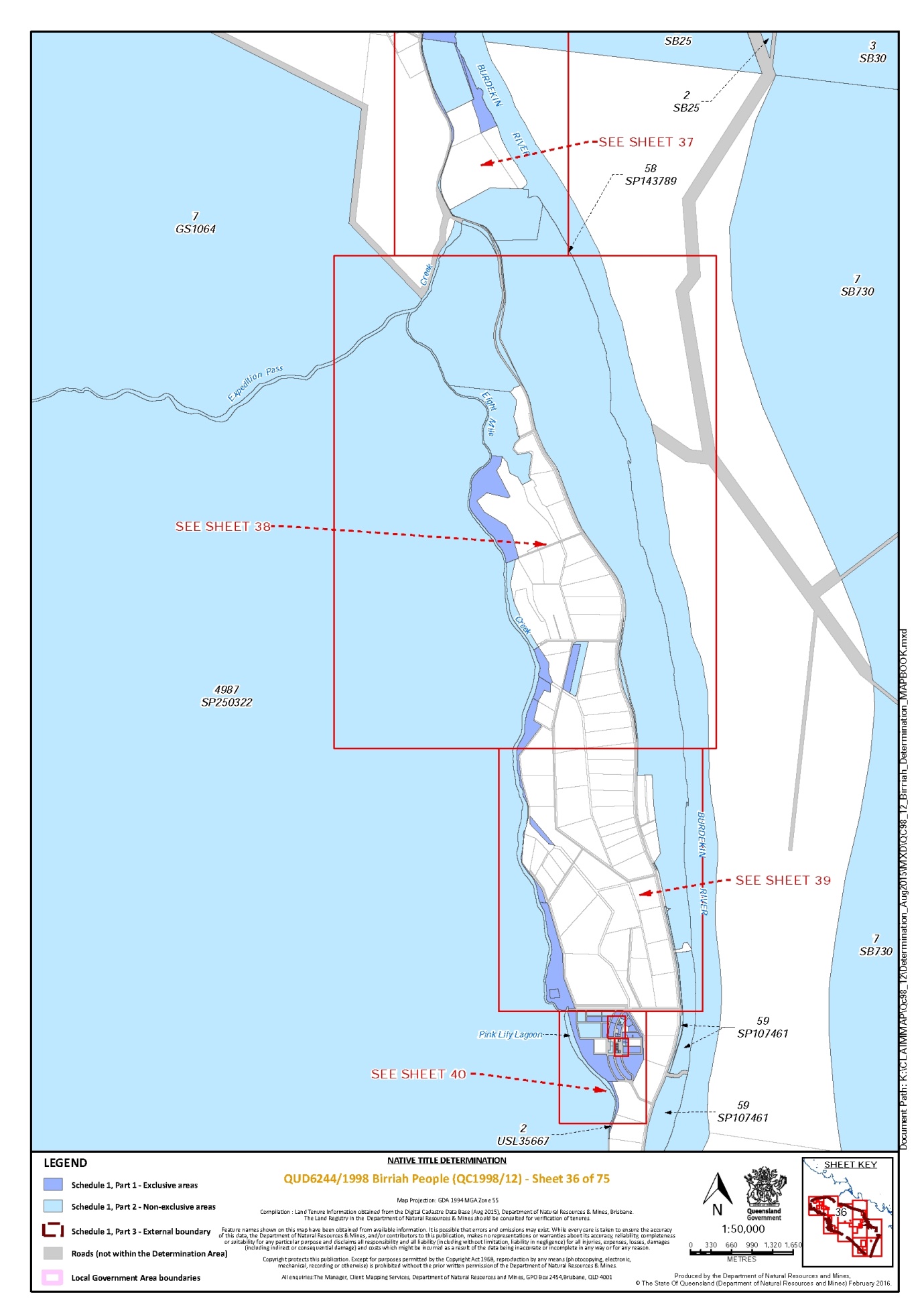
Lot 2 on Plan USL35667 | 36, 40 |
Lot 20 on Plan D9155 | 41 |
Lot 20 on Plan D9158 | 40, 41 |
Lot 20 on Plan GS949 | 42 |
Lot 20 on Plan M9103 | 34 |
Lot 201 on Plan E4741 | 25, 26 |
Lot 201 on Plan R1628 | 24 |
Lot 202 on Plan E4741 | 25, 26 |
Lot 202 on Plan R1628 | 24 |
Lot 203 on Plan E4741 | 25, 26 |
Lot 203 on Plan R1628 | 24 |
Lot 204 on Plan E4741 | 25, 26 |
Lot 204 on Plan R1628 | 24 |
Lot 205 on Plan E4741 | 25, 26 |
Lot 205 on Plan R1628 | 24 |
Lot 206 on Plan E4741 | 25, 26 |
Lot 206 on Plan R1628 | 24 |
Lot 207 on Plan E4741 | 25, 26 |
Lot 207 on Plan R1628 | 24 |
Lot 208 on Plan R1628 | 24 |
Lot 209 on Plan R1628 | 24 |
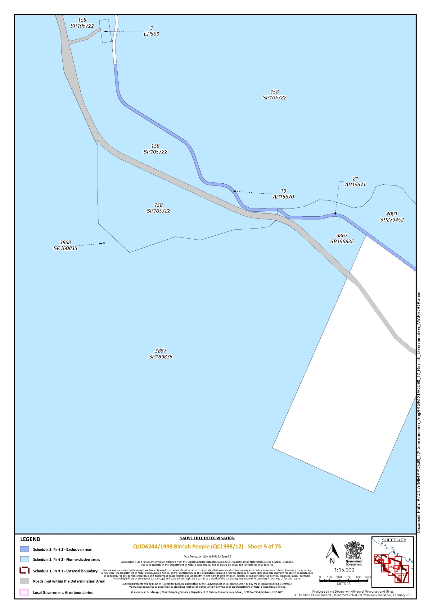
Lot 21 on Plan AP15671 | 5, 6 |
Lot 21 on Plan D9155 | 41 |
Lot 21 on Plan GS949 | 42 |
Lot 21 on Plan M91011 | 35 |
Lot 21 on Plan M9103 | 34 |
Lot 210 on Plan R1628 | 24 |
Lot 211 on Plan R1628 | 24 |
Lot 212 on Plan R1628 | 24 |
Lot 213 on Plan R1628 | 24 |
Lot 214 on Plan R1628 | 24 |
Lot 215 on Plan R1628 | 24 |
Lot 216 on Plan R1628 | 24 |
Lot 217 on Plan R1628 | 24 |
Lot 218 on Plan R1628 | 24 |
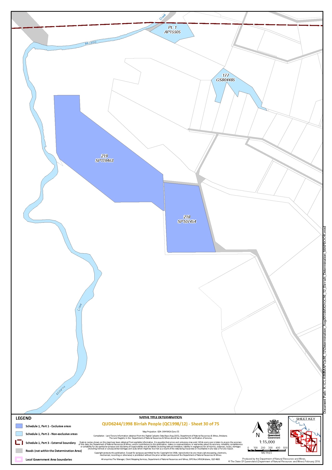
Lot 218 on Plan SP107454 | 30 |
Lot 219 on Plan R1628 | 24 |
Lot 219 on Plan SP119463 | 30 |
Lot 22 on Plan GS949 | 42 |
Lot 22 on Plan M91011 | 35 |
Lot 22 on Plan M91012 | 35 |
Lot 22 on Plan M9103 | 34 |
Lot 220 on Plan R1628 | 24 |
Lot 23 on Plan GS949 | 42 |
Lot 23 on Plan M91011 | 35 |
Lot 23 on Plan M91012 | 35 |
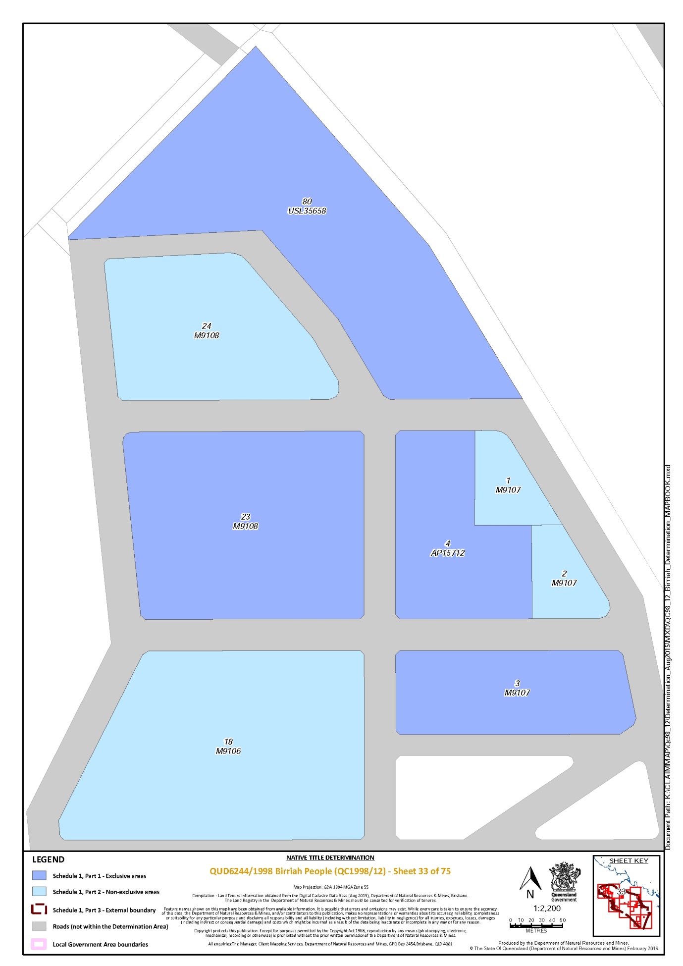
Lot 23 on Plan M9108 | 33 |
Lot 24 on Plan GS949 | 42 |
Lot 24 on Plan M91011 | 35 |
Lot 24 on Plan M91012 | 35 |
Lot 25 on Plan M91011 | 35 |
Lot 26 on Plan M91011 | 35 |
Lot 27 on Plan M91011 | 35 |
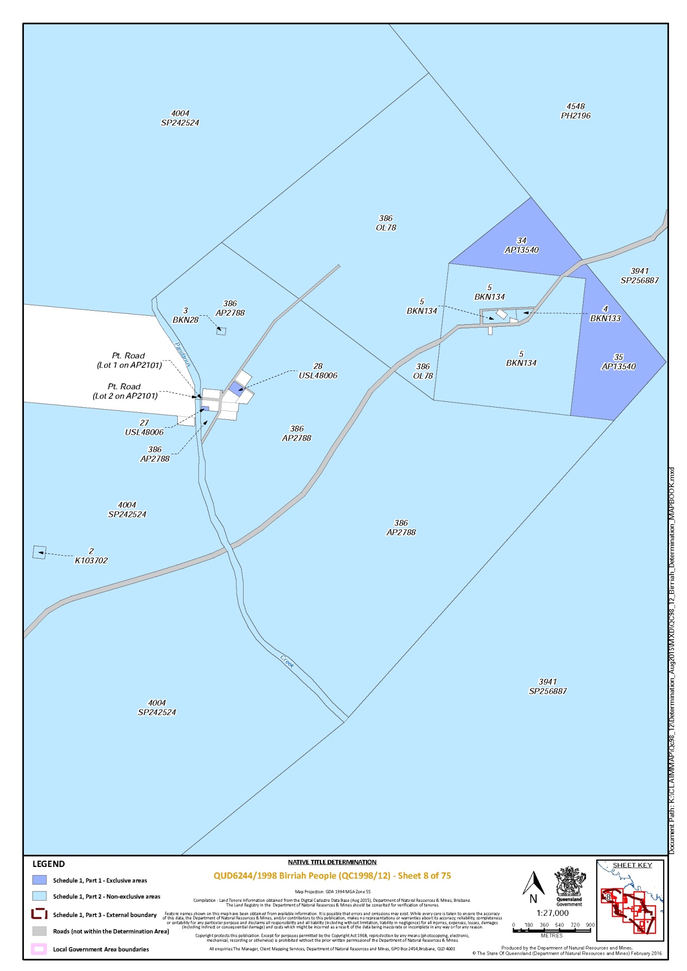
Lot 27 on Plan USL48006 | 8 |
Lot 27 on Plan USL48141 | 4 |
Lot 28 on Plan D91510 | 41 |
Lot 28 on Plan M91011 | 35 |
Lot 28 on Plan USL48006 | 8 |
Lot 3 on Plan AP15549 | 26 |
Lot 3 on Plan AP15858 | 13 |
Lot 3 on Plan AP3534 | 11, 12, 22 |
Lot 3 on Plan AP7731 | 38, 39 |
Lot 3 on Plan DK12 | 69 |
Lot 3 on Plan DK3 | 54 |
Lot 3 on Plan M91011 | 35 |
Lot 3 on Plan M91012 | 35 |
Lot 3 on Plan M9103 | 34 |
Lot 3 on Plan M9107 | 33 |
Lot 3 on Plan M9109 | 32 |
Lot 3 on Plan SP149509 | 39 |
Lot 3 on Plan USL46755 | 57 |
Lot 3 on Plan USL48036 | 23, 27 |
Lot 301 on Plan R1628 | 24 |
Lot 302 on Plan R1628 | 24 |
Lot 303 on Plan R1628 | 24 |
Lot 304 on Plan R1628 | 24 |
Lot 305 on Plan R1628 | 24 |
Lot 306 on Plan AP15784 | 24 |
Lot 306 on Plan E4741 | 26 |
Lot 307 on Plan AP15784 | 24 |
Lot 307 on Plan E4741 | 26 |
Lot 308 on Plan E4741 | 26 |
Lot 309 on Plan E4741 | 26 |
Lot 31 on Plan M9104 | 34 |
Lot 310 on Plan E4741 | 26 |
Lot 311 on Plan E4741 | 26 |
Lot 32 on Plan M9104 | 34 |
Lot 33 on Plan M9104 | 34 |
Lot 34 on Plan AP13540 | 8 |
Lot 35 on Plan AP13540 | 8 |
Lot 35 on Plan M9104 | 34 |
Lot 37 on Plan M9104 | 34 |
Lot 38 on Plan M9104 | 34 |
Lot 39 on Plan M9104 | 34 |
Lot 4 on Plan AP11729 | 37 |
Lot 4 on Plan AP13640 | 60 |
Lot 4 on Plan AP15535 | 40, 41 |
Lot 4 on Plan AP15712 | 33 |
Lot 4 on Plan AP15858 | 13 |
Lot 4 on Plan AP7731 | 39 |
Lot 4 on Plan D91513 | 40, 41 |
Lot 4 on Plan D9154 | 42 |
Lot 4 on Plan M91011 | 35 |
Lot 4 on Plan M91012 | 35 |
Lot 4 on Plan M9102 | 35 |
Lot 4 on Plan M9103 | 34 |
Lot 4 on Plan SP149509 | 39 |
Lot 40 on Plan M9104 | 34 |
Lot 405 on Plan E4741 | 27 |
Lot 406 on Plan E4741 | 27 |
Lot 407 on Plan E4741 | 27 |
Lot 41 on Plan AP15672 | 6 |
Lot 41 on Plan M9104 | 34 |
Lot 42 on Plan M9104 | 34 |
Lot 43 on Plan M9104 | 34 |
Lot 43 on Plan USL35659 | 34 |
Lot 44 on Plan M9104 | 34 |
Lot 45 on Plan M9104 | 34 |
Lot 46 on Plan M9104 | 34 |
Lot 46 on Plan USL48172 | 13 |
Lot 47 on Plan M9104 | 34 |
Lot 48 on Plan M9104 | 34 |
Lot 49 on Plan M9104 | 34 |
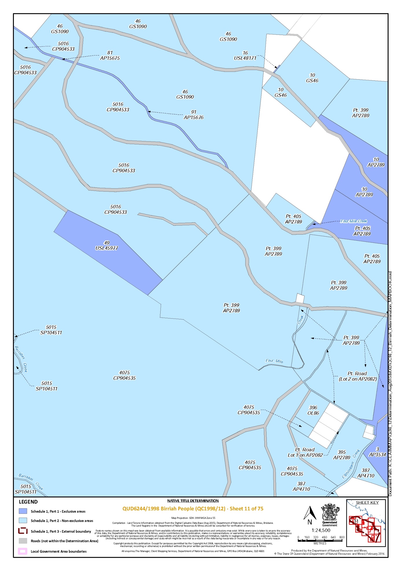
Lot 49 on Plan USL45977 | 11 |
Lot 5 on Plan AP11729 | 29, 37 |
Lot 5 on Plan AP13640 | 60 |
Lot 5 on Plan AP15858 | 13 |
Lot 5 on Plan AP2859 | 39, 40 |
Lot 5 on Plan AP7731 | 39 |
Lot 5 on Plan M91011 | 35 |
Lot 5 on Plan M91012 | 35 |
Lot 5 on Plan M9103 | 34 |
Lot 5 on Plan USL46755 | 57 |
Lot 50 on Plan M9104 | 34 |
Lot 501 on Plan E4741 | 27 |
Lot 502 on Plan E4741 | 27 |
Lot 503 on Plan E4741 | 27 |
Lot 504 on Plan E4741 | 27 |
Lot 505 on Plan E4741 | 27 |
Lot 506 on Plan E4741 | 27 |
Lot 507 on Plan E4741 | 27 |
Lot 51 on Plan M9104 | 34 |
Lot 52 on Plan M9104 | 34 |
Lot 53 on Plan M9104 | 34 |
Lot 54 on Plan M9104 | 34 |
Lot 55 on Plan M9104 | 34 |
Lot 56 on Plan M9104 | 34 |
Lot 566 on Plan CP893180 | 46 |
Lot 57 on Plan M9104 | 34 |
Lot 58 on Plan M9104 | 34 |
Lot 59 on Plan USL48036 | 26 |
Lot 6 on Plan AP11729 | 29, 37 |
Lot 6 on Plan D91514 | 40 |
Lot 6 on Plan M91011 | 35 |
Lot 6 on Plan M91012 | 35 |
Lot 6 on Plan M9103 | 34 |
Lot 6 on Plan MRY27 | 51 |
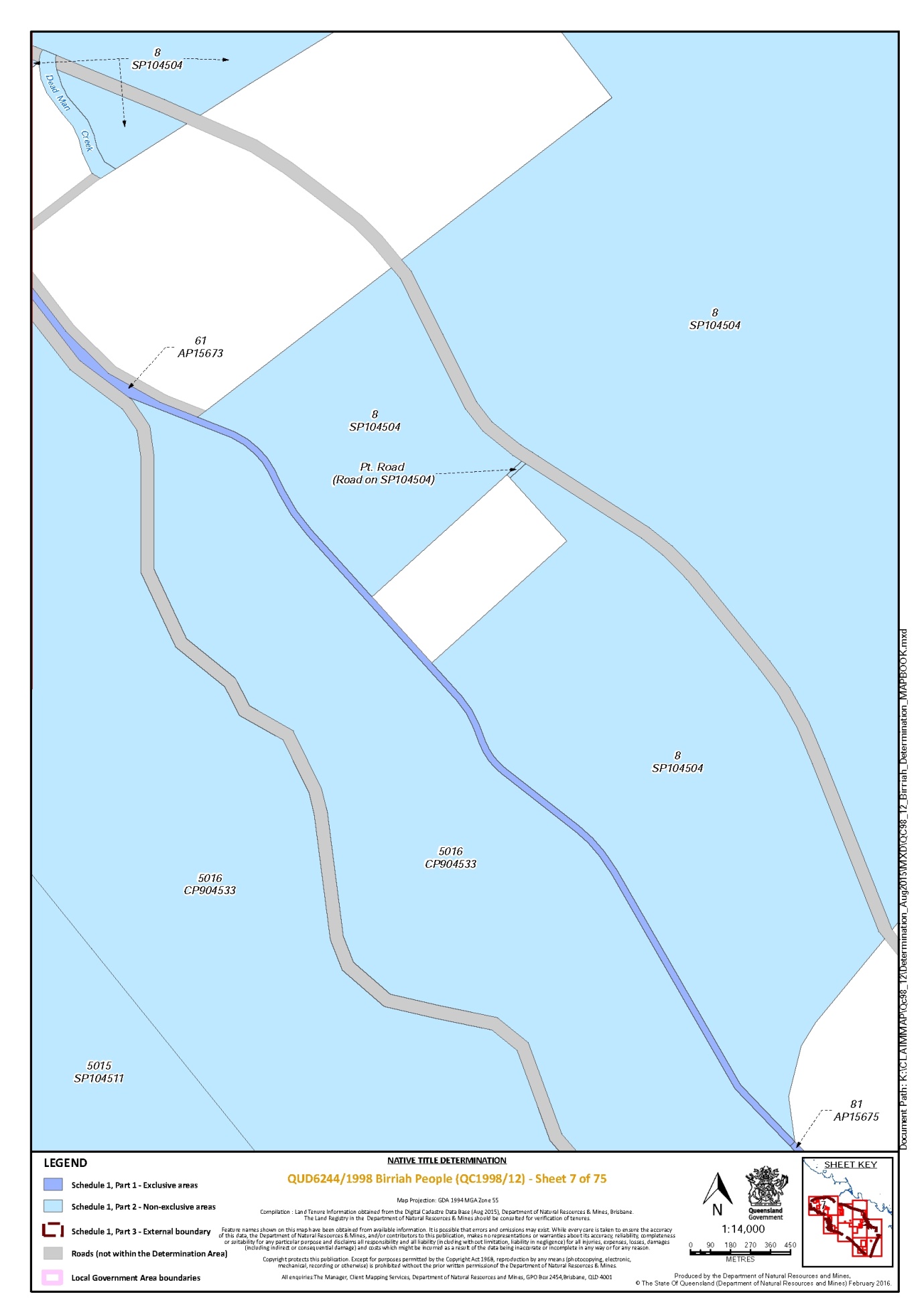
Lot 61 on Plan AP15673 | 1, 6, 7 |
Lot 62 on Plan AP15674 | 6 |
Lot 7 on Plan M91011 | 35 |
Lot 7 on Plan M91020 | 34 |
Lot 7 on Plan M9103 | 34 |
Lot 7 on Plan MRY27 | 51 |
Lot 7 on Plan USL35667 | 28 |
Lot 72 on Plan USL48172 | 13 |
Lot 73 on Plan USL48172 | 13 |
Lot 74 on Plan USL48036 | 26 |
Lot 8 on Plan AP15713 | 32 |
Lot 8 on Plan M91011 | 35 |
Lot 8 on Plan M9103 | 34 |
Lot 80 on Plan USL35658 | 33 |
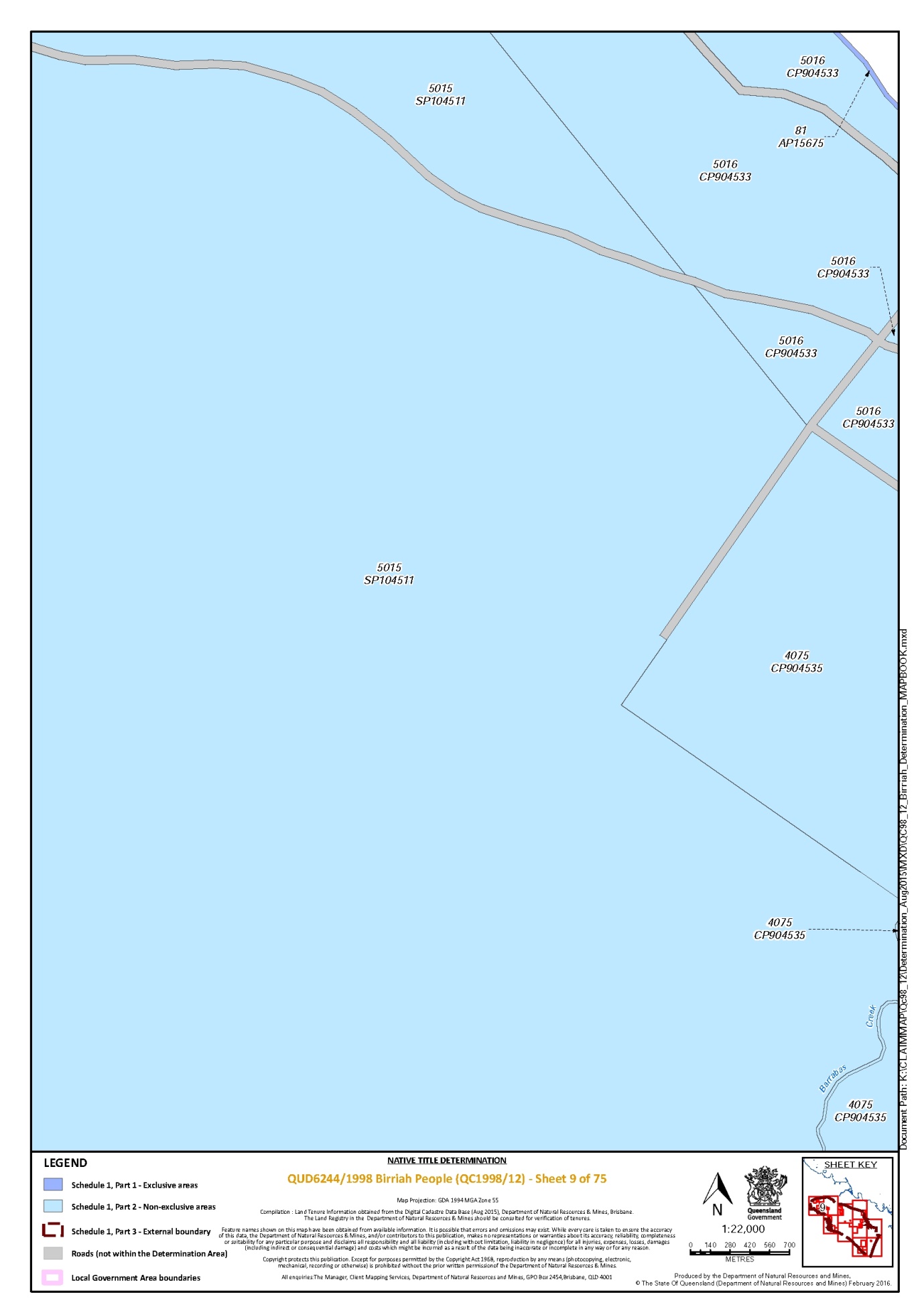
Lot 81 on Plan AP15675 | 7, 9, 11 |
Lot 83 on Plan GS736 | 39 |
Lot 86 on Plan USL35672 | 39, 40, 42 |
Lot 87 on Plan USL35672 | 42 |
Lot 9 on Plan AP15858 | 13 |
Lot 9 on Plan D91512 | 40, 42 |
Lot 9 on Plan GS949 | 42 |
Lot 9 on Plan M91011 | 35 |
Lot 9 on Plan M9103 | 34 |
Lot 90 on Plan USL48036 | 27 |
Lot 901 on Plan E4741 | 25 |
Lot 91 on Plan AP15676 | 11 |
That part of Lot 1 on Plan AP7731 formerly described as Lot 5 on Plan USL35664 | 38 |
That part of Lot 3 on Plan AP11729 formerly described as Lot 13 on Plan USL35660 | 37 |
That part of Lot 399 on Plan AP2789 which does not include the area of ML 1326 and the area formerly described as Lot 399 on Plan OL87 | 11, 12, 14 |
That part of Lot 405 on Plan AP2789 which does not include the area of ML 1326 and the area formerly described as Lot 405 on Plan OL89 | 11, 12, 13 |
That part of Lot 539 on Plan AP3540 which does not include the area formerly described as Lot 539 on Plan OL95 | 12 |
* denotes areas to which s 24KA of the Native Title Act 1993 (Cth) applies
Part 2 — Non-Exclusive Areas
All of the land and waters described in the following table and depicted in light blue on the determination map:
Area description (as at date of determination) | Determination map sheet number |
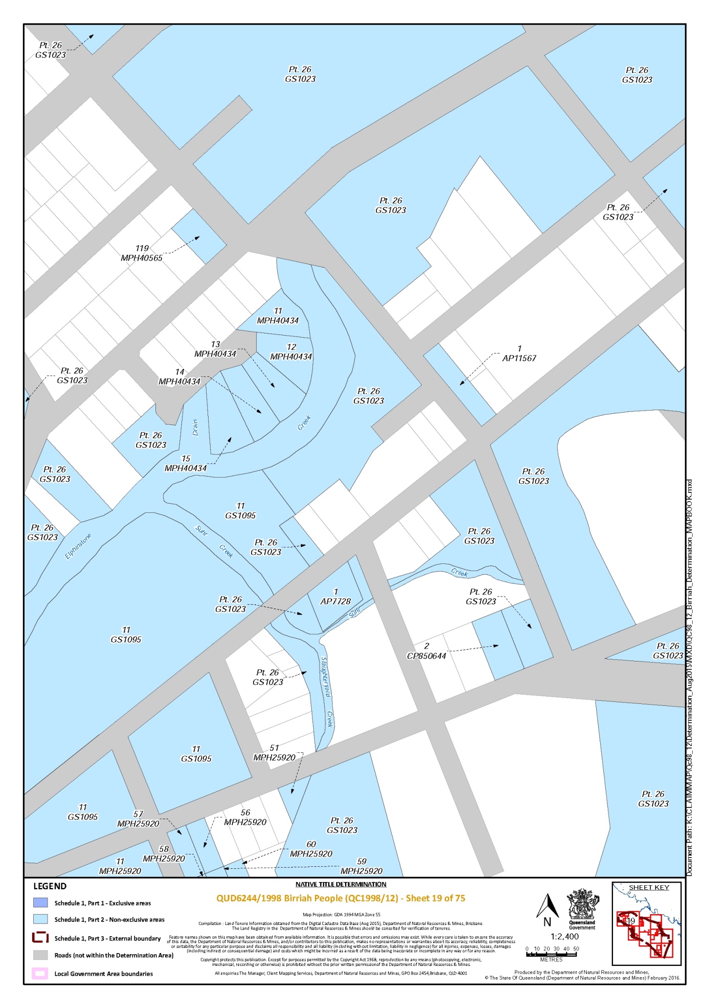
Lot 1 on Plan AP11567 | 19 |
Lot 1 on Plan AP11631 | 57, 63 |
Lot 1 on Plan AP13573 | 18 |
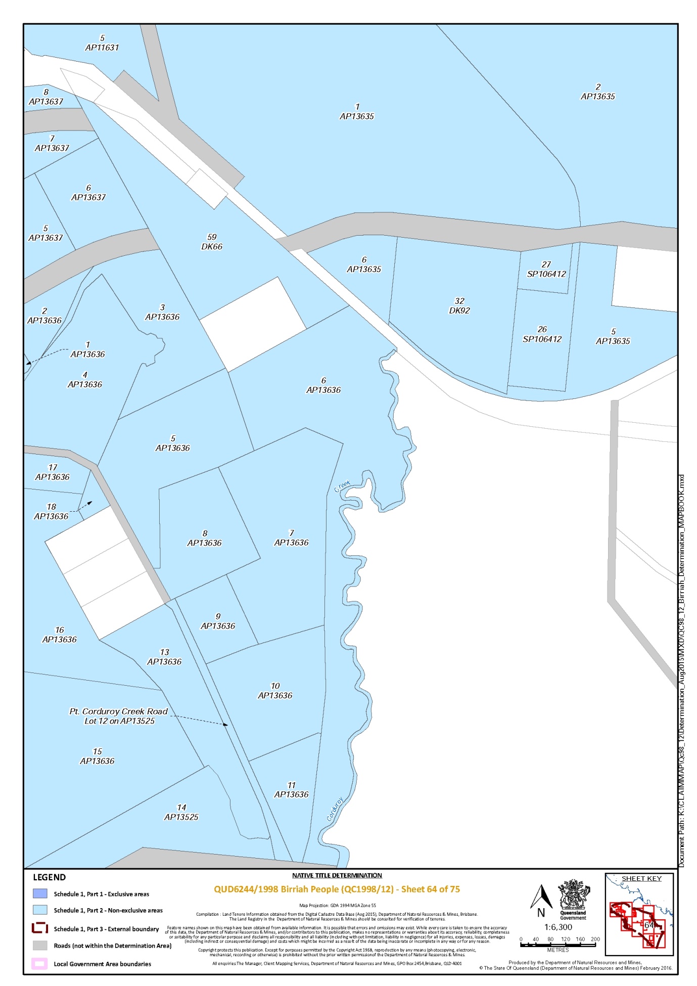
Lot 1 on Plan AP13635 | 58, 64 |
Lot 1 on Plan AP13636 | 63, 64 |
Lot 1 on Plan AP13637 | 63 |
That part of Lot 1 on Plan AP15505 that is within the external boundary described in Part 3 | 30 |
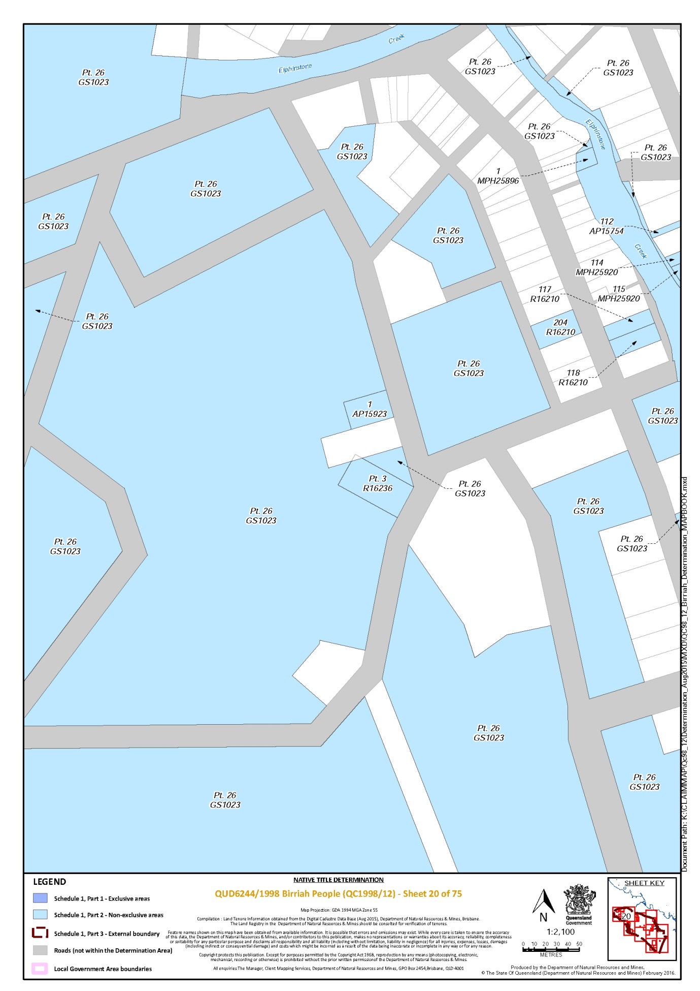
Lot 1 on Plan AP15923 | 20 |
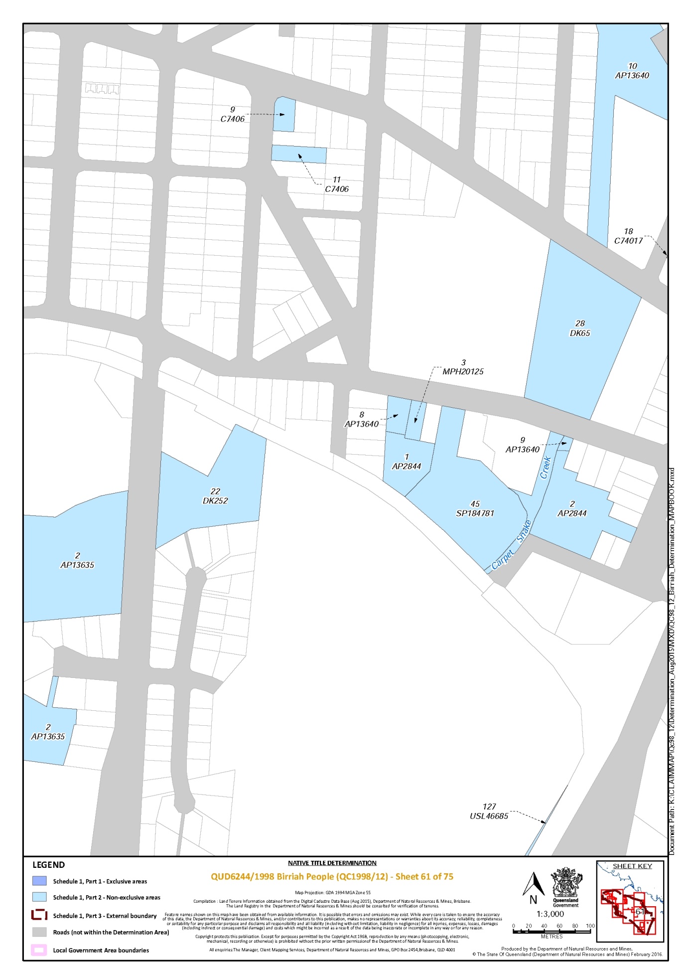
Lot 1 on Plan AP2844 * | 61 |
Lot 1 on Plan AP7728 | 19 |
Lot 1 on Plan C74043 | 59 |
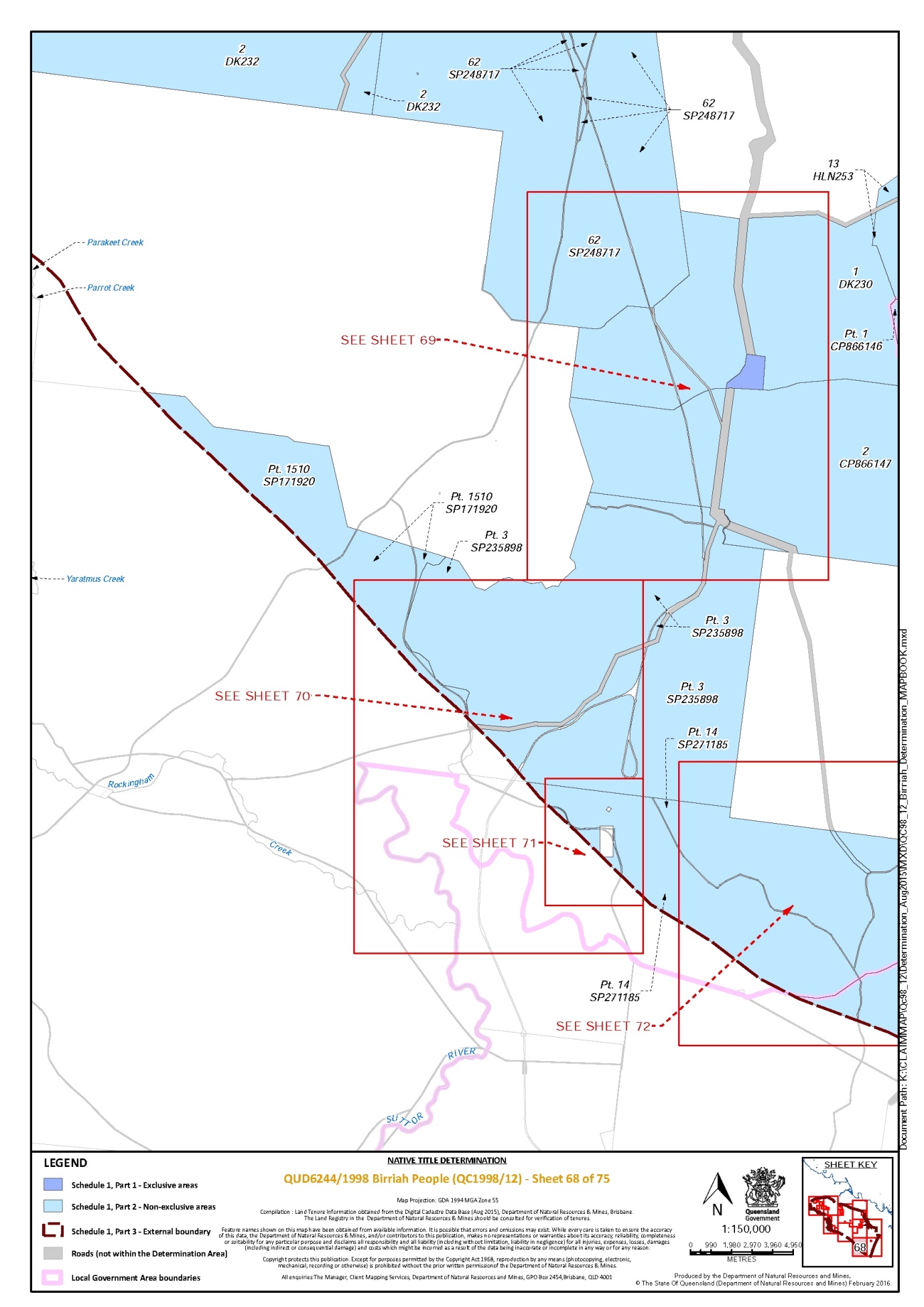
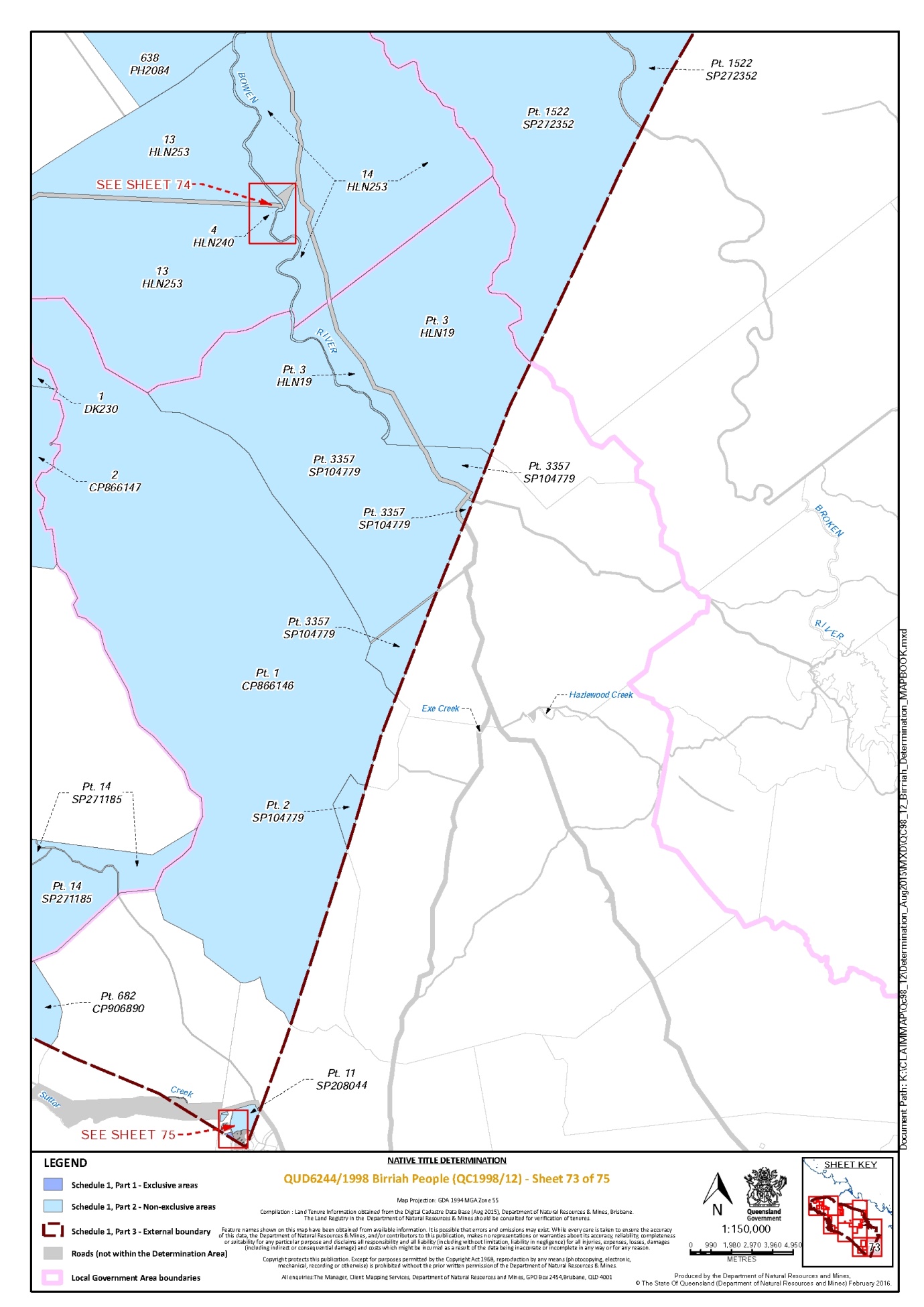
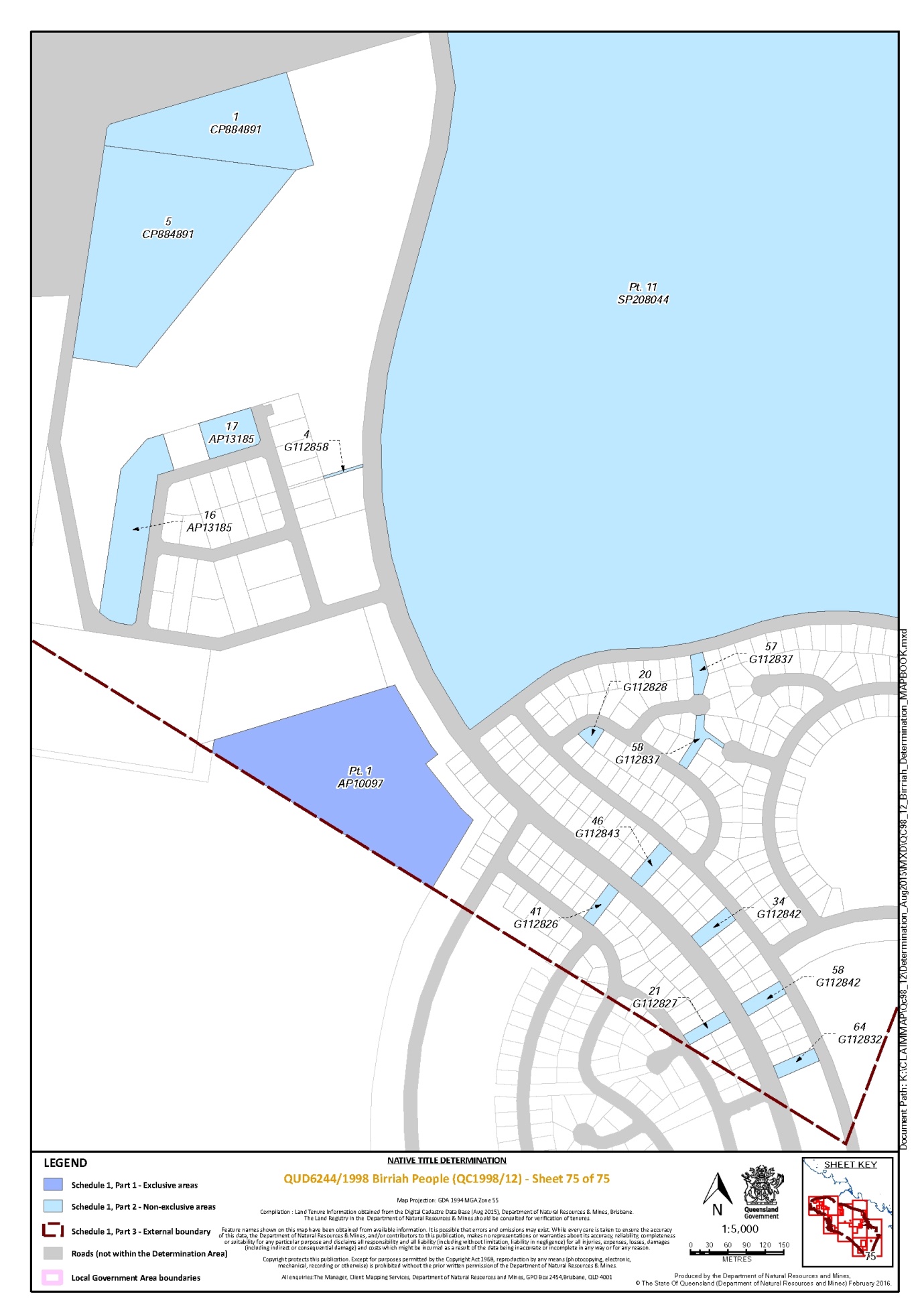
That part of Lot 1 on Plan CP866146 that is within the external boundary described in Part 3 | 68, 73 |
Lot 1 on Plan CP884891 | 75 |
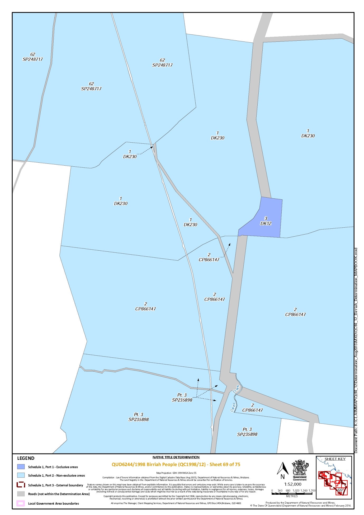
Lot 1 on Plan DK230 | 68, 69, 73 |
Lot 1 on Plan DK265 | 57, 59 |
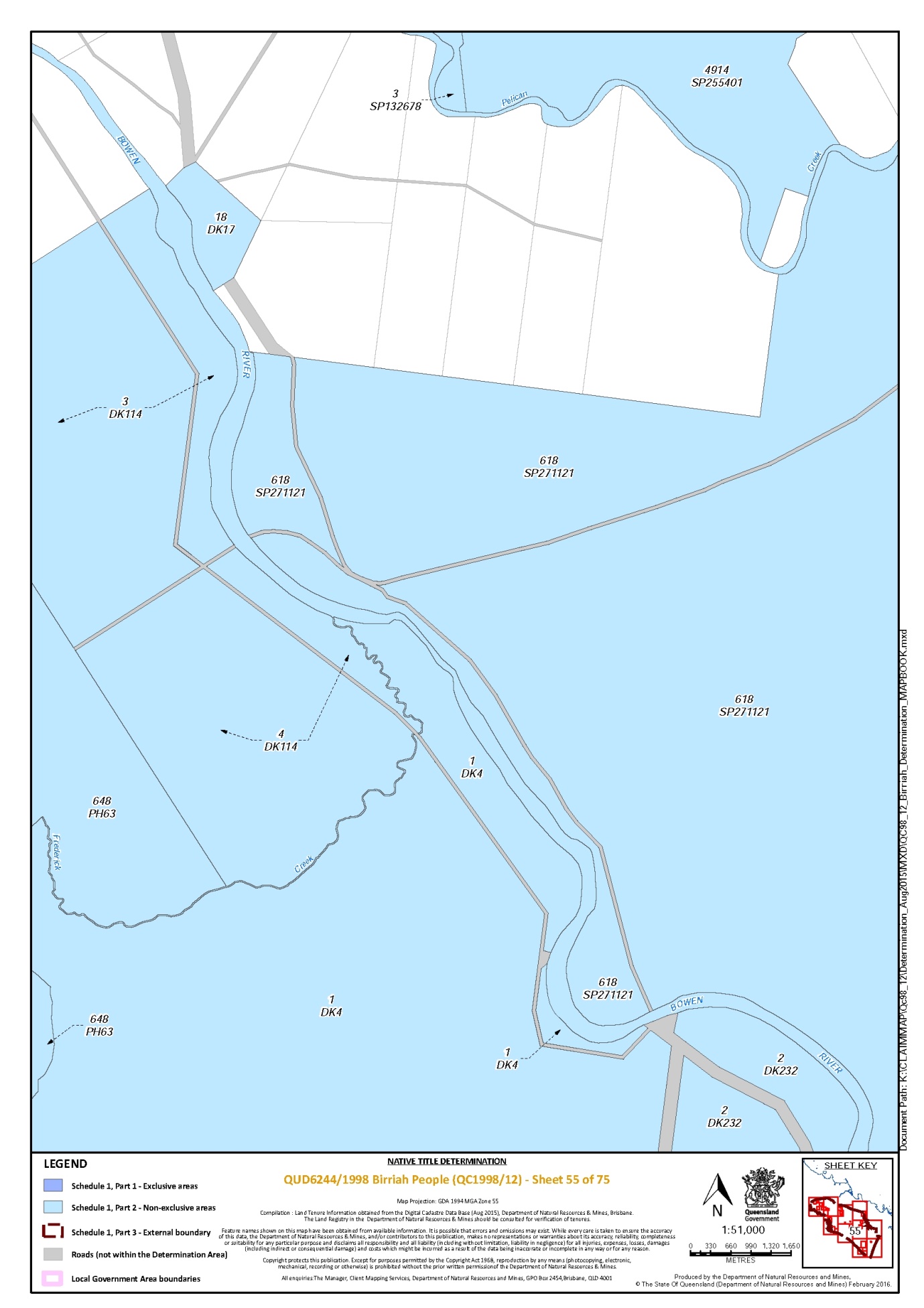
Lot 1 on Plan DK4 | 52, 55 |
Lot 1 on Plan GS949 | 42 |
Lot 1 on Plan M9102 | 35 |
Lot 1 on Plan M9107 | 33 |
Lot 1 on Plan MPH23 | 65 |
Lot 1 on Plan MPH25896 | 20 |
Lot 1 on Plan MPH31062 | 63 |
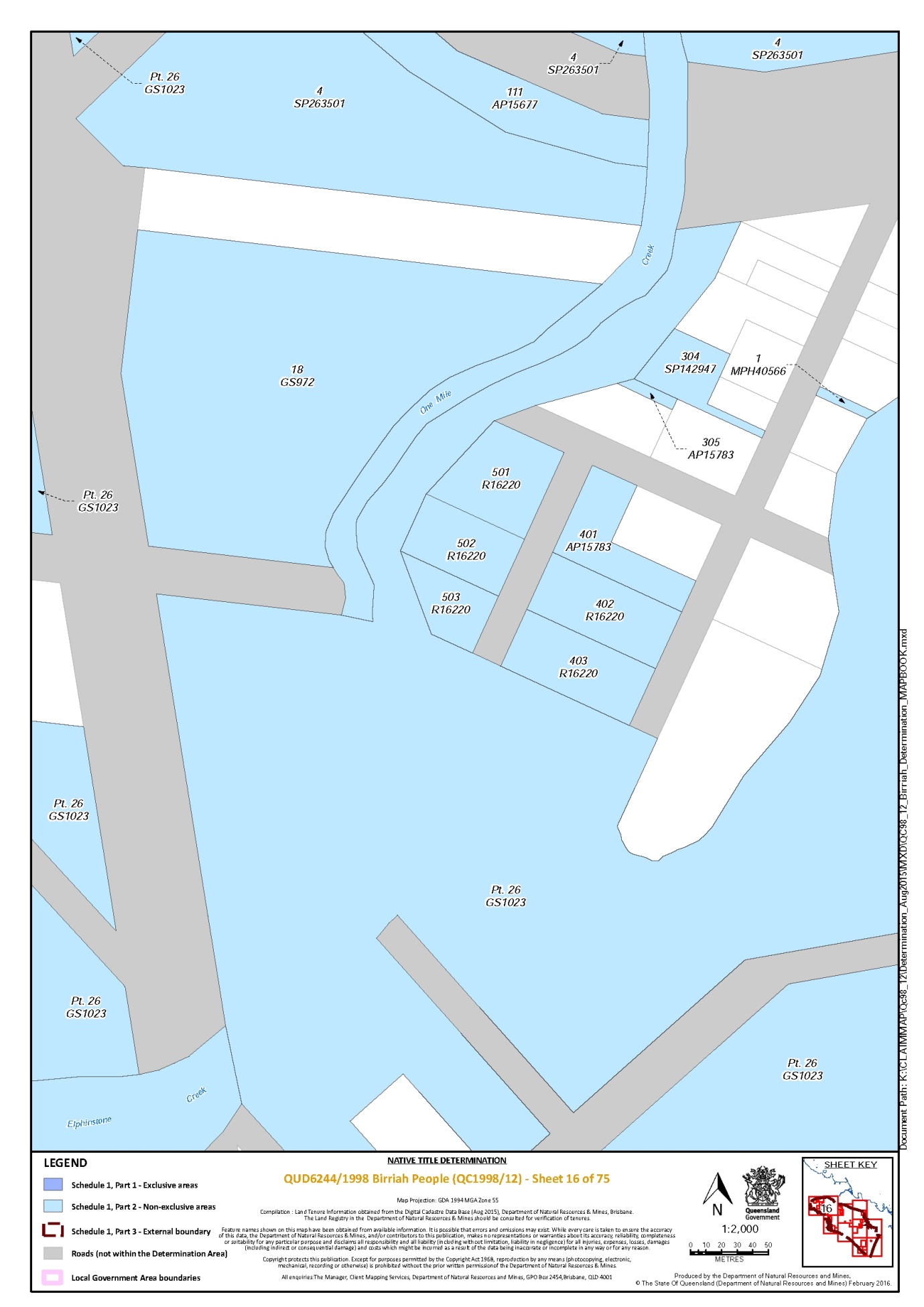
Lot 1 on Plan MPH40566 | 16 |
Lot 1 on Plan MPH40906 | 63 |
Lot 1 on Plan MRY31 | 28, 48, 50, 51, 52 |
Lot 1 on Plan R16227 | 18 |
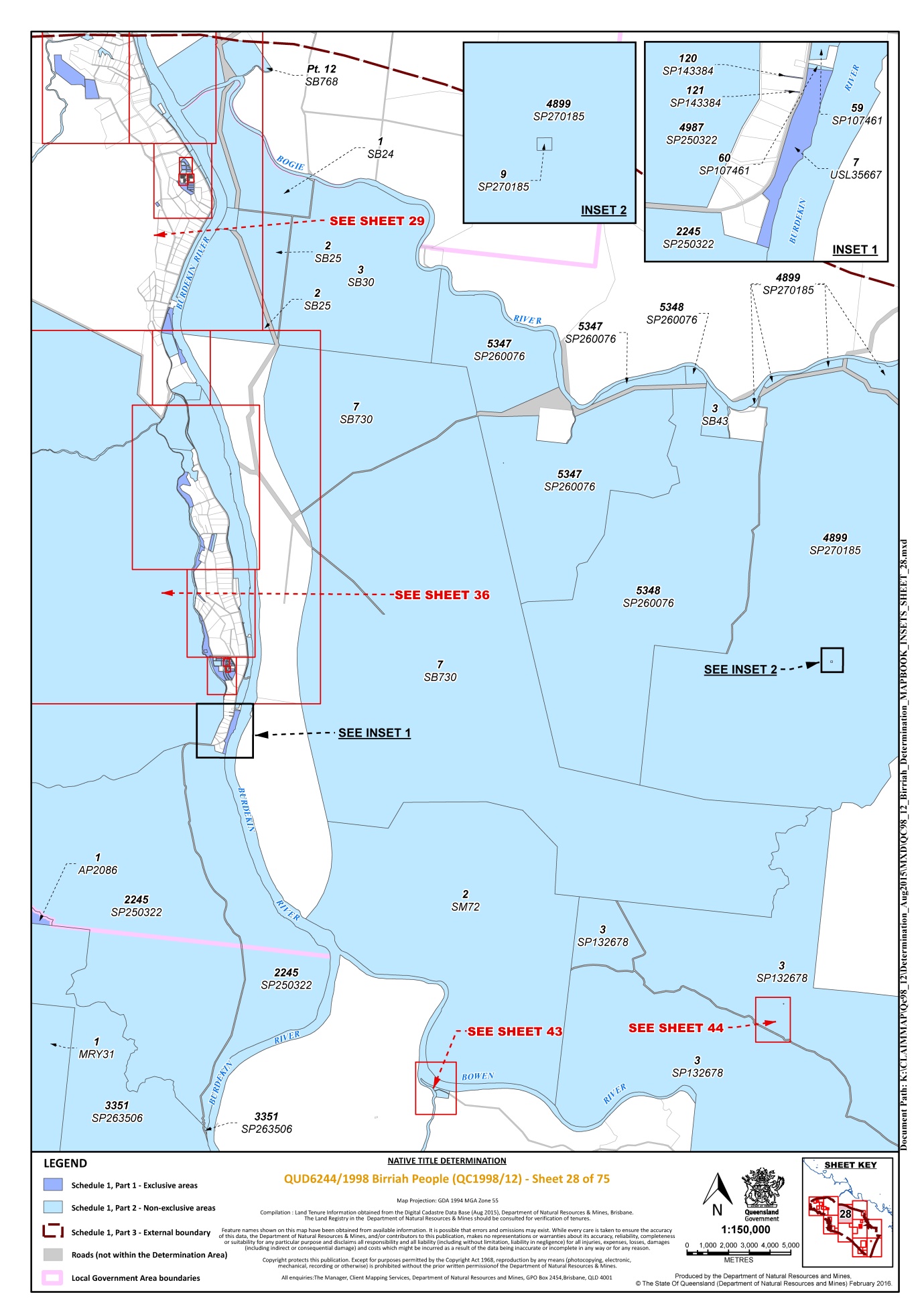
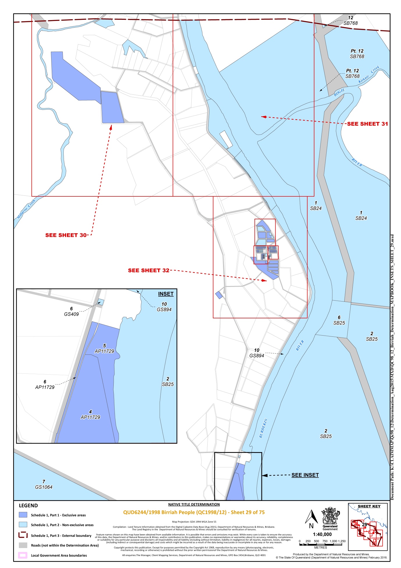
Lot 1 on Plan SB24 | 28, 29, 31, 32 |
Lot 1 on Plan SP108591 * | 53 |
Lot 1 on Plan SP108602 * | 1 |
Lot 10 on Plan AP13636 | 64 |
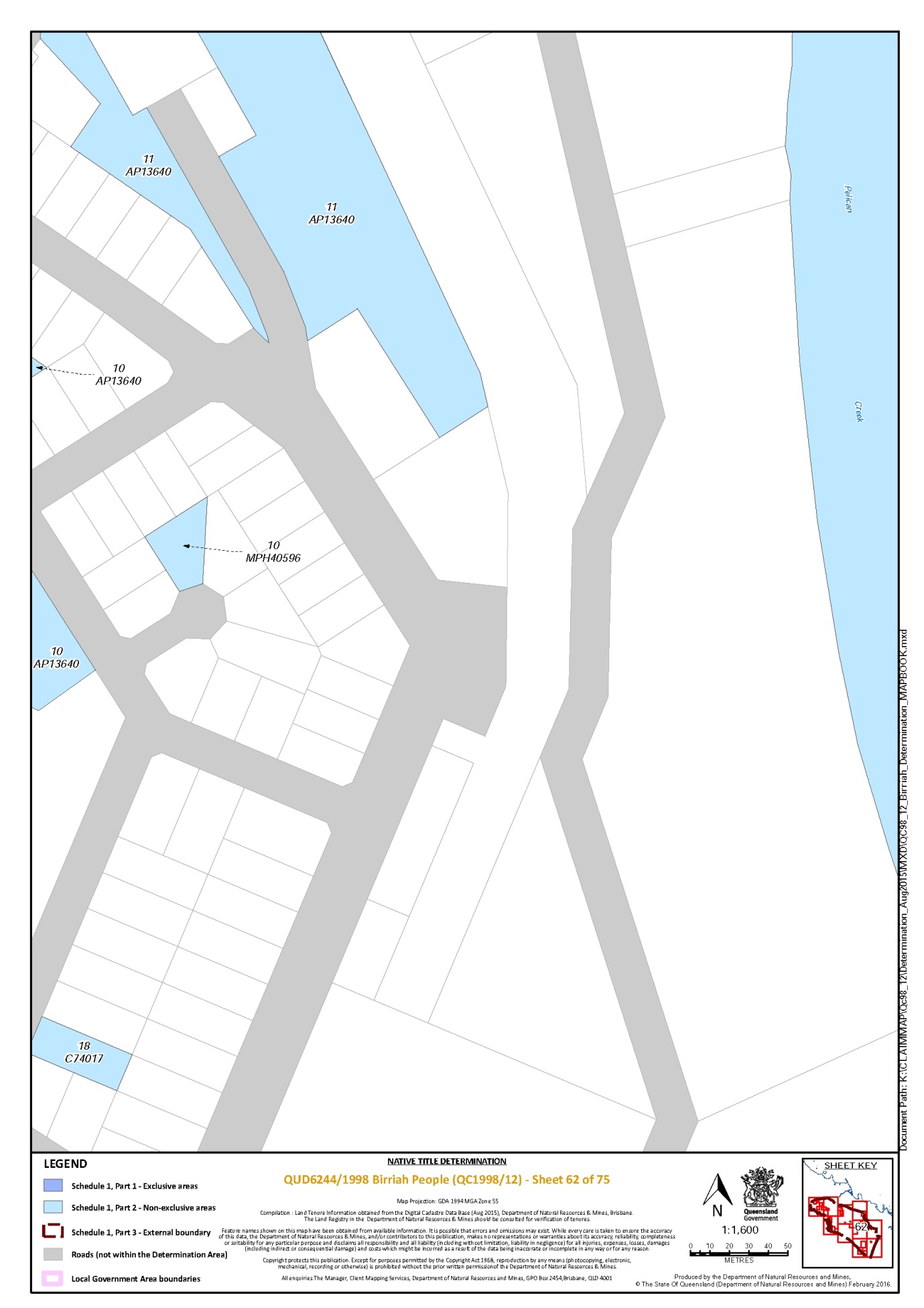
Lot 10 on Plan AP13640 * | 57, 59, 61, 62 |
Lot 10 on Plan AP19503 * | 59 |
Lot 10 on Plan C8243 | 6 |
Lot 10 on Plan DK7 | 54 |
Lot 10 on Plan GS46 | 11 |
Lot 10 on Plan GS894 | 29, 32 |
Lot 10 on Plan MPH40596 | 62 |
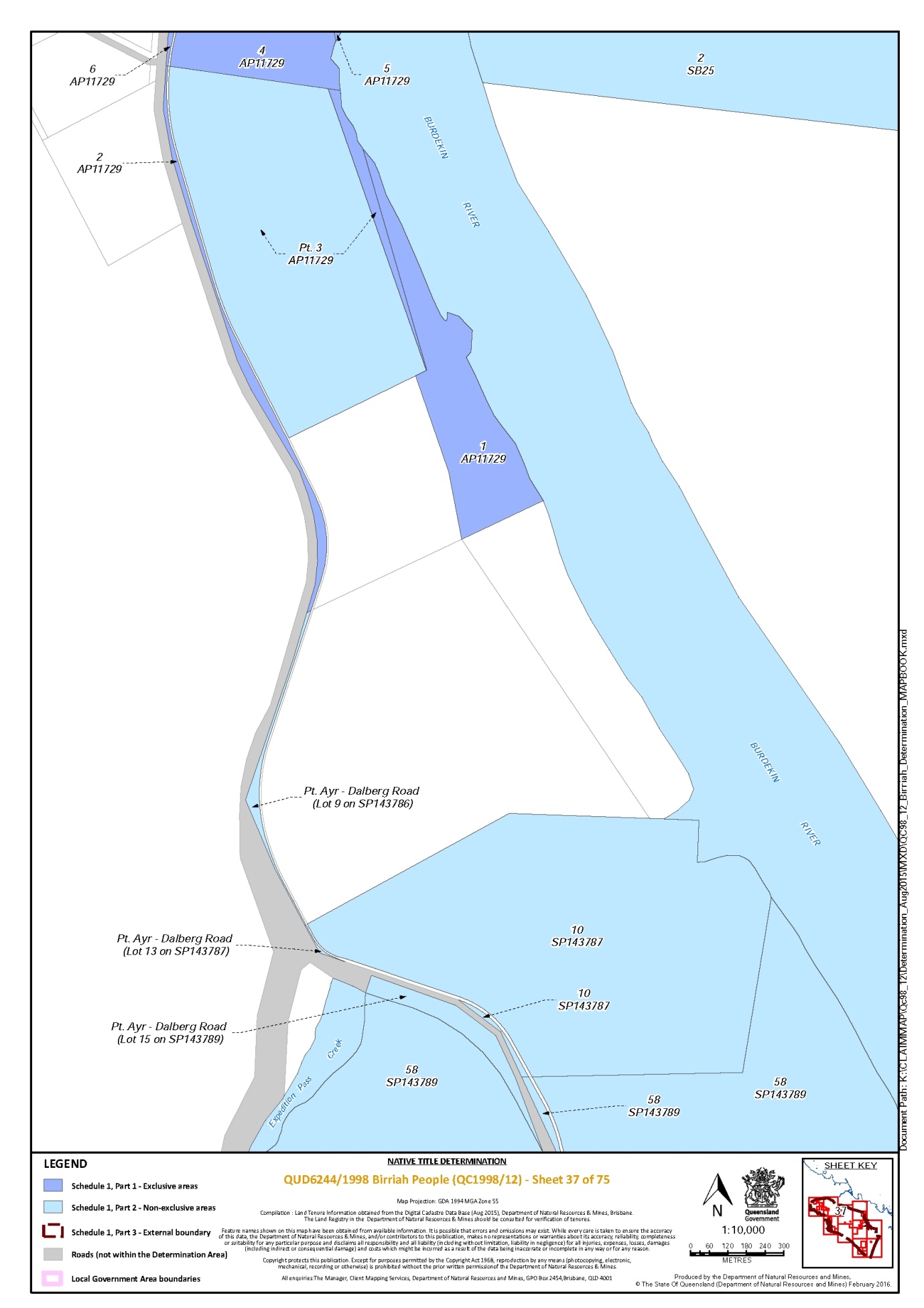
Lot 10 on Plan SP143787 | 37 |
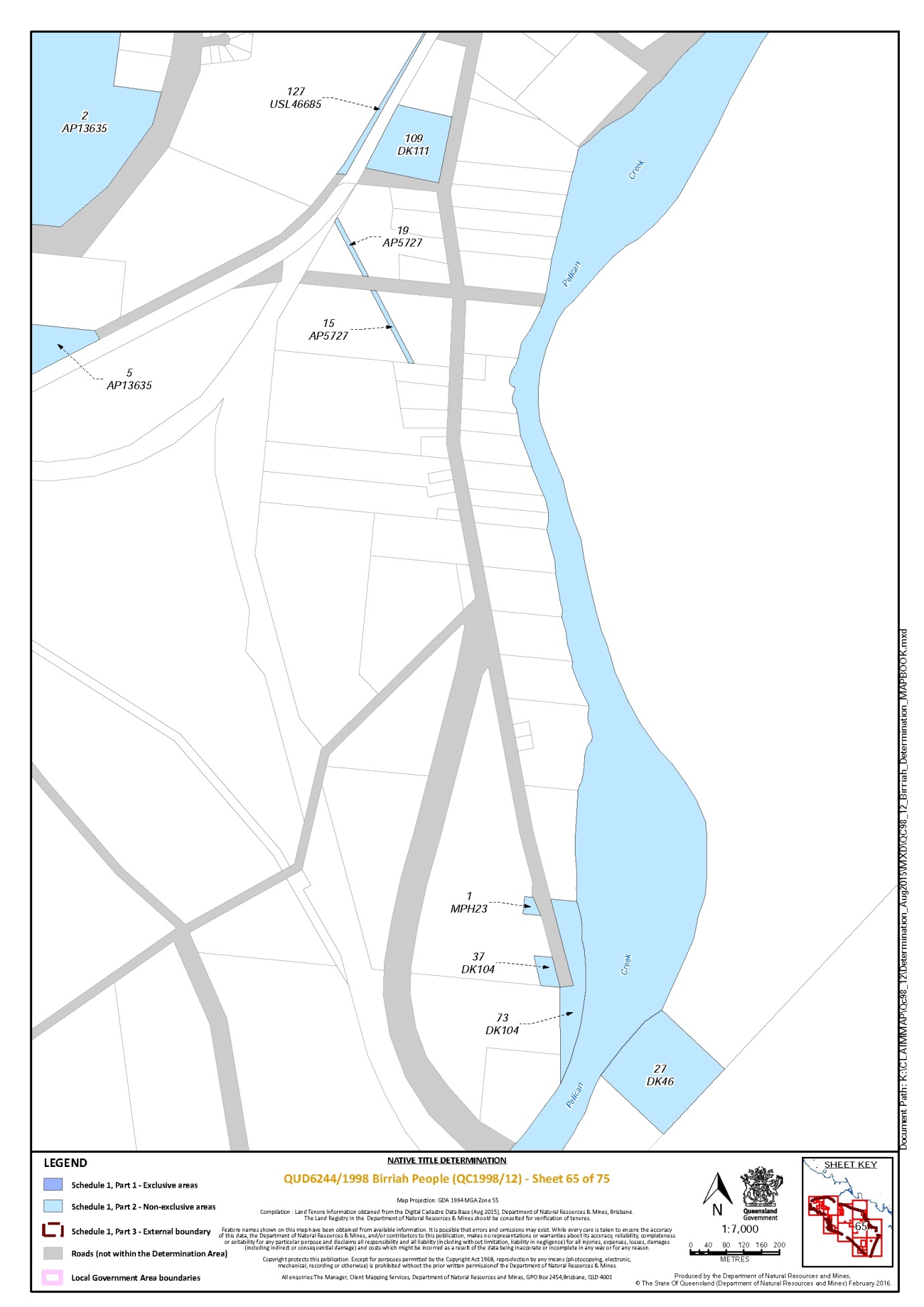
Lot 109 on Plan DK111 | 65 |
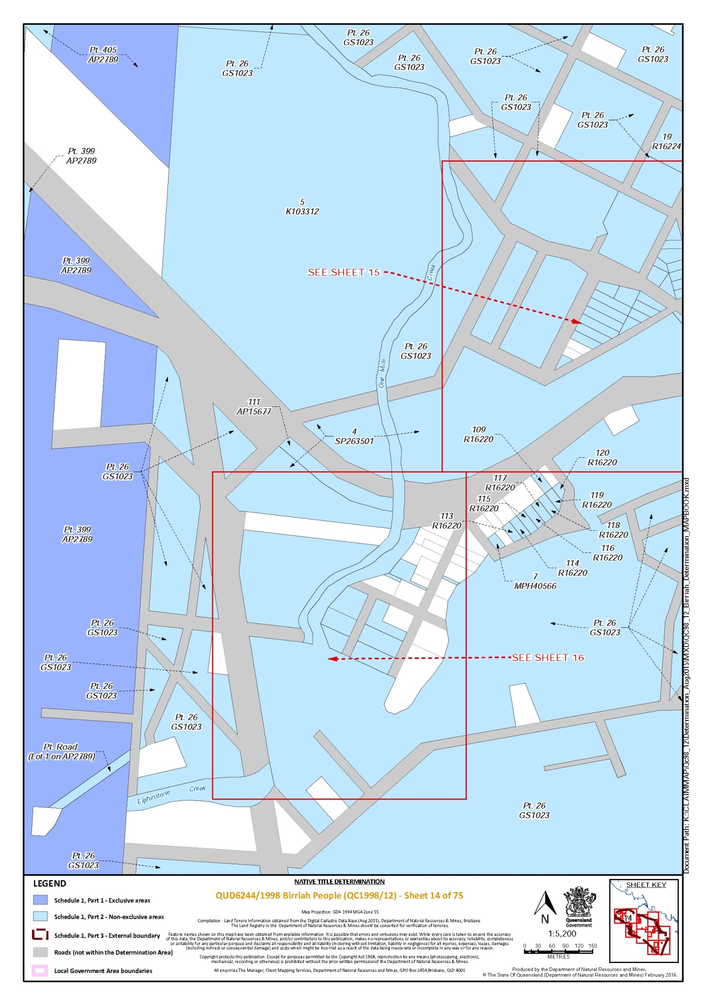
Lot 109 on Plan R16220 | 14, 15 |
Lot 11 on Plan AP13636 | 64 |
Lot 11 on Plan AP13640 | 62 |
Lot 11 on Plan C7406 | 61 |
Lot 11 on Plan DK112 | 54 |
Lot 11 on Plan GS1065 | 10 |
Lot 11 on Plan GS1095 | 18, 19 |
Lot 11 on Plan MPH25920 | 19, 21 |
Lot 11 on Plan MPH40434 | 19 |
That part of Lot 11 on Plan SP208044 that is within the external boundary described in Part 3 | 73, 75 |
Lot 111 on Plan AP15677 | 12, 14, 16 |
Lot 111 on Plan CP851562 | 57, 63 |
Lot 112 on Plan AP15754 | 20, 21 |
Lot 113 on Plan R16220 | 14 |
Lot 114 on Plan MPH25920 | 20, 21 |
Lot 114 on Plan R16220 | 14 |
Lot 115 on Plan MPH25920 | 20, 21 |
Lot 115 on Plan R16220 | 14 |
Lot 116 on Plan R16220 | 14 |
Lot 117 on Plan R16210 | 20 |
Lot 117 on Plan R16220 | 14 |
Lot 118 on Plan R16210 | 20 |
Lot 118 on Plan R16220 | 14 |
Lot 119 on Plan MPH40565 | 19 |
Lot 119 on Plan R16220 | 14 |
Lot 12 on Plan AP13640 * | 59 |
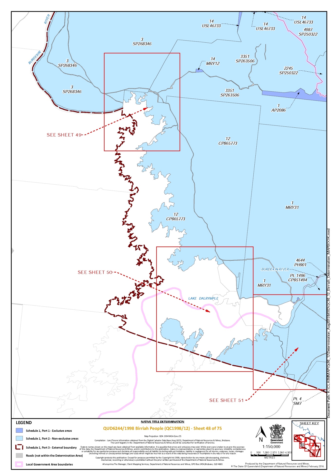
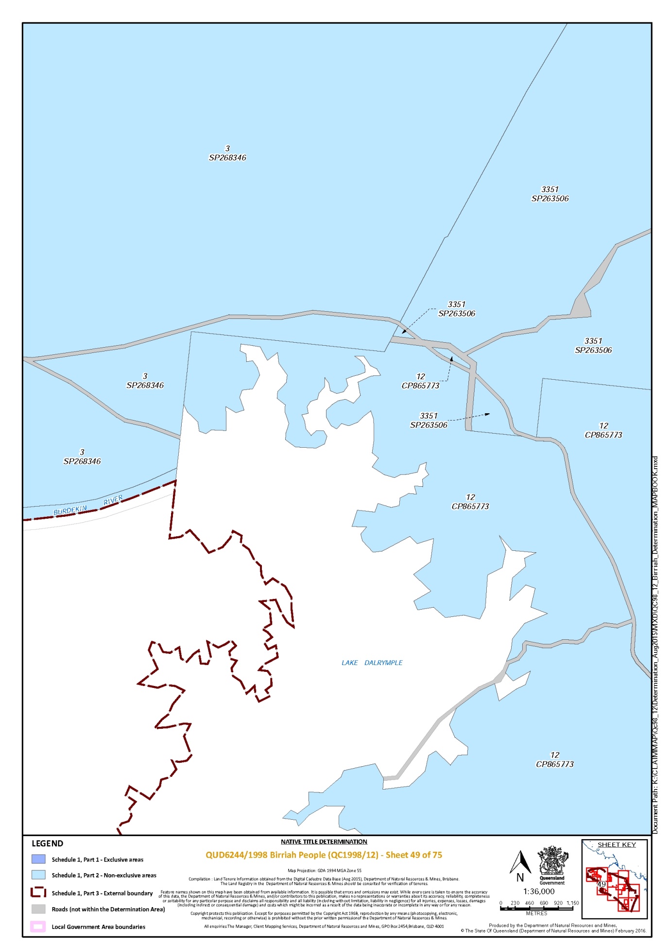
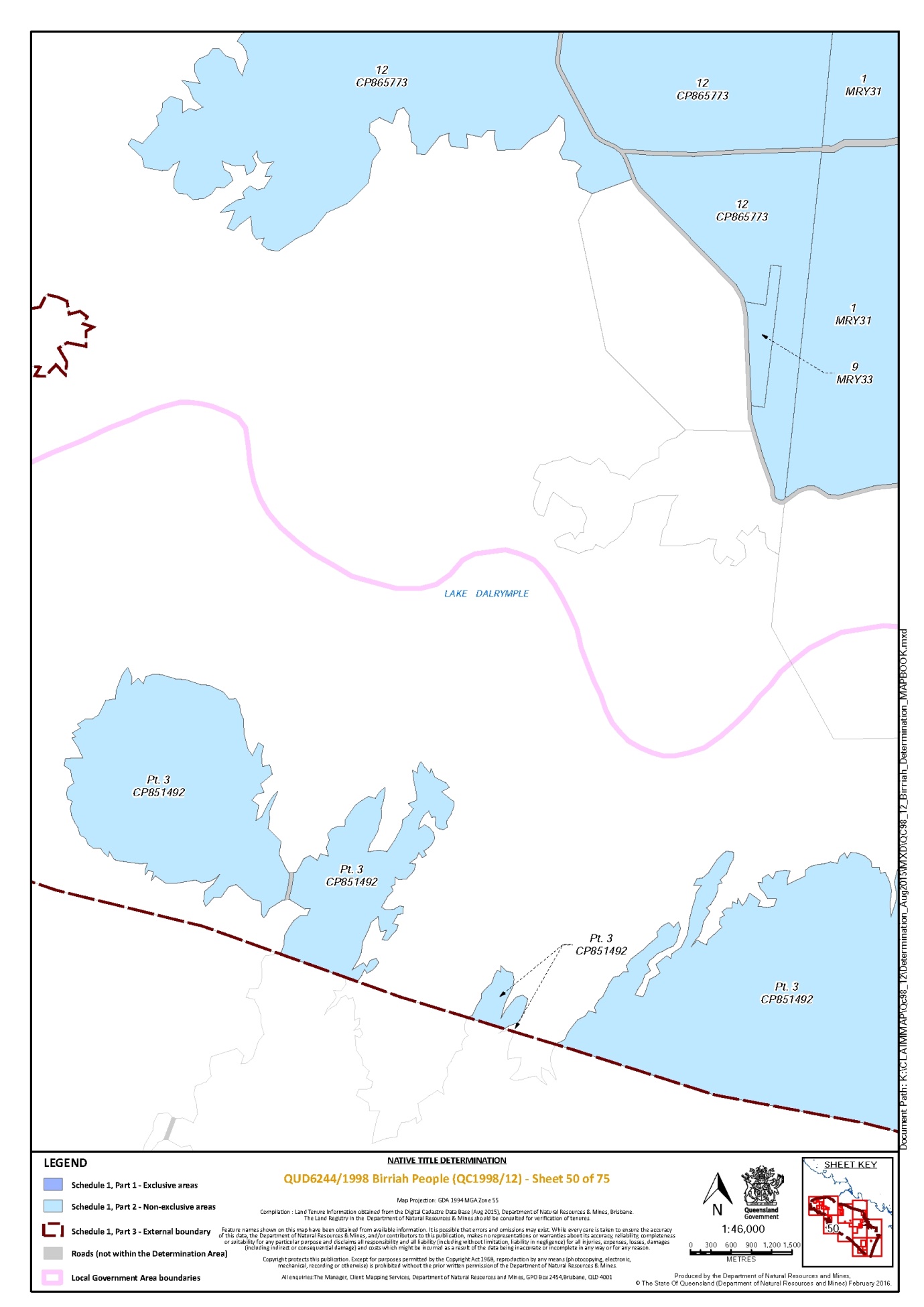
Lot 12 on Plan CP865773 | 48, 49, 50 |
Lot 12 on Plan MPH40434 | 19 |
That part of Lot 12 on Plan SB768 that is within the external boundary described in Part 3 | 28, 29, 31 |
Lot 120 on Plan R16220 | 14 |
Lot 122 on Plan MPH40565 | 18 |
Lot 127 on Plan USL46685 | 61, 65 |
Lot 13 on Plan AP13636 | 64 |
Lot 13 on Plan AP13640 * | 59 |
Lot 13 on Plan GS1083 | 40 |
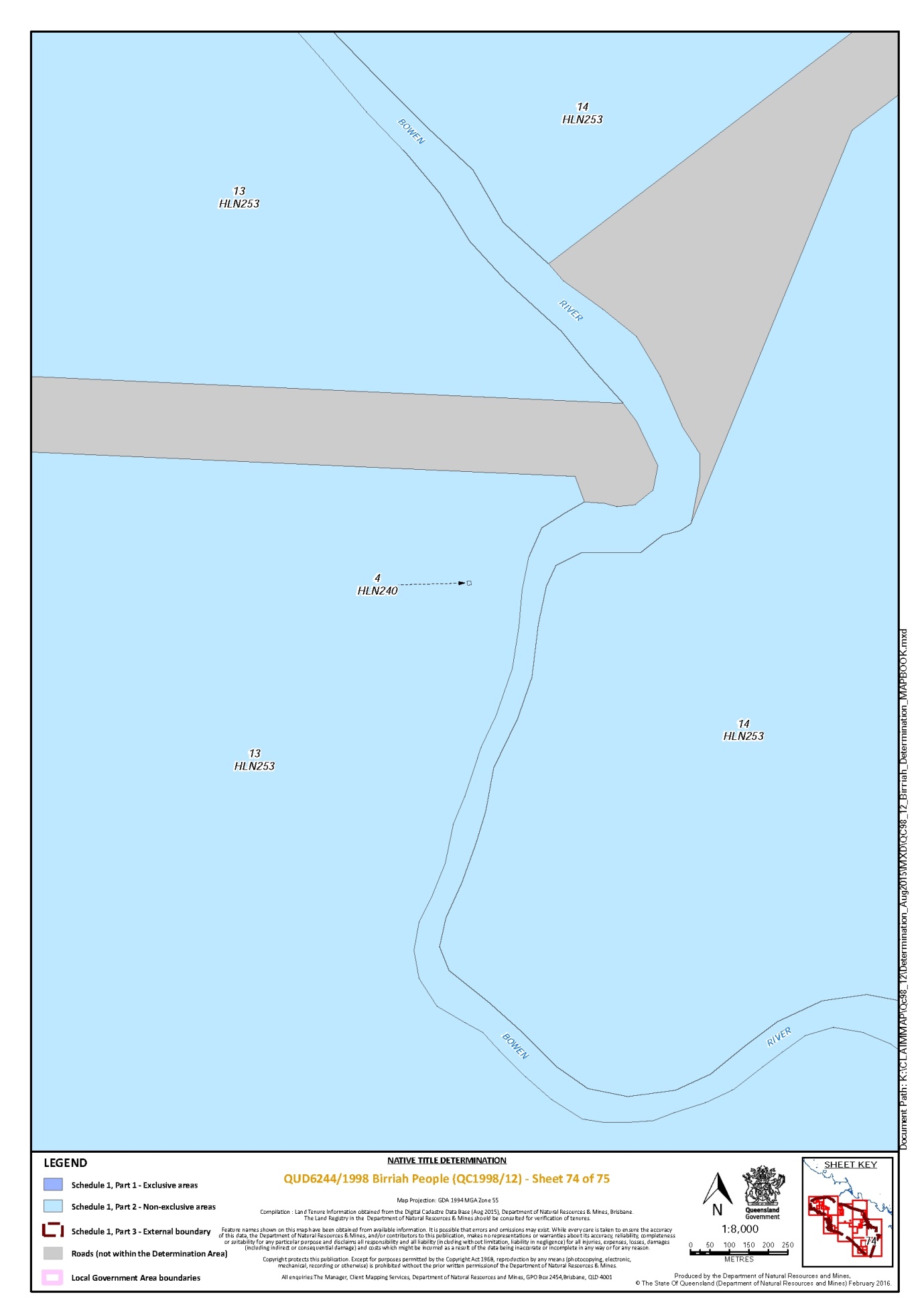
Lot 13 on Plan HLN253 | 68, 73, 74 |
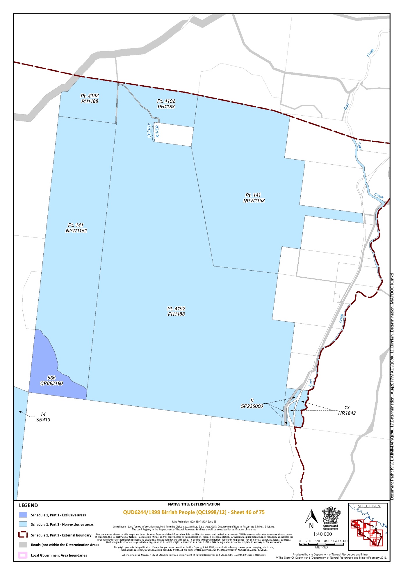
Lot 13 on Plan HR1842 | 46 |
Lot 13 on Plan MPH40434 | 19 |
Lot 14 on Plan AP13525 | 57, 64 |
Lot 14 on Plan D9154 | 42 |
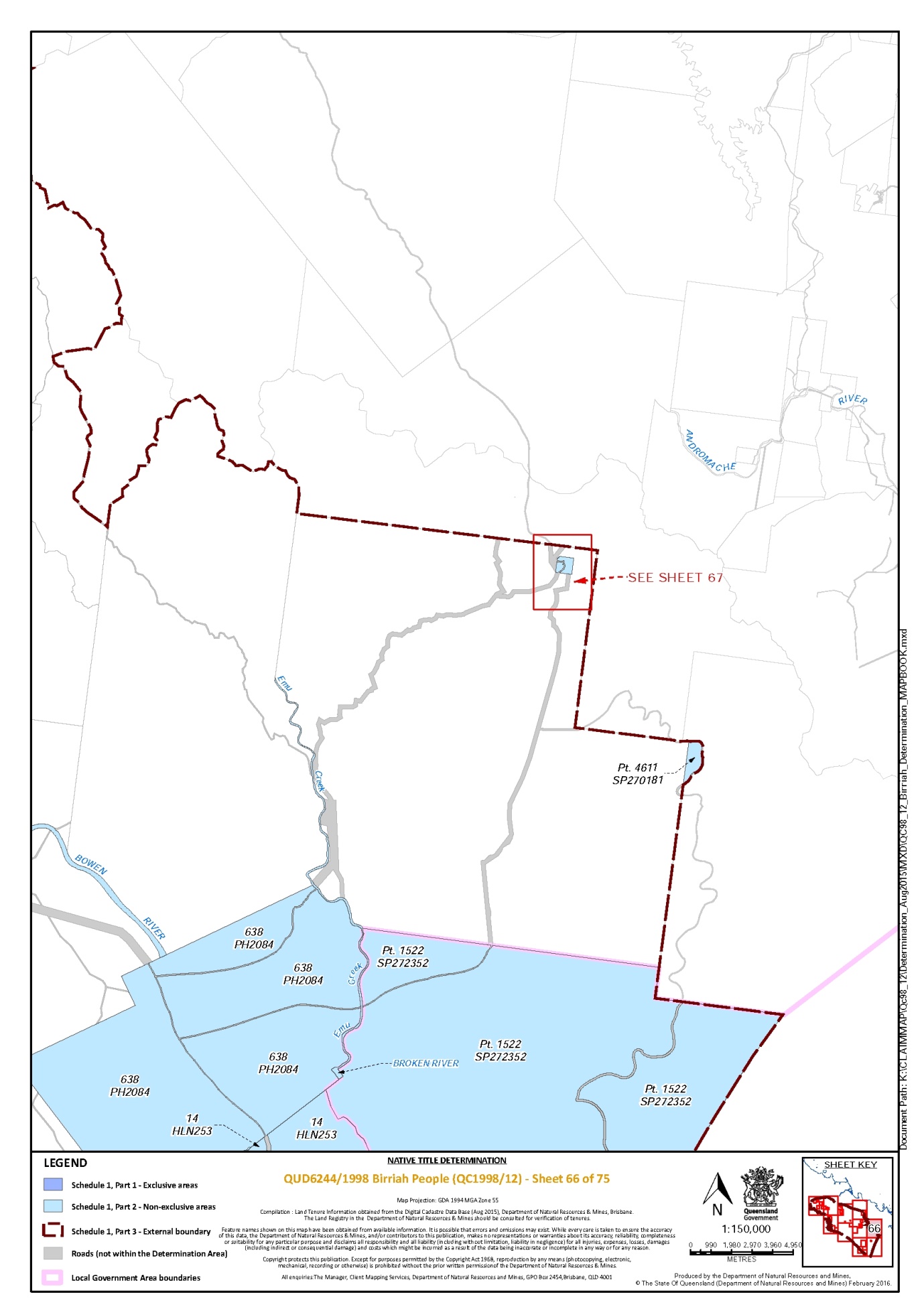
Lot 14 on Plan HLN253 | 66, 73, 74 |
Lot 14 on Plan MPH40434 | 19 |
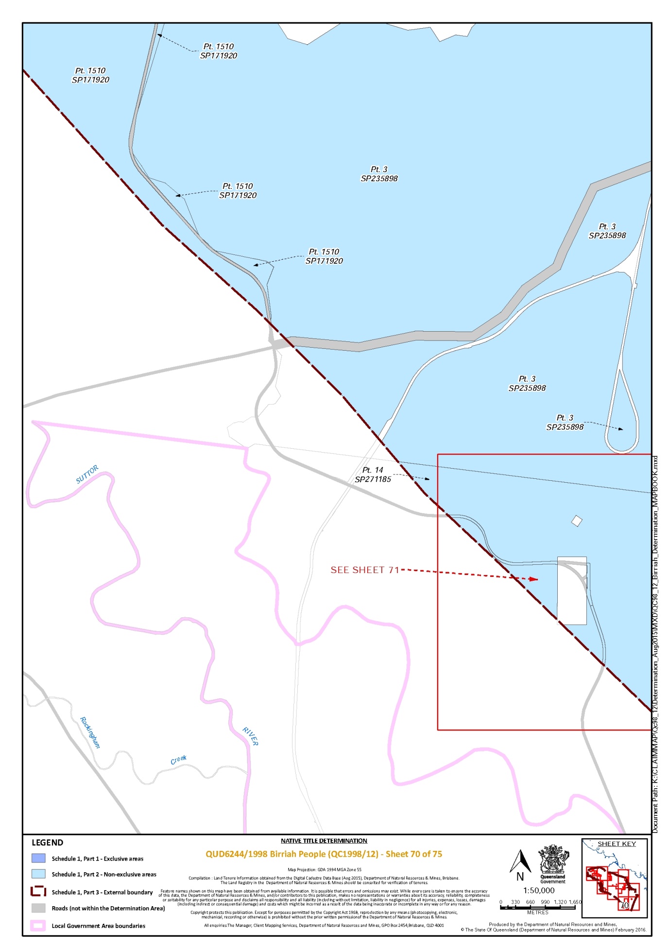
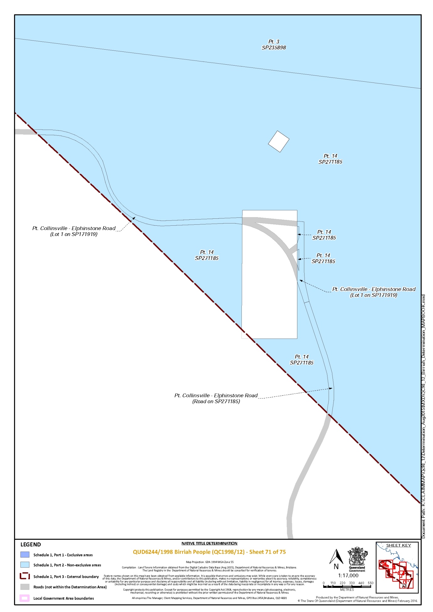
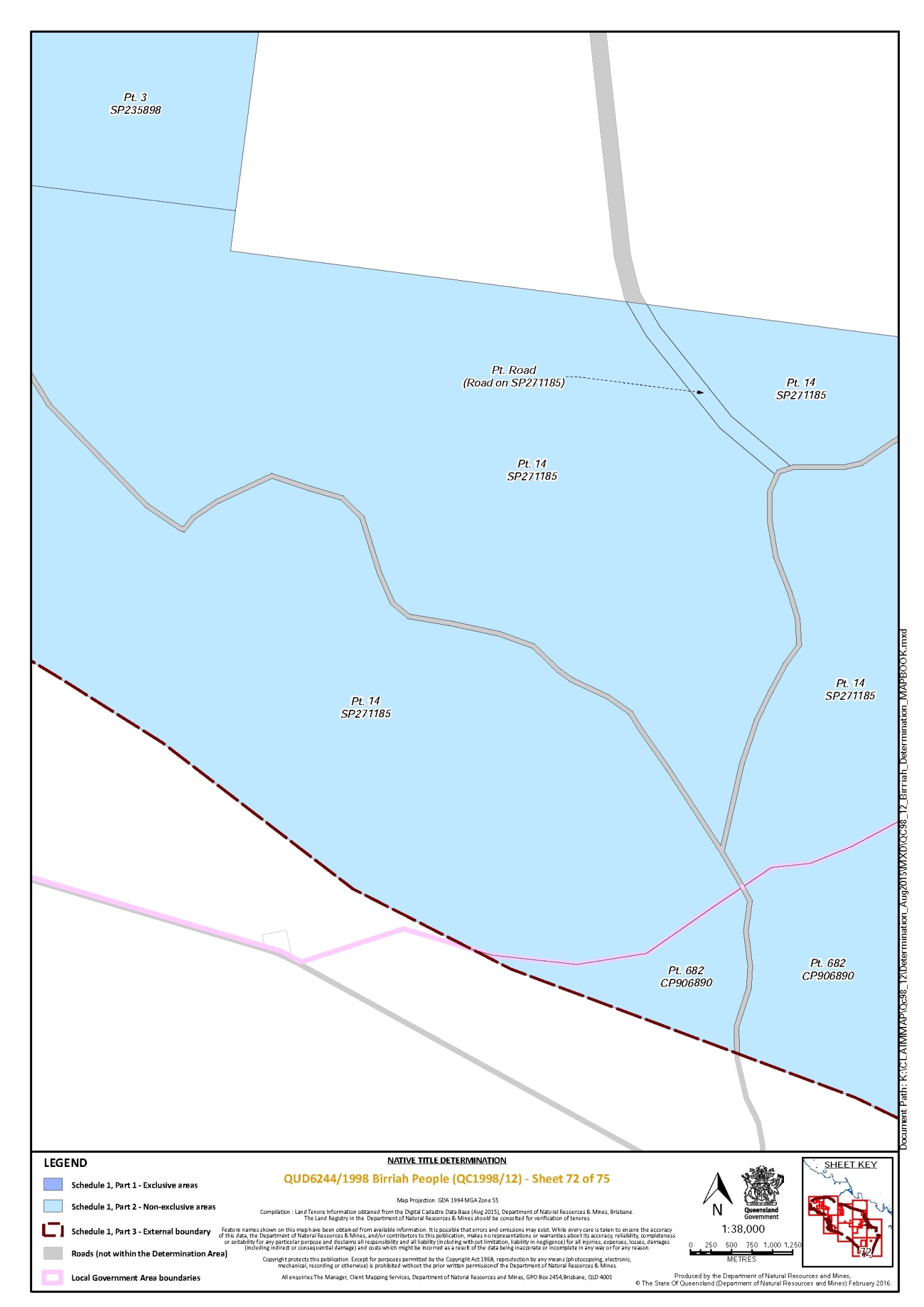
That part of Lot 14 on Plan SP271185 that is within the external boundary described in Part 3 | 68, 70, 71, 72, 73 |
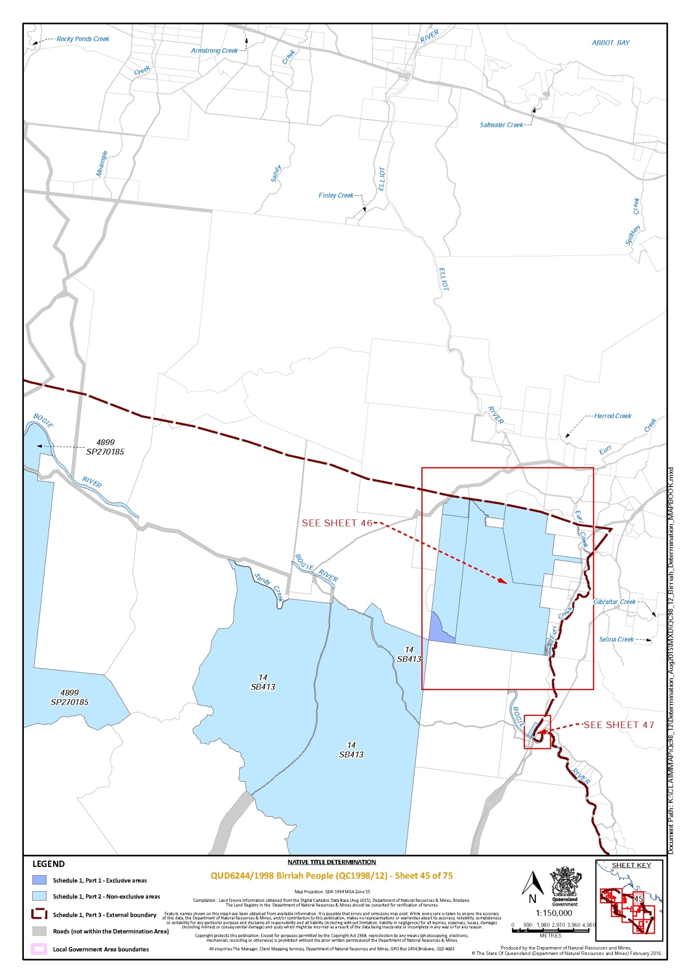
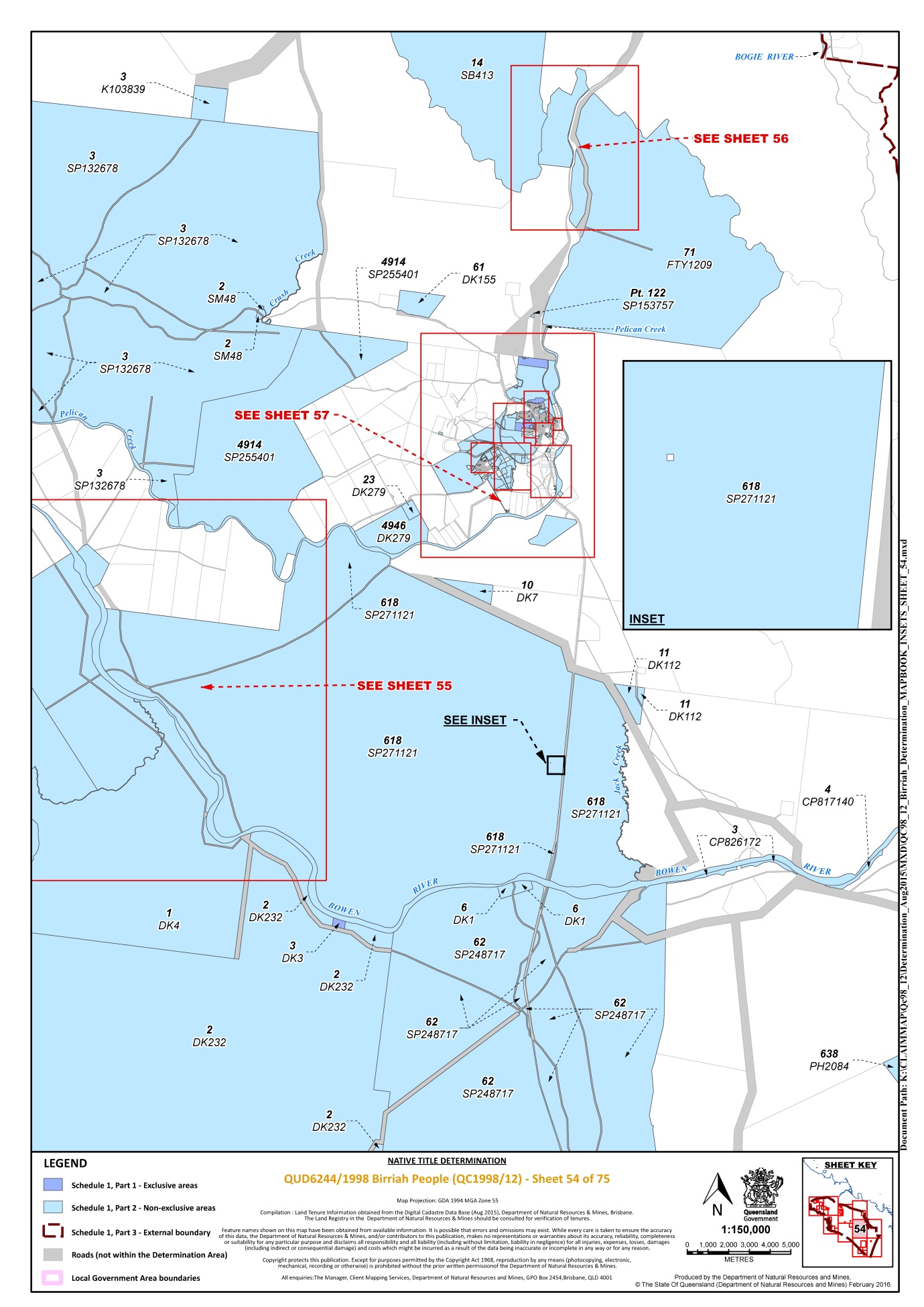
Lot 14 on Plan SB413 | 45, 46, 54, 56 |
Lot 142 on Plan GS890 | 32 |
Lot 149 on Plan S7427 | 63 |
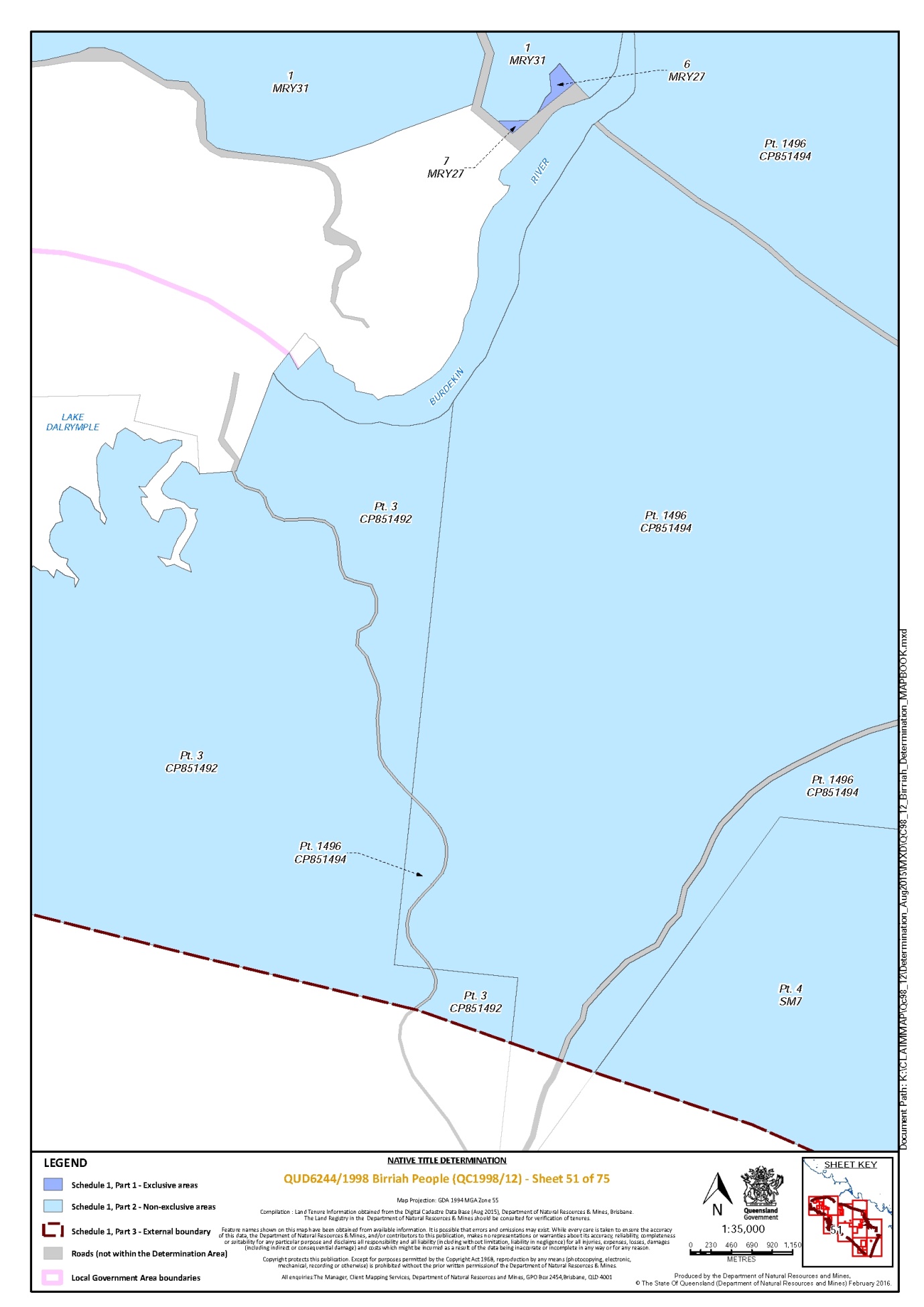
That part of Lot 1496 on Plan CP851494 that is within the external boundary described in Part 3 | 48, 51, 52 |
Lot 15 on Plan AP13636 | 57, 64 |
Lot 15 on Plan AP5727 | 65 |
Lot 15 on Plan C74049 | 58 |
Lot 15 on Plan MPH31317 | 63 |
Lot 15 on Plan MPH40434 | 19 |
Lot 150 on Plan GS896 | 31, 32 |
Lot 151 on Plan GS899 | 32 |
That part of Lot 1510 on Plan SP171920 that is within the external boundary described in Part 3 | 68, 70 |
That part of Lot 1522 on Plan SP272352 that is within the external boundary described in Part 3 | 66, 73 |
That part of Lot 156 on Plan CP826173 that is within the external boundary described in Part 3 | 31 |
Lot 157 on Plan CP826173 | 31 |
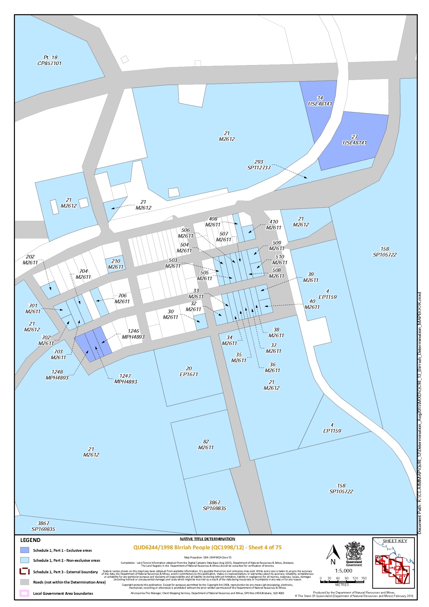
Lot 158 on Plan SP105722 | 1, 4, 5 |
Lot 16 on Plan AP13185 | 75 |
Lot 16 on Plan AP13636 | 63, 64 |
Lot 16 on Plan C74042 | 58, 59 |
Lot 16 on Plan MPH31317 | 63 |
Lot 16 on Plan MPH31319 | 63 |
Lot 17 on Plan AP13185 | 75 |
Lot 17 on Plan AP13636 | 63, 64 |
Lot 17 on Plan M9104 | 34 |
Lot 17 on Plan MPH31317 | 63 |
Lot 17 on Plan MPH31319 | 63 |
Lot 172 on Plan MPH13509 | 59 |
Lot 177 on Plan GS804485 | 30 |
Lot 18 on Plan AP13636 | 64 |
Lot 18 on Plan C74017 | 61, 62 |
Lot 18 on Plan C74030 | 57 |
Lot 18 on Plan DK17 | 55 |
Lot 18 on Plan GS972 | 16 |
Lot 18 on Plan M9104 | 34 |
Lot 18 on Plan M9106 | 33 |
Lot 18 on Plan MPH31061 | 63 |
Lot 19 on AP5727 | 65 |
Lot 19 on Plan C74048 | 58 |
Lot 19 on Plan DK180 | 59 |
Lot 19 on Plan GS1001 | 12 |
Lot 19 on Plan M91012 | 35 |
Lot 19 on Plan M9104 | 34 |
Lot 19 on Plan R16224 | 14, 15, 18 |
Lot 198 on Plan MPH13509 * | 59 |
Lot 2 on Plan CP850644 | 19 |
Lot 2 on Plan AP11631 | 57, 63 |
Lot 2 on Plan AP13635 | 57, 58, 60, 61, 64, 65 |
Lot 2 on Plan AP13636 | 63, 64 |
Lot 2 on Plan AP13637 | 63 |
Lot 2 on Plan AP2844 * | 61 |
Lot 2 on Plan BKN35 | 1 |
Lot 2 on Plan CP866147 | 68, 69, 73 |
Lot 2 on Plan DK232 | 52, 54, 55, 68 |
Lot 2 on Plan GS650 | 10 |
Lot 2 on Plan GS949 | 42 |
Lot 2 on Plan HLN196 | 67 |
Lot 2 on Plan K103702 | 1, 8 |
Lot 2 on Plan M91019 | 34 |
Lot 2 on Plan M9102 | 35 |
Lot 2 on Plan M9107 | 33 |
Lot 2 on Plan R16227 | 18 |
Lot 2 on Plan SB25 | 28, 29, 36, 37 |
Lot 2 on Plan SM48 | 54 |
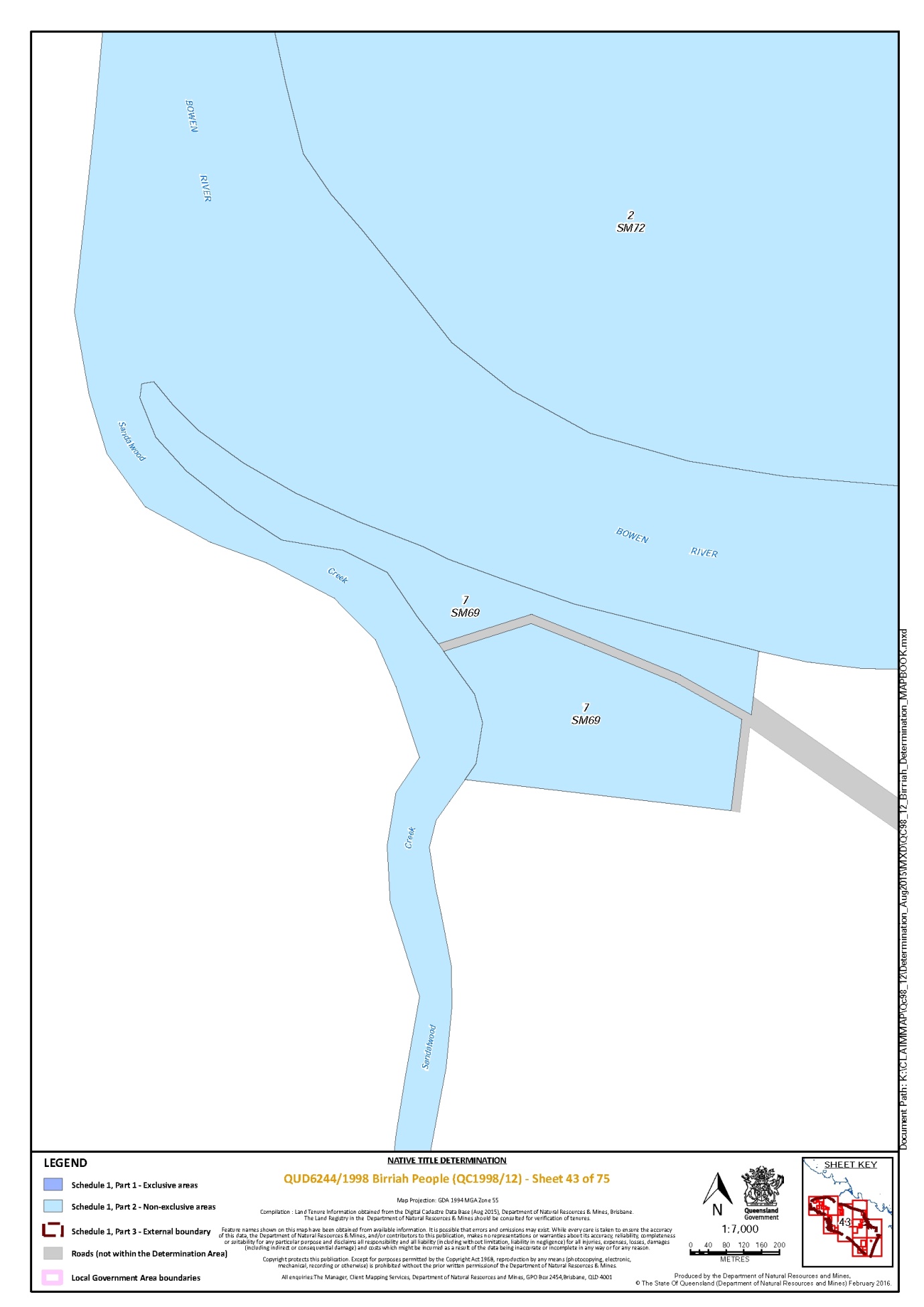
Lot 2 on Plan SM72 | 28, 43 |
That part of Lot 2 on Plan SM9 that is within the external boundary described in Part 3 | 52 |
That part of Lot 2 on Plan SP104779 that is within the external boundary described in Part 3 | 73 |
Lot 20 on Plan EP1671 | 4 |
Lot 20 on Plan G112828 | 75 |
Lot 20 on Plan GS35 | 12 |
Lot 20 on Plan M91012 | 35 |
Lot 20 on Plan M9104 | 34 |
Lot 202 on Plan M2611 | 4 |
Lot 204 on Plan R16210 | 20 |
Lot 21 on Plan BKN113 | 1 |
Lot 21 on Plan C74013 | 60 |
Lot 21 on Plan C74036 | 59 |
Lot 21 on Plan D9158 | 39, 40 |
Lot 21 on Plan G112827 | 75 |
Lot 21 on Plan M2612 | 4 |
Lot 21 on Plan M91012 | 35 |
Lot 21 on Plan M9104 | 34 |
Lot 21 on Plan R16221 | 18 |
Lot 210 on Plan M2611 | 4 |
Lot 22 on Plan D9159 | 39, 40 |
Lot 22 on Plan DK249 | 57 |
Lot 22 on Plan DK252 | 61 |
Lot 22 on Plan GS43 | 21 |
Lot 22 on Plan M9104 | 34 |
Lot 2245 on Plan SP250322 | 28, 48 |
Lot 23 on Plan C74044 | 59 |
Lot 23 on Plan C74048 | 58 |
Lot 23 on Plan D9157 | 40 |
Lot 23 on Plan DK279 | 54 |
Lot 23 on Plan MPH25916 | 18 |
Lot 24 on Plan AP17229 | 59 |
Lot 24 on Plan C8280 | 12 |
Lot 24 on Plan DK190 | 59, 60 |
Lot 24 on Plan M9108 | 33 |
Lot 25 on Plan O2951 | 2 |
Lot 25 on Plan T3491 | 13 |
Lot 26 on Plan BKN137 | 2 |
Lot 26 on Plan SP106412 | 64 |
Lot 27 on Plan DK46 | 65 |
Lot 27 on Plan SP101002 | 3 |
Lot 27 on Plan SP106412 | 64 |
Lot 28 on Plan BKN150 | 2 |
Lot 28 on Plan DK65 | 61 |
Lot 28 on Plan EP1054 | 1 |
Lot 28 on Plan R16214 | 15 |
Lot 2890 on Plan CP904534 | 1 |
Lot 29 on Plan D91510 | 41 |
Lot 293 on Plan SP112737 | 4 |
Lot 3 on Plan AP11631 | 57, 63 |
Lot 3 on Plan AP13635 | 58, 60 |
Lot 3 on Plan AP13636 | 64 |
Lot 3 on Plan AP13637 | 63 |
Lot 3 on Plan BKN28 | 8 |
Lot 3 on Plan CP826172 | 54 |
That part of Lot 3 on Plan CP851492 that is within the external boundary described in Part 3 | 50, 51 |
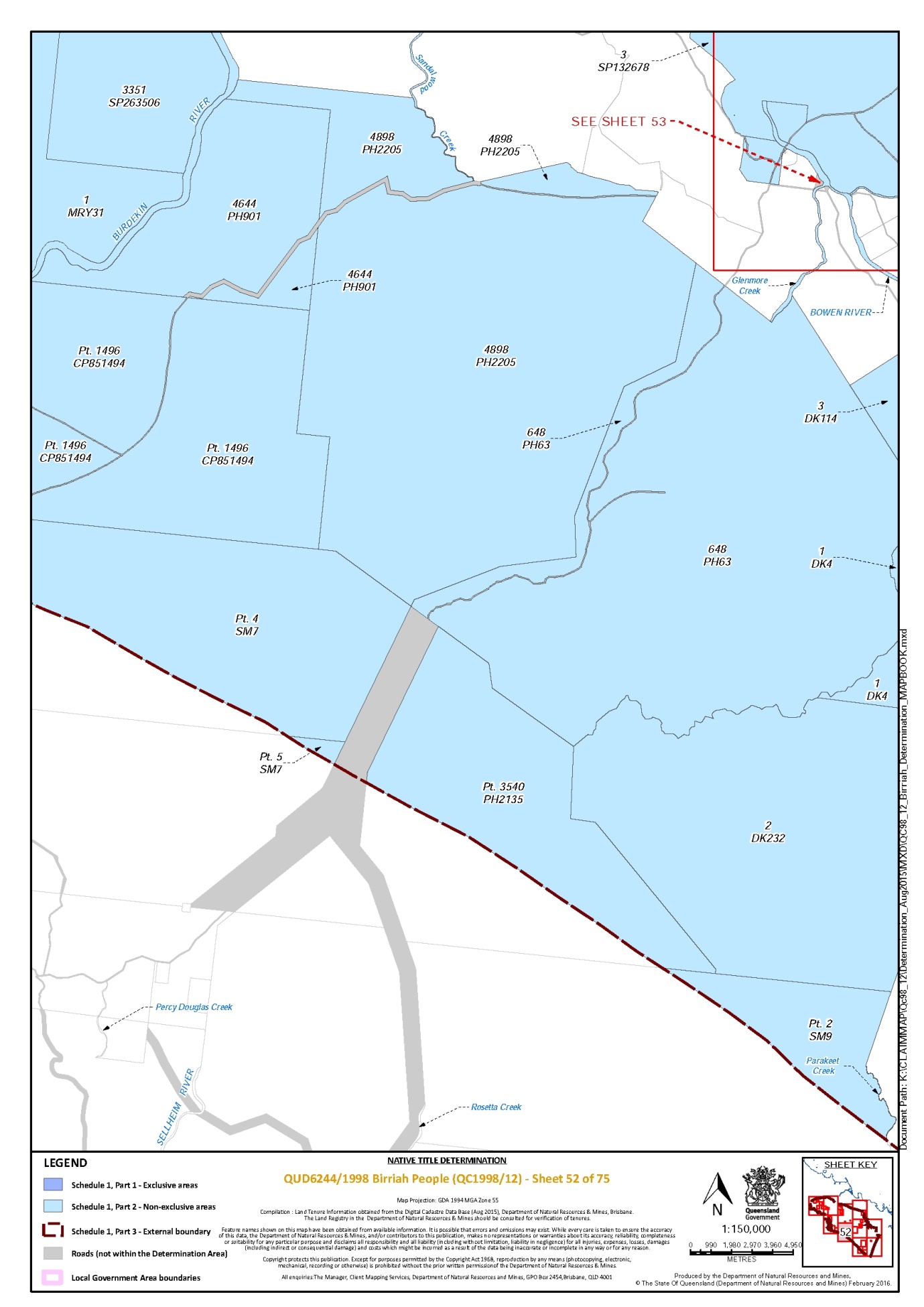
Lot 3 on Plan DK114 | 52, 55 |
Lot 3 on Plan EP563 | 5 |
Lot 3 on Plan GS949 | 42 |
That part of Lot 3 on Plan HLN19 that is within the external boundary described in Part 3 | 73 |
Lot 3 on Plan K103839 | 54 |
Lot 3 on Plan M9102 | 35 |
Lot 3 on Plan MPH20125 * | 61 |
Lot 3 on Plan SB30 | 28, 36 |
Lot 3 on Plan SB43 | 28 |
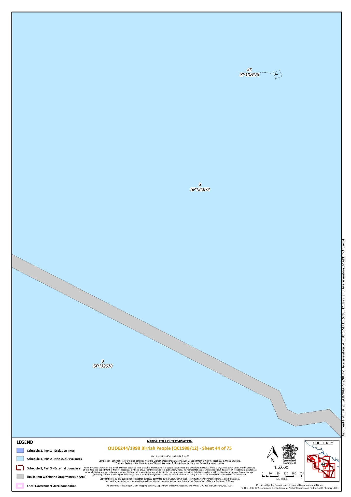
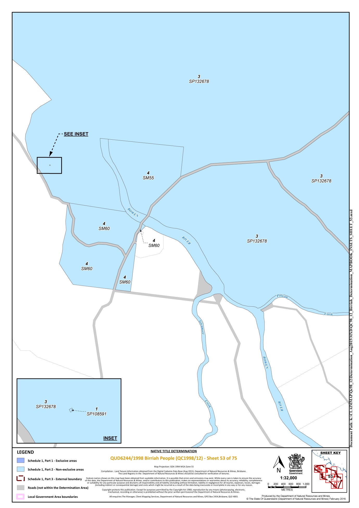
Lot 3 on Plan SP132678 | 28, 44, 53, 54, 55 |
That part of Lot 3 on Plan SP235898 that is within the external boundary described in Part 3 | 68, 69, 70, 71, 72 |
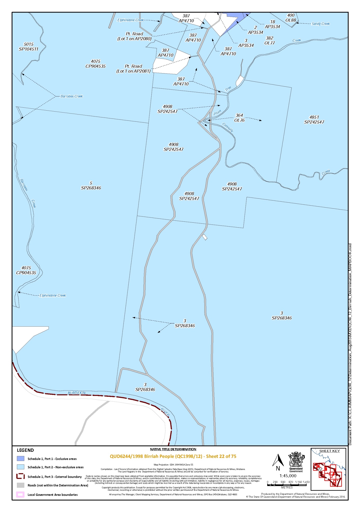
Lot 3 on Plan SP268346 | 10, 22, 48, 49 |
Lot 30 on Plan D91510 | 41 |
Lot 30 on Plan M2611 | 4 |
Lot 304 on Plan SP142947 | 16 |
Lot 305 on Plan AP15783 | 16 |
Lot 31 on Plan DK217 | 60 |
Lot 316 on Plan SP112738 | 3 |
Lot 32 on Plan M2611 | 4 |
Lot 33 on Plan M2611 | 4 |
Lot 3351 on Plan SP263506 | 10, 28, 48, 49, 52 |
That part of Lot 3357 on Plan SP104779 that is within the external boundary described in Part 3 | 73 |
Lot 34 on Plan G112842 | 75 |
Lot 34 on Plan M2611 | 4 |
Lot 34 on Plan MPH13515 | 60 |
Lot 35 on Plan M2611 | 4 |
That part of Lot 3540 on Plan PH2135 that is within the external boundary described in Part 3 | 52 |
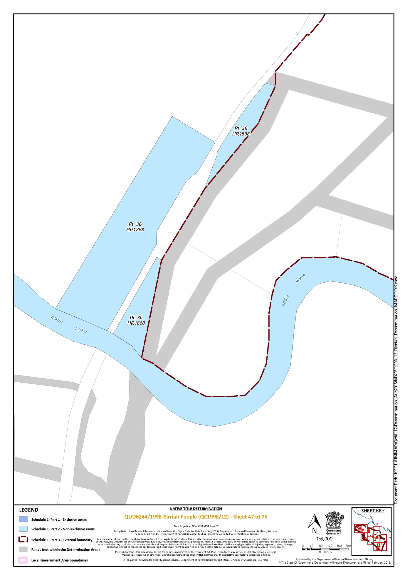
That part of Lot 36 on Plan HR1868 that is within the external boundary described in Part 3 | 47 |
Lot 36 on Plan M2611 | 4 |
Lot 364 on Plan OL76 | 22 |
Lot 37 on Plan DK104 | 65 |
Lot 37 on Plan M2611 | 4 |
Lot 38 on Plan M2611 | 4 |
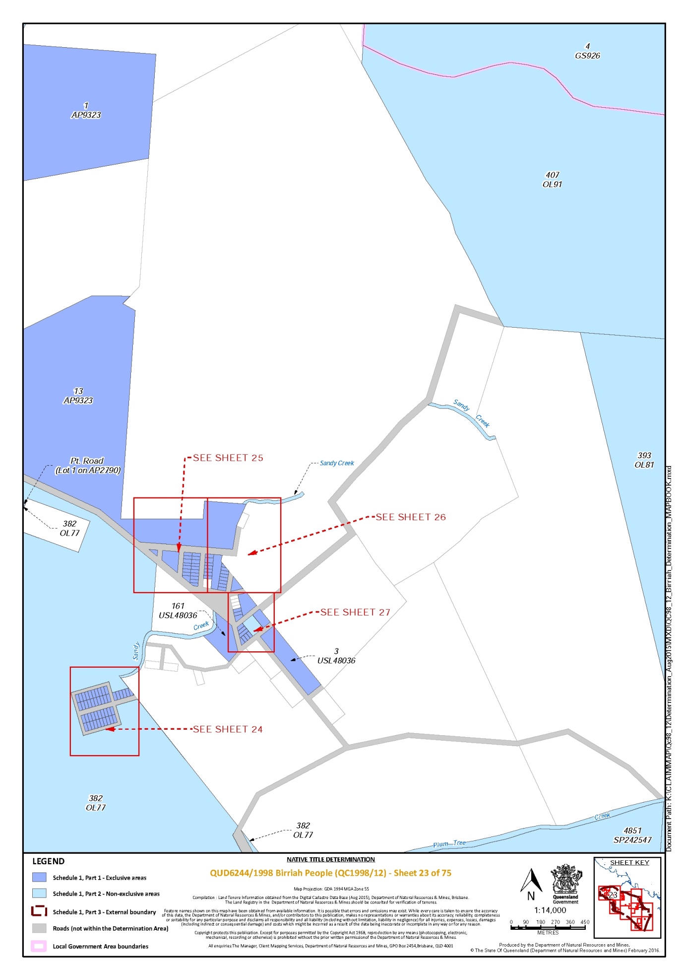
Lot 382 on Plan OL77 | 10, 12, 22, 23, 24, 25 |
Lot 386 on Plan AP2788 | 8 |
Lot 386 on Plan OL78 | 8 |
Lot 3867 on Plan SP169835 | 1, 3, 4, 5, 6 |
Lot 3868 on Plan SP169835 * | 5 |
Lot 387 on Plan AP4710 | 11, 12, 22 |
Lot 39 on Plan M2611 | 4 |
Lot 393 on Plan OL81 | 10, 23 |
Lot 3941 on Plan SP256887 | 1, 6, 8 |
Lot 395 on Plan AP2789 | 11 |
Lot 396 on Plan OL86 | 11 |
Lot 4 on Plan AP11631 | 57, 63, |
Lot 4 on Plan AP13636 | 63, 64 |
Lot 4 on Plan AP13637 | 63 |
Lot 4 on Plan BKN133 | 8 |
Lot 4 on Plan CP815690 | 59 |
Lot 4 on Plan CP817140 | 54 |
Lot 4 on Plan DK114 | 55 |
Lot 4 on Plan EP1159 | 4 |
Lot 4 on Plan G112858 | 75 |
Lot 4 on Plan GS926 | 10, 23 |
Lot 4 on Plan GS949 | 42 |
Lot 4 on Plan HLN240 | 73, 74 |
Lot 4 on Plan M9104 | 34 |
Lot 4 on Plan MPH25920 | 21 |
Lot 4 on Plan SM55 | 53 |
Lot 4 on Plan SM60 | 53 |
That part of Lot 4 on Plan SM7 that is within the external boundary described in Part 3 | 51, 52 |
Lot 4 on Plan SP263501 | 14, 15, 16, 18 |
Lot 40 on Plan M2611 | 4 |
Lot 400 on Plan OL88 | 12, 22 |
Lot 4004 on Plan SP242524 | 1, 8 |
Lot 401 on Plan AP15783 | 16 |
Lot 402 on Plan R16220 | 16 |
Lot 4026 on Plan SP112067 | 1, 6, 10 |
Lot 403 on Plan R16220 | 16 |
Lot 405 on Plan R16210 | 18 |
Lot 406 on Plan OL90 | 10 |
Lot 406 on Plan R16210 | 18 |
Lot 407 on Plan OL91 | 10, 23 |
Lot 407 on Plan R16210 | 18 |
Lot 4075 on Plan CP904535 | 1, 9, 11, 22 |
Lot 408 on Plan M2611 | 4 |
Lot 4091 on Plan SP273452 | 1, 5, 6 |
Lot 41 on Plan G112826 | 75 |
Lot 410 on Plan M2611 | 4 |
Lot 4132 on Plan PH2187 | 1, 10 |
That part of Lot 4192 on Plan PH1188 that is within the external boundary described in Part 3 | 46 |
Lot 42 on Plan DK55 | 57 |
Lot 43 on Plan DK55 | 57 |
Lot 45 on Plan SP132678 * | 44 |
Lot 45 on Plan SP184781 | 61 |
Lot 4548 on Plan PH2196 | 1, 6, 8 |
Lot 4577 on Plan SP112068 | 6 |
Lot 46 on Plan G112843 | 75 |
Lot 46 on Plan GS1090 | 10, 11 |
That part of Lot 4611 on Plan SP270181 that is within the external boundary described in Part 3 | 66 |
Lot 4644 on Plan PH901 | 48, 52 |
Lot 4851 on Plan SP242547 | 10, 22, 23 |
Lot 4898 on Plan PH2205 | 52 |
Lot 4899 on Plan SP270185 | 28, 45 |
Lot 4908 on Plan SP242547 | 10, 22 |
Lot 4914 on Plan SP255401 | 54, 55 |
That part of Lot 4924 on Plan SP262313 that is within the external boundary described in Part 3 | 1 |
Lot 4942 on Plan SP250583 | 3 |
Lot 4946 on Plan DK279 | 54, 57 |
Lot 4987 on Plan SP250322 | 10, 28, 36, 38, 39, 40, 48 |
Lot 5 on Plan AP11631 * | 57, 58, 63, 64 |
Lot 5 on Plan AP13635 | 64, 65 |
Lot 5 on Plan AP13636 | 64 |
Lot 5 on Plan AP13637 | 63, 64 |
Lot 5 on Plan BKN134 | 8 |
Lot 5 on Plan CP884891 | 75 |
Lot 5 on Plan K103312 | 14, 15 |
Lot 5 on Plan M9104 | 34 |
That part of Lot 5 on Plan SM7 that is within the external boundary described in Part 3 | 52 |
Lot 5 on Plan SP268346 | 1, 22 |
Lot 50 on Plan C74044 | 59 |
Lot 501 on Plan R16210 | 18 |
Lot 501 on Plan R16220 | 16 |
Lot 5015 on Plan SP104511 | 1, 7, 9, 11, 22 |
Lot 5016 on Plan CP904533 | 1, 6, 7, 9, 11 |
Lot 502 on Plan R16220 | 16 |
Lot 503 on Plan M2611 | 4 |
Lot 503 on Plan R16220 | 16 |
Lot 504 on Plan M2611 | 4 |
Lot 505 on Plan M2611 | 4 |
Lot 505 on Plan R16210 | 18 |
Lot 506 on Plan M2611 | 4 |
Lot 506 on Plan R16210 | 18 |
Lot 507 on Plan M2611 | 4 |
Lot 508 on Plan E4741 | 27 |
Lot 508 on Plan M2611 | 4 |
Lot 509 on Plan M2611 | 4 |
Lot 51 on Plan MPH25920 | 19 |
Lot 510 on Plan M2611 | 4 |
Lot 511 on Plan PH459 | 1, 2 |
Lot 5188 on Plan SP250844 | 1, 3 |
Lot 5347 on Plan SP260076 | 28 |
Lot 5348 on Plan SP260076 | 28 |
Lot 56 on Plan MPH25920 | 19 |
Lot 56 on Plan S7427 | 63 |
Lot 57 on Plan G112837 | 75 |
Lot 57 on Plan MPH25920 | 19, 21 |
Lot 58 on Plan G112837 | 75 |
Lot 58 on Plan G112842 | 75 |
Lot 58 on Plan MPH25920 | 19, 21 |
Lot 58 on Plan SP143789 | 36, 37, 38, 39 |
Lot 59 on Plan DK66 | 64 |
Lot 59 on Plan MPH25920 | 19, 21 |
Lot 59 on Plan SP107461 | 28, 36, 39 |
Lot 6 on Plan AP11631 * | 63 |
Lot 6 on Plan AP13635 | 64 |
Lot 6 on Plan AP13636 | 64 |
Lot 6 on Plan AP13637 | 64 |
Lot 6 on Plan DK1 | 54 |
Lot 6 on Plan GS409 | 29 |
Lot 6 on Plan M9104 | 34 |
Lot 6 on Plan SB25 | 29 |
Lot 60 on Plan MPH25920 | 19, 21 |
Lot 60 on Plan SP107461 | 28 |
Lot 61 on Plan DK155 | 54 |
Lot 618 on Plan SP271121 | 54, 55 |
Lot 62 on Plan SP248717 | 54, 68, 69 |
Lot 638 on Plan PH2084 | 54, 66, 73 |
Lot 64 on Plan DK77 | 57, 59 |
Lot 64 on Plan G112832 | 75 |
Lot 648 on Plan PH63 | 52, 55 |
That part of Lot 682 on Plan CP906890 that is within the external boundary described in Part 3 | 72, 73 |
Lot 7 on Plan AP11631 | 57 |
Lot 7 on Plan AP13636 | 64 |
Lot 7 on Plan AP13637 | 63, 64 |
Lot 7 on Plan AP13640 | 59 |
Lot 7 on Plan D91513 | 41 |
Lot 7 on Plan GS1064 | 10, 29, 36, 38 |
Lot 7 on Plan M91012 | 35 |
Lot 7 on Plan M9104 | 34 |
Lot 7 on Plan MPH40566 | 14 |
Lot 7 on Plan SB730 | 28, 36 |
Lot 7 on Plan SM69 | 43 |
Lot 7 on Plan SP112066 | 6 |
Lot 701 on Plan M2611 | 4 |
Lot 702 on Plan M2611 | 4 |
Lot 703 on Plan M2611 | 4 |
Lot 704 on Plan M2611 | 4 |
Lot 706 on Plan M2611 | 4 |
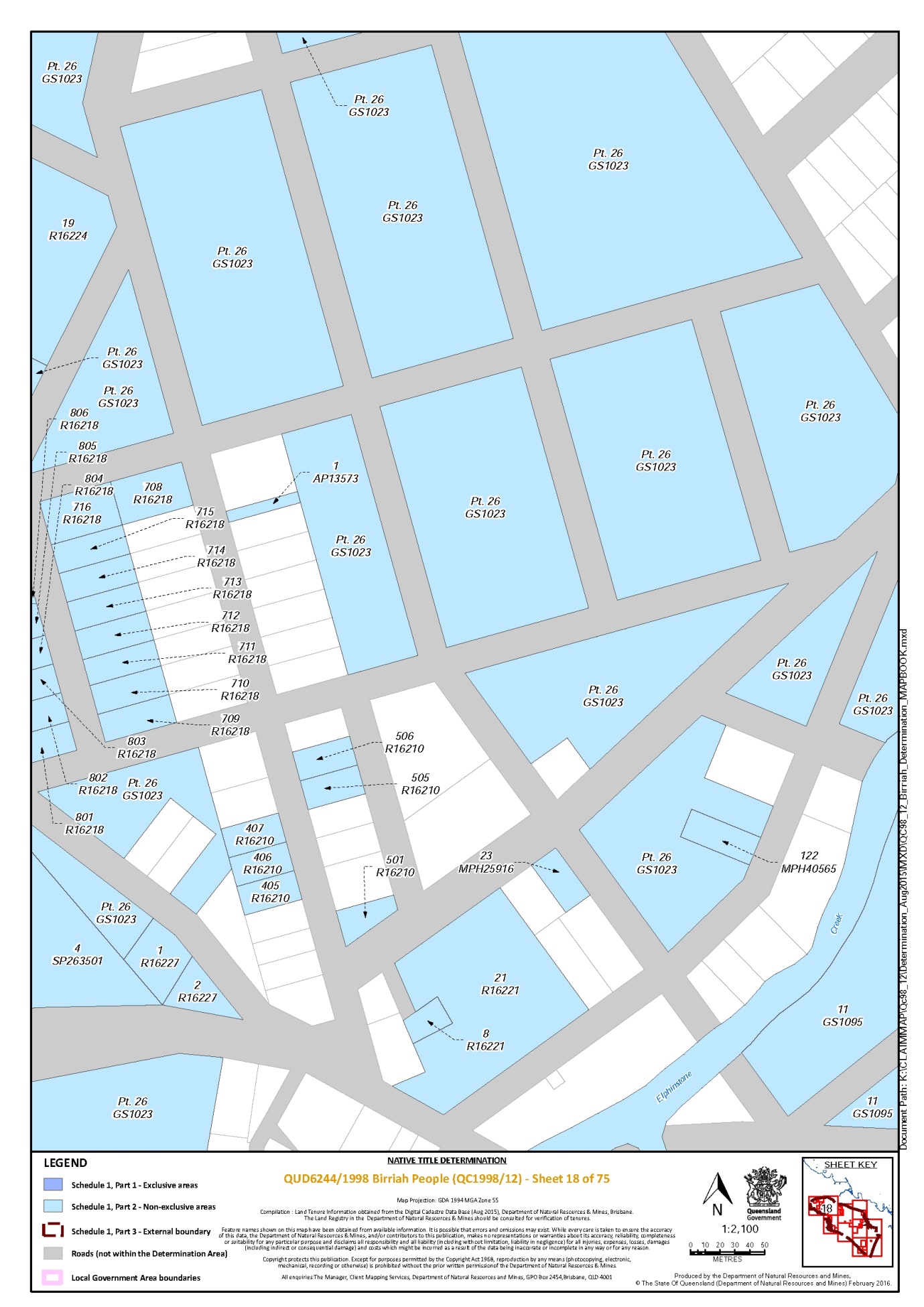
Lot 708 on Plan R16218 | 18 |
Lot 709 on Plan R16218 | 18 |
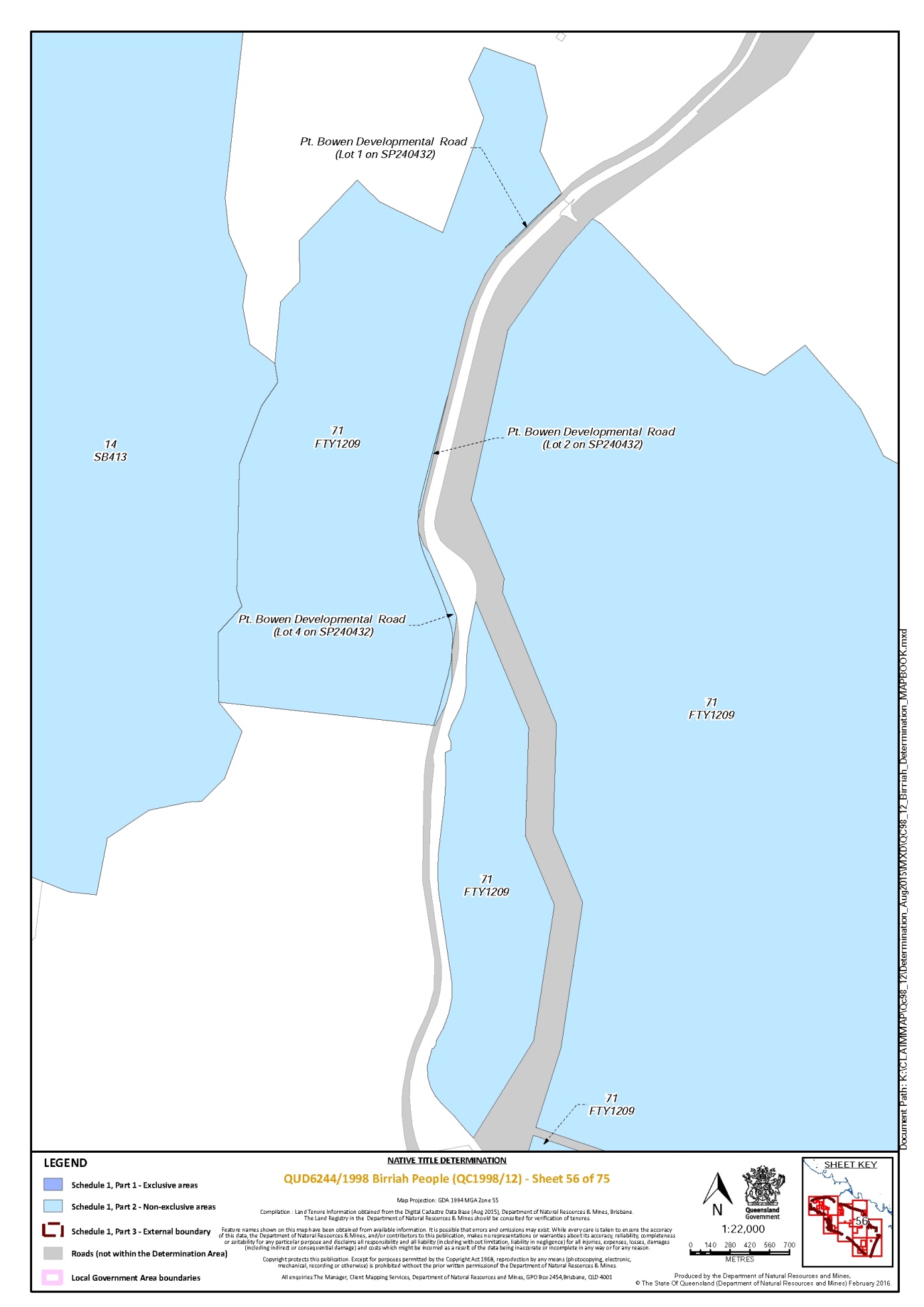
Lot 71 on Plan FTY1209 | 54, 56 |
That part of Lot 71 on Plan GS801636 that is within the external boundary described in Part 3 | 10 |
Lot 710 on Plan R16218 | 18 |
Lot 711 on Plan R16218 | 18 |
Lot 712 on Plan R16218 | 18 |
Lot 713 on Plan R16218 | 18 |
Lot 714 on Plan R16218 | 18 |
Lot 715 on Plan R16218 | 18 |
Lot 716 on Plan R16218 | 18 |
Lot 73 on Plan DK104 | 65 |
Lot 73 on Plan MPH13515 | 60 |
Lot 74 on Plan MPH13515 | 60 |
Lot 75 on Plan MPH13515 | 60 |
Lot 76 on Plan GS612 | 38 |
Lot 8 on Plan AP13636 | 64 |
Lot 8 on Plan AP13637 | 63, 64 |
Lot 8 on Plan AP13640 * | 61 |
Lot 8 on GS286 | 12 |
Lot 8 on Plan M91012 | 35 |
Lot 8 on Plan M9104 | 34 |
Lot 8 on Plan R16221 | 18 |
Lot 8 on Plan SP104504 | 1, 6, 7, 10 |
Lot 80 on Plan CP903173 | 57, 59 |
Lot 80 on GS634 | 38 |
Lot 801 on Plan R16218 | 15, 18 |
Lot 802 on Plan R16218 | 15, 18 |
Lot 803 on Plan R16218 | 15, 18 |
Lot 804 on Plan R16218 | 15, 18 |
Lot 805 on Plan R16218 | 15, 18 |
Lot 806 on Plan R16218 | 15, 18 |
Lot 807 on Plan R16218 | 15 |
Lot 808 on Plan R16218 | 15 |
Lot 809 on Plan R16218 | 15 |
Lot 81 on Plan CP903172 | 57 |
Lot 810 on Plan R16218 | 15 |
Lot 82 on Plan M2611 | 4 |
Lot 85 on Plan MPH40507 * | 59 |
Lot 88 on Plan SP106415 | 58 |
Lot 89 on Plan SP232119 | 58 |
Lot 9 on Plan AP13636 | 64 |
Lot 9 on Plan AP13637 | 63 |
Lot 9 on Plan AP13640 | 61 |
Lot 9 on Plan C7406 | 61 |
Lot 9 on Plan GS903 | 31 |
Lot 9 on Plan M91012 | 35 |
Lot 9 on Plan M9104 | 34 |
Lot 9 on Plan MRY33 | 50 |
Lot 9 on Plan SP235000 | 46 |
Lot 9 on Plan SP270185 * | 28 |
Lot 901 on Plan R16218 | 15 |
Lot 902 on Plan R16218 | 15 |
Lot 903 on Plan R16218 | 15 |
Lot 904 on Plan R16218 | 15 |
Lot 905 on Plan R16218 | 15 |
Lot 906 on Plan R16218 | 15 |
Lot 907 on Plan R16218 | 15 |
Lot 910 on Plan R16218 | 15 |
Lot 911 on Plan R16218 | 15 |
Lot 912 on Plan R16218 | 15 |
Lot 913 on Plan R16218 | 15 |
Lot 914 on Plan R16218 | 15 |
Lot 915 on Plan R16218 | 15 |
Lot 98 on Plan DK53 | 57 |
An area identified as road (part of Walker Street) and delineated by stations 15-16-17-37a-37-38-45-15 on Plan SP106415 * | 58 |
An area identified as road (part of Collinsville – Elphinstone Road) and formerly described as Lot 1 on SP171919 * | 71 |
An area identified as New Road (part of Collinsville – Elphinstone Road) and delineated by stations 213-212-20-26-32-38-44-9-8-45-39-33-27-21-213 on Plan SP225054 * | 71 |
An area identified as New Road and delineated by stations 9a-10-11-35-15-36-18-19-20a-9a on Plan SP271185 * | 72 |
An area identified as road and delineated by stations A-B-C-D-A on Plan SP111980 * | 1 |
An area identified as road (part of Flinders Highway) and delineated by stations A-B-C-D-G-J-K-H-A on Plan SP101002 * | 3 |
An area identified as road (part of Flinders Highway) and formerly described as Lot 315 on Plan SP112738 * | 3 |
An area identified as road and delineated by stations D-E-F-G-D on Plan SP104504 * | 1, 7 |
An area identified as road and formerly described as Lot 1 on Plan AP2101 * | 8 |
An area identified as road and formerly described as Lot 2 on Plan AP2101 * | 8 |
An area identified as road and formerly described as Lot 1 on Plan AP2082 * | 11 |
An area identified as road and formerly described as Lot 2 on Plan AP2082 * | 11 |
An area identified as road and formerly described as Lot 1 on AP2789 * | 14 |
An area identified as road and formerly described as Lot 1 on Plan AP2790 * | 12, 23 |
An area identified as road and formerly described as Lot 1 on Plan AP2080 * | 22 |
An area identified as road and formerly described as Lot 1 on Plan AP2081 * | 22 |
An area identified as road (part of Ayr – Dalbeg Road) and formerly described as Lot 9 on Plan SP143786 * | 37 |
An area identified as road (part of Ayr – Dalbeg Road) and formerly described as Lot 13 on Plan SP143787 * | 37 |
An area identified as road (part of Ayr – Dalbeg Road) and formerly described as Lot 15 on Plan SP143789 * | 37 |
An area identified as road (part of Bowen Developmental Road) and formerly described as Lot 1 on SP240432 * | 56 |
An area identified as road (part of Bowen Developmental Road) and formerly described as Lot 2 on SP240432 * | 56 |
An area identified as road (part of Bowen Developmental Road) and formerly described as Lot 4 on SP240432 * | 56 |
An area identified as road (part of Corduroy Creek Road) and formerly described as Lot 12 on Plan AP13525 * | 64 |
Areas identified as roads and delineated by stations A-B-C-D-A, F-E-H-G-F and J-K-L-M-J on Plan SP112066 * | 1, 6 |
That part of Lot 1 on Plan AP7731 formerly described as Lot 2 on Plan AP2859 | 38 |
That part of Lot 122 on Plan SP153757 identified by stations 10-11-15-10 to the north-east of Easement AA on Plan SP196126 | 54 |
That part of Lot 141 on Plan NPW1152 formerly described as Lot 141 on Plan NPW679 | 46 |
That part of Lot 19 on Plan CP857101 which does not include the areas identified as a Ten Chain Road and part of the Flinders Highway on Plan BKN69 and as Roads to be Closed on Plan RA1589 | 1, 3, 4 |
That part of Lot 2 on Plan S7426 which does not include the area described in Schedule 2 | 63 |
That part of Lot 26 on Plan DK276 which does not include the area described in Schedule 2 | 57 |
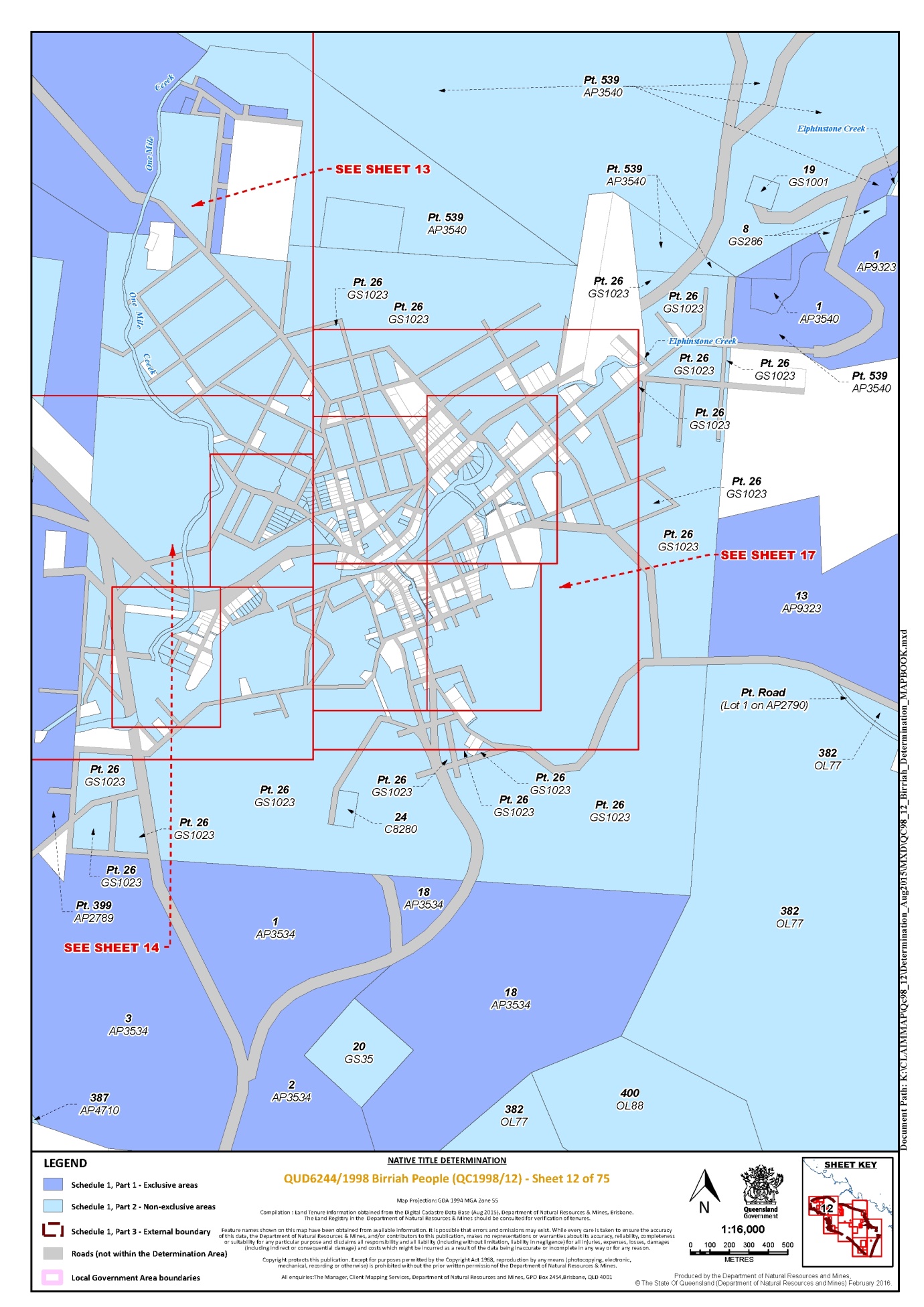
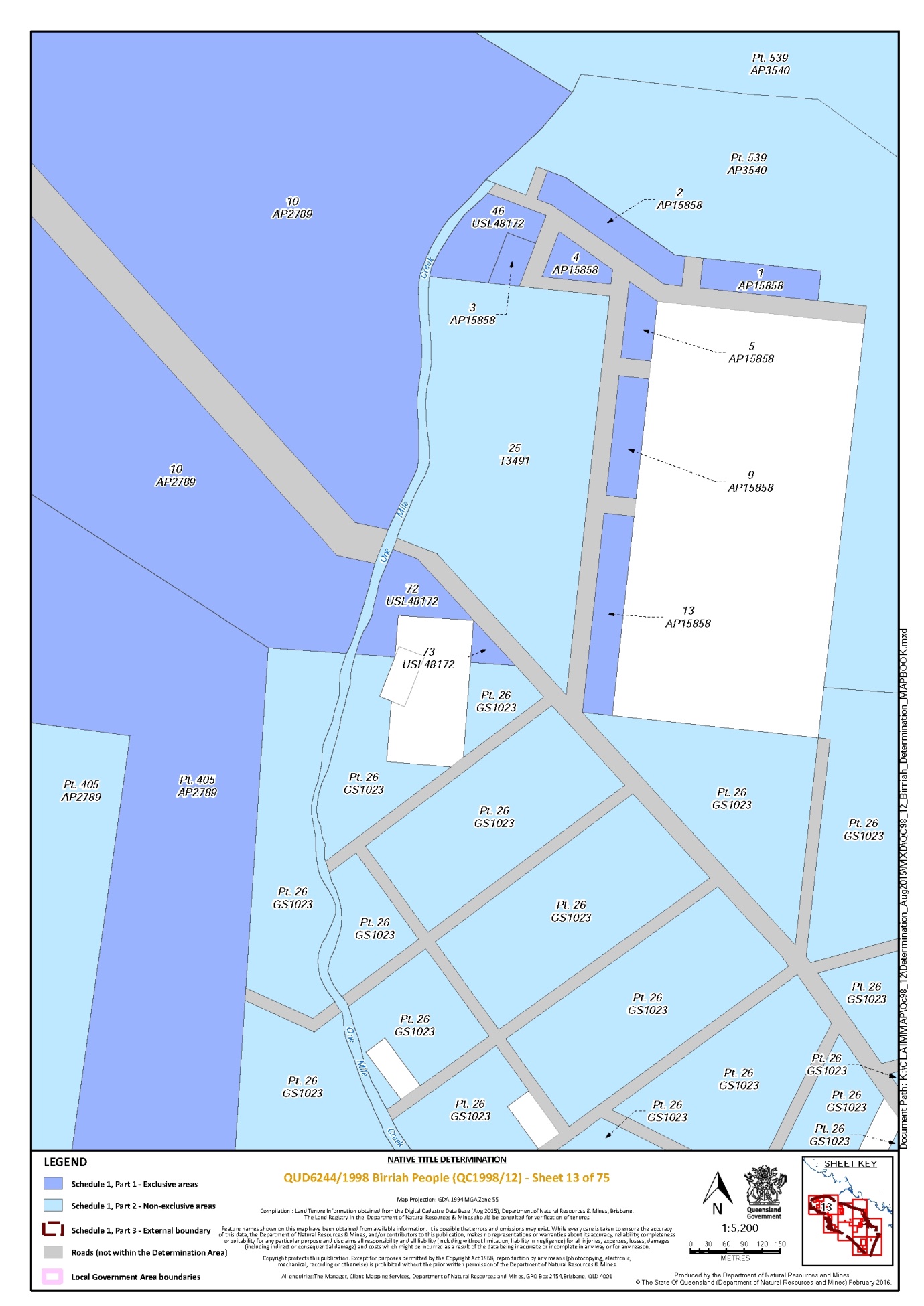
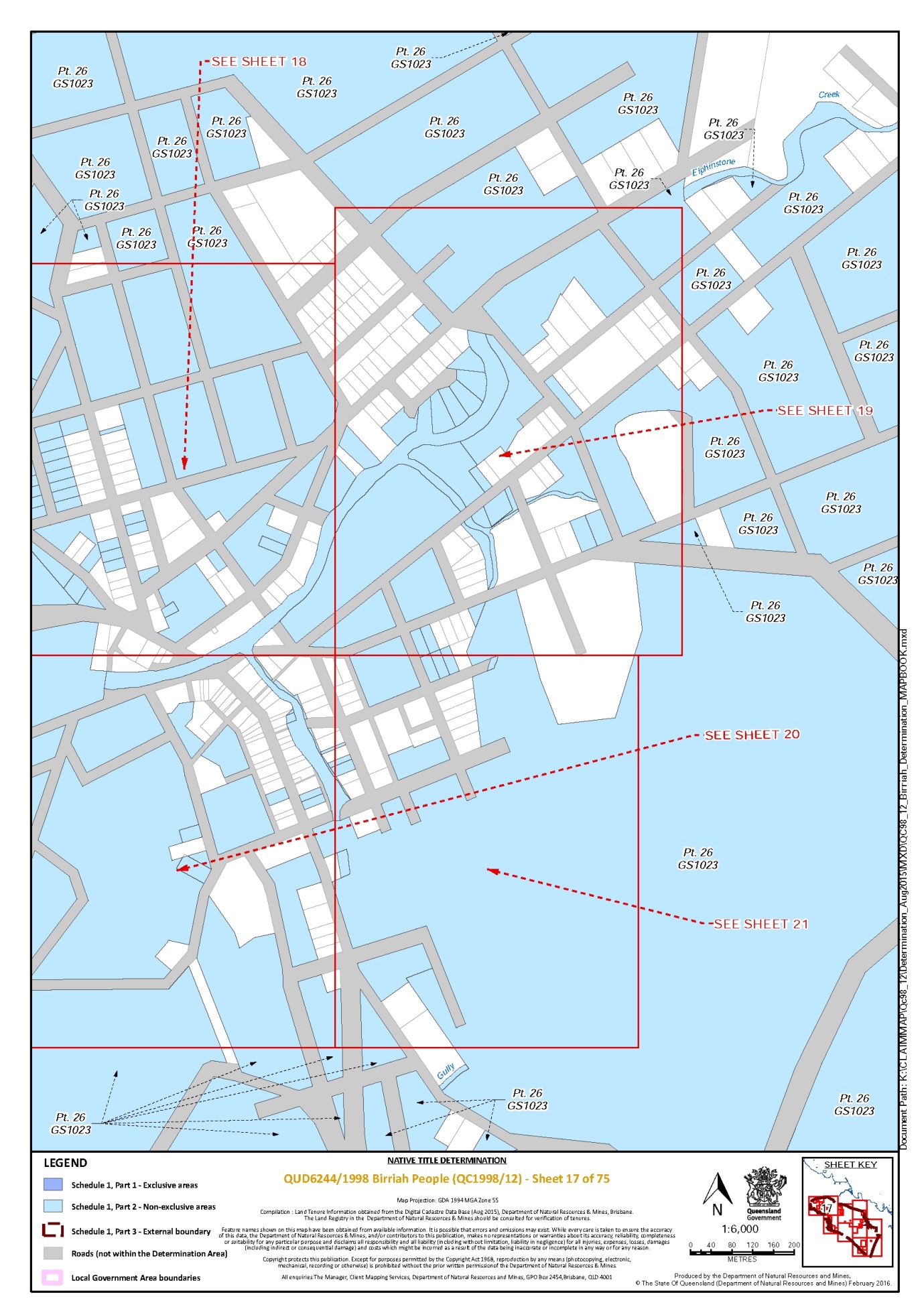
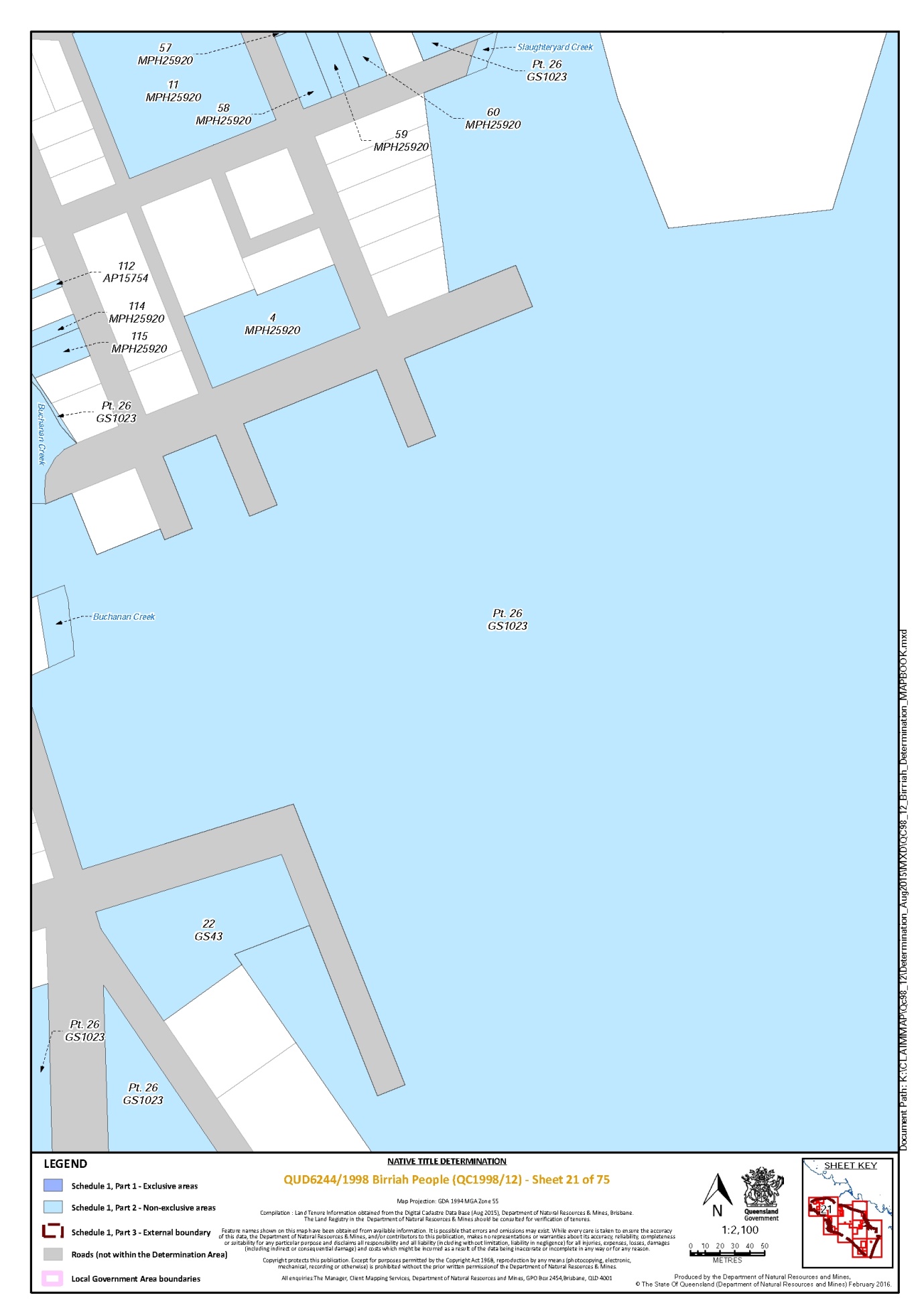
That part of Lot 26 on Plan GS1023 which does not include the area formerly described as MHL 156 on Plan MPH25900 | 12, 13, 14, 15, 16, 17, 18, 19, 20, 21 |
That part of Lot 3 on Plan AP11729 which does not include the area formerly described as Lot 1 on Plan PER6640 | 37 |
That part of Lot 3 on Plan R16236 which does not include the area formerly described as MHL 156 on Plan MPH25900 | 20 |
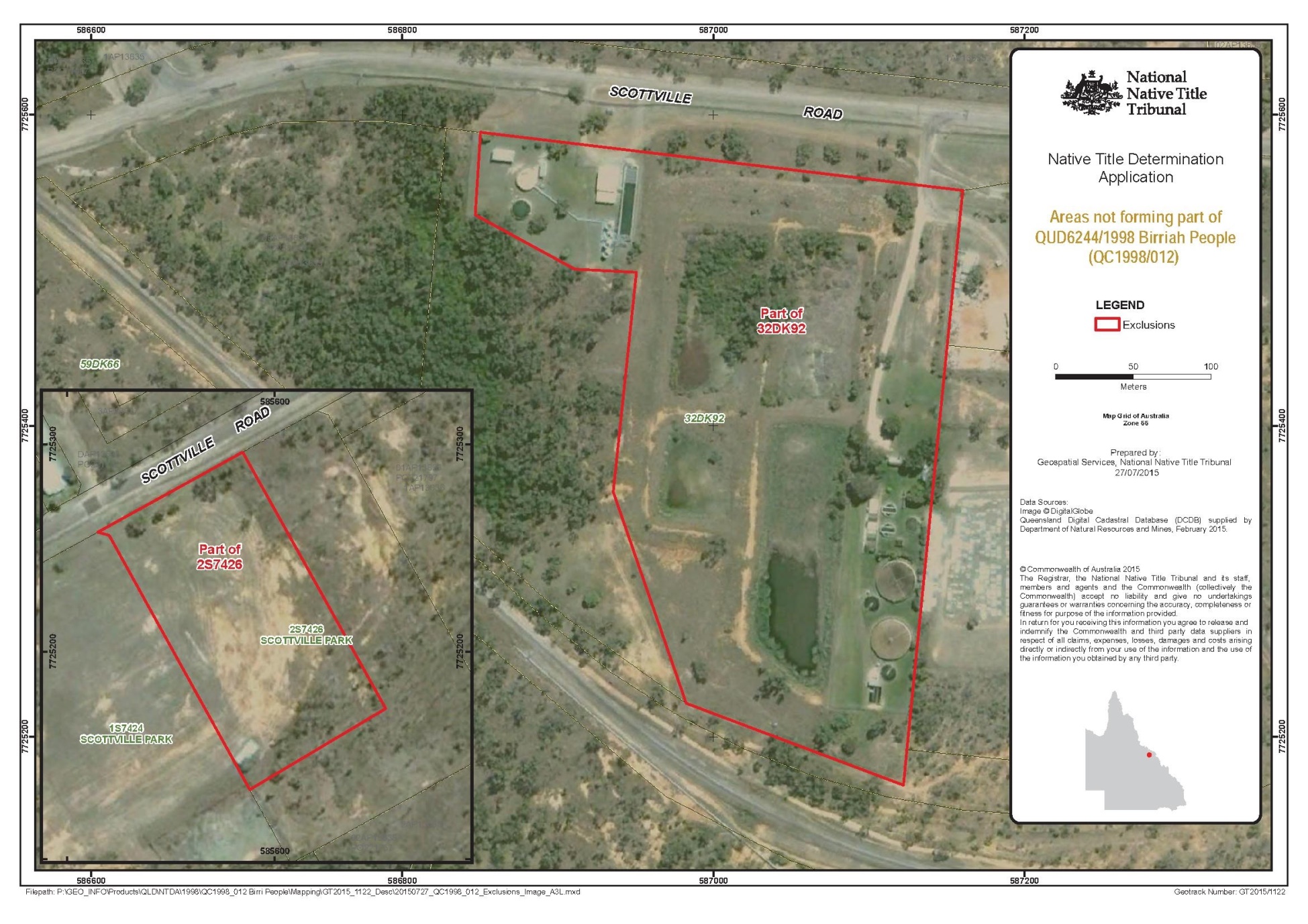
That part of Lot 32 on Plan DK92 which does not include the area described in Schedule 2 | 64 |
That part of Lot 399 on Plan AP2789 that is subject to an area identified as ML 1326 and an area formerly described as Lot 399 on Plan OL87 | 10, 11, 14 |
That part of Lot 405 on Plan AP2789 that is subject to an area identified as ML 1326 and an area formerly described as Lot 405 on Plan OL89 | 10, 11, 13 |
That part of Lot 539 on Plan AP3540 formerly described as Lot 539 on Plan OL95 | 10, 12, 13 |
Save for any waters forming part of a lot on plan, all waterways, natural lakes, creeks and rivers within the external boundary described in Part 3 including but not limited to: Barrabas Creek, the Bogie River, the Bowen River, Brittany Creek, the Broken River, Buchanan Creek, the Burdekin River, Carpet Snake Creek, Cerito Creek, Connolly Creek, Corduroy Creek, Crush Creek, Dead Man Creek, Eight Mile Creek, the Elliot River, Elphinstone Creek, Emu Creek, Euri Creek, Expedition Pass Creek, the Fanning River, Frederick Creek, Glenmore Creek, Green Creek, Gibraltar Creek, the Haughton River, the Kirk River, Kirknie Creek, Landers Creek, Millaroo Creek, Oakey Creek, One Mile Creek, Pandanus Creek, Parakeet Creek, Pelican Creek, Pink Lily Lagoon, Plum Tree Creek, Sandalwood Creek, Sandy Creek, Slaughteryard Creek, Suhr Creek and Swans Lagoon | |
* denotes areas to which s 24KA of the Native Title Act 1993 (Cth) applies
Part 3 – External Boundary Description
Commencing at a point on the centreline of the Burdekin River at Longitude 146.407413° East, a point on the boundary of native title determination application QUD80/05 Gudjala People (QC05/6) as accepted for registration by the NNTT on 22 April 2005 and extending generally northeasterly along boundaries of that native title determination application through the following coordinate points:
Longitude (East) | Latitude (South) |
146.416086 | 19.985842 |
146.429911 | 19.965524 |
146.473331 | 19.911258 |
146.523795 | 19.880315 |
146.563847 | 19.862509 |
146.601231 | 19.849477 |
146.614965 | 19.846002 |
then generally easterly and generally southeasterly through the following coordinate points:
Longitude (East) | Latitude (South) |
146.634938 | 19.840948 |
146.695907 | 19.833473 |
146.763284 | 19.827504 |
146.812475 | 19.824020 |
146.834858 | 19.823719 |
146.839520 | 19.822980 |
146.847118 | 19.819992 |
146.857378 | 19.814739 |
146.871291 | 19.810022 |
146.884634 | 19.808172 |
146.898609 | 19.808032 |
146.909544 | 19.807921 |
146.921088 | 19.807804 |
146.932688 | 19.811693 |
146.949564 | 19.820395 |
146.957787 | 19.824602 |
146.977406 | 19.836420 |
146.995187 | 19.847111 |
147.016671 | 19.861194 |
147.035600 | 19.866711 |
147.057647 | 19.877346 |
147.069902 | 19.883508 |
147.076782 | 19.896030 |
147.082402 | 19.905702 |
147.094708 | 19.918733 |
147.110247 | 19.936310 |
147.126912 | 19.951580 |
147.145379 | 19.965108 |
147.165639 | 19.976322 |
147.179809 | 19.987033 |
147.182781 | 19.988564 |
147.193926 | 19.994307 |
147.206742 | 19.996441 |
147.229866 | 19.995497 |
147.252990 | 19.995860 |
147.270637 | 19.995634 |
147.284633 | 19.995453 |
147.302938 | 19.998079 |
147.327918 | 19.999467 |
147.351133 | 20.004312 |
147.373154 | 20.010315 |
147.397631 | 20.016852 |
147.422122 | 20.025104 |
147.443563 | 20.032250 |
147.461952 | 20.038863 |
147.477961 | 20.048372 |
147.493994 | 20.059026 |
147.510607 | 20.067950 |
147.534574 | 20.079055 |
147.555432 | 20.086765 |
147.584900 | 20.098352 |
147.612466 | 20.105950 |
147.646114 | 20.112874 |
147.681103 | 20.125499 |
147.713519 | 20.131280 |
147.746609 | 20.139907 |
147.772380 | 20.148076 |
147.798701 | 20.153365 |
147.821432 | 20.161576 |
147.850806 | 20.166802 |
147.874685 | 20.171545 |
147.904038 | 20.175614 |
147.929141 | 20.180326 |
147.953092 | 20.187919 |
147.973352 | 20.190211 |
then southwesterly to the intersection of an eastern bank of Euri Creek and a southern boundary of Mt Aberdeen Road reserve; then generally southerly along eastern banks of that creek to a northern boundary of Lot 38 on RP908340; then westerly along northern boundaries of that lot to the northeastern most corner of Lot 161 on SP122361; then generally southerly along eastern boundaries of that lot to the northern boundary of an unnamed road reserve at Latitude 20.301603° South; then southerly to the intersection of a southern boundary of that road reserve and the western boundary of another unnamed road reserve at Longitude 147.930488° East, Latitude 20.302171° South; then generally southwesterly along western boundaries of that unnamed road reserve to Latitude 20.305425° South, being a corner of a western boundary of native title determination application QUD6023/99 Gia People (QC99/24) as accepted for registration by the NNTT on 7 October 2004; again southwesterly along western boundaries of that unnamed road reserve to the northern bank of the Bogie River; then generally southeasterly along northern and eastern banks of that river to the southwestern most corner of Lot 5 on RP908355; then generally easterly, generally southeasterly and generally southwesterly along eastern boundaries of Lot 34 on HR1358 to an eastern boundary of Normanby Road reserve; then generally southerly along eastern boundaries of that road reserve to a western boundary of Lot 3 on HLN243; then generally northeasterly and generally southeasterly along northern boundaries of that lot to the northwestern most corner of Lot 4 on HLN248; then generally easterly, generally southerly and again generally easterly along northern and eastern boundaries of that lot to the western boundary of an unnamed road reserve at Longitude 148.306913° East; then easterly to the northern boundary of that road reserve at Longitude 148.308779° East; then generally easterly, generally southwesterly and again generally easterly along eastern boundaries of that road reserve to a western boundary of Lot 4611 on PH1535 (Mount Crompton Pastoral Holding); then generally southerly and generally easterly along western and southern boundaries of that lot to its southern most southeastern corner; then generally southwesterly through the following coordinate points:
Longitude (East) | Latitude (South) |
148.346562 | 20.825836 |
148.328231 | 20.853924 |
148.307467 | 20.887850 |
148.286743 | 20.927596 |
148.268468 | 20.964993 |
148.250184 | 21.002388 |
148.235545 | 21.031604 |
148.217284 | 21.076961 |
148.215213 | 21.081956 |
148.214411 | 21.083889 |
148.197838 | 21.123860 |
148.177147 | 21.175238 |
148.162832 | 21.221641 |
148.146892 | 21.269584 |
148.134672 | 21.305785 |
148.124952 | 21.331620 |
148.121914 | 21.339330 |
148.118495 | 21.348010 |
148.117124 | 21.351488 |
148.116997 | 21.351812 |
148.115834 | 21.354763 |
then northwesterly through the following coordinate points to the northeastern corner of QUD6230/98 Jangga People (QC98/10) as accepted for registration by the NNTT on 19 October 2004
Longitude (East) | Latitude (South) |
148.105965 | 21.349136 |
148.105722 | 21.348997 |
then generally northwesterly along boundaries of that native title determination application through the following coordinate points:
Longitude (East) | Latitude (South) |
148.034572 | 21.315974 |
148.010434 | 21.305170 |
147.969782 | 21.291235 |
147.951109 | 21.282499 |
147.928638 | 21.266527 |
147.916374 | 21.259376 |
147.899767 | 21.250141 |
147.882577 | 21.234604 |
147.864779 | 21.218489 |
147.847596 | 21.203521 |
147.829828 | 21.183967 |
147.811556 | 21.167020 |
147.791196 | 21.149991 |
147.773438 | 21.131577 |
147.761195 | 21.118916 |
147.744091 | 21.099903 |
147.727536 | 21.084380 |
147.711610 | 21.071122 |
147.695697 | 21.056717 |
147.677332 | 21.041151 |
147.664360 | 21.028477 |
then generally northwesterly through the following coordinate points to again a point on the boundary of QUD6230/98 Jangga People (QC98/10):
Longitude (East) | Latitude (South) |
147.660824 | 21.025023 |
147.641870 | 21.007159 |
147.632739 | 20.993365 |
147.624228 | 20.979574 |
147.615058 | 20.971501 |
147.605516 | 20.964638 |
then generally northwesterly along boundaries of that native title determination application passing through the following coordinate points:
Longitude (East) | Latitude (South) |
147.602206 | 20.962258 |
147.585072 | 20.950124 |
147.566109 | 20.936257 |
147.549622 | 20.921262 |
147.531275 | 20.908541 |
147.511086 | 20.895803 |
147.489063 | 20.882476 |
147.471947 | 20.870901 |
147.454215 | 20.859891 |
147.432825 | 20.845989 |
147.410820 | 20.832650 |
147.382493 | 20.819079 |
147.356993 | 20.805879 |
147.334377 | 20.793667 |
147.316057 | 20.782635 |
147.295263 | 20.773295 |
147.275702 | 20.763962 |
147.258630 | 20.754968 |
147.245779 | 20.747956 |
147.233562 | 20.741255 |
147.214601 | 20.734208 |
147.191982 | 20.724833 |
147.174847 | 20.719516 |
147.155827 | 20.713230 |
147.131388 | 20.707633 |
147.108734 | 20.702248 |
147.087902 | 20.698595 |
147.067658 | 20.692528 |
147.043246 | 20.685527 |
147.015126 | 20.676062 |
146.994318 | 20.671251 |
146.972313 | 20.664136 |
146.956424 | 20.658803 |
146.943613 | 20.652933 |
then northwesterly to a western boundary of Lot 13 on MRY51 at Latitude 20.652816° South; then generally northerly along western boundaries of that lot to the centreline of the Burdekin River; then generally northwesterly along the centreline of that river back to the commencement point.
Reference datum
Geographical coordinates have been provided by the NNTT Geospatial Unit and are referenced to the Geocentric Datum of Australia 1994 (GDA94), in decimal degrees and are based on the spatial reference data acquired from the various custodians at the time.
Data Reference and source
Amended QUD6244/98 Birri People (QC98/12) boundary data compiled by NNTT.
Abutting application boundary data compiled by NNTT based on data sourced from the Department of Natural Resources, Mines & Water (Queensland).
Cadastre and watercourse data sourced from Department of Natural Resources, Mines & Water, Queensland (December 2003).
Parts of the centreline of the Burdekin River and Euri Creek digitised from 1:100,000 topographic image data supplied by Geoimage Pty Ltd under licence from Geoscience Australia (© Commonwealth of Australia).
Use of Coordinates
Where coordinates are used within the description to represent cadastral or topographical boundaries or the intersection with such, they are intended as a guide only. As an outcome to the custodians of cadastral and topographic data continuously recalculating the geographic position of their data based on improved survey and data maintenance procedures, it is not possible to accurately define such a position other than by detailed ground survey.
Prepared by Geospatial Services, NNTT (21 June 2006).
B. Map of Determination Area

SCHEDULE 2 — AREAS NOT FORMING PART OF THE DETERMINATION AREA
The areas described below do not form part of the Determination Area.
Part A
1. Those land and waters within the external boundary described in Part 3 of Schedule 1, which at the time the native title determination application was made:
(a) were the subject of one or more previous exclusive possession acts, as defined in s 23B of the Native Title Act 1993 (Cth) (despite the fact that the areas, or parts of them, may have been subject to earlier acts that extinguished native title); and
(b) to which none of ss 47, 47A or 47B of the Native Title Act 1993 (Cth) applied,
do not form part of the Determination Area on the basis that they could not be claimed, in accordance with s 61A of the Native Title Act 1993 (Cth).
2. Specifically, and to avoid any doubt, the land and waters referred to in paragraph 1 above include the acts described in ss 23B(2) and 23B(3) of the Native Title Act 1993 (Cth) to which s 20 of the Native Title (Queensland) Act 1993 (Qld) applies and include, but are not limited to, the whole of the land and waters described as:
(a) Lot 2 on Plan MRY30;
(b) Lot 9 on Plan DK239;
(c) Lot 22 on Plan C74037;
(d) Lot 77 on Plan GS618;
(e) Lot 152 on Plan GS583;
(f) Lot 40 on Plan RP802431;
(g) Lot 84 on Plan DK178;
(h) Lot 22 on Plan CP857100;
(i) Lot 3 on Plan DK198;
(j) Lot 2 on Plan SP171918;
(k) Lot 12 on Plan SP171912;
(l) Lot 19 on Plan DK205;
(m) Lot 1 on Plan SP271184;
(n) Lot 1026 on Plan MPH40902;
(o) Lot 112 on Plan MPH35514;
(p) Lot 13 on Plan MPH13506;
(q) Lot 14 on Plan MPH13506;
(r) Lot 15 on Plan MPH13506;
(s) Lot 1 on Plan DK261;
(t) Lot 1 on Plan MPH26;
(u) Lot 1 on Plan MPH30800;
(v) Lot 1 on Plan MPH31666;
(w) Lot 1 on Plan MPH34460;
(x) Lot 1 on Plan MPH37;
(y) Lot 1 on Plan MPH40275;
(z) Lot 1 on Plan MPH50;
(aa) Lot 2 on Plan DK835445;
(bb) Lot 2 on Plan MPH13516;
(cc) Lot 2 on Plan MPH34460;
(dd) Lot 36 on Plan MPH20096;
(ee) Lot 39 on MPH20098;
(ff) Lot 3 on Plan MPH13516;
(gg) Lot 3 on Plan MPH20120;
(hh) Lot 40 on Plan MPH20098;
(ii) Lot 41 on Plan MPH20098;
(jj) Lot 43 on Plan MPH20099;
(kk) Lot 48 on Plan MPH13514;
(ll) Lot 4 on Plan MPH20120;
(mm) Lot 70 on Plan MPH30821;
(nn) Lot 74 on Plan DK267;
(oo) Lot 94 on Plan DK804336; and
(pp) Lot 96 on Plan DK257.
3. The land and waters described in paragraph 1 above include the land or waters upon which any public work, as defined in s 253 of the Native Title Act 1993 (Cth), is or was constructed, established, or situated, and to which ss 23B(7) and 23C(2) of the Native Title Act 1993 (Cth) and/or s 21 of the Native Title (Queensland) Act 1993 (Qld) applies, together with any adjacent land or waters in accordance with s 251D of the Native Title Act 1993 (Cth).
4. Specifically, and to avoid any doubt, the areas described in paragraph 3 above include but are not limited to the whole of the land and waters described as:
(a) Lot 1 on Plan DK269;
(b) Lot 27 on Plan DK161;
(c) Lot 10 on Plan C7406;
(d) Lot 1 on Plan C74027;
(e) Lot 46 on Plan DK65;
(f) Lot 1 on S7424;
(g) Lot 1 on Plan GS946;
(h) Lot 14 on Plan MRY52;
(i) Lot 10 on Plan MRY33;
(j) Lot 11 on Plan SP171912;
(k) that part of Lot 32 on Plan DK92* commencing at the intersection of the southern boundary of Scottville Road and 586,850.31 mE and extending easterly, southerly and north westerly along the boundaries of Lot 32 on Plan DK92 to a corner of that lot at 586,982.64 mE, 7,725,221.54 mN; then north westerly, northerly and generally westerly passing through the following coordinate points:
Easting mE | Northing mN |
586,935.62 | 7,725,357.38 |
586,950.64 | 7,725,498.66 |
586,911.05 | 7,725,500.71 |
586,846.90 | 7,725,535.5 |
then northerly back to the commencement point. (Geographical coordinates have been provided by the NNTT Geospatial Services and are referenced to the Geocentric Datum of Australia 1994 (GDA94), in Map Grid of Australia, Zone 55 coordinates and are based on the spatial reference data acquired from the various custodians at the time);
(l) that part of Lot 2 on Plan S7426* commencing at the westernmost corner of Lot 2 on Plan S7426 and extending north easterly along the boundary of that lot to 585584.51 mE; then south easterly and south westerly passing through 585,653.44 mE, 7,725,172.49 mN to the intersection of the south western boundary of that lot at 585,587.92mE mE; then generally north westerly along the boundaries of that lot back to the commencement point. (Geographical coordinates have been provided by the NNTT Geospatial Services and are referenced to the Geocentric Datum of Australia 1994 (GDA94), in Map Grid of Australia, Zone 55 coordinates and are based on the spatial reference data acquired from the various custodians at the time);
(m) that part of Lot 26 on Plan DK276* commencing at the easternmost corner of Lot 26 on Plan DK276 and extending south westerly along the southeast boundary of that lot to Easting 589367.10 mE; then north westerly, south westerly, again north westerly, north easterly, again north westerly and again north easterly passing through the following coordinate points:
Easting mE | Northing mN |
589292.17 | 7722023.04 |
587989.39 | 7721480.75 |
587945.36 | 7721656.83 |
589188.21 | 7722186.93 |
589137.63 | 7722317.12 |
589228.49 | 7722356.46 |
then northerly to the boundary of Lot 26 on Plan DK276 at Easting 589248.15 mE; then easterly along that boundary to Easting 589292.11 mE; then southerly, north easterly and south easterly passing through the following coordinate points:
Easting mE | Northing mN |
589274.38 | 7722385.49 |
589344.62 | 7722407.03 |
589357.73 | 7722379.84 |
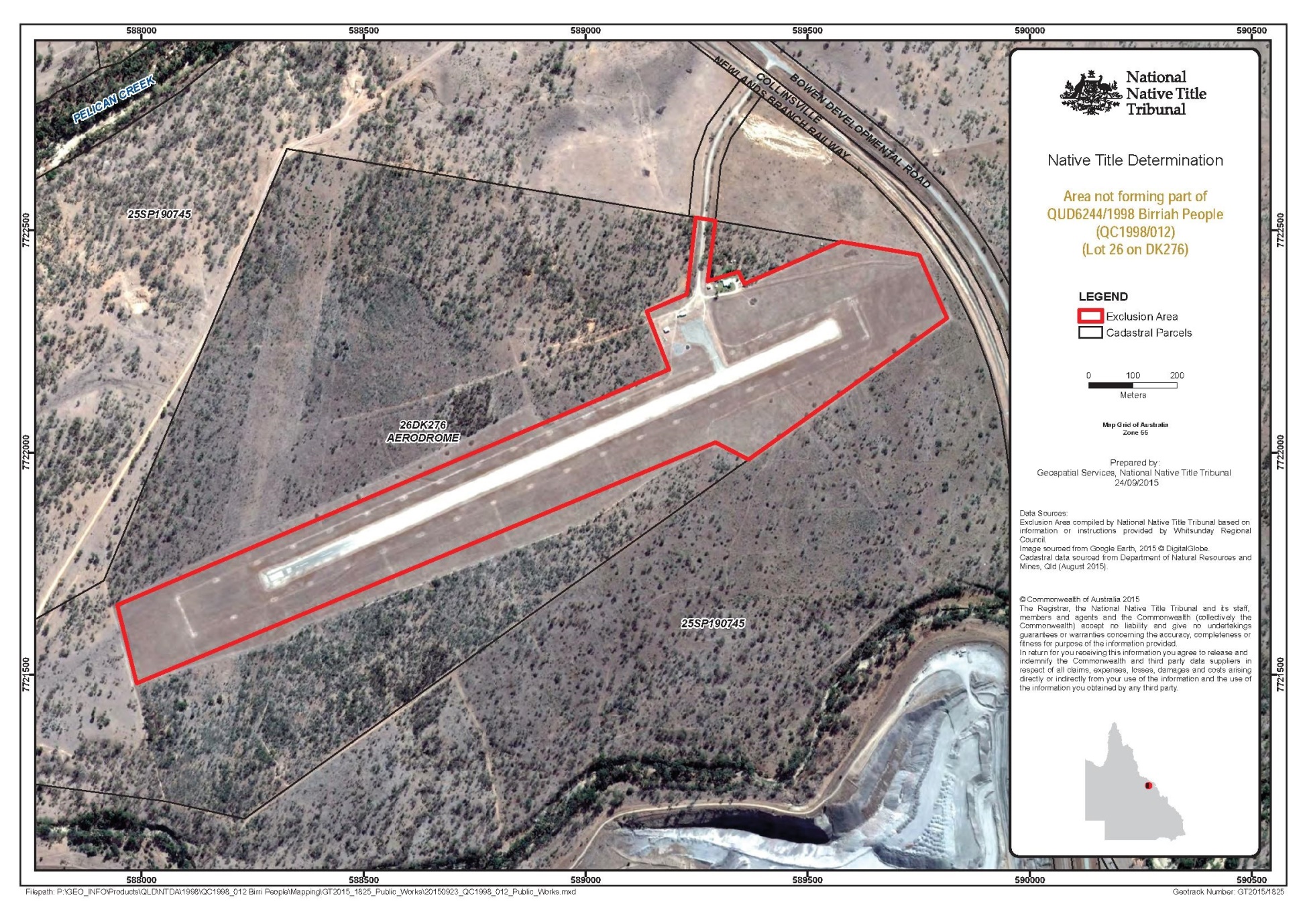
then north easterly to the boundary of Lot 26 on Plan DK276 at Easting 589575.02 mE; then easterly and south easterly back to the commencement point. (Grid coordinates have been provided by the NNTT Geospatial Services and are referenced to the Geocentric Datum of Australia 1994 (GDA94) (Zone 55), in metres and are based on the spatial reference data acquired from the various custodians at the time.)
* areas depicted on the map included in this Part A of Schedule 2. Note that to the extent of any inconsistency between the written description and the map, the written description prevails.
Part B
Land and waters the subject of one or more category A intermediate period acts, as defined in s 232B of the Native Title Act 1993 (Cth) and to which s 13AA of the Native Title (Queensland) Act 1993 (Qld) applies (notwithstanding that the areas, or parts of them, may have been subject to an earlier act or acts that extinguished native title), do not form part of the Determination Area. Specifically, and to avoid any doubt, such areas include (but are not limited to) the whole of the land and waters described as:
(a) Lot 1 on Plan DK235; and
(b) Lot 1 on Plan MPH40904.
Part C
Land and waters the subject of pre-existing rights-based acts, as defined in s 24IB of the Native Title Act 1993 (Cth), which wholly extinguished any native title pursuant to s 24ID(1)(b) of the Native Title Act 1993 (Cth) (notwithstanding that the areas, or parts of them, may have been subject to an earlier act or acts that extinguished native title) do not form part of the Determination Area. Specifically, and to avoid any doubt, such areas include (but are not limited to) the whole of the land and waters described as Lot 17 on Plan GS964.
Part D
Land and waters specifically excluded from QUD6244/1998 Birriah People native title determination application (QC98/12) filed on 22 January 2016, being land and waters subject to:
QUD6230/1998 Jangga People (QC98/10) native title determination application, as accepted for registration by the NNTT on 19 October 2004;
QUD6023/1999 Gia People (QC99/24) as accepted for registration by the NNTT on 7 October 2004; and
QUD80/2005 Gudjala People (QC05/6) as accepted for registration by the NNTT on 22 April 2005.
SCHEDULE 3 — NATIVE TITLE HOLDERS
1. The native title holders are the Birriah People. The Birriah People are the biological or adopted descendants of one or more of the following people:
(a) Jinnie Tiers;
(b) Kuburu, the father of Billy Lightning Banbari;
(c) John Smallwood;
(d) Rosie Schilling;
(e) Peggy Barker;
(f) Sambo Callaghan;
(g) Tommy Morgan;
(h) the mother of Lizzie Limburner;
(i) Nellie Skeen or William (Billy) Skeen Snr;
(j) Caroline Roger; or
(k) Maggie or her husband Harry Shepherd (Snr).
SCHEDULE 4 — OTHER INTERESTS IN THE DETERMINATION AREA
The nature and extent of the other interests in relation to the Determination Area are the following as they exist as at the date of the determination:
1. The rights and interests of the parties under the following agreements:
(a) the Birriah People protected areas indigenous land use agreement (body corporate agreement) between David Miller, Colin McLennan, Gracelyn Smallwood, Algon Walsh Jnr, and Frank Fisher on their own behalf and on behalf of the Birriah People, the Birriah Aboriginal Corporation ICN 8261, the State of Queensland, and the Birriah Aboriginal Corporation RNTBC ICN 8261, which agreement was authorised by the native title claim group on 19 December 2015 and executed by David Miller, Colin McLennan, Gracelyn Smallwood, Algon Walsh Jnr, and Frank Fisher on 19 December 2015, the Birriah Aboriginal Corporation ICN 8261 on 15 January 2016, and the State of Queensland on 24 and 25 February 2016, and that agreement once it becomes registered as a body corporate indigenous land use agreement following execution of the agreement by the registered native title body corporate;
(b) the Birriah People tenure resolution indigenous land use agreement (body corporate agreement) between David Miller, Colin McLennan, Gracelyn Smallwood, Algon Walsh Jnr, and Frank Fisher on their own behalf and on behalf of the Birriah People, the Birriah Aboriginal Corporation ICN 8261, the State of Queensland, and the Birriah Aboriginal Corporation RNTBC ICN 8261, which agreement was authorised by the native title claim group on 19 December 2015 and executed by David Miller, Colin McLennan, Gracelyn Smallwood, Algon Walsh Jnr, and Frank Fisher on 19 December 2015, the Birriah Aboriginal Corporation ICN 8261 on 15 January 2016, and the State of Queensland on 24 February 2016, and that agreement once it becomes registered as a body corporate indigenous land use agreement following execution of the agreement by the registered native title body corporate;
(c) the Birriah People and local government indigenous land use agreement QI2014/090 registered on 19 May 2015;
(d) the Birriah People and Adani Mining North Galilee Basin Rail Project indigenous land use agreement QI2014/080 registered on 24 April 2015;
(e) the Birri People and Comerford indigenous land use agreement QI2011/021 registered on 21 October 2011;
(f) the Hancock Alpha Coal Pty Ltd and Birri Native Title Claim Group indigenous land use agreement QI2011/004 registered on 11 July 2011;
(g) the Burdekin Pipeline indigenous land use agreement QI2005/013 registered on 17 March 2006;
(h) the Birri and Kudjala Peoples Joint indigenous land use agreement – exploration permit backlog project QI2003/039 registered on 23 February 2004; and
(i) the Birri indigenous land use agreement for backlog exploration permits QI2003/032 registered on 11 December 2003.
2. The rights and interests of Glencore Coal Queensland Pty Ltd:
(a) as the holder of exploration permits EPC588, EPC727, EPC734, EPC773, EPC774, EPC964, EPC977, EPC1700 and EPC1914 granted under the Mineral Resources Act 1989 (Qld);
(b) as the holder of mineral development licence MDL368 granted under the Mineral Resources Act 1989 (Qld);
(c) as the holder of mining leases ML1005, ML1006, ML1007, ML1008, ML1037, ML4748, ML4754, ML4771, ML4774, ML1009, ML1015, ML1064, ML4755, ML10111, ML10250, ML10176, ML10316, ML10317, ML10322, ML10333, ML10348, ML10352, ML10361 and ML10362 granted under the Mineral Resources Act 1989 (Qld);
(d) arising under the Deed regarding the inclusion of land pursuant to s 31 of the Native Title Act 1993 (Cth) for EPC 588 between Glencore Coal Queensland Pty Ltd (formerly Xstrata Coal Queensland Pty Ltd), Itochu Coal Resources Australia Pty Limited, ICRA NCA Pty Ltd and Sumisho Coal Australia Pty Limited, the applicant at the time for the Birri People (Colin McLennan, David Miller, Frank Fisher, Patrick Walsh, Allan Fisher, Heather Tilberoo, Gracelyn Smallwood and Algon Walsh Jnr acting on their own behalf and on behalf of the Birri People) and the State of Queensland and the associated Exploration Permit Consent Agreement between Glencore Coal Queensland Pty Ltd (formerly Xstrata Coal Queensland Pty Ltd), Itochu Coal Resources Australia Pty Limited, ICRA NCA Pty Ltd, Sumisho Coal Australia Pty Limited and the applicant at the time for the Birri People (Colin McLennan, David Miller, Frank Fisher, Patrick Walsh, Allan Fisher, Heather Tilberoo, Gracelyn Smallwood and Algon Walsh Jnr acting on their own behalf and on behalf of the Birri People);
(e) arising under the Deed regarding the renewal of exploration permit(s) pursuant to s 31 of the Native Title Act 1993 (Cth) for EPC 727 between Glencore Coal Queensland Pty Ltd (formerly Xstrata Coal Queensland Pty Ltd), Itochu Coal Resources Australia Pty Limited, ICRA NCA Pty Ltd and Sumisho Coal Australia Pty Limited, the applicant at the time for the Birri People (Allan Fisher, Frank Fisher, Colin McLennan, David Miller, Gracelyn Smallwood, Heather Tilberoo, Algon Walsh Jnr and Patrick Walsh on their own behalf and on behalf of the Birri People) and the State of Queensland dated 18 September 2007 and the associated Exploration Permit Consent Agreement between Glencore Coal Queensland Pty Ltd (formerly Xstrata Coal Queensland Pty Ltd), Itochu Coal Resources Australia Pty Limited, ICRA NCA Pty Ltd, Sumisho Coal Australia Pty Limited and the applicant at the time for the Birri People (Colin McLennan, David Miller, Frank Fisher, Allan Fisher, Heather Tilberoo, Gracelyn Smallwood and Algon Walsh Jnr acting on their own behalf and on behalf of the Birri People) dated 29 June 2007;
(f) arising under the Deed regarding the renewal of exploration permit(s) pursuant to s 31 of the Native Title Act 1993 (Cth) for EPC 734 between Glencore Coal Queensland Pty Ltd (formerly Xstrata Coal Queensland Pty Ltd), Itochu Coal Resources Australia Pty Limited, ICRA NCA Pty Ltd and Sumisho Coal Australia Pty Limited, the applicant at the time for the Birri People (Allan Fisher, Frank Fisher, Colin McLennan, David Miller, Gracelyn Smallwood, Heather Tilberoo, Algon Walsh Jnr and Patrick Walsh on their own behalf and on behalf of the Birri People) and the State of Queensland dated 18 September 2007 and the associated Exploration Permit Consent Agreement between Glencore Coal Queensland Pty Ltd (formerly Xstrata Coal Queensland Pty Ltd), Itochu Coal Resources Australia Pty Limited, ICRA NCA Pty Ltd, Sumisho Coal Australia Pty Limited and the applicant at the time for the Birri People (Colin McLennan, David Miller, Frank Fisher, Allan Fisher, Heather Tilberoo, Gracelyn Smallwood and Algon Walsh Jnr acting on their own behalf and on behalf of the Birri People) dated 29 June 2007;
(g) arising under the Deed regarding the grant and renewal(s) of a right to mine pursuant to s 31 of the Native Title Act 1993 (Cth) for ML 10316 between Glencore Coal Queensland Pty Ltd (formerly Xstrata Coal Queensland Pty Ltd), Itochu Coal Resources Australia Pty Limited, ICRA NCA Pty Ltd and Sumisho Coal Australia Pty Limited, the applicant at the time for the Birri People (Allan Fisher, Frank Fisher, Colin McLennan, David Miller, Gracelyn Smallwood, Heather Tilberoo, Algon Walsh Jnr and Patrick Walsh on their own behalf and on behalf of the Birri People) and the State of Queensland dated 16 August 2005 and the associated Mining Lease Consent Agreement between Glencore Coal Queensland Pty Ltd (formerly Xstrata Coal Queensland Pty Ltd), Itochu Coal Resources Australia Pty Limited, ICRA NCA Pty Ltd, Sumisho Coal Australia Pty Limited and the applicant at the time for the Birri People (Colin McLennan, David Miller, Frank Fisher, Patrick Walsh, Allan Fisher, Heather Tilberoo, Gracelyn Smallwood and Algon Walsh Jnr acting on their own behalf and on behalf of the Birri People);
(h) arising under the Deed regarding the grant and renewal of a right to mine pursuant to s 31 of the Native Title Act 1993 (Cth) for ML 10333 between Glencore Coal Queensland Pty Ltd (formerly Xstrata Coal Queensland Pty Ltd), Itochu Coal Resources Australia Pty Limited, ICRA NCA Pty Ltd and Sumisho Coal Australia Pty Limited, the applicant at the time for the Birri People (Frank Fisher, Colin McLennan, David Miller, Gracelyn Smallwood, Heather Tilberoo, Algon Walsh Jnr on their own behalf and on behalf of the Birri People) and the State of Queensland dated 23 November 2010 and the associated Colinta Weir Mining Lease Consent Agreement between Glencore Coal Queensland Pty Ltd (formerly Xstrata Coal Queensland Pty Ltd), Itochu Coal Resources Australia Pty Limited, ICRA NCA Pty Ltd, Sumisho Coal Australia Pty Limited and the applicant at the time for the Birri People (Colin McLennan, David Miller, Frank Fisher, Heather Tilberoo, Gracelyn Smallwood and Algon Walsh Jnr acting on their own behalf and on behalf of the Birri People) dated 5 October 2010;
(i) arising under the Deed regarding the grant and renewal(s) of a right to mine pursuant to s 31 of the Native Title Act 1993 (Cth) for ML 10336 between Glencore Coal Queensland Pty Ltd (formerly Xstrata Coal Queensland Pty Ltd), Itochu Coal Resources Australia Pty Limited, ICRA NCA Pty Ltd and Sumisho Coal Australia Pty Limited, the applicant at the time for the Birri People (Frank Fisher, Colin McLennan, David Miller, Gracelyn Smallwood, Heather Tilberoo, Algon Walsh Jnr on their own behalf and on behalf of the Birri People) and the State of Queensland dated 22 November 2010 and the associated Sarum Mining Lease Consent Agreement between Glencore Coal Queensland Pty Ltd (formerly Xstrata Coal Queensland Pty Ltd), Itochu Coal Resources Australia Pty Limited, ICRA NCA Pty Ltd, Sumisho Coal Australia Pty Limited and the applicant at the time for the Birri People (Colin McLennan, David Miller, Frank Fisher, Heather Tilberoo, Gracelyn Smallwood and Algon Walsh Jnr acting on their own behalf and on behalf of the Birri People) dated 5 October 2010;
(j) arising under the Deed regarding the grant and any subsequent renewal of a right to mine pursuant to s 31 of the Native Title Act 1993 (Cth) for ML 10352 between Glencore Coal Queensland Pty Ltd (formerly Xstrata Coal Queensland Pty Ltd), Itochu Coal Resources Australia Pty Limited, ICRA NCA Pty Ltd and Sumisho Coal Australia Pty Limited, the applicant at the time for the Birri People (Frank Fisher, Colin McLennan, David Miller, Gracelyn Smallwood, Heather Tilberoo, Algon Walsh Jnr on their own behalf and on behalf of the Birri People) and the State of Queensland dated 12 July 2012 and the associated Eastern Creek Mining Leases Consent Agreement between Glencore Coal Queensland Pty Ltd (formerly Xstrata Coal Queensland Pty Ltd), Itochu Coal Resources Australia Pty Limited, ICRA NCA Pty Ltd, Sumisho Coal Australia Pty Limited and the applicant at the time for the Birri People (Colin McLennan, David Miller, Frank Fisher, Heather Tilberoo, Gracelyn Smallwood and Algon Walsh Jnr acting on their own behalf and on behalf of the Birri People) dated 22 May 2012;
(k) arising under the Deed regarding the grant and any subsequent renewal of a right to mine pursuant to s 31 of the Native Title Act 1993 (Cth) for ML 10361 and ML 10362 between Glencore Coal Queensland Pty Ltd (formerly Xstrata Coal Queensland Pty Ltd), Itochu Coal Resources Australia Pty Limited, ICRA NCA Pty Ltd and Sumisho Coal Australia Pty Limited, the applicant at the time for the Birri People (Frank Fisher, Colin McLennan, David Miller, Gracelyn Smallwood, Heather Tilberoo, Algon Walsh Jnr on their own behalf and on behalf of the Birri People) and the State of Queensland dated 12 July 2012 and the associated Eastern Creek Mining Leases Consent Agreement between Glencore Coal Queensland Pty Ltd (formerly Xstrata Coal Queensland Pty Ltd), Itochu Coal Resources Australia Pty Limited, ICRA NCA Pty Ltd, Sumisho Coal Australia Pty Limited and the applicant at the time for the Birri People (Frank Fisher, Colin McLennan, David Miller, Gracelyn Smallwood, Heather Tilberoo, Algon Walsh Jnr on their own behalf and on behalf of the Birri People) dated 22 May 2012;
(l) arising under the Deed regarding the grant and any subsequent renewal of a right to mine pursuant to s 31 of the Native Title Act 1993 (Cth) for ML 10365 between Glencore Coal Queensland Pty Ltd, Itochu Coal Resources Australia Pty Limited, ICRA NCA Pty Ltd and Sumisho Coal Australia Pty Limited, the applicant for the Birriah People and the State of Queensland dated 18 August 2014 and the associated Mining Lease Consent Agreement between Glencore Coal Queensland Pty Ltd, Itochu Coal Resources Australia Pty Limited, ICRA NCA Pty Ltd, Sumisho Coal Australia Pty Limited and the applicant for the Birriah People dated 14 July 2014; and
(m) arising under the Deed regarding the grant of a petroleum lease pursuant to s 31 of the Native Title Act 1993 (Cth) for PL 394 between Glencore Coal Queensland Pty Ltd, Itochu Coal Resources Australia Pty Limited, ICRA NCA Pty Ltd and Sumisho Coal Australia Pty Limited, the applicant for the Birriah People and the State of Queensland dated 18 August 2014 and the associated Petroleum Lease Consent Agreement between Glencore Coal Queensland Pty Ltd, Itochu Coal Resources Australia Pty Limited, ICRA NCA Pty Ltd, Sumisho Coal Australia Pty Limited and the applicant for the Birriah People dated 14 July 2014.
3. The rights and interests of Bowen River Coal Pty Ltd:
(a) as the holder of mining lease ML10345 granted under the Mineral Resources Act 1989 (Qld); and
(b) arising under the Deed regarding the grant and any subsequent renewal of exploration permit(s) pursuant to s 31 of the Native Title Act 1993 (Cth) for EPC 586 between QCoal Pty Ltd (and assigned to Bowen River Coal Pty Ltd on 10 December 2009) and Heather Tilberoo, Frank Fisher, Allan Fisher, Colin McLennan, Algon Walsh Jr, Patrick Walsh, David Miller and Grace Smallwood on their own behalf and on behalf of the Birri People and the State of Queensland dated 2 March 2006 and the associated EPC Agreement between QCoal Pty Ltd and Heather Tilberoo, Frank Fisher, Allan Fisher, Colin McLennan, Algon Walsh Jr, Patrick Walsh, David Miller and Grace Smallwood on their own behalf and on behalf of the Birri People dated 17 February 2006.
4. The rights and interests of Byerwen Coal Pty Ltd:
(a) as the holder of exploration permit for minerals EPM18548 granted under the Mineral Resources Act 1989 (Qld); and
(b) arising under the EPC Agreement regarding the grant of exploration permit(s) pursuant to the Mineral Resources Act 1989 (Qld) for EPC 739 between Christopher Ian Wallin (and assigned to QCoal Pty Ltd on 4 December 2009 and to Byerwen Coal Pty Ltd on 11 December 2009) and Heather Tilberoo, Frank Fisher, Allan Fisher, Colin McLennan, Algon Walsh Jr, Patrick Walsh, David Miller and Grace Smallwood on their own behalf and on behalf of the Birri People dated 17 February 2006.
5. The rights and interests of Drake Coal Pty Ltd as the holder of mining leases ML10349, ML10350 and ML10351 granted pursuant to the Mineral Resources Act 1989 (Qld).
6. The rights and interests of Jax Coal Pty Ltd as the holder of mining lease ML10346 granted pursuant to the Mineral Resources Act 1989 (Qld).
7. The rights and interests of Pelican Creek Coal Pty Ltd as the holder of exploration permit EPC639 granted pursuant to the Mineral Resources Act 1989 (Qld).
8. The rights and interests of Rosella Creek Coal Pty Ltd as the holder of exploration permit EPC768 granted pursuant to the Mineral Resources Act 1989 (Qld).
9. The rights and interests of Christopher Ian Wallin as the current lessee under Term Lease No. 230184 over Lot 10 on Plan DK7.
10. The rights and interests of Colinta Holdings Pty Ltd as the current lessee under:
(a) Term Lease No. 235986 over Lot 4914 on Plan SP255401;
(b) Term Lease No. 235865 over Lot 3 on Plan SP235898; and
(c) Term Lease No. 235642 over Lot 14 on Plan SP271185.
11. The rights and interests of Daniel Edward Comerford, Noel James Griffin Comerford, and Errol Henry Comerford as the current lessee under:
(a) Perpetual Lease No. PPL0/235567 over Lots 13 and 14 on Plan HLN253; and
(b) Rolling Term Lease No. TL0/235745 over Lot 2 on SP104779.
12. The rights and interests of Captain Nominees Pty Ltd as the current lessee under:
(a) Rolling Term Lease No. PDH 5/618 over Lot 618 on Plan SP271121; and
(b) Lease No. PDH5/4887 over Lots 3 and 4 on Plan DK114 and Lot 1 on Plan DK4.
13. The rights and interests of Airservices Australia as the current lessee under Term Lease No. 235439 over Lot 23 on Plan DK279.
14. The rights and interests of Telstra Corporation Limited ACN 051 775 556:
(a) as the owner or operator of telecommunications facilities within the Determination Area;
(b) created pursuant to the Post and Telegraph Act 1901 (Cth), the Telecommunications Act 1975 (Cth), the Australian Telecommunications Corporation Act 1989 (Cth), the Telecommunications Act 1991 (Cth) and the Telecommunications Act 1997 (Cth), including rights:
(i) to inspect land;
(ii) to install and operate telecommunication facilities; and
(iii) to alter, remove, replace, maintain, repair and ensure the proper functioning of its telecommunications facilities;
(c) for its employees, agents or contractors to access its telecommunication facilities in and in the vicinity of the Determination Area in performance of their duties;
(d) under any lease, licence, access agreement or easement relating to its telecommunications facilities in the Determination Area; and
(e) as the current lessee under Term Lease No. 212386 over Lot 1 on Plan SP108591.
15. The rights and interests of Ergon Energy Corporation Limited ACN 087 646 062:
(a) as the owner and operator of any “Works” as that term is defined in the Electricity Act 1994 (Qld) within the Determination Area;
(b) as a distribution entity and the holder of a distribution authority under the Electricity Act 1994 (Qld);
(c) created under the Electricity Act 1994 (Qld) and the Government Owned Corporations Act 1993 (Qld) including:
(i) rights in relation to any agreement relating to the Determination Area existing or entered into before the date on which these orders are made;
(ii) rights to enter the Determination Area by its employees, agents or contractors to exercise any of the rights and interests referred to in this paragraph; and
(iii) to inspect, maintain and manage any Works in the Determination Area.
16. The rights and interests of Queensland Electricity Transmission Corporation Limited trading as Powerlink Queensland ACN 078 849 233 as an electricity entity exercising statutory functions, powers or rights and as the owner and operator of electricity transmission facilities and associated infrastructure situated upon the Determination Area, including but not limited to the right to enter upon the Determination Area in order to access, use, maintain, repair, replace, upgrade, or otherwise deal with those facilities and infrastructure in accordance with the law.
17. The rights and interests of the State of Queensland and Burdekin Shire Council, Charters Towers Regional Council, Isaac Regional Council, Mackay Regional Council, and Whitsunday Regional Council to access, use, operate, maintain and control the dedicated roads in the Determination Area and the rights and interests of the public to use and access the roads.
18. The rights and interests of each of Burdekin Shire Council, Charters Towers Regional Council, Isaac Regional Council, Mackay Regional Council, and Whitsunday Regional Council:
(a) under their local government jurisdiction and functions under the Local Government Act 2009 (Qld), under the Lands Protection (Pest and Stock Route Management) Act 2002 (Qld) and under any other legislation, for that part of the Determination Area within the area declared to be their respective local government area;
(b) as the:
(i) lessor under any leases which were validly entered into before the date on which these orders are made and whether separately particularised in these orders or not;
(ii) grantor of any licences or other rights and interests which were validly granted before the date on which these orders were made and whether separately particularised in these orders or not;
(iii) holder of any estate or interest in land, including as trustee of any reserves, that exist in the Determination Area;
(c) as the owner and operator of infrastructure, and those facilities and other improvements located in the Determination Area validly constructed or established on or before the date on which these orders are made, including but not limited to:
(i) undedicated but constructed roads except for those not operated by Council;
(ii) water pipelines and water supply infrastructure;
(iii) drainage facilities;
(iv) watering point facilities; and
(v) recreational facilities;
(d) to enter the land for the purposes described in paragraphs (a), (b) and (c) above by its employees, agents or contractors to:
(i) exercise any of the rights and interests referred to in paragraphs 17 and 18 above;
(ii) inspect, maintain and repair the infrastructure, facilities and other improvements referred to in paragraph (c) above;
(iii) undertake operational activities in its capacity as a local government such as feral animal control, weed control, erosion control, waste management and fire management.
19. The rights and interests of the State of Queensland or any other person existing by reason of the force and operation of the laws of the State of Queensland, including those existing by reason of the following legislation or any regulation, statutory instrument, declaration, plan, authority, permit, lease or licence made, granted, issued or entered into under that legislation:
(a) the Land Act 1994 (Qld);
(b) the Nature Conservation Act 1992 (Qld);
(c) the Forestry Act 1959 (Qld);
(d) the Water Act 2000 (Qld);
(e) the Petroleum Act 1923 (Qld) or Petroleum and Gas Act 2004 (Qld);
(f) the Mineral Resources Act 1989 (Qld);
(g) the Fisheries Act 1994 (Qld);
(h) the Transport Infrastructure Act 1994 (Qld); and
(i) the Sustainable Planning Act 2009 (Qld).
20. So far as confirmed pursuant to s 212(2) of the Native Title Act 1993 (Cth) and s 18 of the Native Title Act (Queensland) Act 1993 (Qld) as at the date of this determination, any existing public access to, and enjoyment of, the following places in the Determination Area:
(a) waterways;
(b) beds and banks or foreshores of waterways;
(c) stock routes; and
(d) areas that were public places at the end of 31 December 1993.
21. Any other rights and interests:
(a) held by the State of Queensland or Commonwealth of Australia; or
(b) existing by reason of the force and operation of the Laws of the State and the Commonwealth.
SCHEDULE 5 – EXERCISE OF NATIVE TITLE RIGHTS AND INTERESTS ON PASTORAL LEASES
1. Before the native title rights and interests referred to in paragraph 9 of the determination are exercised on a pastoral lease:
(a) the lessee of each pastoral lease situated wholly or partly within the Determination Area (a “Lessee”) must provide the Lessee’s contact details (the “Lessee’s Contact Details”) to the contact person for the Birriah Aboriginal Corporation RNTBC ICN 8261 identified in the corporation extract available from the Office of the Registrar of Indigenous Corporations (the “Birriah Contact Person”) within 60 days of the date of the determination; and
(b) he native title holders, or the Birriah Contact Person, must:
(i) provide at least seven (7) days’ prior notice to a Lessee (by way of the Lessee’s Contact Details) of the native title holders’ intention to exercise their native title rights and interests on the Lessee’s pastoral lease; and
(ii) contact the Lessee to:
(A) discuss any safety issues associated with the proposed exercise of native title rights and interests; and
(B) agree upon a suitable route of access.
2. When the native title right to hunt (referred to in paragraph 9(c) of the determination) is intended to be conducted on a pastoral lease using firearms, it may only be exercised:
(a) in areas where stock are not present; and, for the avoidance of doubt,
(b) if paragraph 1(b) above has been satisfied.
3. When the native title right to maintain and protect places of importance and areas of significance (referred to in paragraph 9(h) of the determination) is intended to involve the erection of a structure to protect a place or area on a pastoral lease from physical harm, it may only be exercised if:
(a) the structure will not materially impact on activities permitted or required by the pastoral lease; and, for the avoidance of doubt,
(b) if paragraph 1(b) above has been satisfied.
4. In the event that a Lessee has not provided the Lessee’s Contact Details to the Birriah Contact Person, the native title holder or the Birriah Contact Person must provide at least seven (7) days’ prior written notice to the Lessee of an intention of a native title holder or holders to exercise native title rights and interests on the Lessee’s pastoral lease by:
(a) posting such a notice to the last known postal address of the Lessee as recorded by the Australian Electoral Commission; or
(b) delivering or causing to be delivered such a notice to a person otherwise responsible for the management of the pastoral lease, or a person permanently residing on the pastoral lease.
5. Provided that a native title holder has complied with or is prepared to comply with paragraphs 1 to 4 above, a Lessee shall not unreasonably withhold consent or refuse a request by that native title holder to exercise the native title rights and interests referred to in paragraph 9 of the determination.
6. The native title holders will not exercise the native title rights and interests referred to in paragraph 9 of the determination in respect of any land or waters on which permanent improvements consisting of:
(a) a homestead, house, shed or other building;
(b) an airstrip;
(c) a constructed dam or other constructed stock watering point, bore, turkey nest, squatters’ tank or other water storage facility; or
(d) stock yards and trap yards,
have, at the date of the determination, been constructed (including adjacent land or waters, the use of which is necessary for, or incidental to, the construction, establishment or use of the permanent improvements) in accordance with the rights of a Lessee under, and within the boundaries of a pastoral lease.
7. In this Schedule:
(a) “firearm” has the same meaning as in the Weapons Act 1990 (Qld); and
(b) “stock” has the same meaning as in the Stock Act 1915 (Qld).
Note: Entry of orders is dealt with in Rule 39.32 of the Federal Court Rules 2011.
LOGAN J:
1 As I have previously observed, when having the privilege of constituting the Court for the making of earlier determinations, one of our National Parliament’s objectives in respect of the Native Title Act 1993 (Cth) (the Act) is the resolution of claims for the recognition of native title by agreement. That objective is borne out in s 87 and s 87A of the Act, especially by amendments made by the Native Title Amendment Act 2009 (Cth).
2 Today is another occasion when the Court gives practical voice to that objective by determining an application for part of an area by consent, save one lot within the claim area. That this objective is, in Queensland, now frequently achieved does not diminish the unique importance of a determination in favour of the Birriah Native Title claimants in respect of the land and waters within the area in north east Queensland identified in Schedule 1 of the Court’s orders.
3 The Birriah claims have a long history in this Court. The first application for a determination of native title over the claim area was lodged with the National Native Title Tribunal on 3 April 1998 by the Central Queensland Land Council Aboriginal Corporation (CQLCAC) and was lodged under the designation of “birria”. Following amendments to the Act in 1998, such applications became Federal Court proceedings. A notice of motion to amend the application was filed in the Federal Court on 6 October 1999 following a decision by the claimant group to change the name of the claim from “birriah” to birri”. The Court granted leave to amend on 18 October 1999. A further amended application was filed in the Court on 24 November 1999 and leave was granted to amend the application on 30 November 1999. This further amended application was accepted for registration by the Native Titles Registrar on 7 February 2000.
4 Between August 2001 and January 2016, six (6) further amended applications were filed with the Court.
5 On 28 September 2014, the Birriah People authorised amendments to their claim group description such that the Birriah people were described as comprising the descendants of Jinnie Tiers, Kuburu, the father of Billy Lightning Banbari, John Smallwood, Rosie Schilling, Peggy Barker, Sambo Callaghan, Tommy Morgan, the mother of Lizzie Limburner and Nellie Skeen or William (Billy) Skeen Snr.
6 The most recent application to amend, filed by the applicants on behalf of the Birriah People, was filed on 8 October 2015. On 21 January 2016, leave to amend was consequentially granted, pursuant to s 66B of the Act. That latest amendment resulted in the inclusion of the descendants of another apical ancestor in the descendants of the Birriah People after additional research had been undertaken regarding the claim group. The descendants of the Biriah People now consist of Jinnie Tiers, Kuburu, the father of Billy Lightning Banbari, John Smallwood, Rosie Schilling, Peggy Barker, Sambo Callaghan, Tommy Morgan, the mother of Lizzie Limburner, Nellie Skeen or William (Billy) Skeen Snr, Caroline Roger, Maggie or her husband Harry Shepherd (Snr).
7 This amended application was filed in Court on 22 January 2016.
8 There are currently thirty-six respondent parties, including the State of Queensland, the Burdekin Shire, Charters Towers Regional, Isaac Regional, Mackay Regional and Whitsundays Regional Councils representing the local governments within the claim area as well as energy, mining and infrastructure companies and various pastoralists.
9 Viewed against that history and like many such claims, it can be seen that this claim has been long in its gestation. In earlier judgements in cases like the present, for example in 2012 in Hoolihan on behalf of the Gugu Badhun People #2 v State of Queensland [2012] FCA 800; Archer on behalf of the Djungan People #1 v State of Queensland [2012] FCA 801 and Fisher on behalf of the Ewamian People #2 v State of Queensland [2013] FCA 1249, I observed that native title claims which linger unresolved on a court list are an affront to our system of justice. The statements which I then made are just as applicable to this case.
10 That said, the consensual resolution of the current Determination Application in less than ten years is testament to much dedicated work by experienced legal advisers and some innovative negotiation techniques, the responsible actions of the parties guided by their advisers and case management by the Court’s registrars. The result is that a s 87A determination for part of the claim area has been achieved in what is a relatively short time in this jurisdiction of the Court. I commend the parties and the legal practitioners involved.
11 In Baker on behalf of the Muluridji People v State of Queensland [2011] FCA 1432 (Muluridji), and as I have in subsequent determinations, I adopted observations made in King v Northern Territory of Australia [2011] FCA 582 (King) by Mansfield J. His Honour made a number of observations about the preamble to the Act. I remain in complete agreement not only with the substance of his Honour’s observations in King but also with the manner in which he expressed them. They are also exactly apposite in the present proceedings. As I did in Muluridji and have done subsequently, I propose therefore to adopt them as my own in these reasons for judgment without further attribution.
12 The preamble to the Act recognised, on behalf of all people of Australia, that the Aboriginal peoples of Australia inhabited this country for many years prior to European settlement, and that the Aboriginal peoples had been progressively dispossessed of their lands. It recorded that, by the overwhelming vote of the people of Australia, the Constitution was amended to enable laws such as the Act to be passed, to facilitate the recognition by our shared legal system of the native title rights and interests in their land. This is an occasion when the Court is to make orders declaring that the groups of Aboriginal persons in the current applications have always been the traditional owners of the land. By the Court’s orders, the Australian community collectively recognises that status. It is important to emphasise that the Court’s orders do not grant that status. The Court is declaring that it exists and has always existed at least since European settlement.
13 The applicants rely on fourteen affidavits from members of the claim group that provide direct evidence of their ongoing connection to the land and waters in the claim area. The affidavits are from a broad cross section of the claim group and depose to the observance of traditional laws and customs and the exercise of the native title rights and interests that I am able to recognise today. The composition of the claim group is supported by an affidavit from anthropologist, Dr David Hugo which provides anthropological evidence of the Birriah People and of the apical ancestors for the Birriah Claim Group as well as genealogical charts and geographical maps of the claim area.
14 The application also relies on supplementary reports by Averil Ginn and Fiona Powell for the provision of a complete, consolidated list of apical ancestors for the Birriah Claim Group.
15 Section 87A of the Act provides that the Court may make a determination of native title by consent over part of an area covered by a native title application and without holding a hearing where:
(a) There is a proceeding in relation to an application for a determination of native title (s 87A(1)(a));
(b) the period specified in the notice given under s 66 of the Act has ended and agreement is reached on a proposed determination of native title in relation to an area included in the area covered by the application (s 87A(1)(b));
(c) the applicant, each registered native title claimant party to the proceeding, each person who holds an interest or claims to hold native title in relation to land or waters in any part of the determination land, the State Minister and any local government body who is party to the proceeding, are parties to the agreement (s 87A(1)(c)(i)-(ix)); and
(d) the terms of the proposed determination are in writing and are signed by or on behalf of the parties and filed with the Court (s 87A(1)(d) and (2));
(e) the Court is satisfied that an order in, or consistent with, those terms would be within its power (s 87A(4)(a)); and
(f) having satisfied the criteria relevantly detailed, the Court considers the making of orders would be appropriate to do so pursuant to s 87A(4) of the Act. The Court may make a determination in accordance with s 87A(4), as is relevant to these proceedings.
16 The focus of the Court in considering whether the orders sought are appropriate under s 87A(1) and s 87A(4) is on the making of the agreement by the parties. In Muluridji I cited observations of North J in Lovett on behalf of the Gunditjmara People v State of Victoria [2007] FCA 474. Such remarks are apt to be adopted in this case. His Honour stated:
[36] … The Act is designed to encourage parties to take responsibility for resolving proceeding without the need for litigation. Section 87 must be construed in this context. The power must be exercised flexibly and with regard to the purpose for which the section is designed.
[37] In this context, when the Court is examining the appropriateness of an agreement, it is not required to examine whether the agreement is grounded on a factual basis which would satisfy the Court at a hearing of the application. The primary consideration of the Court is to determine whether there is an agreement and whether it was freely entered into on an informed basis: Nangkiriny v State of Western Australia (2002) 117 FCR 6; [2002] FCA 660, Ward v State of Western Australia [2006] FCA 1848. Insofar as this latter consideration applies to a State party, it will require the Court to be satisfied that the State party has taken steps to satisfy itself that there is a credible basis for an application: Munn v Queensland (2001) 115 FCR 109; [2001] FCA 1229.
17 The Court is not required to make its own inquiry of the merits of the applicants’ claim so as to be satisfied that the orders sought are supportable and in accordance with the law: Cox on behalf of the Yungngora People v State of Western Australia [2007] FCA 588 at [3]. The Court may nonetheless consider such evidence to determine whether the State is acting in good faith and rationally: Munn (for and on behalf of the Gunggari People) v Queensland (2001) 115 FCR 109 at [29]-[30].
18 In Smith v State of Western Australia (2000) 104 FCR 494 at [38], Madgwick J stated:
[38] … State governments are necessarily obliged to subject claims for native title over lands and waters owned and occupied by the State and State agencies, to scrutiny just as careful as the community would expect in relation to claims by non-Aborigines to significant rights over such land.
19 Section 94A of the Act requires that a native title determination order must satisfy the requirements of s 225 of the Act. Section 225 provides:
A determination of native title is a determination whether or not native title exists in relation to a particular area (the determination area) of land or waters and, if it does exist, a determination of:
(a) who the persons, or each group of persons, holding the common or group rights comprising the native title are; and
(b) the nature and extent of the native title rights and interests in relation to the determination area; and
(c) the nature and extent of any other interests in relation to the determination area; and
(d) the relationship between the rights and interests in paragraphs (b) and (c) (taking into account the effect of this Act); and
(e) to the extent that the land or waters in the determination area are not covered by a non-exclusive agricultural lease or a non-exclusive pastoral lease -- whether the native title rights and interests confer possession, occupation, use and enjoyment of that land or waters on the native title holders to the exclusion of all others.
Note: The determination may deal with the matters in paragraphs (c) and (d) by referring to a particular kind or particular kinds of non-native title interests.
[emphasis in original]
20 Section 223(1) of the Act defines ‘native title’ and ‘native title rights and interests’ as:
(1) … the communal, group or individual rights and interests of Aboriginal peoples or Torres Strait Islanders in relation to land or waters, where:
(a) the rights and interests are possessed under the traditional laws acknowledged, and the traditional customs observed, by Aboriginal peoples or Torres Strait Islanders; and
(b) the Aboriginal peoples or Torres Strait Islanders, by those laws and customs, have a connection with the land or waters; and
(c) the rights and interests are recognised by the common law of Australia.
21 In Members of the Yorta Yorta Aboriginal Community v State of Victoria (2002) 214 CLR 422, Gleeson CJ, Gummow and Hayne JJ (with McHugh J agreeing) stated the relevant principles with respect to s 223 of the Act, at 444 - 447 and 454 - 455:
(a) A traditional law or custom which is the source of native title rights and interests is one which has been passed from generation to generation of a society, usually by word of mouth and common practice.
(b) The origins of the law or custom from which native title rights and interests stem must be found in the normative rules of the relevant Aboriginal or Torres Strait Islander society that existed before the assertion of sovereignty by the British Crown – it is only those rules that are “traditional” laws and customs.
(c) That normative system must have a continuous existence and vitality since sovereignty.
(d) If that society ceases to exist as a group which acknowledges and observes those pre-sovereignty laws and customs, those laws and customs cease to have continued existence and vitality.
(e) Only native title rights or interests that existed at the time of the change in sovereignty will be recognised. However, some change to, or adaptation of, traditional laws or customs or some interruption in the enjoyment or exercise of native title rights or interests in the period between the Crown asserting sovereignty and the present will not necessarily be fatal to a native title claim.
(f) In many cases, perhaps most, claimants will invite the Court to infer, from evidence led at trial, the content of traditional laws and customs at times earlier than those described in the evidence.
22 Further, there is authority of this Court, exercising appellate jurisdiction, which lends itself to a determinative conclusion that physical presence is not a necessary requirement for continuing connection. See, for example, Moses v State of Western Australia [2007] FCAFC 78 at [306] per Moore, North and Mansfield JJ.
APPLICATION OF SECTION 223 AND SECTION 225 TO THE BIRRIAH PEOPLE
23 The Birriah People base their identity on their cognatic descent from those ancestors identified in Schedule 3 of the orders. The apical ancestors are likely to have existed on the claim area at or about the time of first contact in 1844-45 during Ludwig Leichhardt’s expedition, which skirted the western and northern periphery of the region. Leichhardt observed that although the terrain and nature of the Burdekin River did little to attract hunting parties, “whenever we meet with scrub with a good supply of water, we were sure of finding numerous tracks of natives” (Leichhardt 1847 at 216).
24 On a subsequent expedition led by Augustus Charley Gregory, in which Leichardt’s route was retraced (in reverse), Gregory noted, when traversing the Burkedin area and Sutton River, that, “on the bank of the creek we observed the marks of a recent camp group of a large party of blacks … which showed some dance ceremony had been performed by a large number of men” (Gregory, 24 October 1856). Considered in conjunction with the other evidence relied upon, I am able to draw an inference that the Birriah People occupied the area at the time of the assertion of British Sovereignty on 26 January 1788 (the date of legal Sovereignty).
25 The claim area is situated in north eastern Queensland centred around the township of Collinsville. It takes in part of Lake Dalrymple on the south western boundary and parts of the catchments of the Broken River and Bowen River in the south east. It also incorporates Mount Weight in the north and Mount Black Jack in the south. It is covered almost entirely by pastoral leases.
26 I have considered Dr Hugo’s Anthropological Report as well as the supplementary report of Ms Ginn which includes schematic genealogies of the Birriah families. Dr Hugo’s report refers to the work of the early ethnographers, Edward M Curr and Peter R Delamothe. These sources demonstrate that there are broad consistencies between what has been identified with the Birriah People in the earliest records and the current claim. The Curr material is based on his correspondence with government officials, police officers and pastoralists while researching vocabularies from different Aboriginal groups in the 1870s. J. Hall Scott and W.O Hodgkinson were contributors to Curr’s work who would refer to the tribes surrounding the Burkedin River using the suffix “bara”. Other informants of Curr’s material employed the suffix ‘bara’ to refer to sub-tribes of the larger Halifax Bay tribe. In the 1900s, Delamothe noted a series of other ‘bara’ groups in the Burkedin/Whitsundays area (Dr Hugo’s Report at 247).
27 In his report, Dr Hugo refers to a statement by deceased applicant, Patrick Walsh, that ‘Birri’ meant “people of the rivers”, noting that the two biggest rivers in Queensland are found in the Fitzroy and the Burkedin Basin (Dr Hugo’s Report at 294).
28 According to records held by the Queensland Rail Historical Centre, the area south of Townsville was called ‘Birigaba’, referring to “the name of the Aboriginal tribe which inhabited the locality”. This demonstrates recognition of a broad regional grouping. Dr Hugo further found that “claimants expressed a common identity and a mutual understanding by using the term ‘Birri Gubba’ to embrace a regional identity that is applied to land, language and particularly people” (Dr Hugo’s Report at 295).
29 Anthropologist Caroline Kelly, in Dr Hugo’s Report, demonstrates that the Birriah People endured a period of forced removals and enforced confinement on reserves such as Cherbourg and that they consequently suffered from dislocation and an unfulfilled desire to return to country, especially at the time of death: see Dr Hugo’s Report at 352. Current claimant family members have been known to go to great lengths to rebury the remains of Birriah people on country. Claimant family members also acknowledge that the practice contributes to the spiritual renewal and connection to country of present generations (Dr Hugo’s Report at 354 – 356). Dr Hugo concludes that “the law and customs of the Birri people includes the inheritance of the right to possess the claim area” (at 394).
30 Dr Hugo found that forced removal of people from their country lead to a shift in marriage protocol (at 328). While marriage customs among Birriah people are still recognised, Dr Hugo acknowledges that “some of the marriage customs observed and recorded … are no longer practiced” (at 329).
31 Despite forced dislocation, frontier conflict, coercive labour practices and draconian state intervention into the Birriah’s people’s personal and social lives, the Birriah People Claim Group and their predecessors have continuously exercised their right of possession, occupation, use and enjoyment of their traditional country before and since the date of legal Sovereignty.
32 Dr Hugo identifies the importance of employment in the pastoral industry which allowed the Birriah People to continue to observe “their essential laws and customs, including language, totems, bloodlines, elders and kinship” (Dr Hugo’s Report at 350).
33 The Birriah People share unique linguistic features and ceremonial patterns, especially pertaining to burial practices to distinguish themselves from the wider Birra-Gubba grouping.
34 The many affidavits filed in support of the application indicate through the members of the claim group that the transmission of cultural knowledge has continued to the present day to facilitate an ongoing cultural and spiritual connection to country. Although the place of birth for many of the claimant family members is not within the claim area, many nevertheless assert a connection to the claim area with the birthplace of a parent or grandparent.
35 The Birriah People have maintained their identity and connections to their country through working on the pastoral properties within the claim area and identifying themselves as part of the ‘Birra Gubba people’ associated with the ‘Birra Gubba language’ (Dr Hugo’s Report at 429 – 430).
36 The recollection of stories concerning traditional locations in the claim area continues to be transmitted across the generations. Birriah People place strong emphasis upon the narrator being properly authorised to “speak for country” because they believe that it adds legitimacy and authority to the stories themselves. While identification in terms of a wider regional societal entity is strong, a continuing sense of autonomy and primary ownership and the ability to exercise “core rights” remains central to the Birriah People in respect to the claim area (Dr Hugo’s Report at 371).
37 In Ada Sampson’s interview on 2 February 2011, she recognises that the wider Birra Gubba society acknowledges the right of only Birri people to speak about Birri country.
38 The material provides that the Birriah People have an identity and a connection to the land through the application of a shared body of traditional laws and customs that forms part of the greater jural public. Evidence exists of an essential system of law and custom in regard to kinship, bloodline, language and burial. These laws and customs are salient to the reproduction of the claimants’ society.
39 Accordingly, it is appropriate to make the proposed orders which recognise:
(a) that the claim group comprises a society united in and by their acknowledgement and observance of a body of accepted traditional laws and customs;
(b) that the present day body of accepted laws and customs of the society in essence is the same body of laws and customs acknowledged and observed by the ancestors or members of the society adapted to modern circumstances;
(c) that the acknowledgement and observance of those laws and customs has continued substantially uninterrupted by each generation since sovereignty, and that the society has continued to exist throughout that period as a body united in and by its acknowledgement and observance of those laws and customs; and
(d) that the claim group still possesses rights and interests under the traditional laws acknowledged and the traditional customs observed by them, and that those laws and customs give them a connection to the land.
THE APPLICATION OF SECTION 87A TO THE BIRRIAH PEOPLE’S CLAIM
40 The requirements of s 87A of the Act have been satisfied in the present case. In particular:
(a) There is a proceeding in relation to an application for a determination of native title (s 87A(1)(a));
(b) Agreement has been reached on a proposed determination of native title in relation to the area included in the area covered by the application (s 87A(1)(b));
(c) All relevant parties to the proceeding are parties to the agreement (s 87A(1)(c));
(d) An order in terms of or consistent with the agreement would be within the Court’s power and it would be appropriate to make the order (s 87A(4)) because:
(i) the application is valid and was made in accordance with s 61 of the Act; and
(ii) the application is for a determination of native title in relation to an area for which there is no approved determination of native title (s 13(1)(a)).
The agreement complies with s 94A and s 225 of the Act and
(e) It is appropriate that the Court make the orders sought because:
(i) all parties are legally represented;
(ii) it is consistent with objects in the Act that issues and disputes concerning native title are resolved by mediation;
(iii) the State of Queensland has taken a real interest in negotiating the consent determination. In participating in these negotiations, the State of Queensland, acting on behalf of the general community, having had regard to the Act’s requirements and having conducted a thorough assessment process, is satisfied that the determination is justified in all the circumstances;
(iv) the connection material filed by the applicants satisfies s 223 of the Act and supports the making of the proposed determinations;
(v) the requirements of ss 56, 94A and 225 of the Act are satisfied; and
(vi) the proposed determinations are unambiguous and certain as to the rights declared.
SATISFYING SECTION 57 OF THE ACT
41 Under s 55 of the Act, the Court is required, either at the time of the Determination or as soon as practicable after it, to make such determinations as are required by s 56 and s 57 of the Act. They respectively relate to holding the native title on trust or otherwise and if not held on trust, the non-trust functions of the prescribed body corporate.
42 As to the proposed determinations, Mr Michael Owens has informed the Court on 26 February 2016 that the native title is to be held on trust and the Birriah Aboriginal Corporation (ICN 8261) is to be the prescribed body corporate under s 56 of the Act. The Birriah Aboriginal Corporation was registered on 30 July 2015 under the Corporations (Aboriginal and Torres Strait Islanders) Act 2006 (Cth). It will perform the functions mentioned in s 57(1) of the Act.
43 The Court notes that on 26 February 2016, Michael Owens filed an affidavit that annexes a Notice of Nomination and Consent of Birriah Aboriginal Corporation as the Prescribed Body Corporate, which satisfies the requirements of s 57(1) of the Act.
44 The Birriah Aboriginal Corporation satisfies the requirements of the Native Title (Prescribed Bodies Corporate) Regulations 1999 (Cth) because:
(a) it is an Aboriginal and Torres Strait Islander Corporation: reg 4(1);
(b) its purpose, as set out in its Rules of the Corporation, satisfy reg 4(2)(b);
(c) the eligibility requirements of the Rules of the Corporation operate to ensure that all members of the corporation at the time of the determination are included or proposed to be included in the determinations as persons who have native title rights and interests in relation to the determination area: reg 4(2)(b).
45 Finally, and it warrants repetition, it needs to be understood that agreements of the kind that have brought about today’s hearing and determinations do not just happen. They involve co-operation by all of the parties in the administration of justice, careful attention by them and their advisers to the requirements of the Act in relation to the proof of native title, related effort in the gathering of relevant evidence and the ready making of concessions as to whether on the evidence native title can be proved. They also involve the regular review by the Court at directions hearings, some regional, others in Brisbane, and in the intervals in between by the Court’s registrars, to ensure that an application is both prosecuted with due diligence by an applicant and not unreasonably delayed by a respondent in its progress towards a hearing like today or, if needs be, a contested hearing. Ensuring that is important in any litigation but is especially so in a proceeding under the Act which serves a wider public interest recognised in the preamble and which, through the allocation of judicial and other court resources and via the provision of various forms of legal aid, including that so vitally provided by the Commonwealth to pastoralists, involves a considerable investment of public money.
46 For the reasons given, the Determination is now made.
I certify that the preceding forty-six (46) numbered paragraphs are a true copy of the Reasons for Judgment herein of the Honourable Justice Logan. |
QUD 6244 of 1998 | |
GRACELYN SMALLWOOD | |
Fifth Applicant: | ALGON WALSH (JNR) |
ISAAC REGIONAL COUNCIL | |
Fifth Respondent: | MACKAY REGIONAL COUNCIL |
Sixth Respondent: | WHITSUNDAY REGIONAL COUNCIL |
Seventh Respondent: | ERGON ENERGY CORPORATION LIMITED |
Eighth Respondent: | TELSTRA CORPORATION LIMITED (ACN 33 051 775 556) |
Ninth Respondent: | GLENCORE COAL QUEENSLAND PTY LIMITED (FORMERLY XSTRATA COAL QUEENSLAND PTY LTD) |
Tenth Respondent: | NEWLANDS COAL PTY LTD |
Eleventh Respondent: | Q COAL PTY LTD |
Twelfth to Thirty-Fourth various Pastoral Respondents: | HELEN FRANCES ALFORD, WILLIAM HENRY ALFORD (JNR), JUILEANN VERONICA ANGUS, RODNEY STEWART ANGUS, MARIAN JESSIE CERQUI, VINCE CERQUI, COLINTA HOLDINGS PTY LTD, DANIEL EDWARD COMERFORD, ERROL HENRY COMERFORD, NOEL JAMES GRIFFIN COMERFORD, PETER MICHAEL COSTELLO, YVONNE LAMONT COX, LENNETTE ANN DOBE, WILLIAM THOMAS GORDON DOBE, GRASS HUT PTY LTD, KELVA DYAN HUGHES, RICHARD BRIAN HUGHES, LESLIE JOHN PAYNE, ANDREW REA, DENISE ROSE SCHEIDER, ALEXANDER BARNARD TURNER AND NEIL JOHN WHITSON (AS PERSONAL REPRESENTATIVES OF DINA VERA TURNER DECEASED0, DIANE ROSEMARY WATTS, CLIVE ERNEST WATTS |
Thirty-Fifth Respondent: | AIRSERVICES AUSTRALIA |
Thirty-Sixth Respondent: | CASTLE HILL EXOTICS PTY LTD |
Thirty-Seventh Respondent: | RAPISARDA INVESTMENTS PTY LTD |
Thirty-Eighth Respondent: | BEVERLEY ANGUS SPURDLE, GLEN DAVID SPURDLE, GRAHAM ROBERT SPURDLE, GAVIN CRAIG SPURDLE AND JOHN HERBERT SPURDLE |

