
FEDERAL COURT OF AUSTRALIA
Woosup on behalf of the Northern Cape York Group #1 v State of Queensland (No 3) [2014] FCA 1148
|
IN THE FEDERAL COURT OF AUSTRALIA |
|
|
DATE OF ORDER: |
|
|
WHERE MADE: |
INJINOO |
THE COURT NOTES THAT:
A. The parties to the Application have reached an agreement as to the terms of a determination of native title to be made in relation to the Determination Area.
B. On 20 June 2014 a determination that native title exists was made by consent by the Federal Court of Australia over the land and waters covered by the Native Title Determination Application QUD 156/2011.
BEING SATISFIED that an order in the terms set out below is within the power of the Court, and it appearing appropriate to the Court to do so, pursuant to s 87 of the Native Title Act 1993 (Cth),
BY CONSENT THE COURT ORDERS THAT:
1. There be a determination of native title in the terms set out below (“the determination”).
2. The determination will take effect upon the agreements referred to in para 1 of Sch 4 being registered on the Register of Indigenous Land Use Agreements.
3. In the event that the agreements referred to in para 1 of Sch 4 are not registered on the Register of Indigenous Land Use Agreements within six months of the date of this order or such later time as this Court may order, the matter is to be listed for further directions.
4. Each party to the proceedings is to bear its own costs.
BY CONSENT THE COURT DETERMINES THAT:
5. Native title exists in relation to that part of the Determination Area described in Pt 1 and Pt 2 of Sch 1.
6. The native title is held by the Northern Cape York #1 Native Title Claim Group, being the persons descended from the apical ancestors described in Sch 3 (“the native title holders”).
7. Subject to paras 9, 10 and 11 below the nature and extent of the native title rights and interests in relation to the land and waters described in Pt 1 of Sch 1 are:
(a) other than in relation to Water, the rights to possession, occupation, use and enjoyment of the area to the exclusion of all others; and
(b) in relation to Water, the non-exclusive rights to:
(i) hunt, fish and gather from the Water of the area;
(ii) take and use the Natural Resources of the Water in the area; and
(iii) take and use the Water of the area,
for cultural, personal, domestic and communal purposes.
8. Subject to paras 9, 10 and 11 below the nature and extent of the native title rights and interests in relation to the land and waters described in Pt 2 of Sch 1 are the non-exclusive rights to:
(a) access, be present on, move about on and travel over the area;
(b) hunt and fish in or on, and gather from, the area;
(c) take, use, share and exchange Natural Resources on the area;
(d) take and use the Water from the area for cultural, personal, domestic and communal purposes;
(e) live and camp on the area and for those purposes to erect shelters and other structures thereon;
(f) conduct ceremonies on the area;
(g) be buried and to bury native title holders within the area;
(h) maintain places of importance and areas of significance to the native title holders under their traditional laws and customs on the area and to protect those places and areas from harm;
(i) teach on the area the physical and spiritual attributes of the area;
(j) hold meetings on the area;
(k) light fires on the area for cultural, spiritual or domestic purposes including cooking, but not for the purpose of hunting or clearing vegetation; and
(l) be accompanied on to the area by those persons who, though not native title holders, are:
(i) spouses or partners of native title holders;
(ii) people who are members of the immediate family of a spouse or partner of a native title holder; or
(iii) people reasonably required by the native title holders under traditional law and custom for the performance of ceremonies or cultural activities on the area.
9. The native title rights and interests are subject to and exercisable in accordance with:
(a) the Laws of the State and the Commonwealth;
(b) the traditional laws acknowledged and traditional customs observed by the native title holders; and
(c) the terms and conditions of the agreements referred to in para 1 of Sch 4.
10. The native title rights and interests referred to in paras 7(b) and 8 do not confer possession, occupation, use or enjoyment to the exclusion of all others.
11. There are no native title rights in or in relation to minerals as defined by the Mineral Resources Act 1989 (Qld) and petroleum as defined by the Petroleum Act 1923 (Qld) and the Petroleum and Gas (Production and Safety) Act 2004 (Qld).
12. The nature and extent of any other interests in relation to the Determination Area (or respective parts thereof) are set out in Sch 4.
13. The relationship between the native title rights and interests described in paras 7 and 8 and the other interests described in Sch 4 (the “other interests”) is that:
(a) the other interests continue to have effect, and the rights conferred by or held under the other interests may be exercised notwithstanding the existence of the native title rights and interests;
(b) to the extent the other interests are inconsistent with the continued existence, enjoyment or exercise of the native title rights and interests in relation to the land and waters of the Determination Area, the native title continues to exist in its entirety but the native title rights and interests have no effect in relation to the other interests to the extent of the inconsistency for so long as the other interests exist; and
(c) the other interests and any activity that is required or permitted by or under, and done in accordance with, the other interests, or any activity that is associated with or incidental to such an activity, prevail over the native title rights and interests and any exercise of the native title rights and interests.
DEFINITIONS AND INTERPRETATION
14. In this determination, unless the contrary intention appears:
“Determination Area” means the areas of land and waters described in Pt 1 and Pt 2 of Sch 1, to the extent that those areas are within the External Boundary, and depicted in the map attached to Sch 1, and does not include those areas in Sch 2;
“External Boundary” means the boundary described in Pt 3 of Sch 1;
“High Water Mark” means the ordinary high-water mark at spring tides;
“land” and “waters”, respectively, have the same meanings as in the Native Title Act 1993 (Cth);
“Laws of the State and the Commonwealth” means the common law and the laws of the State of Queensland and the Commonwealth of Australia, and includes legislation, regulations, statutory instruments, local planning instruments and local laws;
“Local Government Act” has the meaning in the Local Government Act 2009 (Qld);
“Local Government Areas” has the meaning in the Local Government Act 2009 (Qld);
“Natural Resources” means:
(a) animals;
(b) plants; and
(c) charcoal, wax, resin, clay, soil, sand, shell, gravel, rock or other such material naturally occurring in the land and waters of the Determination Area;
but does not include:
(a) animals that are the private personal property of another;
(b) crops that are the private personal property of another; and
(c) minerals as defined in the Mineral Resources Act 1989 (Qld) or petroleum as defined in the Petroleum Act 1923 (Qld) and the Petroleum and Gas (Production and Safety) Act 2004 (Qld).
“Reserves” means reserves that are dedicated or taken to be reserves under the Land Act 1994 (Qld);
“Water” means:
(a) water which flows, whether permanently or intermittently, within a river, creek or stream;
(b) any natural collection of water, whether permanent or intermittent; and
(c) tidal water.
Other words and expressions used in this Determination have the same meanings as they have in Pt 15 of the Native Title Act 1993 (Cth).
THE COURT DETERMINES THAT:
15. Upon the determination taking effect:
(a) the native title is held in trust; and
(b) the Northern Cape #1 Aboriginal Corporation (ICN: 8114), incorporated under the Corporations (Aboriginal and Torres Strait Islander) Act 2006 (Cth), is to:
(i) be the prescribed body corporate for the purpose of ss 56(2)(b) and 56(3) of the Native Title Act 1993 (Cth); and
(ii) perform the functions mentioned in s 57(1) of the Native Title Act 1993 (Cth) after becoming a registered native title body corporate.
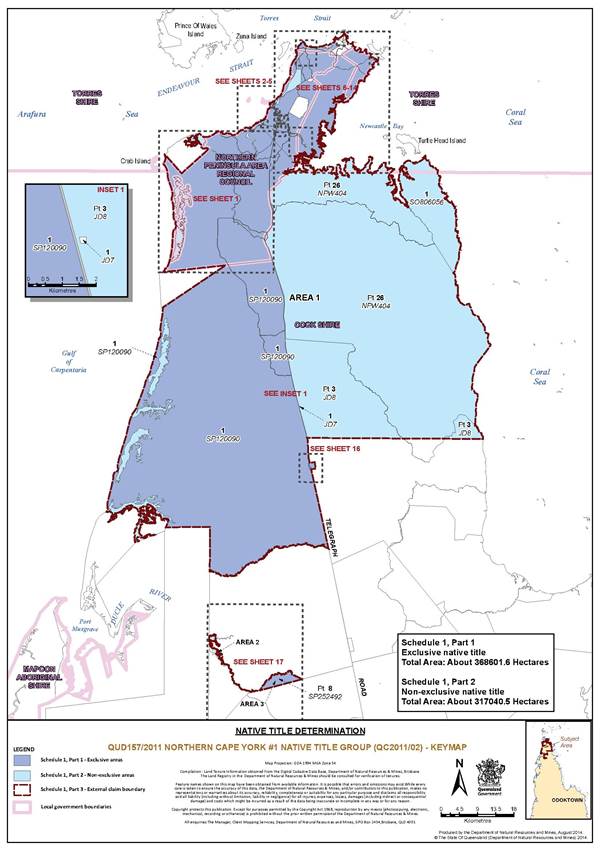
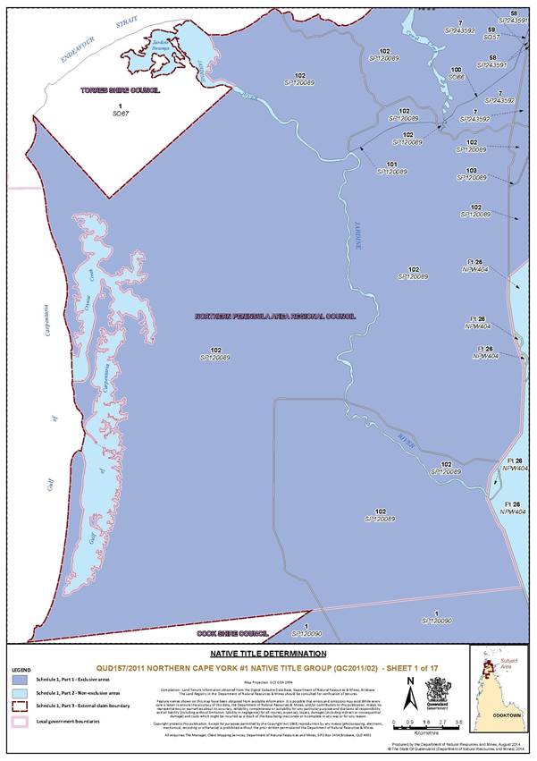
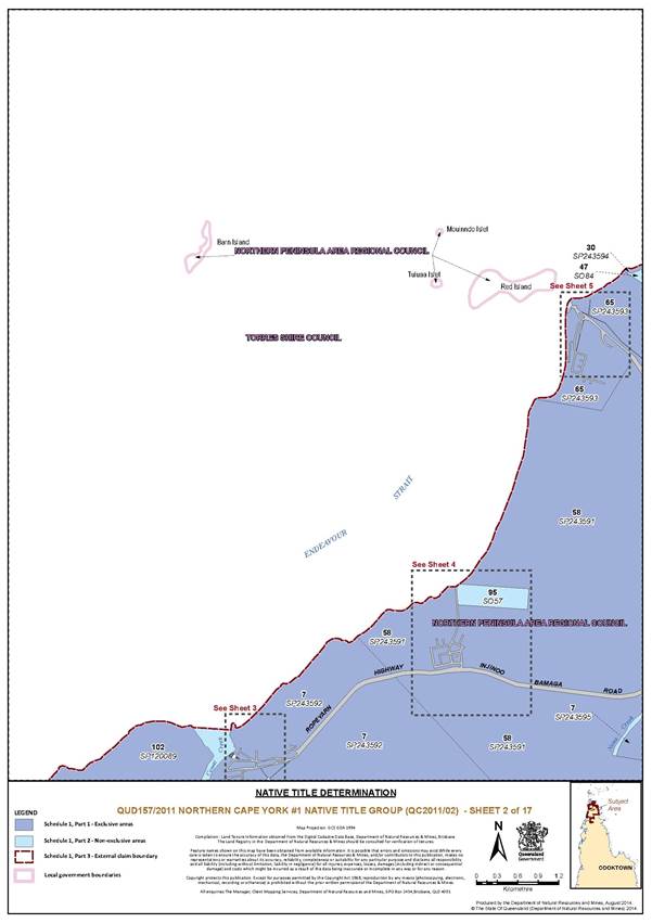
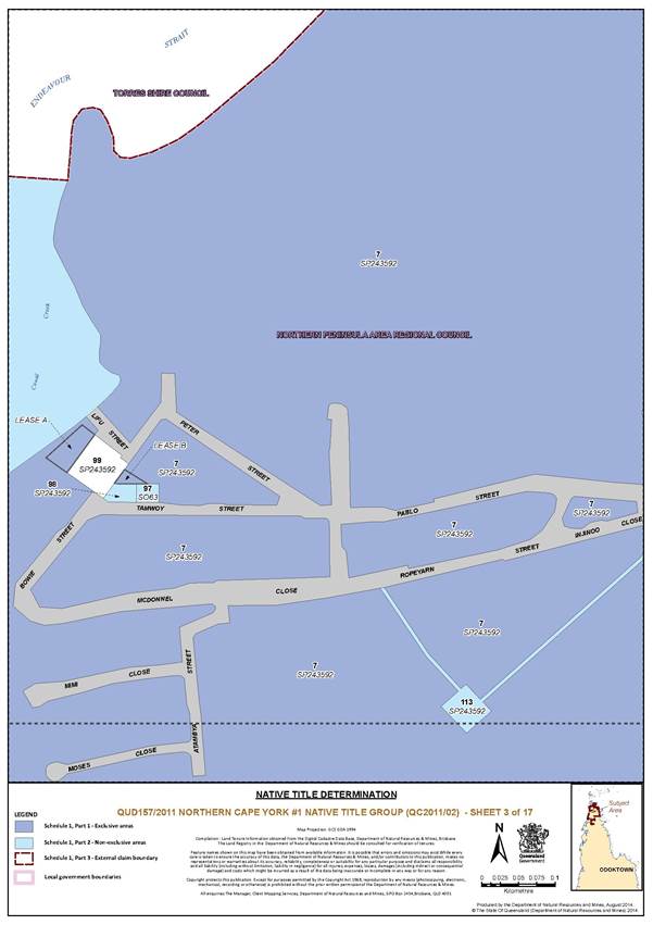
SCHEDULE 1 — DETERMINATION AREA
A. DESCRIPTION OF DETERMINATION AREA
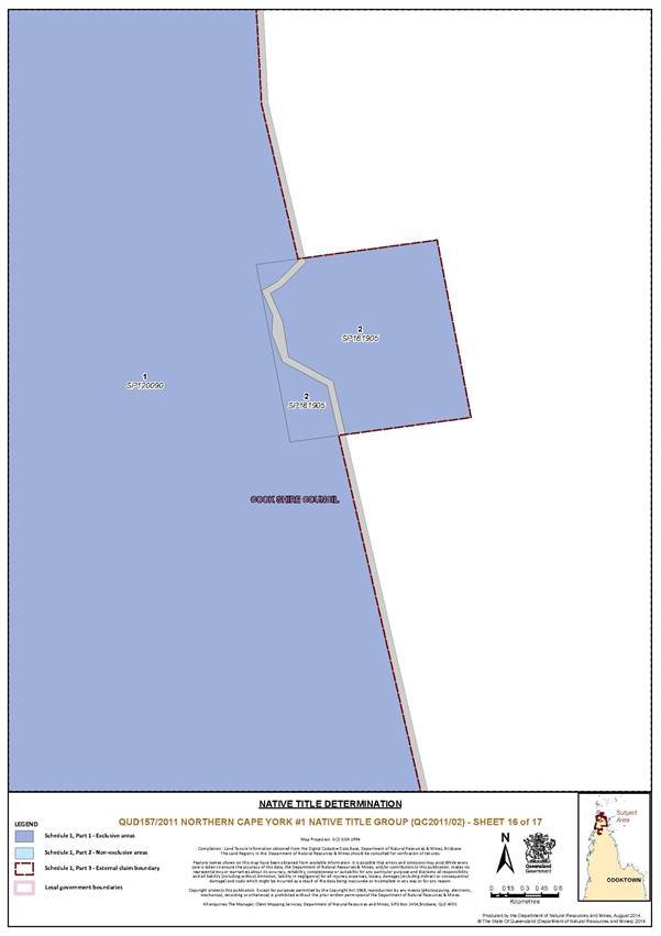
All of the land and waters described in the following table and depicted in dark blue on the determination map:
Part 2 — Non-Exclusive Areas
All of the land and waters described in the following table and depicted in light blue on the determination map:
|
Area Description (at date of Determination) |
Determination Map Sheet Number |
|
Lot 46 on Plan SO84 |
6 |
|
Lot 47 on Plan SO84 |
2, 6 |
|
That part of Lot 3 on Plan JD8 within the External Boundary |
Inset 1 of the Keymap |
|
That part of Lot 26 on Plan NPW404 within the External Boundary |
1, 6 |
|
Lot 1 on Plan SO806056 |
Keymap |
|
Lot 107 on Plan SO53 |
11, 13, 14 |
|
Lot 27 on Plan SO54 |
10 |
|
Lot 28 on Plan SO54 |
10 |
|
Lot 56 on Plan SP243591 |
2, 4 |
|
Lot 57 on Plan SP243591 |
2, 4 |
|
Lot 59 on Plan SO57 |
1, 6, 13, 11 |
|
Lot 95 on Plan SO57 |
2, 4 |
|
Lot 81 on Plan SO60 |
11, 13, 14 |
|
Lot 97 on Plan SO63 |
2, 3 |
|
Lot 100 on Plan SO66 |
1 |
|
Lot 110 on Plan SP243593 |
2, 5 |
|
Lot 106 on Plan SO72 |
13 |
|
Lot 108 on Plan SO74 |
11, 13 |
|
Lot 109 on Plan SO74 |
11, 13 |
|
Lot 111 on Plan SO76 |
10 |
|
Lot 113 on Plan SP243592 |
2, 3 |
|
Lot 94 on Plan SO841790 |
2, 5 |
|
Lot 11 on Plan SP104552 |
15 |
|
Lot 12 on Plan SP104552 |
15 |
|
Lot 105 on Plan SP104552 |
15 |
|
Lot 101 on Plan SP120089 |
1 |
|
Lot 104 on Plan SP104552 |
15 |
|
Lot 89 on Plan SP243595 |
13 |
|
Lot 33 on Plan SO58 |
11, 14 |
|
Lot 36 on Plan SO58 |
11, 14 |
|
Lot 39 on Plan SO58 |
11, 14 |
|
Lot 41 on Plan SO58 |
11, 14 |
|
Lot 42 on Plan SO58 |
11, 14 |
|
Lot 43 on Plan SO58 |
11, 14 |
|
Lot 44 on Plan SO58 |
11, 14 |
|
Lot 45 on Plan SO58 |
11, 14 |
|
Lot 48 on Plan SP243595 |
11, 14 |
|
Lot 49 on Plan SP243595 |
11, 14 |
|
Lot 50 on Plan SO58 |
11, 14 |
|
Lot 51 on Plan SO58 |
11, 14 |
|
Lot 52 on Plan SO58 |
11, 14 |
|
Lot 53 on Plan SO58 |
11, 14 |
|
Lot 60 on Plan SP243595 |
11, 14 |
|
Lot 61 on Plan SO59 |
11, 14 |
|
Lot 62 on Plan SO59 |
11, 14 |
|
Lot 63 on Plan SO59 |
11, 14 |
|
Lot 64 on Plan SO59 |
11, 14 |
|
Lot 66 on Plan SO59 |
11, 14 |
|
Lot 70 on Plan SO59 |
11, 14 |
|
Lot 71 on Plan SO59 |
11, 14 |
|
Lot 73 on Plan SO59 |
11, 14 |
|
Lot 74 on Plan SO59 |
11, 14 |
|
Lot 77 on Plan SO59 |
11, 14 |
|
Lot 78 on Plan SO59 |
11, 14 |
|
Lot 80 on Plan SO59 |
11, 14 |
|
Lot 90 on Plan SO59 |
11, 14 |
|
Lot 91 on Plan SO59 |
11, 14 |
|
Lot 83 on Plan SO60 |
11, 14 |
|
Lot 87 on Plan SO60 |
11, 14 |
|
Lot 29 on Plan SO70 |
11, 12, 13, 14 |
|
Lot 82 on Plan SP120467 |
11, 14 |
|
Lot 34 on Plan SO58 |
11, 14 |
|
Lot 35 on Plan SO58 |
11, 14 |
|
Lot 37 on Plan SO58 |
11, 14 |
|
Lot 38 on Plan SO58 |
11, 14 |
|
Lot 47 on Plan SO58 |
11, 14 |
|
Lot 92 on Plan SO59 |
11, 14 |
|
Lot 84 on Plan SO60 |
11, 14 |
|
Lot 98 on Plan SP243592 |
3 |
|
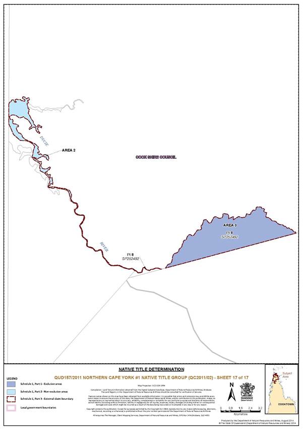
That part of Lot 8 on Plan SP252492 within the External Boundary further described as Area 2 in Schedule 1, Part 3 |
17 |
|
Save for waters forming part of the lot on plan, all waterways, natural lakes, creeks and rivers within the External Boundary including but not limited to: Skardon River, Nona Creek, Jackey Jackey Creek, Jardine Swamps, Crystal Creek, Jardine River, Cowal Creek, Punsand Bay and part of the Ducie River |
1 - 3, 6, 8, 11, 12, 13, 17 |
Part 3 – External Boundary
The External Boundary is described below and is depicted in red on the determination map:
Area 1
Commencing at the northeast corner of Lot 8 on SP252492, also being a point on the southern bank of the Dulhunty River, and extending generally westerly along the southern bank of that river to the eastern boundary of Lot 8 on MP14466; then northerly and westerly along the eastern and northern boundaries of that Lot to the eastern boundary of Lot 13 on SP204113; then north easterly, generally north westerly and generally southerly along the boundaries of that lot to a northern boundary of Lot 7024 on MP41159; then south westerly along the northern boundary of that lot to the eastern most corner of Lot 12 on SP204113; then generally westerly and generally southerly along the northern and western boundaries of that lot to again a northern boundary of Lot 7024 on MP41159; then south westerly along the northern boundary of that lot to the eastern boundary of Lot 11 on SP204113; then generally northern and generally westerly along the eastern and northern boundaries of that lot to its intersection with the High Water Mark of the mainland; then generally northerly along that High Water Mark, crossing the mouths of any waterways between the seaward extremities of each of the opposite banks of each such waterway, to the southern boundary of Lot 7024 on MP41159; then north easterly and westerly along the southern and northern boundaries of that lot to the south west corner of Lot 102 on SP120089 (being a point on the High Water Mark); then generally north easterly along the western boundary of that lot to a point at approximate Longitude 142.153176° East, Latitude 11.129126° South (being a point on the High Water Mark); then northerly to again a point on the western boundary of that lot at approximate Longitude 142.155196° East, Latitude 11.120049° South (being a point on the High Water Mark); then generally northerly along that High Water Mark, again crossing the mouths of any waterways between the seaward extremities of each of the opposite banks of each such waterway, to the westernmost corner of Lot 1 on SO67; then south easterly, north easterly, generally north westerly and generally north easterly along the boundaries of that lot to its intersection with the High Water Mark at the mouth of the Jardine River; then south easterly across the mouth of the Jardine River to a point on the western boundary of Lot 102 SP120089 at approximate Longitude 142.216610° East, Latitude 10.922577° South (being a point on the High Water Mark); then generally easterly and generally north easterly along that High Water Mark, again crossing the mouths of any waterways between the seaward extremities of each of the opposite banks of each such waterway, to approximate Longitude 142.496948° East (being a point on the High Water Mark); then easterly to again a point on the High Water Mark at approximate Longitude 142.499479° East; then generally easterly and generally north easterly along the High Water Mark, again crossing the mouths of any waterways between the seaward extremities of each of the opposite banks of each such waterway to the tip of Cape York; then generally south easterly and generally south westerly along the High Water Mark of the mainland (crossing the mouths of any waterways between the seaward extremities of each of the opposite banks of each such waterway) and onwards along eastern and southern boundaries of Lot 103 on SP104552, Lot 58 on SP243591 and Lot 102 on SP120089 to a point on the northern bank of Jackey Jackey Creek at Latitude 11.005345° South; then south easterly to a point on the southern bank of Jackey Jackey Creek at Longitude 142.401269° East, also being a point on a northern boundary of Lot 26 on NPW404; then generally easterly along that northern boundary of that lot to the western bank of Escape River at Longitude 142.678800° East; then south easterly to the eastern bank of Escape River at Longitude 142.678930° East, also being a point on the western boundary of Lot 1 on SO806056; then generally northerly, generally easterly and generally south easterly along the western, northern and eastern boundaries of that lot to an eastern boundary of Lot 26 on NPW404 (being a point on the High Water Mark); then generally south easterly along that High Water Mark crossing the mouths of any waterways between the seaward extremities of each of the opposite banks of each such waterway to Latitude 11.592880° South; then due west to the eastern boundary of Lot 1 on SP120090; then generally southerly along the eastern boundaries of that lot, northern, eastern and southern boundaries of Lot 2 on SP161905, and again along eastern boundaries of Lot 1 on SP120090 and onwards across the Dulhunty River back to the commencement point.
Area 2
Commencing at the intersection of the centreline of the Ducie River and the northern boundary of Lot 4 on SP222990 and extending generally north westerly along the centreline of that river to the eastern boundary of Lot 8 on MP14466; then northerly along the eastern boundary of that lot to the northern bank of Ducie River; then generally easterly and generally south easterly along the northern bank of that river to the northern boundary of Lot 4 on SP222990; then south westerly along that northern boundary back to the commencement point.
Area 3
Commencing at the intersection of the northern bank of South Palm Creek and the northern boundary of Lot 4 on SP222990 and extending south westerly along the northern boundary of that Lot to the northern bank of the Ducie River; then generally north easterly and generally south easterly along the northern bank of that river and South Palm Creek back to the commencement point.
Exclusions
This application does not include land and waters within the:
• QUD 269/2008 Gudang Yadhaykenu People (QC2008/008) native title determination application as registered on 3 March 2009.
• QUD 6158/1998 Ankamuthi People (QC1999/026) native title determination application as registered on 21 September 1999.
• Mining Leases ML 7031 and ML 7024.
NOTE
Data Reference and source
• Application boundary data compiled by National Native Title Tribunal based on information supplied by Cape York Land Council.
• Native title determination application QUD 6158/1998 Ankamuthi People (QC1999/026) as accepted for registration on 21 September 1999.
• Native title determination application QUD 269/2008 Gudang Yadhaykenu People (QC2008/008) as accepted for registration on 3 March 2009.
• Cadastre data sourced from Department of Natural Resources and Mines, Qld (February, 2014).
• Rivers / Creeks and High Water Mark based on cadastral data (August 2013) – else Topographic vector data is © Commonwealth of Australia (Geoscience Australia) 2008.
• High Water Mark is as defined in the Land Act 1994 (Qld).
Reference datum
Geographical coordinates have been provided by the NNTT Geospatial Services and are referenced to the Geocentric Datum of Australia 1994 (GDA94), in decimal degrees and are based on the spatial reference data acquired from the various custodians at the time
Use of Coordinates
Where coordinates are used within the description to represent cadastral or topographical boundaries or the intersection with such, they are intended as a guide only. As an outcome to the custodians of cadastral and topographic data continuously recalculating the geographic position of their data based on improved survey and data maintenance procedures, it is not possible to accurately define such a position other than by detailed ground survey.
Prepared by Geospatial Services, National Native Title Tribunal (9 July 2014)
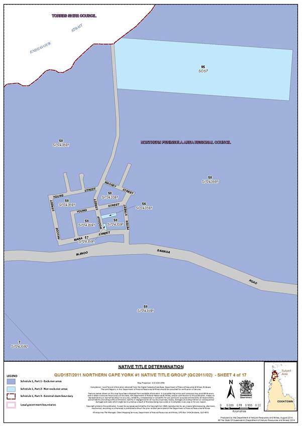
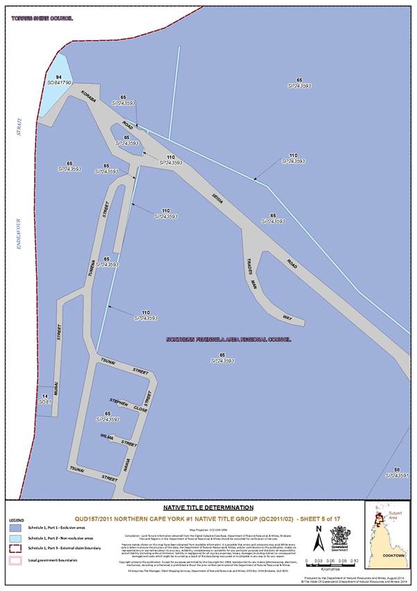
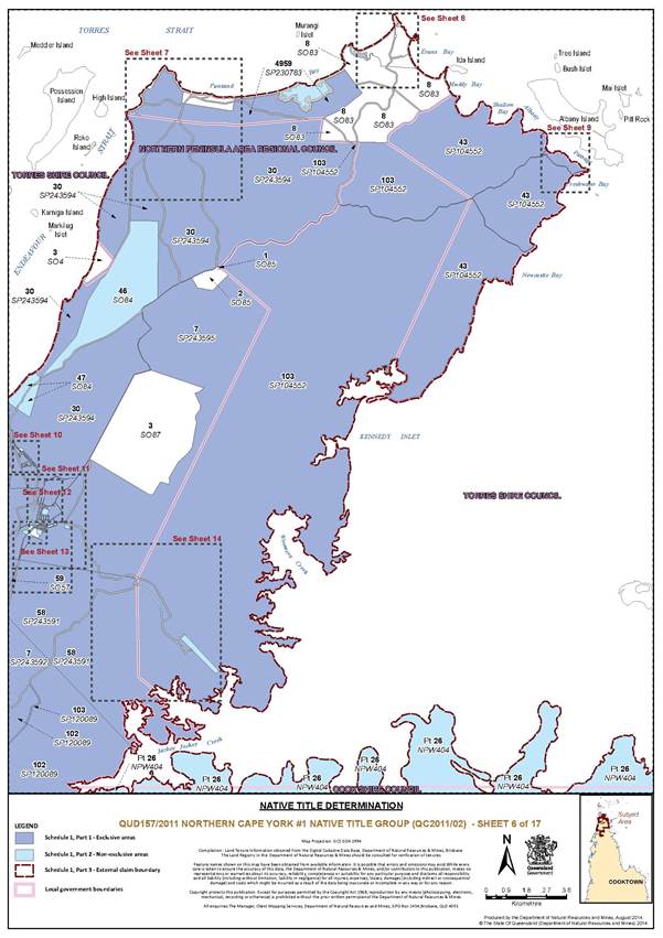
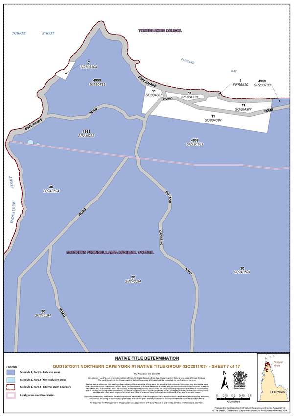
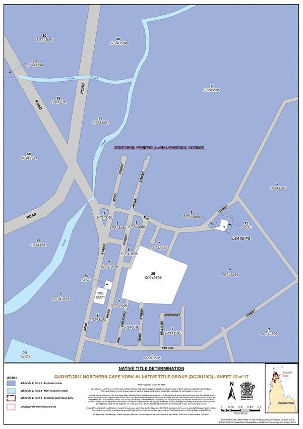
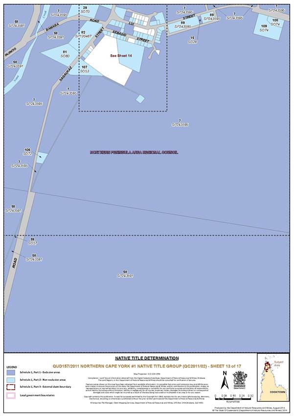
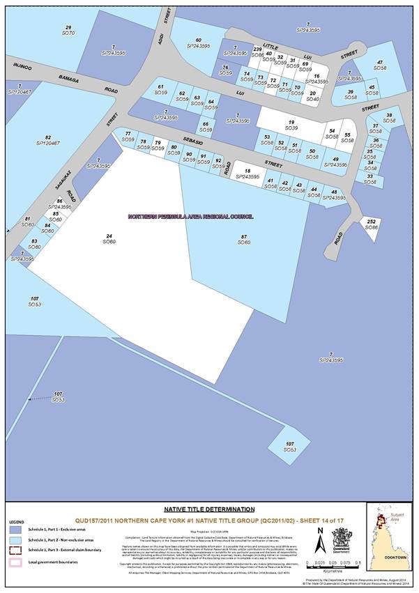
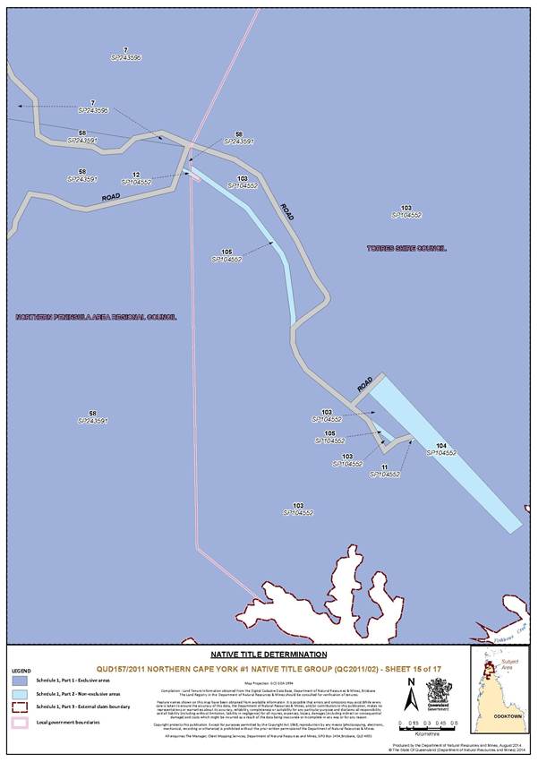
B. MAP OF DETERMINATION AREA
SCHEDULE 2 – AREAS NOT FORMING PART OF THE DETERMINATION AREA
The following areas of land and waters are excluded from the Determination Area.
1. Those land and waters within the External Boundary, which at the time the native title determination application was made:
(a) were the subject of one or more Previous Exclusive Possession Acts, within the meaning of s 23B of the Native Title Act 1993 (Cth); and
(b) to which none of ss 47, 47A or 47B of the Native Title Act 1993 (Cth) applied at the time of the native title determination application;
are excluded from the Determination Area as they could not be claimed in accordance with s 61A of the Native Title Act 1993 (Cth).
2. In addition to the land and waters described in para 1 above, those land and waters within the External Boundary where native title has otherwise been validly extinguished by operation of the laws of the State and the Commonwealth are excluded from the Determination Area.
3. Tenure Based Exclusions (ss 23B(2) and 23B(3))
Specifically, and to avoid doubt, the land and waters described in para 1 above includes the tenure based exclusions under ss 23B(2) and 23B(3) of the Native Title Act 1993 (Cth) to which s 20 of the Native Title (Queensland) Act 1993 (Qld) applies, and includes but is not limited to, the whole of the land and waters described as:
|
Area Description (at date of Determination) |
Determination Map Sheet Number |
|
Lot 3 on Plan SO4 |
6 |
|
Lot 1 on Plan JD7 |
Inset 1 of Keymap |
|
Lot 1 on Plan PER6530 |
7 |
|
Lot 22 on Plan SO47 |
8 |
|
Lot 11 on Plan SO804387 |
7 |
|
Lot 8 on Plan SO83 |
6, 8 |
|
Lot 7 on Plan SO838304 |
7 |
|
Lot 23 on Plan SO47 |
8 |
|
Lot 24 on Plan SO47 |
8 |
|
Lot 25 on Plan SO47 |
8 |
|
Lot 26 on Plan SO47 |
8 |
|
Lot 1 on Plan SO85 |
6 |
|
Lot 2 on Plan SO85 |
6 |
|
Lot 3 on Plan SO87 |
6 |
|
Lot 31 on Plan SO88 |
10 |
|
Lot 239 on Plan SO86 |
11, 14 |
|
Lot 252 on Plan SO86 |
11, 14 |
4. Public Works Based Exclusions:
The land or waters on which any public work, as defined in s 253 of the Native Title Act 1993 (Cth), is constructed, established or situated prior to 23 December 1996, and to which ss 23B(7) and 23C(2) of the Native Title Act 1993 (Cth) and/or s 23B(7) of the Native Title Act 1993 (Cth) and s 21 of the Native Title (Queensland) Act 1993 (Qld), applies, together with any adjacent land or waters in accordance with s 251D of the Native Title Act 1993 (Cth).
Specifically, and to avoid any doubt, the land and waters described in para 4(a) immediately above includes the whole of the land and waters described as:
|
Area Description (at date of Determination) |
Determination Map Sheet Number |
|
Lease FG on SP249801 in Lot 12 on Plan SO25 |
11, 12 |
|
Lot 99 on Plan SP243592 |
3 |
|
Lot 25 on Plan SP243595 |
11, 12 |
|
Lot 18 on Plan SP243595 |
11, 14 |
|
Lot 19 on Plan SO39 |
11, 14 |
|
Lot 54 on Plan SO58 |
11, 14 |
|
Lot 55 on Plan SO58 |
11, 14 |
|
Lot 31 on Plan SO59 |
11, 14 |
|
Lot 32 on Plan SO59 |
11, 14 |
|
Lot 40 on Plan SO59 |
11, 14 |
|
Lot 69 on Plan SO59 |
11, 14 |
|
Lot 24 on Plan SO60 |
11, 14 |
|
Lot 85 on Plan SO60 |
11, 14 |
|
Lot 86 on Plan SP243595 |
11, 14 |
|
Lot 88 on Plan SO71 |
12 |
|
Lot 16 on Plan SP243595 |
11, 14 |
|
Lot 20 on Plan SO40 |
11, 14 |
|
Lot 72 on Plan SO59 |
11, 14 |
|
Lot 79 on Plan SO59 |
11, 14 |
|
Lot 105 on Plan SO71 |
12 |
SCHEDULE 3 — NATIVE TITLE HOLDERS
1. The native title holders are the Northern Cape York #1 Native Title Claim Group, being the persons descended by birth or adoption from the following apical ancestors:
(a) Peter (Pahding) Pablo;
(b) Wymarra (Wymara Outaiakindi);
(c) Mathew (Charlie) Gelapa;
(d) Annie Blanco;
(e) Ela / Illa (father of Tommy Dodd, Polly Polly and Tommy Somerset);
(f) Woonduinagrun and Tariba (parents of Tom Redhead);
(g) Charlotte Ware;
(h) Queen Baki and Chief Tchiako/Tchiaku/Chiaku;
(i) Jipsit and Dolly;
(j) Mary McDonnell and Jack Snake;
(k) Ourinda and Emara McDonnell Charcoal (grandparents of Willy and Louisa Charcoal);
(l) Ralph Coconut;
(m) Charlie Nataki;
(n) William McDonnell;
(o) Charlie Otomo McDonnell and his wife, Agemo (parents of Charlie Woolhead (Pascoe));
(p) Wondorognu Alligator McDonnell and Mary Brown;
(q) Wargo (father of Kitty McDonnell, Jacko, and Frank Doyle);
(r) Clara and Jimmy McDonnell;
(s) Epidin and Eteman (parents of Doris Harry);
(t) Kaio;
(u) Sambo Wooleye (father of Simon and Sarah Peter);
(v) Woobumu and Inmare;
(w) Bullock (father of Mamoose Pitt, husband of Rosie/Lena Braidley);
(x) Charlie Mamoose (father of Silas, Larry, Johnny and Harry Mamoose);
(y) Charlie Seven River;
(z) Toby Seven River (father of Jack Toby);
(aa) Asai Charlie;
(ab) Sam and Nellie (parents of George Stephen);
(ac) Mammus/Mamoos/Mark/Mamoose plus his siblings Peter and Elizabeth;
(ad) Charlie Maganu (husband of Sarah McDonnell);
(ae) Polly (wife of Wautaba Charlie Ropeyarn).
SCHEDULE 4 — OTHER INTERESTS IN THE DETERMINATION AREA
The nature and extent of the other interests in relation to the Determination Area are the following as they exist as at the date of the determination:
1. The rights and interests of the parties under the following agreements:
(a) the Jardine River National Park, Jardine River Regional Park and Heathlands Regional Park Protected Areas ILUA between Larry Woosup, Asai Pablo, Charles Woosup, Walter Moses, Anzac McDonnell, Francis Brisbane, Meun Lifu, George Pausa and Bernard Charlie on their own behalf and on behalf of the Northern Cape York #1 Peoples (QUD 157/2011), and State of Queensland dated 17 October 2014;
(b) Larry Woosup, Asai Pablo, Charles Woosup, Walter Moses, Anzac McDonnell, Francis Brisbane, Meun Lifu, George Pausa and Bernard Charlie on their own behalf and on behalf of the Northern Cape York Group #1 (QUD 157/2011) and Ergon Energy Corporation Limited ACN 087 646 062 as parties to the indigenous land use agreement dated 20 October 2014; and
(c) Larry Woosup, Asai Pablo, Charles Woosup, Walter Moses, Anzac McDonnell, Francis Brisbane, Meun Lifu, George Pausa and Bernard Charlie on their own behalf and on behalf of the Northern Cape York Group #1 and Northern Peninsula Area Regional Council as parties to the Northern Cape York Group People #1 ILUA dated 15 October 2014.
(d) the Northern Peninsula Area Infrastructure ILUA (QI2004/001) registered 12 December 2005.
2. The rights and interests of the State of Queensland and the Northern Peninsula Area Regional Council in the lease dated 9 September 2009 in relation to Lease A and Lease B on SP224686 in Lot 7 on Survey Plan 120089.
3. The rights and interests of the holder of Water Licence No. 103767 granted under the Water Act 2000 (Qld).
4. The rights and interests of the holder of the special lease for grazing cattle and associated activities dated 21 December 1989 being title reference 17717191.
5. The rights and interests of the holder of the special lease for grazing cattle and associated activities dated 21 December 1989 being title reference 17717190.
6. The holder of exploration permit EPM 25147 granted under the Mineral Resources Act 1989 (Qld).
7. The rights and interests of the grantee and others (including beneficiaries) under the Bamaga Deed of Grant in Trust registered 31 May 2013 being Title Reference 50914971 and/or any Deed of Grant granted or re-granted in substitution for, replacement of or in succession to the said Deed of Grant.
8. The rights and interests of the grantee and others (including beneficiaries) under the Seisia Deed of Grant in Trust registered 14 December 2012 being Title Reference 50900950 and/or any Deed of Grant granted or re-granted in substitution for, replacement of or in succession to the said Deed of Grant.
9. The rights and interests of the grantee and others (including beneficiaries) under the Umagico Deed of Grant in Trust registered 22 February 2013 being Title Reference 50906793 and/or any Deed of Grant granted or re-granted in substitution for, replacement of or in succession to the said Deed of Grant.
10. The rights and interests of the grantee and others (including beneficiaries) under the New Mapoon Deed of Grant in Trust registered 23 November 2012 being Title Reference 50898464 and/or any Deed of Grant granted or re-granted in substitution for, replacement of or in succession to the said Deed of Grant.
11. The rights and interests of the grantee and others (including beneficiaries) under the Injinoo Deed of Grant in Trust registered 22 February 2013 being Title Reference 50906792 and/or any Deed of Grant granted or re-granted in substitution for, replacement of or in succession to the said Deed of Grant.
12. The rights and interests of the grantee and beneficiaries of an estate in fee simple under deed of grant title reference No. 50307040.
13. The rights and interests of the grantee and beneficiaries of an estate in fee simple under deed of grant title reference No. 50467812.
14. The rights and interests of the grantee and beneficiaries of an estate in fee simple under deed of grant title reference No. 50914995.
15. The rights and interests of the grantee and beneficiaries of an estate in fee simple under deed of grant title reference No. 50828992.
16. The rights and interests of Telstra Corporation Limited ACN 051 775 556:
(a) as the owner or operator of telecommunications facilities installed within the Determination Area;
(b) created pursuant to the Post and Telegraph Act 1901 (Cth), the Telecommunications Act 1975 (Cth), the Australian Telecommunications Corporation Act 1989 (Cth), the Telecommunications Act 1991 (Cth) and the Telecommunications Act 1997 (Cth), including rights:
(ii) to install and operate telecommunication facilities; and
(iii) to alter, remove, replace, maintain, repair and ensure the proper functioning of its telecommunications facilities;
(c) for its employees, agents or contractors to access its telecommunications facilities; and
(d) under any licences, leases, access agreements or easements relating to its telecommunications facilities in the Determination Area, including under:
(i) an authority issued under s 35 of the National Parks and Wildlife Act 1975 (Qld) on 21 August 1985 to construct and maintain a radio telephone tower and ancillary equipment on a site described as Lease A in Lot 26 on Plan NPW49 in the Parish of Sanamere and County of Somerset.
17. The rights and interests of Ergon Energy Corporation ACN 087 646 062:
(a) as the owner and operator of any “works” as that term is defined in the Electricity Act 1994 (Qld) within the Determination Area;
(b) as a distribution entity and the holder of a distribution authority under the Electricity Act 1994 (Qld);
(c) created under the Electricity Act 1994 (Qld) and the Government Owned Corporations Act 1993 (Qld) including:
(i) rights in relation to any agreement relating to the Determination Area existing or entered into before the date on which these orders are made;
(ii) rights to enter the Determination Area by its employees, agents or contractors to exercise any of the rights and interests referred to in this paragraph; and
(iii) to inspect, maintain and manage any works in the Determination Area.
18. The rights and interests of Cook Shire Council including any rights the Council, its employees, agents or contractors have:
(a) under its local government jurisdiction and functions under the Local Government Act 2009 (Qld), under the Land Protection (Pest and Stock Route Management) Act 2002 (Qld) and under any other legislation, for that part of the Determination Area within its local government area, as defined in the Local Government Act 2009 (Qld);
(b) as the owner and operator of infrastructure, facilities and other improvements located in the Determination Area as at the date of the determination, including but not limited to:
(i) dedicated roads operated by Council;
(ii) gravel pits operated by Council;
(iii) undedicated but constructed roads except for those not operated by Council;
(iv) water pipelines and water supply infrastructure;
(v) drainage facilities;
(c) to enter the land described in paras 18(a) to 18(b):
(i) exercise any of the rights and interests referred to in paras 18(a) to 18(b);
(ii) inspect, maintain or repair infrastructure, facilities and other improvements; and
(iii) undertake operational activities in its capacity as a local government such as feral animal control, weed control, erosion control, waste management and fire management.
19. The rights and interests of Northern Peninsula Area Regional Council including any rights the Council, its employees, agents or contractors have:
(a) under its local government jurisdiction and functions under the Local Government Act 2009 (Qld), under the Land Protection (Pest and Stock Route Management) Act 2002 (Qld) and under any other legislation, for that part of the Determination Area within its Local Government Area, as defined in the Local Government Act 2009 (Qld);
(b) as the:
(i) lessor under any leases which were entered into as at the date of the Determination;
(ii) grantor of any licenses or other rights and interests which were granted as at the date of the Determination;
(iii) holder of any estate or interest in land, and as trustee of any reserves, that exist in the Determination Area as at the date of the Determination;
(c) as the owner and operator of infrastructure, facilities and other improvements located in the Determination Area as at the date of the Determination, including but not limited to:
(i) dedicated roads operated by Council;
(ii) gravel pits operated by Council;
(iii) undedicated but constructed roads except for those not operated by Council;
(iv) water pipelines and water supply infrastructure;
(v) drainage facilities; and
(vi) cemetery and cemetery related facilities; and
(d) to enter the land described in paras 19(a) to 19(c) to:
(i) exercise any of the rights and interests referred to in paras 19(a) to 19(c);
(ii) inspect, maintain or repair infrastructure, facilities and other improvements referred to in para 19(c); and
(iii) undertake operational activities in its capacity as a local government such as feral animal control, weed control, erosion control, waste management and fire management.
20. The rights and interests of the Torres Shire Council as the local government for that part of the Determination Area within its Local Government Area, including:
(a) its powers, functions, responsibilities and jurisdiction under a Local Government Act;
(b) its rights and valid interests under any interest in land or waters within the Determination Area including under any lease, licence, access agreement, easement or Reserve in the Determination Area;
(c) the rights to use, operate, maintain, replace, restore, remediate, repair and otherwise exercise all other rights as the owners and operators of valid infrastructure, structures, earthworks, access works, facilities and other improvements within the Determination Area;
(d) the rights under any valid agreements between Council and any third party which relates to land or water in the Determination Area; and
(e) the rights of their employees, agents and contractors to enter upon the Determination Area for the purpose of performing their powers and responsibilities under paras 20(a) to 20(d).
21. The rights and interests of the State of Queensland in Reserves, the rights and interests of the trustees of those Reserves and of the persons entitled to access and use those Reserves for the respective purpose for which they are reserved.
22. The rights and interests granted or available to Alcan South Pacific Pty Ltd (and any successors in title) under the Alcan Agreement, including, but not limited to, rights and interests in relation to the “bauxite field” (as defined in cl 1 of such Agreement) and areas adjacent to or in the vicinity or outside of such bauxite field, where:
(a) “Alcan Act” means the Alcan Queensland Pty Limited Agreement Act 1965 (Qld); and
(b) “Alcan Agreement” means the agreement in Sch 1 to the Alcan Act, including as amended in accordance with such Act.
23. The rights and interests granted or available to RTA Weipa Pty Ltd and Rio Tinto Aluminium Limited (and any successors in title) under the Comalco Agreement, including, but not limited to, rights and interests in relation to the “bauxite field” (as defined in cl 1 of such Agreement) and areas adjacent to or in the vicinity or outside of such bauxite field, where:
(a) “Comalco Act” means the Commonwealth Aluminium Corporation Pty Limited Agreement Act 1957 (Qld);
(b) “Comalco Agreement” means the agreement in Sch 1 to the Comalco Act, including as amended in accordance with such Act.
24. The rights and interests of members of the public arising under the common law, including but not limited to the following:
(a) any subsisting public right to fish; and
(b) the public right to navigate.
25. So far as confirmed pursuant to s 212(2) of the Native Title Act 1993 (Cth) and s 18 of the Native Title (Queensland) Act 1993 (Qld) as at the date of this Determination, any existing public access to, and enjoyment of, the following places in the Determination Area:
(a) waterways;
(b) beds and banks or foreshores of waterways;
(c) coastal waters;
(d) beaches;
(e) stock routes; and
(f) areas that were public places at the end of 31 December 1993.
26. Any other rights and interests:
(a) held by the State of Queensland or Commonwealth of Australia; or
(b) existing by reason of the force and operation of the Laws of the State or the Commonwealth.
Note: Entry of orders is dealt with in Rule 39.32 of the Federal Court Rules 2011.
|
QUEENSLAND DISTRICT REGISTRY |
|
|
GENERAL DIVISION |
QUD 157 of 2011 |
|
BETWEEN: |
LARRY WOOSUP, ASAI PABLO, CHARLES WOOSUP, WALTER MOSES, ANZAC MCDONNELL, FRANCIS BRISBANE, MEUN LIFU, GEORGE PAUSA AND BERNARD CHARLIE ON THEIR OWN BEHALF AND ON BEHALF OF THE NORTHERN CAPE YORK GROUP #1 Applicant |
|
AND: |
STATE OF QUEENSLAND First Respondent COOK SHIRE COUNCIL Second Respondent NORTHERN PENINSULA AREA REGIONAL COUNCIL Third Respondent APUDTHAMA LAND TRUST Fourth Respondent HARRISON ATU Fifth Respondent RON ATU Sixth Respondent BATICOY BAMAGA Seventh Respondent GIBSON GOWA Eighth Respondent DICK JOEL JACOB Ninth Respondent RON JAWAI Tenth Respondent JACQUELINE ELIZABETH MULHOLLAND Eleventh Respondent JOHN MICHAEL MULHOLLAND Twelfth Respondent TIMACOY OBER Thirteenth Respondent OLD MAPOON ABORIGINAL CORPORATION Fourteenth Respondent JOHN TABUAI Fifteenth Respondent GERALD TAMWOY Sixteenth Respondent CLIFFORD WASIU Seventeenth Respondent ERGON ENERGY CORPORATION LIMITED Eighteenth Respondent TELSTRA CORPORATION LIMITED (ACN 051 775 556) Nineteenth Respondent ALCAN SOUTH PACIFIC PTY LTD Twentieth Respondent RTA WEIPA PTY LTD Twenty-first Respondent THE ISLAND INDUSTRIES BOARD Twenty-second Respondent |
|
JUDGE: |
GREENWOOD J |
|
DATE: |
30 OCTOBER 2014 |
|
PLACE: |
INJINOO |
REASONS FOR JUDGMENT
1 For the second time this year the Federal Court of Australia convenes in the northern part of Cape York Peninsula to explain the reasons for making orders under s 87 of the Native Title Act 1993 (Cth) (“the Act”) that determine the traditional rights and interests of the Northern Cape York #1 native title claim group which is constituted by the Angkamuthi Seven Rivers, the McDonnell Atampaya and the Gudang/Yadhaigana people.
2 The application for a determination of native title was filed on 1 July 2011 and was amended on 29 July 2014 and 17 October 2014.
3 The proceedings are brought on behalf of the native title claim group by Larry Woosup, Asai Pablo, Charles Woosup, Walter Moses, Anzac McDonnell, Francis Brisbane, Meun Lifu, George Pausa and Bernard Charlie.
4 The native title claim group is comprised of all persons descended from the identified apical ancestors whose names are set out in Sch 3 to the orders made today.
5 The determination area covers a large area of the land and waters in northern, north-western and north-eastern Cape York Peninsula generally located north of the Scardon and Dulhunty Rivers and west of the western boundary and north of the northern boundary of Heathland Resources Reserve and extends on the seaward side, to the high water mark. The area is properly described in Pt A of Sch 1 to the orders and depicted on the maps in Pt B of Sch 1.
6 The Cape York Land Council Aboriginal Corporation is the native title representative body for the region and is the legal representative for the claim group in relation to this application.
7 On 1 March 2012, the application passed the registration test pursuant to s 190A of the Act and since that date the application, amended on 29 July 2014 and again on 17 October 2014, has remained on the Register of Native Title Claims. The application was notified by the Native Title Registrar and the notification period for the purposes of s 66 of the Act ended on 15 August 2012.
8 The parties who remain respondents to the application are the State of Queensland, the Northern Peninsula Area Regional Council, Cook Shire Council, Apudthama Land Trust, Old Mapoon Aboriginal Corporation, Ergon Energy Corporation Limited, Telstra Corporation Limited, Alcan South Pacific Pty Ltd, RTA Weipa Pty Ltd, the Island Industries Board and Harrison Atu, Ron Atu, Baticoy Bamaga, Gibson Gowa, Dick Joel Jacob, Ron Jawai, Jacqueline Elizabeth Mulholland, John Michael Mulholland, Timacoy Ober, John Tabuai, Gerald Tamwoy and Clifford Wasiu. Sadly, one of the former individual respondents recently died and with his death he ceased to be a person whose interests might be affected by a determination of native title: see Order made on 28 October 2014.
9 The Commonwealth of Australia is no longer a party to these proceedings.
10 In what is a relatively short timeframe in the native title jurisdiction of the Court, the parties have negotiated the agreement that has been filed under s 87 of the Act. The parties have participated in intensive case management to resolve outstanding issues with some of the intra indigenous issues requiring judicial resolution (see Woosup on behalf of the Northern Cape York Group #1 v State of Queensland & Ors (No 2) [2014] FCA 1086). The parties are to be congratulated on the co-operative approach to the efficient conduct of the matter and the Court recognises and acknowledges their efforts in this regard.
11 On 23 October 2014, the parties filed an agreement under s 87 of the Act seeking the orders that I make today. Section 87 provides, relevantly, that the section applies if, at any stage of the proceedings (after the expiration of the period specified in the notice given under s 66 of the Act), an agreement is reached between the parties on the terms of an order the Federal Court might make in relation to the proceedings; and the terms of the agreement in writing signed by, or on behalf of, the parties are filed with the Court; and the Court is satisfied that an order in, or consistent with, those terms would be within the power of the Court.
12 Once those preconditions are satisfied, the Court may, if it appears to the Court appropriate to do so, make an order in, or consistent with, the terms of the agreement without holding a hearing of questions of fact and law in relation to the application: ss 87(1)(a), (b) and (c), 87(1A) and 87(2).
13 The Court is satisfied, on the affidavit evidence filed by the parties, that orders consistent with the terms of the s 87 Agreement would be within power and that it would be appropriate to make orders in and consistent with those terms without holding a hearing.
14 The Court is also satisfied for the purposes of ss 13(1) and 61(1) (which falls within Pt 3 of the Act) that there is no approved determination of native title in relation to the land and waters the subject of this proceeding.
15 I am satisfied that in determining whether it is appropriate to make the proposed orders, emphasis is to be placed upon whether the s 87 Agreement has been genuinely and freely made on an informed basis by all parties represented by experienced independent lawyers and, in the case of the State of Queensland, whether appropriate consideration has been given to the precise content of the applicant’s claim. As to this latter matter, I note that the State has been a participant in all of the processes earlier described and has raised questions which have been the subject of a supplementary expert anthropological report.
16 Having regard to the history of the State’s engagement in the analysis of native title rights and interests in relation to land and waters throughout Queensland and the resources and expertise available to the State in determining the legal status of particular land and waters, the State’s legal advisers are in a strong position to examine the precise content of an applicant’s determination application under the Act. Although, in my view, it is not necessary for the applicant to file a substantial body of evidence that would otherwise be required to satisfy the Court of the merits of the claim as though findings of fact and law were required to be made, it remains necessary, in my view, for the Court to be satisfied that the terms of the agreement reached between the parties (which provide the foundation for the determination orders) are, as Chief Justice French has observed, “rooted in reality”: Native Title – A Constitutional Shift?, University of Melbourne Law School, JD Lecture Series, French CJ, 24 March 2009; Kerindun v Queensland (2009) 258 ALR 306 at [16]; Kuuku Ya’u People v State of Queensland [2009] FCA 679 at [12] – [15].
17 The question of whether the terms of the agreement are rooted in reality simply requires some material to be before the Court upon which it can act in reaching the statutory state of satisfaction as to the appropriateness of the making of the orders. The parties have been represented by experienced lawyers. The terms of the s 87 Agreement have emerged out of the processes earlier described undertaken by the participants as represented. Although there were, at an earlier stage of this matter, a number of unrepresented indigenous respondents, all of the indigenous parties who remain as respondents to the application today are represented by experienced lawyers.
18 Section 94A of the Act requires that an order for determination of native title must set out details of the matters mentioned in s 225 of the Act which must be read together with s 223 of the Act. These sections give meaning to the terms “determination of native title” and “native title” and “native title rights and interests”. In Members of the Yorta Yorta Aboriginal Community v Victoria (2002) 214 CLR 422 (“Yorta Yorta”) at [76], Gleeson CJ, Gummow and Hayne JJ treated the statutory elements contained in s 223 as central.
19 The mandatory requirements for a determination of native title are these. The native title rights and interests must be communal, group or individual rights and interests. They must be rights and interests in relation to land or waters. They must be possessed under the traditional laws acknowledged, and the traditional customs observed, by Aboriginal peoples, relevantly, for these proceedings. Aboriginal peoples by their law and customs must have a connection with the land or waters, and the rights and interests must be recognised by the common law of Australia. Orders under s 87 of the Act take effect not only inter-parties in the resolution of claims made in the proceedings but represent an independent judicial determination, in the exercise of the judicial power of the Commonwealth, that may be asserted, as a matter of law, against anyone.
20 A determination of native title expresses the recognition and protection of those rights and interests in relation to land and waters defined and described in s 223 of the Act which find their origin in traditional laws and customs acknowledged and observed by Aboriginal peoples: Yorta Yorta at [75] and [76], Gleeson CJ, Gummow and Hayne JJ.
21 A determination of native title requires the Court to determine who are the persons or group of persons who hold the common or group rights comprising the native title; the nature and extent of those rights and interests in the Determination Area; the nature and extent of any other interests; and the relationship between the native title rights and interests and those other interests, in the Determination Area (s 225 of the Act).
22 In determining those matters and the matters mentioned earlier at [15] of these reasons, I have had reference to the following reports that were exhibited to the affidavit of Dr Anthony Redmond filed on 1 September 2014: A Northern Cape York Peninsula Regional Society: Identifying the regionally shared level of society for the NCY#1, NCY#2 and proposed NCY#3 Native Title Claimant Groups, Dr Anthony Redmond, June 2012 (the “Society Report”); Northern Cape York #1 QUD157/11 Native Title Connection Report, Dr Anthony Redmond, August 2012 (the “NCY#1 Connection Report”); NCYP #1 and #2 Native Title Claims: Supplementary Report – Anthropologist’s response to the State of Queensland’s assessment and request for further information in regard to the connection materials, Dr Anthony Redmond, 26 June 2013 (the “Supplementary Report”). I have also had reference to Dr Redmond’s report of 21 May 2014 entitled Northern Cape York Peninsula Regional Aboriginal Society: Summary of Evidence and Opinion, and the updated genealogical charts and final list of apical ancestors.
23 I have had the benefit of reading the applicant’s submissions filed on 3 October 2014. Much of the evidentiary material I have considered in this application was previously considered by me in relation to the orders I made in relation in the Northern Cape York #2 claim: Coconut on behalf of the Northern Cape York #2 Native Title Claim Group v State of Queensland [2014] FCA 629 (“NCY #2”). In NCY #2, I made the following observations on the evidence presented to the Court in the context of that matter:
[24] Dr Redmond is a Visiting Research Fellow at the Centre for Aboriginal Economic Policy Research at the Australian National University. He is an Australian Research Council Fellow who undertook a joint project entitled “Aboriginal Involvement in the inter-cultural frontier Economy”. Dr Redmond has conducted a wide-range of research activities in the discipline of anthropology with particular emphasis upon the foundation for communal, group or individual cultural rights, practises and interests of Aboriginal people. Dr Redmond has undertaken extensive research on this topic in Northern Cape York. Dr Redmond has conducted research in relation to native title claims on behalf of the Northern Cape York Group #2 (“NCY #2”) and also in relation to the claim made by the Northern Cape York Group #1 (“NCY #1”) claimants.
[25] Having regard to that research, Dr Redmond says this:
I came to the professional opinion that the set of regionally shared socio-cultural features and regular interactive patterns characteristic of the groups traditionally associated with the NCY #1 and #2 claim areas indicated that the claimants’ predecessors shared membership of a single society constituted through a body of shared traditional laws and customs, all of which had degrees of bearing upon the allocation of landed rights and interests. …
[emphasis added]
[26] Dr Redmond sets out extensive analysis which represents the foundation for that view. It is not necessary to repeat in these reasons the content of that analysis. Dr Redmond, in forming his professional opinion, also had regard to a wide body of anthropological research work concerning the peoples of Northern Cape York. That body of anthropological research work includes the work of Lauriston Sharp in 1933, 1934 and 1935. It includes the results of field research expeditions to Cape York in 1928 and in 1932/1933 by Donald Thomson including fieldwork in Weipa and Mapoon, with particular reference to Thomson’s papers in 1934, 1939 and 1972. It includes reference to the work of Ursula McConnel who travelled extensively throughout Cape York between 1927 and 1934 and conducted fieldwork to produce a series of reference papers in 1936, 1939 and 1950. It also includes reference to the work of Terrence Crowley, a linguist who undertook field work in Cape York in the 1970s and who produced two publications in 1981 and 1983 of relevance to regionally shared socio-cultural features and patterns of interaction of Aboriginal peoples within the Determination Area the subject of the present claim.
[27] More contemporary work has also been reviewed by Dr Redmond and that work includes the work of Thompson and Chase of 2006 and 2009; the work of Chase, Smith and Thompson of 2005 and the work of Rigsby in 1995 and 1999.
[28] As a result of an analysis of all of this work and Dr Redmond’s own work, he has prepared a map which demonstrates an “overlay” of anthropological data demonstrating considerable overlap of Northern Cape York Peninsula “socio-cultural-linguistic features” and, from the research and data, Dr Redmond identifies an area in which the indigenous people of Northern Cape York shared “an overwhelming preponderance of shared laws and customs in regard to local and social organisation, language affinities, kinship and marriage customs, ceremonial and cosmological beliefs, ritual prohibitions on eating of totemic species, emic perspectives on their relative sameness and difference with their neighbours [perspectives on the language and culture of the peoples in terms of their internal functioning within the group] and regional dispute resolution practices”.
24 In the NCY #1 Connection Report, Dr Redmond refers to his extensive research in relation to the NCY #1 claimant families and their ancestors and at [36] he concludes that:
The forty-eight sources listed in the genealogical database incorporate my own field research as well as drawing upon a wide range of secondary sources including the field-notes of Sharp (1933-4) and Hinton (1963), as well as the more recent reports of Fuary and Greer (1993), Kwok (1998), Elias (1998), McKeown (1996), Taylor and Powell (2008), Powell (2004; 2010), Thompson (2009). The genealogies also incorporate parts of the database compiled by Peter Blackwood and his associates which mostly pertains to the people of the NCY#2 claim area but also contains various relevant information for the current NCY#1 claimant group. The sources cited in the genealogies also include extracts from the Register of Births, Deaths and Marriages, and those drawn from the records of the Presbyterian Church at Mapoon, as well as extracts from information provided by the Community Personal Histories (CPH) section of the Queensland Government.
25 In NCY #2, I noted Dr Redmond’s conclusion that, in his opinion, the data “all point towards the existence of a single regional society uniting the NCY #1 and #2 claimant groups under a shared body of laws and customs” [emphasis added], in respect of which he wrote:
My field research with contemporary claimants in the NCY #1 claim, in conjunction with my study of the research materials pertaining to the NCY #2 claim, strongly indicate that a continuing observance and acknowledgement of the traditional laws and customs of the region continues to unite the peoples of both the NCY #1 and #2 claim areas within a single society. This contemporary social unity is entirely congruent with my findings regarding the [Northern Cape York Peninsula] regional society at the time of sovereignty.
26 Dr Redmond, in the Supplementary Report, refers again to this single “regional Northern Cape York society” that is differentiated in terms of territories most closely associated with the claim group under a regional body of law and custom. He concludes that:
[68] The extensive affinal and kin networks established through the long history of customary intermarriage between the Angkamuthi, Atampaya and Gudang Yathaikeno peoples has engendered a situation in which all of the claimants in the NCY#1 claim have close relatives from each of the three language identified groupings. Indeed, the NCY#1 genealogies show that it would be extremely difficult to identify a single claimant who does not possess socially recognised connections to each of these three language groups …
[69] These patterns of customary intermarriage between the three constituent groupings of the NCY#1 claimant group are considerably more marked than those with their southern neighbours making up the NCY#2 claimant group.
[70] This cultural institution of customary marriage between each of the three NCY#1 language groupings became further intensified in the period of Indigenous settlement into permanent communities and long-term, large-scale camps. This phenomenon of large encampments first emerged at Somerset in the mid-nineteenth century and extended to the major regional camps established at McDonnell and Moreton Stations in the late nineteenth and early twentieth centuries before the establishment of the permanent village at Cowal Creek in about 1912-15 …
27 The land holding groups who possessed rights and interests under traditional laws and customs in relation to each part of the Determination Area at the time of “effective sovereignty” were composed of the ancestors of persons who today identify as members of the Angkamuthi Seven Rivers group, the McDonnell Atampaya group and the Gudang/Yadhaigana group. In the NCY#1 Connection Report at p 8, Dr Redmond describes those three “socio-territorial groupings” in these terms:
The Angkamuthi Seven River [sic] group are the descendants of ancestors whose traditional homelands include places located in the lower catchments of the west coast rivers of northern Cape York, commonly known as the Seven Rivers (an area which includes parts of the catchments of the Jardine River, Crystal Creek, Doughboy River, McDonald River, Jackson River, Skardon River and Ducie/Dulhunty River).
The McDonnell Atampaya group are descendants of ancestors whose traditional country includes the upland regions of Northern Cape York Peninsula in the forested highlands of the Great Dividing Range, between approximately the headwaters of the Jardine River in the north, south to Schramm and Nimrod Creeks, east to Catfish Creek and west to the Richardson Range. The group name derives from a place named Atampaya, near the long abandoned McDonnell Telegraph Station.
The Gudang/Yadhaigana people are descendants of ancestors whose traditional country includes the north eastern and parts of the north-west coast of Cape York. These two named groupings hold adjacent country, are extensively intermarried and commonly act as a single entity in regard to land and decision-making processes.
28 Dr Redmond concludes that the NCY #1 claim area is made up of the traditional lands and waters of these three major socio-territorial groups and the genealogical material relied on demonstrates that the contemporary members of the groups are descendants of those ancestors who are identified in Sch 3 of the orders as: Peter (Pahding) Pablo; Wymarra (Wymara Outaiakindi); Mathew (Charlie) Gelapa; Annie Blanco; Ela / Illa (father of Tommy Dodd, Polly Polly and Tommy Somerset); Woonduinagrun and Tariba (parents of Tom Redhead); Charlotte Ware; Queen Baki and Chief Tchiako/Tchiaku/Chiaku; Jipsit and Dolly; Mary McDonnell and Jack Snake; Ourinda and Emara McDonnell Charcoal (grandparents of Willy and Louisa Charcoal); Ralph Coconut; Charlie Nataki; William McDonnell; Charlie Otomo McDonnell and his wife, Agemo (parents of Charlie Woolhead (Pascoe)); Wondorognu Alligator McDonnell and Mary Brown; Wargo (father of Kitty McDonnell, Jacko, and Frank Doyle); Clara and Jimmy McDonnell; Epidin and Eteman (parents of Doris Harry); Kaio; Sambo Wooleye (father of Simon and Sarah Peter); Woobumu and Inmare; Bullock (father of Mamoose Pitt, husband of Rosie/Lena Braidley); Charlie Mamoose (father of Silas, Larry, Johnny and Harry Mamoose); Charlie Seven River; Toby Seven River (father of Jack Toby); Asai Charlie; Sam and Nellie (parents of George Stephen); Mammus/Mamoos/Mark/Mamoose plus his siblings Peter and Elizabeth; Charlie Maganu (husband of Sarah McDonnell); and Polly (wife of Wautaba Charlie Ropeyarn).
29 Sovereignty of mainland Australia was acquired by the Imperial Crown in 1788. Effective sovereignty did not occur in the claim area until many decades later. The arrival of the Jardines at Somerset in 1864 marked the beginning of a permanent European presence in the claim area. Dr Redmond concludes that the relationship between the Aboriginal people and the new settlers was deeply ambivalent and often violent. Sheep and cattle stations were established from the mid-1860’s and the overland telegraph line was constructed in the 1880’s. The McDonnell telegraph station was opened in 1887. Dr Redmond refers in the NCY#1 Connection Report at para 7 to a report from Archibald Meston (later the Protector of Aboriginals), who in 1896 wrote about the inhabitants of the claim area:
From Newcastle Bay south to Princess Charlotte Bay … are still in their original condition … There is no settlement whatever, nor is there a single white man resident over the whole of that extensive territory, except for a few miners on one locality … the tribes to the westward [of the east coast], between the coast and the telegraph line, are still absolutely wild, and … free from any intercourse or contamination by white men … the whole western coast north from the Mitchell to the Jardine River [is] in absolute possession of the wild tribes.
30 In Dr Redmond’s view, effective sovereignty coincided with the establishment of the first permanent European presence at Somerset in about 1860 and says that the degree of disruption in the more southern reaches of the claim area appears to have been somewhat less intense than in the northern tip. Effective sovereignty is likely to have occurred in the proposed determination area at different points in time over a period of years, perhaps decades, from 1864.
31 In the reasons in NCY #2, reference was made to engagement with early explorers by the ancestors of the claim group:
In 1606 the Dutch vessel Duyfken sailed down the west coast of Cape York Peninsula and sighted land at the Pennefather River in the Determination Area and entered Port Musgrave and the Wenlock River where particular interactions occurred with Aboriginal peoples. In April and May 1623, Jan Carstenzoon led the Dutch vessels Pera and Arnehem on an exploratory mission from Torres Strait down the west coast of Cape York Peninsula to about the Staaten River in the south. Carstenzoon named the river now known as the Wenlock River as the Carpentier River. Carstenzoon’s diaries provide some detail of huts and weaponry and native dwellings seen at the Skardon River. In 1802, Matthew Flinders in the Investigator sailed down the western side of Cape York Peninsula passing Port Musgrave and making particular observations.
32 The rights and interests that are recognised in the orders I make today are derived from the traditional laws and customs and their adaptation since sovereignty. Dr Redmond’s Society Report examines the available evidence in relation to the cosmology, the role of regional elders, the linking of language, shared responsibilities for ceremony, trade and exchange, spiritual beliefs, laws and customs governing regional dispute resolution processes, and a regionally shared mode of aggregating local descent groupings under toponymic labels.
33 Dr Redmond has included various maps in the Society Report that demonstrate pictorially the areas associated with particular laws and customs, as found by Sharp, Thomson, McConnel, Crowley, Alpher and Hale. One of the maps includes is an aggregate of the earlier maps and is striking because of the broad commonality of areas associated with those laws and customs.
34 Dr Redmond comments on this particular map at para 193(n) of the Society Report:
It will be observed from this map that it is possible to delineate an area in which the Indigenous people of Northern Cape York Peninsula clearly shared an overwhelming preponderance of shared laws and customs in regard to local and social organisation, language affinities, kinship and marriage customs, ceremonial and cosmological beliefs, ritual prohibitions on eating of totemic species, emic perspectives on their relative sameness and difference with their neighbours and regional dispute resolution practices. In my opinion, these data all point towards the existence of a single regional society uniting the NCY#1, [NCY]#2 and proposed NCY#3 claimant groups under a shared body of laws and customs.
35 In terms of the contemporary situation, the NCY#1 native title claim group continues to be part of a wider regional society.
36 As Dr Redmond notes in the NCY#1 Connection Report:
The wider Aboriginal jural public of Northern Cape York Peninsula … which upholds the laws and customs in the claim region is more extensive than any single language group and lower-level divisions (including the patriclans recorded at the threshold of colonisation and their present incarnation in contemporary kin-based groupings). For this reason the claimant group can be distinguished from the wider regional society within which it is embedded.
37 Dr Redmond concludes that, at all relevant times, a normative system of traditional law and custom has governed the lives of the claimants and their ancestors:
The predecessors of the NCY#1 claimant group used, occupied and enjoyed a lawful and regulated jurisdiction over the NCY#1 Claim Area … prior to the assumption of effective sovereignty which coincides with the establishment of the first permanent European presence at Somerset in about 1860. That lawful use and occupation has been perpetuated across succeeding generations to the present day under a body of shared traditional laws and customs.
38 The NCY #1 claim group have provided extensive evidence of their continuing connection to the claim area. Members of the claim group live in the five communities within the external boundary of the determination area, Injinoo, Seisia, Bamaga, Umagico and New Mapoon and in semi-permanent camps and outstations. Dr Redmond refers to numerous statements from members of the claim group he has obtained attesting to various activities on country such as hunting, gathering, fishing, camping, manufacturing implements for hunting and fishing, burning country and protecting places. Continuity is expressed in terms of adherence to particular laws, customs, practices and beliefs.
39 I am satisfied having regard to the anthropological reports in evidence that the nature and extent of the native title rights and interests in relation to the land and waters of the Determination Area are these.
40 As to the land and waters described in Pt 1 of Sch 1 otherwise known as the “Exclusive Areas” of exercise of the native title rights and interests, those rights and interests are, other than in relation to Water, the rights to possession, occupation, use and enjoyment of the area to the exclusion of all others, and in relation to Water, the non-exclusive rights to hunt, fish and gather from the Water of the area, take and use the Natural Resources of the Water in the area, and take and use the Water of the area, for cultural, personal, domestic and communal purposes. “Water” has the definition attributed to it as set out in Order 14 of the orders published today.
41 As to the land and waters described in Pt 2 of Sch 1, otherwise known as the “Non-Exclusive Areas” of exercise of the native title rights and interests, those rights and interests are the non-exclusive rights to:
(a) access, be present on, move about on and travel over the area;
(b) hunt and fish in or on, and gather from, the area;
(c) take, use, share and exchange Natural Resources on the area;
(d) take and use Water from the area for cultural, personal, domestic and communal purposes;
(e) live and camp on the area and for those purposes to erect shelters and other structures thereon;
(f) light fires on the area for cultural, spiritual or domestic purposes, including cooking, but not for the purpose of hunting or clearing vegetation;
(g) be buried and to bury native title holders within the area;
(h) conduct ceremonies on the area;
(i) hold meetings on the area;
(j) teach on the area the physical and spiritual attributes of the area;
(k) maintain places of importance and areas of significance to the native title holders under their traditional laws and customs on the area and to protect those places and areas from harm;
(l) be accompanied on to the area by those persons who, though not native title holders, are:
(i) spouses or partners of native title holders;
(ii) people who are members of the immediate family of a spouse or partner of a native title holder; or
(iii) people reasonably required by the native title holders under traditional law and custom for the performance of ceremonies or cultural activities on the area.
42 The native title rights and interests so described are subject to and exercisable in accordance with the laws of the State of Queensland and the Commonwealth, the traditional laws acknowledged and traditional customs observed by the native title holders, and the other interests in the Determination Area referred to in Sch 4 to the Orders.
43 As to the “other interests” recited at paras 7 to 11 of Sch 4, which are the rights and interests of the grantees and others (including beneficiaries) under five Deeds of Grant in Trust (“DOGIT”) (and/or any Deed of Grant granted or re-granted in substitution for, replacement of or in succession to each Deed of Grant), the relationship between those interests and the interests of the native title holders, particularly in the context of the operation of the Aboriginal Land Act 1991 (Qld), was discussed in my reasons in Woosup on behalf of the Northern Cape York Group #1 v State of Queensland [2014] FCA 910.
44 The orders published today precisely set out the conditions upon which Orders 7 and 8 of the orders setting out the nature, scope and content of the native title rights and interests rest, and, in particular, Orders 10, 11 and 12. Order 12 sets out the nature and extent of other interests in relation to the Determination Area or parts of it, described by reference to Sch 4 of the orders. Order 13 sets out the relationship between the native title rights and interests described in Orders 7 and 8 and the other interests described in Sch 4.
45 The applicant has resolved that the native title rights and interests are to be held in trust by the Northern Cape #1 Aboriginal Corporation (ICN 8114) as prescribed body corporate. A written nomination and written consent required by s 56(2)(a) of the Act has been filed with the Federal Court. The orders provide that upon the determination taking effect, the native title is to be held in trust for the common law holders and Northern Cape #1 Aboriginal Corporation is to be the prescribed body corporate for the purposes of ss 56(2)(b) and 56(3) of the Act and is to perform the functions mentioned in s 57(1) of the Act after becoming a registered native title body corporate. The common law native title holders have notified the Court by an affidavit of Charles Thomas Woosup filed 10 October 2014 that the Northern Cape #1 Aboriginal Corporation is nominated as the prescribed body corporate to be the trustee of the native title determined in this proceeding. The determination will take effect according to the terms of Order 2 of the orders. No determination under s 57 of the Act is required having regard to the operation of s 56 of the Act.
46 On the basis of all of the matters described in these reasons, I am satisfied that the Court has power to make the determination in the terms proposed and that it will be appropriate to do so in all the circumstances.
47 The orders made today give recognition within the Australian legal system to the native title rights and interests of the claim group described as the Northern Cape York #1 claim group in relation to the Determination Area, borne out of traditions honoured and customs practiced by the ancestors of the claimants and observed and practiced by their descendants continuously over time as described in the report of Dr Redmond having regard to the detailed anthropological record of Aboriginal peoples and their engagement with the land and waters of the Determination Area.
48 The Court now publishes the orders comprising the determination.
|
I certify that the preceding forty-eight (48) numbered paragraphs are a true copy of the Reasons for Judgment herein of the Honourable Justice Greenwood. |
Associate:

