
FEDERAL COURT OF AUSTRALIA
Murphy on behalf of the Jinibara People v State of Queensland [2012] FCA 1285
IN THE FEDERAL COURT OF AUSTRALIA | |
DATE OF ORDER: | |
WHERE MADE: |
BEING SATISFIED that an order in the terms set out below is within the power of the Court, and it appearing appropriate to the Court to do so, pursuant to s 87 of the Native Title Act 1993 (Cth),
BY CONSENT THE COURT ORDERS THAT:
1. There be a determination of native title in the terms set out below (the Determination).
2. Each party to the proceeding is to bear its own costs.
BY CONSENT THE COURT DETERMINES THAT:
1. Native title exists in relation to the determination area (the Determination Area).
2. The native title is held by the Jinibara People who are the people described in Schedule 3 (the native title holders).
3. Subject to paragraphs 5, 6 and 7, the nature and extent of the native title rights and interests in relation to the Determination Area, other than in relation to Water, are:
(a) in relation to that part of the Determination Area identified in Part 1 of Schedule 1, the rights to possession, occupation, use and enjoyment of the area to the exclusion of all others; and
(b) in relation to that part of the Determination Area identified in Part 2 of Schedule 1, the non-exclusive rights to:
(i) access, move about on and travel over the area;
(ii) camp, and live temporarily on the area as part of camping, and for that purpose build temporary shelters;
(iii) light fires on the area for personal and domestic purposes including cooking, but not for the purpose of hunting or clearing of vegetation;
(iv) fish, hunt, gather, take, keep, use, share and exchange Natural Resources from the area;
(v) conduct, and participate in, rituals and ceremonies on the area, including those relating to initiation, birth and death;
(vi) be buried and bury native title holders within the area;
(vii) maintain sites, objects, places and areas of significance to the native title holders under their traditional laws and customs and protect by lawful means those sites, objects, places and areas from physical harm or desecration;
(viii) teach on the area the physical, cultural and spiritual attributes of the area;
(ix) hold meetings on the area; and
(x) be accompanied on the area by certain non-native title holders, being:
(A) spouses of native title holders, pursuant to the exercise of traditional laws and customs;
(B) people required or permitted under the traditional laws acknowledged and traditional customs observed by the native title holders for the performance of, assistance with or participation in, rituals, ceremonies or cultural activities; or
(C) people who have rights in relation to the area according to the traditional laws and customs of the native title holders.
4. Subject to paragraphs 5, 6 and 7, the nature and extent of native title rights and interests in relation to Water within the Determination Area are the non-exclusive rights to:
(a) hunt, fish, gather, take, keep, use, share and exchange Natural Resources from the Water; and
(b) take, use, share and exchange the Water;
for personal, domestic or non-commercial (including cultural or spiritual) communal purposes.
5. The native title rights and interests are subject to and exercisable in accordance with:
(a) the Laws of the State and the Commonwealth; and
(b) the traditional laws acknowledged and the traditional customs observed by the native title holders.
6. The native title rights and interests referred to in paragraphs 3(b) and 4 do not confer possession, occupation, use or enjoyment to the exclusion of all others.
7. There are no native title rights in minerals as defined by the Mineral Resources Act 1989 (Qld) and petroleum as defined by the Petroleum Act 1923 (Qld) and the Petroleum and Gas (Production and Safety) Act 2004 (Qld).
8. The nature and extent of any other interests in relation to the Determination Area (or respective parts thereof) as at the date of this Determination of native title are set out in Schedule 4 (the Other Interests).
9. The relationship between the native title rights and interests described in paragraphs 3 and 4 and the Other Interests described in Schedule 4 as they exist at the date of this Determination of native title is that, taking into account the effect of the Native Title Act 1993 (Cth):
(a) the Other Interests co-exist with the native title rights and interests;
(b) in the event of inconsistency, the Other Interests prevail over the native title rights and interests and any exercise of the native title rights and interests, but do not extinguish them except in accordance with the law; and
(c) the existence of the native title rights and interests does not prevent the doing of any activity required or permitted to be done by, in accordance with, or under the Other Interests.
10. The native title is not held in trust.
11. The Jinibara People Aboriginal Corporation, incorporated under the Corporations (Aboriginal and Torres Strait Islander) Act 2006 (Cth), is to:
(a) be the agent prescribed body corporate for the purpose of s 57(2) of the Native Title Act 1993 (Cth); and
(b) perform the functions set out in s 57(3) of the Native Title Act 1993 (Cth) after becoming a registered native title body corporate.
12. In this Determination, unless the contrary intention appears:
“Determination Area” means the land and waters described in Parts 1 and 2 of Schedule 1 and shown on the maps attached to Schedule 1 to the extent that the land and waters fall within the External Boundary, but does not include those areas of land and waters described in Schedule 2. To the extent of any inconsistency between the written description and the maps, the written description prevails;
“External Boundary” means the boundary described in Schedule 5;
“land” and “waters”, respectively, have the meaning given by the Native Title Act 1993 (Cth);
“Laws of the State and the Commonwealth” means the common law and the laws of the State of Queensland and the Commonwealth of Australia, and includes legislation, regulations, statutory instruments, local planning instruments and local laws;
“Local Government Act” has the meaning in the Local Government Act 2009 (Qld);
“Local Government Area” has the meaning in the Local Government Act 2009 (Qld);
“Natural Resources” means:
(a) “animals” as defined in the Nature Conservation Act 1992 (Qld), and for certainty includes eggs and honey;
(b) “plants” as defined in the Nature Conservation Act 1992 (Qld), and for certainty includes wax, gum and resin; and
(c) any clays, soil including sub-soil, sand, gravel, shale, ochre, stone or rock found on or below the surface,
but does not include:
(a) animals that are the private personal property of another;
(b) crops that are the private personal property of another; and
(c) minerals as defined in the Mineral Resources Act 1989 (Qld) or petroleum as defined in the Petroleum Act 1923 (Qld) and the Petroleum and Gas (Production and Safety) Act 2004 (Qld).
“Protected Area” has the same meaning as in the Nature Conservation Act 1992 (Qld);
“Reserves” means reserves that are dedicated or taken to be reserves under the Land Act 1994 (Qld); and
“Water” means water as defined by the Water Act 2000 (Qld).
Other words and expressions used in this Determination have the same meaning as they have in Part 15 of the Native Title Act 1993 (Cth).
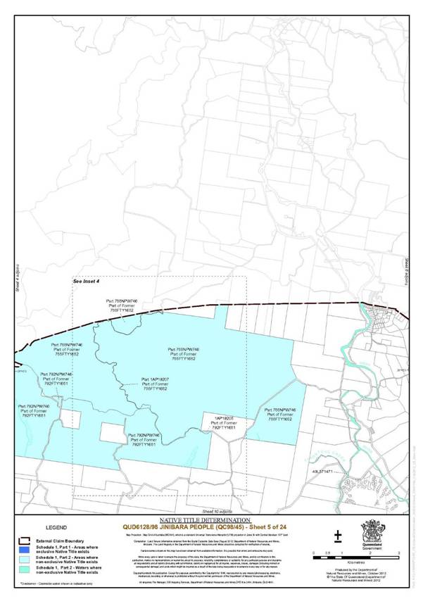
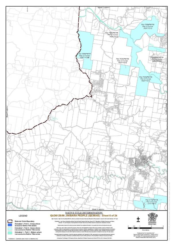
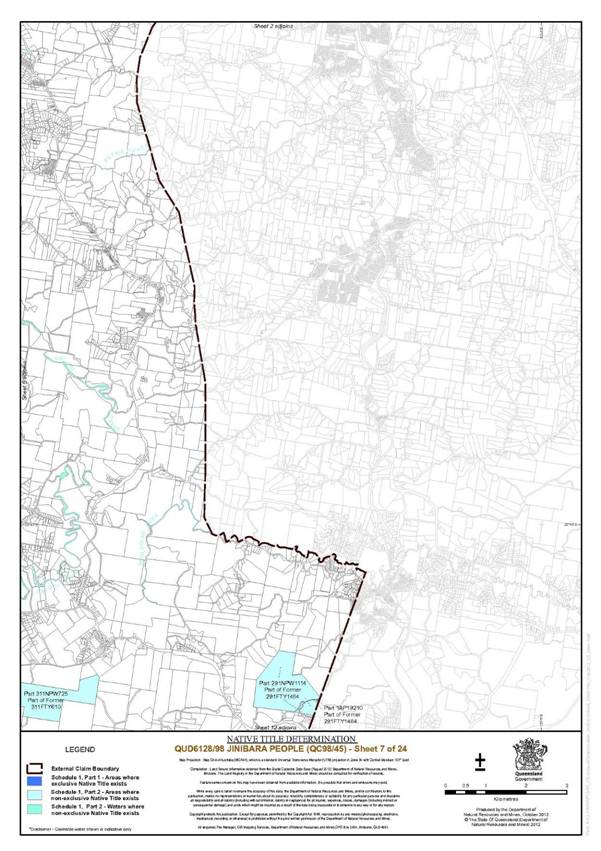
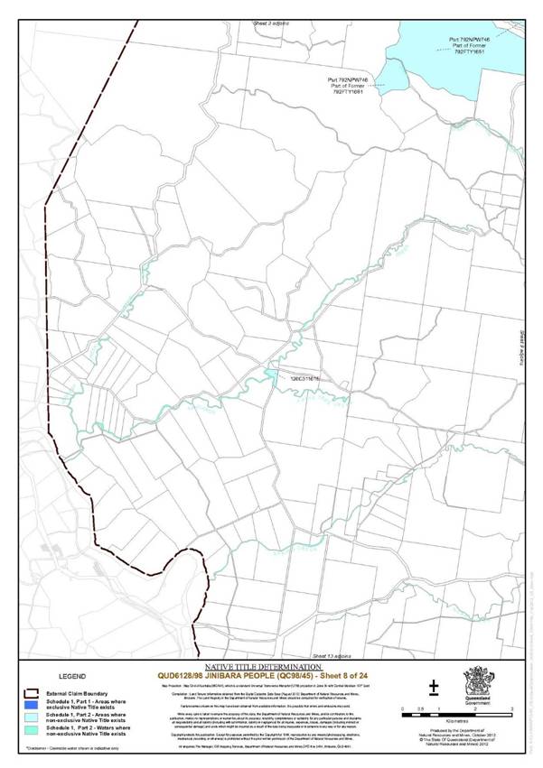
SCHEDULE 1 — DETERMINATION AREA
Description of Determination Area
Excluding the areas in Schedule 2, the Determination Area comprises:
Part 1 – Exclusive Areas
1. Lot 546 on C311044;
2. Lot 401 on C311073;
3. Lot 1009 on C311272;
4. Lot 1008 on CG134;
5. Lot 740 on CG215;
6. Lot 221 on MCH603;
7. Lot 19 on USL10374;
8. Lot 41 on AP6118, formerly described as Lot 41 on USL6622;
9. Lot 17 on SP164074 and an area of road to be opened as delineated on SP164074 formerly described as Lot 17 on USL7444;
10. Lot 73 on CG2508;
11. Lot 103 on CG6135;
12. that part of Lot 4 on SP157521 formerly described as balance area of Lot 4 on RP82485 excluding:
(a) the area described as Lot 7 on SP157521; and
(b) that part easterly and below the 75 metre Elevation Level AHD*;
13. Lot 42 on S312706; and
14. Lot 122 on CP903638.
Part 2 – Non-Exclusive Areas
Land and Waters
1. Lot 192 on CG3472, excluding the area formerly described as Lot 192 on C31900;
2. Lot 517 on CP880835, formerly described as Lot 517 on CG3724 excluding that part westerly and below the 105 metre Elevation Level AHD*;
3. Lot 137 on NPW674, formerly described as Lot 1216 on FTY566;
4. that part of Lot 104 on NPW751 formerly described as Lot 1327 on NPW352, excluding the areas formerly described as:
(a) Lot 1A on S312301; and
(b) Lot 107 on S311176;
5. that part of Lot 546 on NPW788 formerly described as Lot 546 on NPW369, excluding the areas formerly described as:
(c) Lot 89 on MCH576;
(d) Lot 90 on MCH576;
(e) Lot 187 on MCH576;
(f) Lot 186 on MCH577;
(g) Lot 185 on MCH568;
(h) Lot 143v on M371168;
(i) Lot 73 on MCH161; and
(j) Lot 93v on MCH69;
6. that part of Lot 127 on NPW725 formerly described as parts of Lot 127 on NPW509, excluding the areas formerly described as:
(a) Lot 72 on CG2405; and
(b) closed road on RA1796;
7. that part of Lot 102 on NPW746 formerly described as Lot 102 on NPW513;
8. Lot 126 on C311615;
9. Lot 88 on C31221;
10. Lot 72 on C31331;
11. Lot 590 on CG1288;
12. Lot 284 on CG1939;
13. Lot 535 on CG3616, excluding that part of closed road on RA1247;
14. Lot 44 on CG4054;
15. Lot 492 on CG4055;
16. Lot 549 on CP849360;
17. Lot 83 on S311786;
18. Lot 209 on S312892;
19. Lot 242 on SL7761;
20. Lot 313 on FTY1182;
21. that part of Lot 207 on FTY1885 and Lot 207 on NPW746 formerly described as Lot 207 on FTY1211, excluding the areas formerly described as:
(a) Lot 43 on C31355;
(b) Lot 24 on C31351; and
(c) Lot 113v on C311722;
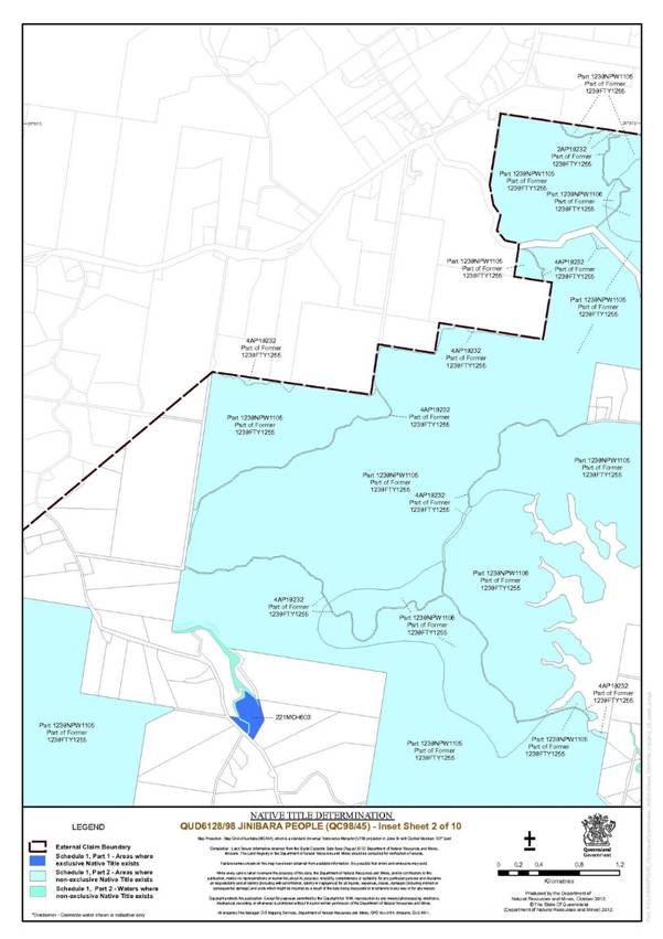
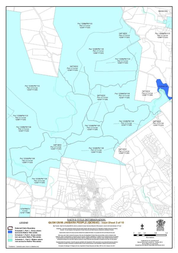
22. Lots 1 to 7 on AP19232 and that part of Lot 1239 on NPW1106 and Lot 1239 on NPW1105 formerly described as Lot 1239 on FTY1255, excluding the areas formerly described as:
(a) Lot 75 on MCH728;
(b) Lot 19v on M37825; and
(c) Lot 26 on MCH134;
23. Lot 728 on NPW787, formerly described as Lot 728 on FTY1256, excluding the area closed road on RA2745;
24. that part of Lot 309 on NPW751 and part of Lot 1 on AP14648 formerly described as part Lot 309 on FTY1307;
25. that part of Lot 291 on NPW1114 and part of Lot 1 on AP19210 formerly described as Lot 291 on FTY1484;
26. Lot 572 on FTY1521, excluding the areas formerly described as:
(a) Lot 160 on C31908;
(b) Lot 80 on C31466;
(c) area of closed road intersecting Lot 112v on C311373; and
(d) area of closed road adjoining the northern boundary of Lot 160 on C31908;
27. that part of Lot 1355 on NPW751, Lots 1 and 3 and part of Lot 2 on AP14647 formerly described as Lot 1355 on FTY1526, excluding the areas formerly described as:
(a) Lot 28v on S313022; and
(b) Lot 91 on S312205;
28. that part of Lots 1 and 2 on AP14645, Lot 893 on FTY1883, Lot 494 on NPW776 and Lot 893 on NPW751 formerly described as Lot 893 on FTY1532, excluding the areas formerly described as:
(a) Lot 84v on S312799;
(b) Lot 116v on SL25;
(c) closed road intersecting Lot 116v on S25;
(d) Lot 110v on S313012;
(e) closed road intersecting Lot 110v on S313012;
(f) Lot 102v on S312975;
(g) closed road adjacent to north-east boundary of Lot 102v on S312975;
(h) closed road on FTY770;
(i) closed road intersecting:
(i) Lots 63v and 64v on S312715;
(ii) Lots 13v and 14v on S312420; and
(iii) Lots 45v, 75v and 76v on S312824;
(j) closed road adjoining southern and eastern boundary of Lot 237 on SL3728;
(k) closed road separating Lots 75v and 76v on S322824;
(l) closed road adjoining north-eastern boundary of Lot 119v on S313017;
(m) closed road adjacent to the western boundary of Lot 211 on SL442; and
(n) Lot 212 on SL2668;
29. that part of Lot 177 on NPW728 and Lot 1 on AP19214 formerly described as Lot 177 on FTY1555, excluding areas of closed road on RA3918;
30. that part of Lot 311 on NPW725 formerly described as Lot 311 on FTY610, excluding the areas of closed road on RA4136;
31. that part of Lot 368 on NPW1111 and Lot 1 on AP19224 formerly described as Lot 368 on FTY1612, excluding the areas of closed road on RA1164;
32. Lot 637 on FTY1613 and Lot 207 on NPW 756 formerly described as Lot 637 on FTY1613;
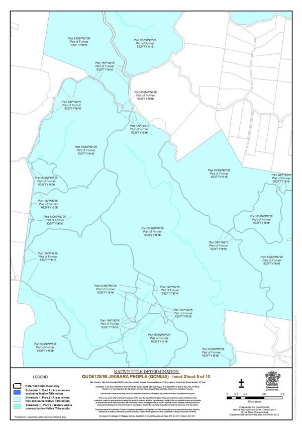
33. that part of Lot 832 on NPW728, Lot 3 and part of Lots 1 and 2 on AP19215 formerly described as Lot 832 on FTY1616, excluding the areas formerly described as:
(a) Lot 148v on CG26;
(b) Lot 420 on CG987;
(c) Lot 306 on CG393;
(d) Lot 46 on LX359;
(e) Lot 46 on CG2648;
(f) Lot 73 on LX1827;
(g) closed road on RA4195; and
(h) closed road described on Lot A on AP1843;
34. those parts of Lot 809 on NPW751 and Lots 1-2 on AP14646 formerly described as Lot 809 on FTY1630, excluding the areas formerly described as:
(a) Lot 30v on SL46;
(b) Lot 35 on S311241 exclusive of the area subsequently described as Lot 2 on RP18089;
(c) Lot 59 on S311950;
(d) Lot 65 on S312178;
(e) Lot 37 on S312309 ;
(f) Lot 8v on S312675;
(g) Lots 18, 69 and 15V on SL367;
(h) Lot 24v on S312995;
(i) Lot 32v on SL49;
(j) Lot 4v on S312638;
(k) closed road intersecting Lot 30v on SL46, Lot 59 on S311950, Lot 65 on S312178, Lot 24v on S312995, Lots 18, 69 and 15v on SL367;
(l) closed road in north-eastern section of Lot 8v on S312675 and other roads shown as closed road on FTY1630; and
(m) Lot 80 on SL6396;
35. Lot 1 on AP19221 and that part of Lot 589 on FTY1876, Lot 589 on NPW725 and Lot 589 on NPW729 and an area opened as road on SP124807 formerly described as Lot 589 on FTY1657, excluding the areas formerly described as:
(a) Lot 52 on C31303;
(b) Lot 112 on C31633;
(c) Lot 33 on C31493;
(d) Lot 29v on C311386;
(e) Lot 70v and 72v on C311132;
(f) Lot 149 on C31855;
(g) Lot 111v on C311372;
(h) Lot 140v on C311609;
(i) Lot 126v on C311539;
(j) Lot 209 on CG60;
(k) Lot 278 on CG156;
(l) Lot 153 on CG790;
(m) Lot 215 on CG159;
(n) Lots 230 and 231 on CG916;
(o) Lot 100v on C311324;
(p) Lot 371 on CG834;
(q) Lots 292 and 295 on CG917;
(r) Lot 303 on CG918;
(s) Lots 149, 313 and 315 on CG919;
(t) Lot 104 on CG487;
(u) Lot 415 on CG1116;
(v) Lot 229 on CG916;
(w) Lots 173, 174,190 and 191 on CG913;
(x) Lots 261 and 279 on CG932;
(y) Lot 210 on CG1183;
(z) Lot 68 on CG1397;
(aa) Lot 216 on CG915;
(bb) Lot 105 on CG753;
(cc) Lots 262 and 263 on CG931;
(dd) closed road within R589 Parish of Beerwah as notified in the Government Gazette of 24 July 1943 at page 130;
(ee) closed road on RA 2554;
(ff) closed road on RA5606;
(gg) closed road on RA5118; and
(hh) closed road on RA5119;
36. Lot 1 and part of Lot 2 on AP19208, part of Lot 792 on FTY1681 and Lot 792 on NPW746 formerly described as Lot 792 on FTY1681, excluding the areas formerly described as:
(a) that part of R480 subject to Lease for Special Purposes No.5829 on CG977; and
(b) closed road on RA3990;
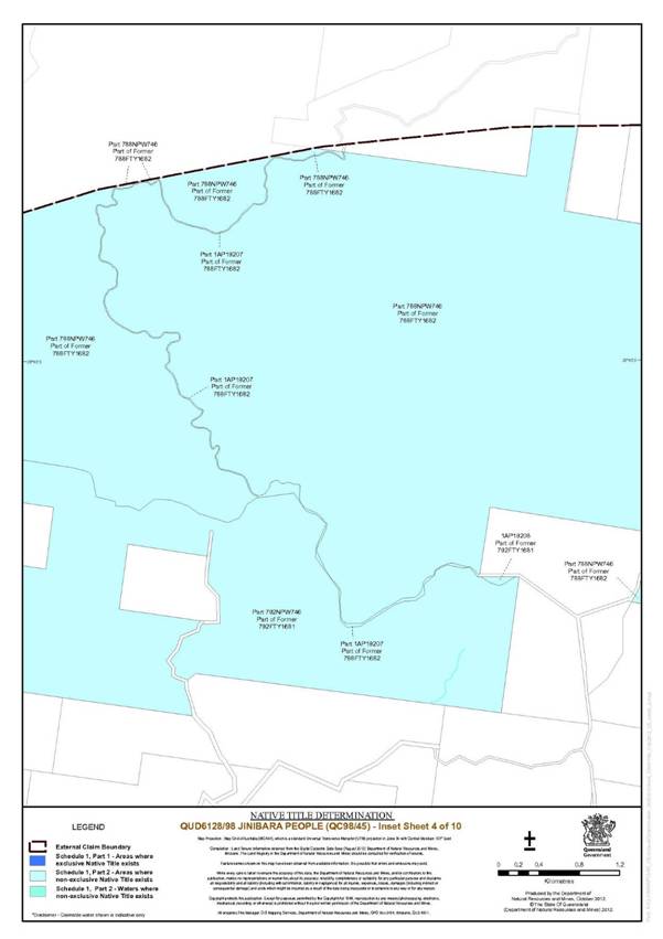
37. those parts of Lot 788 on NPW746 and Lot 1 on AP19207 formerly described as Lot 788 on FTY1682;
38. Lot 184 on NPW750 formerly described as Lot 341 on FTY1716;
39. that part of Lot 783 on NPW788 formerly described as Lot 783 on FTY313 excluding the areas formerly described as:
(a) Lot 73v on M37919;
(b) Lot 6 on MCH113;
(c) Lot 108v on M37974;
(d) Lot 191 on MCH687;
(e) Lot 37v on MCH634; and
(f) closed road intersecting Lot 37v on MCH634 and Lot 6 on MCH113 and the areas of closed road separating Lot 191 on MCH687 from Lot 37v on MCH634 and Lot 6 on MCH113;
40. Lot 766 on FTY559, excluding the areas formerly described as:
(a) Lot 16v on C311128;
(b) Lot 6v on C311055;
(c) Lot 76 on CG467;
(d) Lot 82 on CG739;
(e) Lots 3v, 178, 179 and 135 on CG1219; and
(f) Lot 106 and 816 on CG1147;
41. Lot 2563 on FTY725;
42. Lot 32 on S31107;
43. that part of Lot 589 on FTY1876 formerly described as Lot 62 on CG955;
44. that part of Lot 589 on FTY1876 formerly described as Lot 64 on CG955;
45. that part of Lot 809 on FTY1808 formerly described as Lot 2 on RP18089;
46. that part of Lot 809 on FTY1808 formerly described as Lot 2 on RP18090;
47. that part of Lot 809 on FTY1808 formerly described as Lot 97 on S311292;
48. that part of Lot 809 on FTY1808 formerly described as Lot 39 on S311399;
49. that part of Lot 809 on FTY1808 formerly described as Lot 43 on S311400;
50. that part of Lot 809 on FTY1808 formerly described as Lot 68 on S312295;
51. that part of Lot 809 on FTY1808 formerly described as Lot 70 on S312295;
52. that part of Lot 809 on FTY1808 formerly described as Lot 94 on S312675;
53. that part of Lot 809 on FTY1808 formerly described as Lot 12 on S312707;
54. that part of Lot 809 on FTY1808 formerly described as Lot 7 on S31485; and
55. Lot 49 on L371471.
Waters
All of the waters described below within the External Boundary, excluding those waters within the area covered by any previous exclusive possession act as defined by the Native Title Act 1993 (Cth):
Apple Tree Creek (excluding that part below the 75 metre Elevation Level AHD*) |
Arribaby Creek |
Banks Creek |
Baxter Creek |
Black Jacks Creek |
Branch Creek |
Broken Bridge Creek |
Brown Creek |
Browns Creek |
Bungo Creek |
Butcher Shop Creek |
Byron Creek |
Cabbage Tree Creek |
Caboolture River |
Camp Creek |
Carol Creek |
Catarrh Creek |
Cedar Creek |
Cedar Creek (Cedar Creek) |
Cedar Creek (Mt Sim Jue) |
Centipede Creek |
Cooeembardi Creek |
Culvert Creek |
Dayspring Creek |
Delaney Creek |
Elaman Creek |
England Creek |
Flagstone Creek |
Geraghty Creek |
Gheerulla Creek |
Goodla Creek |
Gregors Creek (Harlin) |
Highland Gully |
Kangaroo Creek |
Kilcoy Creek (excluding that part below the 105 metre Elevation Level AHD*) |
Kipper Creek (Northbrook) |
Lagoon Creek |
Mary River |
Mary Smokes Creek (excluding that part below the 105 metre Elevation Level AHD*) |
Middle Creek |
Monsildale Creek |
Mooloolah River |
Neara Creek |
Neurum Creek (excluding that part below the 105 metre Elevation Level AHD*) |
New Country Creek |
Northbrook Creek (excluding that part below the 75 metre Elevation Level AHD*) |
Obi Obi Creek |
O’Shea Creek |
Oaky Creek (excluding that part below the 105 metre Elevation Level AHD*) |
Oaky Creek (Kilcoy) (excluding that part below the 105 metre Elevation Level AHD*) |
One Mile Creek |
Petrie Creek |
Pryde Creek |
Reedy Creek (Mt Sim Jue) |
Rocky Creek |
Rodgers Gully |
Sandy Creek (Crossdale) (excluding that part below the 105 metre Elevation Level AHD*) |
Sandy Creek (Kilcoy) (excluding that part below the 105 metre Elevation Level AHD*) |
Scrub Creek |
Scrubby Creek (Kilcoy) (excluding that part below the 105 metre Elevation Level AHD*) |
Sheep Station Creek (Kilcoy) (excluding that part below the 105 metre Elevation Level AHD*) |
Sim Jue Creek |
Six Mile Creek |
Skene Creek |
South Maroochy River |
Splitters Creek (excluding that part below the 105 metre Elevation Level AHD*) |
Stanley River (excluding that part below the 105 metre Elevation Level AHD) |
Stony Creek (Kilcoy) (excluding that part below the 105 metre Elevation Level AHD*) |
Tillouren Creek |
Wararba Creek |
Wyangy Creek |
Note:
* 75m and 105m Elevation Level in metres above sea level referenced to AHD (Australian Height Datum) derived from 5m Digital Elevation Model.
On ground coordinates of EL 75m AHD and EL 105m AHD subject to survey.
75m EL and 105m EL sourced from Seqwater, Queensland (August 2012).
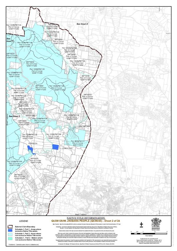
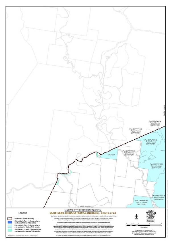
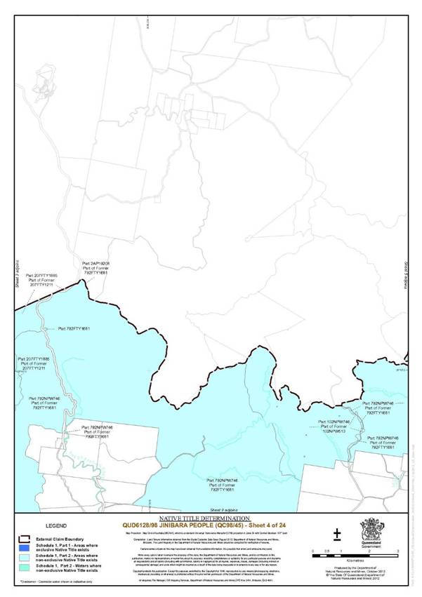
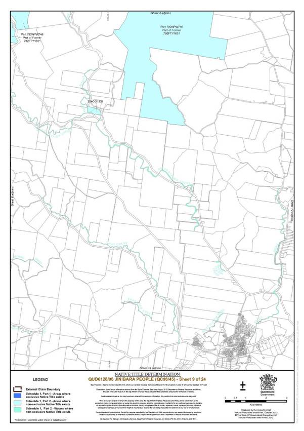
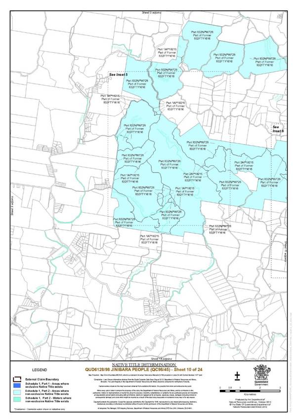
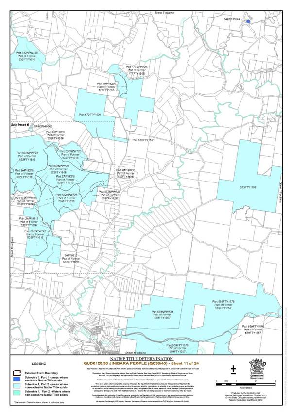
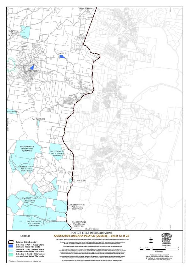
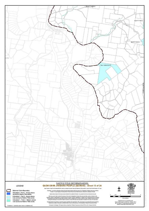
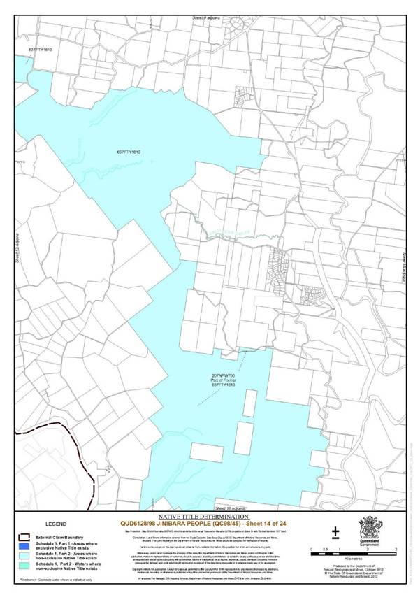
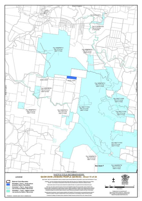
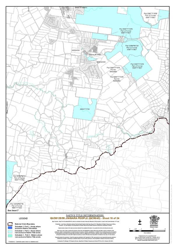
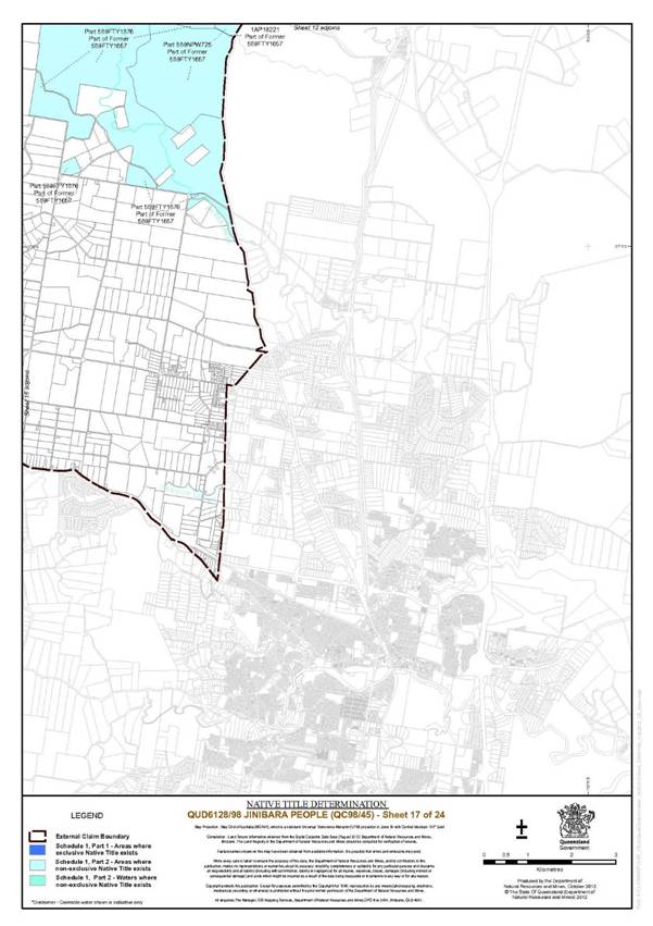
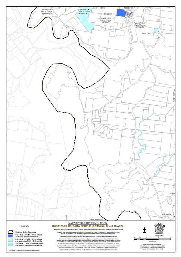
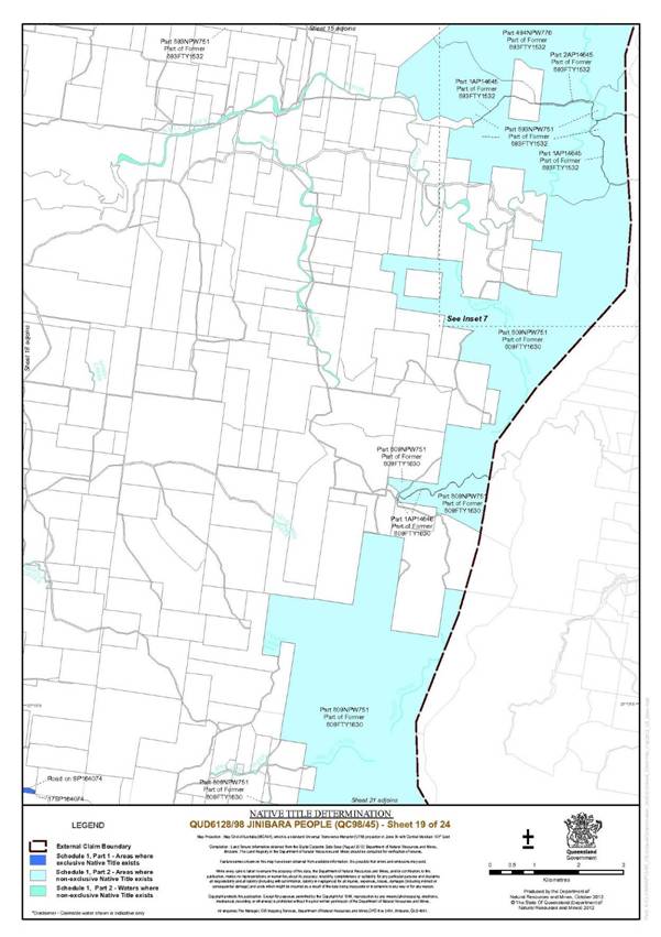
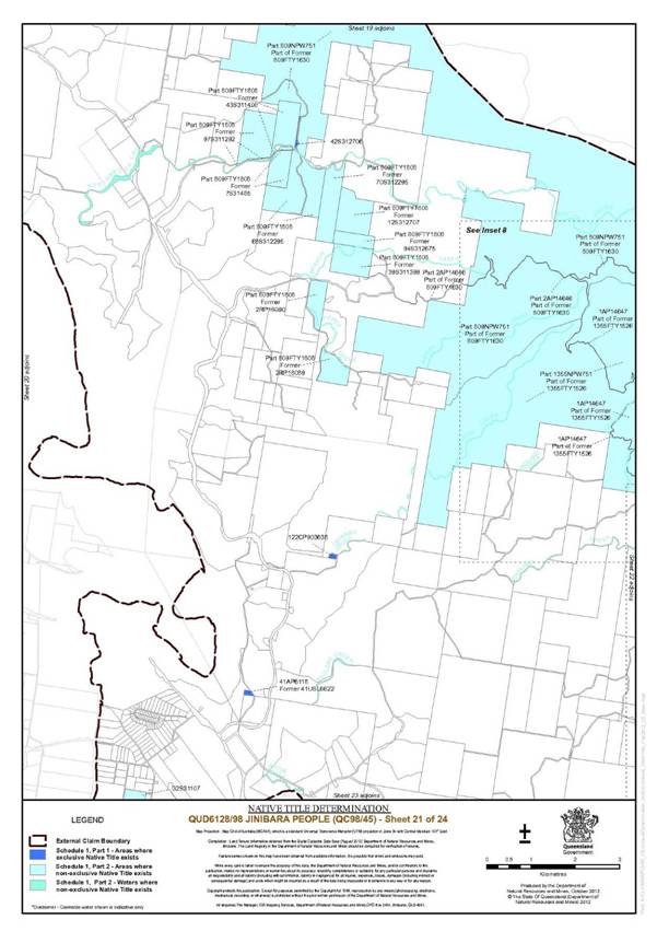
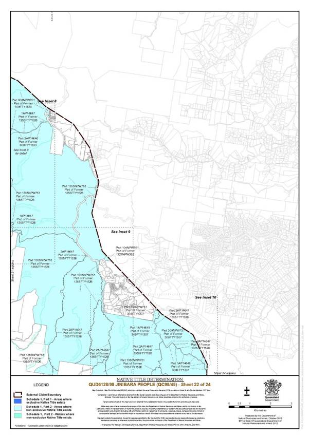
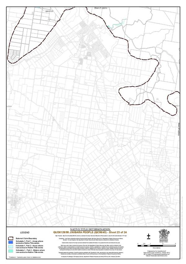
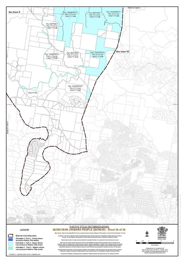
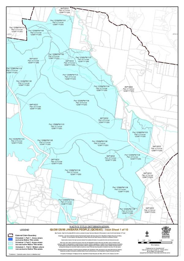
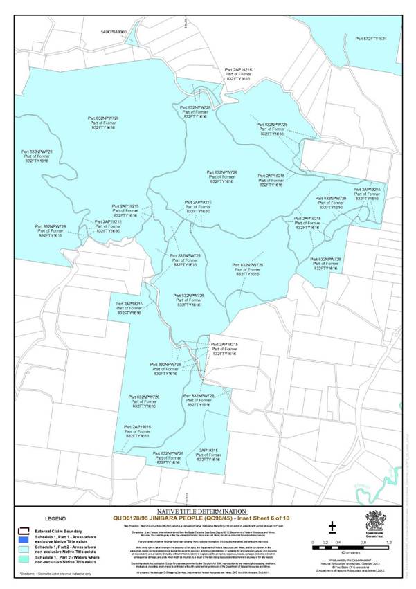
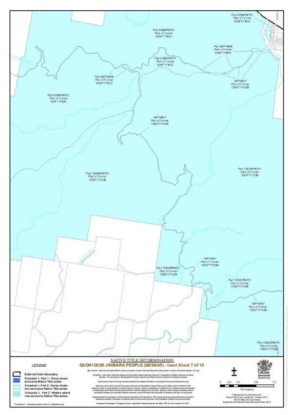
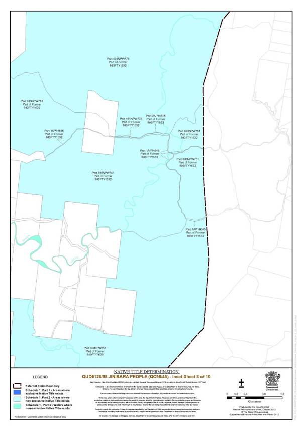
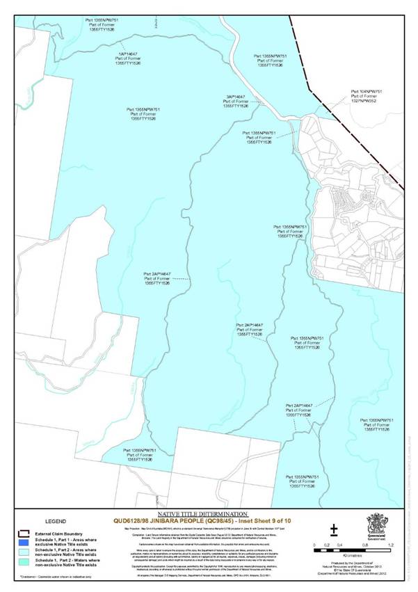
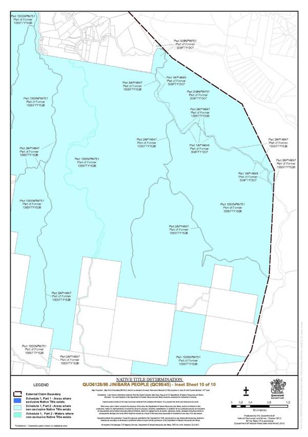
Maps of the Determination Area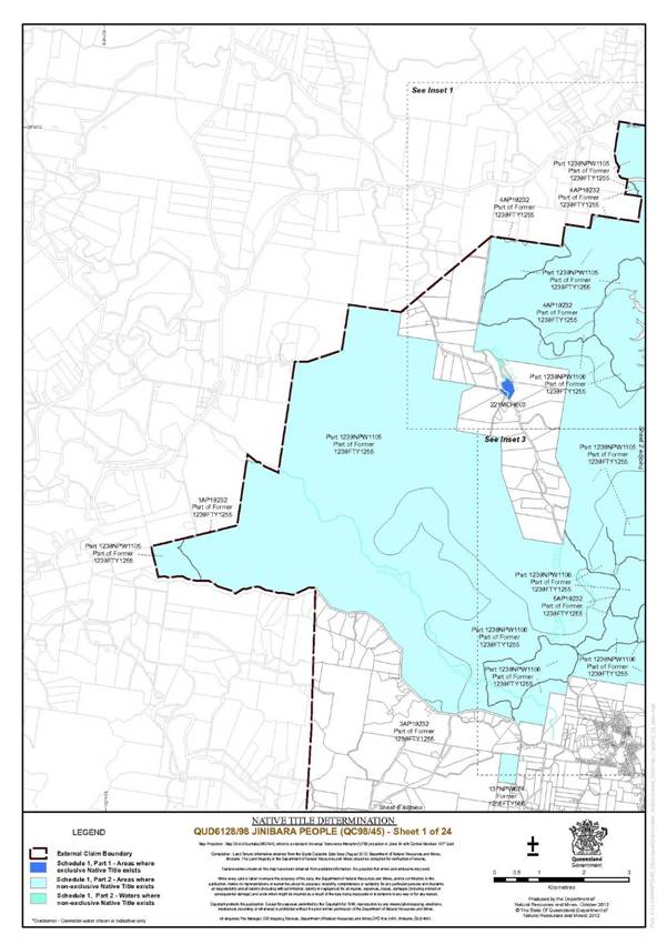

SCHEDULE 2 — AREAS NOT FORMING PART OF THE DETERMINATION AREA
The following areas of land and waters are wholly excluded from the Determination Area on the grounds that they have been the subject of a previous exclusive possession act, as defined in s 23B of the Native Title Act 1993 (Cth), that none of ss 47, 47A or 47B of the Native Title Act 1993 (Cth) applied to them at the time at which the Application was made and therefore, in accordance with s 61A of the Native Title Act 1993 (Cth), could not be claimed:
1. The waters situated within the area covered by any previous exclusive possession act as defined in the Native Title Act 1993 (Cth).
2. The land or waters on which any public work, as defined in s 253 of the Native Title Act 1993 (Cth), is constructed, established or situated, and to which ss 23B(7) and 23C(2) of the Native Title Act 1993 (Cth) and/or s 21 of the Native Title (Queensland) Act 1993 (Qld) applies, together with any adjacent land or waters in accordance with s 251D of the Native Title Act 1993 (Cth).
3. Specifically, the land or waters described in Item 2 above includes the whole of the land or waters described as:
(a) that part of Lot 809 on NPW751 formerly described as Lot 80 on SL6396 (the Mount Glorious VHF tower and shelter site); and
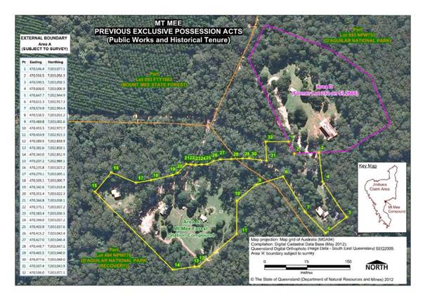
(b) areas A and B within Mount Mee State Forest as shown on the attached map labelled “Mt Mee Previous Exclusive Possession Acts (Public Works and Historical Tenure)”.
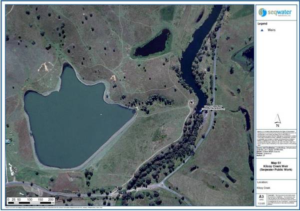
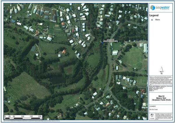
4. Specifically, the land or waters described in Item 2 above include the location of the weirs referred to in Items 4(a) - 4(d) below, which are operated and owned by Queensland Bulk Water Supply Authority (trading as Seqwater) ABN 75 450 239 876:
(a) in Kilcoy Creek, Kilcoy Creek Weir as shown on the attached map labelled “S1”;
(b) in Obi Obi Creek:
(i) Maleny Weir as shown on the attached map labelled “S2”; and
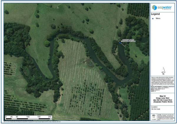
(ii) Kings Lane Weir aka Obi Obi Creek Weir as shown on the attached map labelled “S3”;
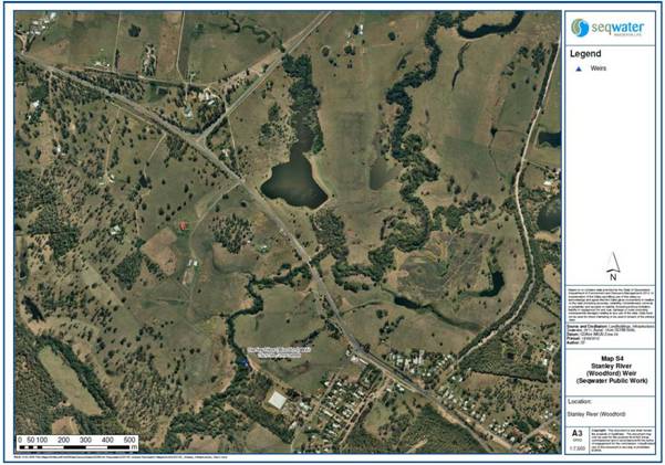
(c) in the Stanley River, Stanley River (Woodford) Weir as shown on the attached map labelled “S4”;
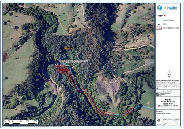
(d) in the South Maroochy River, South Maroochy Intake Weir, as shown on the attached map labelled “S5”. For the avoidance of doubt, in respect of this weir, there are areas of land and waters hatched in red on the map labelled “S5” that are covered or affected by the operation of section 251D of the Native Title Act 1993 (Cth) (namely Lot 7 on AP19232 and part of Lot 1008 on CG134), these being areas the use of which is (or was) necessary for, or incidental to, the construction, establishment or operation of the weir.
Mt Mee Previous Exclusive Possession Acts (Public Works and Historical Tenure)
Seqwater Public Works Maps
SCHEDULE 3 –– NATIVE TITLE HOLDERS
The native title holders for the Determination Area are the Jinibara People who are the biological descendants of the following people:
(a) Wanambi James McKenzie (who was the father of Wangirmau Johnny McKenzie and the paternal grandfather of Gaiarbau Willie McKenzie);
(b) Dil:l (who was the father of Jowalmel Fanny Mason, wife of Wangirmau Johnny McKenzie);
(c) Edward Ross (who was the father of Dick Dahtell Ross); and
(d) Menvil Wanmuarn and his wife, Kitty (who was the daughter of King Sambo and Queen Beauty),
who identify as and are accepted by the Jinibara People as Jinibara People according to Jinibara traditional law and custom.
SCHEDULE 4 — OTHER INTERESTS IN THE DETERMINATION AREA
The nature and extent of Other Interests in relation to the Determination Area are the following, as they exist at the date of this Determination:
1. The rights and interests of the parties under the Deed of Agreement between the Jinibara People Aboriginal Corporation, the Applicant and the State of Queensland dated 30 October 2012 providing for the exercise of native title rights and interests in selected Protected Areas.
2. The rights and interests of the State of Queensland in Reserves, the rights and interests of the trustees of those Reserves and of the persons entitled to access and use those Reserves for the respective purpose for which they are reserved.
3. The rights and interests of the State of Queensland and the Somerset Regional Council to access, use, operate and maintain the area delineated as road on Plan SP164074 for its dedicated purpose and the rights and interests of the general public to access and use the road.
4. The rights and interests of the State of Queensland and the Moreton Bay Regional Council to access, use, operate and maintain the area delineated as road on Plan SP124807 for its dedicated purpose and the rights and interests of the general public to access and use the road.
5. The rights and interests of Moreton Bay Regional Council, Sunshine Coast Regional Council and Somerset Regional Council as local governments for those parts of the Determination Area within their respective Local Government Areas, including:
(a) their powers, functions, responsibilities and jurisdiction under a Local Government Act;
(b) their rights and interests under any interest in land or waters within the Determination Area including under any lease, licence, access agreement, easement or Reserve in the Determination Area;
(c) the rights to use, operate, maintain, replace, restore, remediate, repair and otherwise exercise all other rights as the owners and operators of infrastructure, structures, earthworks, access works, facilities and other improvements within the Determination Area;
(d) the rights under any agreements between them and any third party which relates to land or water in the Determination Area; and
(e) the rights of their employees, agents and contractors to enter upon the Determination Area for the purpose of performing their powers and responsibilities under paragraphs (a)-(d).
6. The rights and interests of Brisbane City Council as local government for that part of the Determination Area within their Local Government Area, including its powers, functions, responsibilities and jurisdiction under the City of Brisbane Act 2010 (Qld) and any rights and interests it or employees or agents have to enter land to perform those functions.
7. The rights and interests of Energex Limited:
(a) as the owner and operator of electricity distribution, generation and transmission facilities within the Determination Area;
(b) as an Electricity Entity under the Electricity Act 1994 (Qld), including but not limited to:
(i) as the holder of a distribution authority; and
(ii) rights to enter the Determination Area by its employees, agents or contractors to exercise any of the rights and interests referred to in this paragraph; and to inspect, maintain and manage any distribution, generation and transmission facilities in the Determination Area; and
(c) in relation to any connection contract, way leave agreement, permit to occupy or easement relating to the Determination Area.
8. The interests of Queensland Electricity Transmission Corporation Limited (trading as Powerlink Queensland) ACN 078 849 233 as an electricity entity exercising statutory functions, powers or rights and as owner and operator of electricity transmission facilities and associated infrastructure situated upon the Determination Area, including but not limited to the right to enter upon the Determination Area at any reasonable time in order to access, use, maintain, repair, replace, upgrade, or otherwise deal with those facilities and infrastructure in accordance with the law.
9. The rights and interests of Queensland Bulk Water Supply Authority (trading as Seqwater) ABN 75 450 239 876:
(a) as trustee of Lot 83 on Crown Plan S311786 (R1070 Stanley, Reserve for Camping and Water);
(b) in relation to any agreement with any third party which relates to land or waters in the Determination Area existing or entered into on or before the date of this Determination; and
(c) to enter the Determination Area by its employees, agents or contractors to exercise any of the rights and interests referred to in this Item 9 of Schedule 4.
10. The rights and interests of Telstra Corporation Limited:
(a) as the owner or operator of telecommunications facilities within the Determination Area;
(b) created pursuant to the Post and Telegraph Act 1901 (Cth), the Telecommunications Act 1975 (Cth), the Australian Telecommunications Corporation Act 1989 (Cth), the Telecommunications Act 1991 (Cth) and the Telecommunications Act 1997 (Cth) including rights:
(i) to inspect land;
(ii) to install and operate telecommunication facilities; and
(iii) to alter, remove, replace, maintain, repair and ensure the proper functioning of its existing and any new telecommunication facilities;
(c) for its employees, agents or contractors to access its telecommunications facilities in, and in the vicinity of, the Determination Area, in the performance of their duties; and
(d) under any lease, licence, access agreement or easement relating to its telecommunication facilities in the Determination Area.
11. The rights and interests of Forestry Plantations Queensland Pty Limited in and under Plantation Licence No 713331865.
12. Any existing public access to and enjoyment of, the following places in the Determination Area:
(a) waterways;
(b) beds and banks or foreshores of waterways;
(c) stock routes; and
(d) areas that were public places at the end of 31 December 1993,
pursuant to s 212(2) of the Native Title Act 1993 (Cth) and s 18 of the Native Title (Queensland) Act 1993 (Qld).
13. The rights and interests of the State of Queensland or any other person (as applicable) existing by reason of the force and operation of the laws of the State of Queensland, including those existing by reason of the following legislation or any regulation, statutory instrument, declaration, plan, authority, permit, lease or licence made, granted, issued or entered into under that legislation:
(a) the Land Act 1994 (Qld);
(b) the Nature Conservation Act 1992 (Qld);
(c) the Petroleum Act 1923 (Qld) and Petroleum and Gas (Production and Safety) Act 2004 (Qld);
(d) the Forestry Act 1959 (Qld);
(e) the Water Act 2000 (Qld);
(f) the Integrated Planning Act 1997 (Qld) or Sustainable Planning Act 2009 (Qld);
(g) the Transport Infrastructure Act 1994 (Qld); and
(h) the Fire and Rescue Services Act 1990 (Qld) and the Ambulance Service Act 1991 (Qld).
14. Any other rights and interests of members of the public arising under the common law, including but not limited to the following:
(a) any subsisting public right to fish;
(b) the public right to navigate; and
(c) the public’s right to access and use the formed roads on Lot 401 on Plan C311073, namely Storrs Road, Fortune Avenue and Jannaii Court.
15. Any other rights and interests held by the State or Commonwealth, or by reason of the force and operation of the Laws of the State or Commonwealth.
SCHEDULE 5 –– EXTERNAL BOUNDARY
Described as commencing at the westernmost corner of Lot 1239 on NPW1105 and extending generally north easterly along the boundary of that lot, northern boundaries of Lot 1 AP19232, again boundaries of Lot 1239 on NPW1105 to a corner of that lot at Longitude 152.816277° East, Latitude 26.537327° South; then north easterly to a north western corner of Lot 4 on AP19232 at Longitude 152.836465° East, Latitude 26.522126° South; then generally easterly and generally north easterly along northern and western boundaries of that lot to a corner at Longitude 152.868677°; then easterly and northerly again along boundaries of Lot 1239 on NPW1105 to again the western boundary of Lot 4 on AP19232; then northerly again along the boundary of Lot 4 on AP19232 to again the boundary Lot 1239 on NPW1105; then northerly, westerly and generally northerly along the boundaries of that lot, a southern boundary of Lot 4 on AP19232, southern and western boundaries of again Lot 1239 on NPW1105 to Lot 2 on AP19232; then generally northerly and easterly along southern, western and northern boundaries of that lot to northern boundary of again Lot 1239 on NPW1105; then generally easterly along the boundary of that lot, northern boundaries of again Lot 2 on AP19232 and again northern boundaries of Lot 1239 on NPW1105 to the western boundary of Lot 1239 on NPW1106; then generally northerly along a western boundary of that lot, western boundary of again Lot 2 on AP19232 and western and northern boundaries of again Lot 1239 on NPW1105 to Longitude 152.887569° East; then northerly passing through Longitude 152.887757° East, Latitude 26.494490° South to the south eastern corner of Anderson Road; then generally northerly along eastern boundaries of that road to the southern boundary of Browns Creek Road; then generally south easterly along boundaries of that road, southern boundaries of Gold Creek Road and western boundaries of Bunya Road to Latitude 26.517695° South; then generally southerly passing through the following coordinate points:
Longitude (East) | Latitude (South) |
152.945840 | 26.532245 |
152.940584 | 26.537915 |
152.938233 | 26.539436 |
152.935468 | 26.542478 |
152.934361 | 26.545106 |
152.933670 | 26.546074 |
152.933532 | 26.547595 |
152.934223 | 26.550776 |
152.936989 | 26.557414 |
152.939340 | 26.561978 |
152.941691 | 26.566403 |
152.942244 | 26.572488 |
152.941553 | 26.577743 |
152.940723 | 26.582030 |
152.937542 | 26.587839 |
152.934223 | 26.594477 |
152.930489 | 26.601806 |
152.918596 | 26.617295 |
152.908224 | 26.626975 |
152.906979 | 26.630156 |
152.906288 | 26.635411 |
152.903384 | 26.639007 |
152.900341 | 26.645783 |
152.899512 | 26.650762 |
152.899605 | 26.656017 |
152.902001 | 26.663485 |
152.902277 | 26.664176 |
152.905043 | 26.673165 |
152.910022 | 26.680356 |
152.911405 | 26.686718 |
152.913894 | 26.696952 |
152.913756 | 26.700409 |
152.914171 | 26.705526 |
152.916522 | 26.718249 |
152.916522 | 26.736780 |
152.916245 | 26.748397 |
152.918040 | 26.751710 |
Then southerly to the southern bank of the Mooloolah River at Longitude 152.918070° East; then generally easterly along banks of that river to Longitude 152.956365° East; then south westerly to the intersection of the eastern boundary of Mount Mellum Road and the southern boundary of Paper Road; then generally south easterly along boundaries of Paper Road to the western boundary of Old Gympie Road; then generally southerly along boundaries of that road, western boundaries of Beerburrum Woodford Road and again Old Gympie Road to the northern boundary of Alcock Road; then generally south westerly and generally westerly along boundaries of that road to the southernmost south western corner of Lot 15 RP843783; then southerly to the western boundary of Easement A on RP104359; and generally southerly along the boundary of that easement, and western boundaries of Easements A on RP104355, A on RP104360, A on RP104618, A on RP104616, A on RP104615, B on RP169368, A on RP105540, B on RP105540, A on RP105208, A on RP105200, A on RP105209, A on RP166401 and A on RP105210 and onwards to the north western corner of A on RP105211, a point on the southern boundary of the King Street (Caboolture Connection Road); then generally north westerly along boundaries of that road and southern boundaries of D’Aguilar Highway to the western boundary of Campbell’s Pocket Road; then generally south westerly along boundaries of that road and northern boundaries of Mount Mee Road to the western boundary of Hewitt Road; then generally south westerly and generally southerly passing through the following coordinate points:
Longitude (East) | Latitude (South) |
152.746044 | 27.089097 |
152.741409 | 27.095276 |
152.731369 | 27.105702 |
152.727121 | 27.118446 |
152.727121 | 27.135824 |
152.728279 | 27.152429 |
152.727121 | 27.165945 |
152.706654 | 27.186026 |
152.697385 | 27.197225 |
152.693524 | 27.217693 |
152.688890 | 27.231981 |
152.679235 | 27.253607 |
152.679621 | 27.266737 |
152.686959 | 27.278322 |
152.700089 | 27.289907 |
152.716694 | 27.293769 |
152.733300 | 27.300720 |
152.746816 | 27.311919 |
152.760332 | 27.319643 |
152.768055 | 27.329683 |
152.772689 | 27.344744 |
152.769214 | 27.358260 |
152.774234 | 27.374865 |
152.803197 | 27.402284 |
152.818258 | 27.411166 |
152.825209 | 27.423909 |
152.824050 | 27.443991 |
152.820189 | 27.458279 |
152.819267 | 27.459654 |
152.810920 | 27.472954 |
152.803197 | 27.482222 |
152.795473 | 27.499986 |
152.790839 | 27.511185 |
152.794315 | 27.523928 |
152.794701 | 27.532810 |
Then southerly to the intersection of the south eastern corner of Lot 45 on S31614 and the northern bank of the Brisbane River, then generally south westerly and generally north westerly along the eastern bank of that River, the eastern bank of the former Brisbane River ,now the subject of Lake Wivenhoe and again the eastern bank of the Brisbane River to Latitude 26.896572° South; then northerly and north easterly, passing through Longitude 152.319629° East, Latitude 26.840408° South to a point on the western boundary Monsildale Creek Road at Latitude 26.772928° South; then generally northerly and generally easterly along boundaries of that road, northern boundaries of Louisavale Road to the south western corner of Lot 2 on RP163086, then generally easterly along the northern boundaries of Louisavale Road, Monsildale Creek, again Louisavale Road (also being the southern boundary of the northern severance of Lot 2 on RP163086) to Longitude 152.403816° East; then north easterly passing through Longitude 152.405421° East, Latitude 26.749056° South, to intersect a point on the eastern boundary of Kilcoy Murgon Road and the northern boundary of an unnamed track, being the north western corner of corner of Lot 2 on AP19208; then generally south easterly along boundaries of that lot and track to Longitude 152.480550° East; then generally south easterly and generally easterly again along northern boundaries of an unnamed track passing through Lot 792 on NPW746 and Lot 102 on NPW746 to Mt Kilcoy Road; then easterly along the northern boundaries of that road to an eastern boundary of Lot 102 on NPW746 at Longitude 152.568169° East; then northerly and generally north-easterly along boundaries of that lot to a corner at Longitude 152.598820° East, Latitude 26.740418° South; then generally easterly passing through the following coordinate points:
Longitude (East) | Latitude (South) |
152.619799 | 26.734666 |
152.641728 | 26.730950 |
152.660839 | 26.729212 |
152.713548 | 26.728587 |
then easterly to the intersection of the eastern bank of the Mary River and the northern boundary of Maleny Kenilworth Road; then generally easterly along boundaries of that road to the western boundary of Curramore Road; then generally northerly along boundaries of that road, western boundaries of Kidaman Creek road, western boundaries of Suicide Road and , again western boundaries of Kidaman Creek Road to Latitude 26.654696° South; then again northerly passing through Longitude 152.795978° East, Latitude 26.621352° South to the southern boundary of Lot 1239 on NPW1105 at Longitude 152.797163° East; then generally westerly and generally northerly along the boundaries of that lot back to the commencement point.
Data Reference and Source
External boundary description is based in part on spatial data sourced from the Department of Natural Resources and Mines (QLD) August 2012.
Cadastral data and Lot on Plan details sourced from Department of Natural Resources and Mines (QLD) August 2102.
River banks based where possible on Casement data sourced from Department of Natural Resources and Mines (QLD) August 2012 or Topographic vector data is © Commonwealth of Australia (Geoscience Australia) 2006.
75m and 105m Elevation Level in metres above sea level referenced to AHD (Australian Height Datum) derived from 5 m Digital Elevation Model sourced from Seqwater (QLD) September 2012.
On ground coordinates of EL 75m AHD and EL 105m AHD subject to survey.
Roads and road names based on Casement data sourced from Department of Natural Resources and Mines (QLD) August 2012.
Tracks as described through Forest Reserve and State Forest based on 100K raster topographic data sourced from Commonwealth of Australia (Geoscience Australia).
Reference Datum
Geographical coordinates are referenced to the Geocentric Datum of Australia 1994 (GDA94), in decimal degrees and are based on spatial reference data acquired from the various custodians at the time.
Use of Coordinates
Where coordinates are used within the description to represent cadastral or topographical boundaries or the intersection with such, they are intended as a guide only. As an outcome to the custodians of cadastral data continuously recalculating the geographic position of their data based on improved ground survey and data maintenance procedures, it is not possible to accurately define such a position other than by detailed ground survey.
Note: Entry of orders is dealt with in Rule 39.32 of the Federal Court Rules 2011.
QUEENSLAND DISTRICT REGISTRY | |
GENERAL DIVISION | QUD 6128 of 1998 |
BETWEEN: | KENNETH MURPHY AND NOEL BLAIR ON BEHALF OF THE JINIBARA PEOPLE Applicant
|
AND: | STATE OF QUEENSLAND First Respondent BRISBANE CITY COUNCIL Second Respondent MORETON BAY REGIONAL COUNCIL Third Respondent SOMERSET REGIONAL COUNCIL Fourth Respondent SUNSHINE COAST REGIONAL COUNCIL Fifth Respondent QUEENSLAND BULK WATER SUPPLY AUTHORITY (TRADING AS SEQWATER) Sixth Respondent
|
JUDGE: | REEVES J |
DATE: | 20 NOVEMBER 2012 |
PLACE: | WOODFORD |
REASONS FOR JUDGMENT
Introduction
1 On 17 May 1770 Captain Cook sailed north, past the bay he was to call Morton’s Bay (later to become Moreton Bay). His journal for that day records that he observed “several smokes” as he looked inland. It is not inconceivable that the smoke Captain Cook observed was the result of fires lit by the forebears of today’s Jinibara people. It was not, however, until approximately 70 years later that the first official contact between European settlers and Aboriginal people in the claim area occurred. The first Europeans in the area were squatters who sought to claim the land for sheep and cattle grazing. Thus started a process of rapid settlement of the area in which local indigenous people were initially retained as station workers and later moved out of the area to designated Aboriginal settlements. Remarkably, notwithstanding the enormous pressures they have experienced, the Jinibara People were able to maintain their social and cultural integrity and come together to make the current application to this Court to recognise their native title in their lands.
2 The Jinibara application was originally lodged with the National Native Title Tribunal (the NNTT) on 29 September 1998. Following amendment of the Native Title Act 1993 (Cth) (the Act) in 1998, the Jinibara application was transferred to the Federal Court. Since the time of its commencement the Jinibara application has undergone considerable refinement. In January 2000 an amended application was filed to remove overlaps with claims filed by the Wakka Wakka People and the Undumbi People. In 2006 the application was further amended to remove the overlap with the Jagera People’s claim. The overlap with the Turrbal People’s claim was removed from the Jinibara application in April 2010. Technical errors in mapping descriptions were corrected by amendment of the claim in May 2010. Finally, the Jinibara application was amended under consent orders made on 26 October 2012 to clearly identify those parcels of land and waters that remained the subject of the application.
3 The parties recently informed the Court that, following mediation conducted through the NNTT, they had reached agreement on the terms of a proposed consent determination of native title. That agreement was evidenced by filing an agreement under s 87 of the Act (the s 87 Agreement) together with draft consent orders.
Section 87 of the Act
4 In circumstances where the parties to native title proceedings reach written agreement and certain other conditions are met the Court is empowered, under s 87 of the Act, to make an order in, or consistent with, the terms of the parties’ agreement, without holding a hearing. In Nelson v Northern Territory of Australia (2010) 190 FCR 344; [2010] FCA 1343 (Nelson), I set out the various conditions that the parties need to meet in order to have the Court make a consent determination of native title under s 87: see at [3]–[4]. The first three of those conditions, and the evidence that shows the parties to these proceedings have met them, are as follows:
(a) First, subsection 87(1) requires that the period specified in the notice given under s 66 of the Act must have ended. The Jinibara application was notified by the Native Title Registrar on 13 December 2000. The period specified in that notice expired on 12 March 2001. Accordingly, this condition is met.
(b) Secondly, the agreement of the parties must relate to the whole of the proceedings, part of the proceedings, or a matter arising out of the proceedings: s 87(1)(a). As the agreement of the parties relates to the whole of the proceeding as reflected in the amendments made on 26 October 2012, this condition, too, has been met.
(c) Thirdly, s 87(1)(b) of the Act requires that the agreement must be reduced to writing, signed by the parties, and filed with the Court. The filing of the s 87 Agreement on 1 November 2012 demonstrates that each of these matters has been met.
5 The fourth condition prescribed by s 87(1)(c) of the Act requires the Court to be satisfied that an order in, or consistent with, the terms of the determination sought by the parties would be within the power of the Court. An order will be within the power of the Court if it is consistent with s 94A of the Act, the rights and interests included in the proposed determination are recognisable by the common law of Australia and there is no other determination in existence over the area the subject of the proposed determination.
6 Section 94A requires the Court, in making a determination, to set out the details of the matters mentioned in s 225 of the Act. Section 225 outlines the content of a determination of native title as:
A determination of native title is a determination whether or not native title exists in relation to a particular area (the determination area) of land and waters and, if it does exist, a determination of:
(a) who the persons, or each group of persons, holding the common or group rights comprising the native title are; and
(b) the nature and extent of the native title rights and interests in relation to the determination area; and
(c) the nature and extent of any other interests in relation to the determination area; and
(d) the relationship between the rights and interests in paragraphs (b) and (c) (taking into account the effect of this Act); and
(e) to the extent that the land or waters in the determination area are not covered by a non-exclusive agricultural lease or a non-exclusive pastoral lease – whether the native title rights and interests confer possession, occupation, use and enjoyment of that land or waters on the native title holders to the exclusion of all others.
(Emphasis in original.)
7 I have examined the proposed determination contained in the s 87 Agreement and I am satisfied that each of the matters referred to in s 225(a) to (e) of the Act is appropriately articulated therein and the rights and interests so described are recognisable by the common law of Australia. The history of the Jinibara application set out in [2] above demonstrates that all overlaps with the claims of other native title claim groups have been removed. Furthermore, I am satisfied from the contents of the National Native Title Register kept under Pt 8 of the Act that no previous determination of native title has been made over the area the subject of the proposed determination.
8 I am therefore satisfied that a determination in the terms sought by the parties would be within the power of the Court.
9 Finally, before the Court makes a determination consistent with the terms of the parties’ agreement, it must be satisfied that it is appropriate to do so: s 87(1A) of the Act. These words:
have been held to confer on the Court a discretion which, subject to the Court being satisfied about the pre-conditions mentioned above, is unfettered. However, like all discretions conferred on the Court, it must be exercised judicially and in exercising it, the Court must have regard to the objects of the Act, one of the most important being the resolution of disputes by negotiation and agreement, rather than litigation: Munn v Queensland (2001) 115 FCR 109 at [26] and [28].
See Nelson at [7].
10 In Nelson (at [8–[13]), I canvassed the authorities that identified the factors that the Court will routinely have regard to in determining this question. Beyond setting out the concluding summary, it is not necessary for me to repeat what I said in Nelson. The concluding summary was as follows (Nelson at [14] but excluding case references):
It follows from all these considerations that the central issue in an application for a consent determination under s 87 is whether there exists a free and informed agreement between the parties. In this respect, the process followed by the State party respondent, particularly how it goes about assessing the underlying evidence as to the existence of native title is critical. Other critical factors, all directed to the processes that lead to the agreement and what was agreed, that have been previously identified by the Court include: whether the parties have independent and competent legal representation..; whether the terms of the proposed order are unambiguous and clear…; and whether the agreement has been preceded by a mediation process…
11 As to the second of these critical factors, I am satisfied from an examination of the terms of the proposed consent determination that it is unambiguous and clear.
12 As to the other factors identified in the concluding summary in Nelson (above), I note that the agreement reached by the parties in this case is partly founded on the expert reports of Dr Redmond (an anthropologist), Dr Skyring (an historian) and Mr Robbins (an archaeologist). In addition to those reports, I have been assisted by the contents of the original and supplementary submissions filed by the Applicant.
13 In those submissions, the Applicant submitted that it is appropriate for the Court to exercise its discretion to make the orders sought because:
(a) the parties have freely entered into the s 87 agreement informed by their involvement in the claim process, including mediation and negotiation, and having had the opportunity to consider and assess the evidence relied upon by the Applicant;
(b) the parties have had the benefit of independent legal advice and have engaged in the claim resolution process rationally and in good faith;
(c) the State of Queensland has taken a “real interest” in the proceedings on behalf of the broader community; and
(d) the process by which the parties have reached agreement is consistent with the objects of the Act which encourage parties to take responsibility for resolving proceedings without the need for litigation.
14 So, in summary, having regard to the factors identified in Nelson, the contents of the reports referred to above and the Applicant’s submissions in support of the determination sought by the parties, I am satisfied that it is appropriate to make the proposed consent determination.
the jinibara native title holding group
15 Notwithstanding this conclusion, I consider it is appropriate to record some of the evidence adduced by the Applicant to establish that native title exists in the area the subject of the Jinibara People’s claim. I do not do this to second guess the process that has been followed by the parties as outlined above, but to give some acknowledgement to the time and effort that has obviously been devoted to the preparation of the materials that have been placed before the Court in support of this application.
16 In its summary of its connection materials, the Applicant noted the observations made by Thomas Petrie and the Crown Land Commissioner Stephen Simpson, among others, in the 1830s and 1840s of the Aboriginal people in and around the claim area. In particular, Petrie and Simpson discussed the customs and ceremonies they observed relating to the Bunya tree. Petrie observed:
Each blackfellow belonging to the district had two or three trees which he considered his own property, and no one else was allowed to climb these trees and gather cones…. The tribe in general owned the animals and birds on the ground, also roots and nests, but certain men and women owned different fruit or flower-trees and shrubs.
17 As land was acquired for sheep and cattle stations the local Aboriginal people were incorporated into the station workforce as stockmen and domestic workers. Station owners recorded their observations of their workers. According to Dr Skyring, Arthur McConnel, one such station owner, made detailed descriptions from the 1840s to the 1870s of “the dwellings people made, their marriage customs, their hunting and food collecting techniques, burial traditions and ceremony”.
18 The materials provided by the Applicant demonstrate that notwithstanding the movement of Jinibara People off the stations to the designated Aboriginal settlements of Durundur and then Barambah (later called Cherbourg), they were able to maintain their connections to the claim area. In his report, Dr Redmond stated that:
a number of families went to considerable lengths to maintain their families outside of the mission environment in small townships (including Linville, Moore, Caloundra and Harlin) around the edge of the claim area…some of the claimants who were young adult residents of Cherbourg continued to not only use the claim area for fishing, camping and hunting but also participated with the other residents in the observation of important aspects of traditional law and custom in regard to kinship and mortuary practices, and maintained the body of beliefs concerning the Rainbow Serpent and the host of elemental spirits which were seen to reside in the landscape and which thus continued to exert a powerful influence in maintaining a social focus upon normative rules governing interaction with lands and waters in the region.
19 Some of today’s Jinibara claimants had direct personal relationships with forebears who were born not long after the time of first contact with Europeans. Mr Ken Murphy is the great nephew of Gaiarbau Willie McKenzie. Gaiarbau was a member of the Dungidau local group of the Jinibara who was born at Kilcoy sometime between 1873 and 1881. He was an informant to ethnographers including Dr LP Winterbotham, Ms Caroline Kelly, Mr AP Elkin and Mr Norman Tindale. Dr Redmond believes that the material provided by Gaiarbau:
…remains the most detailed firsthand account that we have of the social and cultural world of south eastern Queensland aboriginal life as viewed from the perspective of a man born one generation after the first European settlement of the Jinibara claim area (1840-1) and who had the benefit of hearing his parents’, grandparents, and their peers (sic) accounts of their lives at the threshold of colonisation.
20 It was partly through the ethnographic accounts of Gaiarbau’s information that Dr Redmond was able to conclude that in pre-sovereignty times the Jinibara were part of a wider regional society that covered the area between the Logan River in the south, Maryborough in the north-east and the middle Condamine River in the west. This regional society, according to Dr Redmond, included several broad language-labelled aggregations of local groups including Jinibara. These groups collectively adhered to a common system of laws and customs in which there was mutual recognition by neighbouring groups of the local territory and socio-cultural identity of the Jinibara. Dr Redmond explained that:
…it is the regional society’s laws and customs which legitimate the claimant group’s exclusive title to Jinibara country.
21 Dr Redmond identified several features of the “set of social practices, institutions and concomitant laws and customs” of the regional society including named matrimoieties; a cognate set of subsection names inherited through matrifiliation; a system of totemic matriclans; local groups recruited with a loose preference for patrifiliation; overarching language identities; a kind of initiation ceremony known as Bora/Boorool; Toaro or Wandaral, a tribal council constituted across the regional society to authorise decisions made by local groups; a cosmology in which Sky-Gods and the Rainbow Serpent were dominant figures; organised battles to resolve disputes; an organised system for participation in the harvest and consumption of the bunya nut forests and mullet runs and a regional system of land tenure based on loosely patrifilial local countries.
22 Using the information provided by Gaiarbau and recorded by early ethnographers, Dr Redmond identified the four subgroups that made up the Jinibara at the time of early contact. These were the Dungidau in the north-west; the Dal:a through the head of the Mary River in the Conondale Range and north into the Mary River Valley; the Nalbo also in the Conondale Range and at the head of the Mary River and on the Mary Plains; and the Garumngar south of what is now called Somerset Dam. Dr Redmond concluded that:
…these local country groups shared, and continue to share, a body of traditional laws and customs from which their rights and interests in the lands and waters of the claim area ensue.
23 The current members of the four clans of the Jinibara People are descended from a defined set of apical ancestors. It is through their contact with their forebears that today’s Jinibara were taught their laws and customs. Mr Ken Murphy lived with Gaiarbau at various times where he and Mr Noel Blair were taught about the boundaries of Jinibara country, hunting methods, food sharing practices and prohibitions based on totemic identities.
24 Contemporary Jinibara People continue to camp and fish using spears they were taught to make. They gather the resources of their lands and waters including honey, echidna, carpet snake, possum, mujuun (berries), Tillybottle, various varieties of fish including sooty grunter, mountain perch, eels, catfish and yellow belly, goanna and long-necked turtle. They follow the practices and beliefs taught by their forebears, who were themselves taught by their elders, including belief in the Rainbow Serpent and other elemental spirits dwelling in the country and mourning practices, knowledge of the landscape and the pathways through their country. Particular types of behaviour are prohibited at particular locations; other locations are sites related to species increase ceremonies. These practices, customs, beliefs and the sanctions in cases of non-adherence continue to be taught by contemporary Jinibara People to their children.
PRESCRIBED BODY CORPORATE
25 Paragraphs 10 and 11 of the proposed determination address the requirements of s 56 and 57 of the Act respectively. Section 56(1) requires the Court to determine whether the native title is to be held in trust and, if so, by whom. The Court will determine that the native title is to be held in trust where the proposed native title holders under the determination provide the Court with a nominated prescribed body corporate to be the trustee and with the written consent of that body corporate: s 56(2)(a) and (b). If no such nomination is made, the Court must determine that the native title rights and interests are to be held by the proposed native title holders under the determination: s 56(2)(c).
26 The Jinibara native title holders have not nominated a prescribed body corporate under s 56(2)(a). Accordingly, the Court must determine that the native title rights and interests are to be held by the proposed native title holders under the determination.
27 Where the s 56(2)(c) approach is followed, s 57(2) requires that the Court must take certain steps to determine which prescribed body corporate is, after becoming a registered native title body corporate, to perform the functions mentioned in s 57(3). The s 87 Agreement signed by the parties seeks a determination that the Jinibara People Aboriginal Corporation (JPAC) is to be the prescribed body corporate for the purpose of s 57(2) to perform the functions set out in s 57(3). That nomination is supported by the Applicant’s supplementary submissions and the affidavit of Kenneth Paul Murphy sworn 29 October 2012. Mr Murphy deposes that JPAC was nominated by the Jinibara People to be their prescribed body corporate on 10 August 2012 and he provides evidence of the written consent of JPAC to the corporation being so nominated.
28 Accordingly, the Court determines that the JPAC be the prescribed body corporate for the purpose of s 57(2) and that it perform the functions set out in s 57(3) of the Act.
CONCLUSION
29 In concluding, it is appropriate to observe that one of the central objects of the Act is the resolution of native title claims by negotiation and agreement. The achievement of the parties in reaching this agreement as to the Jinibara People’s native title claim plainly meets this central object and is, therefore, to be congratulated.
30 It is a mark of the remarkable tenacity of the Jinibara People that notwithstanding the history I mentioned earlier, they have been able to maintain the laws and customs that have always connected them to their lands. Through this determination the Australian legal system recognises that enduring connection. It is to be hoped that a new and positive chapter in the relationship between the Jinibara and the broader Australian community will succeed with this determination. However, it is important to make this departing point: that these orders do not grant native title to the claimant; they recognise the pre-existing native title that the Jinibara People have long held.
I certify that the preceding thirty (30) numbered paragraphs are a true copy of the Reasons for Judgment herein of the Honourable Justice Reeves. |
Associate:

